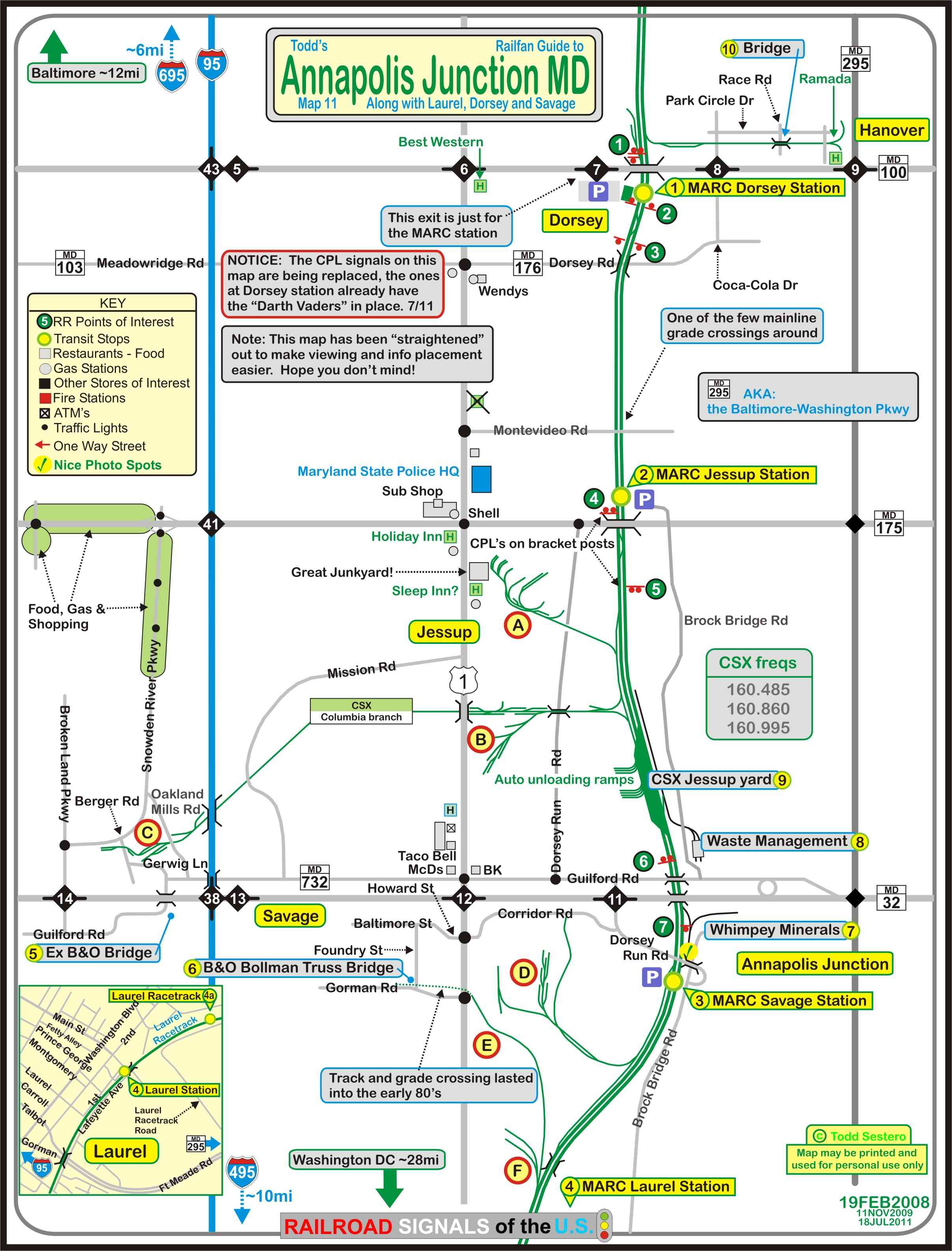
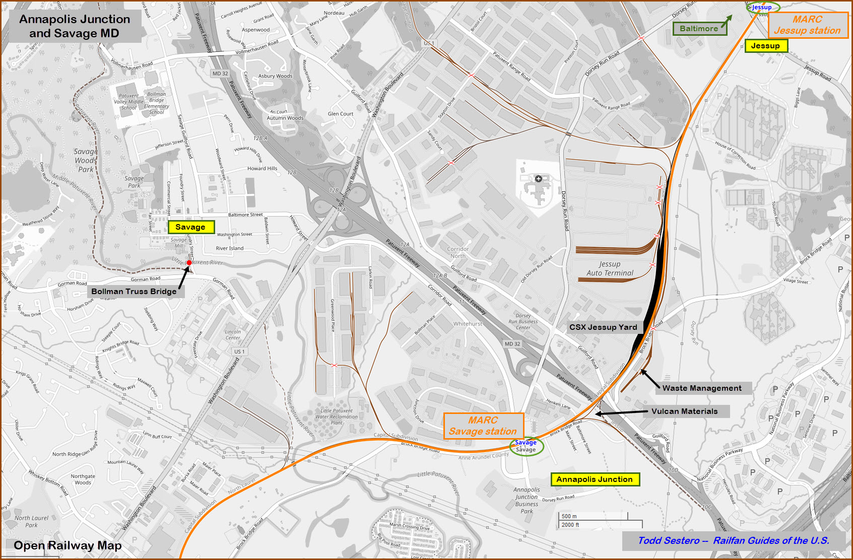
Location / Name:
Annapolis Junction MD, Anne Arundel County
What's Here:
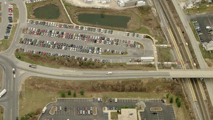
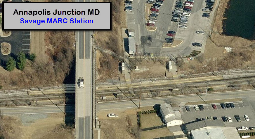
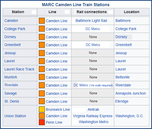
the Savage MARC commuter station
CSX's Jessup Yard
Waste Management facility using second generation diesel
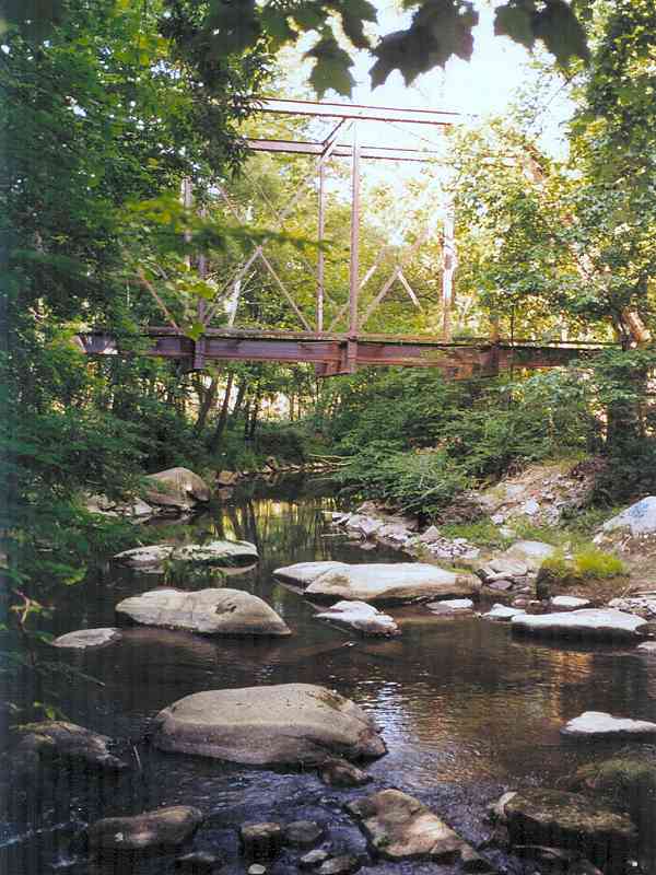
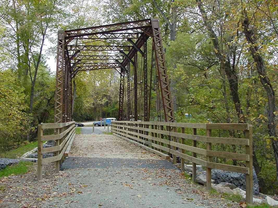
Last surviving B&O Bollman Truss Bridge
Although not a spectacular railfan area, it does offer a few noteworthy items
worth investigating and making it worthwhile to stop by for a visit.
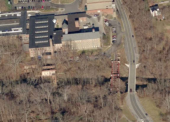
Probably the most notable is the 160ft long B&O Bollman Truss Bridge
built in 1869. It's the only one of this design left.
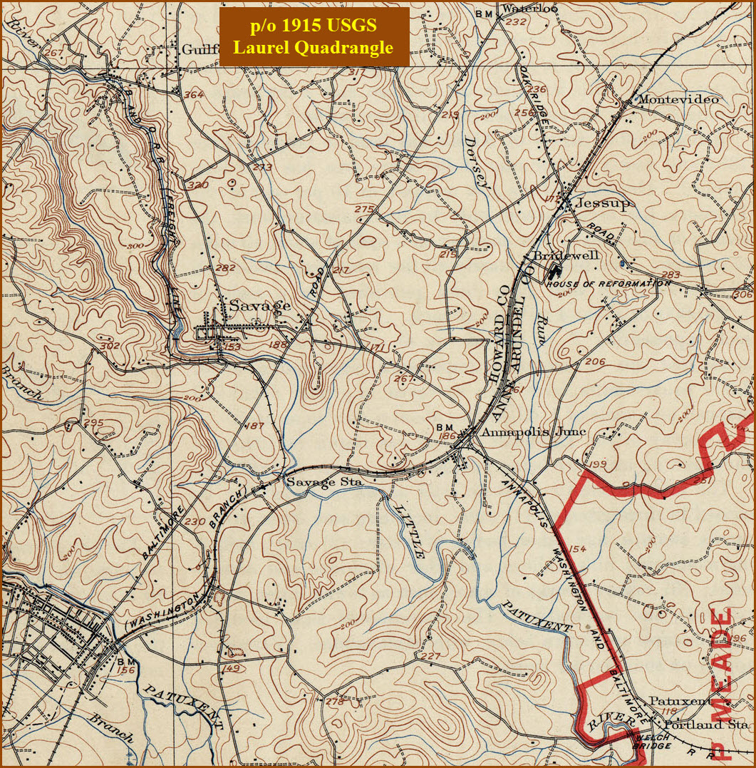
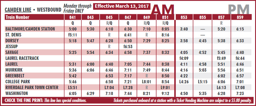
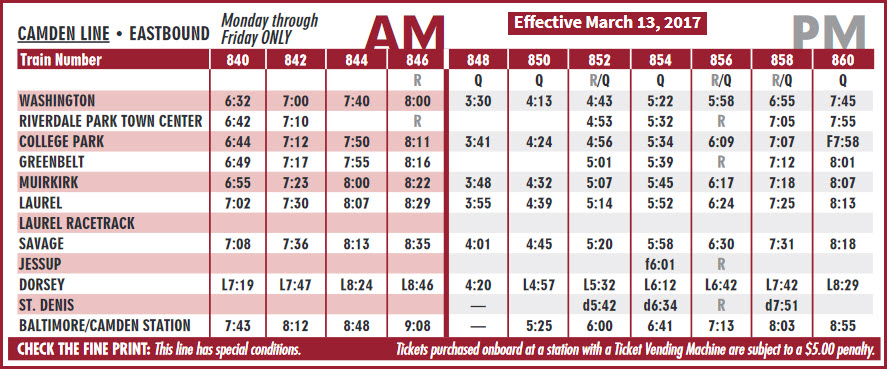
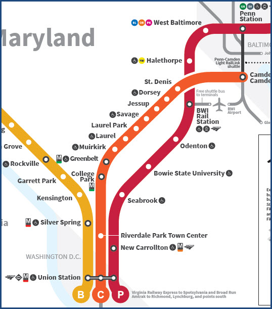
There are three MARC Stations on this map,
Dorsey, Jessup, and Savage. Of the three, only Dorsey has a real station,
having been built maybe ten years ago, and has it's own exit off RT 100.
The exit is the only way to get into the parking lot, so don't try to look for
an entrance off of the surrounding roads. Although Savage is still a
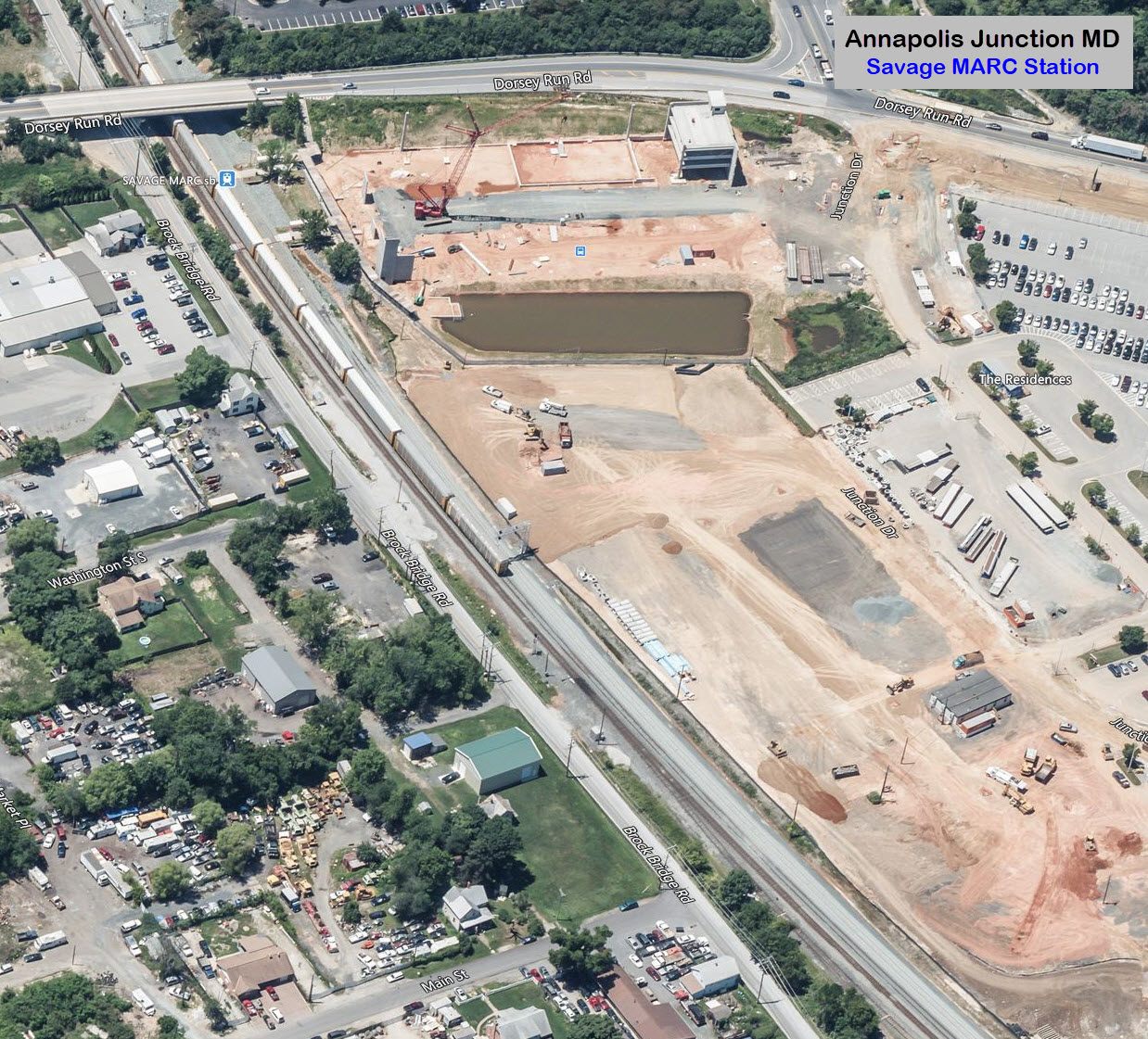
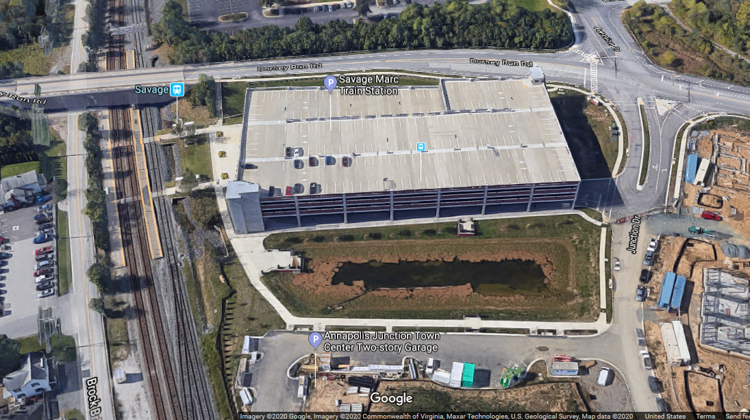
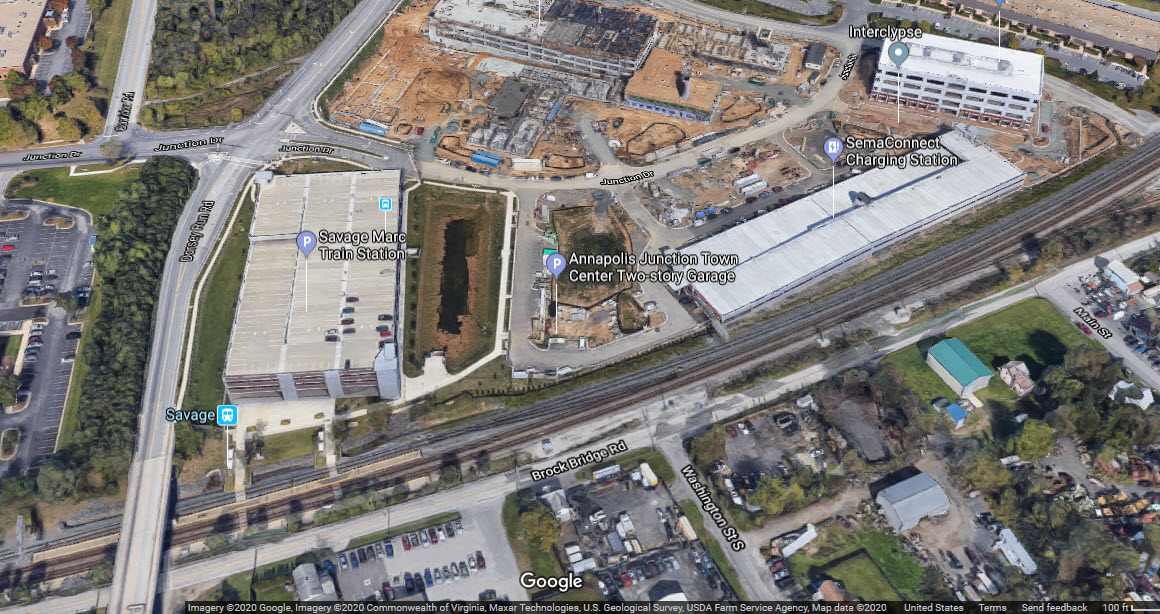
"simple" station, the MTA built one heck of a huge parking garage, and Bing
still has a mid-construction aerial view even tho it was built around 2016 or so.
Off of Route 32 there are a couple of businesses with
older first and second generation diesels as shown on the map.
It doesn't see any traffic these days, but there is a small bridge back off
RT 100 and the BW Pkwy. Update summer 2013: The Dorsey Branch
is being dismantled and CSX is having everything torn up!
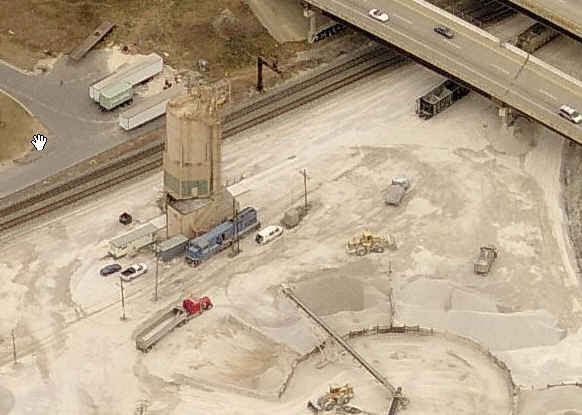
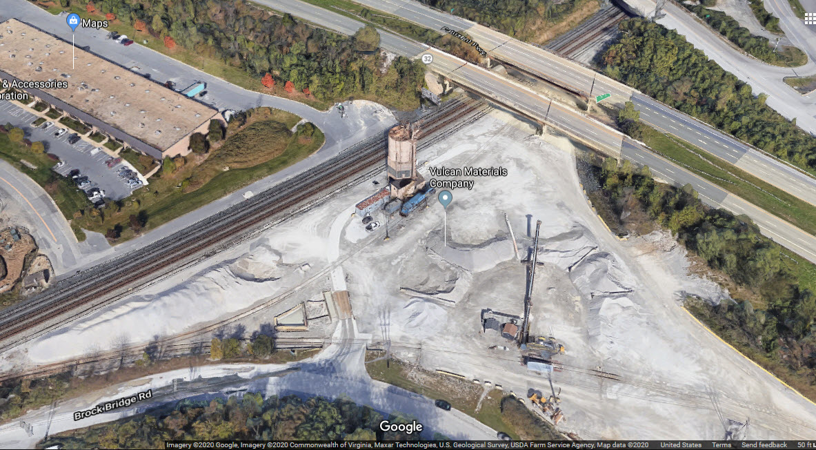
On the history side of things, Annapolis Junction got its name from the
fact that it was the junction between the B&O RR and the Annapolis, Washington &
Baltimore RR, which provided service between Annapolis and Annapolis Junction. The track at
Vulcan Materials is the site of the junction, where there used to be a wye. In the beginning
in 1840, the Annapolis and Elk Ridge Railroad once provided
rail service to Annapolis and was one of the earliest railroads in the U.S.
The A&ERR went bankrupt in 1884 and was sold for $100,000, and then reorganized
as the Annapolis, Washington and Baltimore RR. In 1903 the AW&B was
purchased by the Washington, Baltimore and Annapolis Electric Rwy. The
WB&A ceased operation in 1935, rolling stock was sold, and the (now) branch was
operated till around 1981 to Fort Mead MD.
For the signal fan, this area was predominated
by CPL signals, but as of the summer of 2012, they have all been replaced by
color light signals :-( There were a bunch that are easy to photograph on the
south (or west) side of the station platforms at Jessup and Dorsey, and the north end of Savage.
The signal locations are still the same, just not as nice to frame up with a train.
Reminder: following the
B&O tradition, all directions on the B&O are either eastbound or westbound, at
least here in the Baltimore area. So, here on this map, a westbound
freight is going south from Philly to DC, and an eastbound freight is actually
going north.
Two aerial views of the Savage station from (an early) Bing Maps, before the
parking garage was built.
A later aerial view from Bing, from when the massive parking structure was under construction...
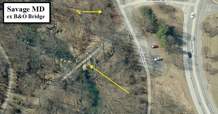
ex B&O Guilford Bridge
GPS Coordinates: 39.165612, -76.840923
This bridge was "saved" maybe back in 2006 or
so when the county decided to use it as part of a hikey-bikey trail, otherwise,
it would have just rusted away... When I first saw it maybe 30 years ago, you
had a hard time finding it amongst the trees, weeds, and vines!
Around 2000, or so, the county did an
excellent job restoring the bridge - including new planking so you can walk
across it. It sits adjacent to the Savage Mill, an eclectic collection of
shops.
The bridge was built for an unknown location
on the main line of the Baltimore and Ohio Railroad in 1852, and was moved to
its present location, spanning the Little Patuxent River on the spur to the
Savage Mill, in 1887. This spur line dates to around 1840 and originally
crossed the river on a stone arch bridge; however, due to alterations to the
mill in the 1880s and topographical restrictions, a replacement bridge was
needed. The bridge remained in service until the mill closed in 1947
Vulcan Materials Company
GPS Coordinates: 39.124880, -76.790876
Used to be known as Whimpey Minerals.
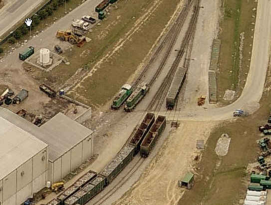
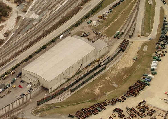
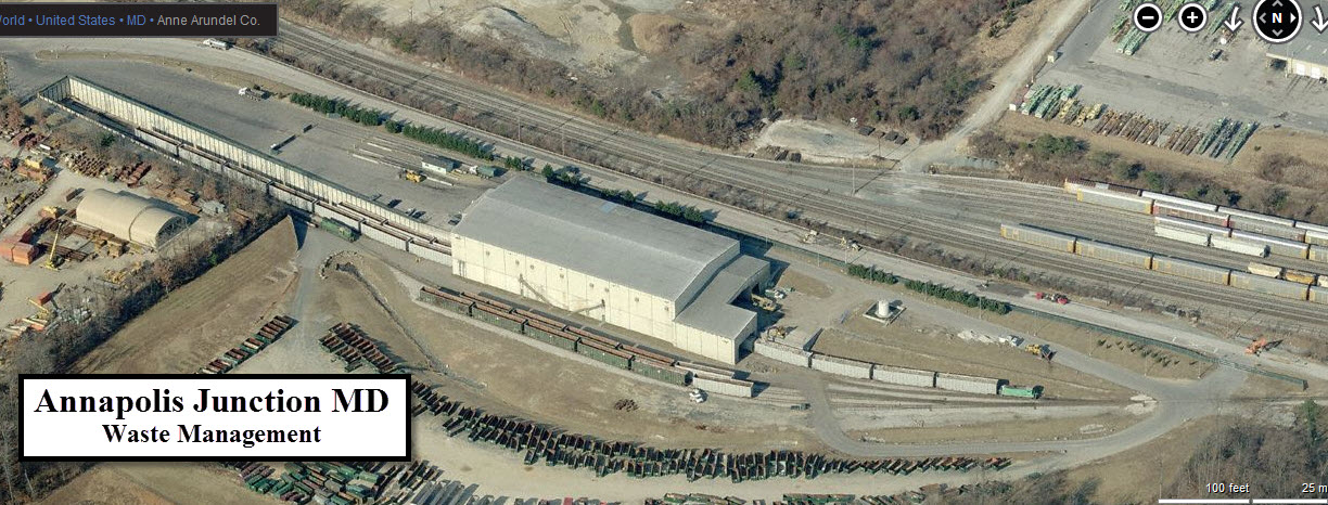
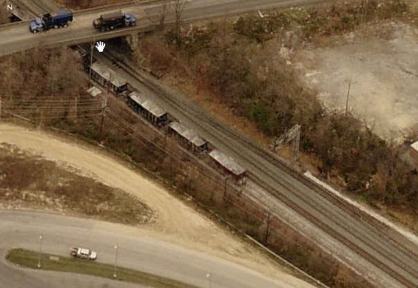
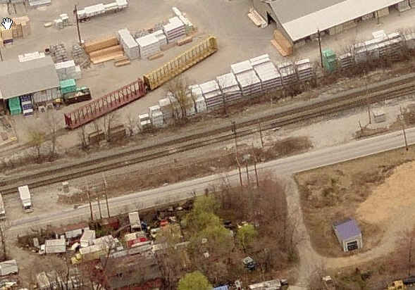
Waste Management
GPS Coordinates: 39.127899, -76.786557
Trash in by truck, trash out by train.
The engines at Waste Management, the lead into the yard, and
their storage track in the yard.
Courtesy of the University of Texas Library, click
here for their index page.
Disclaimers:
I love trains, and I love signals. I am not an expert. My webpages reflect what I find on the topic of the page. This is something I have fun with while
trying to help others.
Please Note: Since the main focus of my two websites is railroad signals, the railfan guides are oriented towards the signal fan being able to locate them.
For those of you into the modeling aspect of our hobby, my
indexa page has a list of almost everything railroad oriented
I can think of to provide you with at least a few pictures to help you detail your pike.
If this is a railfan page, every effort has been made to make sure that the information contained on this map and in this railfan guide is correct. Once in a while,
an error may creep in :-)
My philosophy: Pictures and maps are worth a thousand words, especially for railfanning. Text descriptions only get you so far, especially if you get lost or
disoriented. Take along good maps.... a GPS is OK to get somewhere, but maps are still better if you get lost! I belong to AAA, which allows you to get
local maps for free when you visit the local branches. ADC puts out a nice series of county maps for the Washington DC area, but their state maps do not have the
railroads on them. If you can find em, I like the National Geographic map book of the U.S..... good, clear, and concise graphics, and they do a really good job
of showing you where tourist type attractions are, although they too lack the railroads. Other notes about specific areas will show up on that page if known.
Aerial shots were taken from either Google or Bing Maps as noted. Screen captures are made
with Snagit, a Techsmith product... a great tool if you have never used it!
By the way, floobydust is a term I picked up 30-40 years ago from a National Semiconductor data book, and means miscellaneous
and/or other stuff.
Pictures and additional information is always needed if anyone feels inclined to take 'em, send 'em, and share 'em, or if you have something to add or correct.... credit
is always given! Please be NICE!!! Contact info is here
Beware: If used as a source, ANYTHING from Wikipedia must be treated as being possibly being inaccurate, wrong, or not true.