Location / Name:
Laurel MD, Prince George's County
What's Here:
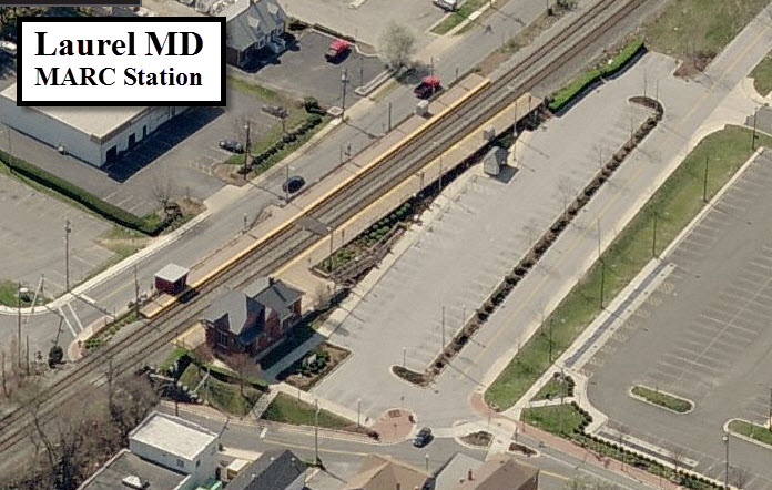
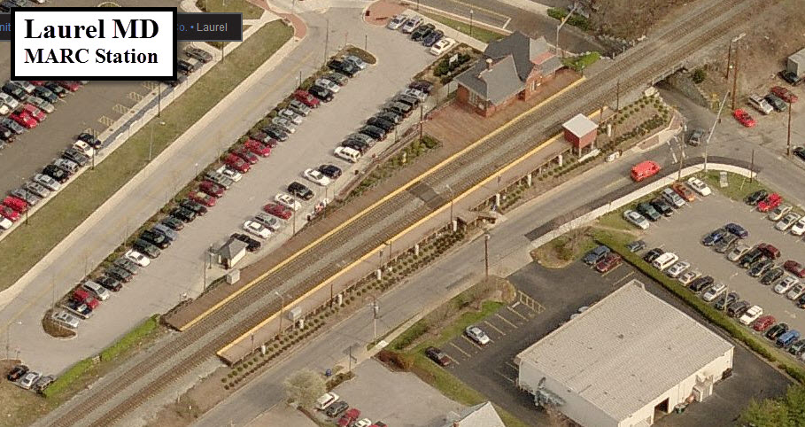
MARC Laurel Commuter Rail Station
MARC Laurel Racetrack Commuter Rail Station
Data:
GPS Coordinates: as needed
Phone A/C: 301
ZIP: 20707
Access by train/transit:
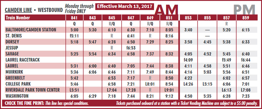
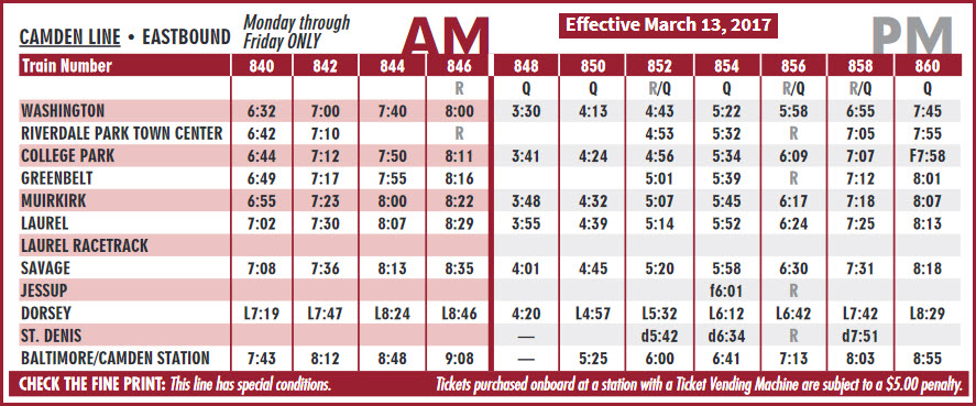
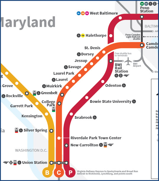
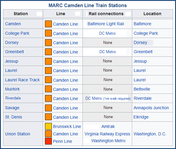
MARC Commuter Rail, Camden Line
The Scoop:
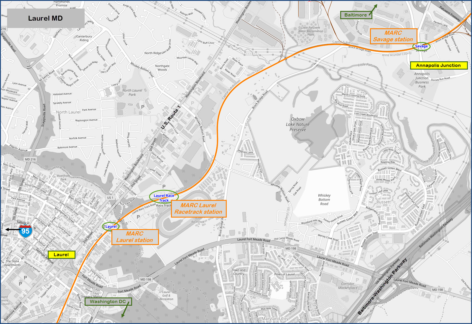
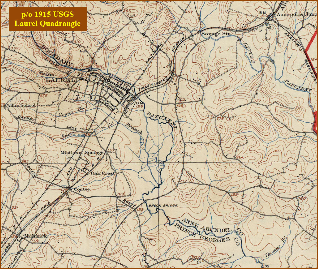
Laurel is about halfway between Baltimore and Washington DC, between I-95
and the Baltimore-Washington Expressway. US route 1 runs right down the
middle of town. CSX's Capitol Sub-Division runs through the eastern side of town.
For the signal fan, this area was predominated
by CPL signals, but as of the summer of 2012, they have all been replaced by
color light signals :-( There were a bunch that are easy to photograph on the
south (or west) side of the station platforms at Jessup and Dorsey, and the north end of Savage.
The signal locations are still the same, just not as nice to frame up with a
train.
Amtrak's NEC is a about 8 miles to the east. Rt 198 kinda takes you
there, running into Rt 32 which will take you into/near Odenton.
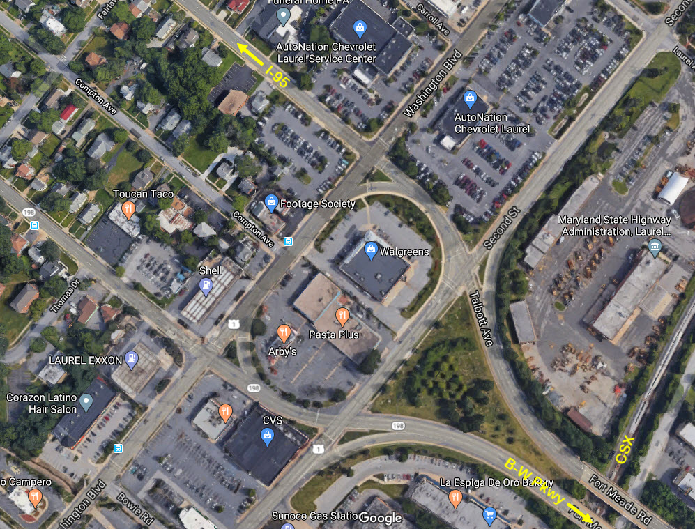
I don't normally push particular food joints, but having gone to El
Salvador, I am a fan of the fast food fried chicken restaurant called
Pollo Compero. They have opened a few of them here in the U.S.,
and one of them is here in Laurel, a block south of Compton Ave in the
Laurel Shopping center. Try it, you might like it. On the way
back from El Salvador, there is so much of this stuff on the airplane, the
smell of it got all thru the plane before the flight attendants got the stuff
"bagged" :-). You can just see where it is on the "getting
here" map below.
Reminder: following
B&O tradition, all directions on CSX are either eastbound or westbound, at
least here in the Baltimore area. So, here on this map, a westbound
freight is going south from Philly to DC, and an eastbound freight is actually
going north.
Acknowledgements:
Denver Todd
Websites and other additional information sources of interest for the area:
https://en.wikipedia.org/wiki/Laurel_station_(MARC)
Both I-95 and the Baltimore-Washington Parkway bring you in from Baltimore
and Washington DC, although I-95 in DC circles around the city as part of the DC
Beltway, so it doesn't get close to the downtown area like they do in Baltimore.
Using I-95, take exit 33, and head east on MD 198 into Laurel. When you
hit Route 1, take a left from Gorman Ave onto NB Second St. 198 will split
into two one-way streets, Gorman Ave is EB, Talbott Ave is WB. The same
goes for Route 1, Second St is NB, and Washington Blvd is SB. The corner
where you want to take a left has a CVS to your right side, and an Arby's on
your left.
When using the B-W Parkway, take the 198 exit, however...... When
going north from DC, there is a sign for the first exit for 198 to take you
to Ft Meade, but the exit you want, the next one, there is no sign that says
Laurel, just a small "exit" sign.
When going SB on the Parkway, there is only one exit for 198, at the top of
the ramp, you will want to take a right to head into Laurel. Take a
right when you get to Route 1 NB at Second St.
Go slightly less than a half mile to Main St and take a right, this will
take you to the Laurel station.
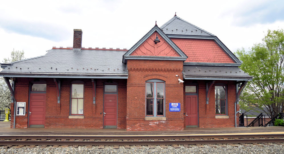
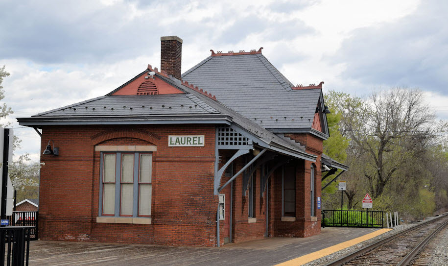
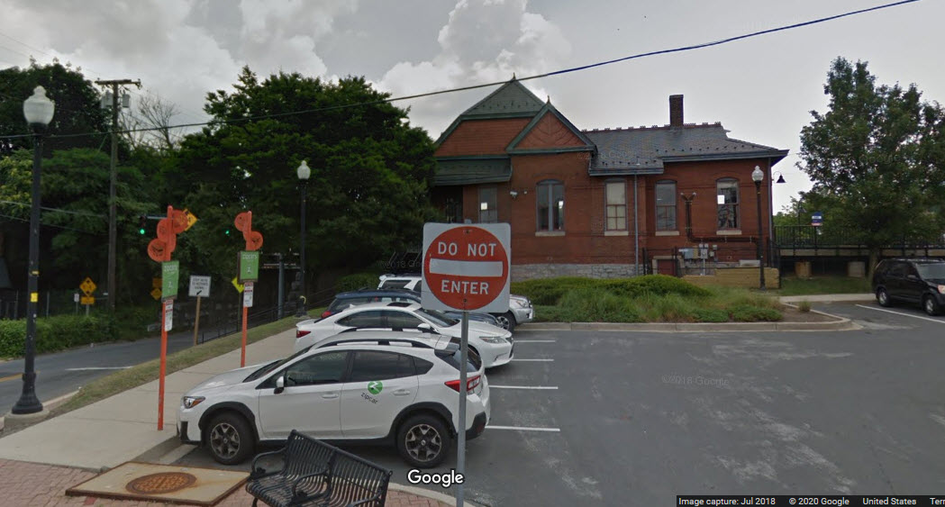
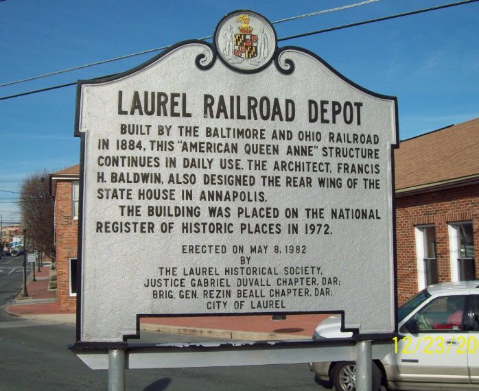
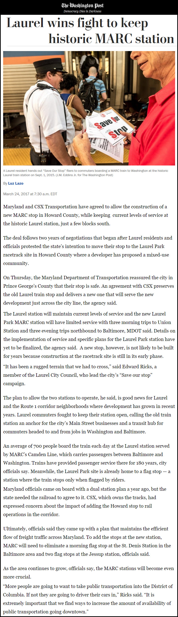
From Wikipedia: The Laurel Railroad Station was originally constructed in 1884 for the Baltimore and Ohio RR
along the railroad's Washington Branch, about halfway between Baltimore and Washington, DC. The architect was
Francis Baldwin. The structure is constructed of brick, and is one and a half stories, modified rectangle in
form with overhanging gabled and hipped roof sections with brackets and terra cotta cresting, and an interior
chimney. There is a louvered lunette in one gable, stick work in another, and fish-scale shingling under
truncated hipped section; shed shelter, segmental arched openings. It is Queen Anne in style. It is nearly
identical in plan and dimensions to the Gaithersburg MD station Baldwin designed, also built in 1884,
although the rooflines and settings are quite different.
Laurel station was listed on the National Register of Historic Places in 1973, (although one source claims
it was 1972) and was reopened into a MARC station when the Camden Line was established.
A fire gutted the interior of the station, and damaged its roof and brick walls, in January 1992. In February
2009, Vice President Joe Biden, Governor Martin O'Malley, and Senator Ben Cardin gave a speech at Laurel
Station to gain support for an economic stimulus package in Congress that would provide funding to rebuild
the station platform, among many other Maryland infrastructure projects. The funding bill passed
and by mid-March, construction fencing went up for an anticipated six months of work on a new platform
and other station improvement.
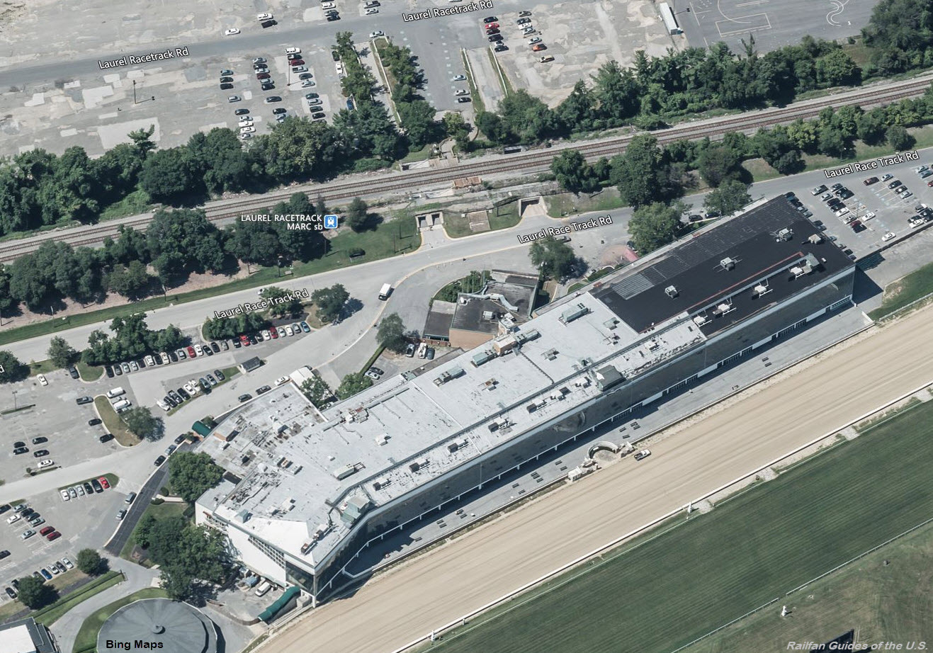
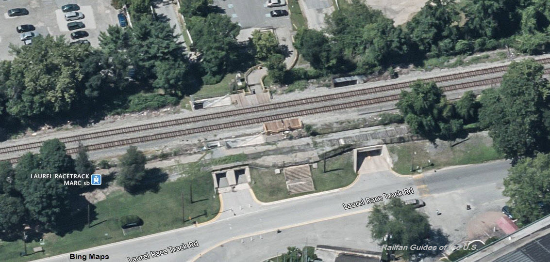
MARC's Laurel Racetrack Station
GPS Coordinates: 39.105661, -76.833926
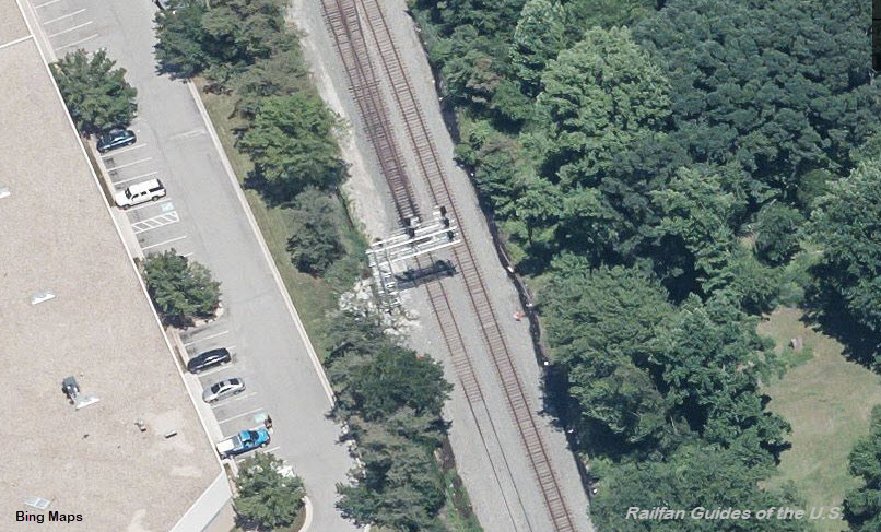
This station is about as simple as you can get, and is only used when the track is open.
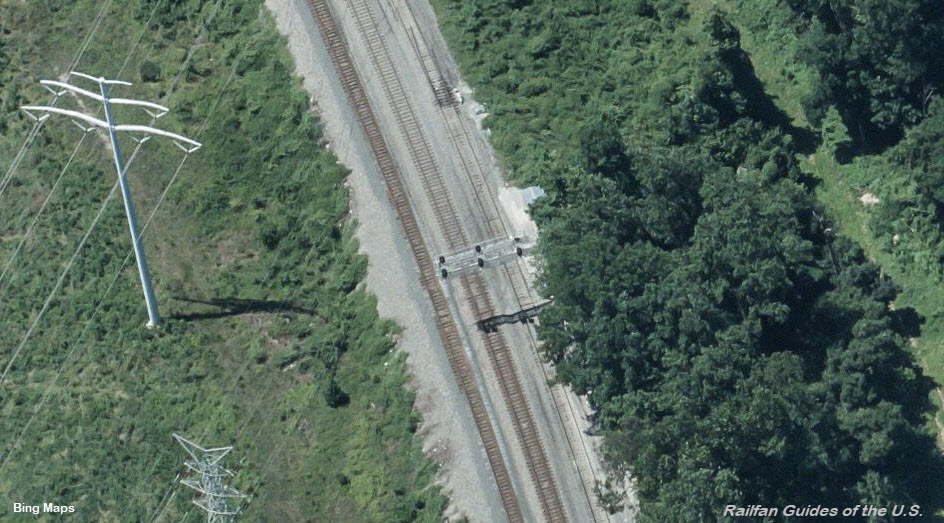
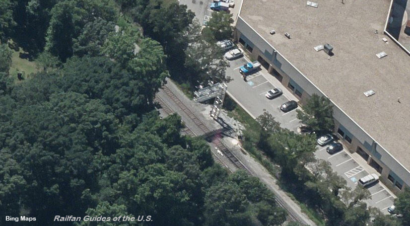
These and the other set of signals protect a double set of crossovers and the reduction from three to two tracks.
These are the only signals in the Laurel area.
NB Interlocking Signals
These signals are 1.4 miles north of the Laurel Racetrack station.
I love trains, and I love signals. I am not an expert. My webpages reflect what I find on the topic of the page. This is something I have fun with while
trying to help others.
Please Note: Since the main focus of my two websites is railroad signals, the railfan guides are oriented towards the signal fan being able to locate them.
For those of you into the modeling aspect of our hobby, my
indexa page has a list of almost everything railroad oriented
I can think of to provide you with at least a few pictures to help you detail your pike.
If this is a railfan page, every effort has been made to make sure that the information contained on this map and in this railfan guide is correct. Once in a while,
an error may creep in :-)
My philosophy: Pictures and maps are worth a thousand words, especially for railfanning. Text descriptions only get you so far, especially if you get lost or
disoriented. Take along good maps.... a GPS is OK to get somewhere, but maps are still better if you get lost! I belong to AAA, which allows you to get
local maps for free when you visit the local branches. ADC puts out a nice series of county maps for the Washington DC area, but their state maps do not have the
railroads on them. If you can find em, I like the National Geographic map book of the U.S..... good, clear, and concise graphics, and they do a really good job
of showing you where tourist type attractions are, although they too lack the railroads. Other notes about specific areas will show up on that page if known.
Aerial shots were taken from either Google or Bing Maps as noted. Screen captures are made
with Snagit, a Techsmith product... a great tool if you have never used it!
By the way, floobydust is a term I picked up 30-40 years ago from a National Semiconductor data book, and means miscellaneous
and/or other stuff.
Pictures and additional information is always needed if anyone feels inclined to take 'em, send 'em, and share 'em, or if you have something to add or correct.... credit
is always given! Please be NICE!!! Contact info is here
Beware: If used as a source, ANYTHING from Wikipedia must be treated as being possibly being inaccurate, wrong, or not true.