
In General
Getting Here
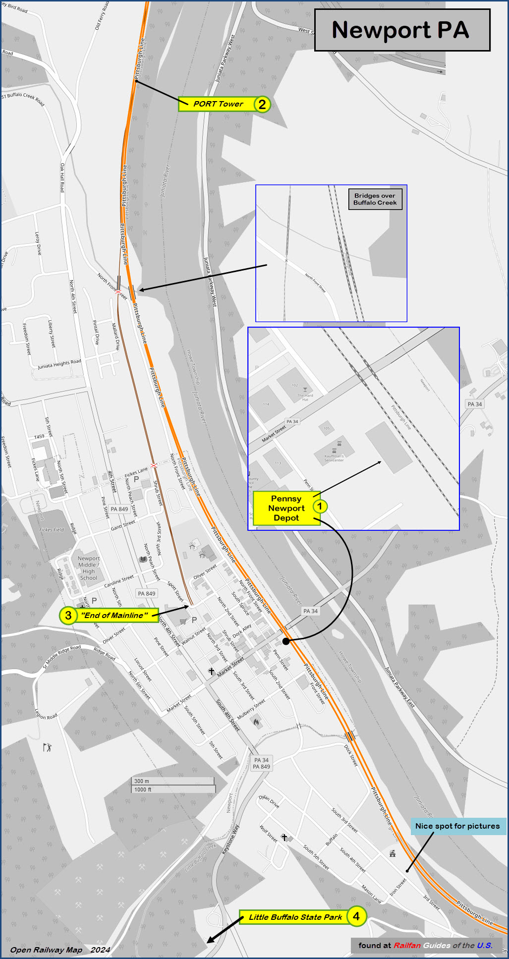
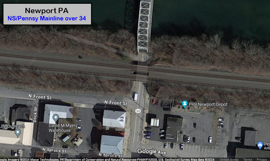
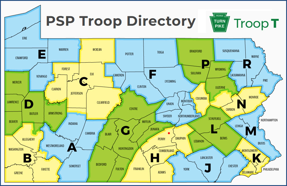
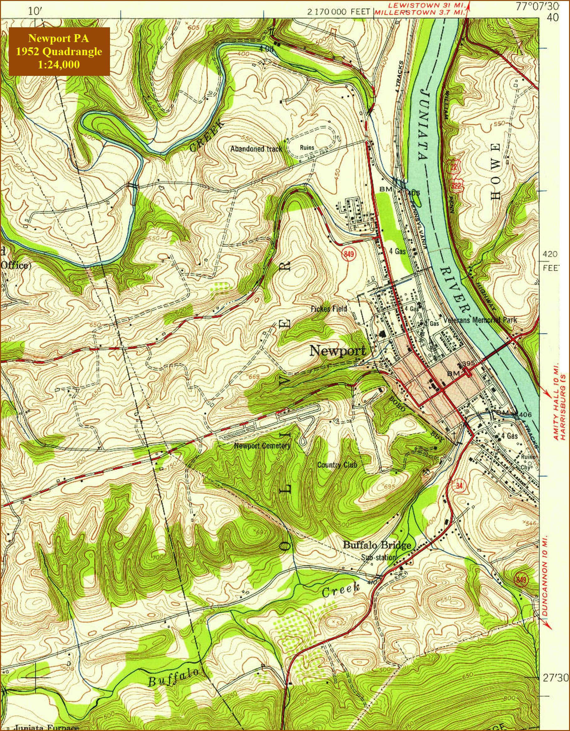
Map
Sights
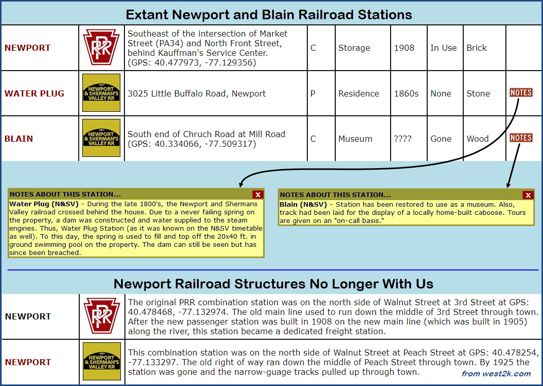
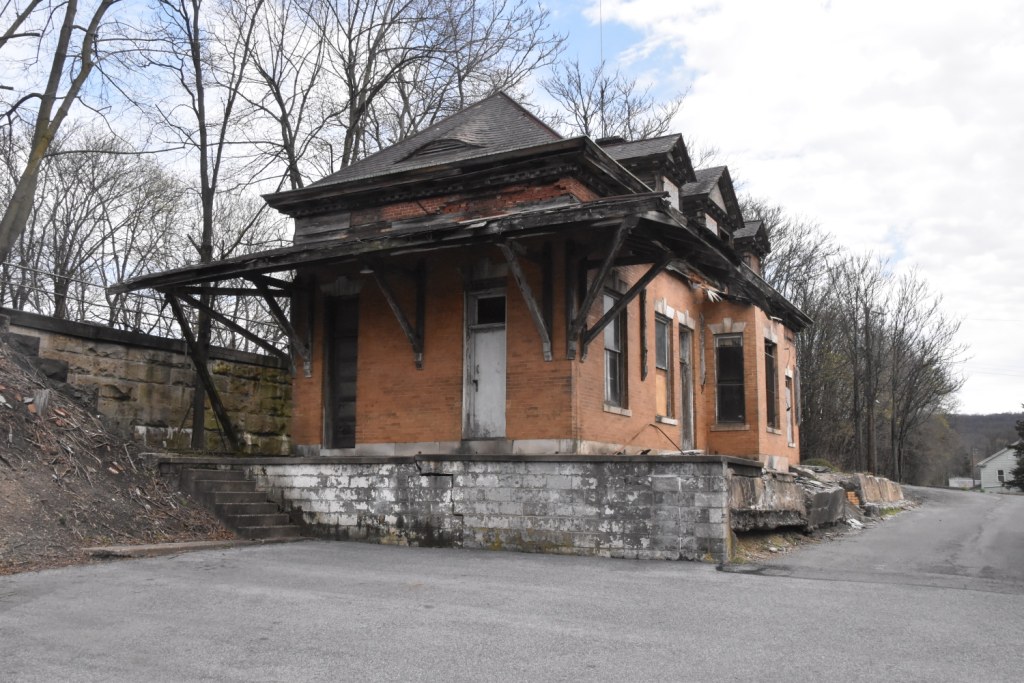
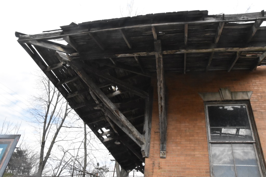
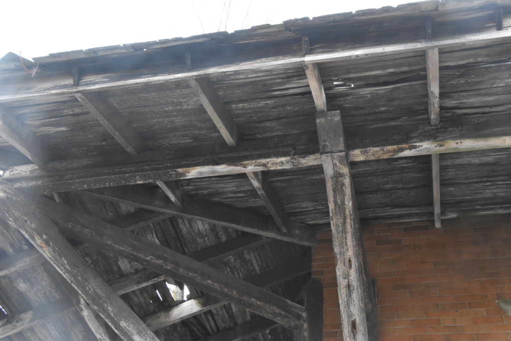
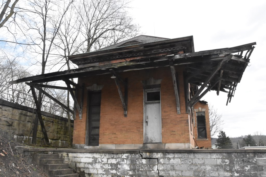
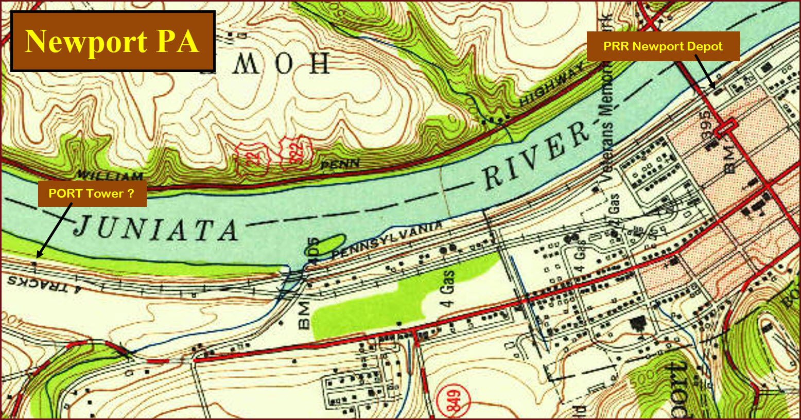
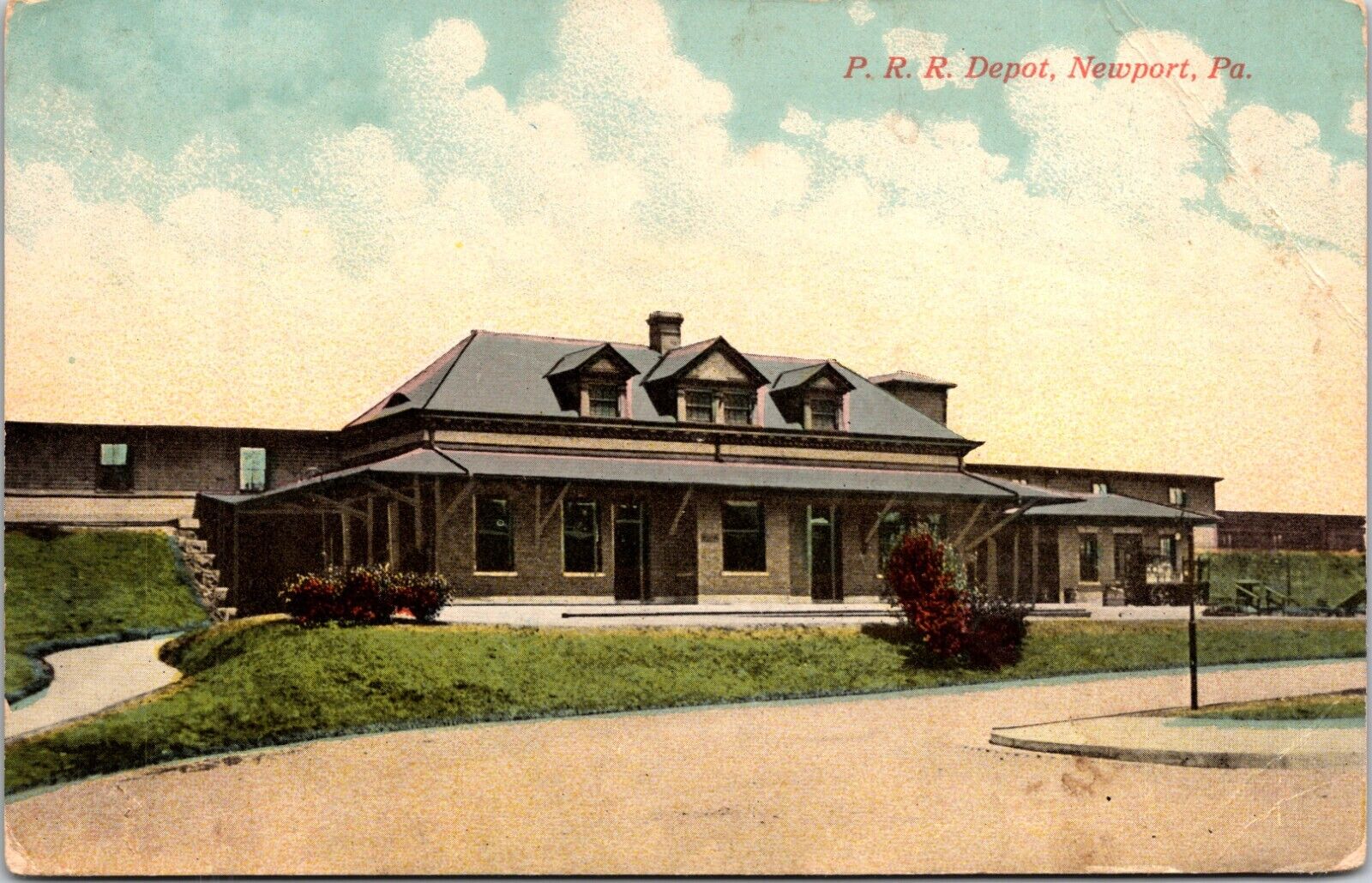
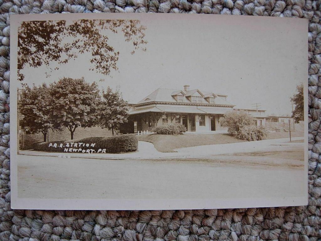
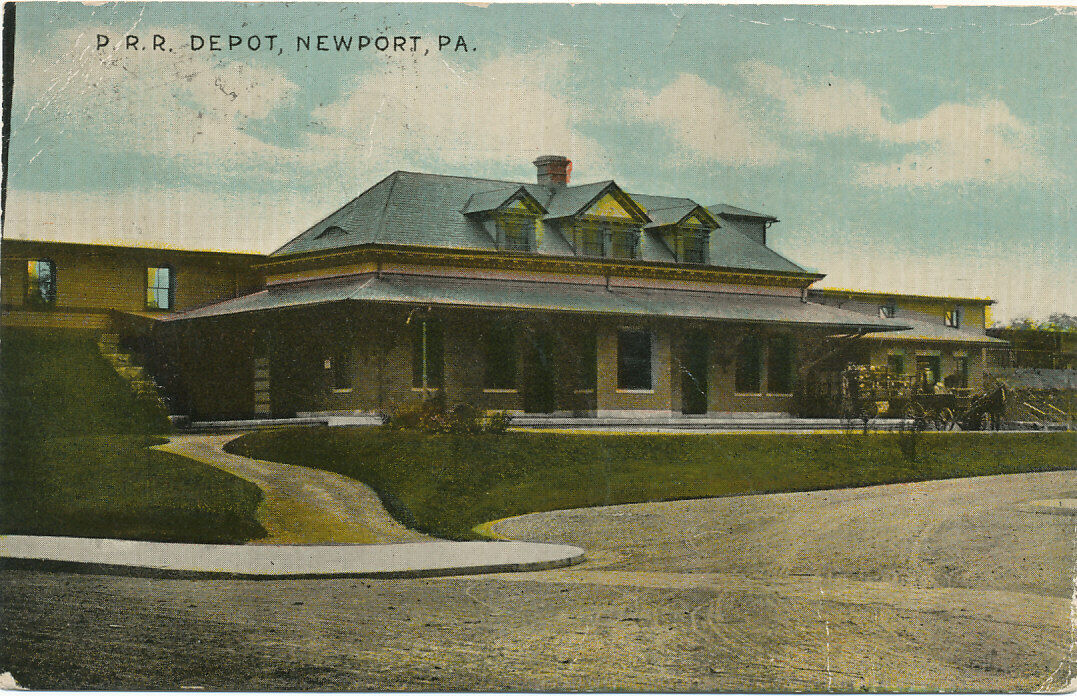
Newport Depot
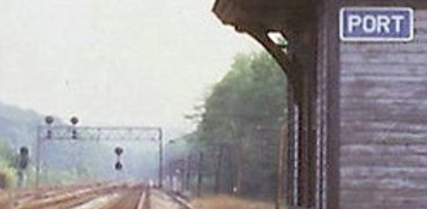
PORT Tower
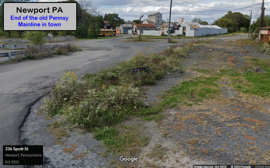
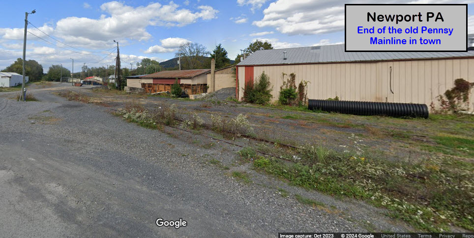
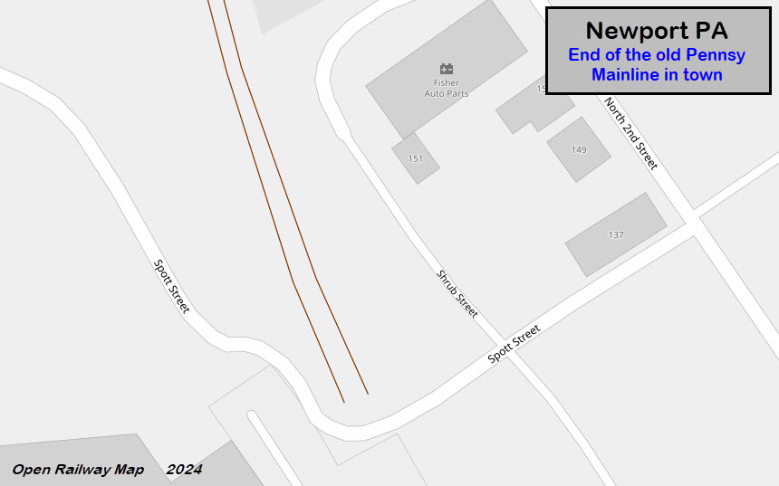
End of the old Mainline
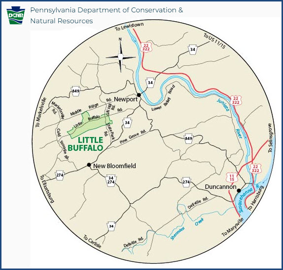
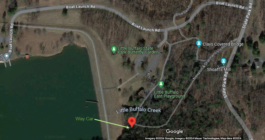
Little Buffalo State Park
Blain Depot
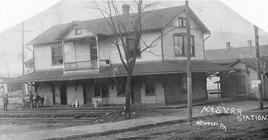
Newport NSVRR Depot
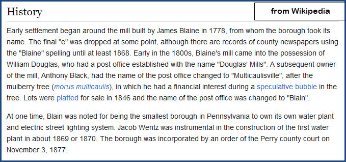
Blain & NSVRR History
Bridges
Signals
Fire & Police
Postcards
Floobydust
USGS Maps
RAILROAD SIGNALS HOME
Location / Name:
Newport PA, Perry County
What's Here:
Newport:
- Former PRR Depot
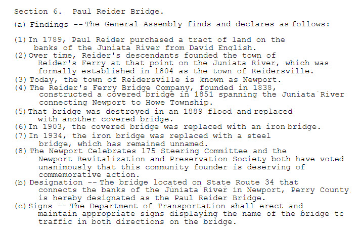
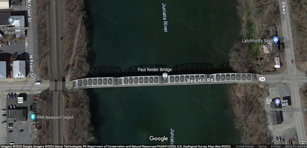
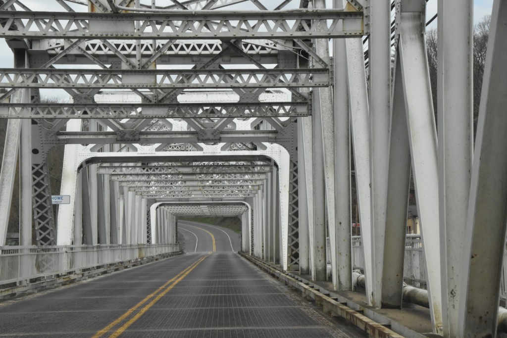
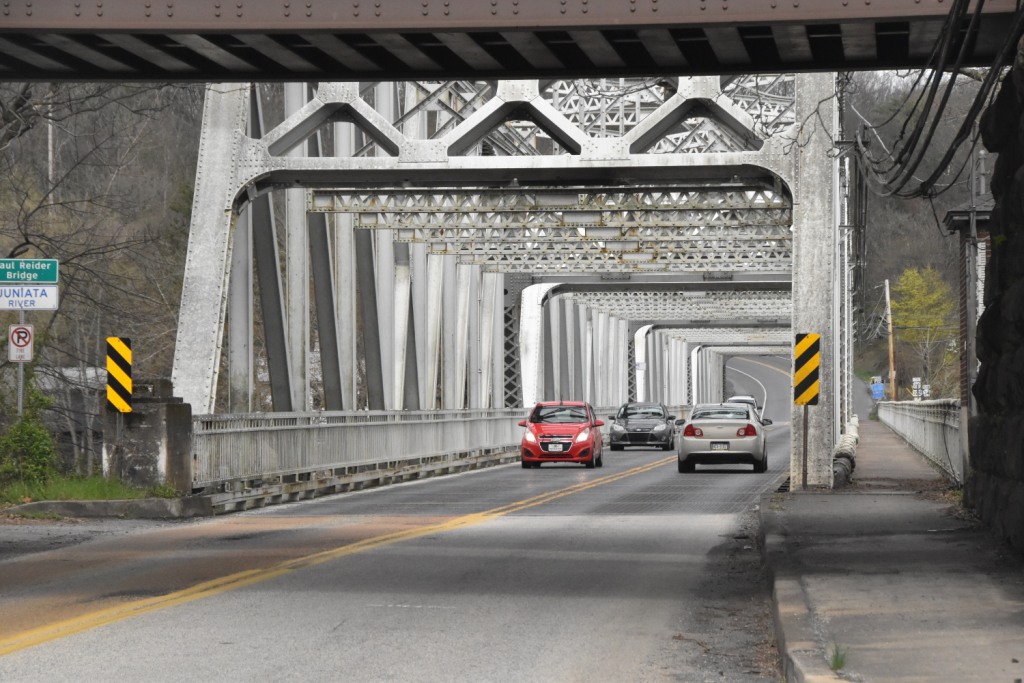
- Paul Reider Bridge over the Juniata River
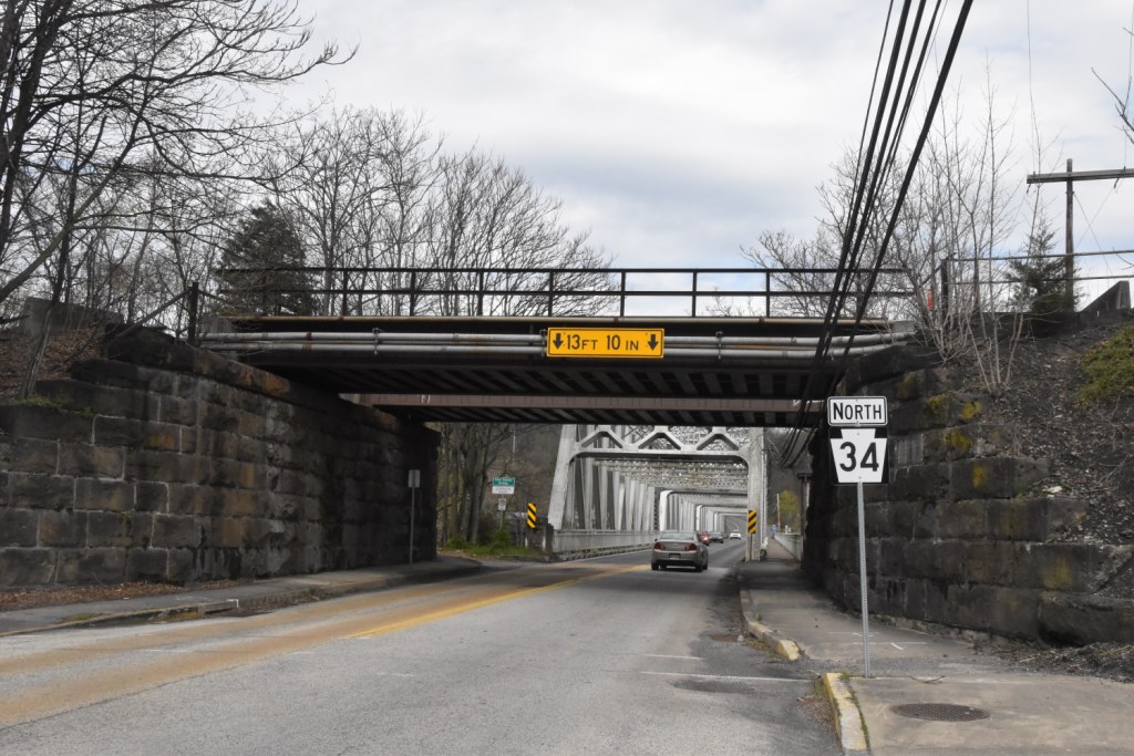
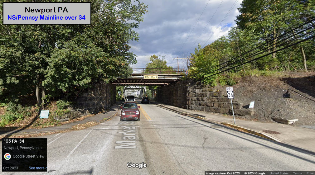
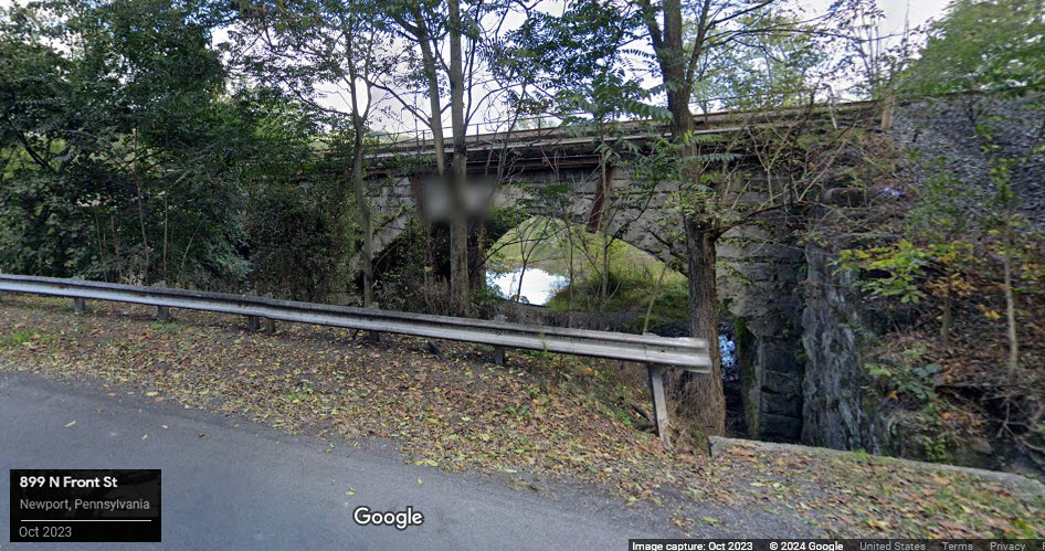
- NS/former Pennsy mainline bridge over state road 343
- NS/former Pennsy mainline bridge over Buffalo Creek
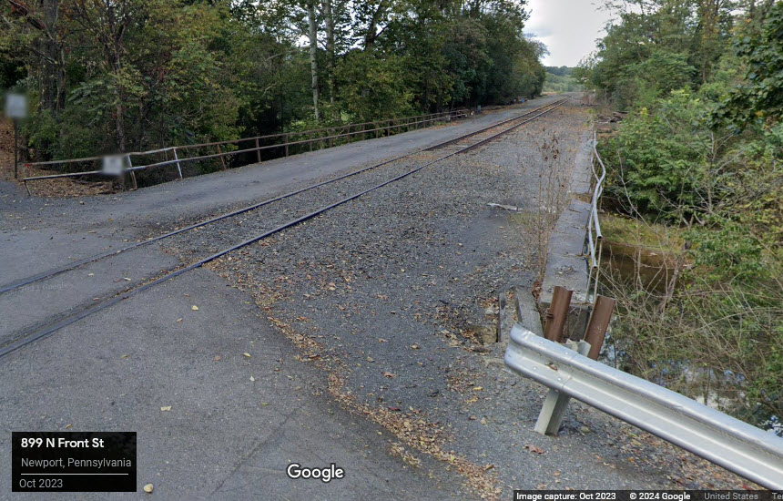
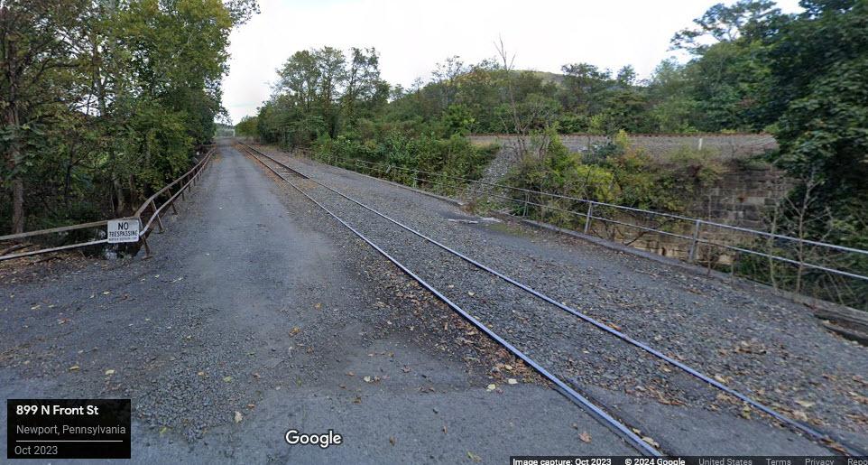
- NS/former Pennsy siding (into Newport) bridge over Buffalo Creek
- State park with an N&SVRR waycar, covered bridge and grist mill
Blain:
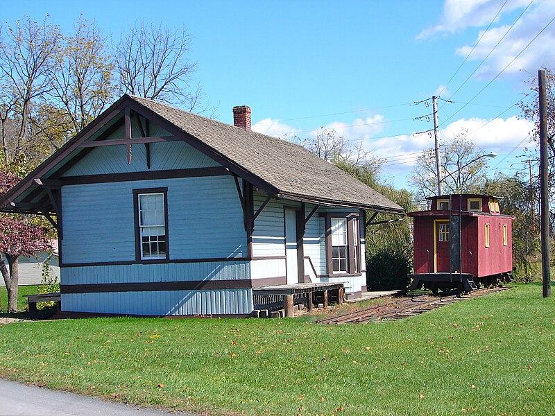
- Newport & Sherman Valley Railroad Depot with caboose
Data:
GPS Coordinates: as needed
Phone A/C: 717
ZIP: 17074
Access by train/transit:
None
Geography:
Very Hilly / Mountainous
The Scoop:
For the railfan, there is admittedly, not much to come to Newport for. However, with that said, if you are into history, you NEED to stop by, at least for a couple of pictures, and with the freight frequency on the Norfolk Southern as high as it is here, you shouldn't have to wait long. While I was taking pictures at the Newport depot, if I had waited another 5 minutes, I would have been able to catch a WB fright passing by. Darn :-) AND, as I was traveling back to Harrisburg on US22, I could see two more freights not far behind. Double darn!! US22, BTW, follows the river almost as well as the railroad does, and if you are so inclined, you can get good shots of NS freights if you have a decent camera with a telephoto lens. The highway is at a much higher elevation, so it provides a good vantage point to take pictures from!
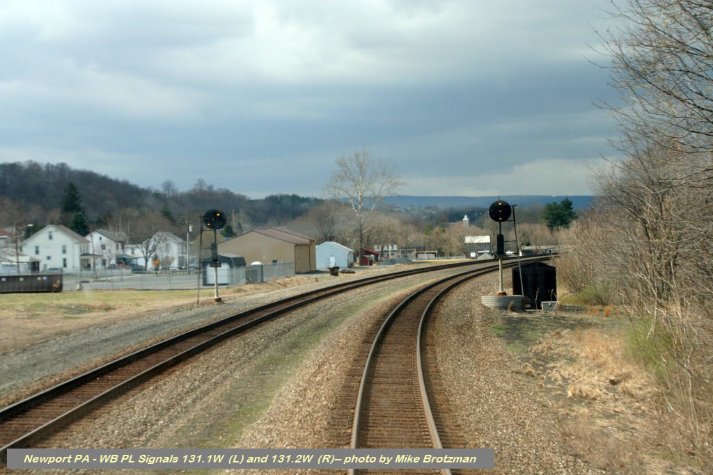
On the south side of town is an open field that affords a railfan a great view of the mainline for pictures. This can be seen in a couple of the signal pictures below. It is off of south 3rd Street.
However, if you are into other things like I am, read on.....
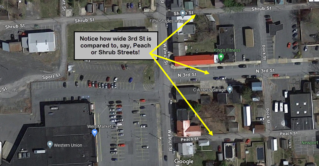
If you are appreciative of history, there is plenty to discover and see in Newport, and you won't be able to just breeze thru town. For instance, why is 3rd Street wider than other north/south running streets? You'll find the answers below, because the reason is train related!
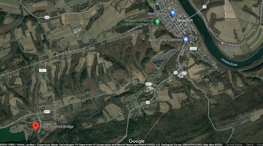
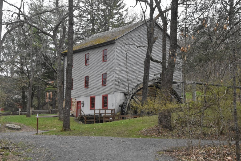
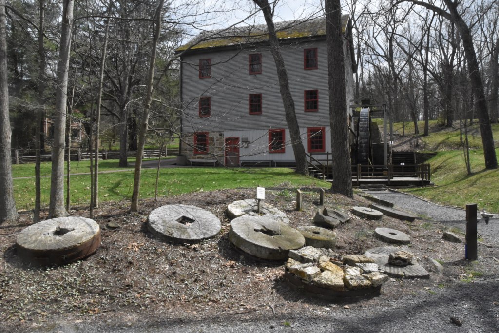
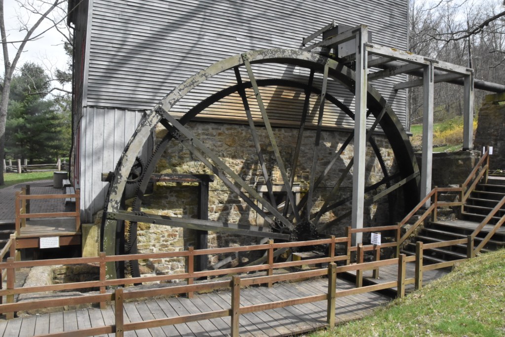
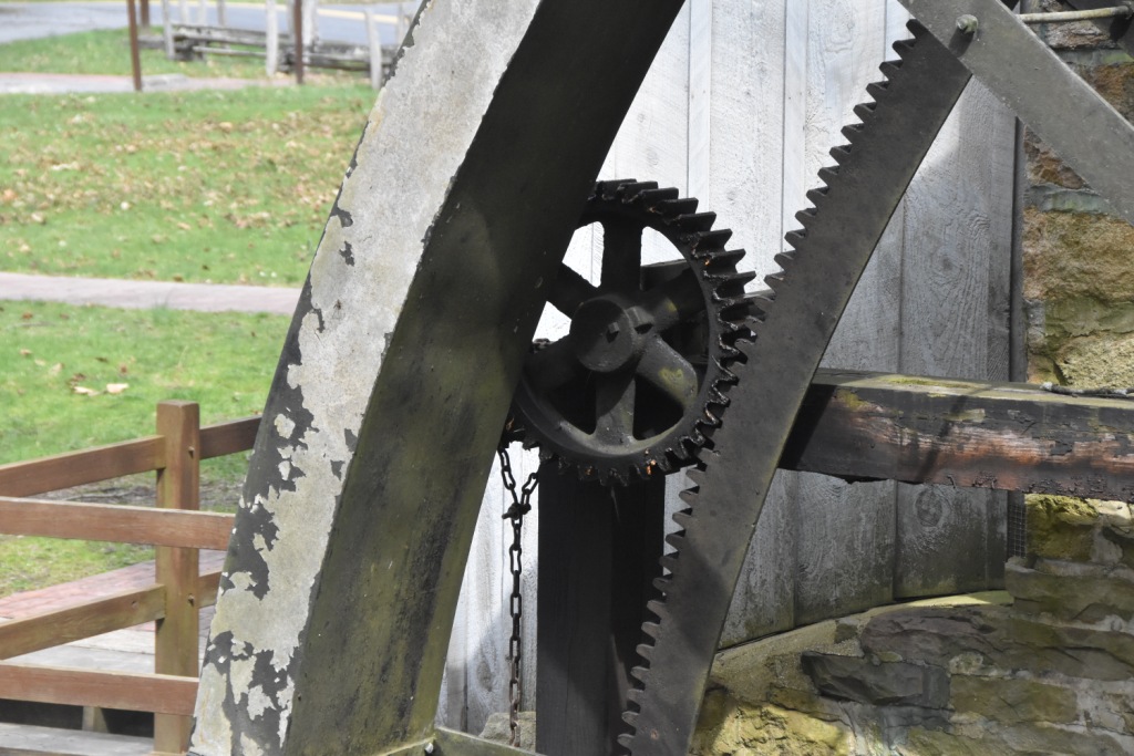
If you're into "National Park" type things like I am, there is the Little Buffalo State Park a few miles SW of town which contains a covered bridge and fully functioning grist mill. They also have a way car from the N&SVRR on display.
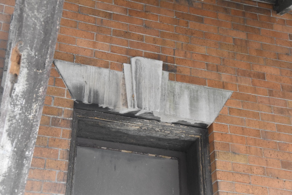
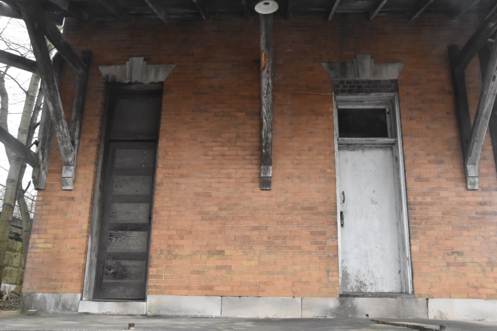
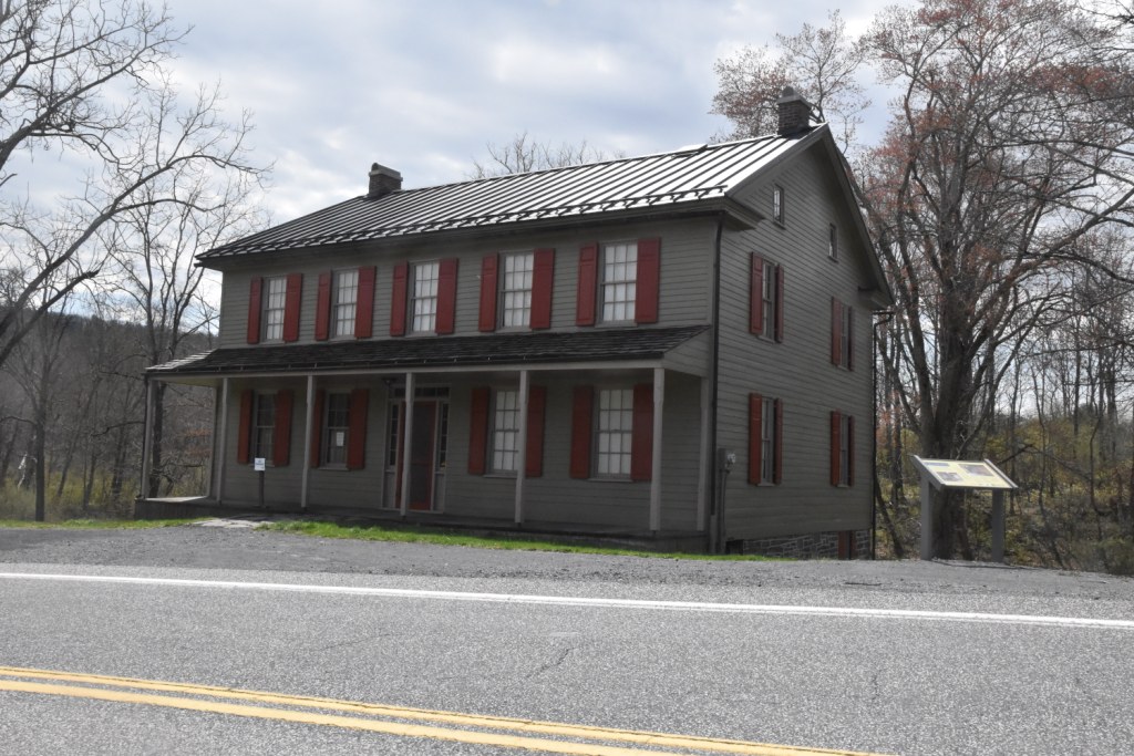
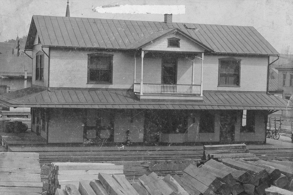
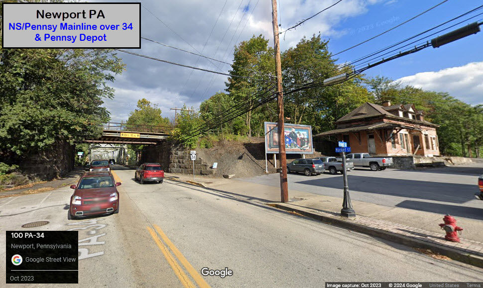
There is the former PRR station right off 34 as you go under the Pennsy main line. Unfortunately, it is in a sad state of repair. At this point, it needs A LOT of TLC, and a lot more than that to bring it back to "the Glory Days"! :-)
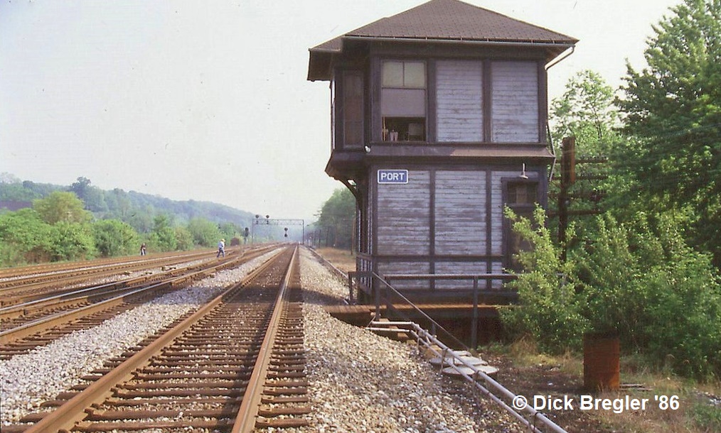
PORT Tower, along with the track crossings and interchange, are all gone, as well as the high signal bridges that spanned all four tracks, when there were four tracks.... So don't waste your time looking for them.
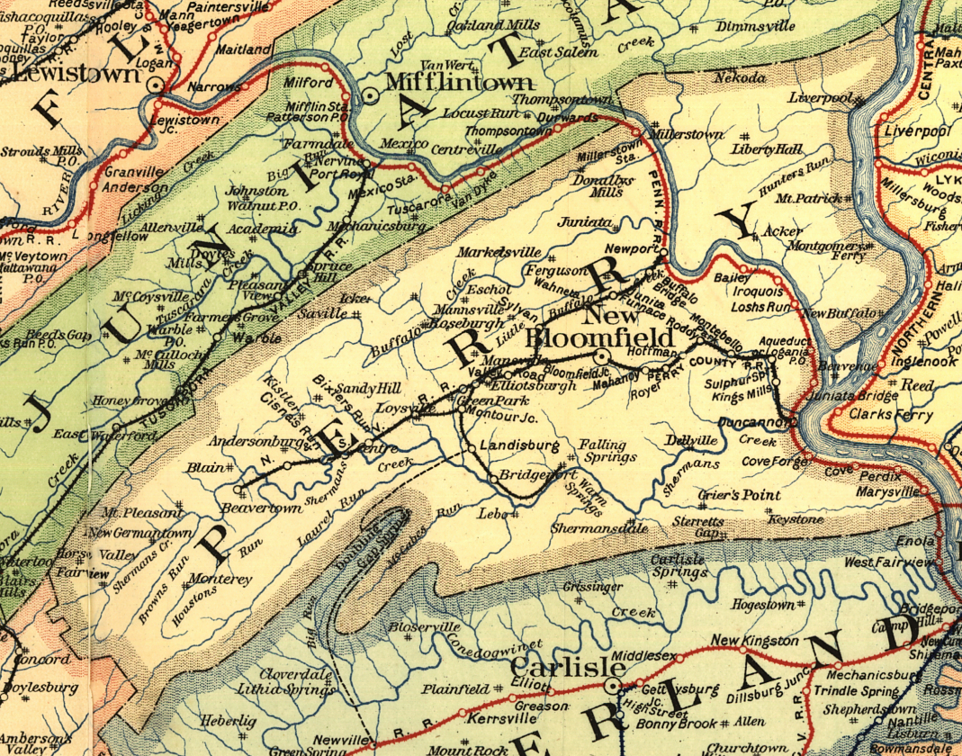
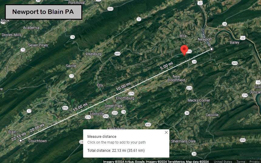
Over in Blain, a depot from the Newport & Sherman Valley narrow gauge railroad is still standing. Although there is a caboose sitting outside, it is not believed to be an original.... more info below. As the crow flies, Blain is about 22 miles SW of Newport.
More tasty tid-bits from Mr. Wertz: What I (your editor) refer to as "the siding", is apparently the route of the mainline when the railroad originally came thru. Where the mainline runs today, used to be the Juniata Division of the Pennsylvania Canal. When the canal was filled in, the Pennsylvania Railroad built the new mainline on top of the canal, and built the station that exists today alongside the R-O-W in 1902. The track that came through town, went down 3rd Street, and if you are wondering why it is wider than the other north-south running streets, this is why. So, what remains of the the R-O-W is now a siding that ends at Spott Street.
From Wikipedia: Newport was originally known as Ryder's Ferry, as it was the site of an early ferry on the Juniata River. It was later renamed Newport after the canal came through. Newport was the eastern end of the Newport and Shermans Valley Railroad. There was a freight yard where railcars and cargo could be transferred to standard gauge for the Pennsylvania Railroad.
From the west2K.com webpage for Perry County PA:
I would like to thank Mr. Campbell for the information he provided for the page: The dates of the township name change, it's incorporation date, and where the Blain Depot is, for even using Google Maps, I could not find it and the Caboose from the aerial views! The dates were especially elusive, and I was coming up with nothing!
I would also like to thank Mr. Wertz for all of his inputs. This page would not be possible without the help of those two gentlemen. They both put a lot of time into researching and providing their answers for all of my dumb questions.
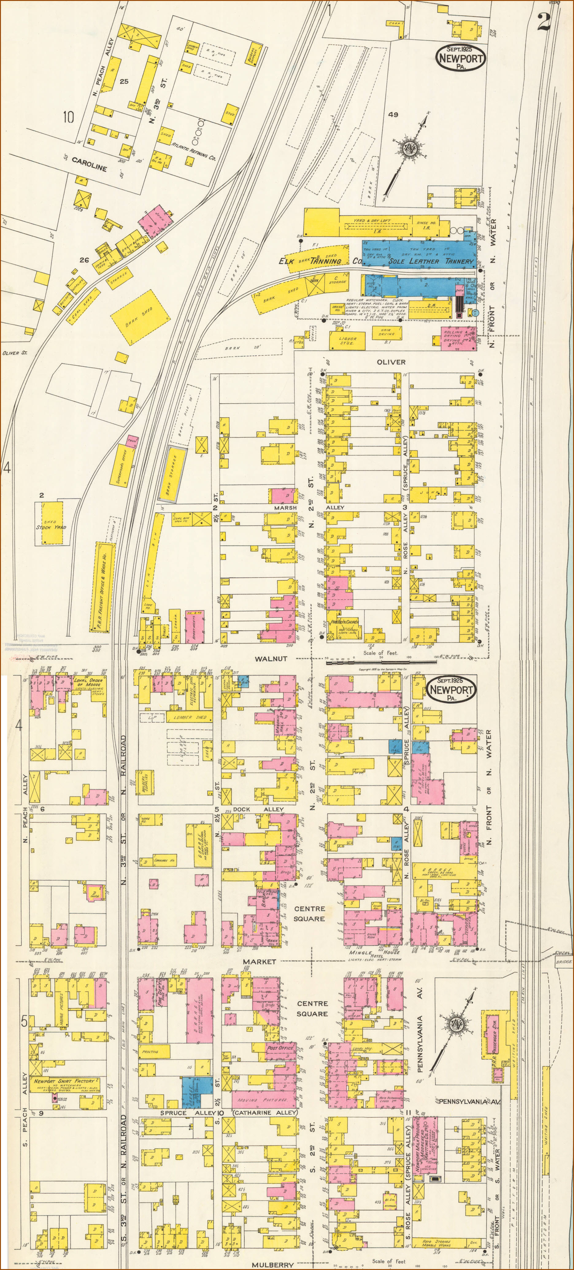
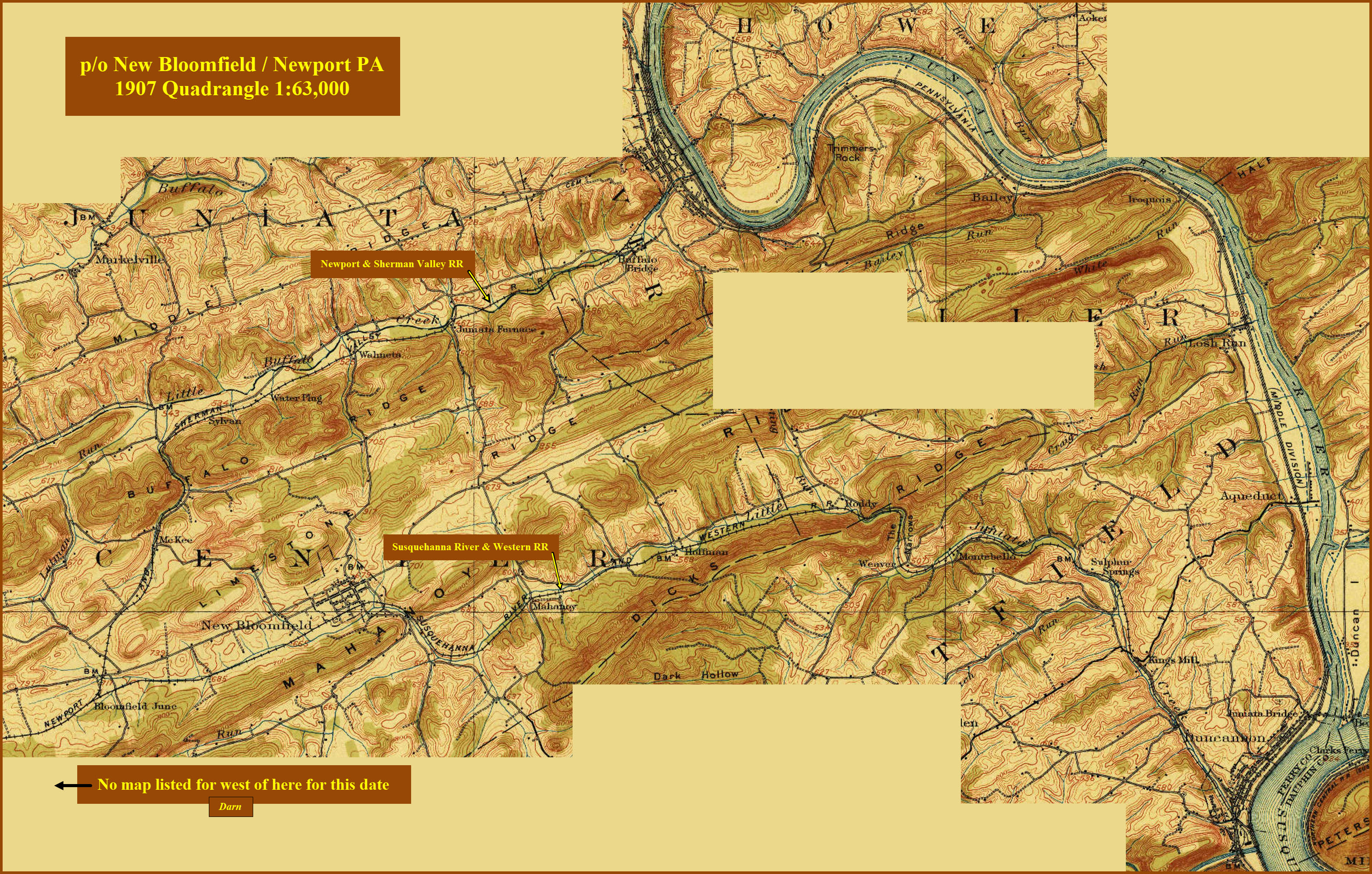
The "jbritton.pennsyrr.com" Page has a bunch of maps from the early 1900's, many of which show the N&SVRR. I only show one of them below, and that one is a combination of maps Sanborn Maps #2 and #3. Some of his dates don't agree with mine, but that is to be expected when digging into history.
Acknowledgements:
Frank Campbell, Perry County Commissioner
Fred Wertz
Dick Bregler
Denver Todd
west2k.com
jbritton.pennsyrr.com
USGS
Google Maps
Open Railway Map
Wikipedia
Picryl
Websites and other additional information sources of interest for the area:
https://thewrightphotographyofthings.com/galleries/night-signals/#jp-carousel-2256 Jon Wright pics of PL and CPL Signals
https://www.legis.state.pa.us/cfdocs/legis/home/docHits.cfm?DocId=134623&Index=D%3A%5CProgram%20Files%20%28x86%29%5CdtSearch%20Developer%5CUserdata%5Cuncons&HitCount=3&hits=f+4f+6f+ State document about the Paul Reiser Bridge
https://www.hmdb.org/m.asp?m=175044 History of Newport
https://www.newportboro.com/information/history/ History of Newport
https://jbritton.pennsyrr.com/index.php/tpm/432-middle-division-main-line-220 source of the Sanborn maps
https://www.facebook.com/littlebuffalostatepark/
https://en.wikipedia.org/wiki/Newport,_Pennsylvania#References
https://www.redoveryellow.com/position-light/06-04-01_2006_PRR_MAIN_LINE_SURVEY/ Best repository of signals pictures out there!
https://www.srbc.gov/our-work/fact-sheets/docs/river-basin-facts.pdf
https://perrycountyheritagetrail.com/trail-locations/regions/newport/
https://www.phmc.state.pa.us/portal/communities/architecture/types/railroad.html
https://pahistoricpreservation.com/from-creek-came-village-blain/#more-4242
https://www.west2k.com/pastations/perrypa.shtml
https://perrycountyheritagetrail.com/trail-locations/regions/blain-western-pc/newport-and-shermans-valley-railroad/
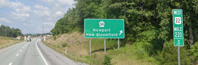
For most of us, find your way to US 22, and hop off at the Newport exit, PA 34. Then head south on 34 into Newport, 1.6mi. You will go down a good sized hill to the Juniata River, and then cross it on the Paul Reider Bridge. JUST after getting off that bridge, you will go under the NS main. The station is IMMEDIATELY on your left!
As you can see from the WB exit sign, you are at the 220 mile marker on US 22.
The mileages below are using US11/15 to get to Marysville and Harrisburg. If you're in a rush, don't get off on 11/15, and stay on US22.
Mileages to the west are via US22 to Lewistown, then by taking US22/US522 to Mt. Union, and 22 to Altoona. US522 heads south out of Mt. Union and will take you to the East Broad Top RR and the Shade Gap Trolley Museum, and eventually east/west running US30 and I-76, the Pennsy Turnpike.
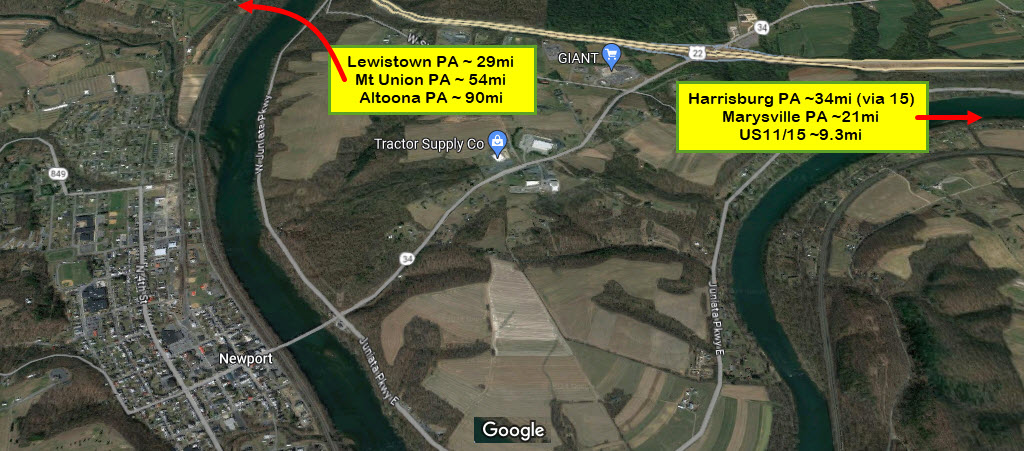
 Coming from US11/15 & Harrisburg
 Coming from Altoona / Lewistown
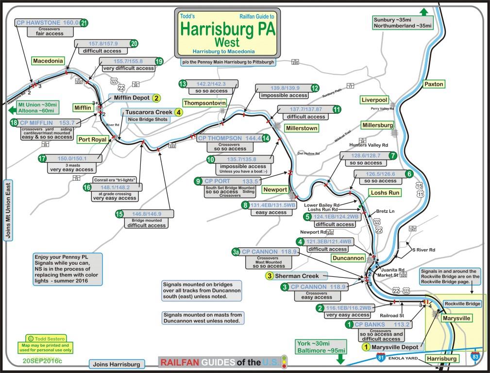
My map above is a map of the signal locations along this route as of 2016.
Most of these signals have been removed as part of the rule 562 signal upgrade,
and only interlocking signals remain.
GPS Coordinates: 40.47803, -77.12940
105 Market St, Newport PA 17074
The station is in horrible condition. It is currently owned by a local resident. Attempts to purchase the depot from him have failed in the past :-(
I just took these pictures in April 2024.
(Former) GPS Coordinates: ~40.49678, -77.13563
GPS Coordinates: 40.47918, -77.13333
In the last of the four pictures under this heading, notice the relative widths of the streets in relationship to each other, and how markedly wider 3rd Street is compared to it's closest two north/south going neighbors! Does anyone know if there is a [picture of a train on 3rd Street, or the old depot that used to be here where the Weis Market is now????
GPS Coordinates: 40.45560, -77.17000 (Bridge)
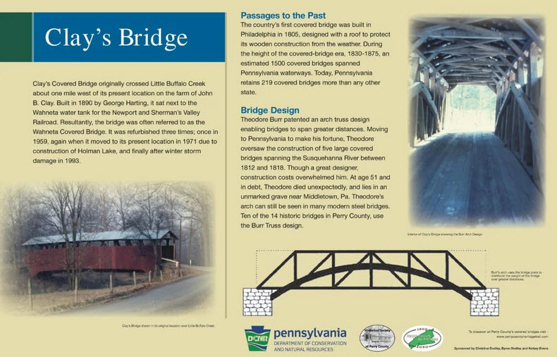
 From the DCNR webpage on Little Buffalo State Park
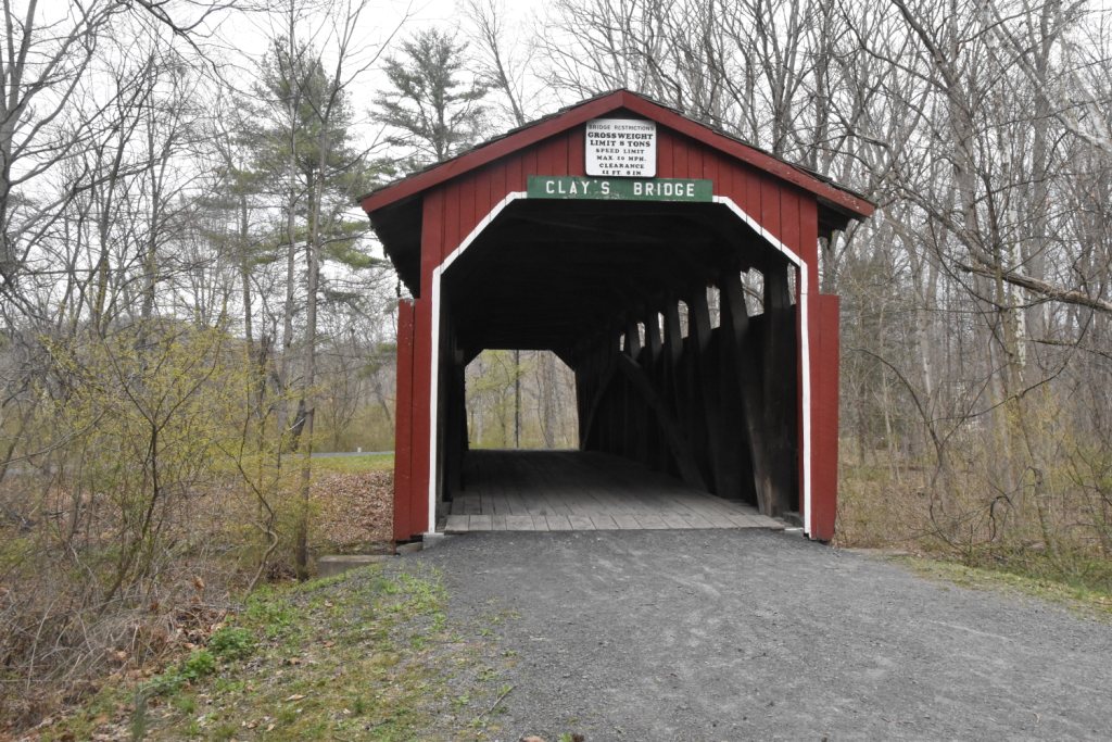
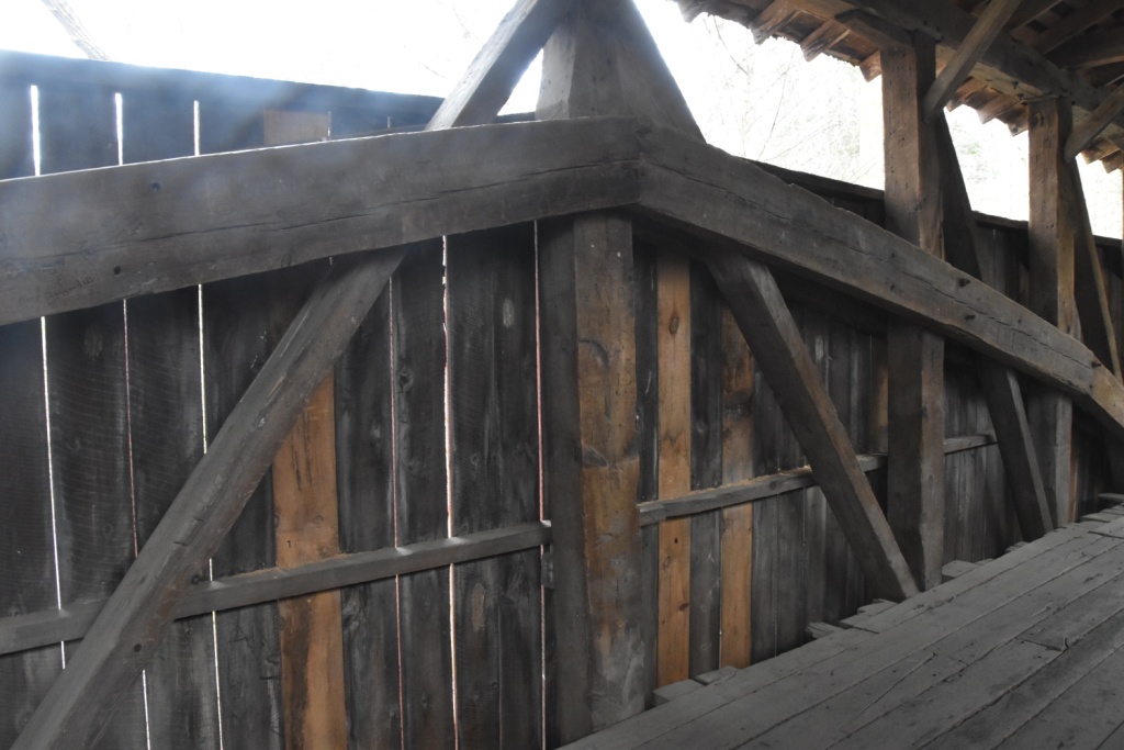
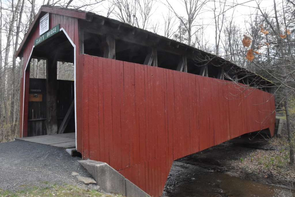
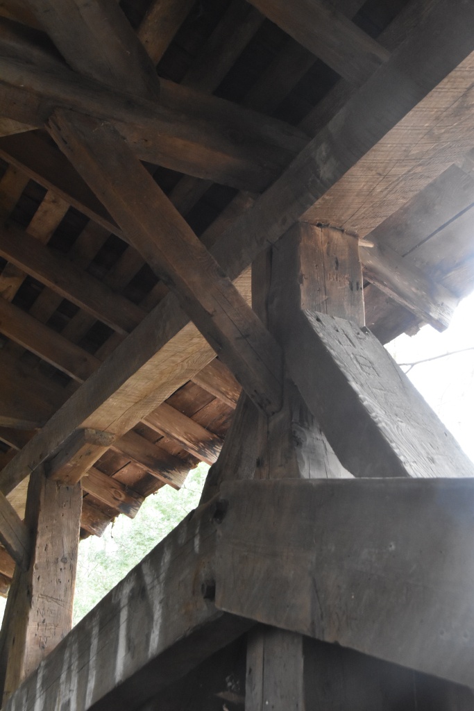
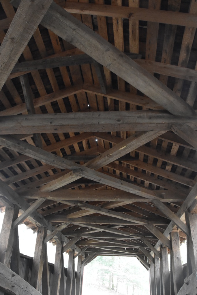
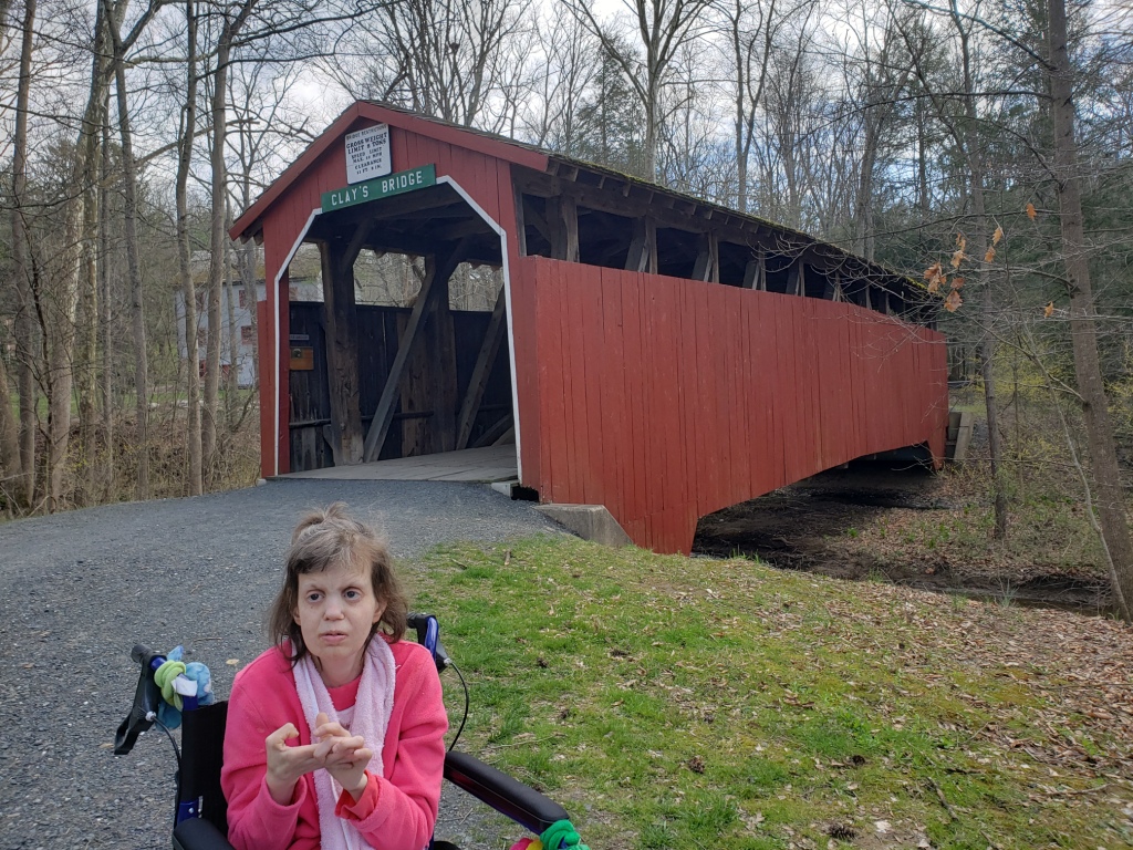
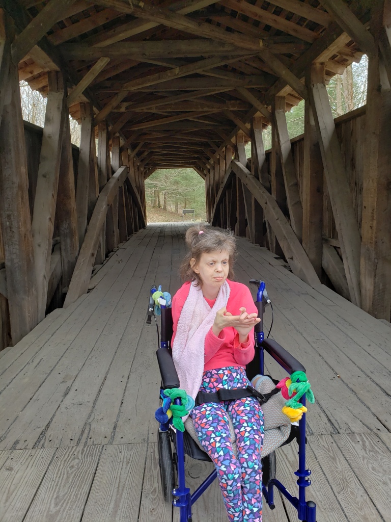
Clays Covered Bridge
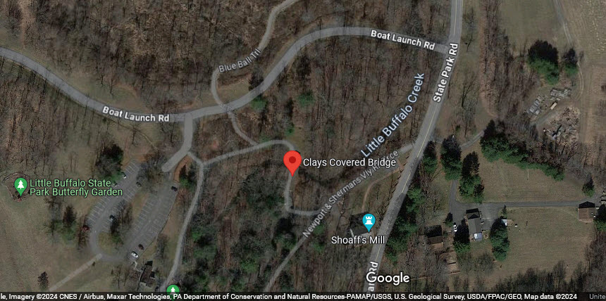
The bridge was built in 1890, but is not in it's original location, as it was moved to it's current location in 1971. The bridge originally crossed the Little Buffalo Creek and was adjacent to the Wahneta water tower for the Newtown & Sherman Valley RR. For this reason, it is also known as the Wahneta Covered Bridge. Unfortunately, the name Wahneta does not appear on the 1907 USGS map :-(
Here's my daughter Jennifer at the bridge (looking none too thrilled to be there BTW :-) :
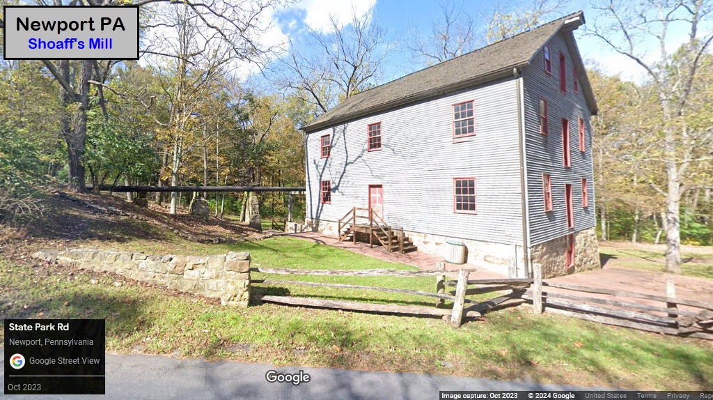
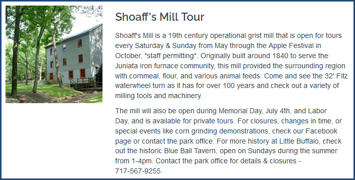
Shoaff's Mill
https://events.dcnr.pa.gov/event/shoaffs_mill_tour_605
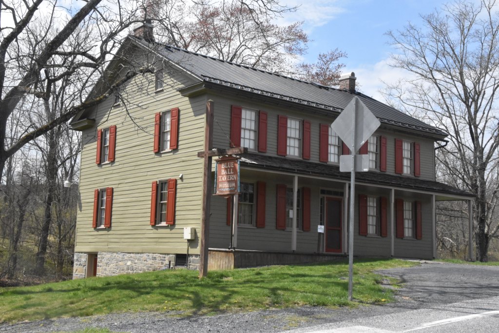
Blue Ball Tavern
https://americandreamsrealestate.com/blue-ball-tavern-museum-newport-pa/
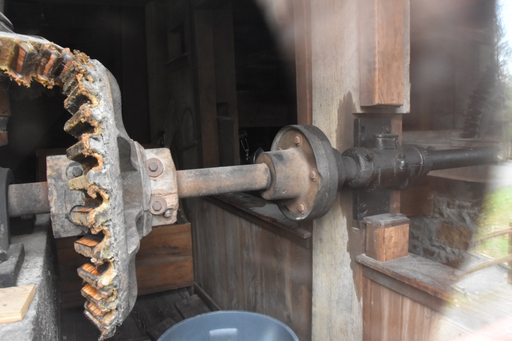
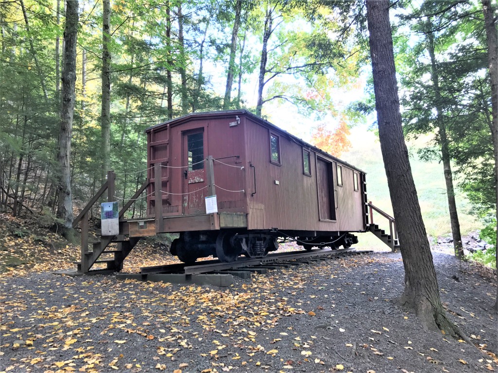
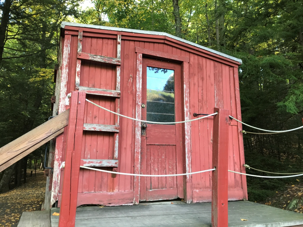
N&SVRR Way Car
GPS Coordinates: approx 40.45394, -77.1718
From Mr. Wertz: The two pictures below were taken by park staff. The platform shown on the close-up was not part of the original arrangement. It was added by the park to provide better pedestrian access. Also, the trucks are not original. When the park acquired the car, they bought the trucks from the EBT (East Broad Top RR - A 3ft narrow gauge railroad to the west), but at least they were narrow gauge! Hope this is useful. The car can be found by following the loop trail around the East Area. It is at the opposite end of the Area from the covered bridge and mill, at the base of the dam, south end.
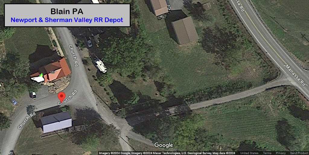
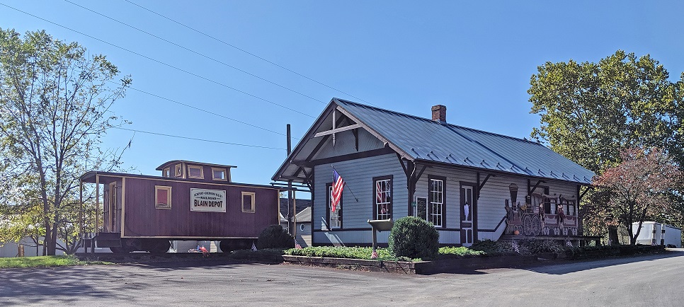
the Blain Depot
https://www.facebook.com/PCSOPA/?locale=nn_NO&paipv=0&eav=AfZ5_7Kalh3Tm5NOnVtEcigqN0xHu5hTiBLzs6gpckxr32BZdI35cmFetkENMaoGX3I&_rdr
GPS Coordinates: 40.33408, -77.50931
144 Church Road, Blain PA 17006
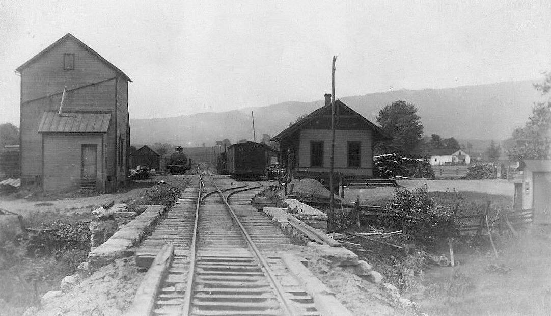
Blain was at the "far end" of a narrow gauge railroad beginning in Newport, called the Newport & Sherman Valley Railroad.
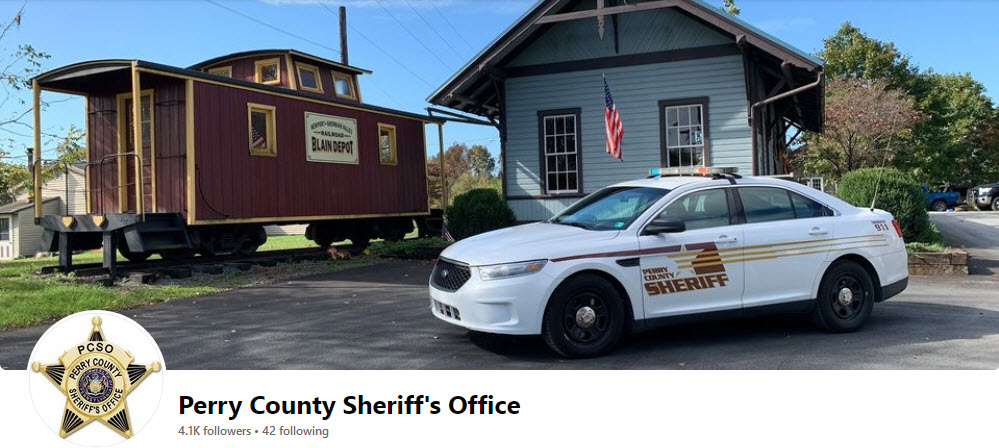
The following picture is "all over the place", even in the heading for the Perry County Sheriff's Department page on Facebook.
Info on the depot is scarce, but one page did have this to say: The Blain train station ended passenger service in 1928 but was given new life when it was restored by Blain Lion’s Club in 1983. It remains open as a historic site.
According to one (unnamed) contributor, the caboose is NOT an original N&SVRR caboose, it is rumored to be a custom creation.
Unfortunately, it does not look like the USGS has a map of the area old enough to show the R-O-W of the N&SV in Blain while it was running. The earliest map I could find that shows the railroad is of the New Bloomfield PA from 1907, but it does not go far enough west to show Blain, even at 1:63,000 (which shows much more territory than a standard 1:24,000 map).
In case you are wondering, Blain used to be spelled with an "E" at the end after the founder of the township, but at some point, a long long time ago, the "E" was dropped, and is now BLAIN.
 via the west2k.com website
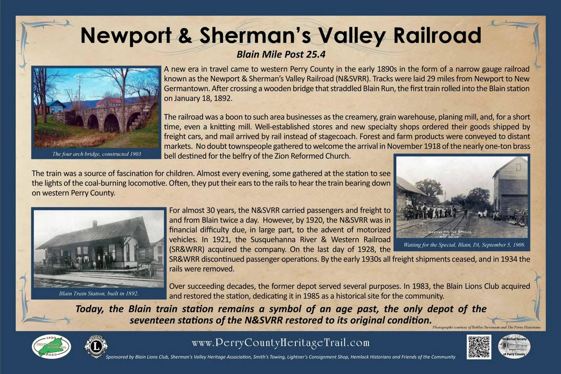
A few pictures of the steam locomotives that used to run on the N&SVRR:
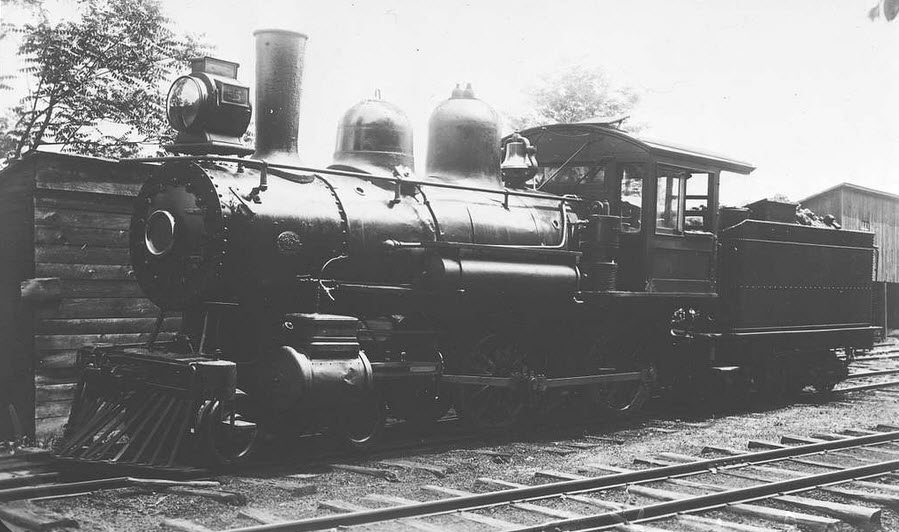 N&SVRR #5
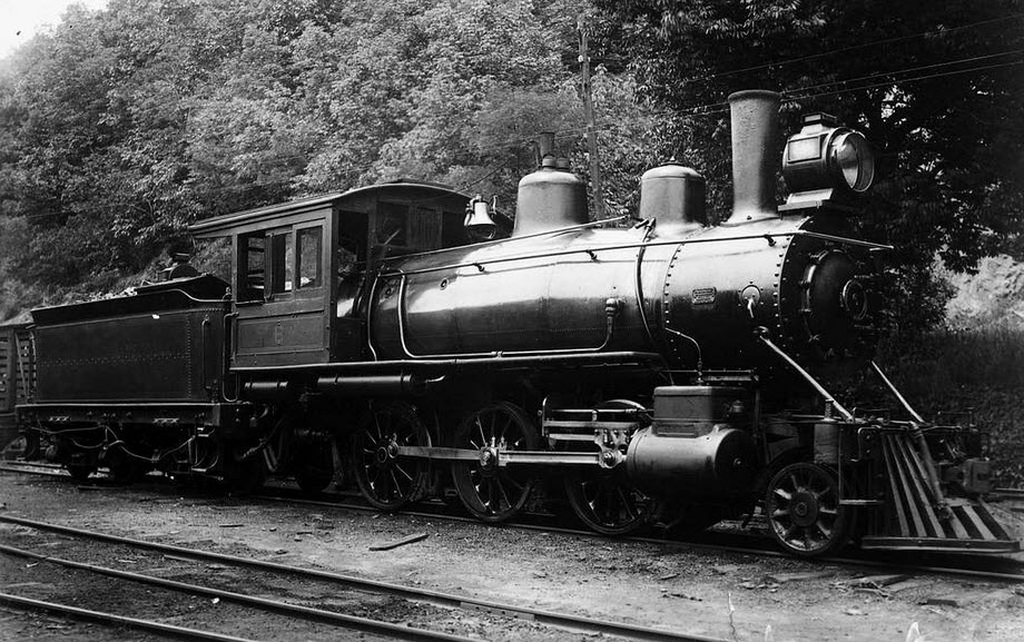 N&SVRR #6
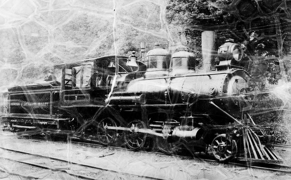 N&SVRR #7
GPS Coordinates: 40.47838, -77.12936
GPS Coordinates: 40.47900, -77.12821 (center of the bridge)
GPS Coordinates: 40.48957, -77.13589
The bridge was designed for four tracks, but now, only sports two. Need better pictures if anyone has them!
GPS Coordinates: 40.48983, -77.13650
GPS Coordinates: was 40.46987, -77.12278
These signals are longer in place. The track has been converted to operating under rule 562, where signals are only used at interlockings and Control Points - "routine" wayside signals are replaced by cab signals.
 ~2015
~2015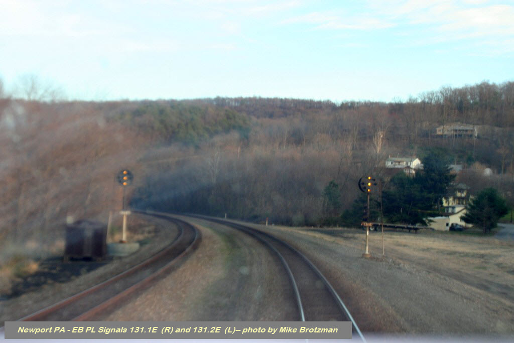 ~2015
~2015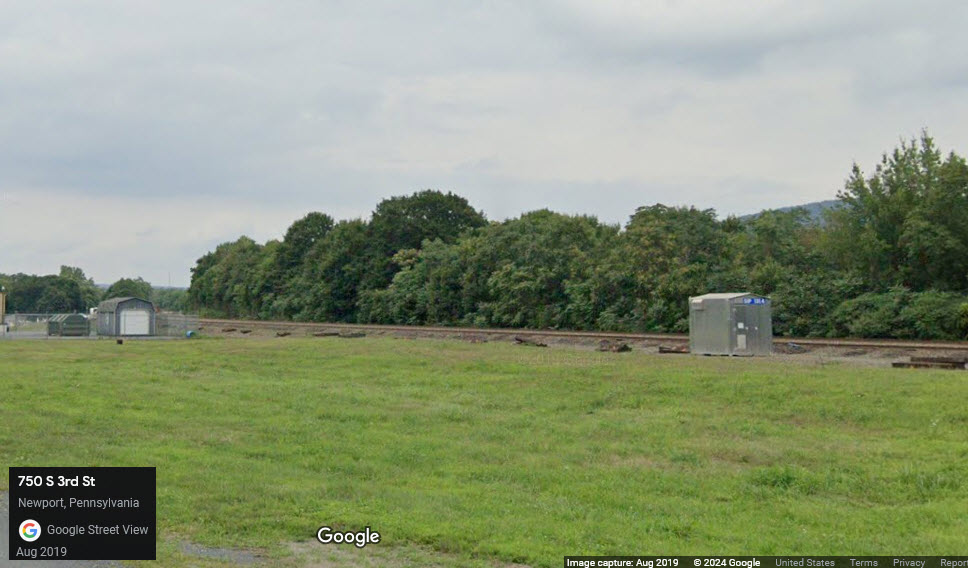 today, nada
Looking for pictures of the crossover signals at CP Port: mp133.5, if anyone has them to share!
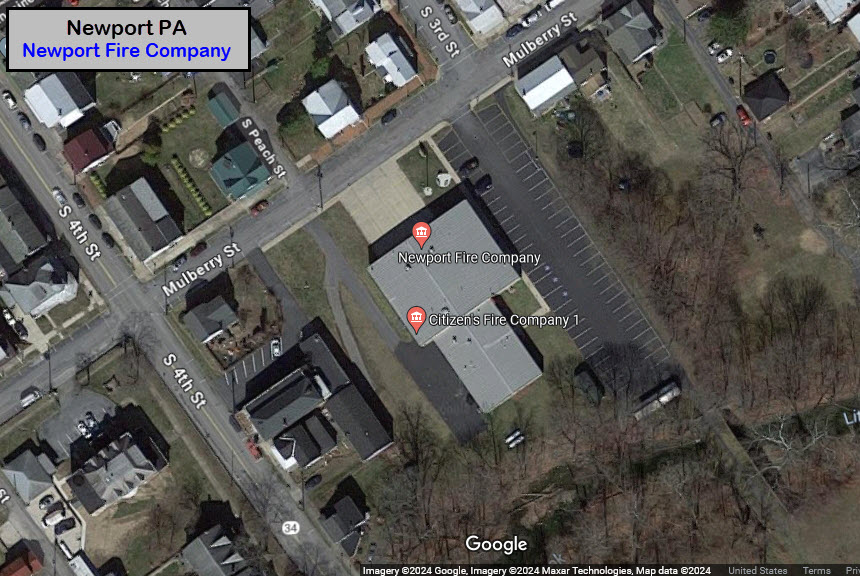
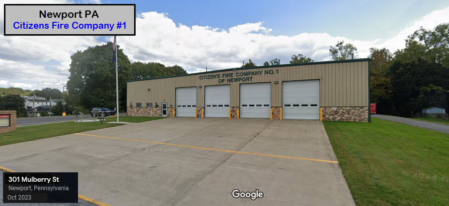
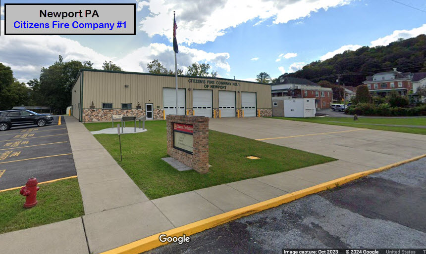
GPS Coordinates: 40.47544, -77.13060
301 Mulberry St, Newport PA 17074
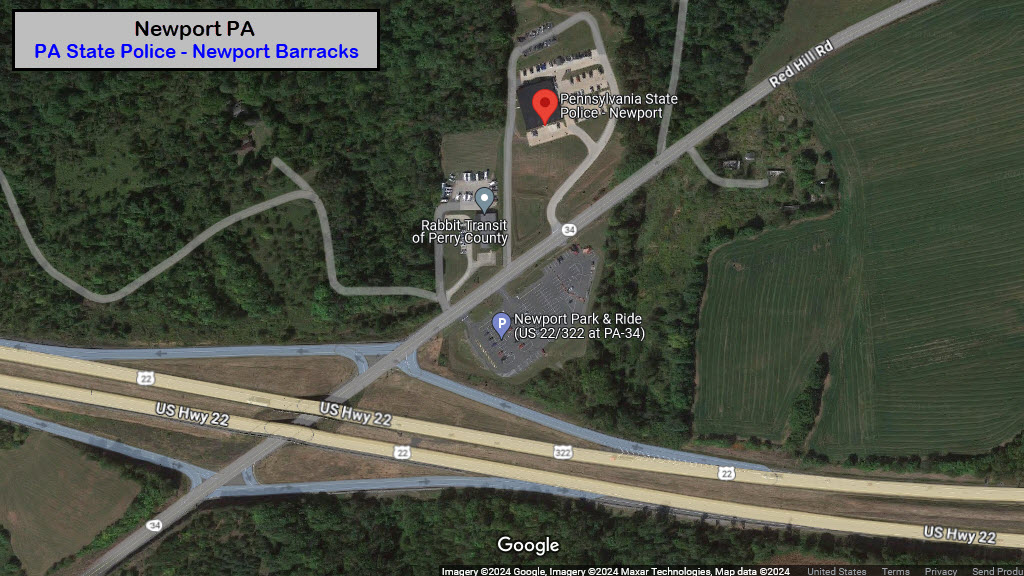
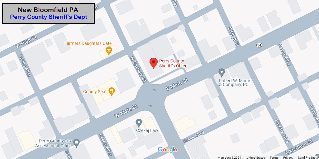
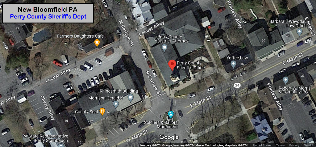
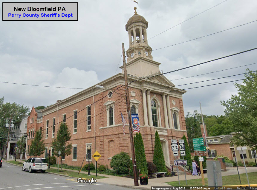
Police
There are no police precincts in Newport. The Sheriff's department is located over in New Bloomfield. And there is a State Police Barracks to the north of the US22 exit on 34.
GPS Coordinates: 40.49721, -77.10533
155 Red Hill Rd, Newport PA 17074
717-567-3110
GPS Coordinates: 40.42006, -77.18715
2 E Main St, New Bloomfield PA 17068
717-582-5123
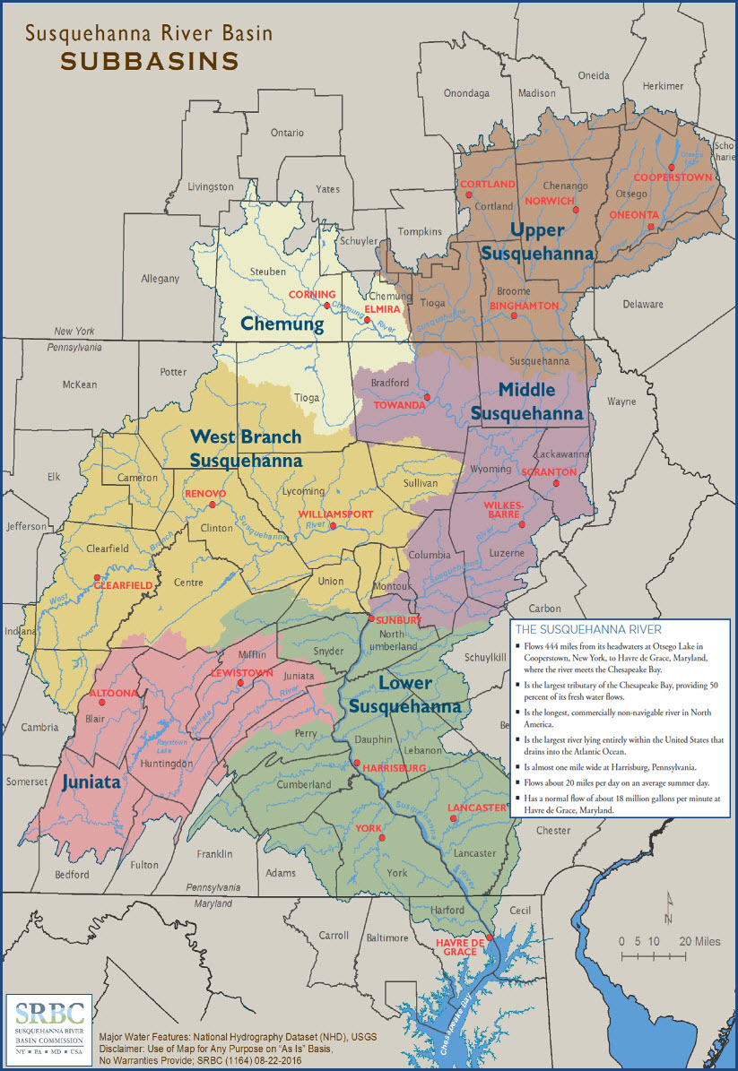
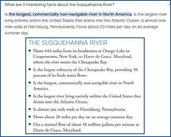
The Susquehanna River
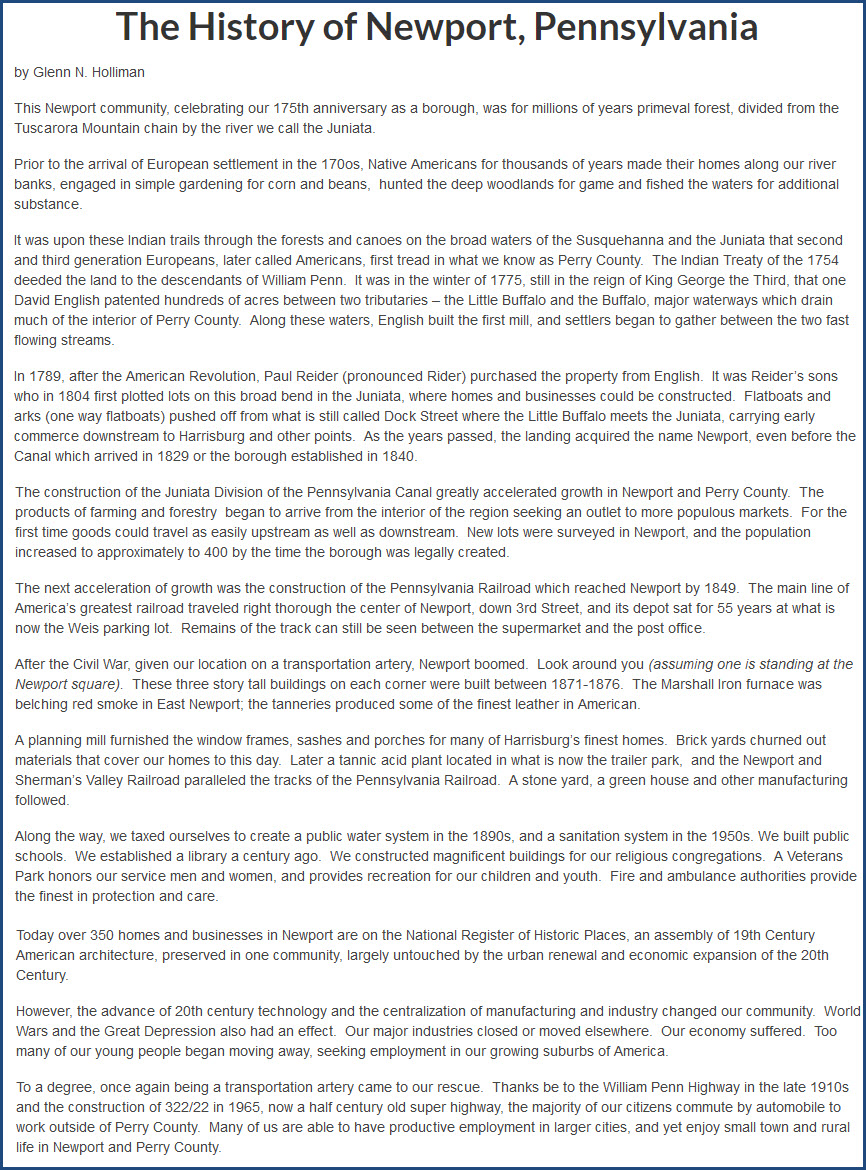
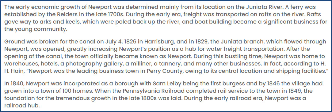
Newport History
The Eclipse
I visited Newport on Eclipse Day 2024: 8APR2024. As such, on the way home, the event happened. SO we pulled over to the side of US 15, a few miles north of Marysville PA, and took a few shots. I guess it was kinda a good thing that there were clouds, as they acted as a pretty good filter for the cellphone and Nikon. I know, they are not worthy of much, but it's all I got. LOL
From GPS Coordinates: 40.37006, -77.02419
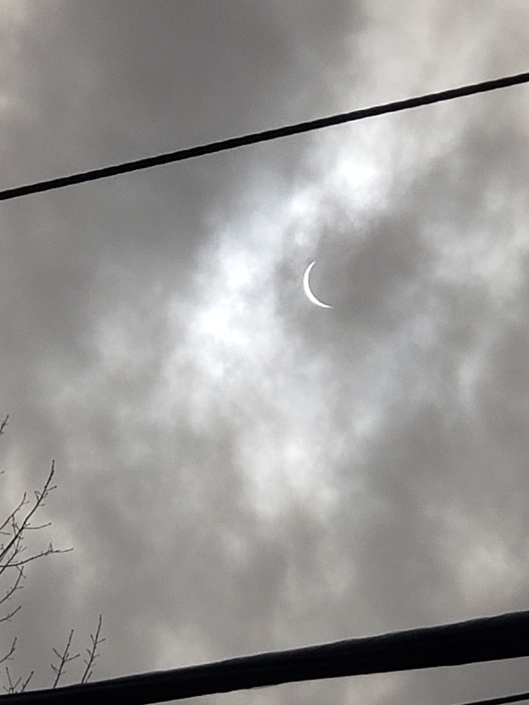 from the cellphone
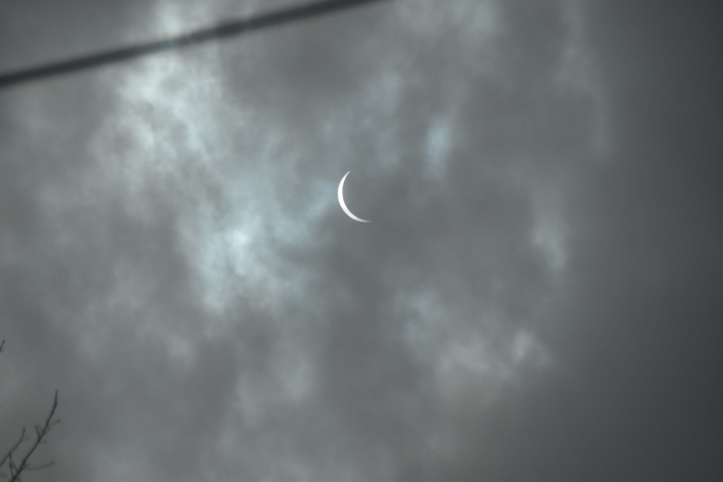 from the Nikon
Errata
Please note, the pictures of the N&SVRR steam locomotives were found on the Picryl website, but were a huge PIA to download, so we did a screenshot of the pictures, while this may not be the best resolution available (and it isn't), they charge you a fee for downloading the hi-res versions. Even the middle resolution pictures are a challenge to wade thru all of the "mierda" in order to download. The pictures are available on the National Park System website, available for free download, but I didn't spend anytime searching for them. As you may have heard me say before, I don't charge for you to use anything from my website, I have no ads, I don't ask for money, and have a problem with those who DO want money from you for stuff that is available for free.
Courtesy USGS, click here for their index page.
Disclaimers:
New format 10/26/23: Please check out my disclaimer page for my standard dribble and contact info here
RAILFAN GUIDES HOME
RAILROAD SIGNALS HOME
NEW 04/10/2023, APR11/13/14/16/17/18/19/26/2024
Last Modified 26-Apr-2024