RAILFAN GUIDES of the U.S.
Todd's Railfan Guide to
BELLEVUE OH
In General
Getting Here
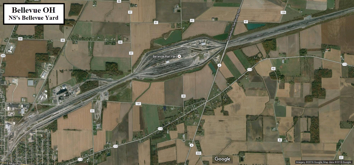
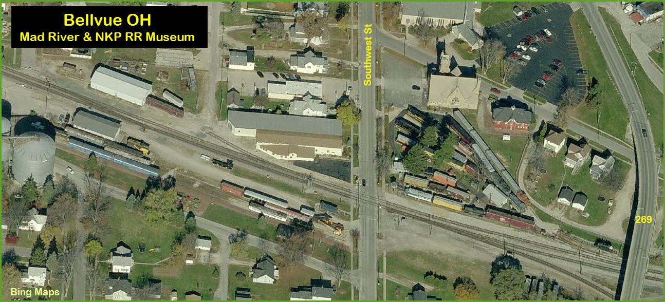
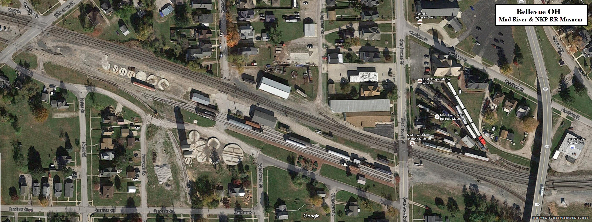
Map
Sights
Signals
Floobydust
RAILFAN GUIDES HOME
RAILROAD SIGNALS HOME
Location / Name:
Bellevue OH
What's Here:
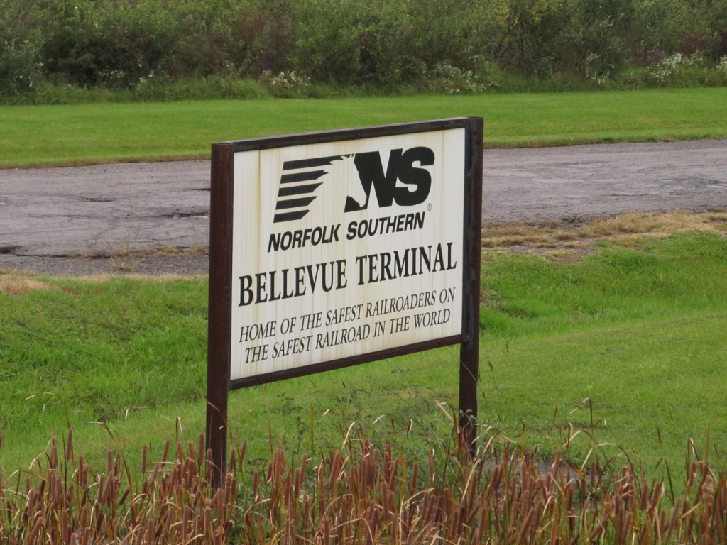
NS's Moorman Yard, formerly Bellevue Yard
the Mad River and NKP RR Museum
Data:
GPS Coordinates: 41.270588,
-82.840544 (at the museum)
ZIP: 44811 (at the museum)
Access by train/transit:
None
other than local bus and Greyhound
The Scoop:
Bellevue is home to a huge yard for
Norfolk Southern, which was a former Nickel Plate yard. About a year
ago in June of 2015, the Norfolk Southern renamed it
Moorman Yard in honor of Charles
W. Moorman who was CEO for 45 years.
The Nickel Plate, or NKP, was a short and nickname for the New York, Chicago, and St Louis RR. It operated primarily in Ohio, Indiana, Illinois, New York, and Pennsylvania. The NKP was absorbed by the Norfolk & Western Rwy in 1964, which then combined with the Southern Rwy in 1982 to become the Norfolk Southern.
For entertainment, Bellevue offers railfans the Mad River & NKP Railroad Museum, which is a really nice museum if you have never had the chance to visit.
With the realignment of Southwest St, and the building of the huge overpass to get over the railroad tracks, many interesting photo ops have disappeared.
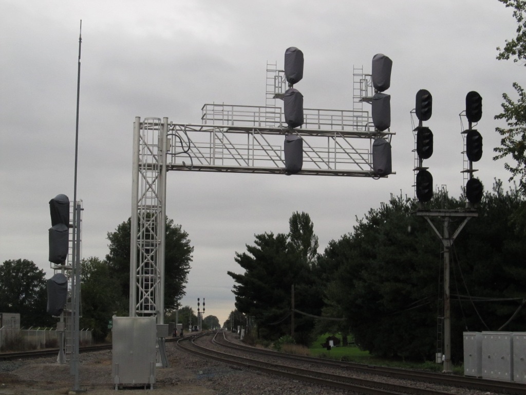
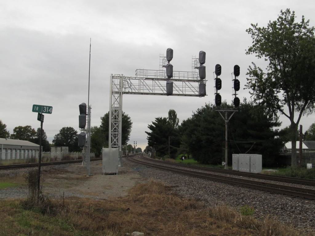
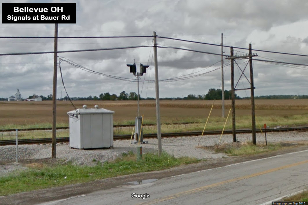
Bellevue is about as much of the signals as it is trains, although sadly, the N&W CPL's are quickly disappearing :-( For signal fans, many of the old N&W CPL signals are already gone, and many more are in the process of being converted over (as of fall 2011), so go and get those CPL pictures while they are still around!!!
Acknowledgements:
Websites and other additional information sources of interest for the area:
A
Aerial shots were taken from either Google Maps or www.bing.com/maps as noted. Screen captures are made with Snagit, a
Techsmith product... a great tool if you have never used it!
More info on the NKP can be found at: http://en.wikipedia.org/wiki/New_York,_Chicago_and_St._Louis_Railroad
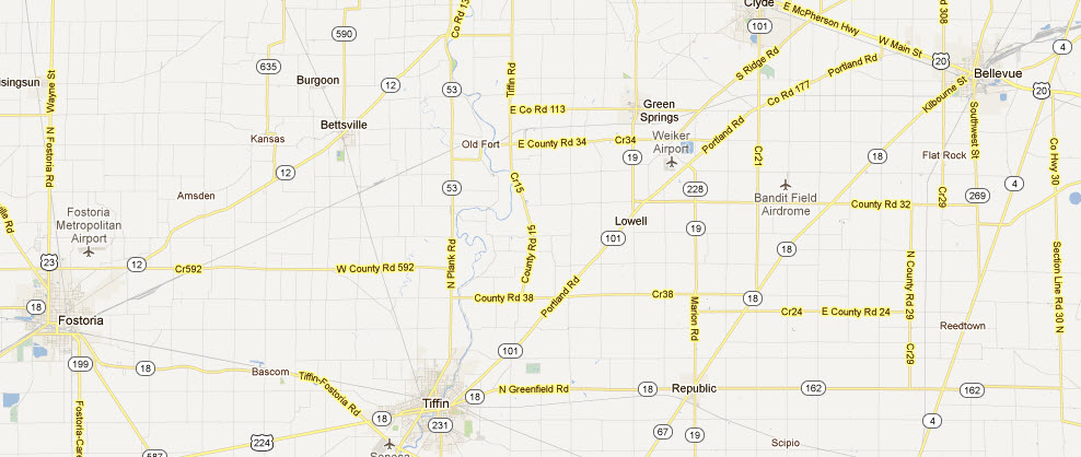
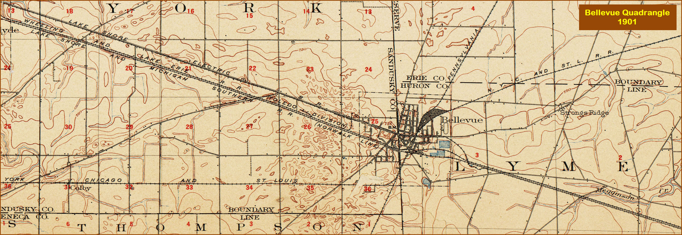
Bellevue is conveniently located off the Ohio Turnpike, I-80/I-90, at exit 110. Go south about 4 miles on OH4 to OH113, taking a right, and that will put you right into the heart of Bellevue.
If you are coming from Fostoria, head east on OH18, and it will bring you right into Bellevue, passing through Tiffin, another good railfan spot. BTW, almost anything along the CSX E-W line is a good spot.
The map below shows where these three towns are in relation to each other.

The above map in PDF
format is
here
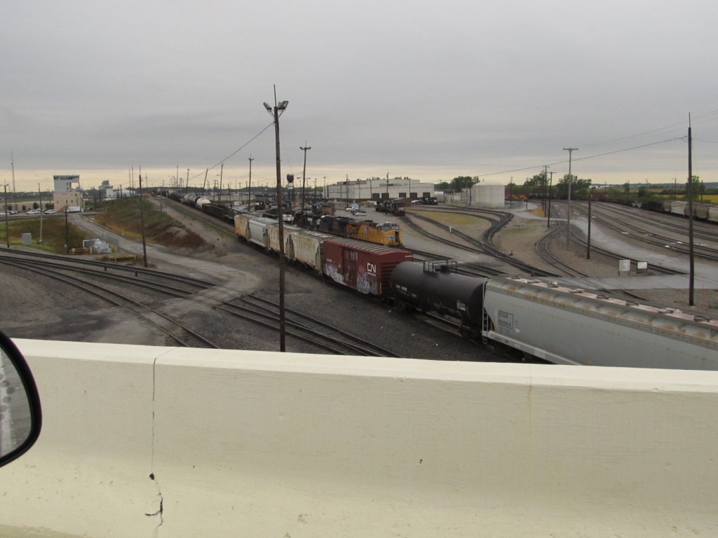
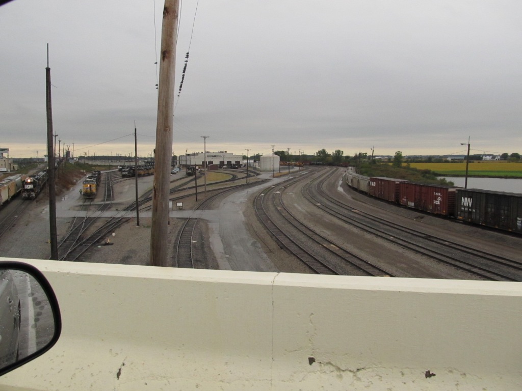
![]() NS's
Bellevue Yard
NS's
Bellevue Yard
Given the trouble I had with the LEO's on my first visit to Bellevue in 2008, where I stopped along the shoulder on the approach to the overpass going over the Bellevue Yard, I passed on stopping there again. I had a bike with me, that I was going to pedal my way up to the bridge with, but as luck had it, it was raining. So these pix are all I took from my 2011 trip thru town.


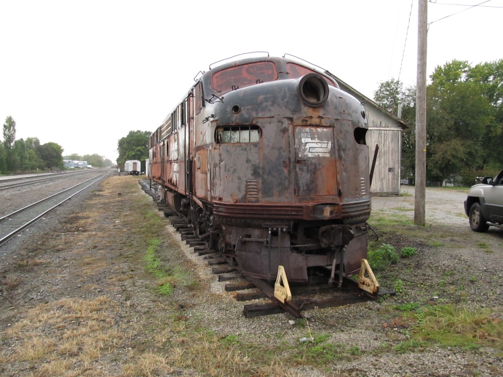
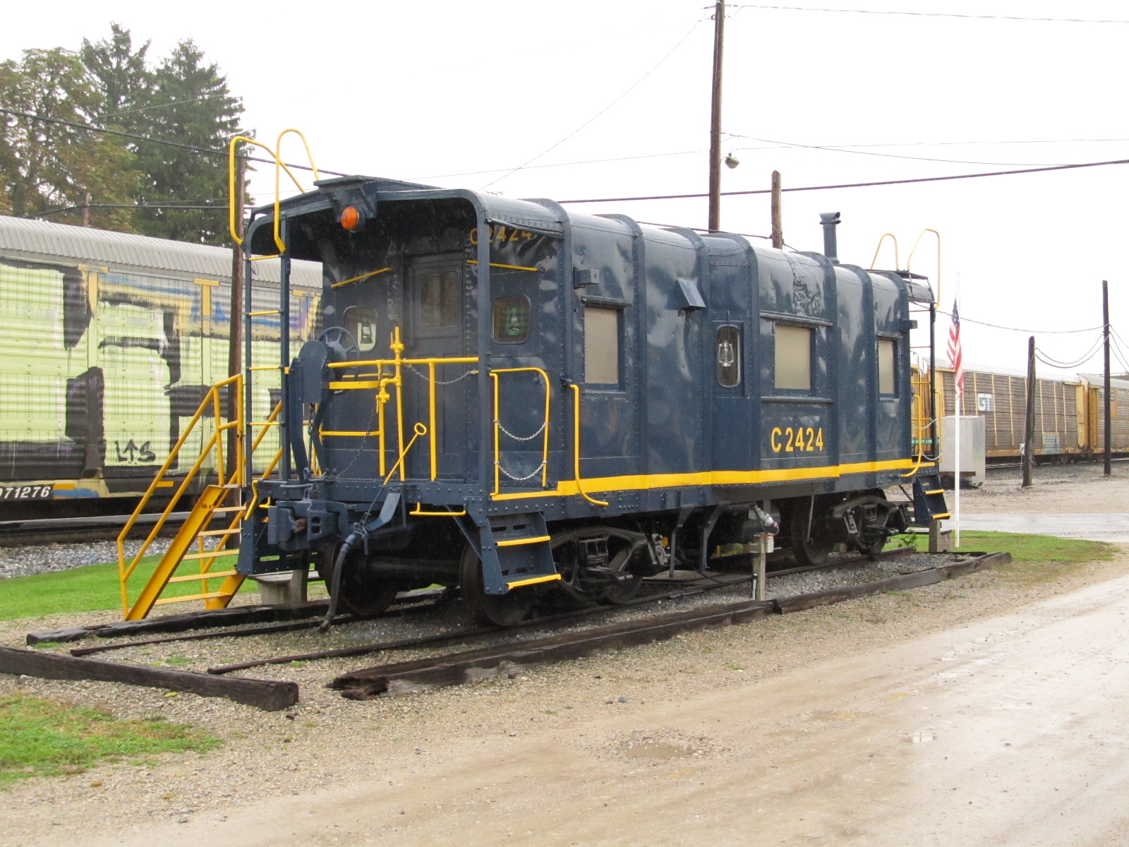
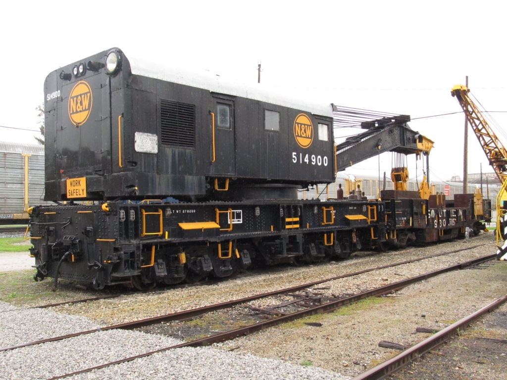
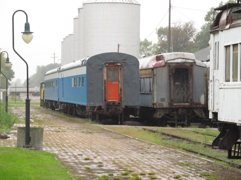
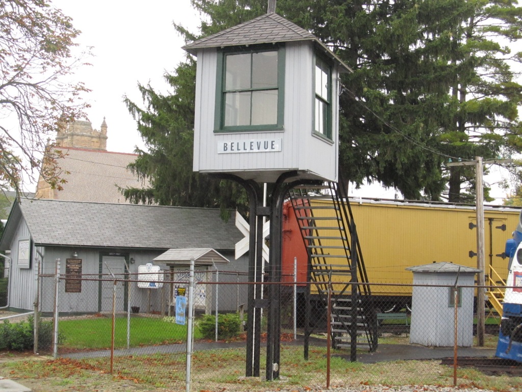
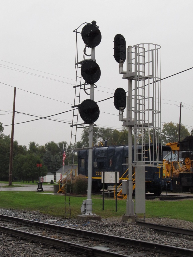
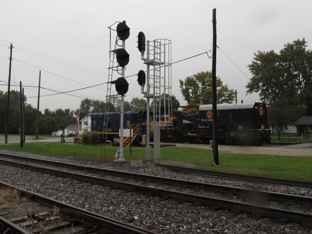
![]() Mad River
RR Museum
Mad River
RR Museum

Pictures from around the museum in no particular order, the museum was closed when I came thru in October.


 If ya'll know my email address, you know this is my
favorite engine, the GP-30.
If ya'll know my email address, you know this is my
favorite engine, the GP-30.
 From the Southwest
St overpass.
From the Southwest
St overpass.
Amtrak
Amtrak does not stop in Bellevue, the closest station is roughly 13 miles north in Sandusky OH.

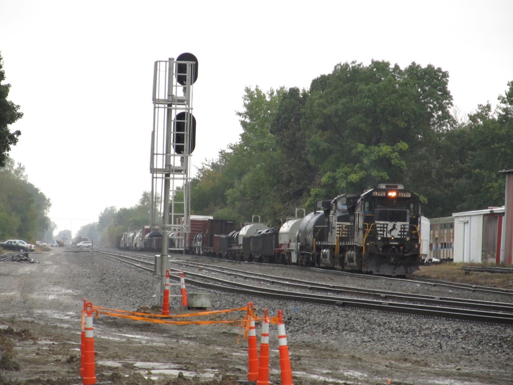
Most, if not all of the "old" N&W style Color Position Light (CPL) signals should be gone by now (2016). Most of them were in the process of being replaced when I last came through town in 2011.
![]()
![]()
 Searchlight signal at the Museum getting ready to be
replaced by a colorlight, October 2011
Searchlight signal at the Museum getting ready to be
replaced by a colorlight, October 2011
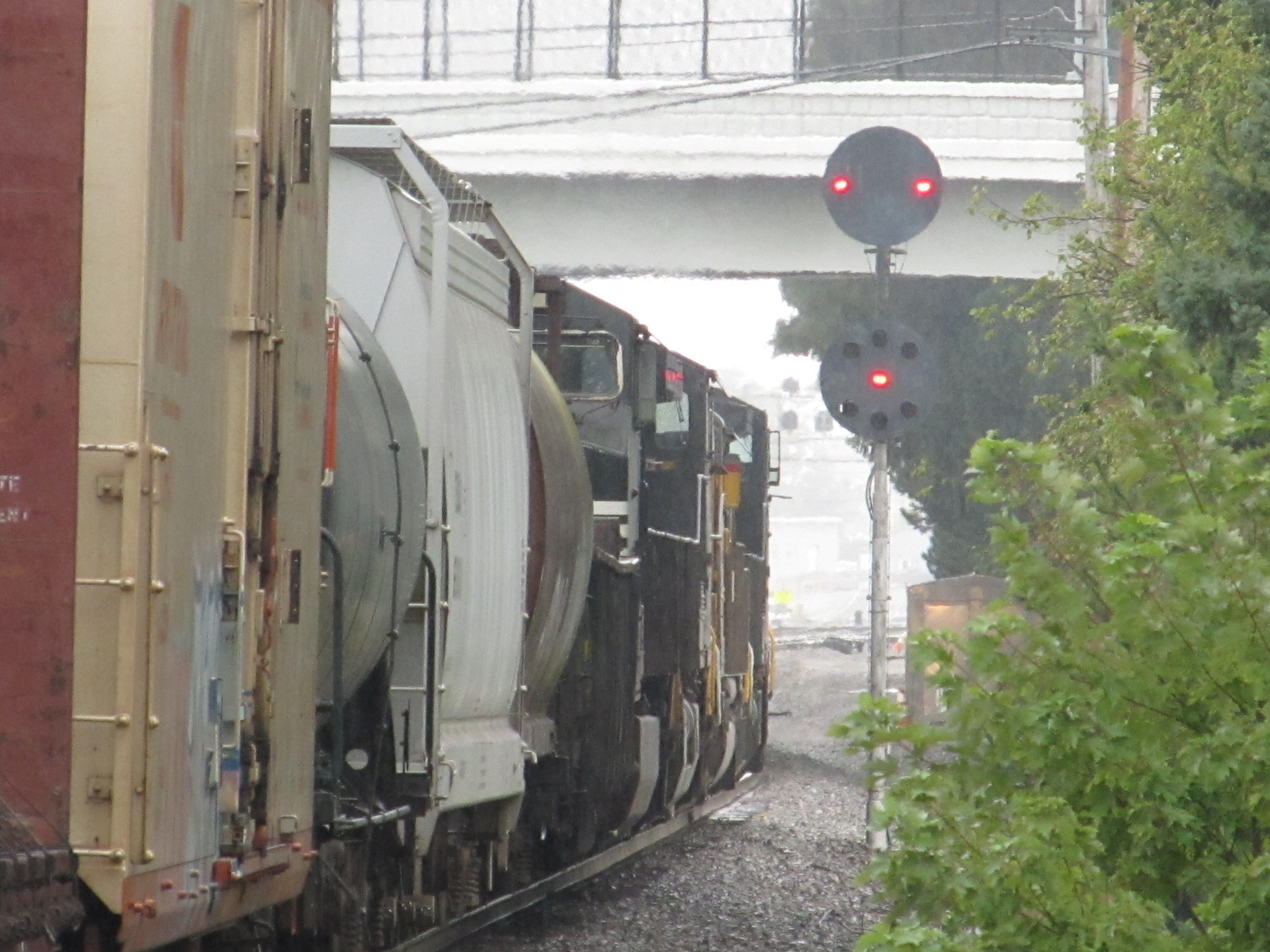
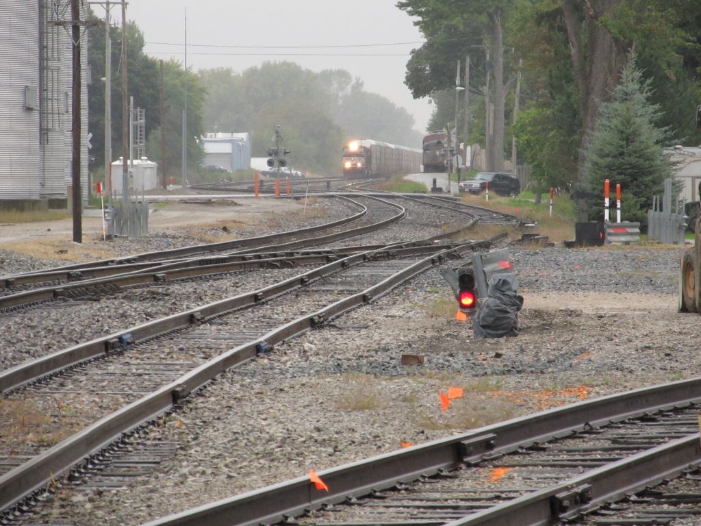 Looking past the Museum, at an approaching EB freight
 A little east of the signal across from the museum is this
approach signal
A little east of the signal across from the museum is this
approach signal
![]()
![]()
![]()
![]()
![]()
![]()
![]()
![]()
![]()
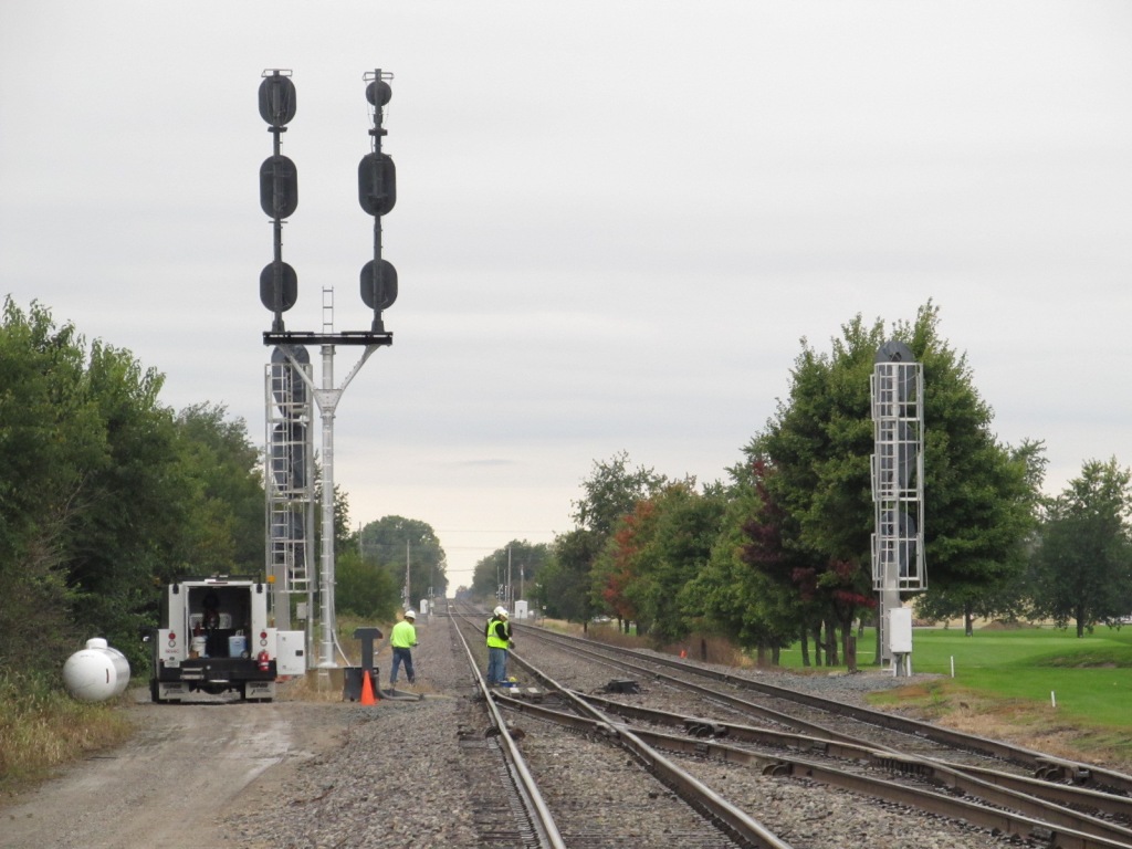
Looking to the west from Co Rd 328 we see the C&O signals getting ready to
be replaced.

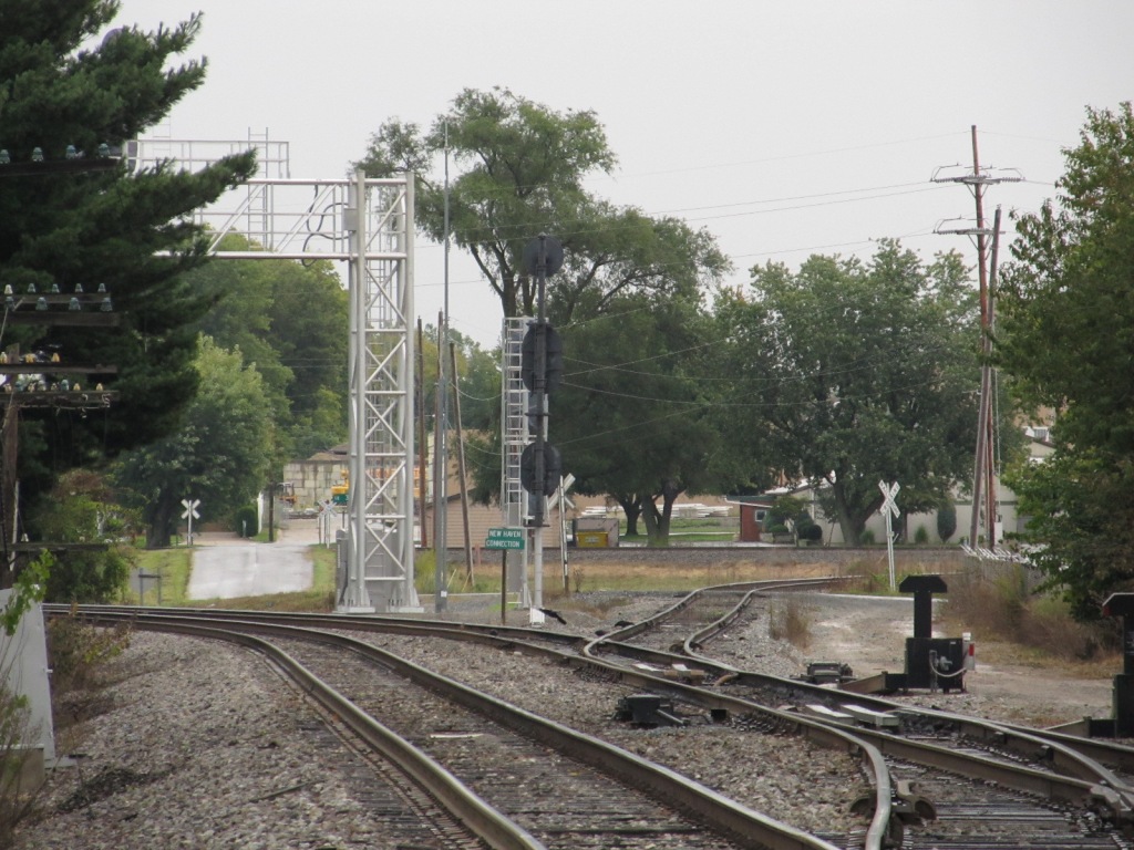
Looking the other way, east, one can see the interlocking signals at the
junction of the wye
A sign in the middle of the junction says "New Haven Connection"
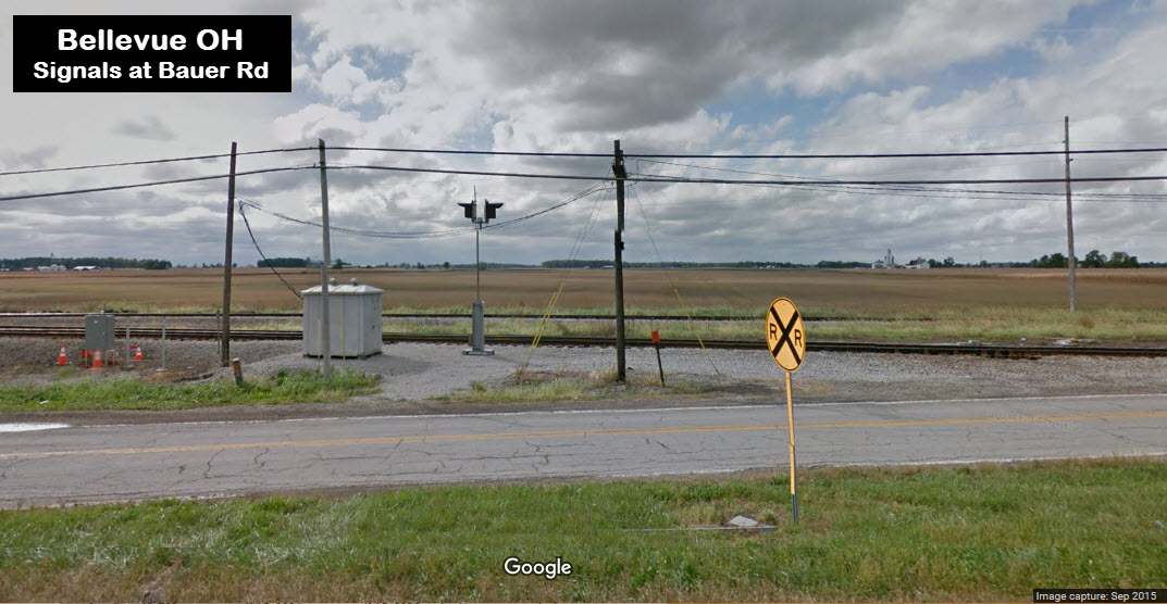
Track heaters adjacent to County Road 328
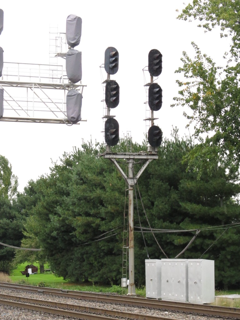

![]()
Before and after pictures with a passing freight changing the aspect. The left signal is a diverging approach, rule 286.... proceed thru turnouts at prescribed speed preparing to stop at the next signal at medium speed, if not going medium speed, you must slow down to that speed. The stop indication in the right photo is rule 292.

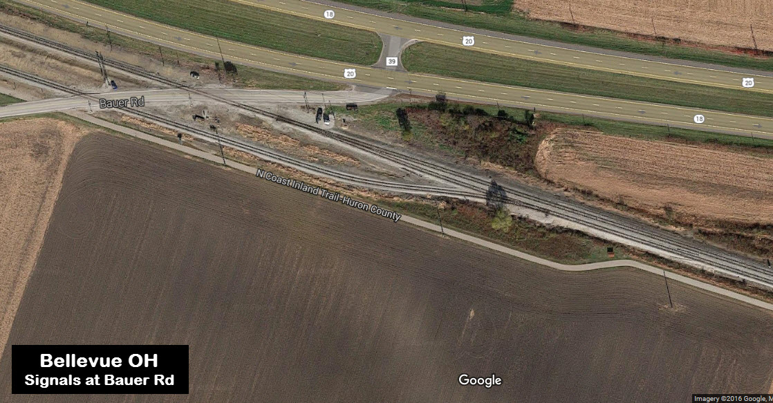
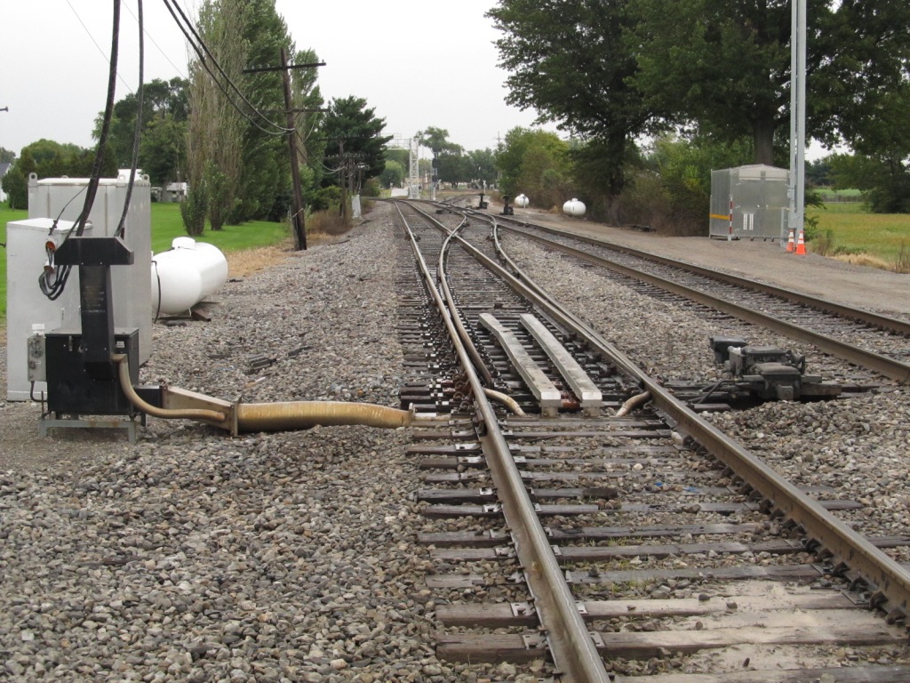
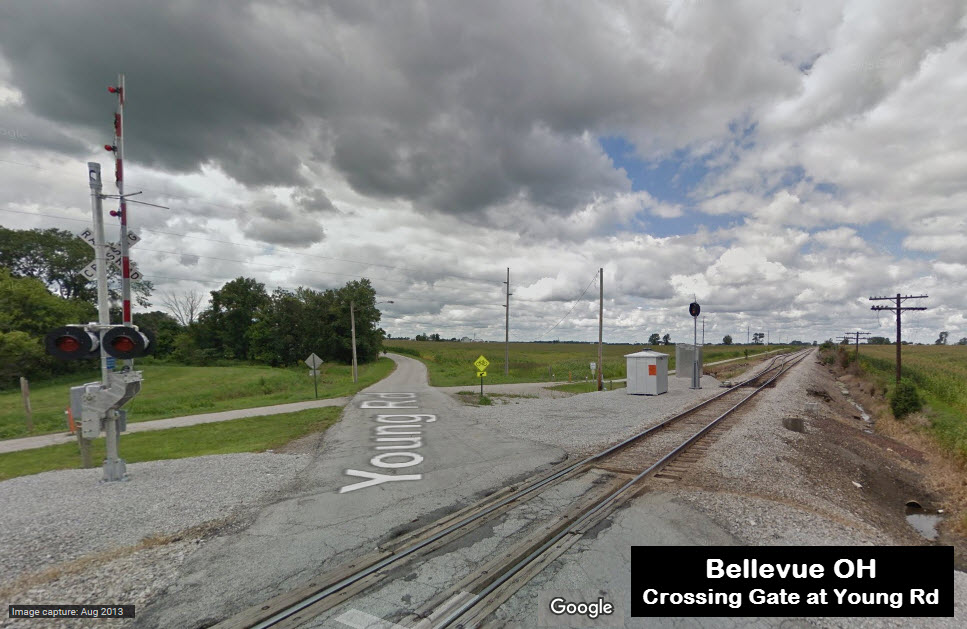
Interlocking in the far southeast corner of Bellevue where the double tracks coming out of Bellevue go down to a single track for it's journey to Norwalk and Wellington (where there is a nice little junction).


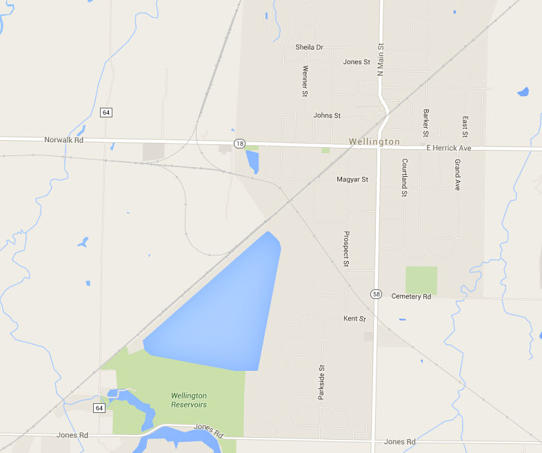 For
reference: the
junction in Wellington.
For
reference: the
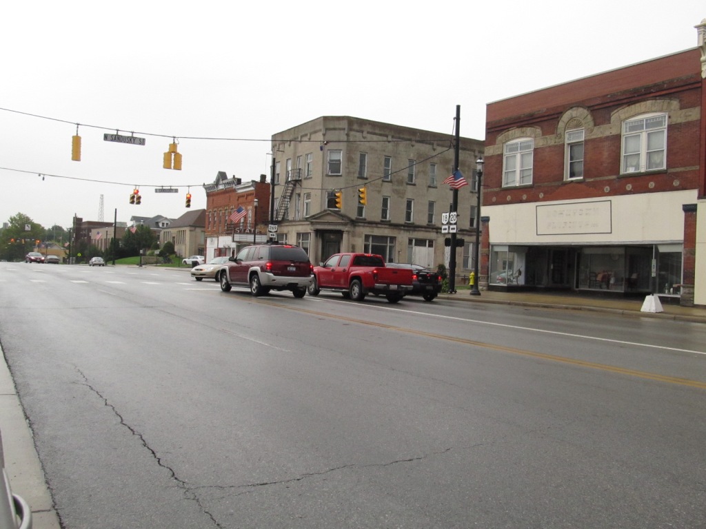
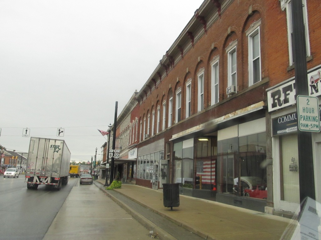
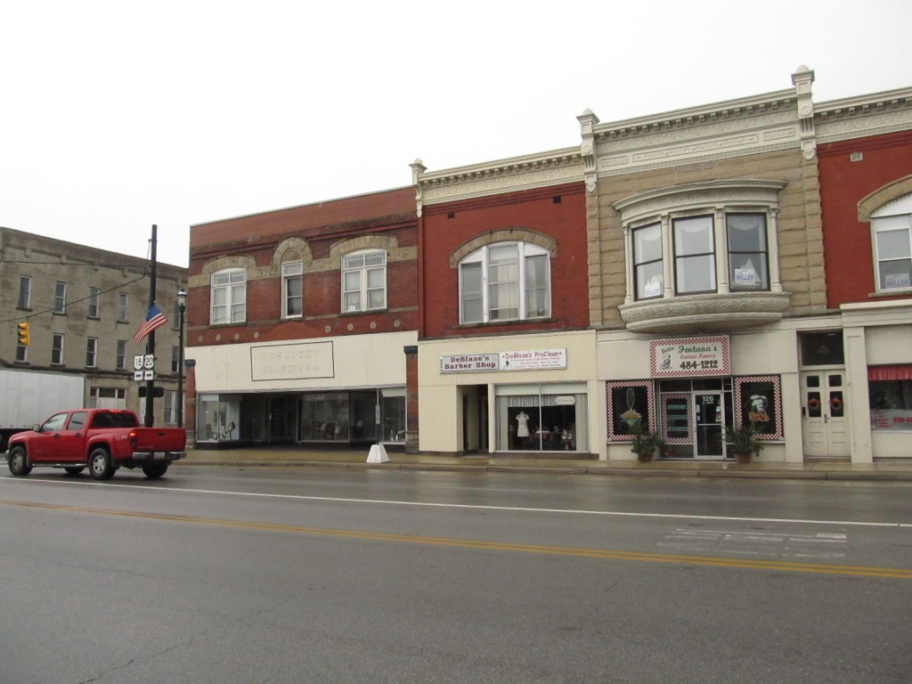
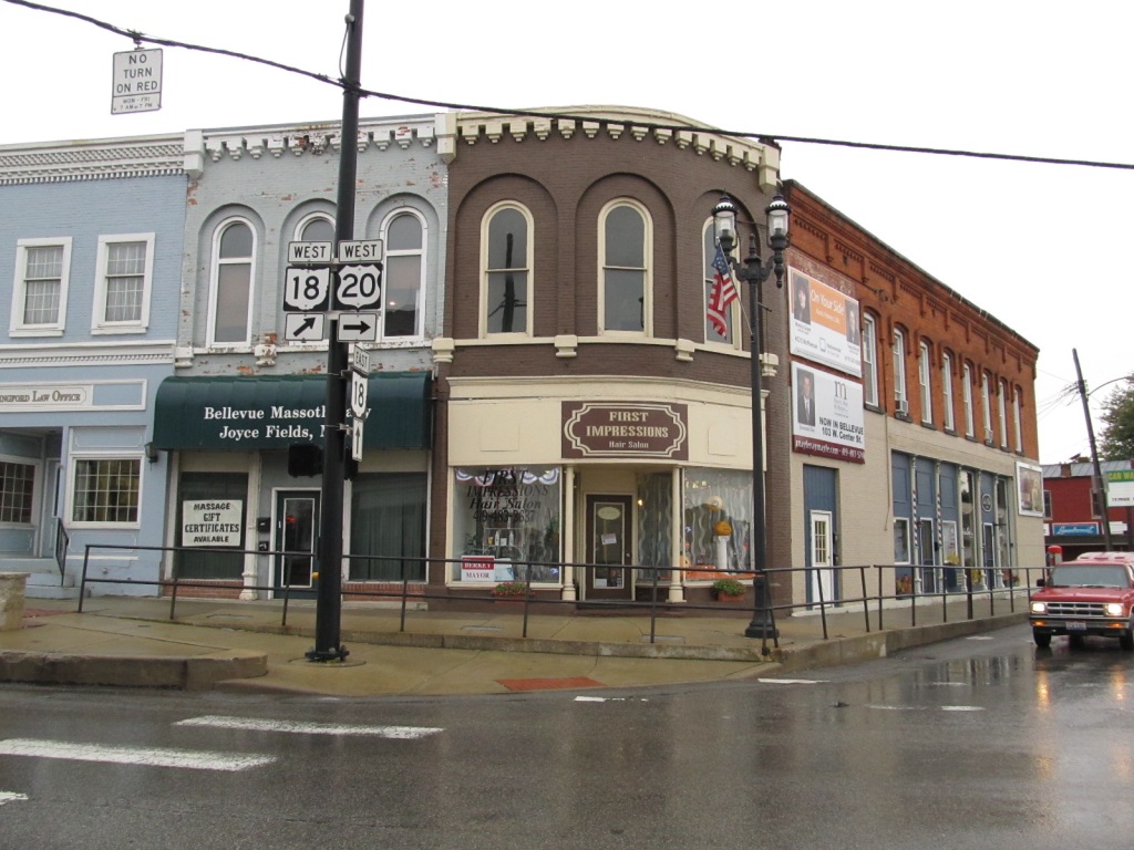
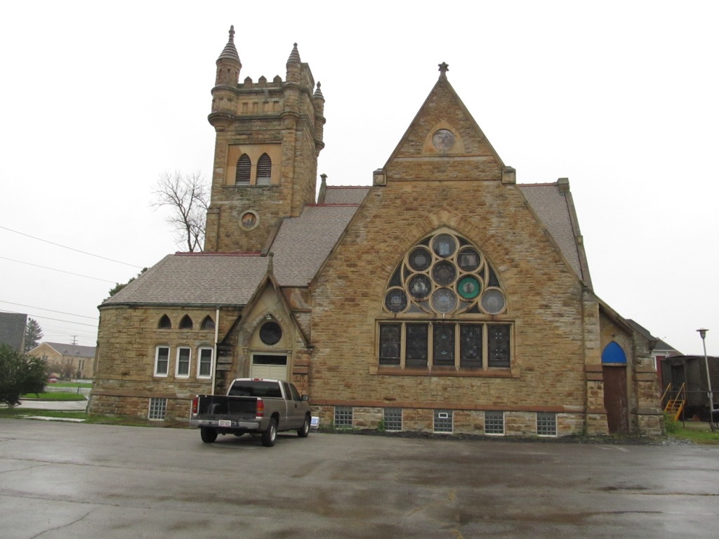
junction in Wellington.Downtown has a decidedly old town look to it. The church on the right was for sale when my wife and I came thru in 2008, would have been a nice place to railfan from! :-)

Courtesy of the University of Texas Library, click here for their index page.
Disclaimers:
I love trains, and I love signals. I am not an expert. My webpages reflect what I find on the topic of the page. This is something I have fun with while trying to help others. My webpages are an attempt at putting everything I can find of the subject in one convenient place. There are plenty of other good websites to help me in this effort, and they are listed in the links section on my indexa page, or as needed on individual pages. Please do not write to me about something that may be incorrect, and then hound the heck out of me if I do not respond to you in the manner you would like. I operate on the "Golden Rule Principle", and if you are not familiar with it, please acquaint yourself with how to treat people by reading Mathew 7:12 (among others, the principle exists in almost every religion). If you contact me (like some do, hi Paul) and try to make it a "non-fun" thing and start with the name calling, your name will go into my spambox list! :-)
Please Note: Since the main focus of my two websites is railroad signals, the railfan guides are oriented towards the signal fan being able to locate them. For those of you into the modeling aspect of our hobby, my indexa page has a list of almost everything railroad oriented I can think of to provide you with at least a few pictures to help you detail your pike.
If this is a railfan page, every effort has been made to make sure that the information contained on this map and in this railfan guide is correct. Once in a while, an error may creep in, especially if restaurants or gas stations open, close, or change names. Most of my maps are a result of personal observation after visiting these locations. I have always felt that a picture is worth a thousand words", and I feel annotated maps such as the ones I work up do the same justice for the railfan over a simple text description of the area. Since the main focus of my website is railroad signals, the railfan guides are oriented towards the signal fan being able to locate them. Since most of us railheads don't have just trains as a hobby, I have also tried to point out where other interesting sites of the area are.... things like fire stations, neat bridges, or other significant historical or geographical feature. While some may feel they shouldn't be included, these other things tend to make MY trips a lot more interesting.... stuff like where the C&O Canal has a bridge going over a river (the Monocacy Aqueduct) between Point of Rocks and Gaithersburg MD, it's way cool to realize this bridge to support a water "road" over a river was built in the 1830's!!!
My philosophy: Pictures and maps are worth a
thousand words, especially for railfanning. Text descriptions only
get you so far, especially if you get lost or disoriented. Take
along good maps.... a GPS is OK to get somewhere, but maps are still
better if you get lost! I belong to AAA, which allows you to get
local maps for free when you visit the local branches. ADC puts
out a nice series of county maps for the Washington DC area, but their
state maps do not have the railroads on them. If you can find em,
I like the National Geographic map book of the U.S..... good, clear, and
concise graphics, and they do a really good job of showing you where
tourist type attractions are, although they too lack the railroads.
Other notes about specific areas will show up on that page if known.
By the way, floobydust is
a term I picked up 30-40 years ago from a National Semiconductor data
book, and means miscellaneous and/or other stuff.
Pictures and additional information is always needed if anyone feels
inclined to take 'em, send 'em, and share 'em, or if you have
something to add or correct.... credit is always given! BE NICE!!! Contact info
is here
Beware: If used as a source, ANYTHING from Wikipedia must be treated as being possibly being inaccurate, wrong, or not true.
RAILFAN GUIDES HOME
RAILROAD SIGNALS HOME
NEW 07/19/2009
Last Modified
13-Jun-2016