
In General
Getting Here
Map
Sights
Signals
Floobydust
USGS Maps
RAILROAD SIGNALS HOME
Location / Name:
St Paul MN, Ramsey County
What's Here:
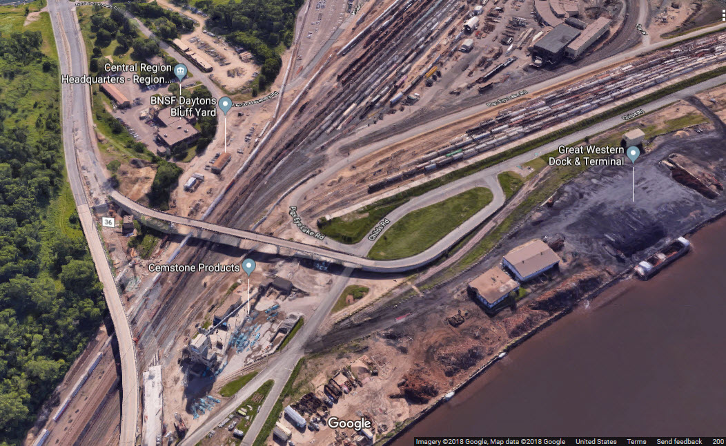
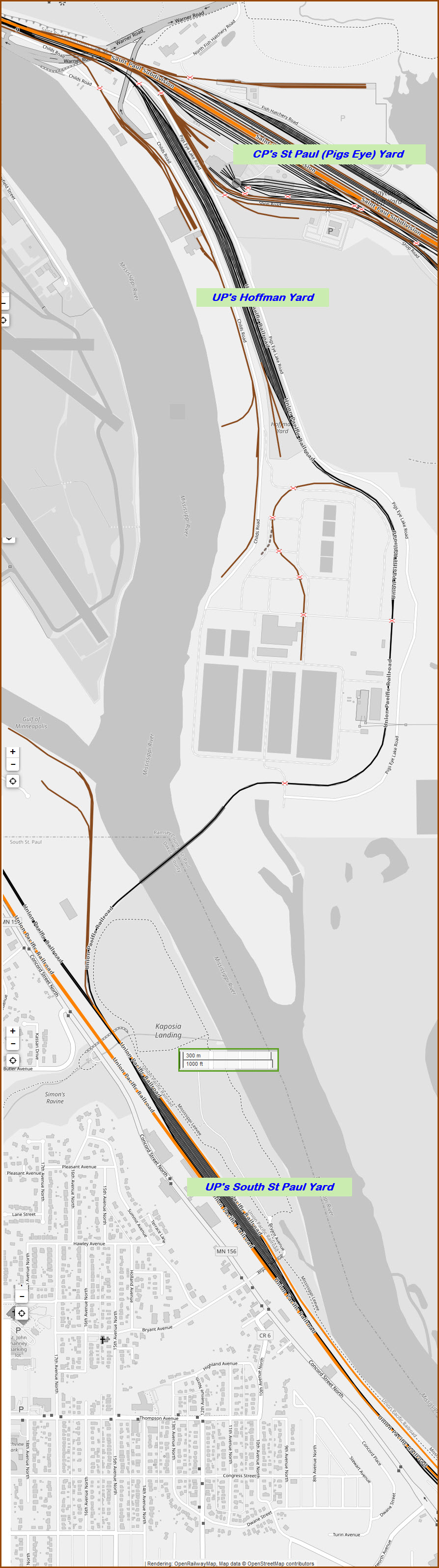
CP's St Paul Yard, AKA, Pigs Eye Yard
UP's Hoffman Yard
UP's South St Paul Yard
UP's Belt Yard
Dayton's Bluff
Data:
GPS Coordinates: As Needed
ZIP: 55101 (dntn St Paul)
Phone A/C: 651
Access by train/transit:
Amtrak's daily Empire Builder
The T's Green Line
The Scoop:
The Dayton's Bluff area is unquestionably the Twin Cities premier railfan location. Almost everything that moves in or out of the area comes thru here.
Acknowledgements:
Jim Mihalek
Denver Todd
Paul Crosby
Jeffrey Thompson/MPR
Google and Google Maps
Bing Maps
Websites and other additional information sources of interest for the area:
https://www.hraadvisors.com/portfolio/st-paul-union-depot/
http://www.rrtlarchitects.com/civic/union-depot
https://www.flickr.com/photos/stef-presslein/8376886688
https://blogs.mprnews.org/cities/2013/10/whats-the-history-behind-passenger-trains-at-the-union-depot/
https://www.theclio.com/web/entry?id=17158
https://www.mprnews.org/story/2013/10/23/business/amtrak-union-depot
Getting to G
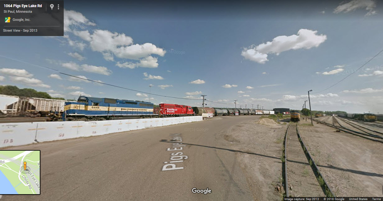
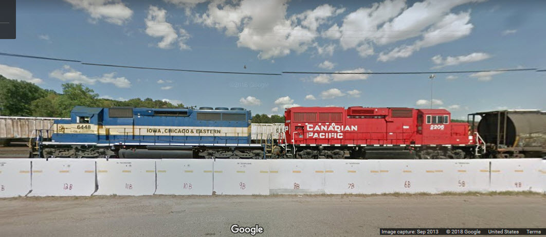
The Google Streetview camera captured these in 2013. Representative of what you can see from the north end of the yard, altho it looks like CP has put up concrete barriers to keep us from parking there and getting good shots.... oh well, another one bites the dust..... This was just after you crossed the UP's tracks, heading into the CP roundhouse and yard area.
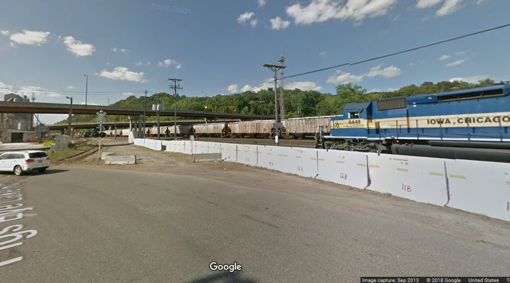
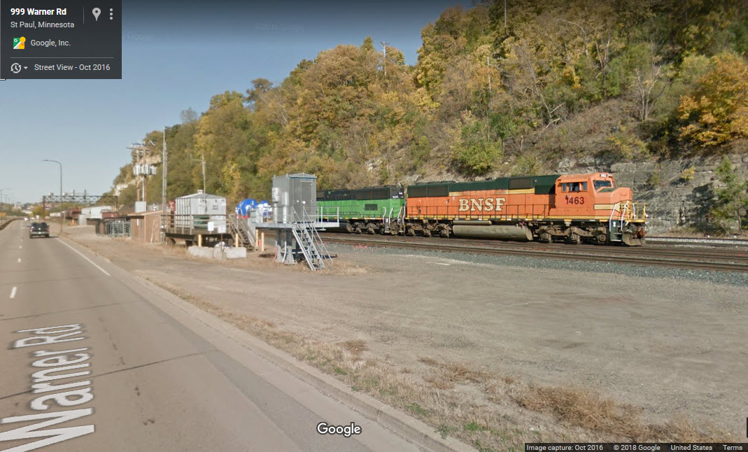
In the picture below, the Google camera is crossing the tracks leading into UP's Hoffman Yard.
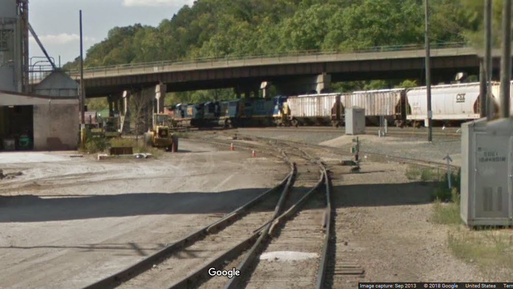
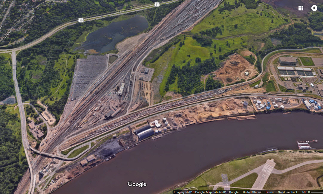
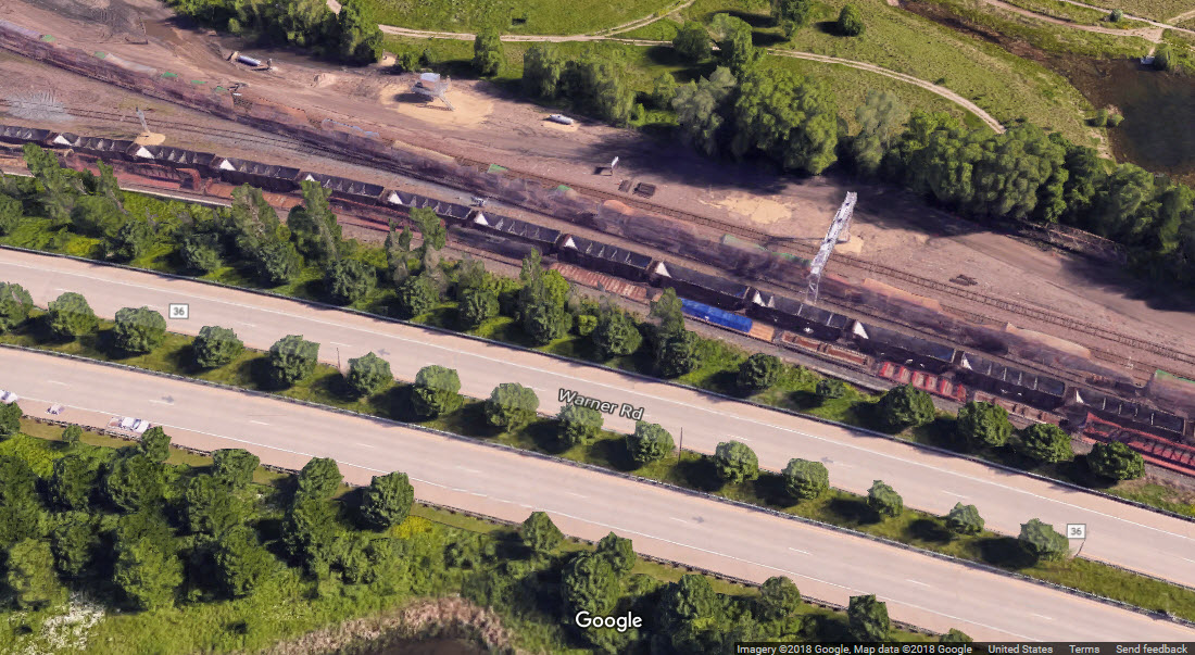
At the north end of the yard near Warner Road, Union Pacific shares the tracks with BNSF and CP thru trackage rights. At the south end of Hoffman Yard, there is a "tail track" that runs across the Mississippi and into South St Paul, where Union Pacific has their South St Paul Yard.
In the late 1900's and early 2000's, a railfan could visit the area, and park just on the other side of Pigs Eye Lake Rd before the Jersey Wall barricades went up, and catch all of the action. Now, the barricades and a fence at Dayton's Bluff prevent a railfan from getting up front and personal.
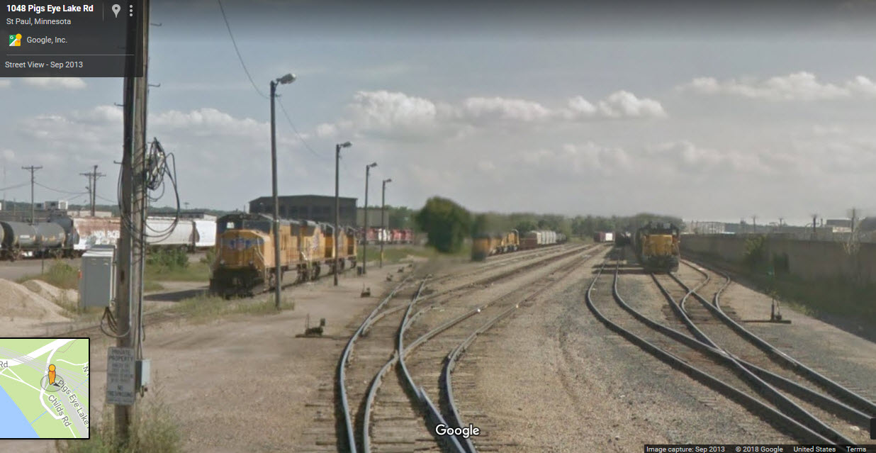
The yard is much longer than pictured below, but this is the business end of the yard where the offices and engine facilities are.
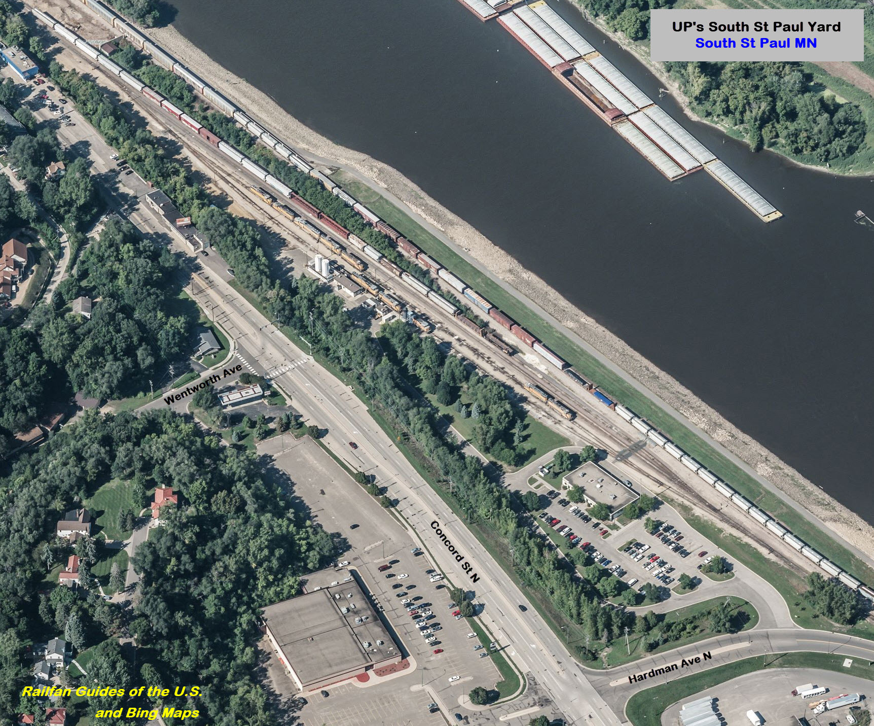
The tracks running along Warner Blvd are where you will find almost everything running into, out of, or thru the Minneapolis and St Paul metro area - one of the few exceptions would be the E/W SOO/WC line going thru New Brighton.
You never know what you will see, and road names seen here includes CP, UP, TC&W, SOO, along with visiting roads such as NS and CSX in addition to lease engines like FURX and GATX.
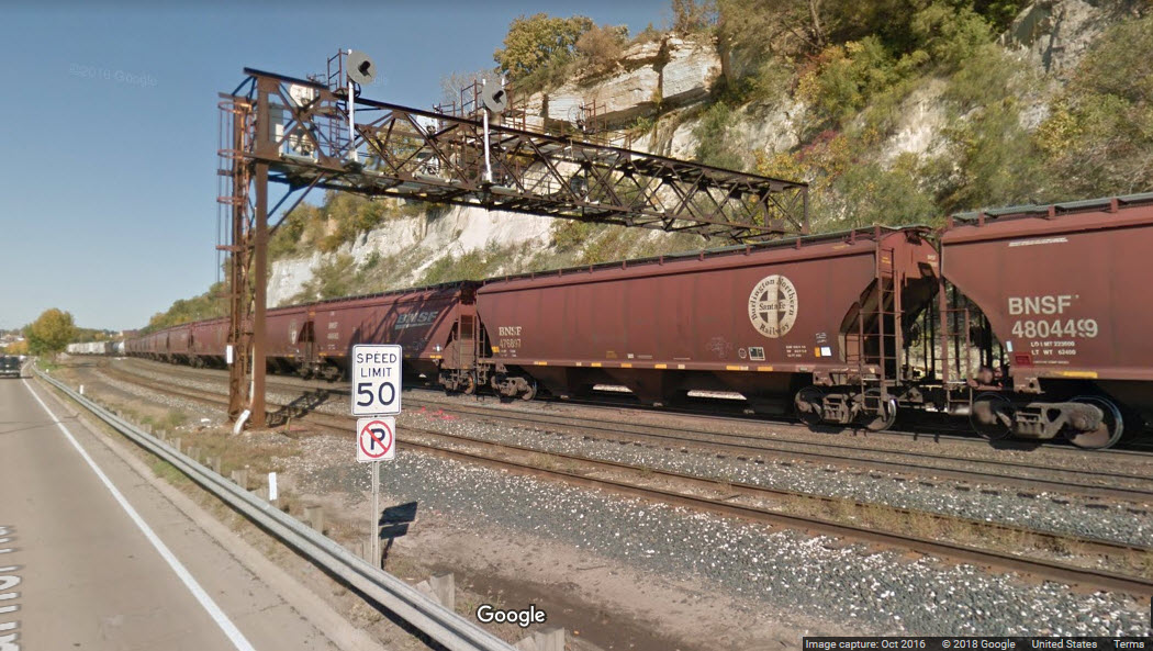
In years past, you used to be able to park alongside the tracks where the signal equipment boxes are located, and even tho the Google pictures do not show it because they are from 2016 (down in the signal section), I've heard that there is now a fence, preventing railfans from parking there and getting some really good shots. Darn.
 Looking towards Union Depot/dntn
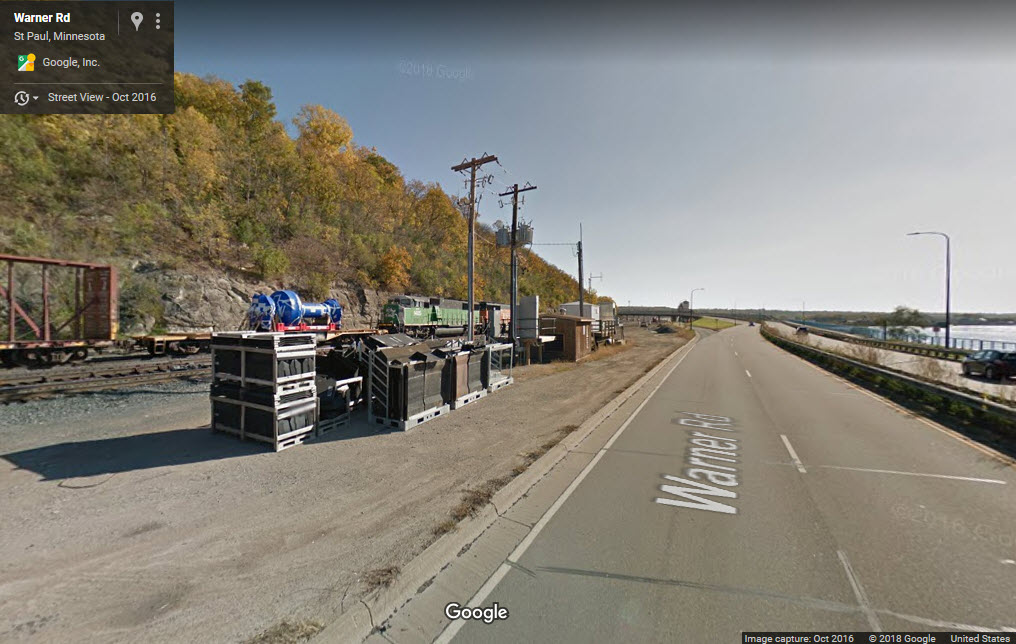 Looking towards the yard.
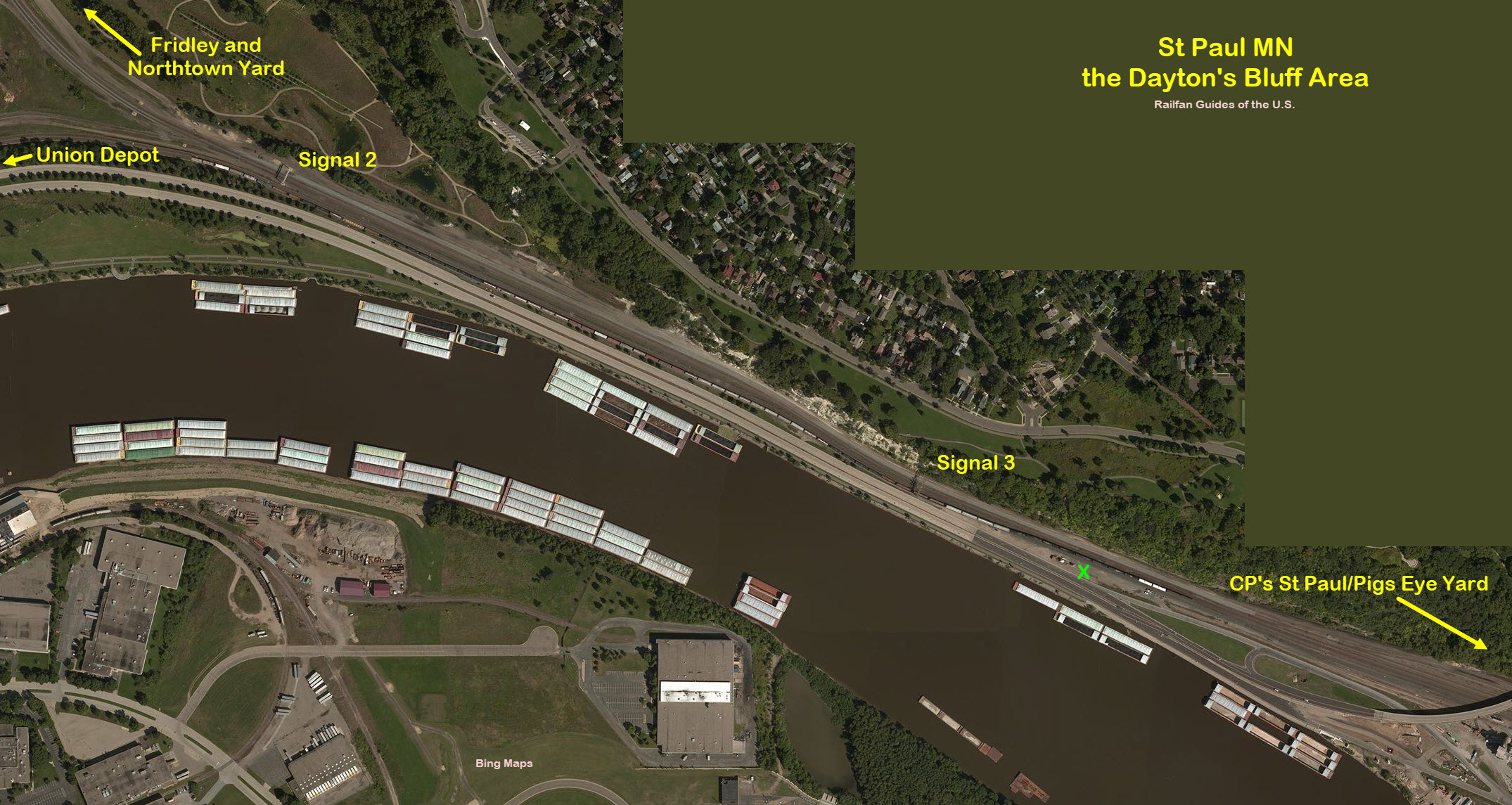
These signals have always been one of my favorite in all of the U.S. Don't know why, but they are. Maybe it's because they are an adaptation of a signal for a use they were never intended for. Maybe because the Canadian Pacific is using them, and they are the only ones west of the Mississippi on a non-Pennsy railroad... oh, wait a minute, they ARE east of the Mississippi, only by a couple of thousand feet or so tho:-).......
These signals are used by the engineers when backing a train into the yard, and indicate how close to "the end" of the track the rear of the train is.
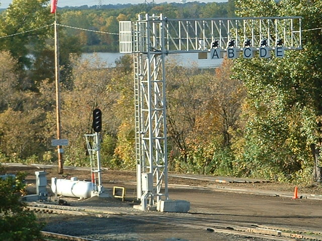 This is my picture of them from my last visit in 2006
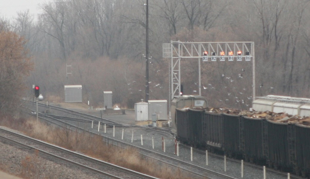
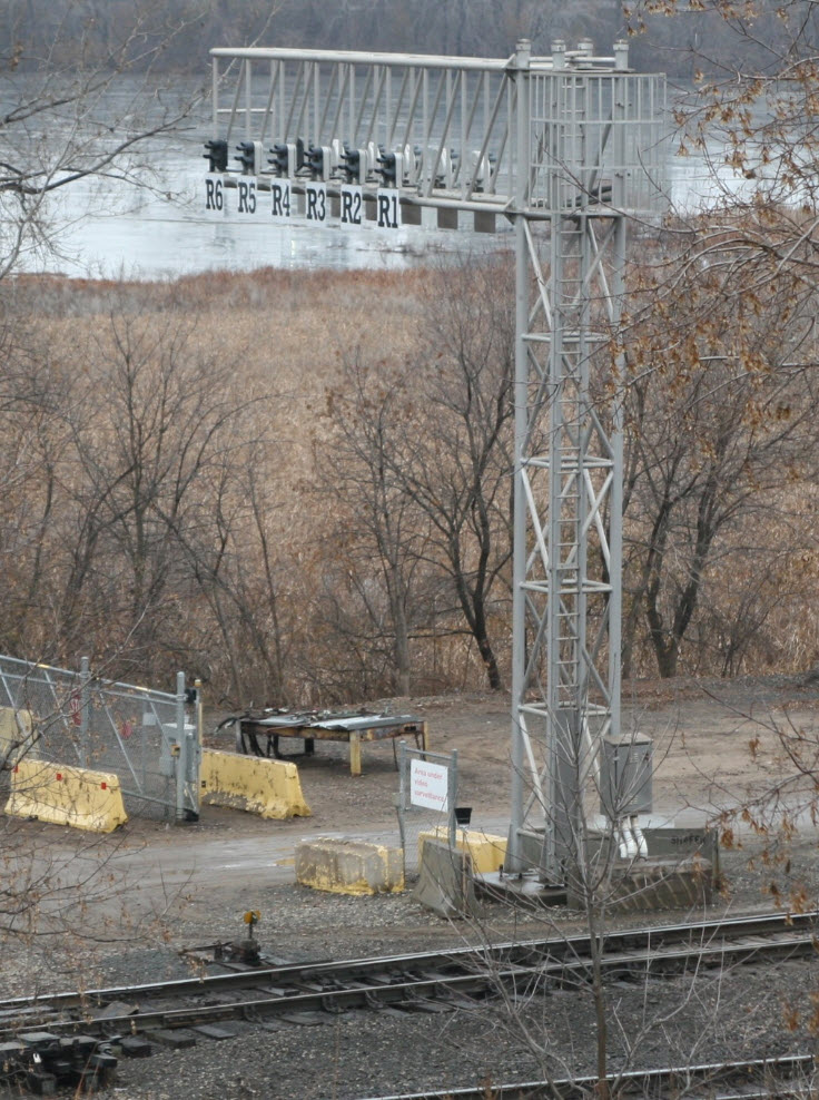
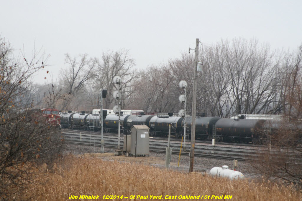
The two pictures below are courtesy Jim Mihalek, and are from 2014. Looks like they added another track and renamed the signal, and for some reason, a duplicate set of signals is on the other side. I'm not sure if a fully lit signal indicates the track is full or empty. Jim also tells me that these guys have been moved to the far south end of the yard, almost to where the steel mill is.
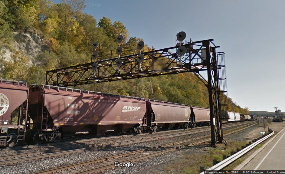
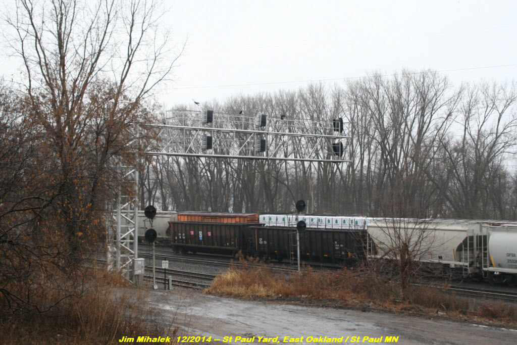
Along Warner Road, where it is between the river and the railroad, are several sets of colorlight signals on signal bridges. These signals control movements in and out of the two yards. This set is for BNSF and CP trains, and is just before the wye near downtown St Paul.
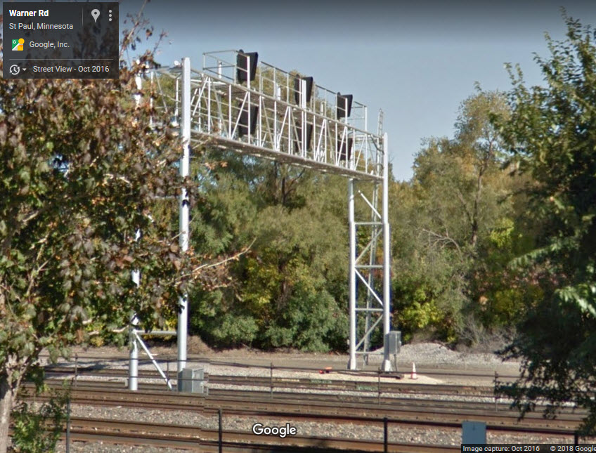
The pictures below from Jim Mihalek are from December 2014, while CP was in the process of replacing the searchlight signals with standard Darth Vader style colorlight signals.


XXX
Courtesy of the University of Texas Library, click here for their index page.
Disclaimers:
I love trains, and I love signals. I am not an expert. I do these pages because I love spending my time doing them - although I do a reasonable amount of research to make sure the information presented is accurate! :-) :-)
Please Note: Since the main focus of my two websites is railroad signals, the railfan guides are oriented towards the signal fan being able to locate them. For those of you into the modeling aspect of our hobby, my indexa page has a list of almost everything railroad oriented I can think of to provide you with at least a few pictures to help you detail your pike.
If this is a railfan page, every effort has been made to make sure that the information contained on this map and in this railfan guide is correct. Once in a while, an error may creep in, oooooooops, oh well! :-)
My philosophy: Pictures and maps are worth a thousand words, especially for railfanning. Text descriptions only get you so far, especially if you get lost or disoriented. Take along good maps.... a GPS is OK to get somewhere, but maps are still better if you get lost! I belong to AAA, which allows you to get local maps for free when you visit the local branches. ADC puts out a nice series of county maps for the Washington DC area, but their state maps do not have the railroads on them. If you can find em, I like the National Geographic map book of the U.S..... good, clear, and concise graphics, and they do a really good job of showing you where tourist type attractions are, although they too lack the railroads. Other notes about specific areas will show up on that page if known.
BTW, floobydust is a term I picked up 30-40 years ago from a National Semiconductor data book, and means miscellaneous and/or other stuff.
Pictures and additional information is always needed if anyone feels inclined to take 'em, send 'em, and share 'em, or if you have something to add or correct.... credit is always given! BE NICE!!! Contact info is here. Beware: If used as a source, ANYTHING from Wikipedia must be treated as being possibly being inaccurate, wrong, or not true.
RAILFAN GUIDES HOME
RAILROAD SIGNALS HOME
NEW
1/16/2017
Last Modified
30-Aug-2018