
In General
Getting Here
Map
Sights
Signals
Bridges & Overpasses
Other Train Pictures
Floobydust
USGS Maps
RAILFAN GUIDES HOME
RAILROAD SIGNALS HOME
Location / Name:
Detroit MI, Wayne County
What's Here:
NS's Oakwood Yard
CSX's Rougemere Yard
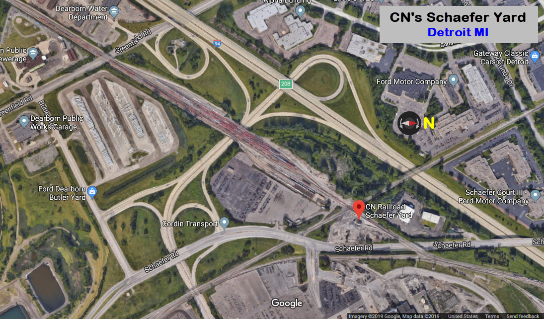
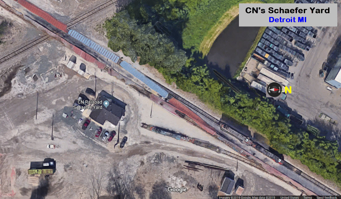
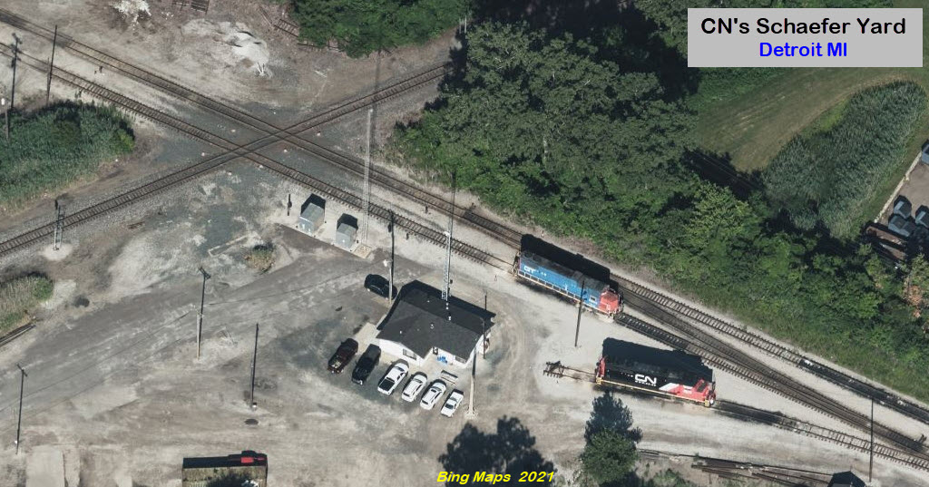
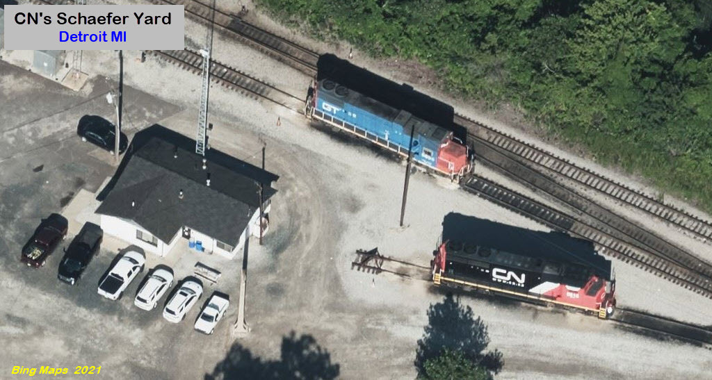
CN's Schaefer Yard
Conrail's Livernois Yard
Amtrak Dearborn Station
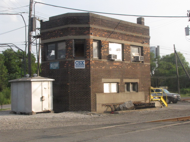
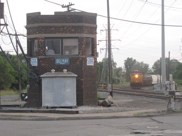
CSX's Delray Tower
Data:
GPS Coordinates: as needed
Phone A/C: 313
ZIP: 48209
Access by train/transit:
Amtrak in Dearborn
Otherwise, it's almost all busses
The Scoop:
Detroit has so much cool stuff for the railfan to see. The southwest area of Detroit has perhaps more of the railroad action than any other "part" of Detroit. In this area alone, all within 10 minutes or so of each other, are a multitude of yards, stations, towers, the Ford Museum, the Ford plant, Rouge Steel... phew, I get tired just thinking about it all!
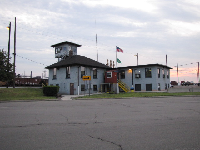
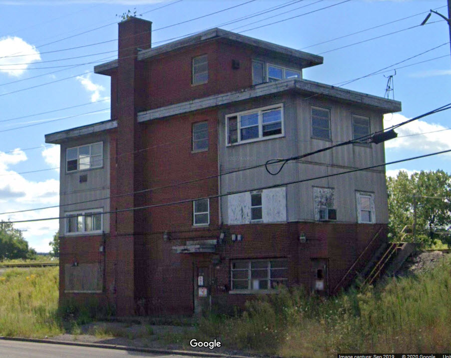
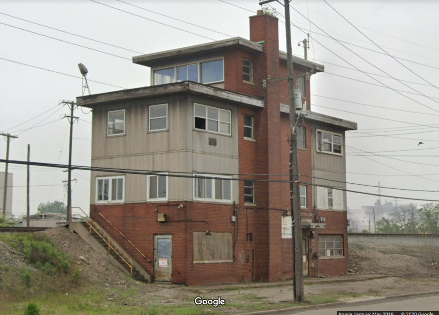
Delray Tower was a great place to go. It closed last year (2020) in November, so it's not quite as much fun to visit as it used to be.
The southwest area of Detroit also includes CSX's Rougemere Yard, CN's Schaefer Yard, NS's Oakwood Yard, NS's River Rouge Yard, and CR's Livernois Yard.
And if you're looking for pictures in an interesting backdrop for pictures that can't be found anywhere else in the United States, check out item number 10, the Ford/DT&I concrete arches that were used to support catenary for electric railroading 100 years ago! Completely unique!!!
I moved my coverage of the over 30 bridges and railroad overpasses to another page, because it made this page unmanageable.....
Detroit is one of three areas of the United States that still has a Conrail operation, the other two being northern New Jersey and part of Philadelphia. Because of that, the action here has not changed substantially compared to that of the Conrail era.
If you're looking for something to eat, gas, or a place to stay, a little further south off I-75 are lots of hotels and places to eat, like:
-- exit 37 - Northline Rd
-- exit 36 - Eureka Rd (Southgate/Southland Center Mall)
-- exit 32 - West Rd (Woodhaven/Best Western, etc))
Both Northline and Eureka are good back roads into the airport, as well as Goddard Rd.
Acknowledgements:
F. Lievertz
Larry Piet / http://lapiet.info/images/photos02/photos02.html
ogauge47 / http://railroadfan.com/phpbb/viewtopic.php?t=32997
Google Maps
Bing Maps
Open Railway Maps
Denver Todd
Websites and other additional information sources of interest for the area:
https://en.wikipedia.org/wiki/Conrail
https://en.wikipedia.org/wiki/Conrail_Shared_Assets_Operations
https://railfanguides.us/mi/detroit/map2/index.htm My page on Delray Tower
https://en.wikipedia.org/wiki/Detroit_Terminal_Railroad
If you're coming up from "the south" on I-75, exit 44 is makes it SOOOO simple - because at the bottom of the exit ramp, Delray Tower is a few feet from you to the left!!!
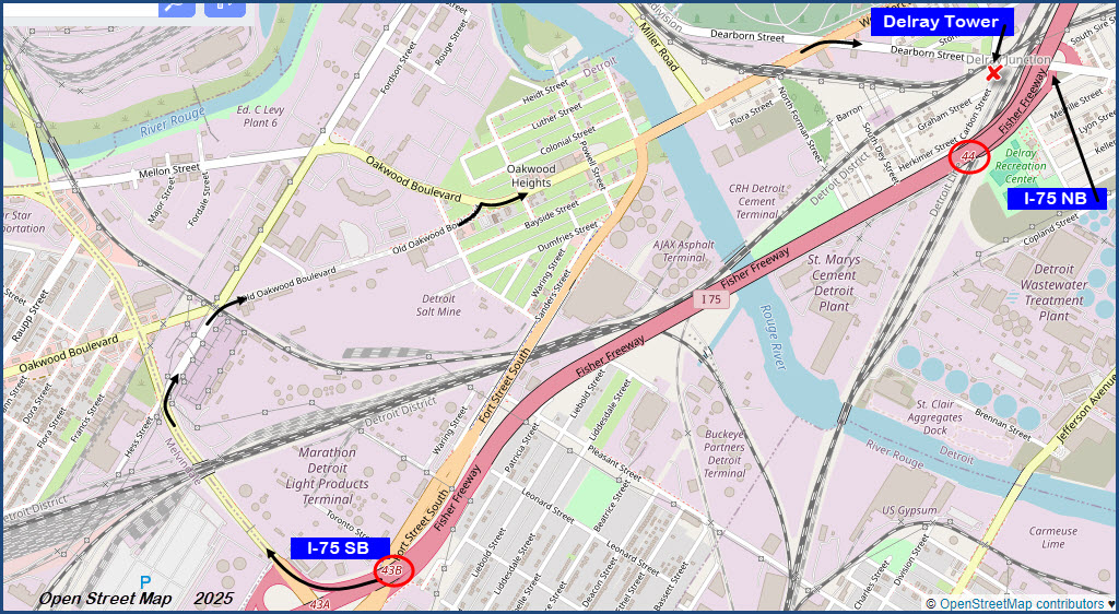
Southbounders can get off I-75 at exit 43 onto Schaefer Road, and then take a right onto South Dix Street After going only about 800ft, take another right onto Oakwood Blvd. This will take you to Dearborn Ave after crossing the River Rouge, where you take yet another right. This will place you at Delray tower in about 1500ft, a good place to start your railfanning of Detroit!
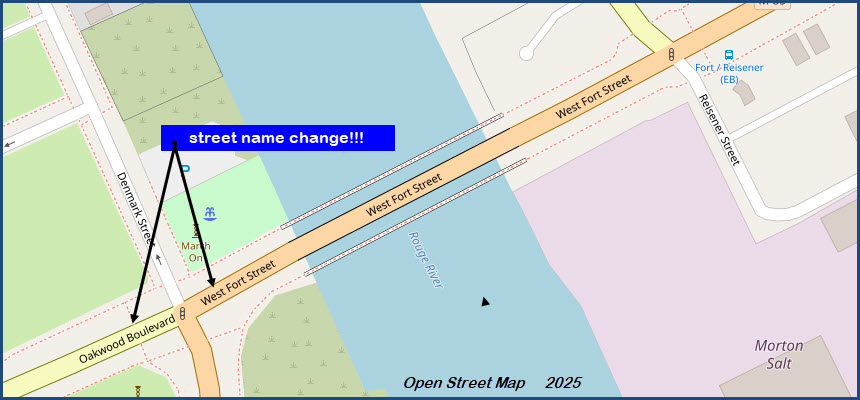
Oakwood Blvd turns into Fort St just before crossing the Rouge River, and going in the other direction, Fort St will bear off to your left after crossing the river.
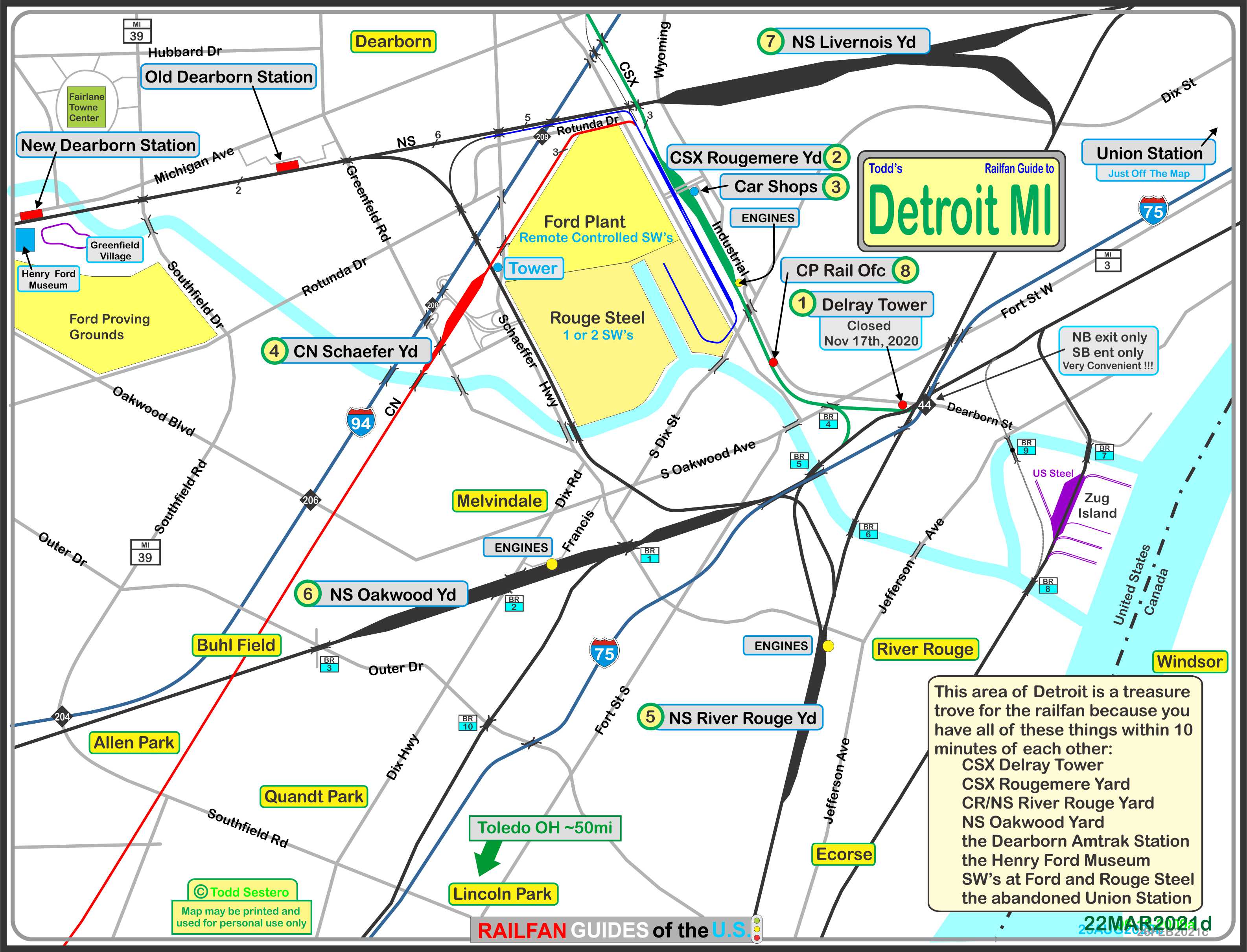
the above map in PDF format is available here
Sights
Delray Tower
Rougemere Yard
CSX Car Shops
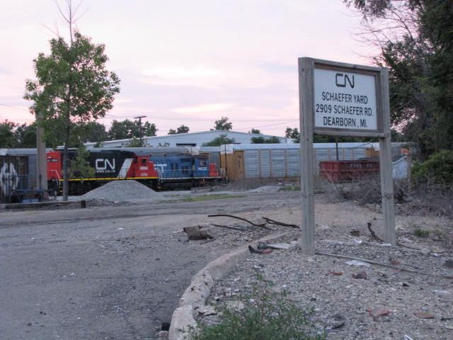
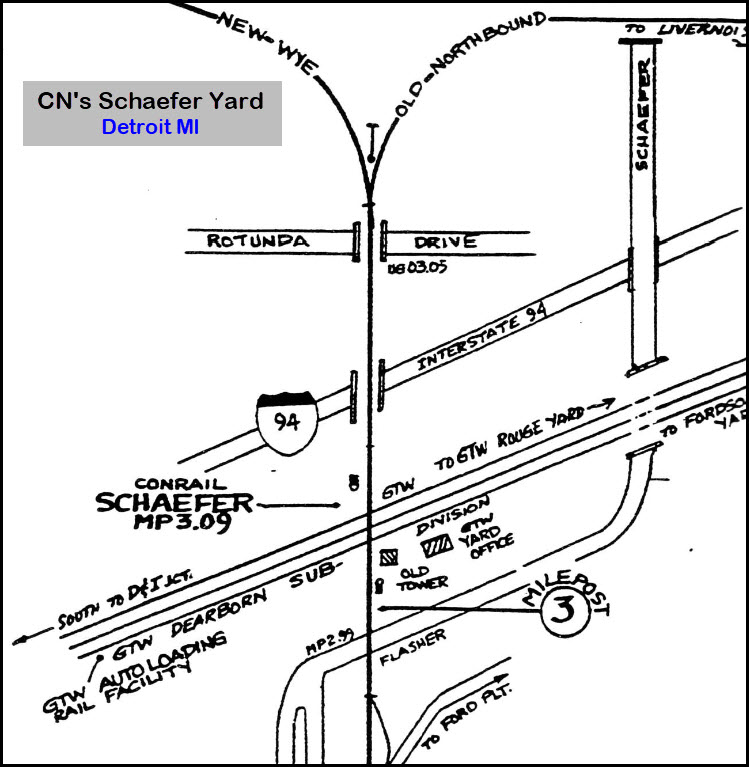
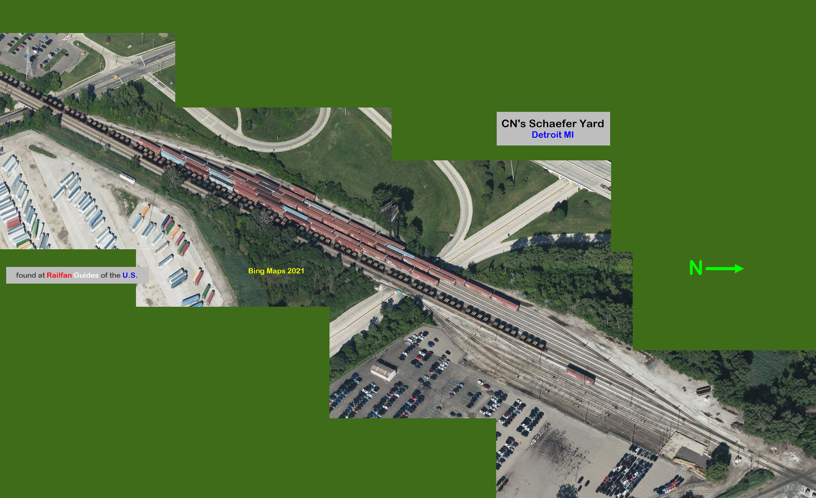
CN's Schaefer Yard
NS's River Rouge Yard
NS's Oakwood Yard
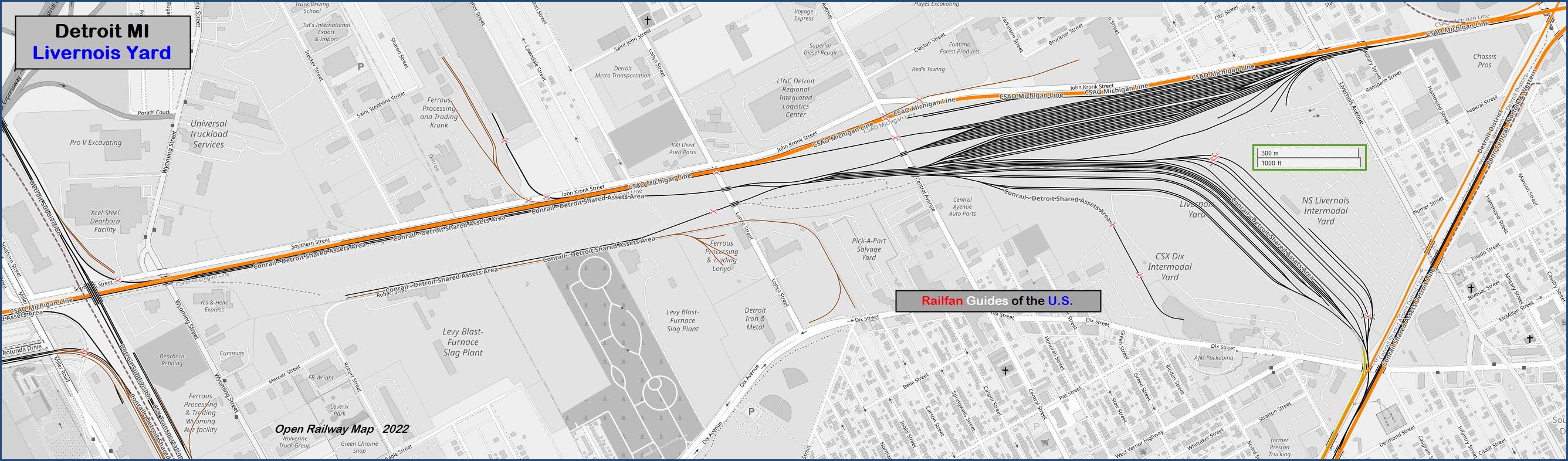
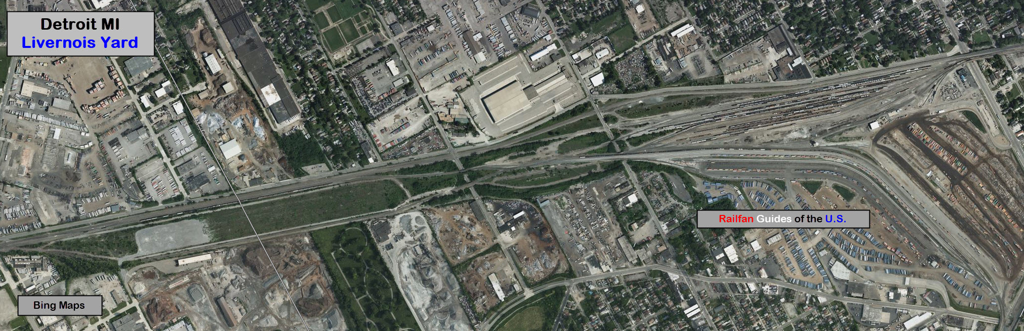
NS's Livernois Yard
CPR Tower/Office
Conrail Tower
Ford / DT&I Concrete Arches
Since I gave the tower it's own page, I will just mention it here in passing, that you can almost anything here!
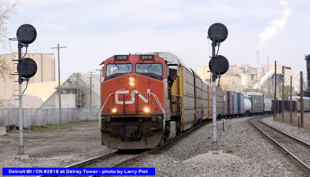
The above photo and more can be found here: http://lapiet.info/images/photos02/photos02.html
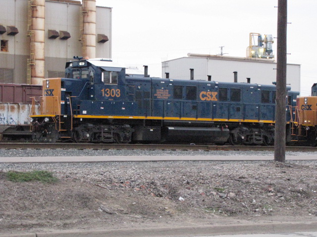
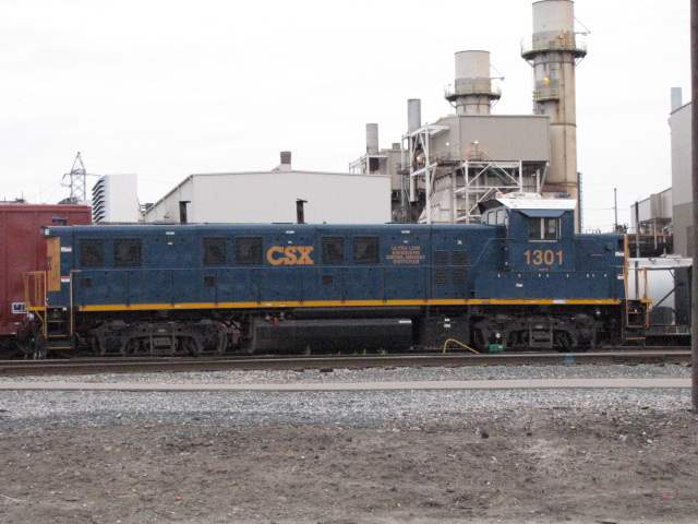
A couple of aerial shots of CSX's Rougemere Yard, the yard office and a couple of new yard goats.
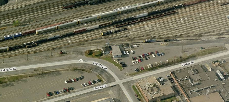
Located at the north end of Rougemere Yard, it is along Ferney St, but a high fence keeps you from getting good pictures.
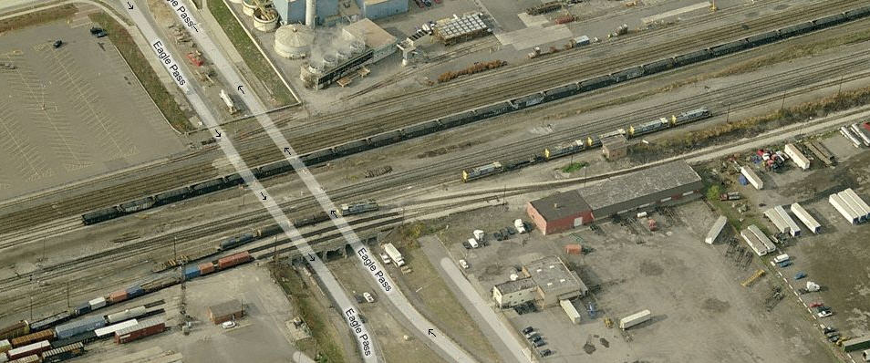
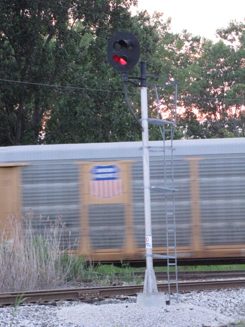
Schaefer Yard is located between I-94 and Schaefer Rd. If you measure it between the diamond and Greenfield Rd, it is 2690 feet long. The yard office and engines sit on the "other" side of the diamond from the actual yard. There used to be a CR tower at the diamond, but it disappeared around 2010, maybe? I passed by there many times looking for action at the Ford plant, and never saw it until Bing Maps came along, and fortunately for us, Bing still had it on their servers. Looks like the diamond is signaled pretty well, at least on the Conrail tracks. A "tri-light" protects the single track going across the diamond, and the sign into the yard. The single track is Conrail's (former NYC and then PC) line, the double track is the GTW/CN (former DT&I) line.
The engine facility at Conrail's River Rouge Yard.
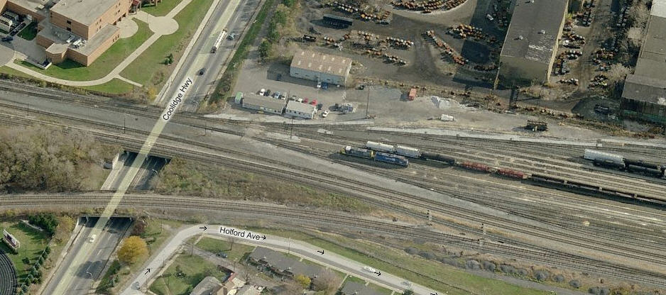
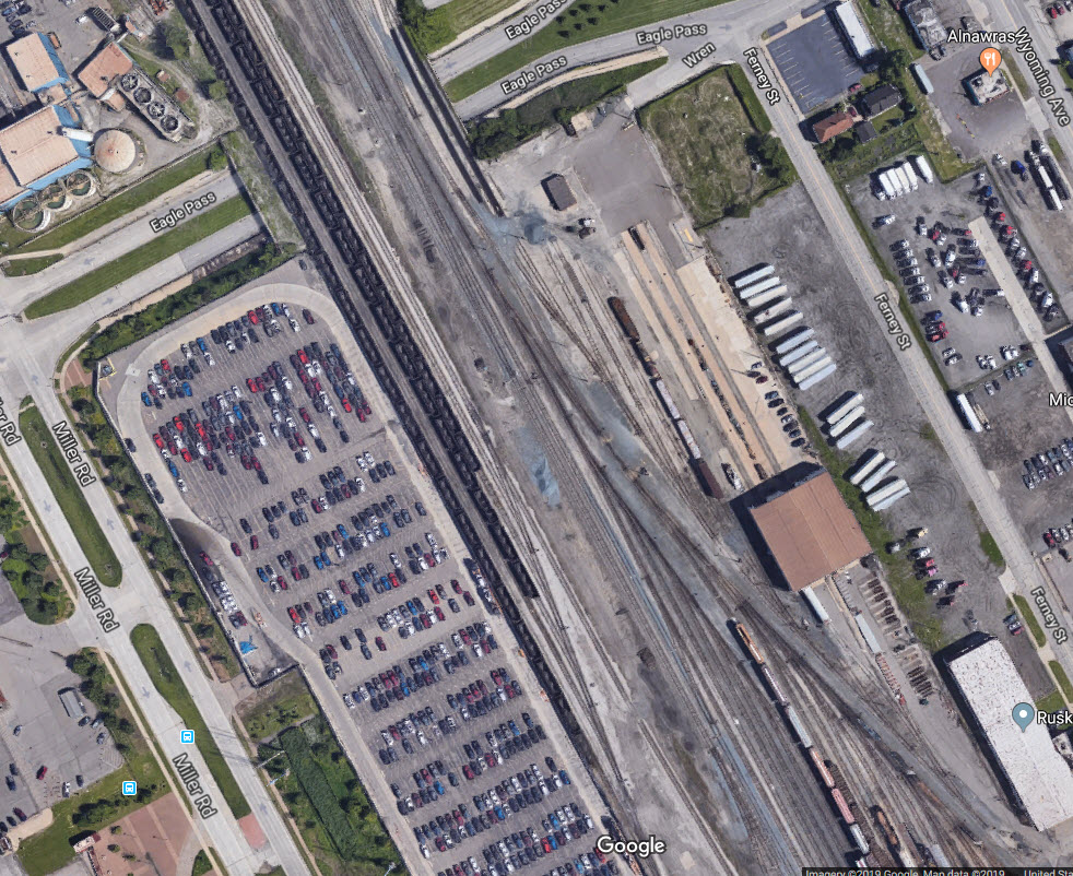
The yard is bounded by Allen Road and Outer Drive on the west, Dix Road goes under the middle of the yard, and Schaefer Road is on the east end of the yard.
The yard measures 1.8 miles long between Outer Drive and Schaefer Road.
The western part (between Dix and Outer) of the yard has 42 tracks, and another three going into (what looks like) a car repair shop.
The eastern section has 20 tracks, plus another three for the engine facility, and one more additional track "outside" the engines facility feeding/receiving 23 tracks in the western part of the yard.
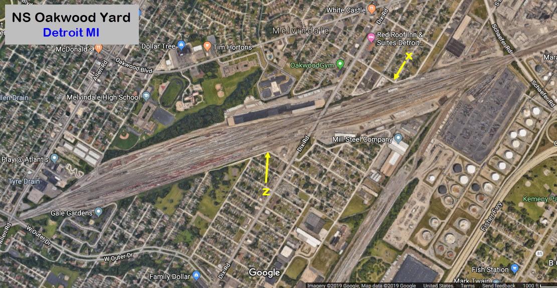
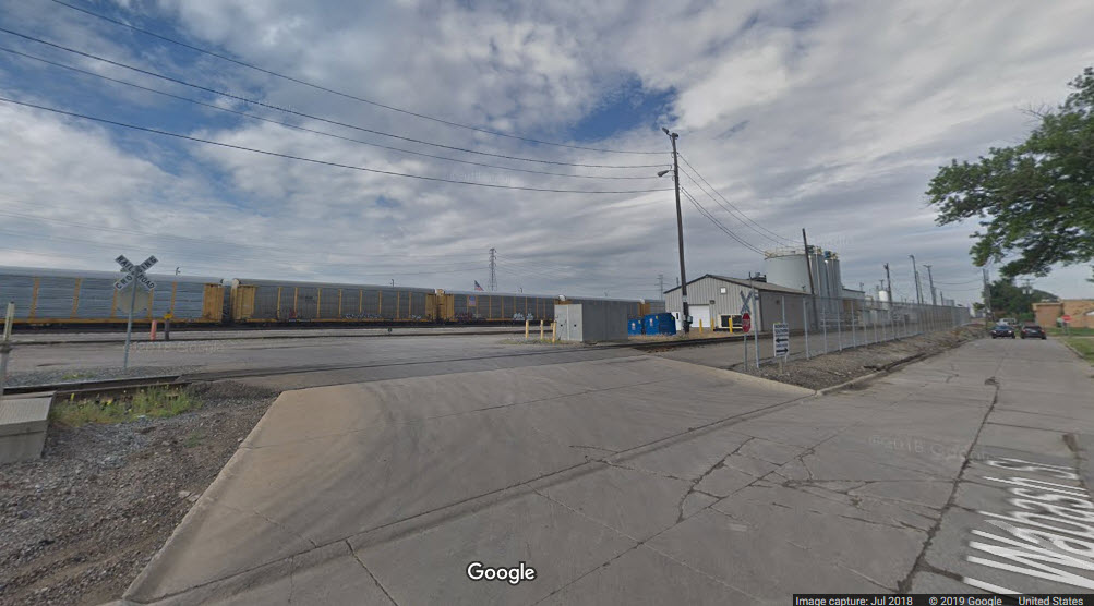
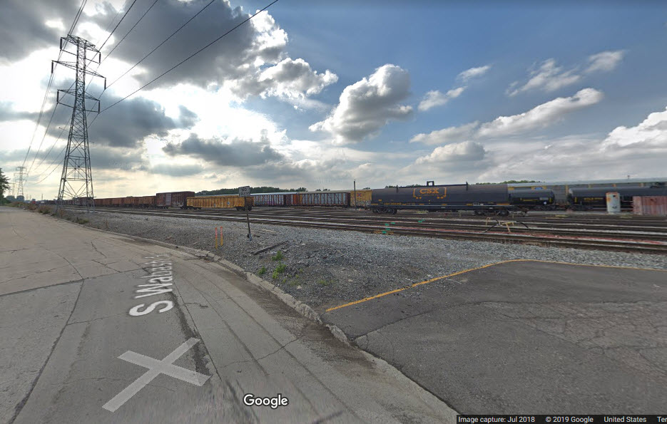
The engine facility for NS's Oakwood Yard is located along Wabash Ave, however, in recent years, they have placed a fence along Wabash.
This shot is taken at the "X" in the aerial shot above.
Pretty good vantage point is from Wabash St, these two shots are taken at the "Z" in the aerial shot above.
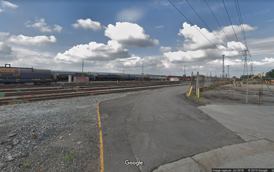
Huge sprawling yard north of downtown and just east of Dearborn.
Central Ave and Lonyo St cross some of the tracks, and go under others of this huge yard.
Southern Ave and John Kronk St travel along the northern edge of the yard - same street, but changes name at Central Ave.
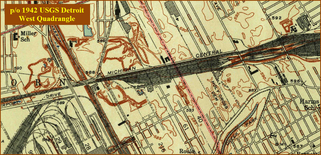
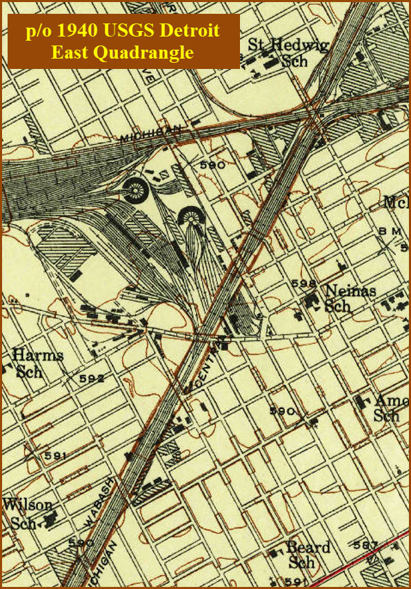
USGS maps from 1940 and 1942 showing you how much we have lost....
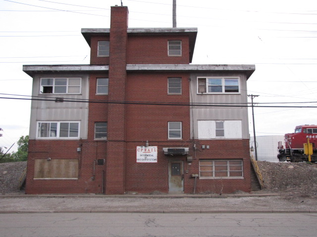
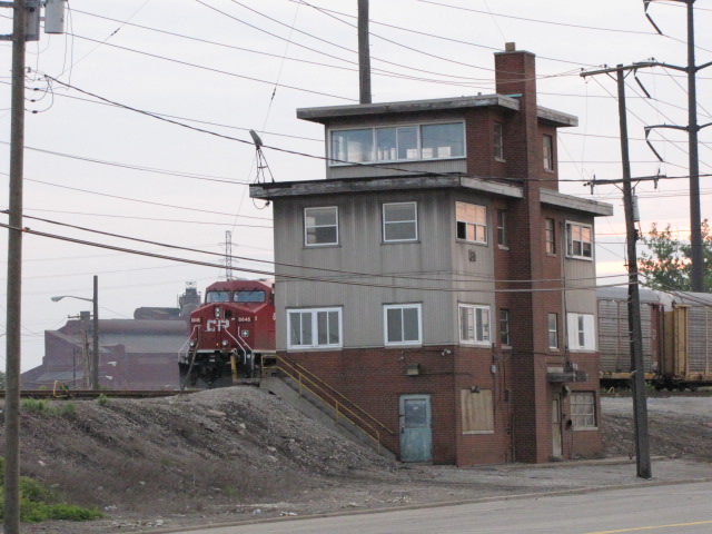
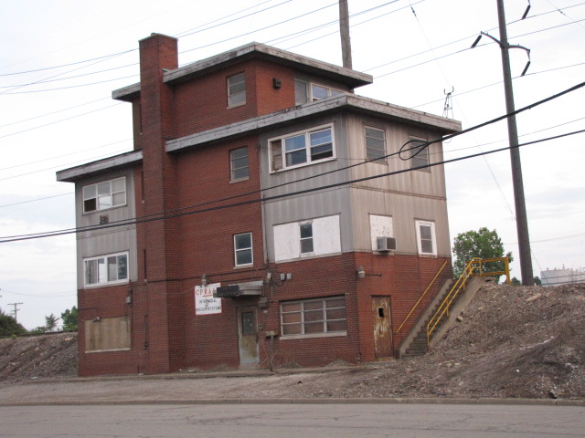
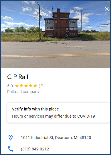
Between Delray Tower and Rougemere Yard, is this building. Not really sure if it is CP, but when visiting here years ago, one could almost always find a set of CP engines sitting here. On Google Maps, if you hover over the info icon and click, it comes up as a CP Rail building. It appears that the CSX cops may also work out of here.
This tower used to stand at the diamond, but it disappeared around 2010, maybe? I passed by there many times looking for action at the Ford plant, and never saw it until Bing Maps came along, and fortunately for us, Bing still had it on their servers.
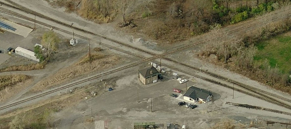
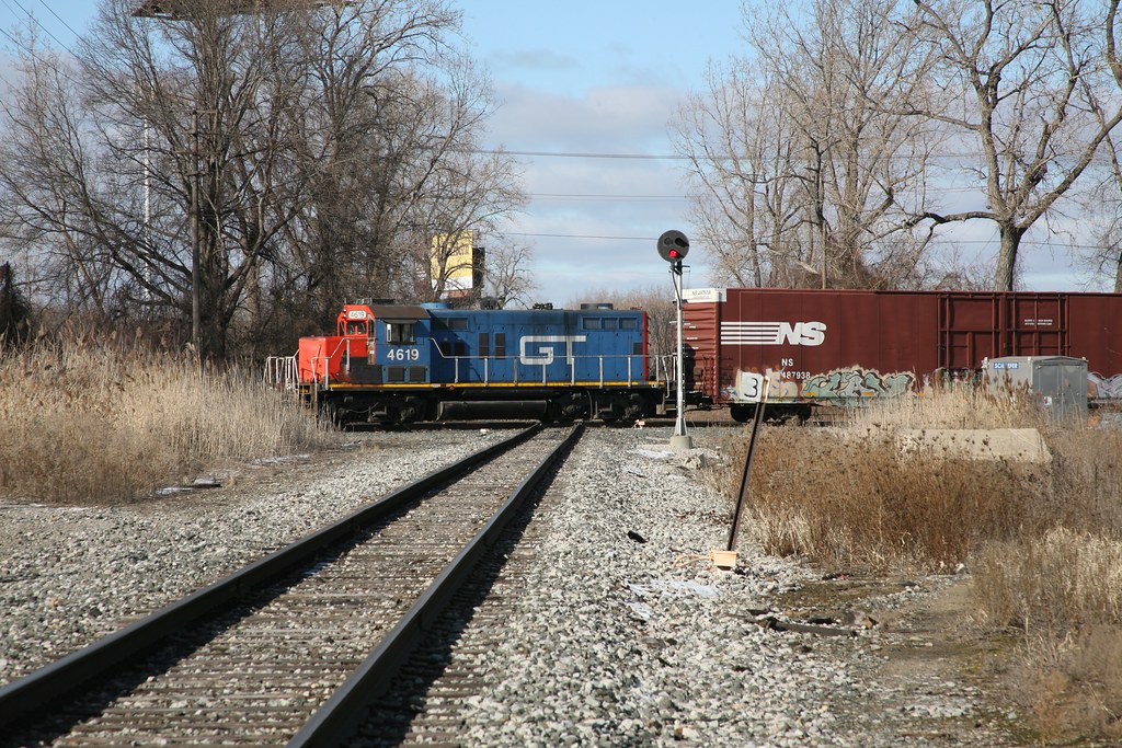 photo by ogauge47, 2016
https://en.wikipedia.org/wiki/Detroit,_Toledo_and_Ironton_Railroad
https://www.thehenryford.org/collections-and-research/digital-collections/expert-sets/101772/
https://fornology.blogspot.com/2014/07/henry-fords-electric-railroad-dt.html
https://www.macsmotorcitygarage.com/henry-fords-railroad-the-detroit-toledo-ironton/
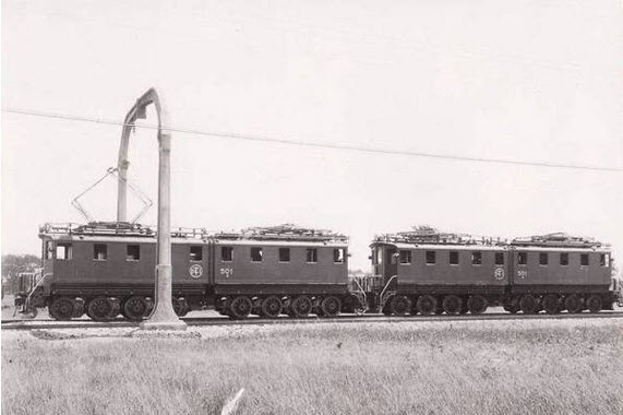
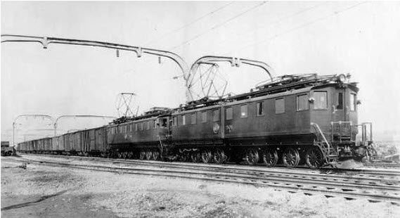
Henry Ford purchased the DT&I RR in 1920, after it had been bankrupt since 1908 but remained solvent. He saw the importance of the line to his automobile business, since he needed a route between the Flat Rock Yard and his plants in Dearborn. In 1927, he embarked on an electrification program which didn't last very long (till 3/1/1930), but the concrete arch catenary supports are still with us for the most part one hundred years later! The first one I can find is just on the north side of Oakwood Ave, and they continue south to just north of Superior Rd. Ford had plans to connect with the Virginian Rwy, but one of the things that stood in the way, is that he selected 22KV/25Hz instead of the 11KV the Virginian used. Ford sold the line to a Pennsy subsidiary in 1929 after getting annoyed with the antics of the ICC. In 1980, the DT&I was acquired by the Grand Trunk Western Railroad (GTW). Under the GTW, the DT&I locomotives were painted in the red and blue livery of the GTW, but retained the DT&I logo. In December 1983, the DT&I was completely assimilated into the GTW.
Grade crossings where you can see the arches and get pictures of trains running under them are:
Champaign Rd
Pelham Rd
Goddard Rd
Northline Rd
Superior Rd (with a long lens)
There is parking at or very near all of the grade crossings if you want to get pictures.
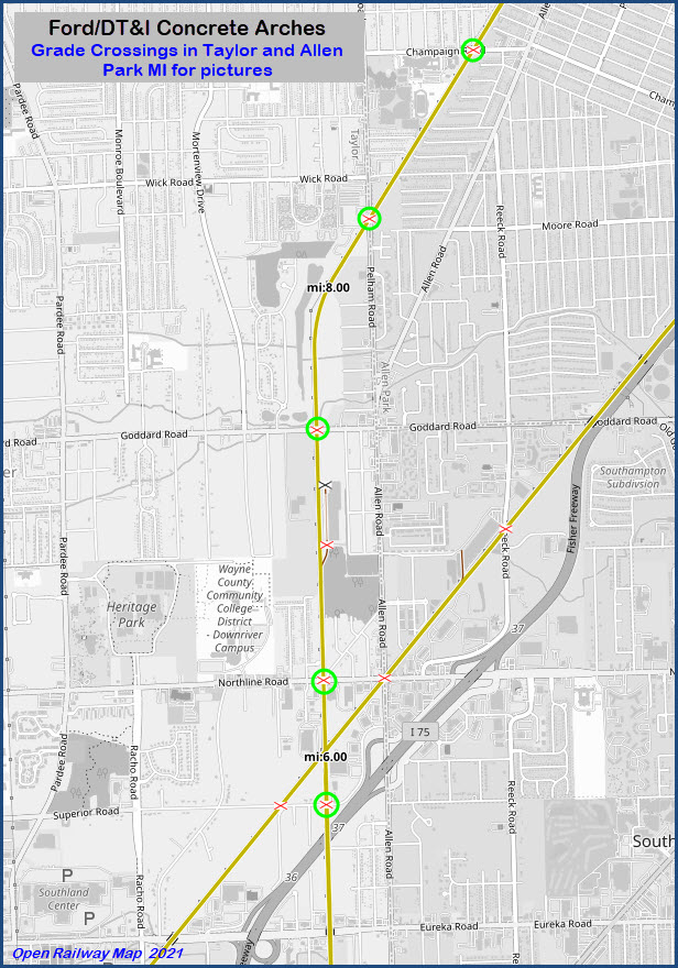
Streets that cross the tracks, but there is no grade crossings (these are north of the above streets):
Oakwood Blvd
Outer Dr
Southfield Rd
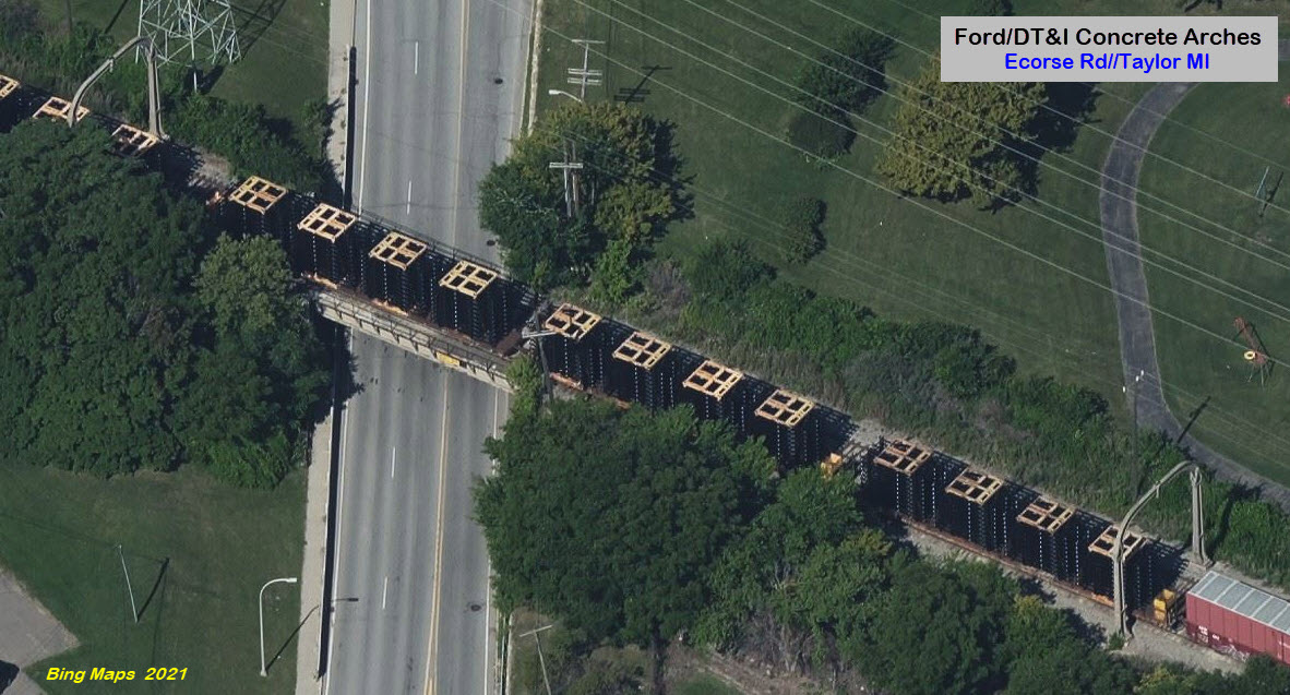
Ecorse Rd
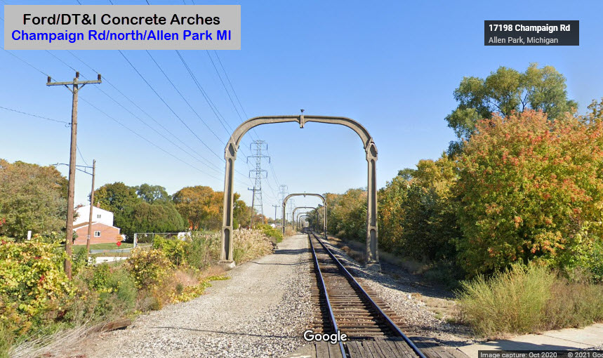 Champaign Rd looking north
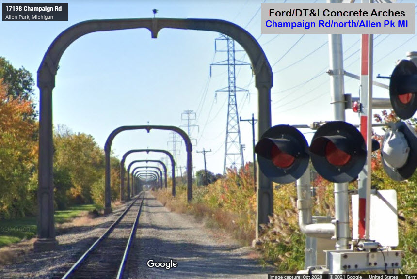 Champaign Rd looking south
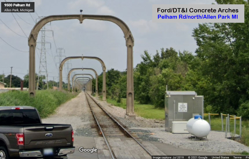 Pelham Rd looking north
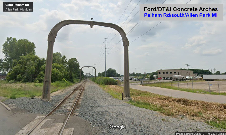 Pelham Rd looking south
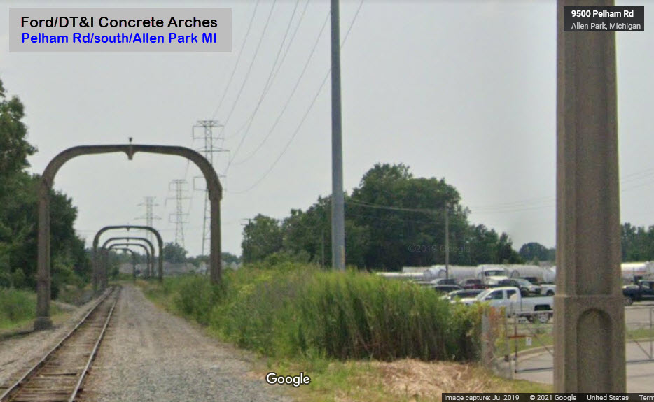 Pelham Rd looking south
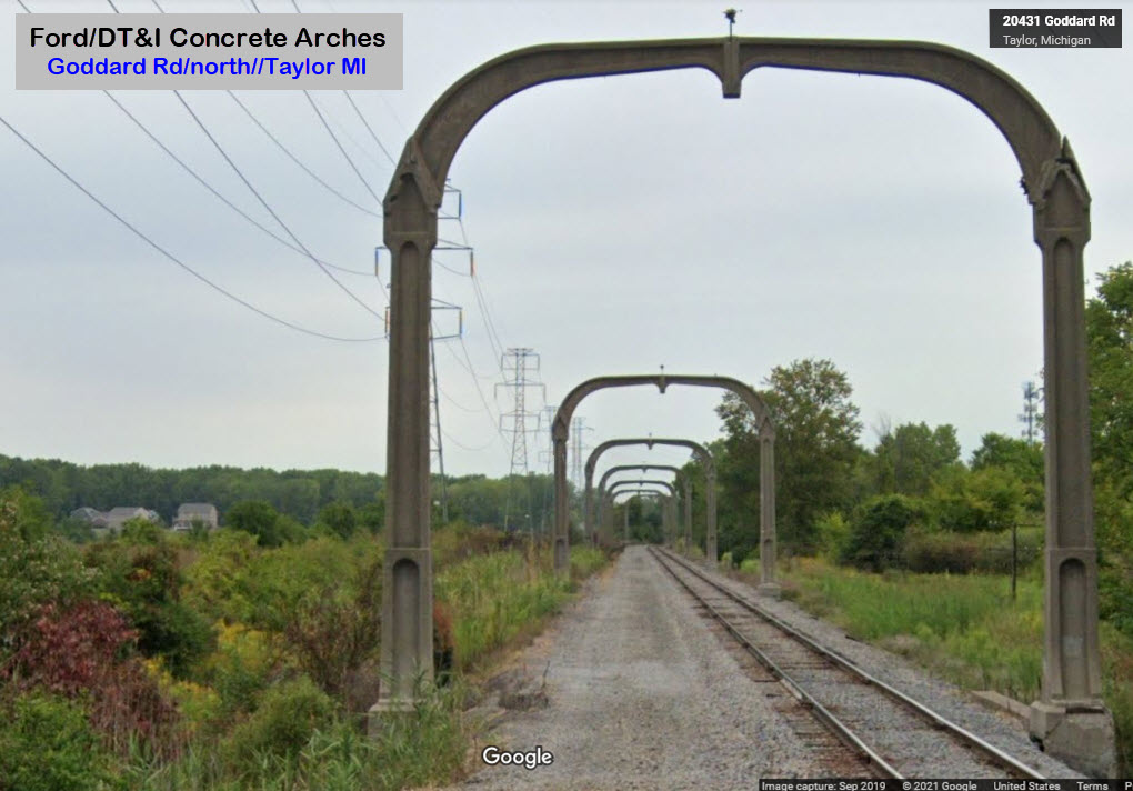 Goddard Rd looking north
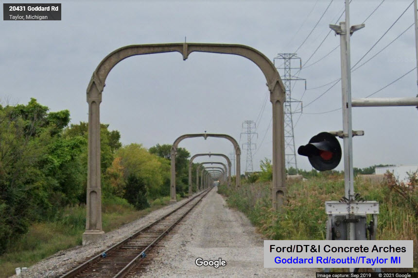 Goddard Rd looking south
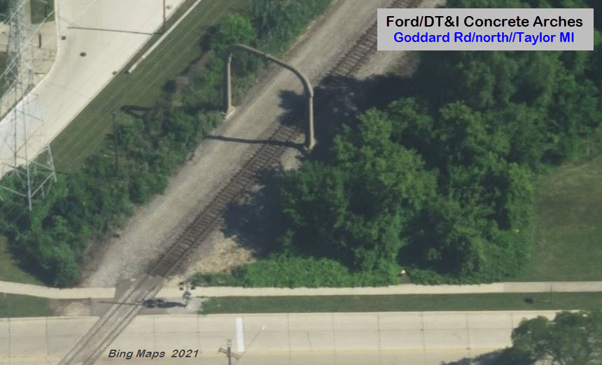
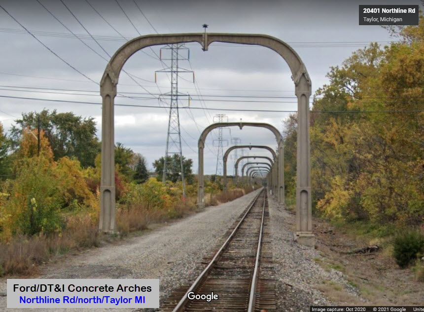 Northline Rd looking north
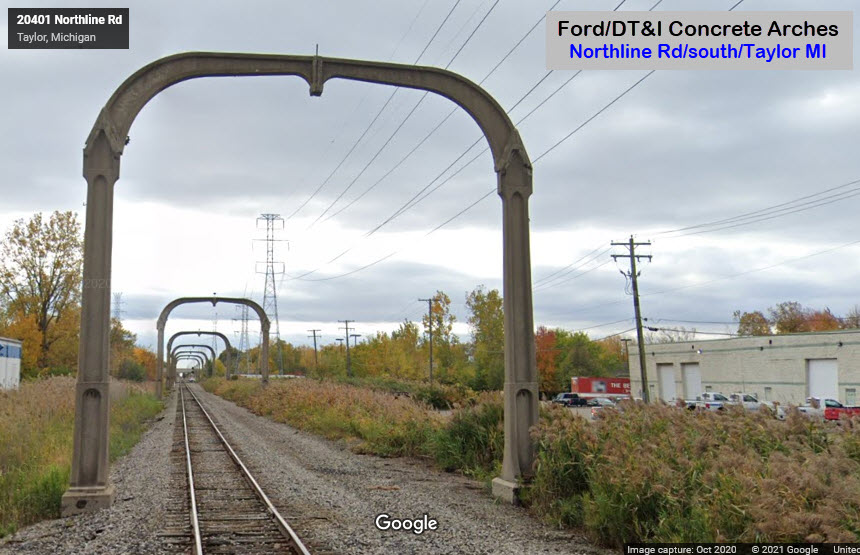 Northline Rd looking south
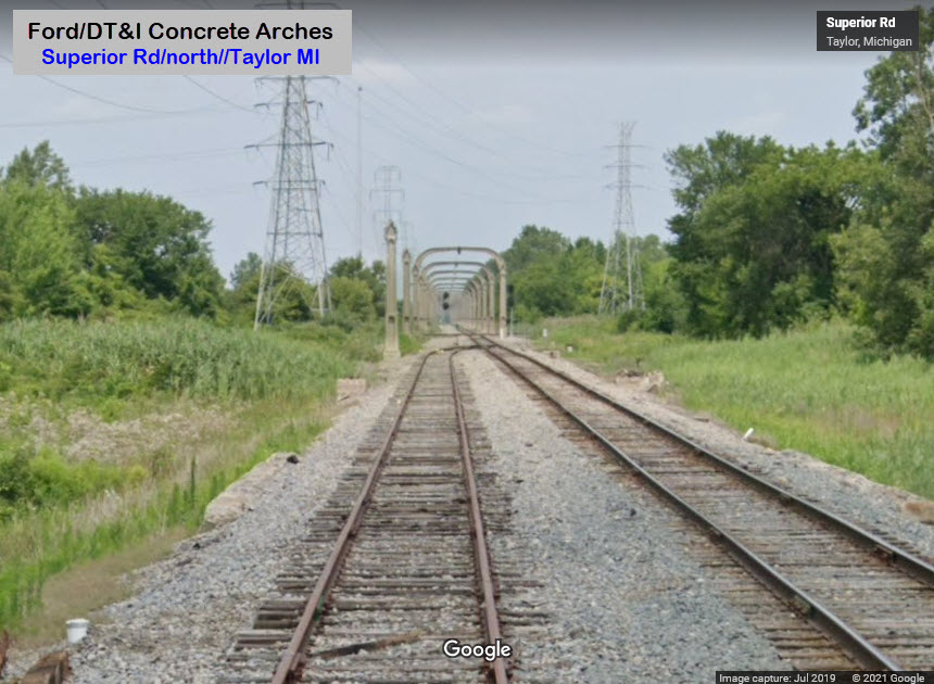 Superior Rd looking north
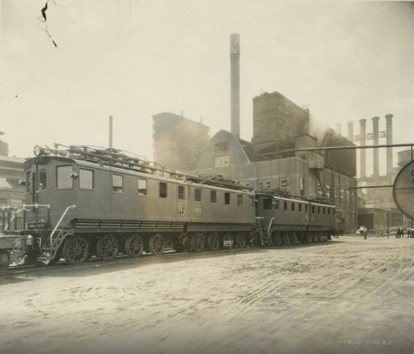
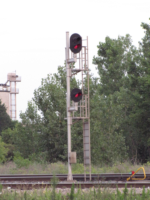
So far, the only signals I really have pictures of are in the immediate Delray Tower area, so they will appear on that page. Any other signals I saw will appear with the sight I saw them at/around.
Because of the large number of railroads and roads, Detroit has an unbelievable number of bridges and overpasses used by the railroads to get over water, roads, and other railroads....
So, due to the large number bridges, I have moved them to their own page, if you're interested:
https://railfanguides.us/mi/detroit/map1a/index.htm
Other Stuff and Train Pictures
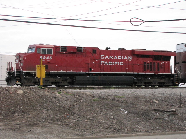
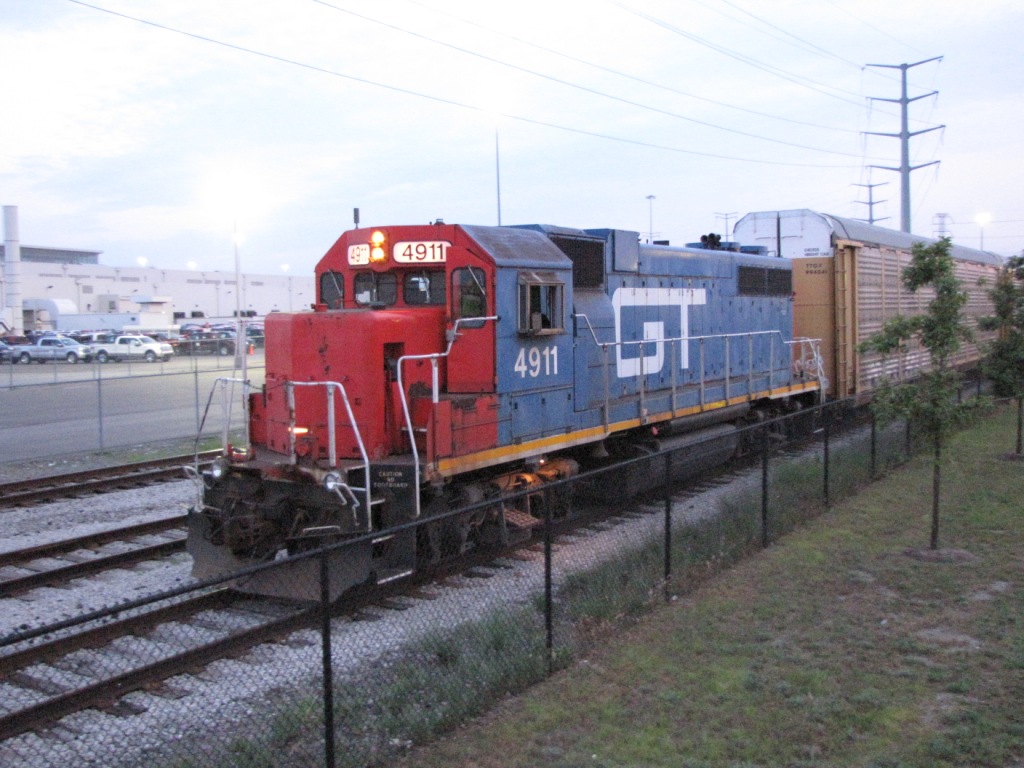
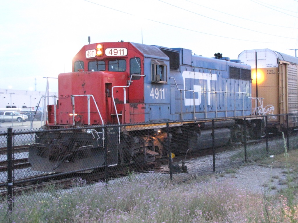
This lone GT engine working the Ford plant was the only moving around late on Friday night. It comes out of the Flatrock yard south of Detroit.
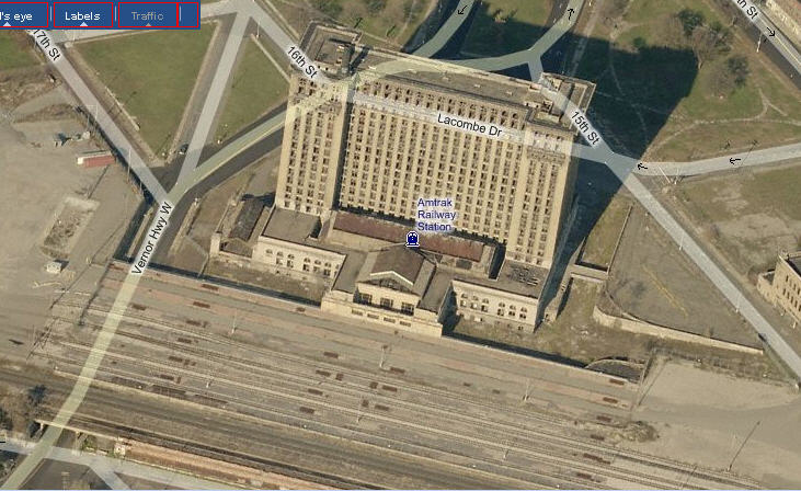
Union Station, it's seen better days...... not on the map.
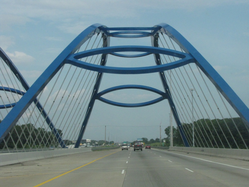
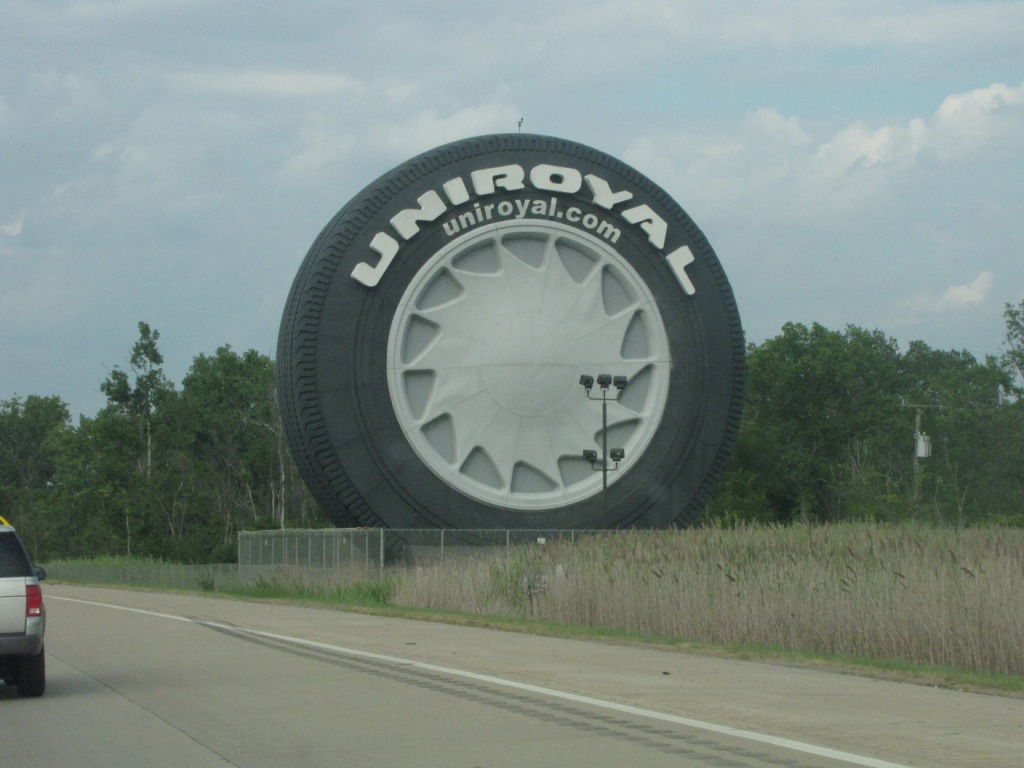
On the way over from the airport, on i94, you go over this really cool bridge, and pass by Uniroyal's huge tire....
Still around, but slowly being taken down one by one, are these concrete support structures for Ford's experiment with electrification.
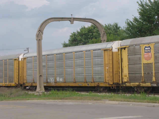
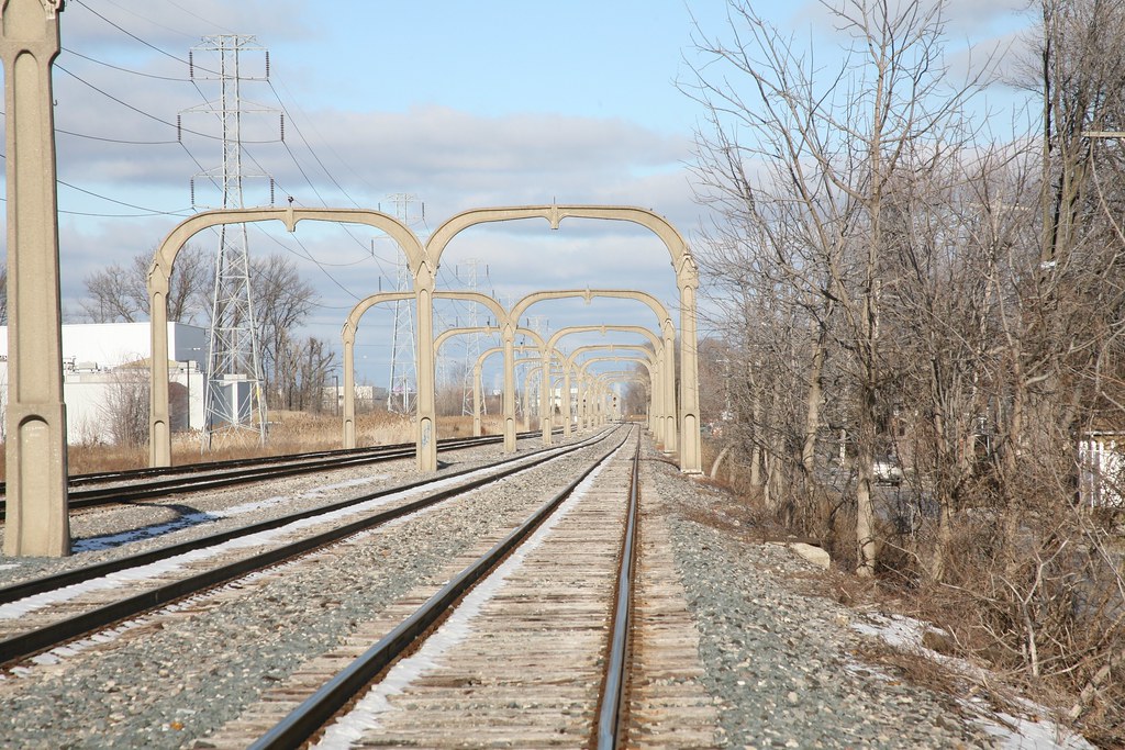 photo by ogauge47
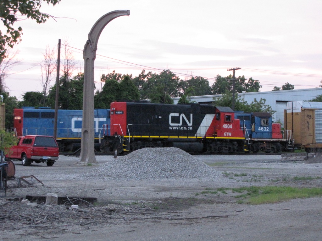
Seems like a popular spot for pictures.... :-)
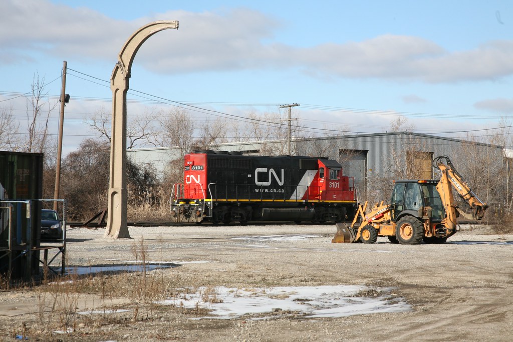 photo by ogauge47
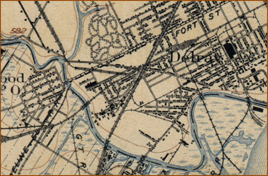
Courtesy of the University of Texas Library, click here for their index page.
Part of a 1904 Detroit Quadrangle Map.
Disclaimers:
New format 10/26/23: Please check out my disclaimer page for my standard dribble and contact info here.
DETROIT RAILFAN GUIDE HOME
RAILFAN GUIDES HOME
RAILROAD SIGNALS HOME
NEW 06/10/2009, SEP06/2016, AUG26/2020, FEB26/2021, MAR21/2021, JUL31/2021, AUG04/2021, JUL21/2022, DEC01/02/2025
Last Modified 02-Dec-2025