
In General
Getting Here
Map
Pictures
Floobydust
RAILFAN GUIDES HOME
RAILROAD SIGNALS HOME
Location / Name:
Towson MD, Baltimore County
What's Here:
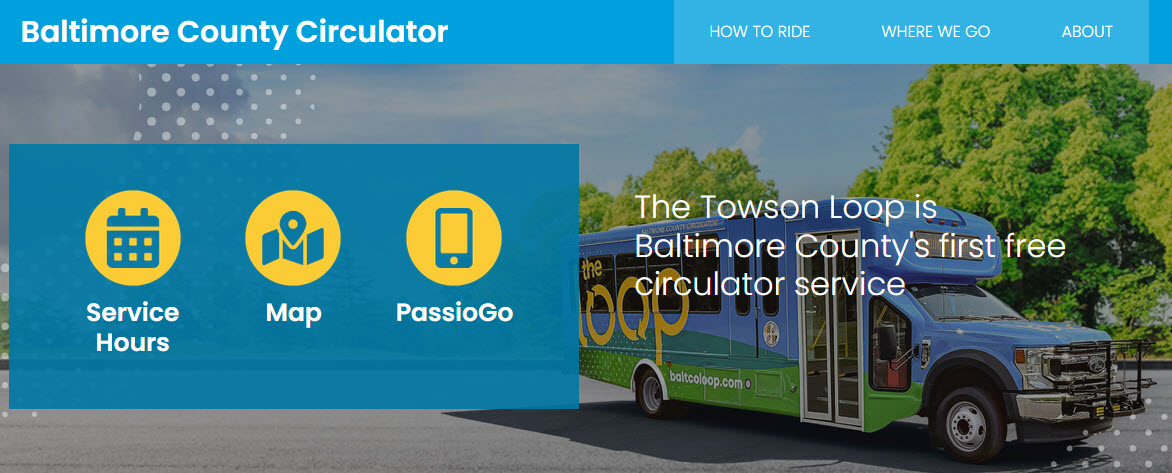
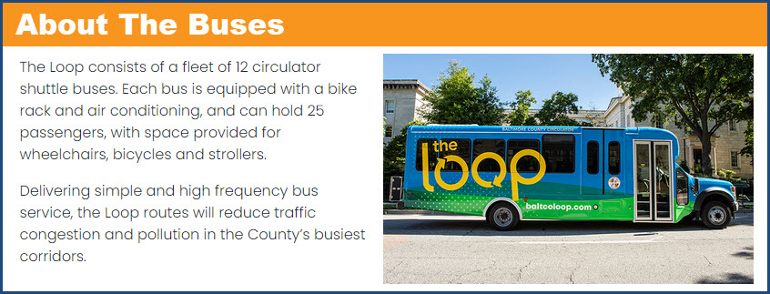
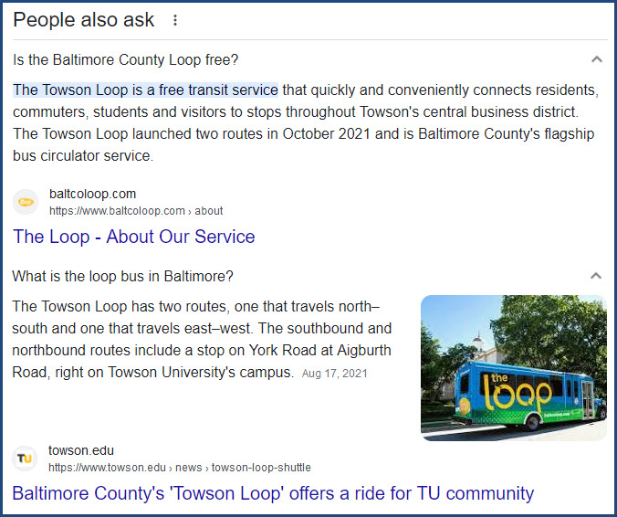
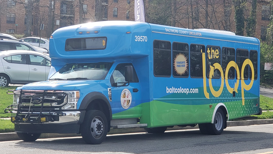
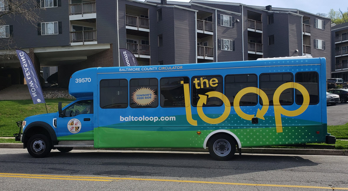
The Loop - Free Bus Service
County Seat
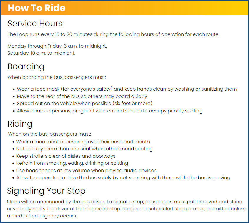
Operating Schedule:
Days of Operation: Monday thru Saturday
Hours of Operation: 06:00 till 00:00 Monday thru Friday // 10:00 till 00:00 Saturday (00:00 is midnight :-)
Frequency of Operation: Every 15 to 20 minutes
Data:
GPS Coordinates: as needed
Phone A/C: 410 / 443
ZIP: 21204 (west) / 21286 (east)
Access by train/transit:
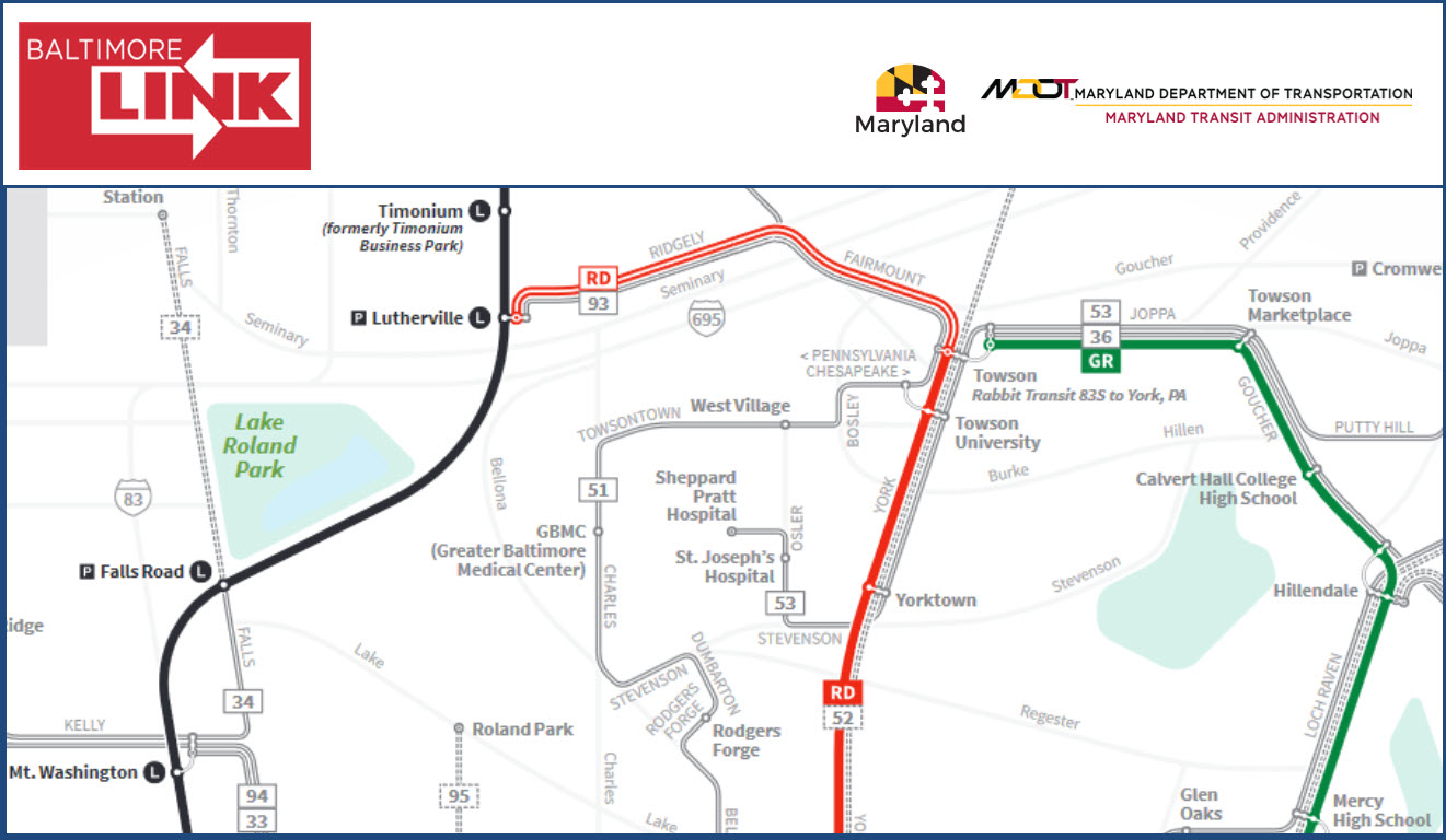
MTA RED Bus Line
The Scoop:
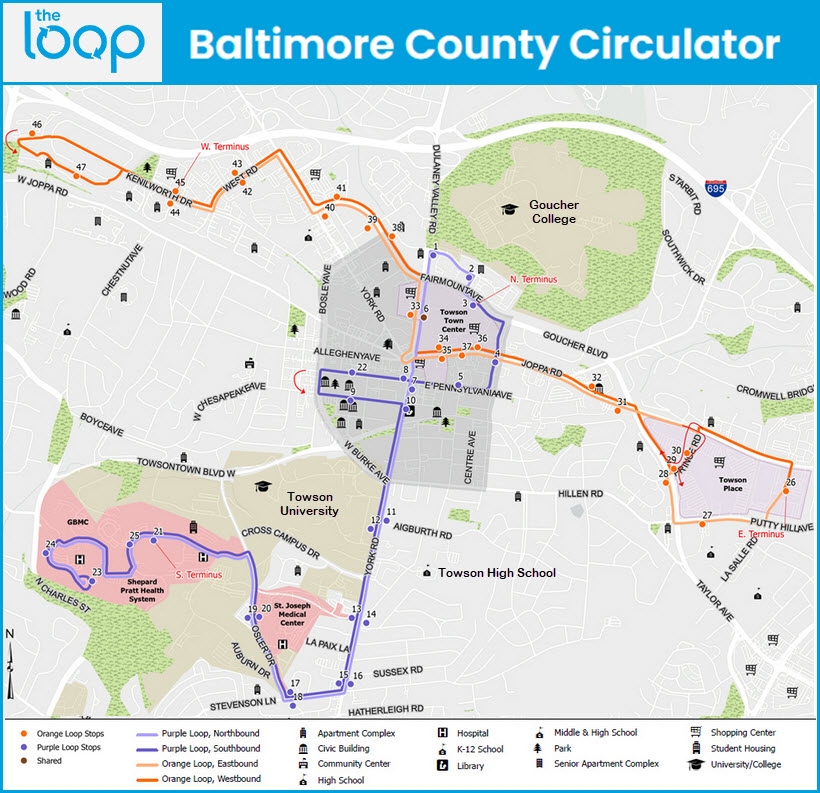
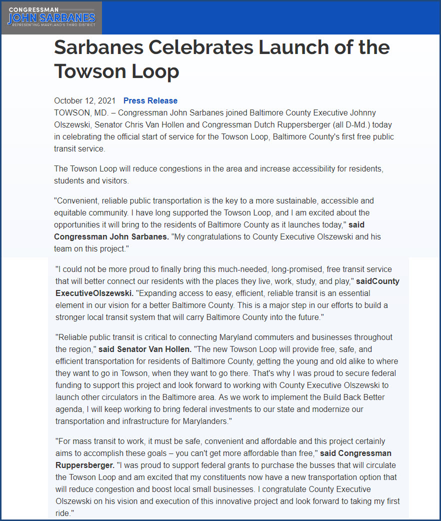
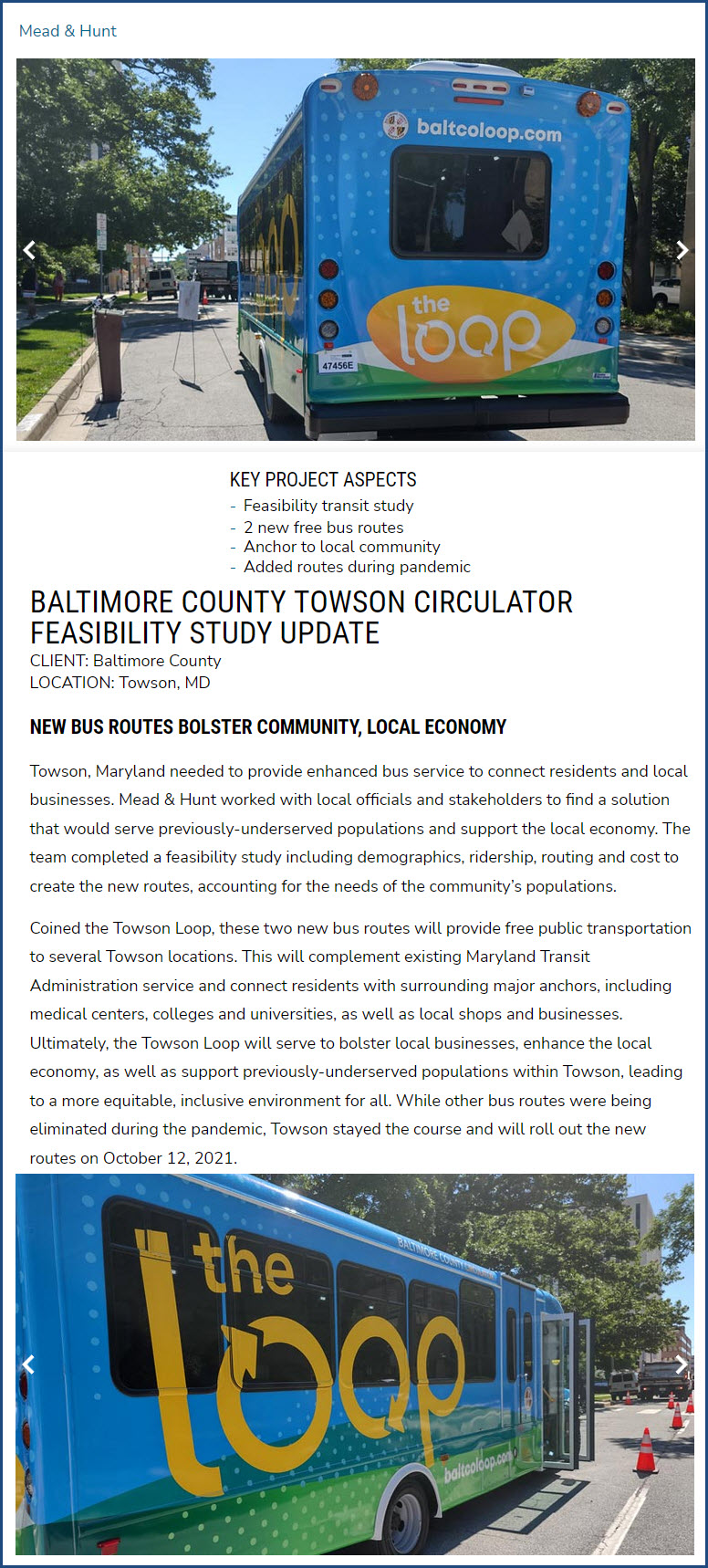
The Towson Loop is a free bus service that is offered in Baltimore County, and consists of two routes: One primarily east and west - the red route, the other primarily north/south - the blue route. Service started in October 2021, and once reference calls it the Baltimore County Circulator. From casual observation (since I live in Towson), ridership is so-so. During the school year, I think they should go through the TSU and Goucher campus' to make it more conducive to students using the service, altho both schools do have their own bus service.
Acknowledgements:
Sites listed below
Websites and other additional information sources of interest for the area:
https://www.baltcoloop.com/
https://wiki.openstreetmap.org/wiki/Maryland/Public_transport
https://meadhunt.com/project/towson-feasibility-study-update/
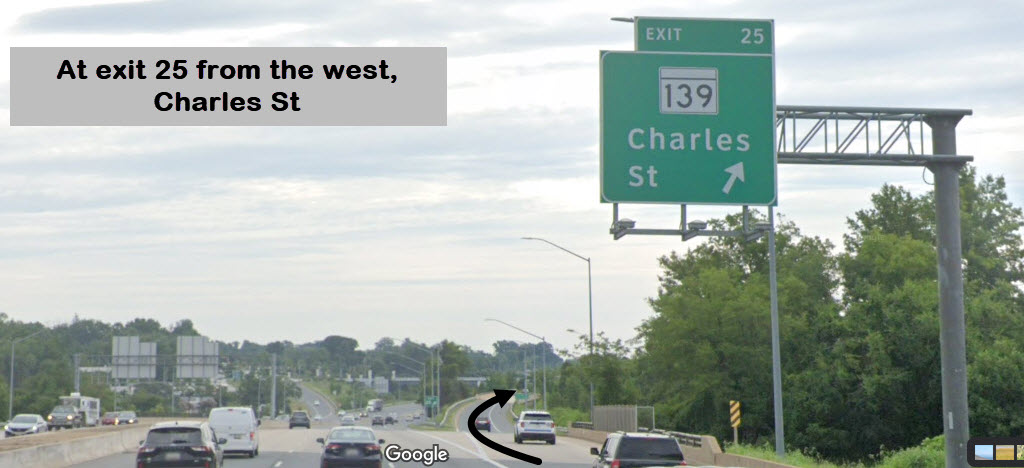
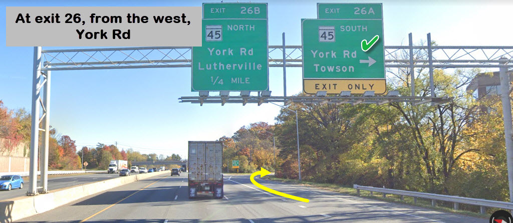
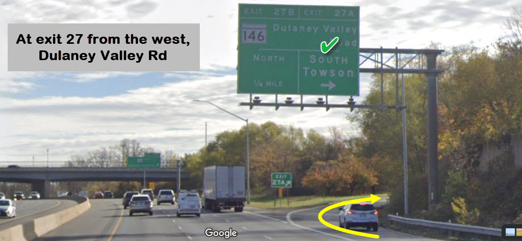
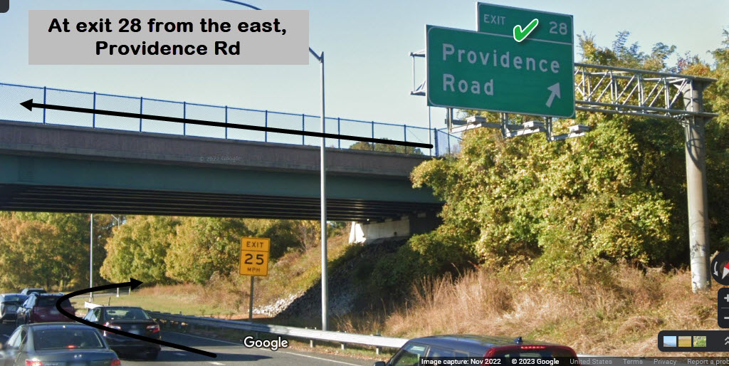
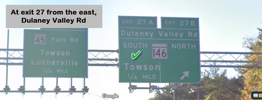
Using the Baltimore Beltway, you can get off at these four convenient exits:
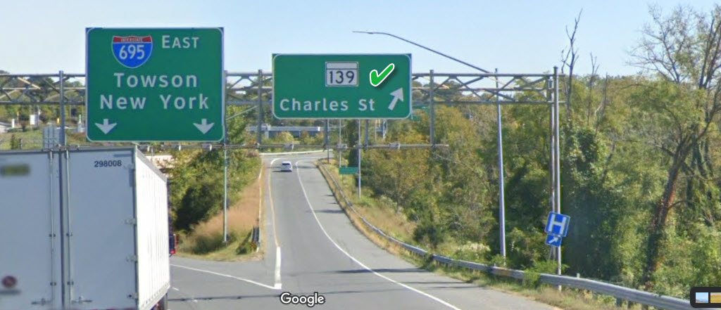
- exit 25, Charles street
- exit 26, York Road
- exit 27, Dulaney Valley Road
- exit 28, Providence Road
Eastbound on the Beltway, from Glen Burnie way, I-70, or I-95 (south) from DC, you can get off at these exit's:

Westbound on the Beltway, from Essex way, or I-95 (north) from Philly and New York, you can get off at these exit's:
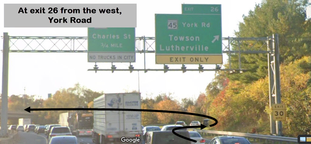
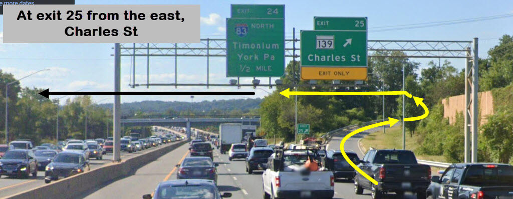
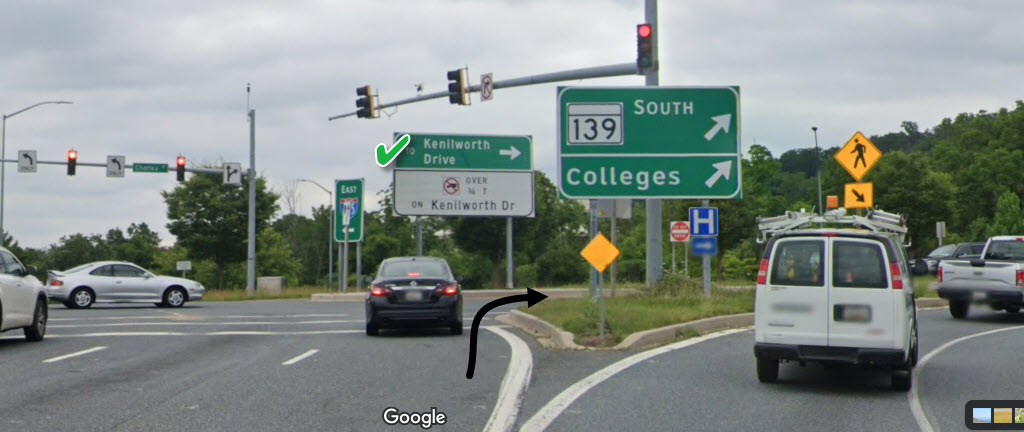
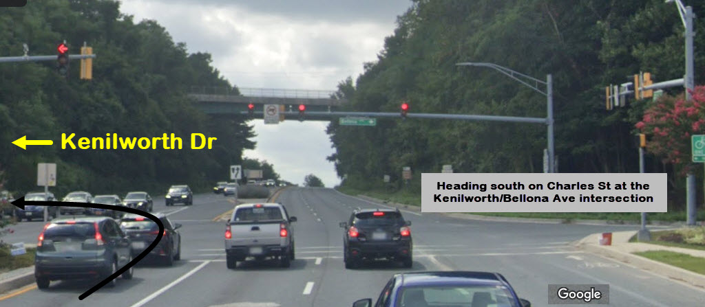
From the north, say York or Harrisburg PA, come down on I-83, and take the Beltway going east to Towson. Once you're on the exit ramp, stay to the right and take the exit for Charles Street, and go thru the light to make a right, this sets you up to be able to make a left onto Kenilworth Dr. In about half a mile, it brings you to the western end of the red line at the Kenilworth Shops. You can of course, continue onto the Beltway and also get off at York, Dulaney Valley, or Providence Roads.
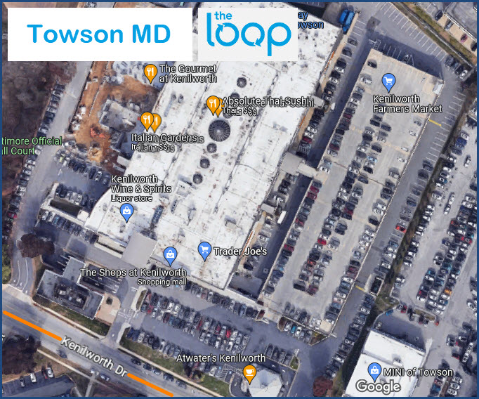
From April 2023, across from Kenilworth Mall, waiting for the start of a new run....
Disclaimers:
I love trains, and I love signals. I am not an expert. My webpages reflect what I find on the topic of the page. This is something I have fun with while trying to help others.
Please Note: Since the main focus of my two websites is railroad signals, the railfan guides are oriented towards the signal fan being able to locate them. For those of you into the modeling aspect of our hobby, my indexa page has a list of almost everything railroad oriented I can think of to provide you with at least a few pictures to help you detail your pike.
If this is a railfan page, every effort has been made to make sure that the information contained on this map and in this railfan guide is correct. Once in a while, an error may creep in :-)
My philosophy: Pictures and maps are worth a thousand words, especially for railfanning. Text descriptions only get you so far, especially if you get lost or disoriented. Take along good maps.... a GPS is OK to get somewhere, but maps are still better if you get lost! I belong to AAA, which allows you to get local maps for free when you visit the local branches. ADC puts out a nice series of county maps for the Washington DC area, but their state maps do not have the railroads on them. If you can find em, I like the National Geographic map book of the U.S..... good, clear, and concise graphics, and they do a really good job of showing you where tourist type attractions are, although they too lack the railroads. Other notes about specific areas will show up on that page if known.
Aerial shots were taken from either Google or Bing Maps as noted. Screen captures are made with Snagit, a Techsmith product... a great tool if you have never used it!
By the way, floobydust is a term I picked up 30-40 years ago from a National Semiconductor data book, and means miscellaneous and/or other stuff.
Pictures and additional information is always needed if anyone feels inclined to take 'em, send 'em, and share 'em, or if you have something to add or correct.... credit is always given! Please be NICE!!! Contact info is here
Beware: If used as a source, ANYTHING from Wikipedia must be treated as being possibly inaccurate, wrong, or not true.
RAILFAN GUIDES HOME
RAILROAD SIGNALS HOME
NEW MAR24/2023, MAR25/26/28/2023, APR13/2023
Last Modified 13-Apr-2023