
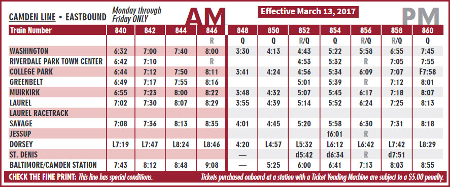
In General
Getting Here
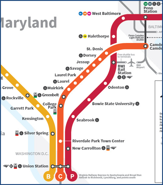
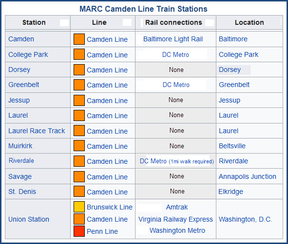
Map
Sights
Signals
RAILROAD SIGNALS HOME
Location / Name:
Greenbelt MD, Prince Georges County
What's Here:
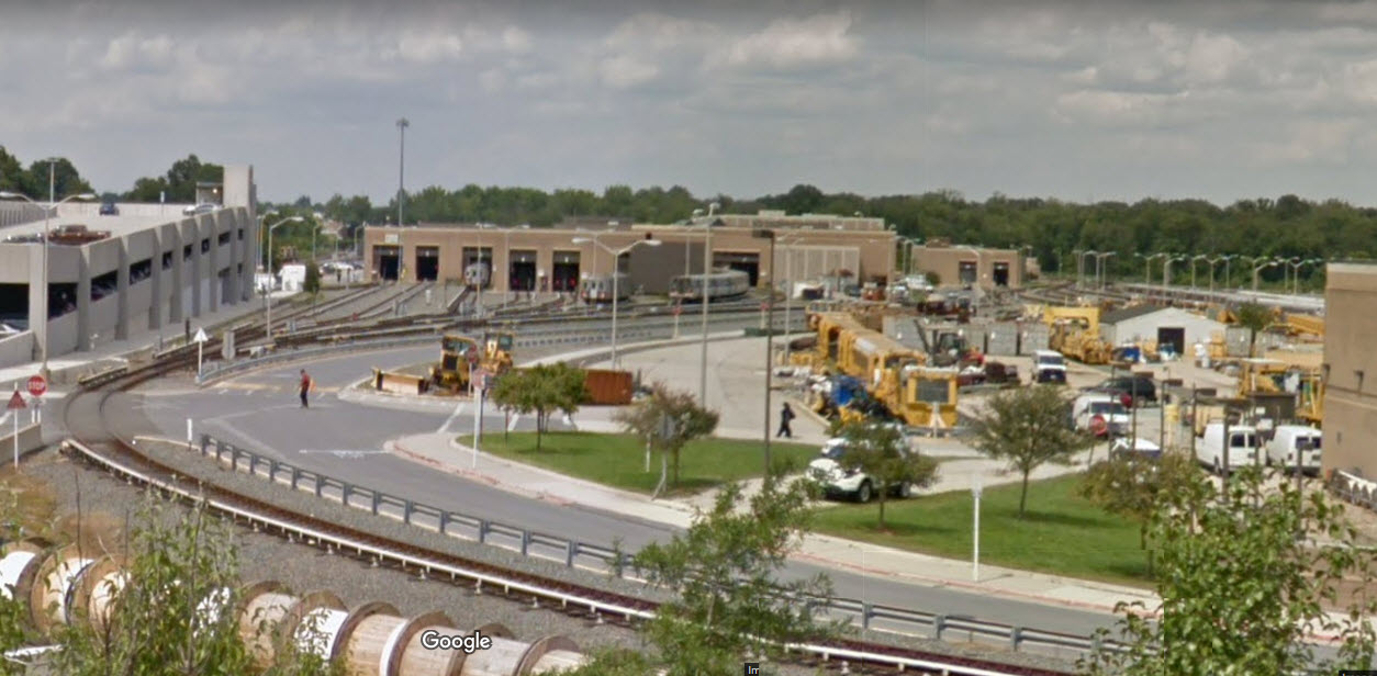
Greenbelt MARC Commuter Rail Station
DC Metro Greenbelt Station
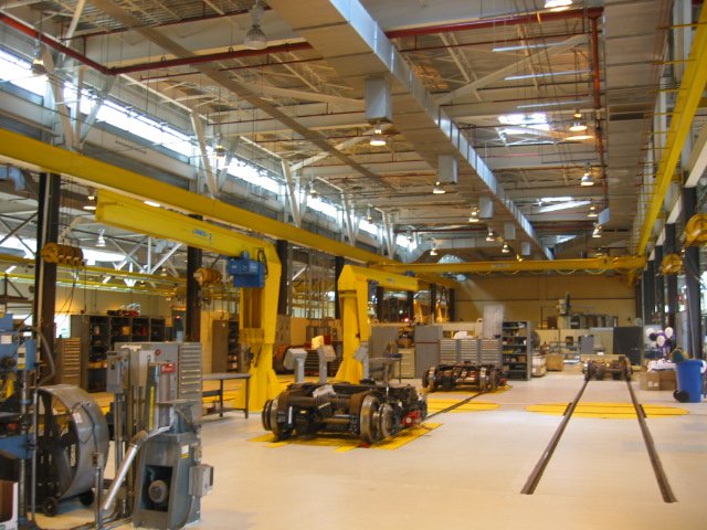
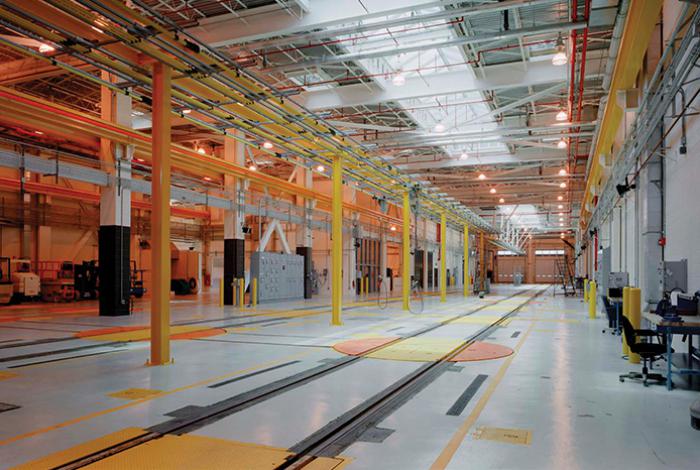
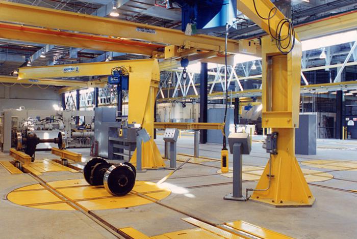
DC Metro's Greenbelt Yard and Maintenance Shops
Data:
GPS Coordinates: as needed 39.062979, -76.884073
Phone A/C: 301
ZIP: 20705
Access by train/transit:
MARC Commuter Rail
DC Metro's Green and Yellow lines
The Scoop:
Greenbelt has a few things noteworthy for railfans: a MARC station, a DC Metro subway station on the green & yellow lines, and one of the DC Metro's subway yards/maintenance center. The Greenbelt station is the first/last station on the line, depending on which way you are going.
Acknowledgements:
Roger Puta
007bond
Swagging
Therailthing
Denver Todd
Websites and other additional information sources of interest for the area:
https://en.wikipedia.org/wiki/Greenbelt_station
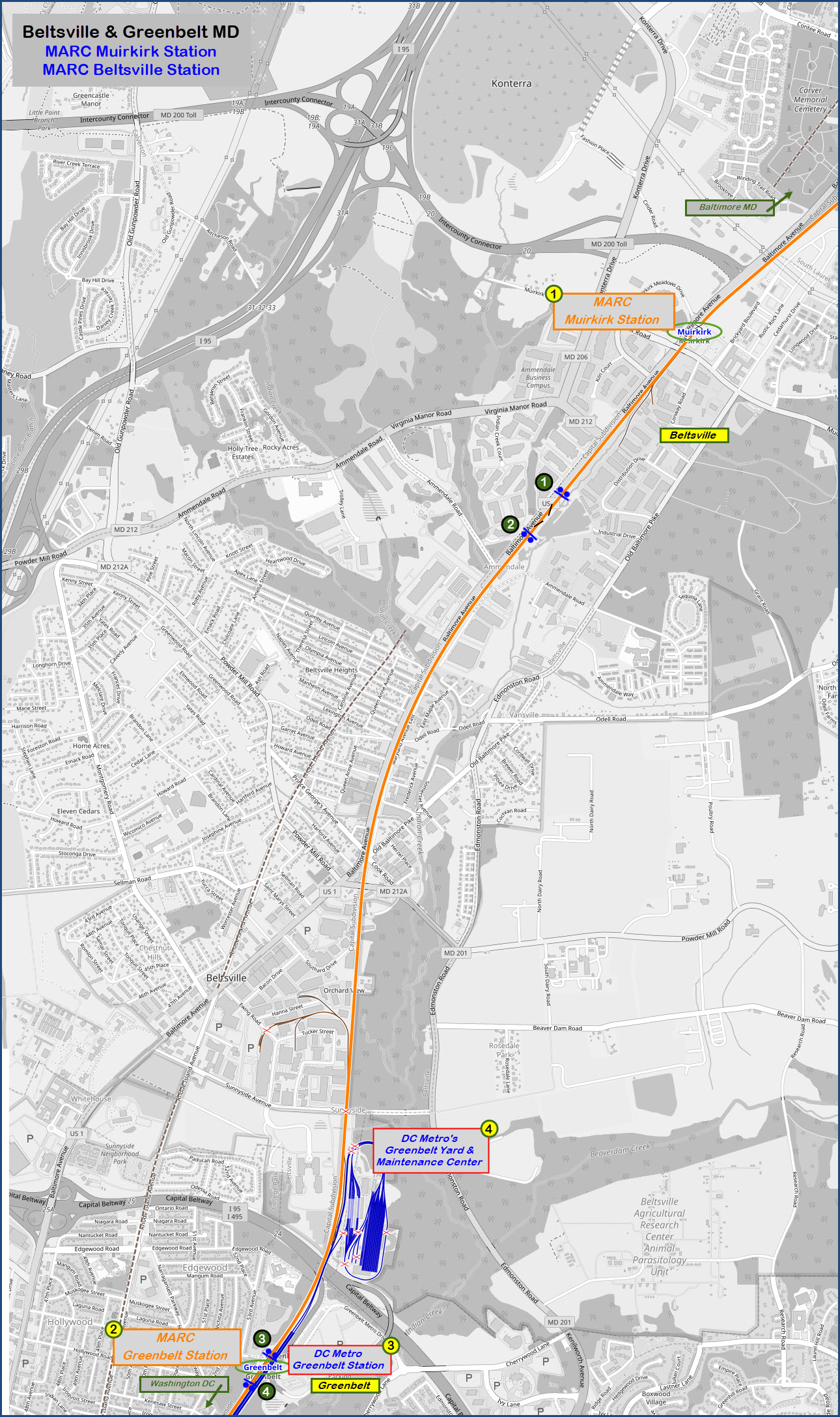
There are a couple of alternatives on getting here. One is via I-95, one is via the Baltimore-Washington Parkway, and the other is U.S. Route 1.
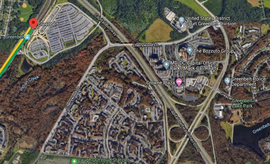
The parking lot for the Greenbelt stations is easily accessible from the DC Beltway to the west and I-95.
Coming from the other direction on the Beltway, say Virginia, you will need to get off at Kenilworth Ave, and take that to Cherrywood Lane where you want to take a left.
If you're coming down Route 1, take a left across from the CVS onto Powder Mill Rod, where Route 1 veers away from the tracks. Go a couple thousand feet and take a right onto 201/Edmondston Rd. Drive about 1-1/2 miles and take a right onto Cherrywood Drive.

GPS Coordinates: 39.010355, -76.912105
5600 Greenbelt Metro Dr, Greenbelt, MD 20740
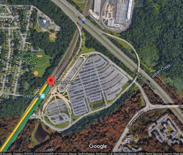
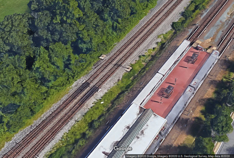
This is the only station on the Camden line which has a separate set of tracks for the commuter trains, as can be seen in the aerial view below.
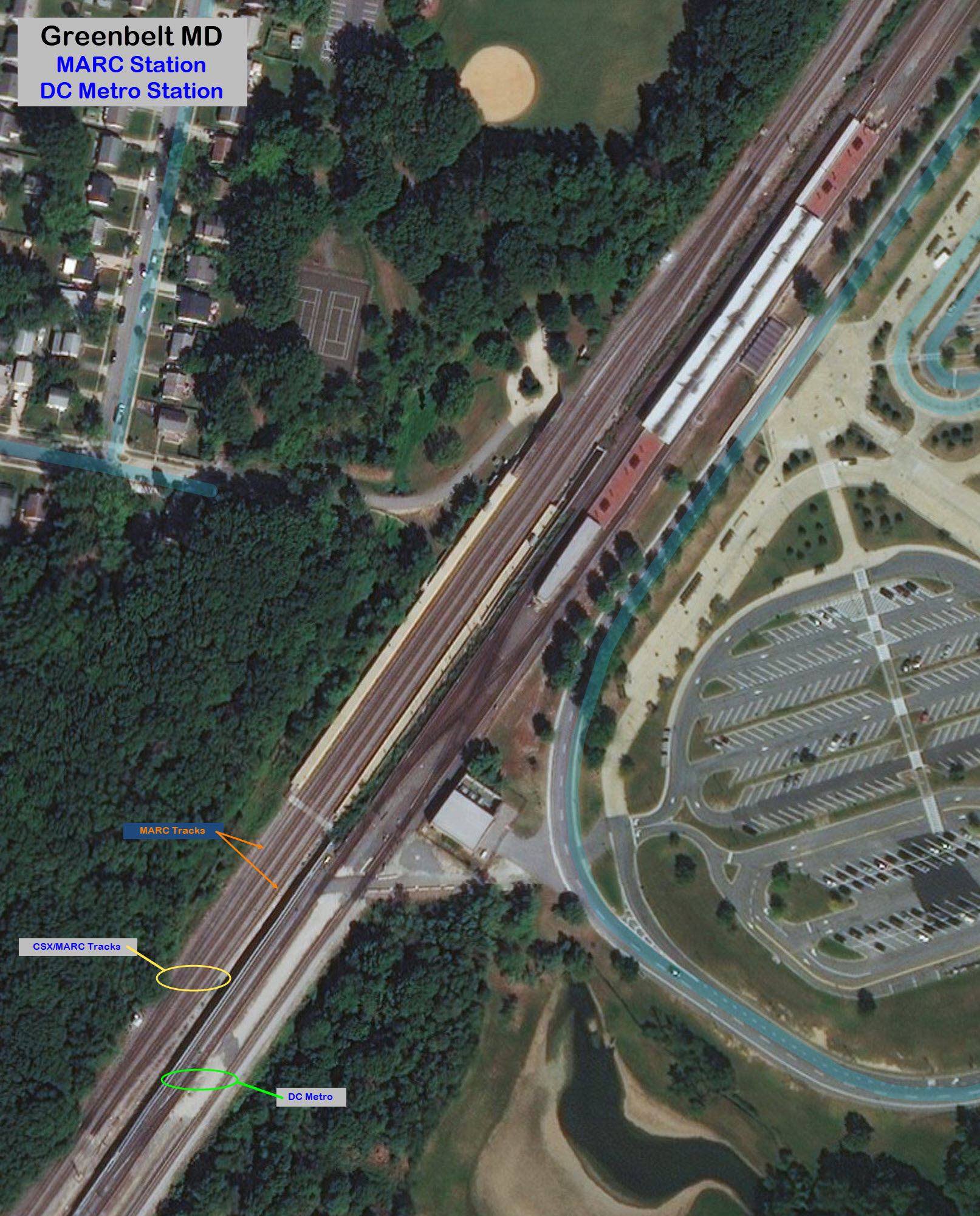
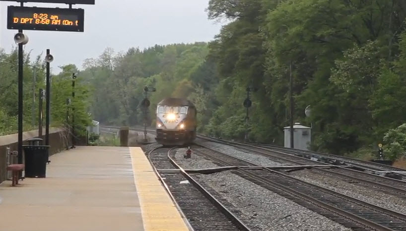
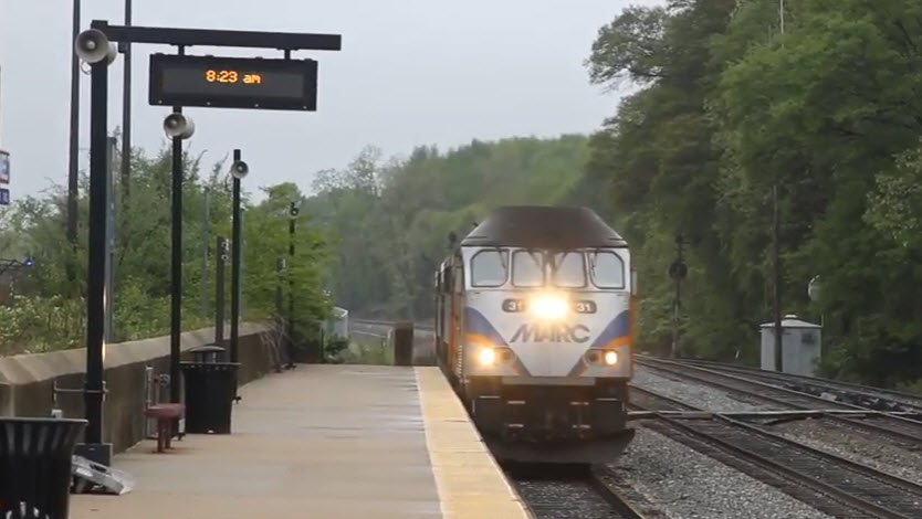
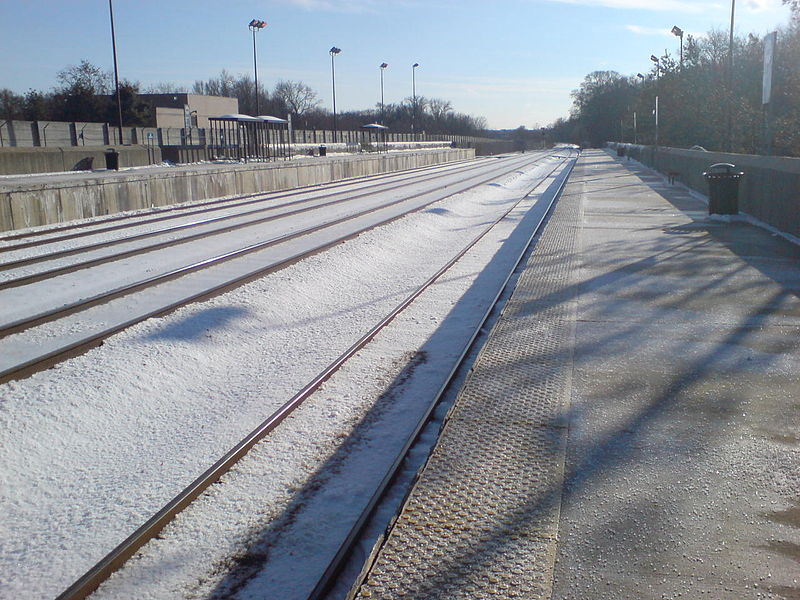 photo by 007bond/Wikipedia, 2007
Here you can clearly see the four tracks at the MARC station.
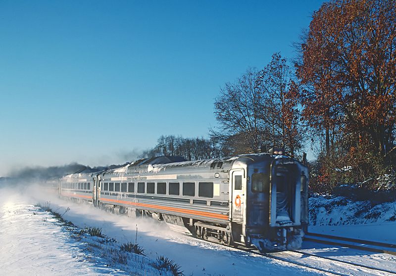 photo by Roger Puta/Wikipedia, 1987
GPS Coordinates: 39.010355, -76.912105
5717 Greenbelt Metro Dr, Greenbelt, MD 20740
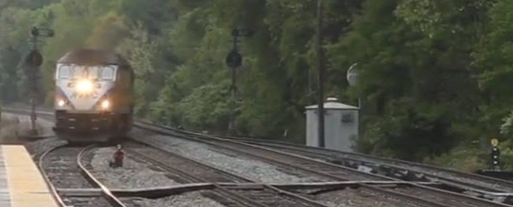
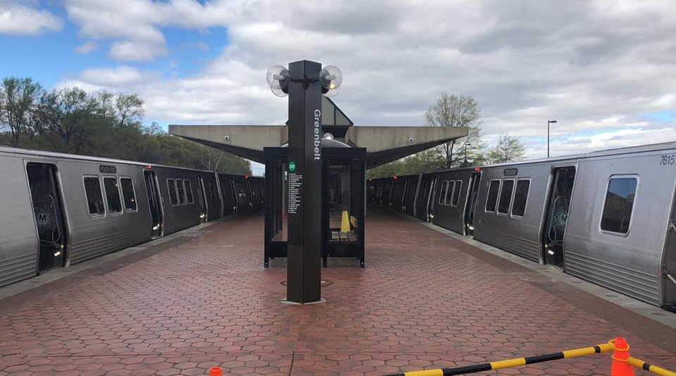 photo by Swagging/Wikipedia, 2019
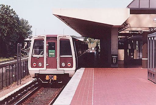
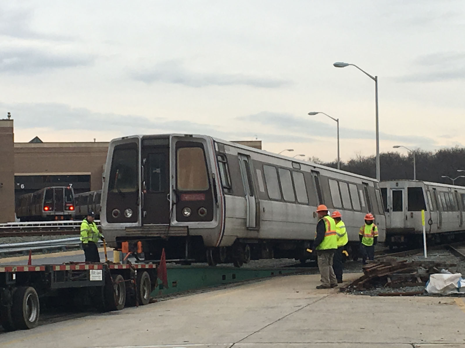
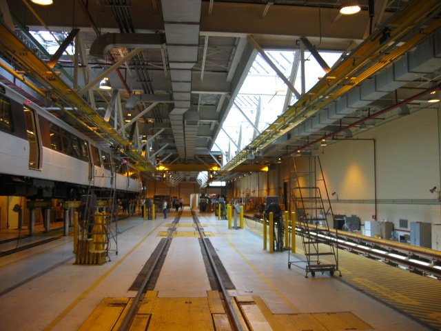
GPS Coordinates: 39.062979, -76.884073
7012-B Muirkirk Road, Beltsville, MD 20705
From the outer loop of the Beltway.
These signals are on the north side of the station.
Before the CPL's were replaced.
These are on the south side of the station.
Disclaimers:
I love trains, and I love signals. I am not an expert. My webpages reflect what I find on the topic of the page. This is something I have fun with while trying to help others.
Please Note: Since the main focus of my two websites is railroad signals, the railfan guides are oriented towards the signal fan being able to locate them. For those of you into the modeling aspect of our hobby, my indexa page has a list of almost everything railroad oriented I can think of to provide you with at least a few pictures to help you detail your pike.
If this is a railfan page, every effort has been made to make sure that the information contained on this map and in this railfan guide is correct. Once in a while, an error may creep in :-)
My philosophy: Pictures and maps are worth a thousand words, especially for railfanning. Text descriptions only get you so far, especially if you get lost or disoriented. Take along good maps.... a GPS is OK to get somewhere, but maps are still better if you get lost! I belong to AAA, which allows you to get local maps for free when you visit the local branches. ADC puts out a nice series of county maps for the Washington DC area, but their state maps do not have the railroads on them. If you can find em, I like the National Geographic map book of the U.S..... good, clear, and concise graphics, and they do a really good job of showing you where tourist type attractions are, although they too lack the railroads. Other notes about specific areas will show up on that page if known.
Aerial shots were taken from either Google or Bing Maps as noted. Screen captures are made with Snagit, a Techsmith product... a great tool if you have never used it!
By the way, floobydust is a term I picked up 30-40 years ago from a National Semiconductor data book, and means miscellaneous and/or other stuff.
Pictures and additional information is always needed if anyone feels inclined to take 'em, send 'em, and share 'em, or if you have something to add or correct.... credit is always given! Please be NICE!!! Contact info is here
Beware: If used as a source, ANYTHING from Wikipedia must be treated as being possibly being inaccurate, wrong, or not true.
RAILFAN GUIDES HOME
RAILROAD SIGNALS HOME
NEW FEB17/2020
Last Modified 17-Feb-2020