
In General
Getting Here
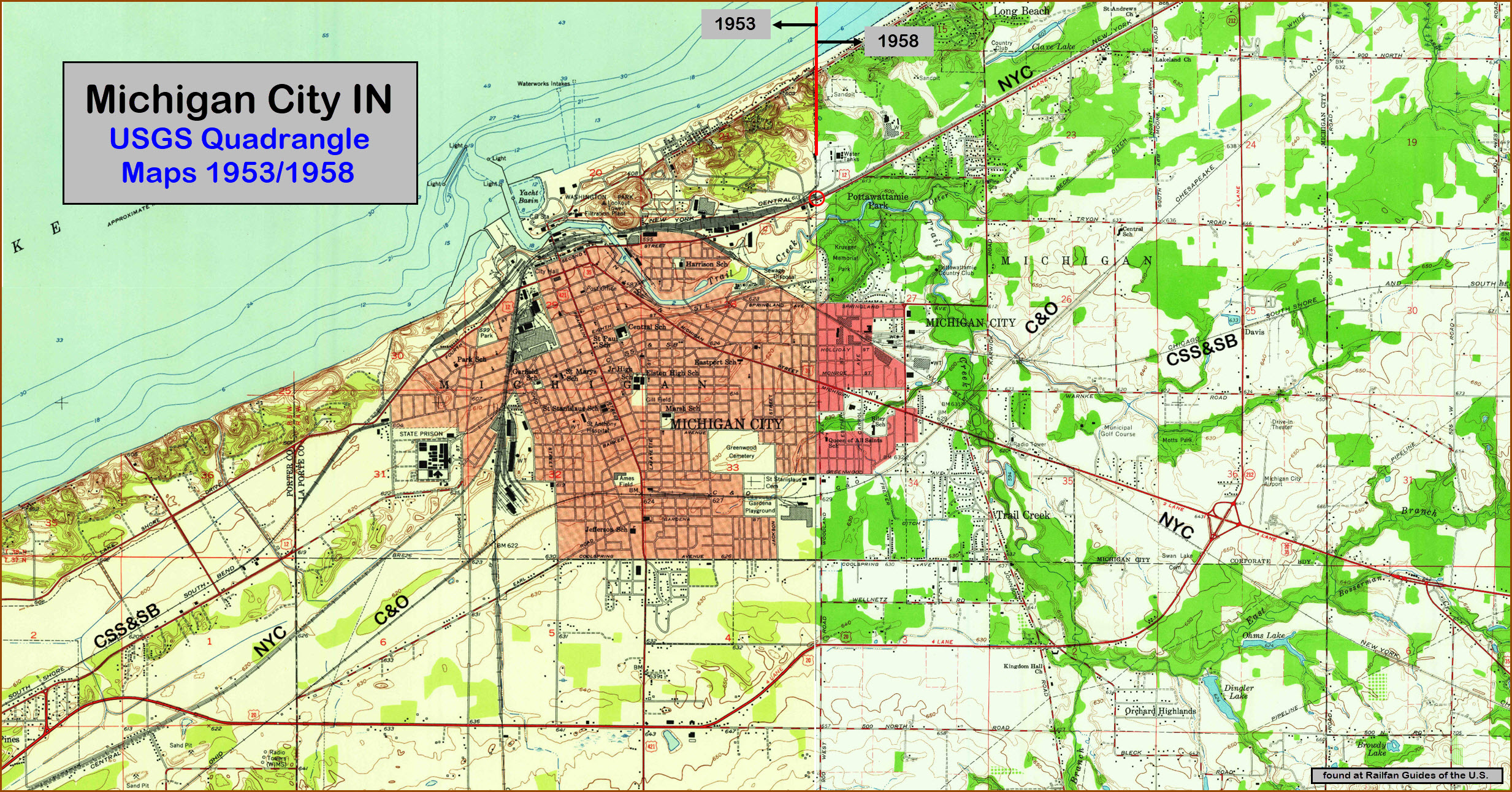
Maps
Sights
Bridges
Signals
Fire & Police
Postcards
Floobydust
USGS Maps
RAILFAN GUIDES HOME
RAILROAD SIGNALS HOME
Location / Name:
Michigan City IN, LaPorte County
What's Here:
1 CSX Grand Rapids Sub-Division (Former NYC and C&O)
2 NS Michigan Sub-Division
3 Amtrak, Wolverine (runs on NS tracks)
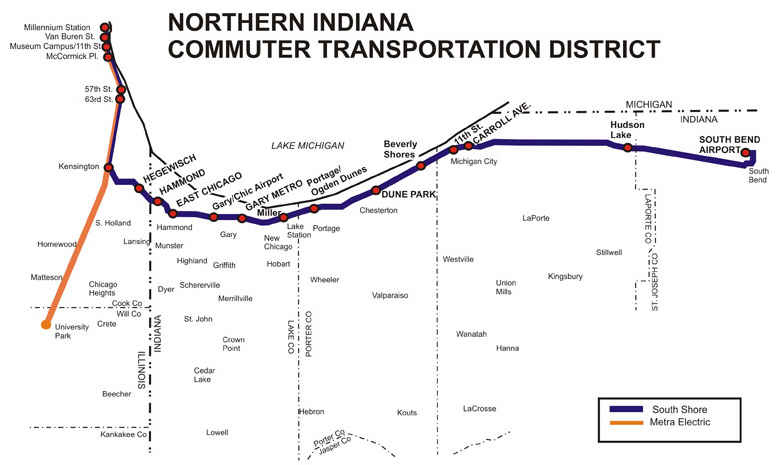
4 NICTD Commuter Line (South Shore)
5 CSX New Buffalo Yard (about 8-1/2mi NE of Michigan City in MI)
6 NIPSCO Michigan City Generating Plant has a couple of locos
Data:
GPS Coordinates: as needed
Phone A/C: 219
ZIP: 46360+
Access by train/transit:
NICTD and Amtrak
Geography:
Flat with small hills
The Scoop:
CSX, NS, Amtrak, the South Shore, and the commuter road: NICTD (Northern Indiana Commuter Transportation District) all have a presence here. In addition, small shops for the later two are located here. The power plant also has a couple of old engines to shove the coal cars around.
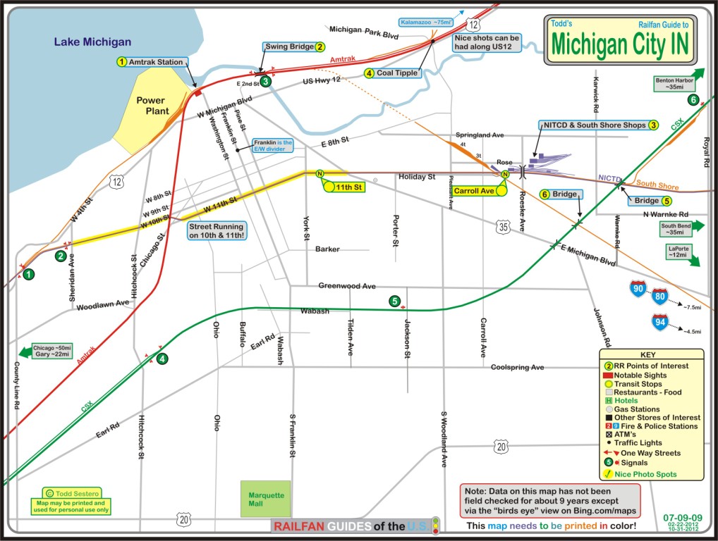
I've always enjoyed visiting Michigan City ever since my best friend John and I stopped here on the way to EMD's 50th anniversary in 1972. Back then, the South Shore's Little Joe's were roaming the streets. Not much has changed in the way of the infrastructure, as simple overhead wire is still in use. The yellow on the map below indicates where the South Shore and commuter trains run through town in the middle of the street. Not too many places like that left. I believe they still run in the street in Erie PA.... there's a town in California where they do (name escapes me ), and Ashland VA doesn't count because it's not in the street, it runs between the two sides of the street, each side being one way (if you know of more, let me know and let's get a list going!).
Correction, since the sale of Conrail to CSX in Erie, the trains no longer run down the street, they now run parallel to the street... Thanks to Jim Mihalek of MN for the tip... He also adds that there is one block of street running in Warsaw IN on the NS Marion Branch, just north of the crossing with the old Pennsy.... Anyways, back to our regularly scheduled programming :-)....
Note: This guide was originally done in 2009, when Bing maps had a really great service called "the birds-eye" view. Well, I don't remember when they did away with the service, but what they have now isn't any better than what Google offers. I guess it cost too much to have small planes fly around with cameras to shoot all of the shots used ..... darn-it.
And speaking of hobbies, check out the following source of model railroad equipment from the South Shore and other northern Indiana railroads:
-- http://carrollaveshops.com/
-- http://www.southshoremodeler.com/..... gone, darn
Acknowledgements:
Jim Mihalek
Denver Todd
Google Maps
Bing Maps
Open Railway Map
Wikipedia
Websites and other additional information sources of interest for the area:
https://www.norfolksouthern.com/en/ship-by-rail/our-rail-network HUGE PDF!!!
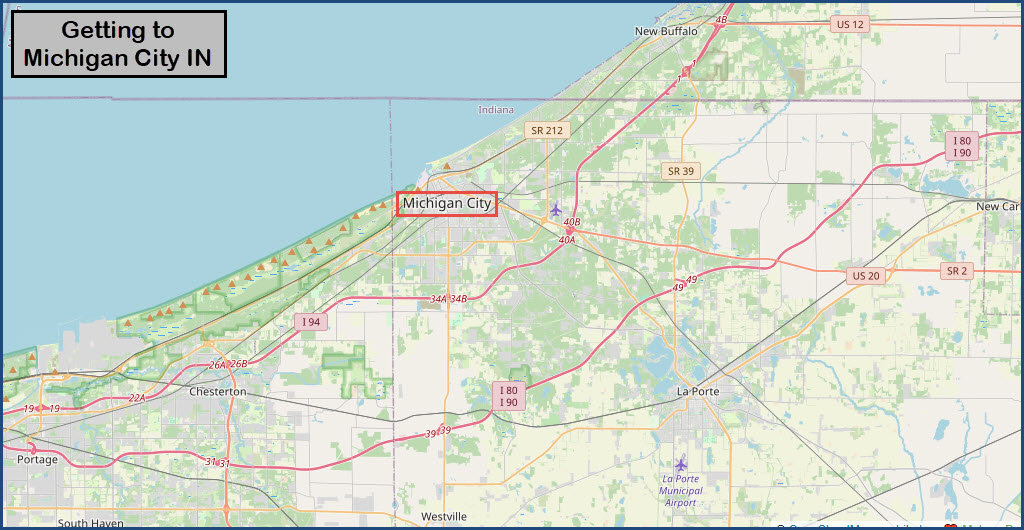
Michigan city is convenient to two interstates and US12, which runs pretty much along the coast line of Lake Michigan.
Chicago's downtown is about 45 miles away, Gary IN is about 15 miles to the west, and Benton Harbor MI is about 35 miles up the coast.
I-94 is the closest interstate and runs from Chicago to Kalamazoo, with I-196 splitting off at Benton Harbor to head up to Grand Rapids.
For going east and west, exit 49 off I-80/I-90, the Indiana Tollway, is the most convenient exit.
The closest north-south interstate is I-65 over in Gary.
The above map in PDF format

Sights
the Amtrak Station
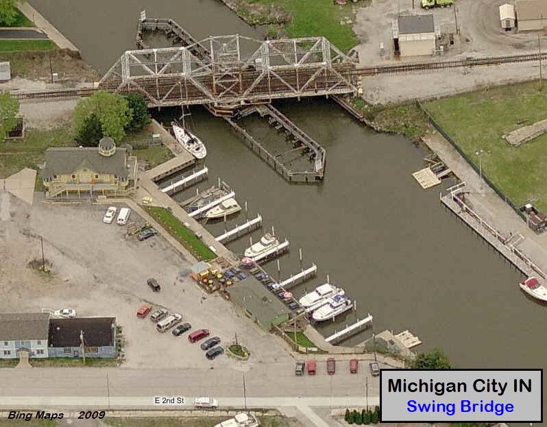
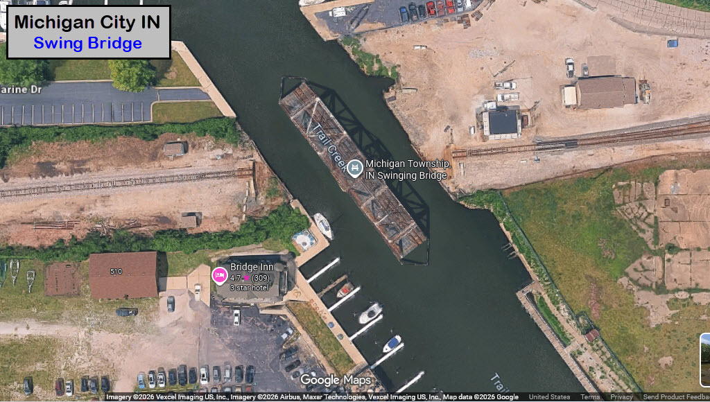
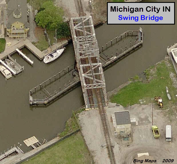
Swing Bridge
South Shore Shops
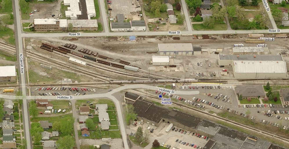
Carroll Ave NICTD Station
South Shore / Amtrak Crossing
11th St NICTD Station
The East End of street running
The West End of street running
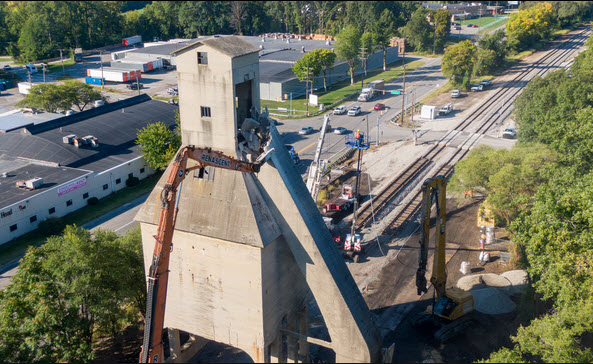
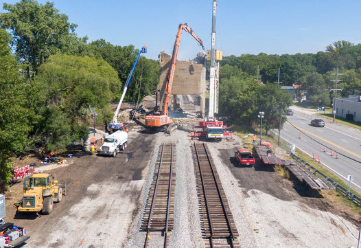
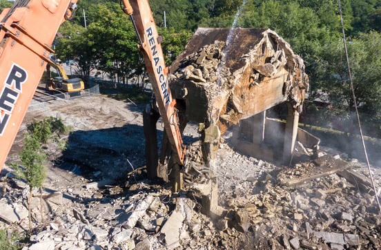
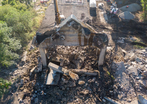
Coal Tipple
CSX Crossings
At the Power Plant
Diamond 1
Diamond 2
Where Amtrak and the South Shore meet up
Harbor County Museum of History + Rail
GPS Coordinates: 41.72081, -86.90572
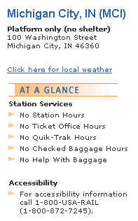
Station code: MCI
https://en.wikipedia.org/wiki/Michigan_City_station
The depot building used to be the Arcadia Cafe and Bar, but it looks like it's been a while since it was.....
From Wikipedia: Michigan City station was a train station in Michigan City, Indiana served by Amtrak, the national railroad passenger system. It was served by two eastbound and one westbound Wolverine train at the time of closure; other Wolverine and Blue Water trains did not stop. The station had a platform shelter near the former prairie-style Michigan Central RR depot dating from 1915, which was converted into a local restaurant. The restaurant closed not long after the station closed.[4] That earlier station served Michigan Central Railroad, and later, New York Central passenger trains. Major NYC named trains passing through the station included the Canadian (east to Detroit and Toronto), the Chicago Mercury (east to Detroit) and the Wolverine (east to New York via Detroit and southwestern Canada, in contrast to the modern train).
Service began at the new Amtrak station on April 26, 1981. The station closed effective April 4, 2022. No official reason was given for the closure, and passengers were advised to instead use the New Buffalo station 10 miles (16 km) east. end Wiki
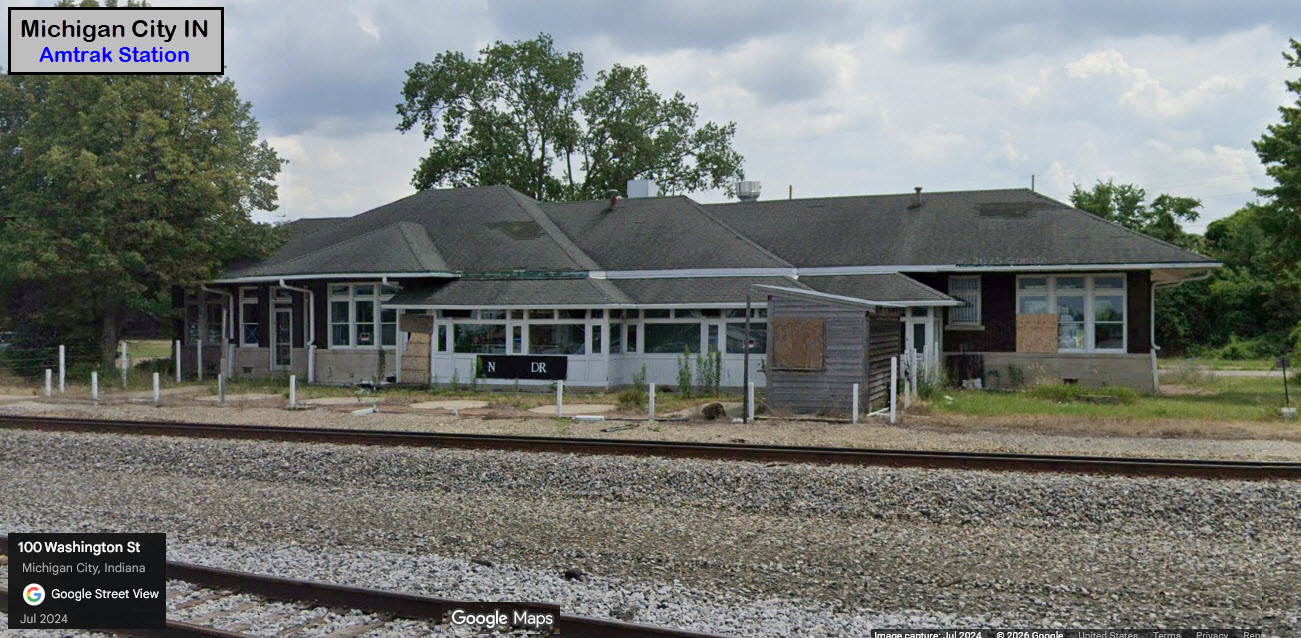
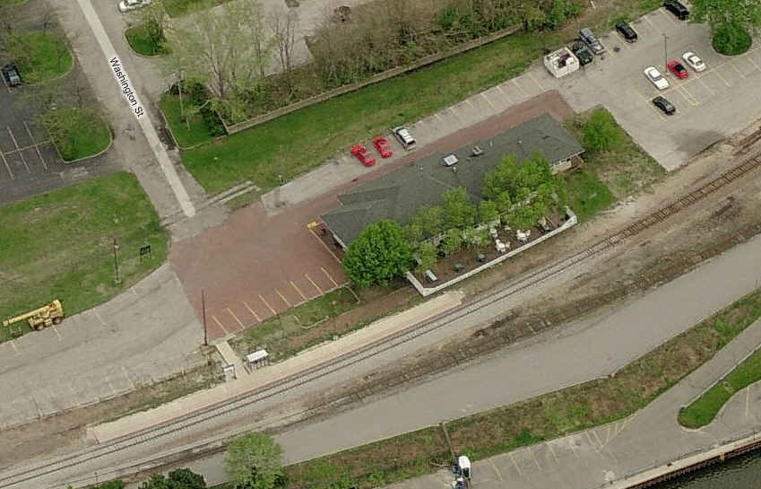
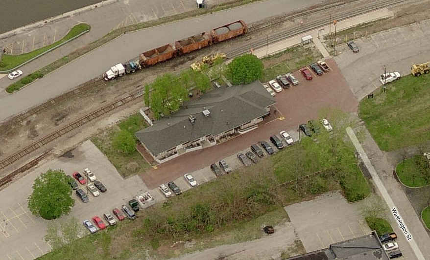
Two views of the Amtrak Station, and info from their website.
Moved to the Bridges and Tunnels section
GPS Coordinates: 41.71327, -86.86950 (at the Carroll Ave grade crossing)
These aerial shots show you the South Shore and NICTD shops on the east side of town.
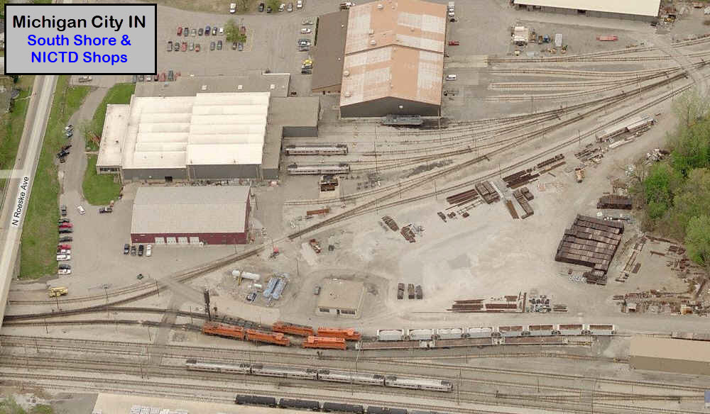
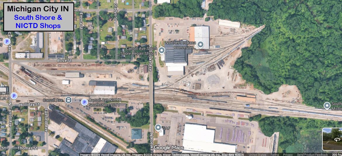
The Carroll Avenue NICTD station, along with a diamond and additional shops.
This where the South Shore crosses over from 10th to 11th St.... Also, the South Shore line crosses Amtrak here.
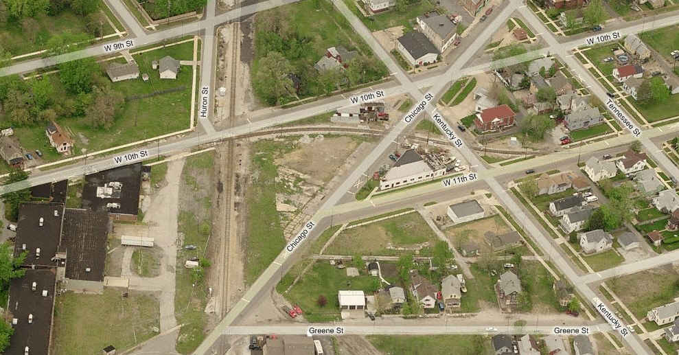
NICTD's 11th St station is this "invisible" stop in the middle of the street, with the parking lot on the north side. The info for this stop tells you to get here early, as the 37 spots fill up quick.
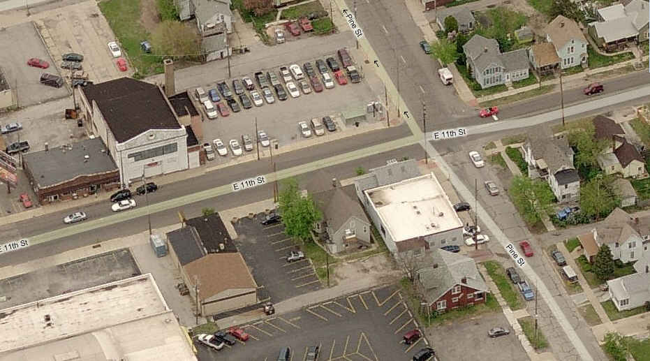
The entrance/exit on the east end of 11th Street.
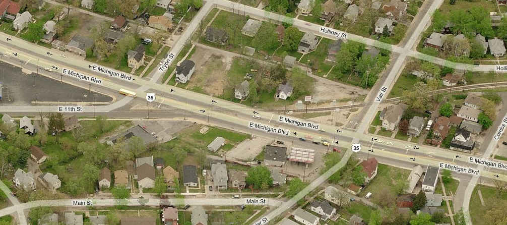
This is the western end of the street running. It looks like a visiting UP and SP pair of Dash-9's in the small yard above.
Close-up of the interlocking signals just off the end of 10th St.
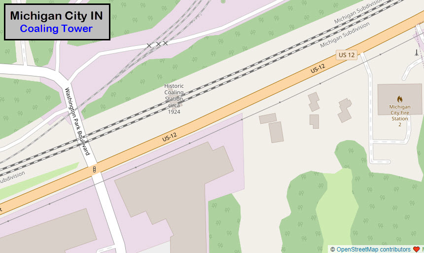
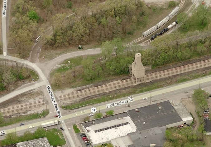
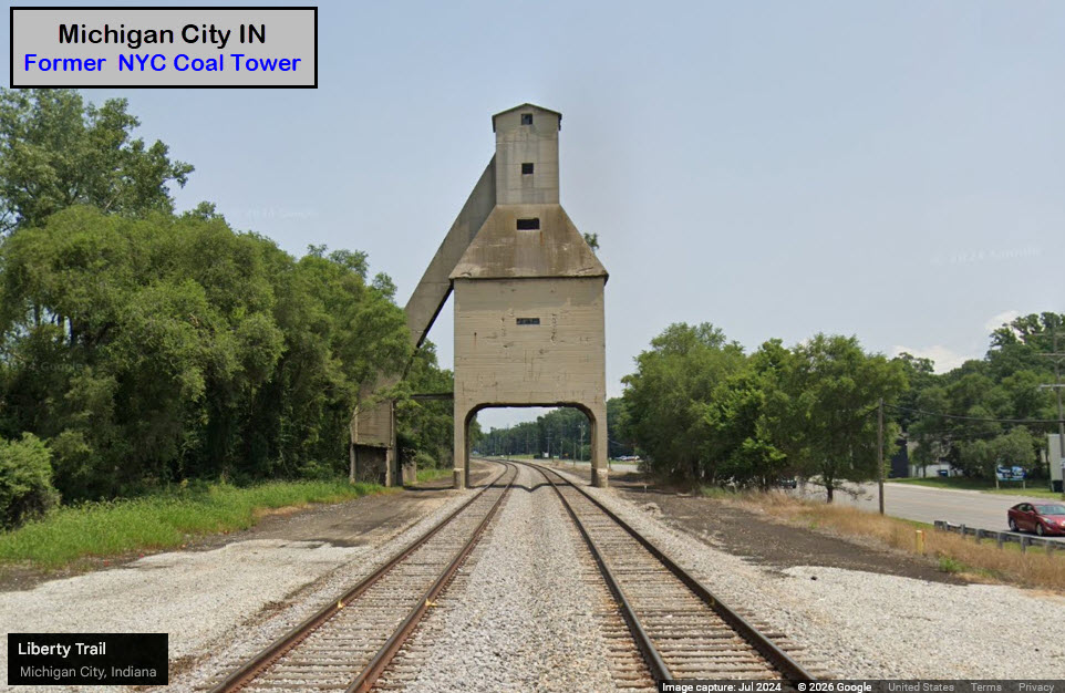
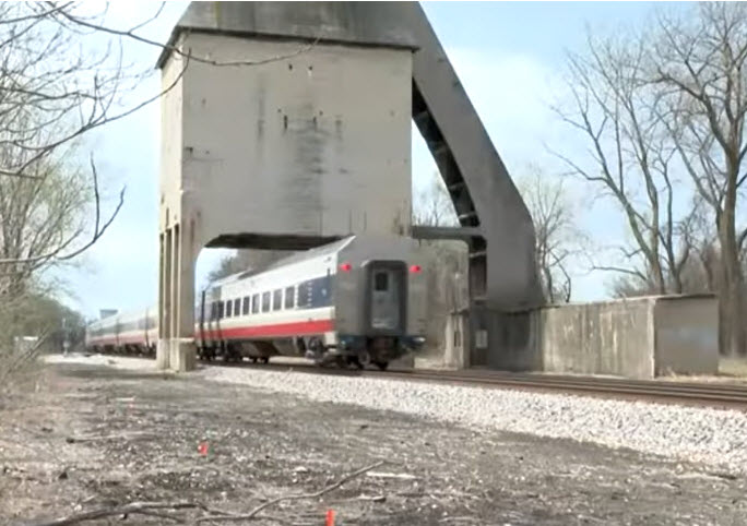
GPS Coordinates: 41.72588, -86.87537
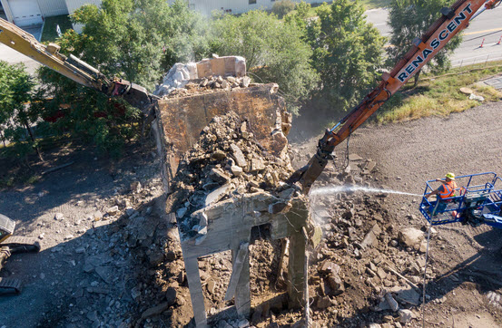
From days gone by - a coaling tower built in 1923 (according to the channel 22 WSBP video interview) by the New York Central. It was 1.2mi (1.9km) east of the swing bridge. Some references have 1924 as the build date.
Note: This structure was finally "torn down" in the fall of 2025. :-(
A few pix from the two links, check the second one for 30 pix. You'll notice that they took out two sections of track in advance of bringing the tower down.
WSBT Video
WSBT Pictures
Moved to the Bridges and Tunnels section
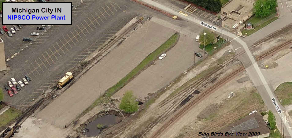
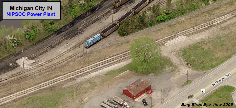
GPS Coordinates, north end of yard: 41.72048, -86.90685
GPS Coordinates, south end of yard: 41.70648, -86.92473
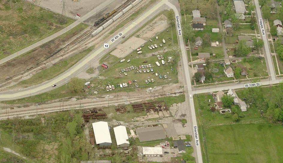
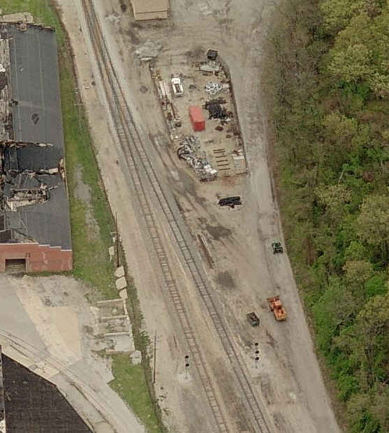
The power plant is powered by coal, and it looks like they have an older SW and GP unit to shove cars around - at least back in 2009 when I originally did this guide.
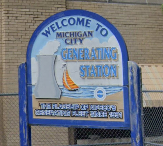 Sign off of Water Street, a few hundred feet from the ex Amtrak Station.
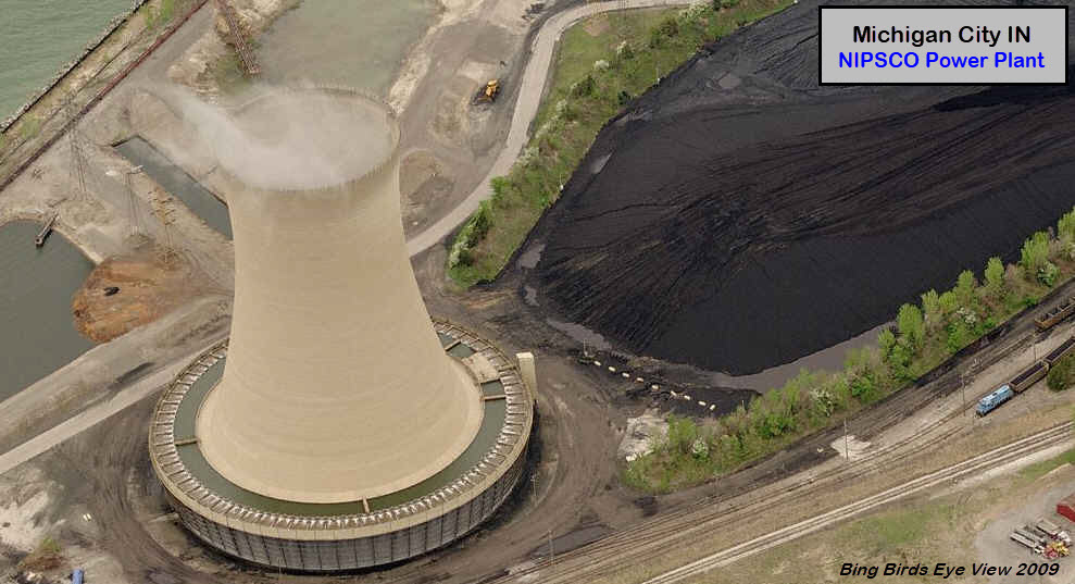
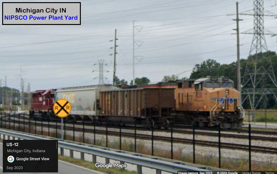
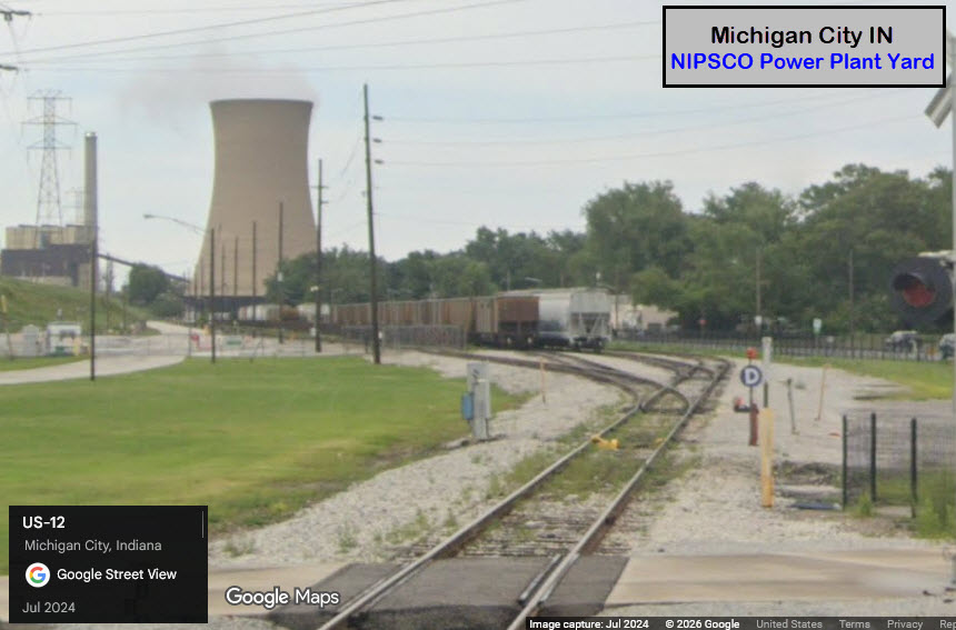
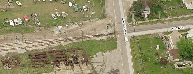
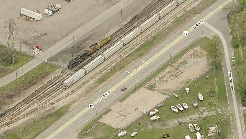
At the south end of the power plant yard where US12 crosses the tracks.
GPS Coordinates: 41.69895, -86.93254
About 2 miles south of the swing bridge, US 12 crosses the South Shore tracks again, and from here, you can see where the NS and South Shore come together.
At the interlocking, there is a single signal for EB traffic on the left side of the tracks, and for WB traffic, there is a cantilever post for two signals.
There is also the Calumet Trail (with parking) where you can walk up to the interlocking for pictures with the signals in the shots.
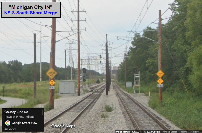
GPS Coordinates: 41.69895, -86.93254
530 S Whittaker St, New Buffalo, MI 49117
https://harborcountrymuseum.org/
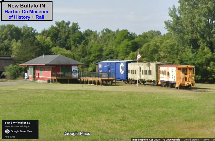
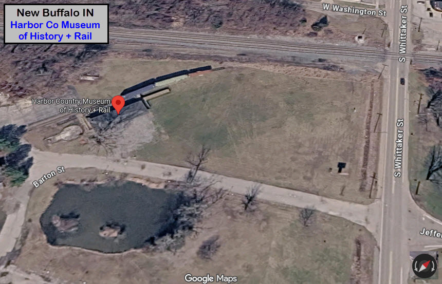
GPS Coordinates: 41.72263, -86.89812
Two views of the swing bridge just east of the Amtrak Station.
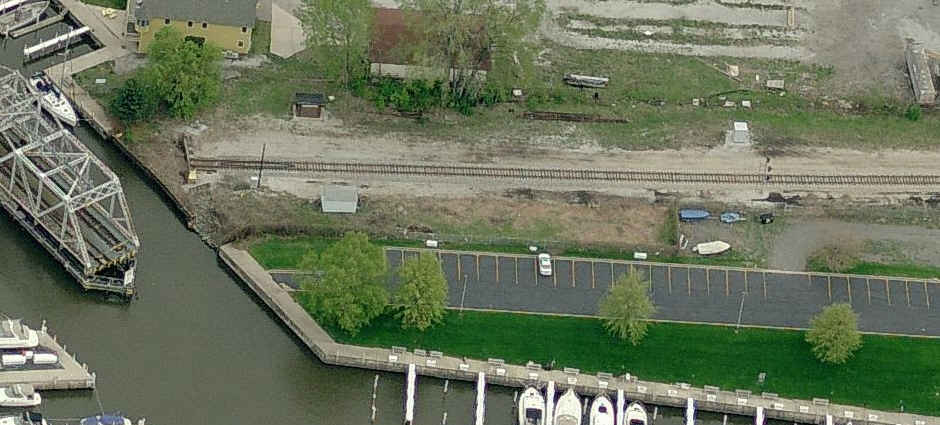
WB Amtrak signals guarding the swing bridge.
And a little further east of the swing bridge signals are the interlocking signals where the Amtrak line goes down to a single track.
GPS Coordinates: 41.70826, -86.85785
CSX crosses other lines in two places, neither are easily accessible without a little walking.
The bridge in the first picture is only about 800ft from either Michigan Blvd or Warnke Road.
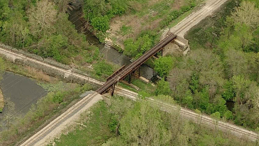 crossing 1 on the map
GPS Coordinates:
CSX crosses other lines in two places, neither are easily accessible without a little walking.
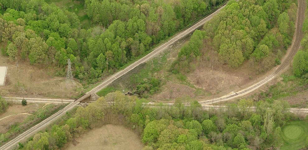 crossing 2 on the map
GPS Coordinates:
The
GPS Coordinates:
The
Got nuttin for now.... How about YOU???
Got anything to add or contribute? Shoot me an email :-)
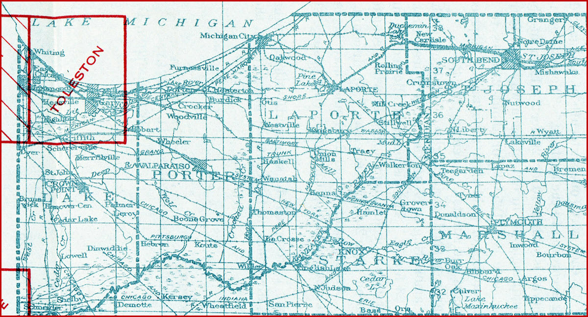
1st map - courtesy of the University of Texas Library, click here for their index page. The map is part of the index map for Indiana circa 1925. Not much of Indiana had been mapped by the USGS in the early 1900's.
The 2nd map comes from the USGS topo service, found here
Disclaimers:
New format 10/26/23: Please check out my disclaimer page for my standard dribble and contact info here
RAILFAN GUIDES HOME
RAILROAD SIGNALS HOME
Last Modified 26-Mar-2026