
In General
Getting Here
Map
Station by Station
Pictures
Signals
Floobydust
RAILROAD SIGNALS HOME
Location / Name:
Atlanta GA, xxx County
What's Here:
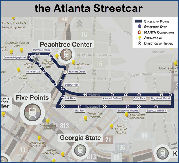
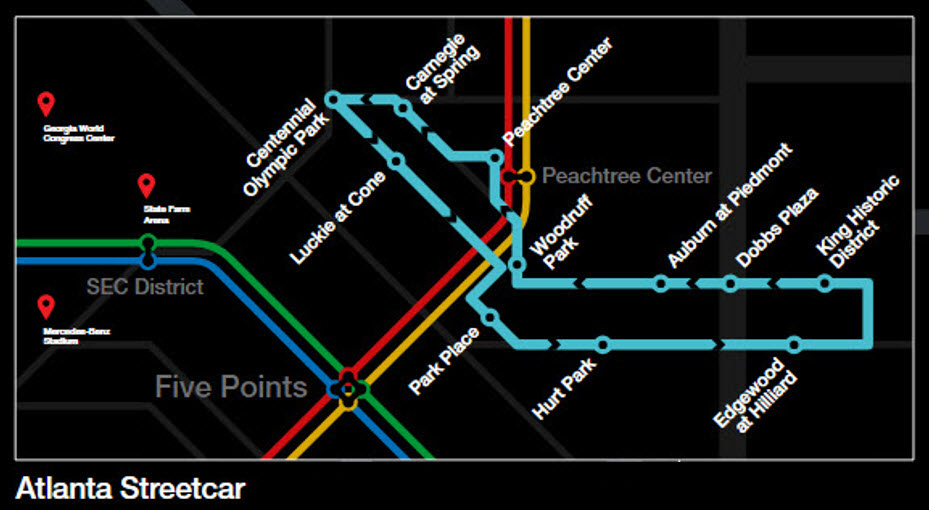
the Atlanta Streetcar
Data:
GPS Coordinates: as needed
Phone A/C:
ZIP:
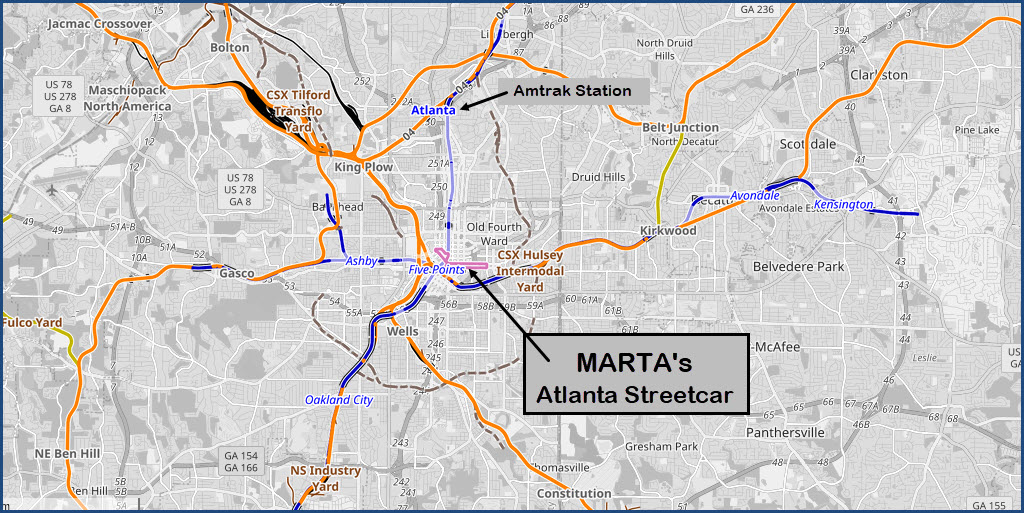
Access by train/transit:
the Streetcar System itself
Atlanta MARTA Metro system - Transfer to streetcar system at Peachtree Center.
Amtrak
Geography:
Flat-ish
The Scoop:
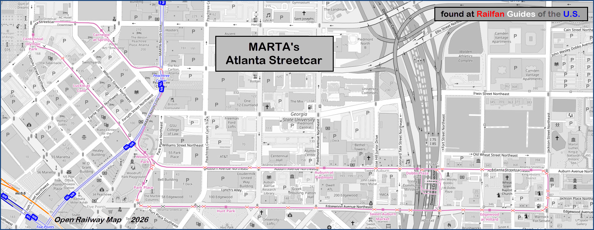
The Atlanta Streetcar system runs a small fleet of Light Rail Vehicles (LRV's). They operate two at a time running about 10-15 minutes apart on a 2.7 mile (4.3 km) one-way route.
Revenue passenger service began on December 30, 2014.
Streetcars run approximately every 10 to 15 minutes, depending on ridership demand and traffic conditions. Start times may vary. (from the MARTA website)
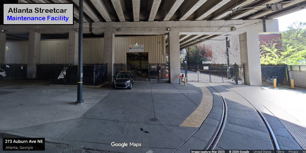
The vehicle maintenance facility is located under the I-75/I-85 overpass on Edgewood Avenue
Acknowledgements:
Google Maps
Open Railway Map
Wikipedia
Websites and other additional information sources of interest for the area:
https://itsmarta.com/streetcar.aspx
https://en.wikipedia.org/wiki/Atlanta_Streetcar
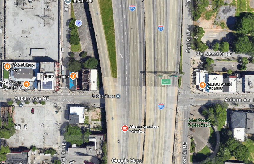
The streetcar system is in the middle of "highway hell".
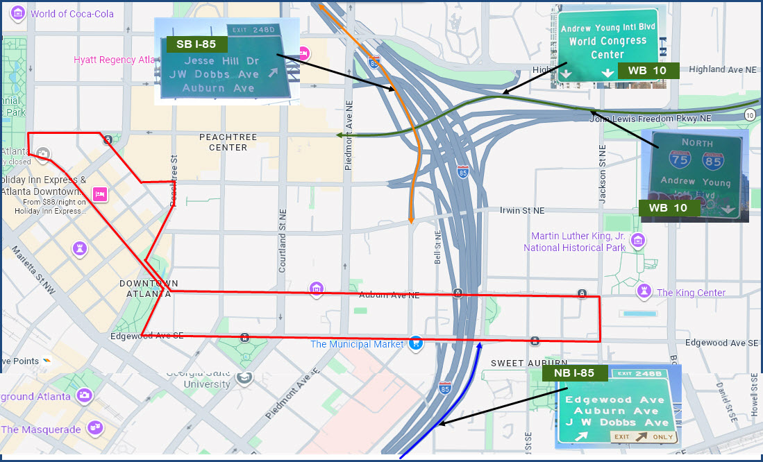
From NB I-85, use exit 248B, this will dump you out on Edgewood Ave, where the EB streetcar line runs.
From SB I-85, use exit 248D, this will dump you out on Irwin St NE, one block from the streetcar system.
From WB 10, the John Lewis Freedom Pkwy, follow the signs for Andrew Young Intl Blvd.
Go thru Piedmont Ave NE (1-way, the wrong way) to Courtland St NE and take a left - you're three blocks from the WB streetcar line on Auburn Ave NE.
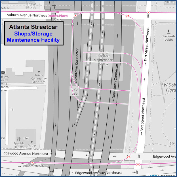
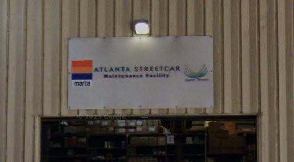
The Shops/Maintenance Facility
GPS Coordinates: 33.75557, -84.37888 (north side of shops at Dobbs Plaza station)
The four Siemens LRV's are stored and maintained here.
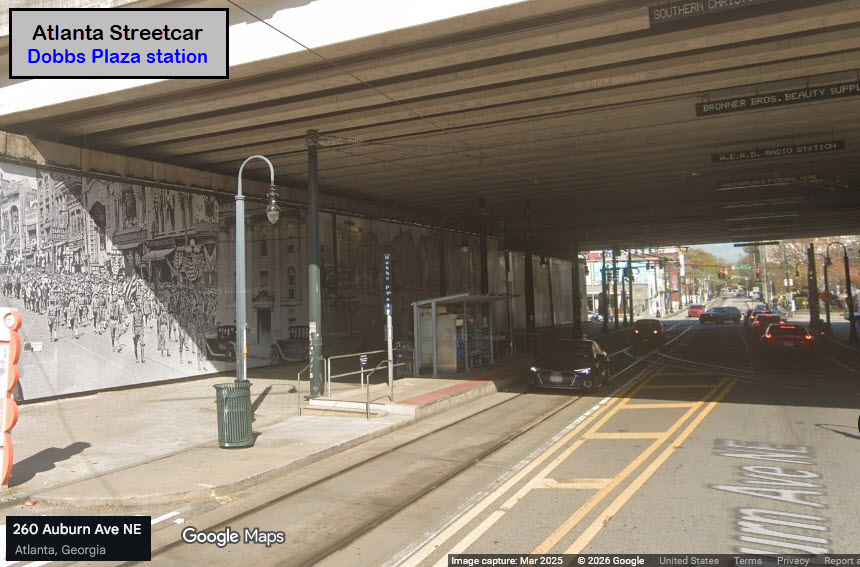
Dobbs Plaza
GPS Coordinates: 33.75557, -84.37888
Right out in front of the northside of the shops on the WB track.
The
GPS Coordinates:
The
GPS Coordinates:
The
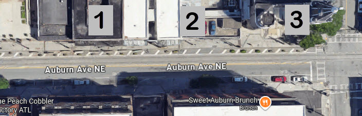
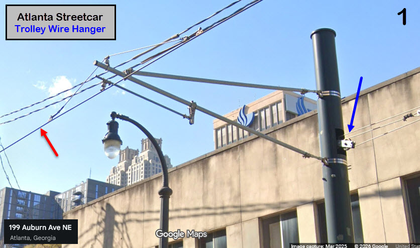
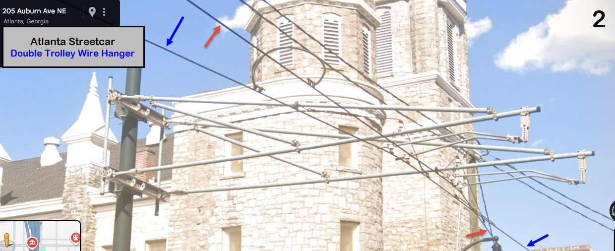
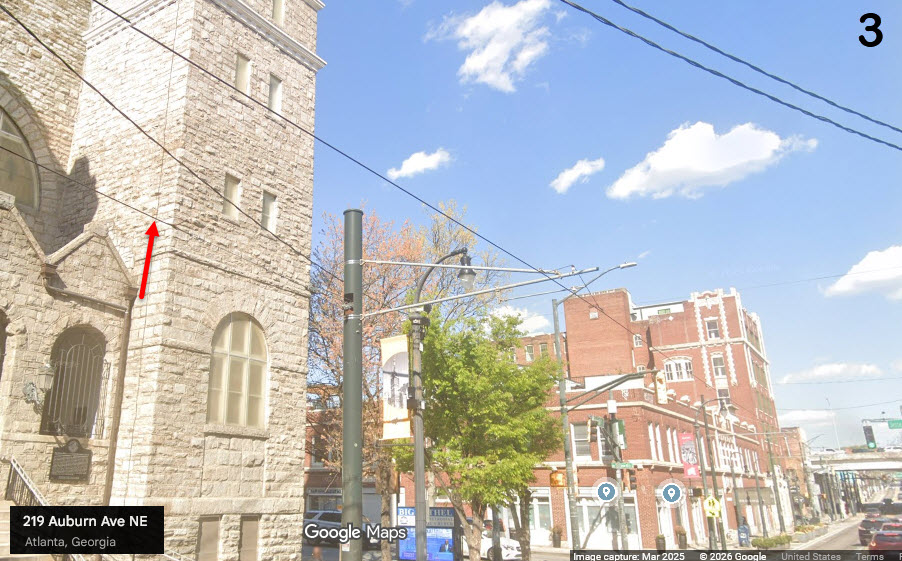
the Trolley Wire / Catenary
Simple stuff, just a single wire, non-tensioned - the ends of each section tied off to the next pole.
For this illustration, the blue wire comes WB from the right, and terminates on pole #1.
Mixing of the two wires happens on the double hanger on pole #2.
The red wire, starts at pole #3, and continues on west.
Disclaimers:
New format 10/26/23: Please check out my disclaimer page for my standard dribble and contact info here
RAILFAN GUIDES HOME
RAILROAD SIGNALS HOME
NEW 01/30/2026
Last Modified 30-Jan-2026