In General
Getting Here
Map
Station by Station
Sights
Pictures
Bridges
Signals
Floobydust
USGS Maps
RAILROAD SIGNALS HOME
Location / Name:
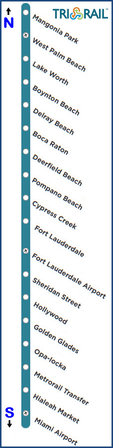
Miami / South Florida area: Miami north to Mangonia Park
Palm Beach, Broward, and Miami-Dade counties
What's Here:
Tri-Rail Regional Commuter Rail
Data:
GPS Coordinates: as needed
Phone A/C: 305, 786
ZIP: Too many to list
Access by train/transit:
Miami Metrorail at:
The Miami Airport
MIA Mover at:
The Miami Airport
The Scoop:
Tri-Rail is a 71 mile long commuter rail operation operating out of the Miami area, and opened on
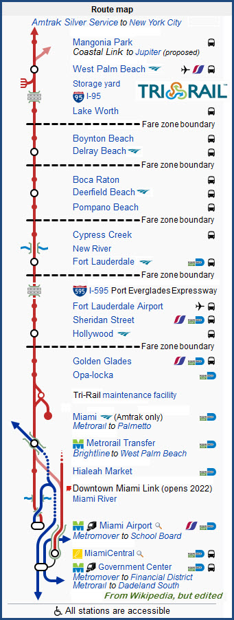
From Wikipedia: Tri-Rail (reporting mark TRCX) is a commuter rail line linking Miami, Fort Lauderdale and West Palm Beach in Florida. The Tri prefix in the name refers to the three counties served by the railroad: Palm Beach, Broward, and Miami-Dade. Tri-Rail is managed by the South Florida Regional Transportation Authority (SFRTA) along CSX Transportation's former Miami Subdivision, the line now wholly owned by the Florida DOT. The 70.9-mile-long (114.1 km) system has 18 stations along the Southeast Florida coast, and connects directly to Amtrak at numerous stations, and to Metrorail at the Tri-Rail and Metrorail Transfer station and at Miami Intermodal Center.
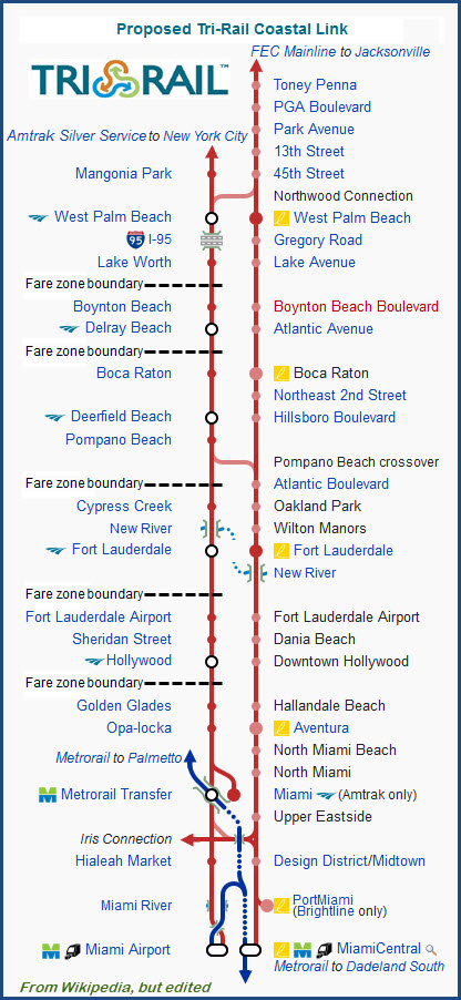
A second Tri-Rail line on the Florida East Coast Railway corridor, dubbed the "Coastal Link", has been proposed. The line would operate between Toney Penna station in Jupiter and Miami Central in Downtown Miami, and add commuter rail service between the downtown areas of cities between West Palm Beach and Miami. Combined with the existing Tri-Rail line, the Tri-Rail system would have a daily passenger ridership of almost 30,000; or approximately 9 million passengers per annum, doubling Tri-Rail's current ridership.
The line on which Tri-Rail operates was built by the Seaboard-All Florida Railway (a subsidiary of the Seaboard Air Line Railroad) for intercity passenger rail service in the early 1920s. Today, the original 1920s Seaboard stations are used by Tri-Rail for service at West Palm Beach, Deerfield Beach, Fort Lauderdale, Hollywood. Though no longer in use, the Seaboard stations at Delray Beach, Opa-locka and Hialeah are still standing.
The line has no turn around for the locomotives, so all trains face the same direction at all times - they always face south. For this reason, Dual Operation Passenger Cabs are located on the north end of the train. So trains travel north in "reverse" and "forward" heading south.(end Wiki)
From the Tri-Rail website: The South Florida Regional Transportation Authority: With the creation of the SFRTA on July 1, 2003, South Florida’s three counties began efforts to work together to ensure a viable regional transportation system. The SFRTA, with cooperation from our transportation partners, works diligently to plan, develop, fund and operate a seamless, safe and efficient regional transportation system. A regional transportation system in South Florida will ensure mobility, advance sustainable growth and improve the quality of life for our current and future residents.
To meet public demand, the SFRTA is strategically planning for several needed transit projects to provide for the future regional mobility needs of South Florida’s resident and visitors. These projects will allow people to rely on transit and enjoy the benefits of avoiding our increasingly congested highways, while saving money on gas, as well as on auto insurance and maintenance. These projects complement existing and planned transit service by transportation partners, and will provide the backbone of an expanded regional transportation system that may include light rail, busways, streetcars and rapid bus transit, as well as others. The current projects include: encouraging, Regional Transit Oriented Development, Tri-Rail Coastal Link and Tri-Rail Station Improvements. (end Tri-Rail)
Acknowledgements:
Denver Todd
Wikipedia
Tri-Rail's Website
Google and Google Maps
Bing Maps
Websites and other additional information sources of interest for the area:
https://www.tri-rail.com/
https://en.wikipedia.org/wiki/Tri-Rail
Too many locations to list individually, please use your GPS..... :-)
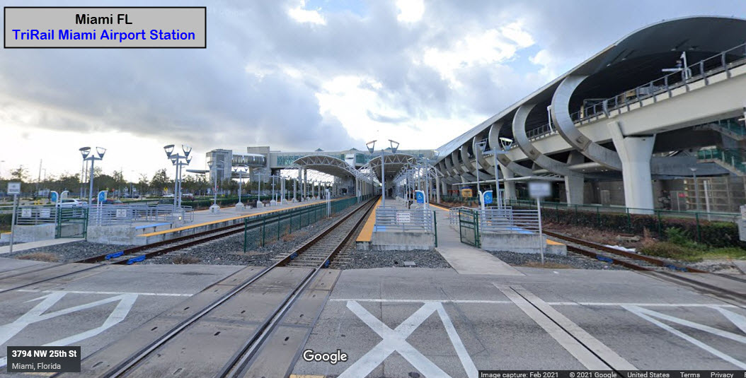
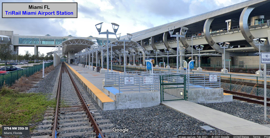
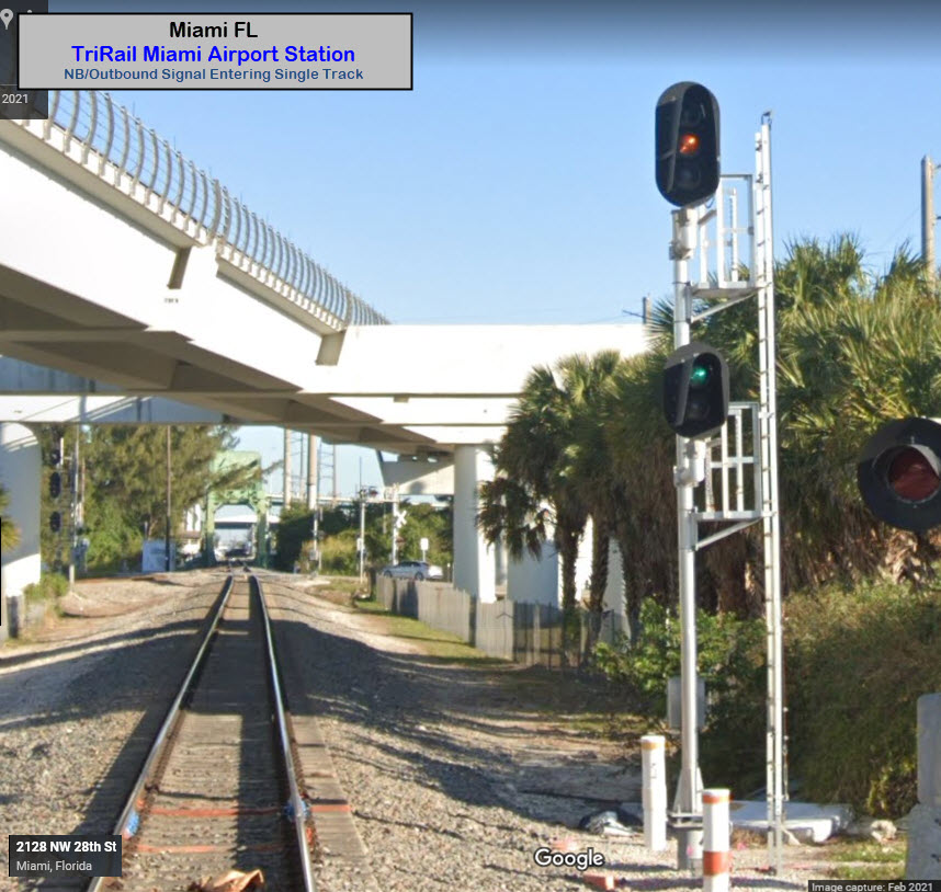
Miami Airport Station
GPS Coordinates: 25.79713, -80.25824
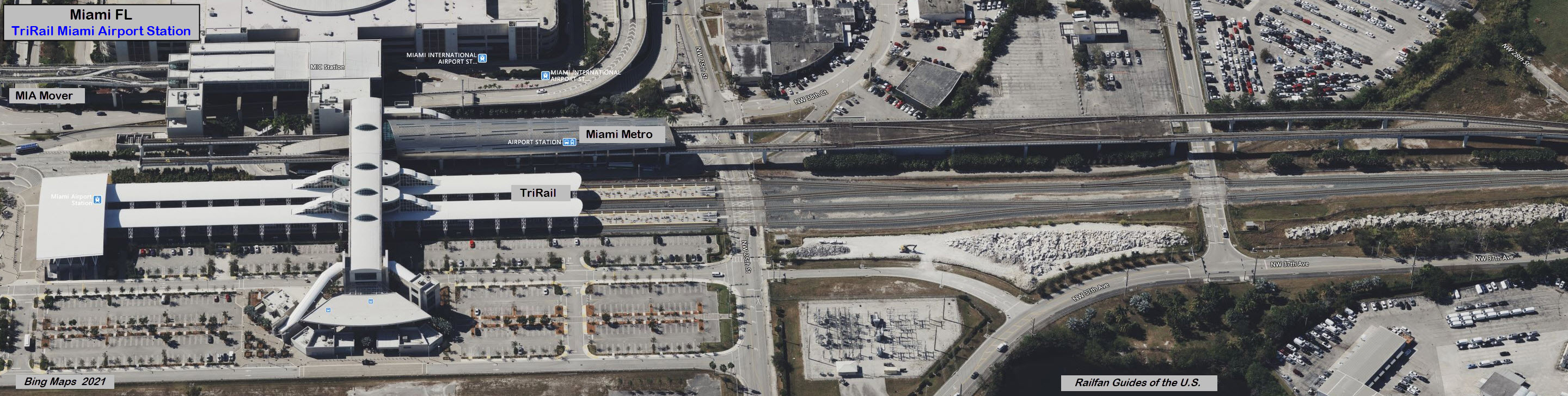
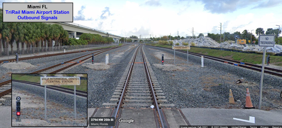
Once we get down to a single track leaving the station, we have the first full size signal.
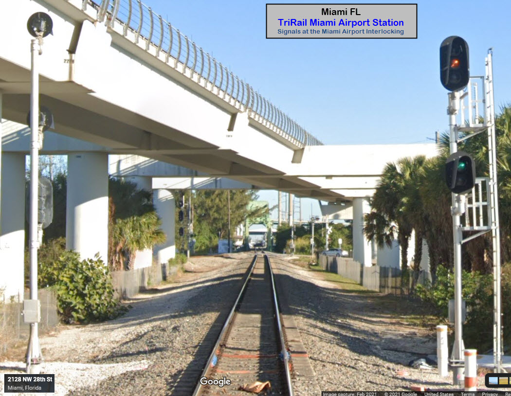
After crossing the canal coming into the station, we have an industrial line taking off to the right, and the Miami Metro going over the TriRail line.
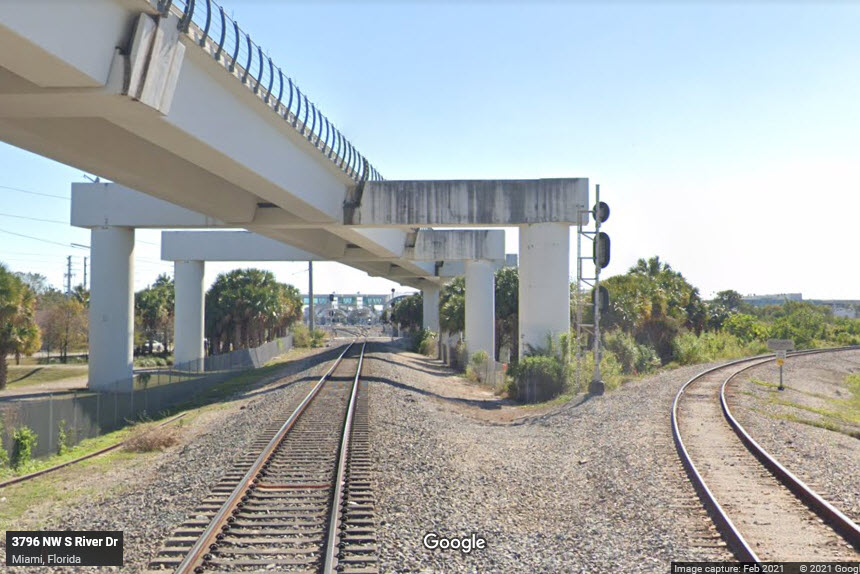
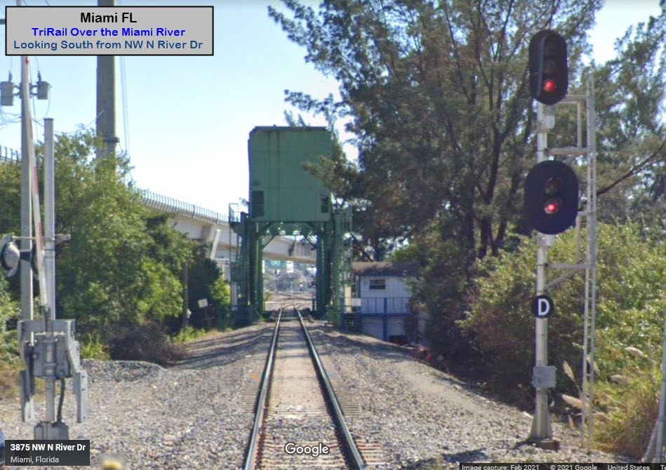
GPS Coordinates: 25.80514, -80.25856, from NW S River Dr.
The grade crossings at NW 28th St and NW S River Dr both look like good photo spots.
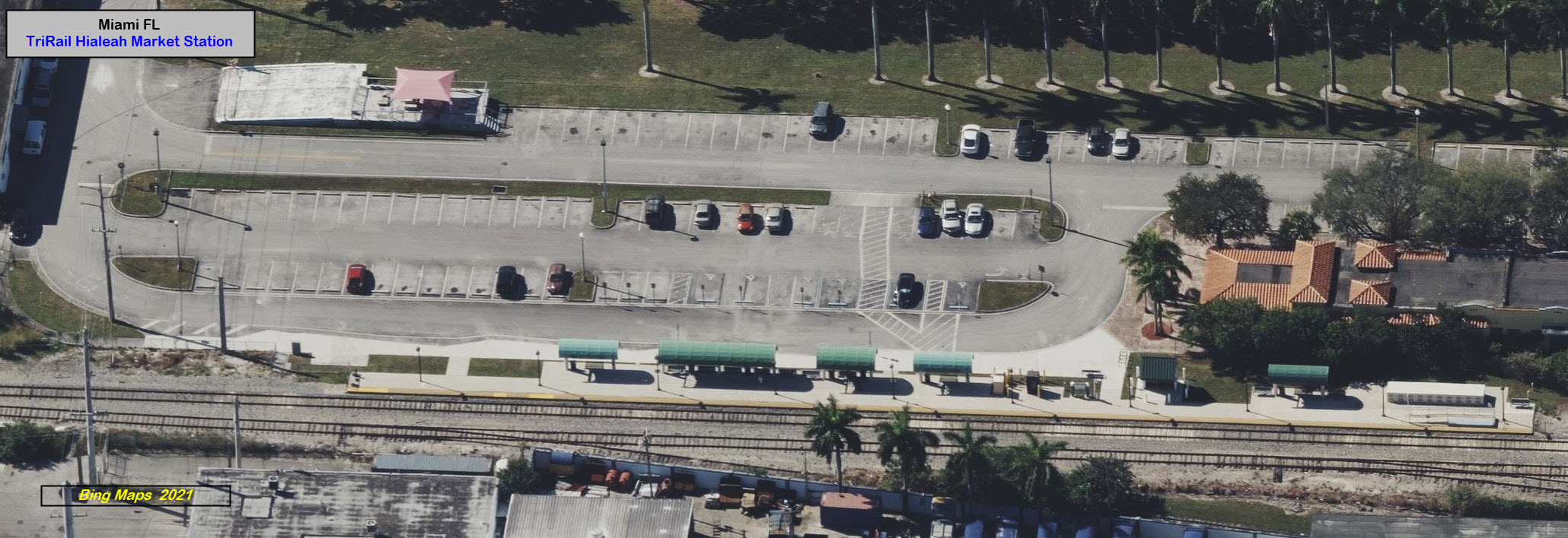
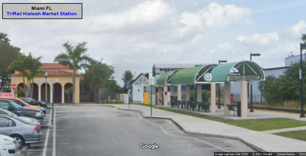
Hialeah Market Station
GPS Coordinates: 25.81107, -80.25876
Access is off of S Le Jeune Rd, and SE 12th St.
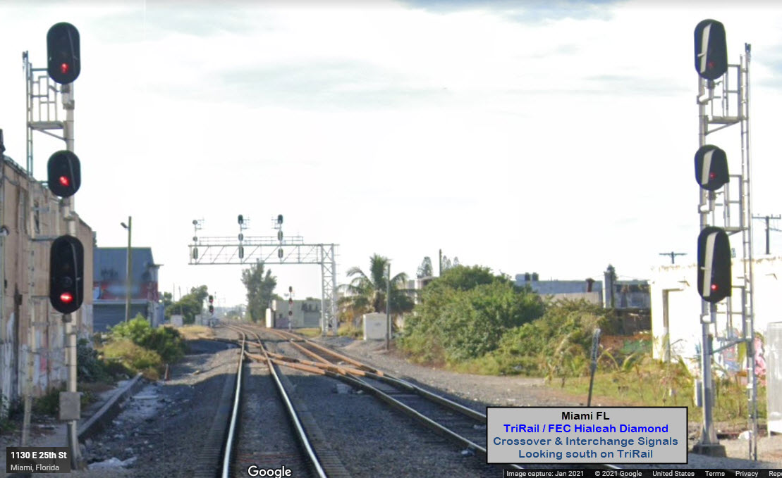
Hialeah Diamond
GPS Coordinates: 25.84216, -80.25954
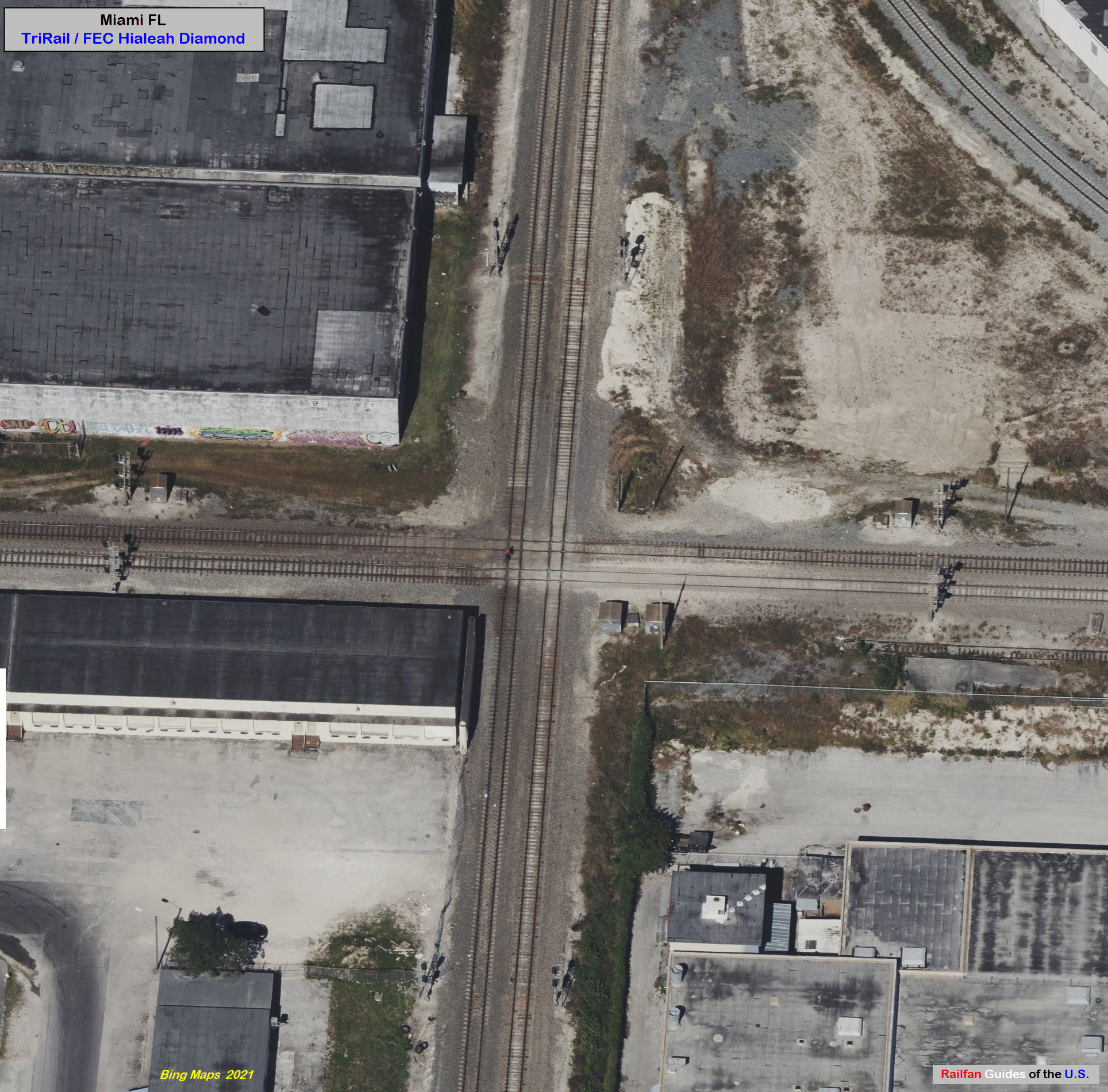
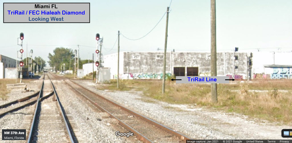
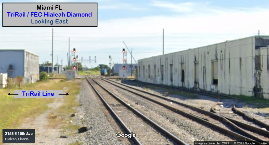
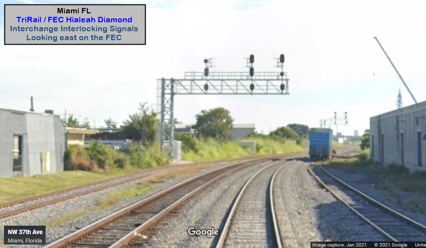
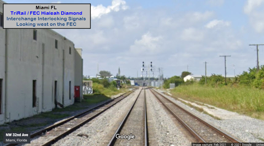
Next, from East 25th St, we can see the SB signals for the crossover, then the NB interlocking/crossover signals for the mainline and the interchange track, and finally, the distant signals are for SB TriRail trains and the diamond. The Miami Metro is overhead, and the TriRail / Metrorail Transfer station is behind us.
MetroRail Transfer Station
GPS Coordinates: 25.84628, -80.25964
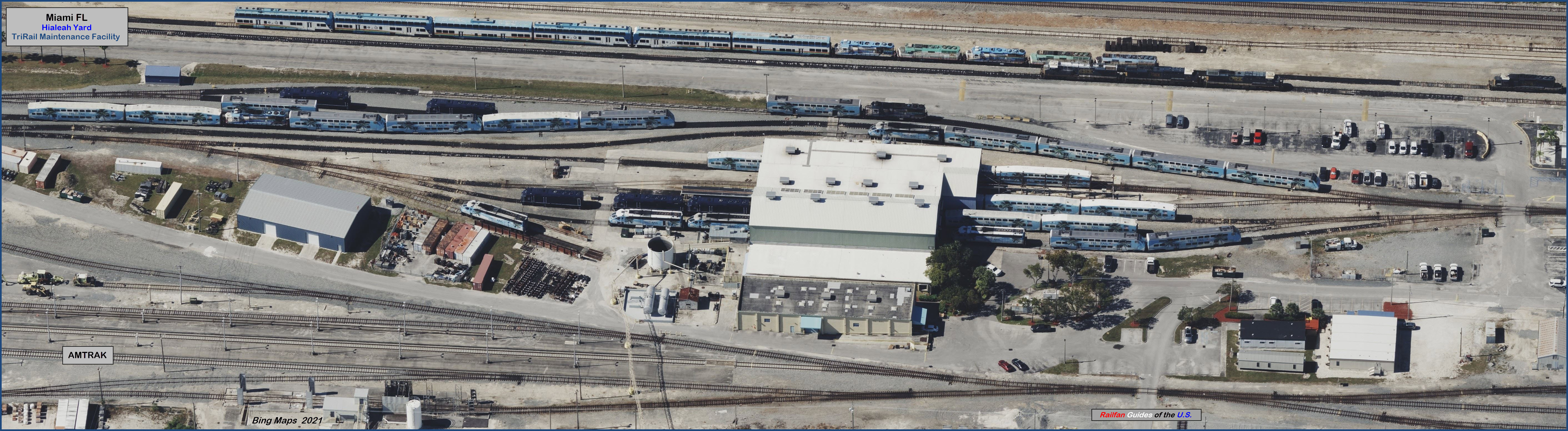
TriRail Maintenance Facility
GPS Coordinates: 25.85450, -80.25877
Click on the picture below for the full size 2meg JPEG.... about 30 screen shots went into making the picture.
Opa locka Station
GPS Coordinates: 25.89988, -80.25305
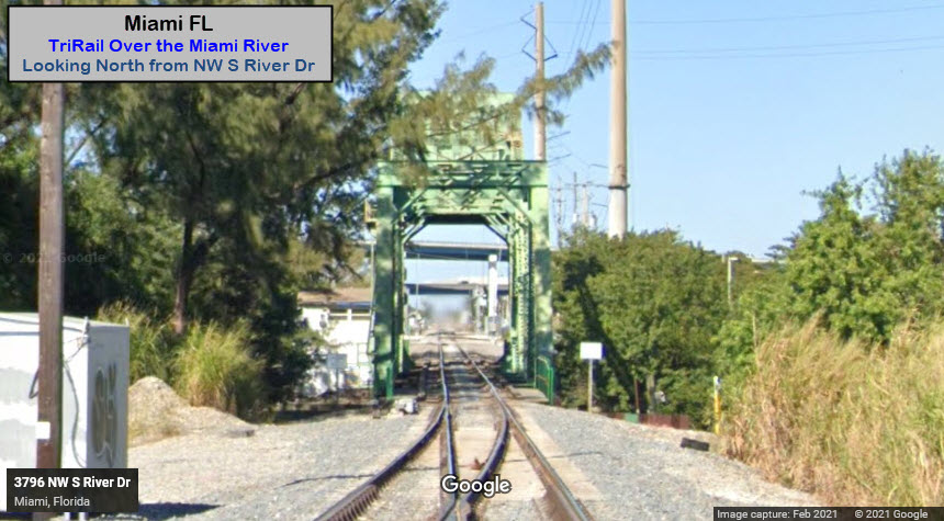
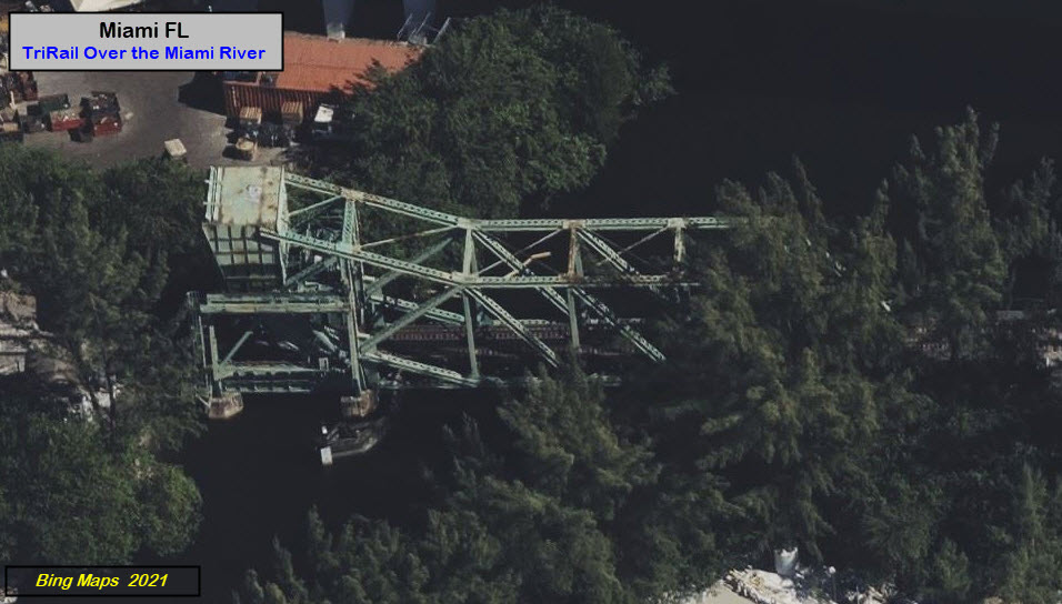
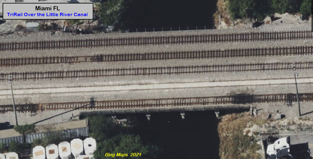
The first bridge trains come to after leaving the Miami Airport is just north of the station, situated between NW N River Drive and NW S River Drive crossing the Miami River. On the north side of the river, we have an interlocking signal for SB trains coming into the station.
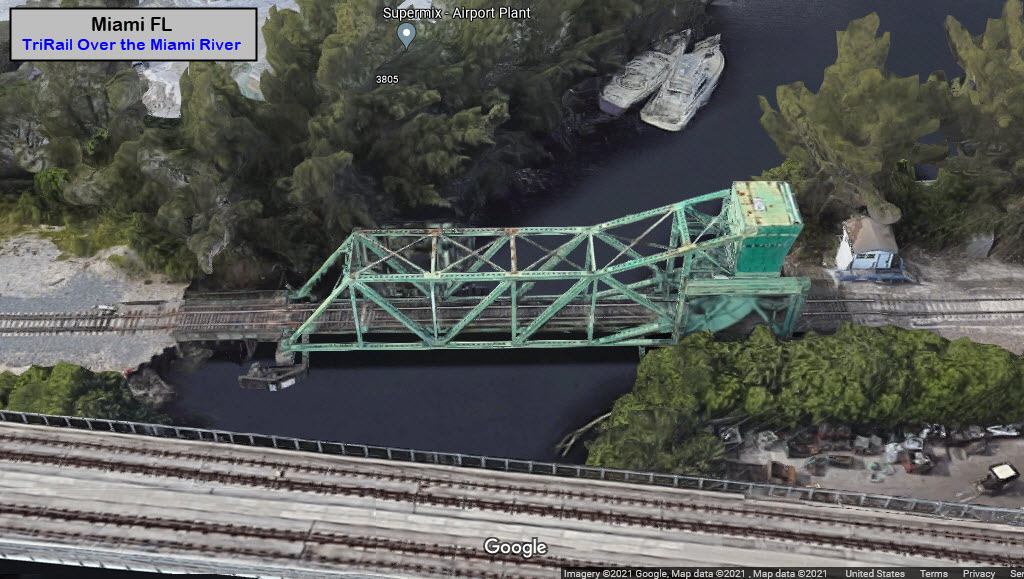
GPS Coordinates: 25.87063, -80.26015
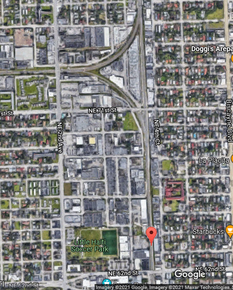
GPS Coordinates: 25.81059, -80.19107
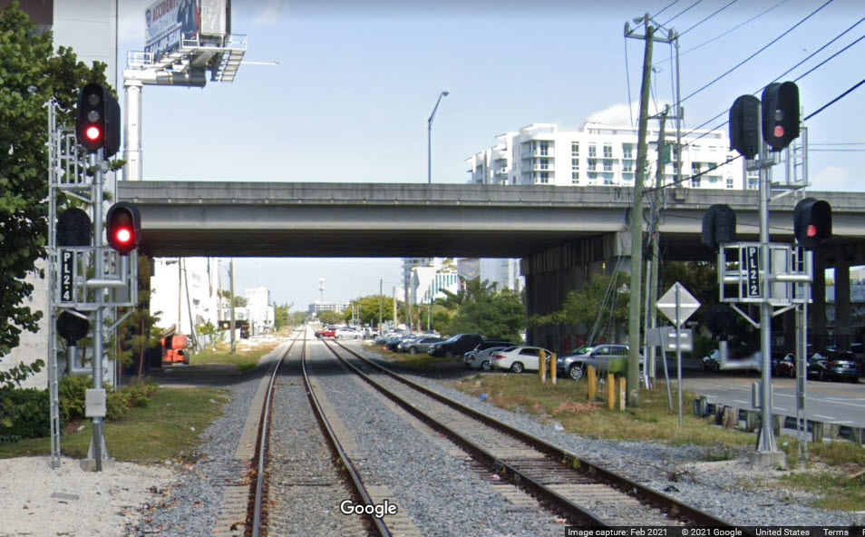
Located a couple of blocks west of where exit 2B drops you off on NE 36th Street in the Wynwood/Beverly Terrace area of North Miami. Both tracks are completely signaled for dual direction traffic. The signals use LED's.
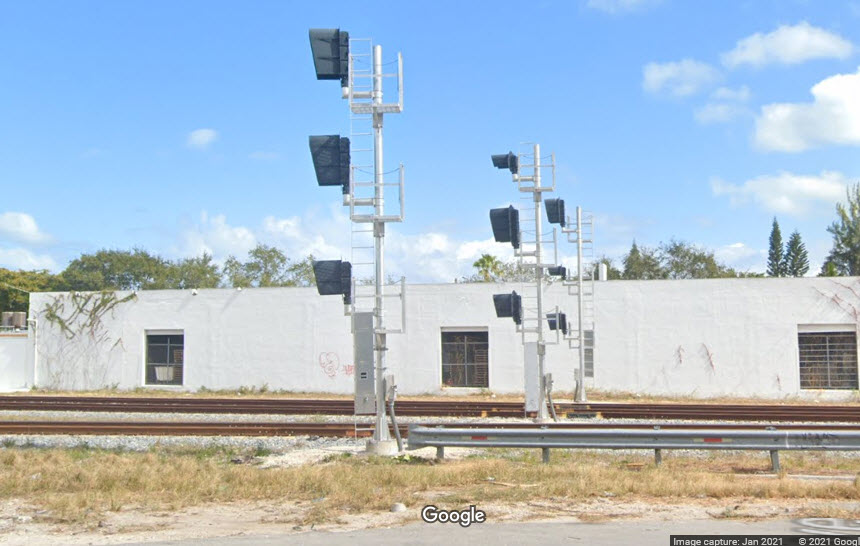
GPS Coordinates: 25.83443, -80.18811
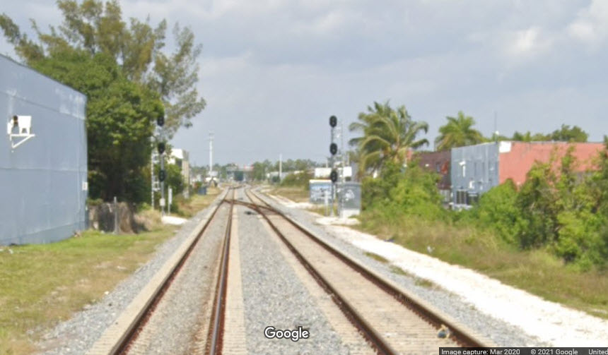
Signals in advance of a crossover, in preparation for the upcoming wye north of this location.
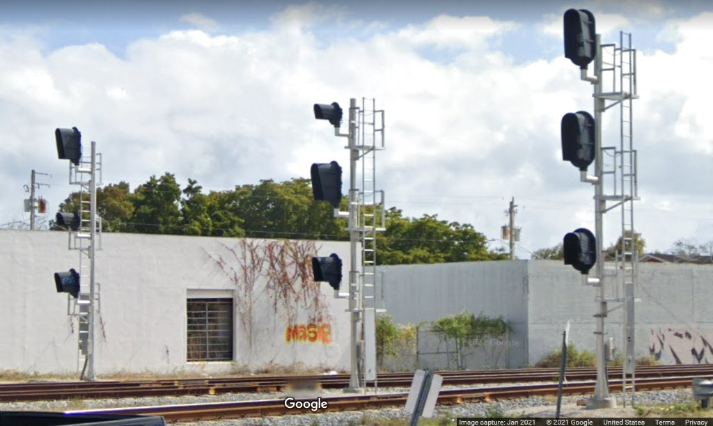
GPS Coordinates: 25.83936, -80.18836
Southbound signals for the interlocking on the south side of the wye.
Disclaimers:
I love trains, and I love signals. I am not an expert. My webpages reflect what I find on the topic of the page. This is something I have fun with while trying to help others.
Please Note: Since the main focus of my two websites is railroad signals, the railfan guides are oriented towards the signal fan being able to locate them. For those of you into the modeling aspect of our hobby, my indexa page has a list of almost everything railroad oriented I can think of to provide you with at least a few pictures to help you detail your pike.
If this is a railfan page, every effort has been made to make sure that the information contained on this map and in this railfan guide is correct. Once in a while, an error may creep in :-)
My philosophy: Pictures and maps are worth a thousand words, especially for railfanning. Text descriptions only get you so far, especially if you get lost or disoriented. Take along good maps.... a GPS is OK to get somewhere, but maps are still better if you get lost! I belong to AAA, which allows you to get local maps for free when you visit the local branches. ADC puts out a nice series of county maps for the Washington DC area, but their state maps do not have the railroads on them. If you can find em, I like the National Geographic map book of the U.S..... good, clear, and concise graphics, and they do a really good job of showing you where tourist type attractions are, although they too lack the railroads. Other notes about specific areas will show up on that page if known.
Aerial shots were taken from either Google or Bing Maps as noted. Screen captures are made with Snagit, a Techsmith product... a great tool if you have never used it!
By the way, floobydust is a term I picked up 30-40 years ago from a National Semiconductor data book, and means miscellaneous and/or other stuff.
Pictures and additional information is always needed if anyone feels inclined to take 'em, send 'em, and share 'em, or if you have something to add or correct.... credit is always given! Please be NICE!!! Contact info is here
Beware: If used as a source, ANYTHING from Wikipedia must be treated as being possibly inaccurate, wrong, or not true.
RAILFAN GUIDES HOME
RAILROAD SIGNALS HOME
NEW 12/11/2021, DEC17/24/25/2021
Last Modified 28-Dec-2021