What's Here:
Amtrak Maintenance Facility
DC Metro yard
Data:
GPS Coordinates: 38.915054, -76.988336 (New York Ave, adjacent to the middle of the yard)
BTW -
You're in the city of Washington DC: No state, no county, no representation!
(it's on their license plates)
ZIP: 20002
Phone A/C: 202
Access by train/transit:
The Rhode Island Metro station is about a half a mile to the north of the two yards
The Union Station Metro station is about 3/4 of a mile to the south
DC's Union Station, where you have Amtrak, VRE, and MARC, it is about 3/4 of a mile to the south
Railfan Safety:
The Ivy City area is not especially a really safe place to wander
around alone, bring a friend, better yet, bring along 2 or 3 friends
The hikey-bikey trail that runs parallel to the tracks coming out of
Union Station seems to be pretty safe tho
The Scoop:
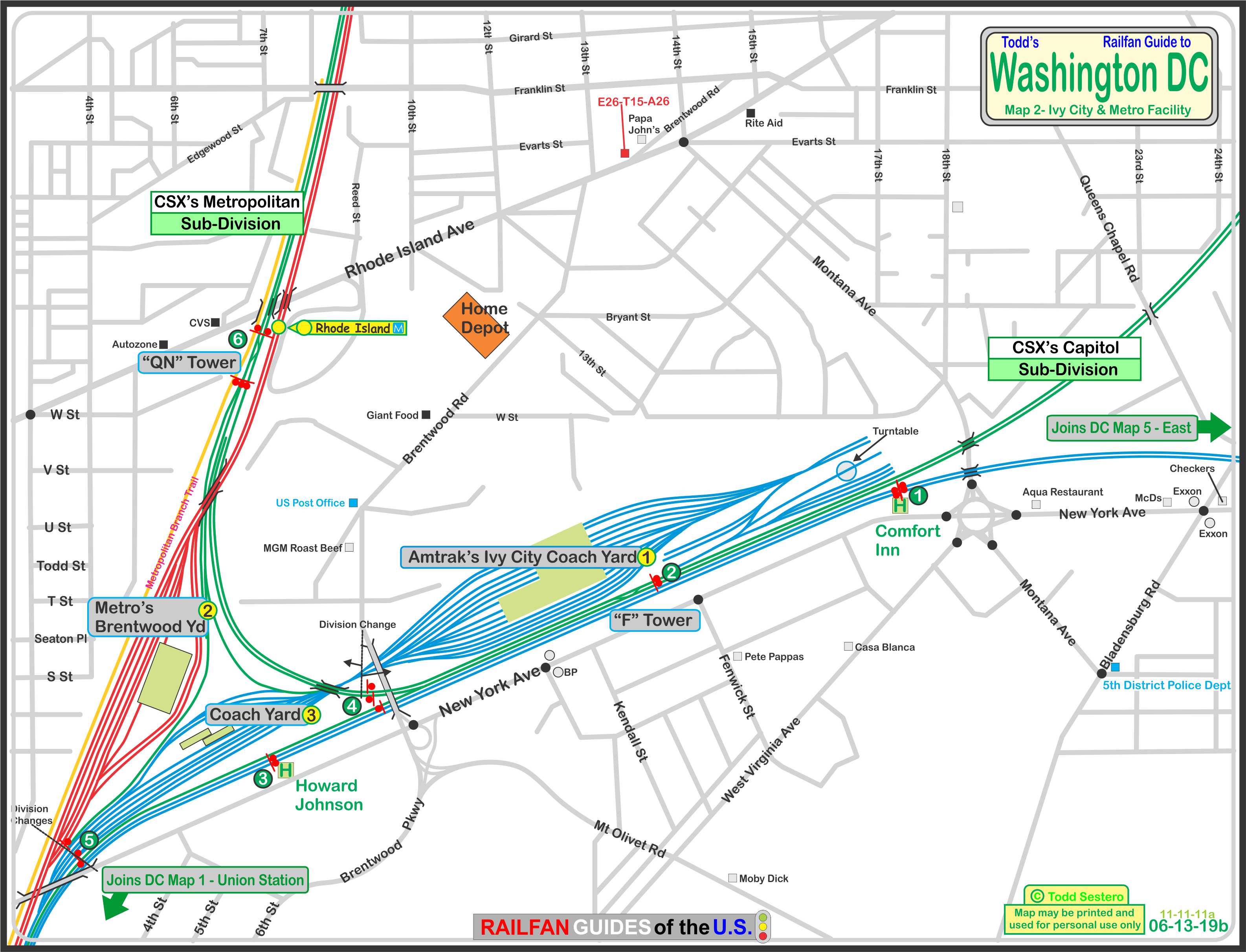
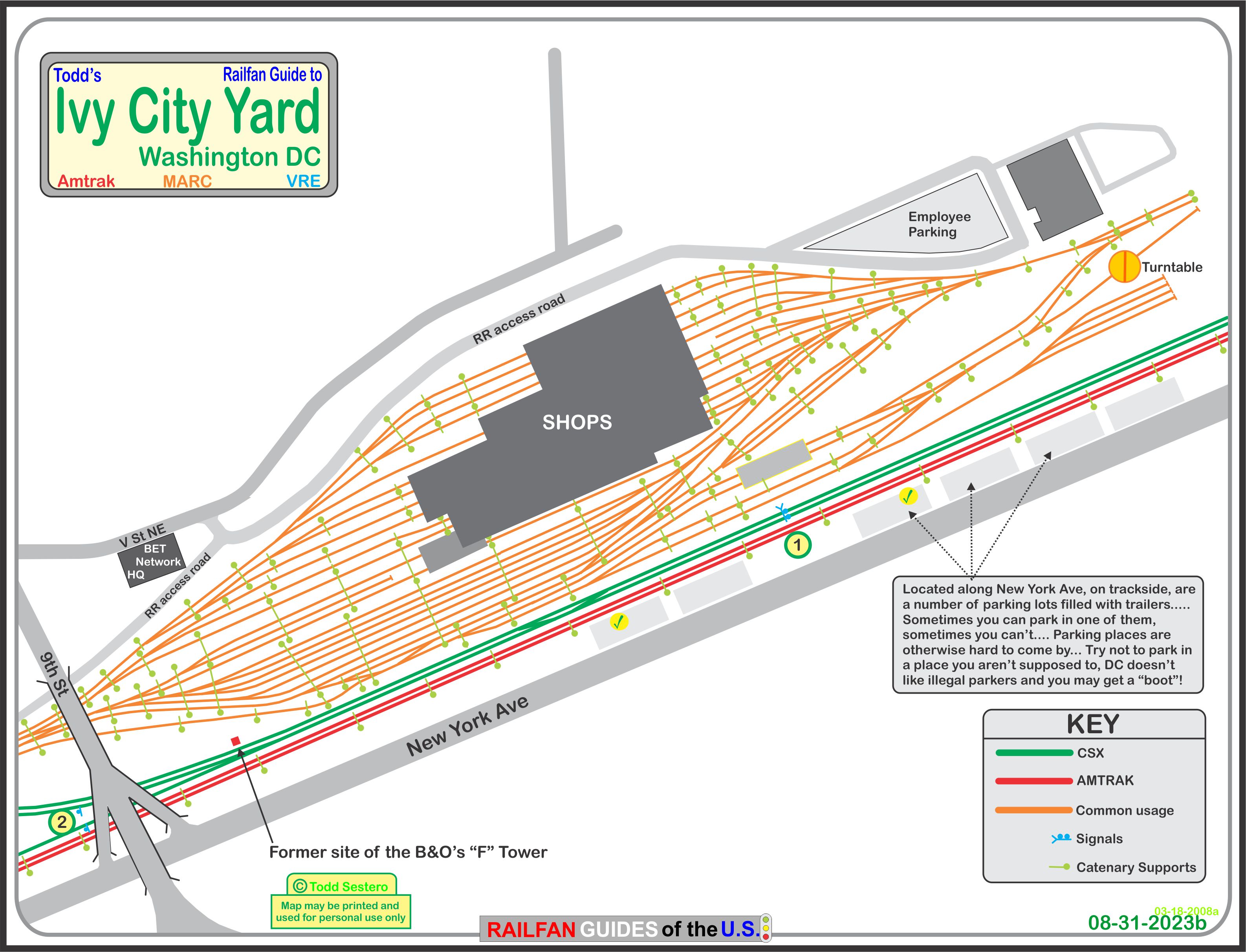
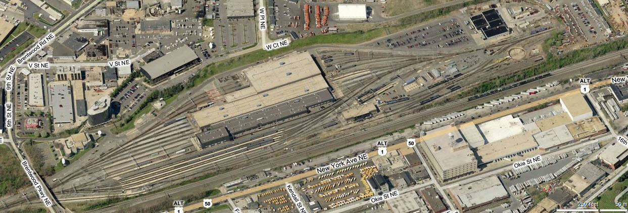
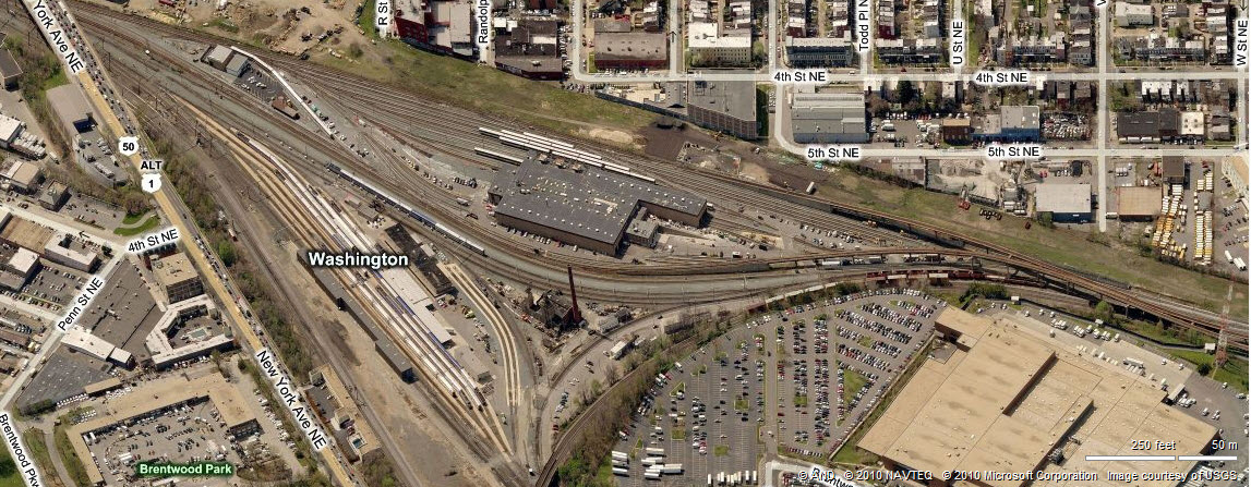
Ivy City serves as the maintenance facility and storage yard for
Amtrak (including the Northeast Corridor), MARC, and the VRE.
It used to be home to some great trains back in the old days of the
Baltimore & Ohio, the Pennsylvania RR, the Richmond Fredericksburg &
Potomac, the Southern Railway, and the Seaboard System; not to mention the
great photo ops provided by the multitude of colors!
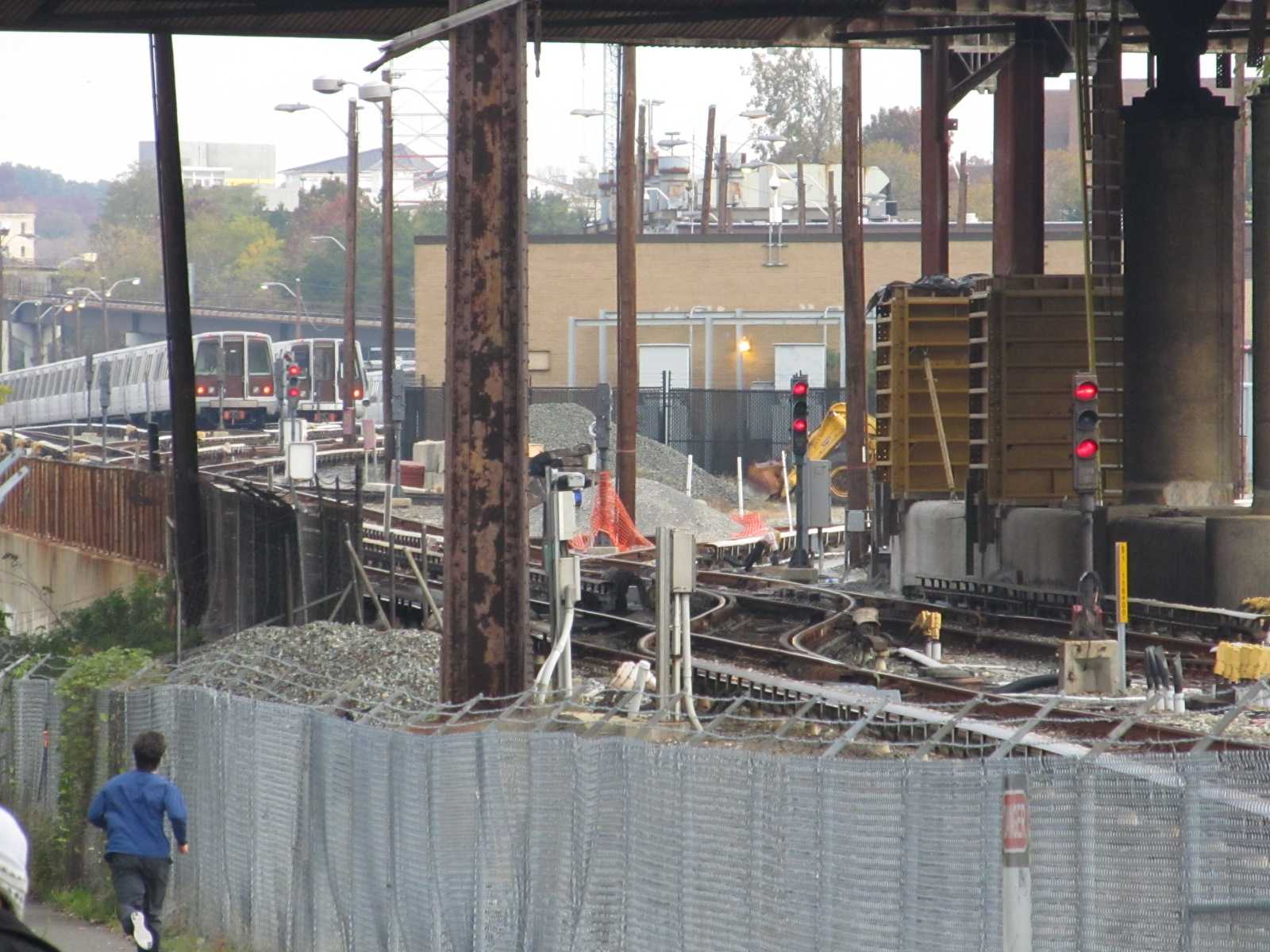
Adjacent to the Amtrak Yard is one of several area DC Metro heavy rail (subway) yards.
Ivy City Yard, where all of the passenger and commuter trains are
serviced and staged for the rush hours. Union Station is to the left,
Baltimore is to the right.
The Metro facility is built on the site of the
former Washington Terminal coach yard. The
aerial shot shows both the Washington Metro shops and yard, and some of the
coach storage tracks (which is pretty much the way it looks when WT operated the
yard). Union Station is to the left, Baltimore off the bottom, and points
west off to the right.
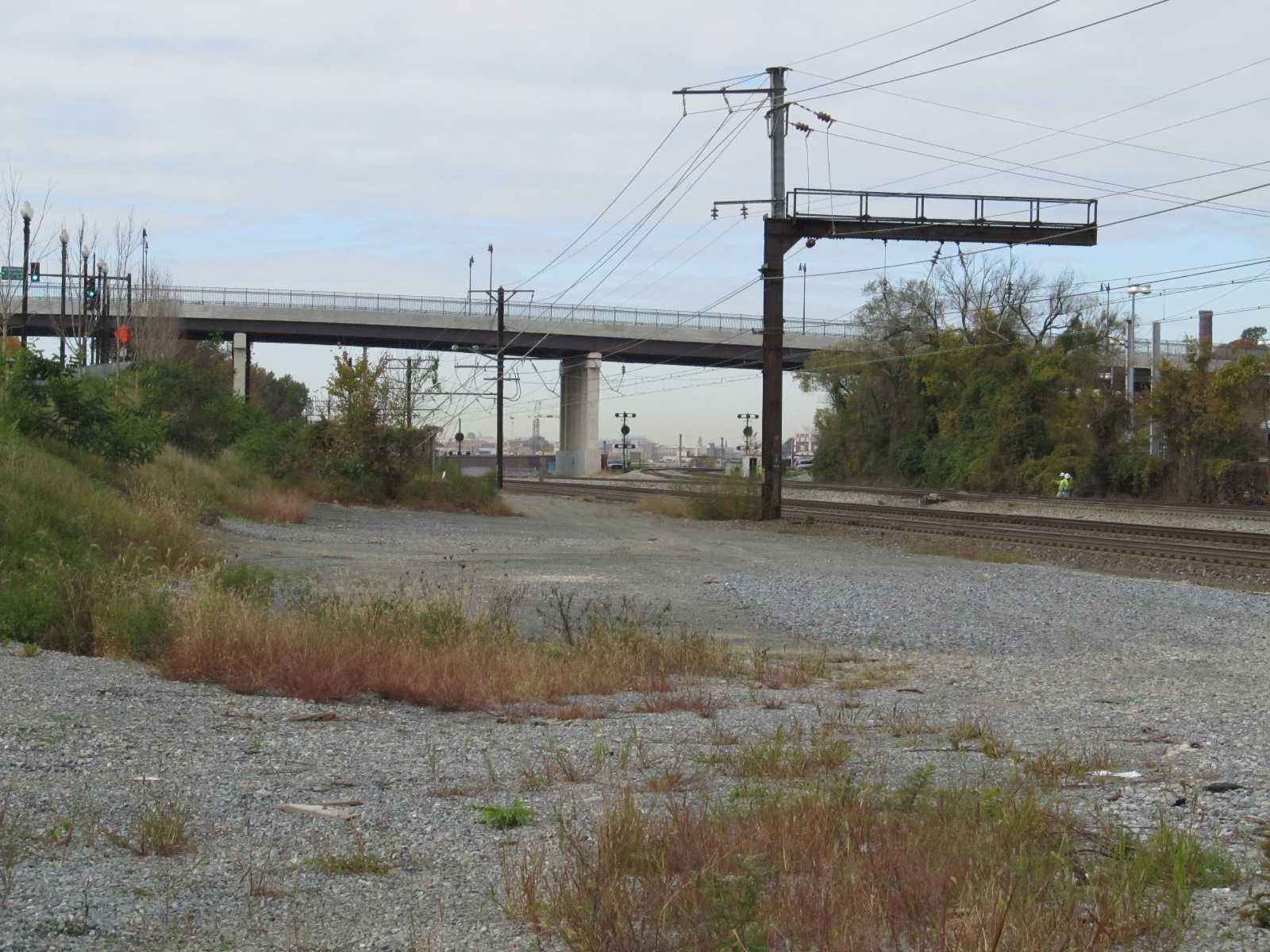
For the signal fan, we have a variety of signals in the area.
On the Northeast Corridor, we have the standard Amtrak PCL's.
Over on CSX, the old B&O, almost all of the CPL signals have been replaced with the
standard "Darth Vader" type colorlight signals, in late 2014 or early
2015. As of January 2019, there are still two full size CPL's standing next to the
Metro shops, and all the signals in the throat and at the station are still dwarf CPL's.
With the railroads replaced legacy type signals all over the place, east,
west, north, south, it is getting increasingly difficult to find signals
different from the now standard colorlight signal. HOWEVER, this area
contains a most unique set of signals on the NEC, as you will see below.
When the Washington Terminal decided on using the B&O CPL signals as
their "standard", the Pennsy used standard PL parts to build a
B&O style CPL signal... very cool!
Last, but not least, we have the standard red/white/red transit style colorlight
signals over on the DC Metro.
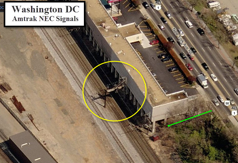
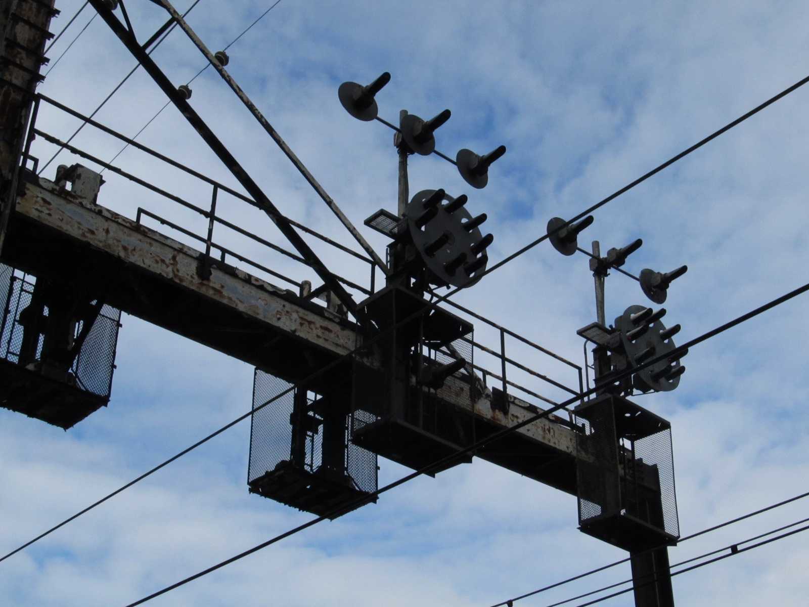
Amtrak NEC PCL's
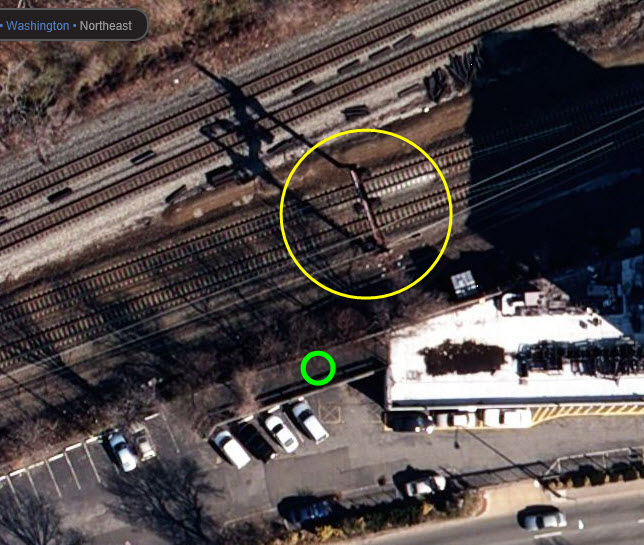
This set of PL signals can be found behind the Comfort Suites
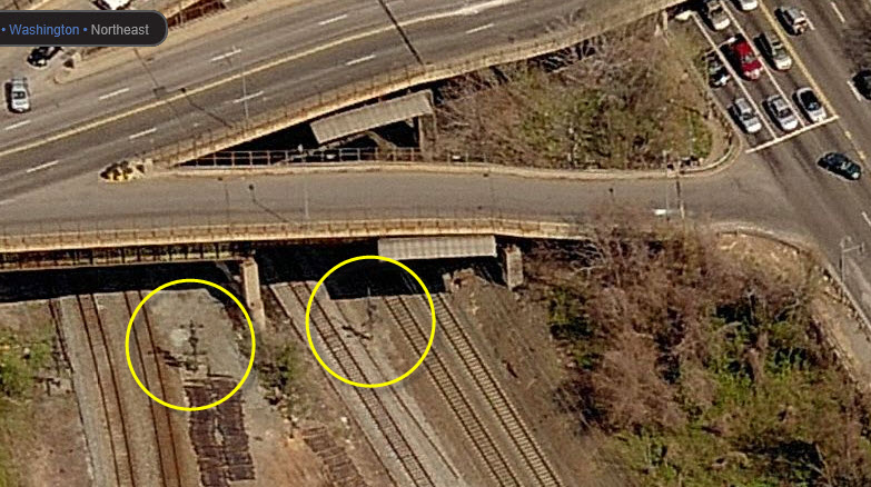
hotel on New York Avenue NE, where Montana Avenue crosses.
For inbound trains, this is the last set of "PL"
signals. The pictures were taken from the green circle.
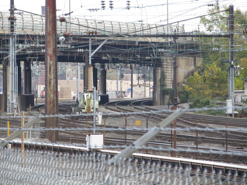
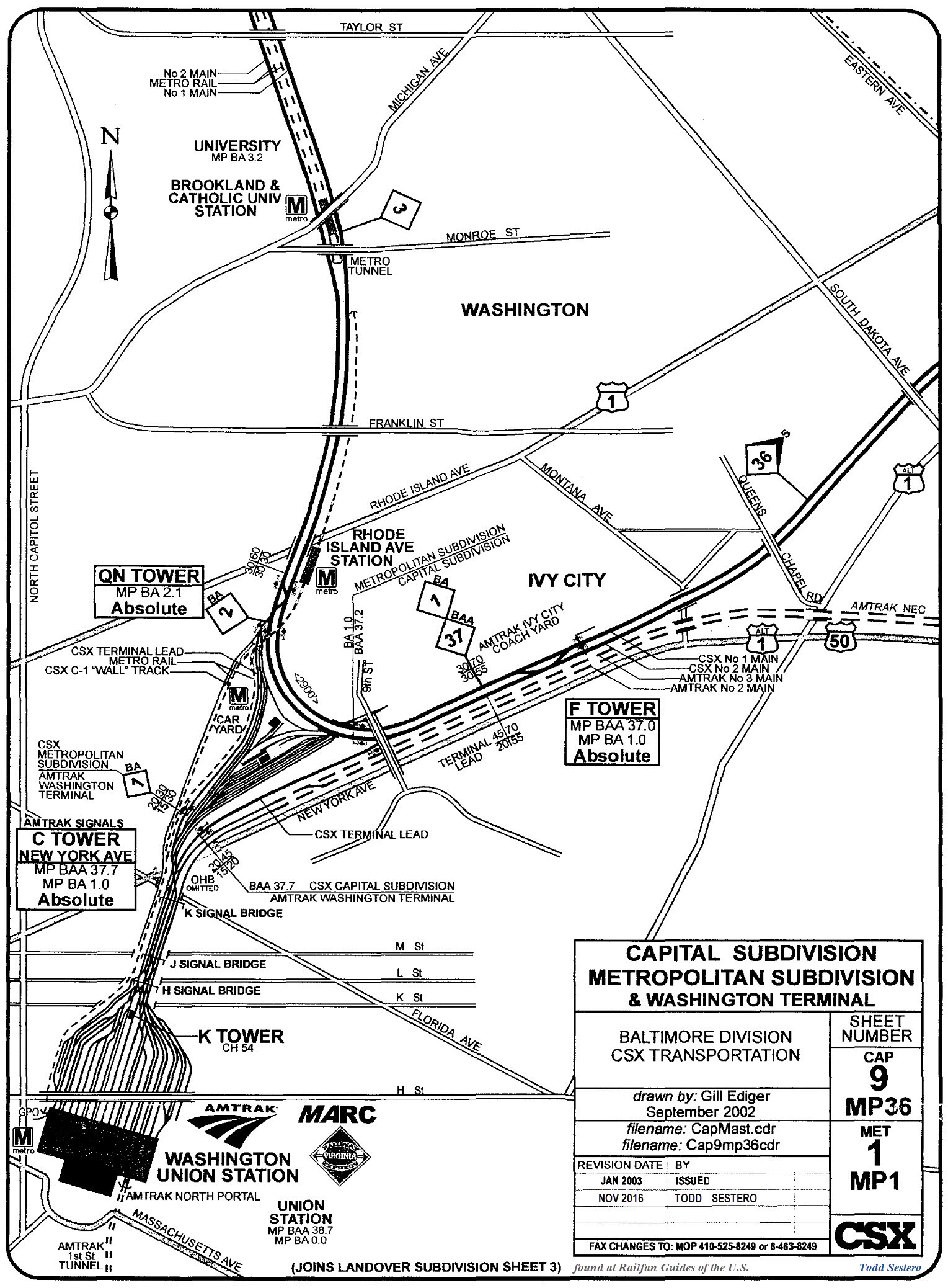
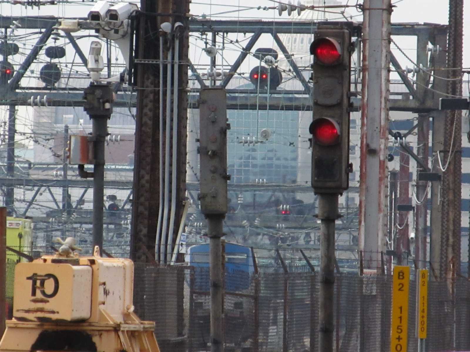
WB CSX CPL's
About a quarter of a mile west from the Comfort Suites hotel is this CSX
CPL signal location for WB trains. The picture on the right was taken
from the Comfort Suites hotel.
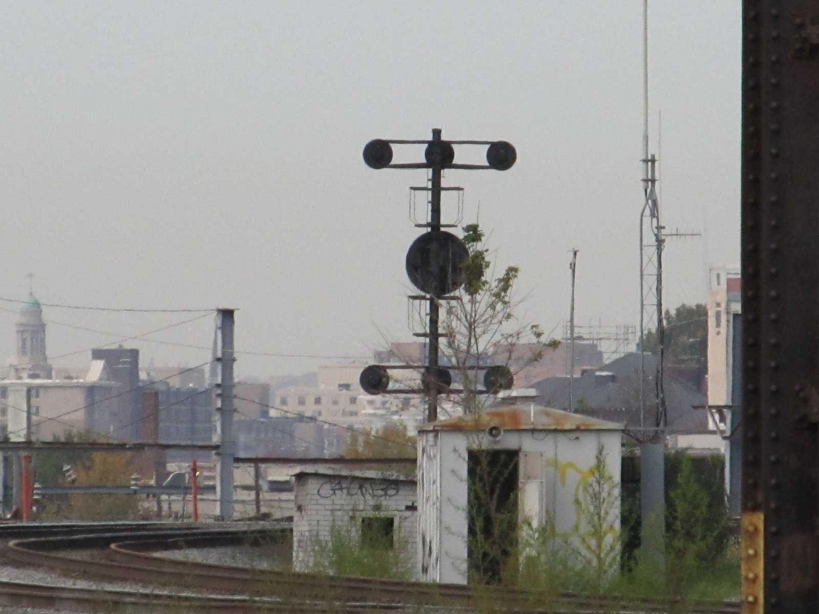
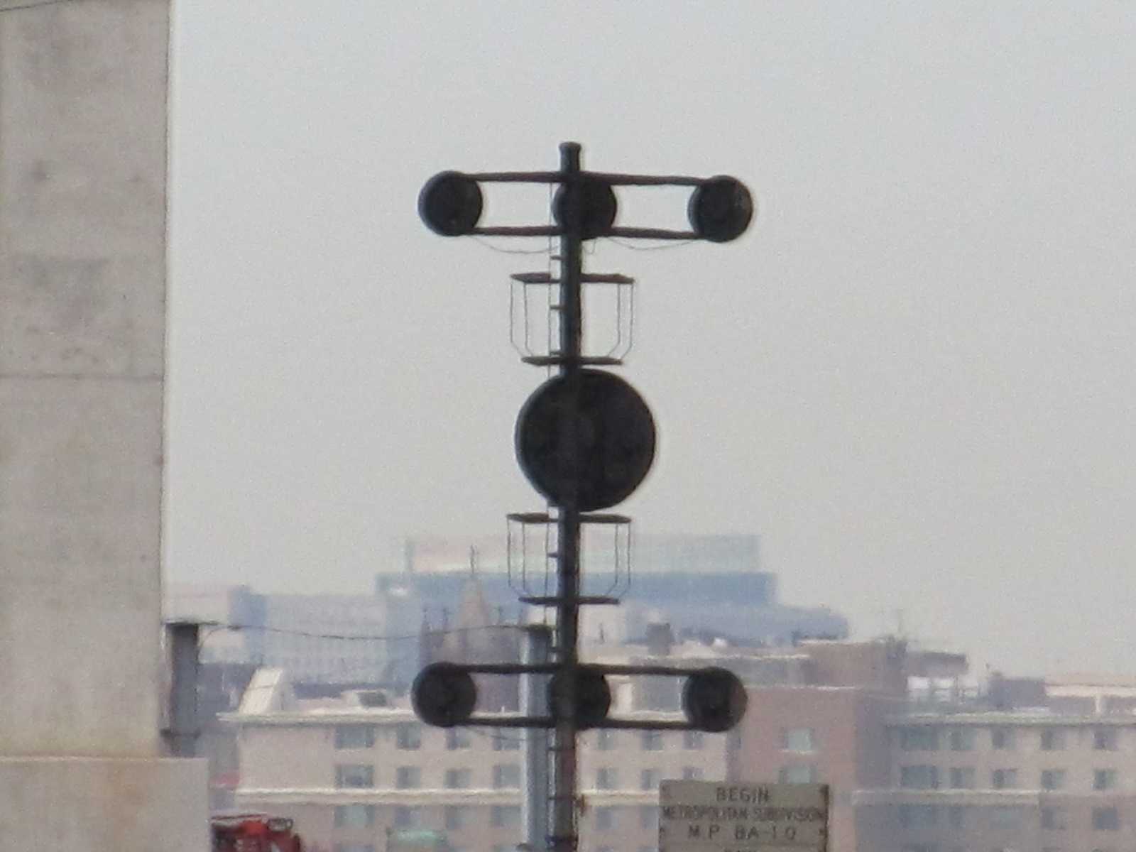
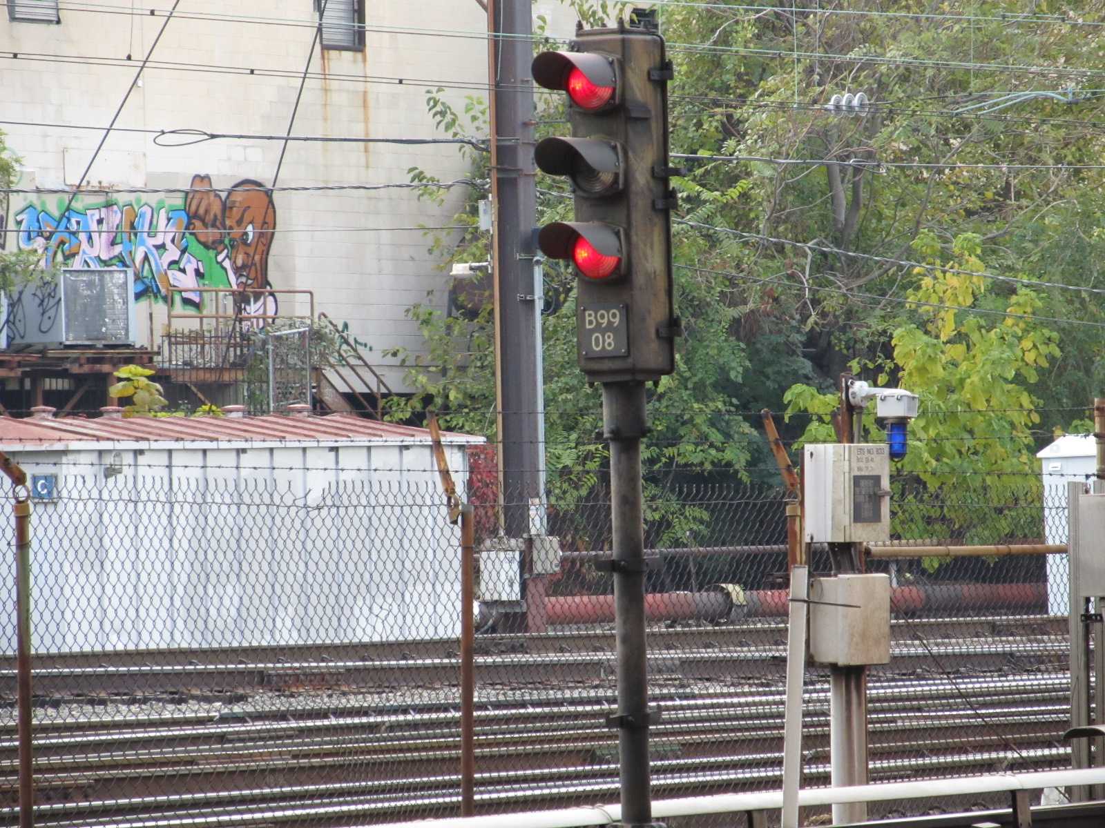
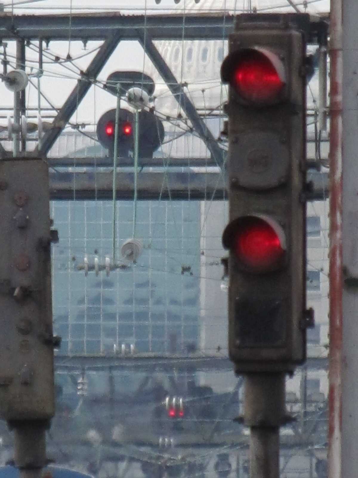
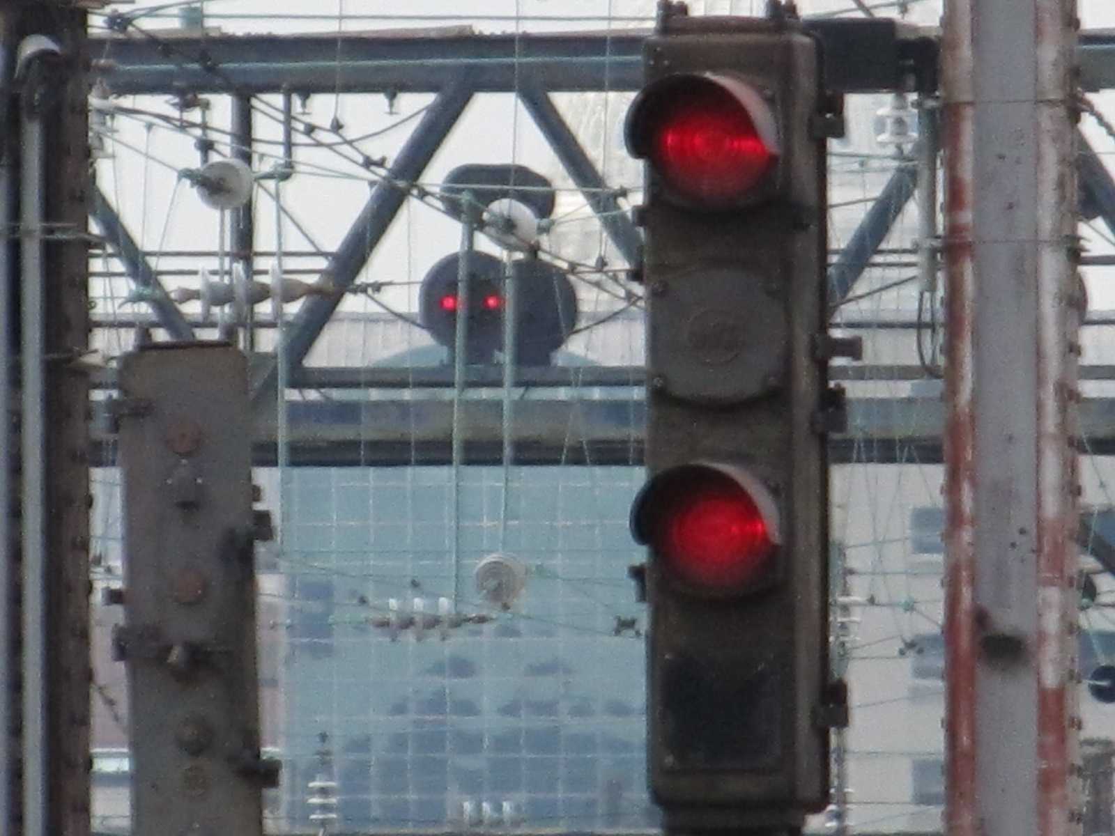
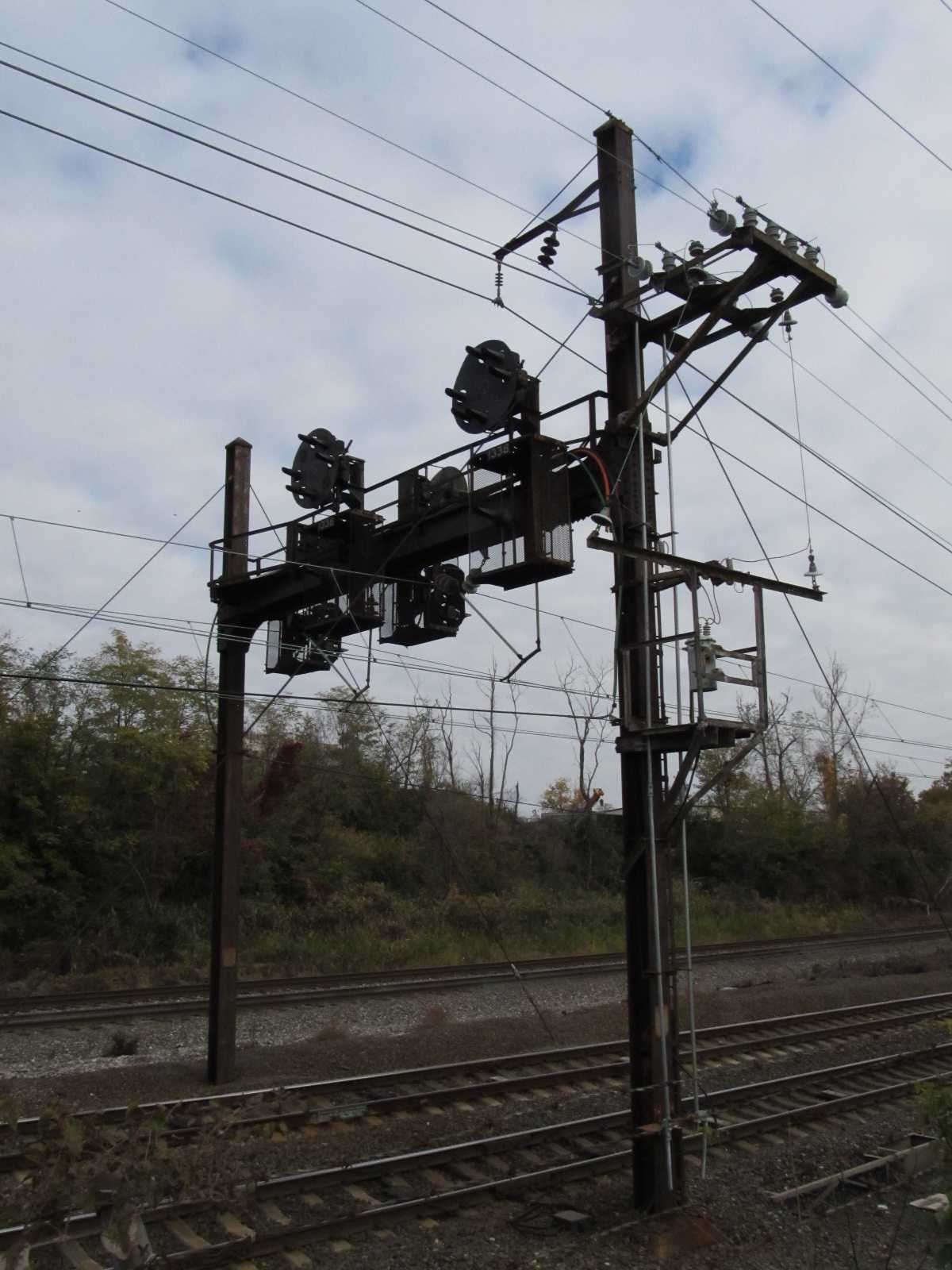
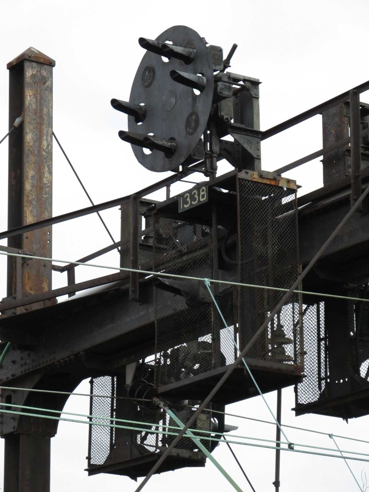
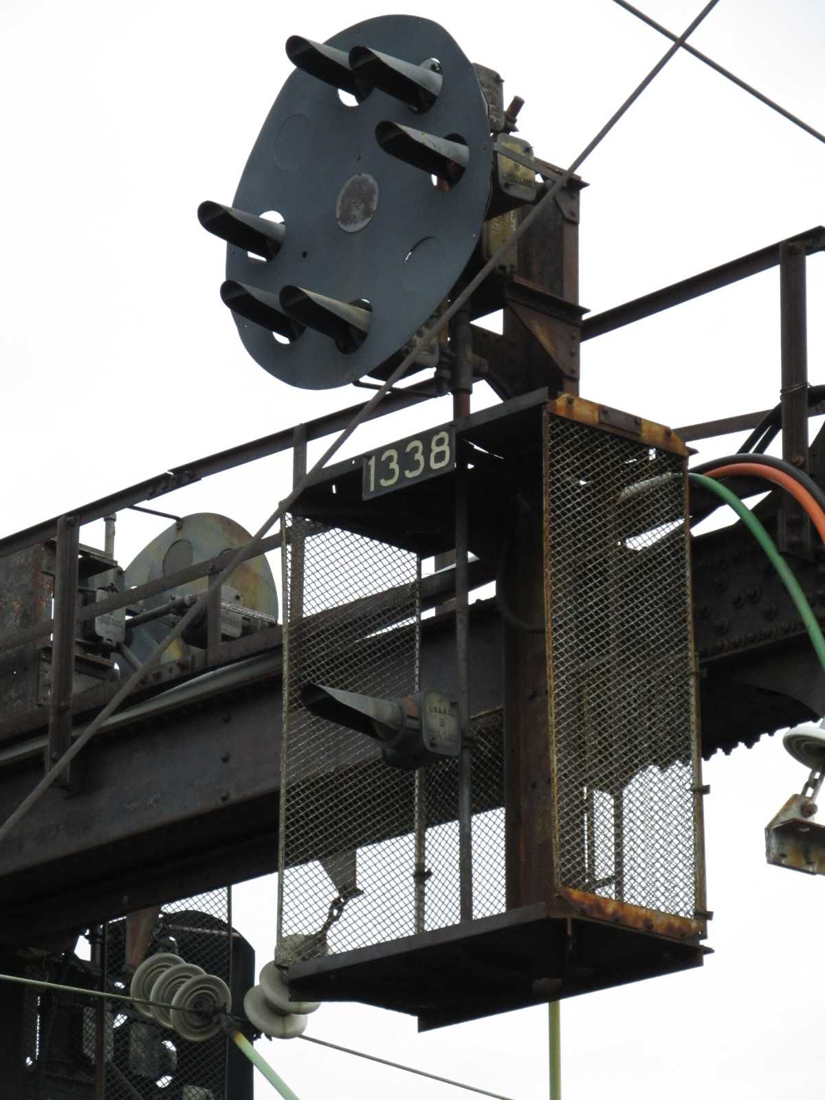
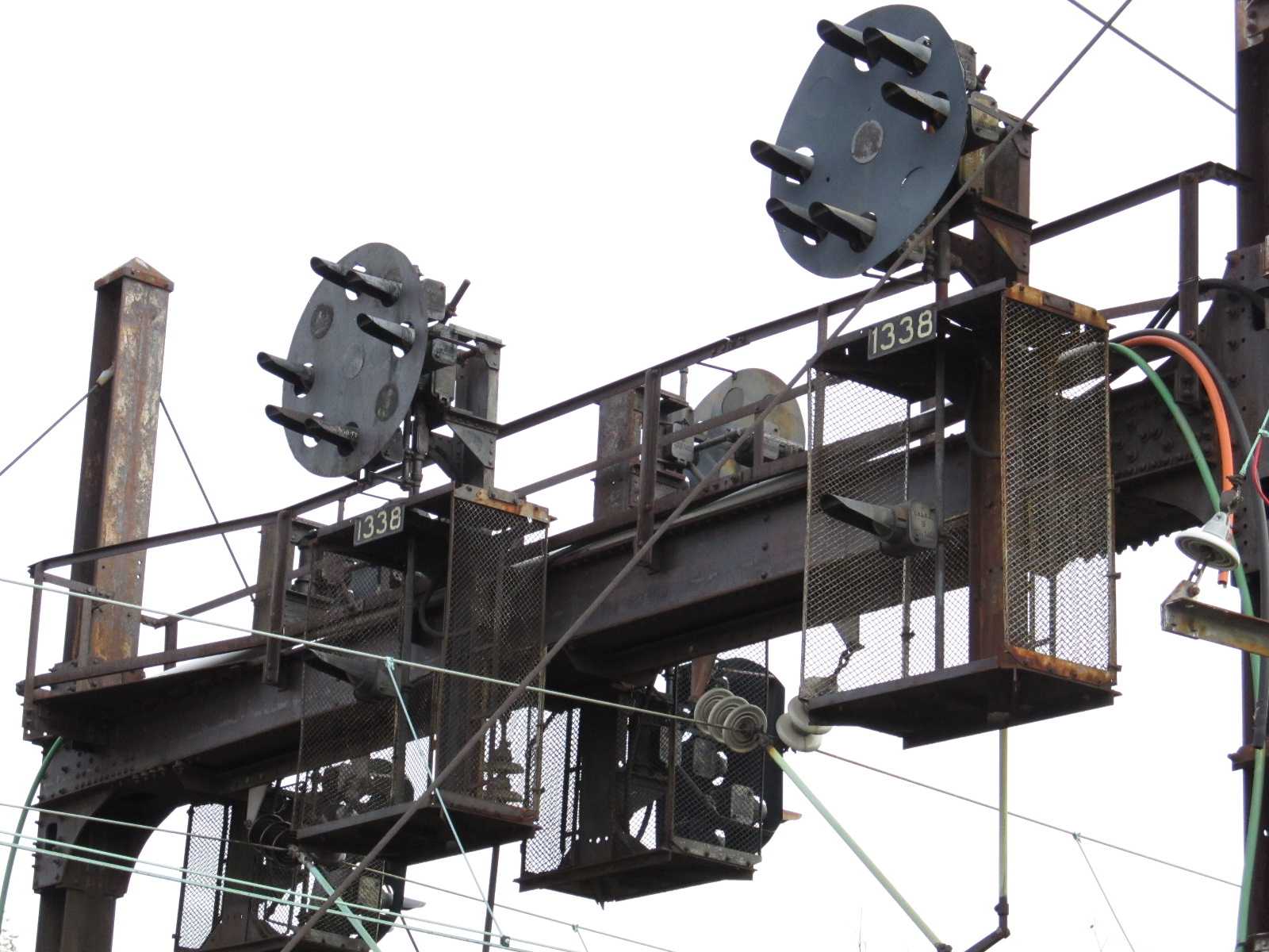
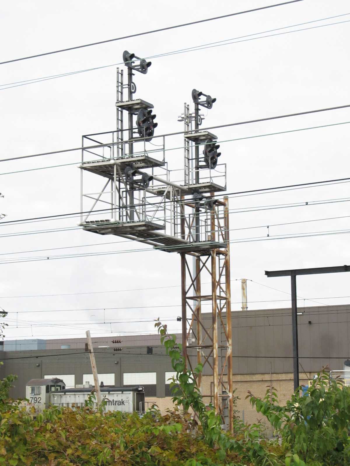
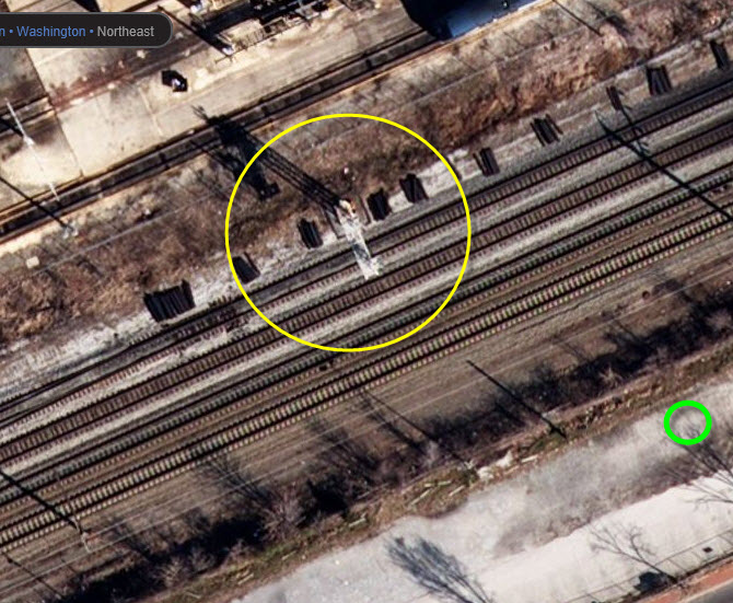
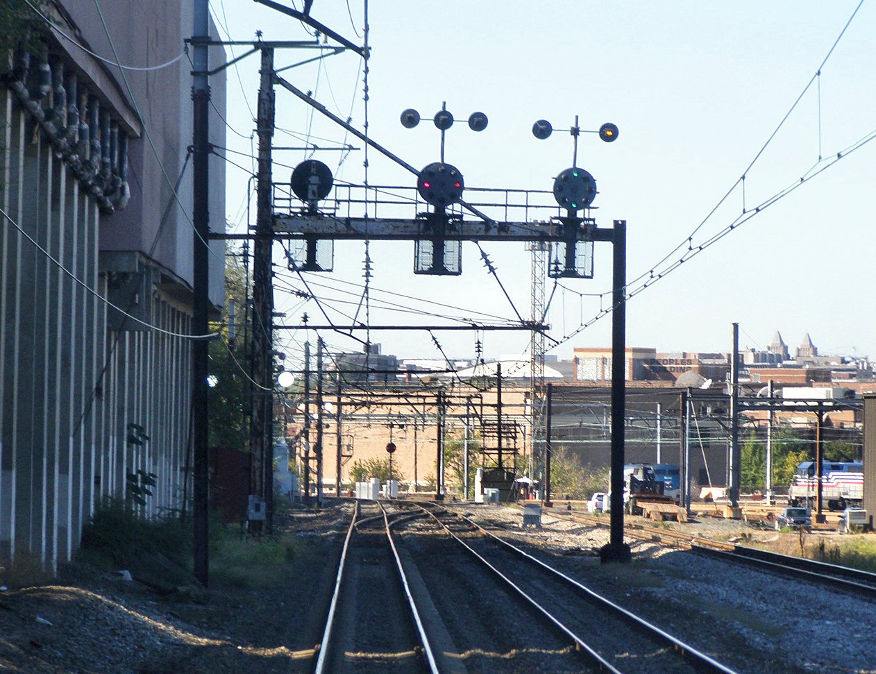
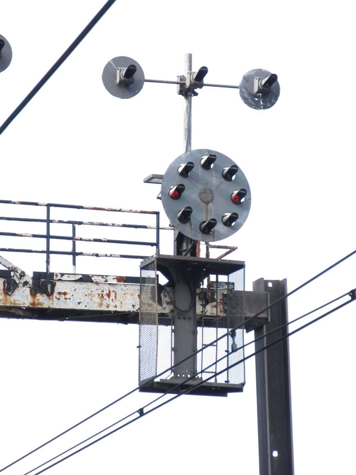
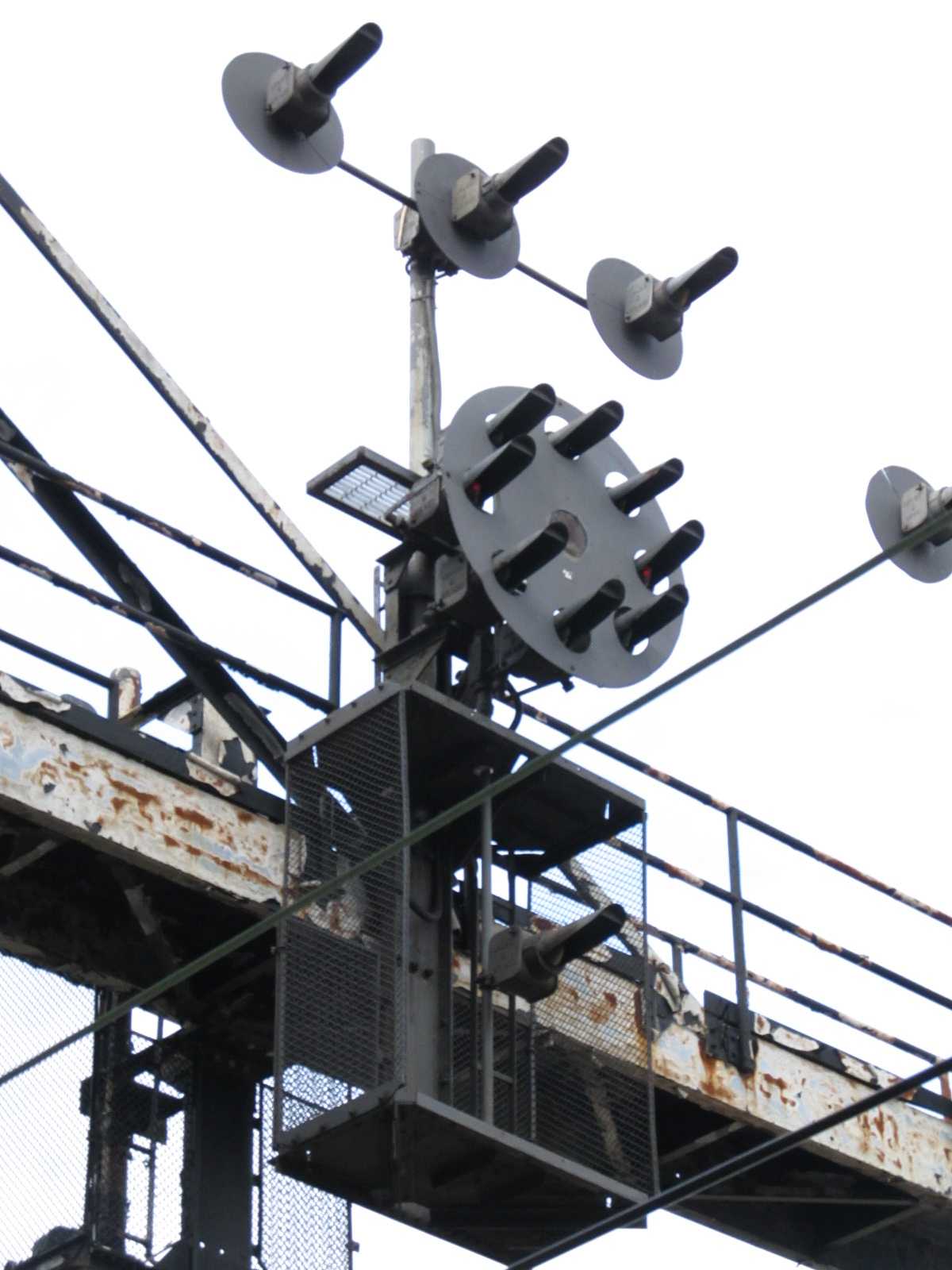
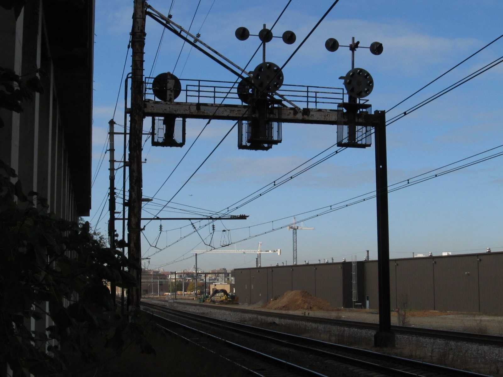
Amtrak NEC PCL's as B&O Style "CPL's"
The inbound signals here are quite unique. The last NEC signal set before
reaching the CPL dwarfs on the
signals bridges is located behind the Howard Johnson hotel along New York Avenue... if
you look close, you will notice that the signals facing us are Pennsy PL's, and
the signals on the far side, for inbound traffic to Union Station, are
CPL's. However, what you can't see from the aerial shot, is that the CPL
signals on the inbound side are assembled from Pennsy PL parts. This makes
the two signals quite unique indeed! As unique as the signals in
Northumberland PA. You can access the signals by going underneath the
hotel, but take along a buddy, just in case, as our shoe prints weren't the only
ones down there. You can shimmy down the embankment where the green line is.
Picture courtesy Jersey Mike
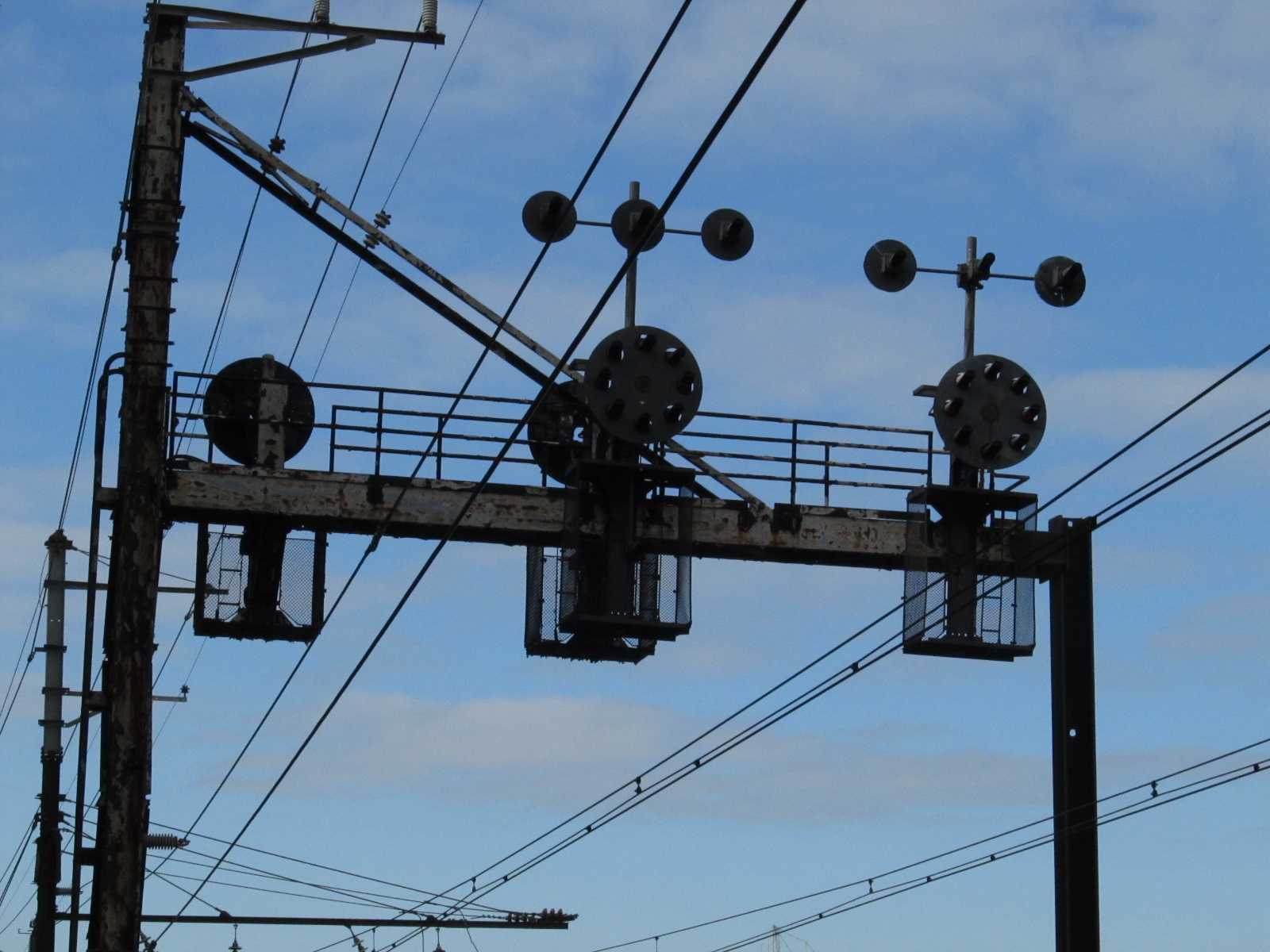
The SB "CPL" side.
The NB PL side.
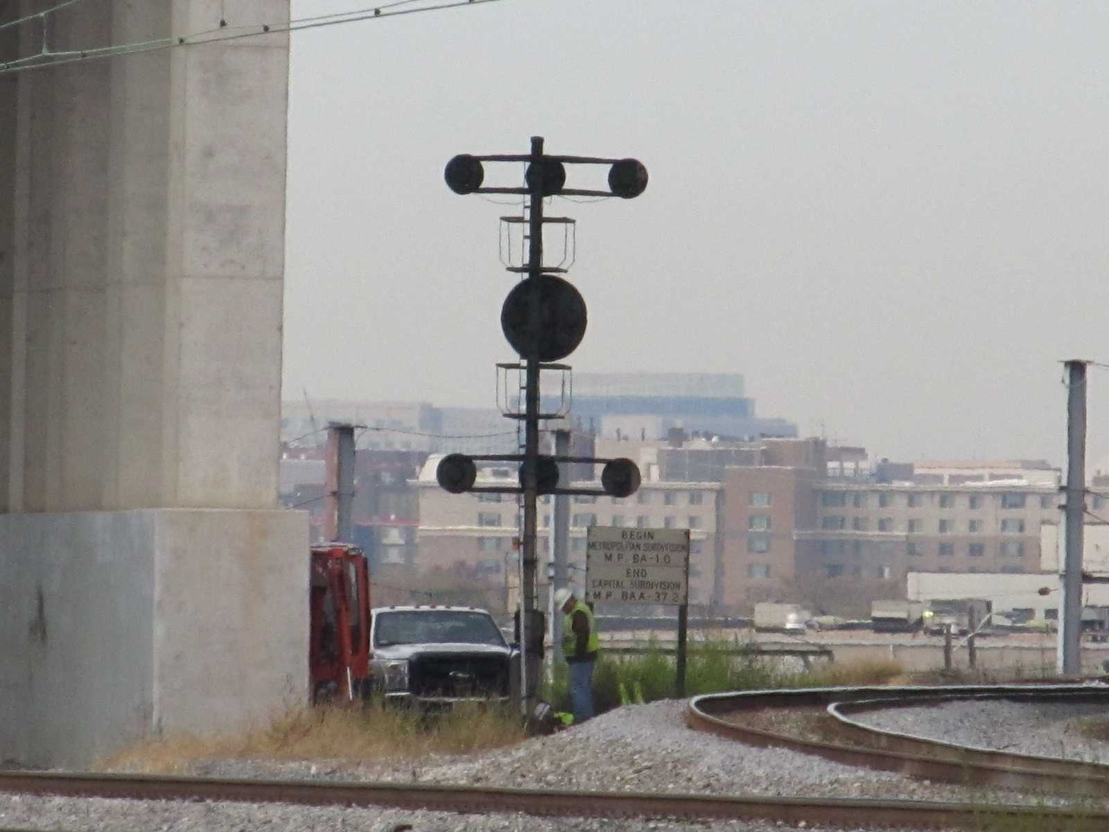
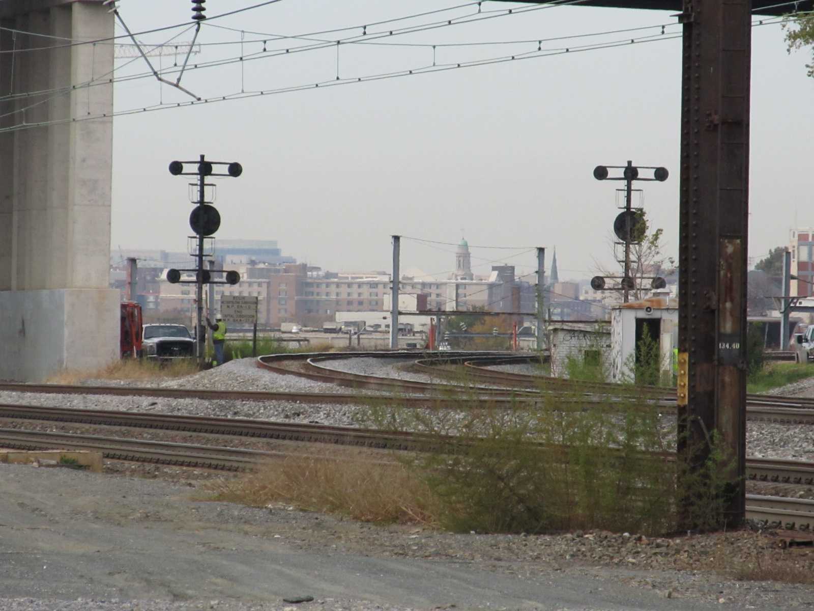
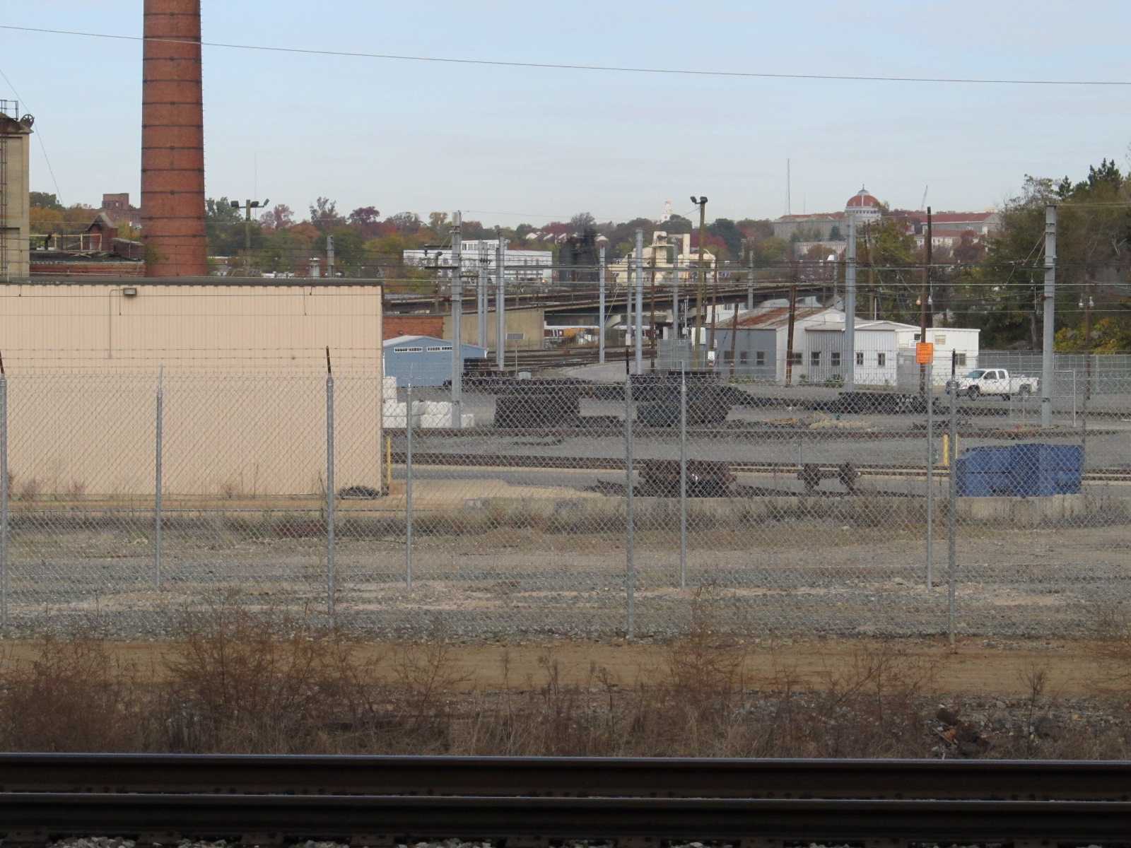
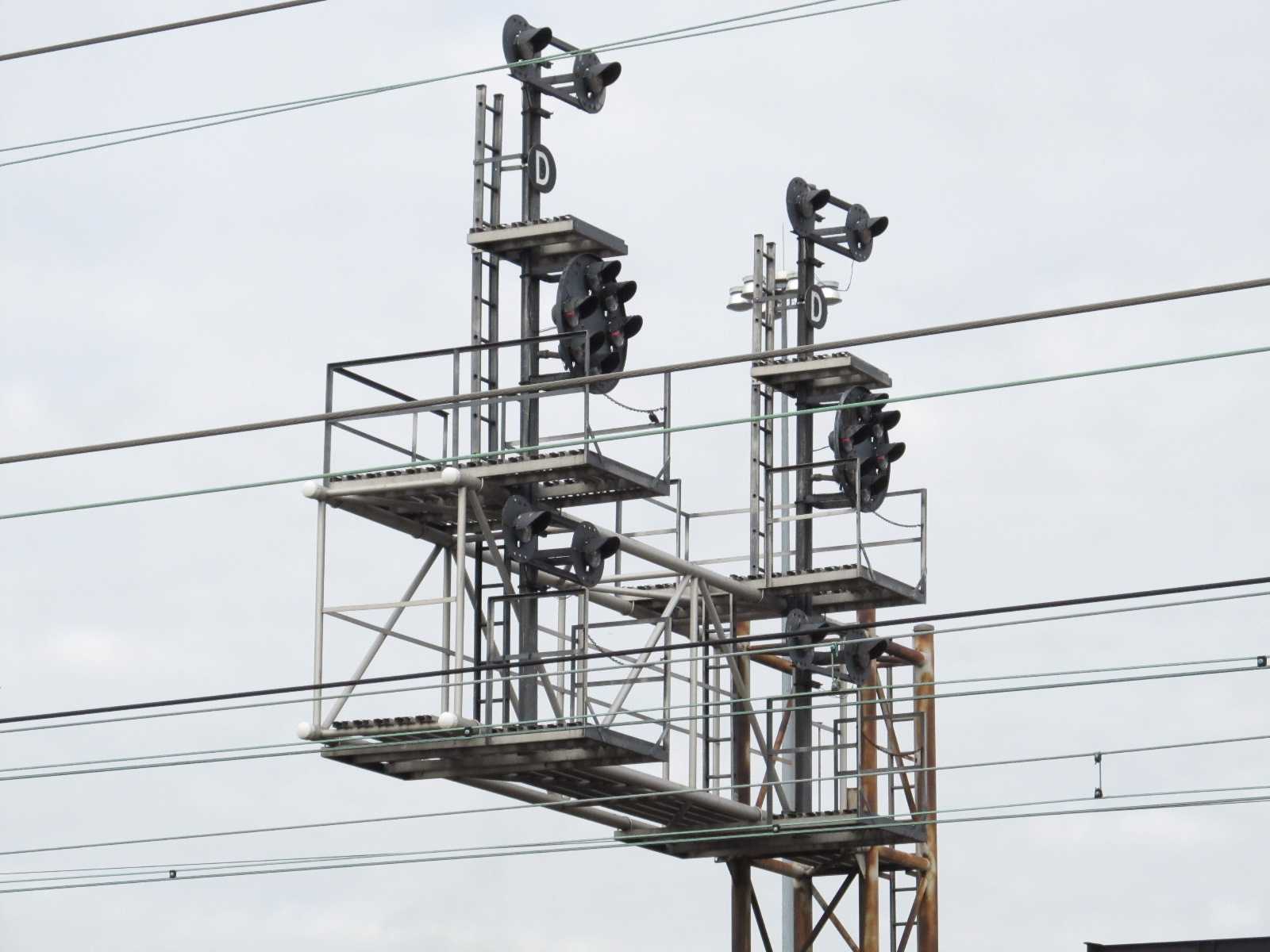
CSX CPL's at the Wye - East Side
These two signals control movements off the wye onto the EB track.
They're almost directly under the Brentwood Pkwy NE overpass.
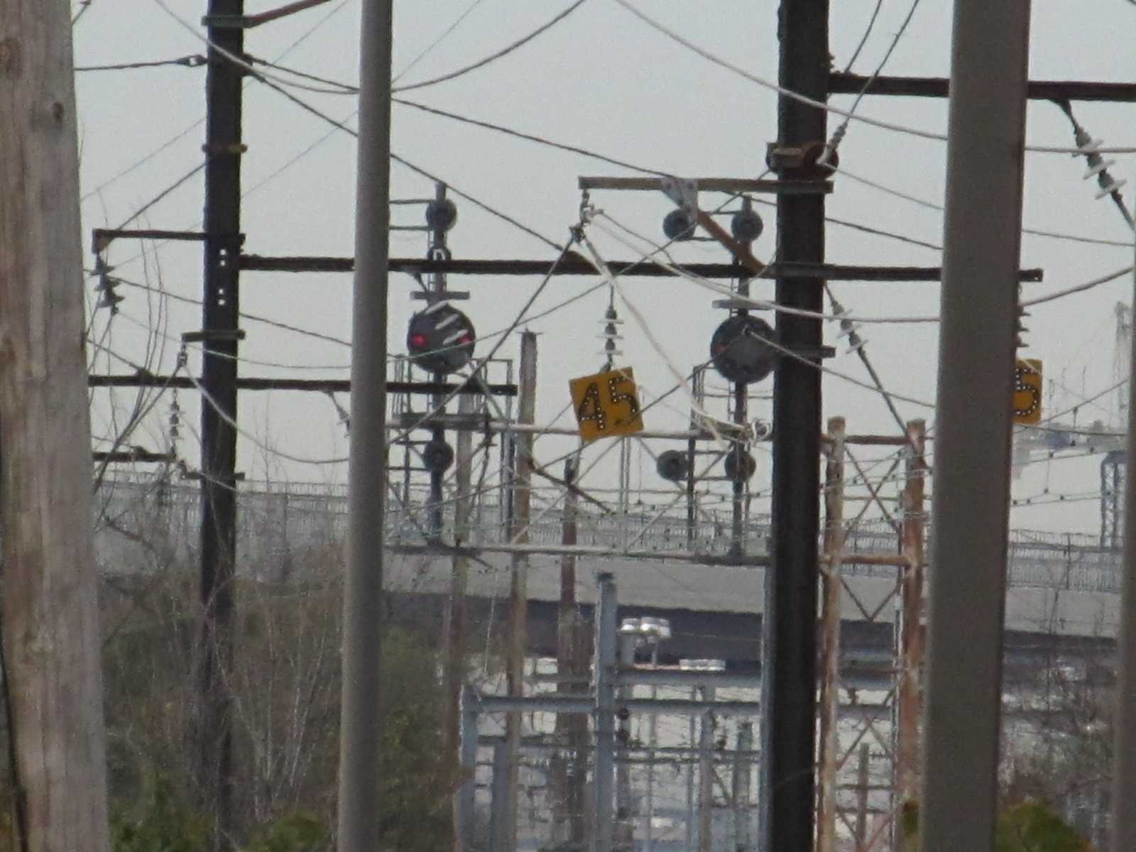
CSX CPL's at the Wye - West Side
These CPL's were still with us as of early 2019. The two curved
tracks on the right is the NEC, the single one on the left is CSX.
It is at these signals that CSX's Metropolitan Division starts and the
Amtrak Washington Terminal ends.
CSX CPL's at the Wye - North Side
I wasn't able to get any pix, did you?
Disclaimers:
Updated 8/20/23 -- I love trains, I love signals. I am not an expert.
My pages reflect what -I find- on the topic of the page, they are a
collection of what you can find elsewhere. MY maps and drawings are
the exception! This is something I have fun with while trying to help
others. If you have helping comments, corrections, pictures, and/or information
to make the page better, please, by all means, shoot me an email.
Contributors are given credit unless the fame is not wanted. If
you have a negative comment, I'd rather you keep it too yourself unless
you are really tactful, as I have enough to do maintaining 1200+ pages :-)
How many cats can you put in an empty box? Only one, because after
that, the box is not empty :-)
Please Note: Since the main focus of my two websites is railroad signals,
the railfan guides are oriented towards the signal fan being able to locate them.
For those of you into the modeling aspect of our hobby, my
indexa page has a list of
almost everything railroad oriented I can think of to provide you with at
least a few pictures to help you detail your pike.
If this is a railfan page, every effort has been made to make sure that the information
contained on this map and in this railfan guide is correct. Once in a while,
an error may creep in :-)
My philosophy: Pictures and maps are worth a thousand words, especially for
railfanning. Text descriptions only get you so far, especially if you get lost or
disoriented. Take along good maps.... a GPS is OK to get somewhere, but maps
are still better if you get lost! I belong to AAA, which allows you to get
local maps for free when you visit the local branches. ADC puts out a nice
series of county maps for the Washington DC area, but their state maps do not have the
railroads on them. If you can find em, I like the National Geographic map book
of the U.S..... good, clear, and concise graphics, and they do a really good job
of showing you where tourist type attractions are, although they too lack the
railroads. Other notes about specific areas will show up on that page if known.
Aerial shots were taken from either Google or Bing Maps as noted.
Screen captures are made with Snagit, a Techsmith product...
a great tool if you have never used it!
By the way, floobydust is a term I picked up 30-40 years ago from a National
Semiconductor data book, and means miscellaneous and/or other stuff.
Pictures and additional information is always needed if anyone feels inclined to
take 'em, send 'em, and share 'em, or if you have something to add or correct.... credit
is always given! Please be NICE!!! Contact info is here
Beware: If used as a source, ANYTHING from Wikipedia must be treated
as being possibly inaccurate, wrong, or not true.
Please note: That my pages here and on my signal pages are mostly a collection
of information you can find elsewhere. Hopefully, my pages bring all that information
together on one easy to use page: What is interesting to look at, how to get there,
details and history of the sights, other things a lot of railfans are into (like bridges
and fire companies). Pictures of others are used with credit and the source of the
pictures if known, allowed by the fact that this is a totally not-for-profit
website and is used as an informative website. I you have a problem with me using
one of your photos, please let me know, and I will remove it if you really don't
want people to know you took such a great photo :-).
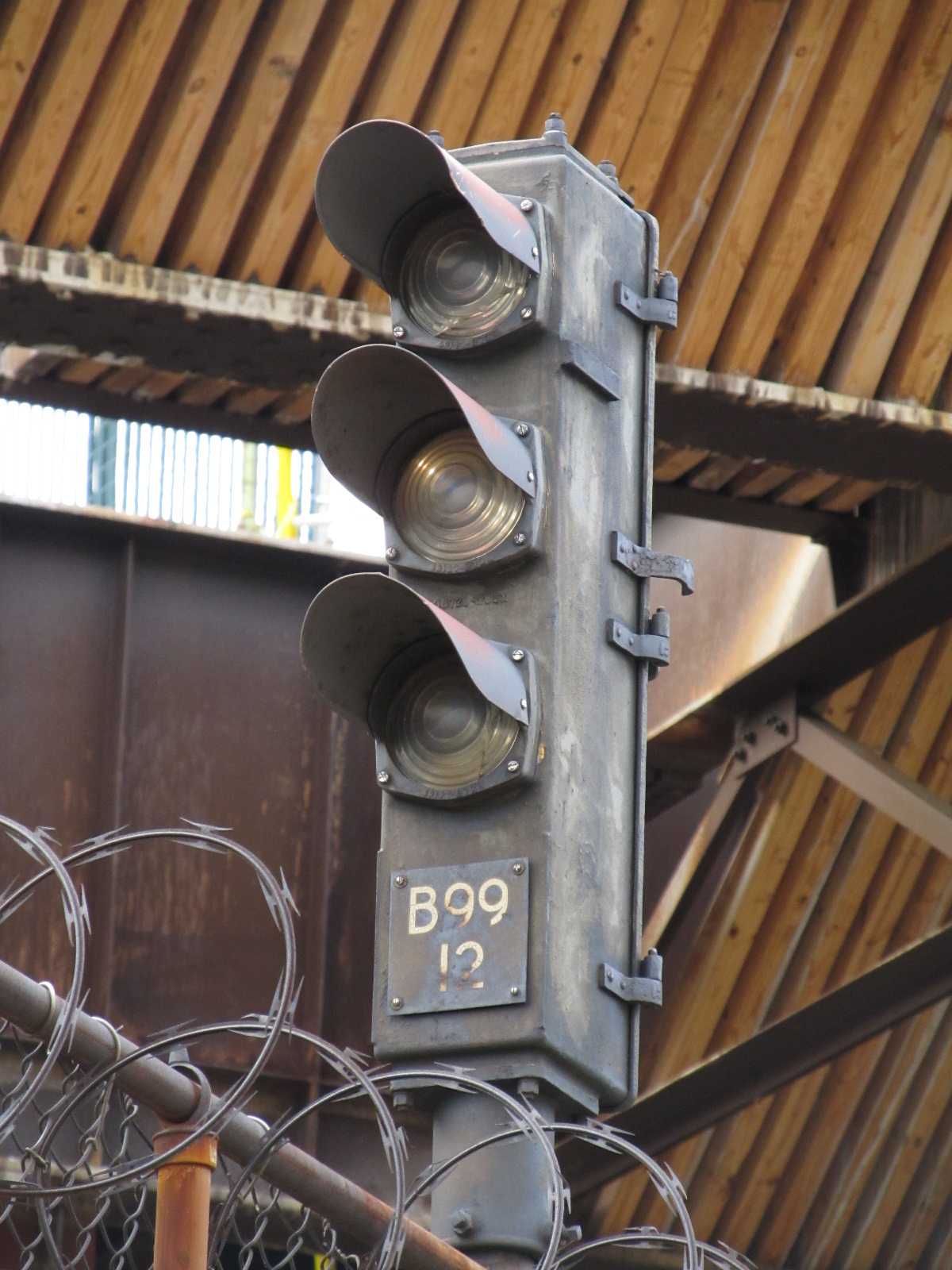
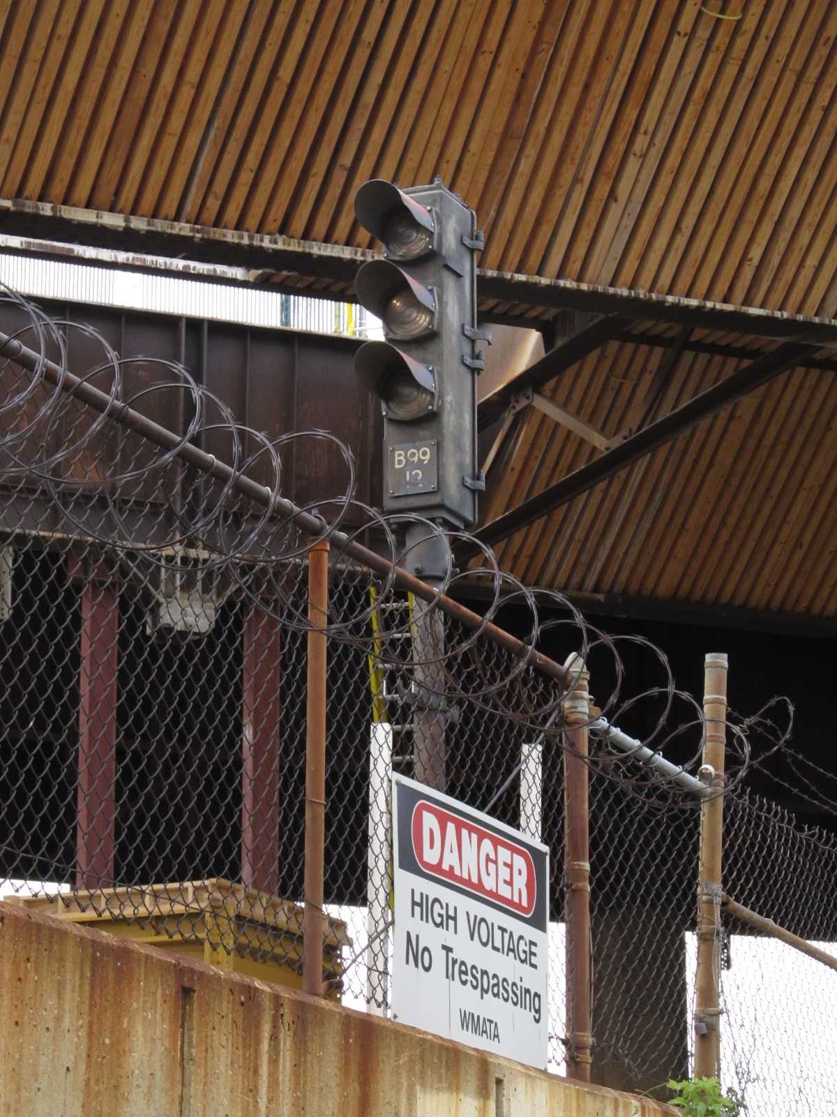
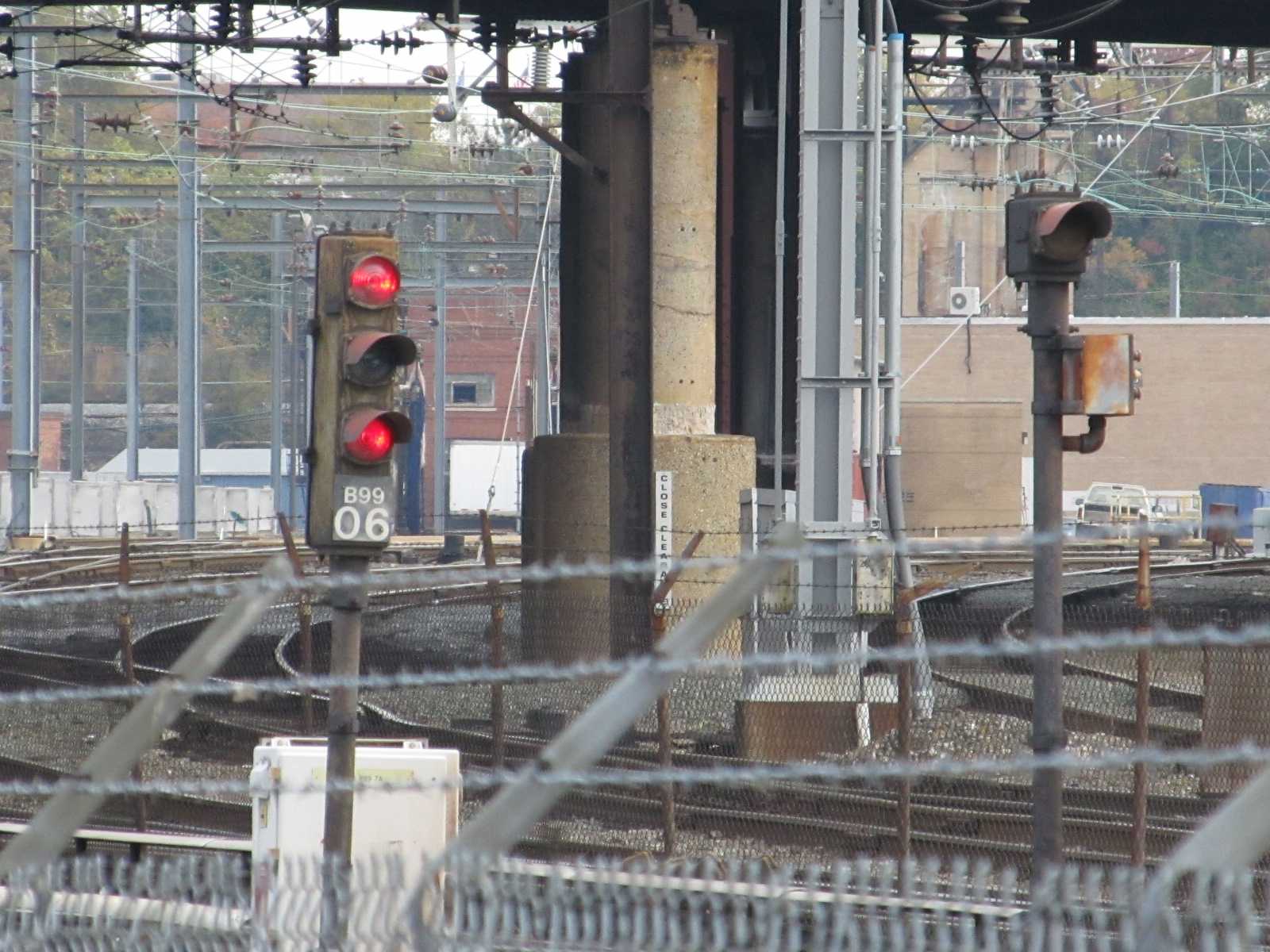
 Metro signals along the trail.
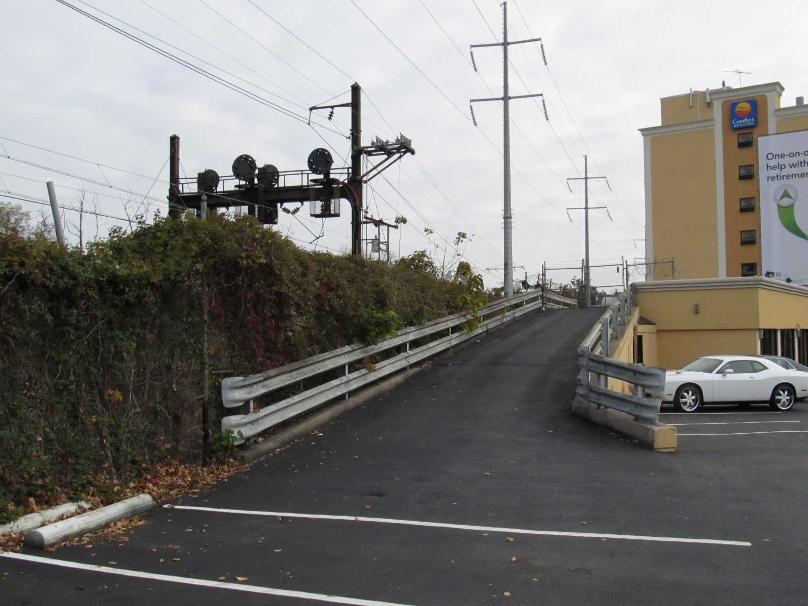
 Picture courtesy Jersey Mike
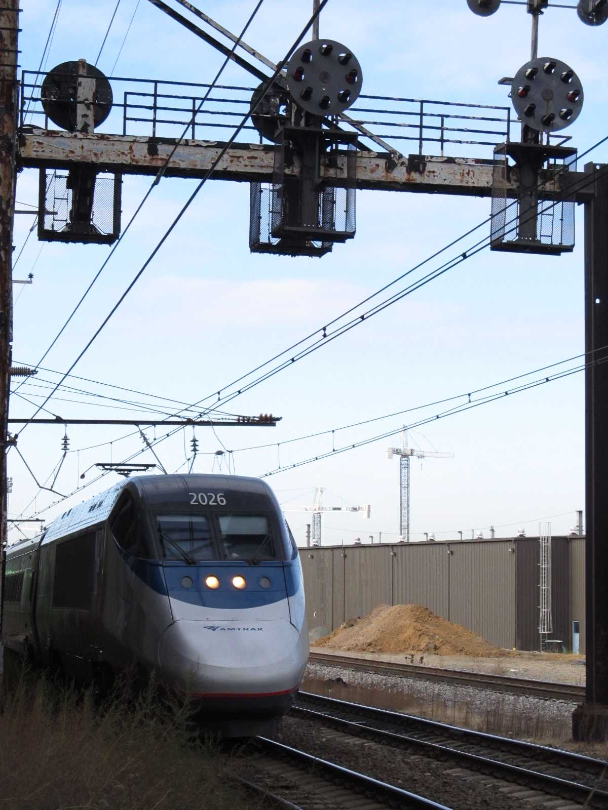
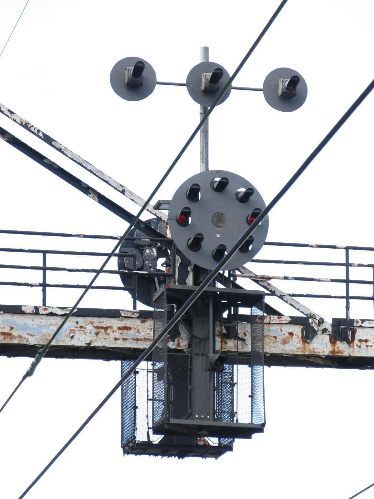
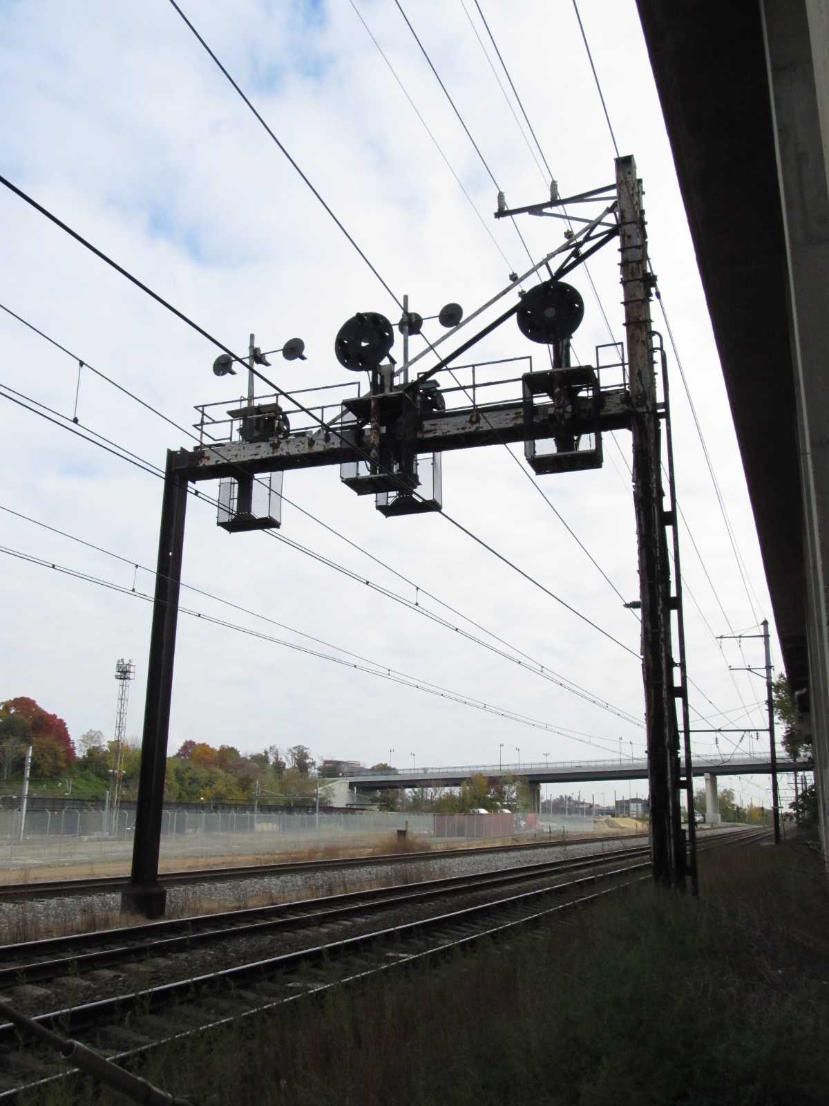
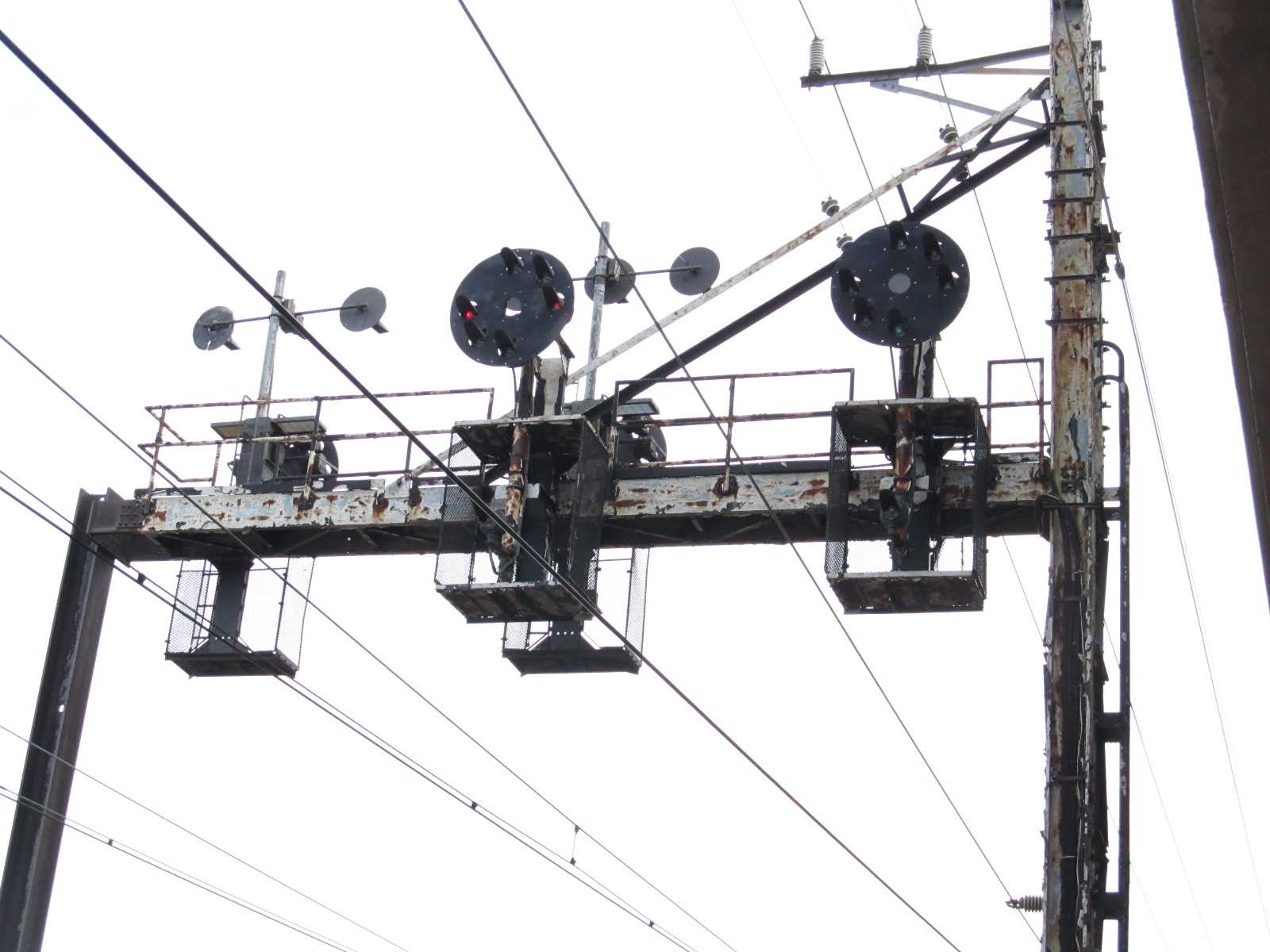 The NB PL side.