In General
Getting Here
Map
Sights
Pictures
Signals
Bridges
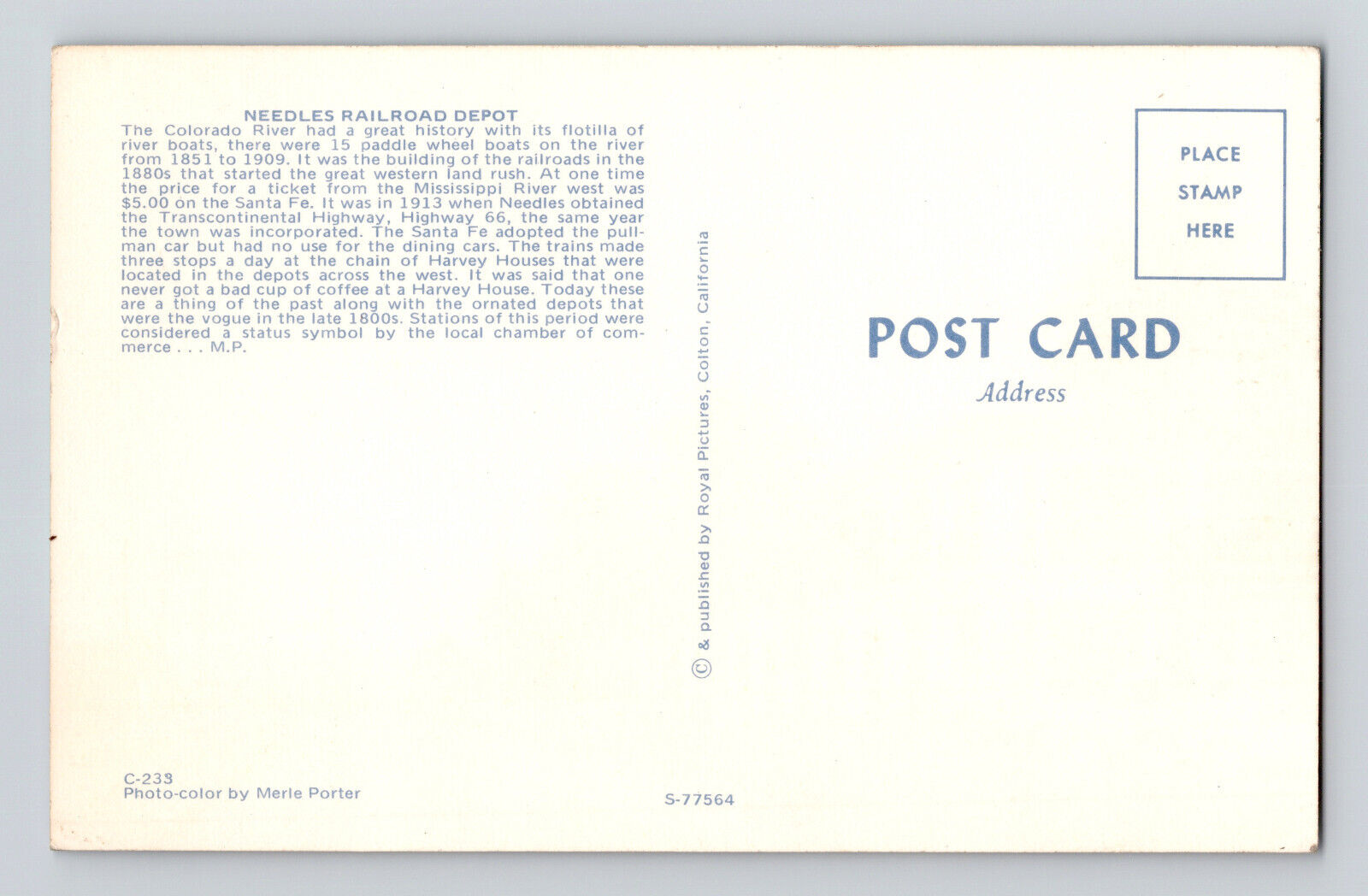
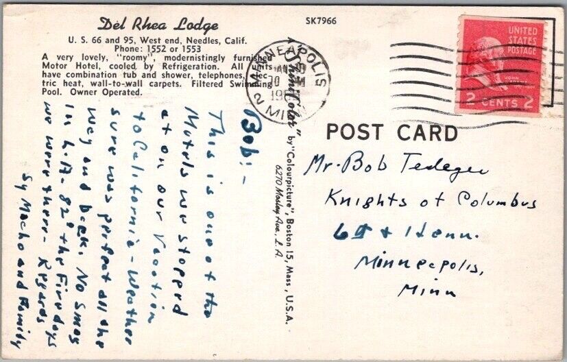
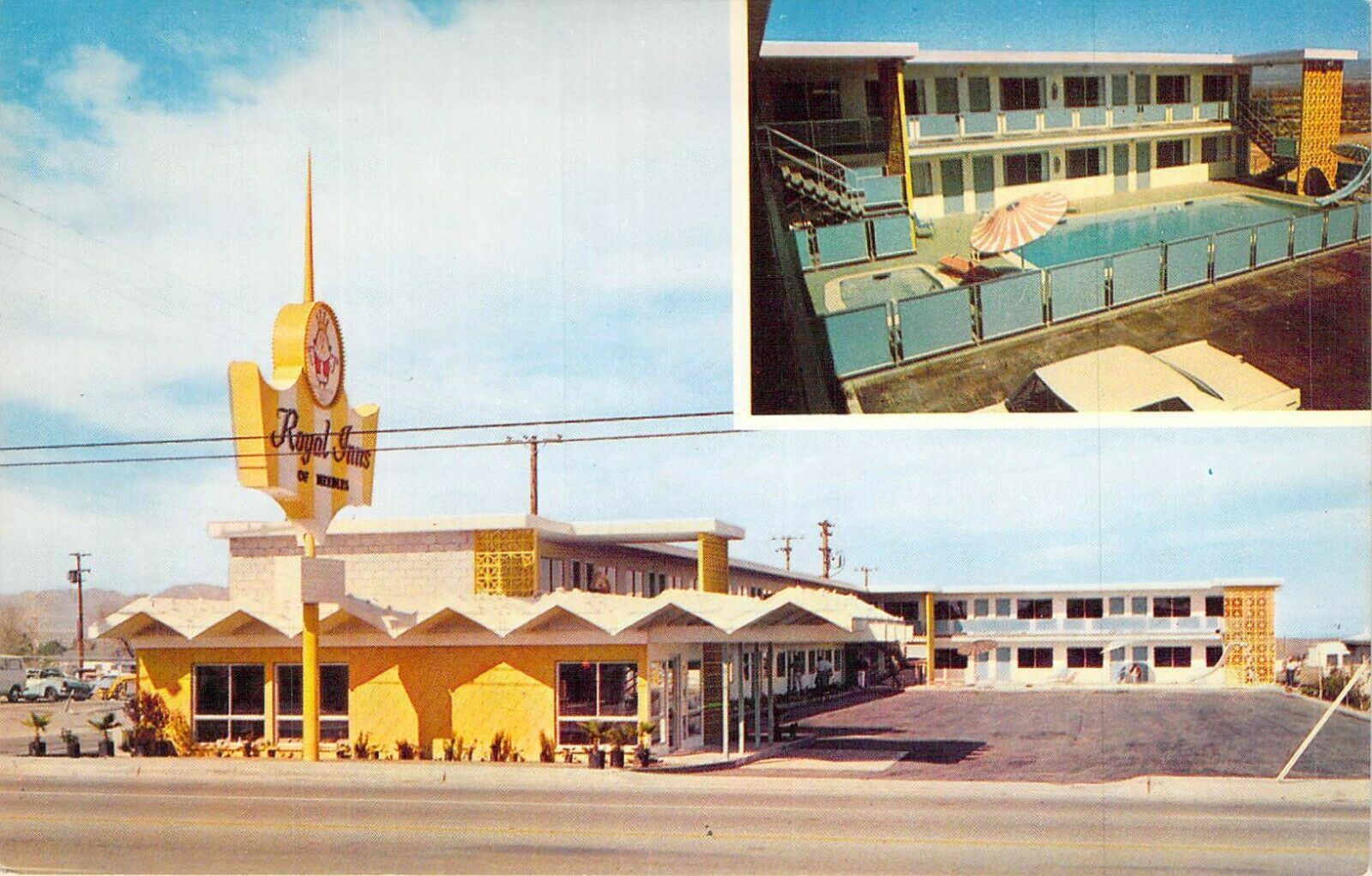
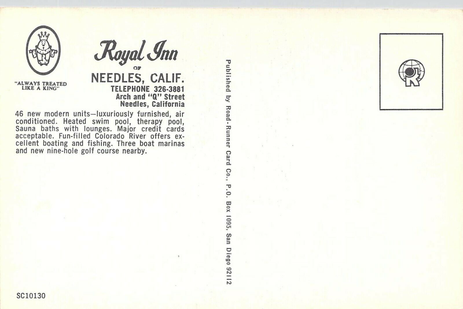
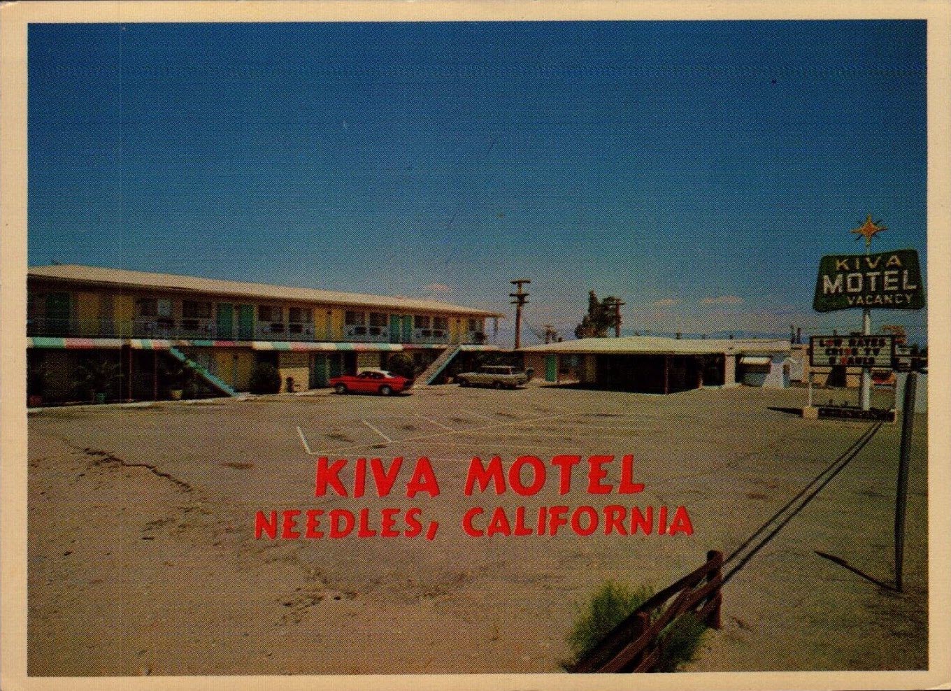
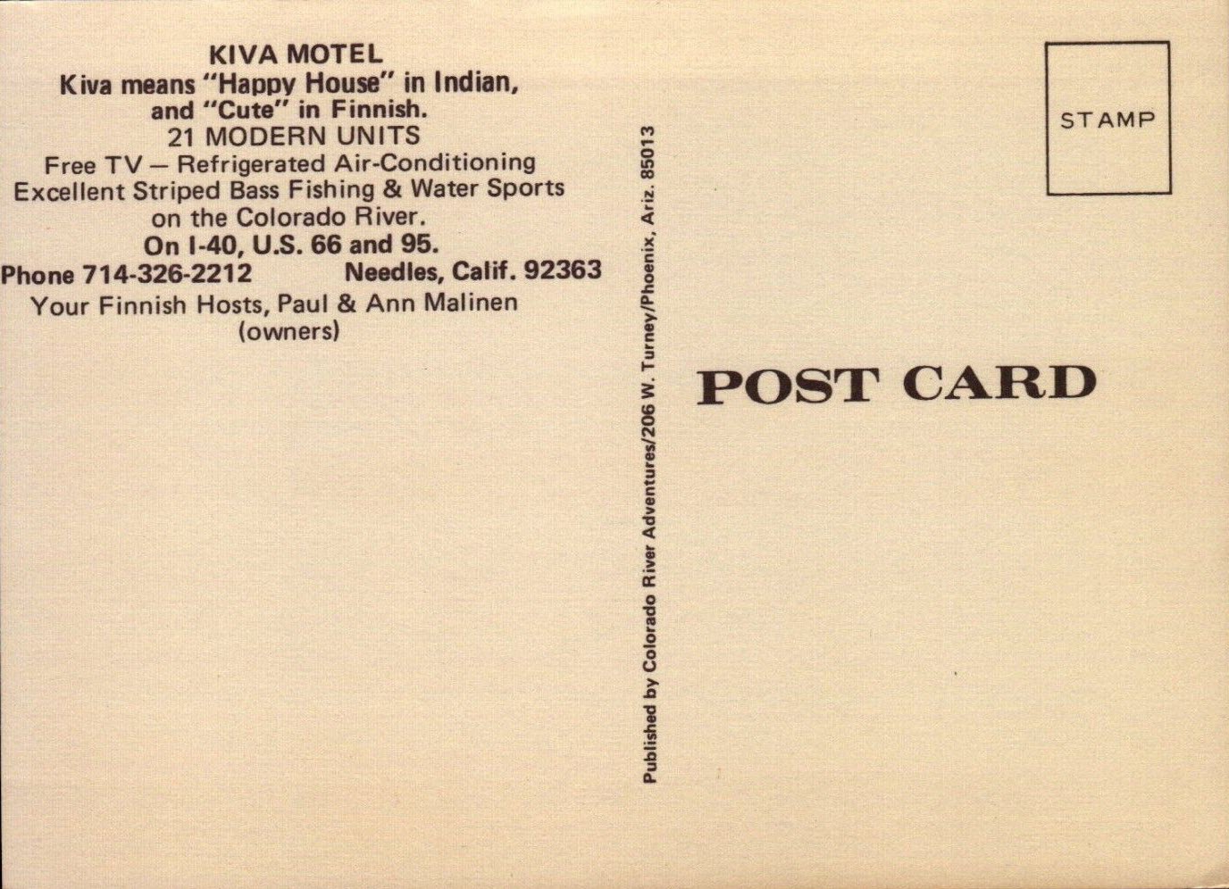
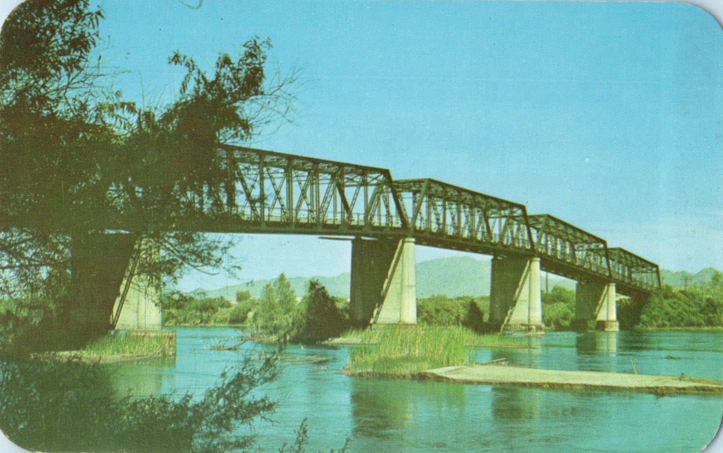
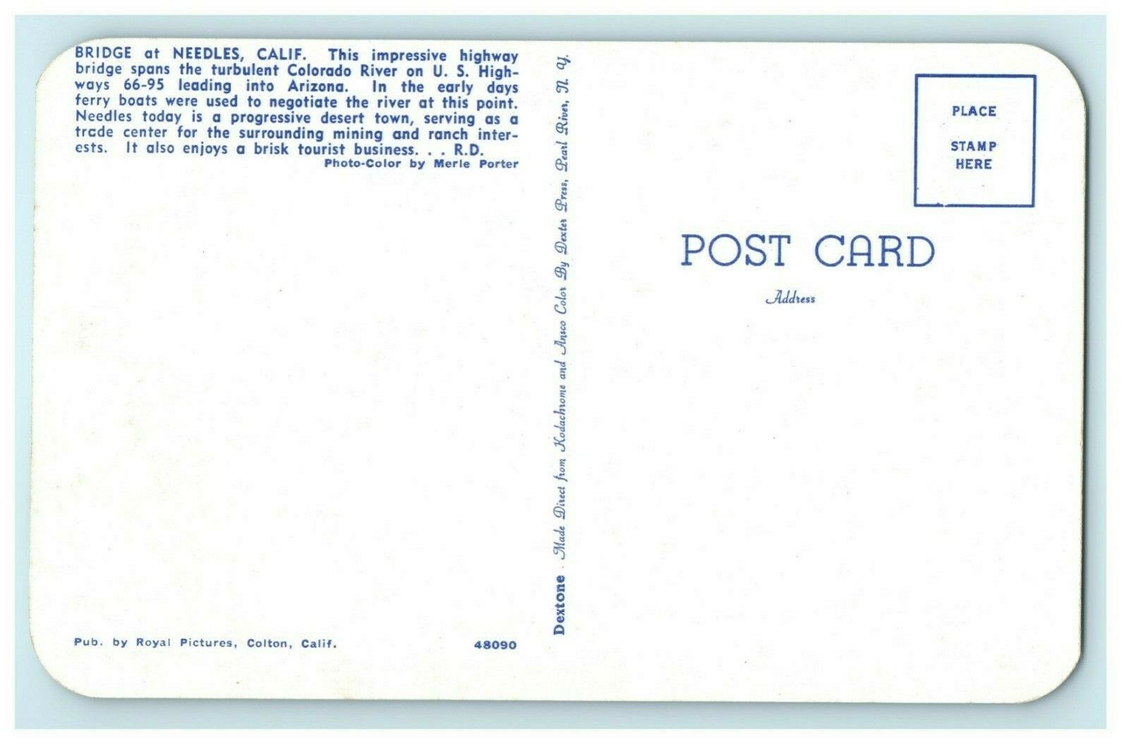
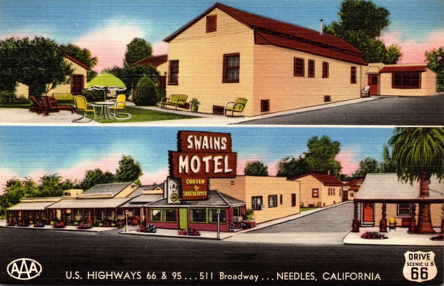
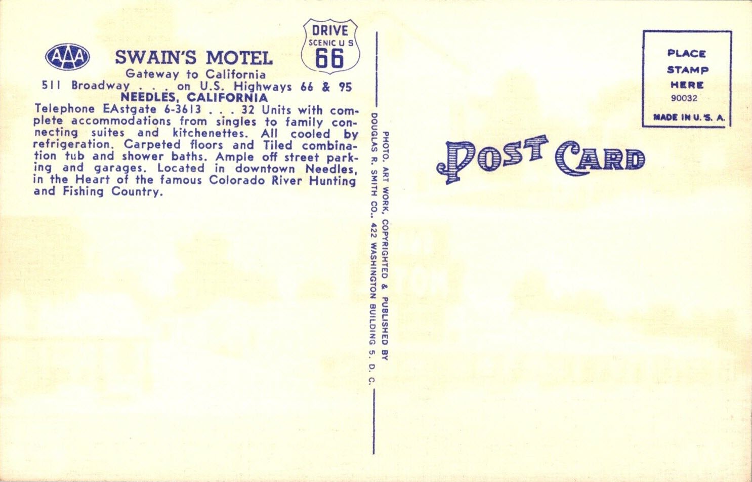
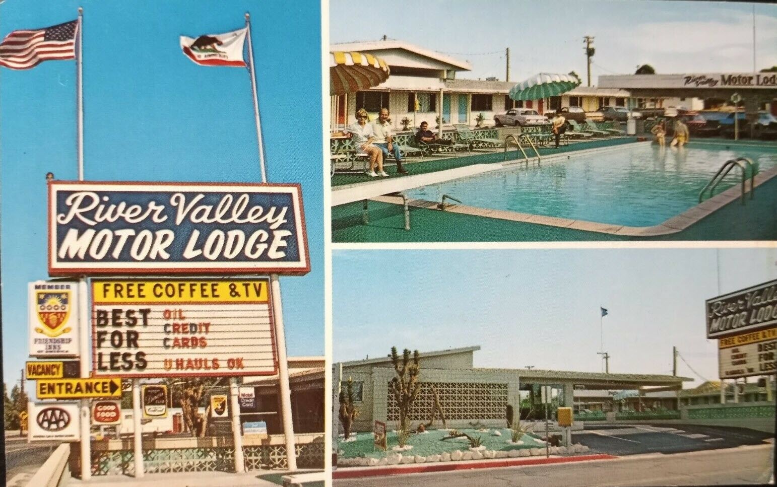
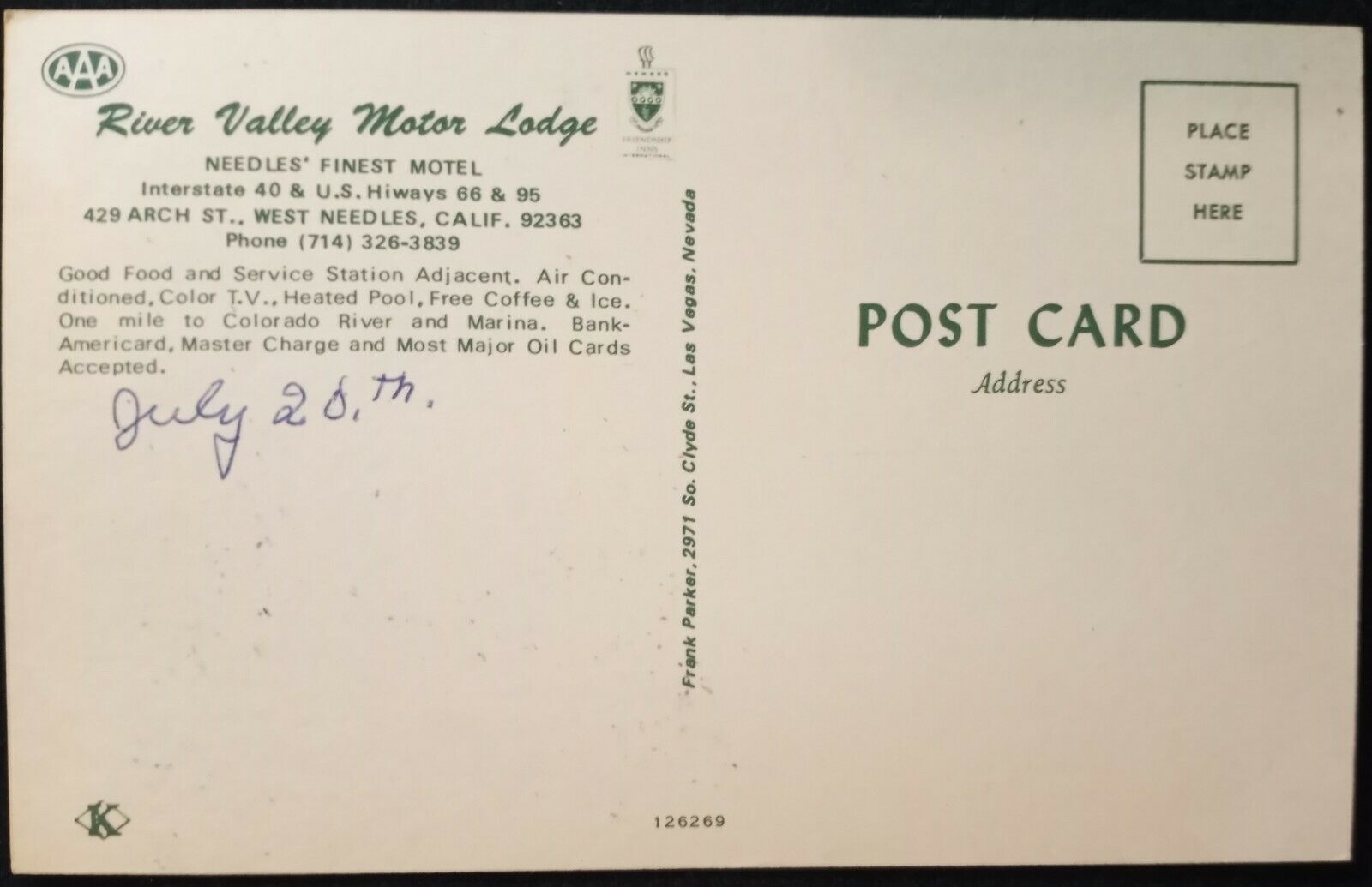
Postcards
Floobydust
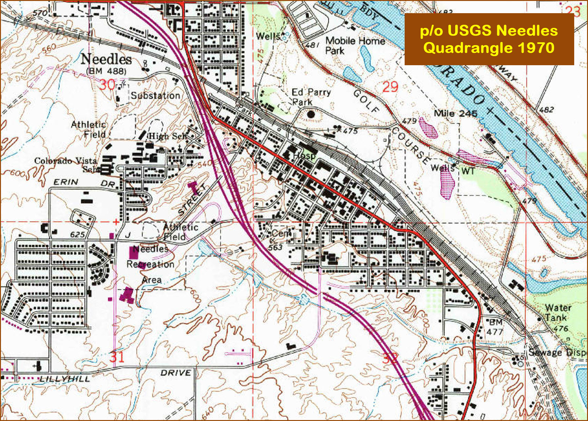
USGS Maps
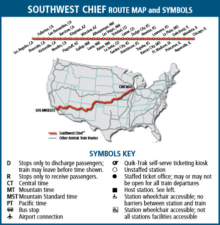
RAILROAD SIGNALS HOME
Location / Name:
Needles CA, San Bernardino County
What's Here:
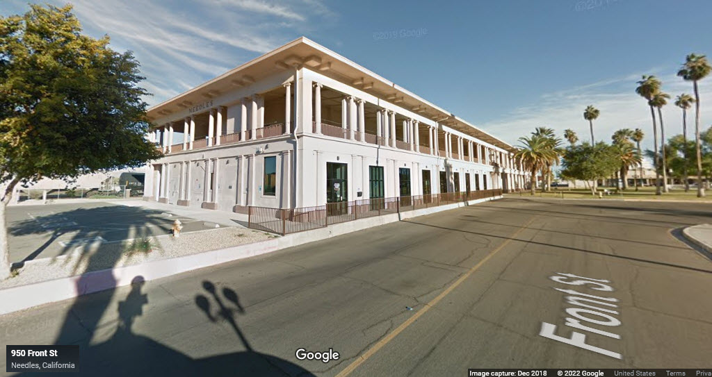
Amtrak Station
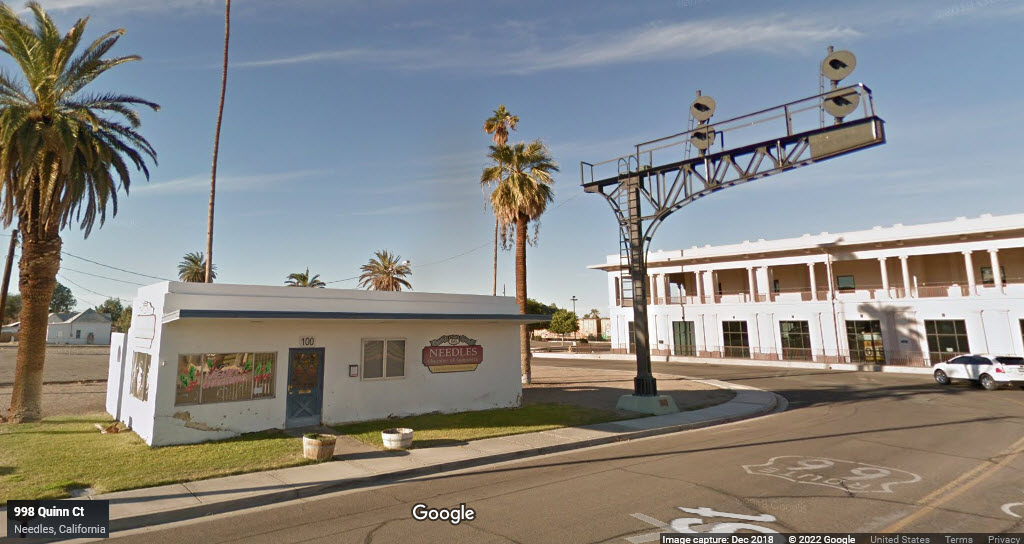
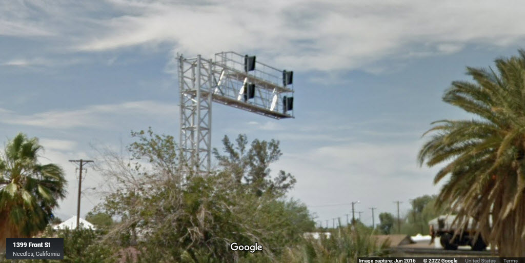
A Saved Cantilever Signal Bridge
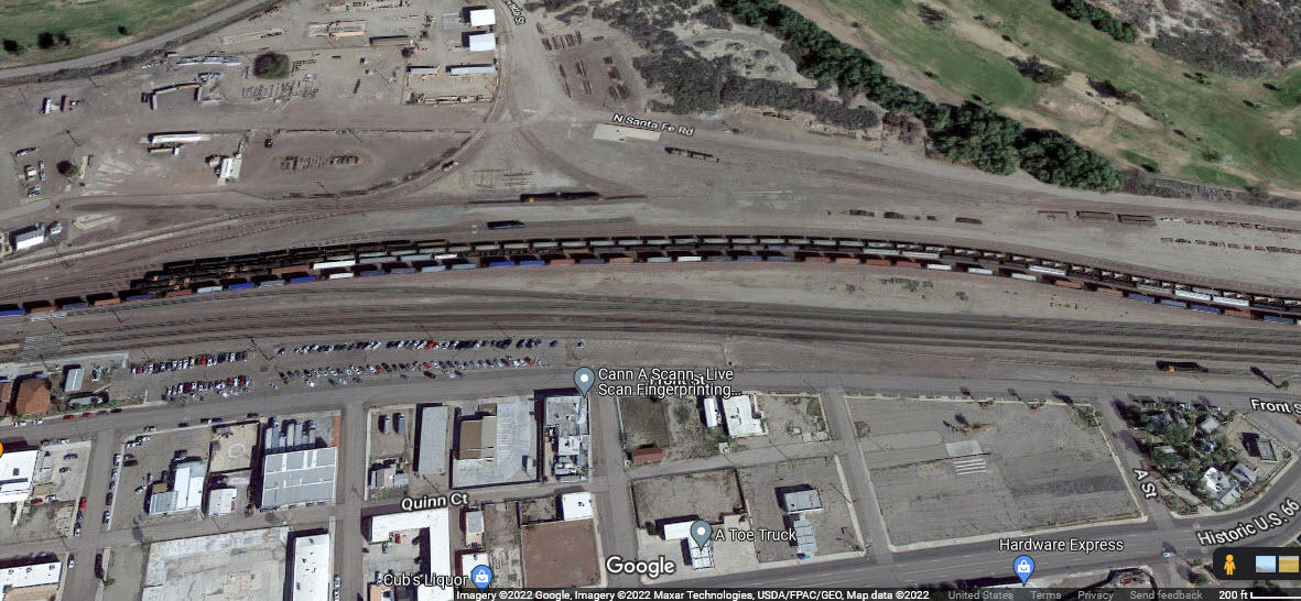
BNSF Yard
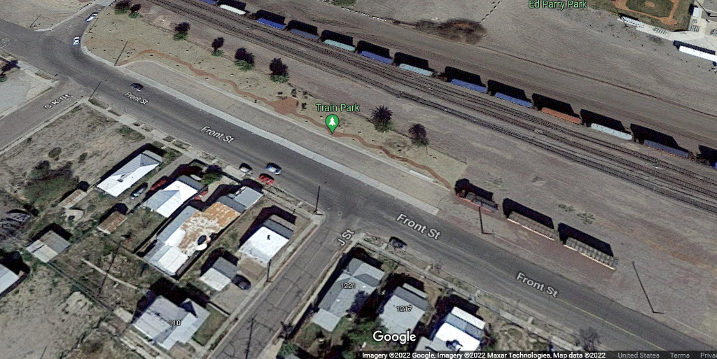
Train Park
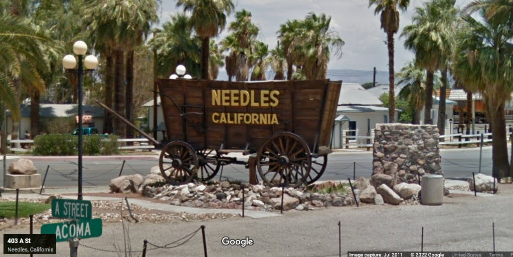
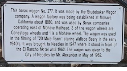
Borax Wagon
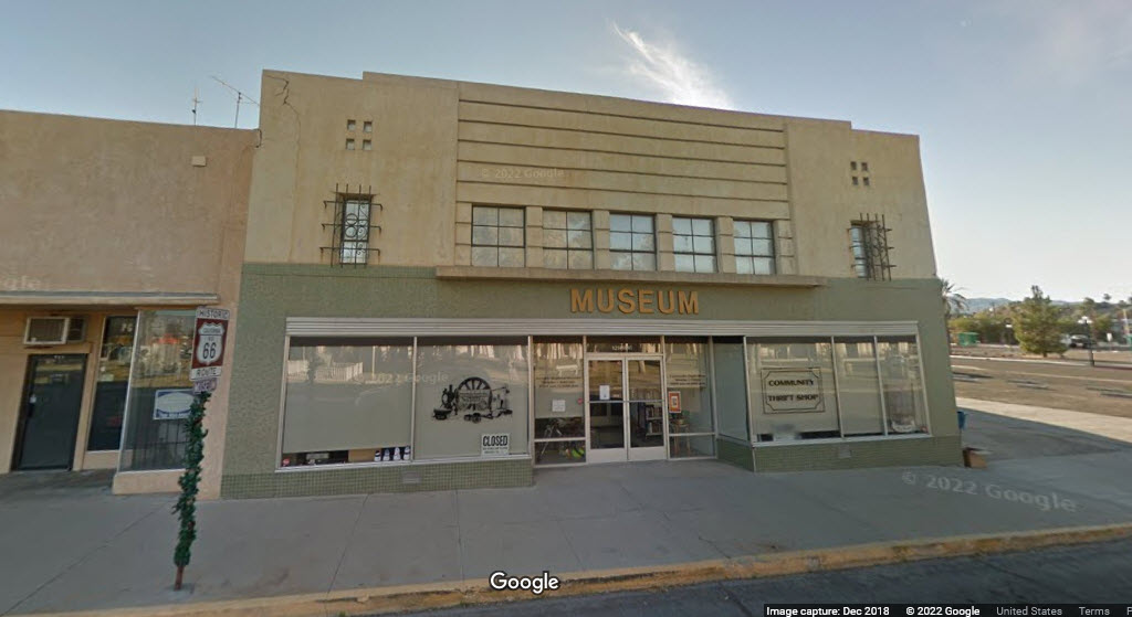
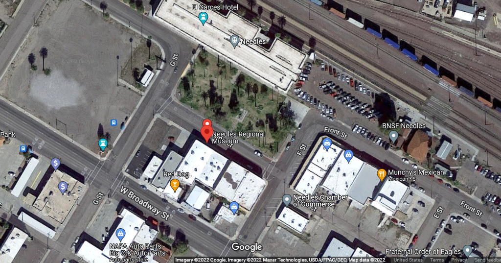
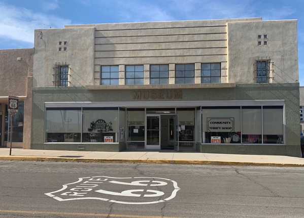
Needles Regional Museum
Data:
GPS Coordinates: as needed
Phone A/C: 760
ZIP: 92363 (at station)
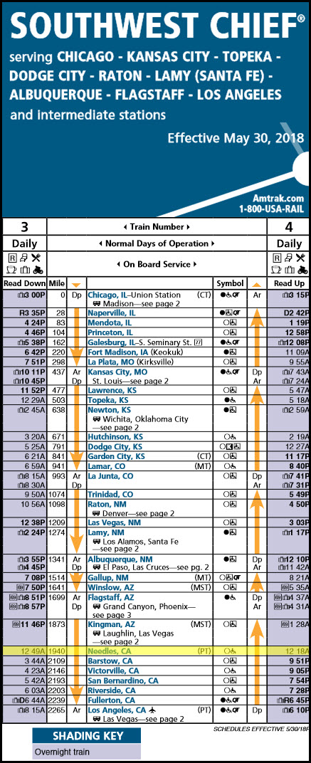
Access by train/transit:
Amtrak Southwest Chief
The Scoop:
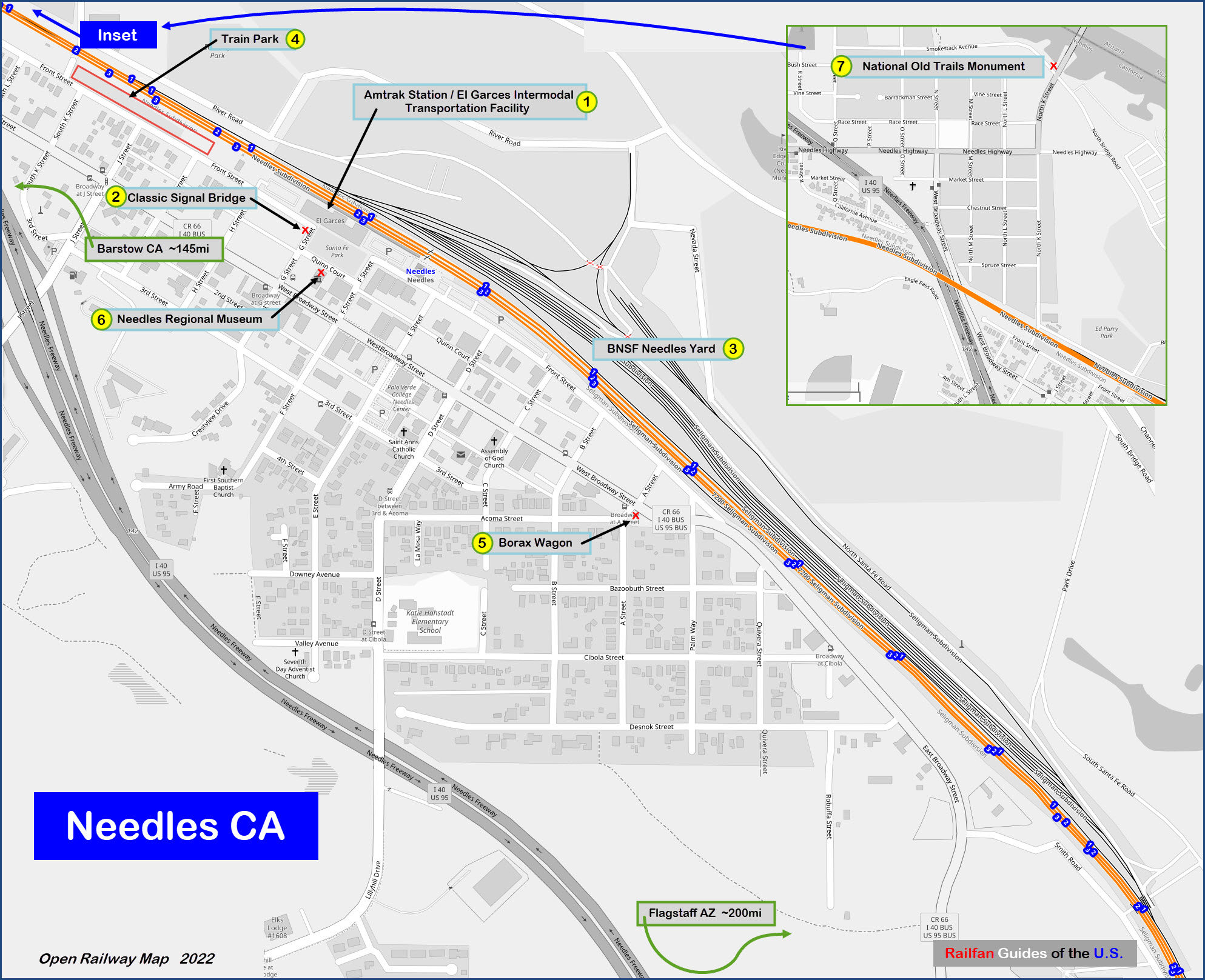
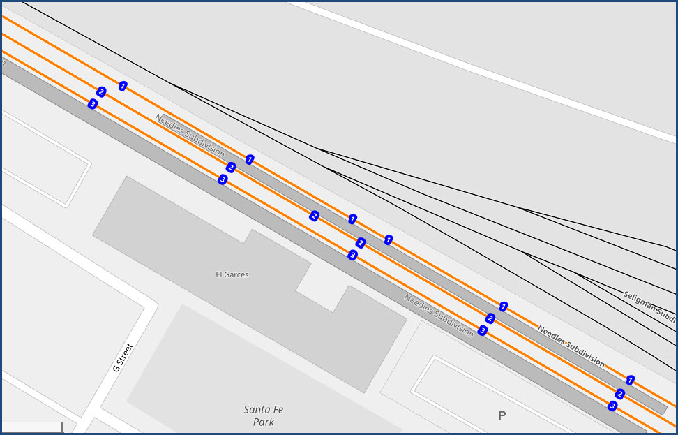
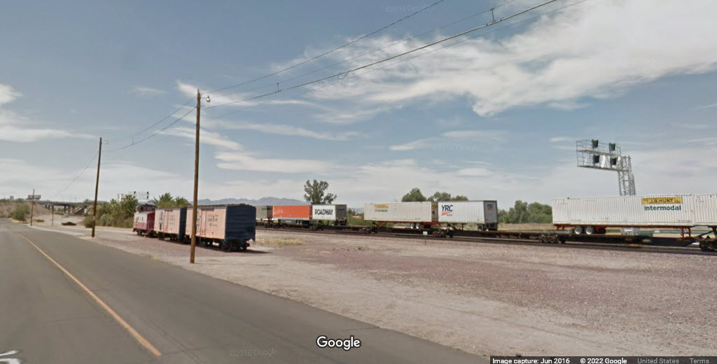
It looks like the BNSF comes through town on three tracks, with the yard starting just east of I-40, and extending east of town about 2 miles. There are approximately 60 to 70 trains a day, which includes passenger, Intermodal, manifest, and auto-trains. Maximum authorized speed limits are 70 for freights and 90 for passenger.
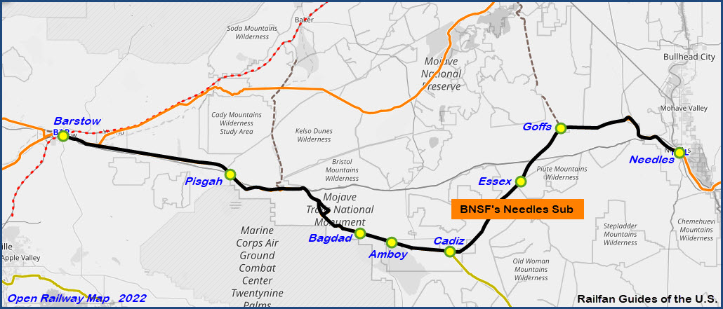
West of Needles is BNSF's Needles Sub, which 170 miles of rugged terrain and a lot of hill climbing. According to other guides for the area, roads, mostly US Route 66 and I-40, do a pretty good job of following the right-of-way for most of the trek. Needles is at 488 feet above sea level, Goffs is 2599. Going westbound, the tracks go from 2 to 4 tracks 3.3 miles south of the station. In looking at the aerial views, there seems to be plenty of dirt roads in the area if you're interested in getting pictures at the signals.
Needles is a division point between the Needles Sub-division (west to Barstow - 171 miles) and the Seligman Sub-division (east to Winslow AZ - about 225 miles), the town of Seligman is -about- the middle of the division.

Amtrak comes through once a day (in each direction) with the Southwest Chief, unfortunately, the times are in the middle of the night: WB #3 at 1:22am, and EB #4 at 1:18am.
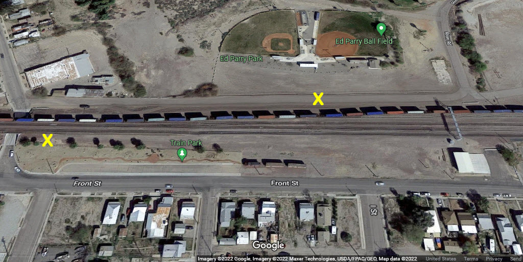
Looks like there are no grade crossings in town, everything goes over or under the tracks.
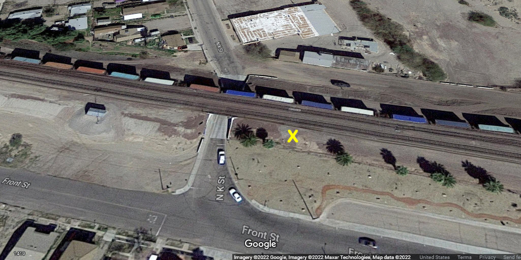
There are two cantilevered signal bridge across from the train park, and there are signals just to the west of I-40 and "below" the yard on the south end, access for the most part is a walking affair, unless you have a dirt bike or ATV :-)
The BNSF yard is a long skinny yard, only a few tracks wide - looks like 6, and as I said, is about 2 miles long.
Other things to see in town is a borax wagon and the Needles Regional Museum featuring a variety of local items.
Refer to the Train Web info page for a lot more information for the area, including good photo locations.
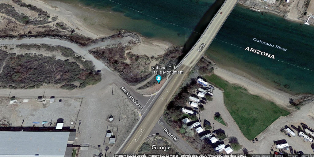
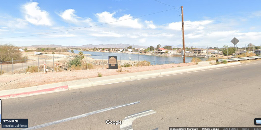
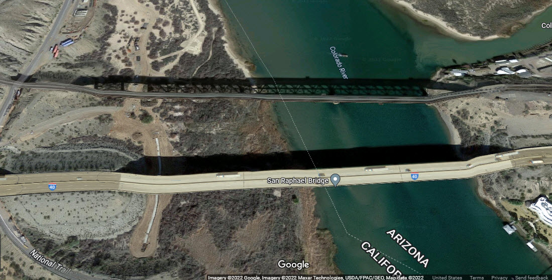
Needles sits on the CA/AZ border, which is the Colorado River. North K Street from Needles goes over the river into Arizona.
Radio Freqs:
AAR 55 / 160.935 - Needles to Hector
AAR 55 / 160.935 - Mojave Dispatcher, Hector to E. Barstow
AAR 32 / 160.590 - Mojave Dispatcher, E. Barstow to Barstow
Acknowledgements:
Denver Todd
Paul Walters
David Carballido-Jeans
Pat Sweeney
James Griffin
Howard Thompson
Google Maps
Bing Maps
Open Railway Map
Wikipedia
Websites and other additional information sources of interest for the area:
https://en.wikipedia.org/wiki/El_Garces_Intermodal_Transportation_Facility
Text only page (pictures missing) about stuff in Needles, including the signal
https://www.greatamericanstations.com/stations/needles-ca-ndl/
https://www.amtrak.com/stations/ndl
http://www.trainweb.org/brettrw/maps/needlessub/needeast.html
https://www.railpictures.net/photo/792409/
https://www.flickr.com/photos/128398014@N04/49662093392/in/photostream/
http://www.qstation.org/Needles_Subdivision/
http://www.trainweb.org/brettrw/bnsf/needles.html
http://www.qstation.org/bnsfresource.html#Railfanning index page for BNSF railfan spots
https://actionroad.net/bnsf/bnsf-action/
http://www.waltersrail.com/2019/03/bnsf-transcon-kansas-city-to-cajon-part.html
Exit 142 from east-west running I-40. Go NE on J Street a couple of blocks to Front St, and take a right to the train station.
US 95 comes up from Yuma AZ, about 180 miles, with a couple of stints on I-10 (20 miles) and I-40 into Needles.
Las Vegas is ~105 miles north via US 95 and I-11.
GPS Coordinates: 34.84071, -11460593
950 Front Street, Needles CA 92363
Amtrak code: NDL
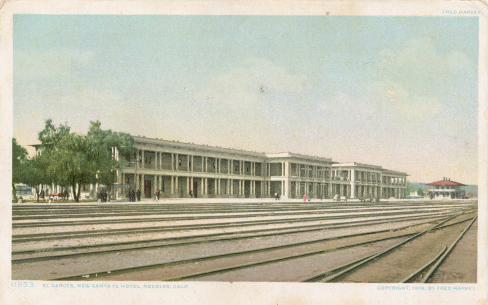
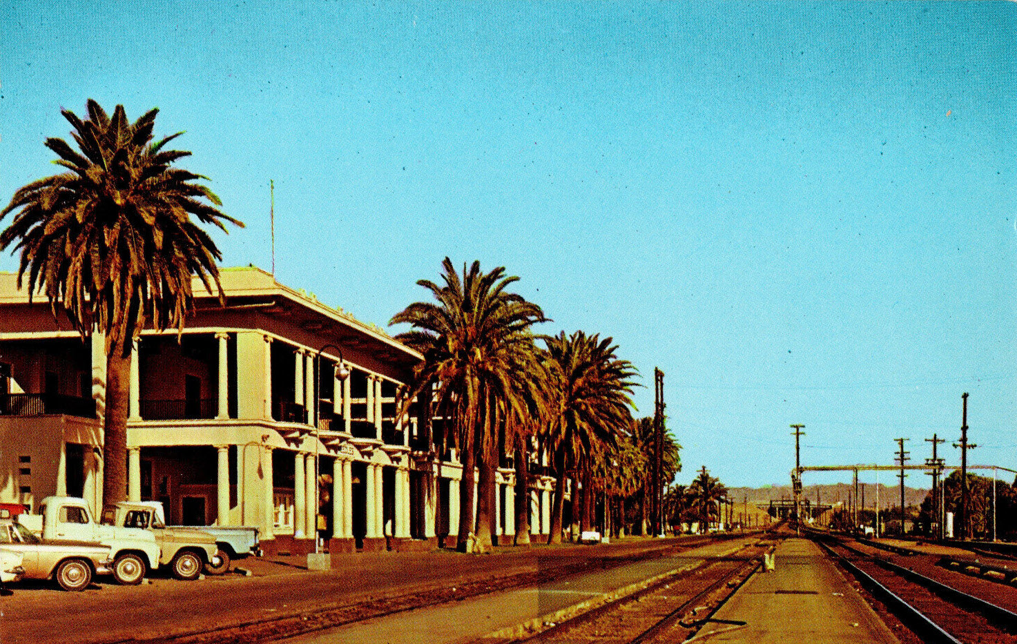
The El Garces Intermodal Transportation Facility (also known as Needles station) is an Amtrak intercity rail station and bus depot in downtown Needles CA. The structure was originally built in 1908 as El Garces, a Harvey House and Atchison, Topeka and Santa Fe Railway (ATSF) station. It is named for Francisco Garcés, a Spanish missionary who surveyed the area in the 1770s. It was added to the National Register of Historic Places in 2002.
This screenshot comes from one of the postcards below, if they only knew then, what we have today that passes for food on trains! :-) :-)
 from Wikipedia
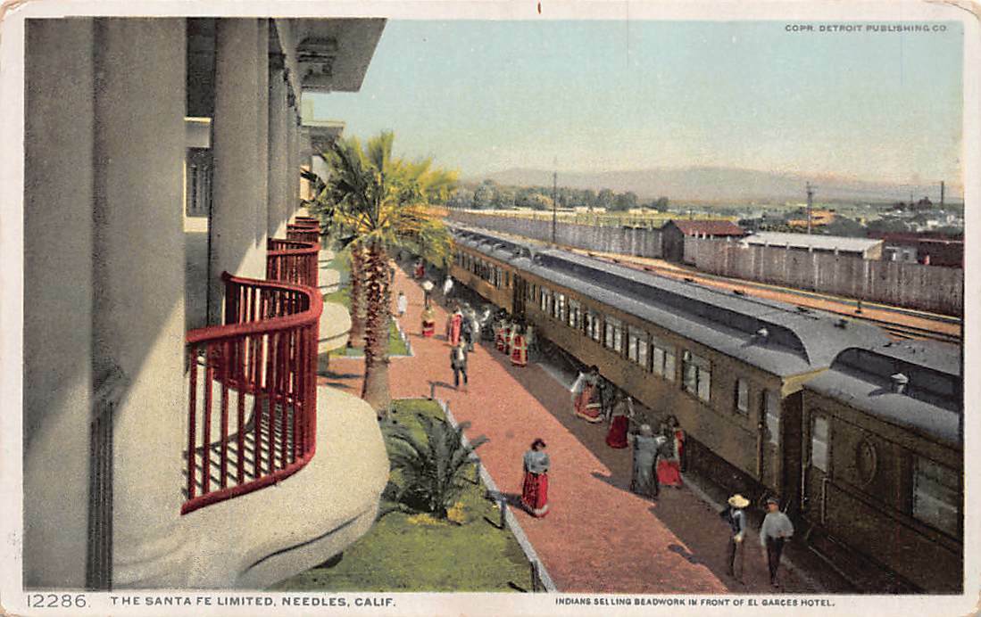
GPS Coordinates: 34.84053, -11460653
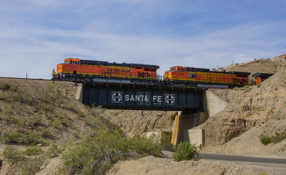
Normally, this would go under the signals heading, but since it is a preserved signal, and one preserved by the city, it gets a special mention in this section. It's across the street from the train station.
City of Needles Mayor Edward T. Paget dedicated the old railroad cantilever signal to the community and the people who work on the railroad. According to City of Needles Mayor Edward T. Paget, BNSF RR donated the old railroad cantilever signal in early 2013, the Friends of the Needles Centennial raised money for the moving and placement project, and the City of Needles Public Works Department Crew Members removed the old railroad cantilever signal from its railroad side location on the west end of Needles in the spring of 2013. Needles Public Works Department crews on Monday, October 20th, 2014 dig out the hole for the foundation of the old railroad cantilever signal (Above Pictures) and built the base to hold up the old railroad cantilever signal which the signal part of the old railroad cantilever signal will be hanging over G Street facing West Broadway and Downtown Needles, California. They then assembled together parts of the old railroad signal at its new location on the windy morning of Monday, November 17th, 2014. (from the page above with the missing pictures)
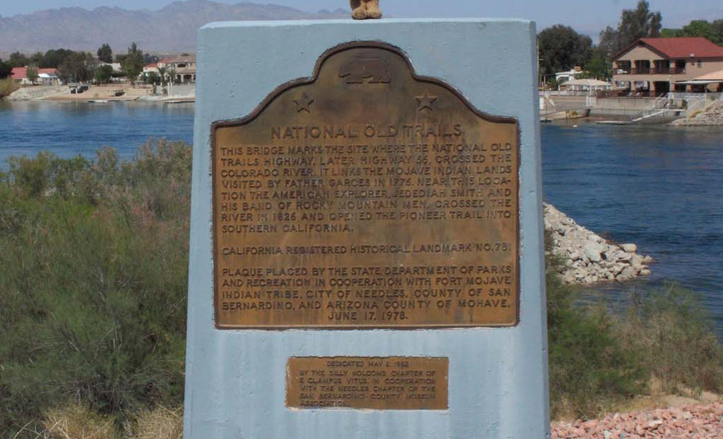
GPS Coordinates: 34.840862, -114.605457
Looks like the engines will be most accessible from Santa Fe Rd, using Smith Road to go under the tracks to get to the north side where the engines sit.
GPS Coordinates: 34.842376, -114.609459
Along Front St next to the train station
The park features an ATSF caboose and a couple of ATSF boxcars, and a place to watch trains from.
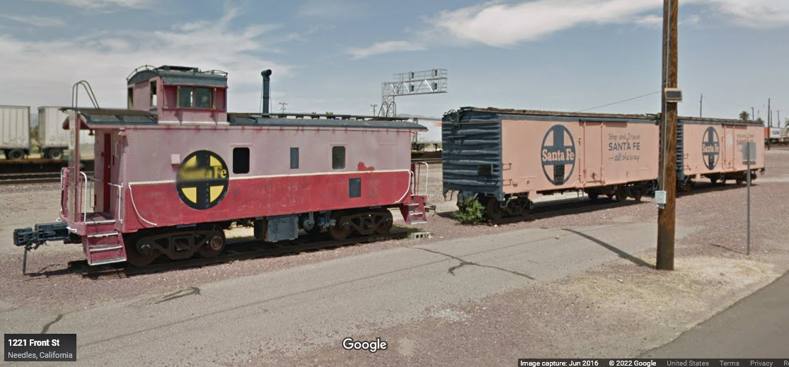
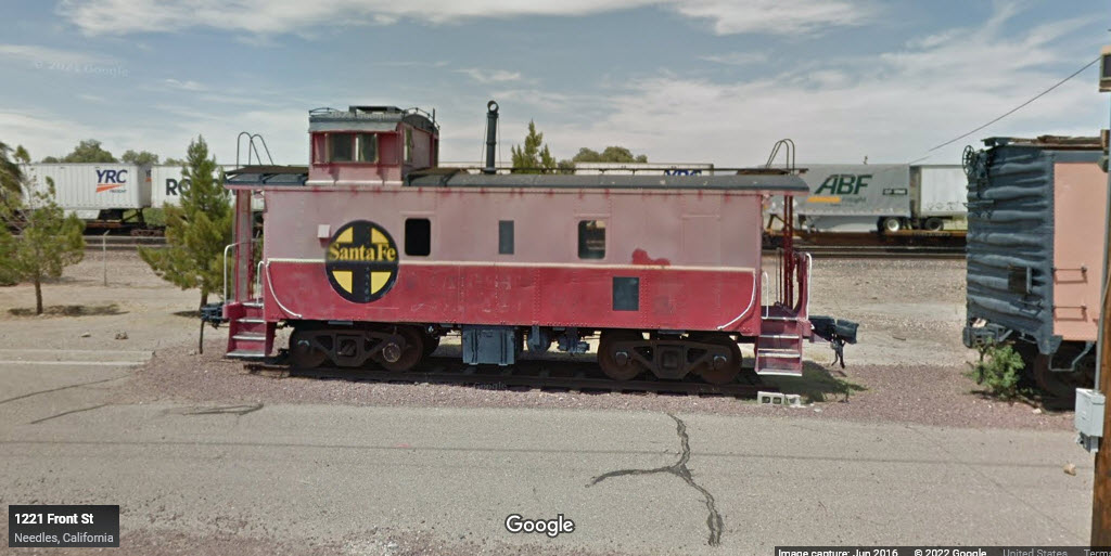
GPS Coordinates: 34.836406, -114.600565
305-399 W Broadway St, Needles CA 92363
GPS Coordinates: 34.840000, -114.60615
929 Front St, Needles, CA 92363
https://www.needlesregionalmuseum.org/
https://www.facebook.com/profile.php?id=100057098604820
Features ‘Spike’.... Snoopy, the comic cartoon dog’s brother, who was from Needles (among other things)
GPS Coordinates: 34.85098, -114.60971
About 975 North K St, Needles, CA 92363
 12/22/21
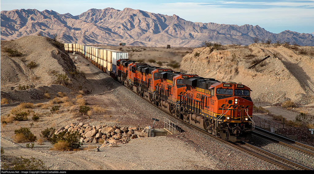
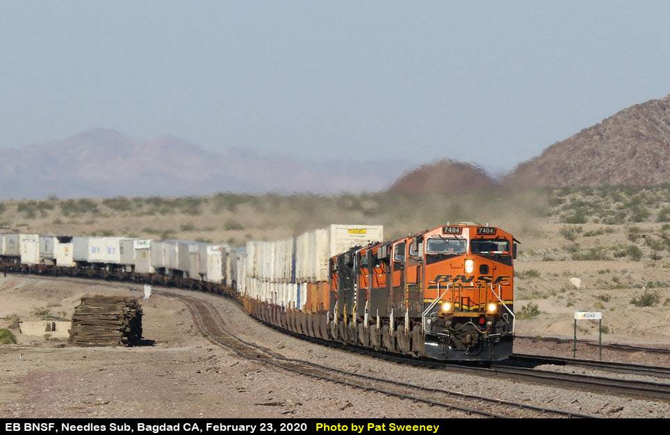
One of the hottest trains on the railroad, the Los Angeles to Willow Springs UPS Z9, races into Needles for a crew change. With 118 UPS loads, this hotshot train will arrive into Willow Springs just after midnight of Christmas Eve to unload last minute Christmas gifts.
https://actionroad.net/bnsf/bnsf-action/
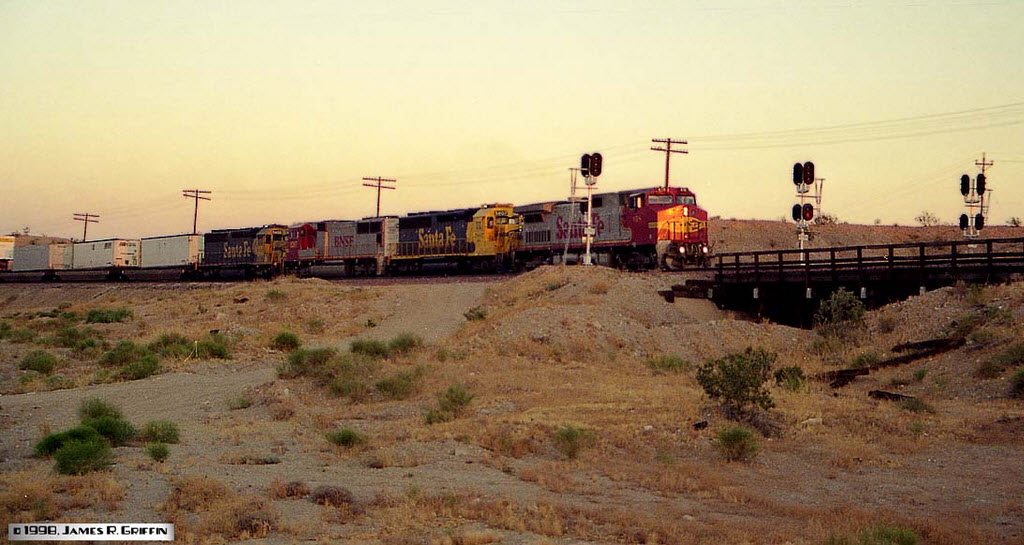
A westbound Intermodal train hits the grade out of the Colorado River valley at Needles. The long train has a mostly Santa Fe consist (the warbonnet SD75I is lettered for BNSF). Two SD45-2’s are still wearing the blue/yellow warbonnet scheme, though they’ve been patched and renumbered into the BNSF system.(5/23/1998)
GPS Coordinates: 34.84236, -11460820
These are probably "new" signals, as they are not showing up on Googles aerial view, yet (8/22). The bottom pictures shows where the signals should be, but aren't shown yet.
GPS Coordinates: 34.84293, -114.61039
GPS Coordinates: 34.71822, -114.48823 (center)
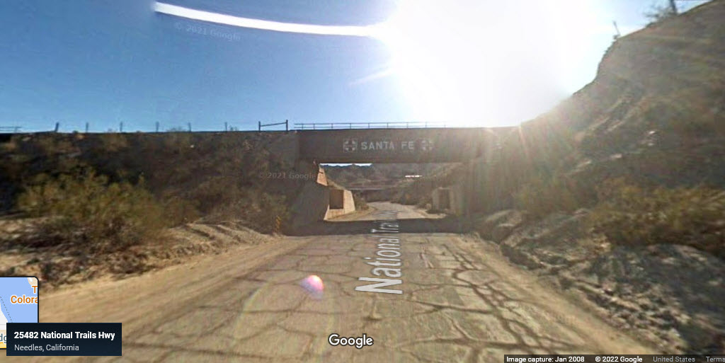
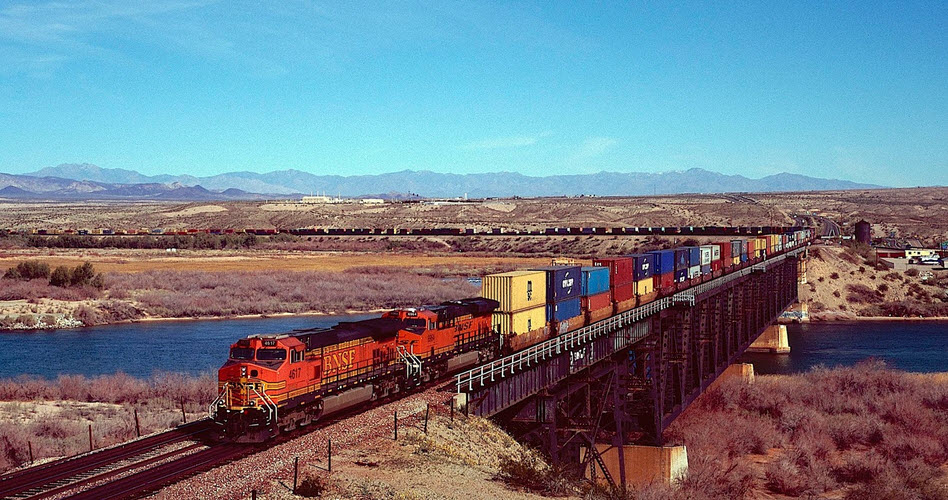
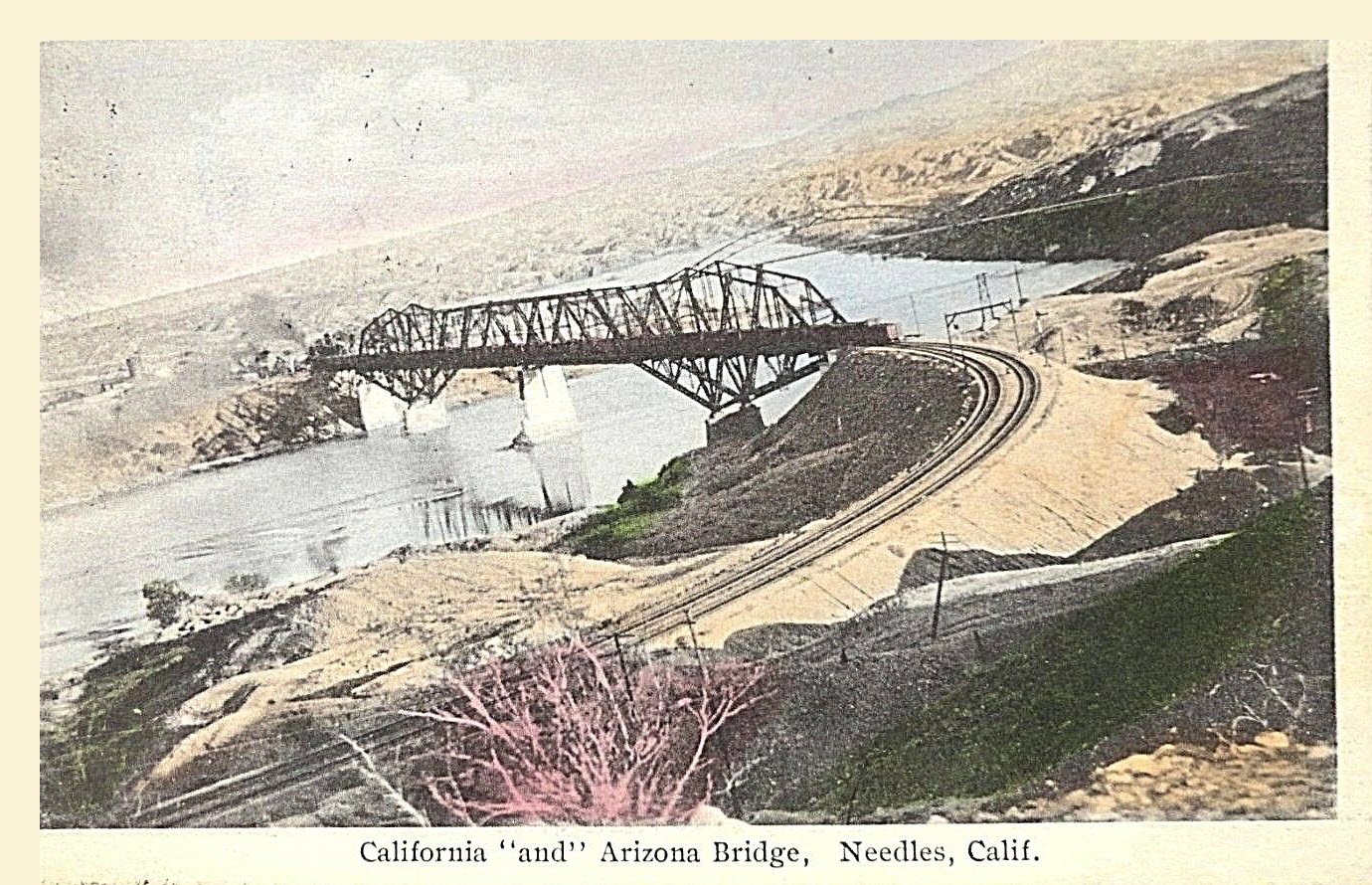
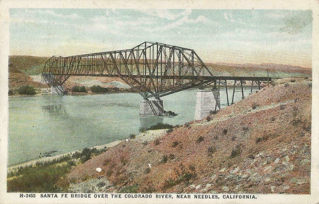
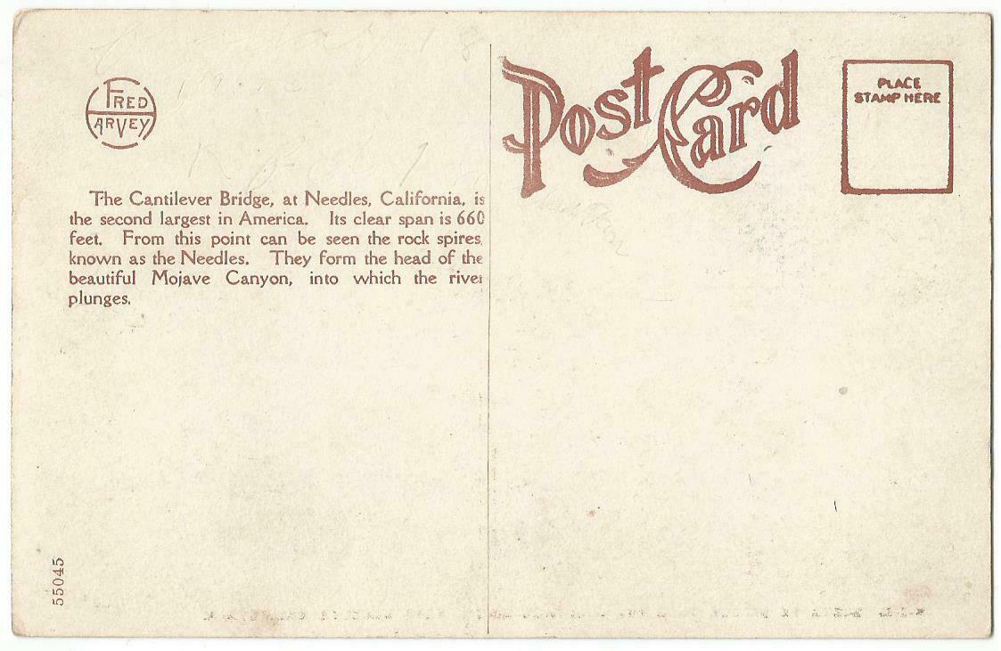
With as many trains coming through here each day, you shouldn't have to wait for pictures from a number of spots! I'm not sure, but I'm guessing the old postcard pictures are a previous version of this bridge? Not Sure. The bridge is actually about 12 miles south of Needles via I-40, but WELL worth the trip if you have come this far!
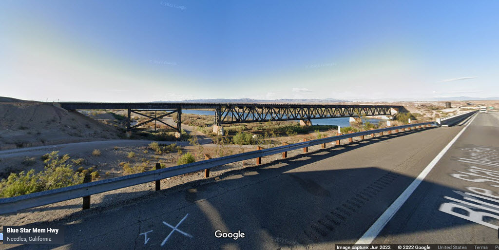
On the California side, the National Trails Highway runs under one of the approach spans to the main bridge, and it stills says "Santa Fe" on it.
 2019, Paul Walters
http://www.waltersrail.com/2019/03/bnsf-transcon-kansas-city-to-cajon-part.html
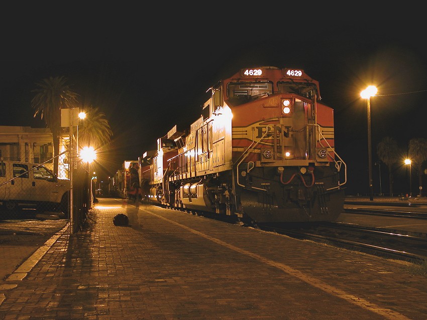
 2015, Howard Thompson
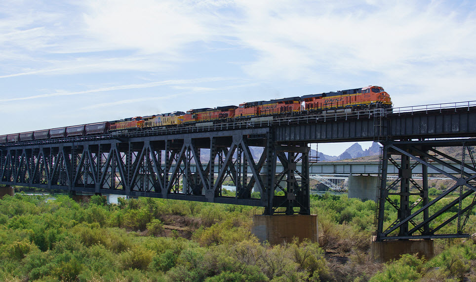 2015, Howard Thompson
Two pictures from: https://2for66.com/2015/05/04/route-66-day-8-needles-to-williams/

Courtesy of the USGS, click here for their index page.
Disclaimers:
I love trains, and I love signals. I am not an expert. My webpages reflect what I find on the topic of the page. This is something I have fun with while trying to help others.
Please Note: Since the main focus of my two websites is railroad signals, the railfan guides are oriented towards the signal fan being able to locate them. For those of you into the modeling aspect of our hobby, my indexa page has a list of almost everything railroad oriented I can think of to provide you with at least a few pictures to help you detail your pike.
If this is a railfan page, every effort has been made to make sure that the information contained on this map and in this railfan guide is correct. Once in a while, an error may creep in :-)
My philosophy: Pictures and maps are worth a thousand words, especially for railfanning. Text descriptions only get you so far, especially if you get lost or disoriented. Take along good maps.... a GPS is OK to get somewhere, but maps are still better if you get lost! I belong to AAA, which allows you to get local maps for free when you visit the local branches. ADC puts out a nice series of county maps for the Washington DC area, but their state maps do not have the railroads on them. If you can find em, I like the National Geographic map book of the U.S..... good, clear, and concise graphics, and they do a really good job of showing you where tourist type attractions are, although they too lack the railroads. Other notes about specific areas will show up on that page if known.
Aerial shots were taken from either Google or Bing Maps as noted. Screen captures are made with Snagit, a Techsmith product... a great tool if you have never used it!
By the way, floobydust is a term I picked up 30-40 years ago from a National Semiconductor data book, and means miscellaneous and/or other stuff.
Pictures and additional information is always needed if anyone feels inclined to take 'em, send 'em, and share 'em, or if you have something to add or correct.... credit is always given! Please be NICE!!! Contact info is here
Beware: If used as a source, ANYTHING from Wikipedia must be treated as being possibly inaccurate, wrong, or not true.
RAILFAN GUIDES HOME
RAILROAD SIGNALS HOME
NEW 08/19/2022, AUG20/21/2022
Last Modified 21-Aug-2022