In General
Getting Here
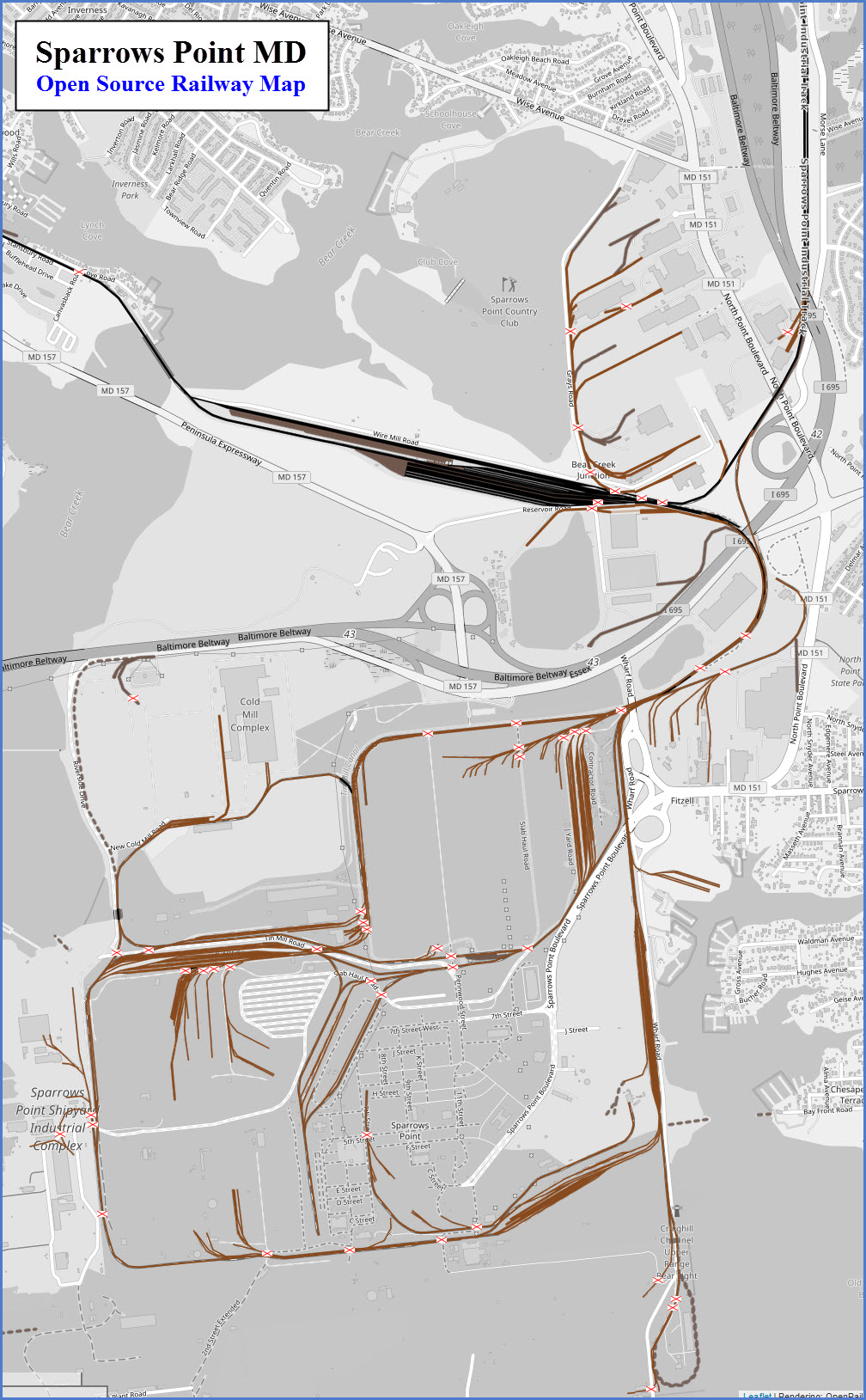
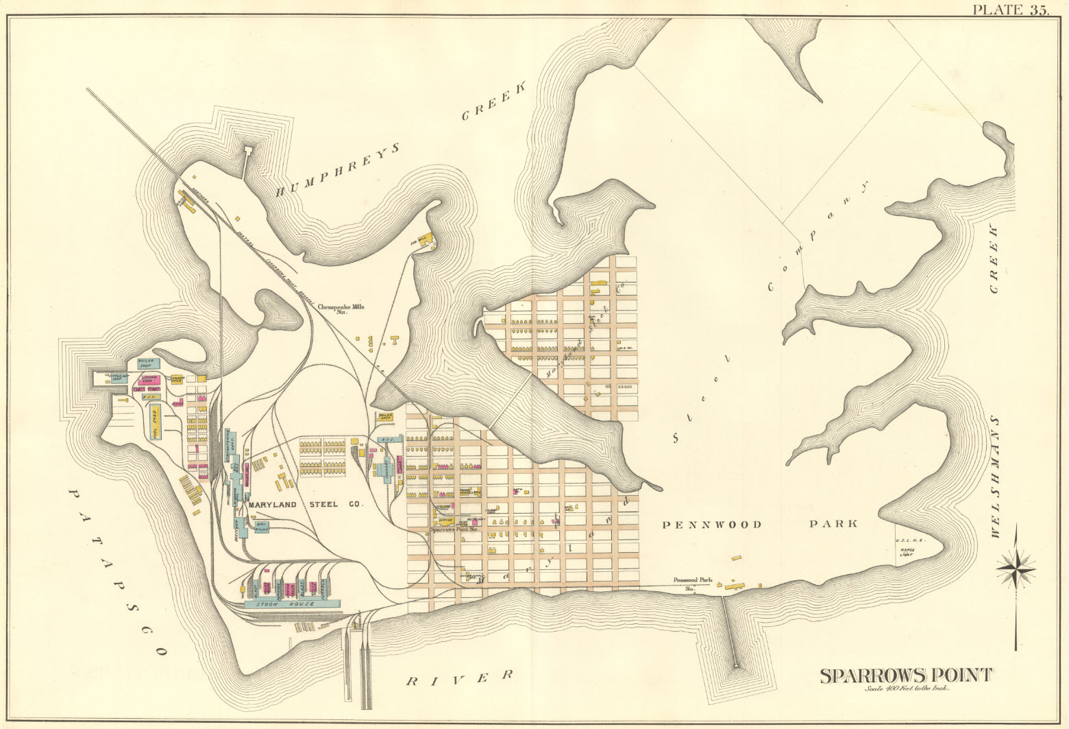
Map
Sights
Signals
Fire & Police
the Patapsco & Back Rivers RR
Transit
The Bethlehem Steel - Steel Mill
In General
Getting Here
Map
Sights
Signals
Fire & Police
the Patapsco & Back Rivers RR
Transit
The Bethlehem Steel - Steel Mill
RAILFAN GUIDES HOME
RAILROAD SIGNALS HOME
Guide Home Maps Hiways Hotels Intro Railroad Sights Links Photos Busses Bio's
Station & Depots
Yards
Museums
Other Sights
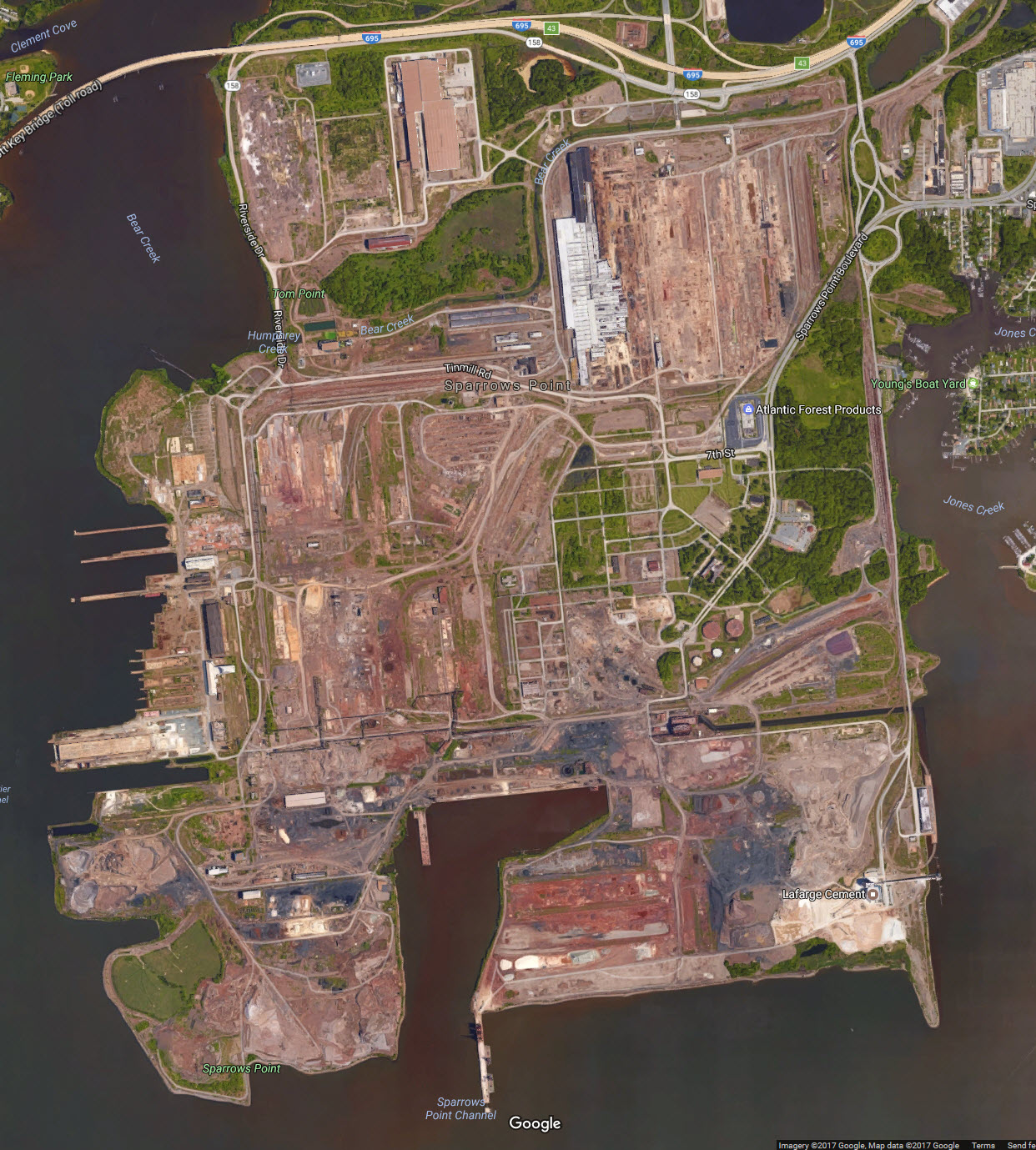
The map below shows the area to the southeast of Baltimore City, most of which is in Baltimore County.
Of all of the areas covered in the Baltimore Railfan Guide, this area is probably tied with MAP 4 for the least activity for the railfan.
The Bethlehem Steel - Steel Mill Disclaimers: I love trains, and I love signals. I am not an
expert. I do these pages because I love spending my time doing them -
although I do a reasonable amount of research to make sure the information
presented is accurate! :-) :-) Please Note: Since the main focus of my two websites is railroad signals, the railfan guides
are oriented towards the signal fan being able to locate them. For those
of you into the modeling aspect of our hobby, my
indexa page has a list of
almost everything railroad oriented I can think of to provide you with at least a few pictures to
help you detail your pike. If this is a railfan page, every effort has
been made to make sure that the information contained on this map and in this
railfan guide is correct. Once in a while, an error may creep in,
oooooooops, oh well! :-)
My philosophy: Pictures and maps are worth a
thousand words, especially for railfanning. Text descriptions only
get you so far, especially if you get lost or disoriented. Take
along good maps.... a GPS is OK to get somewhere, but maps are still
better if you get lost! I belong to AAA, which allows you to get
local maps for free when you visit the local branches. ADC puts
out a nice series of county maps for the Washington DC area, but their
state maps do not have the railroads on them. If you can find em,
I like the National Geographic map book of the U.S..... good, clear, and
concise graphics, and they do a really good job of showing you where
tourist type attractions are, although they too lack the railroads.
Other notes about specific areas will show up on that page if known. Beware: If used as a source, ANYTHING from Wikipedia must be treated as
being possibly being inaccurate, wrong, or not true.
RAILFAN GUIDES HOME
Admittedly, since Bethlehem Steel sold off all of it's operations, there is
not much going on "down here" in Sparrows Point. Traffic in and out of Gray's yard is substantially less.
Shoot, we even lost our last semaphore of the Baltimore area in 2009.
If you can catch a freight over Bear Creek, nice shots can be had, but you need to scout out the area before it comes thru so you know where you want to be. As far as the NS tracks go..... good
luck, as even in the "good ole" days, it was hard to catch a Conrail freight in or out of Grays yard..... now it's even harder.
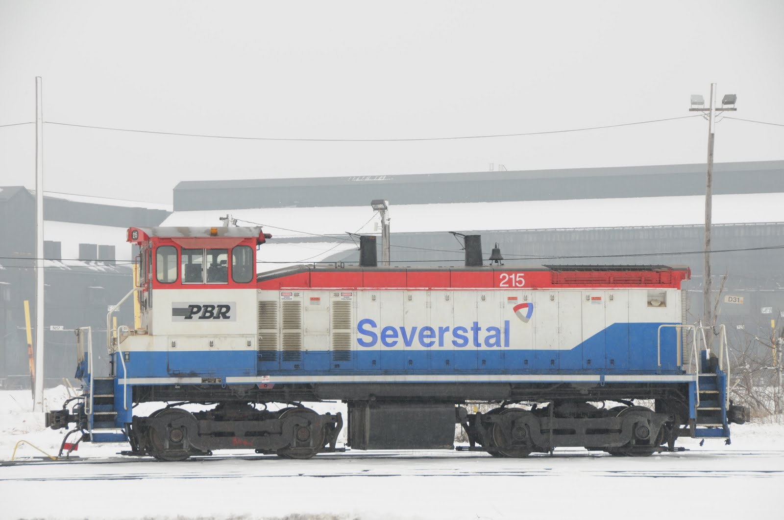
The Patapsco and Back River RR engines were painted the same as the rest of the Beth Steel paint schemes, yellow engines with black lettering and insignia - altho I haven't been to Sparrows Point for
a number of years to see if this is still how they are painted. In the old days, the Beth Steel police were a formidable obstacle to getting good pictures because they were concerned about
industrial espionage - don't know what it's like today.
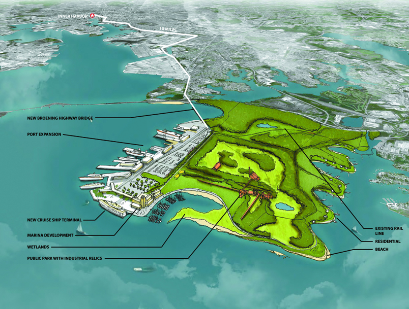
With most, if not all of Sparrows Point steel mills torn down, there is a
lot of talk about doing something with the land, below is one proposal.
For additional reading:
https://en.wikipedia.org/wiki/Patapsco_and_Back_Rivers_Railroad
http://stephenvoss.photoshelter.com/gallery/WSJ-Sparrows-Point/G000002FRsjUYcHk/
Exit 42 or 43 if you are coming here by way of 695, the Baltimore Beltway. If you are coming from the Glen Burnie area, or the south west side of Baltimore, you will have to cross the Francis Scott Key
Bridge, which is something like 4 bucks (2017).
If you are coming here from the downtown area, go east on Eastern Ave, and then bear right onto Dundalk Ave (3.2mi from President St). Go south about 1.3mi to Holabird Ave, and take a left. In one
block, take a right onto Sollers Point Rd. In about 1.3mi, it will turn into the Peninsula Expy, and take you into Sparrows Point.
If you are in Canton at either the Canton or Penn-Mary Yards, just take Holabird Ave east until you get to Sollers Point Rd after you cross Dundalk Ave (1.5mi).
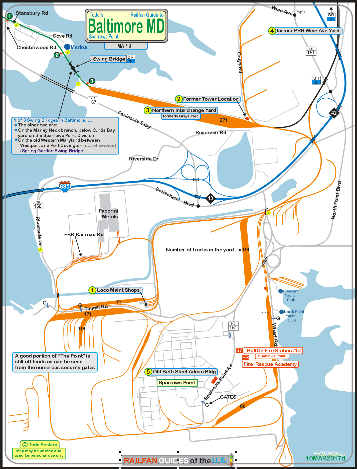
The above map is here as a PDF
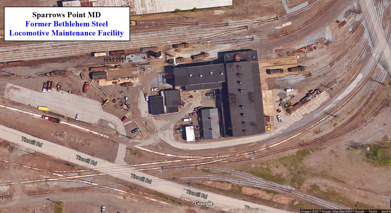
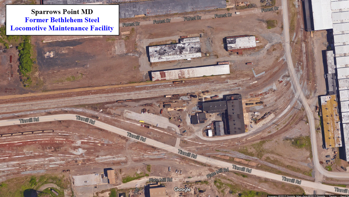
![]() Locomotive Maintenance Shops
Locomotive Maintenance Shops
GPS Coordinates: 39.226761, -76.479573
Don't know if this is still an active facility or not (as of early 2017) - and
I didn't see any operating engines on a visit in March of 2017 (doesn't prove
anything tho).
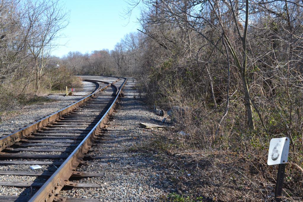
Interesting track work if you want to model an industrial complex!
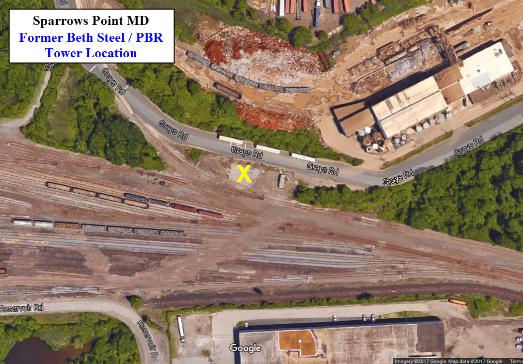
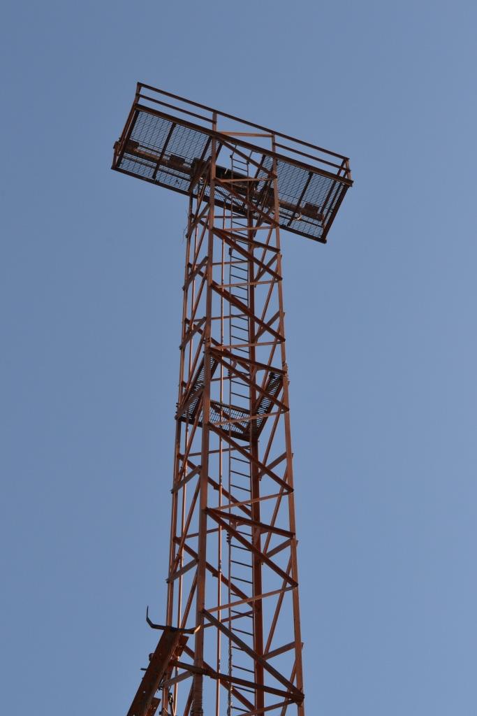
![]() Former PBR Tower Location
Former PBR Tower Location
GPS Coordinates: 39.244137, -76.466059
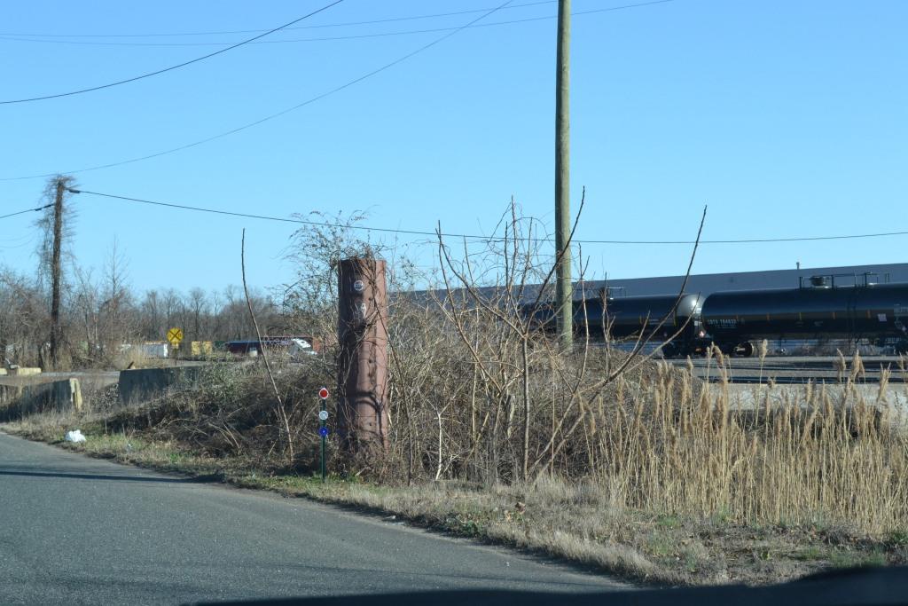
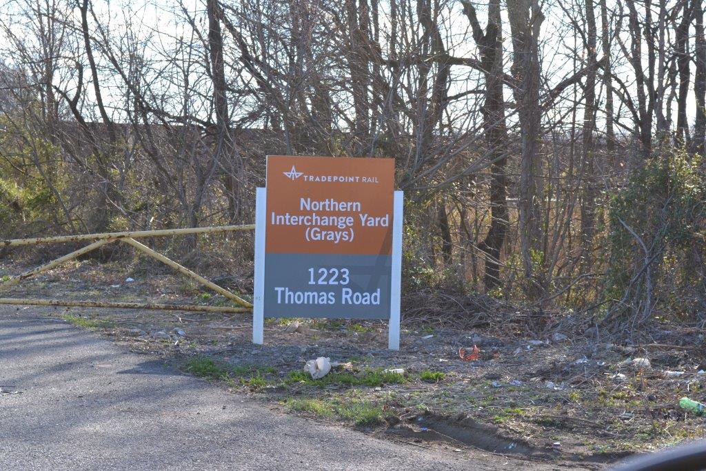
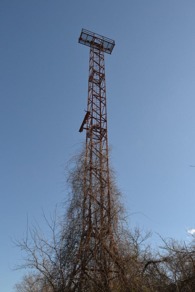
![]() Northern Interchange Yard
Northern Interchange Yard
GPS Coordinates: 39.244930, -76.473531
Under the Patapsco & Back Rivers RR, this yard was known as Grays Yard. I'm a guessin that when the railroad became the
Baltimore Industrial RR back in 2012, they renamed it.
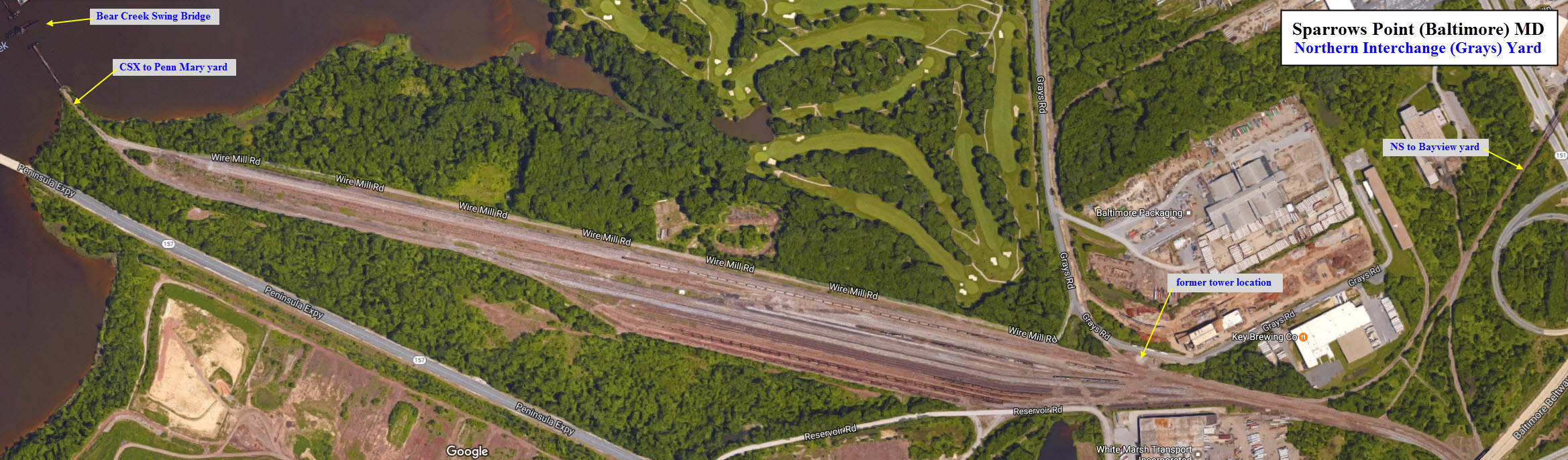
Below is the west end of the yard, a couple of hundred feet down from the swing bridge.
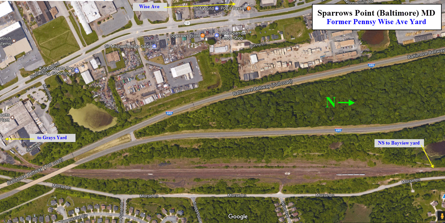
![]() former Pennsy/Conrail Wise Ave Yard
former Pennsy/Conrail Wise Ave Yard
GPS Coordinates: 39.257042, -76.456451
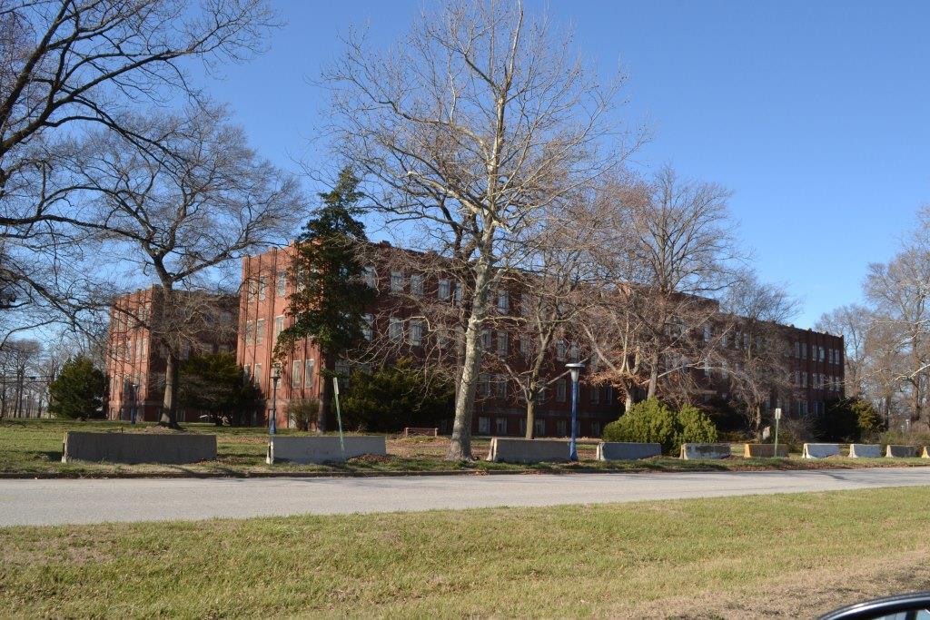
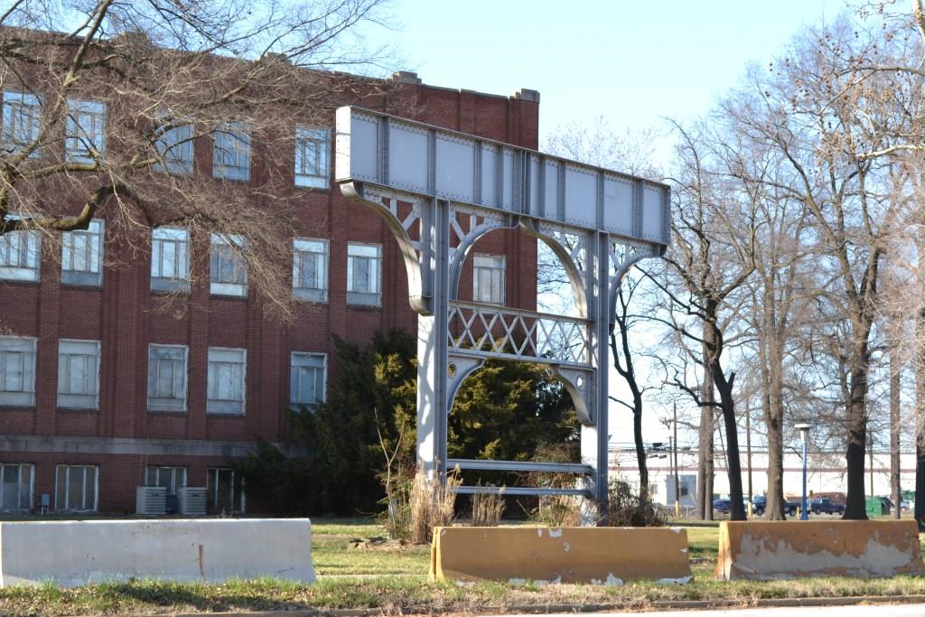
![]() former Bethelehem Steel Administration Building
former Bethelehem Steel Administration Building
GPS Coordinates: 39.219587, -76.471301
In the "old days", when you had to come to visit Bethlehem Steel for anything, you had to stop here and sign in.
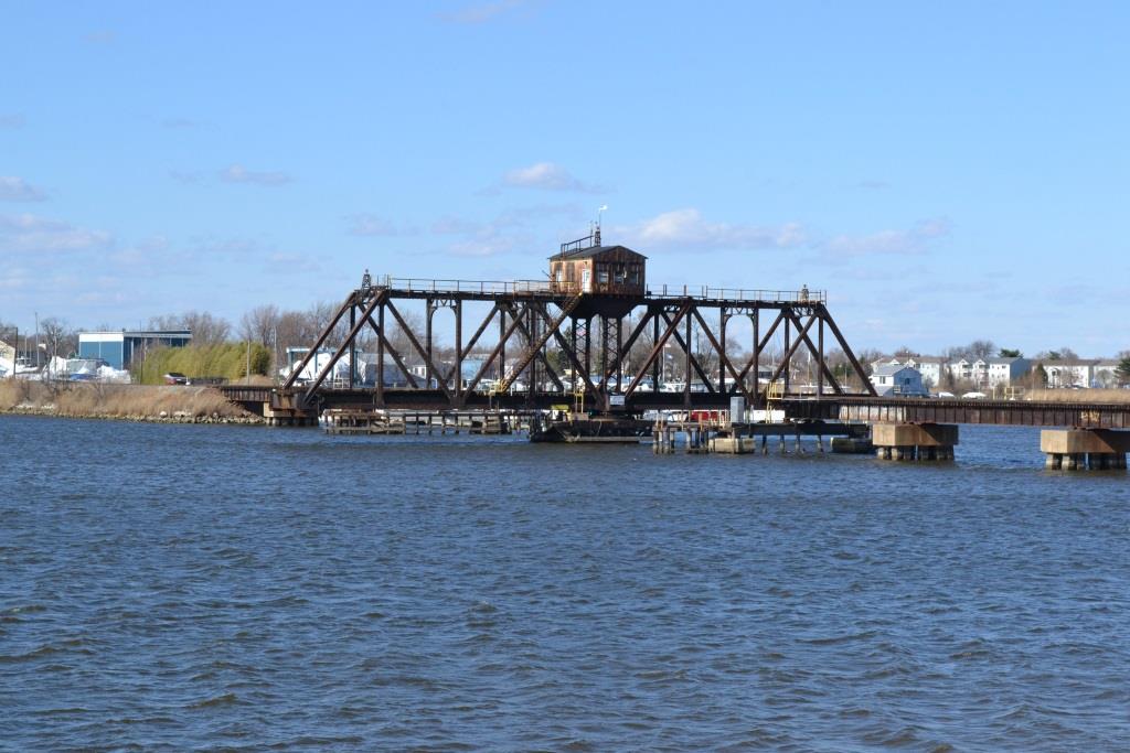
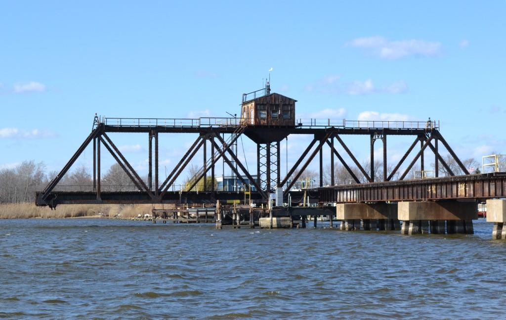
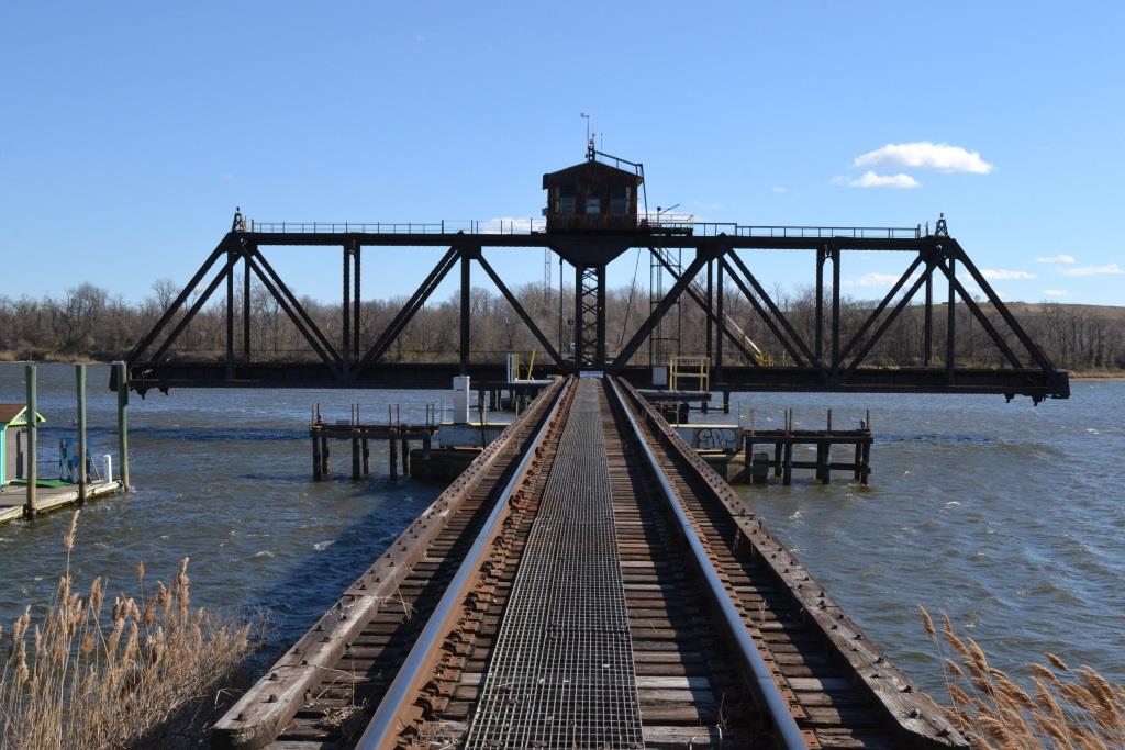
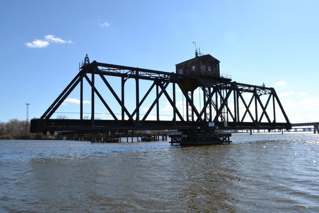
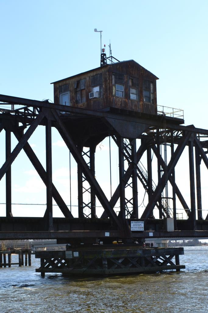
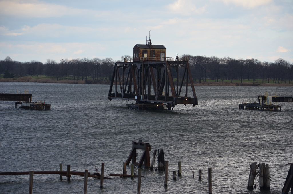
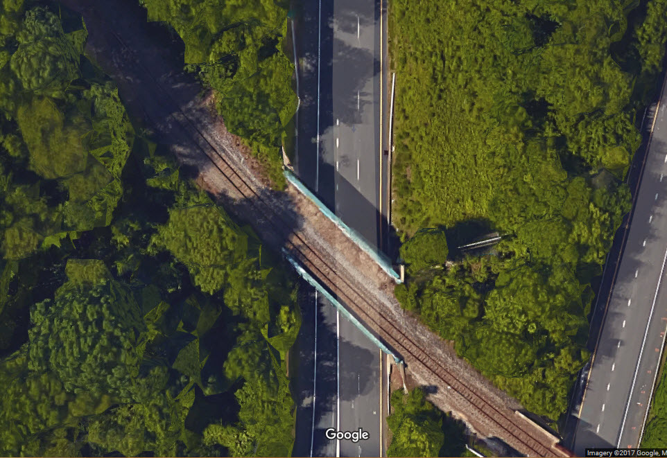
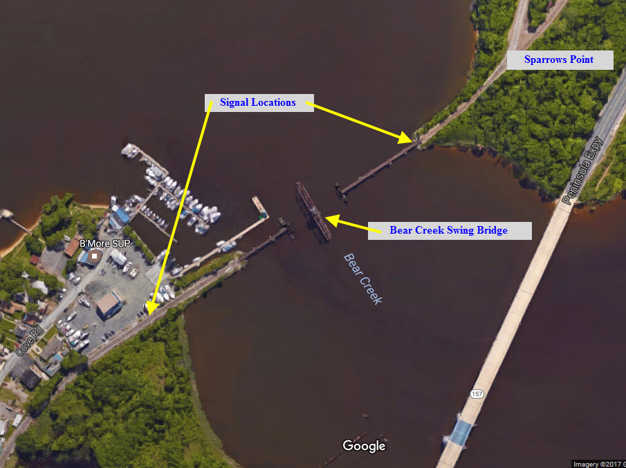
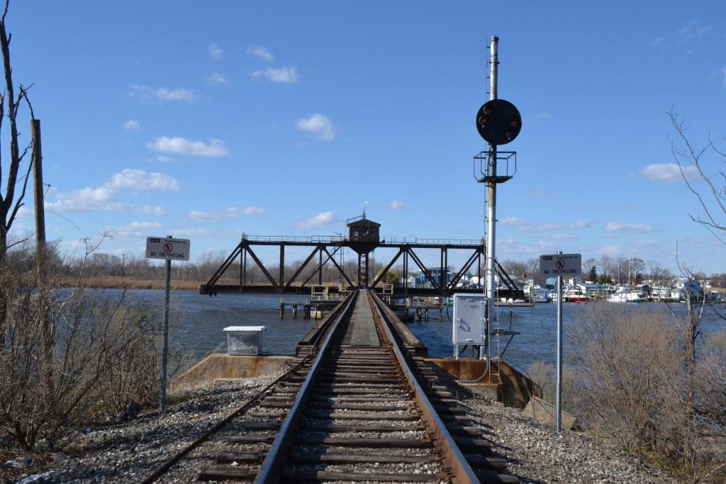
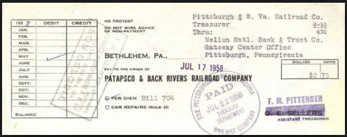
 CSX's Bear Creek Swing Bridge
GPS Coordinates: 39.249340, -76.488800
Good pictures can be had from the marina at the end of Cove Road, or from the beach on the Sparrows Point side of the river.
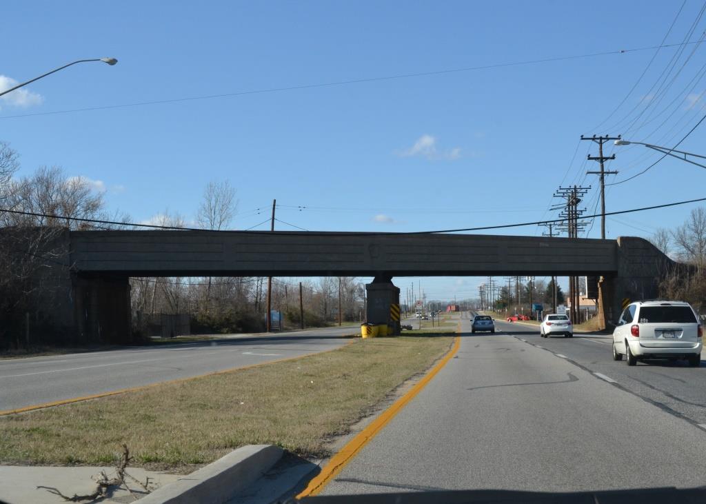
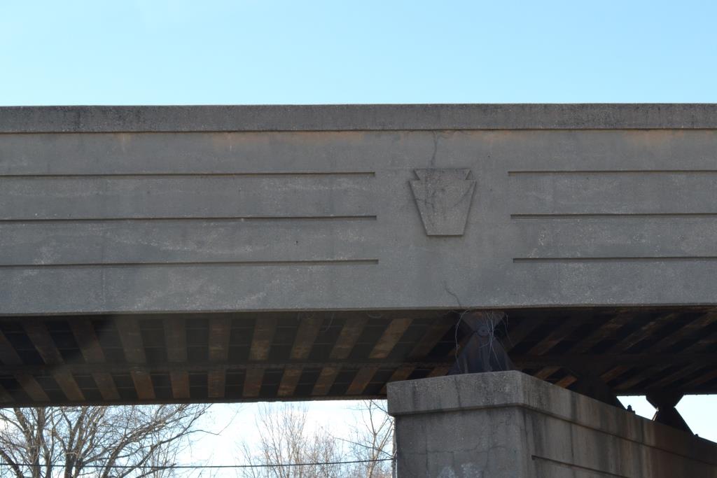
 NS Bridge Over North Point Blvd
GPS Coordinates: 39.247814, -76.457704
50 years and we still have the Pennsy emblem on the bridge. :-) It's outlasted the Pennsy, Penn Central, and Conrail!
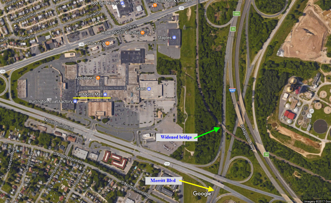
 NS/Pennsy Bridge Over Merritt Blvd
GPS Coordinates: 39.291855, -76.504123
According to one source, this bridge was rebuilt when the Beltway came thru and they had to build an interchange for Merritt Blvd back in the 1960's (not sure of an exact time). It was widened to
accommodate 2 tracks for increased traffic. The Pennsy also (supposedly) graded for an additional track, and built some new bridge abutments, but plans for the extra track fell thru when the
increase in traffic never materialized.
This thread was found here:http://railroad.net/forums/viewtopic.php?f=122&t=119196

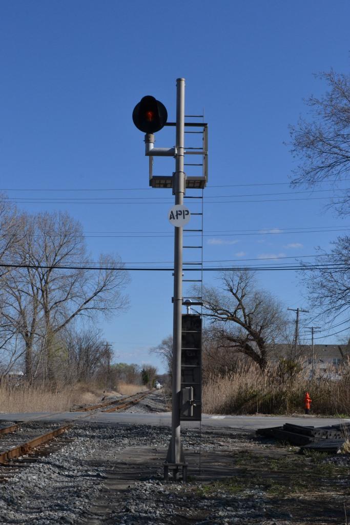
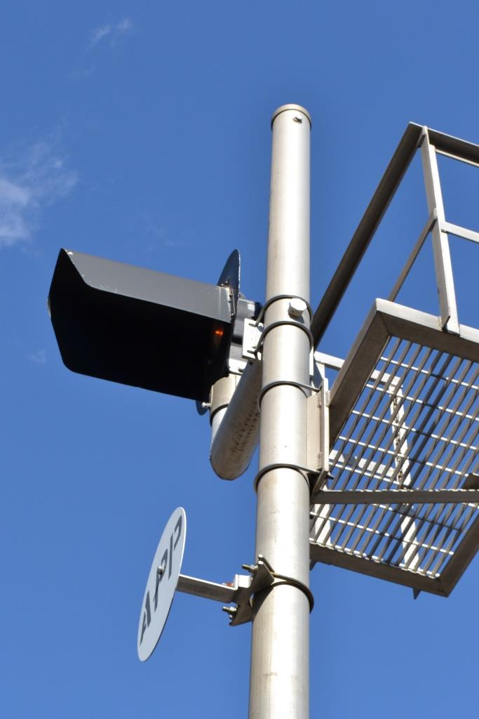
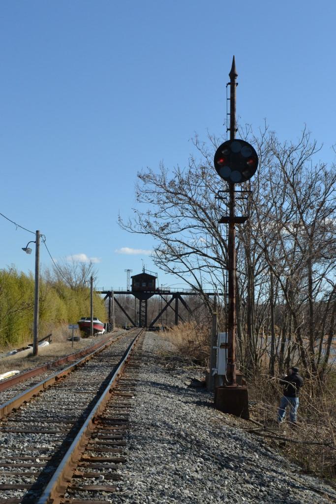
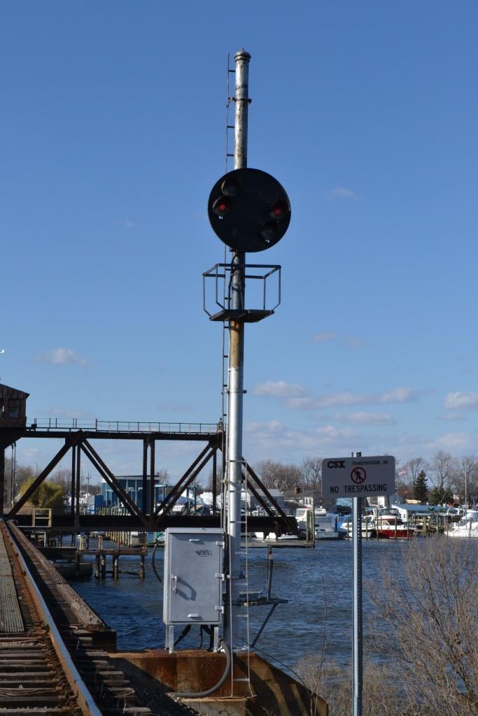
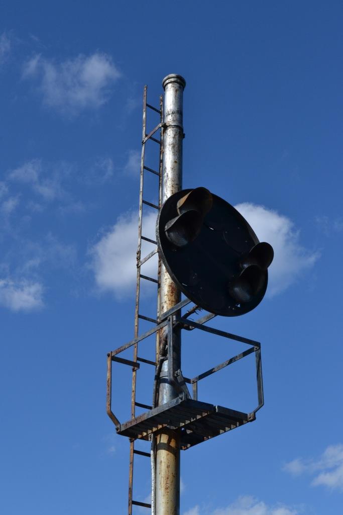
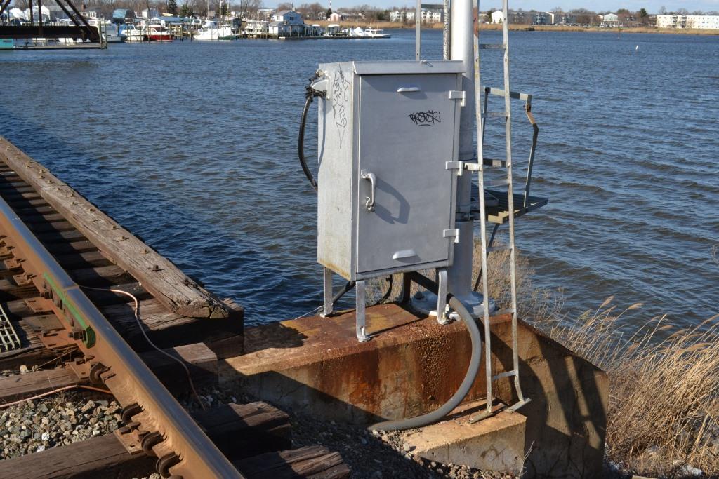
![]() Fixed Approach Signal
Fixed Approach Signal
GPS Coordinates: 39.254932, -76.499315
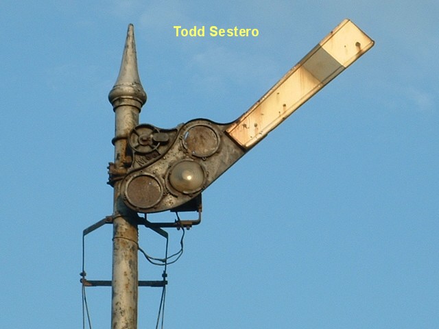
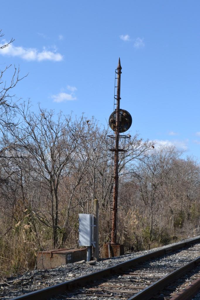
This is an approach signal for the CPL signal (#2) below. It is always lit. The CPL on the other side of the swing bridge does not have an approach signal. This signal
replaces Maryland's last semaphore, replaced around 2006 or so. The semaphore is shown below, and as can be seen, it was also a fixed signal. I wonder who has the semaphore,
cause you just have to know it didn't hit the scrap pile! :-)
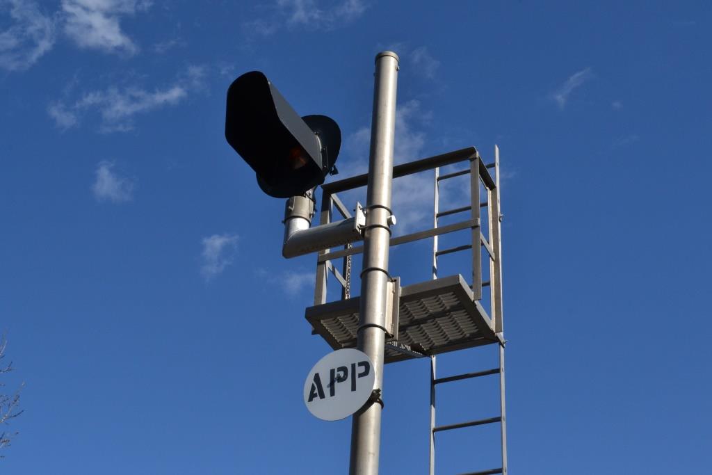
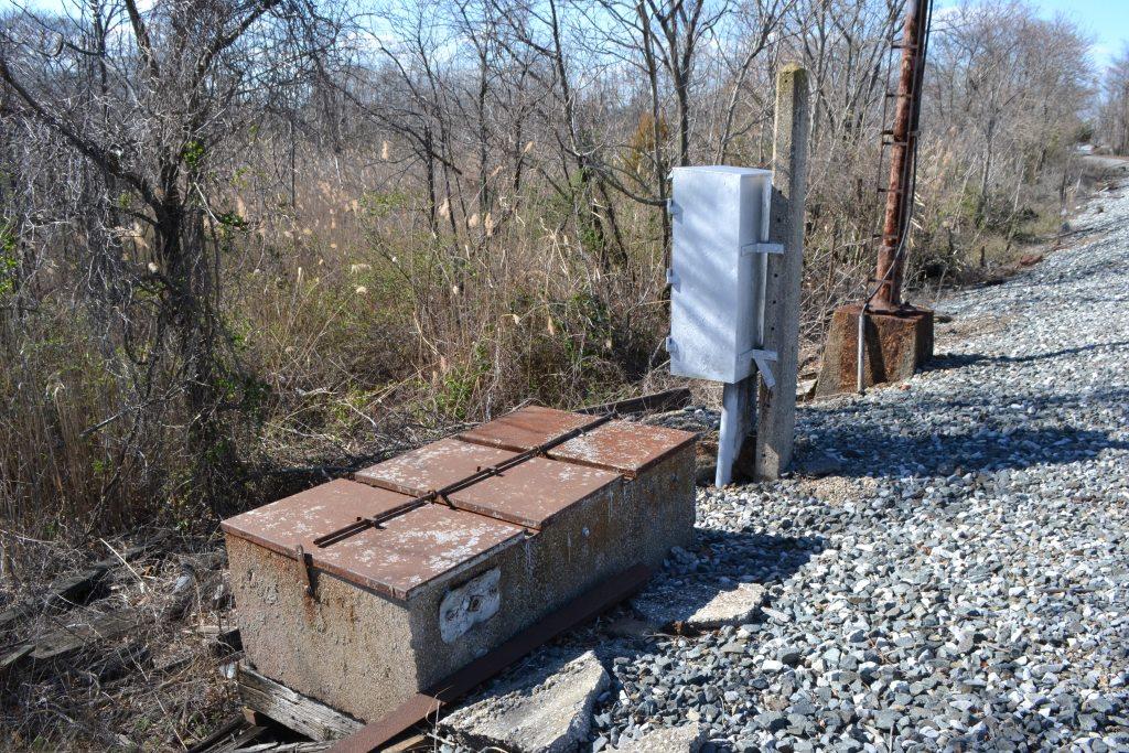
![]() 2 Aspect CPL Signal
2 Aspect CPL Signal
GPS Coordinates: 39.250719, -76.490008
This and the other CPL can display stop (rule 292) and restricting (rule 290). They both provide protection for the swing bridge. They are continuously lit.
![]() 2 Aspect CPL Signal
2 Aspect CPL Signal
GPS Coordinates: 39.248418, -76.487954
Unlike the signal above, this one is mounted right at the bridge. Doesn't leave much room if you're inattentive, huh? :-) :-)
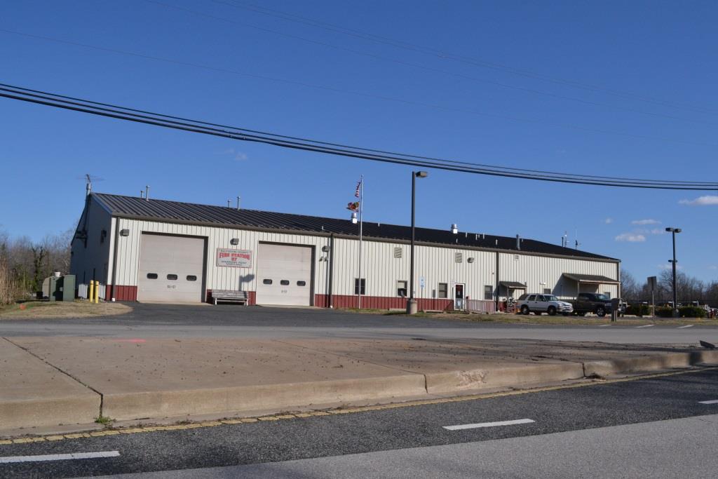
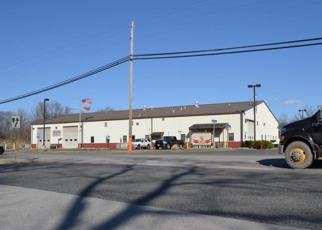
![]() Baltimore County Fire Department - Station 57 - Sparrows Point
Baltimore County Fire Department - Station 57 - Sparrows Point
GPS Coordinates: 39.244930, -76.473531
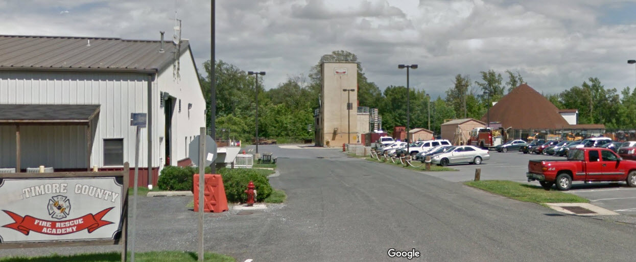
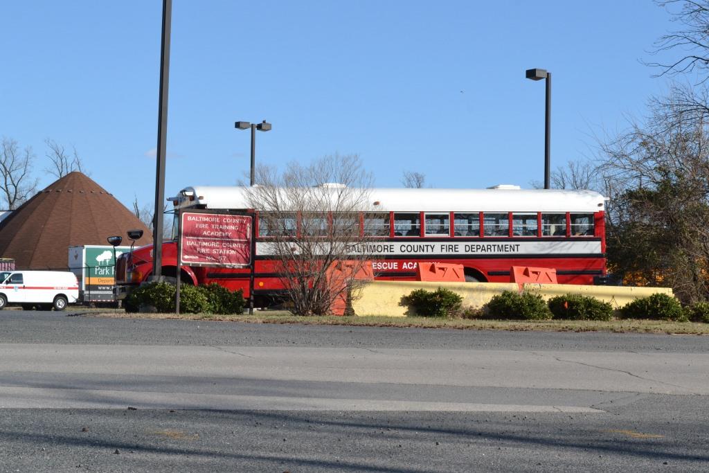
![]() Baltimore County Fire Department - Fire Rescue Academy
Baltimore County Fire Department - Fire Rescue Academy
This is the training facility for the Baltimore County Fire Department, including the volunteer companies. Many a year ago, it was located adjacent to the old Station 1 in Towson.
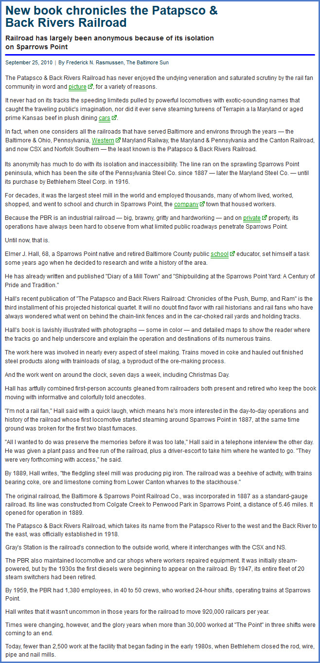
The Patapsco & Back Rivers RR (1918-2012) was one of many Bethlehem Steel railroads, including the Cambria & Indiana (1904-1995), the South Buffalo Rwy, and
the Steelton & Highspire RR (Harrisburg PA). MCM Management Corp purchased the railroad in 2012, and renamed it the Baltimore Industrial RR.
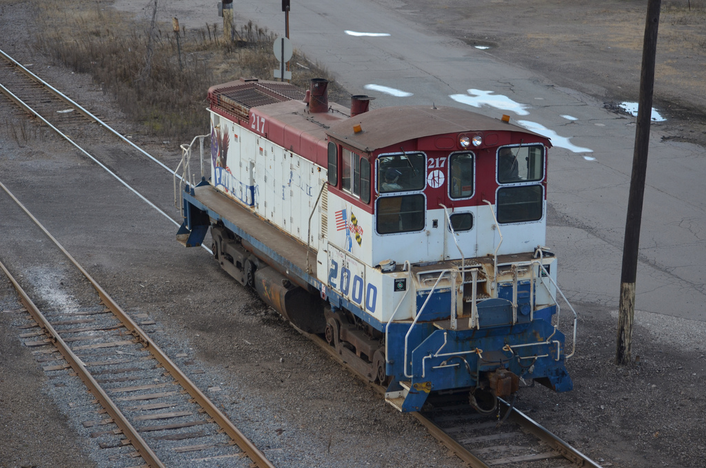
A former PBR engine in a CSX consist crossing the diamond in Deshler OH.
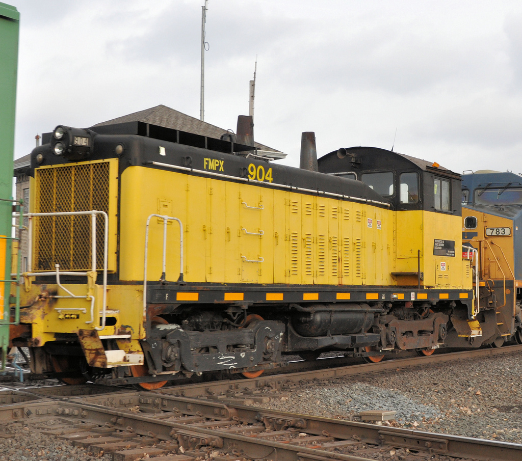
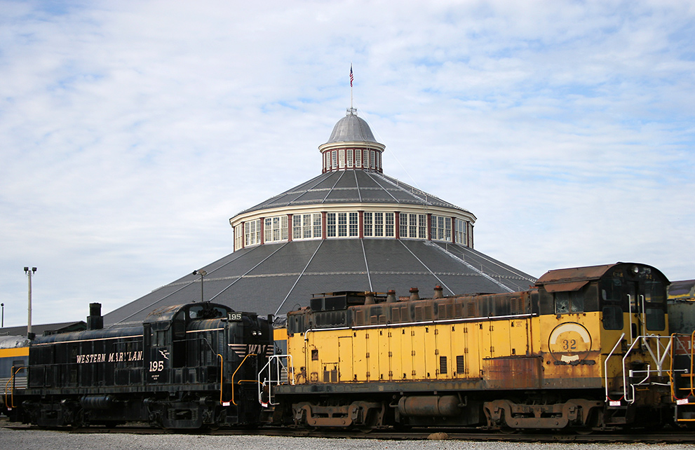
PBR #32 at the B&O Railroad Museum in Baltimore.
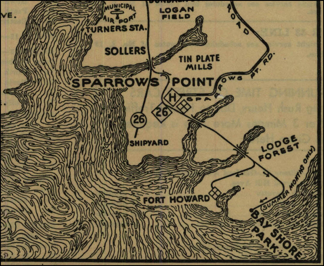
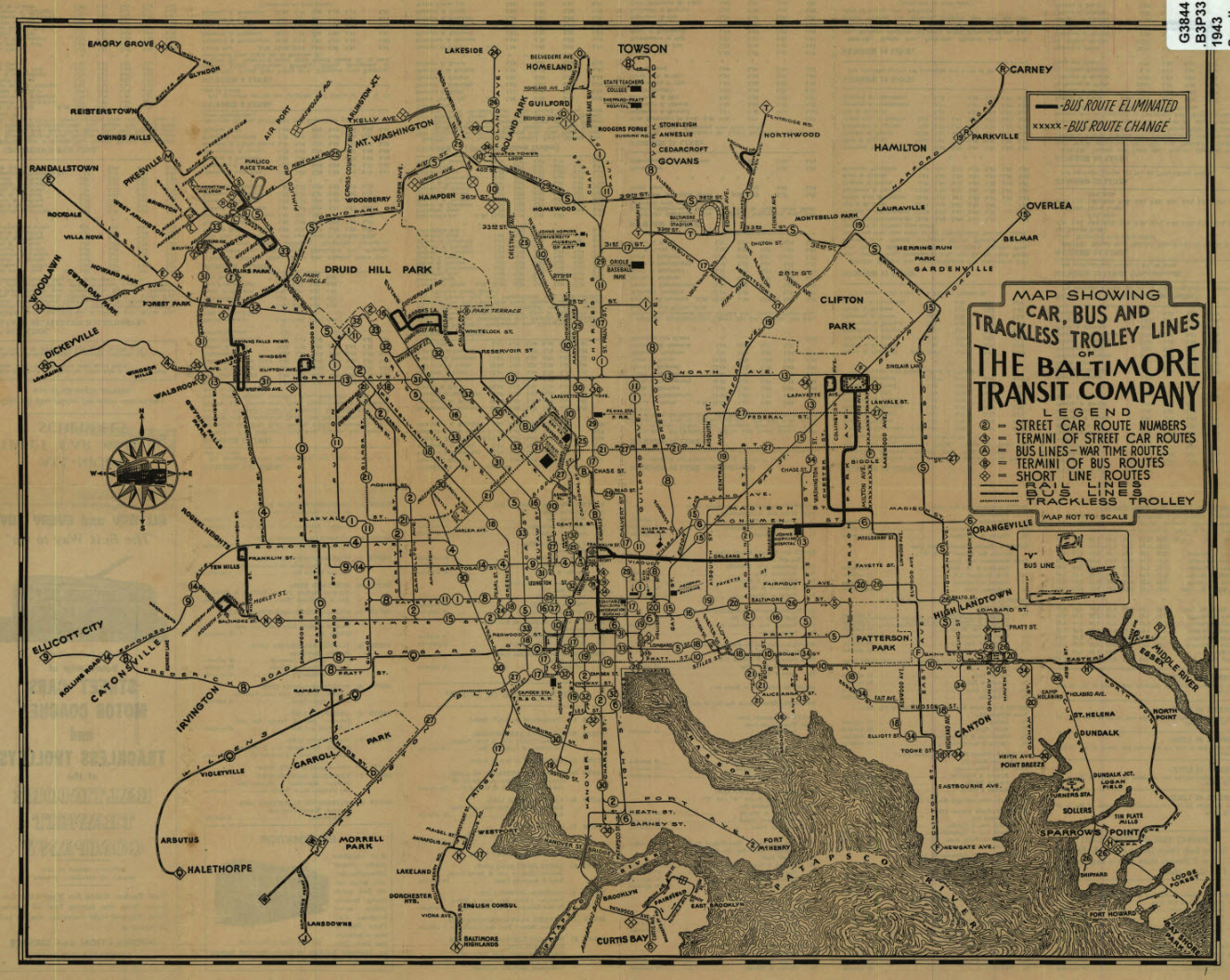
Streetcars used to come out to Sparrows Point until the demise of the streetcar system in 1963. Nothing remains of the line into Sparrows point, Bay Shore, or Ft Howard.
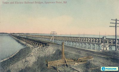
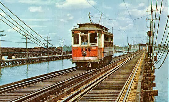
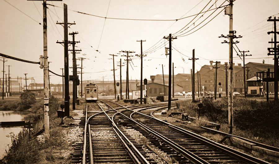
The #26 line into Sparrows Point and Bay Shore, and the whole system map.....
When I first came down to Sparrows Point in 1969, it seems like something out of fantasy land or something. Everything was covered by a layer of red rust. There was actually a small
village of Sparrows Point, with a church and homes, buried in the middle of the giant industrial complex. Not sure when the town center disappeared.
At one time, Bethlehem Steel was Maryland's largest private employer until the late 80's, with around 20,000 workers. They were followed by Westinghouse Electric's Defense plant (we made radars
and jamming equipment) at around 18,000. One of Beth Steel's biggest problems was not putting enough money into the pension fund, and then they had to tell retiree's that sorry, we don't have any
money! Ouch!!! Westinghouse had three (3) layoff's in 91-92 that reduced their workforce down to 8,000 - I got hit in the first one :-), but after Northrop Grumman bought them in 1995, they
started hiring and went back up to around the 18,000 mark. It's too bad the unions wanted so much money for their people, for we might have had a chance in keeping the industry alive even against
foreign competition since they have to transport the shit from halfway around the world, and settle for crap steel on top of that!
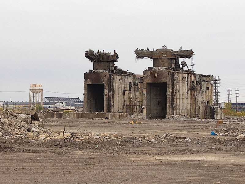
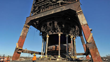
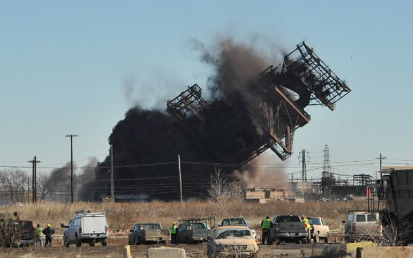
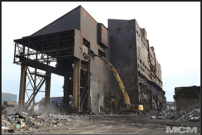
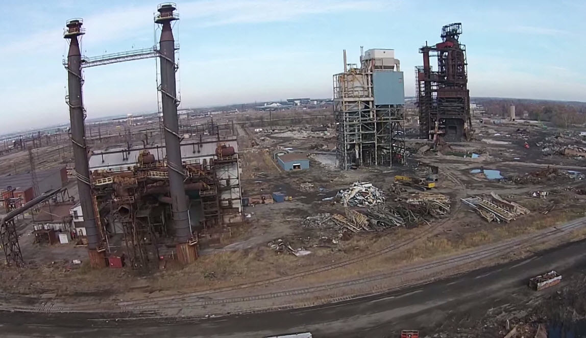
Bethlehem Steel itself gave up around 2009?, and steel production ceased in 2012, when the 4th successor, RG Steel, closed it doors. Since then, Most of the buildings have been torn down as
can be seen in a few of the pictures below.
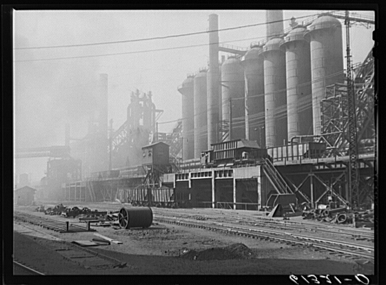
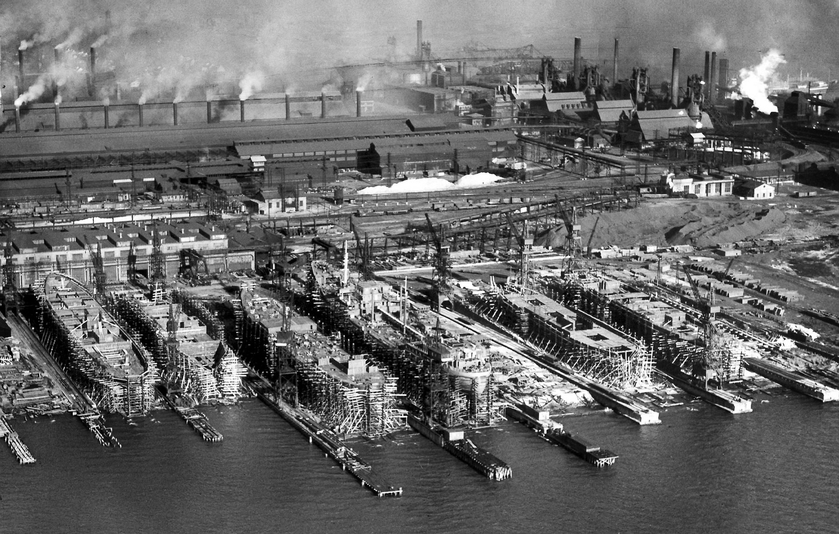 in 1940
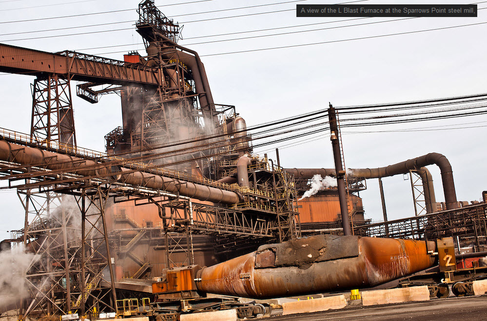
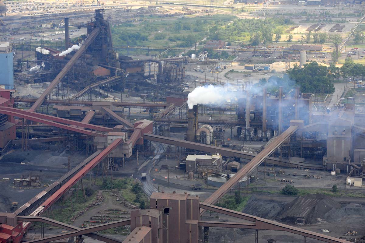 in 2009
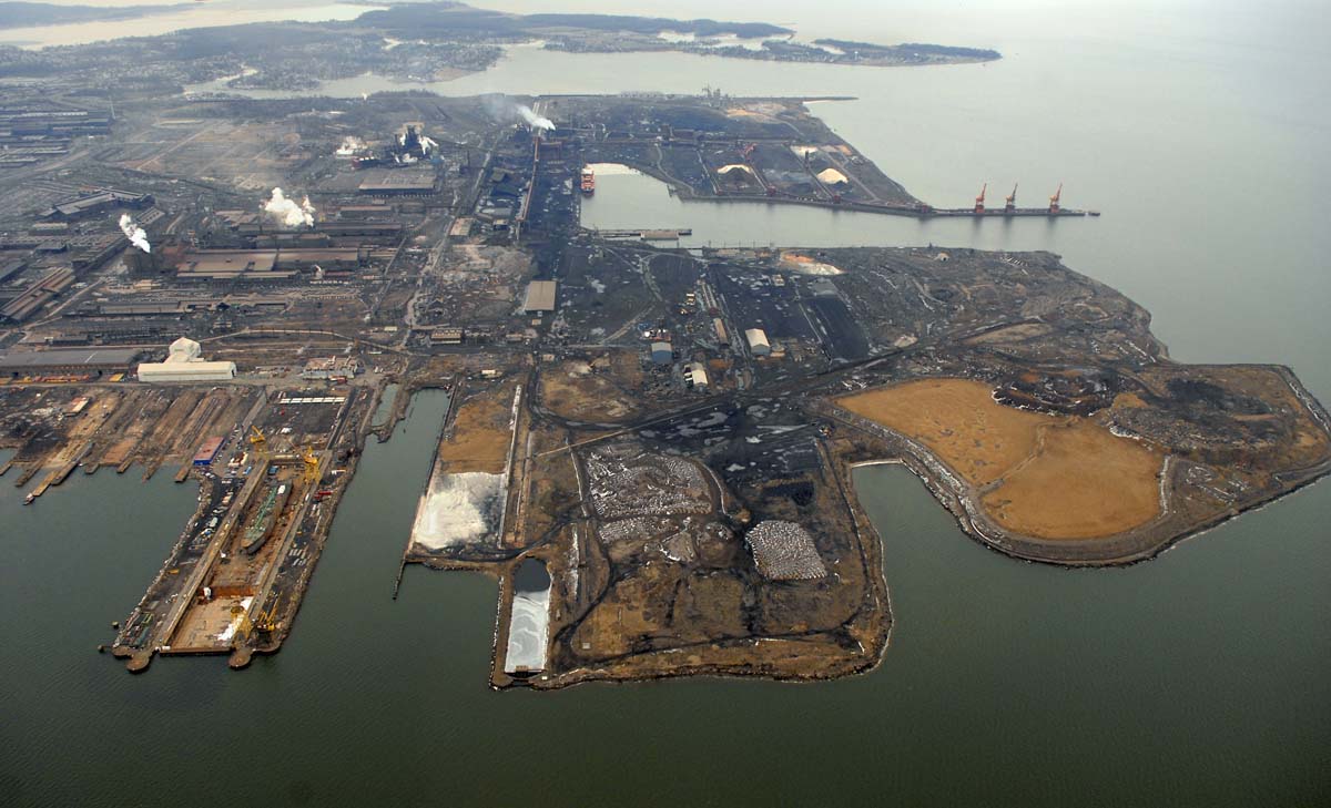 in 2015
 unknown date
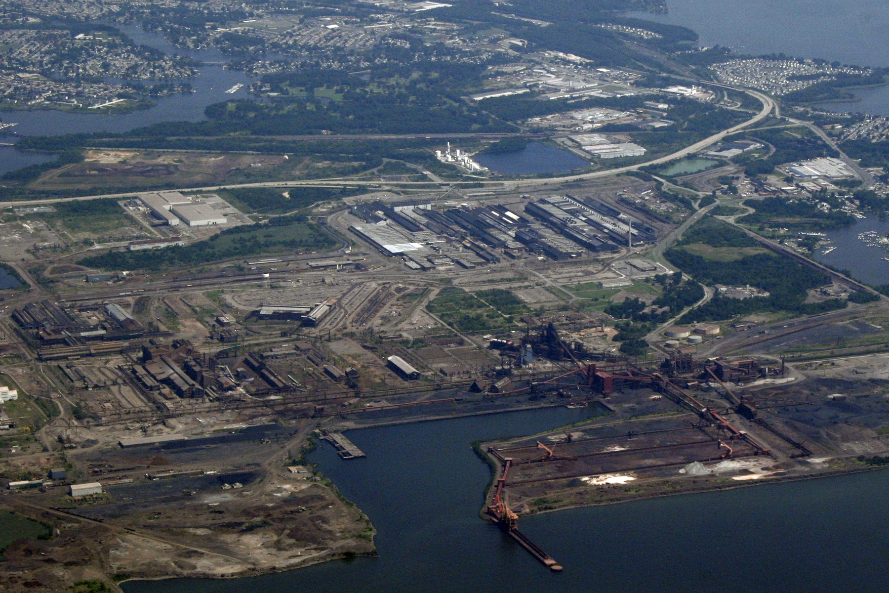
 2017 aerial
 maybe 2015?
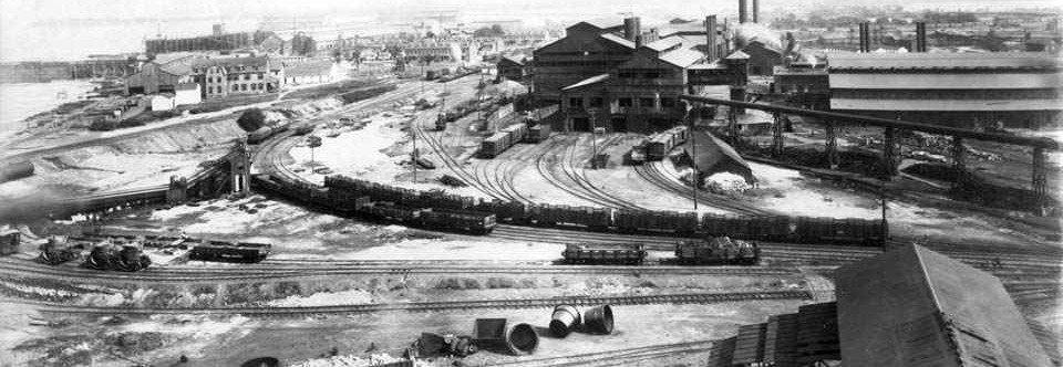 The rail mill around 1900.
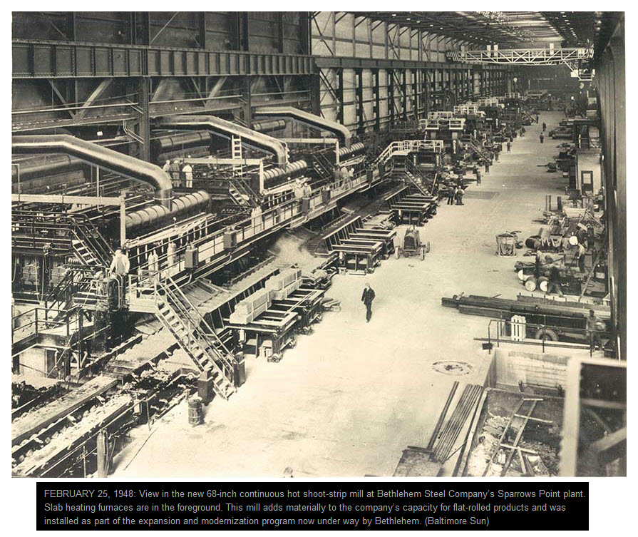
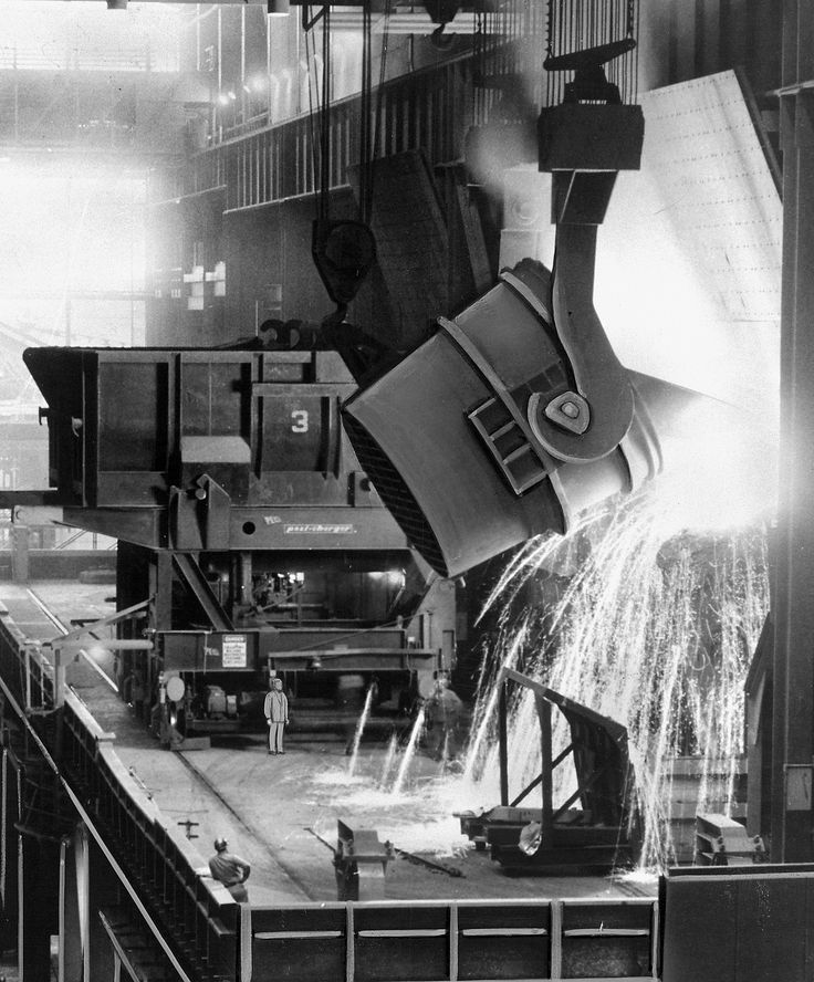
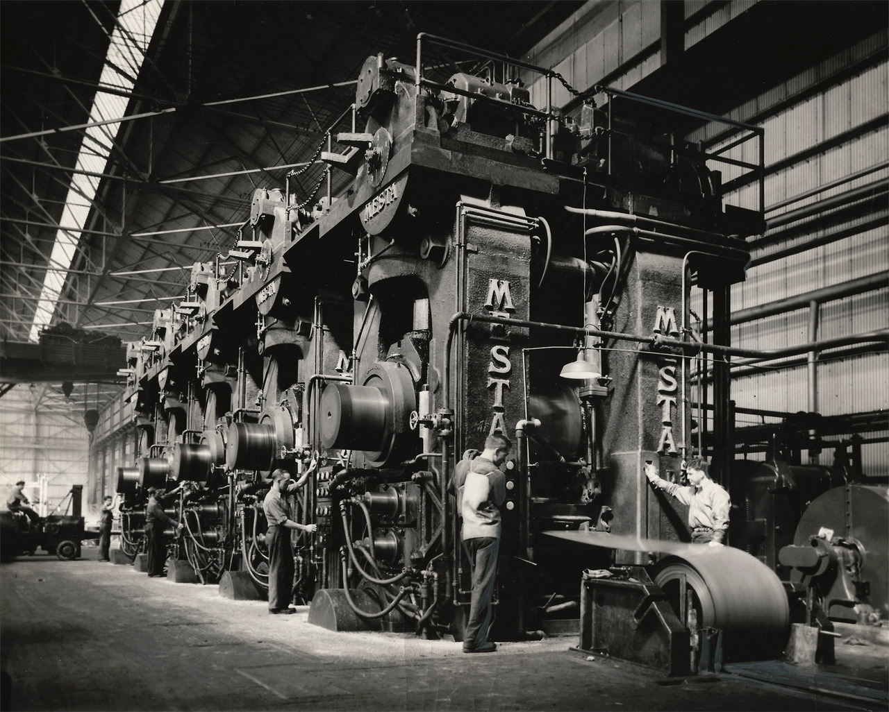
Rollers at the Tin Mill. When I visited the plant in 1972 to do some service, these things were twice as high, and the sheet was travelling fast. When the roll gets full, there is a system of
rollers that take up the slack until a new roll is started. Everything is perfectly timed, or else all hell will break loose!!!
BTW, floobydust is
a term I picked up 30-40 years ago from a National Semiconductor data
book, and means miscellaneous and/or other stuff.
Pictures and additional information is always needed if anyone feels
inclined to take 'em, send 'em, and share 'em, or if you have
something to add or correct.... credit is always given! BE NICE!!! Contact info
is here
RAILROAD SIGNALS HOME
Created 06/13/2007
Last Modified:
03/10/2017