In General
Getting Here
Map
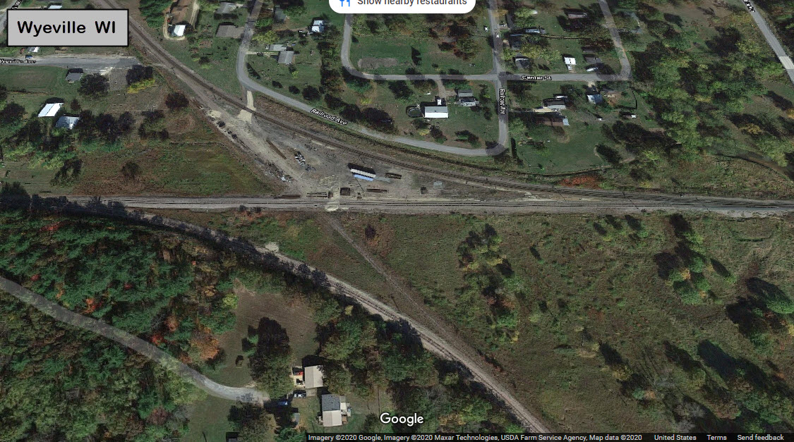
Wyeville
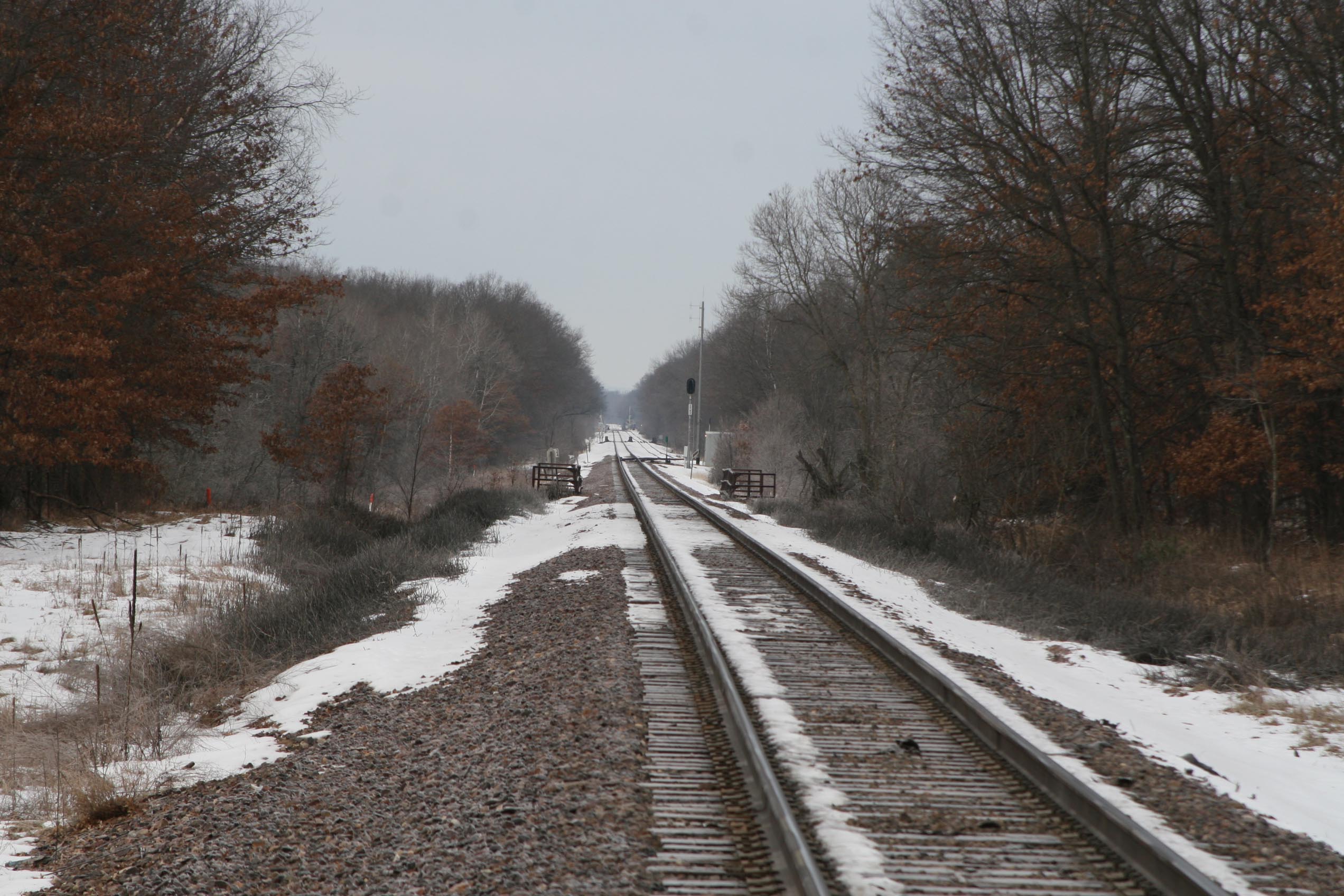
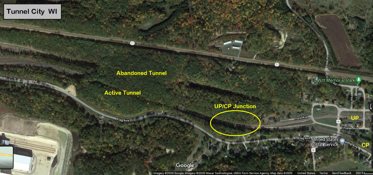
Tunnel City
Floobydust
USGS Maps
RAILROAD SIGNALS HOME
Location / Name:
Wyeville WI, Monroe County
Tunnel City WI, also Monroe County
What's Here:
UP/UP Interchange (and former Diamond) - Wyeville
Tunnel(s) - Tunnel City
UP/CP Junction - Tunnel City
Signals
Cranberry Farms
Data:
GPS Coordinates: as needed
Phone A/C: 608
ZIP: 54662/Tunnel City, 54660/Wyeville
Access by train/transit:
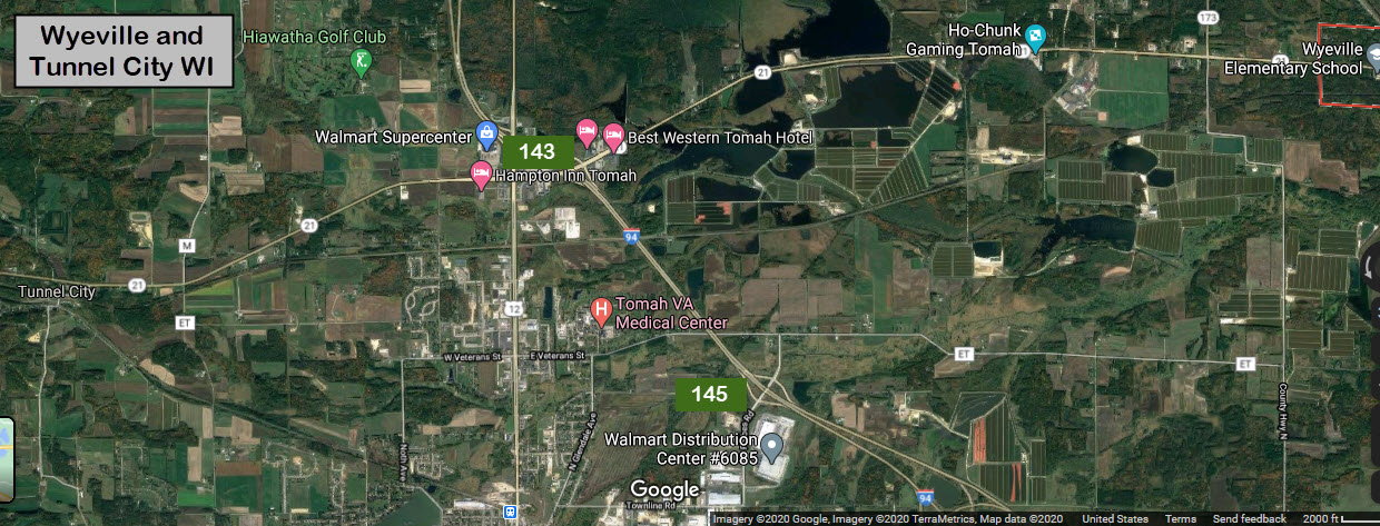
Greyhound, at exit #143
The Scoop:
This is a mini-guide, because, admittedly, there is not much here for the railfan.... but if you are traveling between (say) Milwaukee and Minneapolis (as I was years ago, and didn't know of these places), they might provide a welcome break from the endless miles of asphalt! :-)
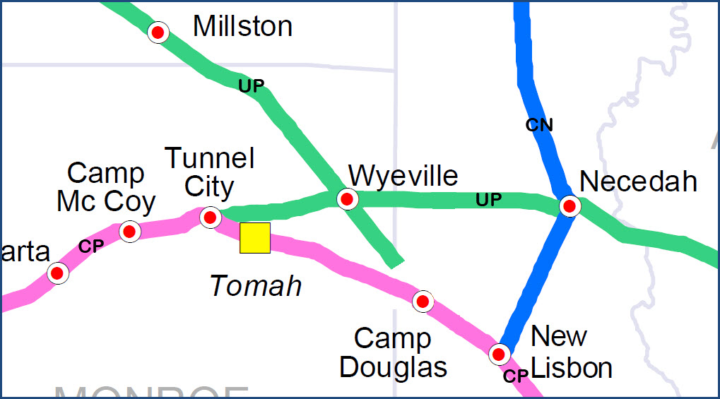
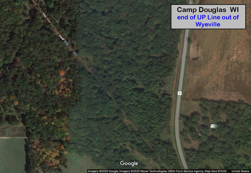
Quick History: It was the junction of the original C&NW CHI-STP route, via Madison, and the Milwaukee-Winona line. In Wyeville, the mainline comes in from Milwaukee from the east, goes around the tight turn and heads north(ish) towards the Twin Cities. The UP line heading west out of Wyeville goes to Tunnel City, where it connects to the CP (ex-Soo, exx-MILW) and then they run on rights to Winona, MN. The UP used to have its own tunnel and route. The old UP main line going SE out of Wyeville is used as car storage and ends just before Volk Field in Camp Douglas. There are tracks on the base but do not appear to be connected to anything.
Over in Wyeville, there is an interchange between the two Union Pacific lines. There used to be a diamond here, but was removed within the past few years.
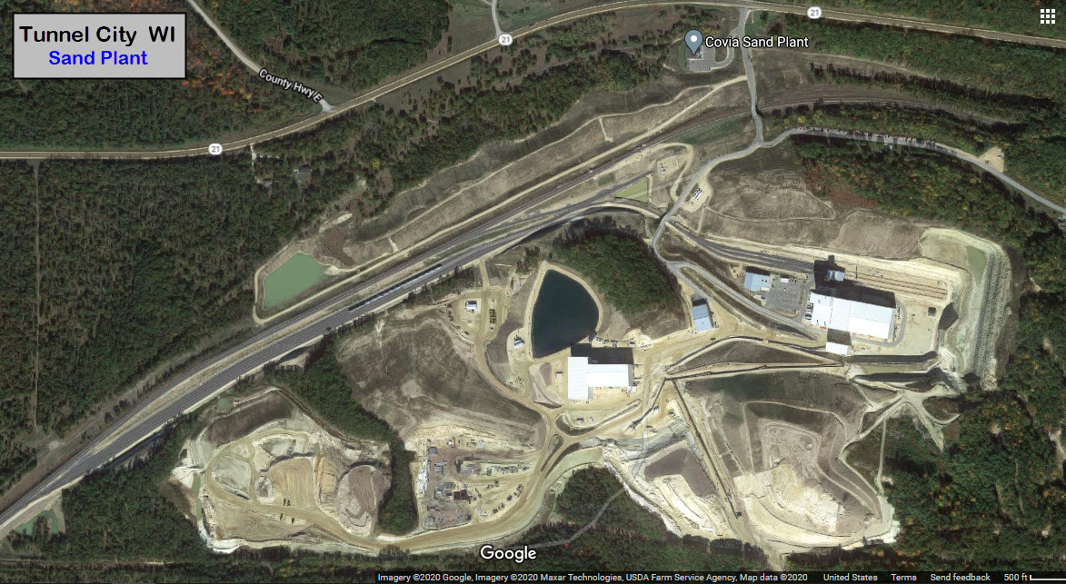
In Tunnel City, we used to have two active tunnels, now there is only one. The UP and CP meet up here. There is also a small yard to service the sand plant located just to the west of the tunnel - I don't know if the yard is accessible to railfans.
If lady luck is with you, while you are in this area, you may be able to catch Union Pacific, Canadian Pacific, and Canadian National freights, as all three have tracks within a few miles of each other.
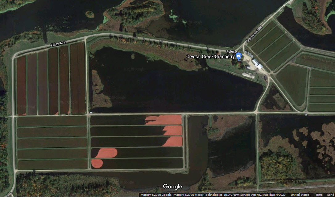
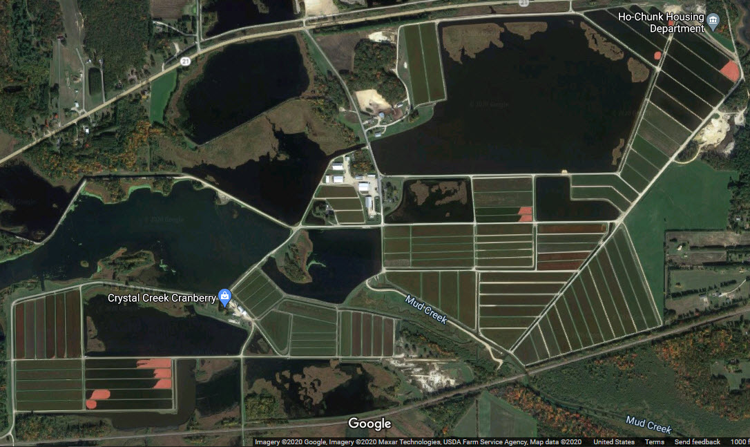
On the way over to Wyeville, if you happen by during the right time of the season, there is a cranberry farm off to your right. You might be able to catch the pools filled with colorful berries, as the aerials below can attest to.
Traffic.... These are guesses: The UP main has maybe 4-6 trains a day. The line to Winona 1 each way, or out one day and back the next. The CP line frequency is higher, maybe around 20.
Services are at exit 143 - Walmart, McD's, Arby's, Dunkin Donuts, Pizza Hut, Taphouse Twenty, Culver's, Starbucks; SIX hotels; and a bunch of gas station. There is even a Greyhound bus terminal behind McDonalds.
I would like to thank Jim for stopping here and documenting the signals.
Acknowledgements:
Jim Mihalek
Google Maps
Websites and other additional information sources of interest for the area:
https://wisconsindot.gov/Documents/travel/rail/railmap.pdf Railroad map of Wisconsin
Exit #143 from I-94 puts you on WI 21.
Go west 3.5 miles to get to Tunnel City.
Go east 5.8 miles to get to the diamond in Wyeville.
Exit #143 is just a few miles north of the I-90 and I-94 split in Tomah WI.
Camp Douglas is at Exit #55 off of I-90/I-94.
Map
The map below is an excerpt from the Wisconsin State Railroad map, and
has been edited to reflect the abandoned (and removed) UP track just north
of Camp Douglas.
Wyeville
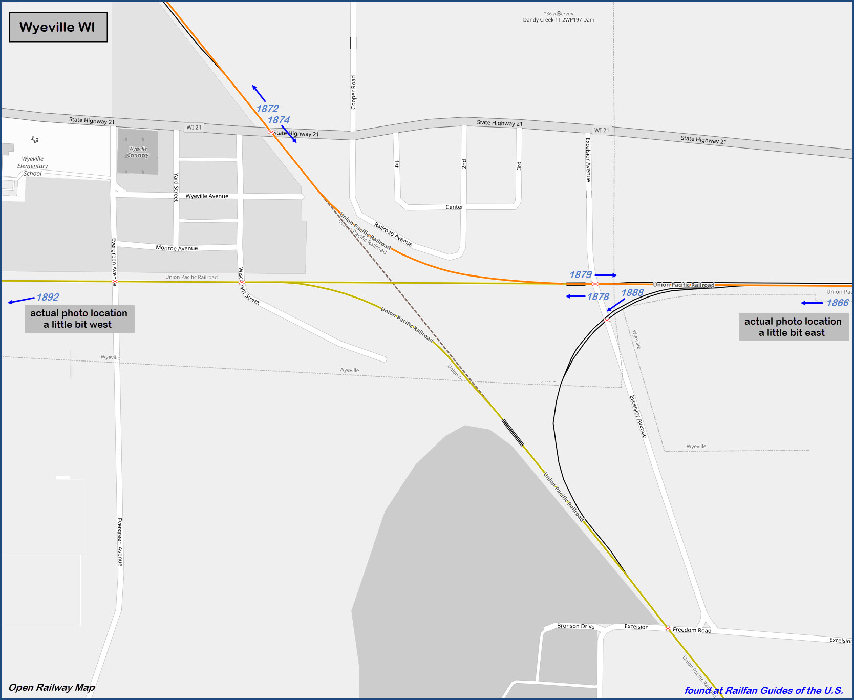
 1866, from County Hwy PP
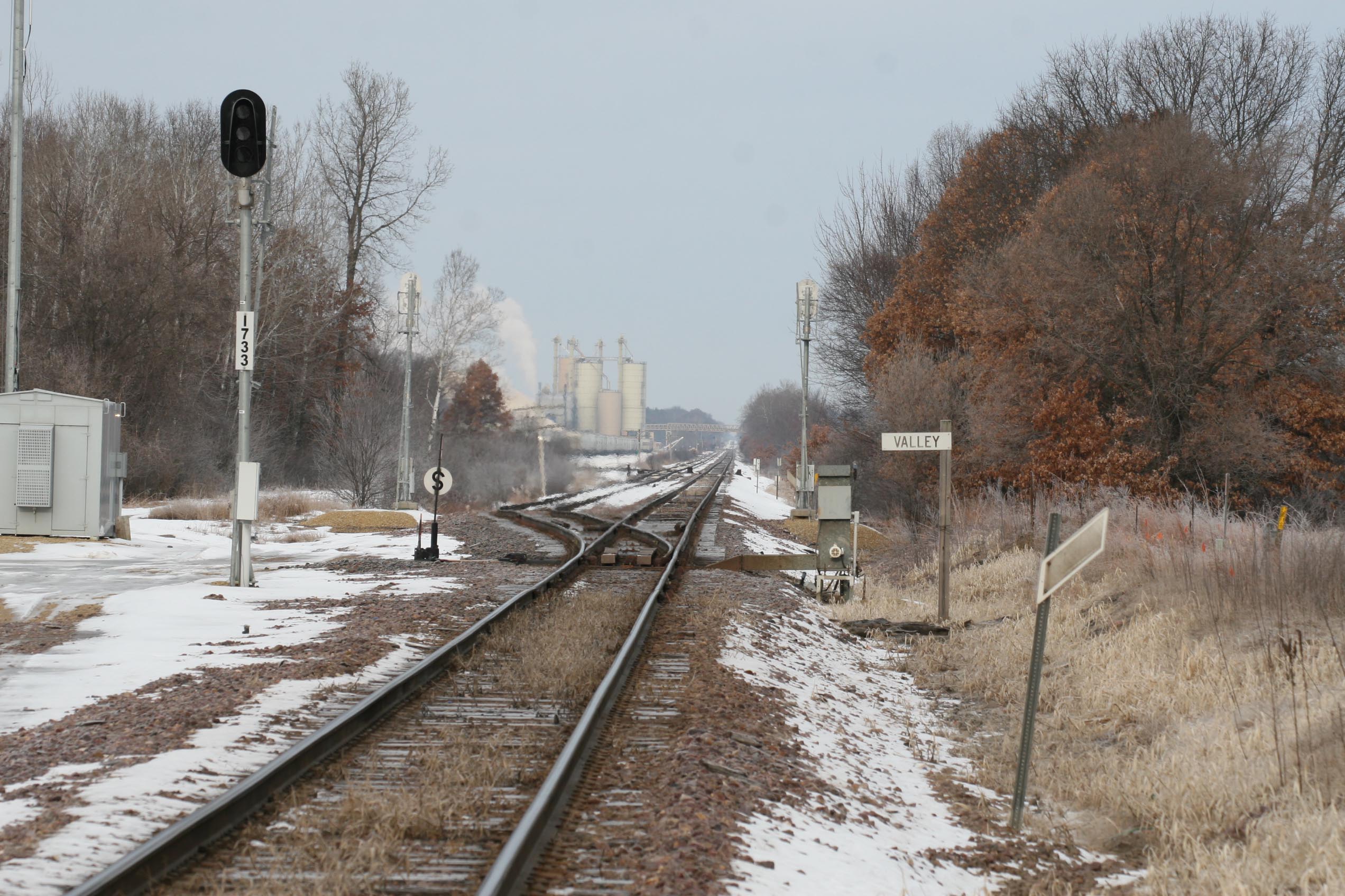 1872
1872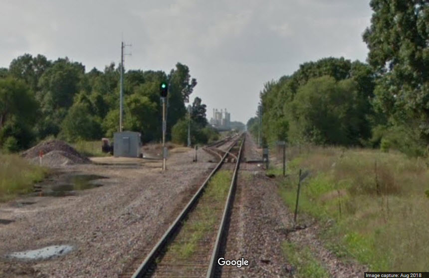 Google caught the signal lit! :-)
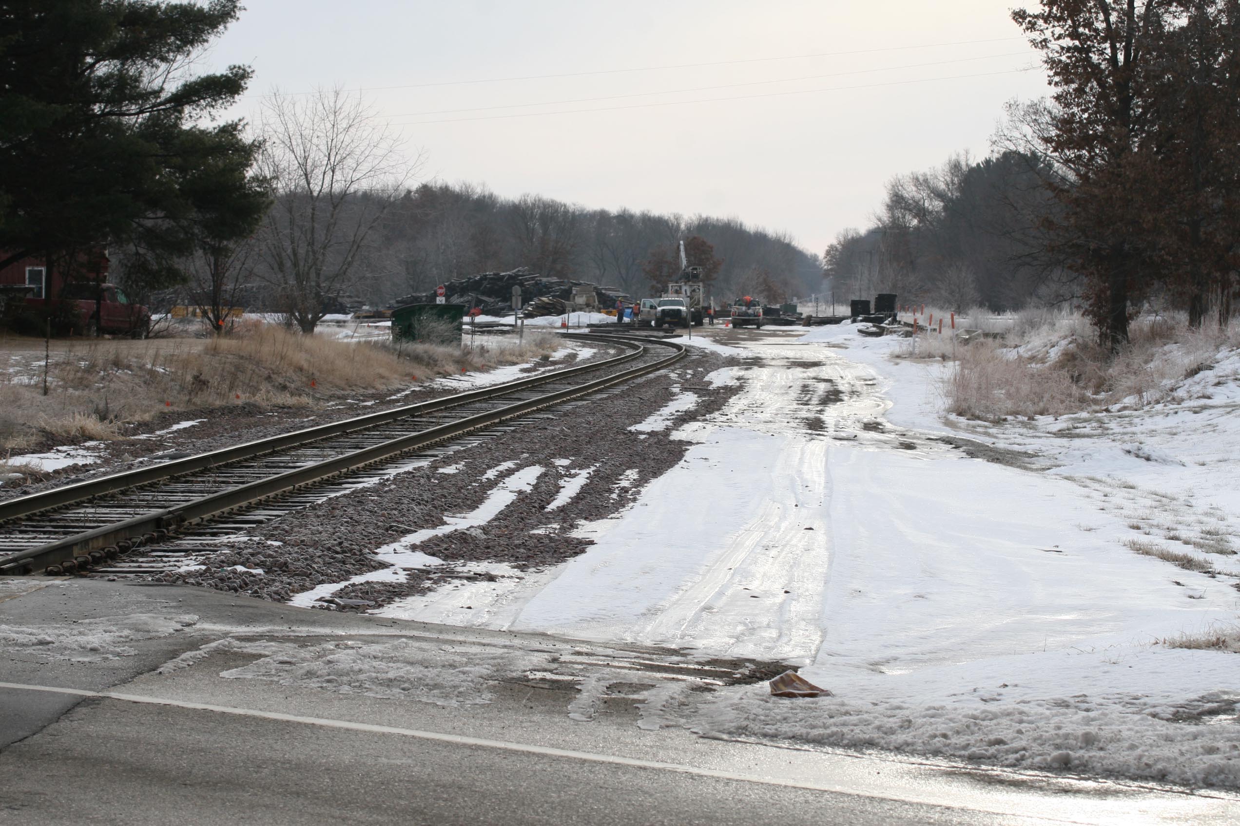 1874
1874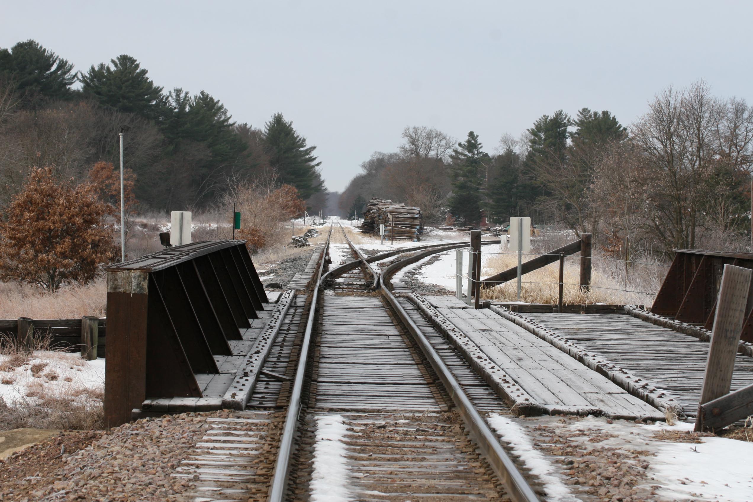 1878
1878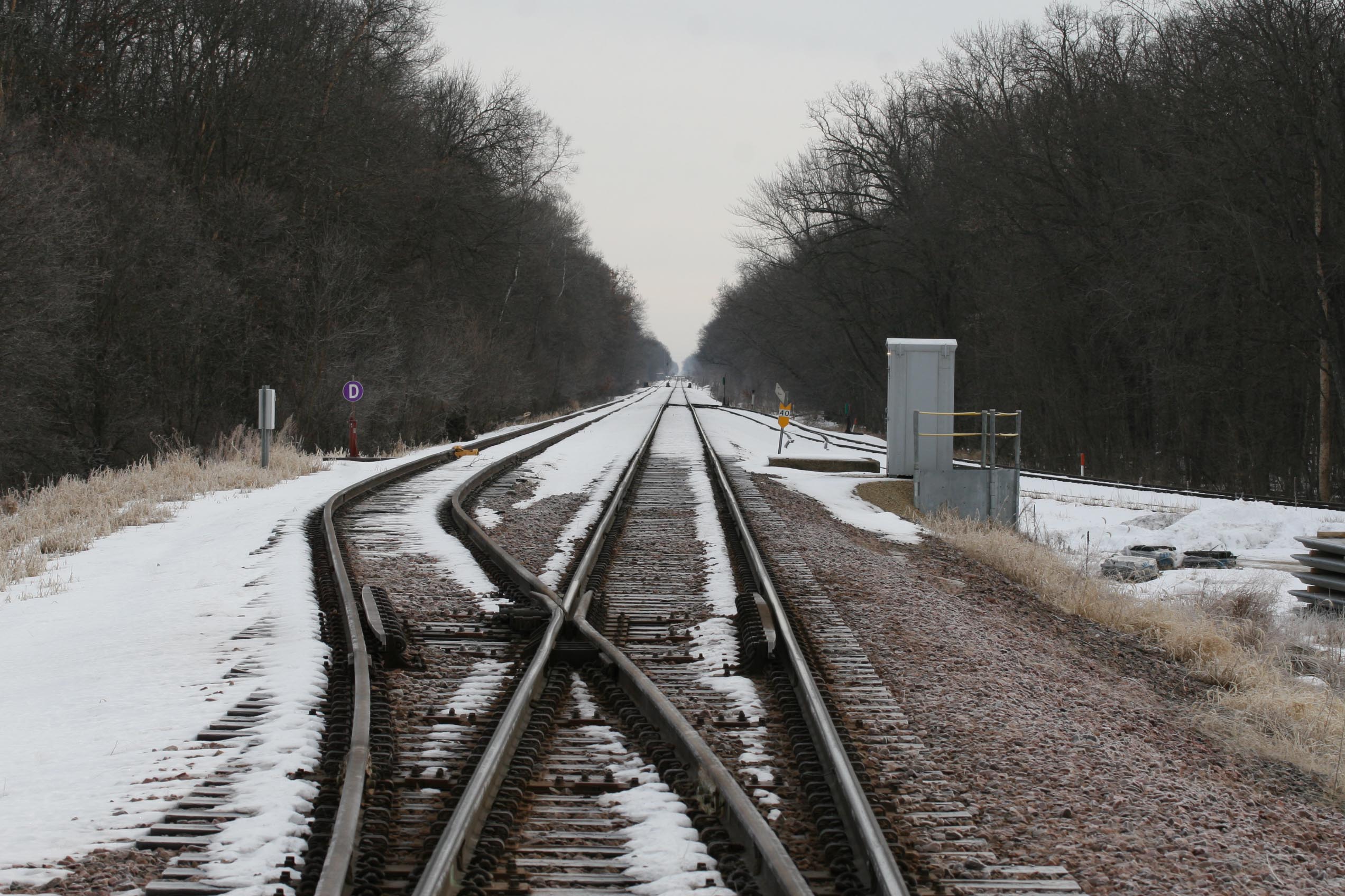 1879
1879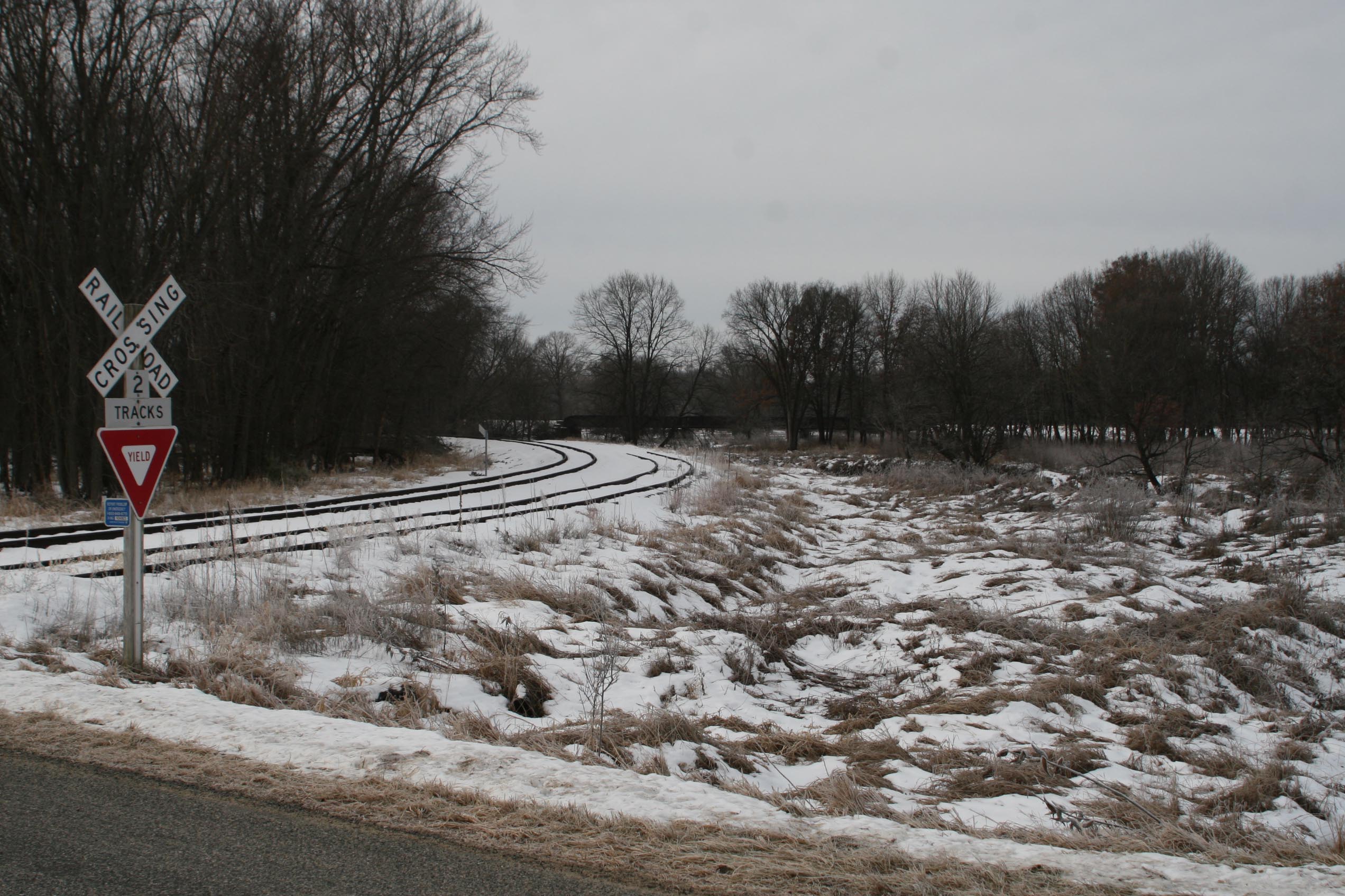 1888
1888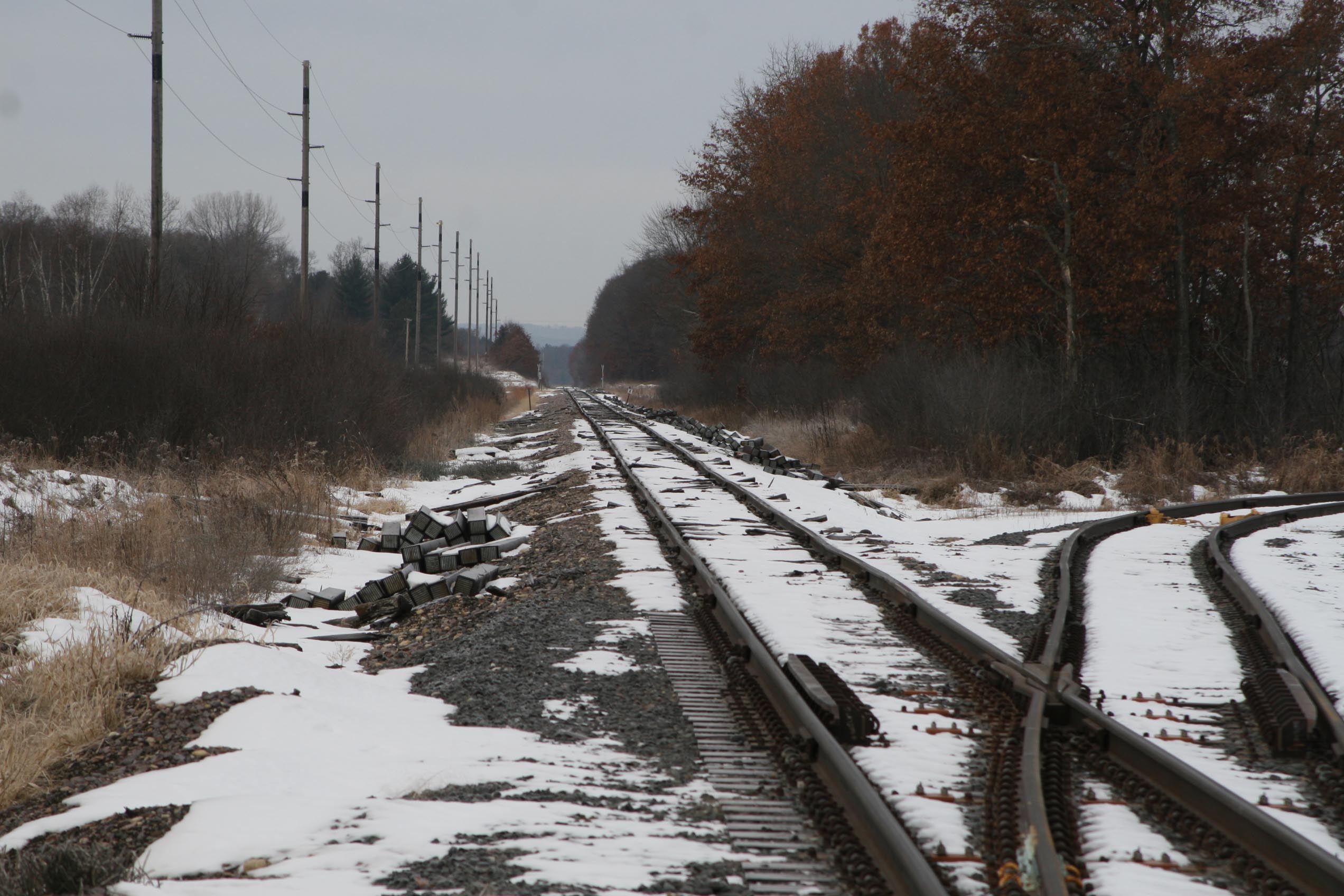 1892
1892Tunnel City
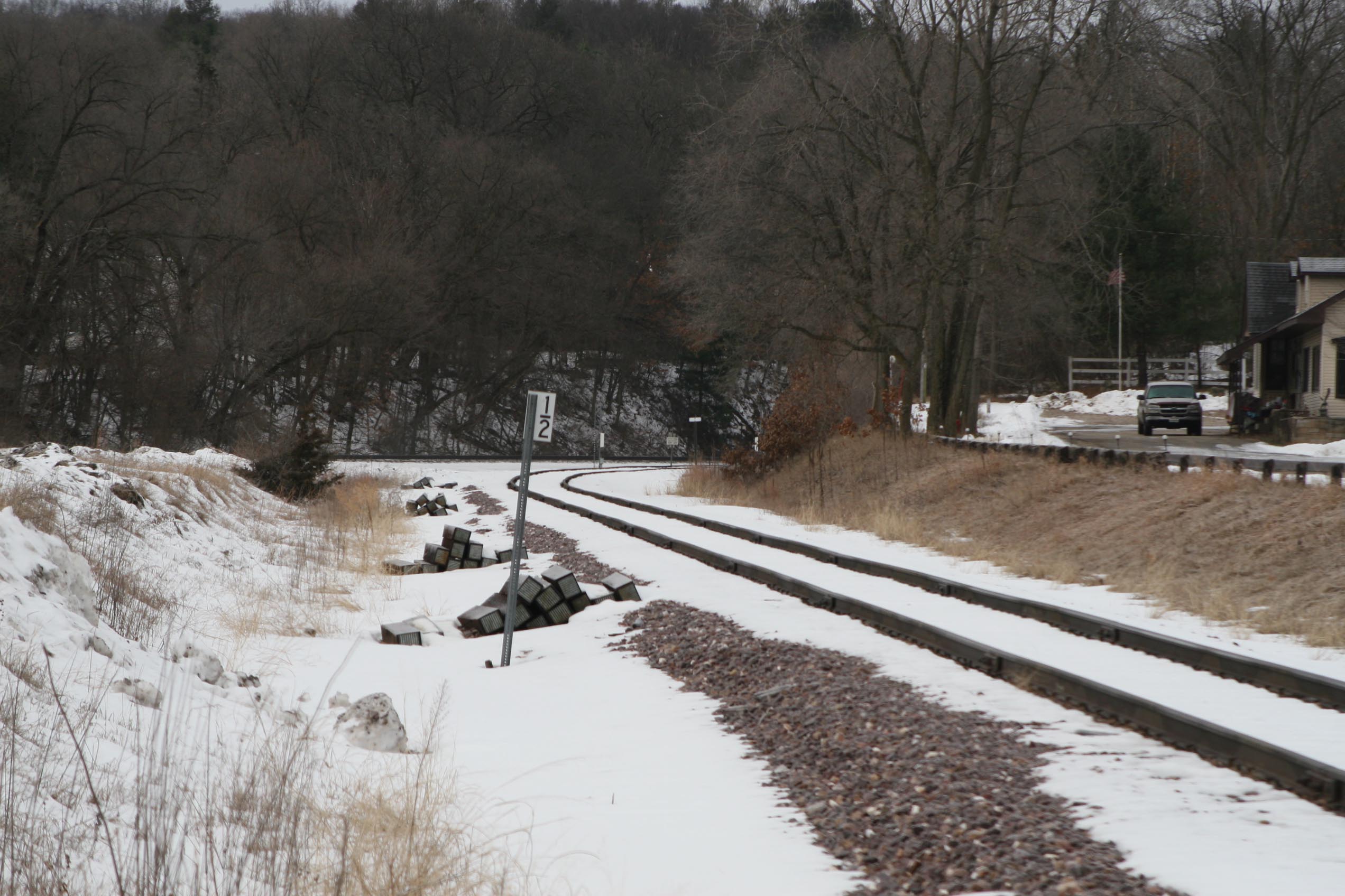
Because it is a hike to get to the tunnel area, we only have a couple of general views looking west towards the tunnel, however, the tunnel is out of sight if you were hoping for a quick shot of a freight.... you will have to do a little walking. Both of these pictures were taken adjacent to County Highway M.
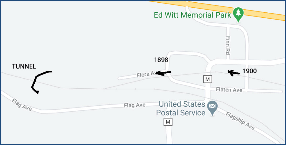
 1898
1898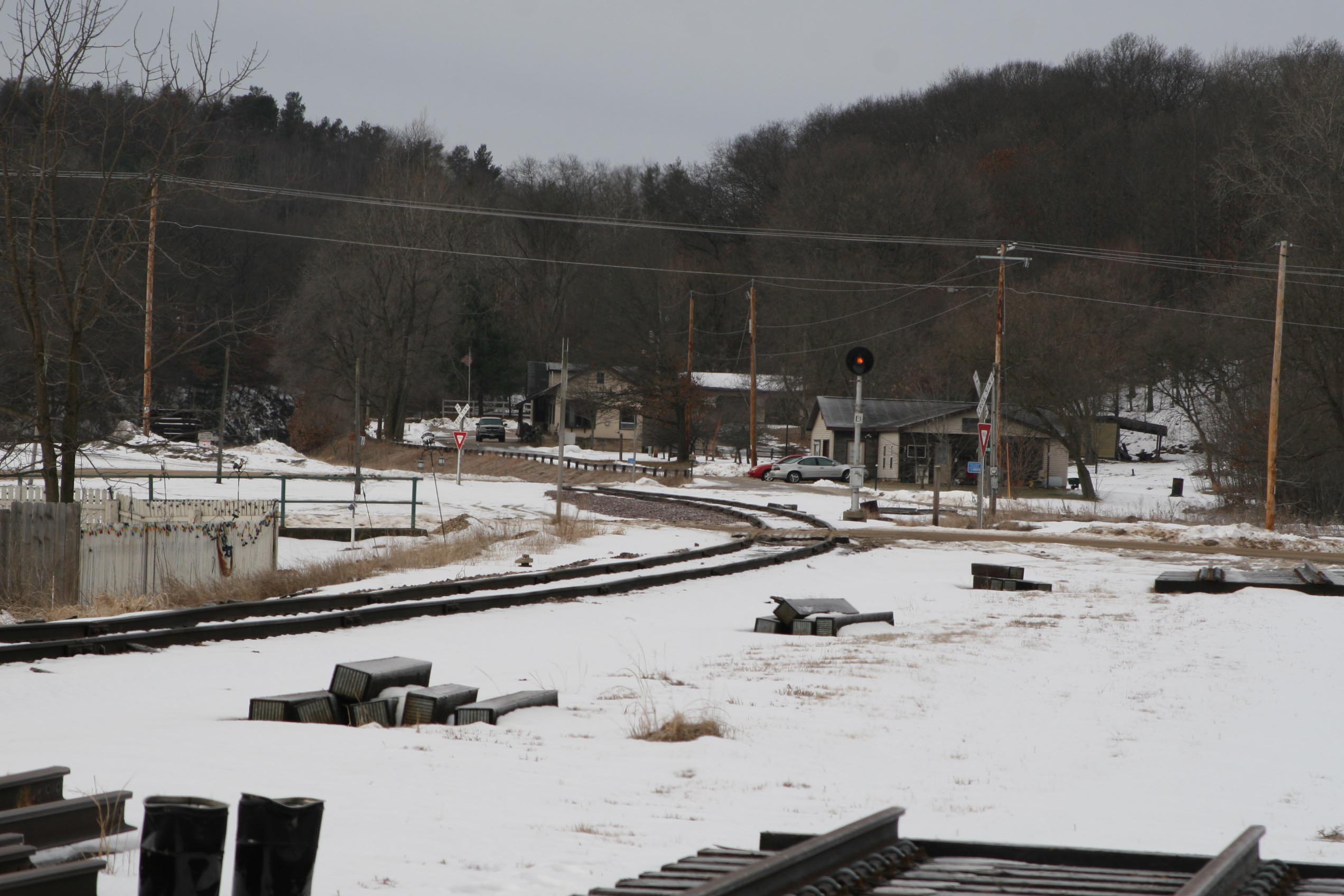 1900
1900the Cranberry Farms
the Sand Plant / Tunnel City
Camp Douglas / end of UP Line
Courtesy of the University of Texas Library, click here for their index page.
Disclaimers:
I love trains, and I love signals. I am not an expert. My webpages reflect what I find on the topic of the page. This is something I have fun with while trying to help others.
Please Note: Since the main focus of my two websites is railroad signals, the railfan guides are oriented towards the signal fan being able to locate them. For those of you into the modeling aspect of our hobby, my indexa page has a list of almost everything railroad oriented I can think of to provide you with at least a few pictures to help you detail your pike.
If this is a railfan page, every effort has been made to make sure that the information contained on this map and in this railfan guide is correct. Once in a while, an error may creep in :-)
My philosophy: Pictures and maps are worth a thousand words, especially for railfanning. Text descriptions only get you so far, especially if you get lost or disoriented. Take along good maps.... a GPS is OK to get somewhere, but maps are still better if you get lost! I belong to AAA, which allows you to get local maps for free when you visit the local branches. ADC puts out a nice series of county maps for the Washington DC area, but their state maps do not have the railroads on them. If you can find em, I like the National Geographic map book of the U.S..... good, clear, and concise graphics, and they do a really good job of showing you where tourist type attractions are, although they too lack the railroads. Other notes about specific areas will show up on that page if known.
Aerial shots were taken from either Google or Bing Maps as noted. Screen captures are made with Snagit, a Techsmith product... a great tool if you have never used it!
By the way, floobydust is a term I picked up 30-40 years ago from a National Semiconductor data book, and means miscellaneous and/or other stuff.
Pictures and additional information is always needed if anyone feels inclined to take 'em, send 'em, and share 'em, or if you have something to add or correct.... credit is always given! Please be NICE!!! Contact info is here
Beware: If used as a source, ANYTHING from Wikipedia must be treated as being possibly inaccurate, wrong, or not true.
RAILFAN GUIDES HOME
RAILROAD SIGNALS HOME
NEW 10/29/2020
Last Modified 29-Oct-2020