RAILFAN GUIDES of the U.S.
Todd's Railfan Guide to
MIDDLEBURY VT
In General
Getting Here
Map
Sights
Bridges
Signals
Fire & Police
Postcards
Floobydust
USGS Maps
RAILROAD SIGNALS HOME
Location / Name:
Middlebury VT, Addison County
What's Here:
Amtrak Station
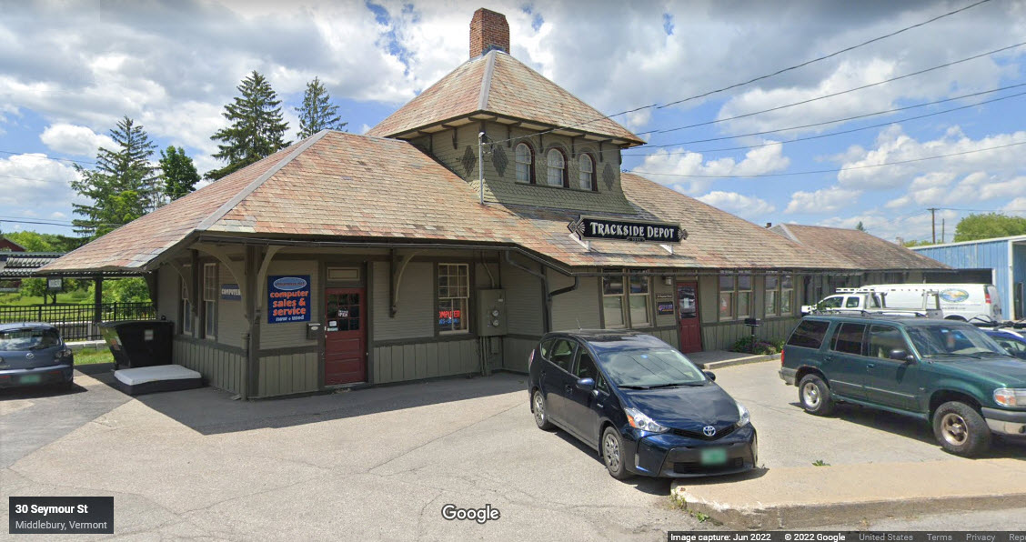
Former Rutland Depot
Small Yard
Data:
GPS Coordinates: as needed
Phone A/C: 802
ZIP: 05753
Access by train/transit:
Amtrak Ethan Allen Express
The Scoop:
When came through here 20 years ago, the Rutland depot was in "hard" shape, and the tracks didn't look all that good. Fast forward to today, and we can see the positive impact of having Amtrak come thru has had on the town (hopefully everyone feels that way :-).
The Rutland depot was built in 1891. It has been "fixed up" by the current tenants and restored to "near original" condition.
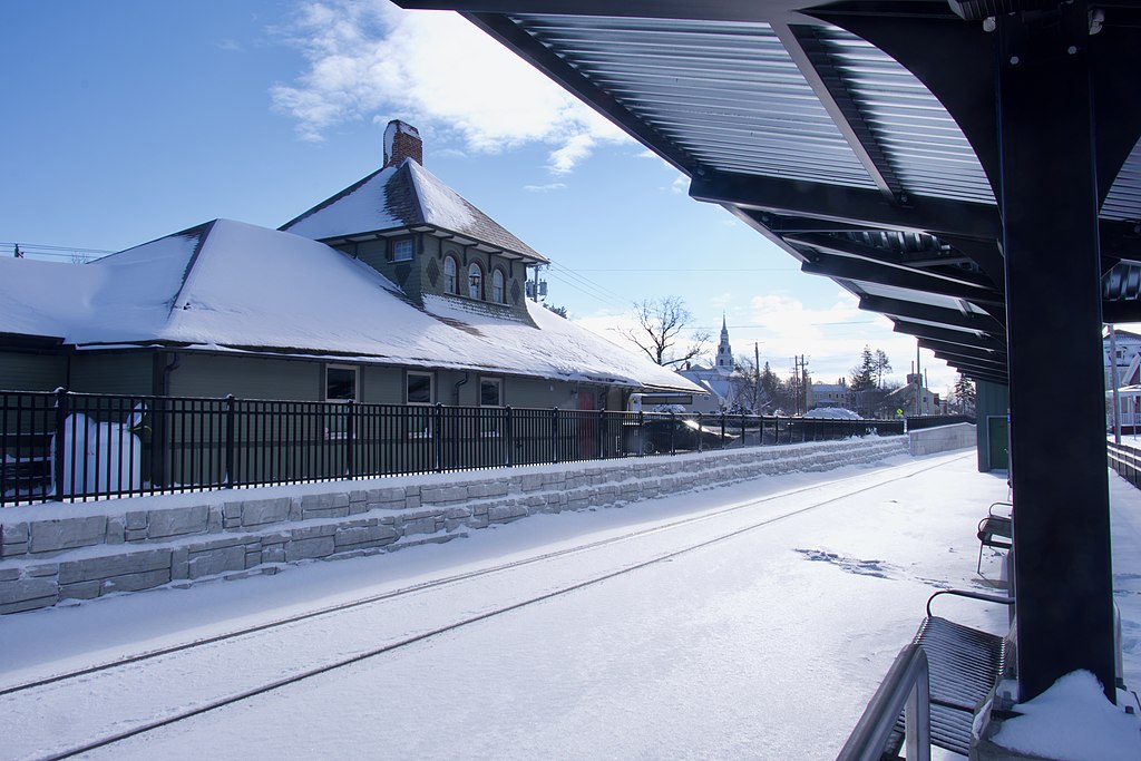
Amtrak had the station built in 2021/22, and it was just dedicated this past July (of 2022).
Acknowledgements:
Adam Moss
Bonnie Shatraw Wingler
Quincy Morgan
Eiledon
Google Maps
Open Railway Map
Wikipedia
Websites and other additional information sources of interest for the area:
https://en.wikipedia.org/wiki/Middlebury_station
https://www.amtrak.com/stations/mby
https://www.middleburycampus.com/article/2022/04/new-amtrak-passenger-train-coming-to-middlebury-this-july-increasing-need-for-rail-safety-awareness
https://www.middlebury.edu/announcements/news/2022/07/train-service-new-york-city-starts-july-29-safety-information
https://www.greatamericanstations.com/stations/middlebury-vt-mby/
https://vermontintegratedarchitecture.com/trackside-depot/
https://www.pinterest.com/pin/735071970400577831/
Getting to G
GPS Coordinates: 44.01760, -73.16981
Station Code: MBY
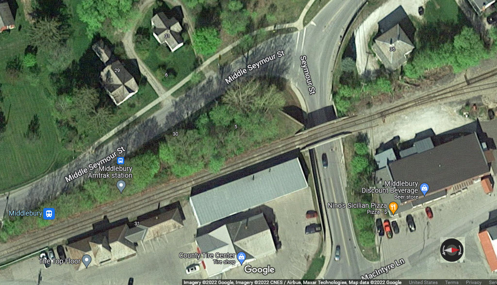
30 Middle Seymour Street, 17 parking spaces
Judging from the fact that the station does not appear in Google's aerial view, I'm guessing this is a relatively new build, and according to Wikipedia, it is - the station opened on July 29, 2022.

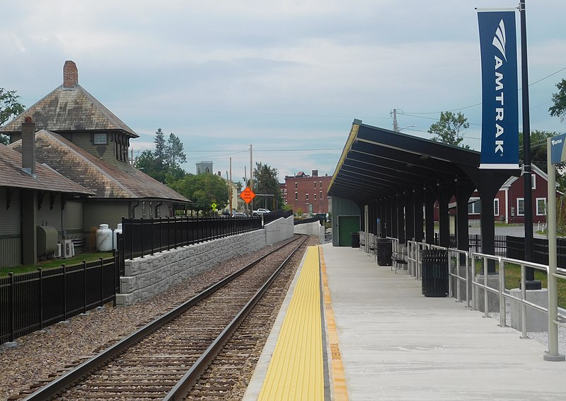 Adam Moss via Wikipedia, August 2022
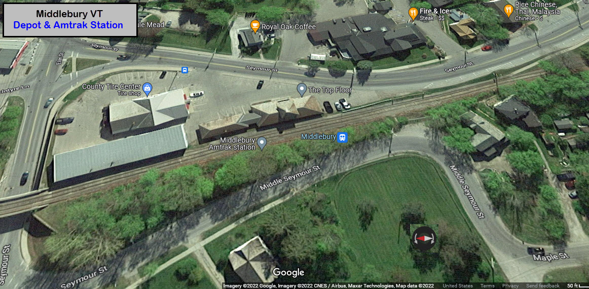
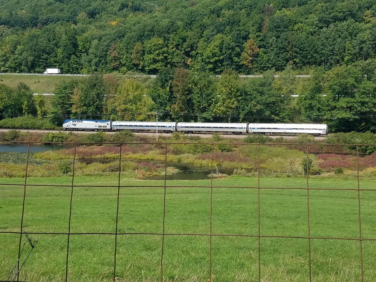
An Amtrak train speeds westbound along the Ethan Allen Express route near West Rutland during a training/inspection run last September (2021).
Photo: Bonnie Shatraw Wingler, from the VermontBiz page.
GPS Coordinates: 44.01764, -73.16963
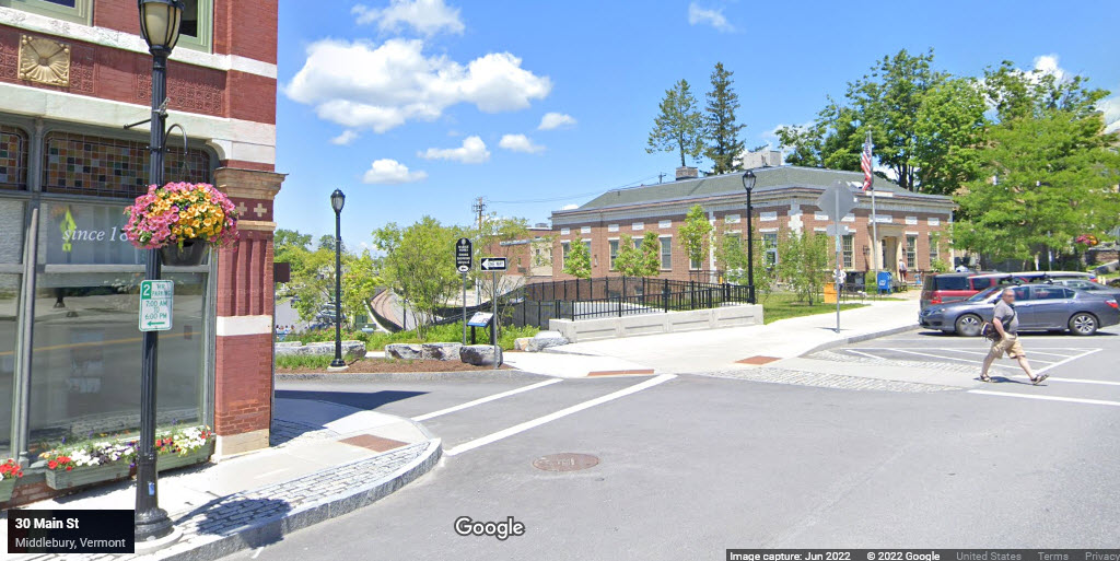
From Wikipedia: Middlebury's historic train station closed in 1953 when the Rutland Railroad discontinued passenger service to the town. The building is now private property and houses retail space. End Wiki
From Vermont Integrated Architecture: Built in 1891 and moved to a new foundation at its current location in 1911, the Middlebury depot served as a Rutland Railway passenger and freight station until the late 1950s and is a contributing structure to the Middlebury Village Historic District. Fifty years after the end of its life as an active railroad station, careless additions by successive retail operations and years of deferred maintenance had turned this classic late Victorian style station into a drafty eyesore. The adjacent business owners who purchased the property wanted to return the building to its former beauty and usefulness with the goal of creating attractive, marketable office space on a very modest budget. Awards of state and federal tax credits and a USDA energy grant allowed us to expand the scope of the project to include a significant energy retrofit along with the preservation and restoration of historic interior and exterior details. End VIA
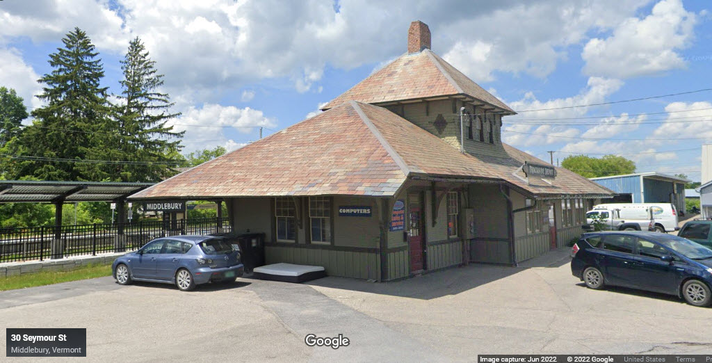
 Quincy Morgan/Wikipedia
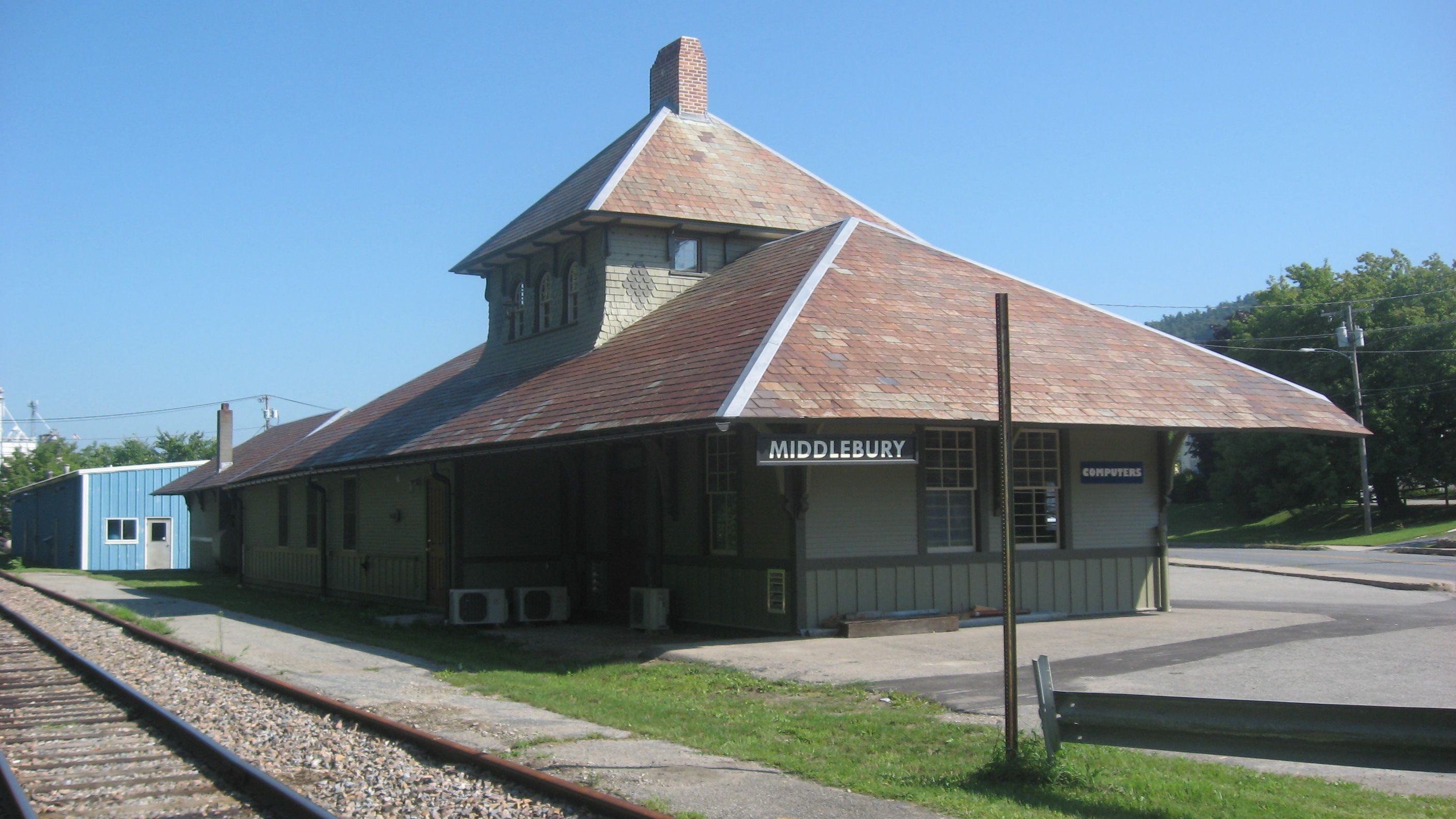 Eiledon/Pinterest
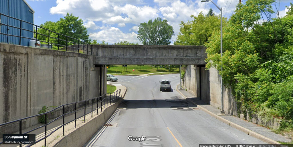
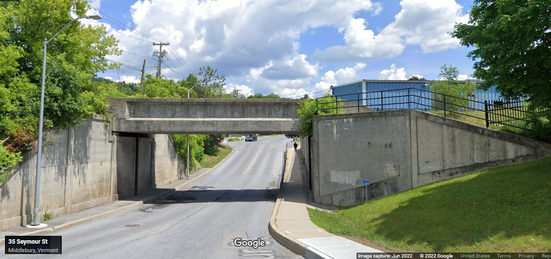
From Wikipedia: Downtown rail tunnel - In conjunction with restoring passenger train service to Middlebury, the Main Street and Merchant's Row bridges over the rail line needed to be addressed. VTrans and Middlebury had replaced the 100-year-old bridges with temporary spans in 2017 following an emergency closure. In summer 2020, the roads were closed for ten weeks while a 360-foot (110 m) rail tunnel was constructed. The new tunnel has an additional 4 feet (1.2 m) of clearance, accommodating double-stack rail cars. It also created new public space in Triangle Park next to St. Stephen's Episcopal Church. The first train went through the tunnel on September 18, 2020, as part of a reopening celebration. Due to the bridge's proximity to Otter Creek, additional drainage had to be added. The project delayed construction on the Middlebury station, and with it the entire Burlington extension project, as the Middlebury station's platform ended where the grade to a new 19 ft (5.8 m) tunnel began. The project was completed within budget at a cost of $91.5 million: $72 million for construction, $14.8 million for right-of-way, $4.4 million for engineering, and $300,000 for utility relocation. End Wiki
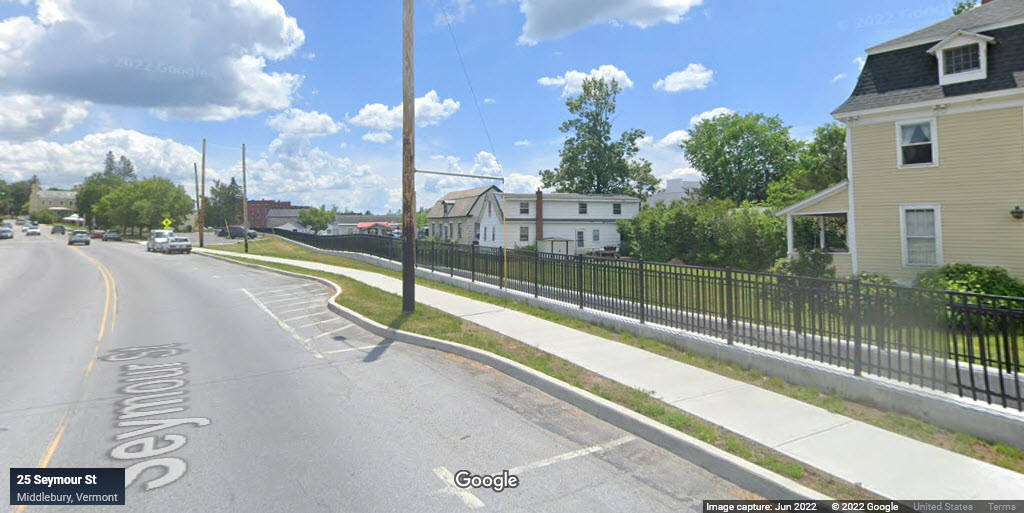
From Main Street, we can just barely see the tracks as they come out of the new tunnel and head towards the Amtrak station.
GPS Coordinates: 44.01834, -73.17010
No signals found in the area.
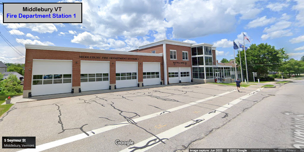
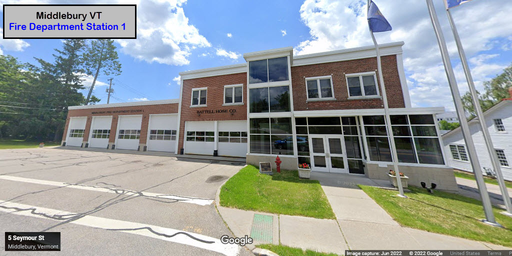
![]() Middlebury Fire Department Station 1
Middlebury Fire Department Station 1
5 Seymour St, Middlebury VT 05753
802-388-4462
![]() Xxx
Xxx
![]() Xxx
Xxx
Did U Know?
None for now......
Courtesy of the University of Texas Library, click here for their index page.
Disclaimers:
I love trains, and I love signals. I am not an expert. My webpages reflect what I find on the topic of the page. This is something I have fun with while trying to help others.
Please Note: Since the main focus of my two websites is railroad signals, the railfan guides are oriented towards the signal fan being able to locate them. For those of you into the modeling aspect of our hobby, my indexa page has a list of almost everything railroad oriented I can think of to provide you with at least a few pictures to help you detail your pike.
If this is a railfan page, every effort has been made to make sure that the information contained on this map and in this railfan guide is correct. Once in a while, an error may creep in :-)
My philosophy: Pictures and maps are worth a thousand words, especially for railfanning. Text descriptions only get you so far, especially if you get lost or disoriented. Take along good maps.... a GPS is OK to get somewhere, but maps are still better if you get lost! I belong to AAA, which allows you to get local maps for free when you visit the local branches. ADC puts out a nice series of county maps for the Washington DC area, but their state maps do not have the railroads on them. If you can find em, I like the National Geographic map book of the U.S..... good, clear, and concise graphics, and they do a really good job of showing you where tourist type attractions are, although they too lack the railroads. Other notes about specific areas will show up on that page if known.
Aerial shots were taken from either Google or Bing Maps as noted. Screen captures are made with Snagit, a Techsmith product... a great tool if you have never used it!
By the way, floobydust is a term I picked up 30-40 years ago from a National Semiconductor data book, and means miscellaneous and/or other stuff.
Pictures and additional information is always needed if anyone feels inclined to take 'em, send 'em, and share 'em, or if you have something to add or correct.... credit is always given! Please be NICE!!! Contact info is here
Beware: If used as a source, ANYTHING from Wikipedia must be treated as being possibly inaccurate, wrong, or not true.
RAILFAN GUIDES HOME
RAILROAD SIGNALS HOME
NEW 10/26/2022
Last Modified 26-Oct-2022