RAILFAN GUIDES of the U.S.
Todd's Railfan Guide
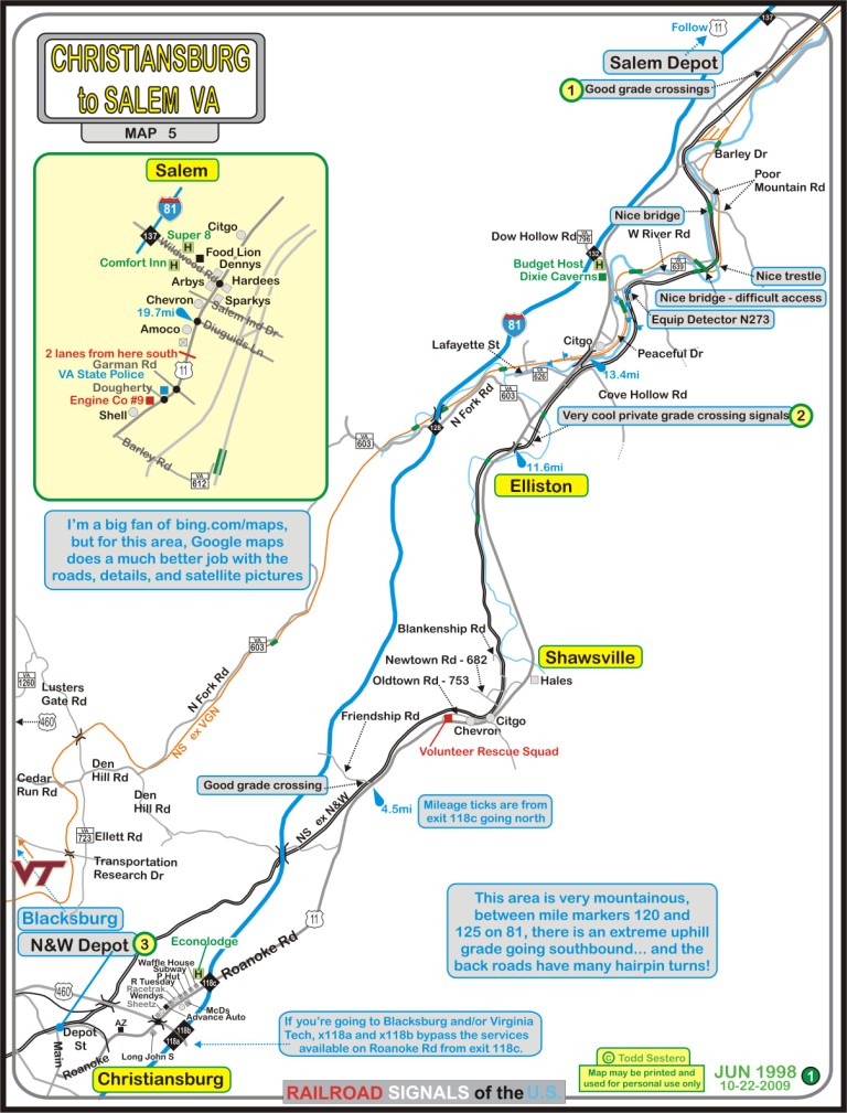
CHRISTIANSBURG to SALEM
VA
Map 5 of 5 for the
Roanoke Area
ROANOKE HOMEPAGE
RAILFAN GUIDES HOME
RAILROAD SIGNALS HOME
This chase map covers the area between Salem and Christiansburg Virginia. Exit wise off of Interstate 81, it covers from exit 118 at Christiansburg, to exit 137 in Salem, just three miles shy of I581 that takes you into the downtown area of Roanoke.
The two (formerly) competing lines of the Virginian and the Norfolk & Western intertwine for a few miles south of Salem, and then go off in their separate directions to get to the coal fields.
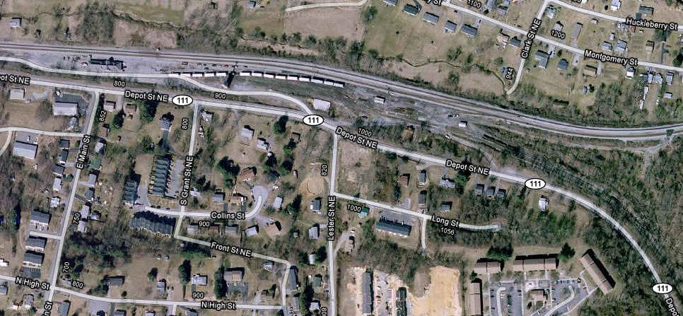
Both Christiansburg and Salem have depots still standing, see this map for the location of the one in Christiansburg. The Salem depot is shown on map 4, Salem. Next to the depot in Christiansburg, there is a small maintenance yard as seen in the photos.
This map is a big improvement over the earlier B&W version which I originally did about 10 years ago.
The satellite photos are from Google maps, which for the area, have the advantage over bing.com/maps, which I usually prefer. Google has also done a better job of supplying local information on their maps in the way of restaurants, shopping, services like fire and police, etc.
Click here for the PDF version of the below map, or here for a PDF with all five Roanoke maps.
As always, if anyone has additional info, pictures, etc to contribute, please check out my contact page here

For you Hokies... the above VT insignia from my map is available here as a
GIF,
TIFF,
JPEG,
or
Windows Metafile
1 Diuguids Road
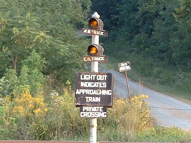
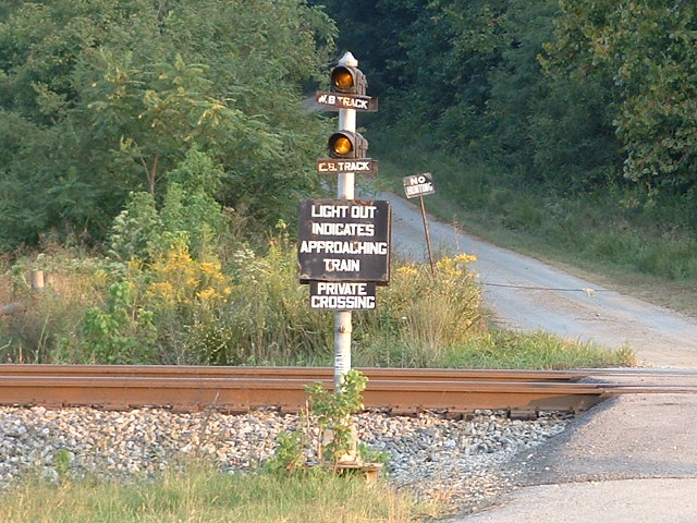
2 Grade Crossing Signals
3 The N&W Depot in Christiansburg
NEW 10/15/2009
Last Modified
28-Mar-2012