
RAILFAN GUIDES HOME
RAILROAD SIGNALS HOME
Location / Name:
Downtown Roanoke VA, NO County (Roanoke is an independent city within the boundary of surrounding Roanoke County
What's Here:
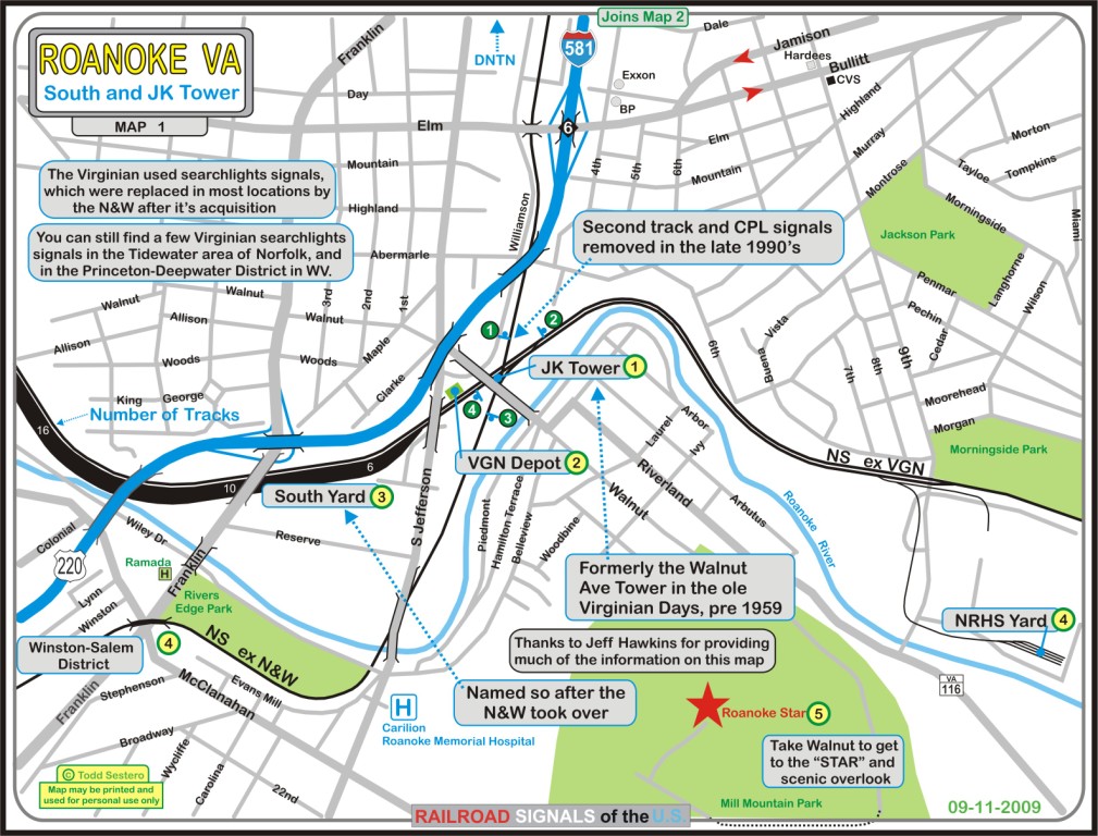
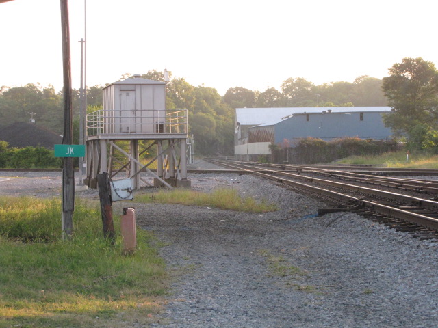
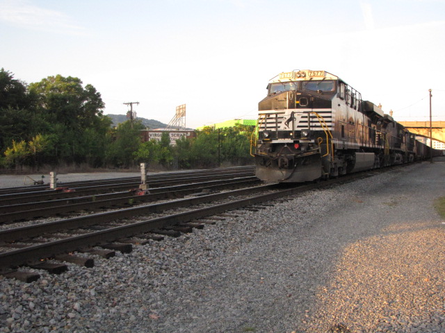
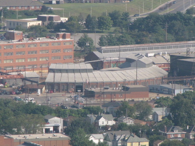
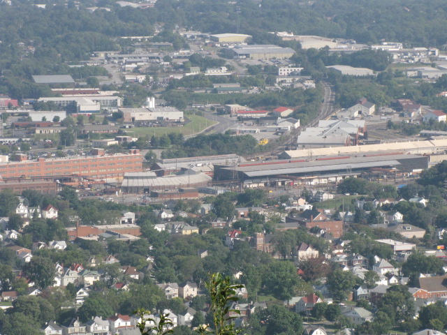
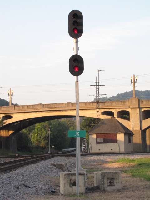
JK Junction
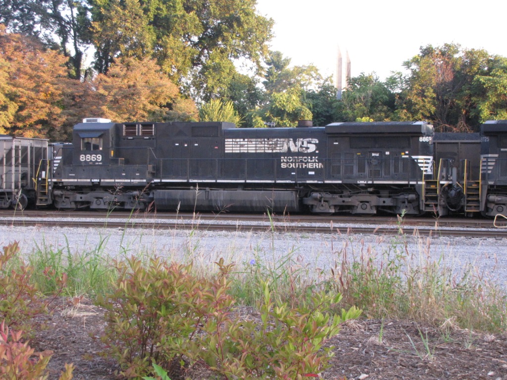
the ex Virginian yard now named "South Yard"
and the NRHS storage area
Data:
GPS Coordinates: as needed
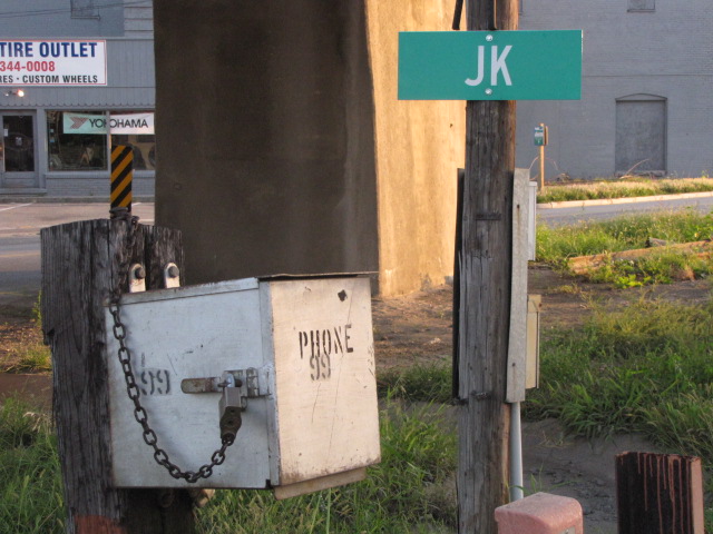
Phone A/C: 540
ZIP: 24016
Access by train/transit:
Amtrak Northeast Regional
The Scoop:
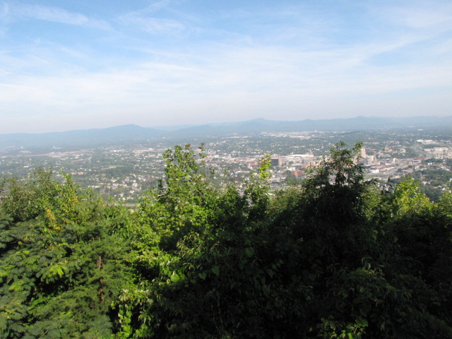
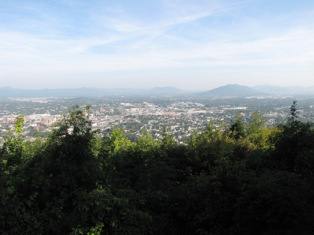
Roanoke has always seemed to be one of those "lost railfan paradises". Even in this "one railroad" era, there are plenty of things to see and do between downtown, this area on the south side, the main NS yard on the west side, and Salem and Christiansburg to the southwest....
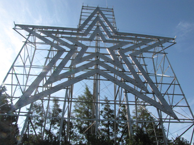
In addition, less than 30 miles to the east in Bedford, is the most impressive war memorial I have ever seen, and I live in an area with probably more memorials than any other part of the country that includes Gettysburg, DC, Philly, and Baltimore!
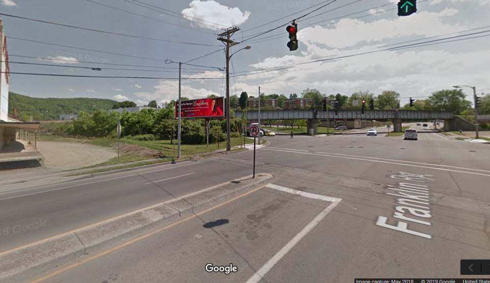
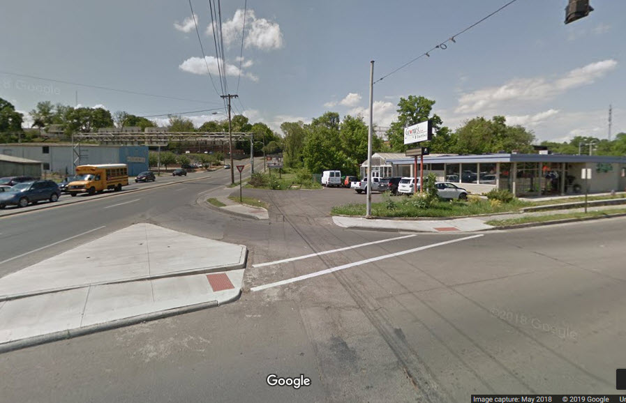
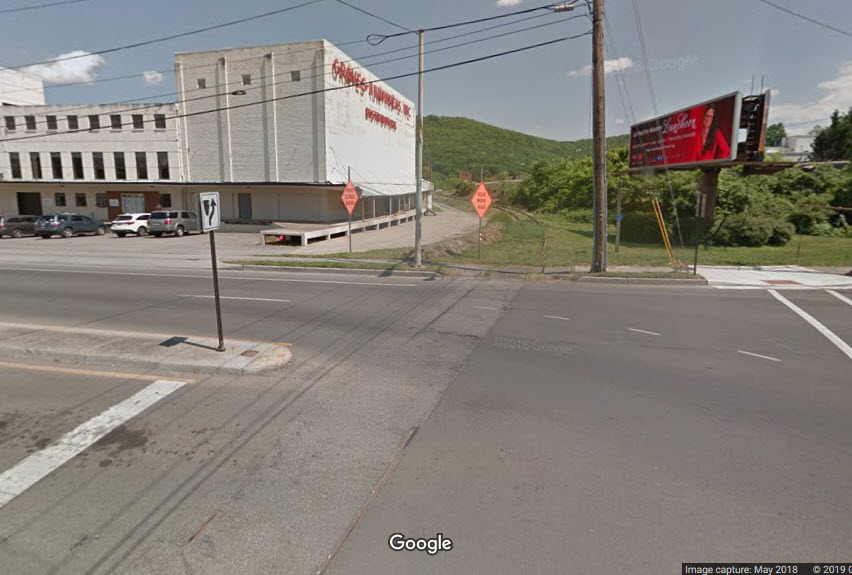
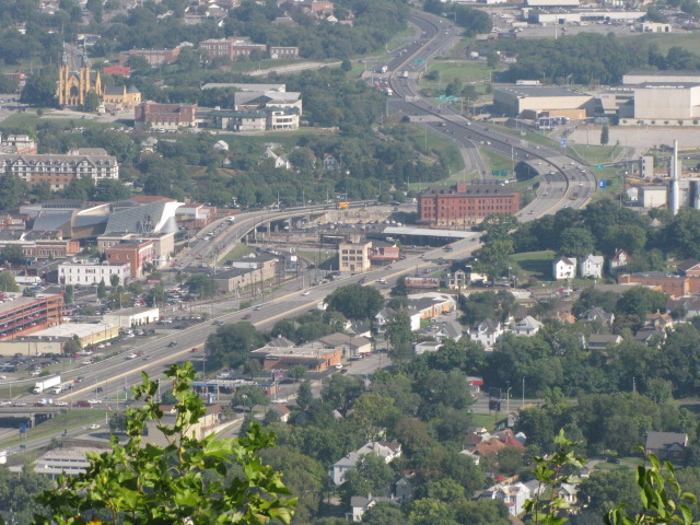
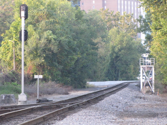
This map covers the south side of Roanoke, which includes JK Junction, the ex Virginian yard now named "South Yard", and the NRHS storage area in an industrial park off 9th.
Acknowledgements:
Thanks to Bill King for some updates and corrections to the page.
Denver Todd
Websites and other additional information sources of interest for the area:
None for now.....
GPS Coordinates: 37.260369, -79.939465
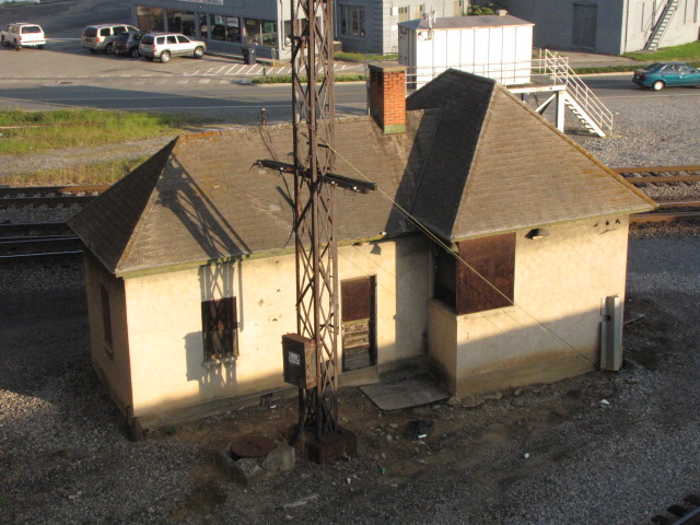
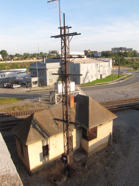
JK Tower was not always JK Tower. Apparently, in the pre-merger days between the VGN and the N&W, it was known as the Walnut St. Tower. Gordon H of the Yahoo Virginian Group informs us that on the N&W TT #18, dated 2/19/61, it is referred to as Walnut St. On timetable #23, dated 10/31/65, it is called JK. The tower was originally a two-story wood building, and was quite an extensive and complex pipe interlocking plant!
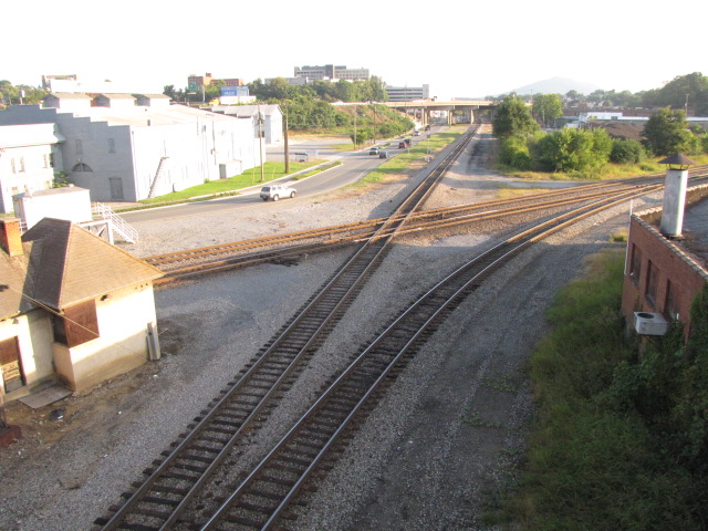
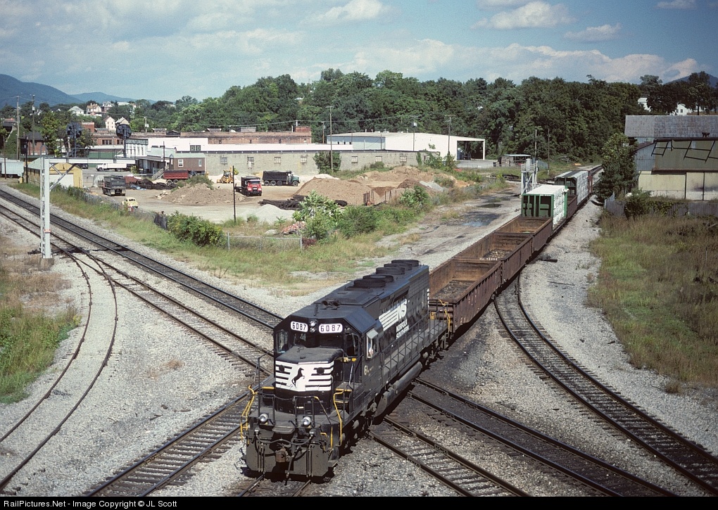
The picture of NS SD40-2 # 6087 at the diamond before the second track and signals were removed is used by permission of JL Scott, click here for the picture on railpictures.net, and a way to his other photos of the area. The picture was taken on 9/22/96 from the Walnut St overpass... great shot!
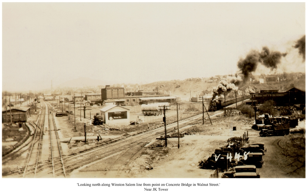
The other shot was passed onto me by Doug Harris, and I am grateful he decided to share this great photo with us all. Take the time to absorb all of the differences from the current photos! Click here for a great PDF map of the JK area from 1931, also passed onto me by Doug.... it's a great map, and shows the streetcar tracks and the close proximity of the carbarn and shops to the crossover in addition to the railroads. It's about a 1 meg download.

GPS Coordinates: 37.259706, -79.940954
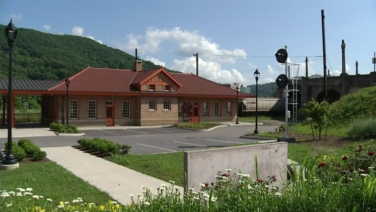
1402 Jefferson St., Roanoke VA, 24016.
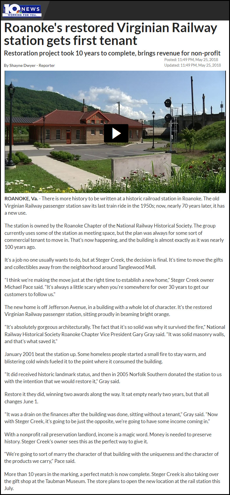
https://en.wikipedia.org/wiki/Virginian_Railway_Passenger_Station
The Virginian Railway Passenger Station was built in 1909. 1909 is also the year that the VGN completed it's track from Deepwater WV to Sewells Point in Hampton Roads VA (Norfolk). Trains were running between Roanoke and Deepwater in February of 1909, and in June, service began to Norfolk. Passenger service was discontinued in the mid-50's, shortly after the N&W dieselized its fleet. The N&W leased the VGN in 1926, and in 1959, the VGN was merged into the N&W. In January of 2001, the depot was damaged by a fire, and has been in it's present state since then.
The NRHS started a renovation on the depot, and it is pretty much completed as of late 2016.
The station is listed on the U.S. National Register of Historic Places.

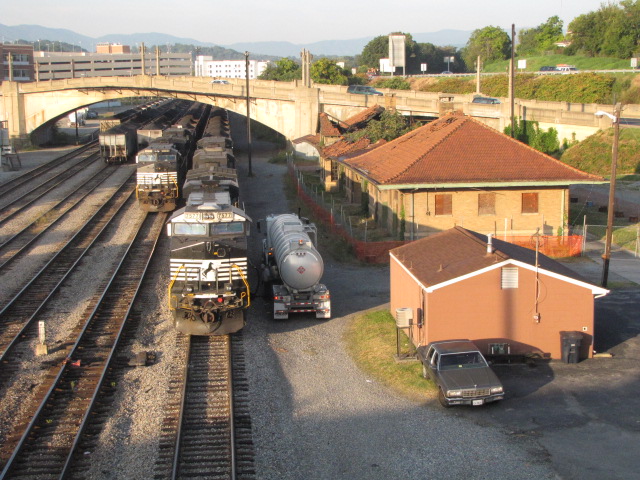
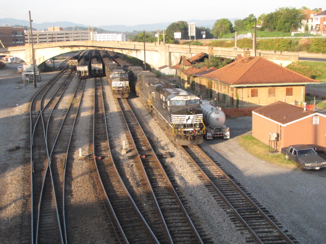

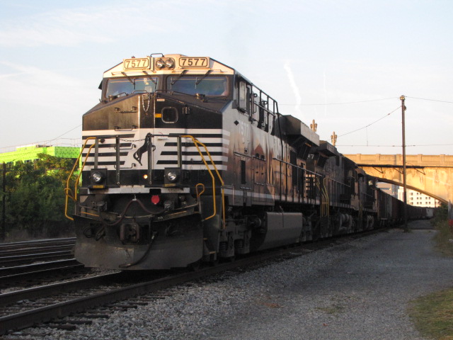
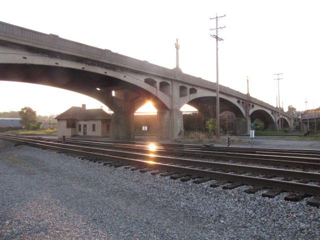
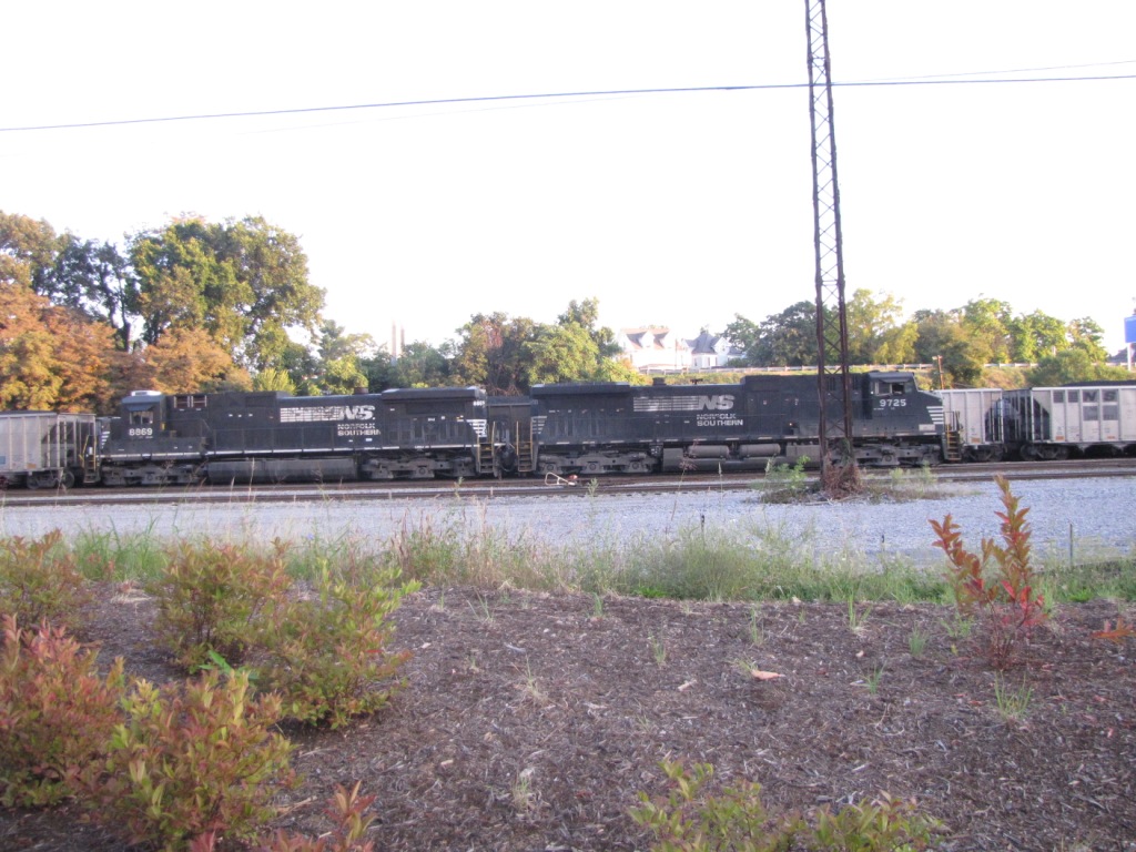
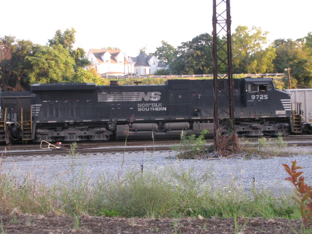
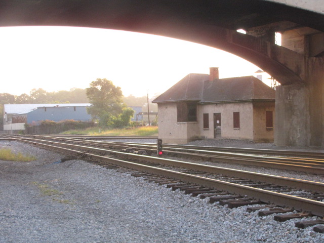
South Yard serves mostly as a holding yard for eastbound coal drags headed for Norfolk, via Petersburg and Chesapeake. The east end of the yard is adjacent to the Virginian depot above.
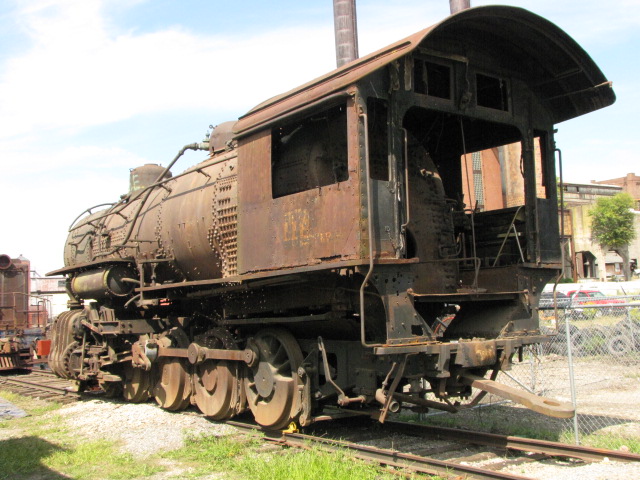
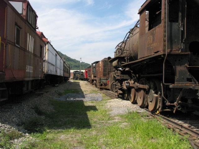
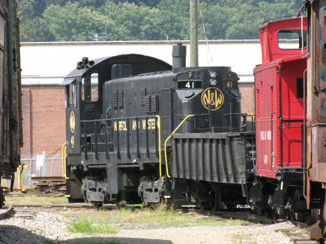
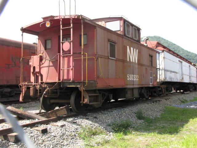
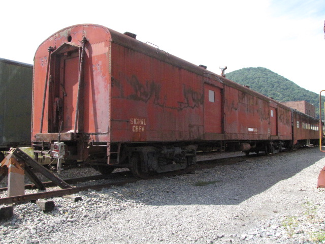
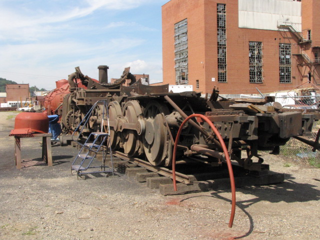
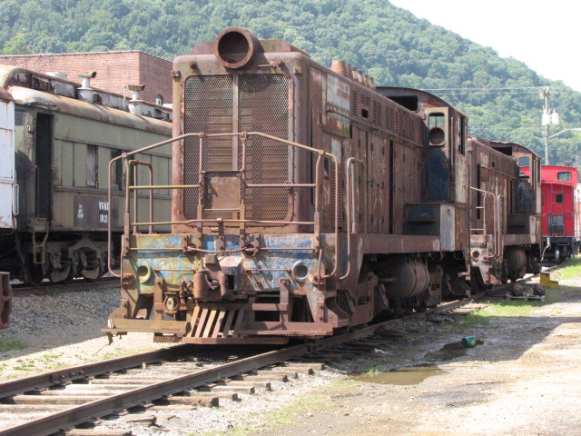
Lots of goodies waiting for your help to restore in the NRHS yard! Among them are the "lost" steam engines of Roanoke.

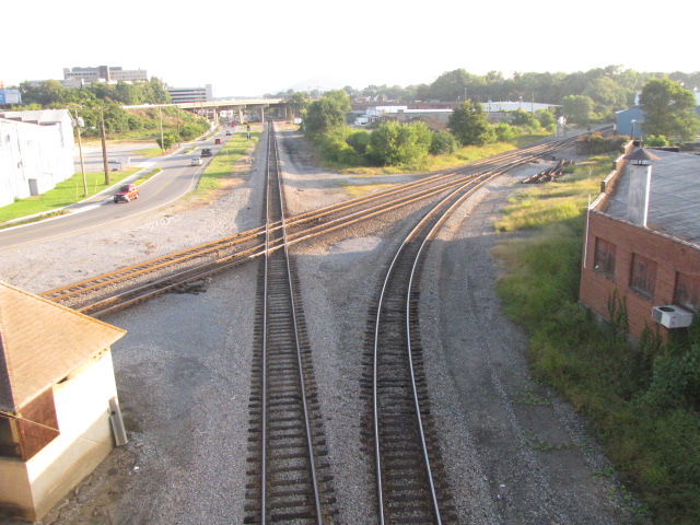
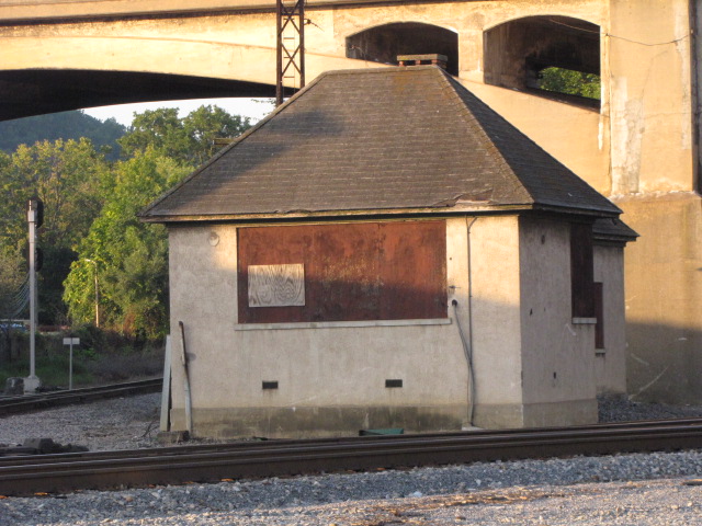
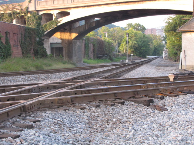
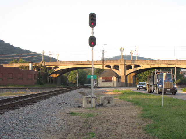
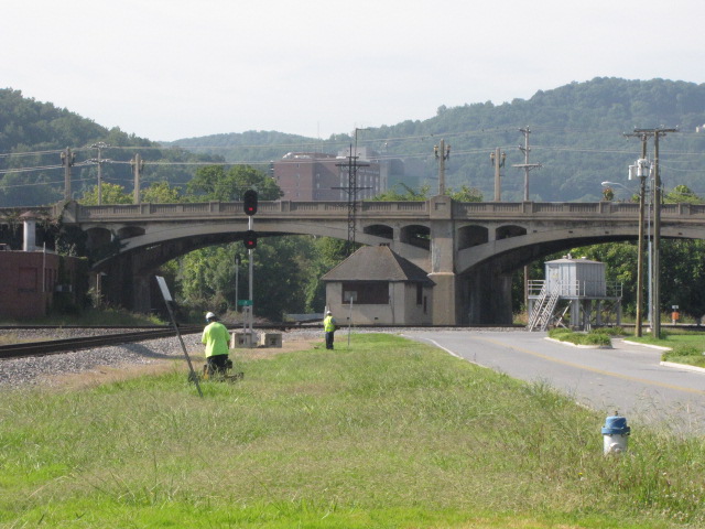
This overpass was a former N&W bridge and is still marked as such with a N&W Rwy sign. The trackage was the Winston-Salem District of the N&W�s Shenandoah Division.
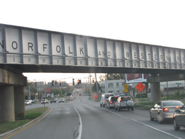
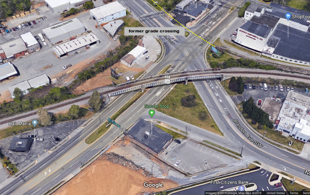
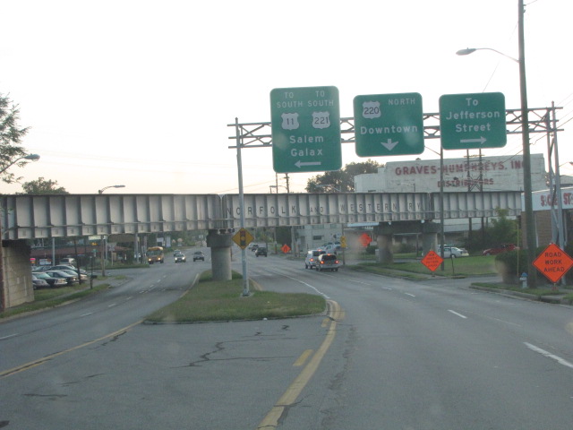

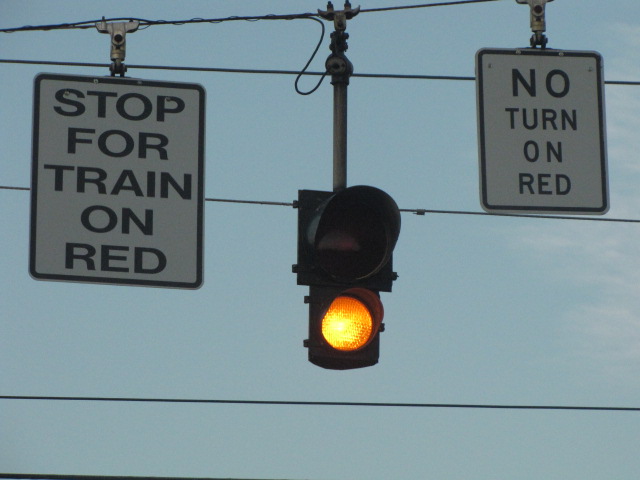
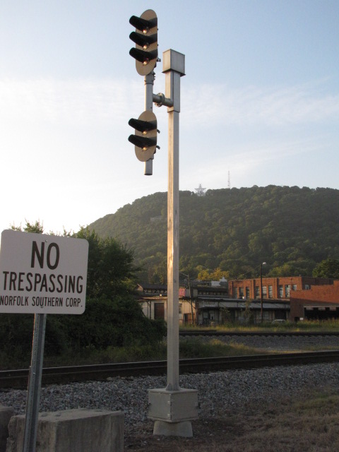
The grade crossing that used to be here is now paved over, so the sign and light governing the crossing have been removed.


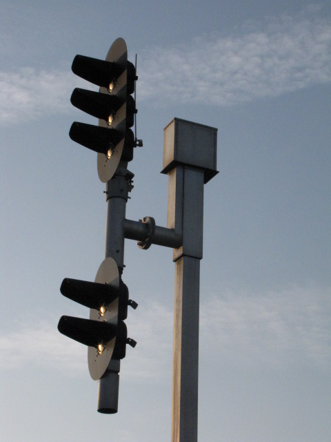
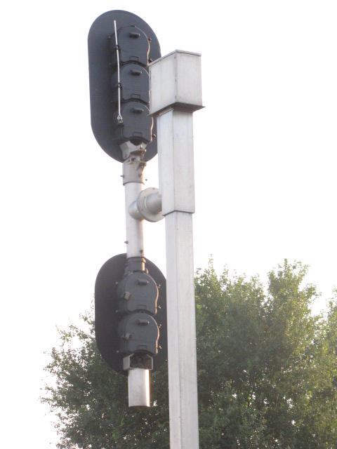
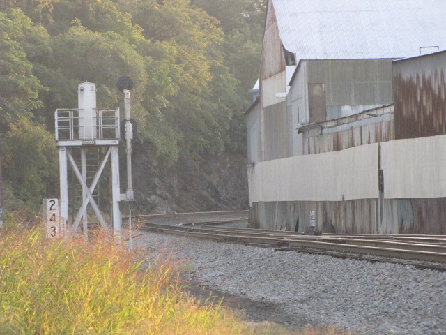
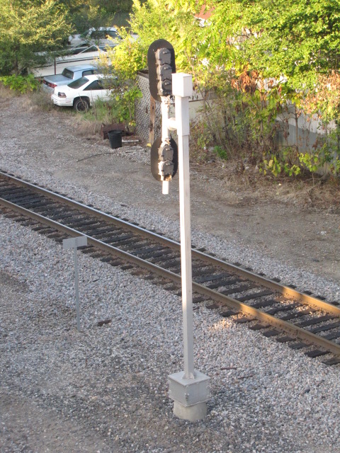
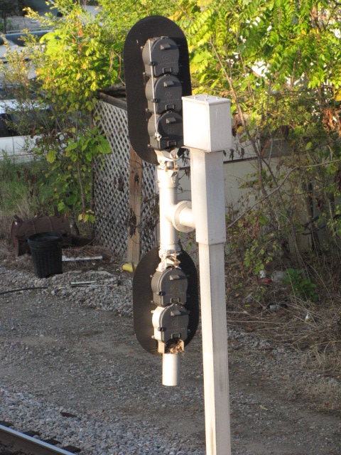
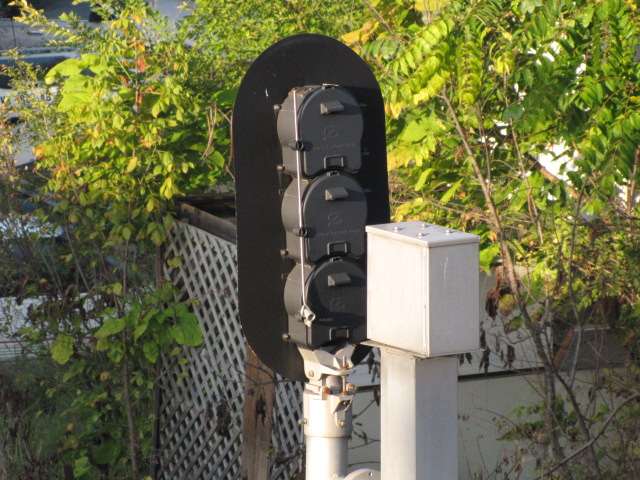
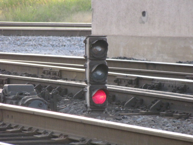
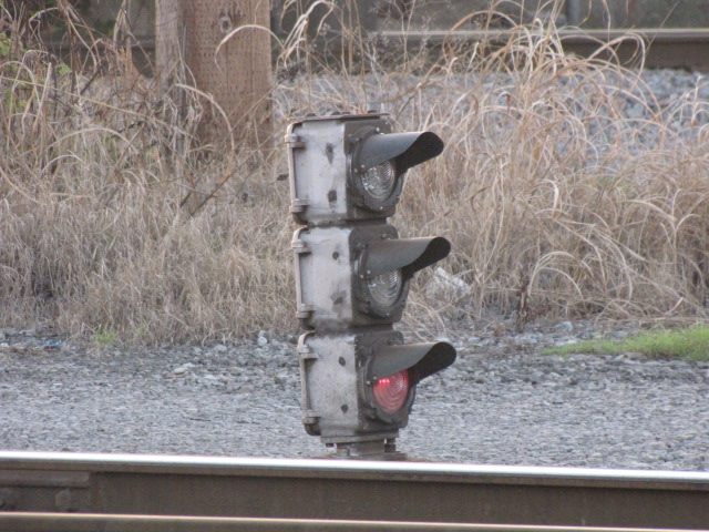
The signals at JK are actually pretty boring, the only interesting ones to note are the two signals on the single track N&W line where the head moves up and down to facilitate bulb replacement. The first time I noticed this style was back in 1996 when visiting UVa in Charlottesville VA. As noted on the map, the ex Virginian track used to have searchlights before being acquired by the N&W in 1959. According to Jeff Hawkins, there are some VGN searchlights still standing in the Norfolk area of Virginia, and the Princeton-Deepwater District in West Virginia.... roadtrip.


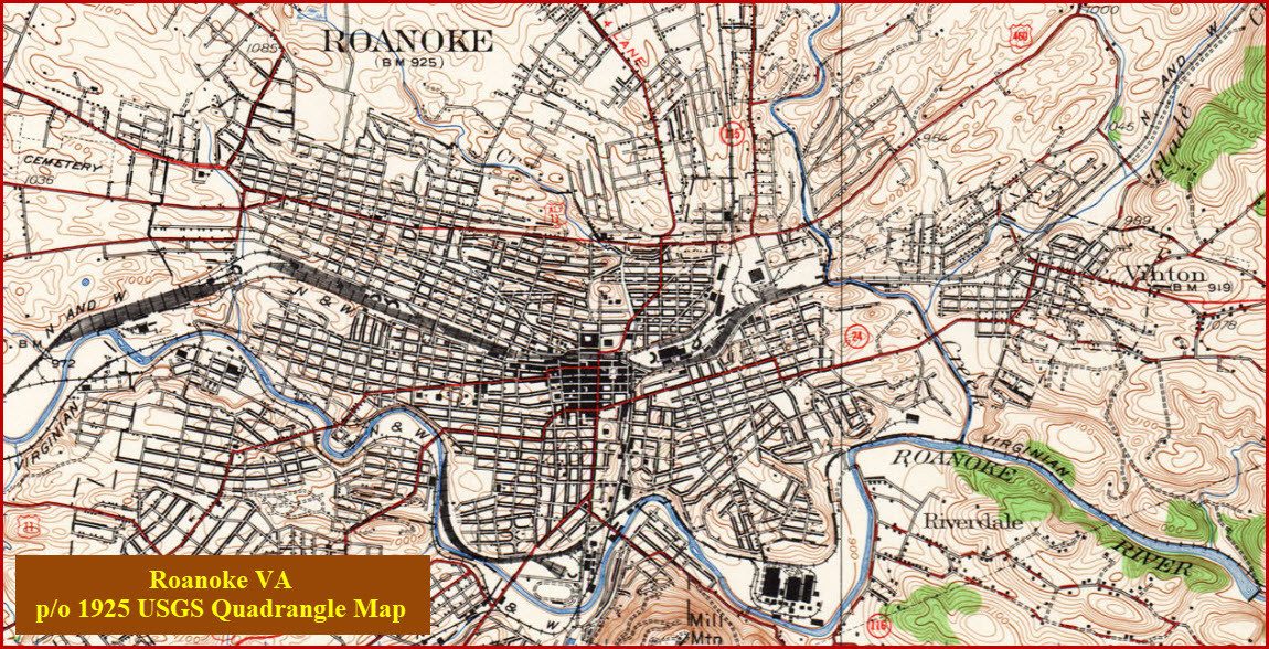
Below, 1925 USGS map of Roanoke, from the Univ of Texas Collection: http://www.lib.utexas.edu/maps/topo/virginia/
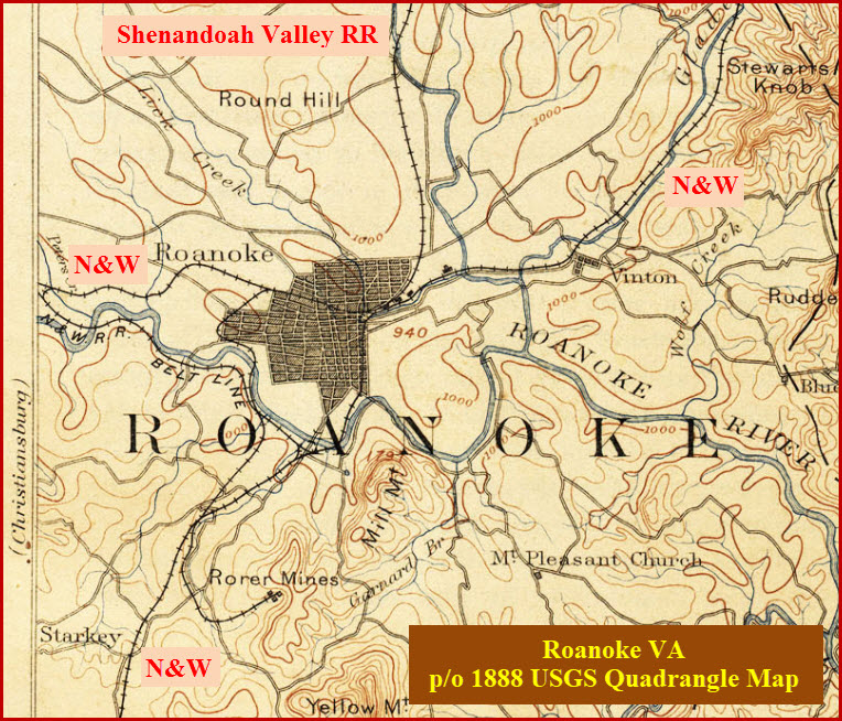
Below, 1888 USGS map of Roanoke, again, from the Univ of Texas Collection
Disclaimers:
I love trains, and I love signals. I am not an expert. My webpages reflect what I find on the topic of the page. This is something I have fun with while trying to help others. My webpages are an attempt at putting everything I can find of the subject in one convenient place. There are plenty of other good websites to help me in this effort, and they are listed in the links section on my indexa page, or as needed on individual pages. Please do not write to me about something that may be incorrect, and then hound the heck out of me if I do not respond to you in the manner you would like. I operate on the "Golden Rule Principle", and if you are not familiar with it, please acquaint yourself with how to treat people by reading Mathew 7:12 (among others, the principle exists in almost every religion). If you contact me (like some do, hi Paul) and try to make it a "non-fun" thing and start with the name calling, your name will go into my spambox list! :-)
Please Note: Since the main focus of my two websites is railroad signals, the railfan guides are oriented towards the signal fan being able to locate them. For those of you into the modeling aspect of our hobby, my indexa page has a list of almost everything railroad oriented I can think of to provide you with at least a few pictures to help you detail your pike.
If this is a railfan page, every effort has been made to make sure that the information contained on this map and in this railfan guide is correct. Once in a while, an error may creep in, especially if restaurants or gas stations open, close, or change names. Most of my maps are a result of personal observation after visiting these locations. I have always felt that a picture is worth a thousand words", and I feel annotated maps such as the ones I work up do the same justice for the railfan over a simple text description of the area. Since the main focus of my website is railroad signals, the railfan guides are oriented towards the signal fan being able to locate them. Since most of us railheads don't have just trains as a hobby, I have also tried to point out where other interesting sites of the area are.... things like fire stations, neat bridges, or other significant historical or geographical feature. While some may feel they shouldn't be included, these other things tend to make MY trips a lot more interesting.... stuff like where the C&O Canal has a bridge going over a river (the Monocacy Aqueduct) between Point of Rocks and Gaithersburg MD, it's way cool to realize this bridge to support a water "road" over a river was built in the 1830's!!!
My philosophy: Pictures and maps are worth a thousand words, especially for railfanning. Text descriptions only get you so far, especially if you get lost or disoriented. Take along good maps.... a GPS is OK to get somewhere, but maps are still better if you get lost! I belong to AAA, which allows you to get local maps for free when you visit the local branches. ADC puts out a nice series of county maps for the Washington DC area, but their state maps do not have the railroads on them. If you can find em, I like the National Geographic map book of the U.S..... good, clear, and concise graphics, and they do a really good job of showing you where tourist type attractions are, although they too lack the railroads. Other notes about specific areas will show up on that page if known.
Pictures and additional information is always needed if anyone feels inclined to take 'em, send 'em, and share 'em, or if you have something to add or correct.... credit is always given! BE NICE!!! Contact info is here
Beware: If used as a source, ANYTHING from Wikipedia must be treated as being possibly being inaccurate, wrong, or not true.
RAILFAN GUIDES HOME
RAILROAD SIGNALS HOME
NEW 09/16/2009, 03/19/2015
Last Modified 31-May-2019