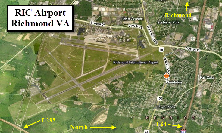
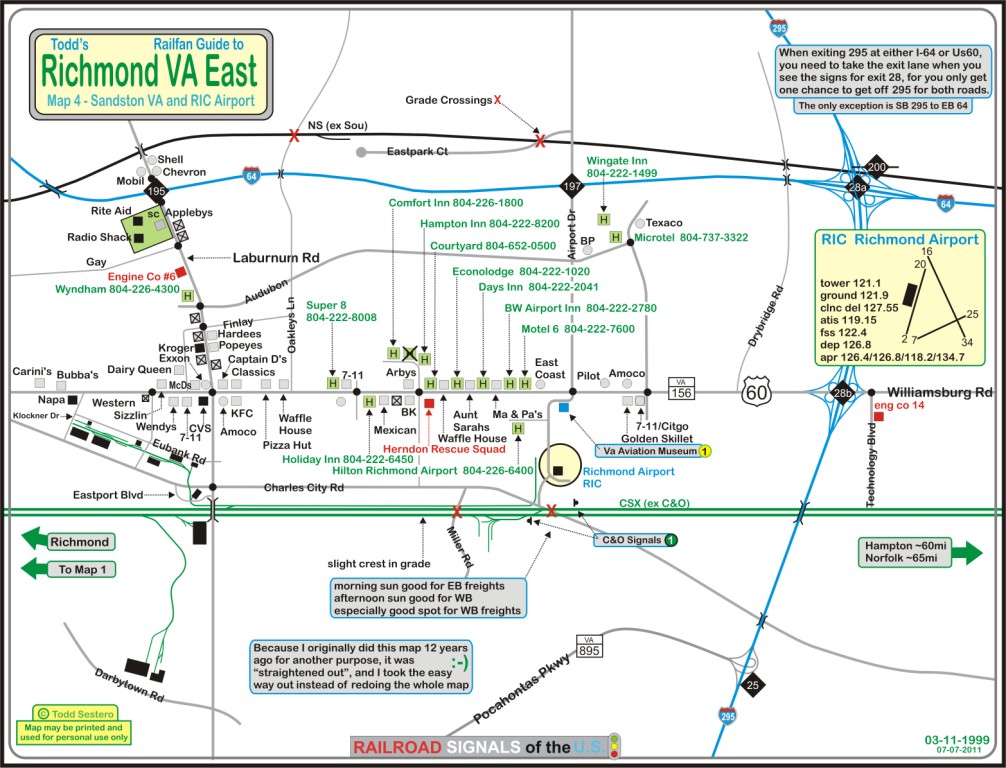
Location / Name:
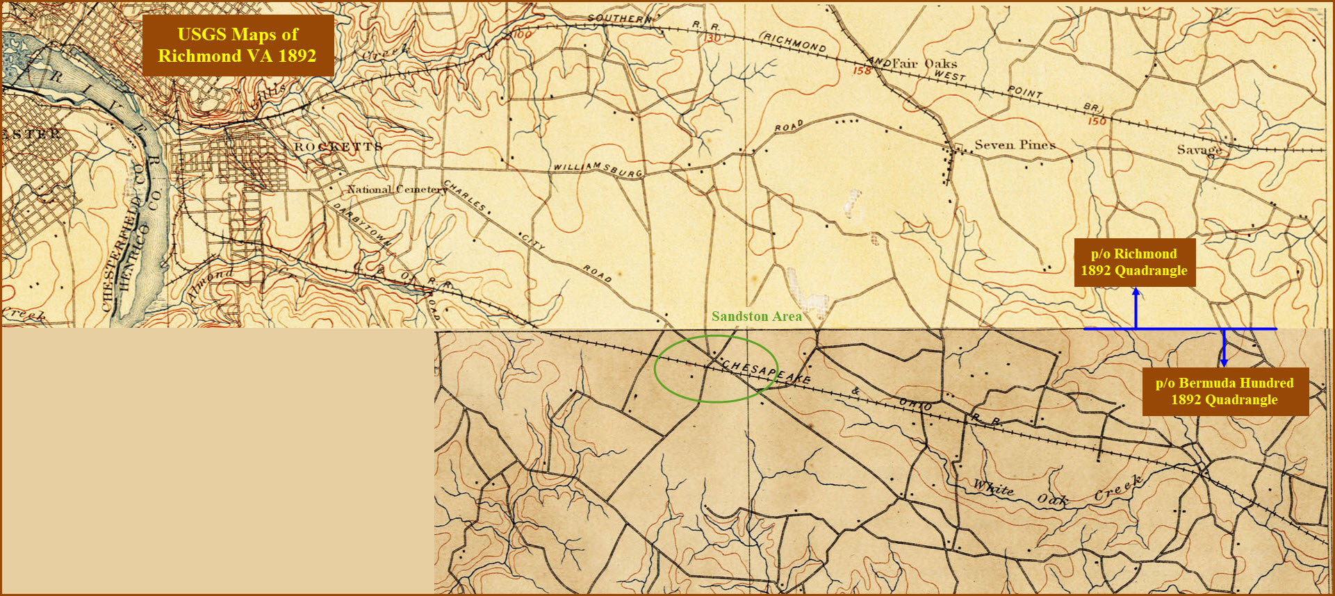
Sandston VA (East Richmond), Henrico County
What's Here:
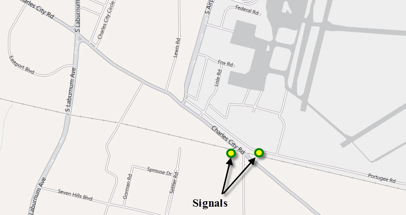
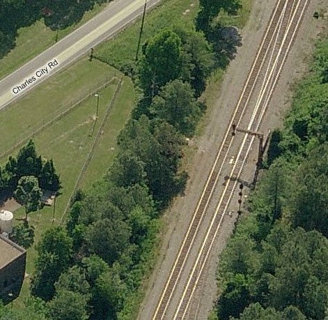
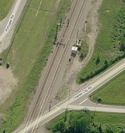
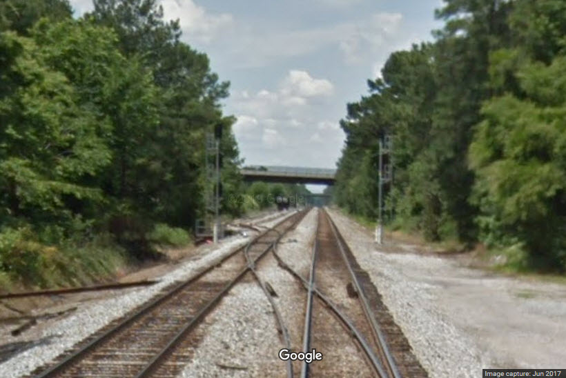
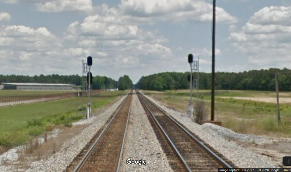
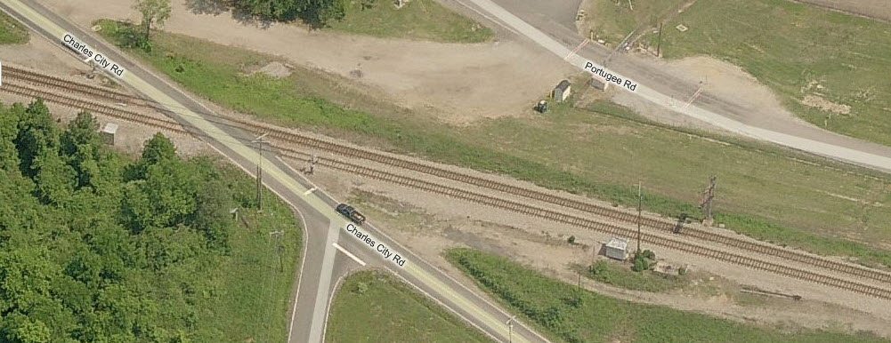
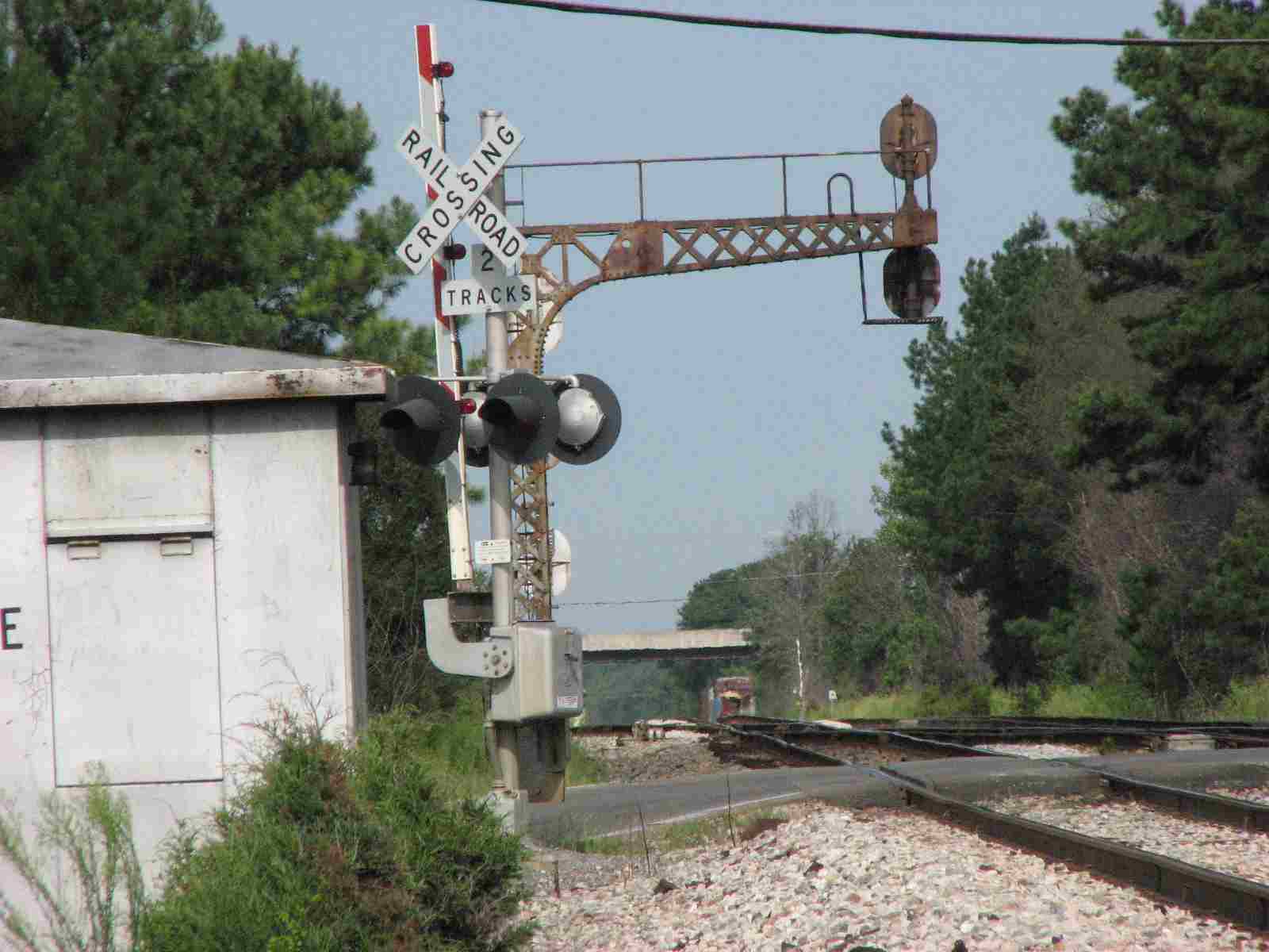
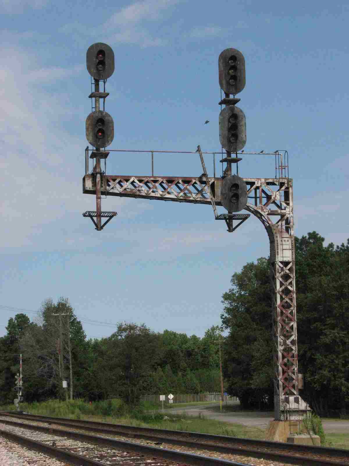
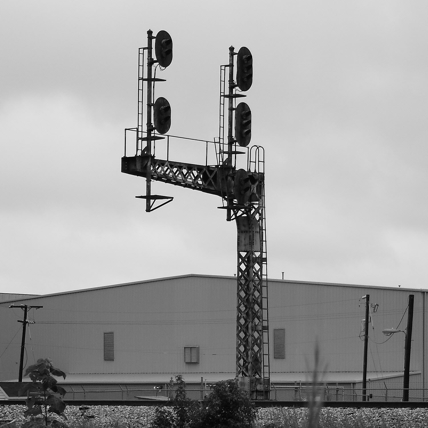
Two sets of signals
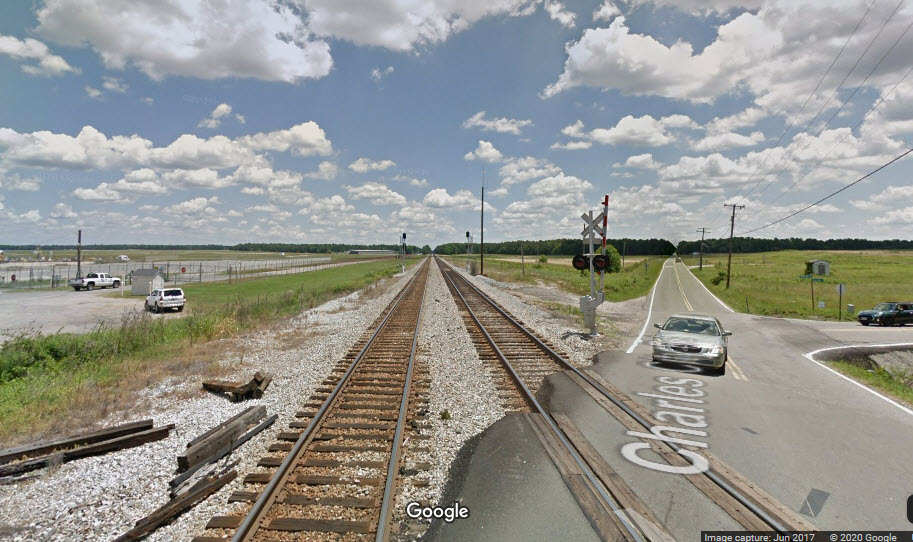
Really straight stretch of track in both directions from Charles City Road
A Single Crossover on the West Side of Charles City Road the other one is down by Miller Road
20/21 Industrial Sidings (depending on how you count em)
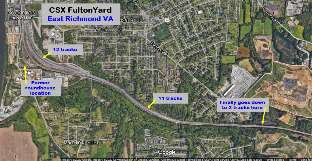
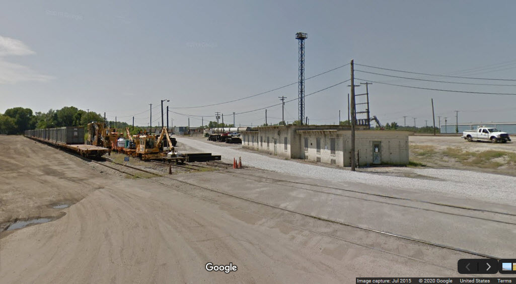
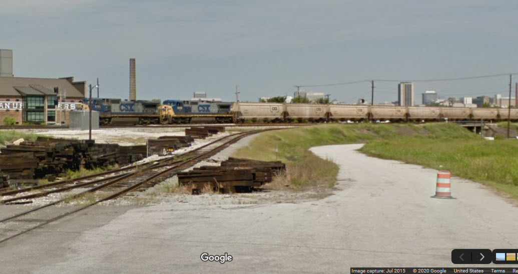
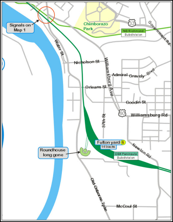
CSX Fulton Yard
The Richmond Airport
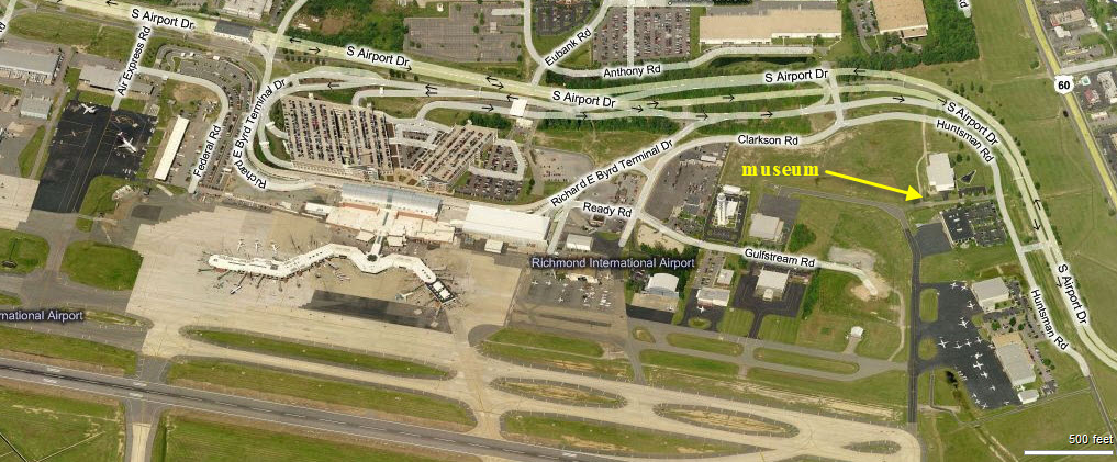
The Virginia Aviation Museum
Other than that, not much really, just a nice spot to take pictures
Data:
GPS Coordinates: as needed
Phone A/C: 804
ZIP: 23150
Access by train/transit:
None local to Sandston
The Scoop:
Admittedly, this side of Richmond doesn't have a whole heck of a lot for
the railfan to see, especially if you're not a fan of airplanes.
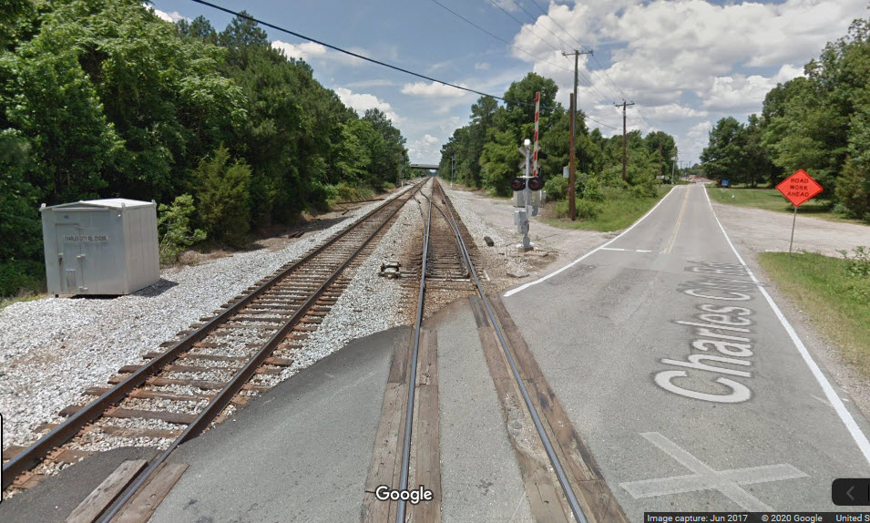
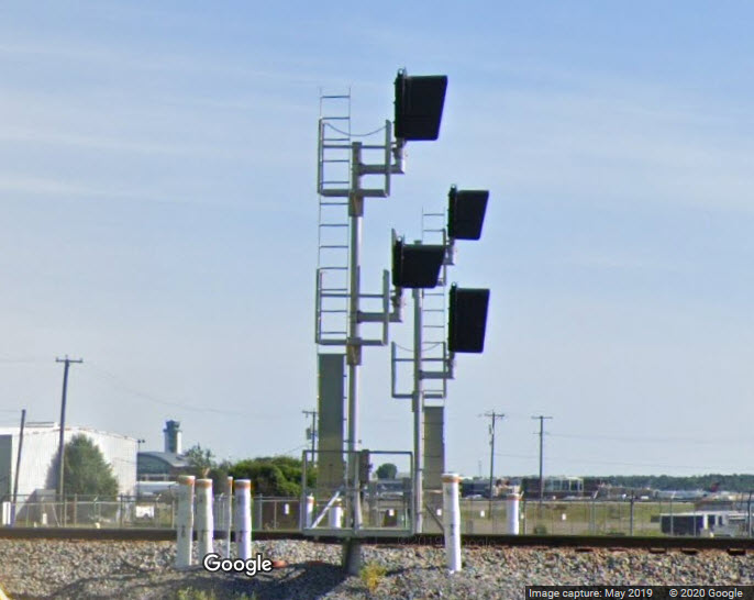
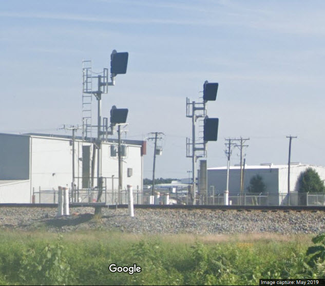
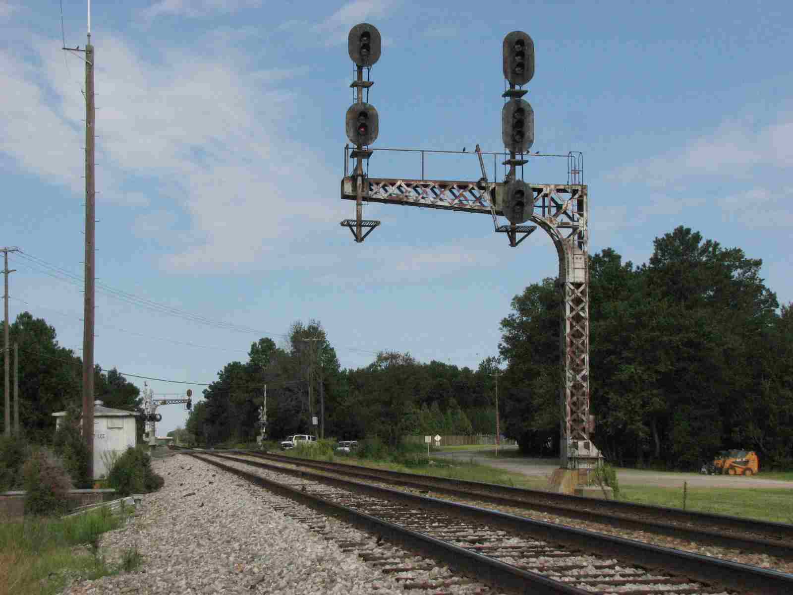
And now that the old C&O cantilever mounted
signals at Charles City Road are gone, replaced by the now standard "Darth
Vader" type colorlight signals, there is even less of a reason to visit the east
side of Richmond on the old C&O.
In looking at the aerials tho, there still seems to
be a fair bit of local freight operations servicing things like lumber yards.
So if you can catch a local working the area, you might get some good
action. At least from what the Google Aerial cameras caught, it looks
like they send out two geeps on the freight. The local freights
probably originate in Fulton Yard.
Probably the largest concentration of hotels close to the downtown area is
along Williamsburg Road. There are also lots of hotels in the
Midlothian area, but they are not as convenient to the majority of railroad
attractions.
I wouldn't normally do a map for an area with
so little railroad stuff, but I had this map laying around from years ago when I
used to come to Richmond to visit a customer just south of Company 14. If
you get to travel for your job, and you're into trains, hopefully you get some
spare time to get in a little railfanning as I did. Richmond as a
whole, has a lot going for it.
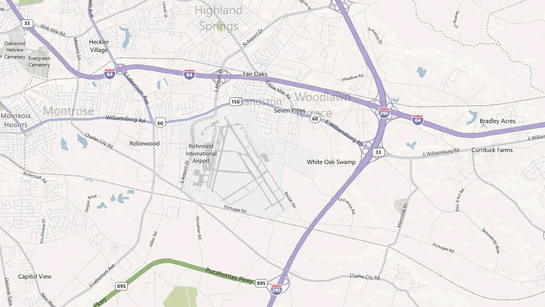
Please note, MY map below is not laid out as you would view it on a map.... as I
"squared" everything up on the original. I originally did this
map some 20+ years ago when I was coming here for work. When I updated the
map, I corrected some of the "squareness", but in order to save time
in redrawing the whole map, Williamsburg Road is still drawn as being straight
and due east-west. So, to help you orient yourself, I've included several
other map views to help locate things.
Acknowledgements:
Larry Haake IV
Google Maps
Denver Todd
Websites and other additional information sources of interest for the area:
None for now.....
From the downtown Richmond area, you have
several choices. If you like doing the highway thing, you can take I-64
east and get off at either Laburnum (x195) or South Airport Drive (x197).
If you prefer the regular roads, take Main St
east, it will jog to the right a little, and before you cross the tracks,
Williamsburg Ave takes off to the left. At Powhatan Park and Hatcher St,
Williamsburg hangs a left and turns into Williamsburg Rd.
You can also take Broad St to Chimborazo Park, where you will pick up Government
Rd, which will finally join up Williamsburg Road.
From north or south of Richmond (within reason), take I-295 and get off at exit 28a, US60/Williamsburg Road.
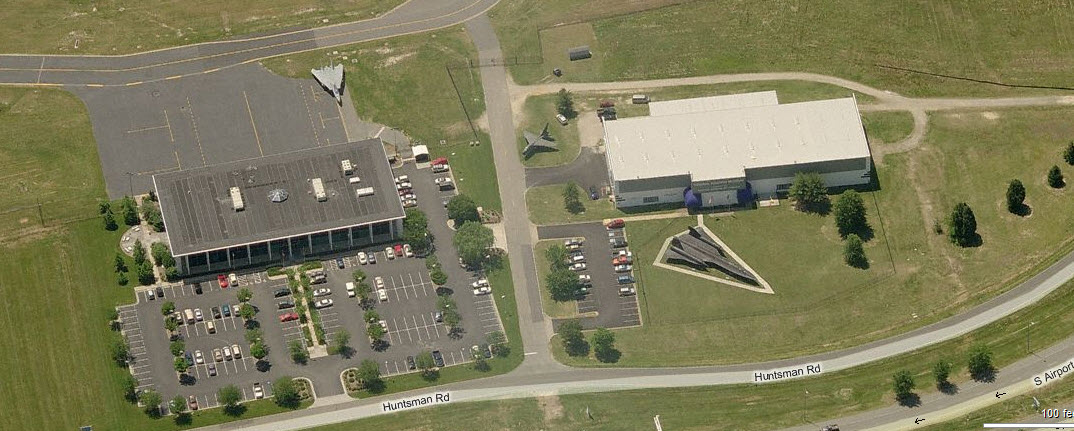
The Virginia Aviation Museum
Cool museum.... notice the Blackbird SR-71.
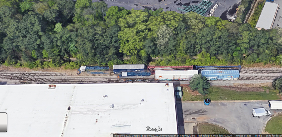
CSX's Fulton Yard
This was a former C&O yard, and is located on the south eastern side of Richmond.
This yard is covered on page 3 of the Richmond guide, but I included it on this page, because
technically, I guess it IS in East Richmond, and it is also the biggest thing on
the former C&O line to Newport News. Since I first did these guides around
the 2011 timeframe, it appears that CSX has removed 2 tracks in the yard.
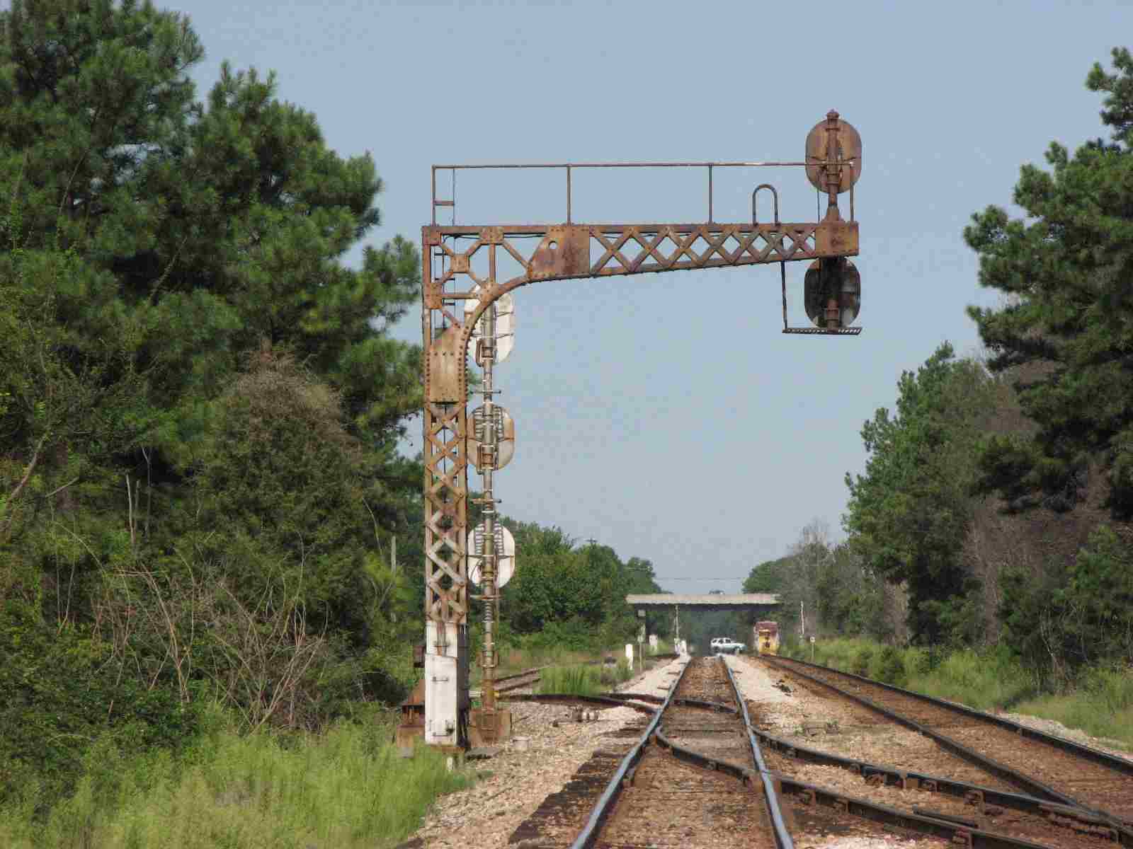
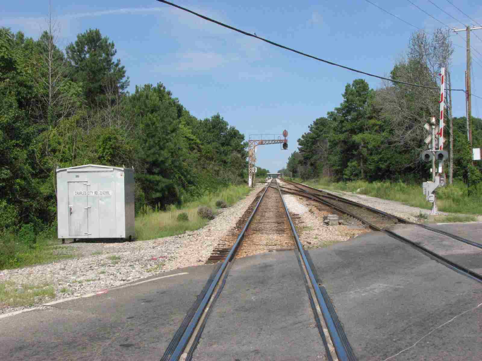
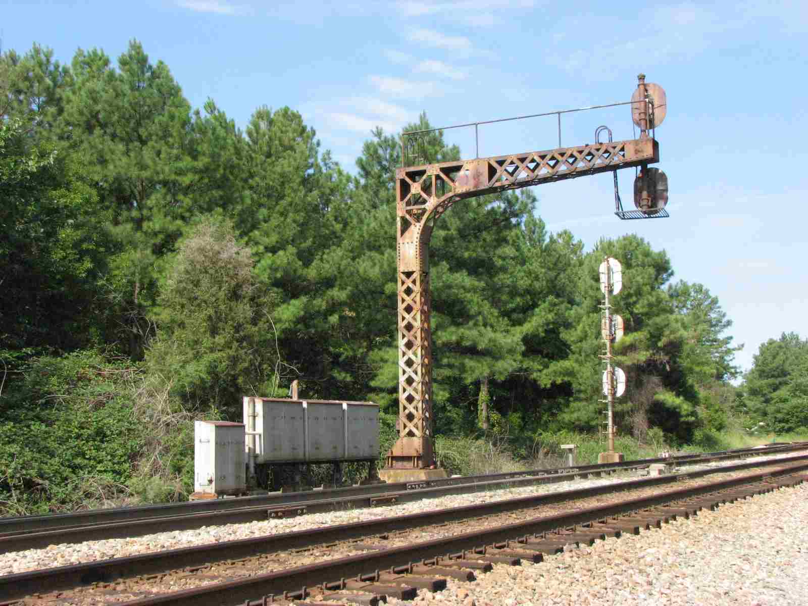
There are only two set of signals in this area, both visible from the Charles City Road grade crossing.
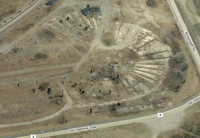
Former C&O Signals
Not sure when CSX upgraded these signals, but this is what used to be here -
two classic cantilever bridges, C&O style, on the backside of the Richmond Airport.
Courtesy of the University of Texas Library, click here for their index page.
Disclaimers:
I love trains, and I love signals. I am not an expert. My webpages
reflect what I find on the topic of the page. This is something I have fun with while
trying to help others.
Please Note: Since the main focus of my two websites is railroad signals, the
railfan guides are oriented towards the signal fan being able to locate them.
For those of you into the modeling aspect of our hobby, my
indexa page has a list of almost everything railroad oriented
I can think of to provide you with at least a few pictures to help you detail your pike.
If this is a railfan page, every effort has been made to make sure that the information contained on this map and in this railfan guide is correct. Once in a while,
an error may creep in :-)
My philosophy: Pictures and maps are worth a thousand words, especially for railfanning. Text descriptions only get you so far, especially if you get lost or
disoriented. Take along good maps.... a GPS is OK to get somewhere, but maps are still better if you get lost! I belong to AAA, which allows you to get
local maps for free when you visit the local branches. ADC puts out a nice series of county maps for the Washington DC area, but their state maps do not have the
railroads on them. If you can find em, I like the National Geographic map book of the U.S..... good, clear, and concise graphics, and they do a really good job
of showing you where tourist type attractions are, although they too lack the railroads. Other notes about specific areas will show up on that page if known.
Aerial shots were taken from either Google or Bing Maps as noted. Screen captures are made
with Snagit, a Techsmith product... a great tool if you have never used it!
By the way, floobydust is a term I picked up 30-40 years ago from a National Semiconductor data book, and means miscellaneous
and/or other stuff.
Pictures and additional information is always needed if anyone feels inclined to take 'em, send 'em, and share 'em, or if you have something to add or correct.... credit
is always given! Please be NICE!!! Contact info is here
Beware: If used as a source, ANYTHING from Wikipedia must be treated as being possibly being inaccurate, wrong, or not true.


 from 2011
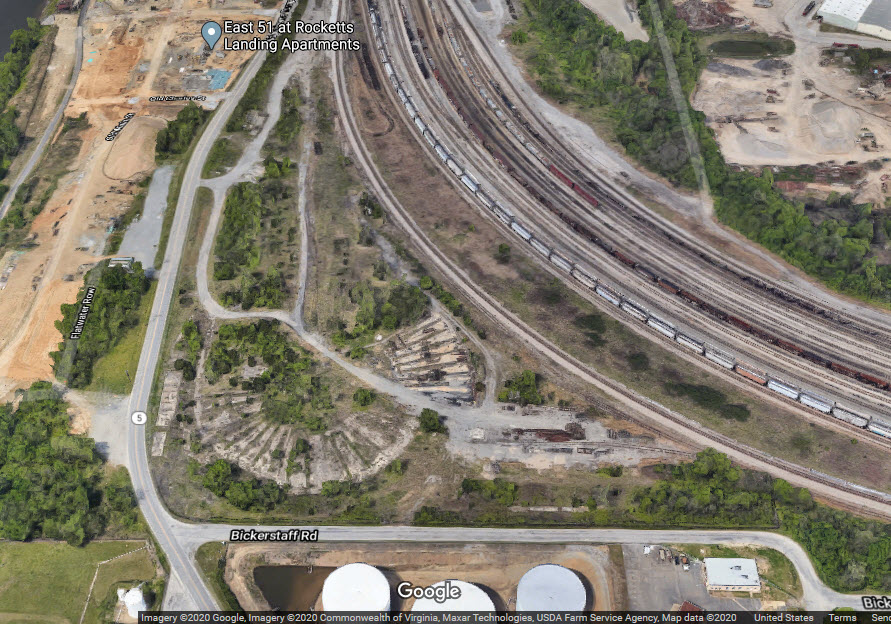 in 2020
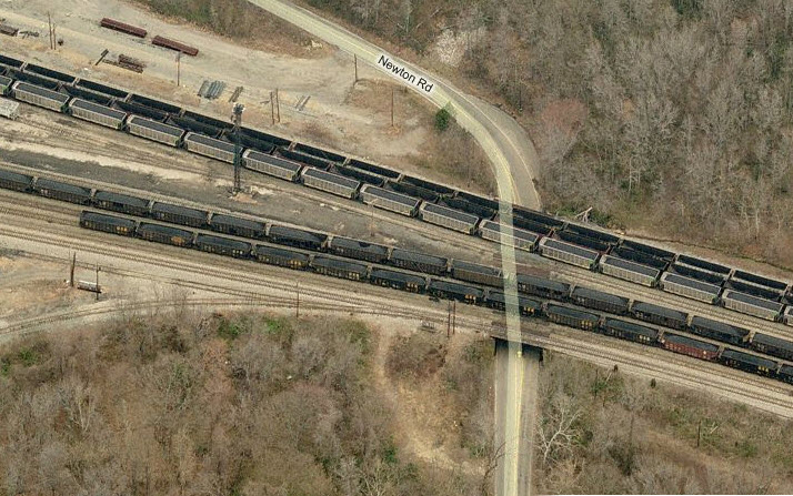
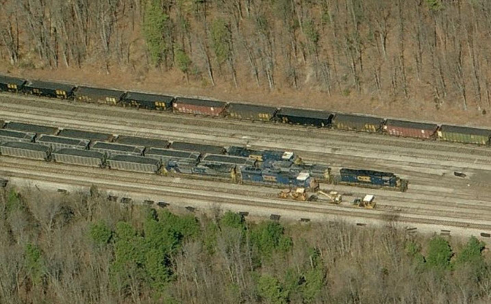
 excerpt from my Richmond 3 Map
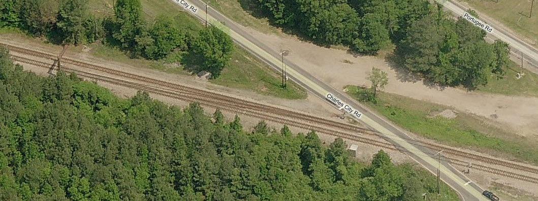
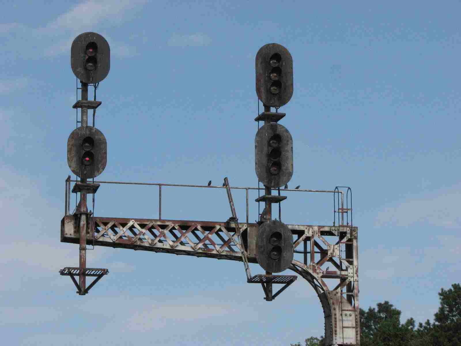
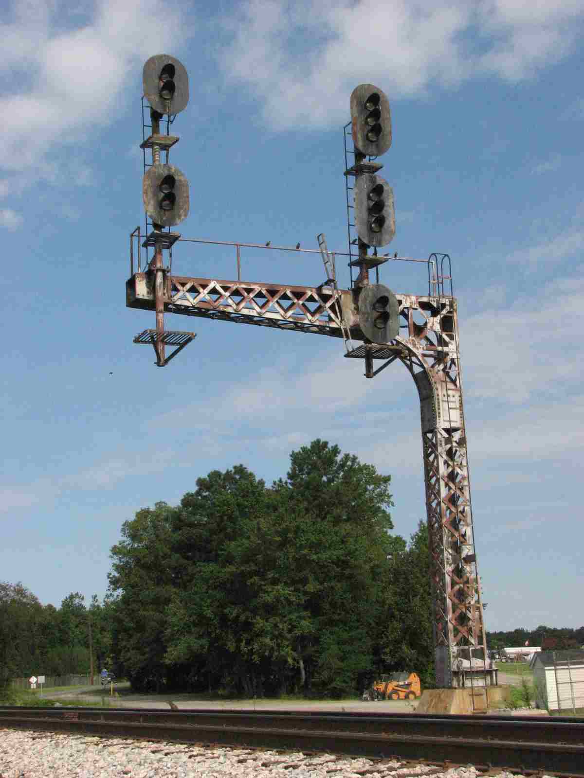

 Picture by Larry Haake IV