In General
Getting Here
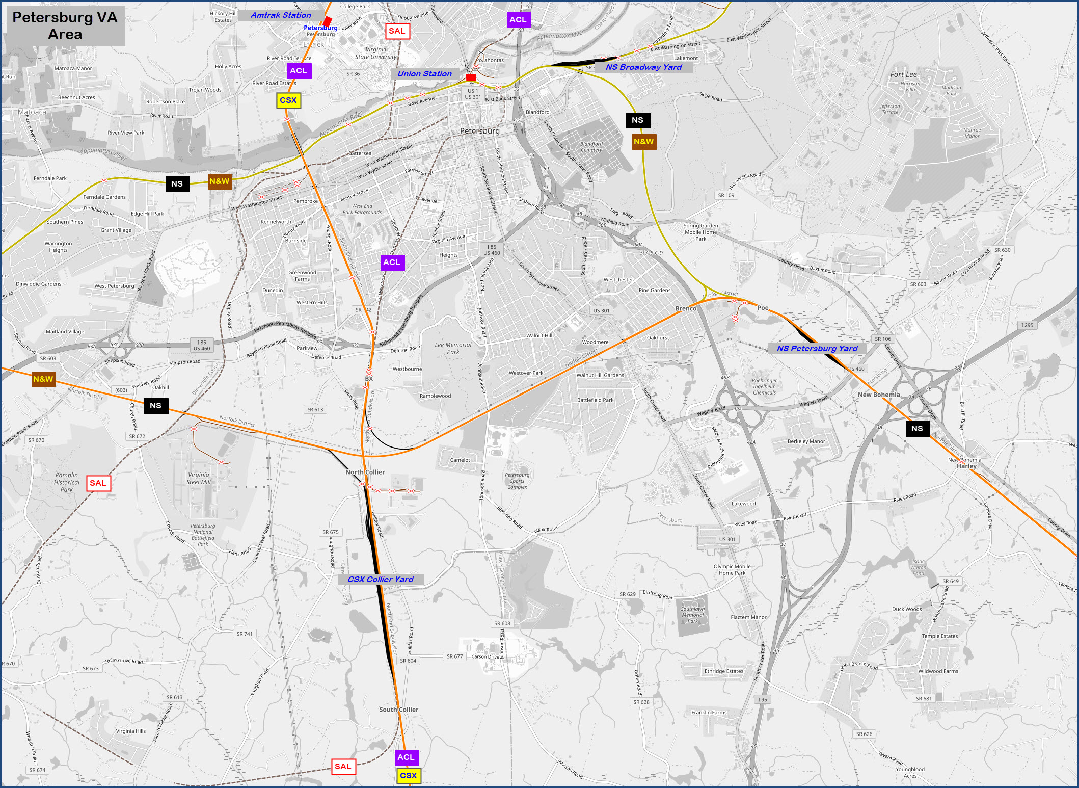
Map
Sights
Signals
Bridges
Floobydust
RAILFAN GUIDES HOME
RAILROAD SIGNALS HOME
Location / Name:
Petersburg VA, Chesterfield County
What's Here:
CSX's Collier Yard
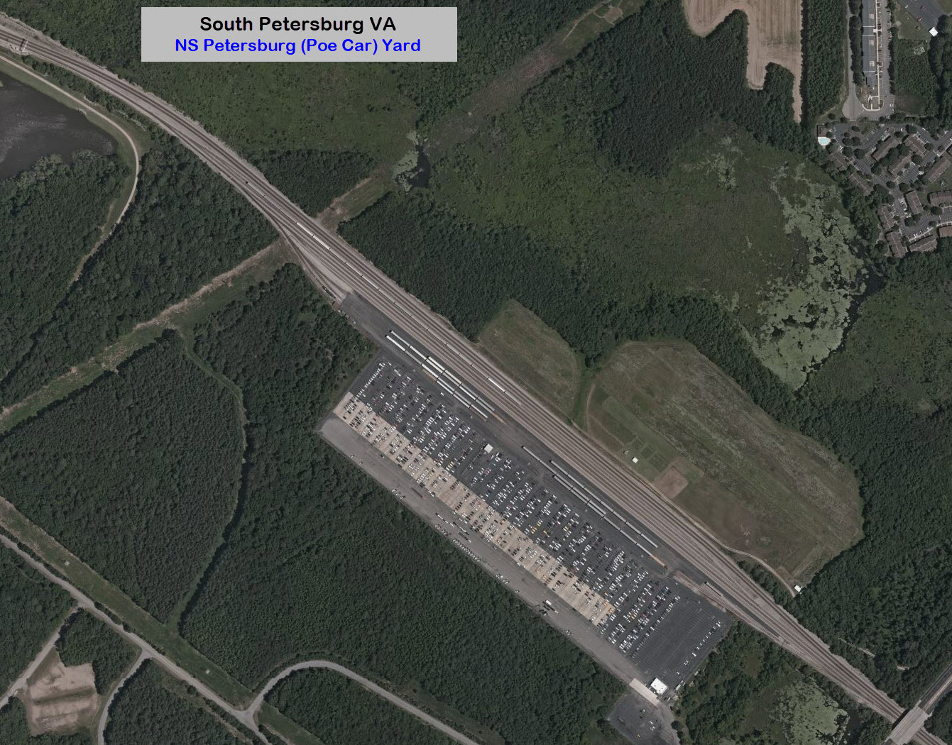
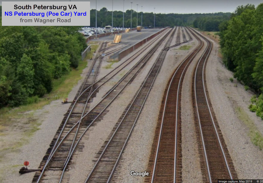
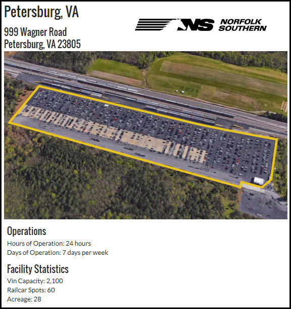
NS's Petersburg Yard (Poe Car Lot)
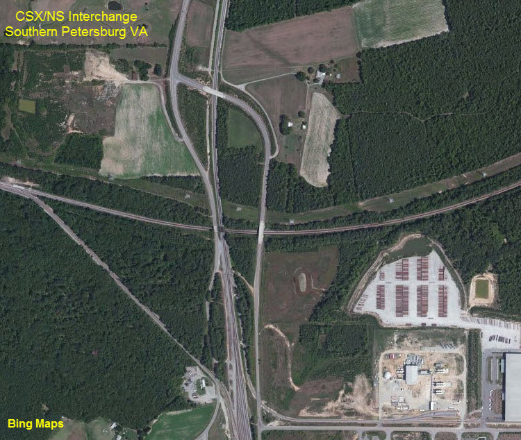
Interchange between CSX's A-Line and the NS Belt Line
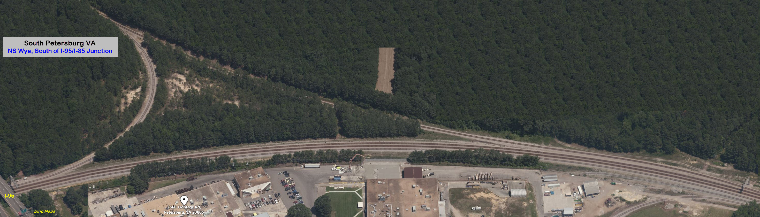
NS wye between the downtown N&W line, Poe Yard, and the Belt Line.
Data:
GPS Coordinates: as needed
ZIP: 23805
Phone A/C: 804
Access by train/transit:
Amtrak up in Ettrick, and then by cab if you don't have a ride.
The Scoop:
The main attraction to the south side of Petersburg is CSX's Collier Yard. I'm surprised, with Acca Yard only 20 miles away in Richmond, that Collier Yard has remained as large as it is.
NS has a smaller presence, having a small auto unload yard in the Poe area, referred to on Open Railway's map as the Poe Car Yard.
Here, as in Richmond, CSX is pretty much a north-south railroad, and NS is an east-west railroad.
Amtrak comes thru on CSX.
The NS wye I refer to above, is about 2 miles south of the I-95/I-85 junction off to the east.
Websites and other additional information sources of interest for the area:
https://www.broadcastify.com/listen/feed/12794
To Collier Yard:
I-95 to I-85 SB, get off at exit 65, Squirrel Level Rd, head south. This will turn into Wells Rd, which turns in to Halifax Rd, which runs parallel to the yard.
The NS's Petersburg Yard:
I-95 exit 48, US460, and go east. 460/Wagner Rd will go over the yard. I dunno if I would try to head into the yard area, as this is a automobile unloading yard, and I'm sure security is worse here than regular NS yards, which is already pretty tough on railfans.
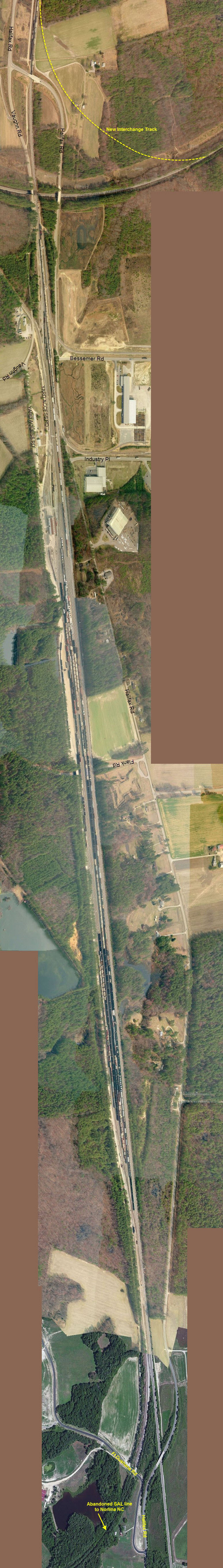
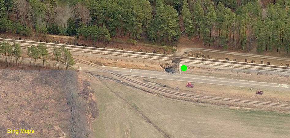
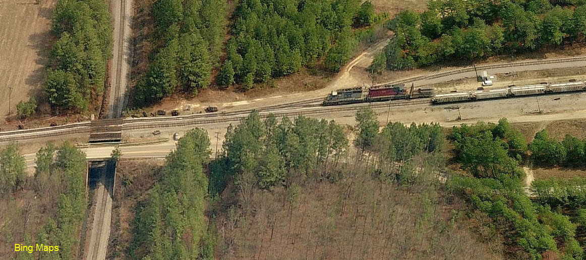
Before and after aerial views of the interchange. Again, we can thank Bing for not updating their pictures as quickly as Google.

 As seen from I-95
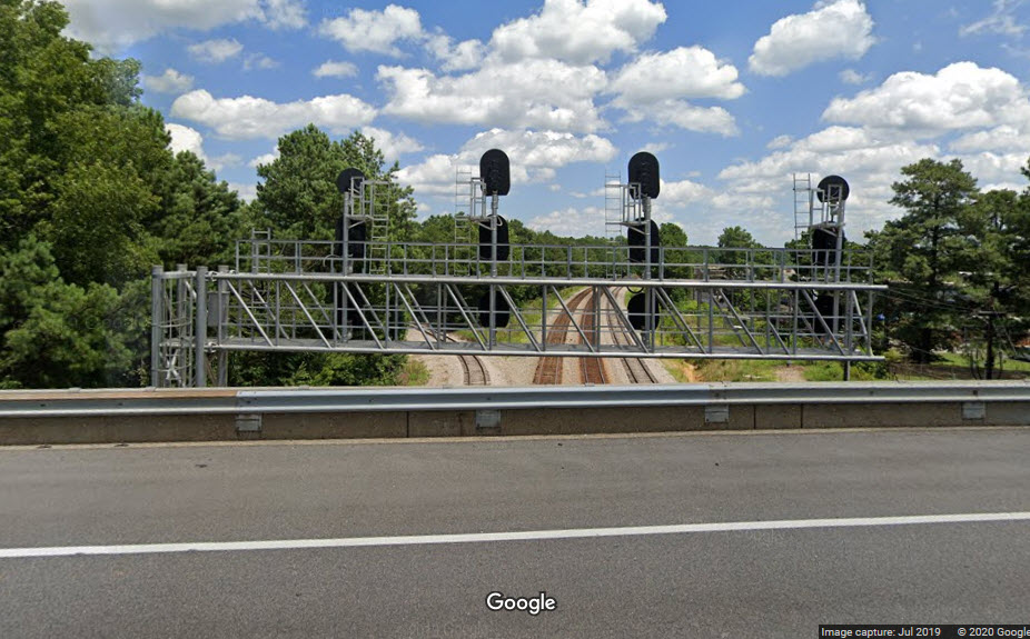
A recent installation, as they do not show up in the Bing birds-eye view. A nice concrete whistle sign is also here.
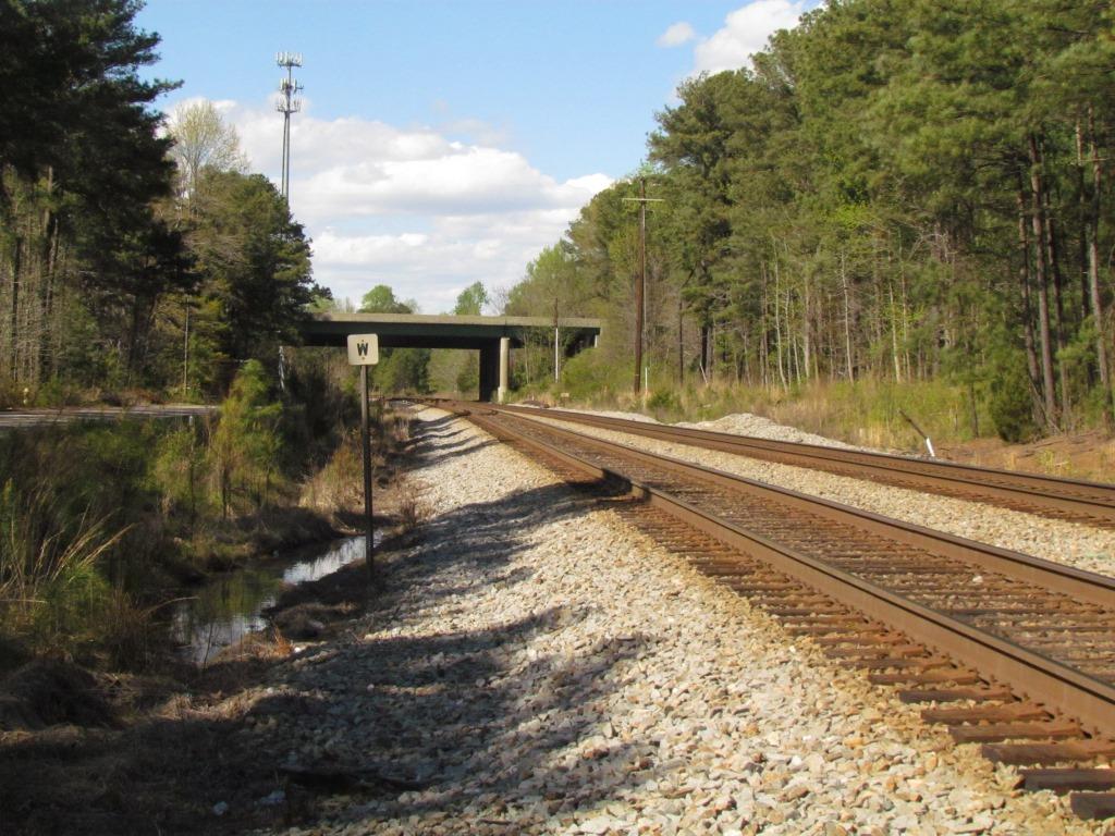 Looking north towards Ettrick.
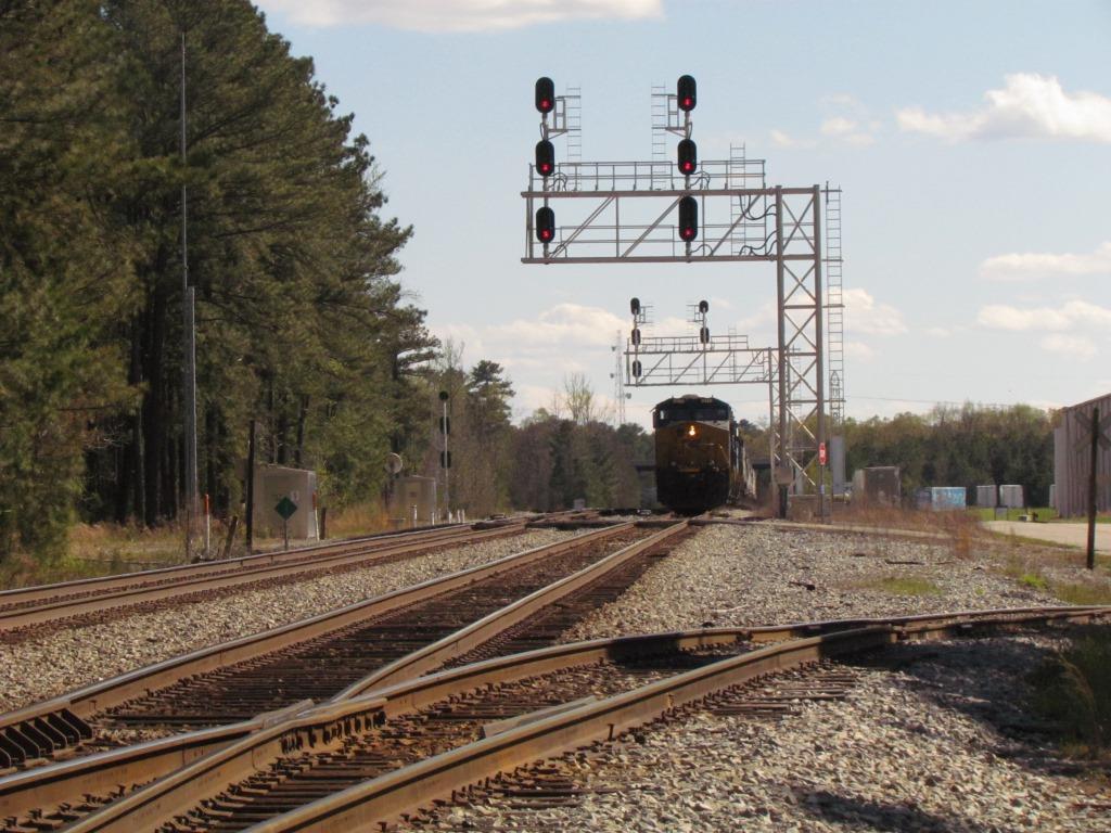
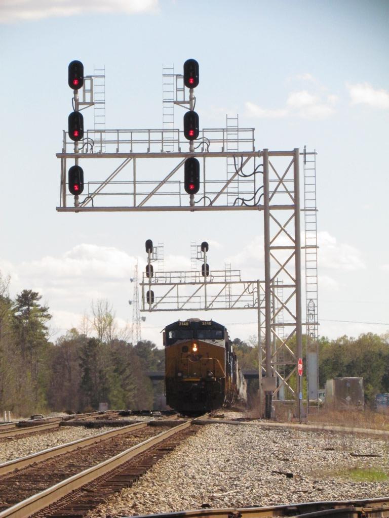
Just missed the front end of the SB freight :-(
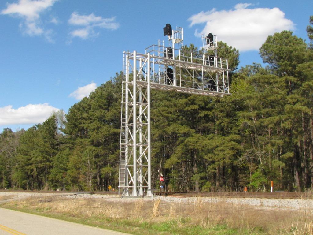
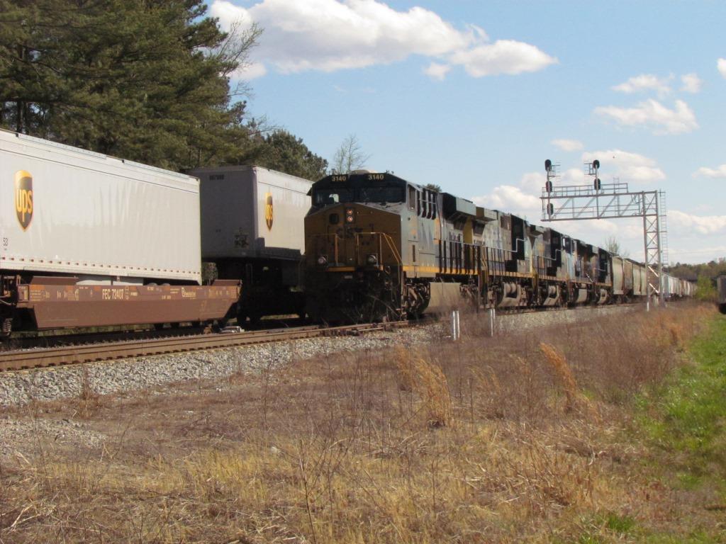
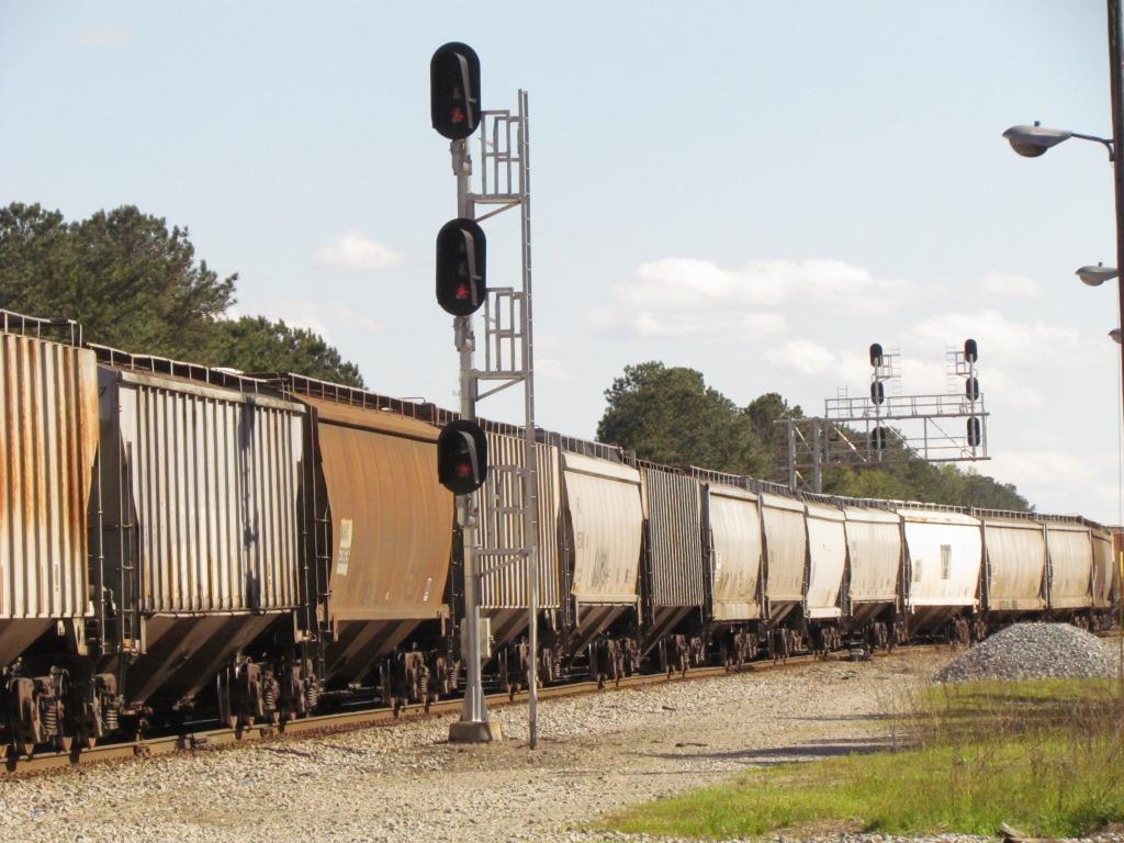
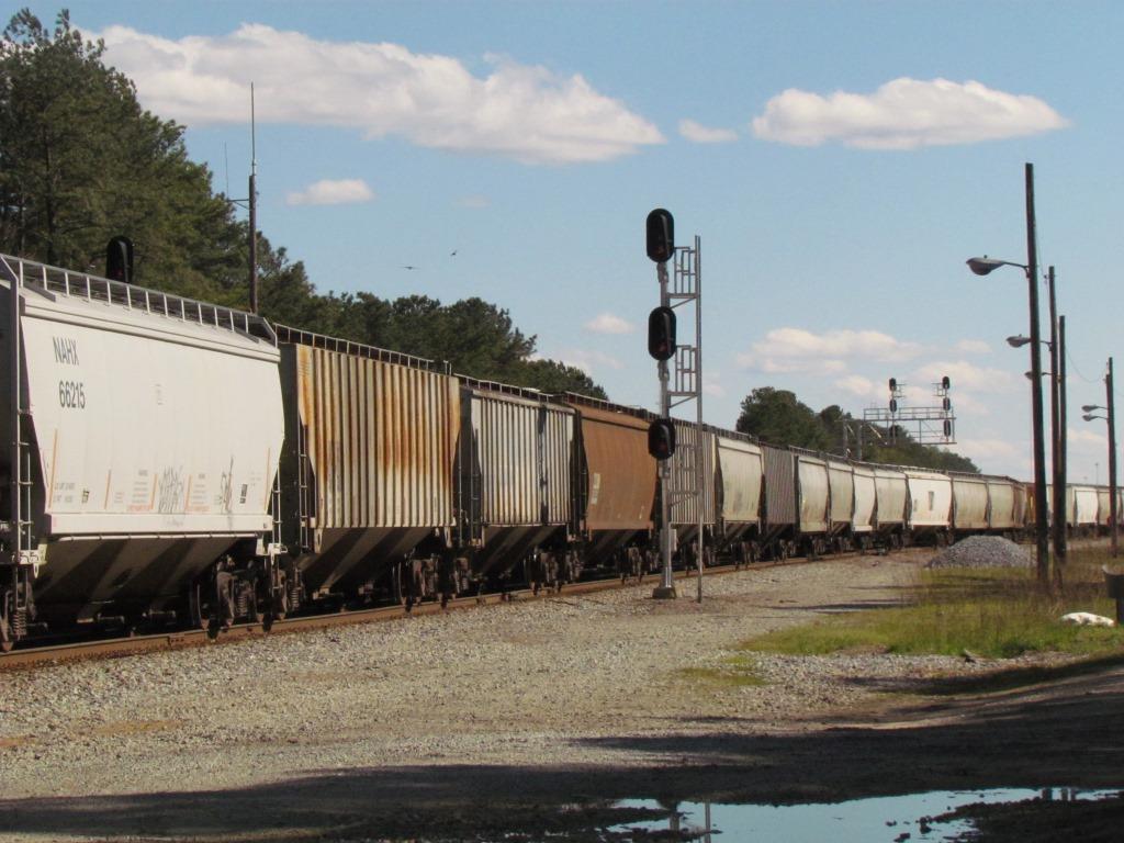
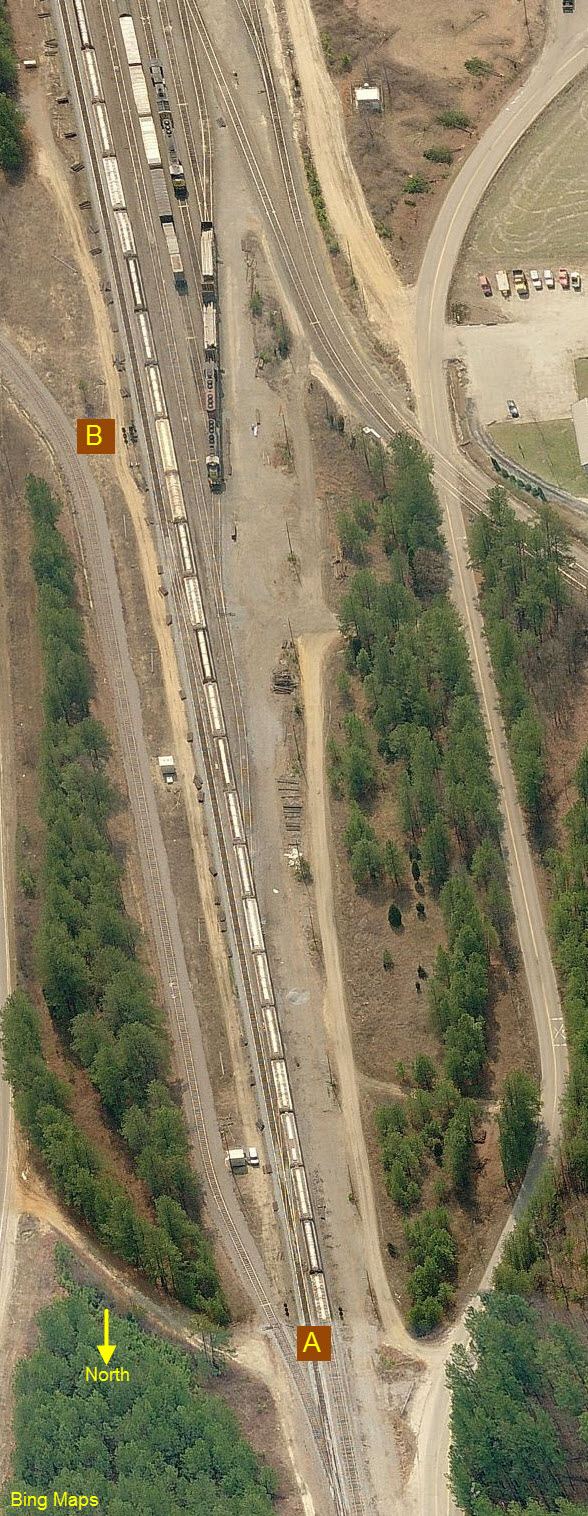
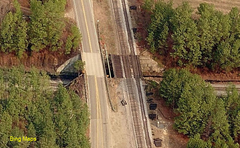
The other set of signals in the above pictures.
At the northern throat of the yard.
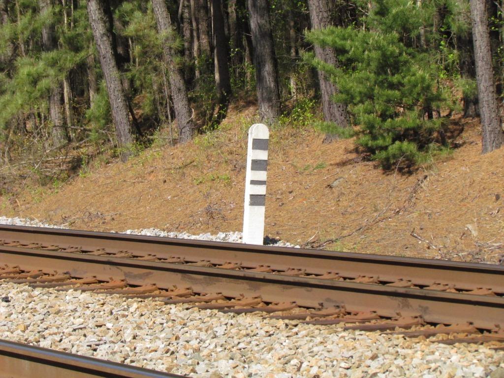
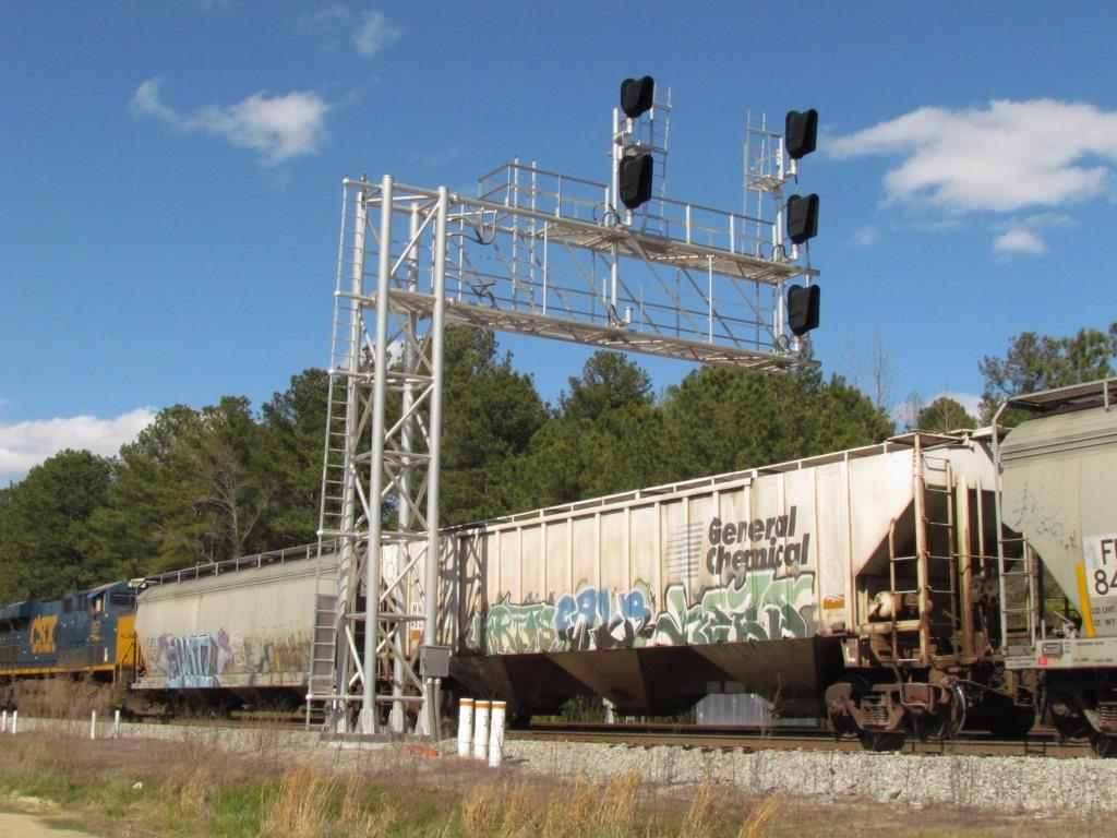
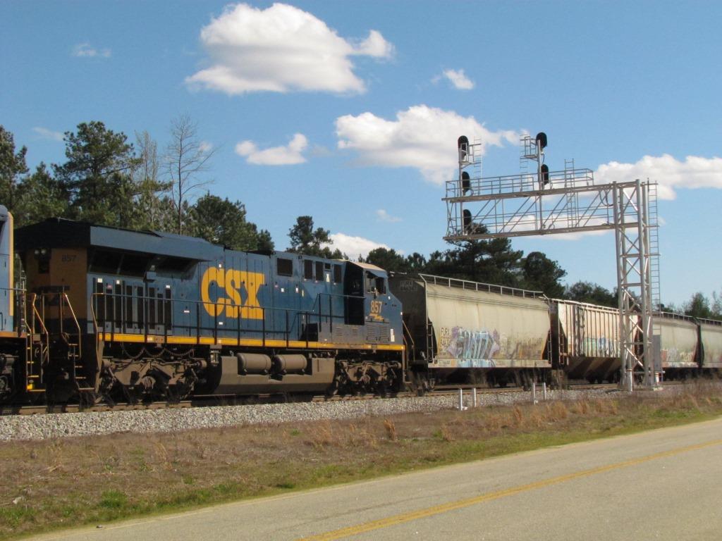
These also look like new signals (at least the ones on the cantilever bridge are), as they also do not appear in a couple of the aerial views from Bing.
The single set of signals is at location "A", and the cantilever bridge is at "B".
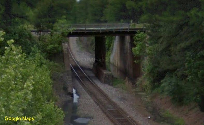
A well maintained brick bridge handling both the CSX and Hallifax Rd.
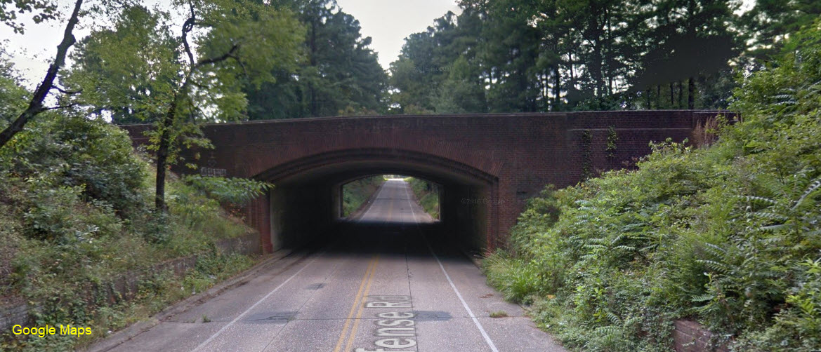 Looking West.
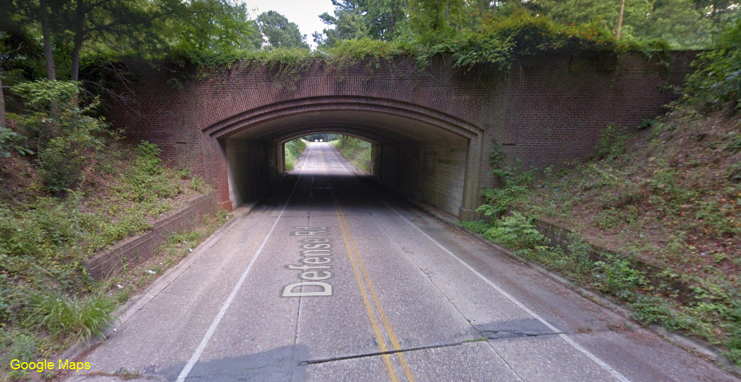 Looking East.
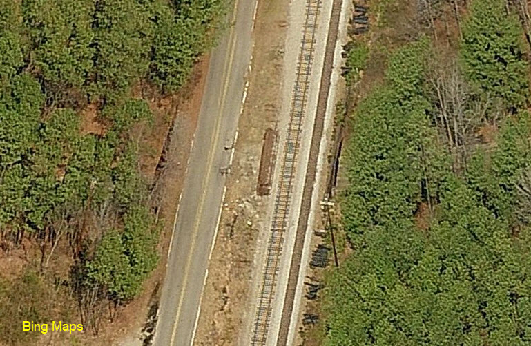
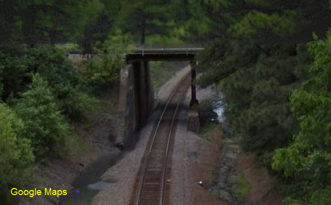
Just north of Collier Yard - a short span, but still needs mid-bridge supports. The bridge used to carry three tracks.
None for now.....
Disclaimers:
I love trains, and I love signals. I am not an expert. My webpages reflect what I find on the topic of the page. This is something I have fun with while trying to help others.
Please Note: Since the main focus of my two websites is railroad signals, the railfan guides are oriented towards the signal fan being able to locate them. For those of you into the modeling aspect of our hobby, my indexa page has a list of almost everything railroad oriented I can think of to provide you with at least a few pictures to help you detail your pike.
If this is a railfan page, every effort has been made to make sure that the information contained on this map and in this railfan guide is correct. Once in a while, an error may creep in :-)
My philosophy: Pictures and maps are worth a thousand words, especially for railfanning. Text descriptions only get you so far, especially if you get lost or disoriented. Take along good maps.... a GPS is OK to get somewhere, but maps are still better if you get lost! I belong to AAA, which allows you to get local maps for free when you visit the local branches. ADC puts out a nice series of county maps for the Washington DC area, but their state maps do not have the railroads on them. If you can find em, I like the National Geographic map book of the U.S..... good, clear, and concise graphics, and they do a really good job of showing you where tourist type attractions are, although they too lack the railroads. Other notes about specific areas will show up on that page if known.
Aerial shots were taken from either Google or Bing Maps as noted. Screen captures are made with Snagit, a Techsmith product... a great tool if you have never used it!
By the way, floobydust is a term I picked up 30-40 years ago from a National Semiconductor data book, and means miscellaneous and/or other stuff.
Pictures and additional information is always needed if anyone feels inclined to take 'em, send 'em, and share 'em, or if you have something to add or correct.... credit is always given! Please be NICE!!! Contact info is here
Beware: If used as a source, ANYTHING from Wikipedia must be treated as being possibly inaccurate, wrong, or not true.
RAILFAN GUIDES HOME
RAILROAD SIGNALS HOME
NEW 04/21/2016, APR22/2016, SEP29/2020, SEP30/2020
Last Modified 30-Sep-2020