
In General
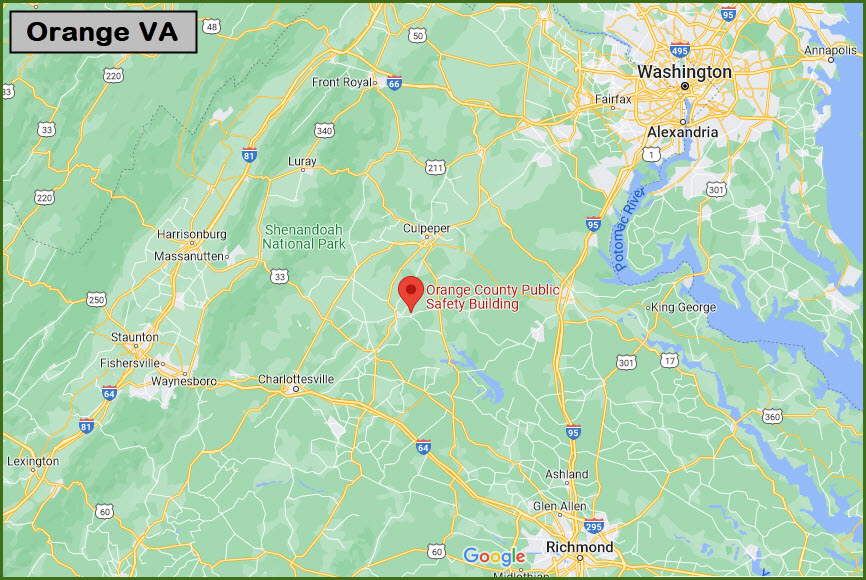
Getting Here
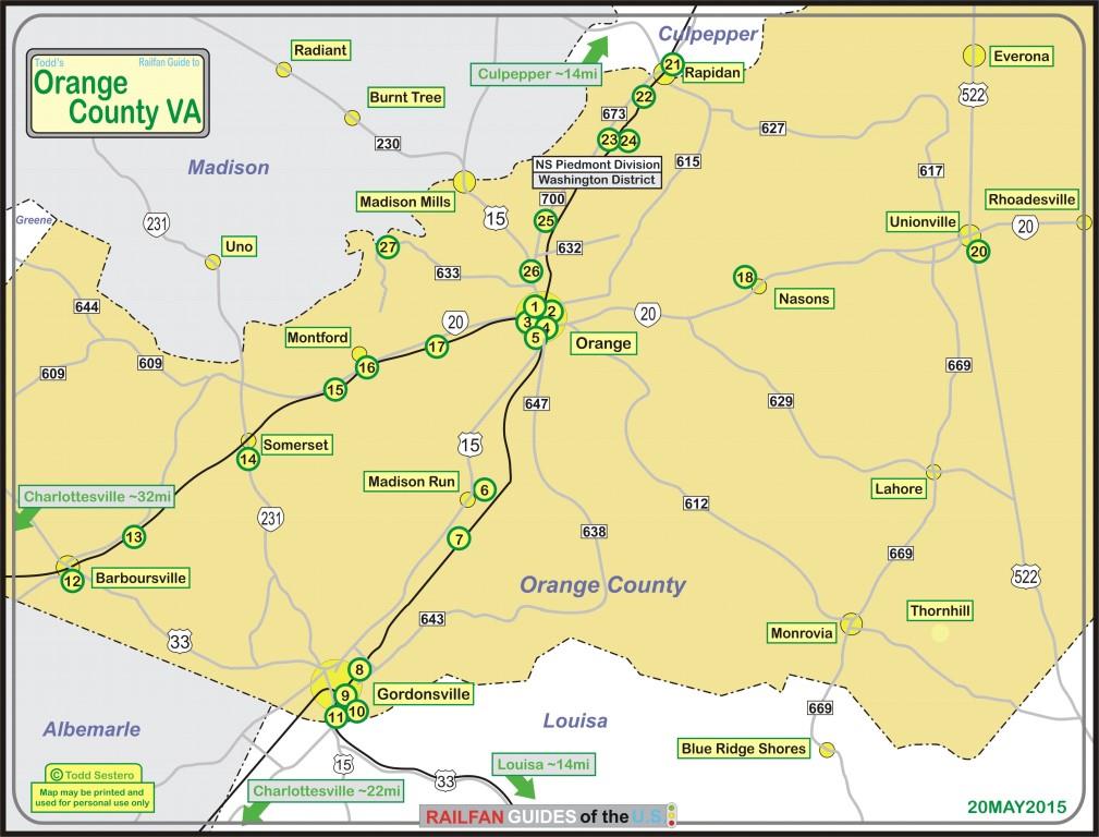
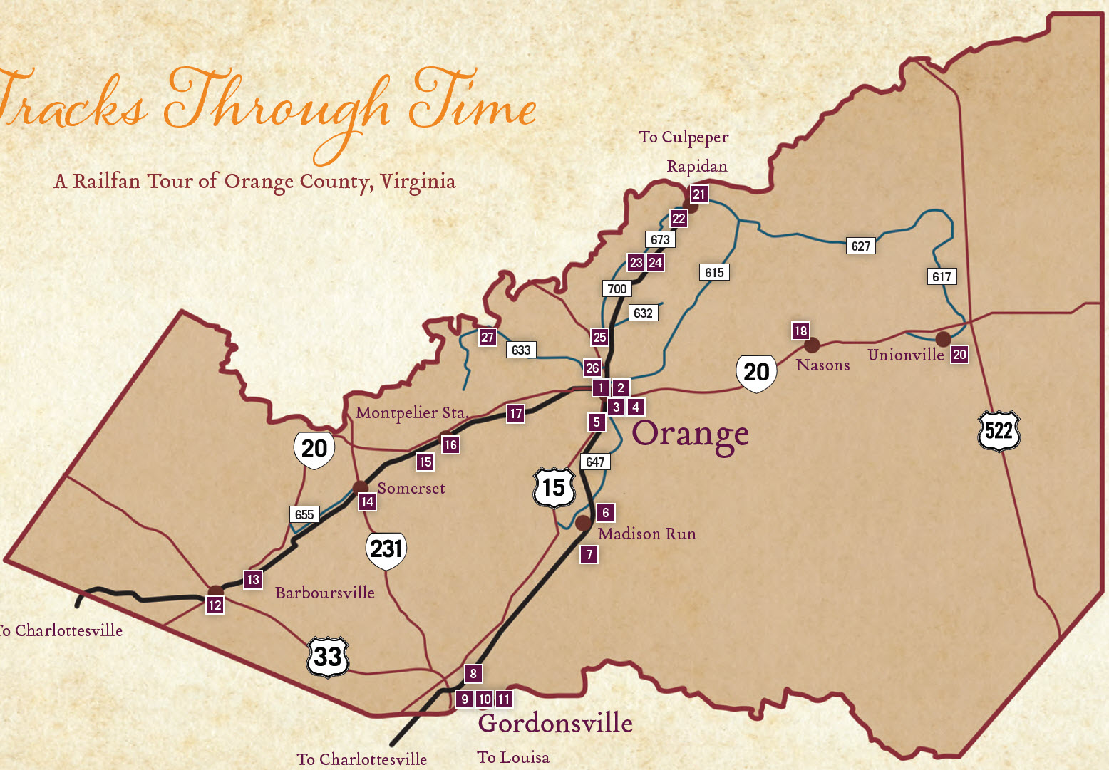
Map
Sights
Pictures
Signals
Floobydust
USGS Maps
RAILFAN GUIDES HOME
RAILROAD SIGNALS HOME
Location / Name:
Orange VA and Orange County Virginia / county seat
What's Here:
Historic Depot
Many other items of interest to the Railfan community.
Data:
GPS Coordinates: as needed
Phone A/C: 540
ZIP: 22960
Access by train/transit:
The closest Amtrak station is in Charlottesville VA
The Scoop:
Orange is 25 miles NE of Charlottesville VA, 88 miles SW of Washington DC, about 64 miles NW of Richmond VA, and 4 miles east of James Madison's plantation of Montpelier VA.
Regular followers of my railfan guides will know that I try to highlight not just the items of interest to the railfan, but anything else in the vicinity that may be of interest, regardless of the genre, therefore, you will see many additional items on this page that are not necessarily mentioned or otherwise highlighted in the Orange County Railfan Guide.
In the two maps below, my map follows the sight assignments of the map found in the Orange County Railfan Guide.
From Wikipedia about the courthouse: In 1847, the Orange and Alexandria Railroad chose to route their new railway from Alexandria to Gordonsville through Orange. The county court granted the railroad right-of-way through the courthouse property, which required the courthouse to be moved to another location. End Wiki
From Wikipedia about the Civil War: Orange was a strategically important location during the American Civil War. Just north of town, the Rapidan River was effectively the northern border of the Confederacy from March 1862 to May 1864. Consequently, the area witnessed countless troop movements, patrols, skirmishes, and encampments. In addition, the Town of Orange served as General Robert E. Lee's headquarters during that time. General Lee worshipped at the St. Thomas Episcopal Church. This church is also significant as it served as a hospital for Confederate wounded after the Battle of Chancellorsville and the Battle of the Wilderness. Lee passed by this church many times during his stay in Orange. End Wiki
If you see ARTOC, this is where I copied the text from the Railfan Tour of Orange County, "according to the......."
My guide will follow the Railfan Guide to Orange County, with "extra" things thrown in whenever I come across them.
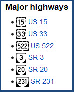
The major roads of Orange County:
Historical Markers:
The state of Virginia, as well as local municipalities, have done an excellent job of erecting historical markers throughout the state. From Waymarking.com: Almost every driver on Virginia’s roadways has seen one. The state sponsored markers are tall, silver historical highway markers. In addition there are historical markers sponsored by municipalities, counties, and various organizations such as the DAR. All together there are many more than 2,000 of them bringing bits of history to motorists in Virginia.
Scanner Frequencies:
NS: 160.950 & 160.245
Equipment/defect detectors: MP 79.2-Rapidan and MP 91.5-Weyburn: both 160.950
Acknowledgements:
Denver Todd
Websites and other additional information sources of interest for the area:
None for now.....
History/Timeline:
Please note that over the years in this area, there have been two completely separate railroads that have been called the Norfolk Southern. What we call Norfolk Southern today, is a railroad created in 1980? with the merger of the Southern Railway and the Norfolk & Western Rwy. Up until ~1972, there was a regional railroad called the Norfolk Southern, that merged into the Southern Rwy. Also, without spending a whole lot of time on research, there seem to be some inconsistences in the dates and with what happened....
1840 - the Louisa RR became the Virginian Central
1848 - the Orange & Alexandria RR was chartered, 18MAY1848
1850 - construction begins on the O&A, completed in APR1854, connects with the Virginia Central RR in Orange County
1853 - the Potomac, Fredericksburg & Piedmont was given
1854 - the O&A was the first railroad to come through Orange (now NS, but leased to CSX, and sub-leased to the Buckingham Branch RR)
1854 - the O&A was given permission to build southward from Charlottesville to Lynchburg
1854 - the O&A became part of the (old) Norfolk Southern
1854/55 - the first version of Railroad Ave appears
1860 - the O&A line to Lynchburg completed
1861 - Orange's first fatal train accident between two Confederate trains heading to Manassas, 25MAY1861, 2/3 people killed, nine injured
1867 - the O&A merged with the Manassas Gap RR to become the Orange, Alexandria & Manassas RR
1873 - the OA&M was consolidated into the Virginia Midland RR
1876 - a cutoff between Orange and Charlottesville was incorporated as the Charlottesville & Rapidan RR, opens in 1880
1877 - the Potomac, Fredericksburg & Piedmont started running between Orange and Fredericksburg, the line was 36" narrow gauge
1880 - the Charlottesville & Rapidan RR laid tracks going through Orange (the R-O-W is now part of NS)
1880 - the Charlottesville & Rapidan RR became part of the Washington City, Virginia Midland & Great Southern RR (phew, what a mouthfull! :-)
???? - the Virginia Midland RR becomes part of the Richmond & Danville RR
1894 - the Richmond & Danville RR became part of the Southern Railway
1908 - the Great Fire of 1908 which destroyed almost everything on Railroad Avenue, including the 1850 O&A depot
1910 - the Southern Rwy builds the depot that is -today- used as the visitors center
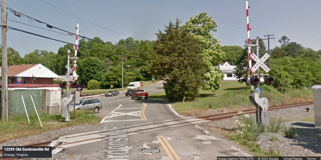
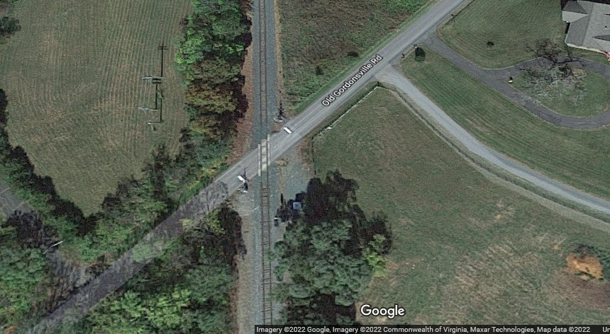
1913 - first auto/train collision at Old Gordonsville Road
1914 - the C&R was merged into the Southern Rwy
1917, Oct 1 - NB #38 sideswipes NB local #16, four cars overturned, engineer Larmand and fireman die, happened near station named for Larmand
1921 - the Rapidan RR ran to Wolftown and into mountain logging camps
1924 - the Rapidan RR abandoned its line to Wolftown and the logging camps, and the property reverted back to the landowners
1926 - the PF&P converted to standard gauge, renamed itself the Virginia Central
1926 - the PF&P built the depot that is here
1938 - the PF&P/Virginia Central was abandoned
1965 - on a freight train coming through town, a load of steel bar joists came loose and several went through the depot, 1FEB1965
1970 - the last pre-Amtrak passenger train stops in Orange
1982 - the Southern Railway and the Norfolk & Western Railway merged to become the current day Norfolk Southern RR
Additional Simplified History:
From the Orange County Railfan Guide:
- The 1840 Louisa RR became the Virginia Central, then became part of the CSX. Its R/W is being used by CSX, Buckingham Branch, and Amtrak.
- The 1854 Orange & Alexandria (O&A) became part of Norfolk Southern, and its R/W is being used by Buckingham Branch and Amtrak.
- The Potomac, Fredericksburg & Piedmont started running from Orange to Fredericksburg in 1877, then in 1926 it converted to standard gauge and renamed itself the Virginia Central. The R/W was abandoned in 1938 and over time portions have been acquired by adjoining landowners.
- The 1880 Charlottesville & Rapidan (C&R) became a part of the Washington City, Virginia Midland and Great Southern RR that became a part of Norfolk Southern, and the R/W is being used by Norfolk Southern and Amtrak.
- The Rapidan RR ran from Orange to Wolftown and into mountain logging camps from 1921 to 1924. Its R/W was conveyed back to the adjoining landowners. end OCRG
Acknowledgements:
Denver Todd
Orange County Railfan Guide
Bernice Walker
Mxg910
Rutke421
Google Maps
Wikipedia
Websites and other additional information sources of interest for the area:
https://visitorangevirginia.com/
http://www.nbc29.com/story/15536745/new-life-for-historic-train-depot-in-the-works
http://en.wikipedia.org/wiki/Orange_and_Alexandria_Railroad
http://www.nvcc.edu/home/csiegel/
http://en.wikipedia.org/wiki/Category:Predecessors_of_the_Southern_Railway_(U.S.)
http://en.wikipedia.org/wiki/Category:Railway_companies_established_in_1848
http://en.wikipedia.org/wiki/Virginia_Central_Railroad
http://www.virginiaplaces.org/rail/
https://www.dhr.virginia.gov/highway-markers/
http://www.cvillerail.org/centralvarailhistory.html
https://en.wikipedia.org/wiki/Orange,_Virginia
https://staging.waymarking.com/cat/details.aspx?f=1&guid=9b6042c8-b5ef-490a-b401-ceed86ceb178&lat=37.26955&lon=-77.196317&t=6&wo=True&p=26&sg=23cb195e-74da-4511-b6e0-4dffccfb75b3&st=2
Orange is not in a convenient location to get to, even though it is on US-15.
It is 21 miles north of I-64 exit #136, via US-15. I-64 runs from Richmond (which is on I-95) to Staunton VA (which is on I-81).
Exit #136 is about 19 miles east of the Charlottesville VA exit for US-29.
If you want to get here from I-95 when coming down from (say) Washington DC, I would probably get of at exit #130 in Fredericksburg and head west on VA-3. After about 13 miles, take a left onto VA-20 in Wilderness VA. In 22 miles, you will be in Orange.
If you're coming up I-81 from the Roanoke area, get off at I-64 and head east to US-15.
If you coming down (southbound) on I-81 from the Winchester area, or Maryland and I-70, it's going to be a tough destination. I would follow the advice of your GPS :-)
Because there is a lot on this page to view, I've included the shortcuts below to make it easier.
1
2
3
4
5
6
7
8
9
10
11
12
13
14
15
16
17
18
19
20
21
22
23
24
25
26
27
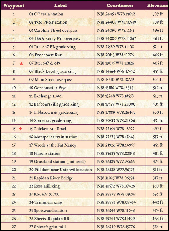
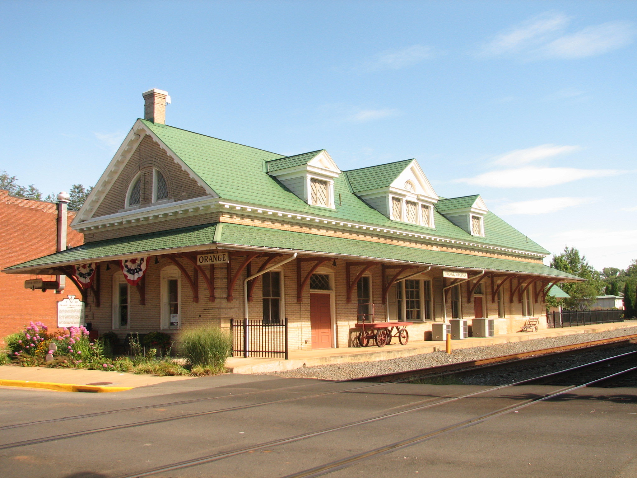 photo by Rutke421, 2008
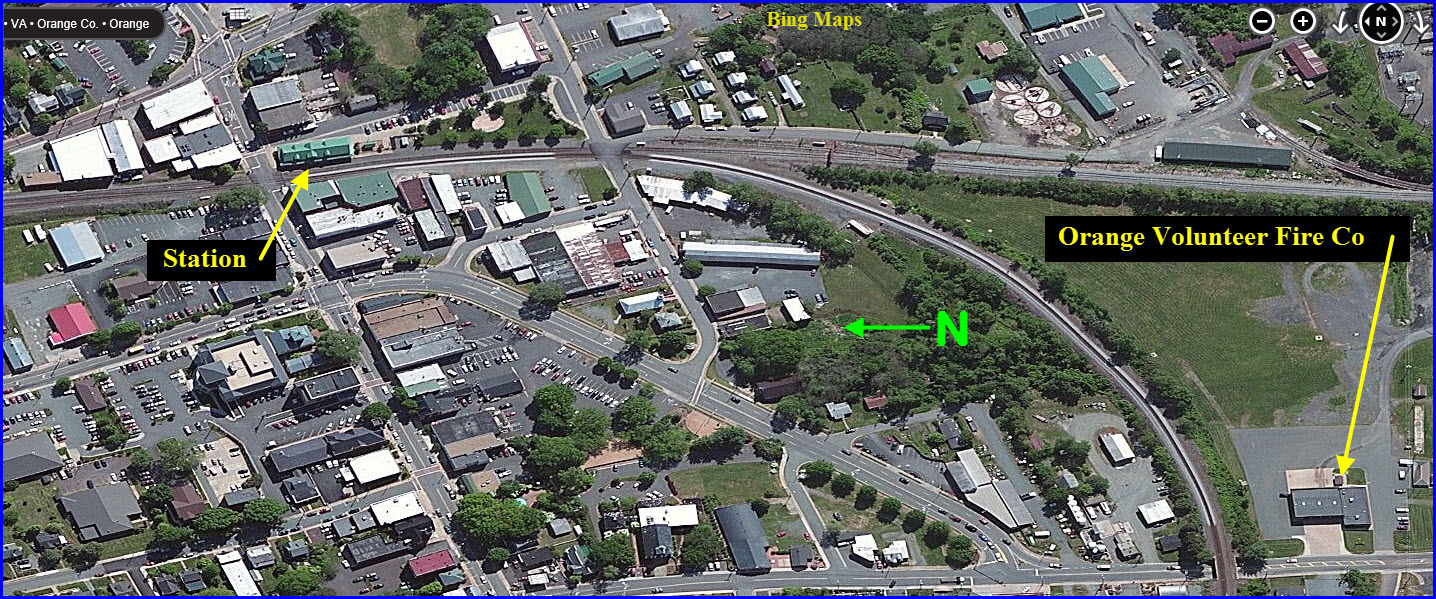
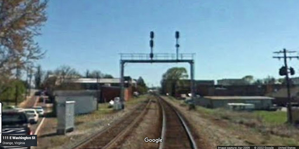
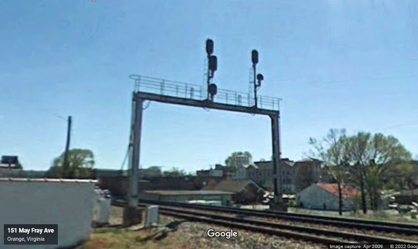
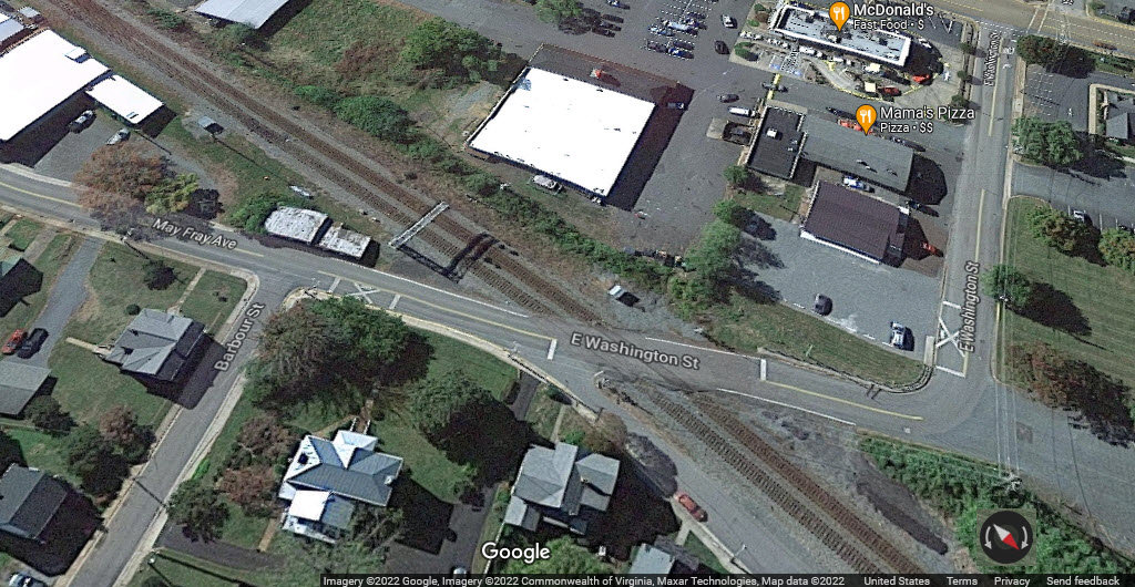
From here you have a good view of the PF&P depot. A cantilever signal is located here.
GPS Coordinates: 38.24136, -76.11322
GPS Coordinates: 38.24013, -76.11038

GPS Coordinates: 38.23580, -78.11085
GPS Coordinates: 38.20307, -78.12283, about 2.4 miles south of the above grade crossing on 647, no Streetview available
GPS Coordinates: 38.19327, -78.13361
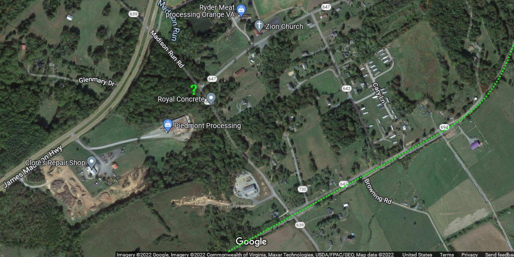
Location of a former SR depot - Not sure why a depot would be that far away from the R-O-W, unless the R-O-W was realigned.
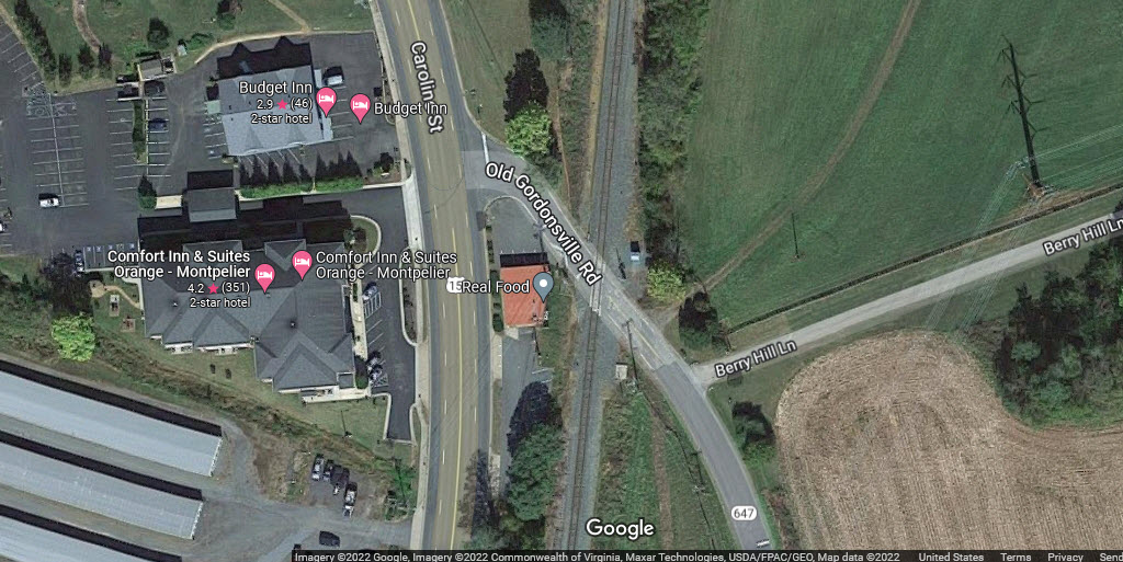
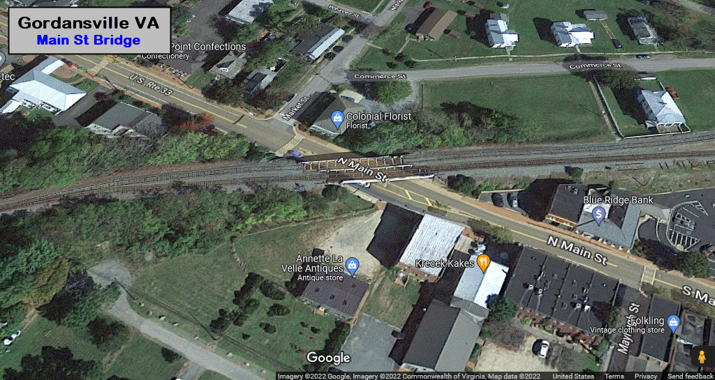
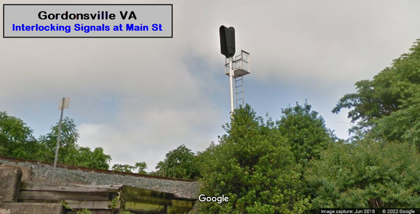
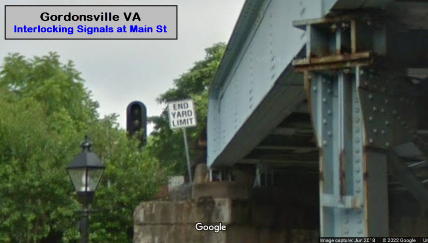
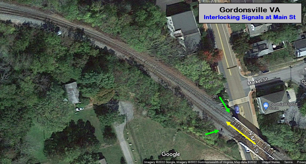
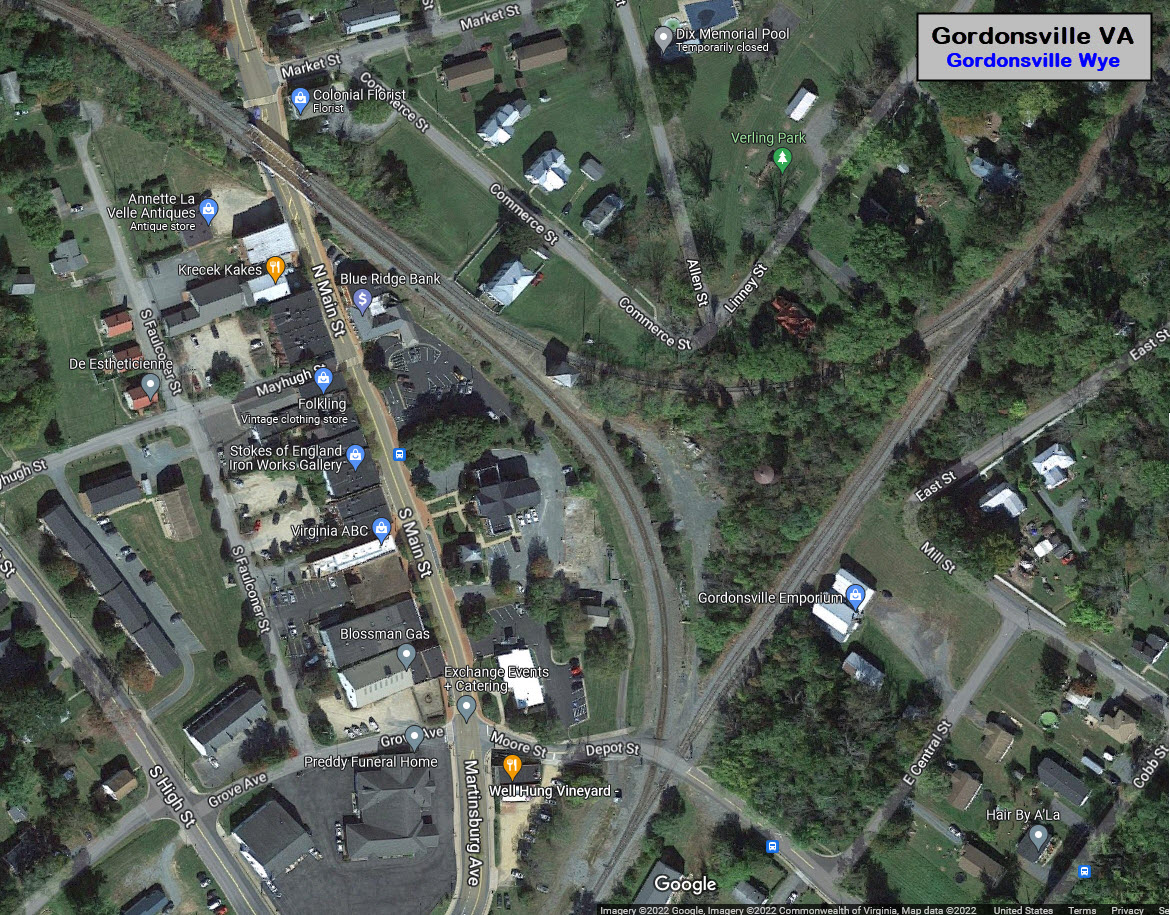
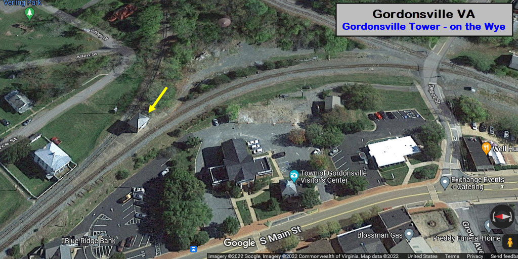
Gordonsville (8, 9, 10, 11)
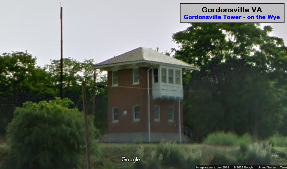
One of the railroad items NOT listed in the "Orange County RR Tour", is the Gordonsville Tower, located at the NW side of the wye..... WHY???
We're going to add it here as waypoint 10A.....
GPS Coordinates: 38.13598, -78.18711
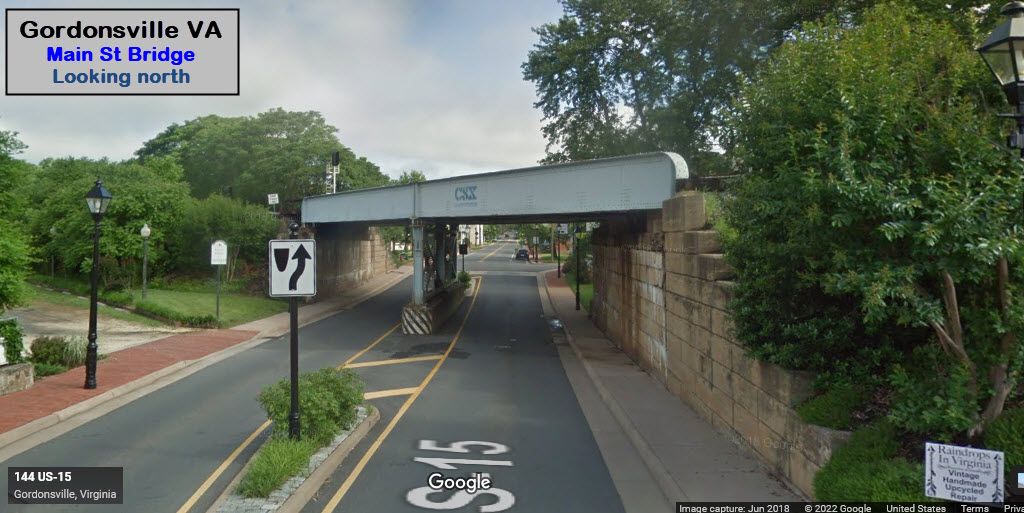
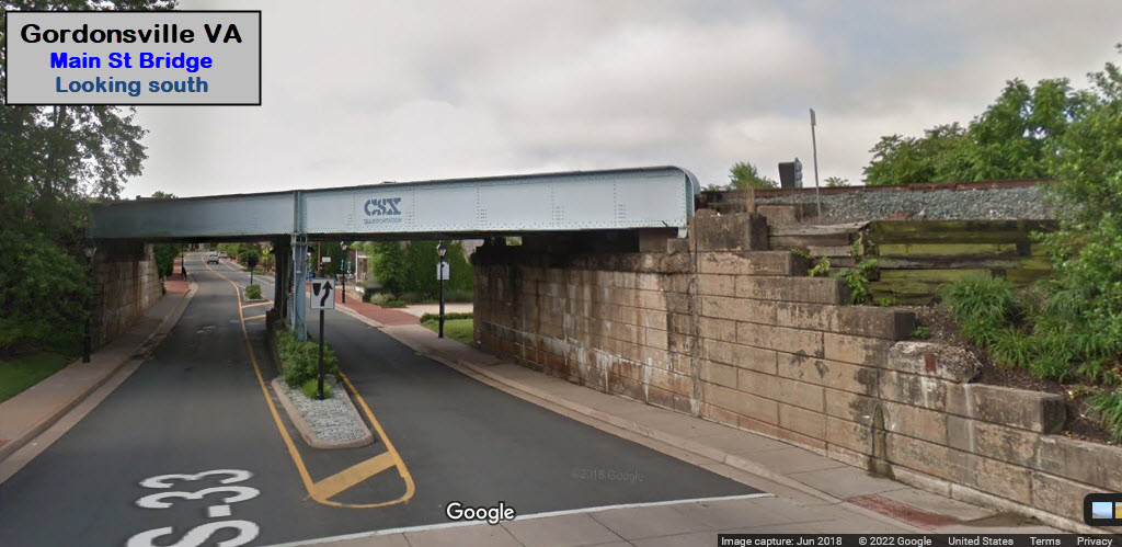
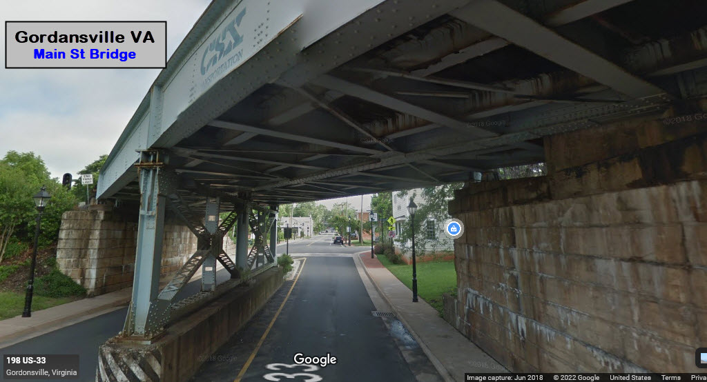
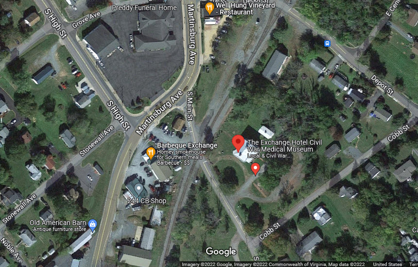
Trains coming off the wye and continuing west will go through an interlocking where the tracks go from two down to one, and back to two, I guess this saved them two turnouts if the had a double set of crossovers. The WB signals are pretty easy to catch from Main St.
GPS Coordinates: 38.13386, -78.18535 (at Depot St Grade Crossing)
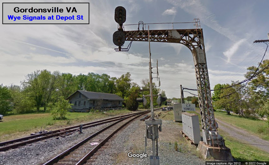
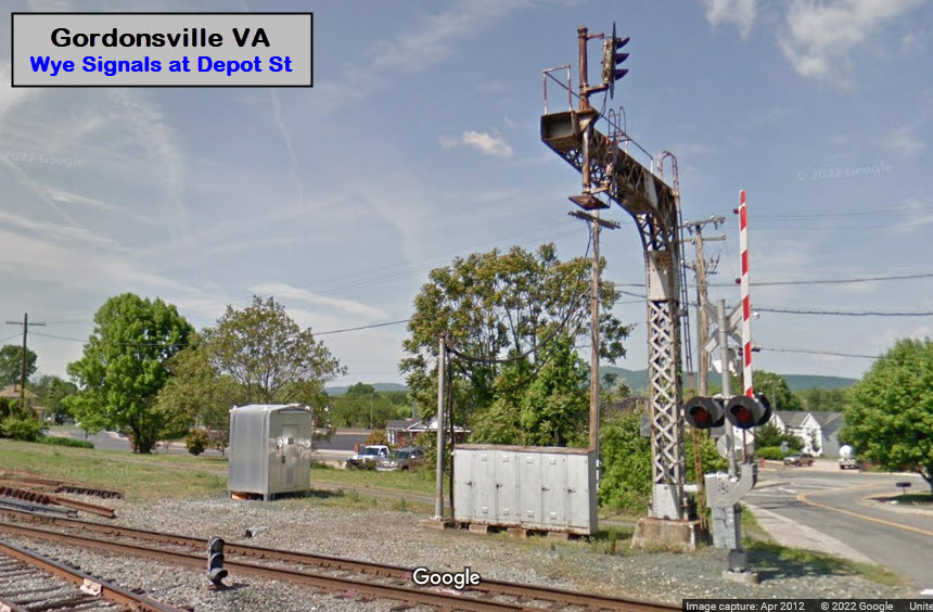
Signals at Depot St
These Streetview pictures are from 2012, the aerial view looks to be more current, as it does not show the signals. Thank you Google for the old shots! :-)
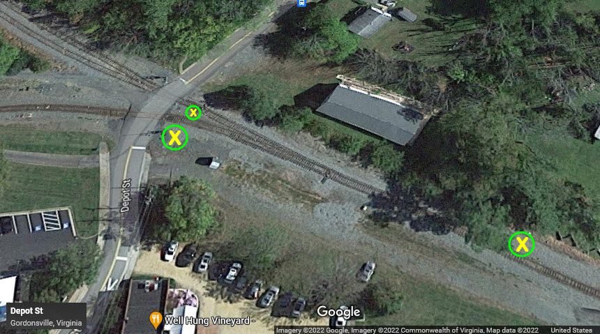
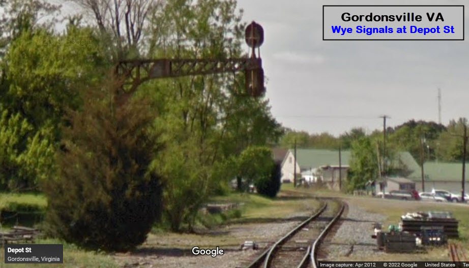
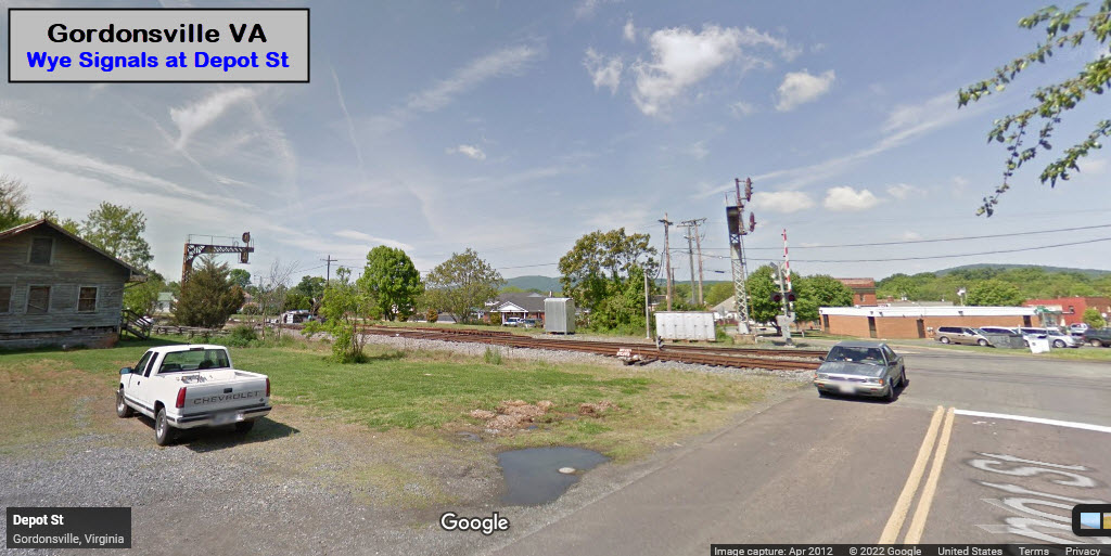
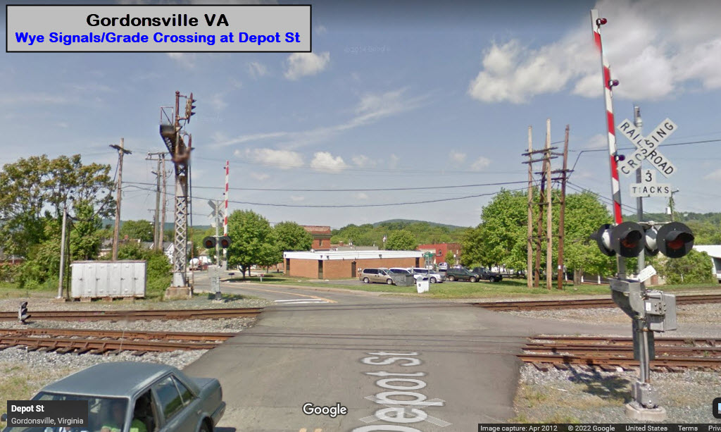
GPS Coordinates: 38.13520, -78.18578
Pictures are easy to get from the parking lots of the Visitors Center, or the Blue Ridge Bank. You can also walk up to it from the other side of the tracks on Commerce Street. Hopefully, the tower is still with us?
GPS Coordinates: 38.13266, -78.18570
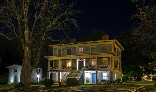
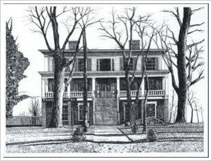
It is now The Exchange Hotel Civil War Medical Museum
400 South Main Street, Gordonsville, VA 22942
Mailing Address: P.O. Box 542, Gordonsville, VA 22942
540-832-2944
https://www.theexchangehotelmuseum.org/
Sitting at the edge of downtown Gordonsville is The Exchange Hotel Civil War Medical Museum. The museum is rich in history and the original structure has survived over 150 years from war to abandonment to what is now a thriving museum. We tell the story of this building from its start as a grand hotel in the early years, through the harsh realities of the Civil War as Gordonsville's General Receiving Hospital, on through to the end of the war when it became a Freedmen's Bureau.
GPS Coordinates: 38.14314, -78.22251
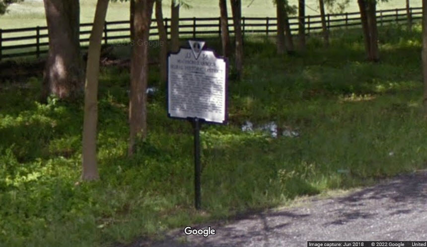
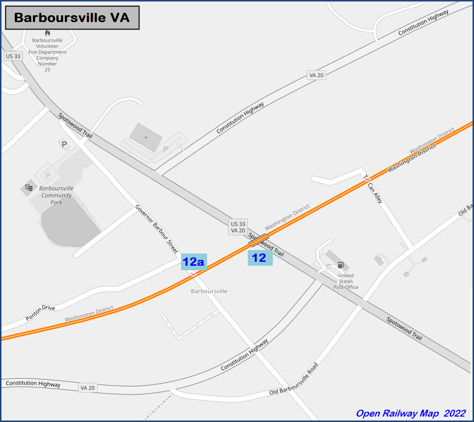
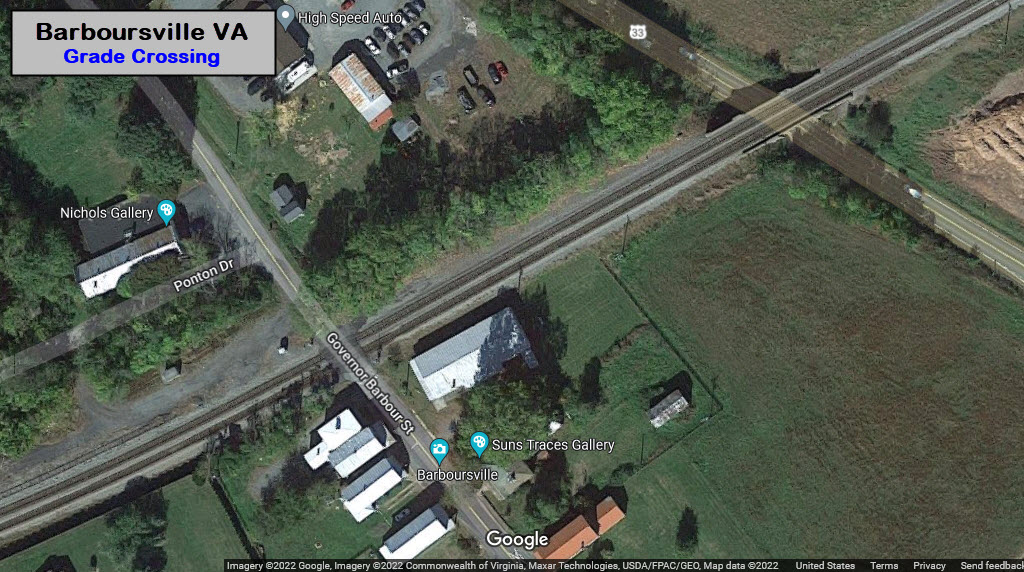
1.89mi west of Gordonsville, 3.85mi east of Barboursville on US-33.
Oddly enough, the state's database does not have a picture of the marker....

GPS Coordinates: 38.14314, -78.22251
2.32mi west of Gordonsville, 3.52mi east of Barboursville on US-33.


GPS Coordinates: 38.17184, -78.28058
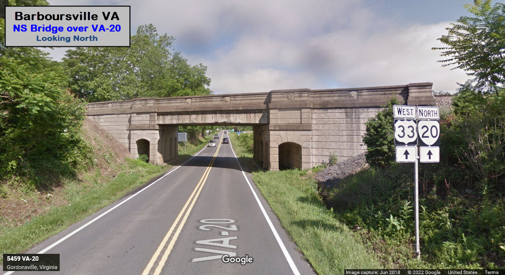
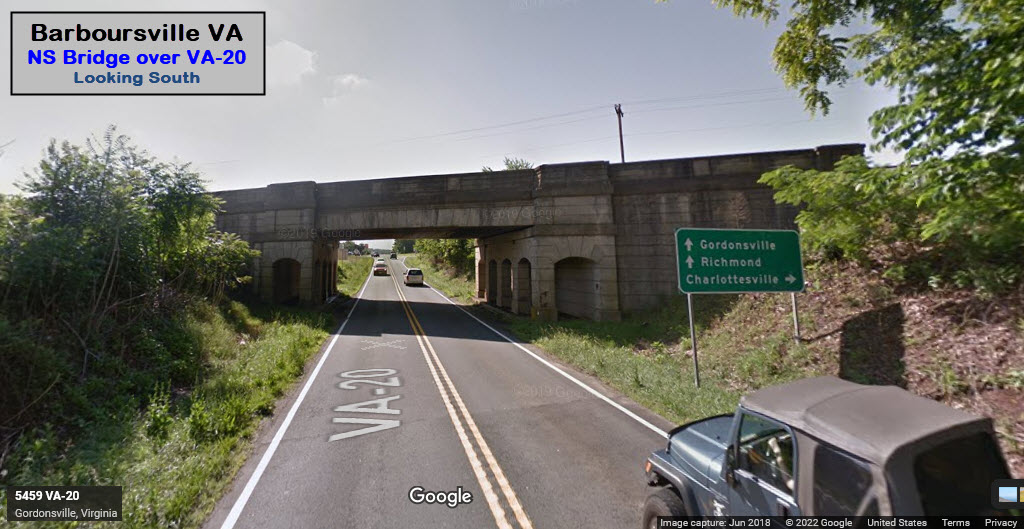
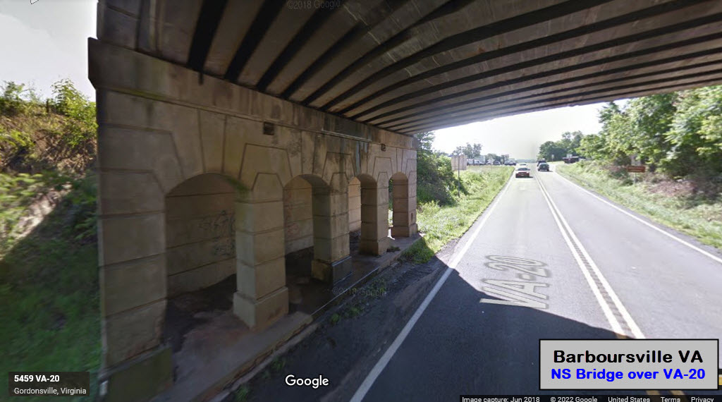
https://www.waymarking.com/waymarks/WMW73A_Barboursville_Railbridge_Barboursville_VA
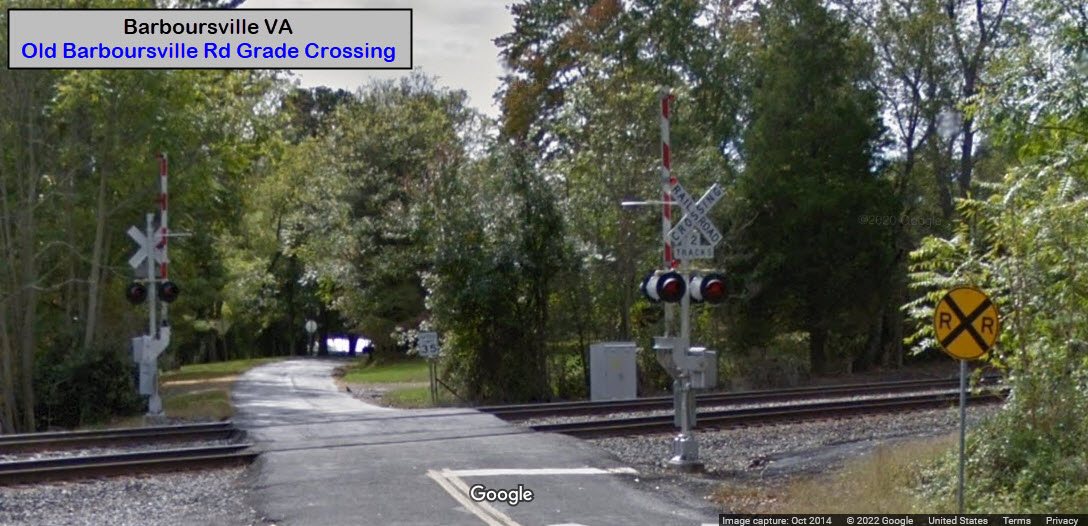
A slight confusion between the list of railroad sights vs. what is in the written guide - the list says the noteworthy item is the grade crossing, while the guide makes note of the bridge over US-30. At any rate, this beautiful bridge is of cast concrete design with steel I-beam supports. This is the 1880 right-of-way of the Charlottesville & Rapidan RR, now the Norfolk Southern. The bridge dates from 1941.
GPS Coordinates: 38.17125, -78.28206
GPS Coordinates: 38.17538, -78.28515
When leaving Barboursville, we'll take VA-20 heading northeast out of town.
GPS Coordinates: 38.17866, -76.26491
ARTOC: The area this grade crossing is in is called Tibbstown. It is one of the 15 Freedman’s Villages that appeared in Orange County after the Civil War, as former slaves found places to live after emancipation.
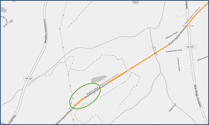
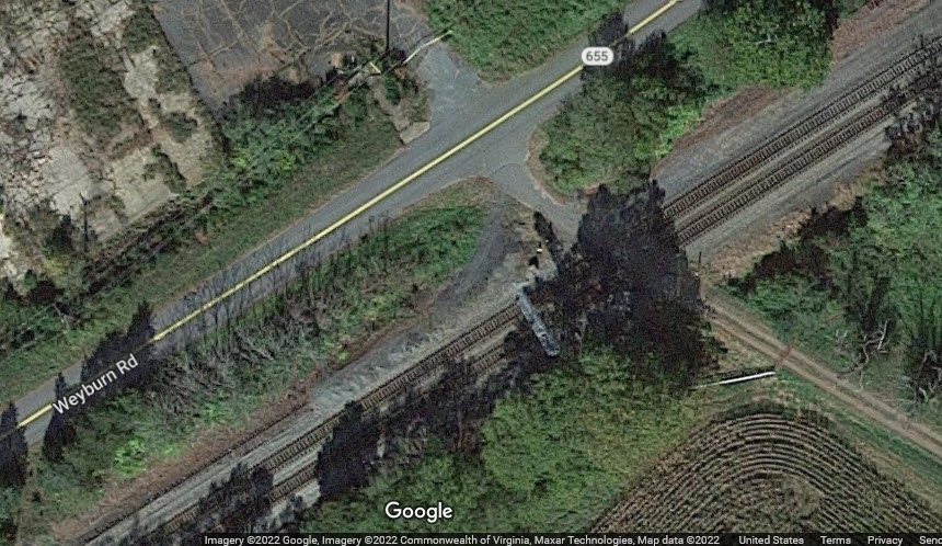
We're going to take a little detour off of VA-20, and take a right onto Weyburn Rd (VA-655), where there are three railroad items of interest.
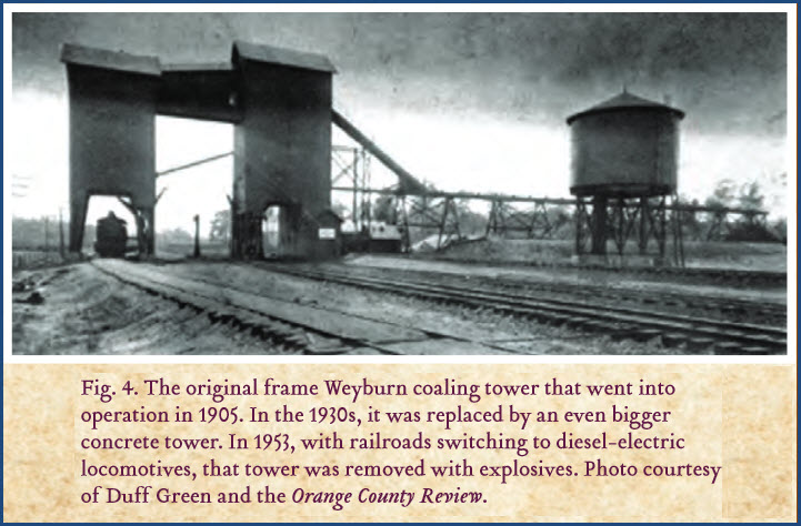
Location of Former Southern Rwy Yard
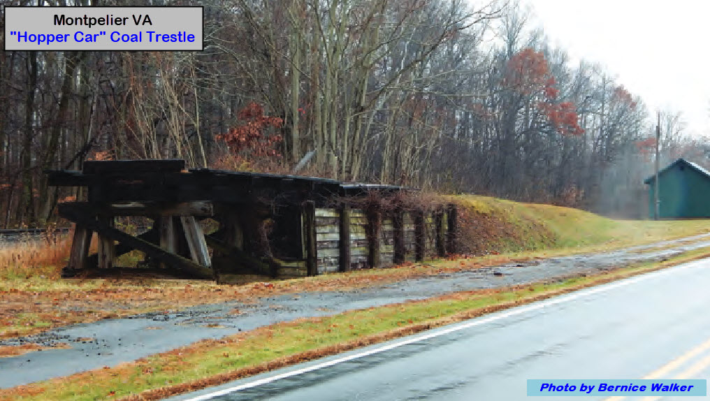
I have not been able to find any definitive information on the location of the yard and coaling tower, the circle is just a guess. Picture and text from the RTOC: At an earlier time, you would have seen the enormous coaling tower of Weyburn Station ahead on your right. That station served the water. The original frame Weyburn coaling tower that went into operation in 1905. In the 1930s, it was replaced by an even bigger concrete tower. In 1953, with railroads switching to diesel-electric locomotives, that tower was removed with explosives. Photo courtesy of Duff Green and the Orange County Review.
Signals
GPS Coordinates: 38.20141, -78.22874
Not sure, without an in person inspection, if they are NB or SB signals, or both. The road used to be a driveway for a brick company that used to be here.
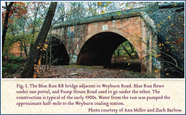
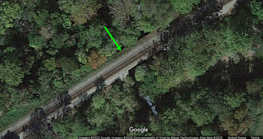
Bridge Over Blue Run Creek
GPS Coordinates: 38.20376, -78.22392
Difficult to see once the vegetation is in bloom.
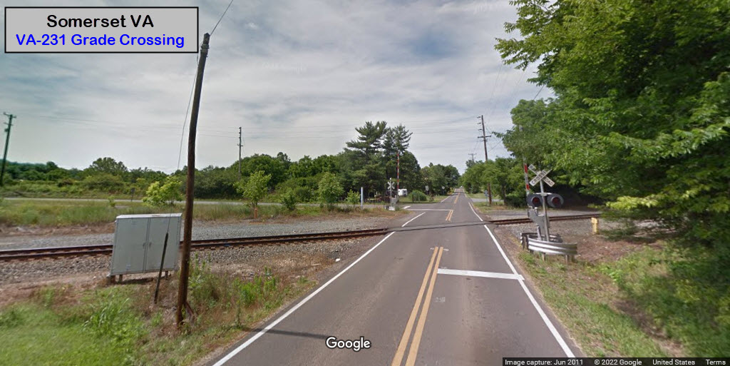
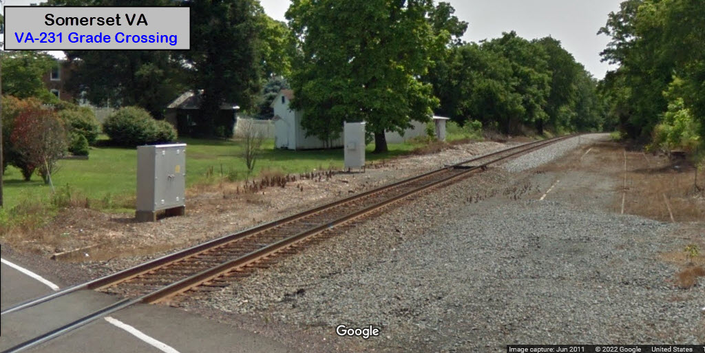
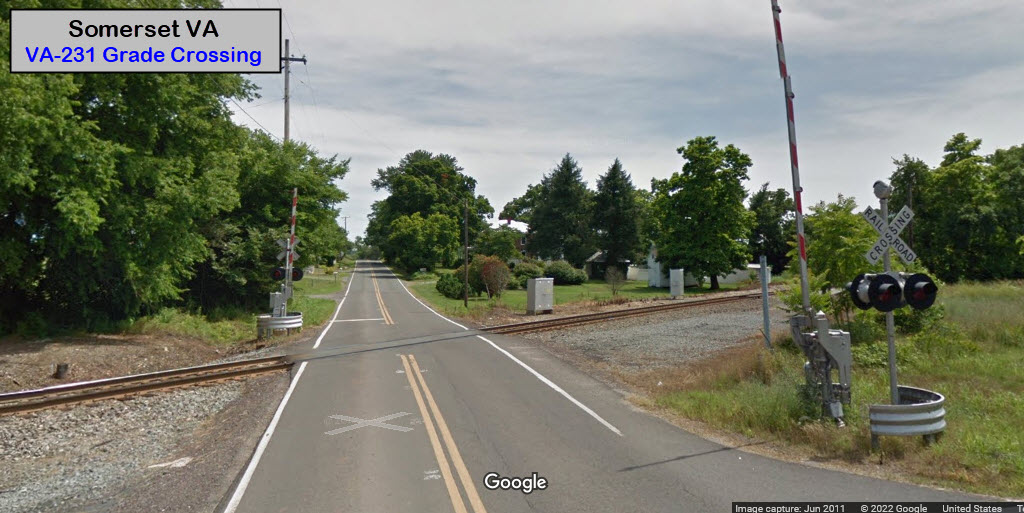
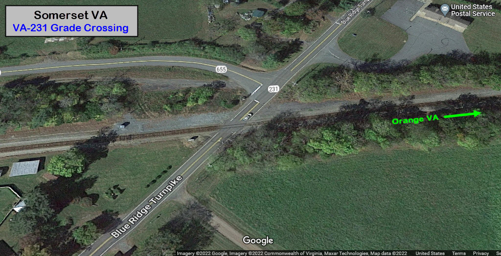
When you get to VA-231, take a right, stop and check out the grade crossing, and then take a left onto VA-655, Jacksontown Rd.
GPS Coordinates: 38.20376, -78.22392
Good sight lines in both directions!
GPS Coordinates: 38.22154, -78.18922
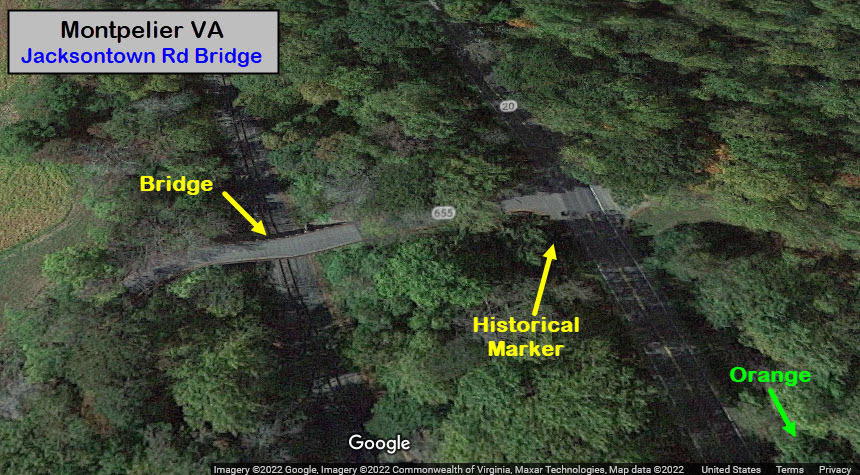
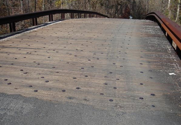
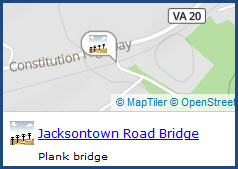
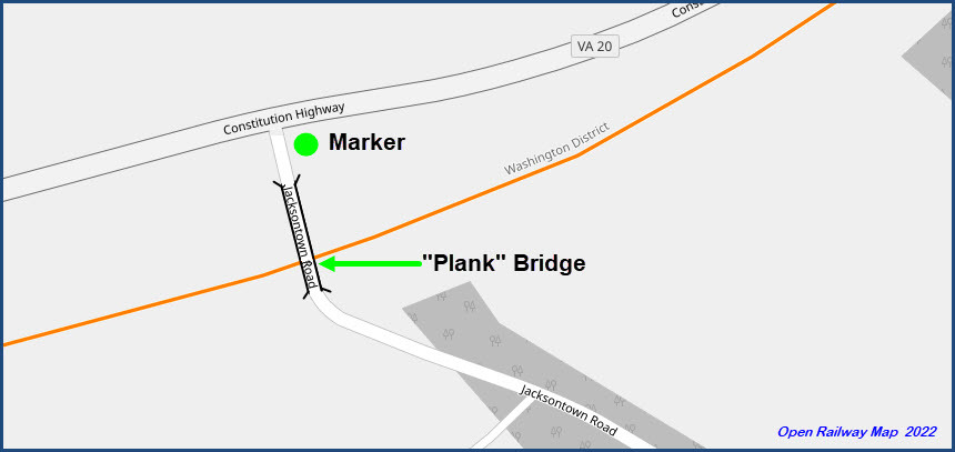
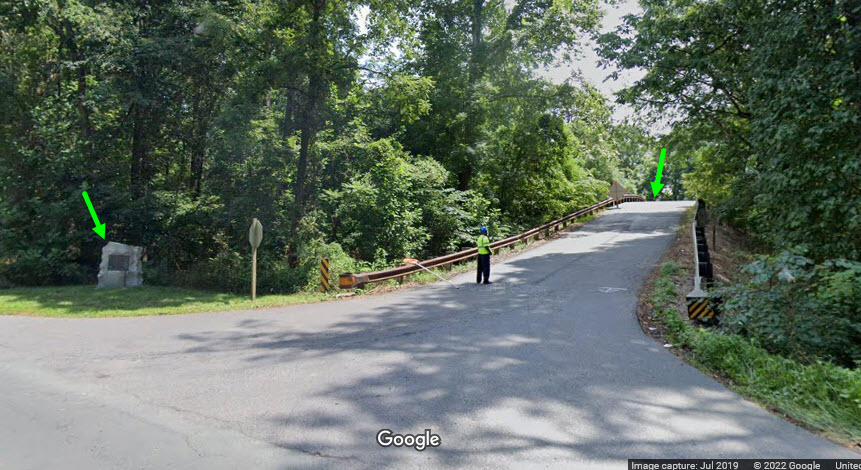
The RTOC lists this bridge as being on Chicken Mountain Rd, but it is NOT, it is on Jacksontown Rd, just before/after the junction with VA-20. The bridge is significant, because it is made of wooden planks.
GPS Coordinates: 38.22838, -78.17675
https://en.wikipedia.org/wiki/Montpelier_Station,_Virginia
From Wikipedia (edited): William du Pont purchased the Montpelier Estate in 1901 and paid to have a train depot built there to bring in supplies and for his weekly travel to Wilmington DE for business. The station was designed by the Southern Railway Company using one of its standard floor plans. Freight service began in 1911 and ceased in 1962. Passenger service began in 1912 and cased in 1929, after which time the time postal area on the first floor was enlarged. Following the death of Marion du Pont Scott in 1983, the Montpelier Estate was passed to the National Trust for Historic Preservation. In 2008, the Montpelier Foundation undertook a renovation of the Depot, restoring it to its original 1910s appearance. On February 21, 2010, the restored Depot reopened with a new exhibition. end Wikipedia
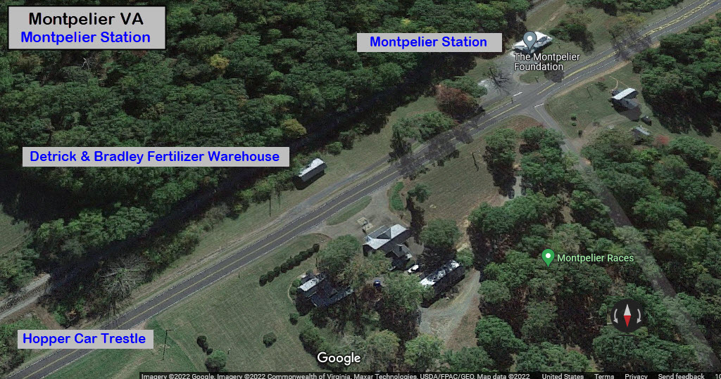
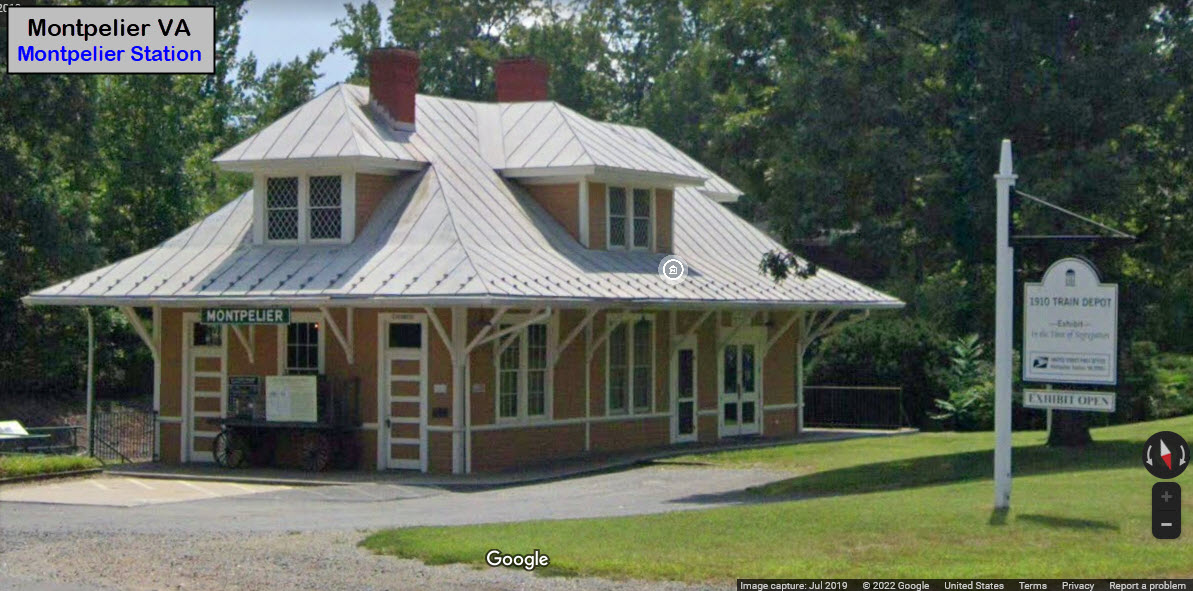
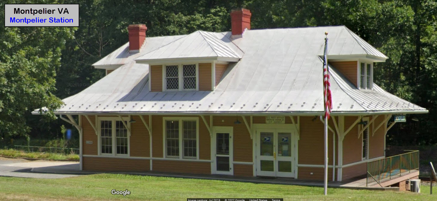
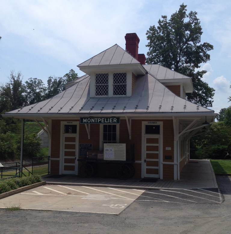 photo by Mxg910, 9 August 2012
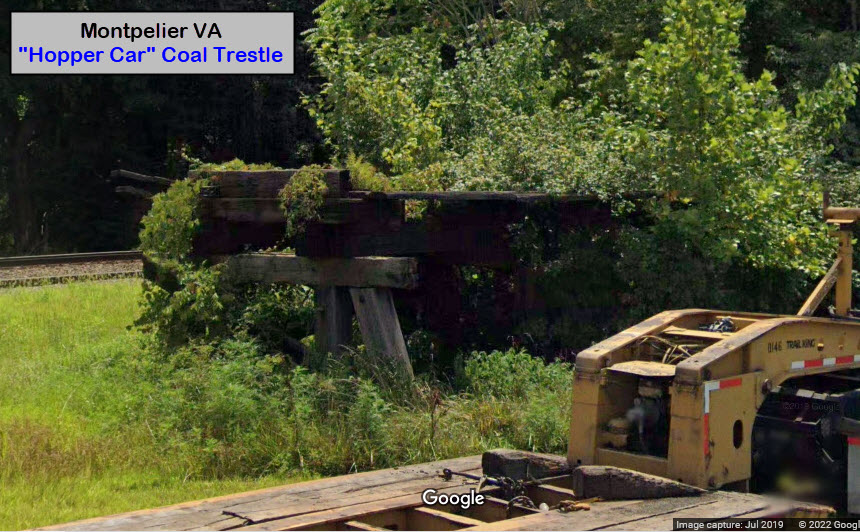
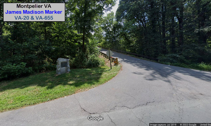
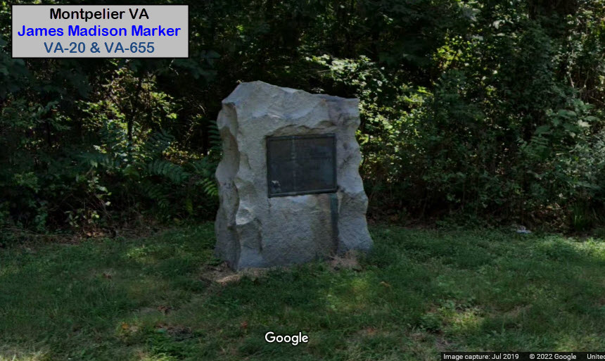
GPS Coordinates: 38.22201, -78.18926
Monument erected in 1930 by the Daughters of the American Revolution calling attention to the fact that James and Dolley Madison are buried nearby. Jut slightly south of where they are buried at the corner of Constitution Hwy and Jacksontown Road. I'm kind of surprised that there is neither a state marker here, or a mention of this on the Waymarking website!.... However, the plank bridge at the crest of the road is mentioned??? The plank bridge goes over the Norfolk Southern line.
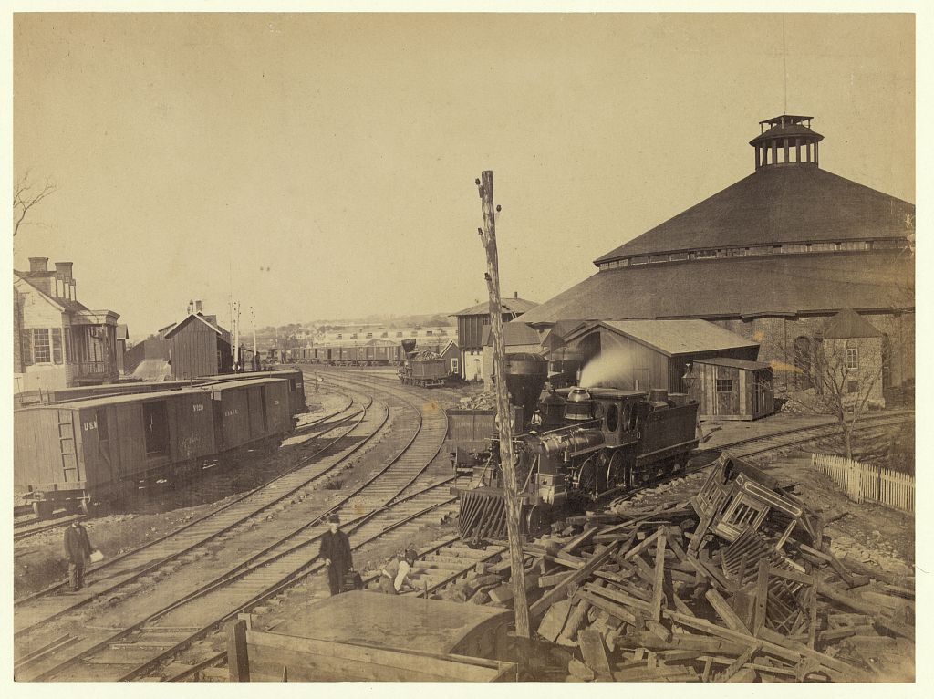
Very early picture of the Orange &
Alexandria RR yard in Alexandria..... found on Google images, no credit given for
source...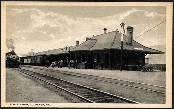
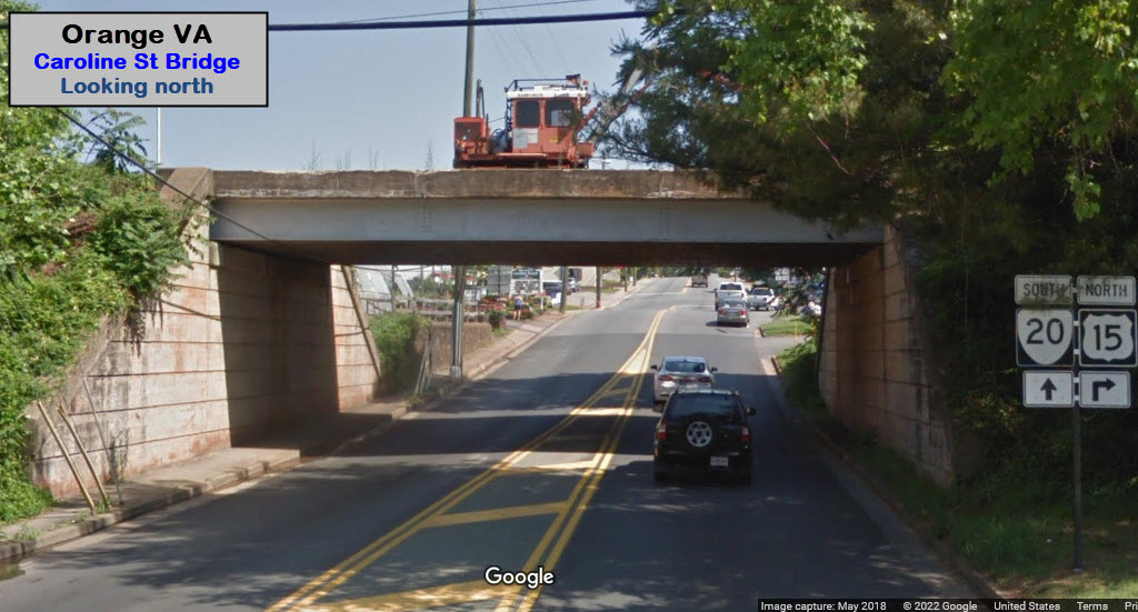
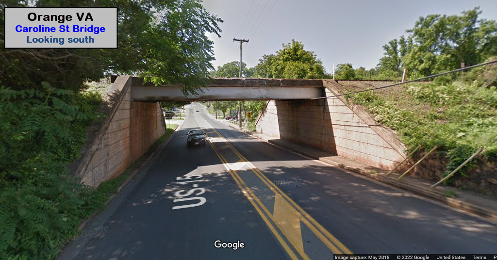
Adjacent to Washington St Crossing. Looks like the standard old Southern Rwy color light signals have been replaced by a set of signals on a cantilever bridge. We don't have a Streetview view any newer than 2009, but the new signals are visible in the aerial view.
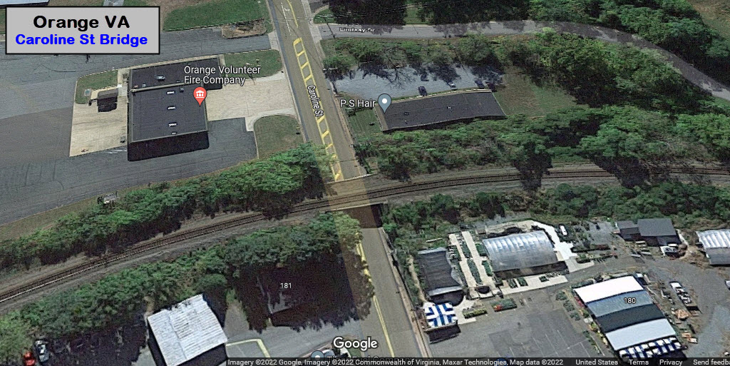
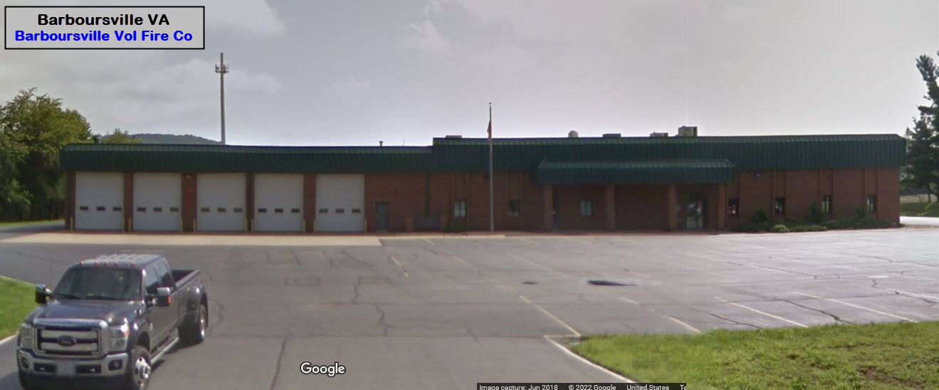
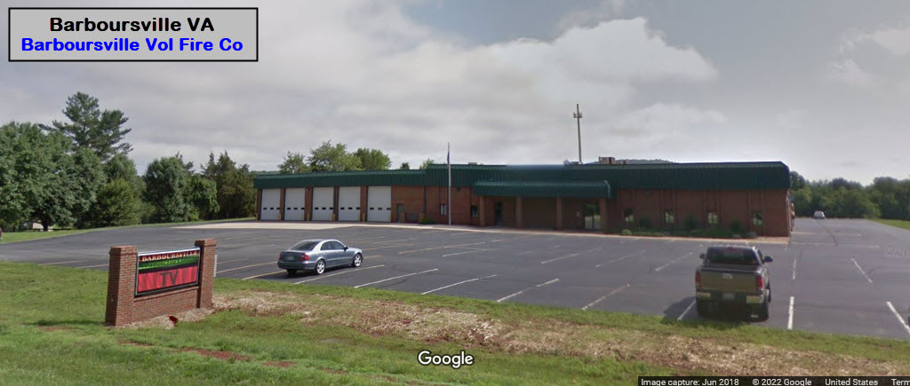
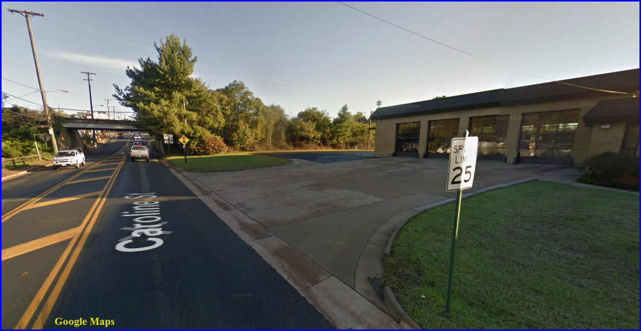
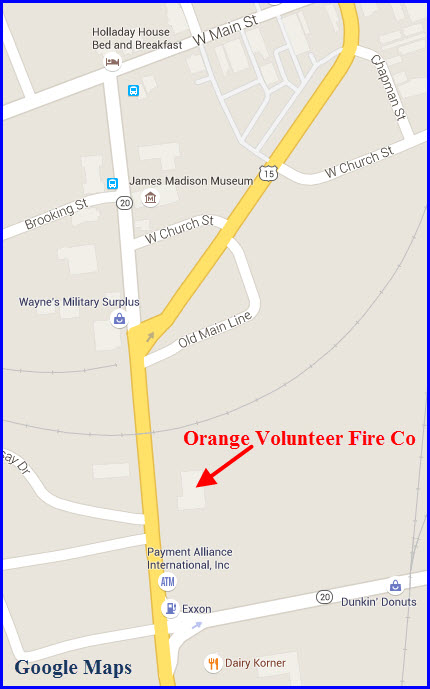
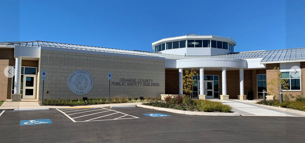
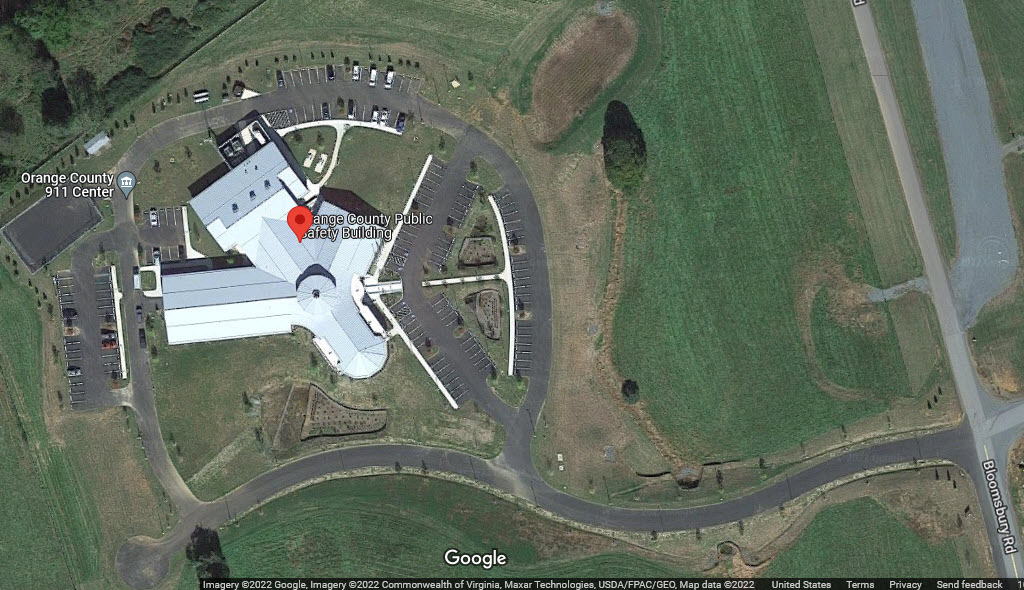
Orange Volunteer Fire Company
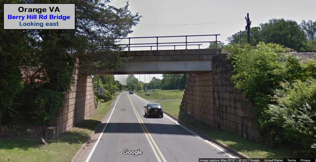
GPS Coordinates: 38.23580, -78.11085
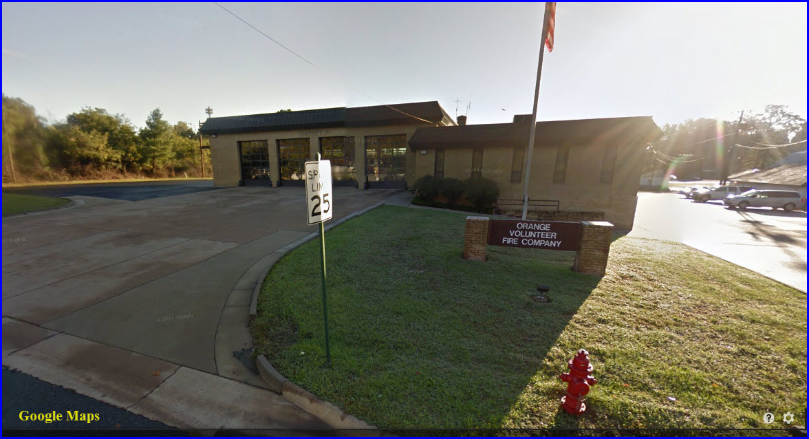
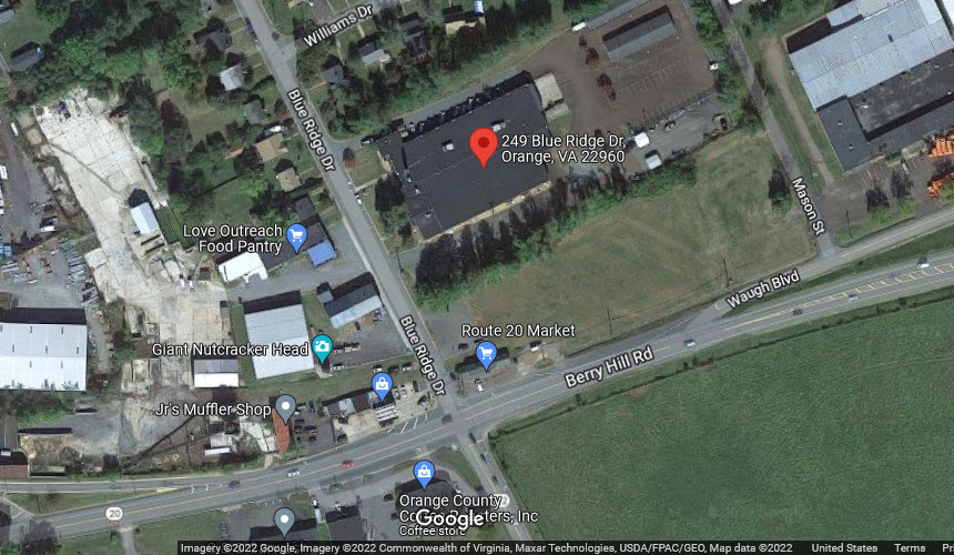
Orange Police Department
GPS Coordinates: 38.23580, -78.11085
249 Blue Ridge Drive, Orange VA 22960
Phone: 540-672-1491
Fax: 540-672-0162
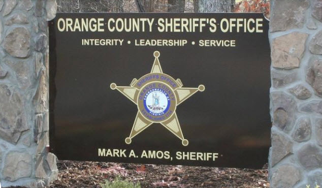
Orange County Sheriff's Department
GPS Coordinates: 38.24859, -78.05548
11282 Government Center Dr, Orange VA 22960
Phone: 540-672-1200
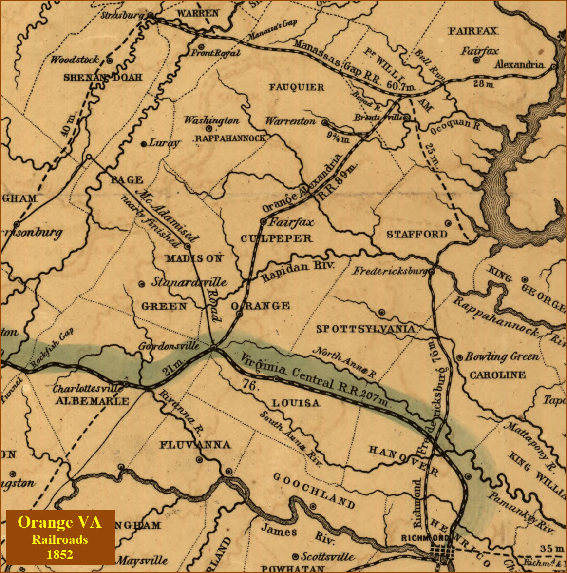
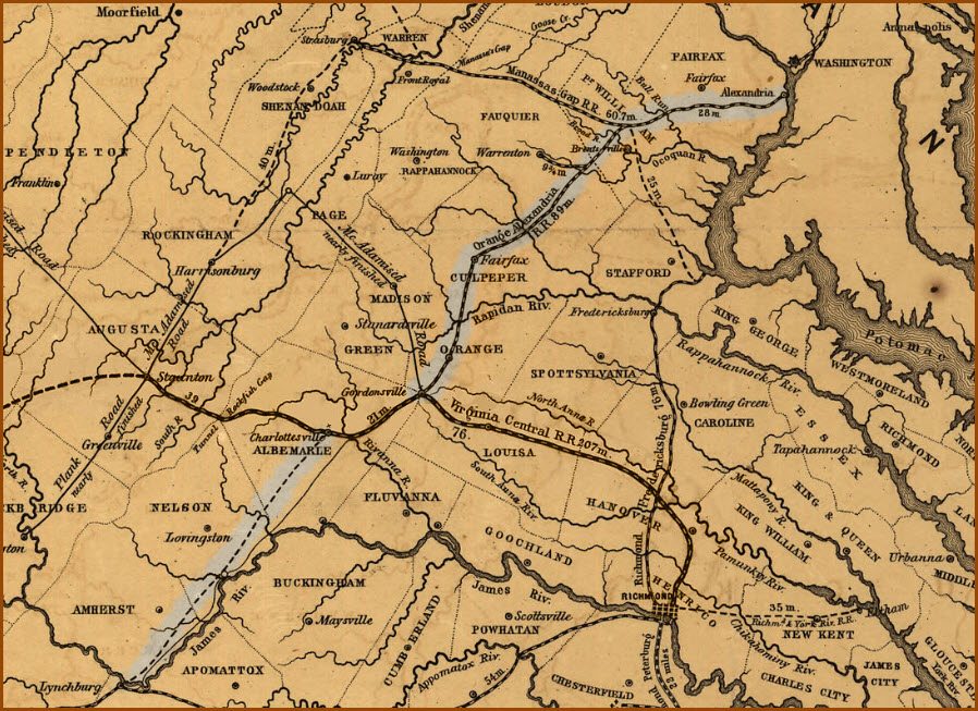
Map of the Orange and Alexandria RR, 1852
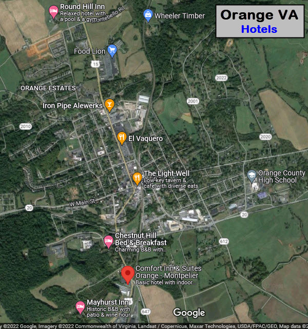 Area hotels, motels and B&B's
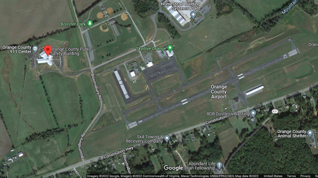
If you're flying in, for some reason, it's runway 8/26.
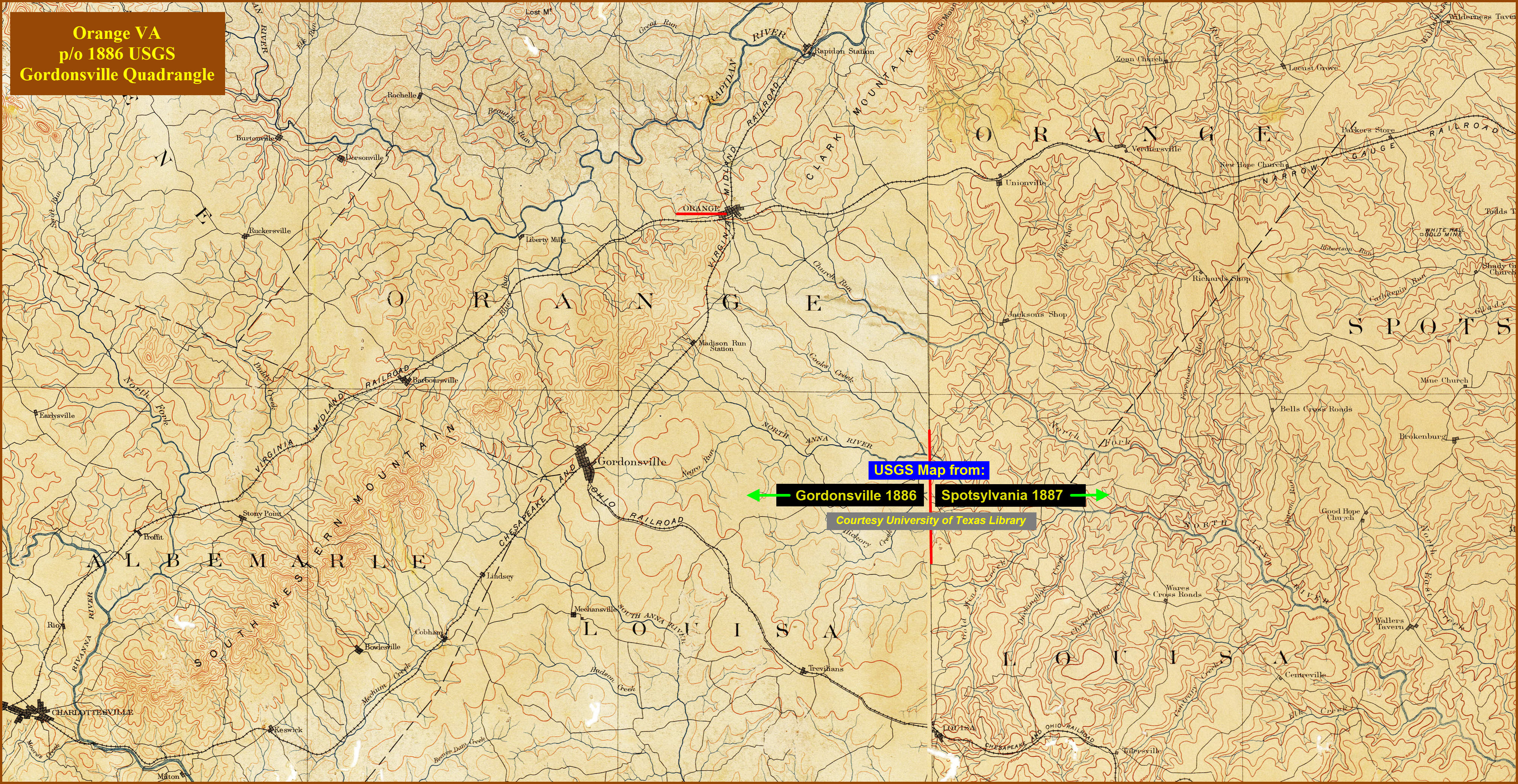
The USGS map below is a composite of the quadrangle maps of Gordonsville 1886 and Spotsylvania 1887. It appears that the map of Spotsylvania had a wee bit more detail, if you examine the points at which the two maps join. The map is way larger in its native resolution, so you may want to download the map in order to be able to expand it, the map is around a 4.2 meg JPEG. Courtesy of the University of Texas Library, click here for their index page.
Disclaimers:
I love trains, and I love signals. I am not an expert. My webpages reflect what I find on the topic of the page. This is something I have fun with while trying to help others.
Please Note: Since the main focus of my two websites is railroad signals, the railfan guides are oriented towards the signal fan being able to locate them. For those of you into the modeling aspect of our hobby, my indexa page has a list of almost everything railroad oriented I can think of to provide you with at least a few pictures to help you detail your pike.
If this is a railfan page, every effort has been made to make sure that the information contained on this map and in this railfan guide is correct. Once in a while, an error may creep in :-)
My philosophy: Pictures and maps are worth a thousand words, especially for railfanning. Text descriptions only get you so far, especially if you get lost or disoriented. Take along good maps.... a GPS is OK to get somewhere, but maps are still better if you get lost! I belong to AAA, which allows you to get local maps for free when you visit the local branches. ADC puts out a nice series of county maps for the Washington DC area, but their state maps do not have the railroads on them. If you can find em, I like the National Geographic map book of the U.S..... good, clear, and concise graphics, and they do a really good job of showing you where tourist type attractions are, although they too lack the railroads. Other notes about specific areas will show up on that page if known.
Aerial shots were taken from either Google or Bing Maps as noted. Screen captures are made with Snagit, a Techsmith product... a great tool if you have never used it!
By the way, floobydust is a term I picked up 30-40 years ago from a National Semiconductor data book, and means miscellaneous and/or other stuff.
Pictures and additional information is always needed if anyone feels inclined to take 'em, send 'em, and share 'em, or if you have something to add or correct.... credit is always given! Please be NICE!!! Contact info is here
Beware: If used as a source, ANYTHING from Wikipedia must be treated as being possibly inaccurate, wrong, or not true.
RAILFAN GUIDES HOME
RAILROAD SIGNALS HOME
NEW 05/20/2015, JUN16/2020, MAY08/09/10/2022
Last Modified
15-May-2022