
In General
Getting Here
Map
Pictures
Signals
Fire & Police
Floobydust
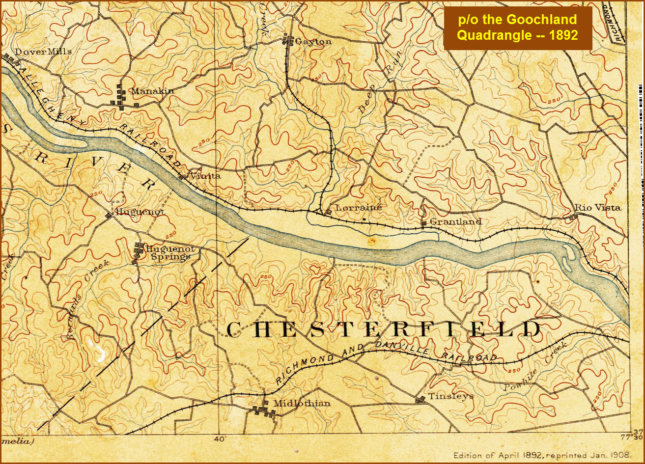
USGS Maps
RAILROAD SIGNALS HOME
Location / Name:
Midlothian VA, Chesterfield County
What's Here:
Cool grade crossing
Data:
GPS Coordinates: 37.522213, -77.611707
Phone A/C: 804
ZIP: 23235
Access by train/transit:
None
The Scoop:
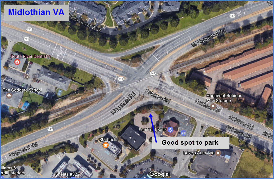
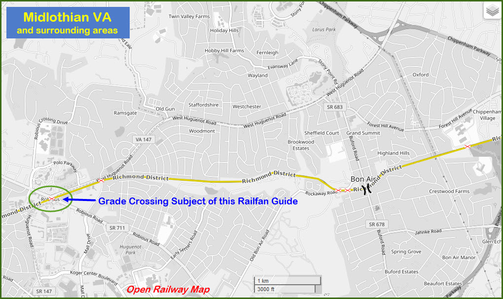
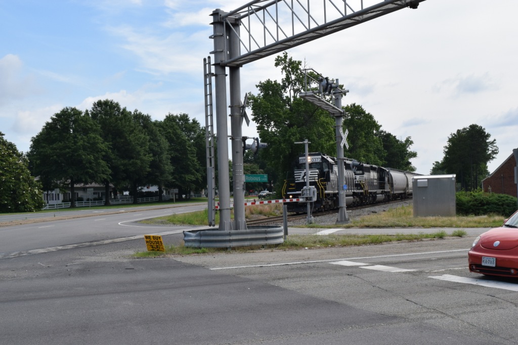
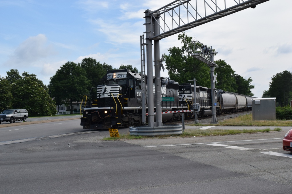
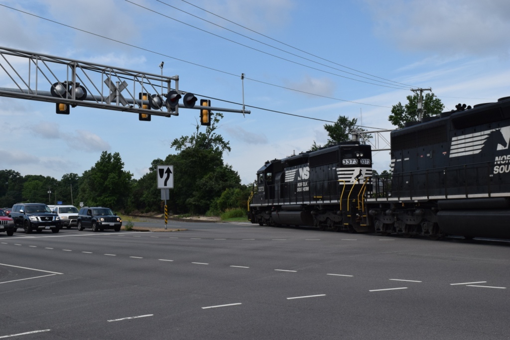
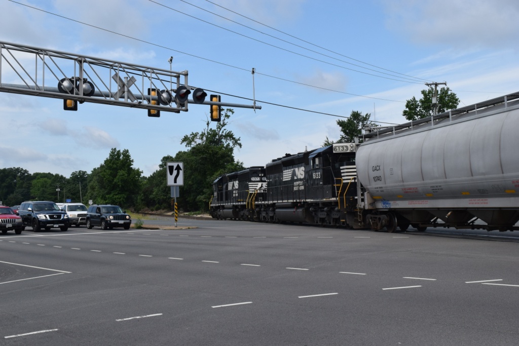
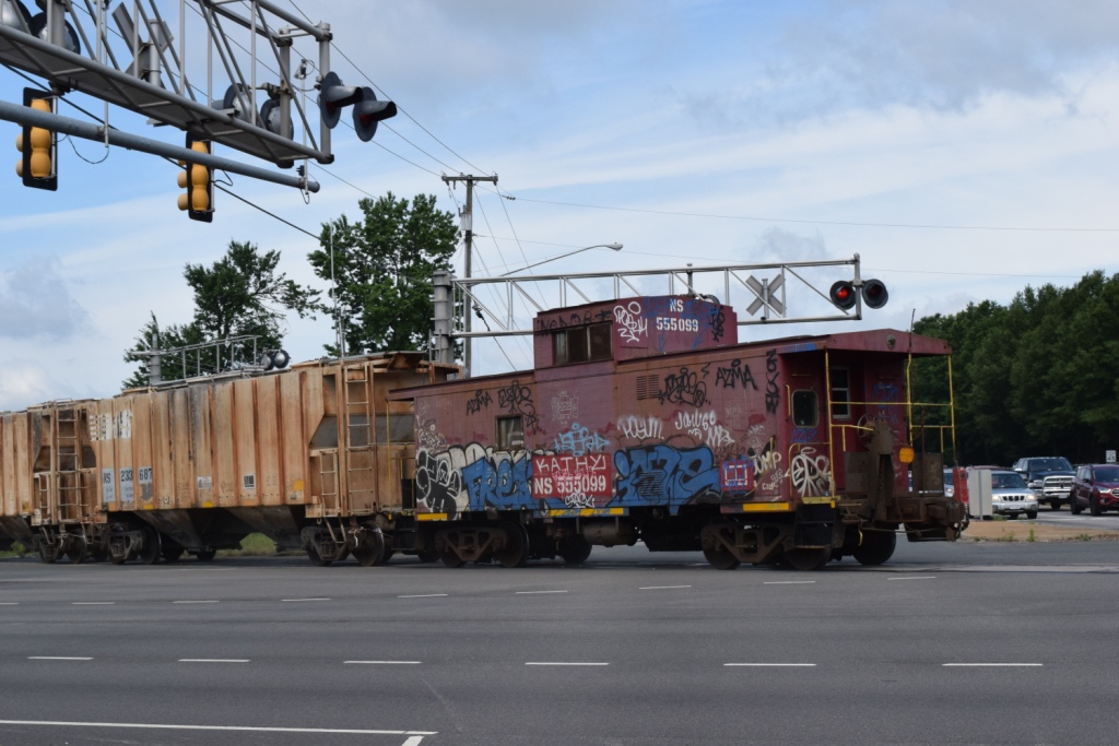
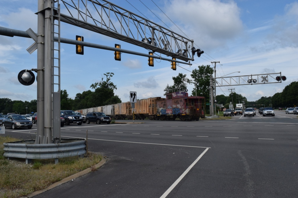
Midlothian has a most interesting grade crossing, situated in the middle of two fairly high density traffic roads: Robious Rd and Huguenot St. A local uses the crossing every morning around 10:30, pretty much like clockwork.
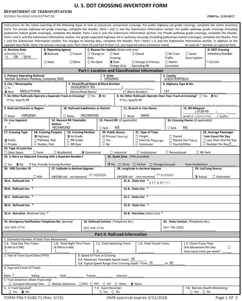
When does the train return? The one time I heard it blowing for a crossing was around 6:30PM, but I wasn't able to catch it as I was at a swim meet several blocks away. We can see from the DOT Crossing Inventory Form below, that there is only 1 train each day in each direction, and altho the maximum authorized track speed is 35, typical speed thru here runs between 15 and 25MPH.
When the signals activate, you do not have much time to stage yourself for a shot, so you need patience, and you need to be waiting in the spot you want to take pictures in, trust me, for I was sitting in my car and the pictures below are the result of being lazy :-)
The local even uses a caboose (well decorated by local artists :-)
The railroad also crosses under Midlothian Turnpike about a quarter of a mile off of 288, and crosses under 288 just south of the Midlothian Turnpike exit. The track is straight in both places, and offers a good shot.
Other places to catch it are:
Watkins Centre Pkwy (an overpass)
Old Hundred Rd (an overpass)
Winterfield Rd (good clear shots in both directions)
Salisbury Dr
Robious and Huguenot
Cranbeck Rd
Rockaway Rd
Rockcrest Rd (these two are next to each other, and are on a curve)
Buford Rd (an overpass)
A private grade crossing off of South Coleman Lane
Chippenham Pkwy (a dual overpass)
the Powhite (goes under)
and immediately, Forest Hill Ave - this is a nice spot for EB trains with the curve going over the Powhite as it comes at you at the crossing

Interesting fact: if you come to Midlothian by way of I-64 and 288, you will pass right by the National HQ for CARMAX off to your right at Tuckahoe Creek Pkwy!
Another interesting fact, if you are coming here from the south using I-95, you will have passed the worlds largest Arby's back at exit 54, Temple Ave, more on my Petersburg page :-)
Acknowledgements:
Eli Christman
Denver Todd
Websites and other additional information sources of interest for the area:
http://www.chesterfield.gov/
http://www.midlothianfire.org/
http://www.chesterfield.gov/
https://www.chesterfield.gov/Departments.aspx?id=9550
http://www.chesterfield.gov/FireAndEMS.aspx?id=2184
http://www.chesterfield.gov/FireAndEMS.aspx?id=2354 About their memorial to fallen heros
https://www.stoppingpoints.com/va/Chesterfield/ Historical markers in Chesterfield County
From the west of Richmond off I-64, take exit 175, 288, and come down about 12 miles to US60, Midlothian Turnpike.
If you're coming down I-95 from the north, you have two choices. One is more interesting than the other, but you have to pay tolls on the Powhite.
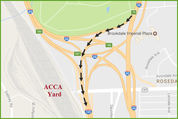
For the interesting route, take exit 79, but when you do, stay to your left, for you will be immediately be taking another exit for I-195 and the Powhite Pkwy, VA76. Once thru the junction, it will put you next to, and then over Acca Yard. After you go over Acca, 195 zips thru the fringes of downtown Richmond with the CSX ROW in between the two sides of 195. This will continue for about a mile, then the railroad takes off in preparation to cross the James River, which will be coming up on your left. Beautiful bridge. If you time it right around 4:30, you can catch a SB Amtrak coming thru first at Acca, then along 195, and then at the river. At this point, you will be on the Powhite Pkwy, which has two 75 cent tolls. You can get off at Midlothian Turnpike (a 25 cent toll) and head west.
For the un-interesting route to Midlothian, you can get off of I-95 at exit 84, I-295 and skirt around the west side of Richmond. Take 295 about 9-1/2 miles to I-64. Head west about 3-1/2 miles to 288, and take that south the 12 miles to Midlothian Turnpike. Then head east on Midlo Turnpike.
From the south via I-95, take exit 62, which is 288. It's a long drive to Midlo Turnpike, about 21 miles.
From the east via I-64, get off at 195 and follow the interesting route! :-)
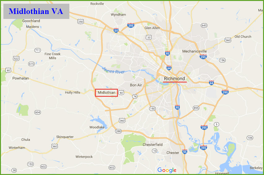
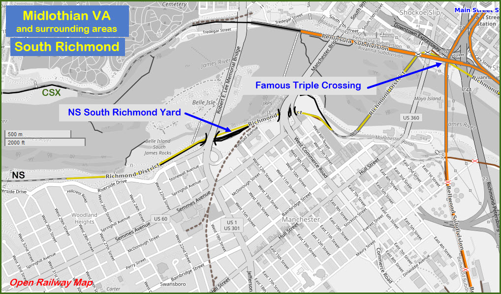
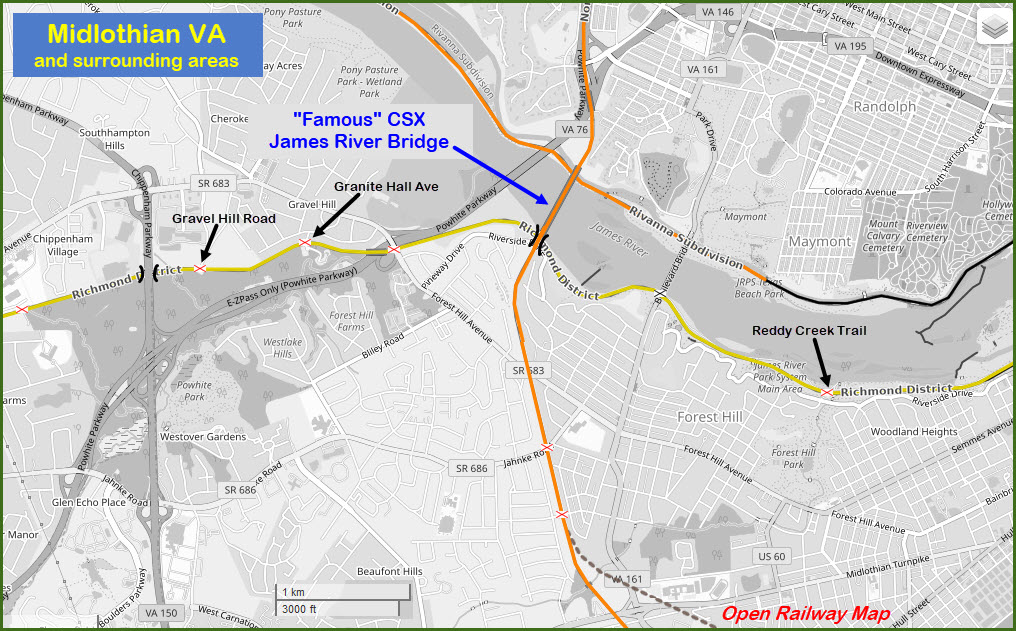
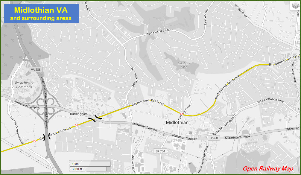
Map
Chesterfield Co Station No 5
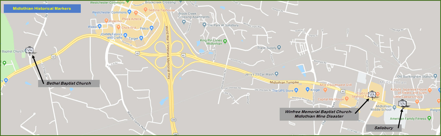
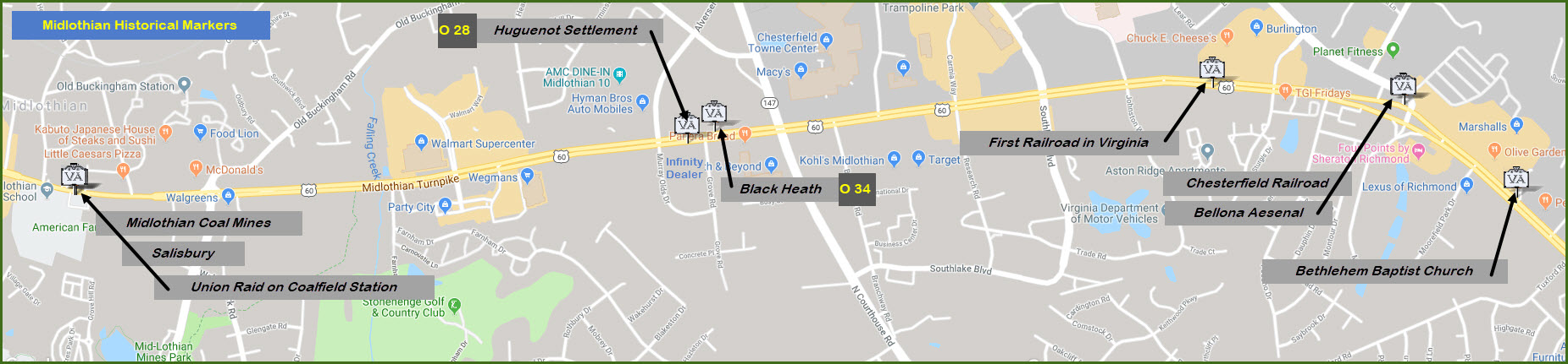
Historical Markers Courtesy of the University of Texas Library, click here for their index page. NEW 06/09/2017,
06/14/2017
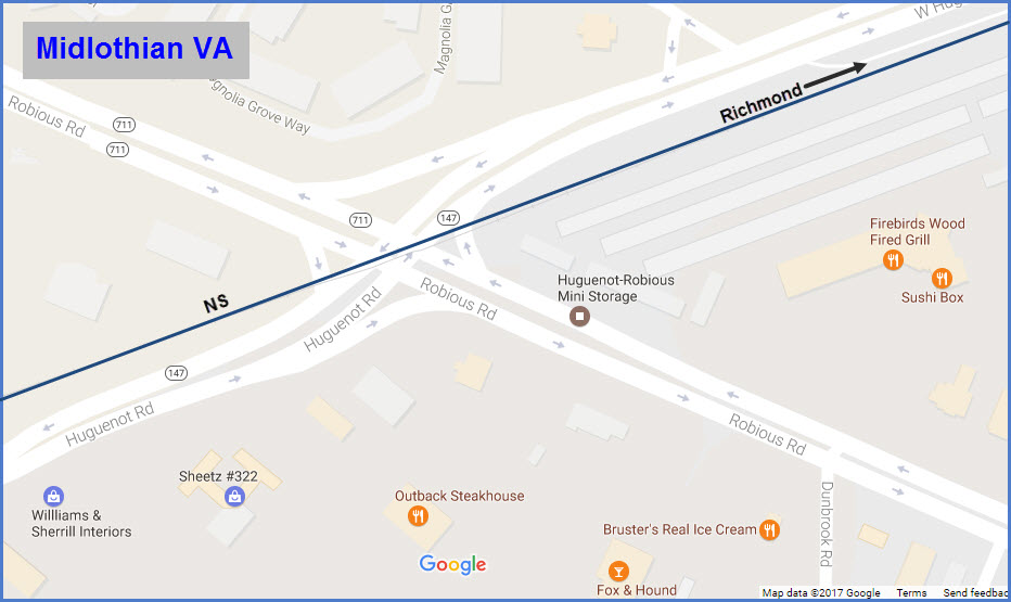
If you want to try to catch the local at other spots, here are mini-maps of
the trek from the yard to Midlothian:
Sorry, no signals around these here parts to report on.
GPS Coordinates: 37.522213, -77.611707
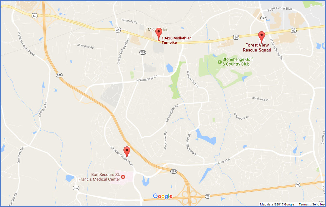
13420 Midlothian Turnpike, Midlothian, VA 23113
http://www.chesterfield.gov/
http://www.midlothianfire.org/
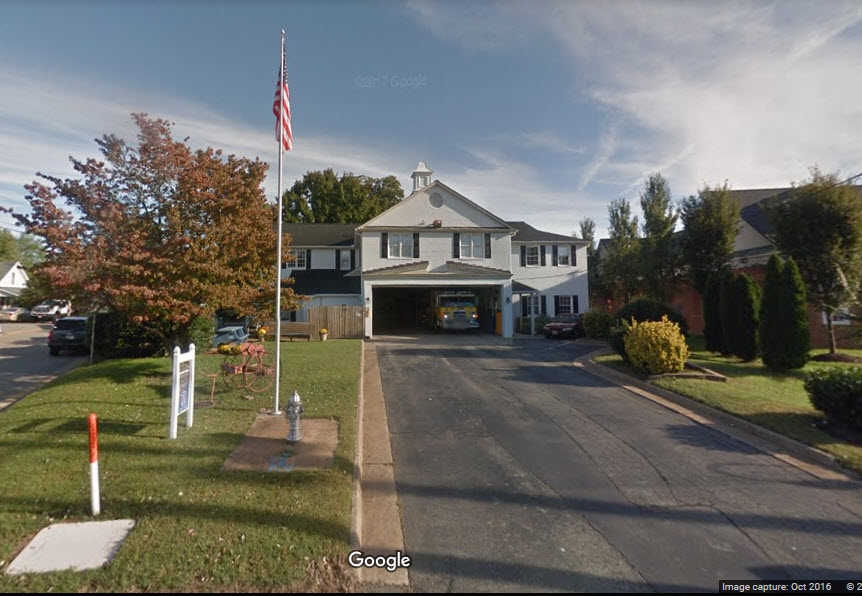
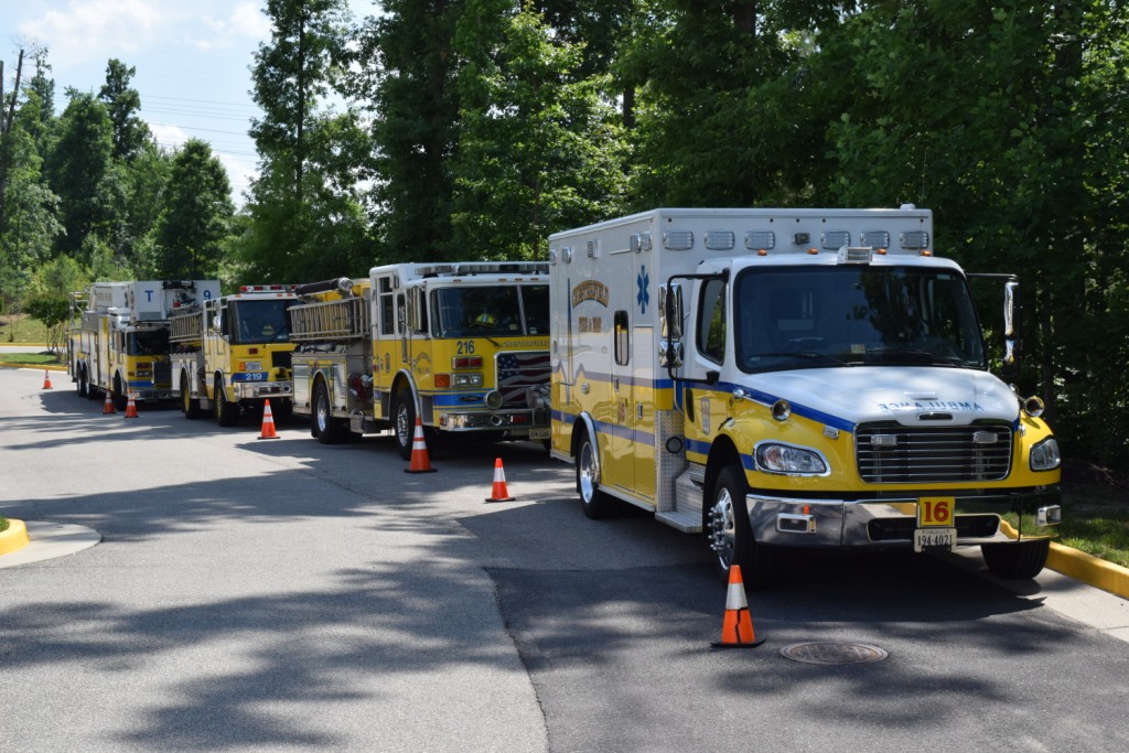
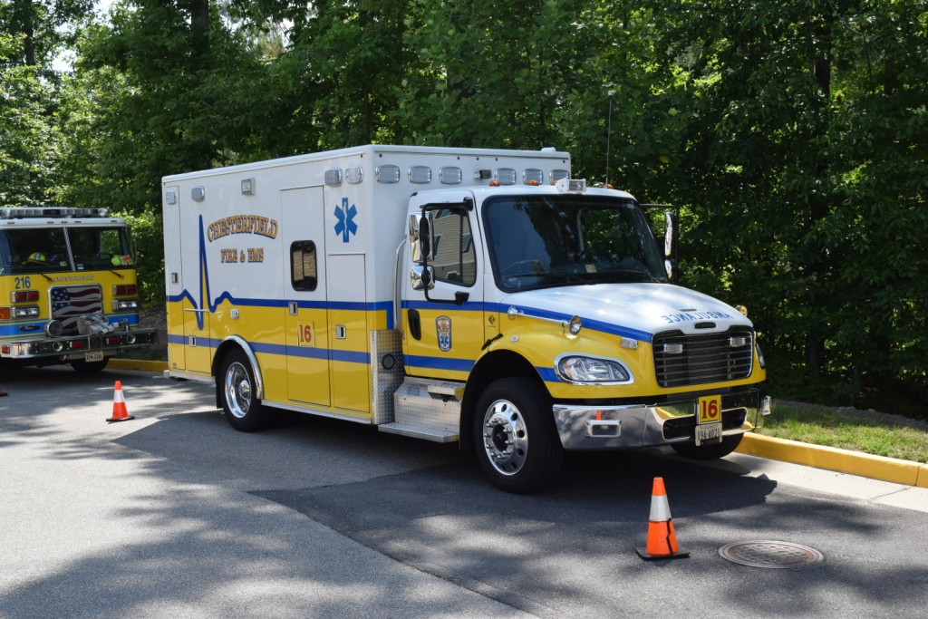
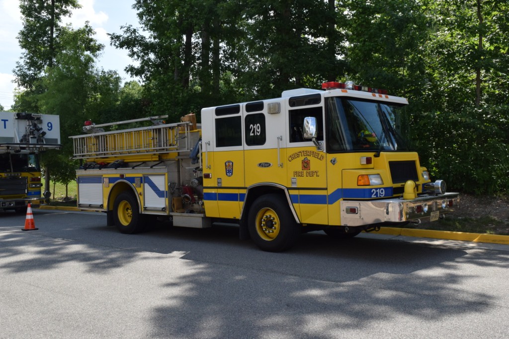
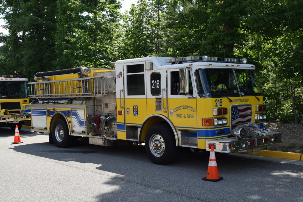
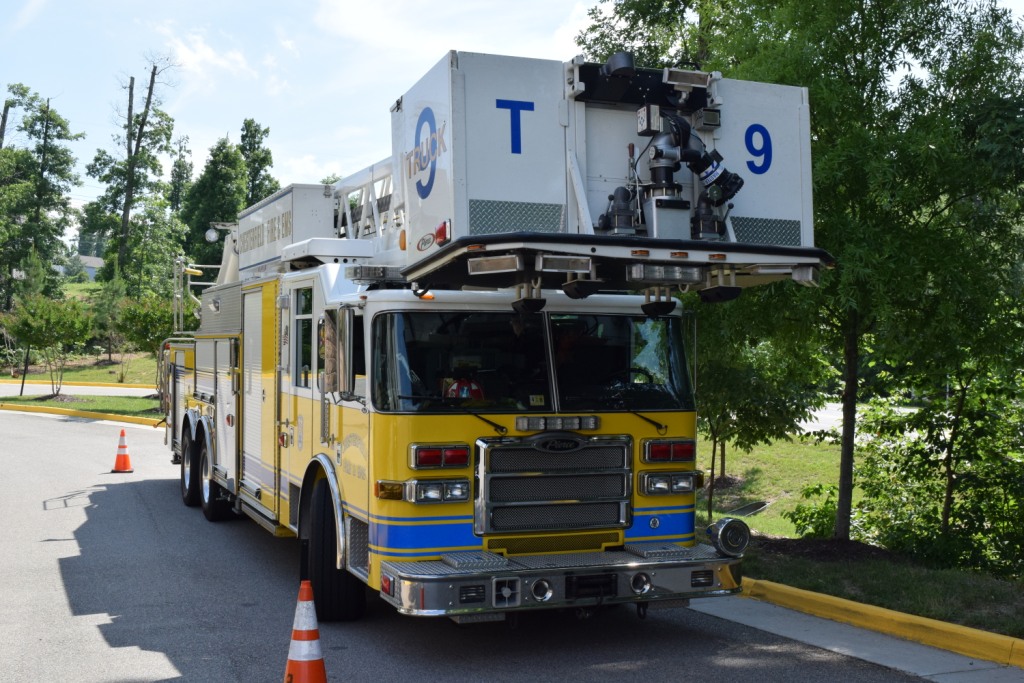
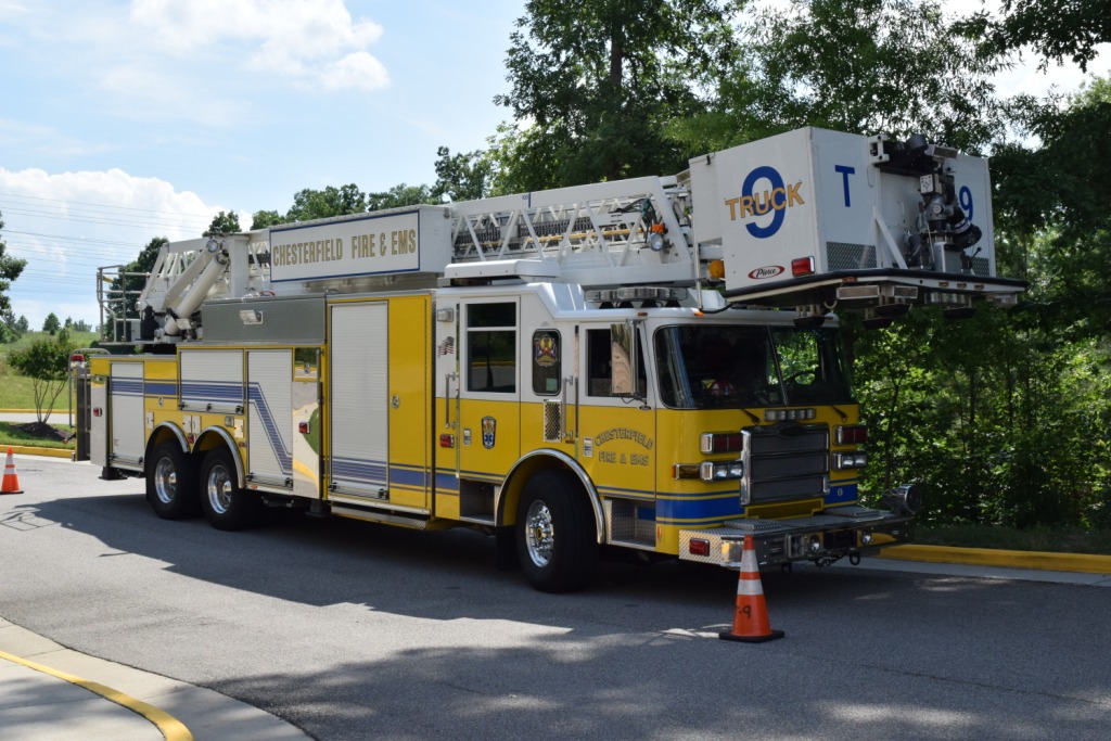
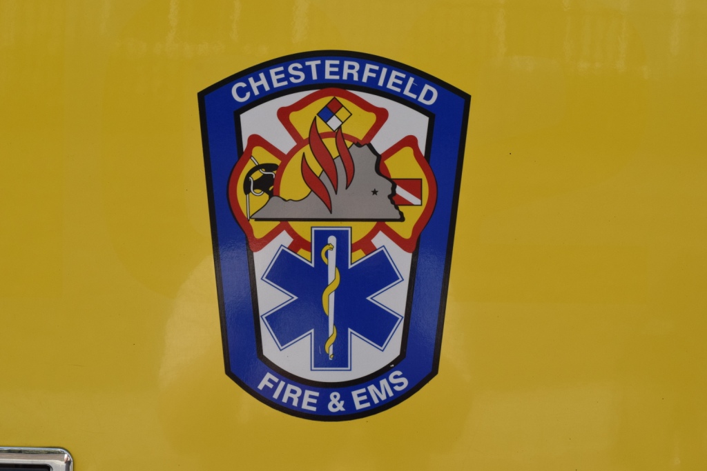
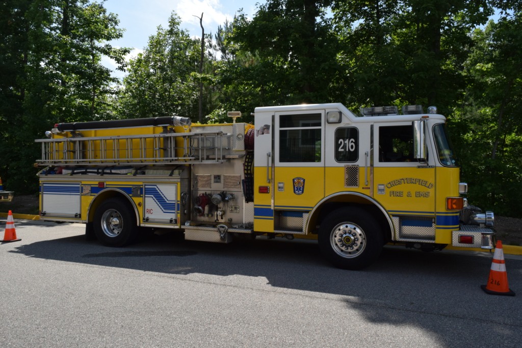
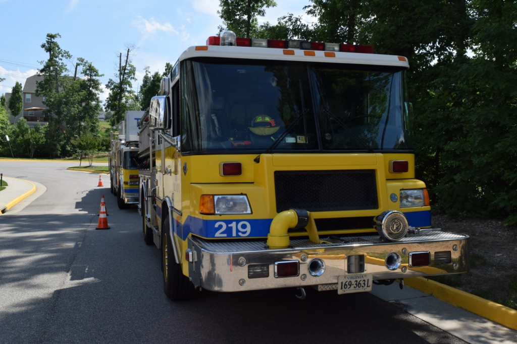
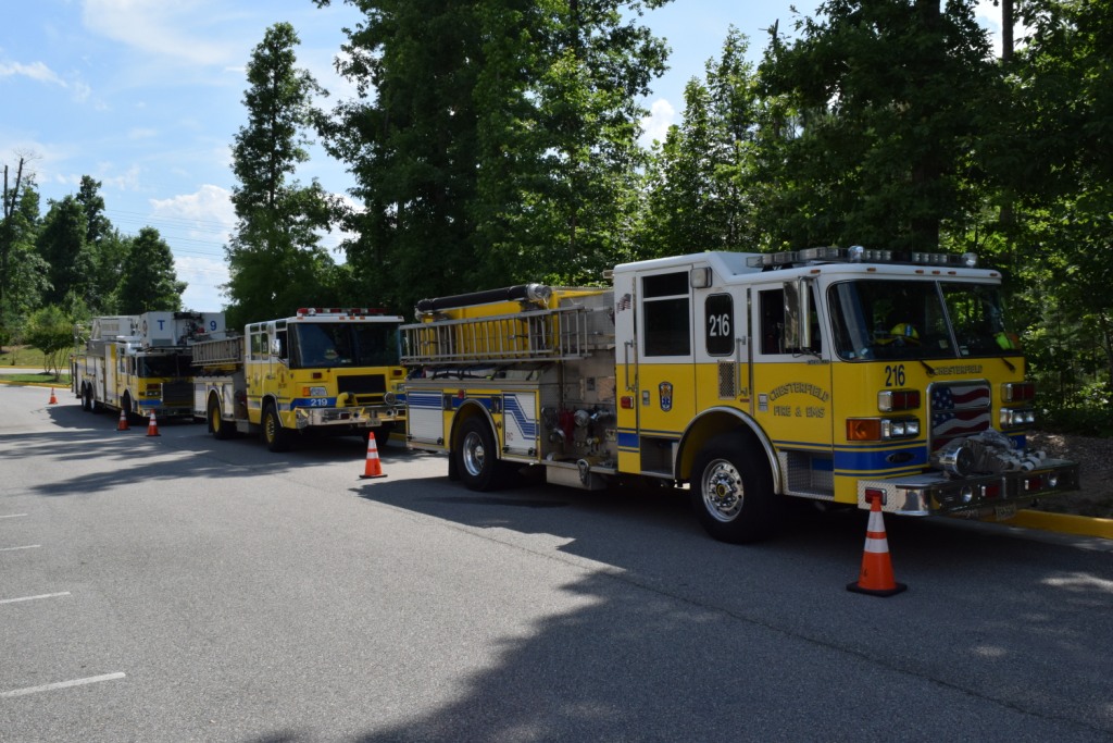
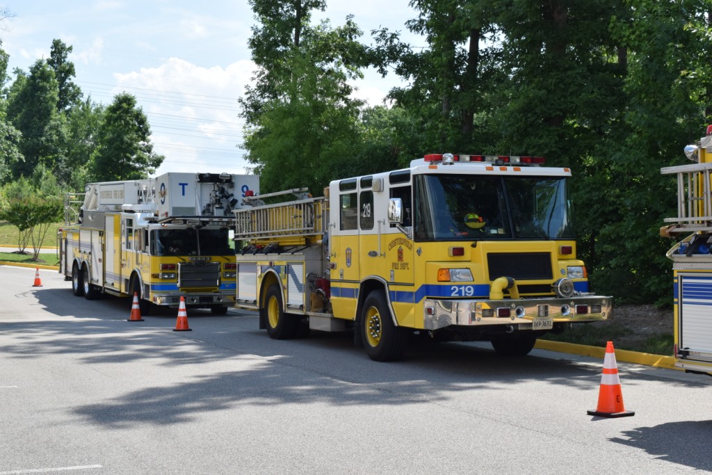
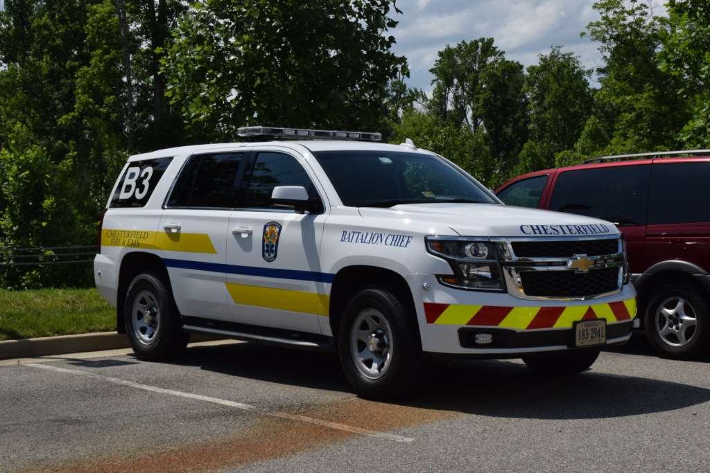
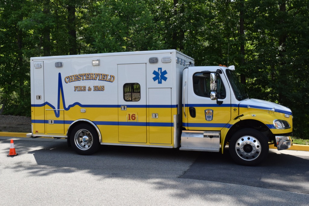
I caught these guys at a retirement home along Charter Colony Parkway, not sure why they were all here......
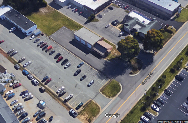
Forest View Volunteer Rescue Squad Station #2
GPS Coordinates: 37.522213, -77.611707
916 Grove Rd, Midlothian, VA 23113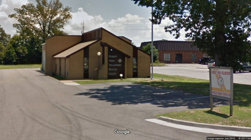
https://www.stoppingpoints.com/va/Chesterfield/
Disclaimers:
I love trains, and I love signals. I am not an
expert. My webpages reflect what I find on the topic of the page.
This is something I have fun with while trying to help others.
Please Note:
Since the main focus of my two websites is railroad signals, the railfan guides
are oriented towards the signal fan being able to locate them. For those
of you into the modeling aspect of our hobby, my
indexa page has a list of
almost everything railroad oriented I can think of to provide you with at least a few pictures to
help you detail your pike.
If this is a railfan page, every effort has been made
to make sure that the information contained on this map and in this railfan
guide is correct. Once in a while, an error may creep in :-)
My philosophy: Pictures and maps are worth a
thousand words, especially for railfanning. Text descriptions only
get you so far, especially if you get lost or disoriented. Take
along good maps.... a GPS is OK to get somewhere, but maps are still
better if you get lost! I belong to AAA, which allows you to get
local maps for free when you visit the local branches. ADC puts
out a nice series of county maps for the Washington DC area, but their
state maps do not have the railroads on them. If you can find em,
I like the National Geographic map book of the U.S..... good, clear, and
concise graphics, and they do a really good job of showing you where
tourist type attractions are, although they too lack the railroads.
Other notes about specific areas will show up on that page if known.
By the way, floobydust is
a term I picked up 30-40 years ago from a National Semiconductor data
book, and means miscellaneous and/or other stuff.
Aerial shots were taken from either Google or Bing Maps as noted.
Screen captures are made with Snagit, a Techsmith product... a great
tool if you have never used it!
Pictures and additional information is always needed if anyone feels
inclined to take 'em, send 'em, and share 'em, or if you have
something to add or correct.... credit is always given! BE NICE!!! Contact info
is here
Beware: If used as a source, ANYTHING from Wikipedia must be treated as
being possibly being inaccurate, wrong, or not true.
RAILFAN GUIDES HOME
RAILROAD SIGNALS HOME
Last Modified
18-Apr-2019