In General
Getting Here
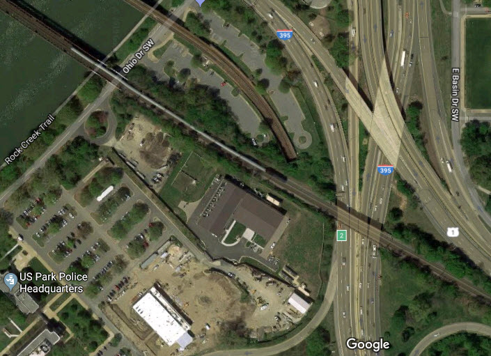
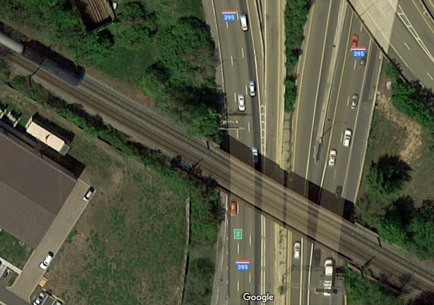
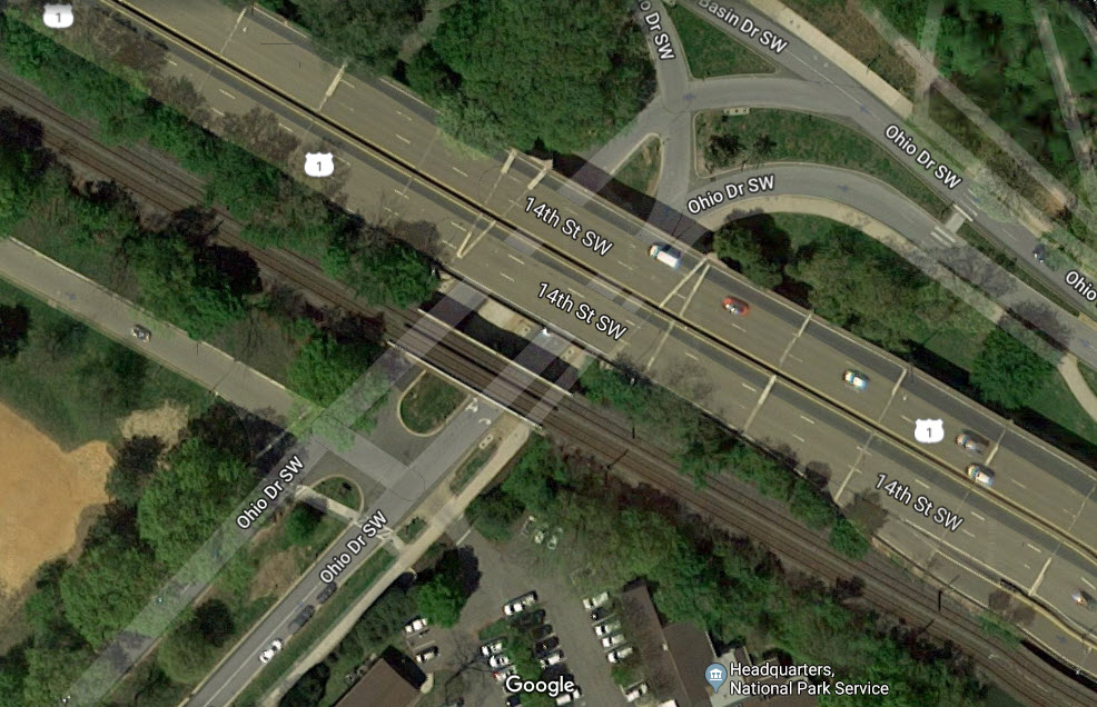
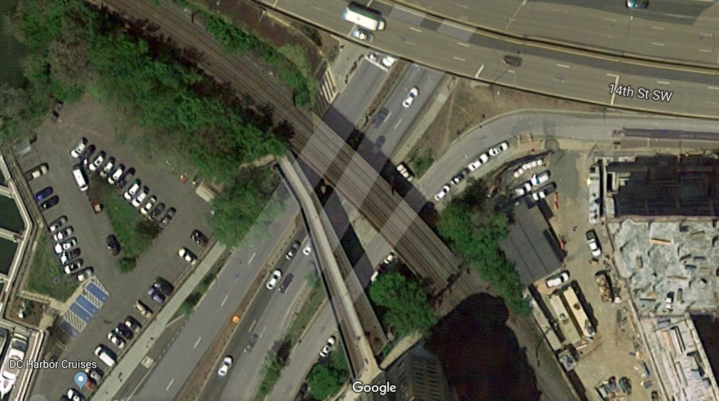
Maps
Pictures
Bridges
Signals
The "New" Long Bridge
Floobydust
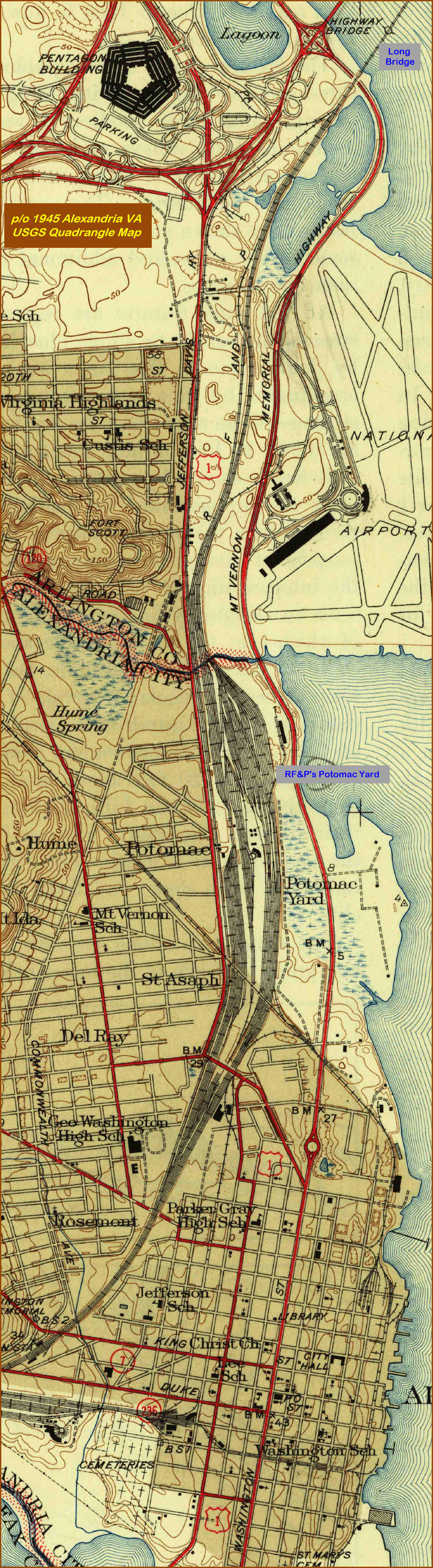
USGS Maps
RAILROAD SIGNALS HOME
Location / Name:
Arlington VA, Arlington County
Washington DC
What's Here:
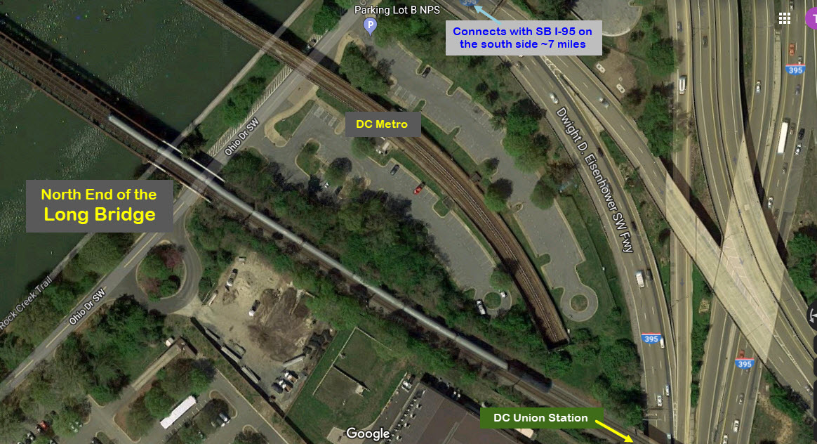
The Long Bridge
Data:
GPS Coordinates:
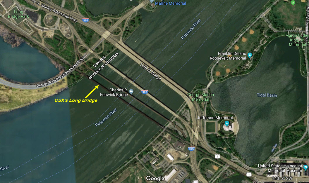
38.877175, -77.036449 north end
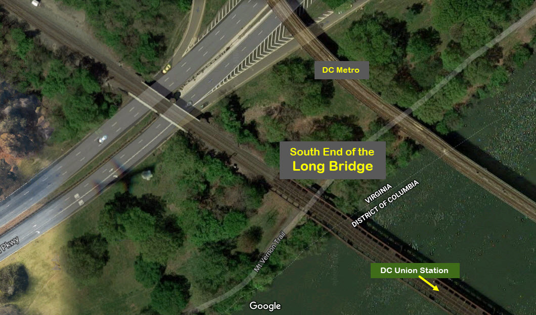
38.871475, -77.041322 south end
Phone A/C: 202 in VA, 202 in DC
ZIP: 22202 in VA, 20024 in DC
Access by train/transit:
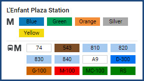
North End -- L'Enfant station -- VRE / Amtrak (a lengthy 2.4km/1.5 mi walk)
North End -- DC Metro L'Enfant Plaza station (same distance walk)
South End -- DC Metro Crystal City station (about a 1.2 mile walk, or 1.93km to the end of the bridge; or 7/8 mile (1.4km) to the park viewing area)
South End -- Crystal City VRE station (about 1500 feet closer than the Metro station)

The Scoop:
The Long Bridge is the east coast's version of I-95 for trains. The bridge provides an important link between the northern and mid-Atlantic states, and the south.
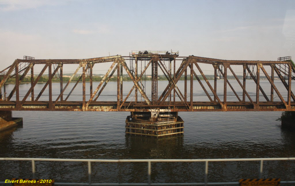
It is a double-track bridge going between Washington DC and Arlington VA in NOVA. If we can believe the measurement capability of Google Maps, I measure the bridge at 2,533 feet long (772m). Wikipedia does not list it's length, nor does Bridgehunter. It has 11 truss spans - ten are from another bridge and one was a new span when the bridge was built. The crossing also contains a swing bridge to allow for boat traffic on the Potomac River, but it has not been opened since the 60's.
The bridge now handles traffic from CSX, Amtrak, and the VRE. The Virginia Rail Express is the regional commuter rail line that operates between Washington DC, and Fredericksburg VA and Manassas VA. According to Wikipedia, Norfolk Southern has trackage rights over the bridge, but does not currently exercise them.
One of the more interesting tidbits of info about the current 115 year old bridge (in 2019), is that the bridge uses ten recycled truss spans from an old Delaware River bridge in Trenton NJ, along with one new truss span and a swing bridge. The new double-tracked Long Bridge, which opened on August 25, 1904, replaced a single track bridge built in 1884 .
From Bridgehunter dot com: Built 1902-04 with truss spans adapted for reuse from previous bridge (possibly at Trenton, NJ), except for new swing span. Rebuilt substantially 1942-43 with additional piers added and two steel plate girder spans replacing each iron truss span, except for the swing span. Built 1904; majorly rebuilt 1942-43 with girder spans replacing truss spans except for swing span. Non-functioning swing span in navigation channel of the river. Swing span last opened on November 7, 1967 and March 3, 1969.
If you want to consider it "lucky", Virginia is lucky in the sense that they have not one, but TWO Long Bridges. The other Long Bridge is located in central Virginia near Farmville, and thanks to my daughter Tina, I have a page for the bridge here.
History: The 1800's Bridges
The first "Long" bridge to carry rail traffic was an earlier bridge meant only to carry horse traffic. After a military train caused a span to fail on February 18, 1865, the Army took possession of a newer bridge only a few feet south from the first that was completed on July 23, 1864, and moved the rails onto it.


Acknowledgements:
Denver Todd
Elvert Barnes
Greater Greater Washington
Websites and other additional information sources of interest for the area:
https://en.wikipedia.org/wiki/Long_Bridge_(Potomac_River)
http://landmarkhunter.com/quad/507 PDF's of the Alexandria Quadrangle map from 1945 on up
https://bridgehunter.com/dc/washington/bh48195/
https://www.loc.gov/pictures/item/2004677105/
Oooooooh, there are so many options!
By car:
Xxxx
By transit and walking:
If you want to take transit and walk to the bridge, be prepared to walk. All walks are over a mile. Please only attempt if you are in good physical condition!
The First 1800's Bridge
The first "Long" bridge to carry rail traffic was an earlier bridge meant only to carry horse traffic. After a military train caused a span to fail on February 18, 1865, the Army took possession of a newer bridge only a few feet south from the first that was completed on July 23, 1864, and moved the rails onto it.
The center span from 1904.....
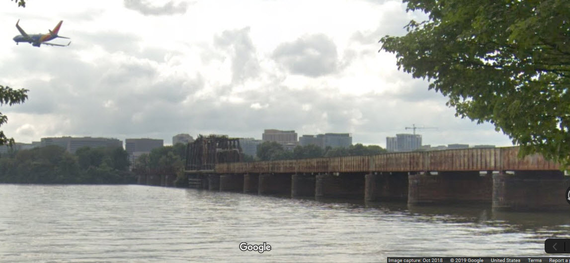
From Ohio Drive SW, in DC, with a SouthWest jet landing at National Airport.
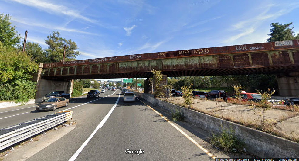
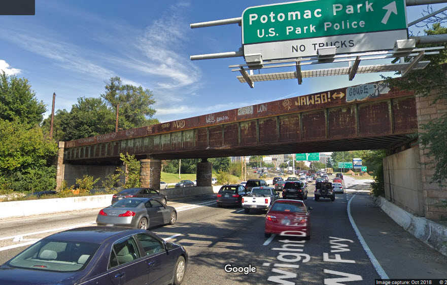
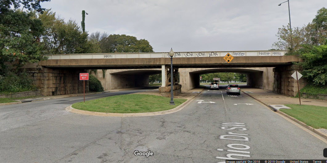
There are a number of other short bridges going over the roads on the approach to each end of the Long Bridge.
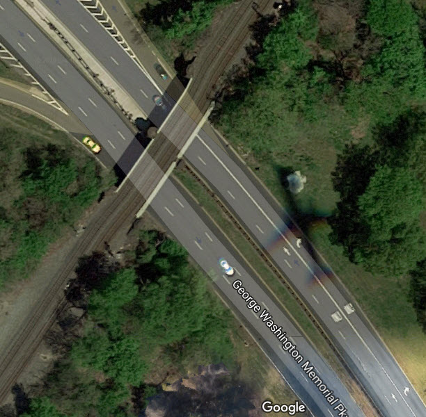
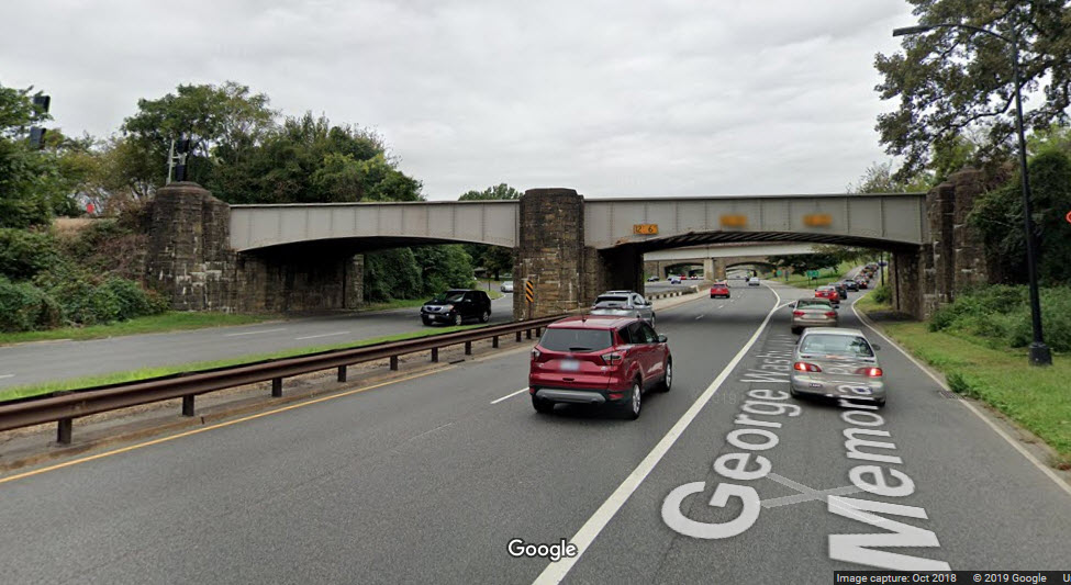
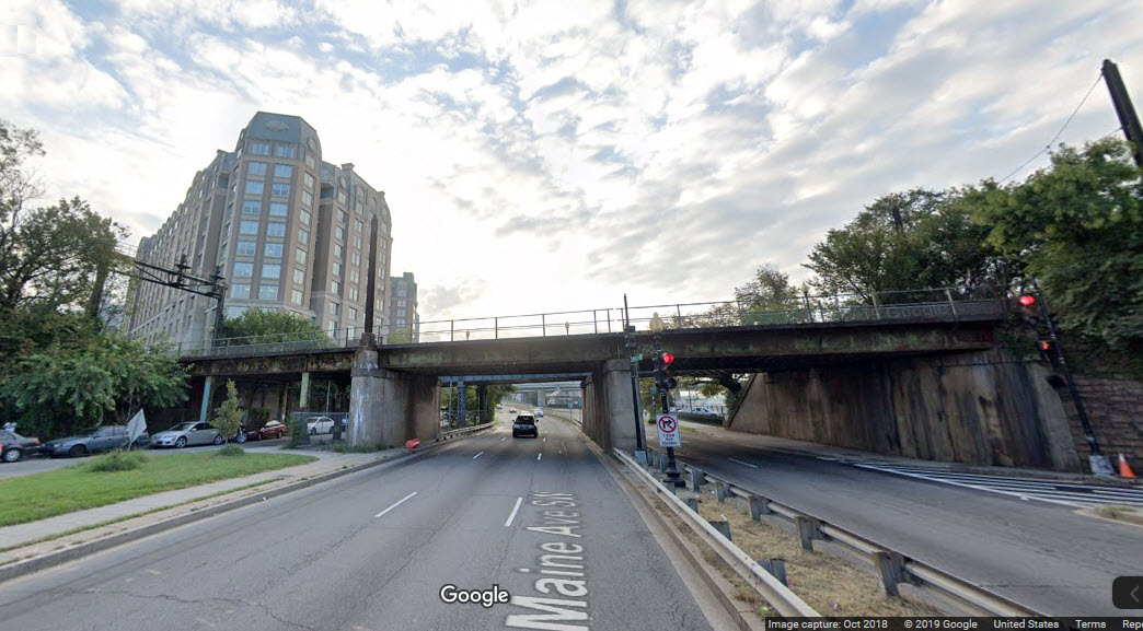
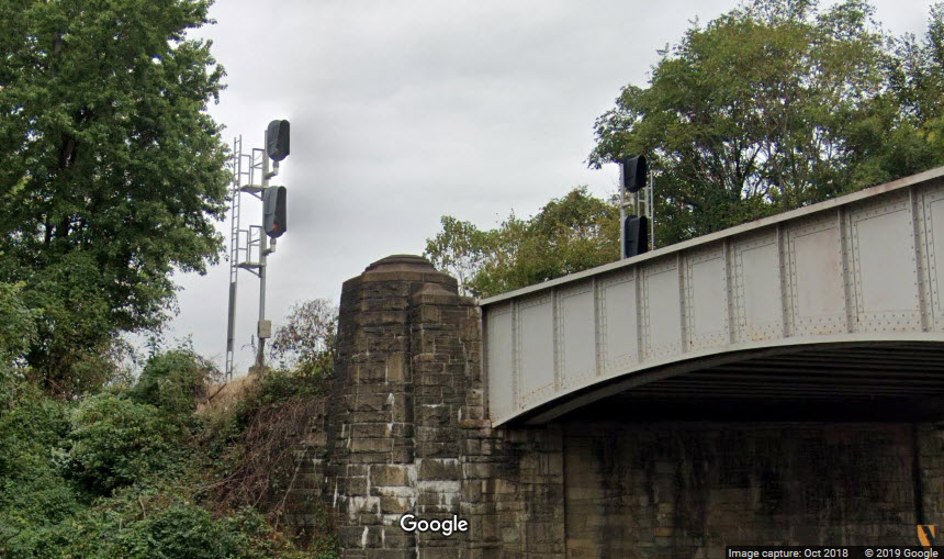
These two sets of signals are for SB trains coming off the bridge into Virginia, as seen from the George Washington Memorial Parkway.
The
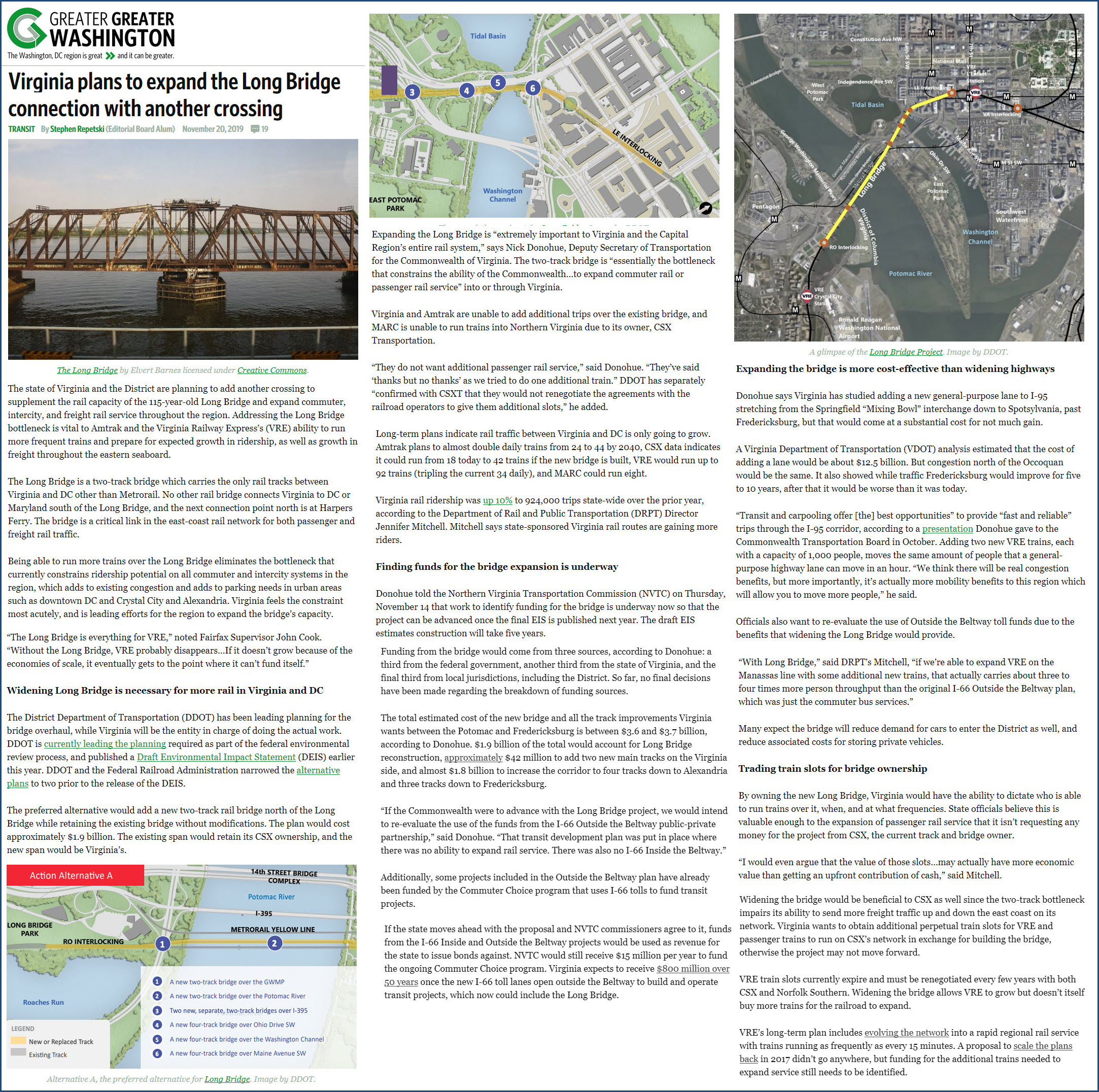
Plans are underway to add a parallel bridge in order to be able to increase train frequency for Amtrak and VRE, since CSX doesn't seem to be especially cooperative in making additional time slots available on the Long Bridge and the DOJ has not been particularly efficient at enforcing the 1973 law saying that freight railroads are supposed to give preference to Amtrak trains :-( Note: In 2022, myself and a friend of mine took Amtrak to Savannah GA for a quick visit. The returning train back to NYC, which originates in Savannah, departed 30 minutes late because we were waiting for a freight to clear the tracks the Amtrak siding is off of. During the trips, we were also "put in the hole" twice for a total of about 45 minutes waiting again, for freights to clear the old RF&P mainline north of Richmond VA.
https://ggwash.org/view/74789/virginia-plans-to-expand-long-bridge-crossing
The

none for now
Courtesy USGS, click here for their index page.
Disclaimers:
New format 10/26/23: Please check out my disclaimer page for my standard dribble and contact info here
RAILFAN GUIDES HOME
RAILROAD SIGNALS HOME
NEW 11/22/2018, OCT19/2024
Last Modified 19-Oct-2024