In General
Getting Here
Map
Sights
Pictures
Signals
Bridges
Fire & Police
Amtrak
Floobydust
USGS Maps
RAILROAD SIGNALS HOME
Location / Name:
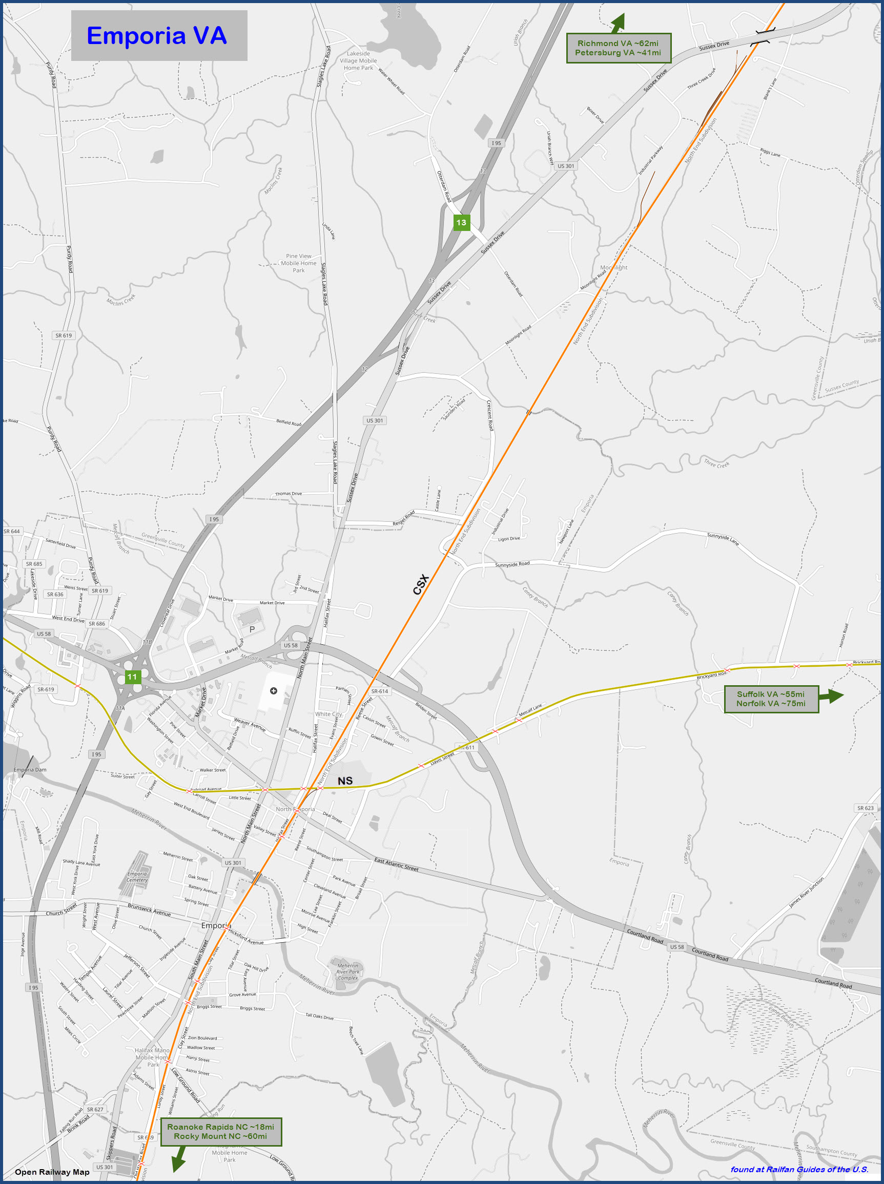
Emporia VA, Greenville County
What's Here:
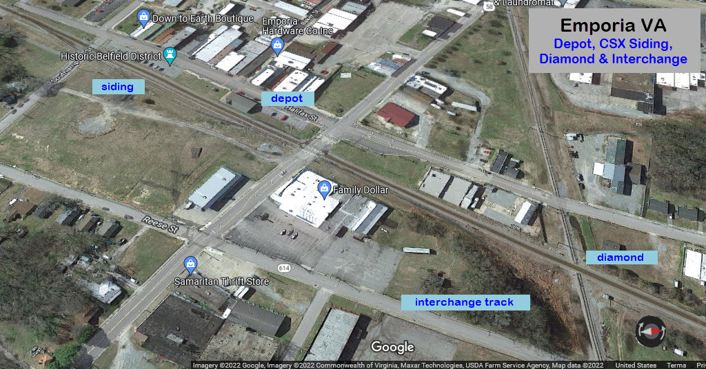
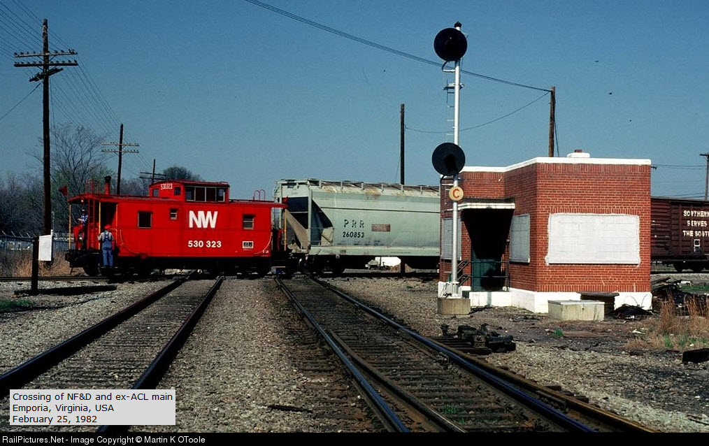
Former Diamond between the Norfolk Southern and CSX
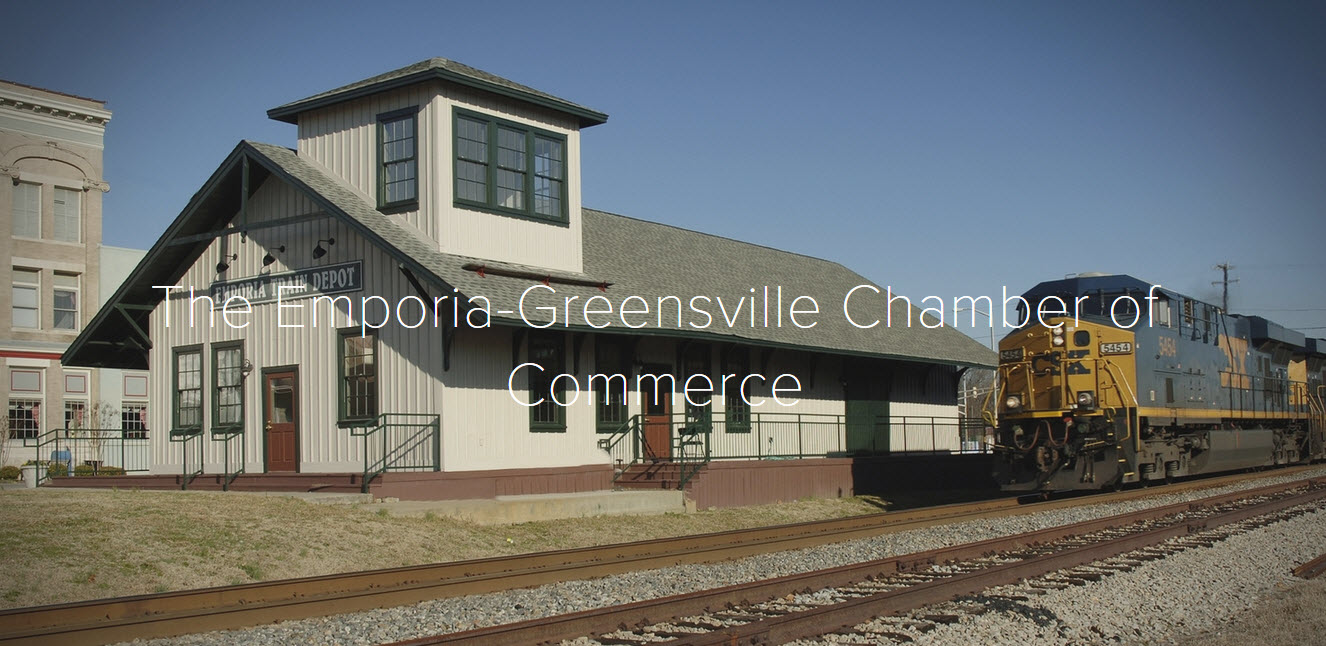
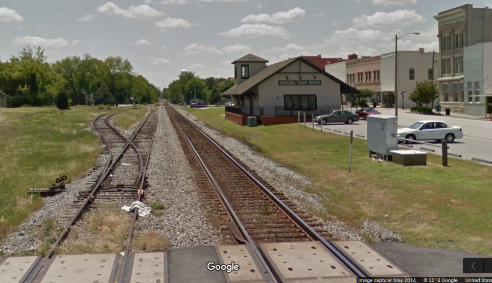
Former Atlantic Coast Line Depot
Data:
GPS Coordinates: 36.695148, -77.534553 (at the diamond)
Phone A/C: 434
ZIP: 23847
Access by train/transit:
None
The Scoop:
Emporia is a sleepy little town, about 11 miles north of the Virginia-North Carolina border, that time has seemed to forget about. This page is as much about history as it is for what remains today.
Today, train service in Emporia is down to CSX trains only running north and south, as the diamond that used to be here with the Norfolk Southern was taken out sometime soon after 2014, thankfully, after the Google Streetview cameras had a chance to come thru.
The N/S CSX line, AKA the "A" Line, was once the Atlantic Coast Line running south out of Richmond VA.
The former E/W line, before becoming NS, was once the Atlantic & Danville RR, and then the Norfolk, Franklin & Danville.
Another missing site today is the interlocking tower that used to control the junction. Not exactly sure when it disappeared, but the Carrtracks website has it going away around 1958.
CSX has its Tropicana train coming thru, but I'm not sure if the "trash train" comes this far south.
Amtrak Silver Service, Palmetto, and Carolinian trains pass through Emporia, but do not stop here.
The closest Amtrak station to Emporia is Petersburg (Ettrick) VA, about 20 miles north; second closest is Rocky Mount NC.
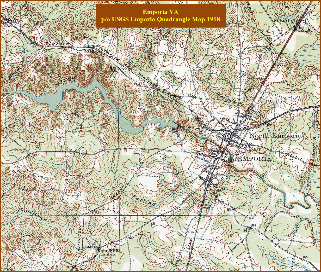
If we look at the USGS map below from 1918, the diamond was actually in North Emporia!
Plenty of food, gas, and hotels are located near the interstate exit on US 58.
Acknowledgements:
Jeff Hawkins
Martin K OToole
Rush W
R. W. Dawson
Lee Wilson
Jerseyboy70
Denver Todd
Websites and other additional information sources of interest for the area:
http://www.emporiagreensvillechamber.com/ Not really a whole lot here of interest for the railfan, except for the cover photo
http://www.railsinvirginia.com/abandoned/acl/signals.html
https://www.railfanmotels.com/vaemporia.htm Hotels in Emporia with a view of the railroad
http://www.carrtracks.com/virginia.htm - I'm sorry to report that as of 23JAN2021, the website has been taken down, darn
I-95 makes it convenient to get here. Take exit 11 and go east on US58 to Market Drive, and take a right. Market is the first traffic light on 58 off 95.
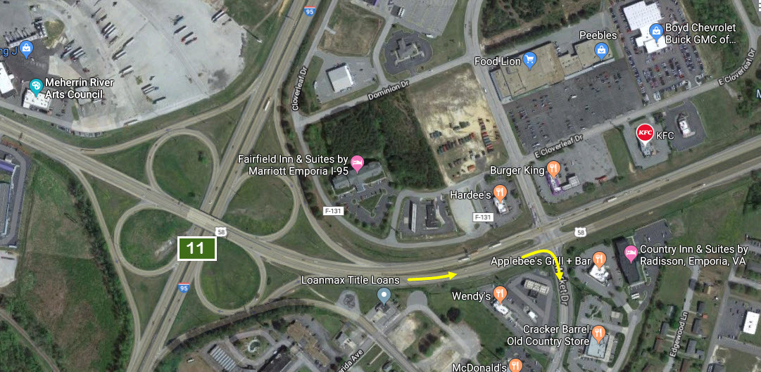
Market Drive turns into West Atlantic Street. Keep going thru the intersection with Main St and the railroad crossing.
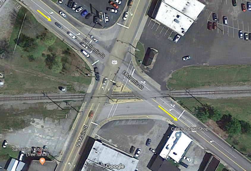
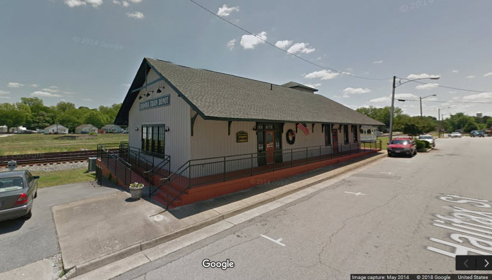
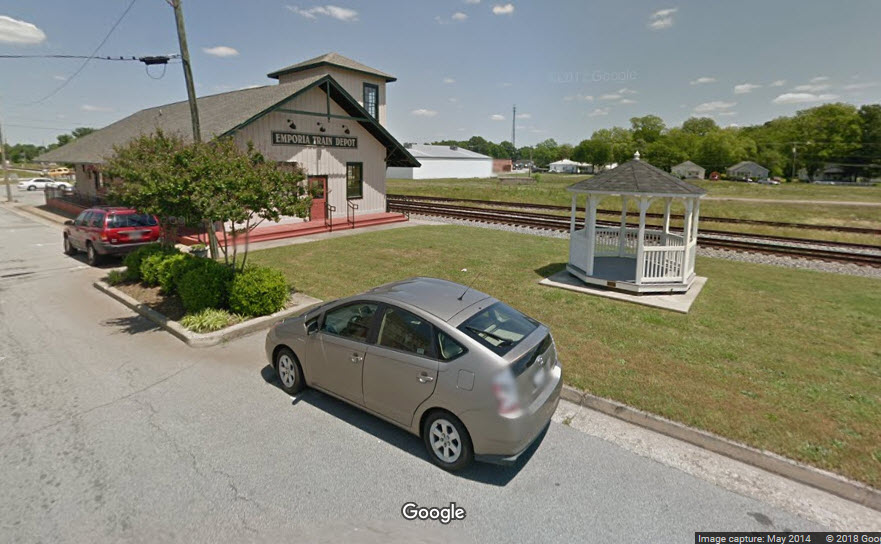
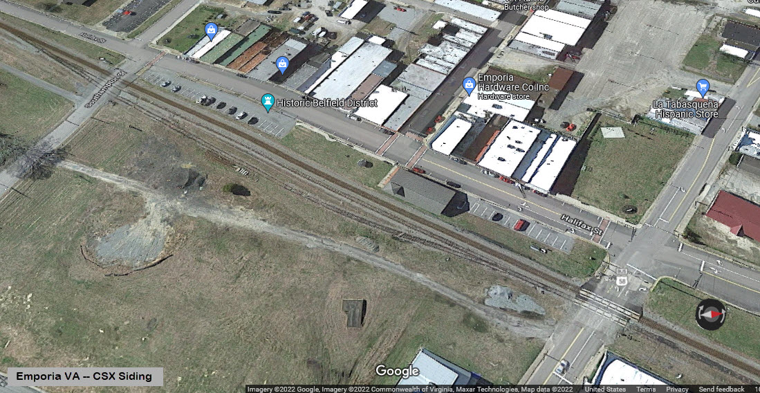
The next cross street you come to is Halifax Street. The depot is to your right, the diamond is to your left.
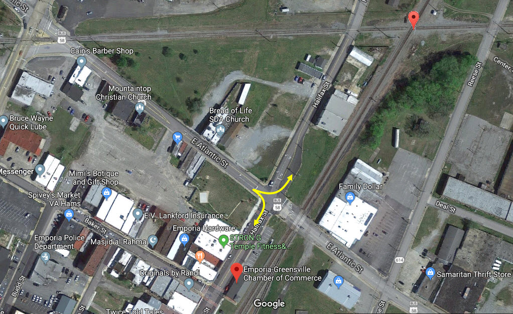
GPS Coordinates: 36.693108, -77.536254
400 Halifax St, Emporia, VA 23847
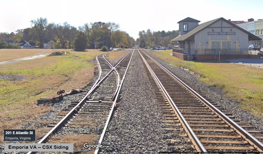
The depot is now home to the Emporia-Greensville Chamber of Commerce.
If you refer to a 1964 ACL schedule, it should be noted that only the secondary trains, Havana Special and the Palmetto, stopped here.
GPS Coordinates: 36.695148, -77.534553
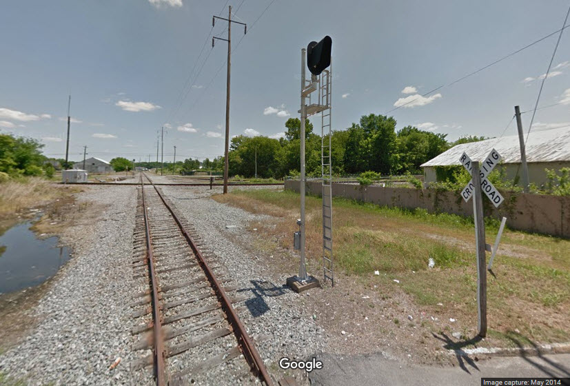
The approximate date the diamond was taken out of service is maybe around late 2014, or 2015. In this view, you can see the foundation for the tower.
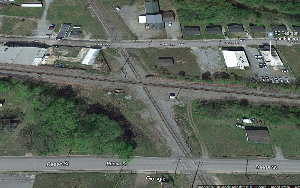
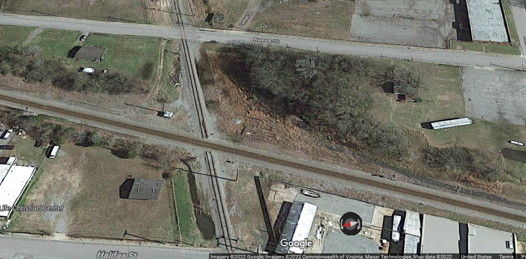
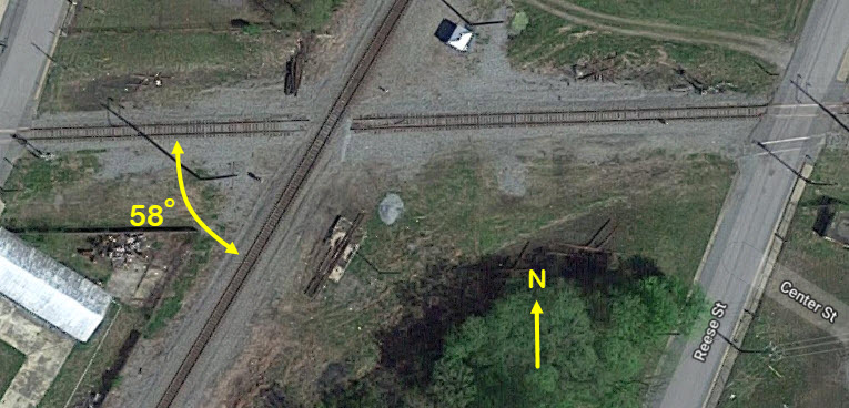
GPS Coordinates: 36.694973, -77.534533
According to the Carrtracks webpage, the tower was replaced by an automatic interlocker in 1958. I'm looking for additional pictures of the tower. Also looking for any other info on the tower, like it's name, etc.
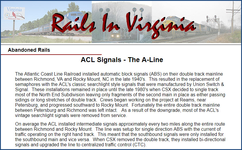
Looking north from Atlantic Avenue. Photo comes from Jeff Hawkins page on the ACL signals. This is at ACL milepost 62.6.
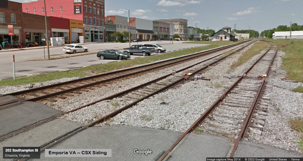
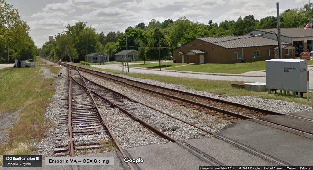
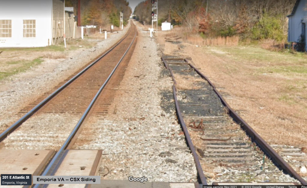
CSX has a small siding in town, left over from what used to be the interchange track between the NS and CSX lines. It's a stub siding.
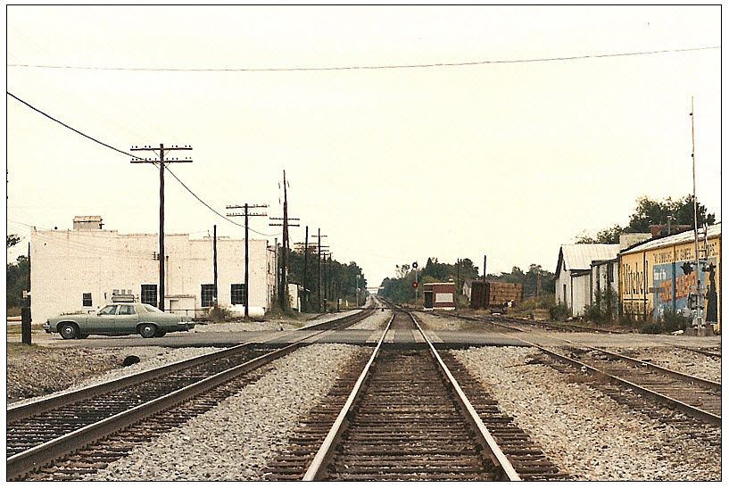
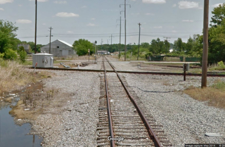
These two views are from the Southhampton St grade crossing.
These two views are from the Atlantic St grade crossing.
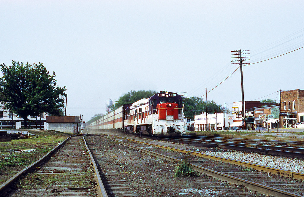 picture by ex127so (flicker)
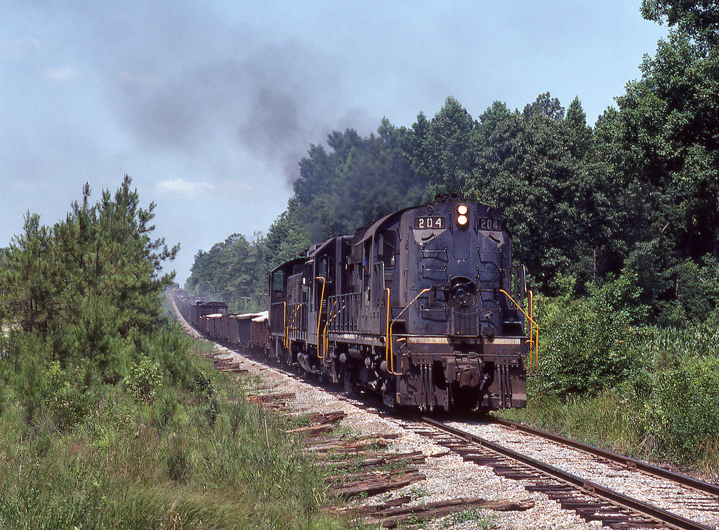 picture by ex127so (flicker)
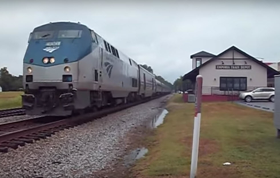
Amtrak Carolinian heading north, Train #80, August 7th, 2015, picture from video by Jerseyboy70
https://www.youtube.com/watch?v=p1p23kMVIwU
Jeff Hawkins has done an amazing job at documenting the "lost" signals of Virginia. The page referenced below covers the "A" line signals, of which, Emporia was part of. Please make sure you visit his page.
http://www.railsinvirginia.com/abandoned/acl/signals.html
Since the diamond has been removed, it is doubtful that these signals are still in place.
The next time I visit my daughter in Richmond VA, I will have to make a field trip to check.
From the Carrtracks website comes this: The Atlantic Coast Line added 147 signals from Richmond to Pleasant Hill (one mile south of NC state line) on double track in 1914. Around 1958, the ACL and Atlantic & Danville replaced the mechanical interlocking at Emporia, VA with an automatic interlocker. It was estimated that the closing of the interlocking tower saved the railroad a little more than $20,000 a year.
As of 2019, I don't think this signal would still be in place, but who knows? View is from Halifax Street.
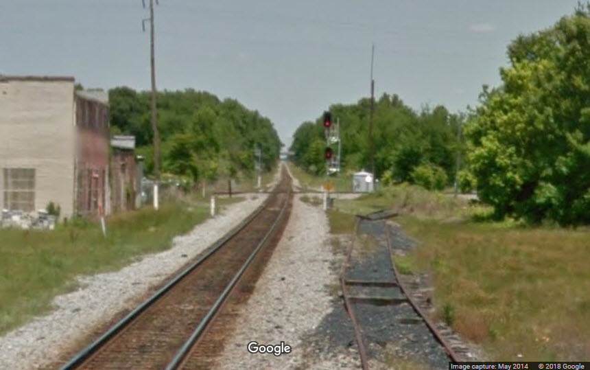
View is from Reese Street.
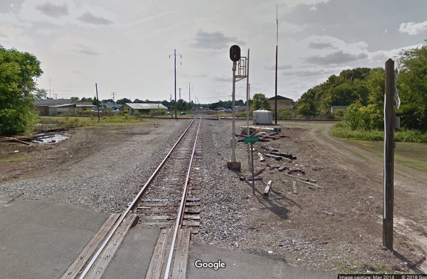
The view is from East Atlantic Street. The tower would have been adjacent to the signal, on the far side of it.
Need pictures.
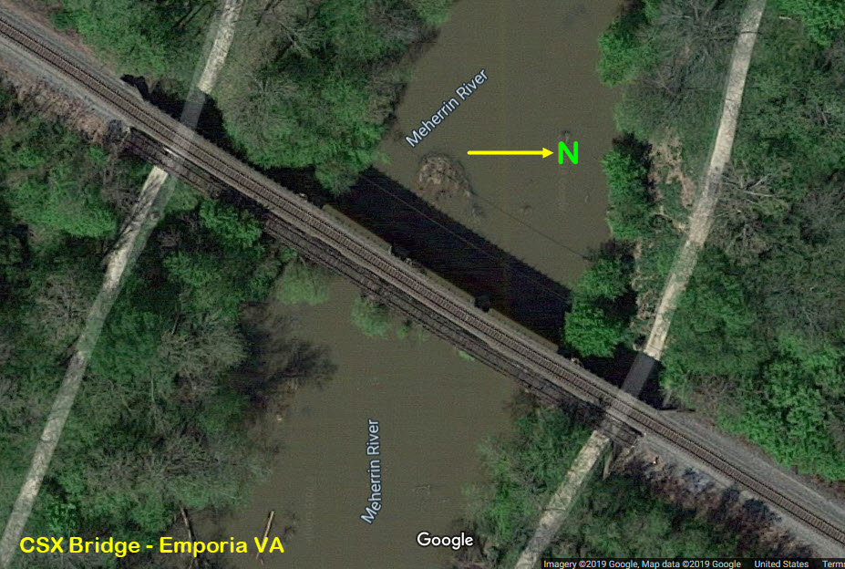
Less than a mile south of where the diamond was, is this CSX bridge over the Meherrin River. From this view, you can see the bridge had two tracks on it.
(Emporia) Greenville County Fire Department
209 Halifax St, Emporia, VA 23847
434-634-7340
http://www.greensvillecountyva.gov/index.php/discover-greensville/public-safety/emporia-volunteer-fire-department
The first three are from the Virginia Ave side, the last one is taken from Valley St.
About 9 miles north, you also have the Jarrett Volunteer Fire Company.
http://www.greensvillecountyva.gov/index.php/discover-greensville/public-safety/jarratt-volunteer-fire-department
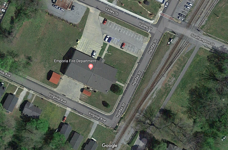
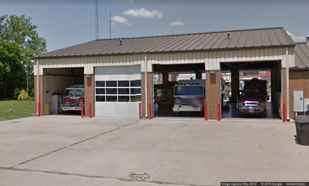
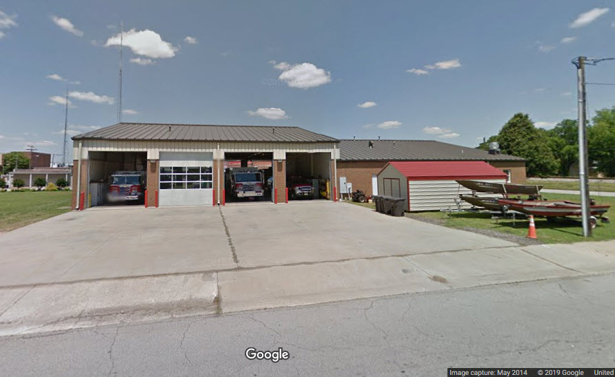
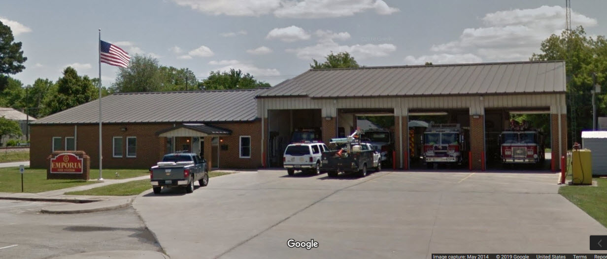
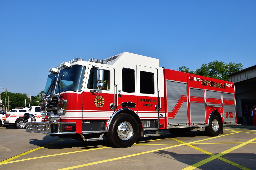 photo by Lee Wilson
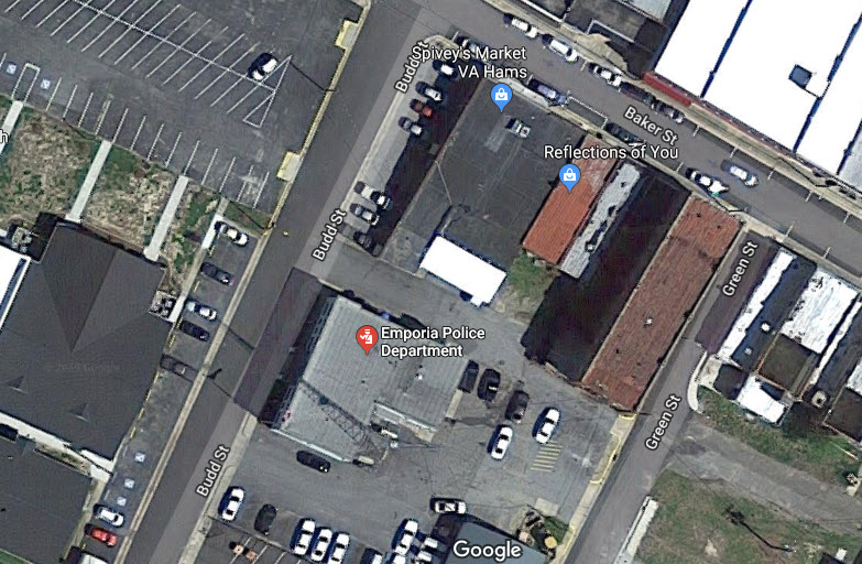
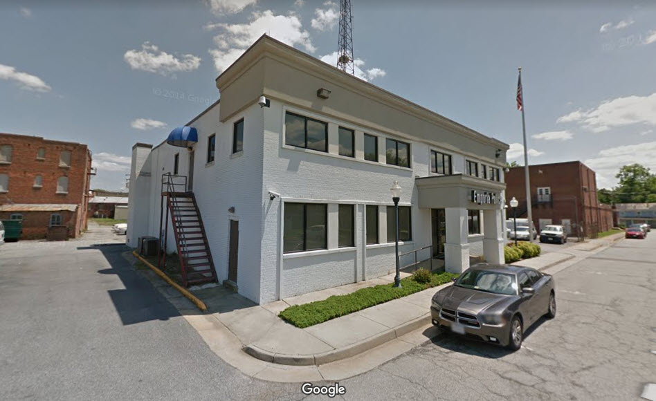
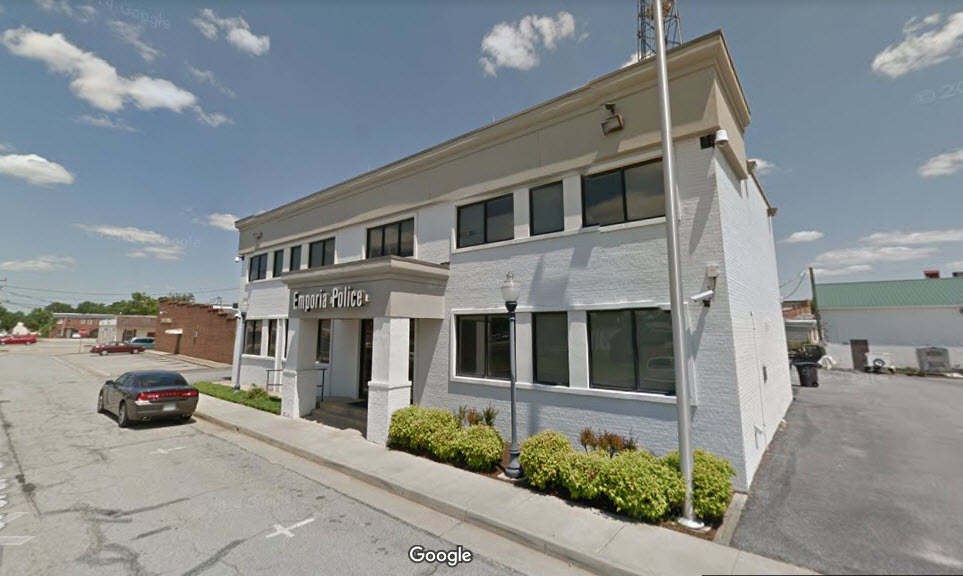
Emporia Police Department
310 Budd St, Emporia, VA 23847
(434) 634-2121
No website
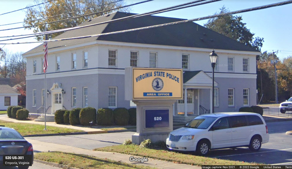
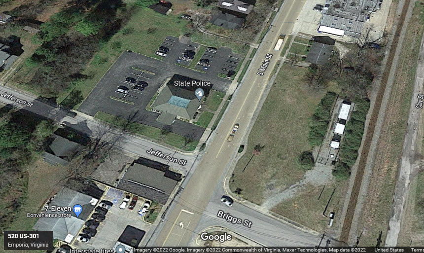
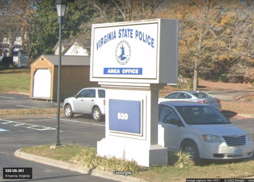
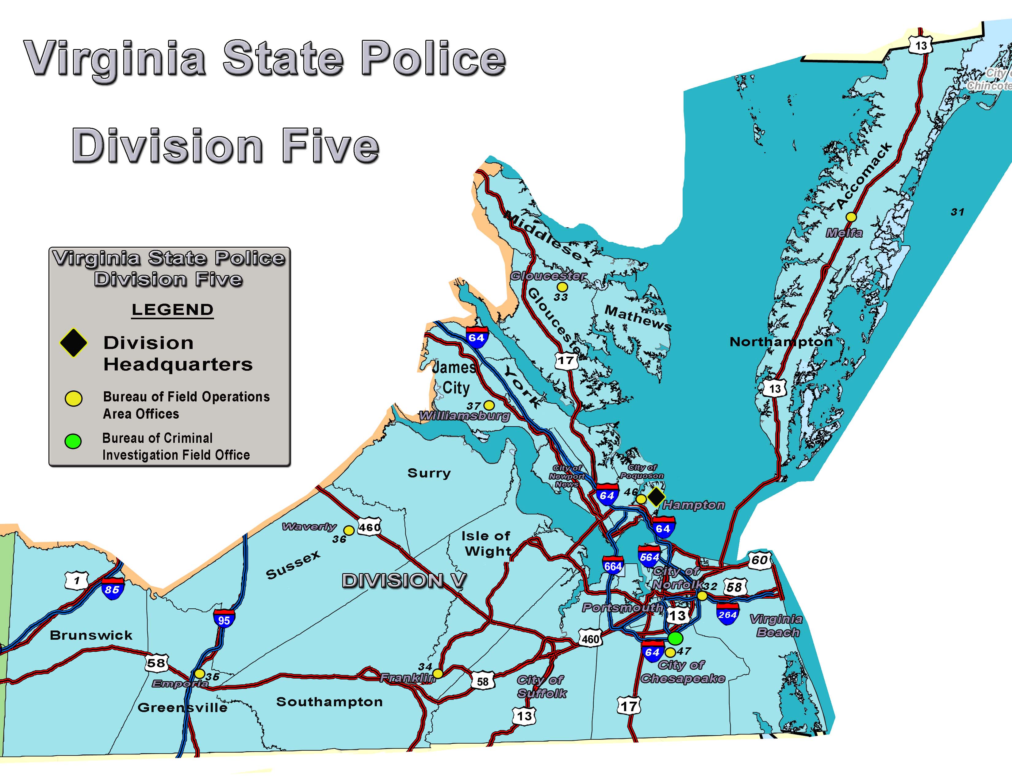
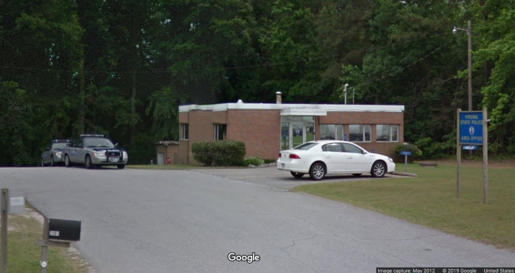
Virginia State Police
The barracks for the state police moved sometime in 2019 or 2020, and are now located south of downtown. The State Police Barracks is about a mile south of where Main St crosses the E/W Norfolk Southern line.
Thanks to Rush for giving me a heads up on their relocation!
Division 5, Office 35
520 South Main Street, Emporia, VA 23847
434-634-4454
http://www.vsp.virginia.gov/
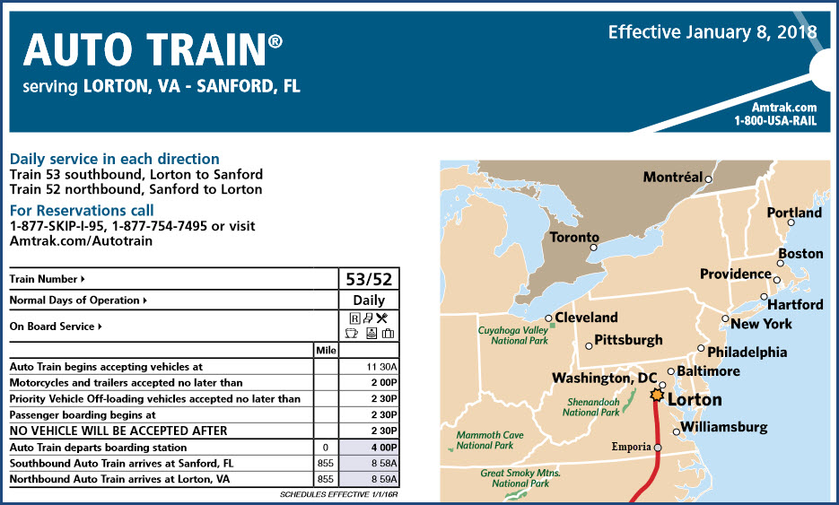
Although Emporia does not sit on an Amtrak superhighway, it does see a fair number of trains.
One of those trains is the Autotrain, the SB of which comes thru around 7PM, the NB comes thru around 6AM. I base this on 50MPH, and the fact that Emporia is ~145 miles south of Lorton.
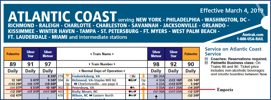
The Palmetto, Silver Star, and Silver Meteor all pass thru Emporia. Keep in mind, that Emporia is about 40 miles south of Petersburg VA, and about 55 miles north of Rocky Mount NC. This means the Silver Meteor will be in the dark in both directions when it passes thru.....
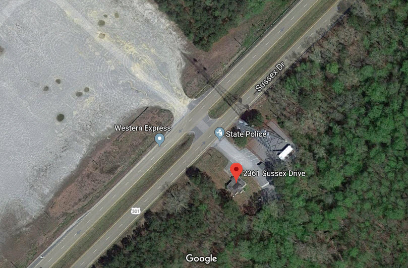
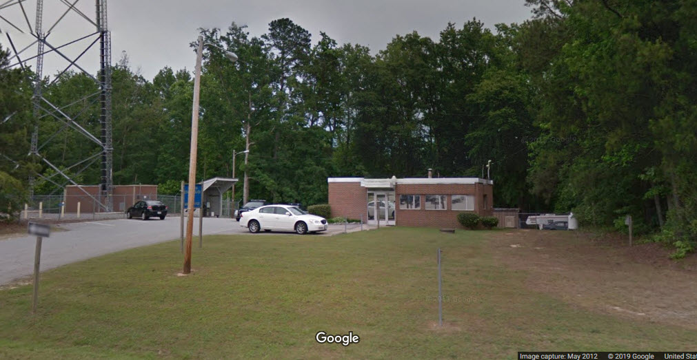
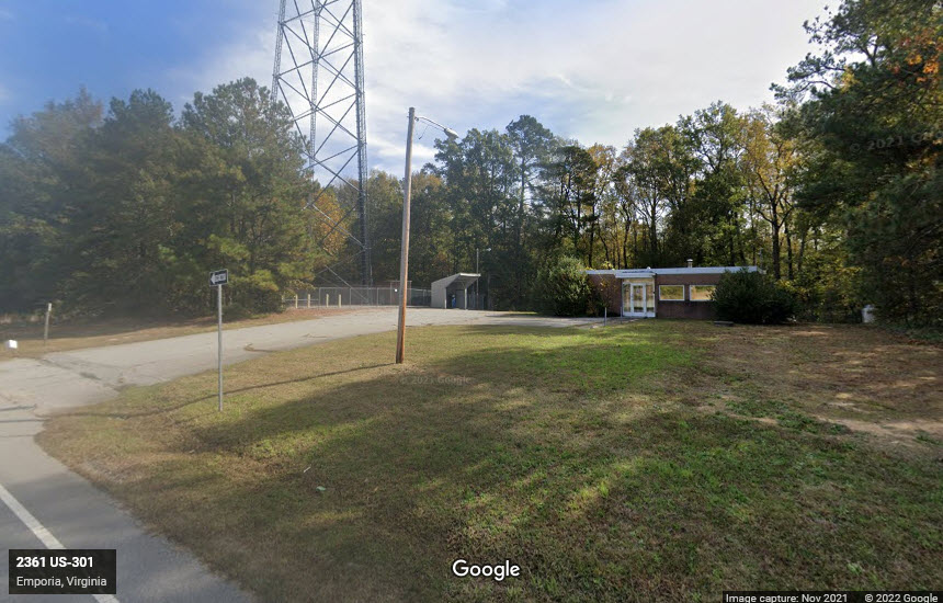
Virginia State Police
The local state police barracks used to be located north of town, and this is provided as part of your history lesson for today :-) The State Police Barracks was about a mile north of Otterdam Rd, I-95 exit 13. Looks like they still maintain their microwave tower at this location....
The address was 2361 Sussex Dr, Emporia, VA 23847
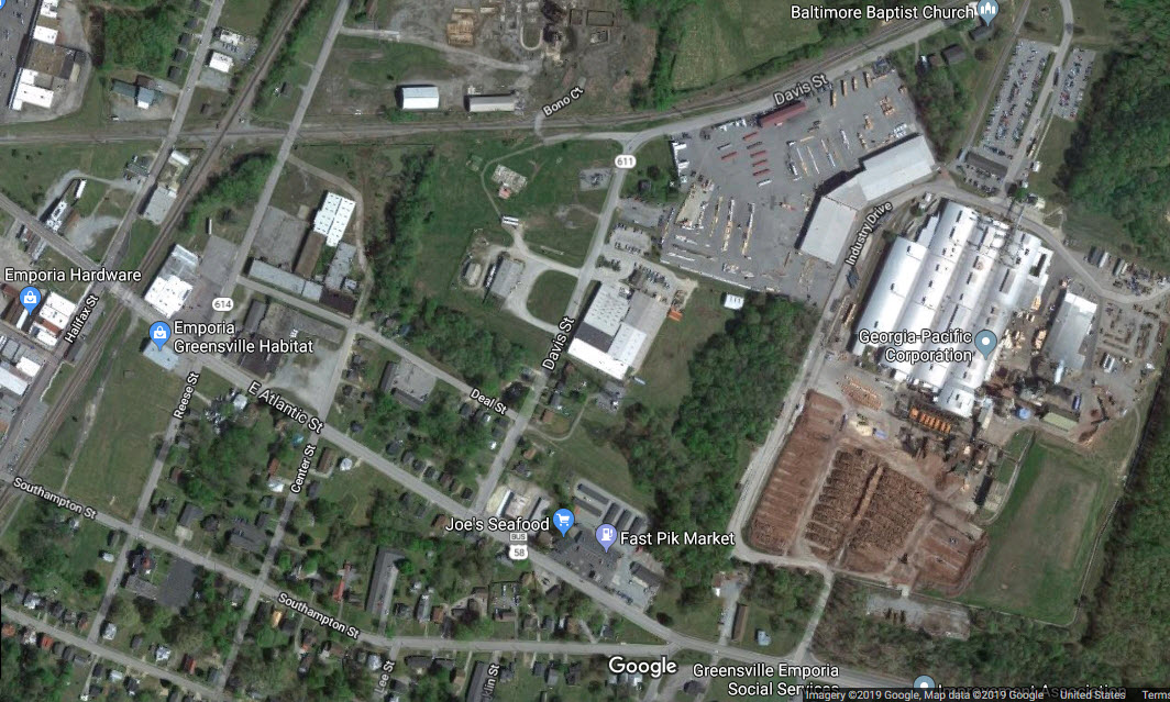
Georgia Pacific
This is a pretty big operation for Georgia Pacific -- one of the things I know they make here is plywood, for I can find their products at the Home Depots here in Baltimore! :-)
They used to have a siding coming onto the property, but is is either disconnected or paved over at Industry Drive.
Mr Dawson did a champion job of going around Emporia and documenting the "old Emporia".
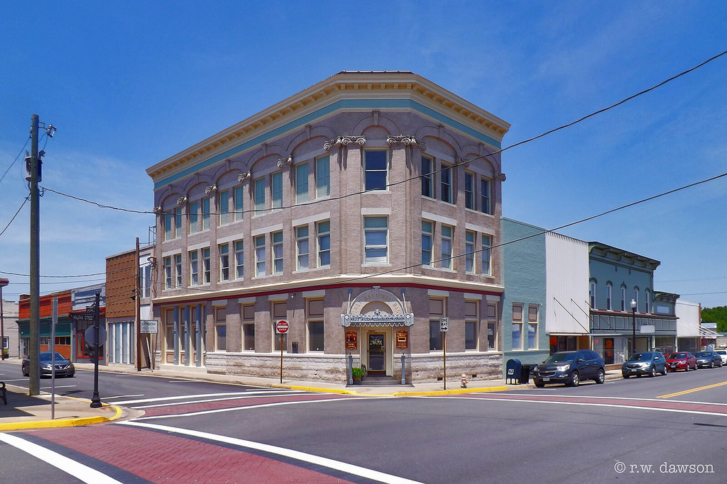 photo by R. W. Dawson
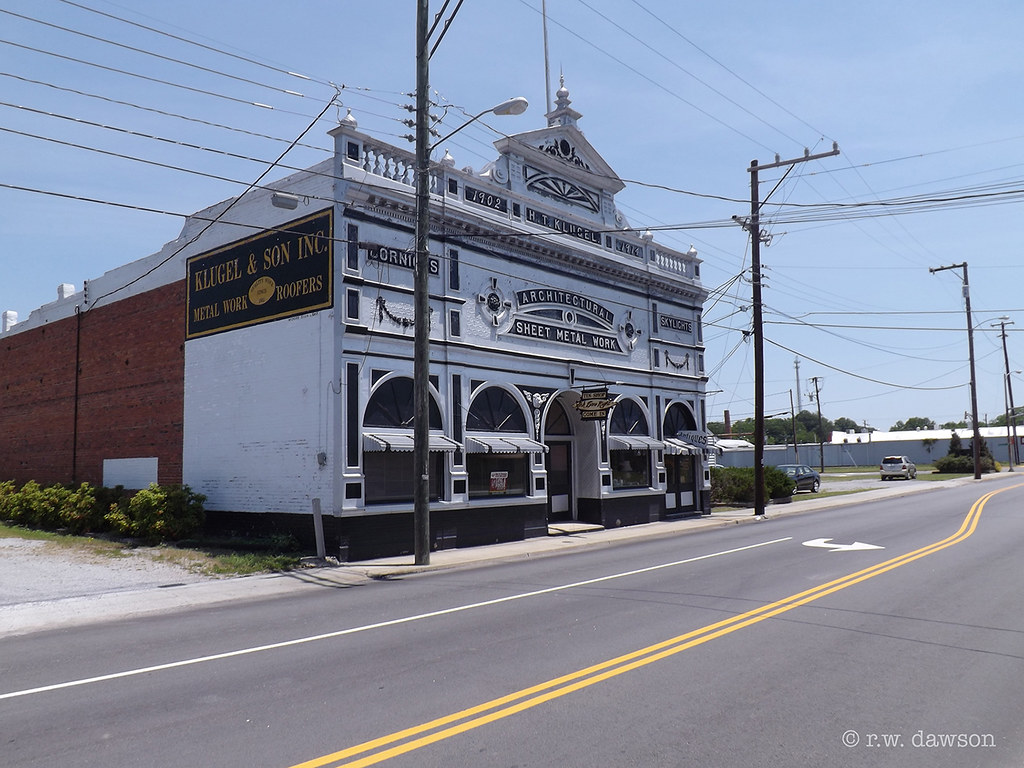 photo by R. W. Dawson
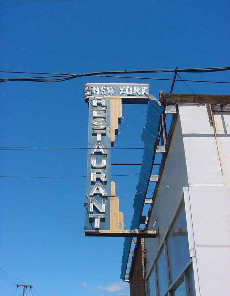 photo by R. W. Dawson
 photo by R. W. Dawson
 photo by R. W. Dawson
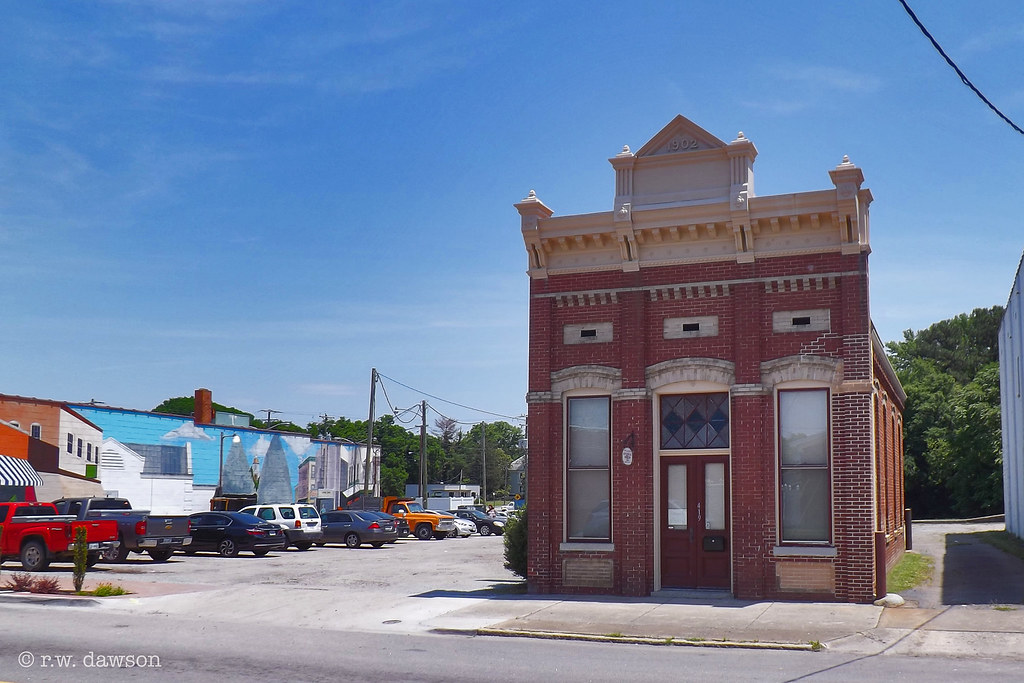 photo by R. W. Dawson
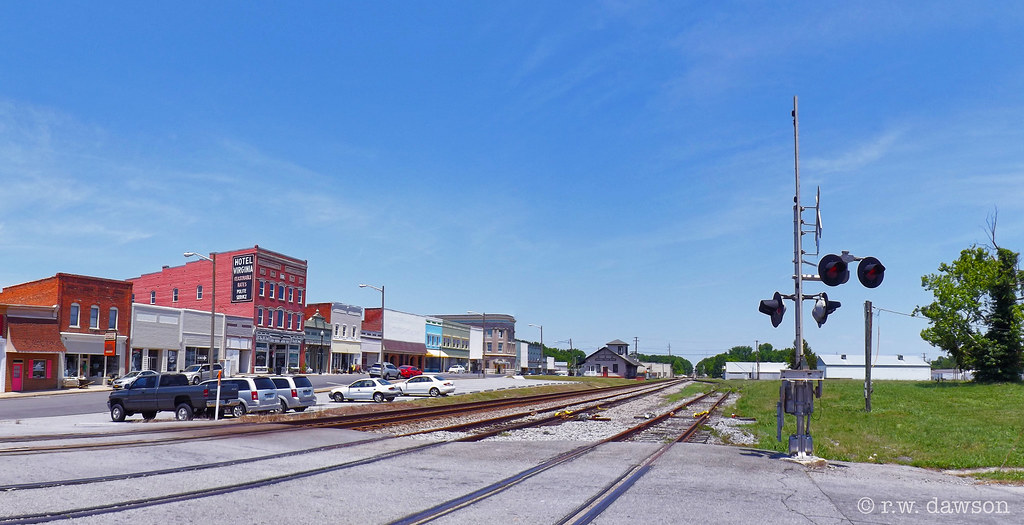 photo by R. W. Dawson
View from Southampton Street.
Courtesy of the University of Texas Library, click here for their index page.
Disclaimers:
I love trains, and I love signals. I am not an expert. My webpages reflect what I find on the topic of the page. This is something I have fun with while trying to help others.
Please Note: Since the main focus of my two websites is railroad signals, the railfan guides are oriented towards the signal fan being able to locate them. For those of you into the modeling aspect of our hobby, my indexa page has a list of almost everything railroad oriented I can think of to provide you with at least a few pictures to help you detail your pike.
If this is a railfan page, every effort has been made to make sure that the information contained on this map and in this railfan guide is correct. Once in a while, an error may creep in :-)
My philosophy: Pictures and maps are worth a thousand words, especially for railfanning. Text descriptions only get you so far, especially if you get lost or disoriented. Take along good maps.... a GPS is OK to get somewhere, but maps are still better if you get lost! I belong to AAA, which allows you to get local maps for free when you visit the local branches. ADC puts out a nice series of county maps for the Washington DC area, but their state maps do not have the railroads on them. If you can find em, I like the National Geographic map book of the U.S..... good, clear, and concise graphics, and they do a really good job of showing you where tourist type attractions are, although they too lack the railroads. Other notes about specific areas will show up on that page if known.
Aerial shots were taken from either Google or Bing Maps as noted. Screen captures are made with Snagit, a Techsmith product... a great tool if you have never used it!
By the way, floobydust is a term I picked up 30-40 years ago from a National Semiconductor data book, and means miscellaneous and/or other stuff.
Pictures and additional information is always needed if anyone feels inclined to take 'em, send 'em, and share 'em, or if you have something to add or correct.... credit is always given! Please be NICE!!! Contact info is here
Beware: If used as a source, ANYTHING from Wikipedia must be treated as being possibly being inaccurate, wrong, or not true.
RAILFAN GUIDES HOME
RAILROAD SIGNALS HOME
NEW MAY14/2019, MAY22/2019, APR23/2020, JAN23/2021, MAR10/11/13/14/2022
Last Modified 14-Mar-2022