
In General
Getting Here
Map
Sights
Floobydust
USGS Maps
RAILFAN GUIDES HOME
RAILROAD SIGNALS HOME
Location / Name:
Christiansburg VA, Montgomery County
What's Here:
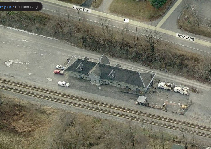
Former N&W Depot
Former V&T Depot / N&W Freight Shed
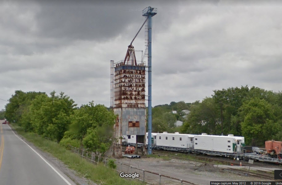
Old Grain Tower
Data:
GPS Coordinates: as needed
Phone A/C: 540
ZIP: 24073
Access by train/transit:
None
The Scoop:
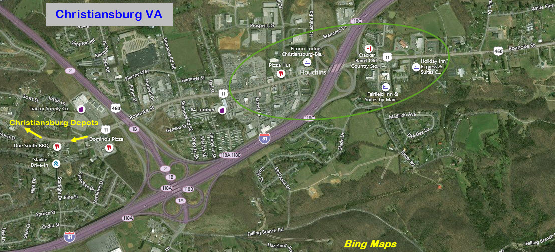
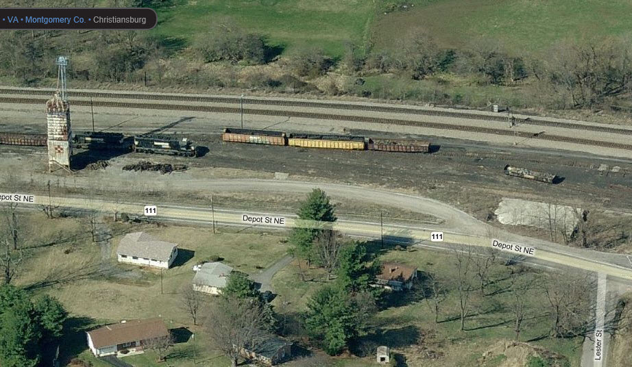
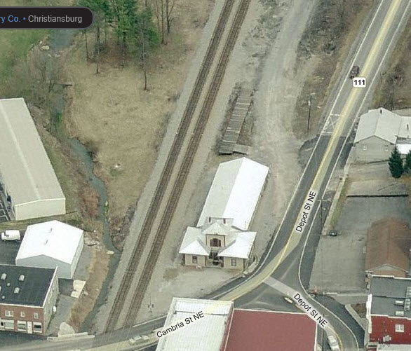
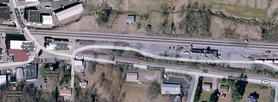
A couple of gems off the beaten track, worth your while if you want an interesting back drop for train pictures. The grade crossing at Cambria Street porobably provides the best angle to take pictures from, unless you want to get the depots in the forefront of the pictures, in which case, you will have to take them from Depot St.
Christiansburg is about 30 miles from downtown Roanoke, and about 23 from Salem.
Hotels, gas, and restaurants abound on US 11 at the original exit 118, exit 118C.
There are no nearby facilities if you need to go to the bathroom while checking out the depots, so plan ahead.
US 11 between Christiansburg and Salem provide ample opportunity for some great pictures with a combination of straight track and mountainous track!
Acknowledgements:
Roanoke Public Library
Hikki Nagasak
VT Library
Denver Todd
Websites and other additional information sources of interest for the area:
None for now.....
Easy Peezy....
Exit 118A and 118B off of I-81 are your best best. You want to go towards Blacksburg, but be careful for the signs for US 11 which is an immediate exit after you get off I-81 on US 460.
Go south on US 11 into Christiansburg. From US 460, it's about 1.9 miles to the depots. US 11 is AKA Business 460, Lee Highway, and Roanoke Street.
At VA111, take a right - it is less than a mile from US 460. VA111 turns into Depot Street NE.
Food, gas n all are inside the green oval.....
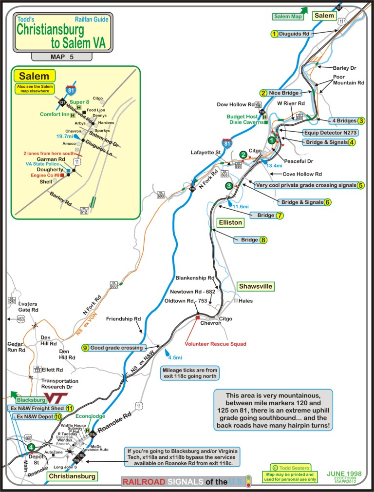
Click here for the PDF version of the
above map, or
here for a PDF with all five Roanoke maps.
GPS Coordinates: 37.141301, -80.401745
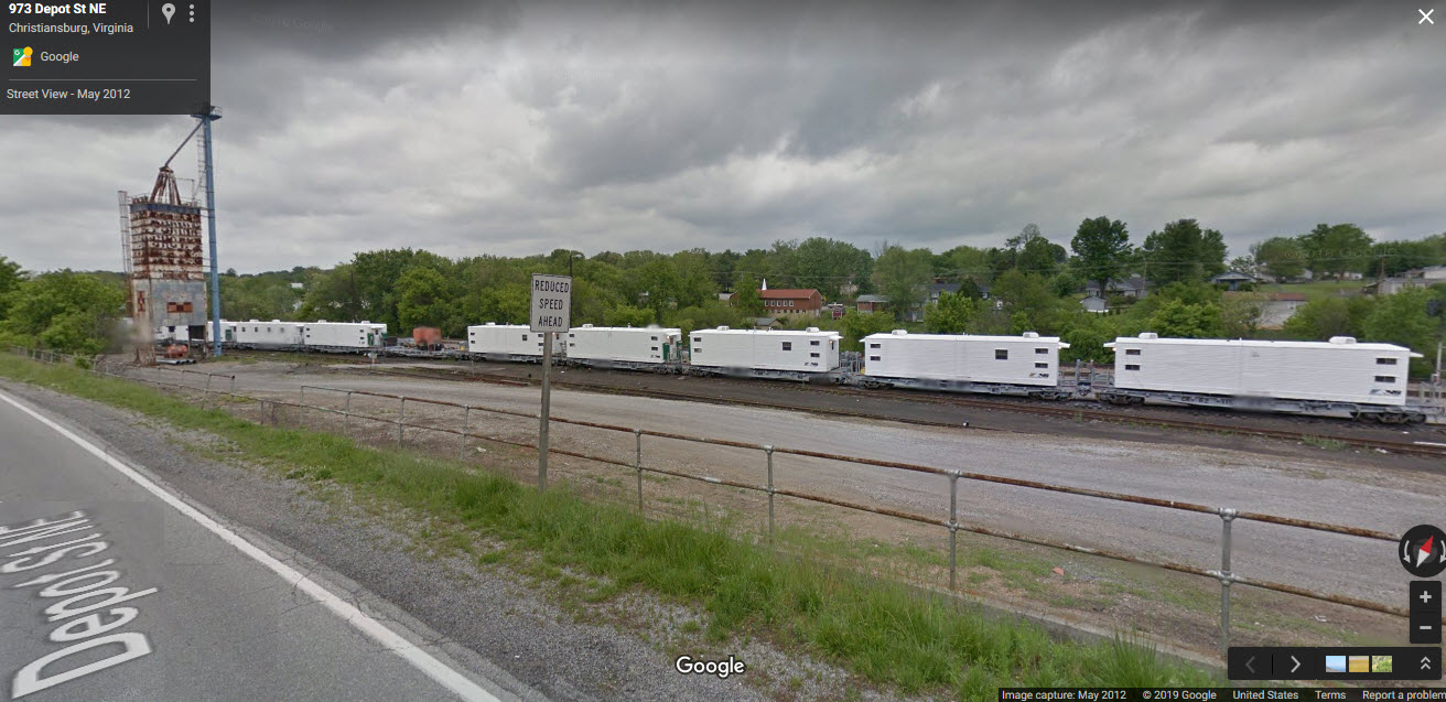
Two shots of the depot, now used by NS for the MOW guys.
Also here is a track where you can find something almost all the time, and a set of NB signals.
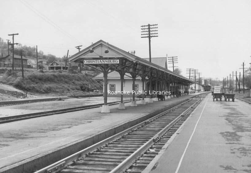
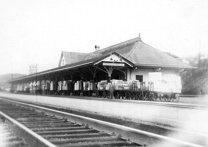 From the VT Library
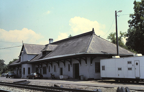 photo by Hikki Nagasak
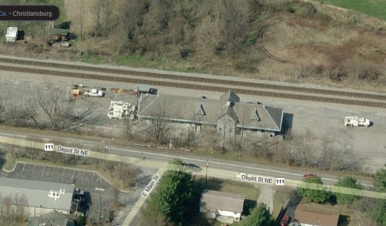
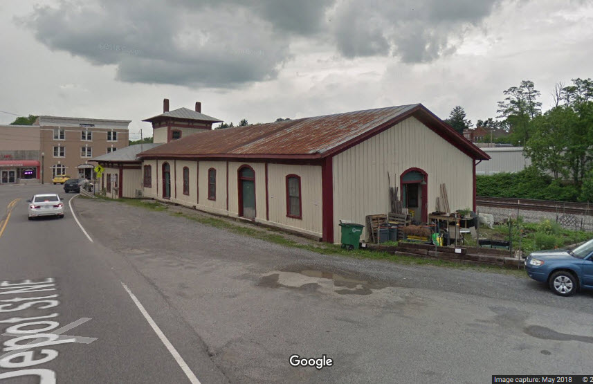
GPS Coordinates: 37.141457, -80.404395
Many people confuse this former freight depot with the Christiansburg Passenger Depot, located a few hundred feet north. Originally, yes, it was a depot for the Virginia & Tennessee RR, but in later years, it was used as a freight shed by the N&W.
From Wikipedia: The Virginia and Tennessee Railroad was built through Christiansburg in 1857. Originally planned to go through the town center, it was rerouted to the north due to the concerns of town leaders. A train station was built in Cambria (which was a separate municipality until 1964).
Much of the railroad was destroyed by Union forces during the Civil War. In 1868�69, a larger one-story station was built. That station was itself too small after several decades; a new station was built in 1906 and the older station because the town's freight house.
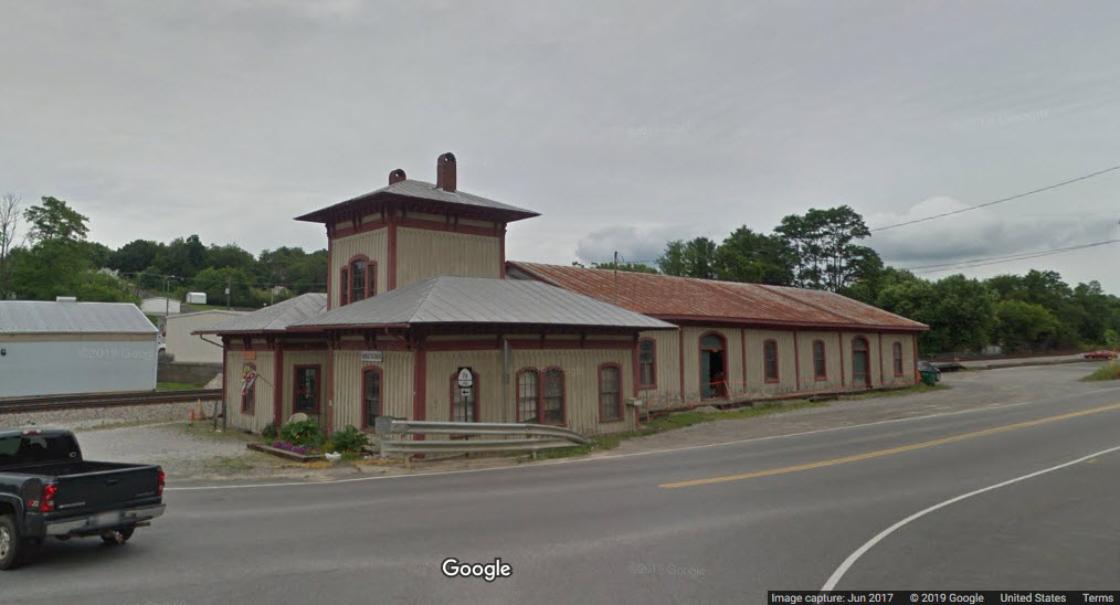
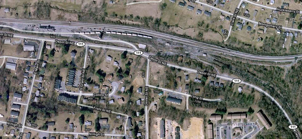
GPS Coordinates: 37.141049, -80.399920
Amtrak Service
Christiansburg has had two go-arounds with Amtrak:
From Wikipedia: The N&W also operated the Birmingham�Washington Birmingham Special (unnamed after February 1970 and cut back to Bristol in August 1970), the New Orleans- Washington Pelican (discontinued, 1970) and the Memphis-bound Tennessean. When Amtrak took over intercity passenger rail service on May 1, 1971, it chose not to continue service on the two trains, thus ending service to Christiansburg.
Service was restored on March 24, 1975 with the introduction of the Mountaineer service between Norfolk and Chicago.[2] The Mountaineer was replaced by the Hilltopper on June 1, 1977. The Hilltopper was discontinued on October 1, 1979, ending rail service to Christiansburg for the second time.
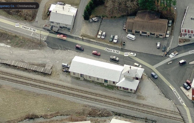
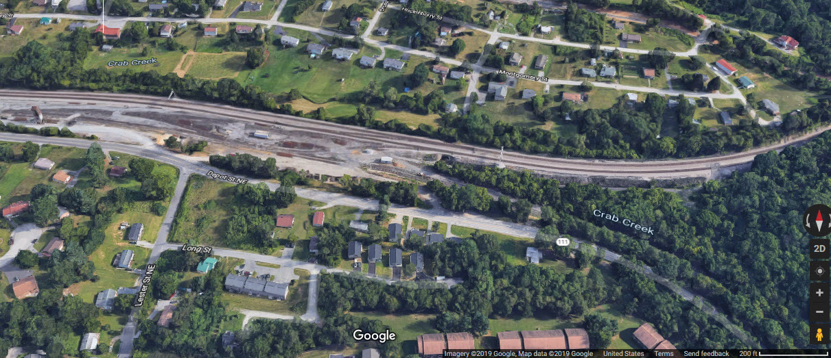
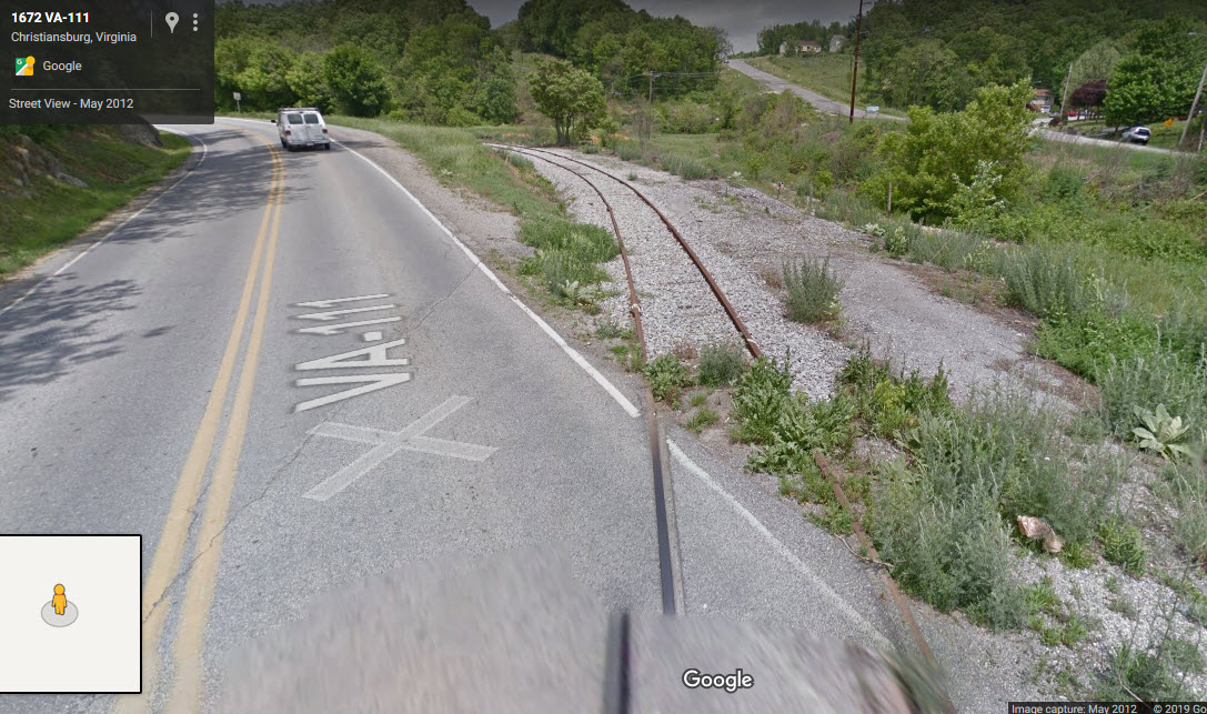
Christiansburg Siding and Branch Line
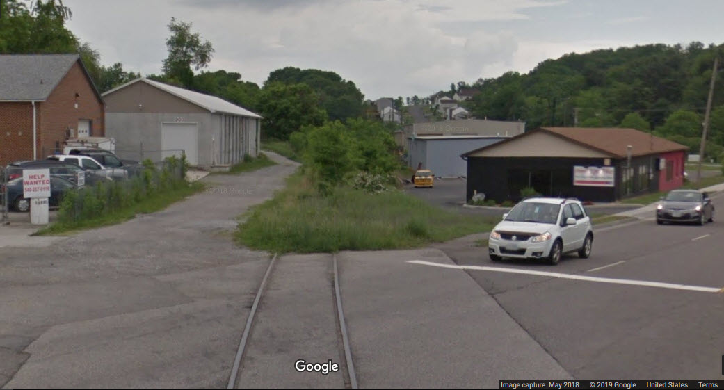
A few Google Streetview pictures of equipment sitting on the Christiansburg siding.
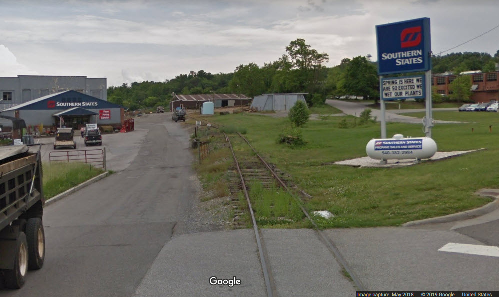
The closest track in the picture above also turns into a small branchline that services Southern States adjacent to Business 460, but it doesn't look like it has been used for a while.... quite a while!!!.
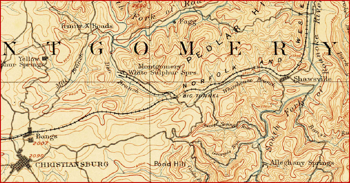
This set of map was drawn before the Virginian was built.
Disclaimers:
I love trains, and I love signals. I am not an expert. My webpages reflect what I find on the topic of the page. This is something I have fun with while trying to help others.
Please Note: Since the main focus of my two websites is railroad signals, the railfan guides are oriented towards the signal fan being able to locate them. For those of you into the modeling aspect of our hobby, my indexa page has a list of almost everything railroad oriented I can think of to provide you with at least a few pictures to help you detail your pike.
If this is a railfan page, every effort has been made to make sure that the information contained on this map and in this railfan guide is correct. Once in a while, an error may creep in :-)
My philosophy: Pictures and maps are worth a thousand words, especially for railfanning. Text descriptions only get you so far, especially if you get lost or disoriented. Take along good maps.... a GPS is OK to get somewhere, but maps are still better if you get lost! I belong to AAA, which allows you to get local maps for free when you visit the local branches. ADC puts out a nice series of county maps for the Washington DC area, but their state maps do not have the railroads on them. If you can find em, I like the National Geographic map book of the U.S..... good, clear, and concise graphics, and they do a really good job of showing you where tourist type attractions are, although they too lack the railroads. Other notes about specific areas will show up on that page if known.
Aerial shots were taken from either Google or Bing Maps as noted. Screen captures are made with Snagit, a Techsmith product... a great tool if you have never used it!
By the way, floobydust is a term I picked up 30-40 years ago from a National Semiconductor data book, and means miscellaneous and/or other stuff.
Pictures and additional information is always needed if anyone feels inclined to take 'em, send 'em, and share 'em, or if you have something to add or correct.... credit is always given! Please be NICE!!! Contact info is here
Beware: If used as a source, ANYTHING from Wikipedia must be treated as being possibly being inaccurate, wrong, or not true.
RAILFAN GUIDES HOME
RAILROAD SIGNALS HOME
NEW 06/01/2019
Last Modified
01-Jun-2019