
In General
Getting Here
Map
Station by Station
Pictures
Signals
RAILFAN GUIDES HOME
RAILROAD SIGNALS HOME
Location / Name:
Salt Lake City UT, Salt Lake County (county seat)
What's Here:
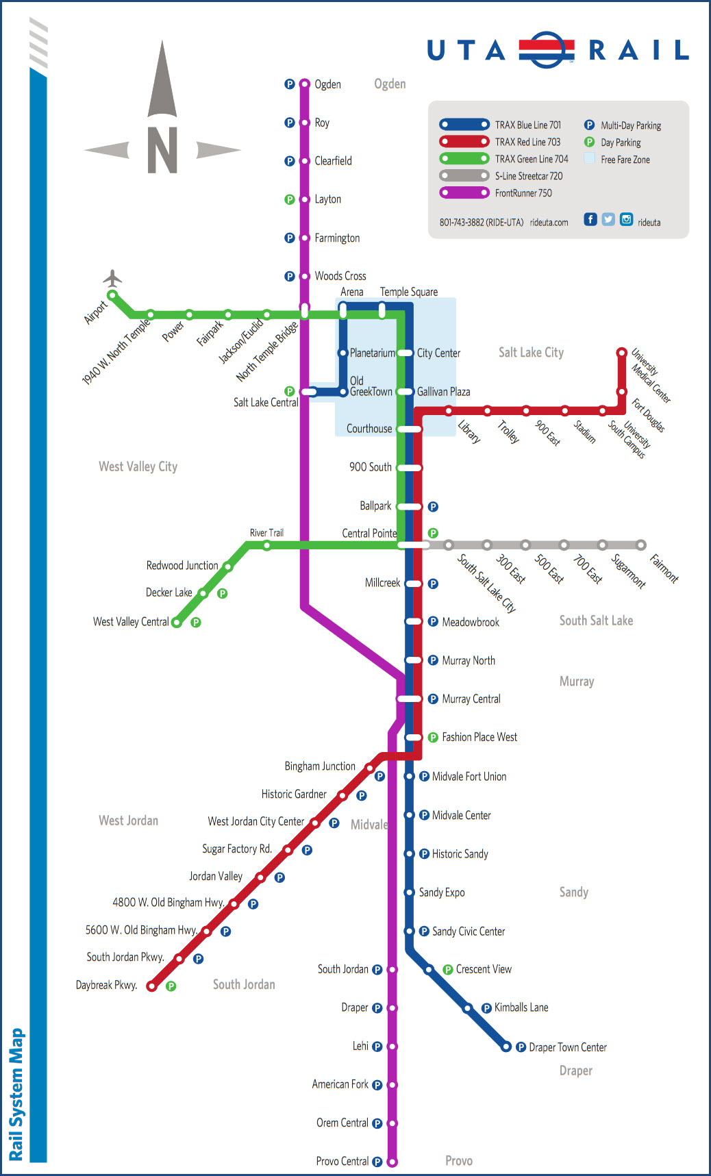
UTA Light Rail and Streetcar systems
UTA FrontRunner Commuter Rail
Amtrak
Data:
GPS Coordinates: as needed
Phone A/C: 801
ZIP: 84101
Access by train/transit:
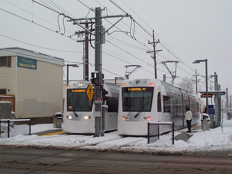
UTA Red, Green, and Blue Lines at the Central Pointe station.
SLC Airport is 13 stops away via the Green Line at the Airport station.
The Amtrak Station is 10 stops away via the Blue Line at the Salt Lake Central station.
Geography:
Flat
The Scoop:
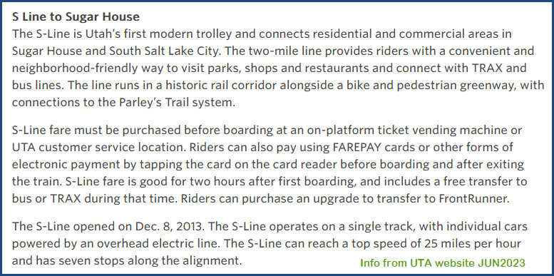
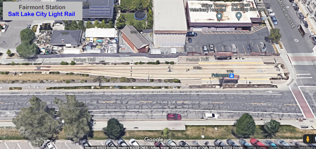
The S-Line covers a distance of 2 miles, and runs between the Central Point station, which serves the three light rail lines, and Fairmont - the current end of the line.
Most of the line is single track, with a couple of double track segments.
Travel time between Central Pointe and Fairmont is around ten minutes. A representative section of their schedule is shown below.
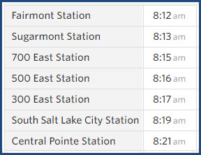
It is way easier to screengrab a section of their page than to type all this stuff, so here we have a little info on the S-Line.
Below that, we have their current fare structure as of June 2023.

Acknowledgements:
Denver Todd
UTA
Google Maps
Open Railway Map
Wikipedia
Websites and other additional information sources of interest for the area:
https://en.wikipedia.org/wiki/S_Line_(Utah_Transit_Authority)
https://www.transit.wiki/UTA_S-Line
https://unifiedplan.org/benefits-of-the-unified-plan/s-line-streetcar/
https://www.rideuta.com/rider-tools/schedules-and-maps/720-s-line
https://www.greatamericanstations.com/stations/salt-lake-city-ut-slc/
https://www.rideuta.com/Services/TRAX
https://en.wikipedia.org/wiki/Salt_Lake_City_Intermodal_Hub
https://buildingsaltlake.com/the-s-line-greenway-ready-for-use/
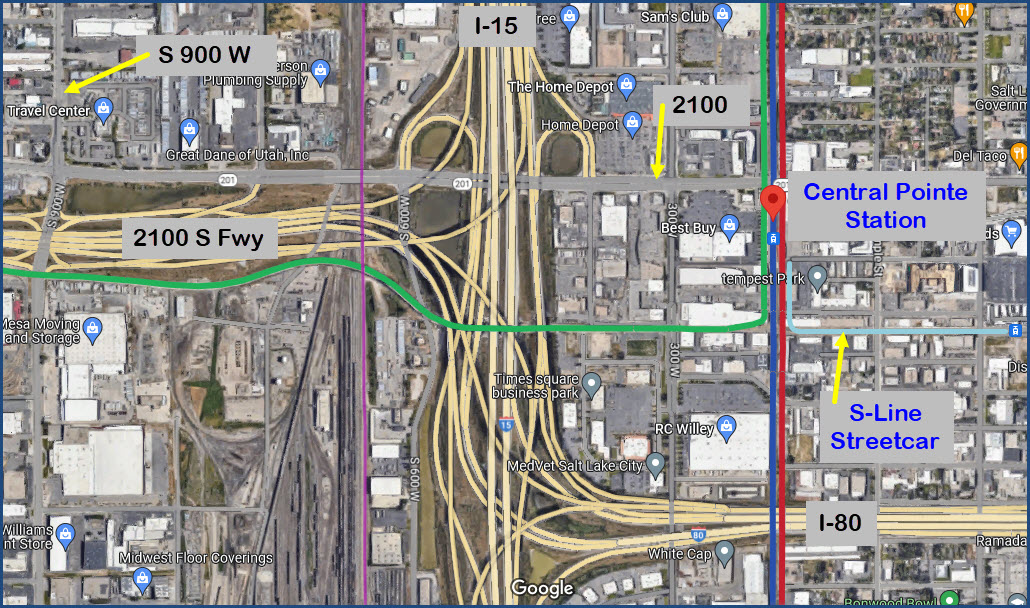
Exit 304/305 off of I15 dumps you off onto 2100 (I can't get used to street names using just numbers like this, I'm used to things like 7th (in NYC :-)). Go east.
On I-80? Take it to I-15 and go north to the first exit, which is 2100.
I fyou're coming in from the west via the 2100S Freeway, get off at exit 17, and go north on "S 900 W" to 2100, and take a right.
Roughly 3 blocks east of I-15 is the Central Point Station, and good starting point.
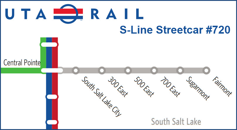
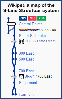
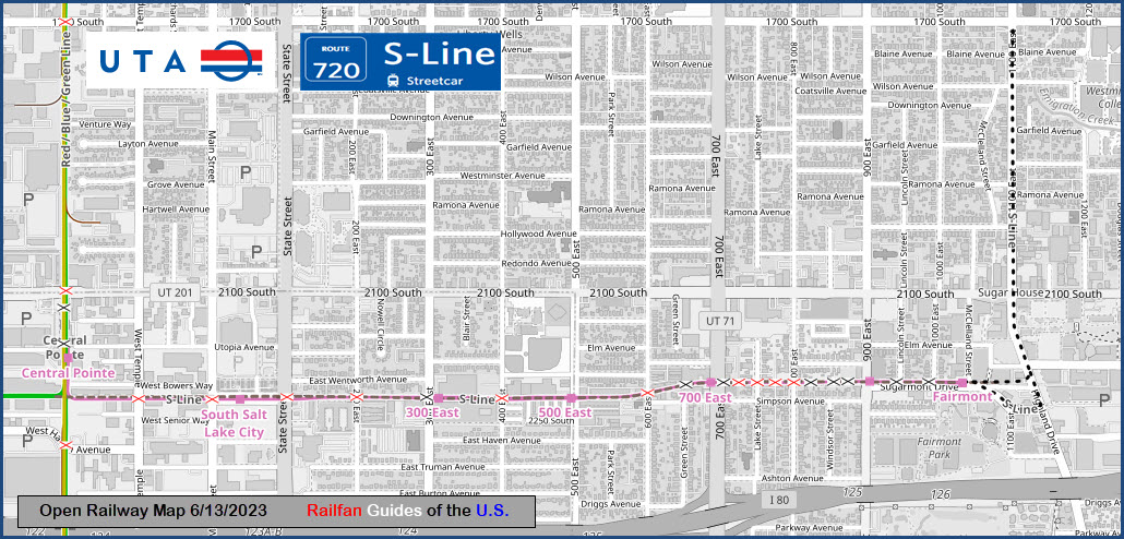
Central Pointe Station
GPS Coordinates: 40.72354, -111.89674
The S-Line Streetcar stop is not directly adjacent to the LRV station, it is about 70 feet from the southern crosswalk of the Central Pointe station.
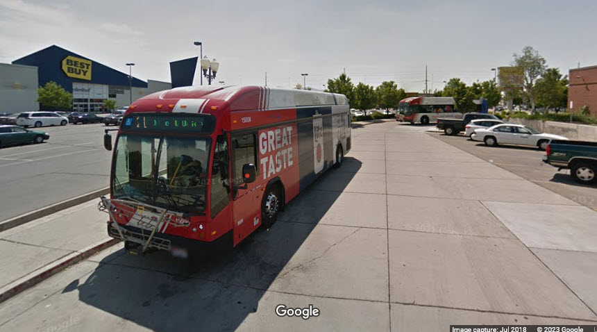
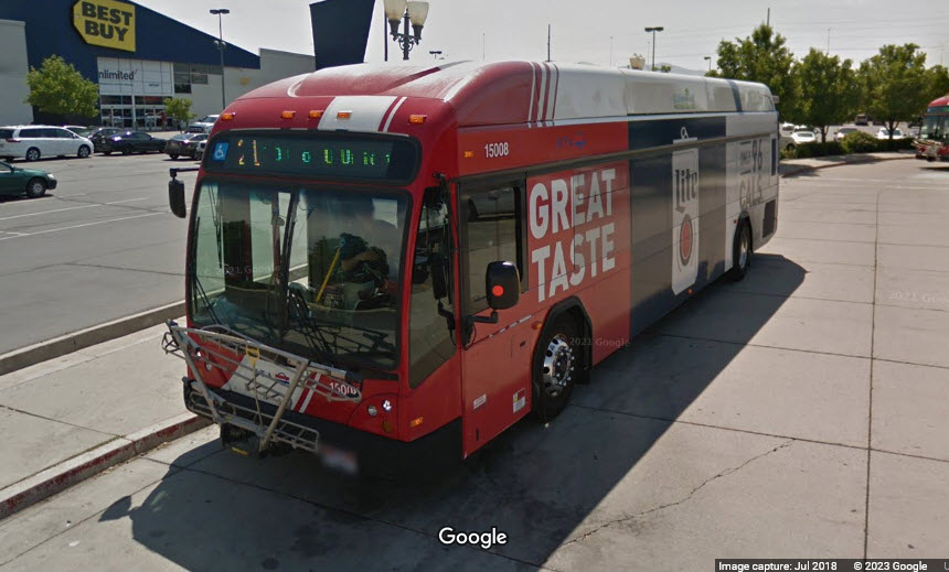
UTA Buses at the Central Pointe station.
South Salt Lake City Station
GPS Coordinates: 40.72228, -111.89011
The
300 East Station
GPS Coordinates: 40.72230, -111.88230
The
500 East Station
GPS Coordinates: 40.72230, -111.87719
 12/2013-Wikipedia, no photo credit
700 East Station
GPS Coordinates: 40.72275, -111.87166
The
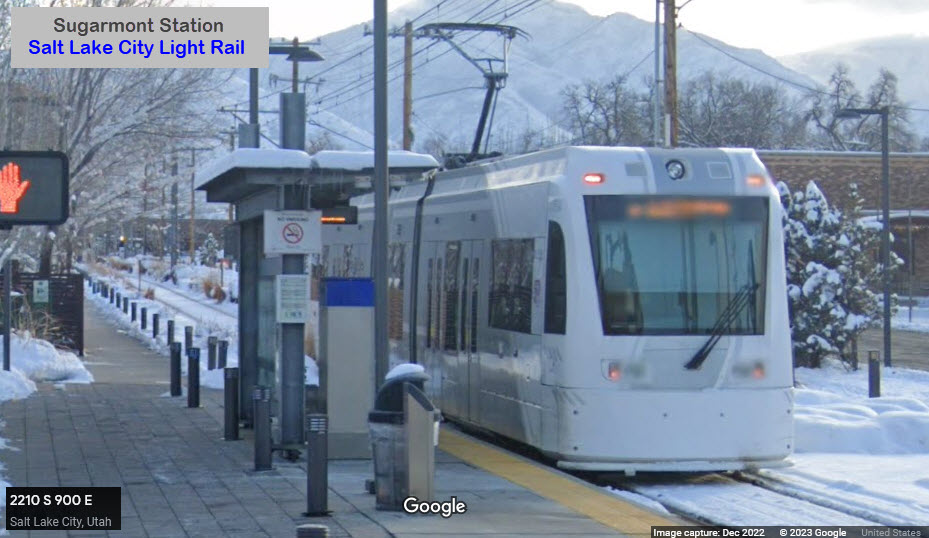
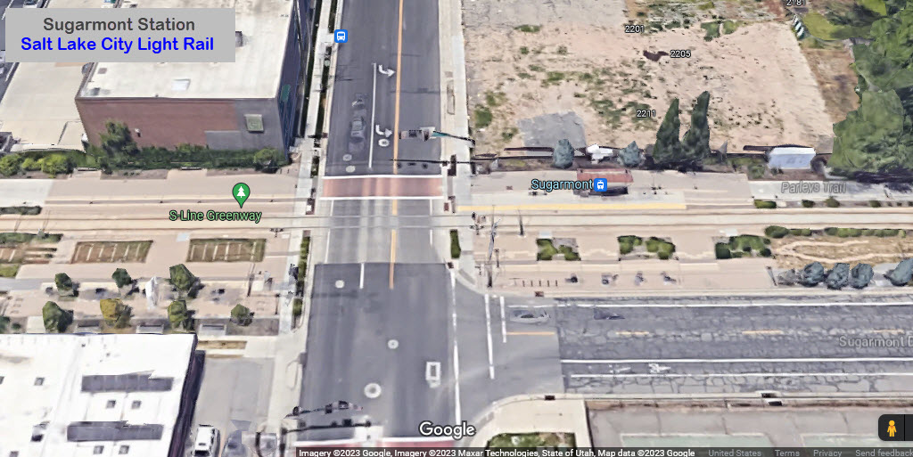
Sugarmont Station
GPS Coordinates: 40.72278, -111.86536
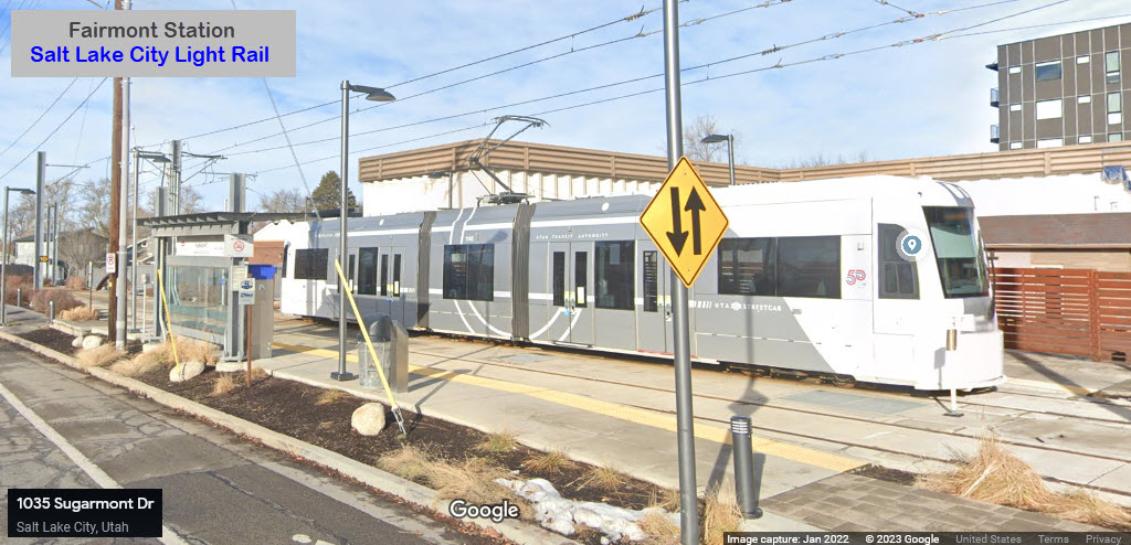
Fairmont Station
GPS Coordinates: 40.72275, -111.86172
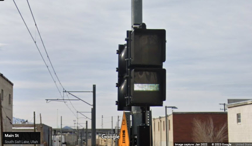
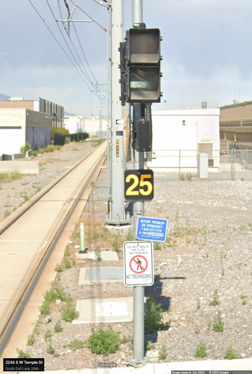
Bar Signals seem to prevail, although I have no idea why the one set where the line goes from two tracks down to one, are red colored signals - I'm sure there is a reason for the different color....
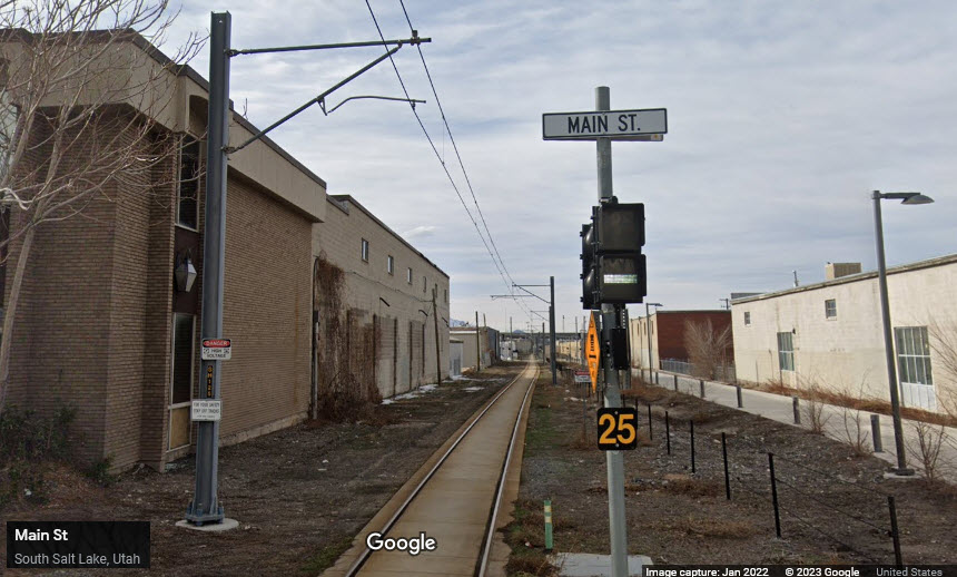
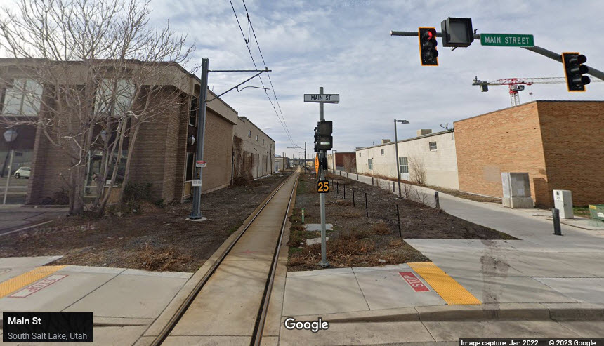
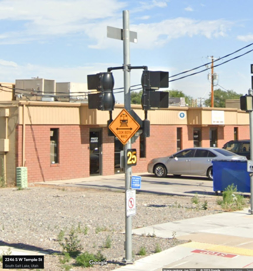
Temple Street is the first grade crossing after leaving the Central Pointe station.

Disclaimers:
I love trains, and I love signals. I am not an expert. My webpages reflect what I find on the topic of the page. This is something I have fun with while trying to help others.
Please Note: Since the main focus of my two websites is railroad signals, the railfan guides are oriented towards the signal fan being able to locate them. For those of you into the modeling aspect of our hobby, my indexa page has a list of almost everything railroad oriented I can think of to provide you with at least a few pictures to help you detail your pike.
If this is a railfan page, every effort has been made to make sure that the information contained on this map and in this railfan guide is correct. Once in a while, an error may creep in :-)
My philosophy: Pictures and maps are worth a thousand words, especially for railfanning. Text descriptions only get you so far, especially if you get lost or disoriented. Take along good maps.... a GPS is OK to get somewhere, but maps are still better if you get lost! I belong to AAA, which allows you to get local maps for free when you visit the local branches. ADC puts out a nice series of county maps for the Washington DC area, but their state maps do not have the railroads on them. If you can find em, I like the National Geographic map book of the U.S..... good, clear, and concise graphics, and they do a really good job of showing you where tourist type attractions are, although they too lack the railroads. Other notes about specific areas will show up on that page if known.
Also, please note, that many screen shots from Google Streetview are stitched together from more than one screen shot because I have zoomed in for the detail :-)
Aerial shots were taken from either Google or Bing Maps as noted. Screen captures are made with Snagit, a Techsmith product... a great tool if you have never used it!
By the way, floobydust is a term I picked up 30-40 years ago from a National Semiconductor data book, and means miscellaneous and/or other stuff.
Pictures and additional information is always needed if anyone feels inclined to take 'em, send 'em, and share 'em, or if you have something to add or correct.... credit is always given! Please be NICE!!! Contact info is here
Beware: If used as a source, ANYTHING from Wikipedia must be treated as being possibly inaccurate, wrong, or not true.
RAILFAN GUIDES HOME
RAILROAD SIGNALS HOME
NEW 06/13/2023, JUN17/2023
Last Modified 17-Jun-2023