
In General
Getting Here
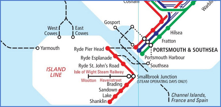
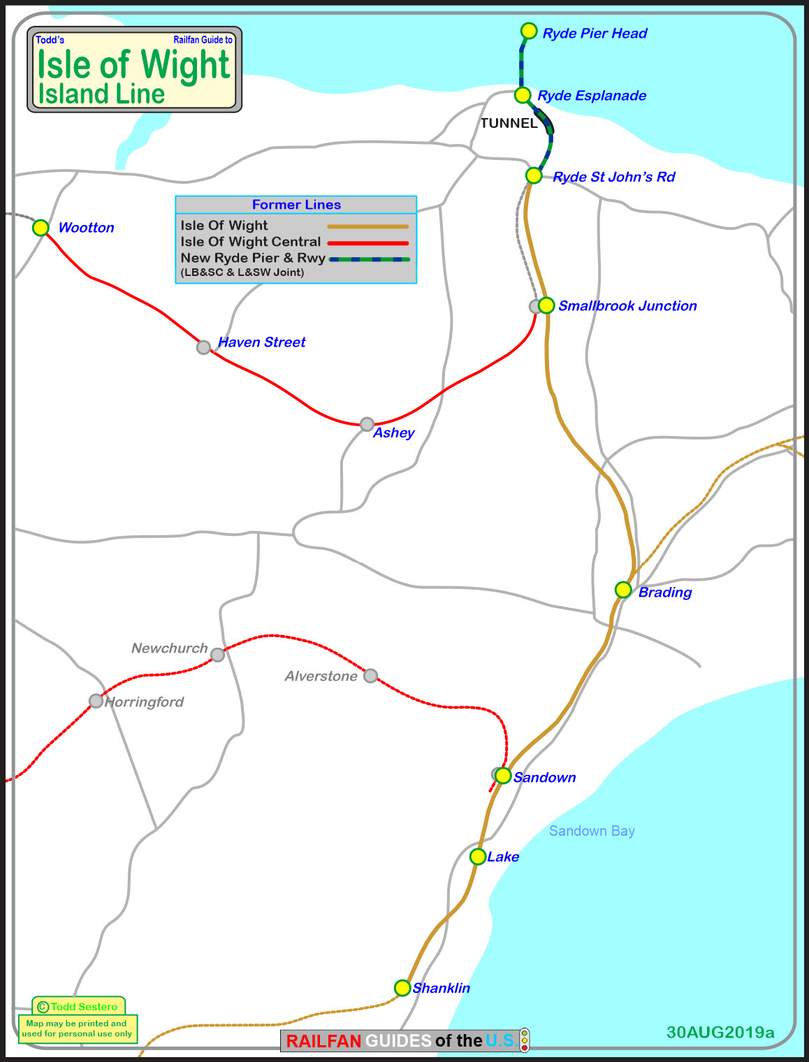
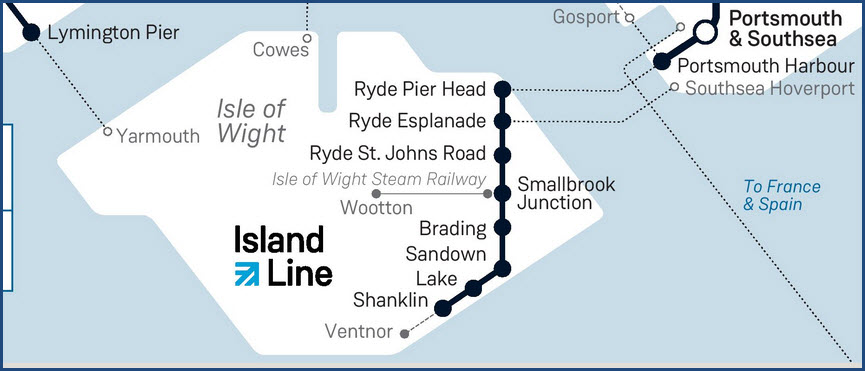
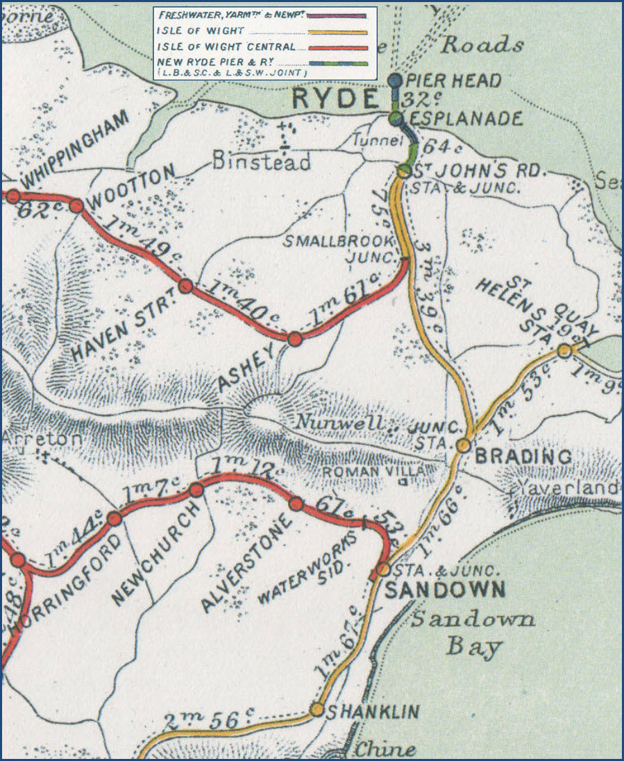
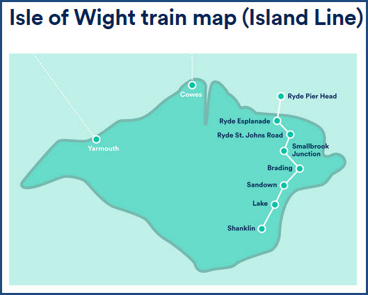
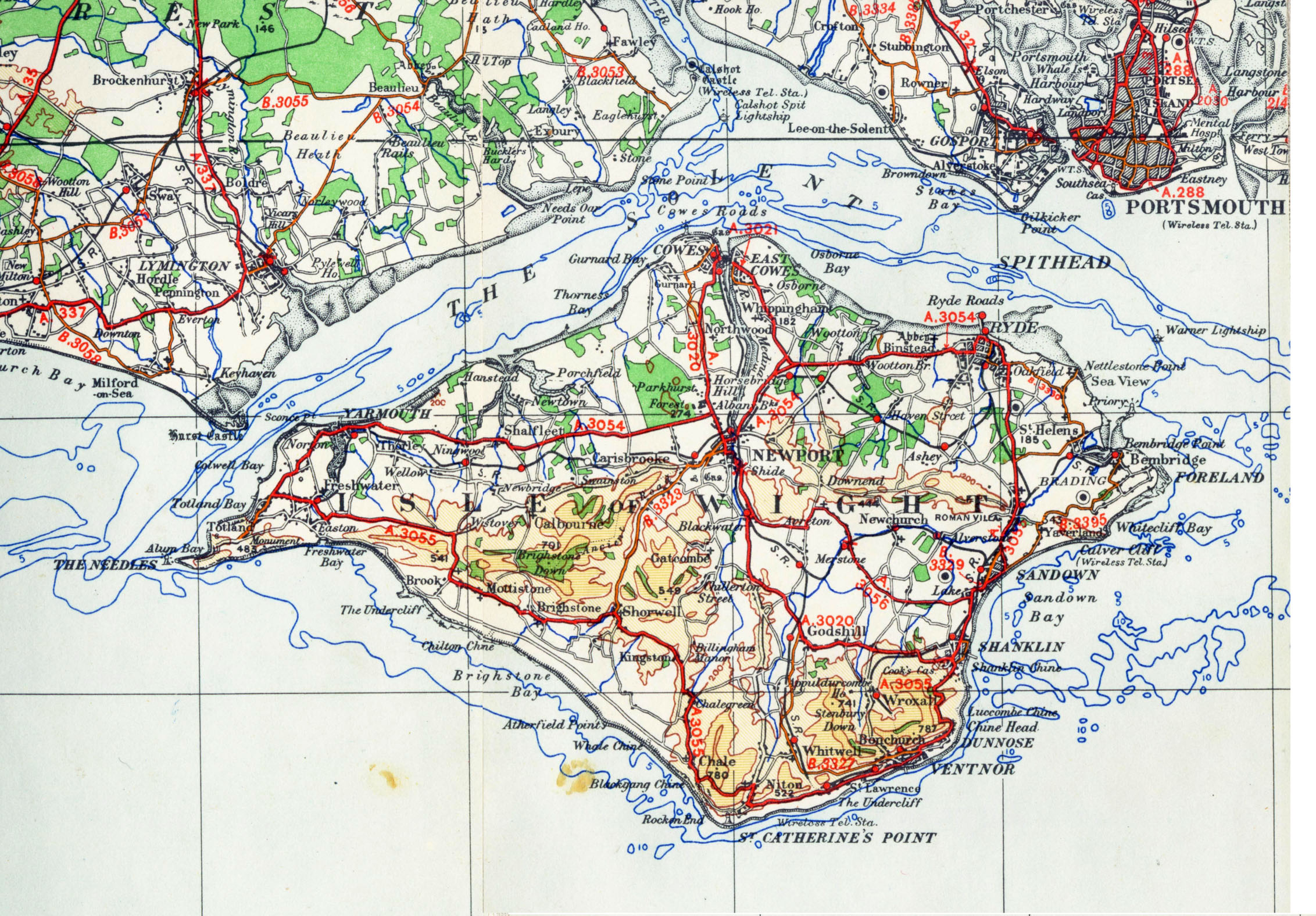
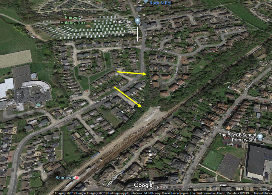
Map
Station by Station
Pictures
Bridges & Tunnels
Signals
Floobydust
RAILROAD SIGNALS HOME
Location / Name:
Isle of Wight, UK
What's Here:
the 8 Mile Long Island Line
the Isle of Wight Steam Railway
Data:
GPS Coordinates: as needed
Phone A/C: +44 1983
Access by train/transit:
Ferry from the Mainland
Hovercraft from the Mainland at Southsea
The Scoop:
In American terms, this is a subway line. The line is about 8 miles long, having been longer at one point, going all the way to Ventnor. Travel time from end to end is 23/24 minutes.
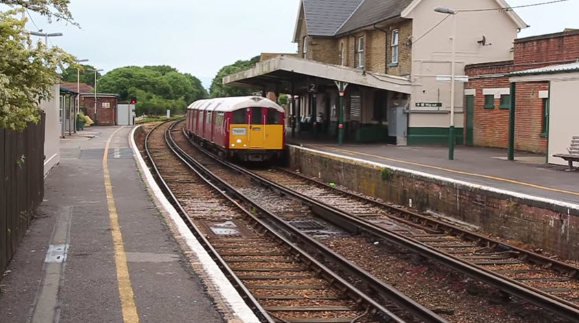
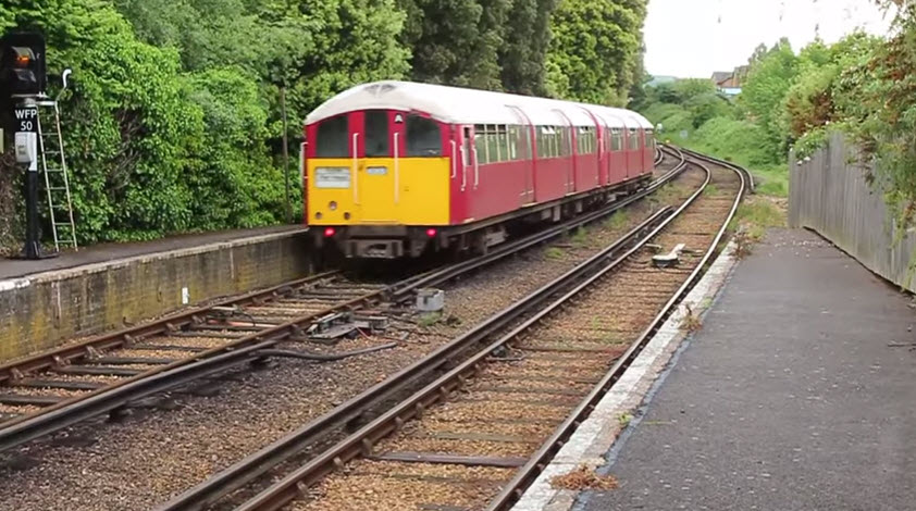
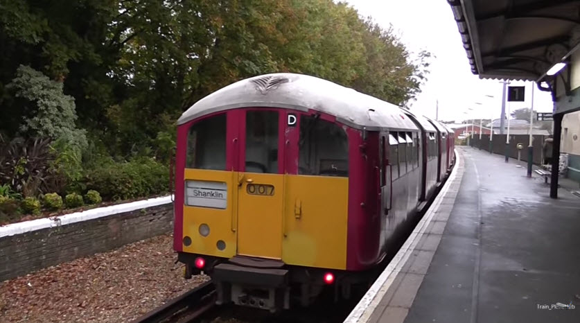
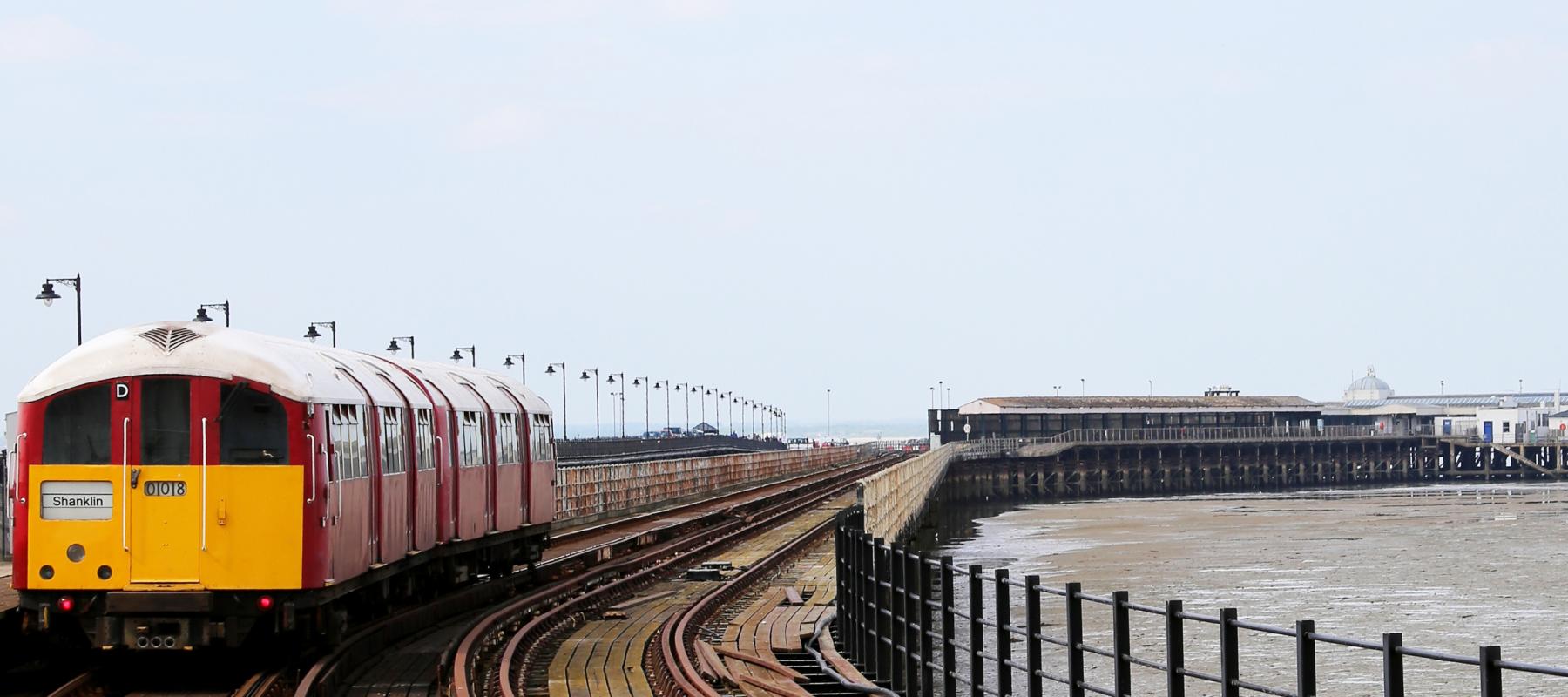
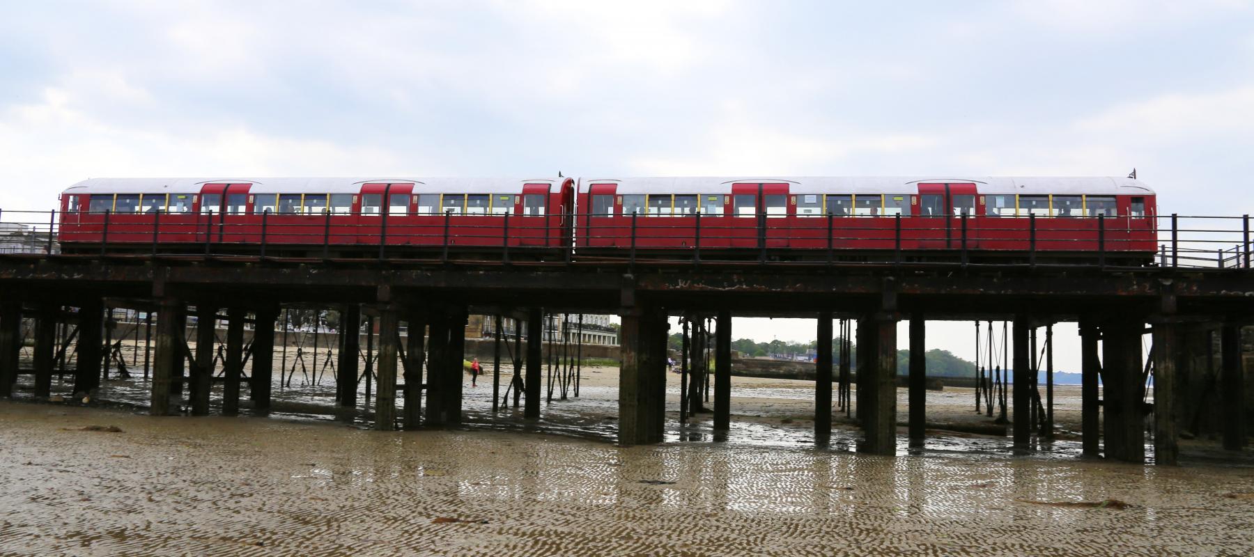
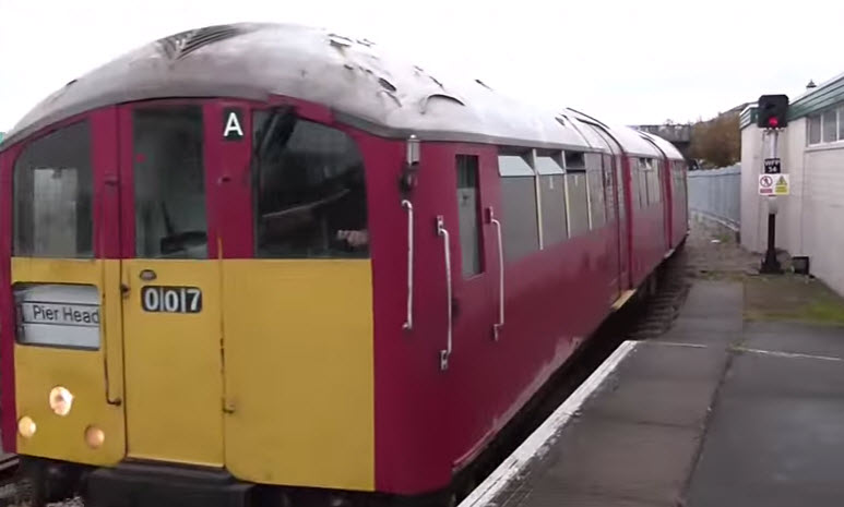
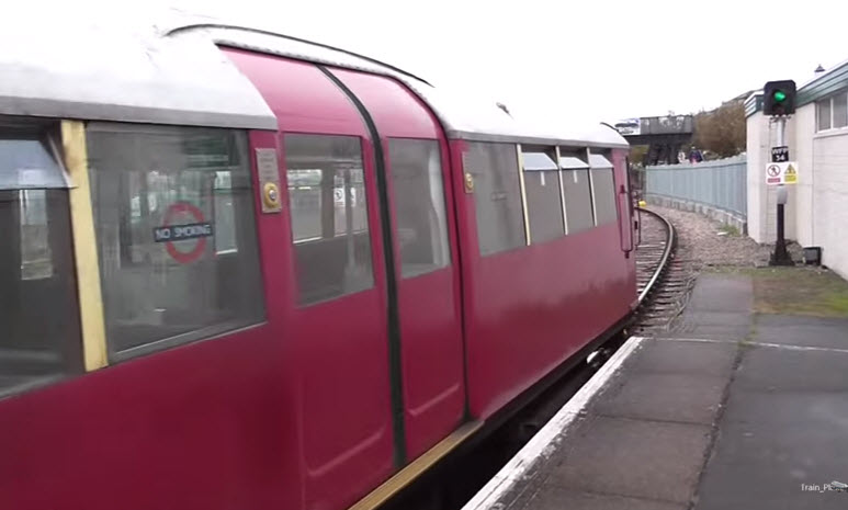
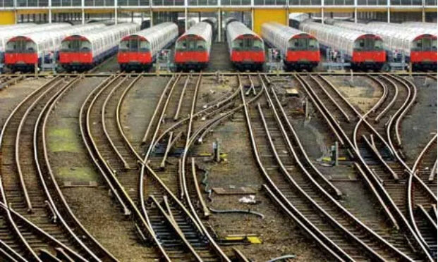
One of the unique things about this line is the use of "old" equipment from the London Underground, used because of the tunnel on the line, which is about 10 inches too short to use a standard type transit car. They are the oldest cars in service in the UK.
The cars currently in use, as of 2019, are 1938 vintage BR type 438 cars. Because of the age of the cars, little things like the doors may not be functioning at peak performance. One of the videos about the line says that they brought 9 of the cars, one for spare parts, and the other 8 run in "married" pairs. The cars were converted for use on the Island Line in 1989/1990. The trains run on 660VDC. I'm guessing one of the things they had to do to convert them was to make them operate from three rails instead of four, as the London Underground uses four rails for running on and power (see below in the floobydust section).
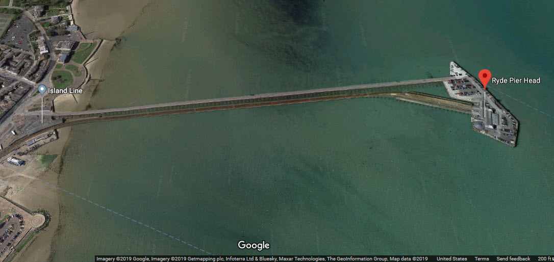
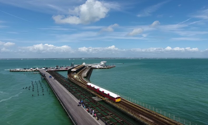
Another unique feature of the line, is that it goes out into the water by almost a half a mile to service the ferry terminal. There are two tracks that go out this far, there used to be four.
Due to the cars age, it is not known how much longer they will survive, get em while you can!
Trains run from 6am until midnight, 7 days a week.
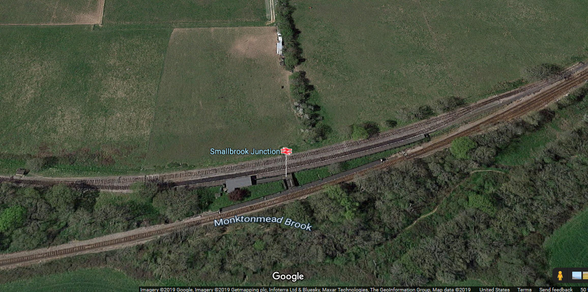
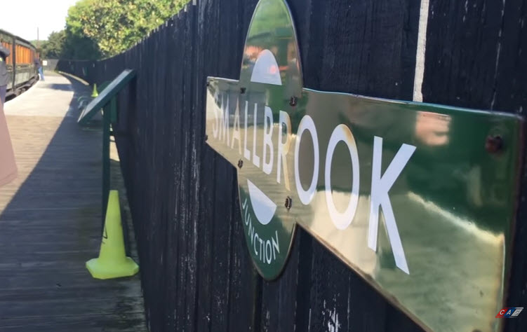
At Smallbrook Junction, the station is a transfer point to the Isle of Wight Steam Railway. Trains only stop here when the steam trains are running. It is the newest station on the line, having been built in 1987.
Brading station has a heritage centre and restored signalbox.
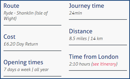 Fares vary depending on package
Fares
One way: £4.70
Evening return: Travel after 1800 for just £3.30 between Ryde Esplanade and Shanklin.
Hover Rover Rail (to the Isle of Wight): The excitement of traveling on a hovercraft, plus one day's unlimited travel on the Island Line trains, all for £23.20 (£11.65 for children or £71.30 for a family).
Hover Liner: Travel to Portsmouth and Southsea via Hovertravel Hovercraft service, starting from Shanklin, Lake, Sandown, Brading and Ryde St Johns Road Stations. Just £18.10 for an Adult Day Return (£9.05 for Children aged 5-15), including your bus journey between the Hovercraft terminal and Portsmouth City Centre (or Gunwharf Quays). Buy your ticket from Shanklin ticket office or onboard the train.
Island Liner: A joint ticket for travel on the Island Line and the Isle of Wight Steam Railway. Just £16 for adults (£8 for children aged 5-14), for a day's unlimited travel. Buy your ticket from Ryde Esplanade and Shanklin ticket offices, or on board the train. Only available on Steam Railway operating dates; visit the Isle of Wight Steam Railway website for details.
Day Ranger: Unlimited day travel on the Island Line for just £6.50 (£3 for children) or take the family (2 adults, 3 children) for just £17! See everything the island has to offer!
Isle of Wight Steam Railway
A fantastic day out can be had at the Isle of WIght steam railway where you can enjoy a ride in restored Victorian and Edwardian carriages pulled by steam locomotives. The journey takes you on a five and half mile route from Wotton to Smallbrook junction. Young children(0-4 years) travel for free, children's tickets start at £5 and adults at £9.50. Tickets give a days unlimited travel.
Acknowledgements:
Nigel Dymock
Denver Todd (he and Nigel provided the seed to do this page)
Roger Templeton
Phil Marsh
The various videos listed below
Google Maps
Websites and other additional information sources of interest for the area:
https://www.youtube.com/watch?v=W1IO6xF_I5k&feature=youtu.be video by Rachael Matt/Train Plane Hub from 2015
https://www.youtube.com/watch?v=L5Zb5S9dPLY video by David Henderson from 2014 and 2017
https://www.youtube.com/watch?v=qAoPKpL0_jE narrated video by Andy Carter from 2016
https://en.wikipedia.org/wiki/Isle_of_Wight_Railway
https://www.iwsteamrailway.co.uk/
https://www.scenicrailbritain.com/lines/island-line
http://www.isleofwightholidays.com/isle_of_wight_trains.html
Getting to the Isle of Wight is fairly simple. Your only real choice, unless you are a pilot, is to take the ferry or Hovercraft from the mainland.
The Hovercraft can be caught at Southsea.
Ferries to the Isle of Wight can be found at Portsmouth, Southampton, and Lymington.
In order to get to the Isle of Wight from London, passengers need to catch one of the regular trains to Portsmouth. South Western Railway run the most direct service between Waterloo and Portsmouth Harbour, with most journeys only an hour and 40 minutes long.
 Ferry options
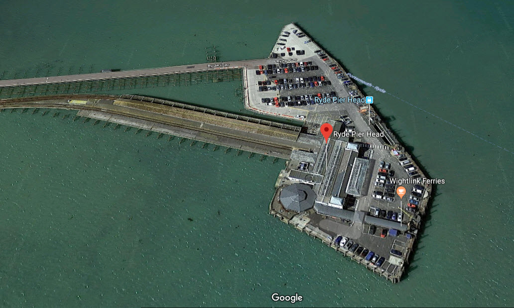
Ryde Pier Head
GPS Coordinates: 50.739131, -1.160327
At the end of the Ryde Pier.
Post: Ryde PO33 2HF, UK
Parking: yes-kinda, while waiting for the ferry (pay)
Double track at and leading up to the station.
This is the northern most station on the line, and connects with the ferries coming from the mainland.
Ryde Esplanade
GPS Coordinates: 50.733031, -1.159786
Esplanade at Ryde Pier
Post: Ryde PO33 2HF, UK
Parking: yes
Double track thru the station.
The causeway to Rydes Pier Head starts here.
The Hoverport is also located adjacent to the station.
The facility is more like a Transportation Center than a station, for it is a main bus depot too.
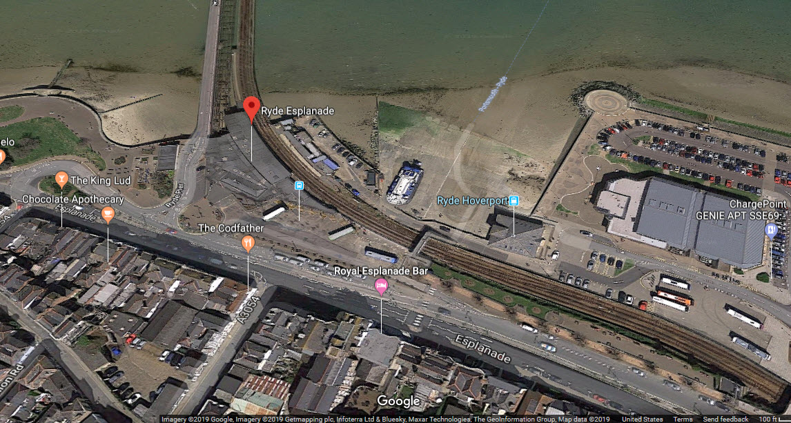

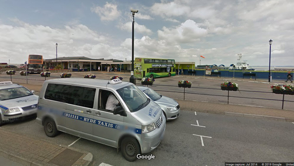
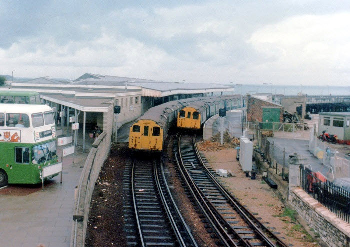 photo by Phil Marsh, 1985
Ryse St John's Road
GPS Coordinates: 50.724305, -1.156712
St Johns Road at Monkton Street
Post: Ryde PO33 2BA, UK
Parking: yes
Double track thru the station.
The shops is co-located here.
Operating semaphore at the south end of the station.
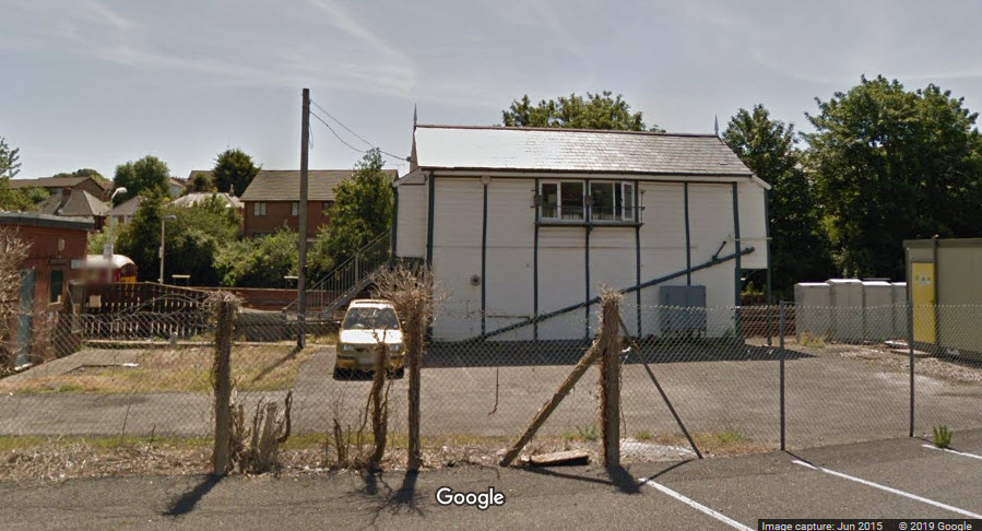
Cabin at the south of the station.
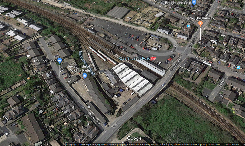
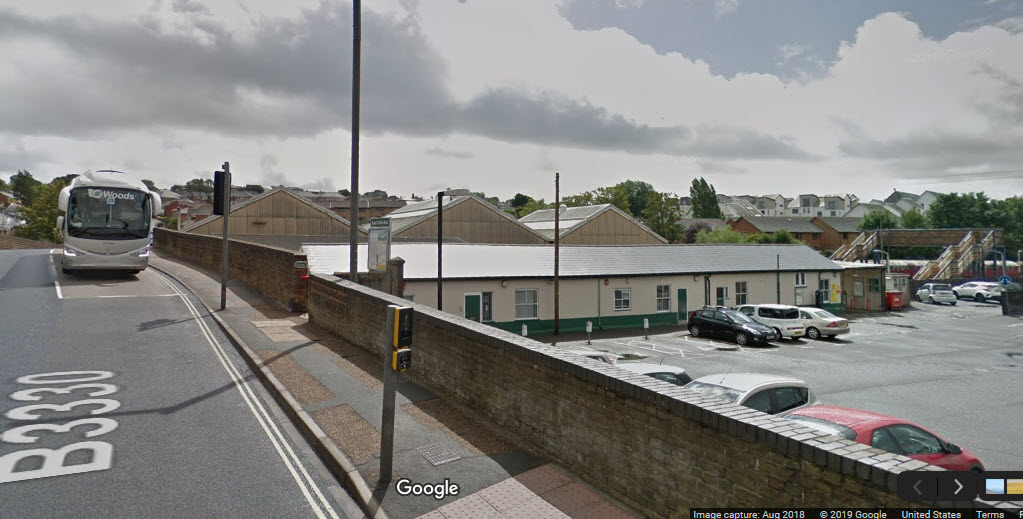
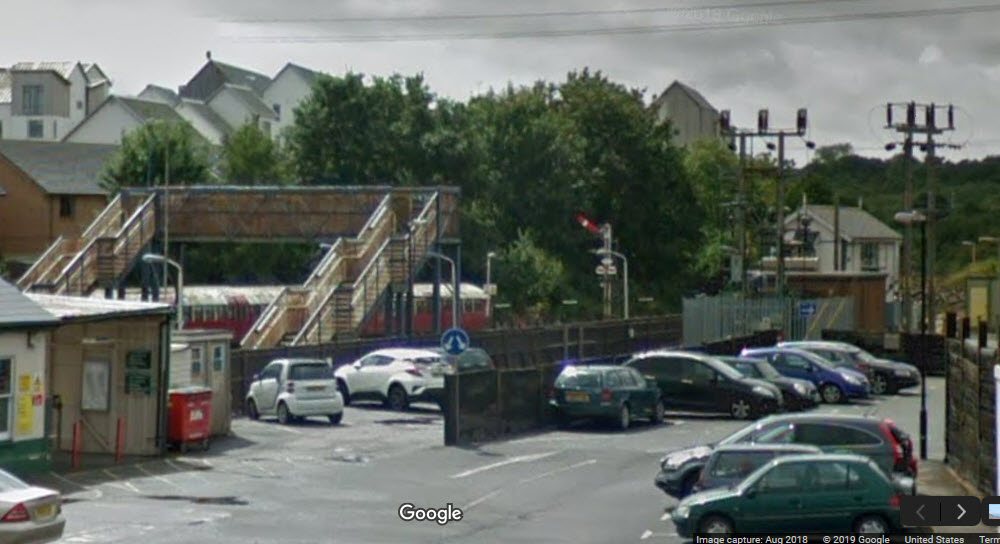
The only tower, or Cabin, is located at the south end of the interlocking here at St Johns.
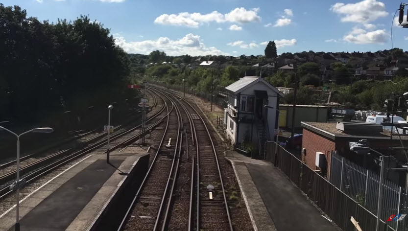
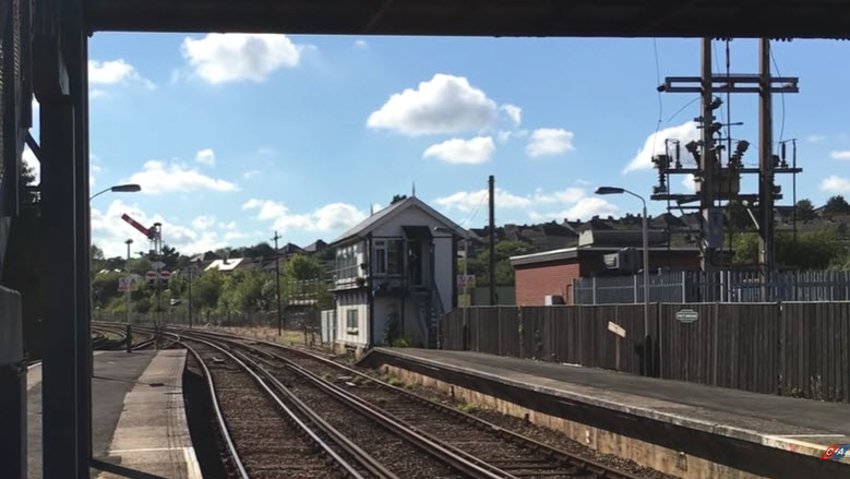 Notice the semaphore on your left!
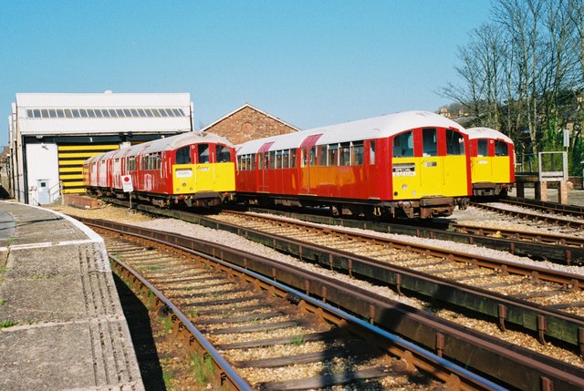 Storage tracks and shops,
photo by Roger Templeton.
Storage tracks and shops,
photo by Roger Templeton.Smallbrook Junction
GPS Coordinates: 50.711385, -1.155039
NOTE: No street access
Post: Ryde PO33 4BE, UK
Parking: none
Single track thru the station, but go to double track just north of the station, for the remainder of the trip north.
Transfer to the Isle of Wight Steam Railway.
Station only active when the steam trains are running.
This is the newest station of the line, having been built I believe in 1987.
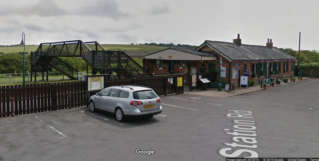
Brading
GPS Coordinates: 50.678372, -1.138658
Station Road
Post: Brading, Sandown PO36 0EB, UK
Parking: yes
Single track thru the station.
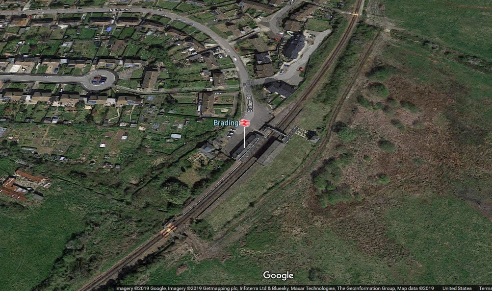
Former interchange for the branch to Helens Station and Bembridge.
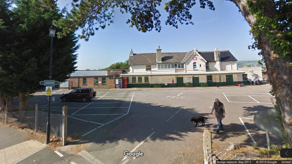
Sandown
GPS Coordinates: 50.656971, -1.162272
Simeon Path at Nunwell Street
Post: Sandown PO36 9FE, UK
Parking: yes
Double track thru the station, about 1,235 feet of it.
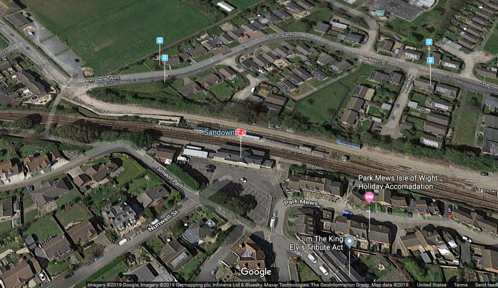
In the picture below, you can see where the line to Alverstone took off. The extra trackwork here is probably part of the old interchange.
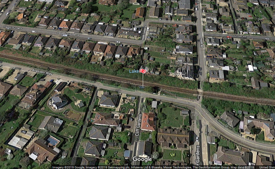
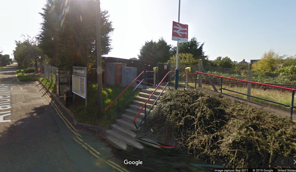
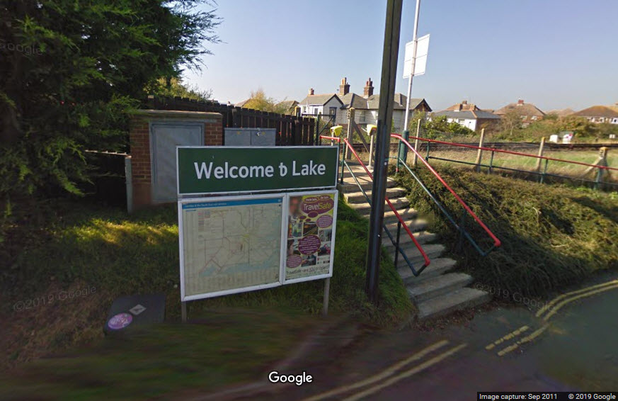
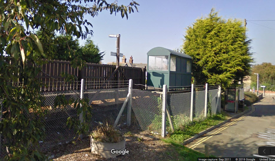
Lake
GPS Coordinates: 50.646440, -1.166319
Araluen Way at Cliff Gardens
Post: Sandown PO36 8PJ, UK
Parking: no
No formal station, only a single bus type shelter.
Single track here.
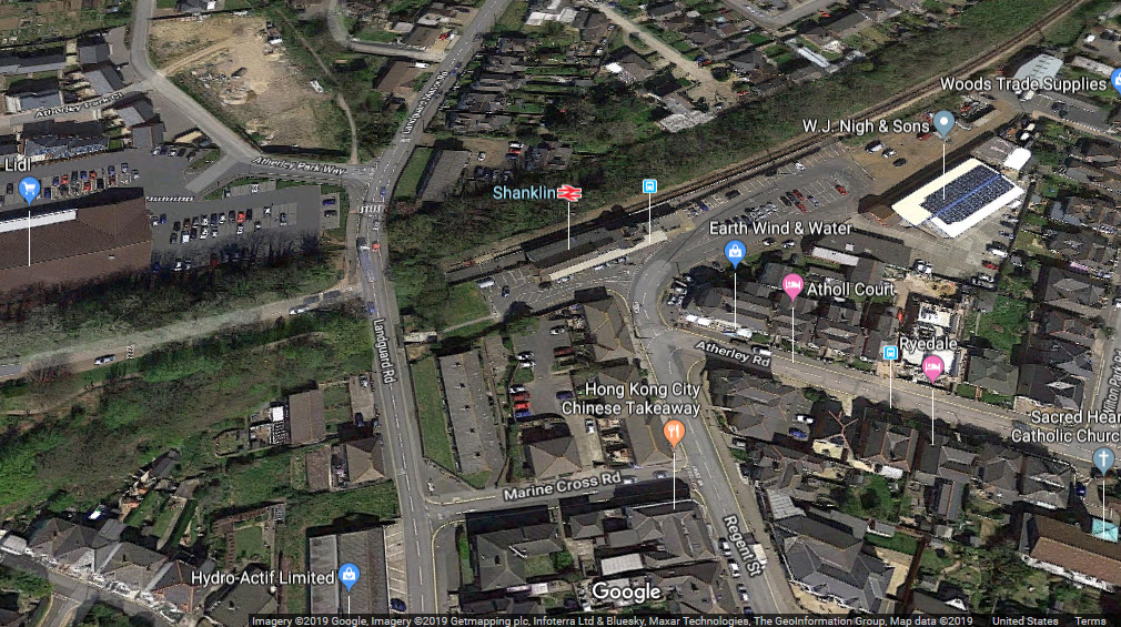
Shanklin
GPS Coordinates: 50.633775, -1.179915
Regent Road at Atherley Road
Post: Shanklin PO37 7AR, UK
Parking: yes
This is the southernmost station on the line. The tracks going beyond here were taken up years ago.
Single track here.
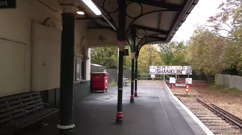 End of the line
The Ryde Pier Bridge
GPS Coordinates: 50.739131, -1.160327 (northern end)
Tunnel
GPS Coordinates: 50.732013, -1.157191 (northern portal)
GPS Coordinates: 50.729374, -1.154396 (southern portal)
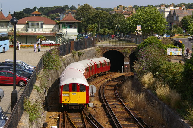 Northern portal
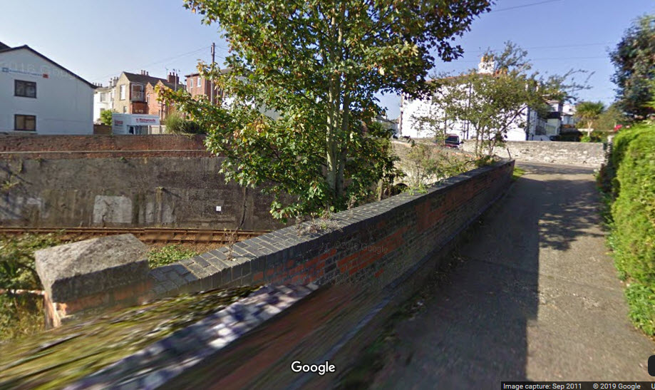 Southern portal
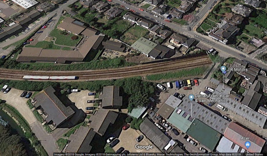 Southern portal
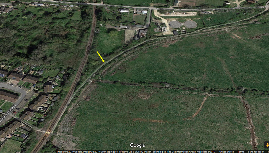
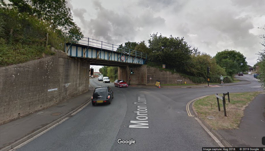
Girder Bridge over Avenue Road/A3055
GPS Coordinates: 50.663591, -1.152788
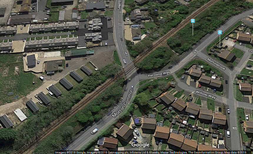
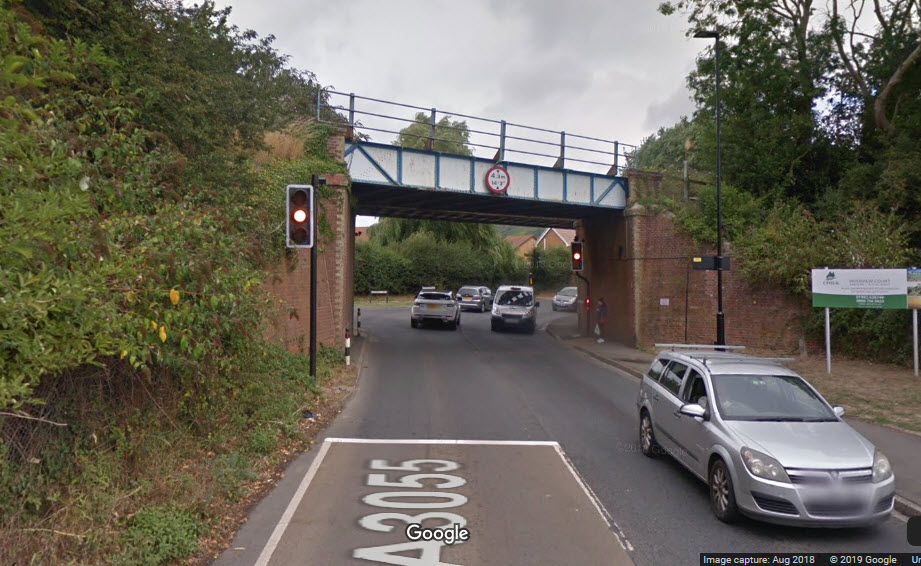
The unused girder bridge is on the Morton Commons side.
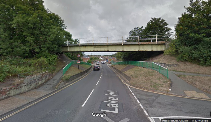
Girder Bridge over Lake Hill/A3055
GPS Coordinates: 50.650230, -1.165756
Near as I can tell, the line uses two aspect red/green signals. I am basing this on one of the videos, where you can see a signal change as a train approaches the photographer. Looks like the signal clears with the train passing the signal going away from it, giving us a clear as soon as the train gets out of the previous block.
Did U Know?
The London Underground trains use a four rail system, compared to the Island Line, and most other subway/metro systems. The forth rail is used as a power return instead of relying on the running rails for the return. Originally, it was used to help keep the voltage drop to 7 volts in each section. This was intended to reduce problems caused by stray currents causing electrolysis affecting utility pipes and cables
Disclaimers:
I love trains, and I love signals. I am not an expert. My webpages reflect what I find on the topic of the page. This is something I have fun with while trying to help others.
Please Note: Since the main focus of my two websites is railroad signals, the railfan guides are oriented towards the signal fan being able to locate them. For those of you into the modeling aspect of our hobby, my indexa page has a list of almost everything railroad oriented I can think of to provide you with at least a few pictures to help you detail your pike.
If this is a railfan page, every effort has been made to make sure that the information contained on this map and in this railfan guide is correct. Once in a while, an error may creep in :-)
My philosophy: Pictures and maps are worth a thousand words, especially for railfanning. Text descriptions only get you so far, especially if you get lost or disoriented. Take along good maps.... a GPS is OK to get somewhere, but maps are still better if you get lost! I belong to AAA, which allows you to get local maps for free when you visit the local branches. ADC puts out a nice series of county maps for the Washington DC area, but their state maps do not have the railroads on them. If you can find em, I like the National Geographic map book of the U.S..... good, clear, and concise graphics, and they do a really good job of showing you where tourist type attractions are, although they too lack the railroads. Other notes about specific areas will show up on that page if known.
Aerial shots were taken from either Google or Bing Maps as noted. Screen captures are made with Snagit, a Techsmith product... a great tool if you have never used it!
By the way, floobydust is a term I picked up 30-40 years ago from a National Semiconductor data book, and means miscellaneous and/or other stuff.
Pictures and additional information is always needed if anyone feels inclined to take 'em, send 'em, and share 'em, or if you have something to add or correct.... credit is always given! Please be NICE!!! Contact info is here
Beware: If used as a source, ANYTHING from Wikipedia must be treated as being possibly being inaccurate, wrong, or not true.
RAILFAN GUIDES HOME
RAILROAD SIGNALS HOME
NEW 08/29/2019
Last Modified
31-Aug-2019