Data:
GPS Coordinates: as needed
Phone A/C: 713
ZIP: 77028
Access by train/transit:
#77 Bus, comes down Liberty Road past Tower 68, but doesn't make it to the
diamond, turns up Homestead Rd.
The Scoop:
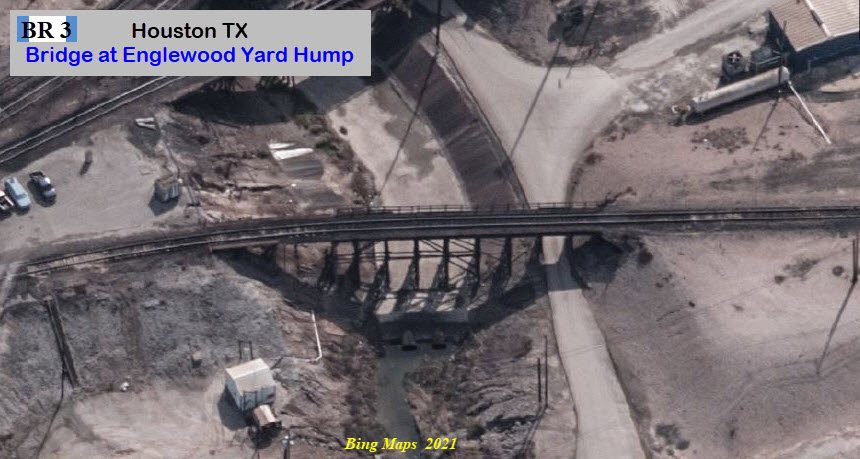
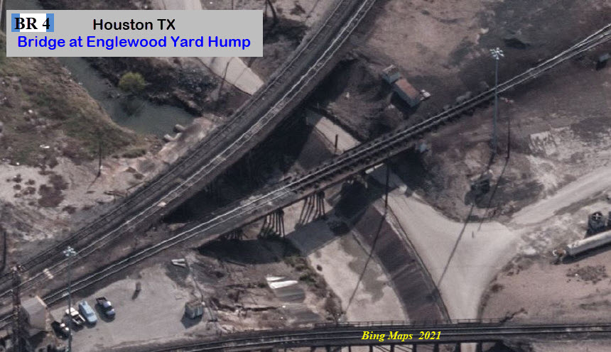
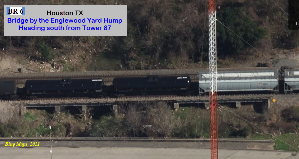
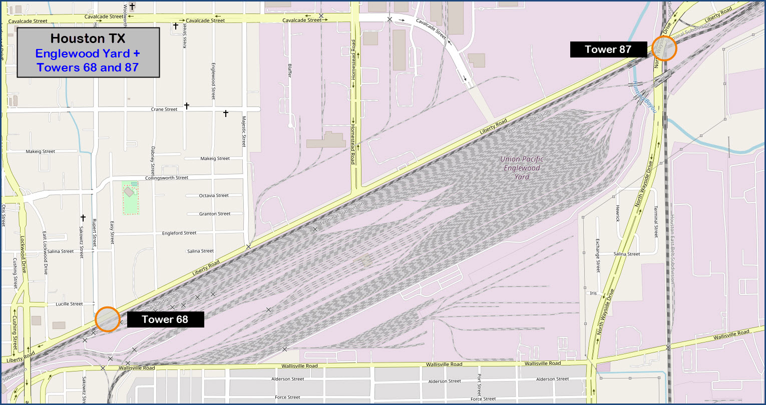
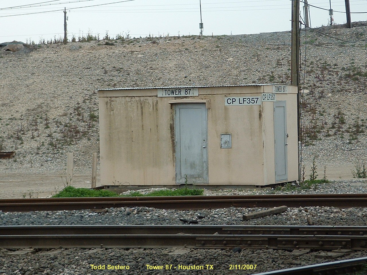
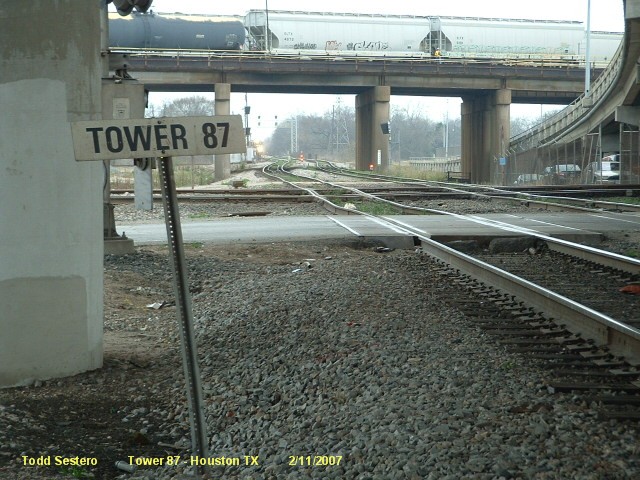
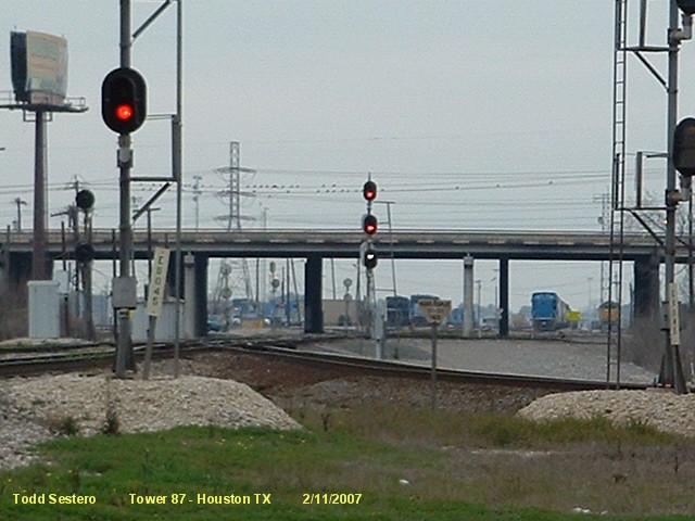
This page covers Tower 87, a diamond located at Englewood Yard in northeast Houston TX.
More correctly, this page is about THE SIGNALS associated with Tower 87.
For info on the tower itself, I will refer you to the Texas Railroad History
page on Towers 68 & 87.
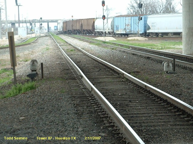
This also a page of history, because the great majority of signals the were
around here in 2007 are now gone... the searchlight dwarfs, the few high
searchlight locations, the "trilight" signals at the Mesa Crossover, and to a
lesser degree, some of the standard colorlight locations.
Because of where this diamond is, there is almost ALWAYS something moving,
somewhere. If you plan to visit, and you have friends, bring them along
and have them all stand in different spots and share the pictures.... as you
will not be able to keep up with the traffic at times!
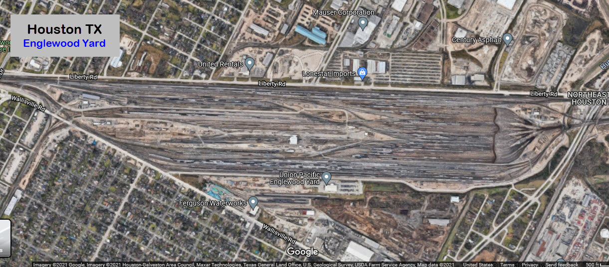
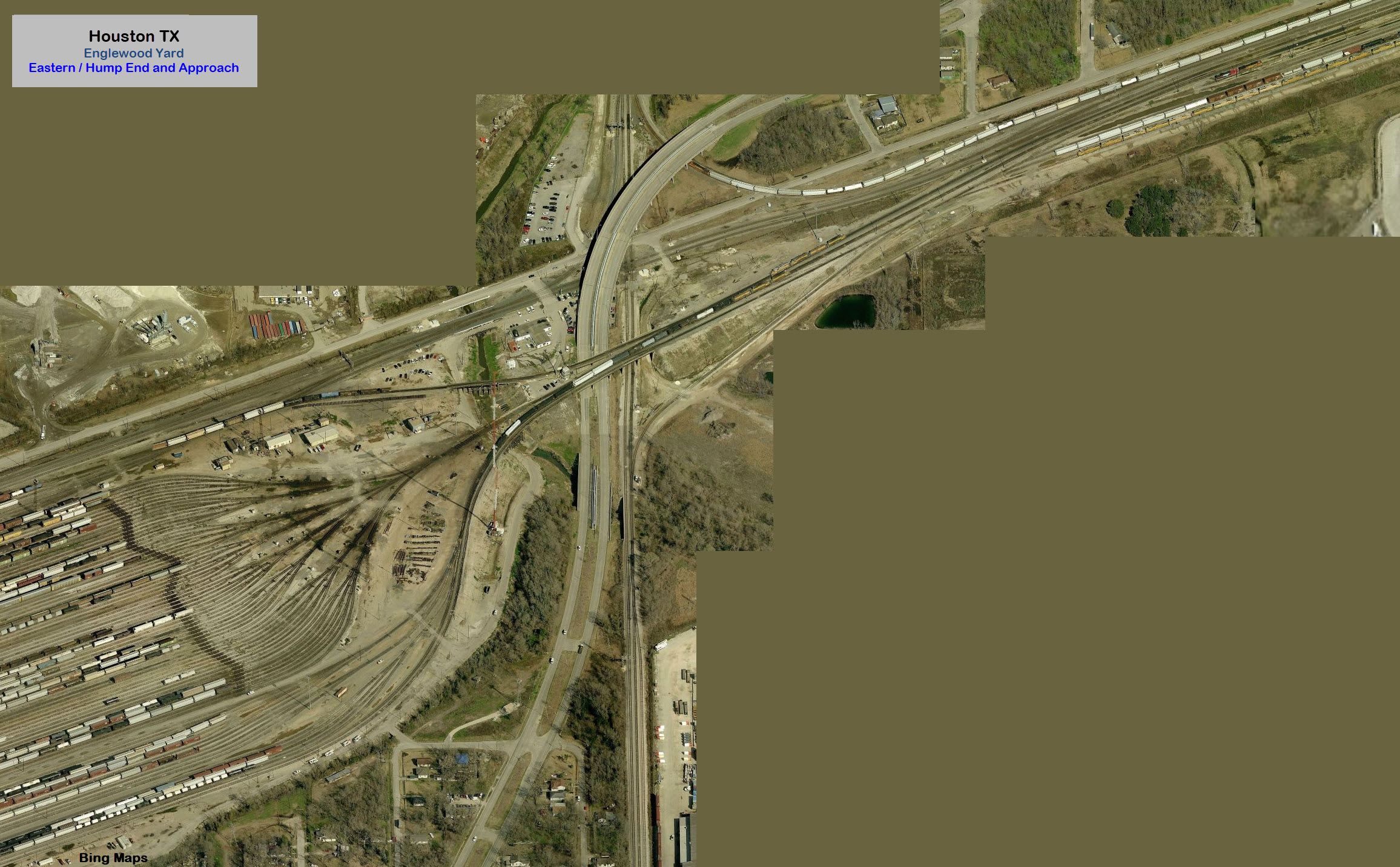
Englewood Yard is a former Southern Pacific Yard, Settegast was always a UP Yard.
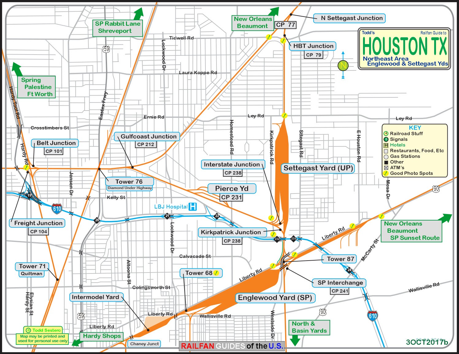
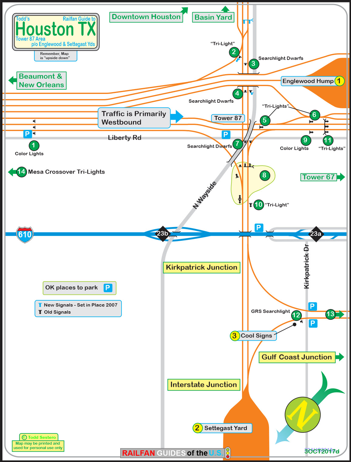
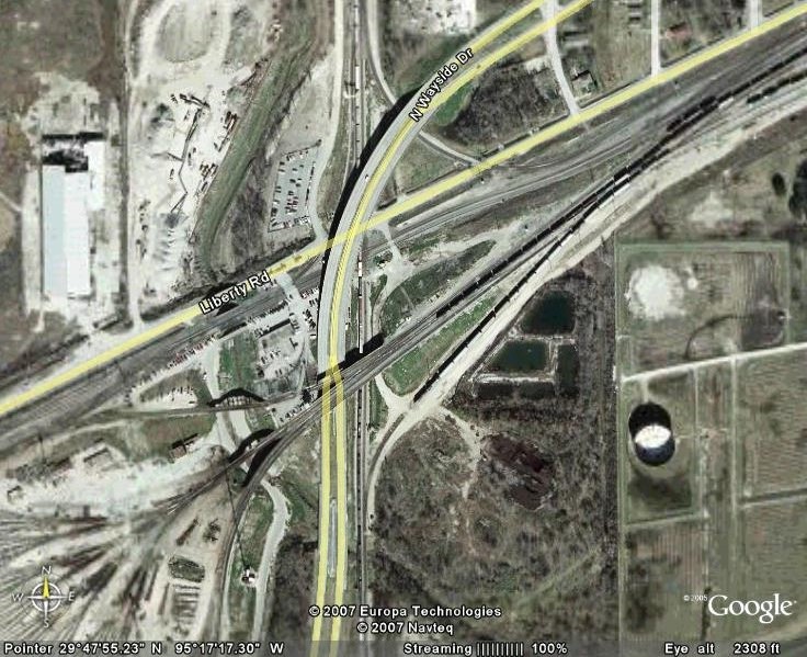
Below is an area map of the northeast side of Houston, and two site specific maps of
the signals at Tower 87 - my original one from 2007, and it's updated
brother. There is also a snapshot of a Google satellite view of the Tower
area. My original map is oriented as you would be looking at the signals in Englewood yard
from Liberty Rd. I also inverted the Google Earth map so it would be in the same
orientation. In the picture and on the map, you will notice a dirt road that
runs from Liberty Road to the I-610 service road, and also services the fenced
in employee parking lot. In the 2021 re-do of the map, it is oriented with
north to the top.
Time was short when I was here in 2007, so I
missed getting good pictures at all of the locations, if you can help out, it
would be appreciated. I'm sure many things have changed since then! :-)
Acknowledgements:
Texas Railroad History
Google Maps
Bing Maps
If you look at a map of Houston, you
will notice two loop highways (Beltways if you are from the mid-Atlantic area),
and one of them, the inner loop, is interstate 610, the Loop Freeway.
The outer loop is the Sam Houston Tollway. Highways in Texas are
generally superior to those elsewhere in the country. Houston is no
exception. If you've never been to Texas before, the majority of their
highways have service roads that run parallel to the highway, on both sides.
This makes getting on and off MUCH easier, as the service roads are one-way. At
most of the intersections that go over or under a freeway, there are usually
U-Turn lanes where you do not have to wait for the light to change or go thru
the intersection to make the U-Turn. Wish other places had em both!!!
From the downtown area, I would come
out of town on US59, heading north, and then take 610 east to exit 22, Homestead
Rd. Take a right, and it will run into Liberty at the yard... take a left.
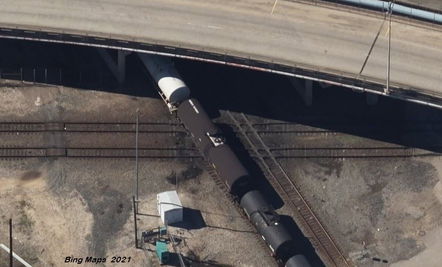
When you come to a highway overpass, you're at the location. There's a
grade crossing with the original UP line, and you should be able to pull off the
road along Liberty.
Coming from the east on I10, take I610 at exit 775, and head north on the loop
to exit 23a. Take the service road to Homestead, where you'll take a
left,. Then follow the above directions.
From the west on I10, take US59 north from the downtown area, and follow the instructions above.
If you're coming up I45 from Galveston, I would probably take I610 around to exit 22.
From the north on US59 or I45 for example, I would take I610 east to the above mentioned exit.
5500 Wallisville Rd, Houston TX 77020 (from Google Maps)
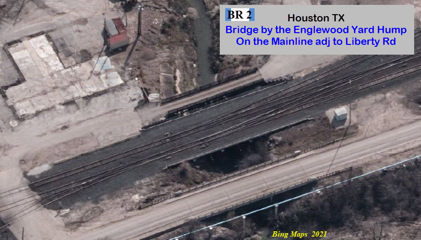
Depending on where you you measure it from and to, Englewood Yard is "about"
3.46 miles long, going to the last switch at the western end that directs
traffic into parts of the yard, and on the eastern end, the first switch for
movements into the marshalling yard for the hump. If we measure just
Englewood Yard (to Wayside Dr), it's 2.0 miles long.
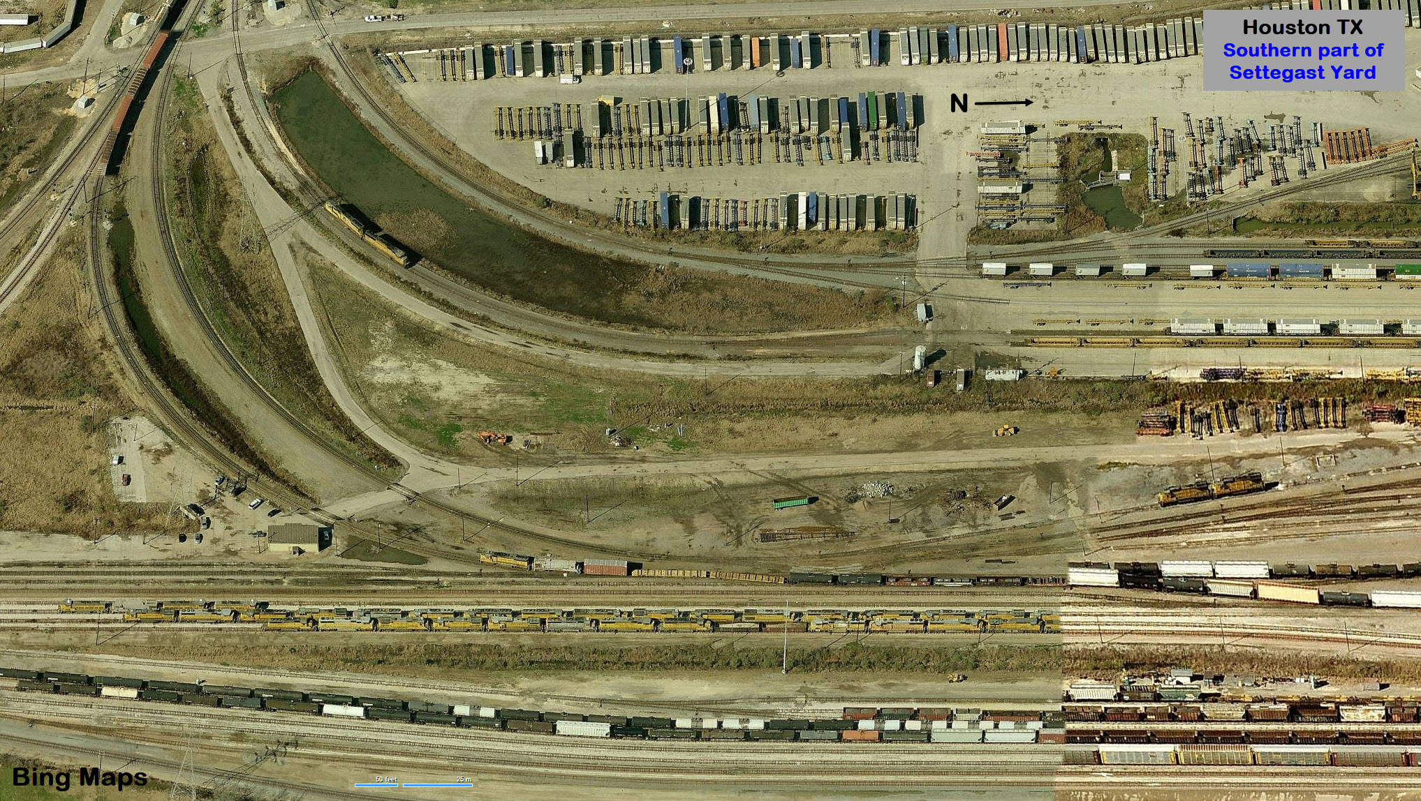
the Southern End of Settegast Yard
GPS Coordinates: 29.80406, -95.28861 (at the entrance of the yard under I-610)
Keep in mind that I'm concentrating on Tower 87 on this page, so I will only
cover the south end of Settegast Yard, since it is in close proximity to Tower
87, and half the traffic going thru the diamond is headed there.
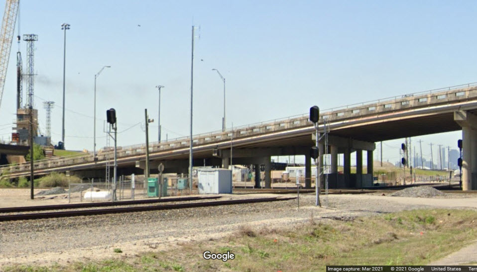
A good number of the signals in this area have been upgraded and replaced.
Most, if not all of the searchlight signals are gone, as are most of the
older "trilight" style signals. For comparison, I have left my 2007
signal locator map on the page. Also, most of the signals covered on
this page are involved with the interlocking for Tower 87. This area is
"packed" with signals, however, for signal fans, it's not quite a
"go-to" spot as it used to be before the upgrade took place, darn.
Please Note: The numbering of MY signal locations follows the newer/2021 version of my locator map.
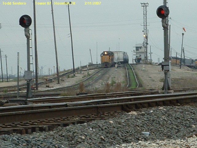
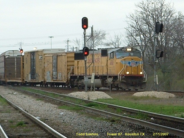
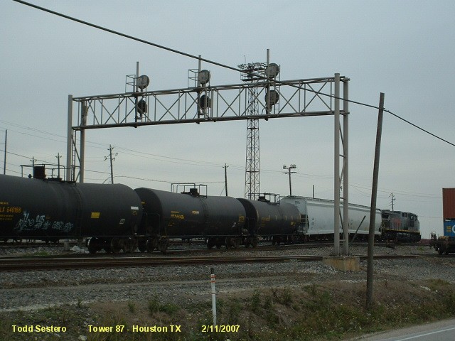
Color light signals at this location, by the approach to the hump. It looks like
one of the signals, the farthest one from Liberty Road, may have
been removed, altho the view is blocked on Google Maps Streetview.
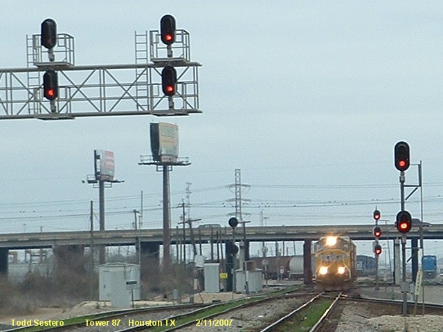
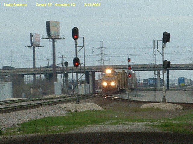
EB Colorlight Signals
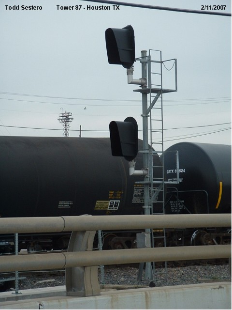
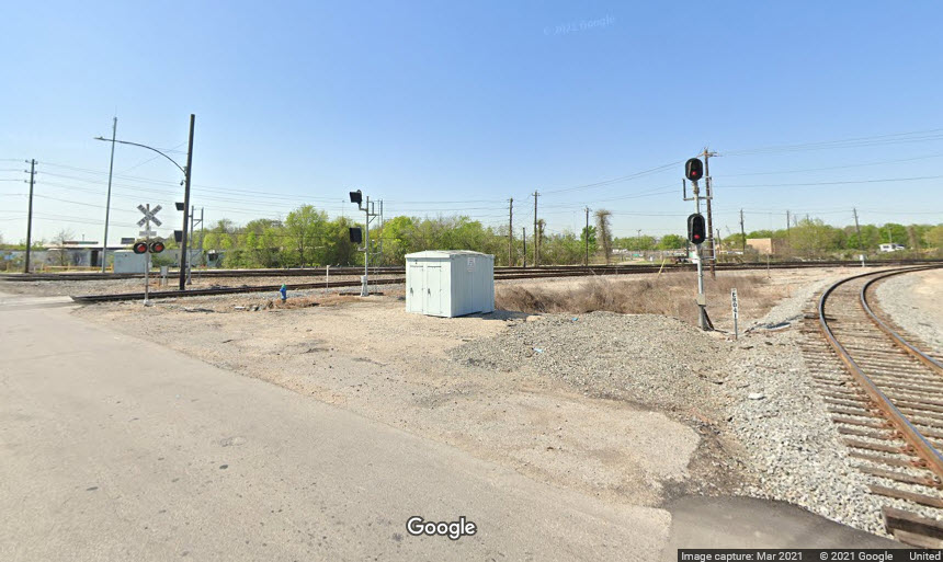
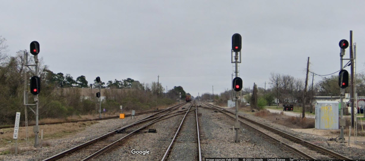
SB Interchange "Trilight" Signal
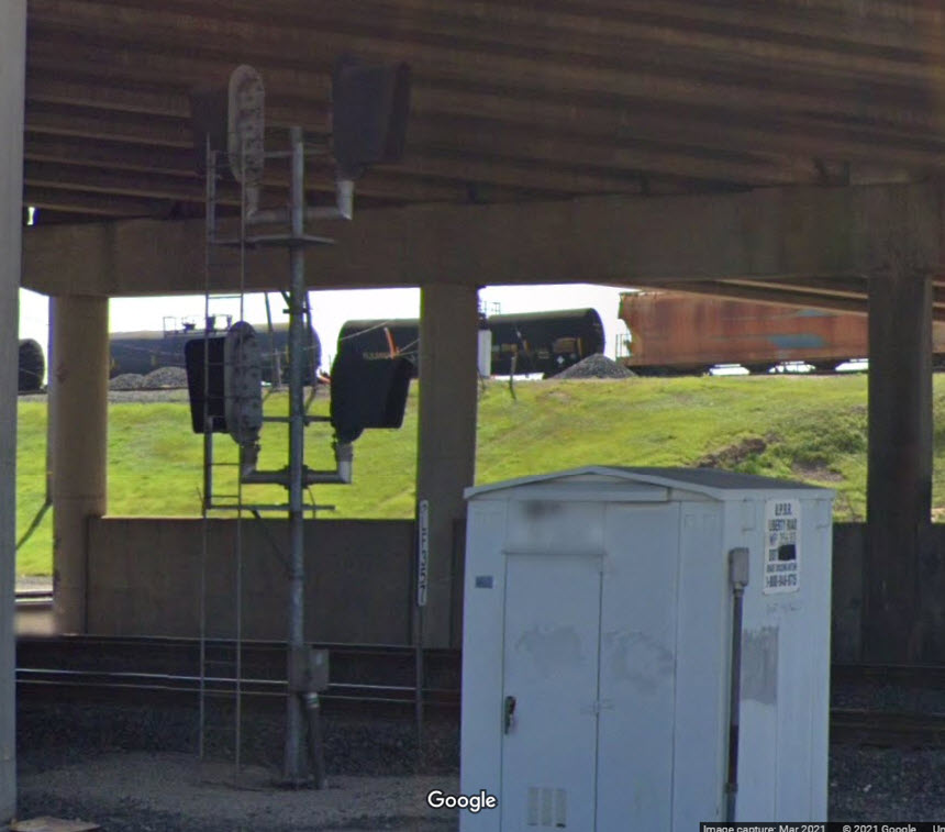
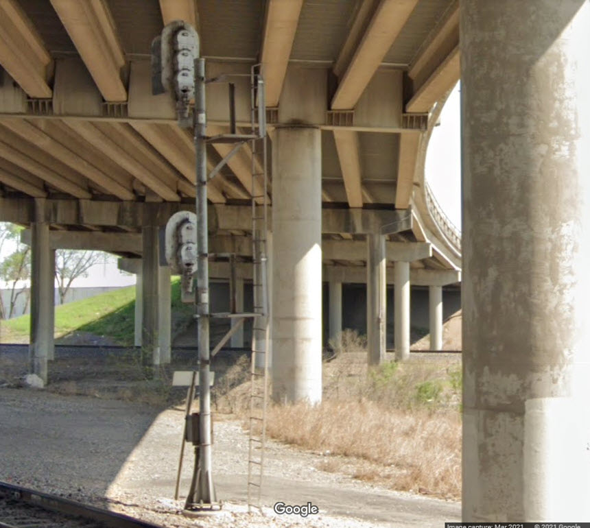
SB Dual Searchlight Dwarf Signal
NB/SB Searchlight Dwarf Signals
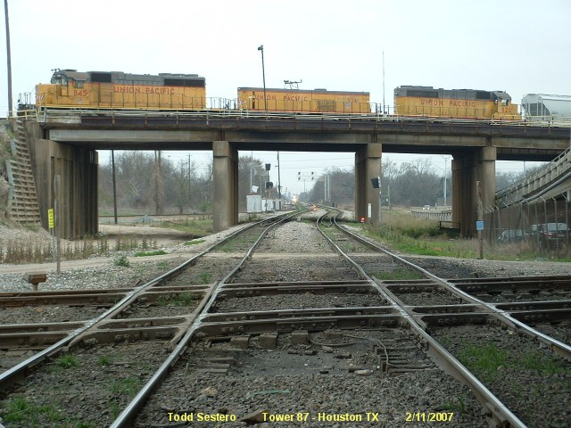
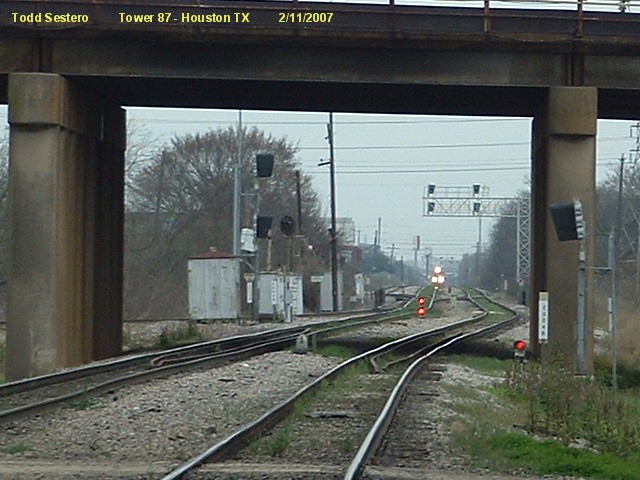
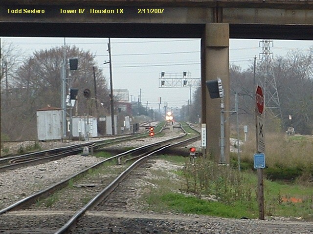
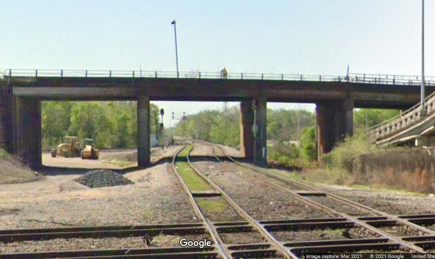
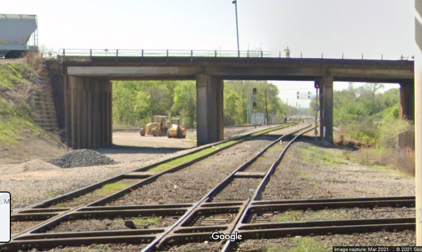
Looking south under the flyover bridge towards signals 2, 3, and 4.
We can see the new signals waiting to be cut-over. It looks like
signal 3 has been replaced by a two head colorlight signal, and the NB
searchlight is gone with no replacement. We can see in the streetview the
"new" colorlight signal at 4.
Signal #2 (the "trilight" signal in the pictures below), which is an interchange
control signal, has probably been moved so
that it is no longer visible from Liberty Road. Maybe someone that works
for the UP could send me a picture of the new/relocated signal?
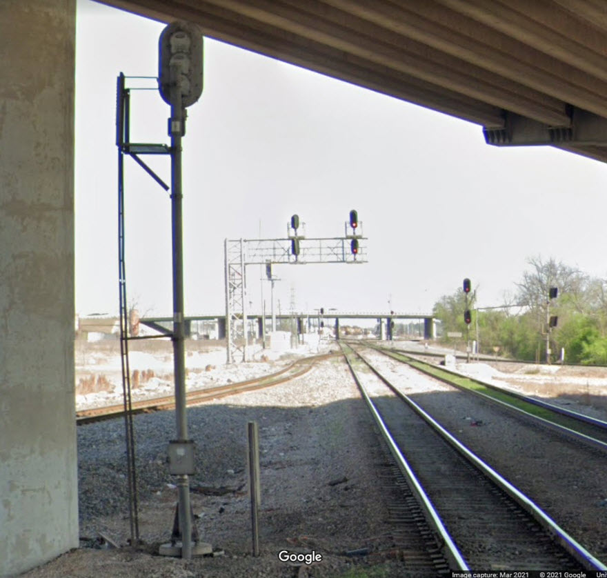
EB/WB Colorlight Signals for the Diamond
These signals are on the West side of the Diamond. Both sets of signals
have a westbound and an eastbound signal back to back, and all four of them are
two headed signals.
EB Colorlight Signal
This appears to be a signal for engines (and maybe trains) coming out of the yard and
going out onto the mainline, probably for engines pushing trains over the hump and
needing to get on the far side of the train???? Just guessin.
WB Colorlight Signal
This signal appears to have been removed and not relocated. It was right next to Liberty Road
where it goes over Hunting Bayou on the WB main.
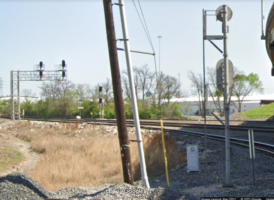
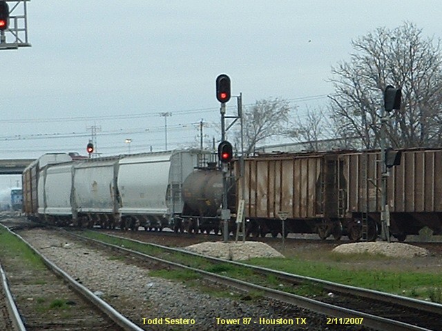
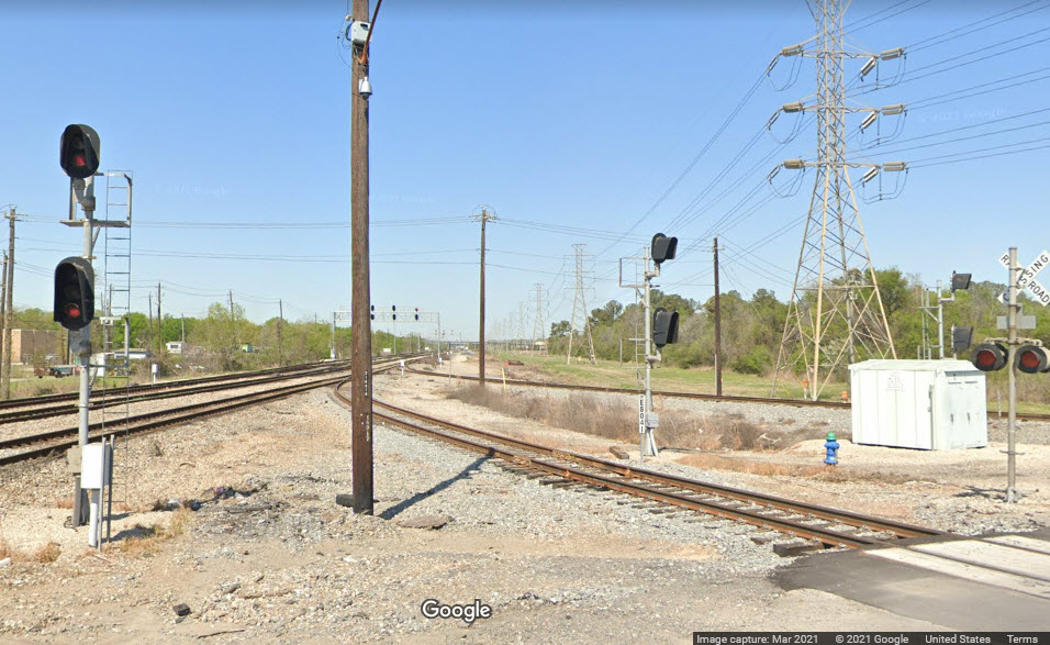
SB Colorlight Signals for the Diamond
These signals are or trains coming south out of Settegast, or from Gulf Coat
Junction. There used to be two US&S searchlight dwarfs at this
location, now, they are standard colorlights. The west signal is a single
head signal, while the eastern one has two heads.
SB Interchange Colorlight Signal
This signal controls SB movements out of Settegast onto the WB "SP" main.
Signal 7a is on the right
I've grouped a number of signal locations in with number 8, got lazy, I know,
I'll burn in hell for doing so :-)
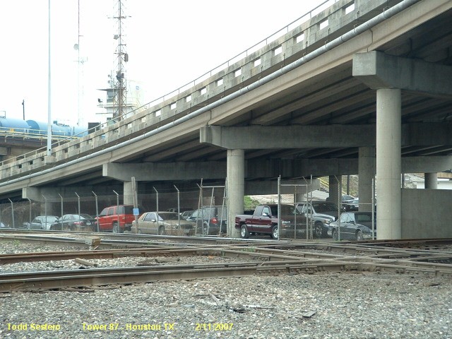
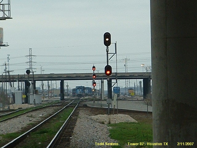
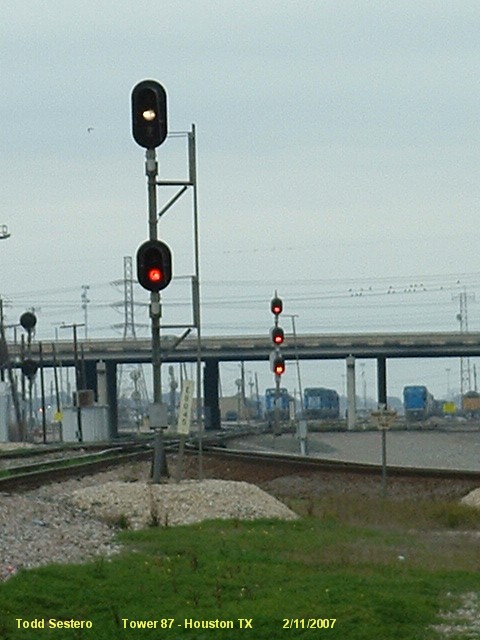
from under I-610
from the I-610 overpass
The next two photos illustrate two different aspects for "restrict", one is L/R, the other is R/R/L.
WB Colorlight Signals for the Diamond
See the Settegast Signals
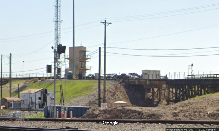
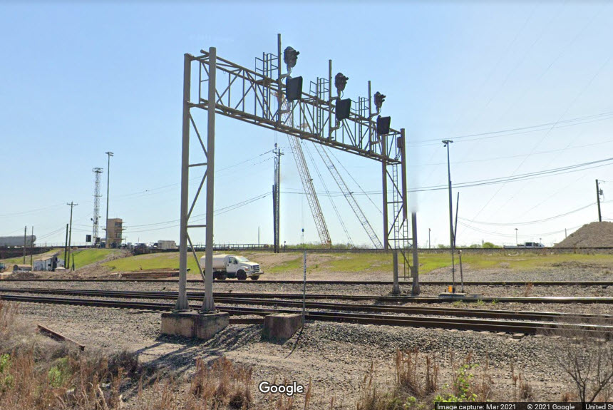
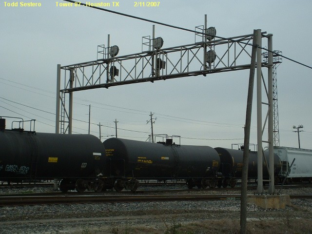
Signal Bridge
GPS Coordinates: 29.79824, -95.29109
One of the few signal bridges in the area, this one spans 3 tracks, and uses
"trilight" signals on the top, and standard colorlights on the bottom of all
three signals. When I came thru in 2007, the signal on the left was
all "trilights". These trilight signals are some of the very
few that have not been changed over to
colorlight signals in the Englewood/Settegast interlocking plant.
Signal bridge at this location spanning three tracks. The two signals on the right
use a standard color light signal head for the bottom location, while the remaining positions
are "tri-light" signals. These signals are for eastbound movements.
See the Settegast Signals See the Settegast Signals See the Mesa Crossover Signals See the Settegast Signals See the Settegast Signals
"NB" Interchange Colorlight Signal
This signal controls movement out of Settegast onto the EB SP main heading towards New Orleans.
I'm not 100% sure, but this signal may not have been in place on my 2007 visit.
Not sure, this signal, which sits kinda under I-610, might be signal 10, relocated.
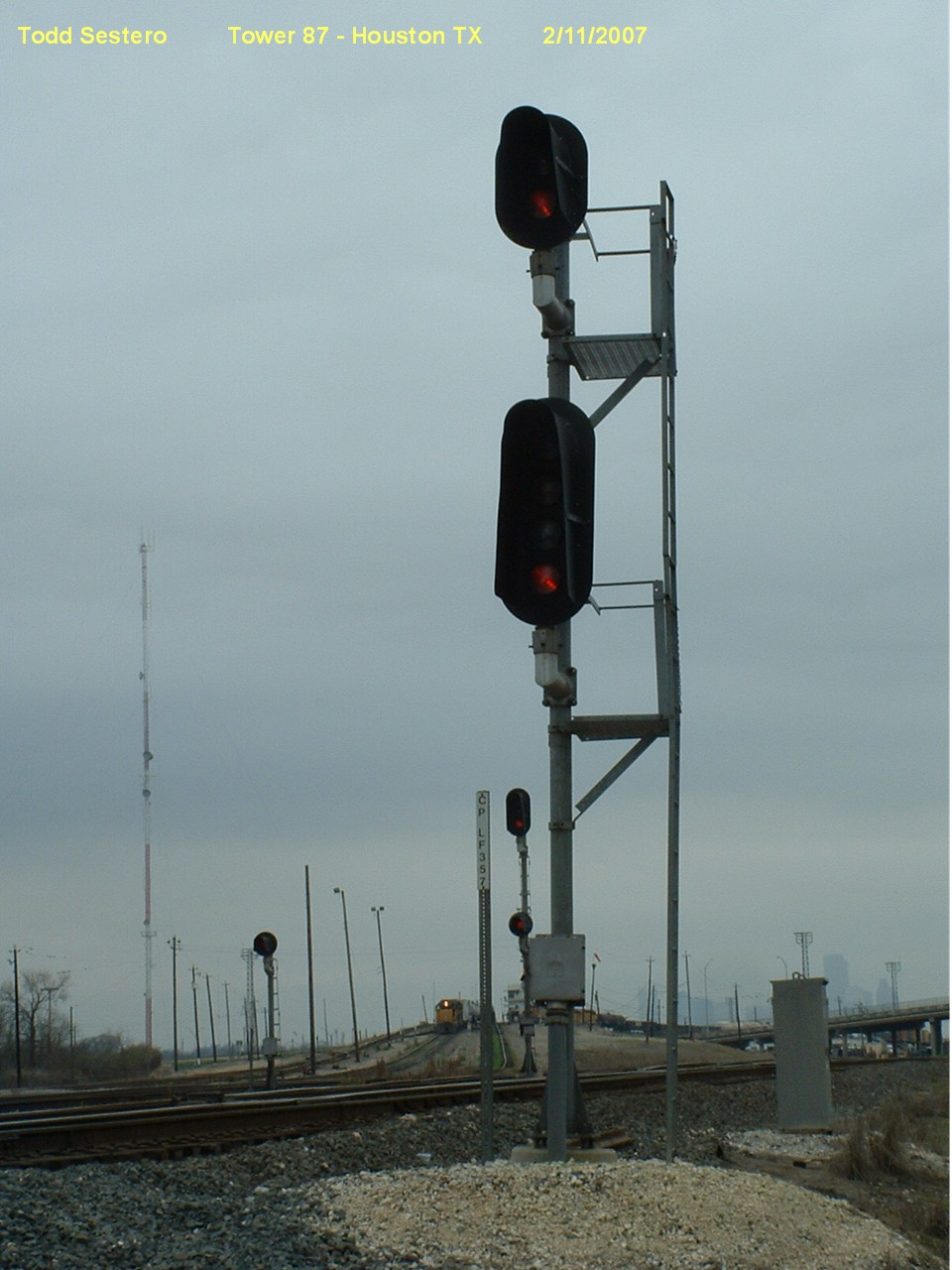
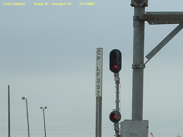
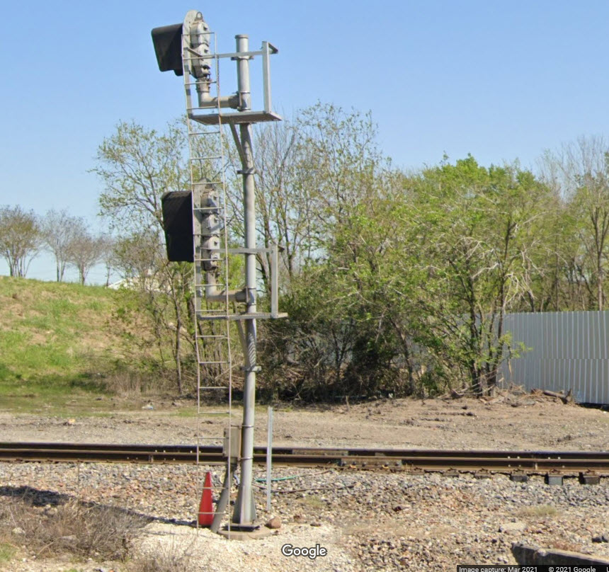
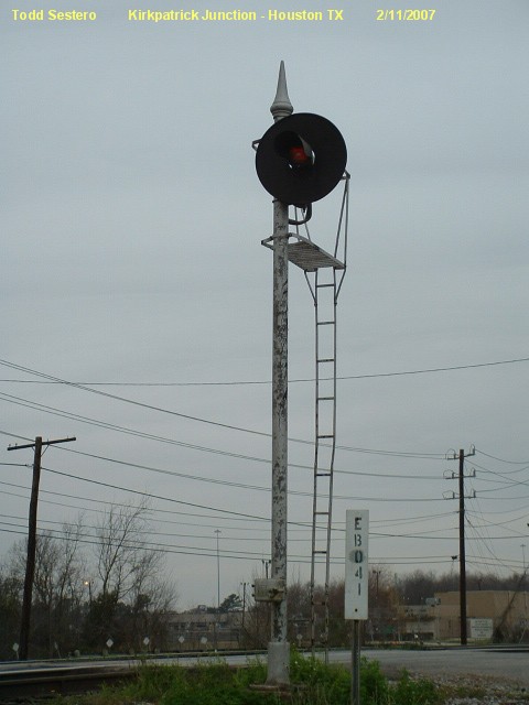
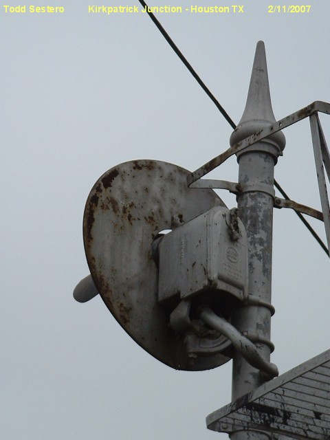
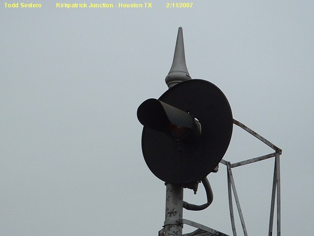
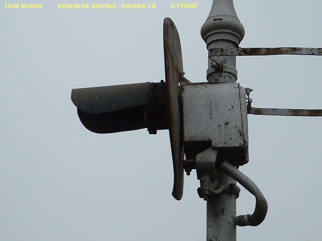
GRS Searchlight
This signal is at Kirkpatrick Junction. It's the only GRS signal I saw
during my three day trip. It was replaced at some point after my 2007 trip.
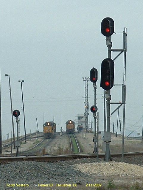
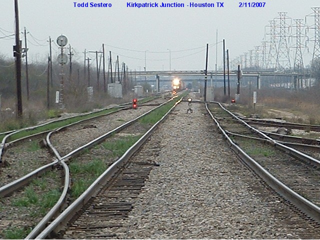
A view looking west from Kirkpatrick Junction, still lots of dwarf searchlights
used. The middle searchlight is displaying a lunar white for restrict.
I wish I had taken these pictures in the high res mode with the camera, darnit.
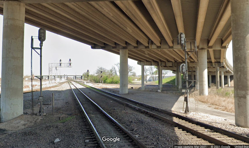
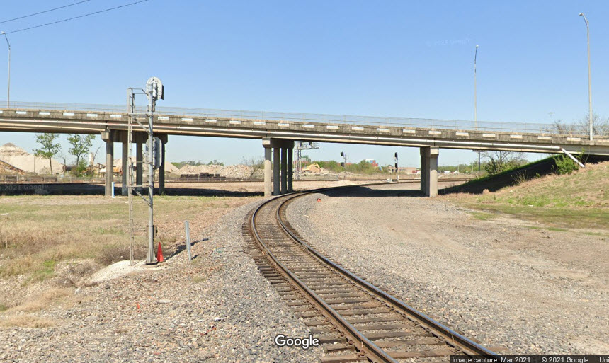
In the picture below, we can see a lot has happened here in the past 14 years -
pole line removed, tracks added, signal bridge added, and signals updated.
I think we'll miss that lunar indication! :-)
WB Colorlights
Signal #12 was replaced by the one in the middle, and the other two were
added during the signal upgrade.
SB Colorlights
Of the three signals at this location, the one on the left is for an interchange
track coming from Gulf Coast Junction, and the other two are for Settegast Yard leads.
For WB traffic, there are three signals for three Tracks at Fields St, with an additional
signal for the industrial siding controlling movements onto the mainline.
The three EB signals can be easily seen from Liberty Road. The signals
here used to be "trilights", but are all now standard color light signals.
I love trains, and I love signals. I am not an expert. My webpages reflect what I find on the topic of the page. This is something I have fun with while
trying to help others.
Please Note: Since the main focus of my two websites is railroad signals, the railfan guides are oriented towards the signal fan being able to locate them.
For those of you into the modeling aspect of our hobby, my
indexa page has a list of almost everything railroad oriented
I can think of to provide you with at least a few pictures to help you detail your pike.
If this is a railfan page, every effort has been made to make sure that the information contained on this map and in this railfan guide is correct. Once in a while,
an error may creep in :-)
My philosophy: Pictures and maps are worth a thousand words, especially for railfanning. Text descriptions only get you so far, especially if you get lost or
disoriented. Take along good maps.... a GPS is OK to get somewhere, but maps are still better if you get lost! I belong to AAA, which allows you to get
local maps for free when you visit the local branches. ADC puts out a nice series of county maps for the Washington DC area, but their state maps do not have the
railroads on them. If you can find em, I like the National Geographic map book of the U.S..... good, clear, and concise graphics, and they do a really good job
of showing you where tourist type attractions are, although they too lack the railroads. Other notes about specific areas will show up on that page if known.
Aerial shots were taken from either Google or Bing Maps as noted. Screen captures are made
with Snagit, a Techsmith product... a great tool if you have never used it!
By the way, floobydust is a term I picked up 30-40 years ago from a National Semiconductor data book, and means miscellaneous
and/or other stuff.
Pictures and additional information is always needed if anyone feels inclined to take 'em, send 'em, and share 'em, or if you have something to add or correct.... credit
is always given! Please be NICE!!! Contact info is here
Beware: If used as a source, ANYTHING from Wikipedia must be treated as being possibly inaccurate, wrong, or not true.


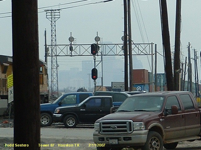
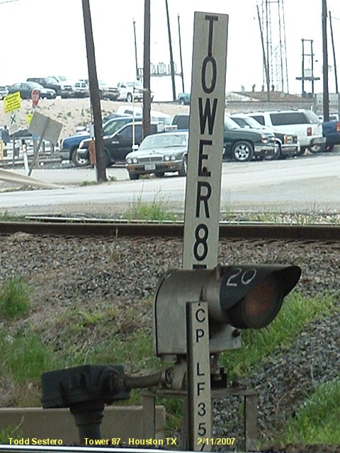
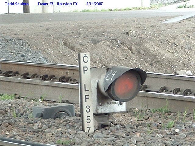
 These three - 2007
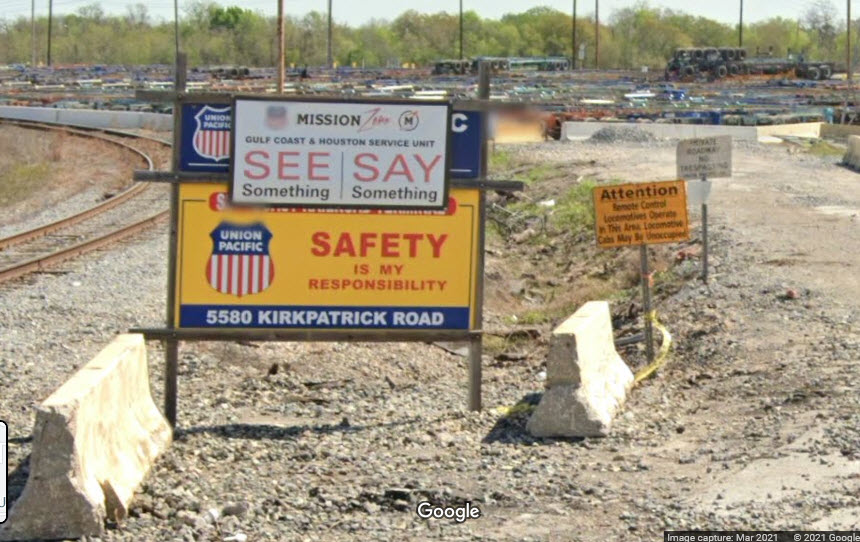


 Signal 7a is on the right
 from under I-610
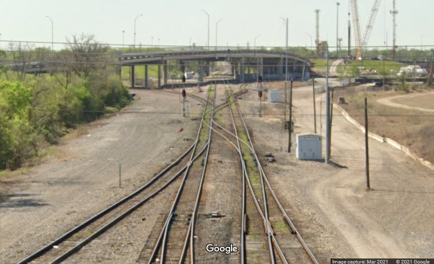 from the I-610 overpass
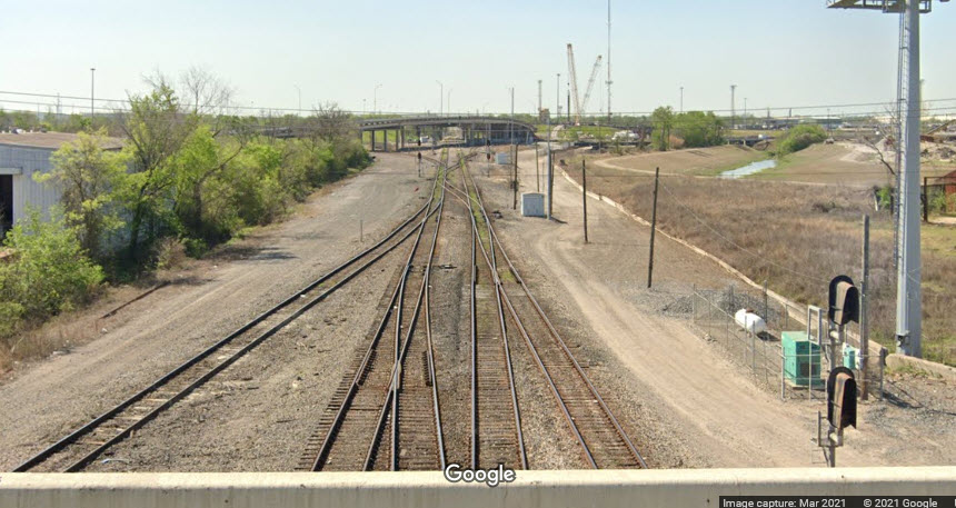


 from the I-610 overpass
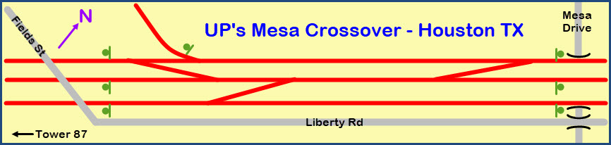
 WB signals at Field Rd
 The siding signal
 EB signals