
In General
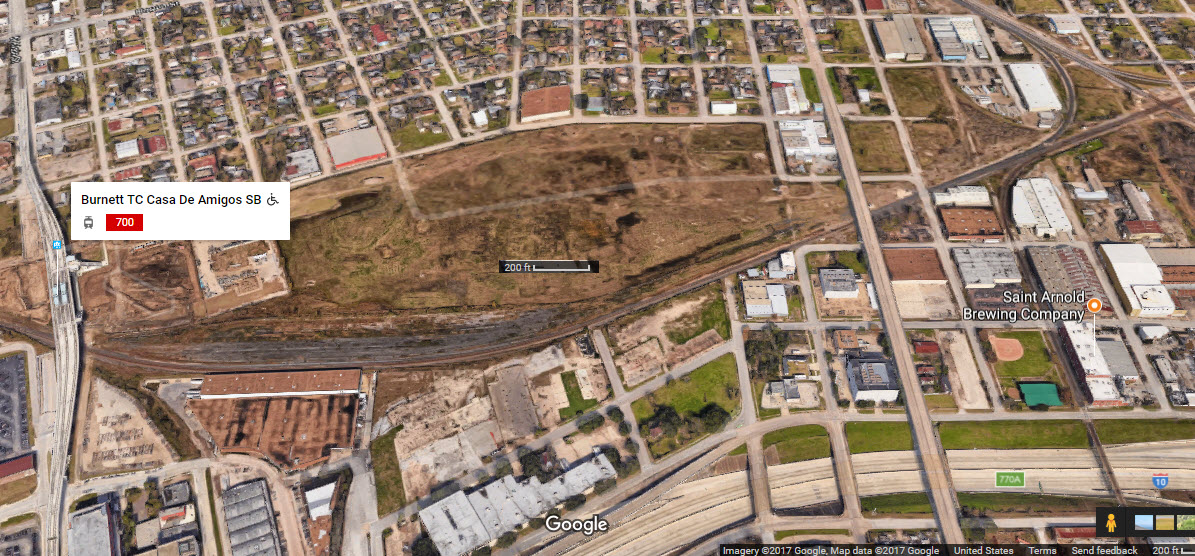
Getting Here
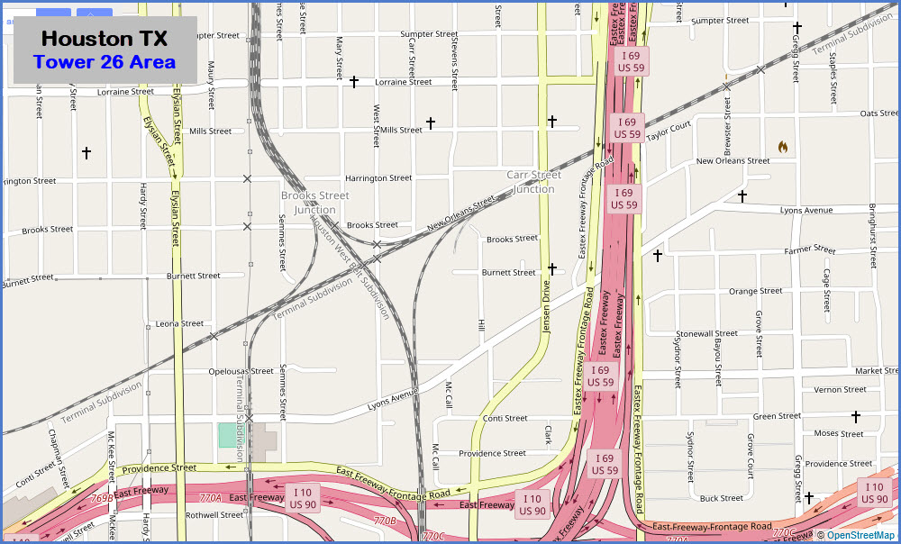
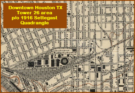
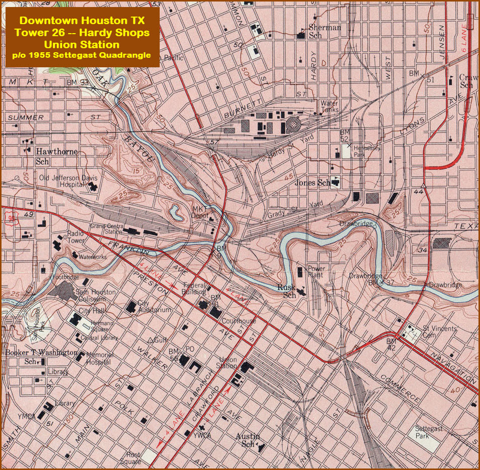
Map
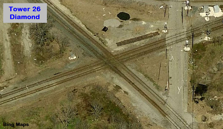
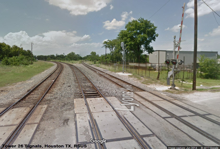
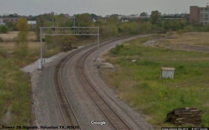
the Diamond
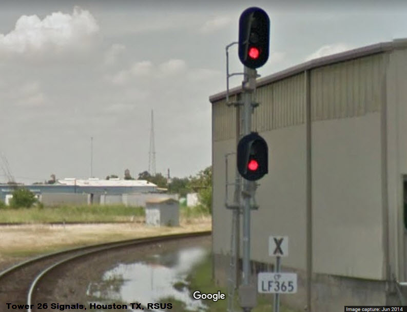
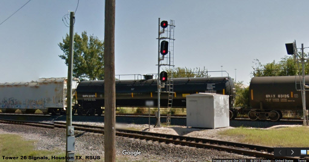
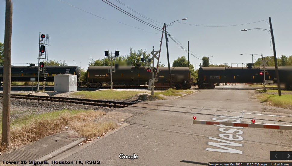
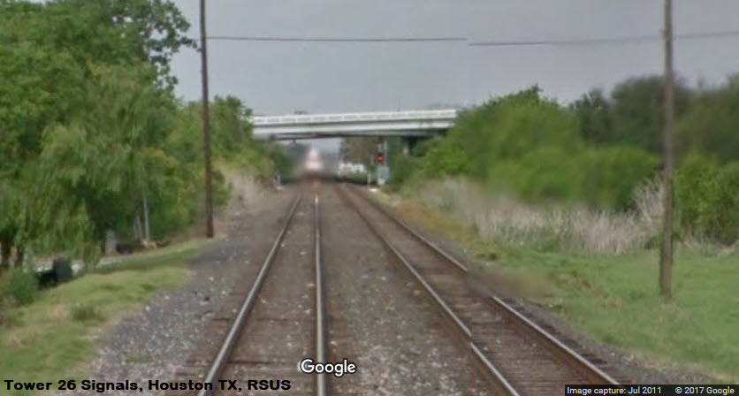
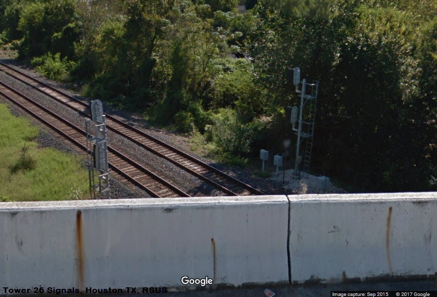
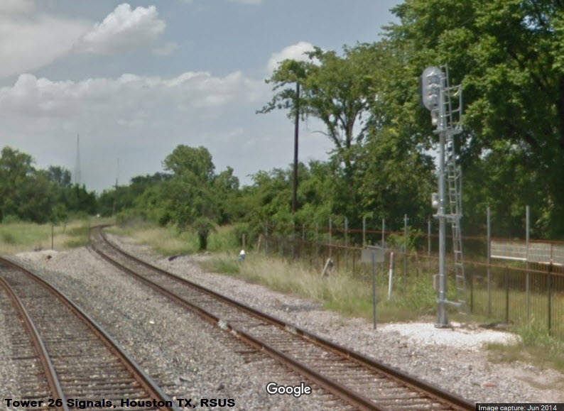
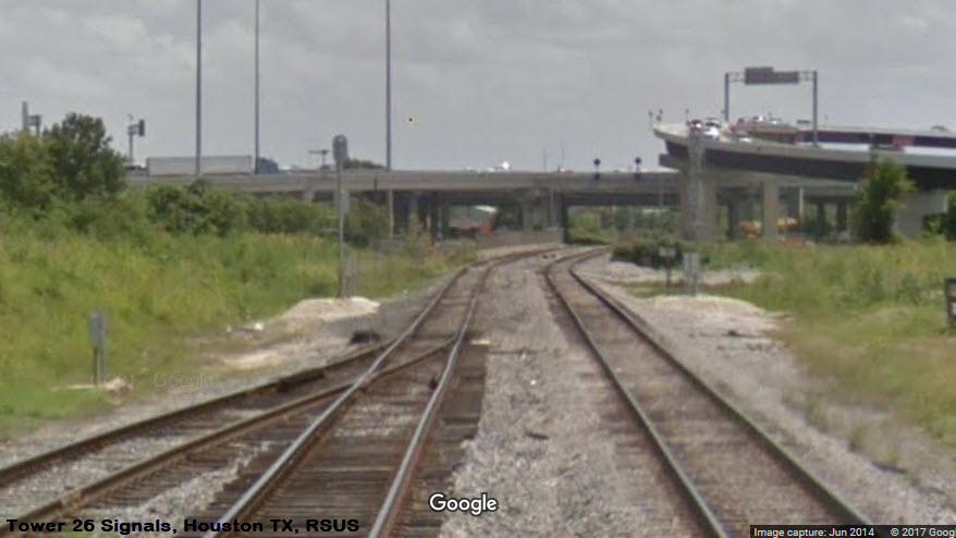
Signals
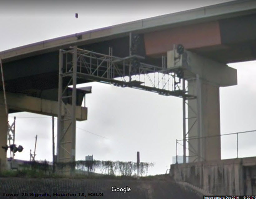
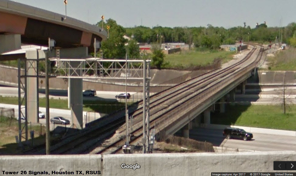
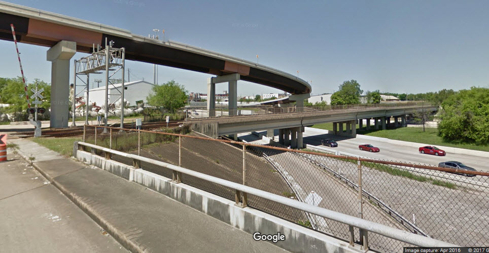
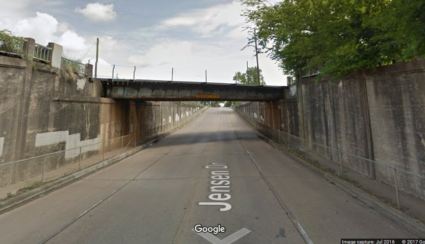
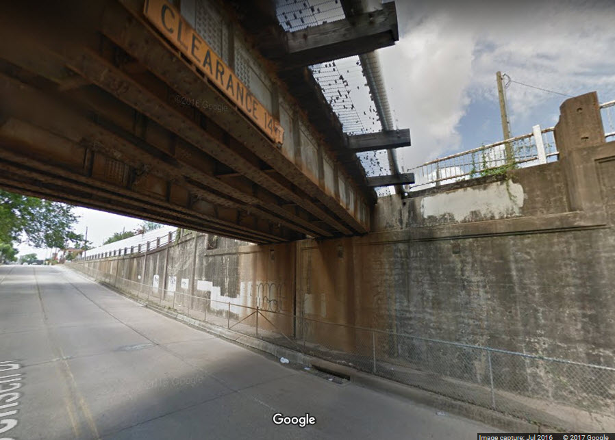
Bridges
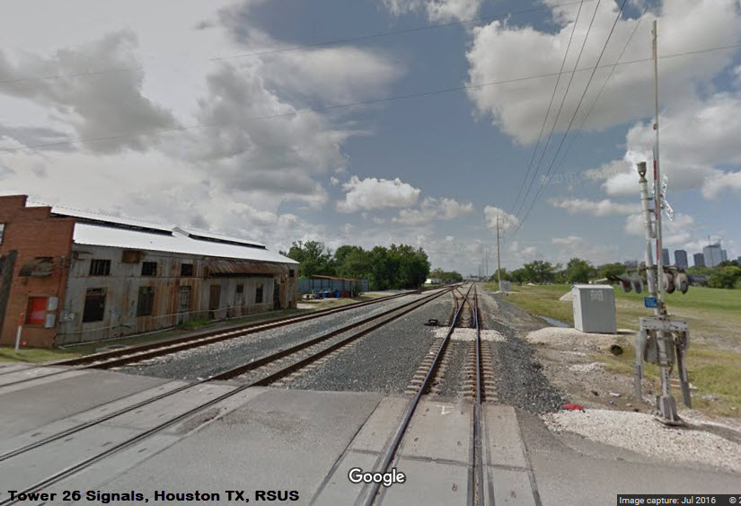
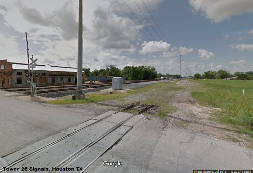
Pictures
Floobydust
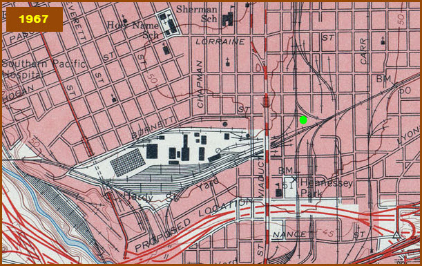
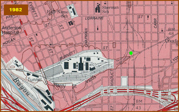
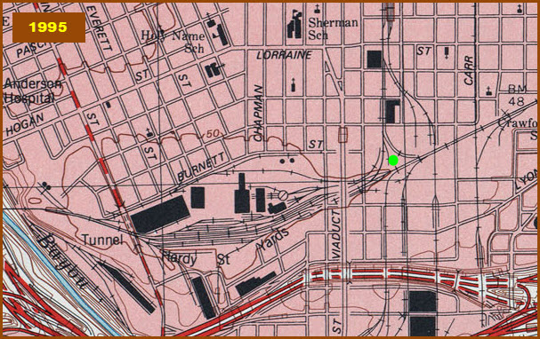
USGS Maps
HOUSTON HOMEPAGE
RAILFAN GUIDES HOME
RAILROAD SIGNALS HOME
Location / Name:
Downtown Houston TX, Harris County
What's Here:
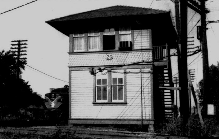
Tower 26:
Diamond Crossing
3 Interchange Tracks
Extensive Signaling
Data:
GPS Coordinates: 29.774775, -95.346123
Phone A/C: 713
ZIP: 77026
Access by train/transit:
The MetroRail Red Line Burnett TC station is about a 3/4 mile walk from the diamond.
The Scoop:
The Tower 26 area is rich in history. Back in the early part of the 1900's, there were three towers doing their part to protect this complicated interlocking: 25, 26, and 207. Tower 26 became the major player when it took over the operations of 25 and 207. Both Towers 25 and 26 began operations in September of 1903. Tower 26 was relocated in 1927 - it took over the operations of Tower 25, and Tower 25 was decommissioned. Tower 26 was rebuilt in 1959. Tower 26 assumed the operation of Tower 71 in 1930, Tower 210 in 1961, Tower 13 in 1966, and possibly Tower 207 in the 60's. Tower 26 was taken out of service and came down on Nov 10th, 2001.
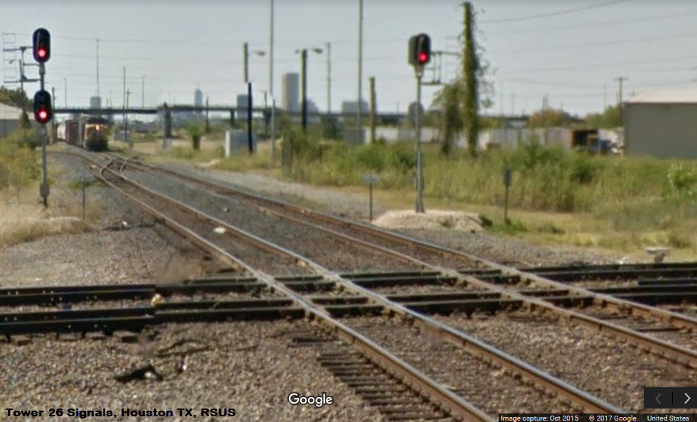
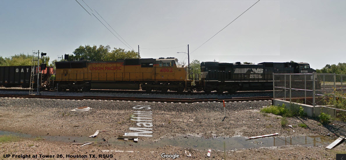
What will you will see here?.... although the tracks are owned by the Union Pacific, you will also see BNSF, KCS, and Amtrak rolling thru.
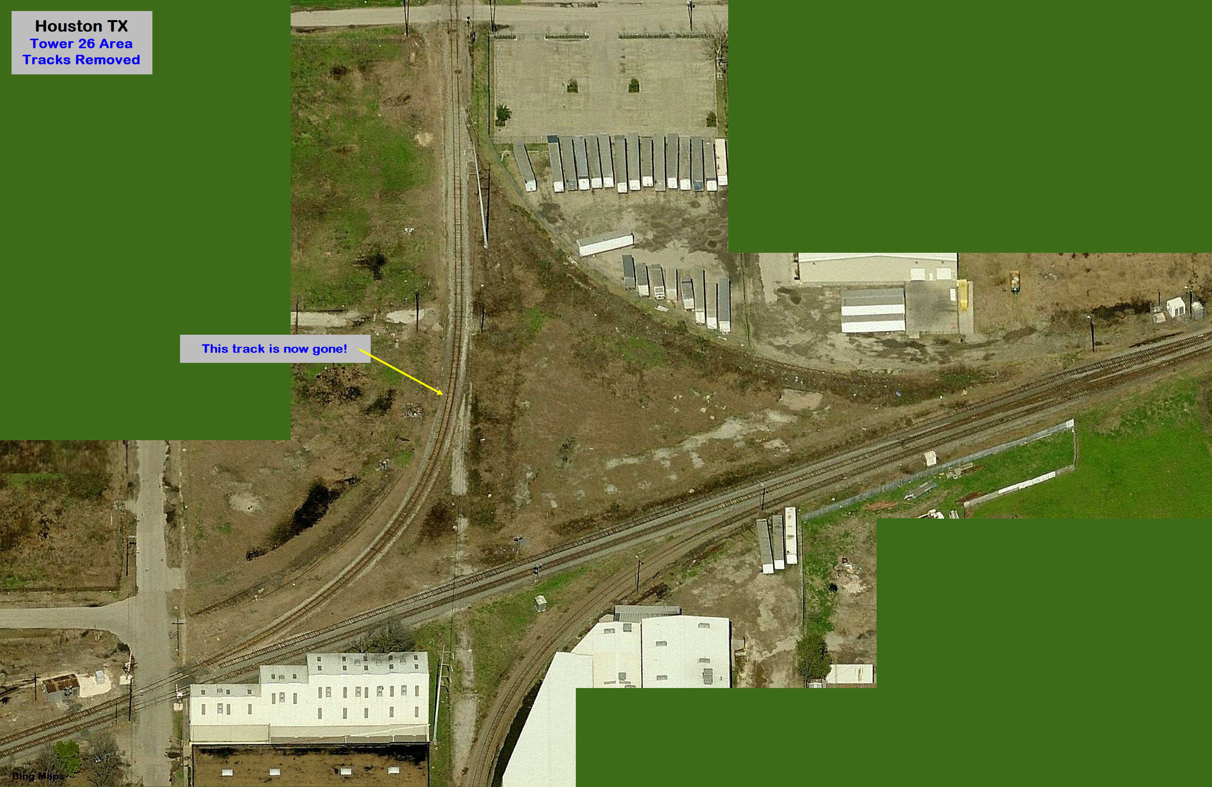
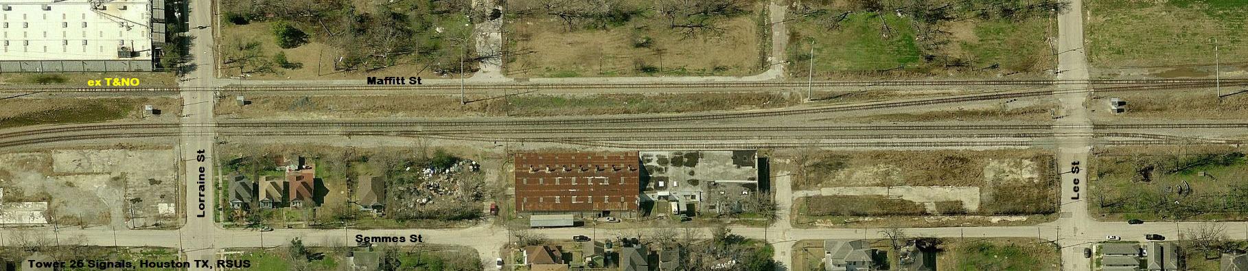
As far as I can guess, the whole interlocking was upgraded and resignaled around 2013/2014. A new connector was added, going from the north to the west, and the north to east connector was given its own track past Quitman. The ex HE&WT trackage (in blue) was removed in its entirety.
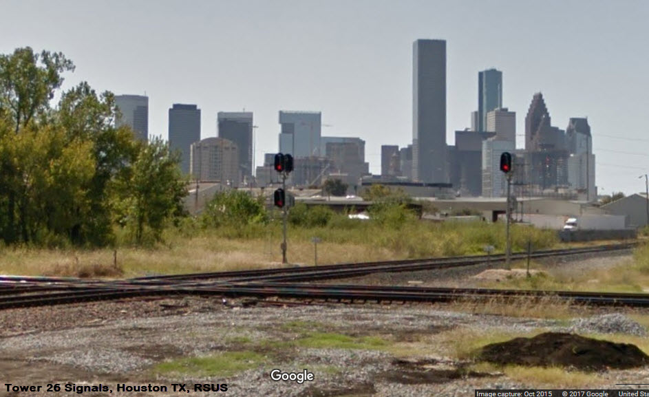
It is tough to get pictures from any one spot of all of the action going on here because of the distances involved, I found this out when I visited in 1998 and again in 2007.
According to the DOT crossing reports (below), there are approximately 20+ trains a day going north-south on the West Belt Sub, including the Amtrak trains, and around 70+ trains a day on the east-west Terminal Sub, 40 of which are thru trains. These numbers do not include trains traversing the east-south connector. Trains are limited to 30MPH E/W and 20MPH N/S.
Safety: Use caution, not the best neighborhoods, railfan with a buddy or two.
Bonus: The Burnett TC has a pocket track!
Acknowledgements:
Texas Railroad History
Jersey Mike
Denver Todd
Kenneth L. Anthony
Joe R. Thompson/Railroad and Heritage Museum
John W Barriger III National Railroad Library
Websites and other additional information sources of interest for the area:
http://txrrhistory.com/towers/026/026.htm
http://txrrhistory.com/towers/207/207.htm
http://www.abandonedrails.com/towers.aspx
http://www.trainboard.com/highball/index.php?media/tower-26-houston.99728/
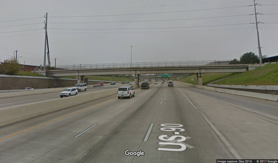
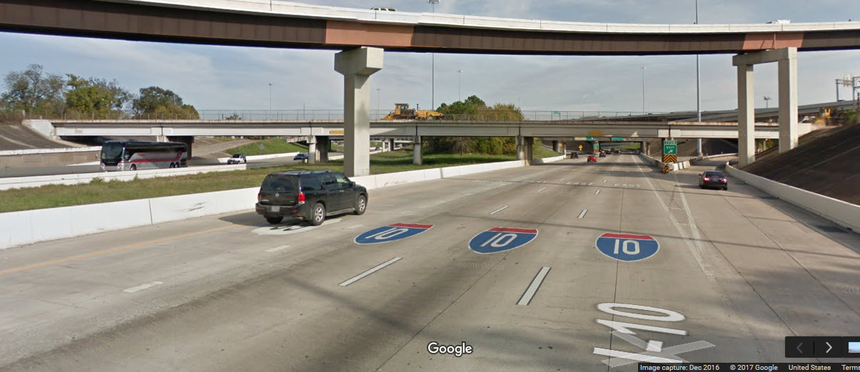
From I-10 WB, take exit 769B after the junction with I-69, this is for San Jacinto St/Main St. This exit will put you on Providence St. Get over to your right as quickly as you can, and take a right onto Walnut St. Take another right onto Conti St in a block, and this will take you into the west side of the interlocking.
From I-10 EB, take exit 770B for Jenson Dr/Meadow St/Gregg St. The first street is Jenson Dr.
If you are northbound on I-69, take the exit for Lyons Ave/Quitman St, just after the junction with I-10. Take a left onto either of those streets.
SB on I-69?, you have an exit for the same two streets, although it appears that Quitman will be behind you once you exit.
If you go straight on Providence, it will take you to Main St, where you will find the Light Rail running. If you decide to visit by light rail and make the 3/4 mile trek, make sure there are at least two of you!
Map
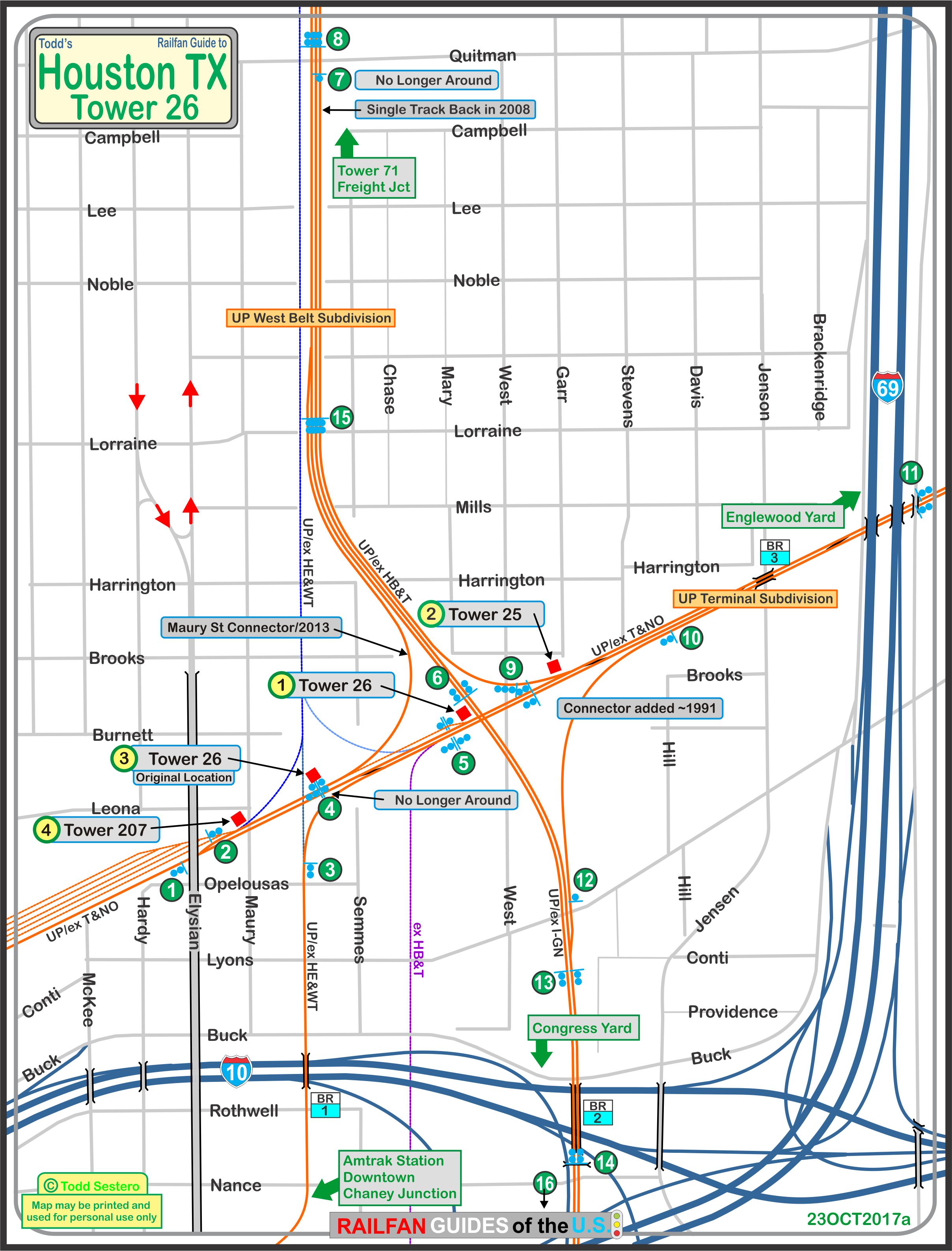
the above map in PDF format is here
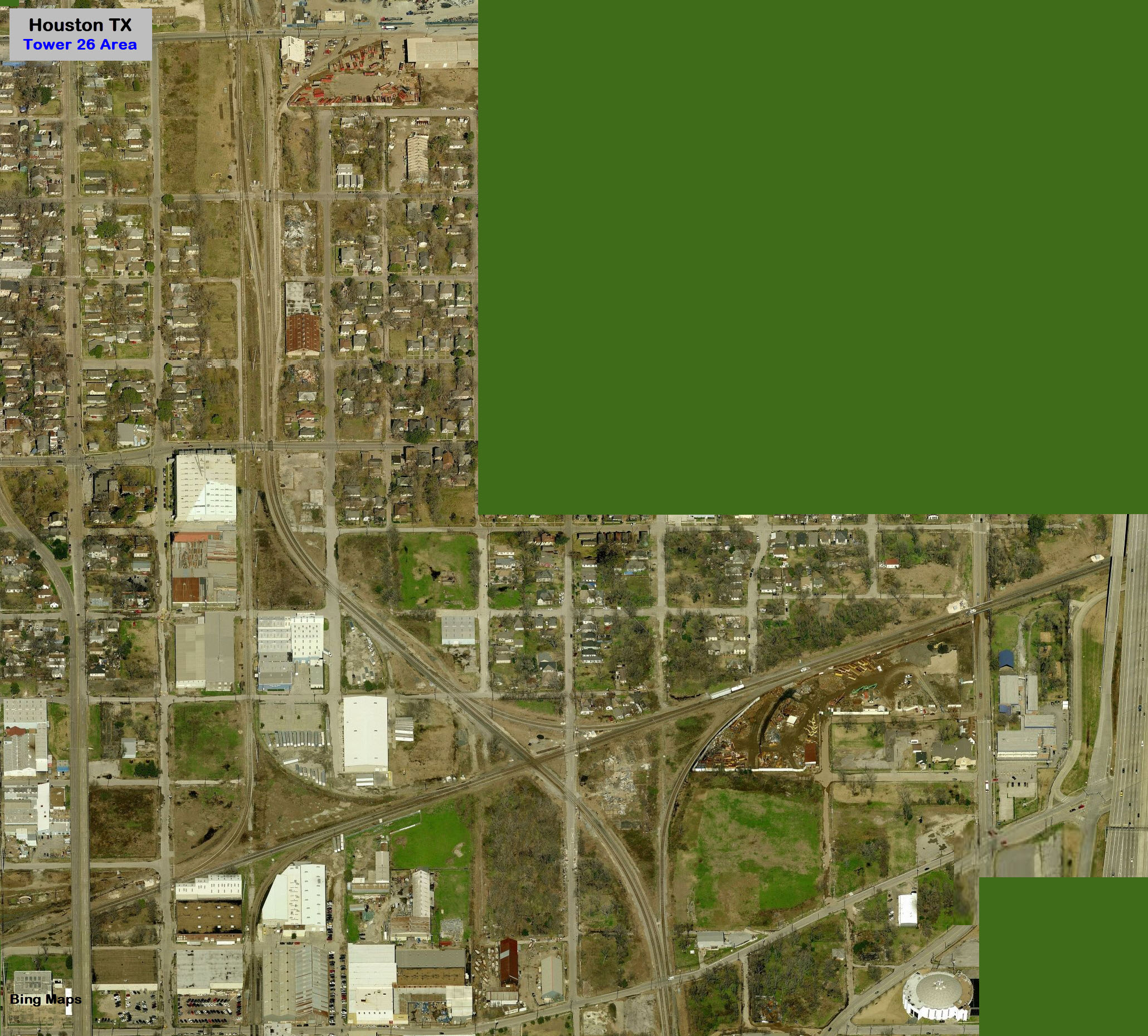
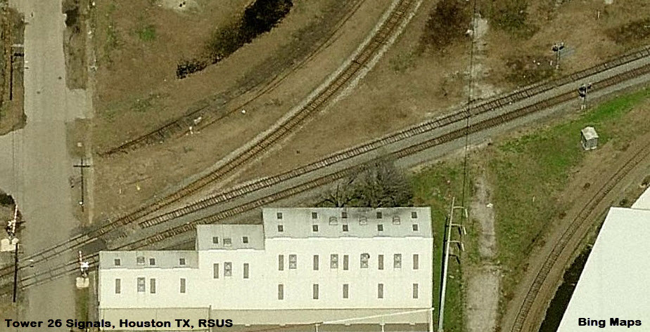
The aerial view from Bing below shows the interlocking before Union Pacific upgraded the track and signals.
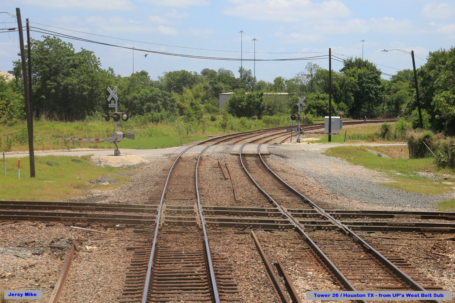 Jersey Mike
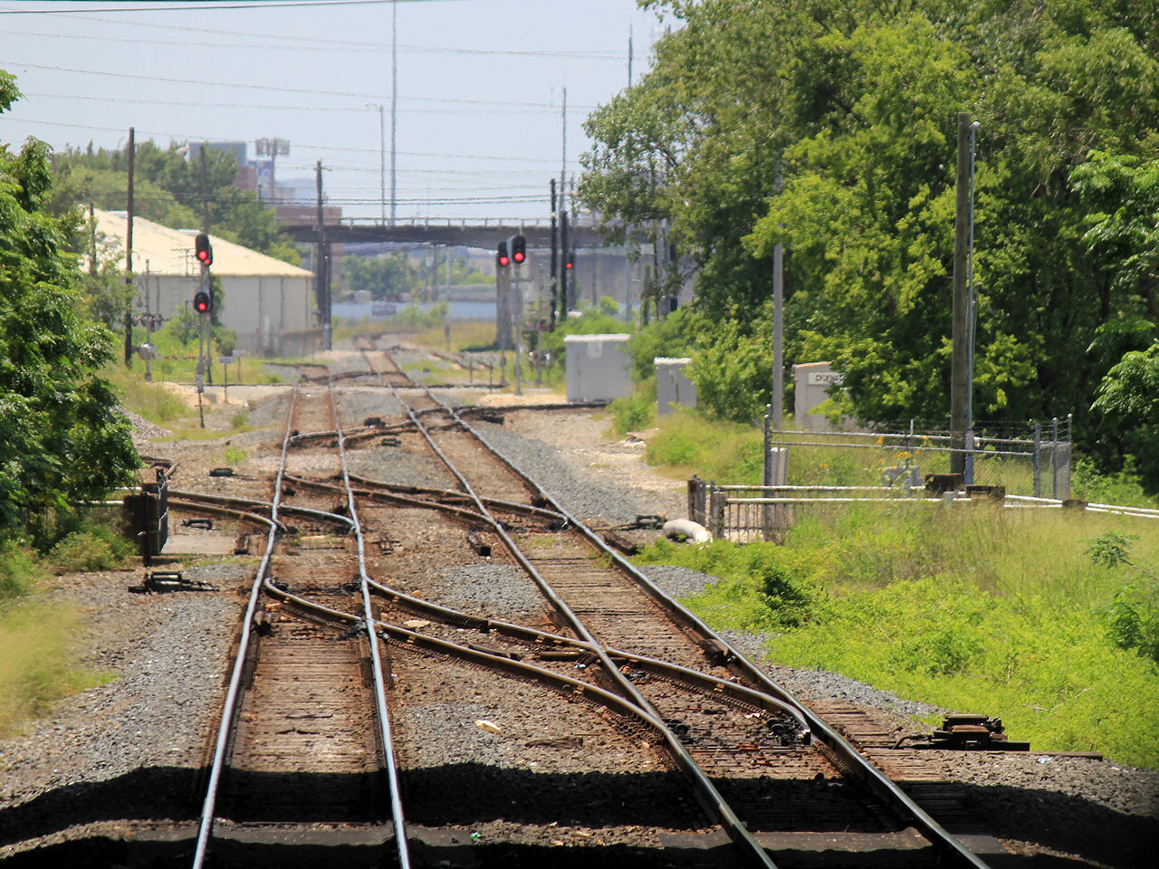 Jersey Mike
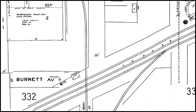
 Joe Thompson/TxRRHistory
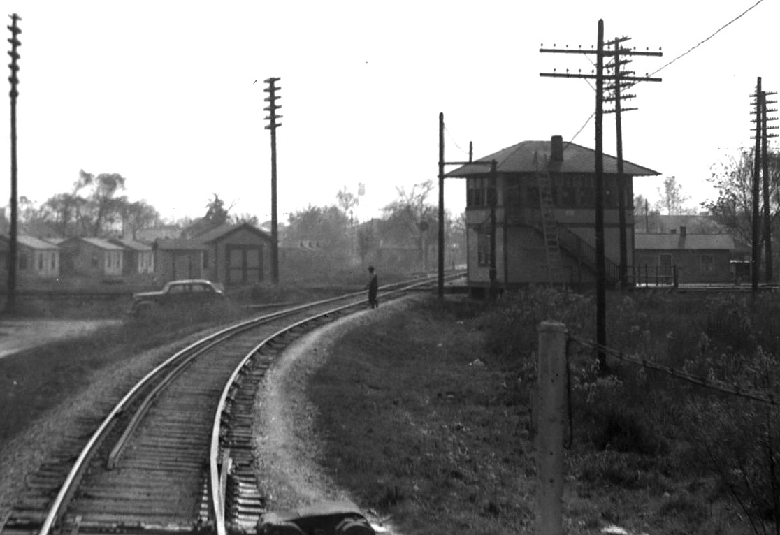 National RR Library/TxRRHistory
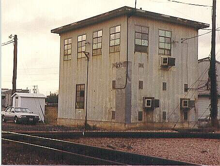 Paul Fafrak/TxRRHistory
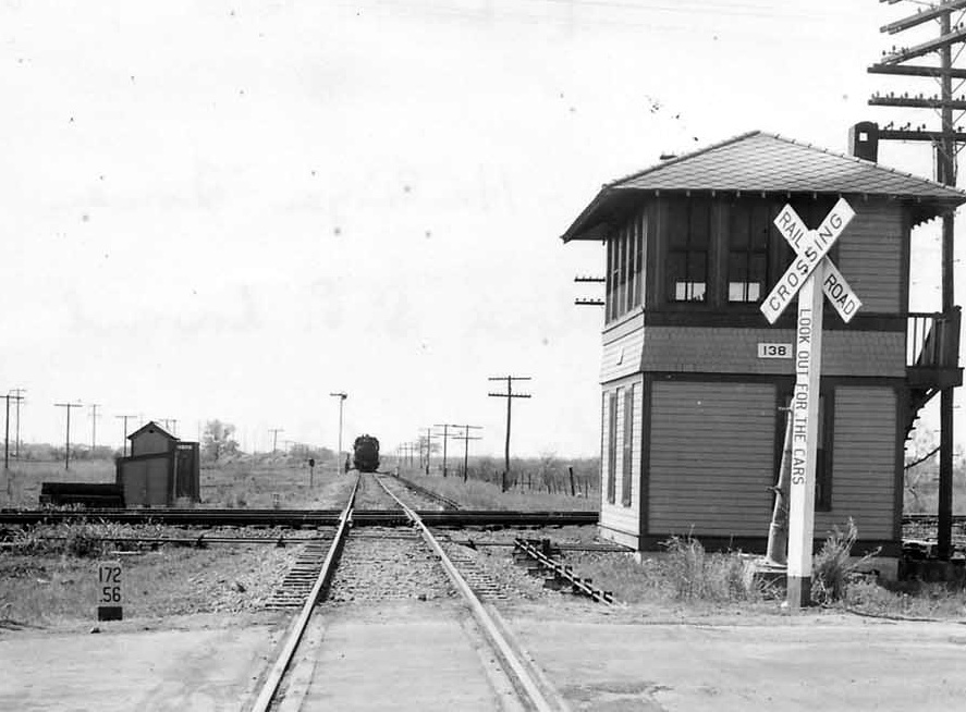 Picture of Tower 138 shows the similar design of SP towers/TxRRHistory
Need pictures
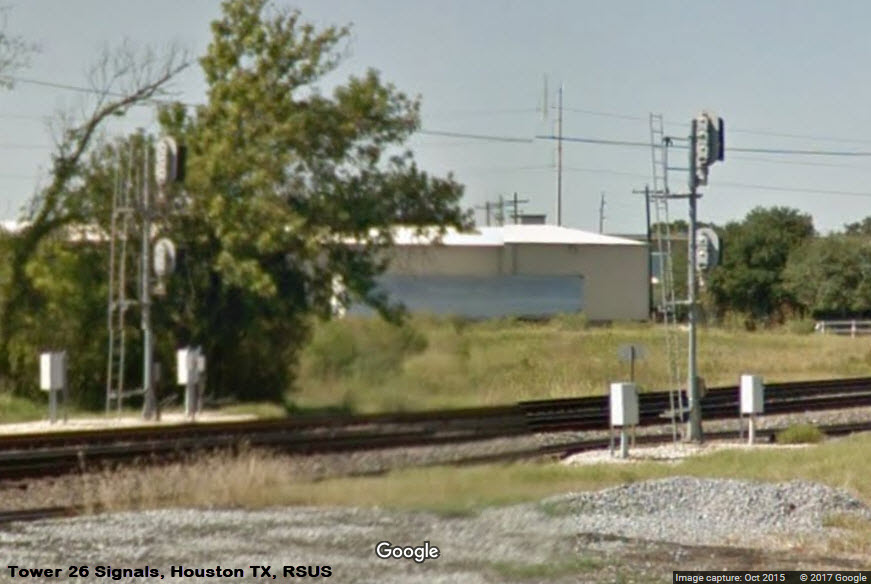
The picture below is before Union Pacific upgraded the signals at Tower 26. Need current pictures.
The signals in this picture no longer exist, they may have been left over from the diamond that was taken out in the late 60's.
These signals only show up on Bings birds eye view.
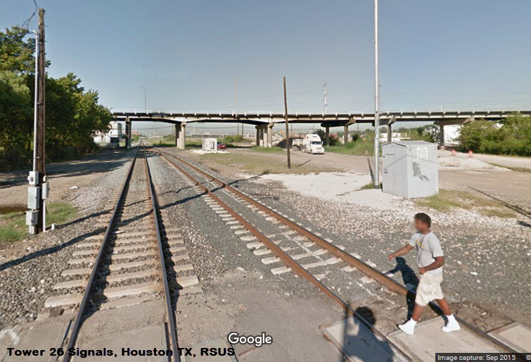
We are lucky once again that Google and Bing don't clean off their servers as much as they would like. This shot of the crossing at Quitman looking south shows the single track that that used to be here along with a lone searchlight type NB signal and the T&NO track on the other side of the pole line.
The picture below is again, from before the UP upgraded the interlocking.....
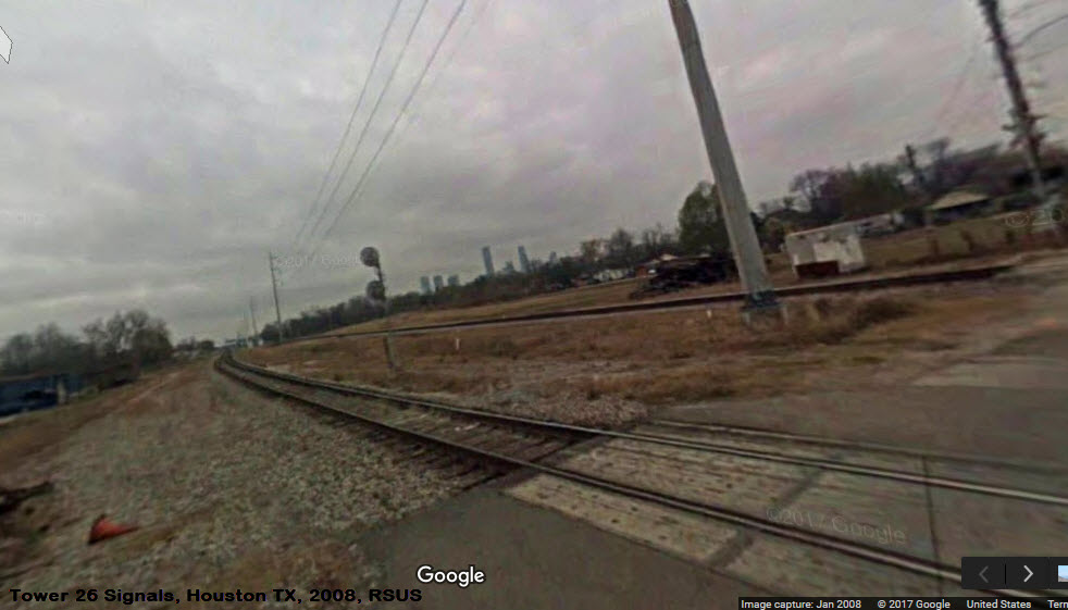
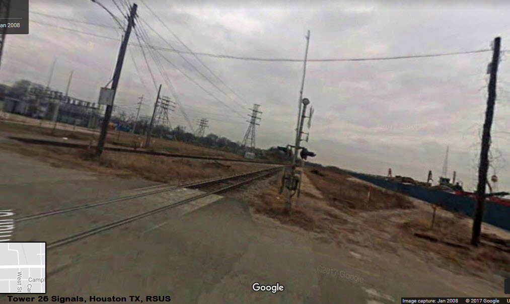 from 2008
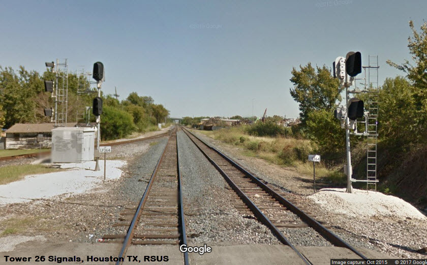
Need pictures
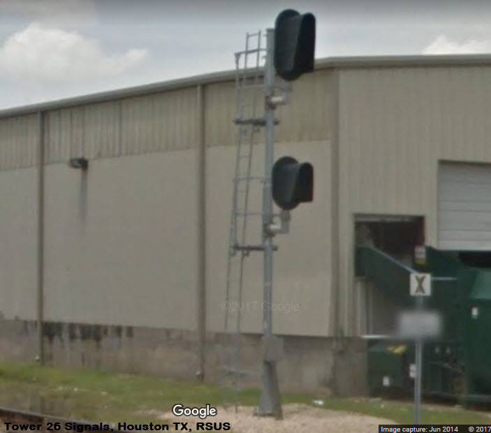
Need much better close-up pictures
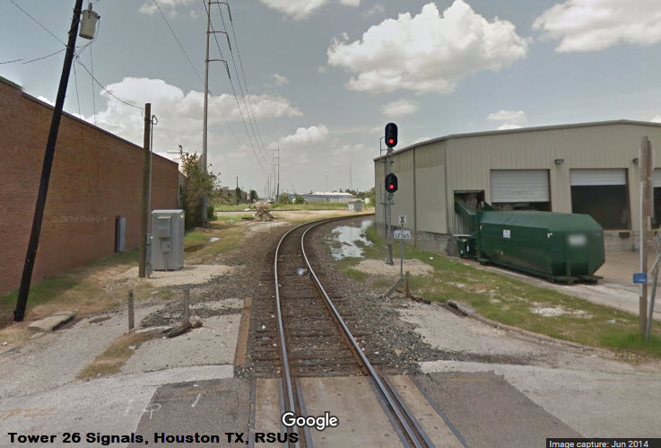
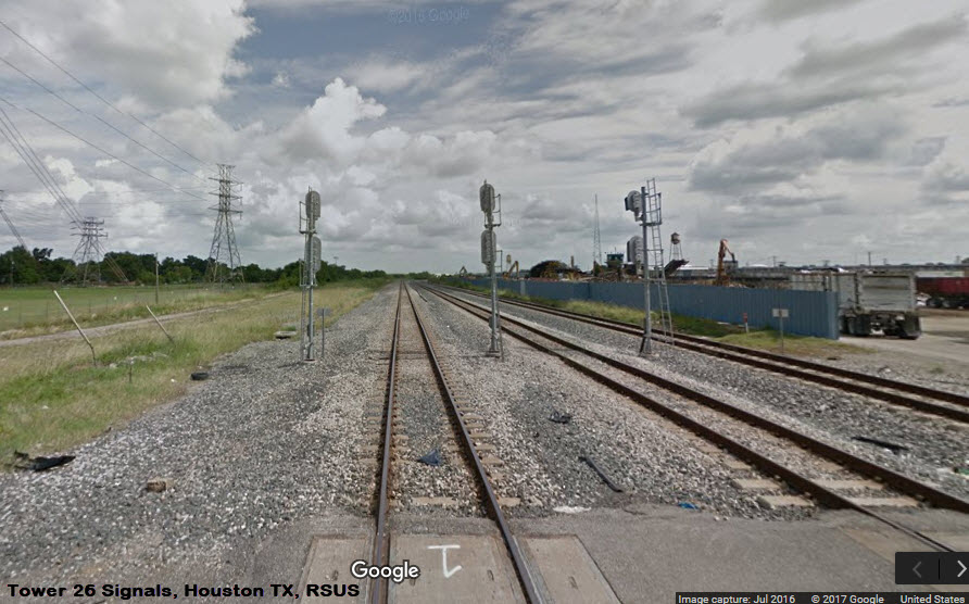
Need better pictures.....
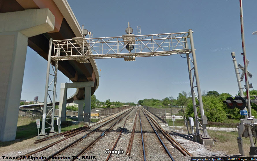

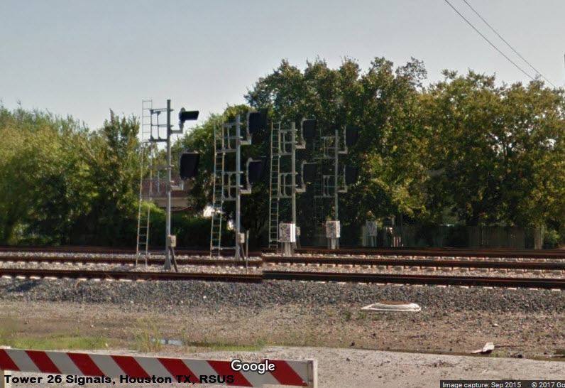
Although not on my map, these signals, 2 sets of NB "tri-lights" for the approach to the Tower 26 interlocking, can be seen from I-10.
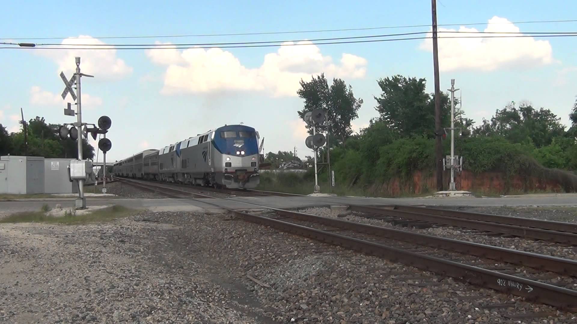 Amtrak at Tower 26
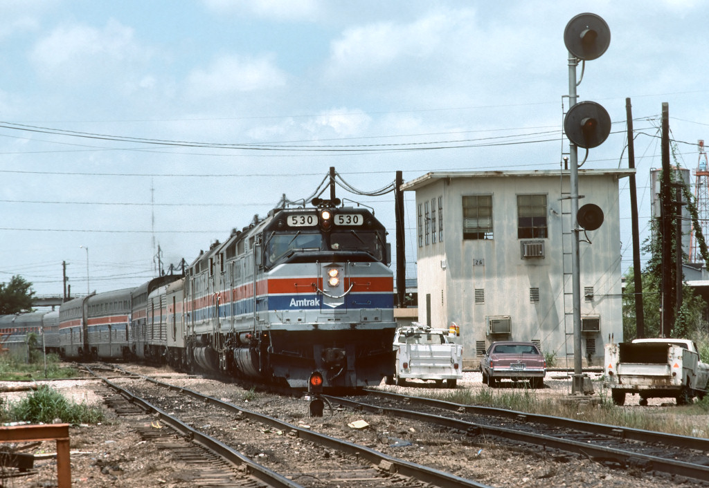 Amtrak at Tower 26/1978 - TxRRHistory
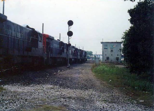 Kenneth L. Anthony, circa 1986
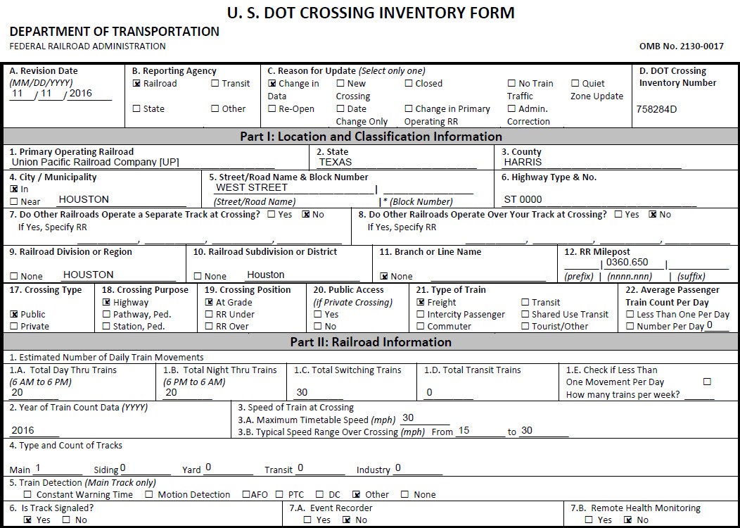
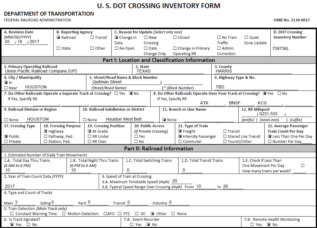
Here are shortened versions of the grade reports for two of the crossing at Tower 26. Courtesy Denver Todd.
Courtesy of the University of Texas Library, click here for their index page.
Disclaimers:
I love trains, and I love signals. I am not an expert. My webpages reflect what I find on the topic of the page. This is something I have fun with while trying to help others.
Please Note: Since the main focus of my two websites is railroad signals, the railfan guides are oriented towards the signal fan being able to locate them. For those of you into the modeling aspect of our hobby, myindexa page has a list of almost everything railroad oriented I can think of to provide you with at least a few pictures to help you detail your pike.
If this is a railfan page, every effort has been made to make sure that the information contained on this map and in this railfan guide is correct. Once in a while, an error may creep in :-)
My philosophy: Pictures and maps are worth a thousand words, especially for railfanning. Text descriptions only get you so far, especially if you get lost or disoriented. Take along good maps.... a GPS is OK to get somewhere, but maps are still better if you get lost! I belong to AAA, which allows you to get local maps for free when you visit the local branches. ADC puts out a nice series of county maps for the Washington DC area, but their state maps do not have the railroads on them. If you can find em, I like the National Geographic map book of the U.S..... good, clear, and concise graphics, and they do a really good job of showing you where tourist type attractions are, although they too lack the railroads. Other notes about specific areas will show up on that page if known.
Aerial shots were taken from either Google Maps or www.bing.com/maps as noted. Screen captures are made with Snagit, a Techsmith product... a great tool if you have never used it!
By the way, floobydust is a term I picked up 30-40 years ago from a National Semiconductor data book, and means miscellaneous and/or other stuff.
Pictures and additional information is always needed if anyone feels inclined to take 'em, send 'em, and share 'em, or if you have something to add or correct.... credit is always given! Please be NICE!!! Contact info is here
Beware: If used as a source, ANYTHING from Wikipedia must be treated as being possibly being inaccurate, wrong, or not true.
HOUSTON HOMEPAGE
RAILFAN GUIDES HOME
RAILROAD SIGNALS HOME
NEW
10/19/2017
Last Modified
24-Oct-2017