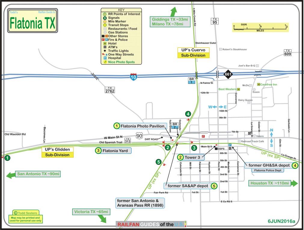
The above map in a PDF is here
RAILFAN GUIDES of the U.S.
Todd's Railfan Guide to
FLATONIA TX
In General
Getting Here
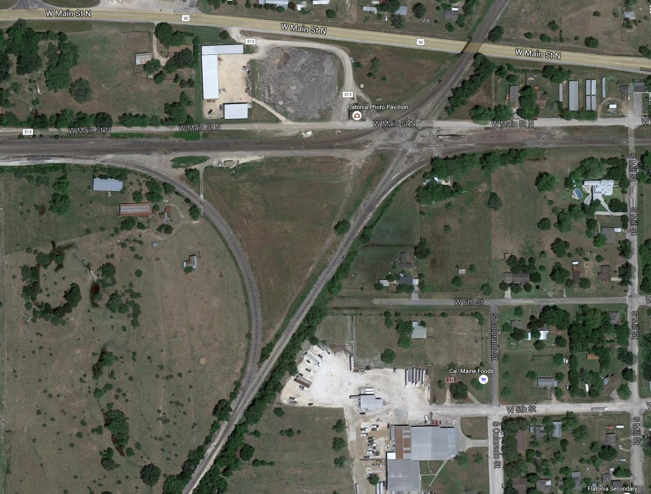
Map
Sights
Signals
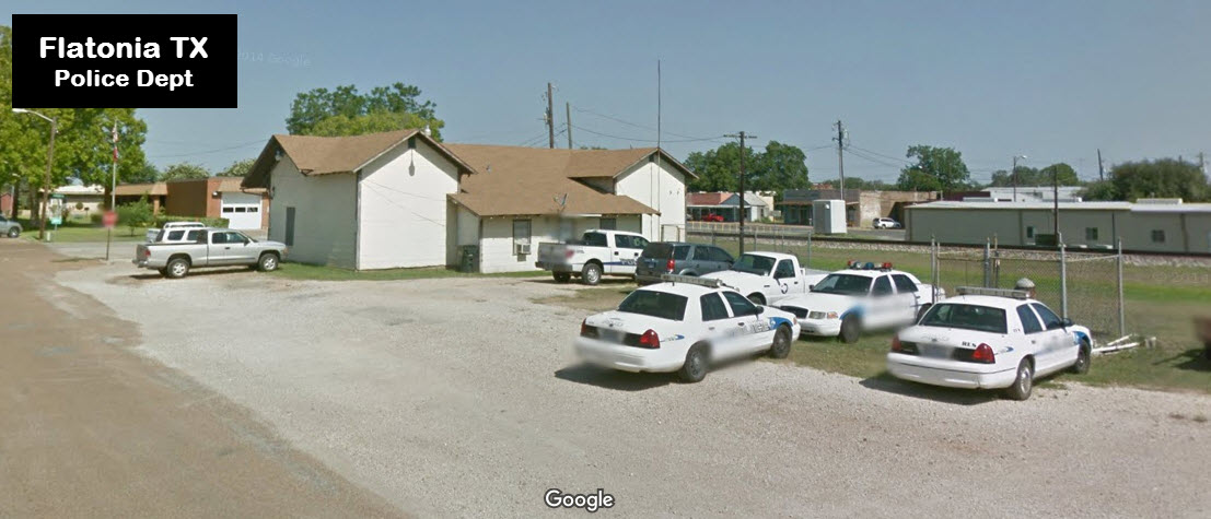
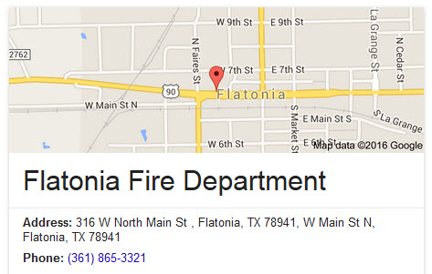
Fire & Police
Floobydust
USGS Maps
RAILFAN GUIDES HOME
RAILROAD SIGNALS HOME
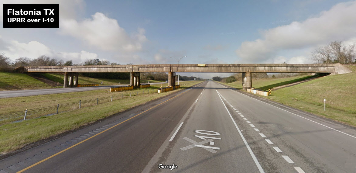
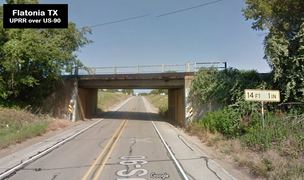
Exit 661 off of I-10 from either the Houston or San
Antonio directions.
From Austin, take the Ben White (TX71) east out
of town, go about 35 miles, and than take TX95 south in Smithville into
Flatonia.
From Victoria (along the Gulf Coast), head north on US 77
to I-10 and head west two exits (13 miles).
The above map in a PDF is
here
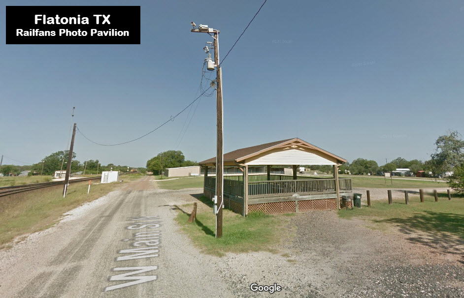
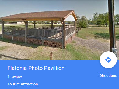
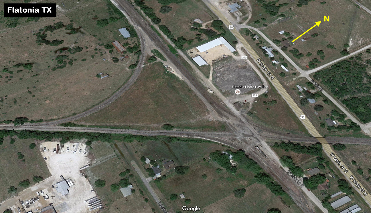
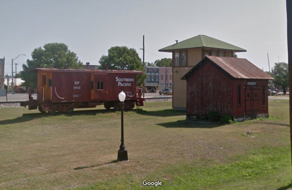
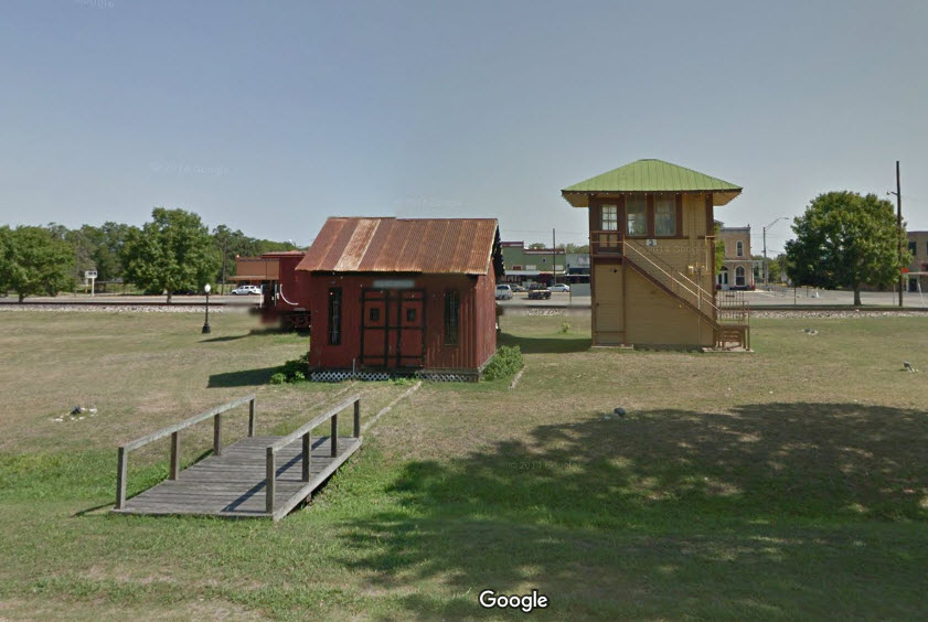
![]() Photo Pavilion
Photo Pavilion
GPS Coordinates: 29.687382, -97.115983
602 W. North Main St, Flatonia, TX 78941
The park was opened in 2002.
It stands on the former location of Tower 3. All railroad towers in
Texas are uniquely numbered throughout the whole state, as it was decided
early on by the Texas Railroad Commission to number them this way.
The park hosts railfan events the first Saturday of April and November.
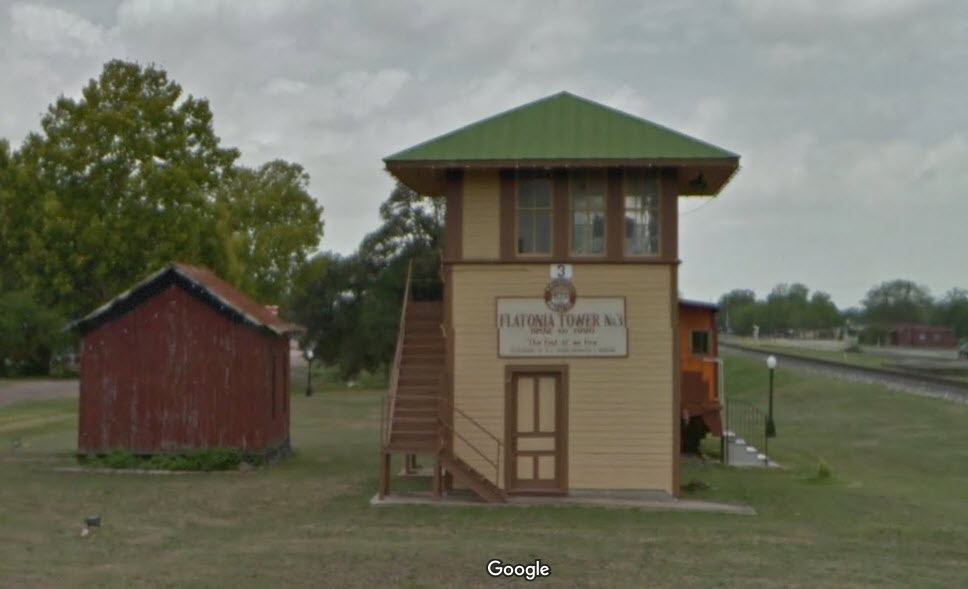
![]() Tower 3
Tower 3
Tower 3 used to be located where the photo pavilion is located now. It
was opened in 1902. It was closed in 1996 and then moved to it's
current location and renovated. Tower 3 is available for tour by
appointment only by contacting the Flatonia Chamber of Commerce at
361-865-3920.
Many more excellent pictures and information can
be found on this page:
http://www.towers.txrrhistory.com/003/003.htm
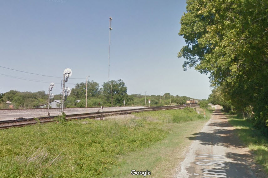
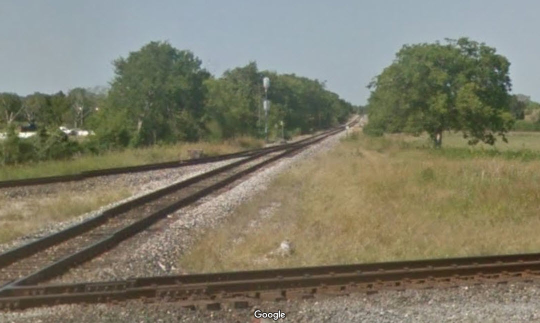
![]() UP's Flatonia Yard
UP's Flatonia Yard
Can't tell you anything about the yard or how frequently it sees activity,
but the Google map truck was lucky enough to catch something in the yard.
The yard has five tracks in it, and it looks like the middle track is
probably the thru track. Don't know when the new interchange track was
put in, but it is not on the 1965 USGS map.
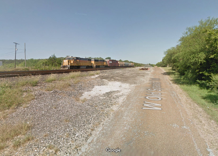
The east end of the
yard, the crossing, and the "new" interchange track.
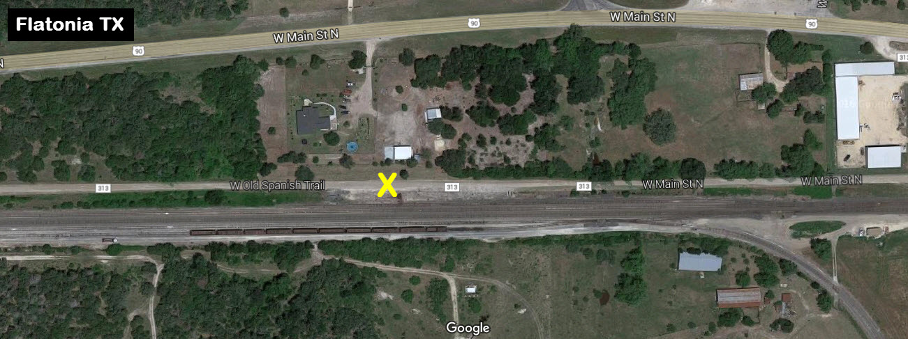
The east end of
the yard, the shot with the engines in it was taken from Google Maps, about
where the yellow "X" is.
![]() ex Galveston, Harrisburg & San Antonio Rwy Depot
ex Galveston, Harrisburg & San Antonio Rwy Depot
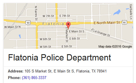
It is now the Flatonia Police Department building.
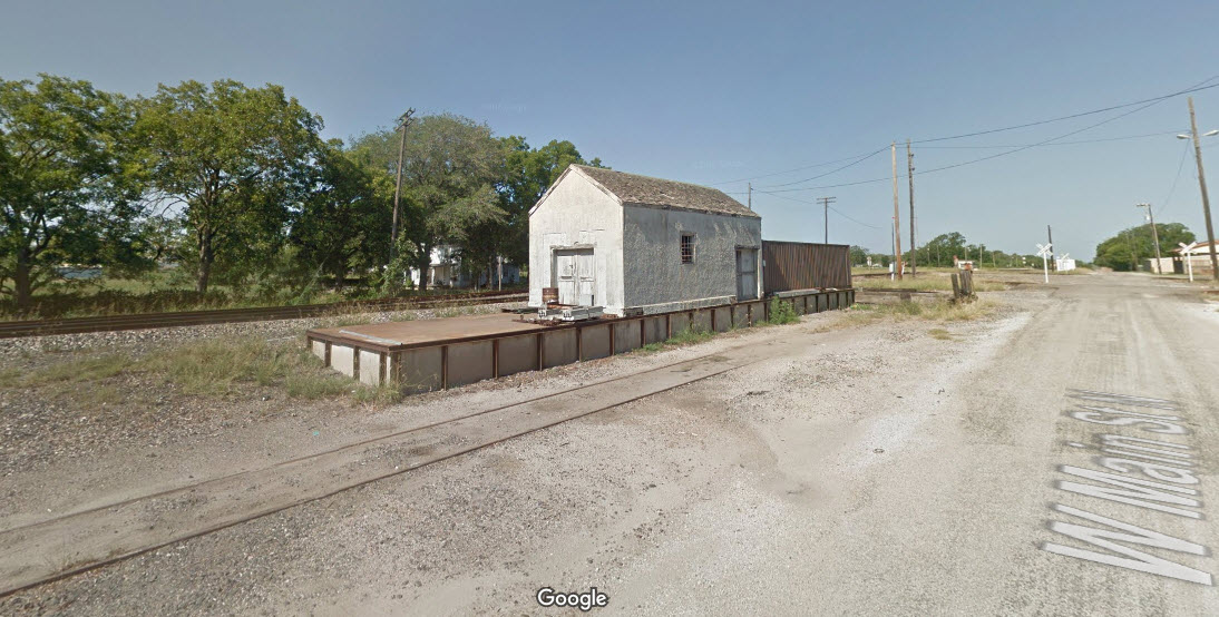
![]() ex San Antonio & Aransas Pass (SA&AP) Railway Depot
ex San Antonio & Aransas Pass (SA&AP) Railway Depot
Now used as a storage/freight shed by the UP.
ex San Antonio & Aransas Pass (SA&AP) Railway Freight Depot
Mentioned on the Tower 3 page is a former SA&AP freight depot, but I can not find it on Google Maps, if anyone knows what building it is, please shoot me an email with a picture.


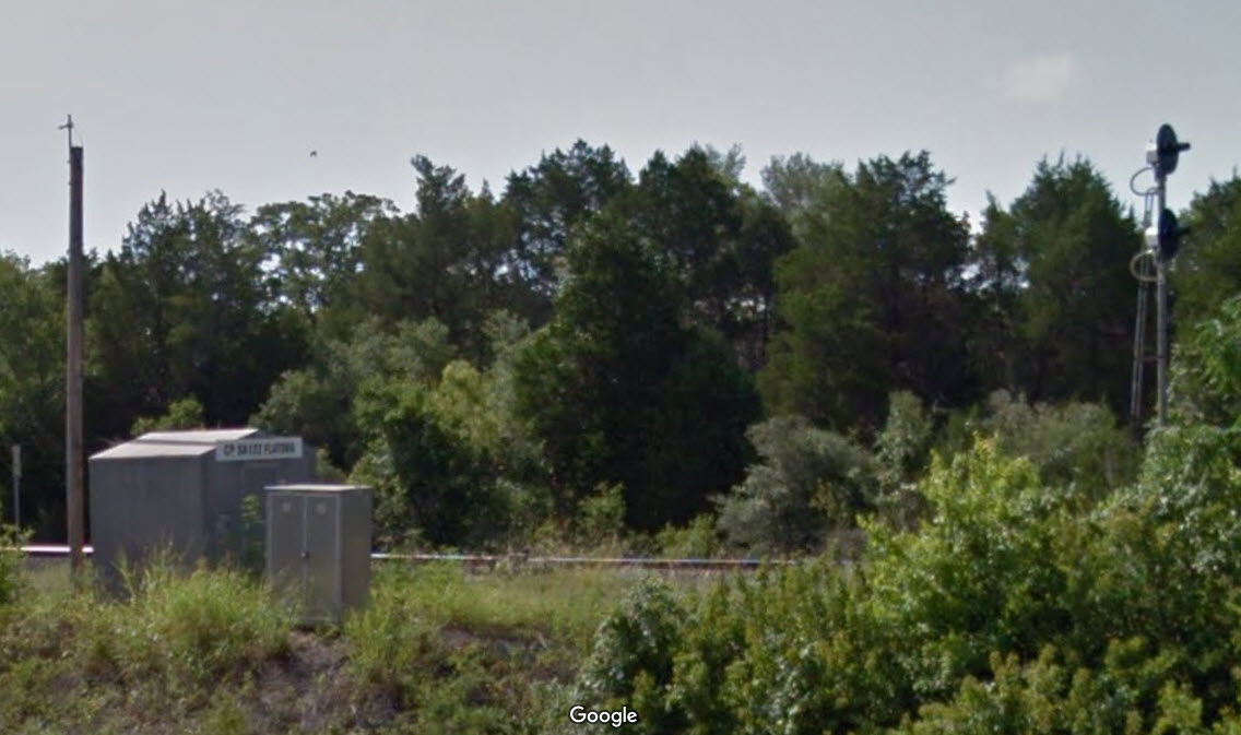
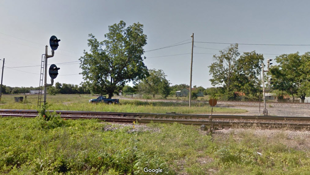
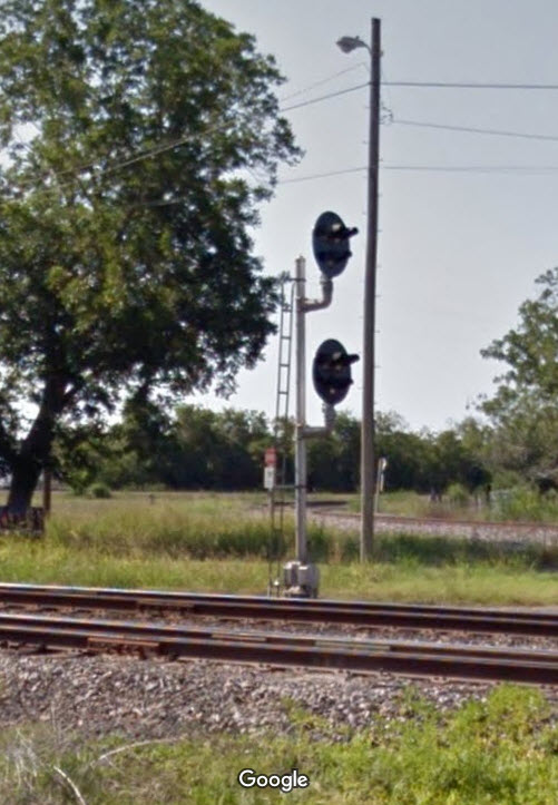
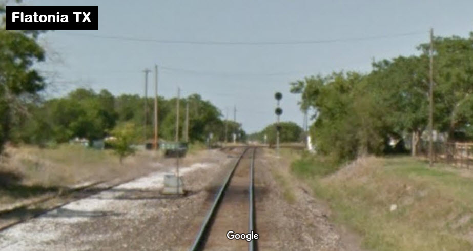
![]() EB Searchlight Signals
EB Searchlight Signals
A two head searchlight installation for the approach to the yard.
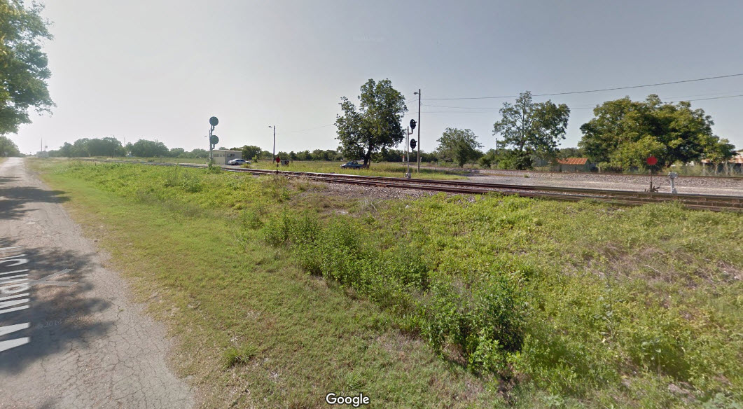
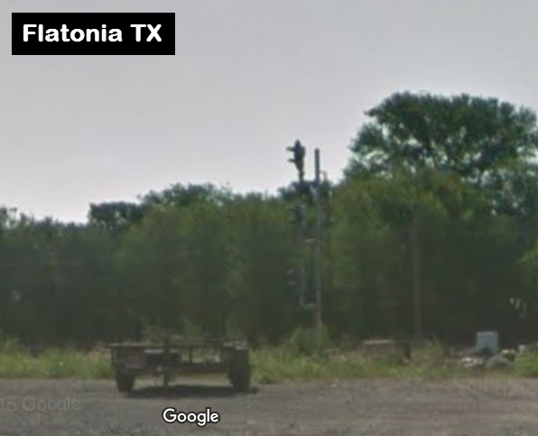
![]() EB "Tri-light" Colorlight Signals
EB "Tri-light" Colorlight Signals
Two sets of signals, one for the interchange and one for the crossing.
![]() WB Colorlight Signals
WB Colorlight Signals
For the interchange and the crossing.

![]() SB "Trilight" Colorlight Signals
SB "Trilight" Colorlight Signals
For the interchange and the crossing.

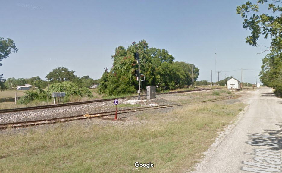
![]() NB Colorlight Signals
NB Colorlight Signals
For the interchange and the crossing.
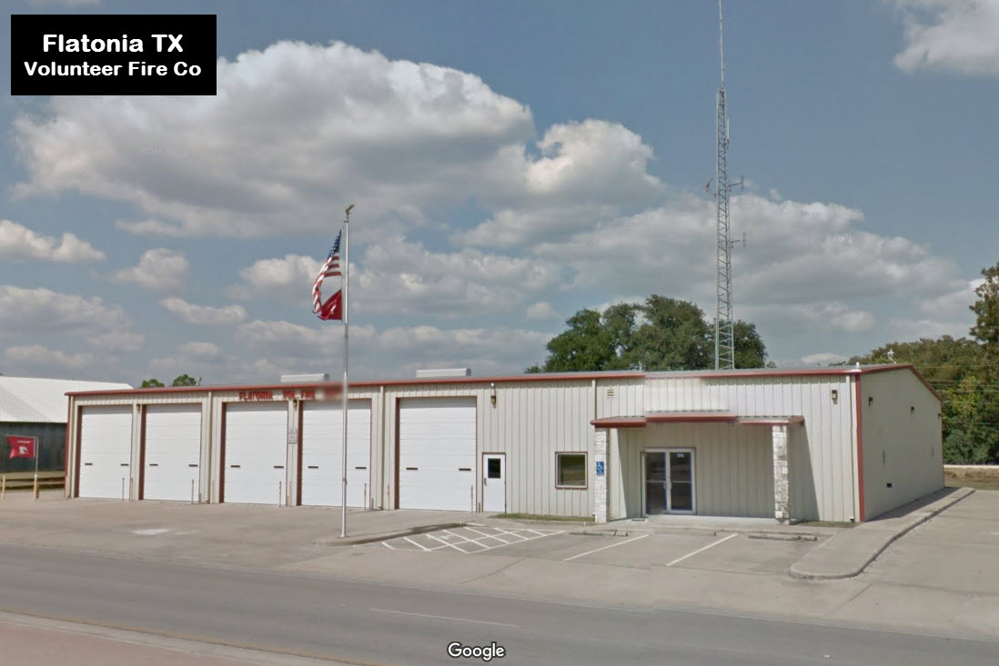
Flatonia Volunteer Fire Co
Flatonia Police Department
The police department's building is the former Galveston, Harrisburg and
San Antonio (GH&SA) Railway Depot.
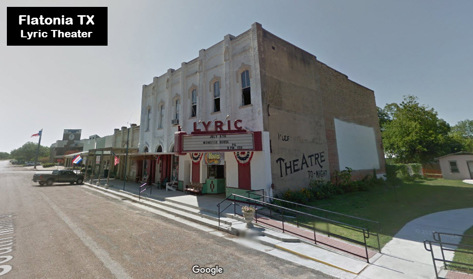
the Lyric Theater
I used to live in Tyler TX back in the early 60's. Back then, a lot of towns still had wooden sidewalks, many of which I assume by now have been replaced with
concrete as shown here. By the time we moved to Tyler in 1959, everything was concrete, but in a nearby small town we used to go for dinner, they still had wooden sidewalks
and dirt streets.
Brief History Courtesy of the University of Texas Library, click
here for
their index page. Disclaimers: I love trains, and I love signals. I am not an
expert. My webpages reflect what I find on the topic of the page.
This is something I have fun with while trying to help others. My
webpages are an attempt at putting everything I can find of the subject in
one convenient place. There are plenty of other good websites to help
me in this effort, and they are listed in the links section on my indexa
page, or as needed on individual pages. Please do not write to me
about something that may be incorrect, and then hound the heck out of me if
I do not respond to you in the manner you would like. I operate on the
"Golden Rule Principle", and if you are not familiar with it, please
acquaint yourself with how to treat people by reading Mathew 7:12 (among
others, the principle exists in almost every religion). If you contact
me (like some do, hi Paul) and try to make it a "non-fun" thing and start
with the name calling, your name will go into my spambox list! :-) Please Note:
Since the main focus of my two websites is railroad signals, the railfan guides
are oriented towards the signal fan being able to locate them. For those
of you into the modeling aspect of our hobby, my
indexa page has a list of
almost everything railroad oriented I can think of to provide you with at least a few pictures to
help you detail your pike. If this is a railfan page, every effort has
been made to make sure that the information contained on this map and in this
railfan guide is correct. Once in a while, an error may creep in,
especially if restaurants or gas stations open, close, or change names.
Most of my maps are a result of personal observation after visiting these
locations. I have always felt that a picture is worth a thousand words",
and I feel annotated maps such as the ones I work up do the same justice for the
railfan over a simple text description of the area. Since the main focus
of my website is railroad signals, the railfan guides are oriented towards the
signal fan being able to locate them. Since most of us railheads don't have just
trains as a hobby, I have also tried to point out where other interesting sites
of the area are.... things like fire stations, neat bridges, or other
significant historical or geographical feature. While some may feel they
shouldn't be included, these other things tend to make MY trips a lot more
interesting.... stuff like where the C&O Canal has a bridge going over a river (the Monocacy Aqueduct) between Point of Rocks and Gaithersburg MD, it's way cool to
realize this bridge to support a water "road" over a river was built in the
1830's!!!
My philosophy: Pictures and maps are worth a
thousand words, especially for railfanning. Text descriptions only
get you so far, especially if you get lost or disoriented. Take
along good maps.... a GPS is OK to get somewhere, but maps are still
better if you get lost! I belong to AAA, which allows you to get
local maps for free when you visit the local branches. ADC puts
out a nice series of county maps for the Washington DC area, but their
state maps do not have the railroads on them. If you can find em,
I like the National Geographic map book of the U.S..... good, clear, and
concise graphics, and they do a really good job of showing you where
tourist type attractions are, although they too lack the railroads.
Other notes about specific areas will show up on that page if known. Beware: If used as a source, ANYTHING from Wikipedia must be treated as
being possibly being inaccurate, wrong, or not true.
RAILFAN GUIDES HOME
NEW 01/01/2014
Prior to the Civil War, the Buffalo Bayou, Brazos and Colorado (BBB&C) Railroad built westward from Harrisburg to Alleyton, a town on the east bank of the
Colorado River near Columbus. After the war, the BBB&C bridged the river but proceeded no further due to financial problems. In 1868, the BBB&C was sold
to various investors to pay off construction debts and other judgments. In 1870, it was re-sold and reorganized again by Thomas Peirce who amended the
charter and renamed it the Galveston, Harrisburg and San Antonio (GH&SA) Railway. In 1873, the GH&SA resumed construction westward toward San
Antonio, passing near an existing settlement known as Flatonia. The citizens of Flatonia moved their houses and businesses one mile northwest to the
GH&SA tracks and the new town was incorporated in 1875.
In 1887, the San Antonio & Aransas Pass (SA&AP) Railway began a northerly expansion out of its traditional south Texas territory by building a line north
from Yoakum with a destination of Waco. The line crossed the GH&SA at Flatonia, which became one of the earliest and busiest rail crossings in Texas. As a rural
location which would otherwise not justify a large number of stopping trains, Flatonia was an ideal candidate for a manned interlocking tower due to the high
volume of rail traffic. As a result, one of the earliest interlocking control towers, Tower 3, was established at Flatonia in October, 1902.
(from the Tower 3 page)
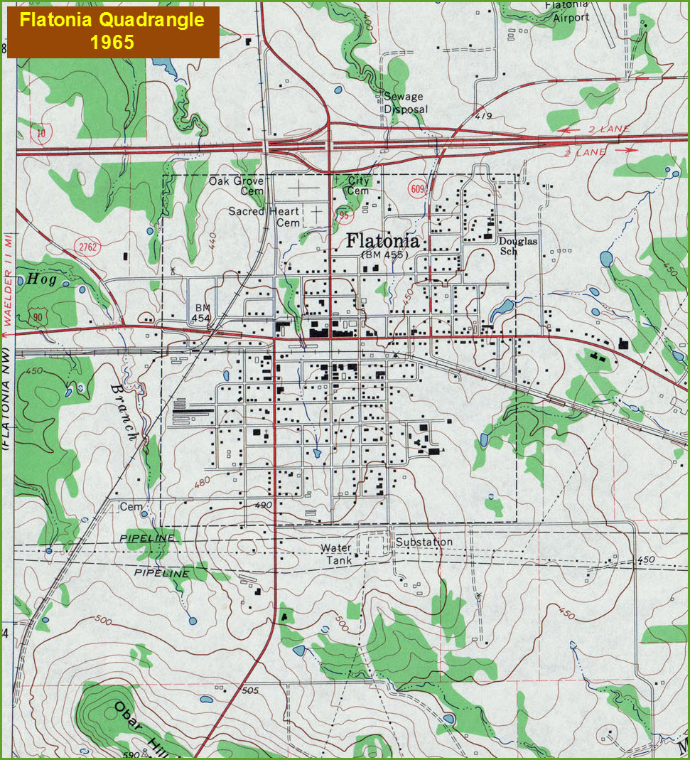
 1898 USGS map.
By the way, floobydust is
a term I picked up 30-40 years ago from a National Semiconductor data
book, and means miscellaneous and/or other stuff.
Pictures and additional information is always needed if anyone feels
inclined to take 'em, send 'em, and share 'em, or if you have
something to add or correct.... credit is always given! BE NICE!!! Contact info
is here
RAILROAD SIGNALS HOME
Last Modified
09-Jun-2016