RAILFAN GUIDES of the U.S.
Todd's Railfan Guide to
DALLAS TX
Downtown
Union Station Area
In General
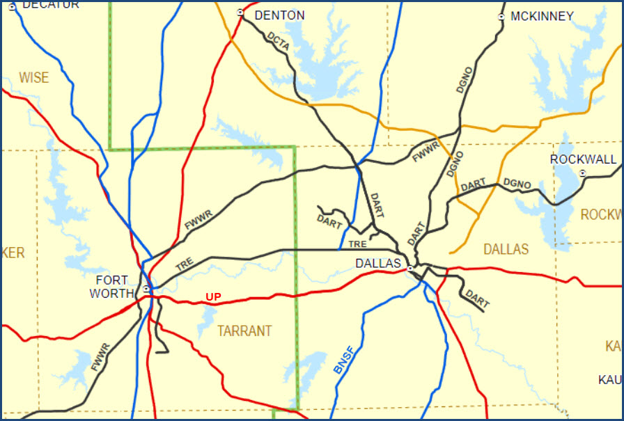
Getting Here
Map
Sights
Pictures
Bridges
Signals
Floobydust
USGS Maps
RAILROAD SIGNALS HOME
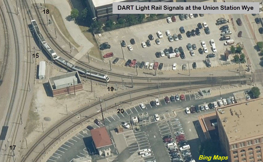
Location / Name:
Dallas TX, Dallas County
What's Here:
Union Station
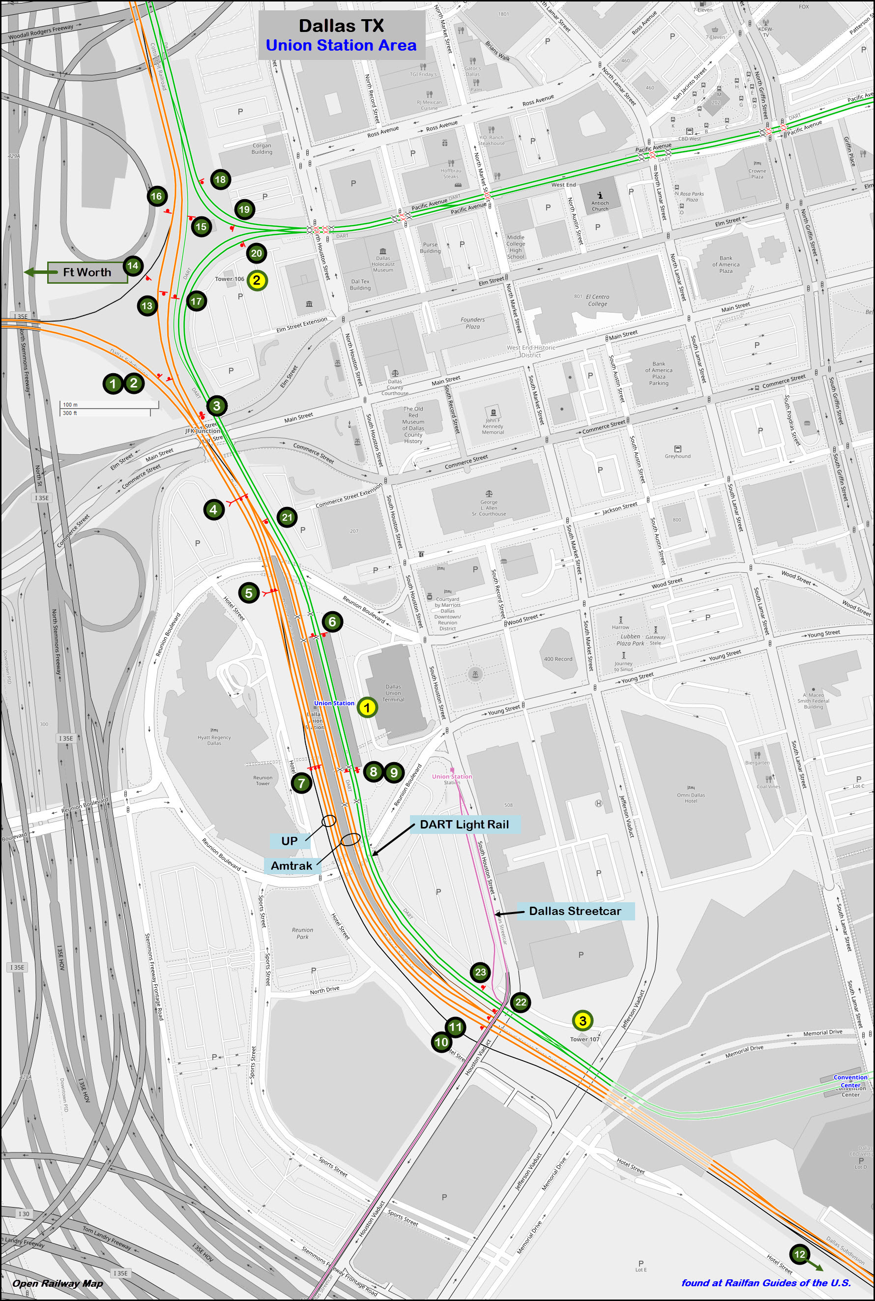
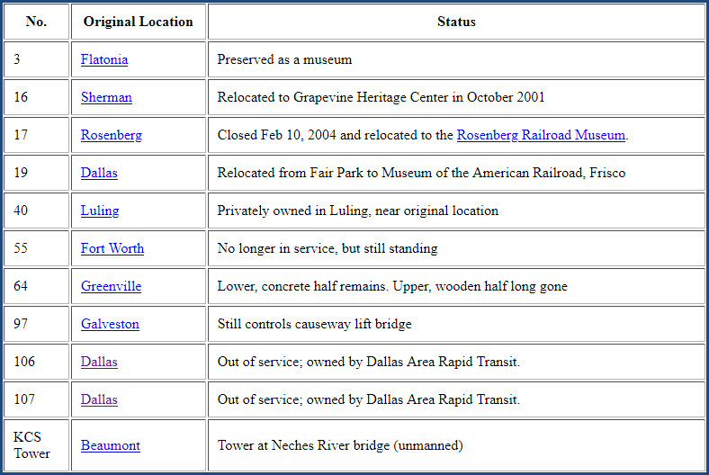
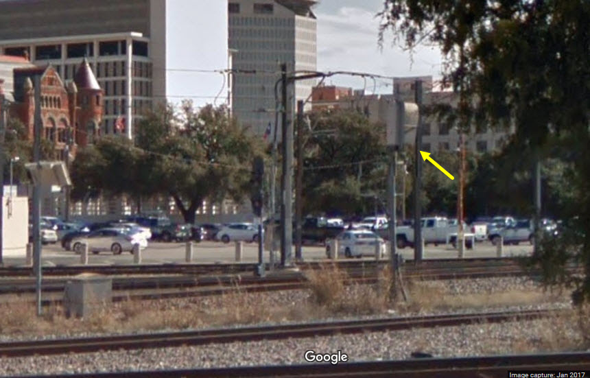
Tower 106 (north tower)
Tower 107 (south tower)
Data:
GPS Coordinates: as needed
Phone A/C: 214
ZIP: 75207
Access by train/transit:
Amtrak
DART Light Rail and Busses
Dallas Streetcar
Trinity Rail Express
The Scoop:
The
Acknowledgements:
Jersey Mike
GojiMet86
Michael Barera
Richard Whitenight
Denver Todd
Google Maps
Bing Maps
Websites and other additional information sources of interest for the area:
https://www.redoveryellow.com/position-light/19-03-31_DALLAS_REUNION/-Thumbnails.html A lot of the pictures on this page are from here
https://www.redoveryellow.com/position-light/17-03-23_DALLAS_FT-WORTH/-Thumbnails.html
http://txrrhistory.com/towers/106/106.htm
http://www.trainweb.org/usarail/dallas.htm
https://en.wikipedia.org/wiki/Dallas_Union_Station
http://www.carrtracks.com/Dallas_Union_Station.htm
http://ftp.dot.state.tx.us/pub/txdot-info/tpp/maps/2016-railroad.pdf
SB I-35E exit 428E onto Commerce St, then a right onto South Houston St to the station.
NB I-35E exit for Commerce Street, then a right onto S. Houston St.
Coming off EB I-30, look for the exit for Commerce Street, there doesn't seem to be an exit number, so you have to pay attention, GPS OR NOT!
The Interstate system around the Union Station area is "ugly". If you are not from Dallas, and not familiar with the highways in the downtown area, you need to take it slow, especially if you are from the east, where the highways do not have service roads.
GPS Coordinates: 32.776116, -96.807540
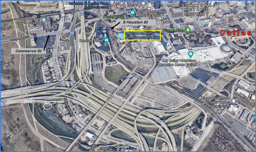
From Wikipedia: Dallas Union Station (officially Eddie Bernice Johnson Union Station, or simply EBJ Union Station), is also known as the Dallas Union Terminal, is a railroad station in Dallas TX. It serves DART Light Rail, Trinity Railway Express commuter rail, and Amtrak. It is located on Houston Street, between Wood and Young Streets, in the Reunion district of Downtown Dallas. The structure is a Dallas Landmark and is listed on the National Register of Historic Places.
Union Station is served by Amtrak, DART's Light Rail, DART's Trinity Rail Express, and DART's Dallas Streetcar. The station is served by Amtrak's Texas Eagle with Chicago as the eastern terminus and either San Antonio or Los Angeles as the western terminus. The light rail station serves as a stop on the Red and Blue lines as well as the TRE. Union Station is the northern terminus of the Dallas Streetcar and provides access to the Greyhound bus terminal, the George Allen Courts Building, Dealey Plaza, the Hyatt Regency at Reunion, and Reunion Tower.
The Union Terminal Company constructed the Dallas Union Terminal, as Union Station was originally called, in 1916 to consolidate five rail stations scattered around Dallas into one. At the peak of its usage, as many as 80 trains stopped each day at the station. It was designed by Jarvis Hunt, who designed other large train stations. Railroads served by the station included the Atchison, Topeka and Santa Fe Rwy ('Santa Fe'), the St. Louis Southwestern Rwy (the "Cotton Belt"), the Fort Worth & Denver Rwy, the Chicago, Rock Island and Pacific RR ('Rock Island'), the Burlington-Rock Island RR, the St. Louis and San Francisco Rwy ('Frisco'), the Missouri– Kansas–Texas RR ('Katy'), the Southern Pacific RR, and the Texas & Pacific Rwy.
The last privately owned passenger train to serve Union Station, the Missouri Pacific RR's Texas Eagle, left on May 31, 1969. Amtrak initially consolidated most of its Metroplex service at Fort Worth, but planned to introduce service to Dallas once improvements were made at Union Terminal. With those improvements, Amtrak service began on March 14, 1974 with the Inter-American between St. Louis and Laredo; the train evolved into today's Texas Eagle. From 1975 to 1981, the station was also served by the Lone Star, a descendant of an old Santa Fe mainstay, the Texas Chief.
DART's light-rail service began at the station on June 14, 1996. The station's upper-level waiting room was re-purposed into meeting and convention space for the Hyatt Regency Dallas, which is connected via an underground walkway. In October 2016, the station was renamed the Eddie Bernice Johnson Union Station in honor of U.S. Representative Eddie Bernice Johnson. It is mostly referred to as EBJ Union Station. -end Wiki-
There are more pictures from the Union Station area down in the TRE section.
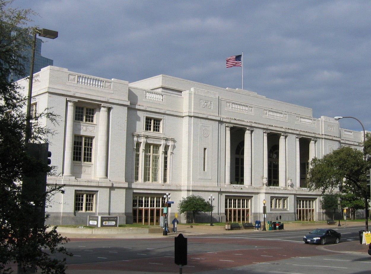 photo by kla4067, 30JUN2006, from Wikipedia
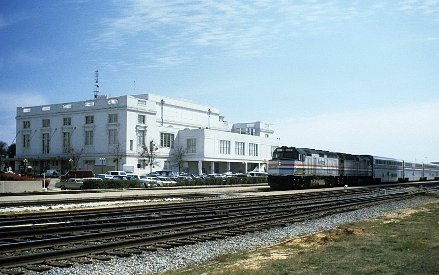
GPS Coordinates: 32.779920, -96.809311
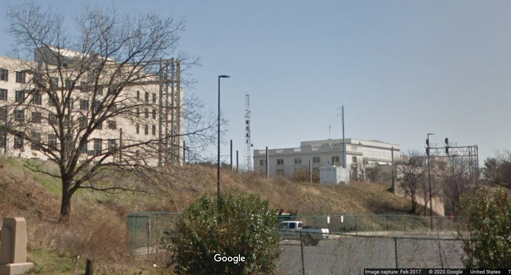
These two towers are some of the few that are still standing in Texas. They are now owned by DART.
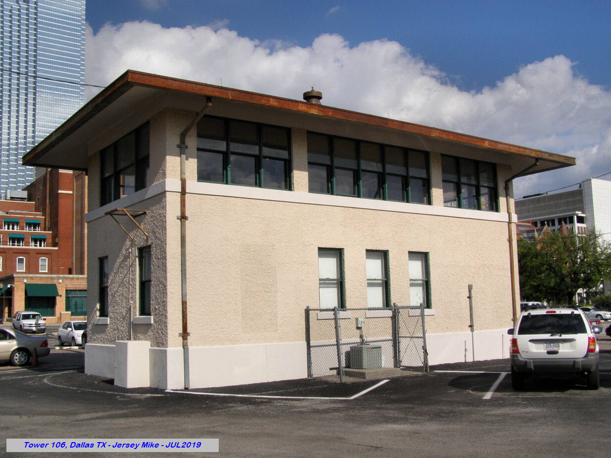 photo by Jersey Mike, 7/2019
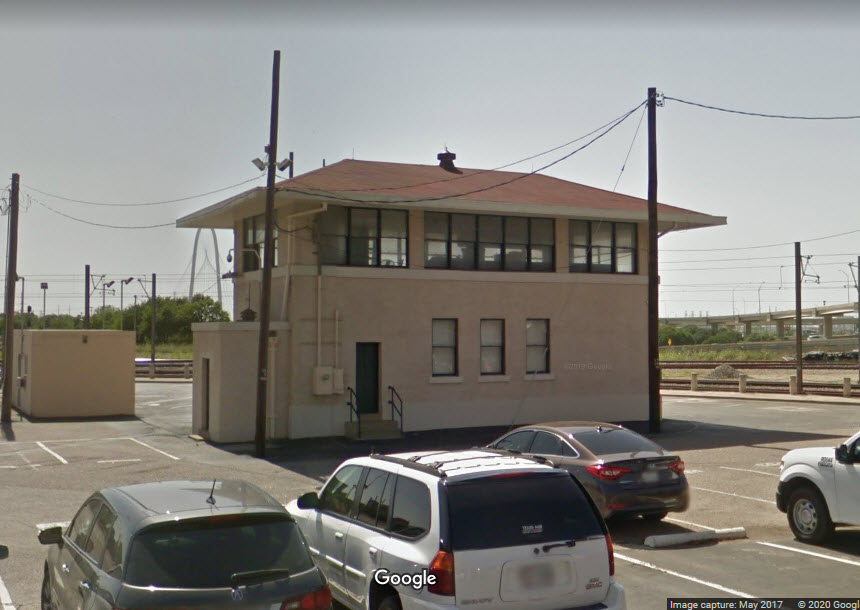
Below is a screen shot from the Texas Interlocking towers website of the remaining towers.
GPS Coordinates: 32.772942, -96.805400
Both towers are easy to access, the south tower is on an access road off Houston St, and the north tower is in the middle of a parking lot off N Houston Street, by the light rail crossing.
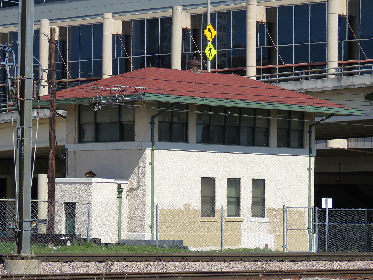 photo by Jersey Mike, 7/2019
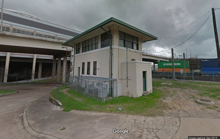
https://en.wikipedia.org/wiki/Trinity_Railway_Express
https://www.dart.org/riding/tre.asp
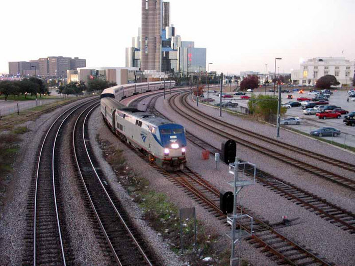
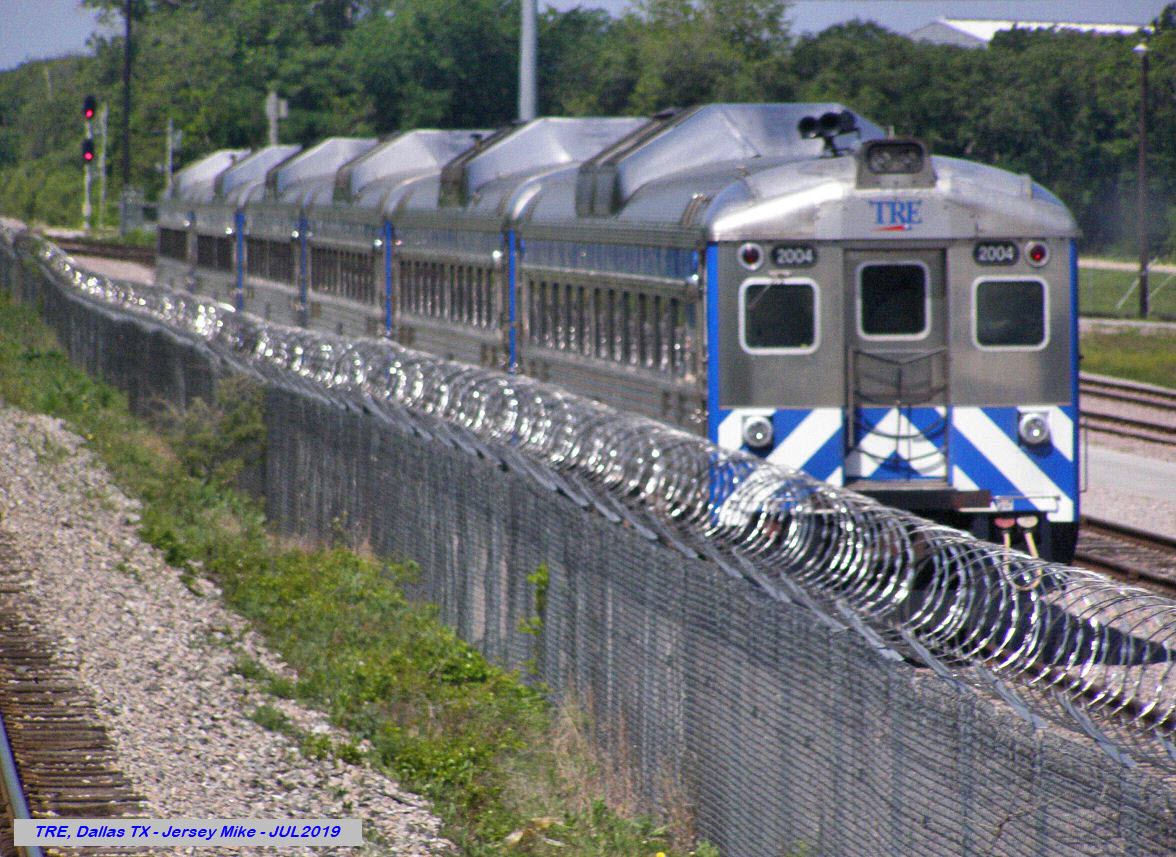
From Wikipedia: The Trinity Railway Express (TRE) is a commuter rail line in the Dallas–Fort Worth metroplex. It was established by an interlocal agreement between Dallas Area Rapid Transit (DART) and Trinity Metro. Each transit authority owns a 50% stake in the joint rail project and contractor Herzog Transit Services operates the line. The TRE began operating in December 1996.
As of the fourth quarter of 2014, the TRE has an average weekday ridership of 8,200 passengers per day and is the fifteenth most-ridden commuter rail system in the United States. In 2014, the TRE carried 2,293,500 passengers. Before 2006, the TRE was typically shown as a green line on DART maps and therefore was sometimes referred to as the "Green Line," but this was not an official designation. In 2006, DART chose green as the color for its new light rail route, the Green Line. Since 2006, the TRE has been shown as a dark blue line on DART maps.
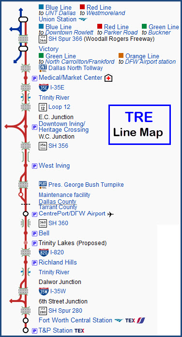
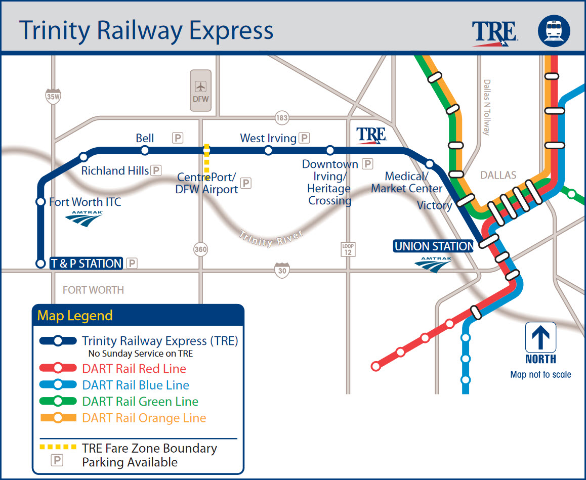
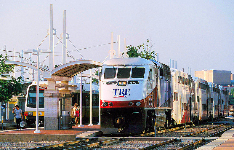
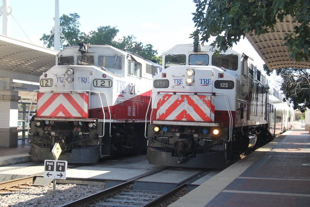 photo by GojiMet86, 10/3/2019
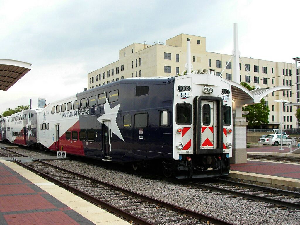 photo by Richard Whitenight, 4/6/2006
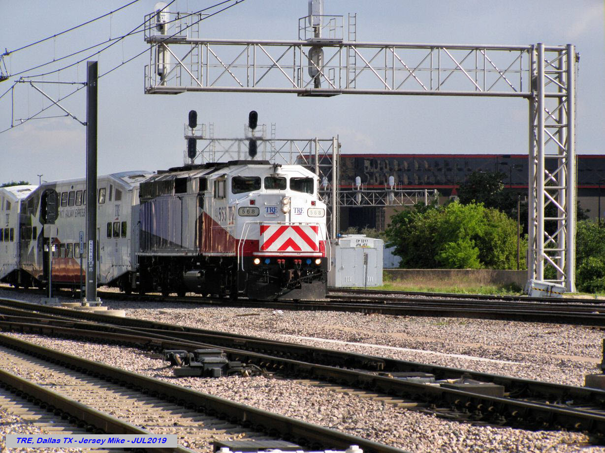 photo by Jersey Mike, 7/2019
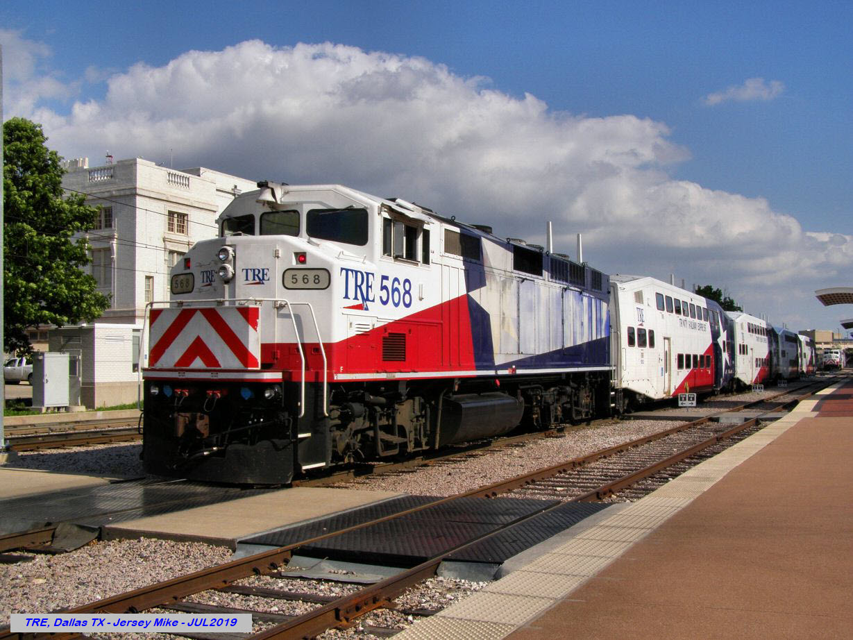 photo by Jersey Mike, 7/2019
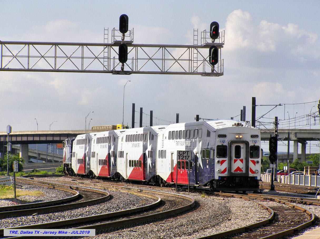 photo by Jersey Mike, 7/2019
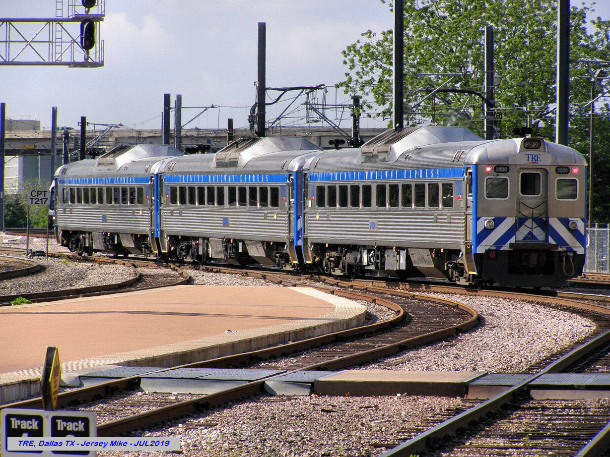 photo by Jersey Mike, 7/2019
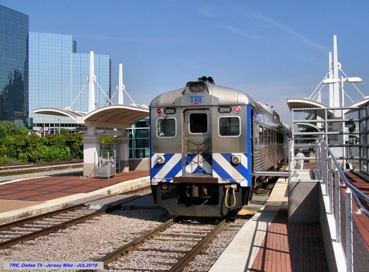 photo by Jersey Mike, 7/2019
https://en.wikipedia.org/wiki/Dallas_Streetcar
From Wikipedia: The Dallas Streetcar is a 2.45-mile (3.94 km) modern streetcar line in Dallas TX. It is owned by the city of Dallas and operated by Dallas Area Rapid Transit, which also operates Dallas's DART Light Rail system. Construction on the line began in May 2013, and it opened for public service on April 13, 2015. The streetcar line operates between downtown Dallas and Oak Cliff by way of the Houston Street Viaduct. The streetcar line originally operated from Union Station to Methodist Dallas Medical Center, but an extension to the Bishop Arts District opened on August 29, 2016.
The streetcar's: In February 2013, an order was placed with Brookville Equipment Corporation for two low-floor streetcars to provide the service on the line. The Brookville "Liberty" model articulated cars are 67 feet (20.42 m) long and have limited capability to operate away from overhead trolley lines by operating on battery power. This battery-powered operation allows the streetcars to travel across the Houston Street viaduct, which does not have overhead lines installed. The first car (No. 302) was delivered on March 20, 2015, and at the time of the line's opening in mid-April it was the only car in the fleet. The second car, No. 301, was delivered on May 15, 2015. Dallas ordered two more streetcars in July 2015. The third and fourth cars (Nos. 303–304) were delivered in summer 2016.
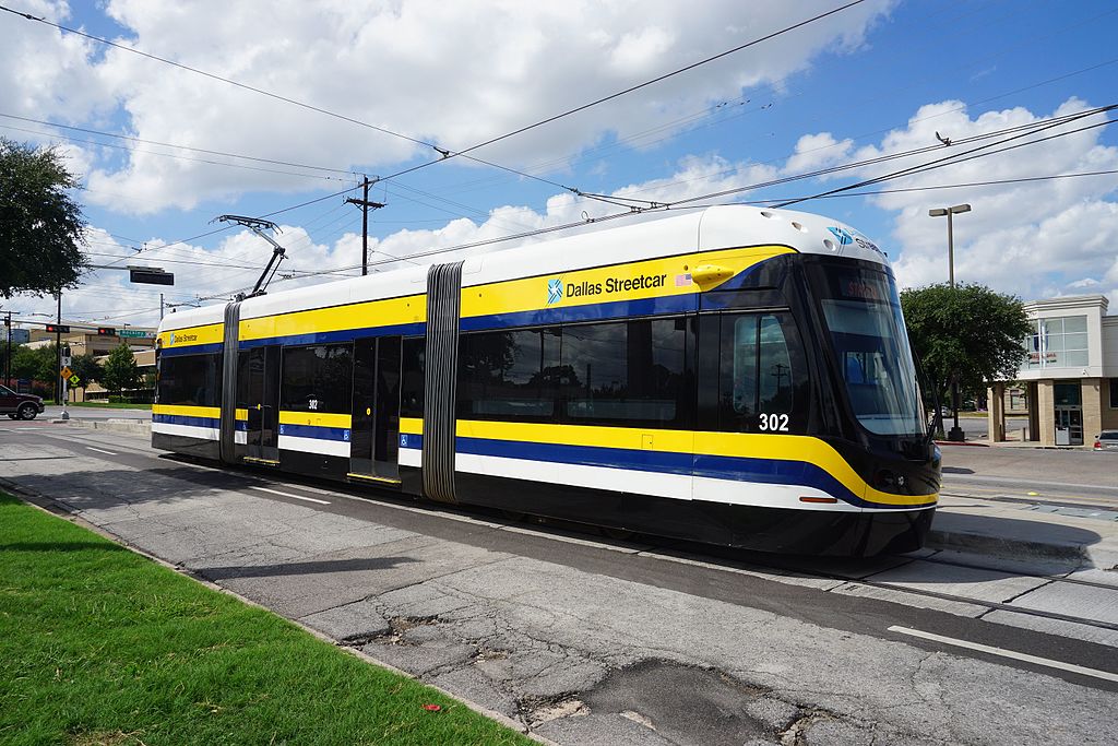 photo by Michael Barera, 2016, via Wikipedia
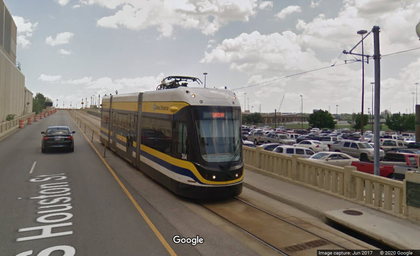
The DART Light Rail system has a really easy transfer to both Amtrak and the Trinity Rail Express at Union Station.
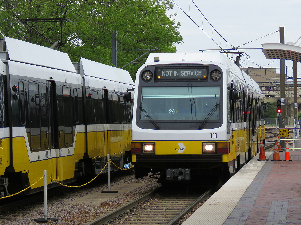 photo by Jersey Mike, 7/2019
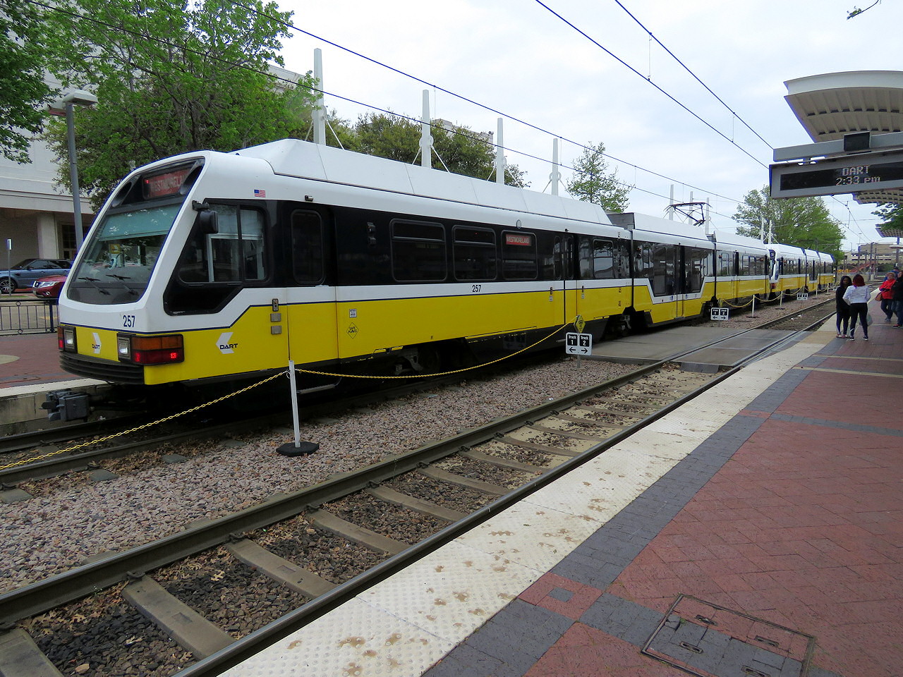 photo by Jersey Mike, 7/2019
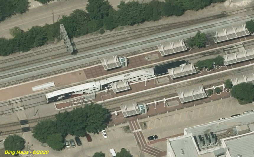
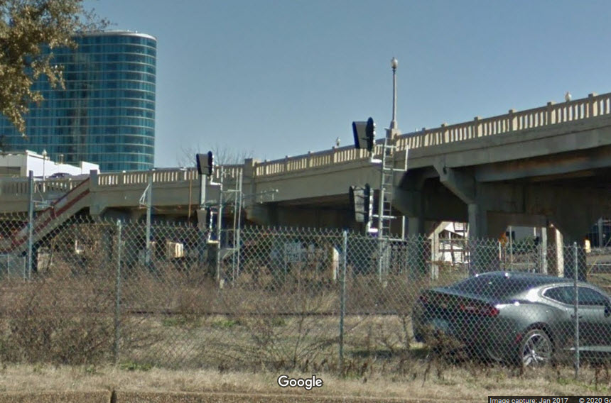
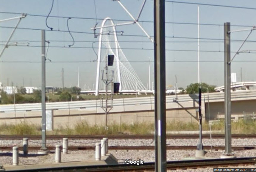
GPS Coordinates: 32.778500, -96.809470
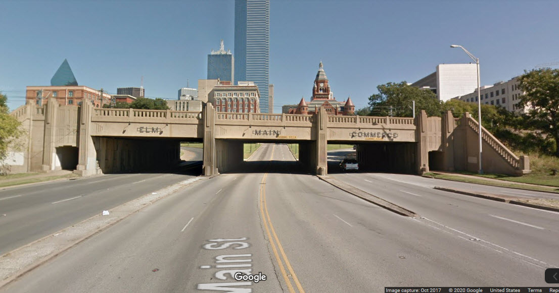
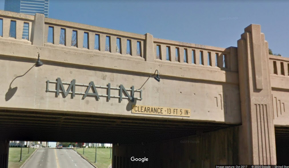
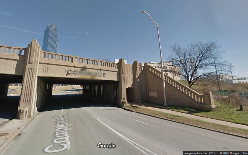
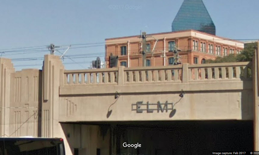
This bridge carries two light rail tracks, and three for the Union Pacific/Amtrak/TRE.
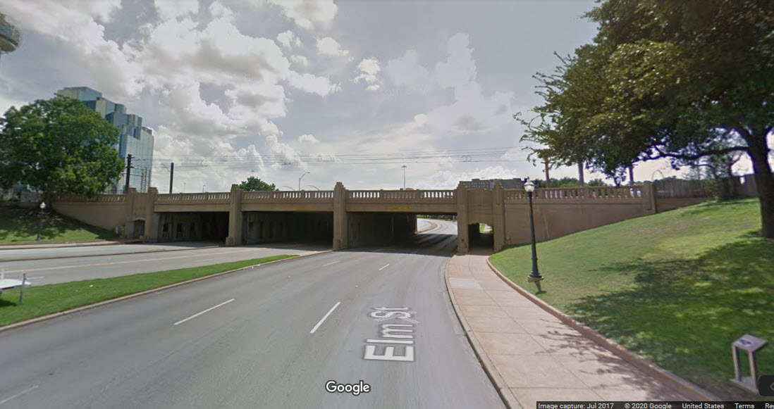
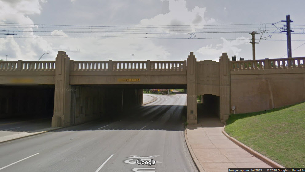
If you don't know what street you are on, "just look up"..... This is a beautiful structure!

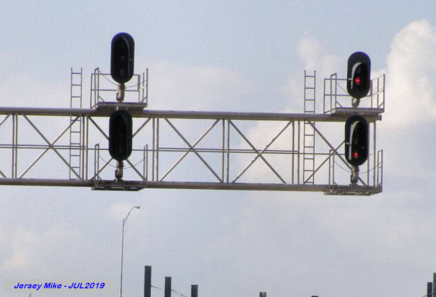
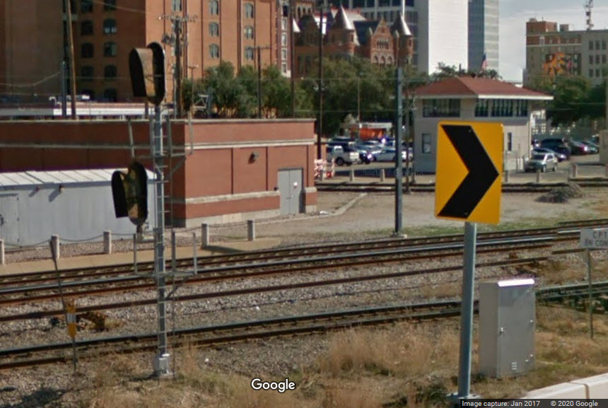
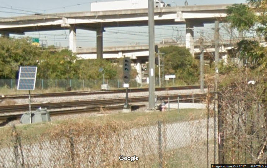
Signal with heads facing in both directions, not very usual for the area.....
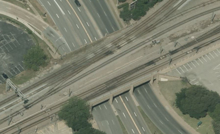
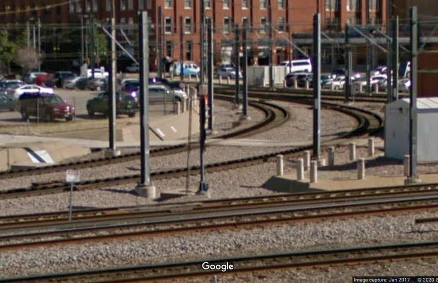
This screenshot was really just an excuse for getting another view of the overpass.... :-)
Located on a cantilever bridge for traffic leaving the Union Station area.
Located on a cantilever bridge for traffic heading into a crossover at the Union Station passenger platforms.
A pair of signals at the northern end of the Light Rail platforms.
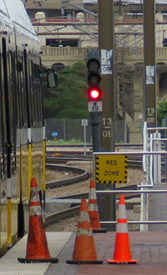 photo by Jersey Mike, 7/2019
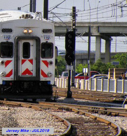
3 sets of signals on a cantilever bridge for traffic heading towards Ft Worth adjacent to the passenger platforms.
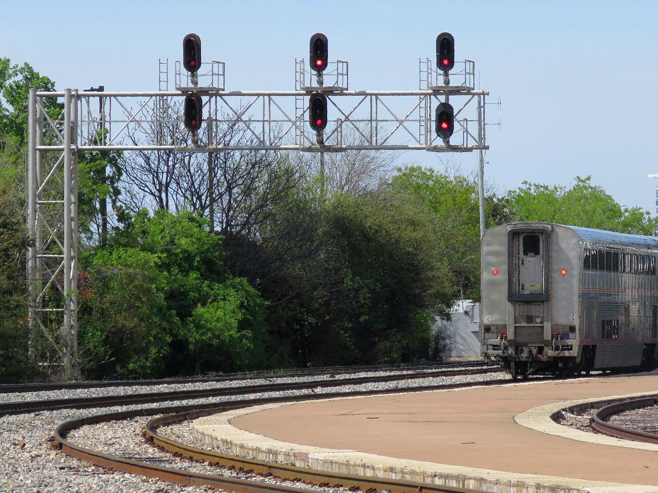 photo by Jersey Mike, 7/2019
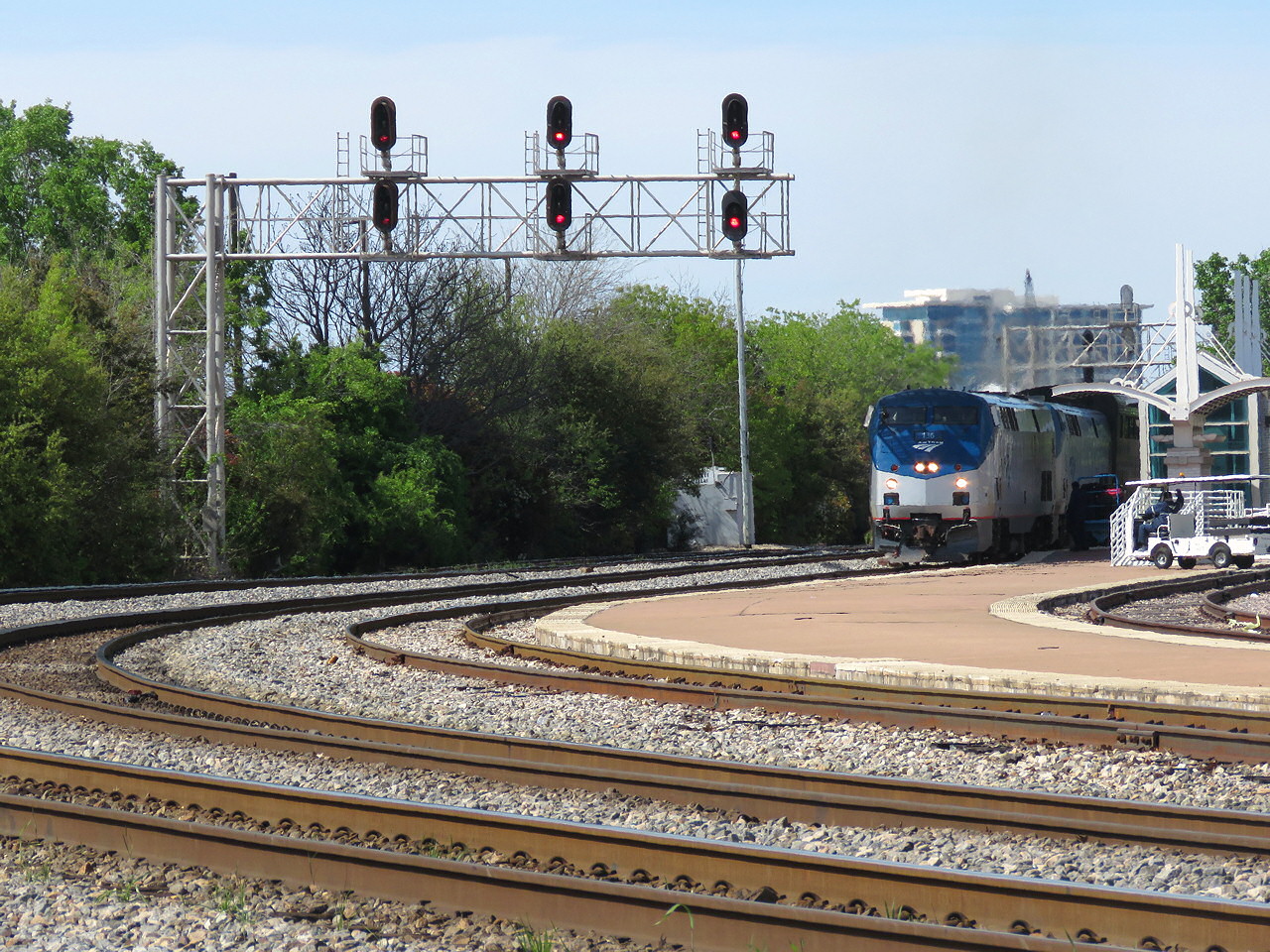 photo by Jersey Mike, 7/2019
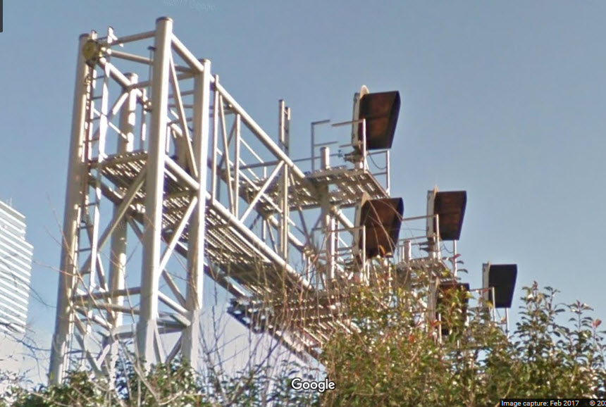
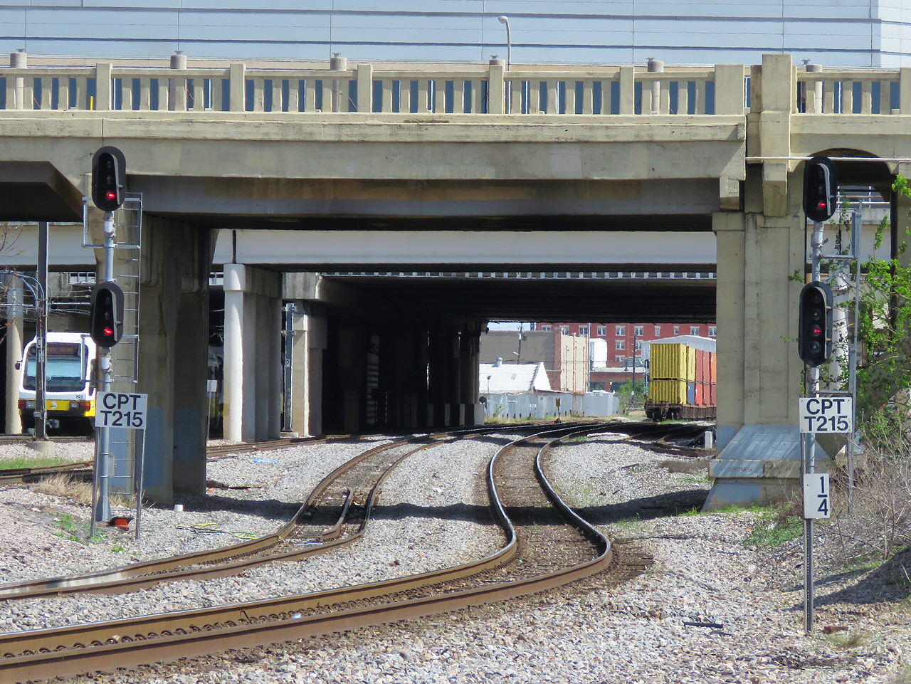 photo by Jersey Mike, 7/2019
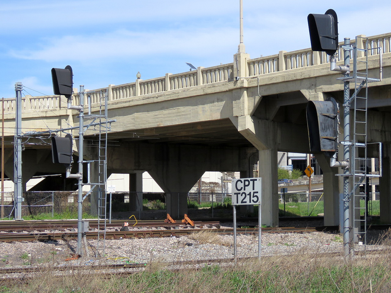 photo by Jersey Mike, 7/2019
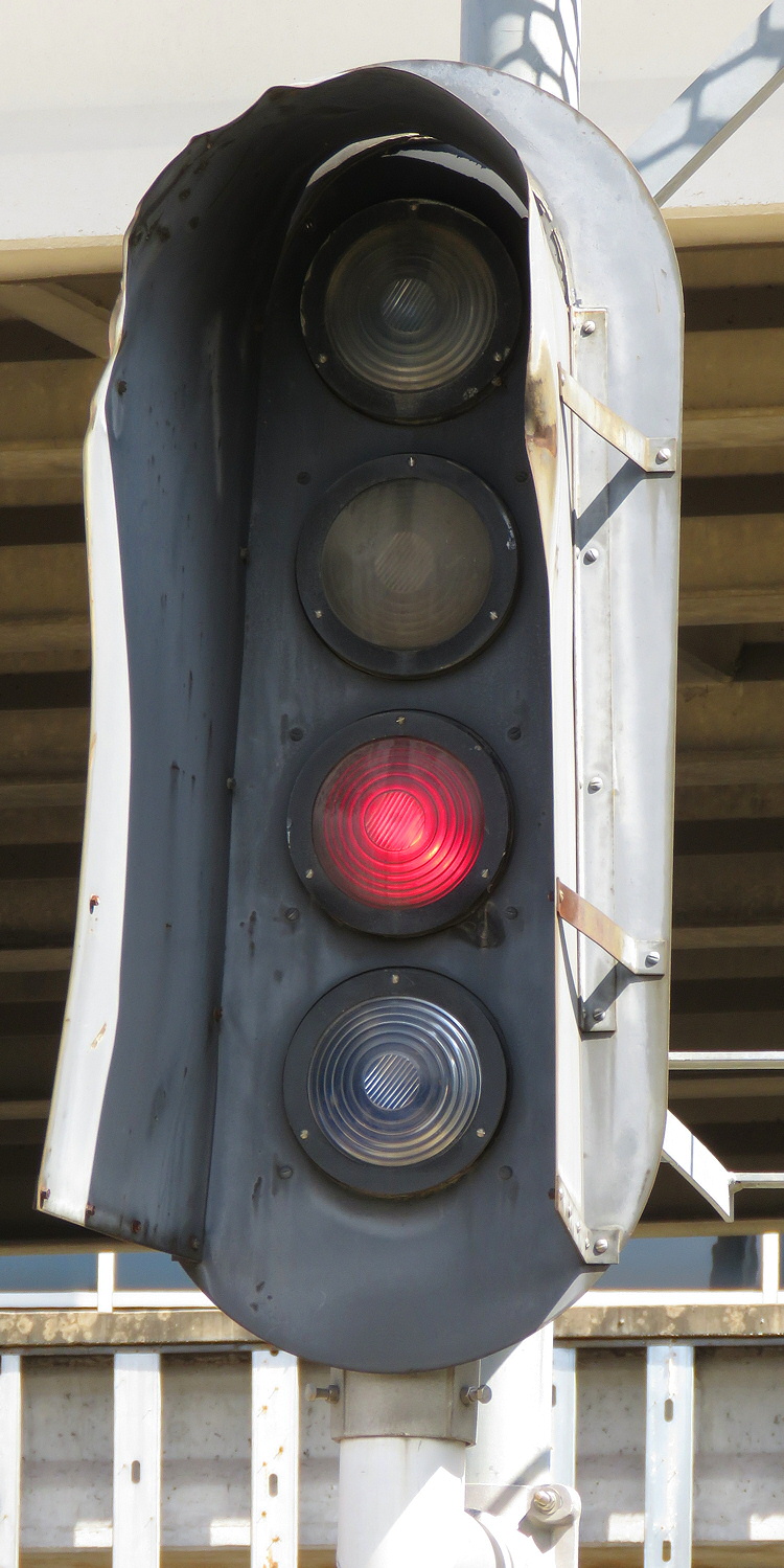 Lower head of #10, photo by Jersey Mike, 7/2019
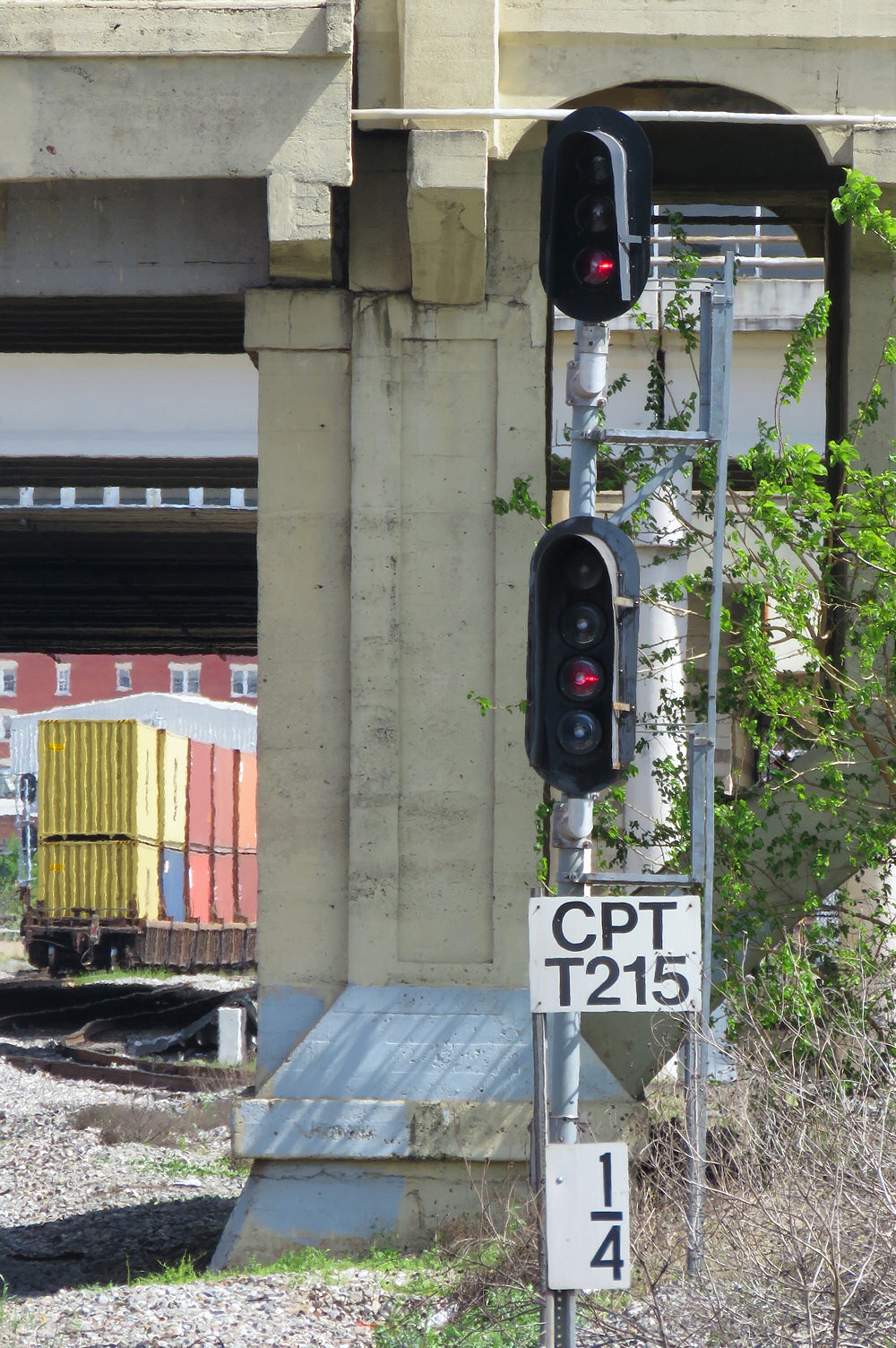 #10, photo by Jersey Mike, 7/2019
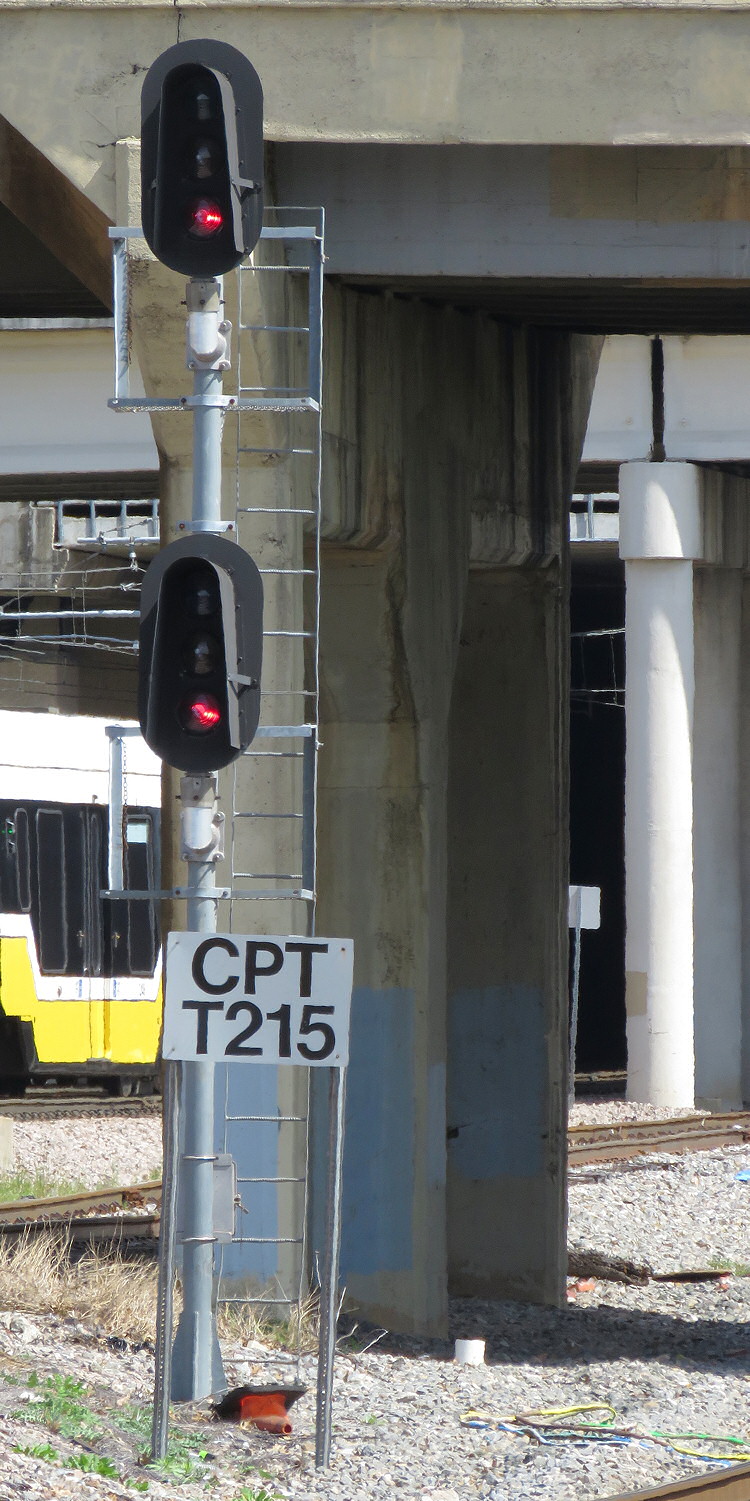 #11, photo by Jersey Mike, 7/2019
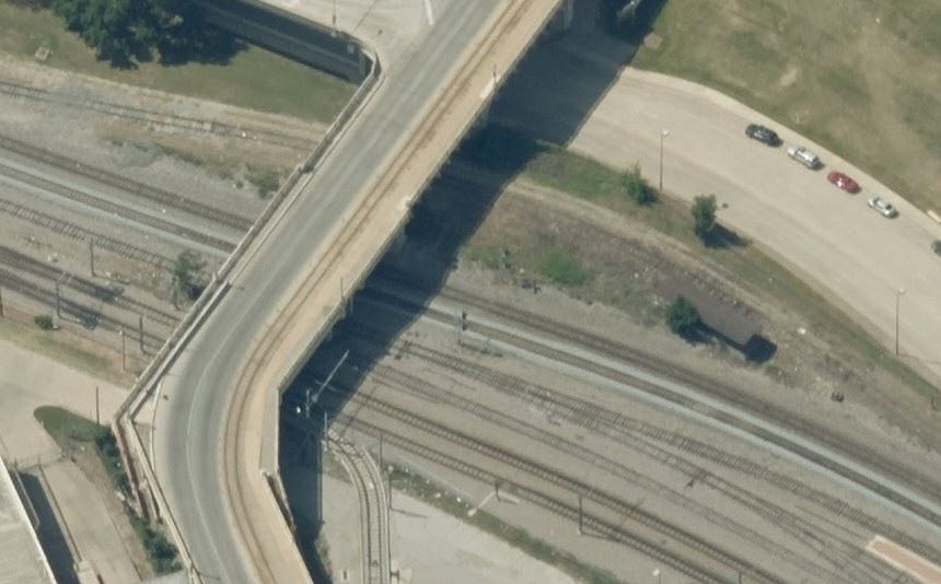
Between the convention center and I-30, we have a couple of signals and a "tri-color" dwarf.
I grouped all three of these as location 12, because they are off the above map....
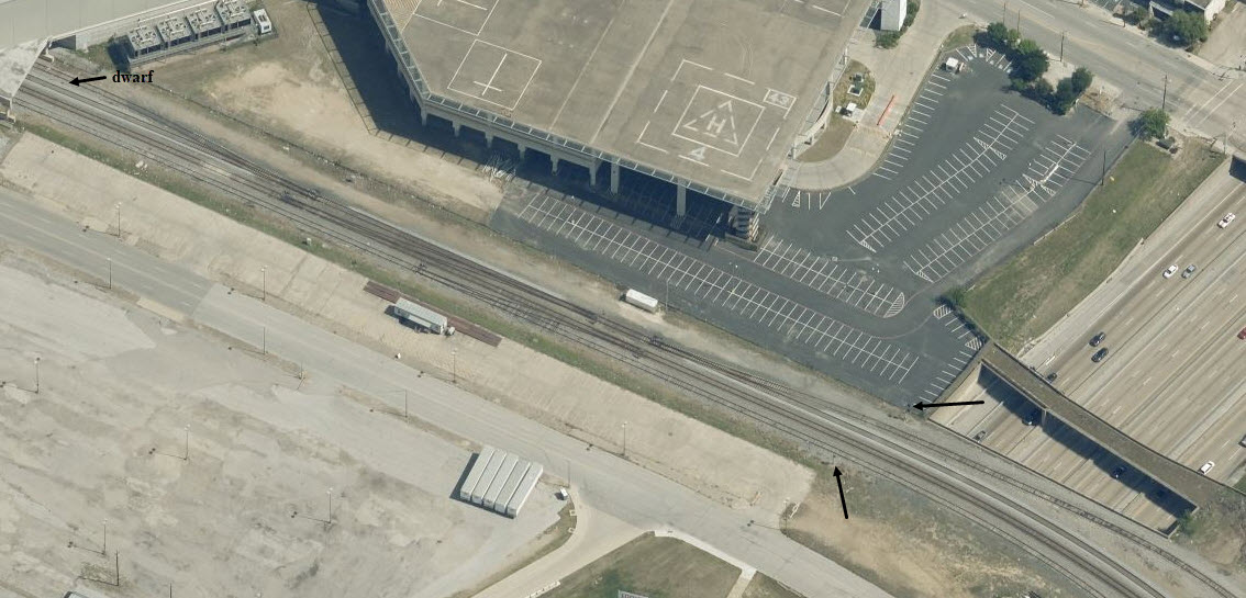
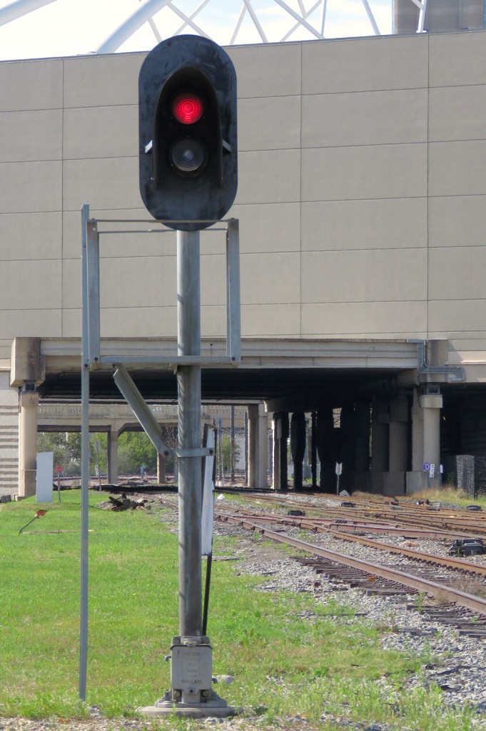 photo by Jersey Mike, 7/2019
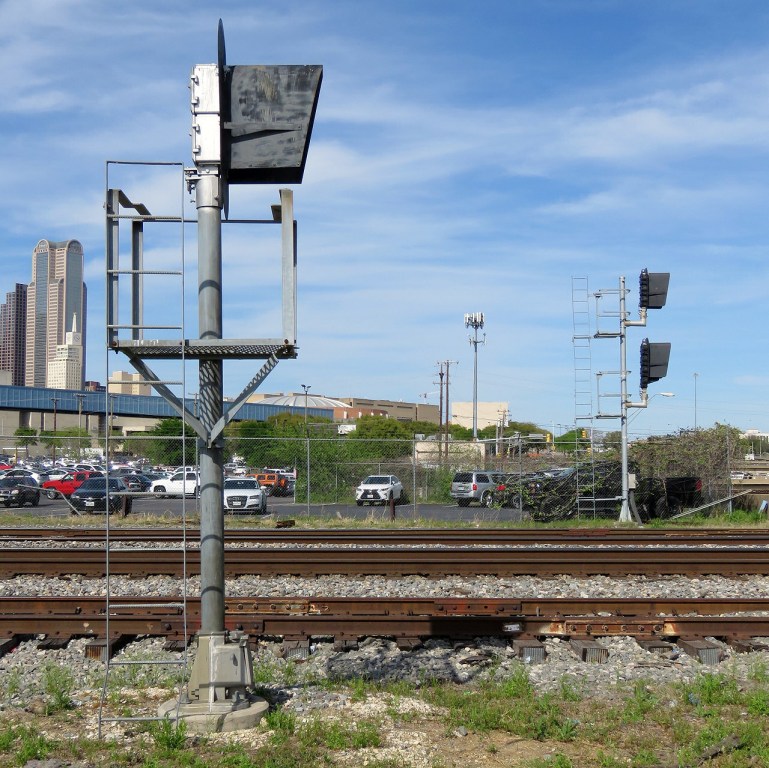 photo by Jersey Mike, 7/2019
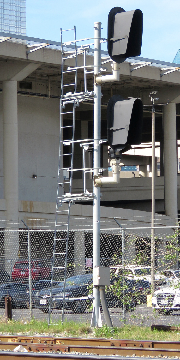 photo by Jersey Mike, 7/2019
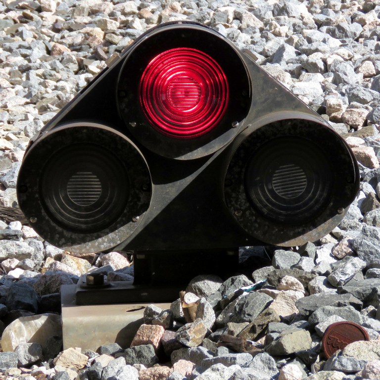 photo by Jersey Mike, 7/2019
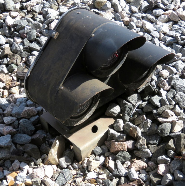 photo by Jersey Mike, 7/2019
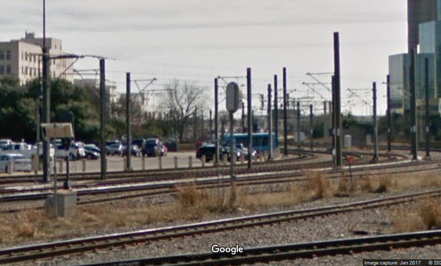
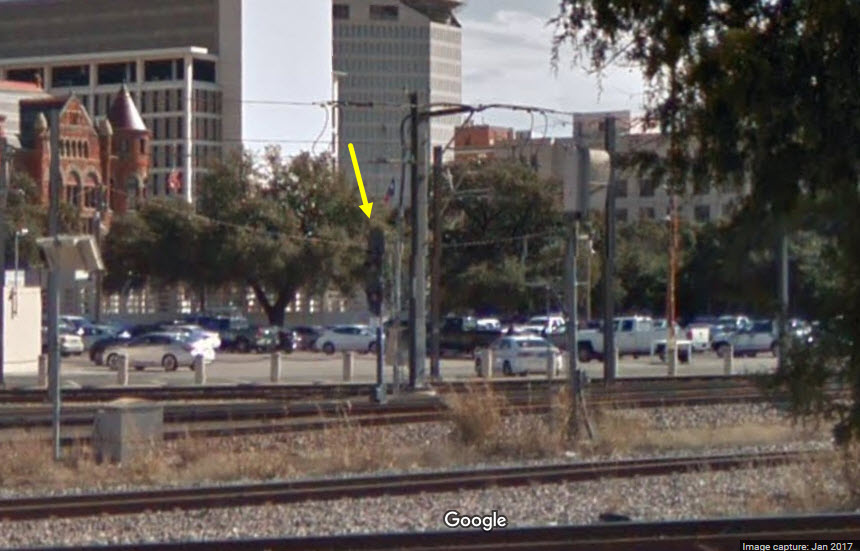
I can't quite tell if this signal, the one on the left, is for the light rail system or not, and if it is, it looks like a leftover from the railroad days.
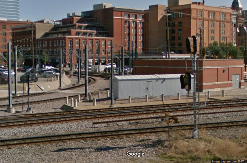
This picture is at the wye, but I'm not sure if it is of the signal I have on my map for location 20.....
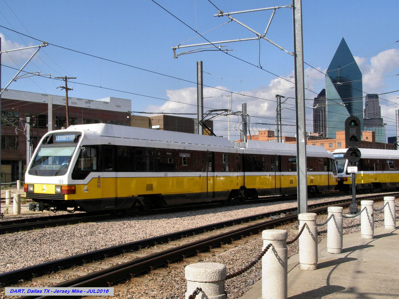 photo by Jersey Mike, 7/2016
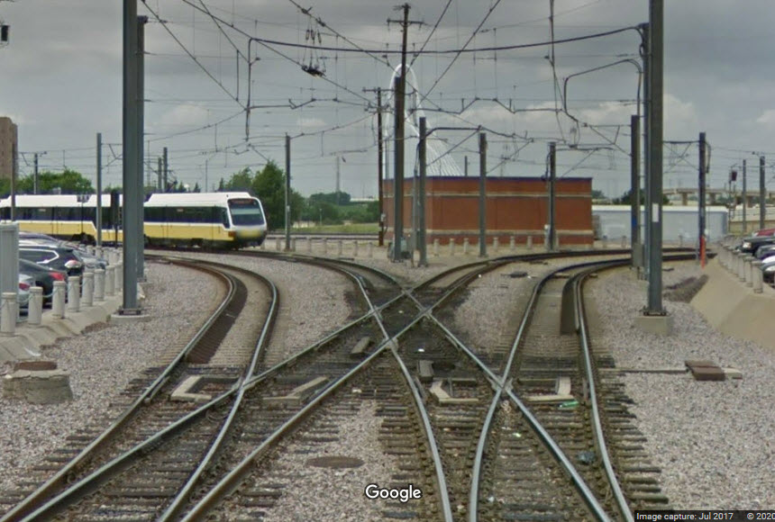 from the Houston St grade crossing
For reverse traffic trains leaving Union Station for the wye.
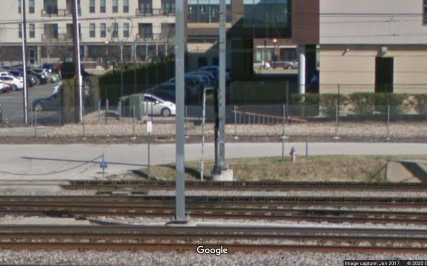
In between the Houston and Market Street overpasses, and adjacent to Tower 107, is a double crossover, these are the SB signals controlling the movements thru it.
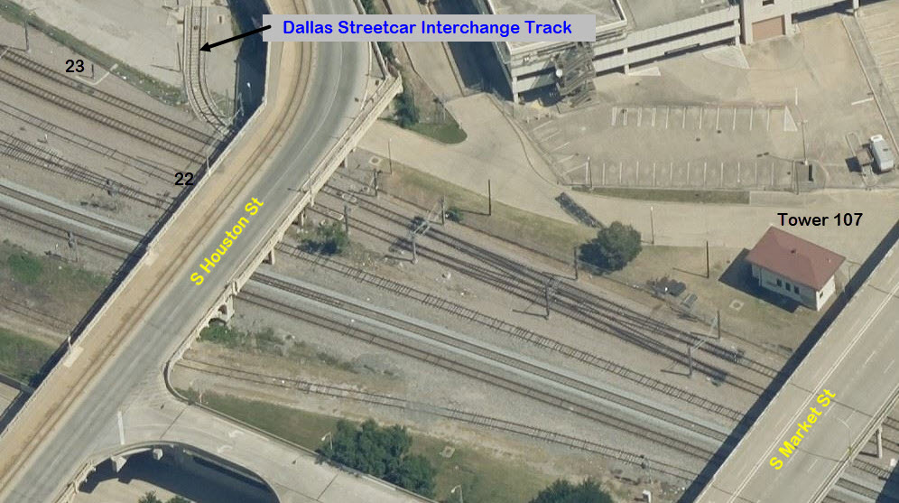
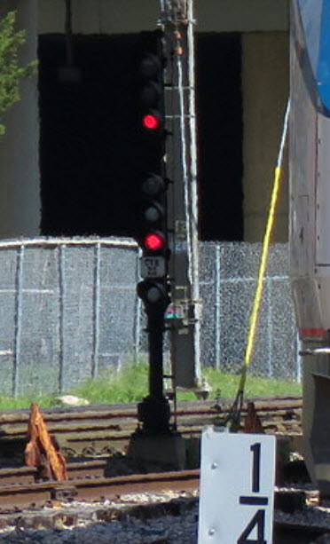 Signal 22, photo by Jersey Mike, 7/2019
A couple of other TRE pictures from Jersey Mike, the first one is at their storage area between Dallas and Ft Worth....
 7/2019
The next shot is of their station in Ft Worth.
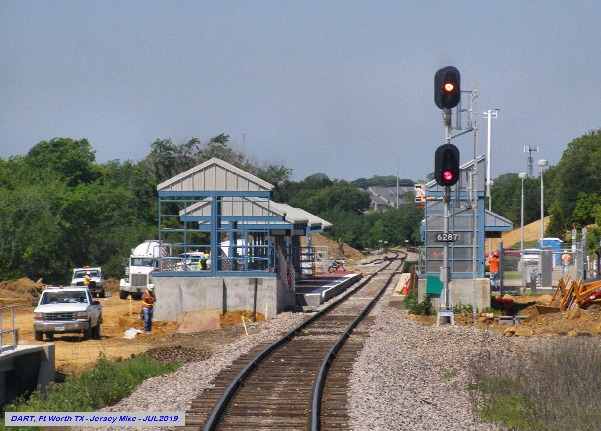 7/2019
Reunion Tower
The most recognizable building of the Dallas skyline....
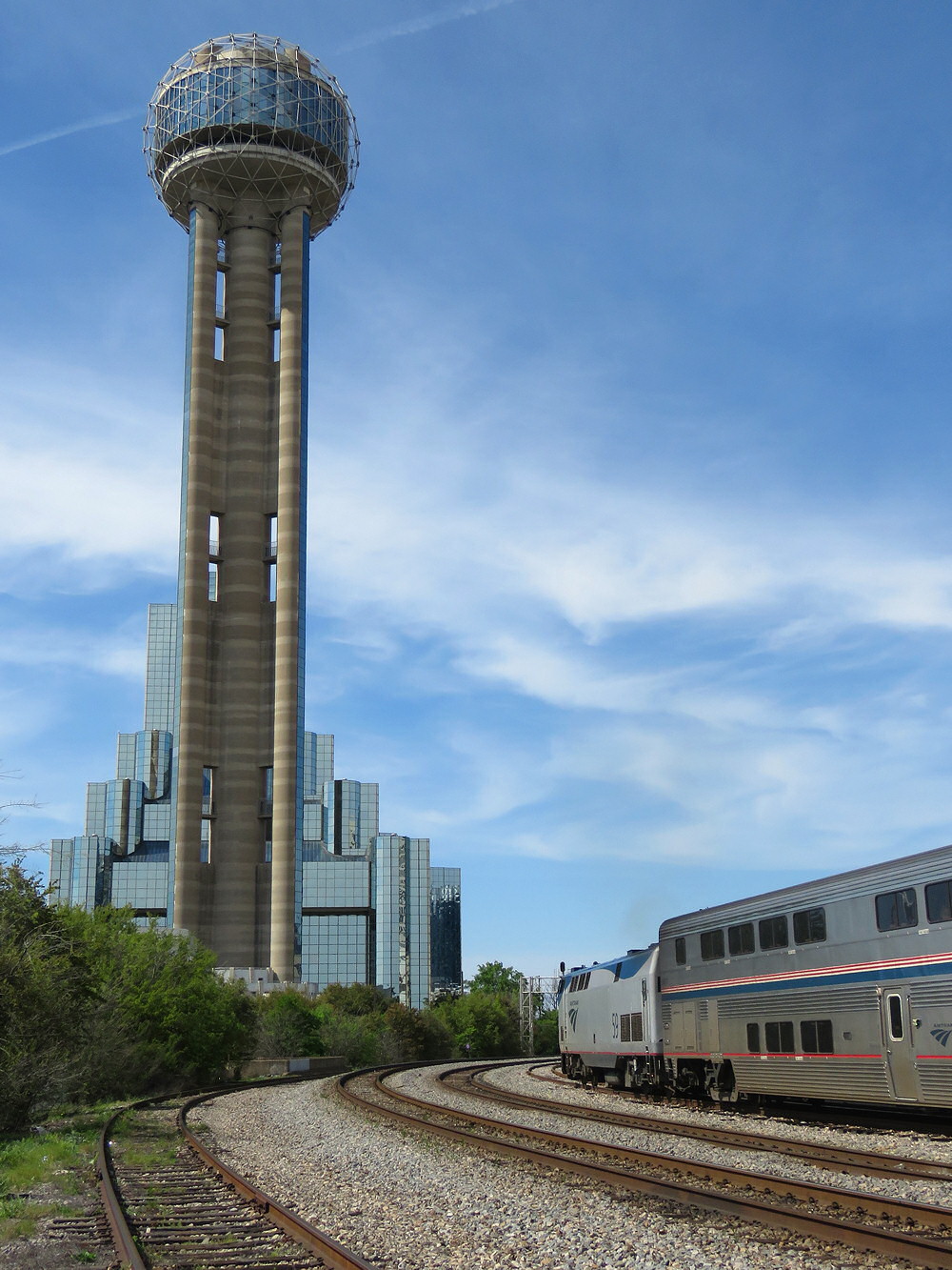 photo by Jersey Mike, 7/2019
Did U Know?
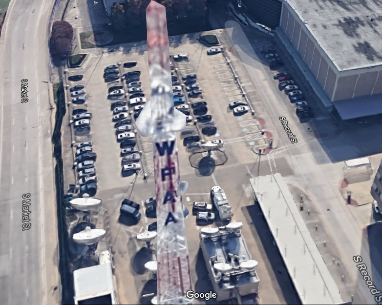
For those of you that don't know me, I have both a Ham Radio license, and a commercial FCC license, and as such, have an interest in "radio" As a kid living in Tyler TX, back in 1959-1964, I used to love going to the town square, where just off of it, was a radio station where the DJ had a window on the street, with a speaker above so you could listen in... that was a hoot!
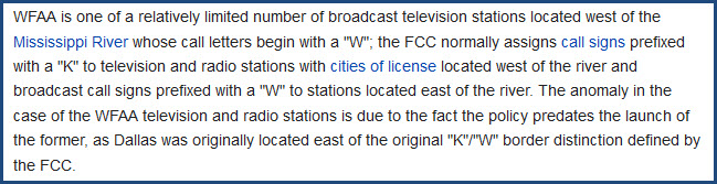
WFAA has the distinction, of being one of the very few radio/TV Stations that start with a "W", and is west of the Mississippi River, like KDKA in Pittsburgh is a "K" station EAST of the Mississippi. The tower is only a couple of blocks from Union Station.
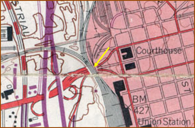
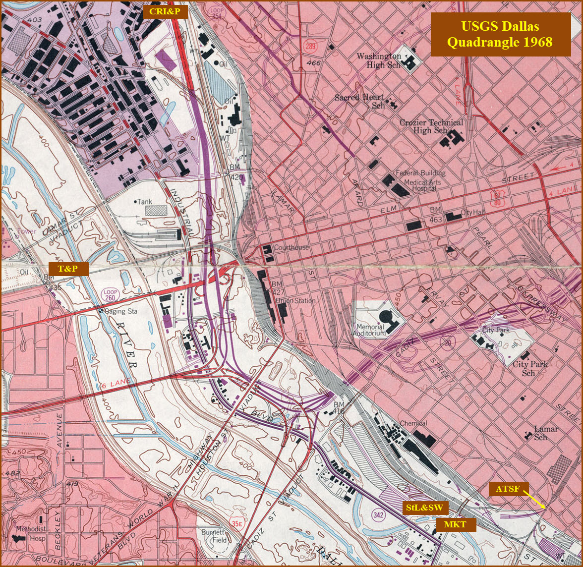
Courtesy of the University of Texas Library, click here for their index page.
http://legacy.lib.utexas.edu/maps/topo/texas/txu-pclmaps-topo-tx-dallas-1968.jpg
Disclaimers:
I love trains, and I love signals. I am not an expert. My webpages reflect what I find on the topic of the page. This is something I have fun with while trying to help others.
Please Note: Since the main focus of my two websites is railroad signals, the railfan guides are oriented towards the signal fan being able to locate them. For those of you into the modeling aspect of our hobby, my indexa page has a list of almost everything railroad oriented I can think of to provide you with at least a few pictures to help you detail your pike.
If this is a railfan page, every effort has been made to make sure that the information contained on this map and in this railfan guide is correct. Once in a while, an error may creep in :-)
My philosophy: Pictures and maps are worth a thousand words, especially for railfanning. Text descriptions only get you so far, especially if you get lost or disoriented. Take along good maps.... a GPS is OK to get somewhere, but maps are still better if you get lost! I belong to AAA, which allows you to get local maps for free when you visit the local branches. ADC puts out a nice series of county maps for the Washington DC area, but their state maps do not have the railroads on them. If you can find em, I like the National Geographic map book of the U.S..... good, clear, and concise graphics, and they do a really good job of showing you where tourist type attractions are, although they too lack the railroads. Other notes about specific areas will show up on that page if known.
Aerial shots were taken from either Google or Bing Maps as noted. Screen captures are made with Snagit, a Techsmith product... a great tool if you have never used it!
By the way, floobydust is a term I picked up 30-40 years ago from a National Semiconductor data book, and means miscellaneous and/or other stuff.
Pictures and additional information is always needed if anyone feels inclined to take 'em, send 'em, and share 'em, or if you have something to add or correct.... credit is always given! Please be NICE!!! Contact info is here
Beware: If used as a source, ANYTHING from Wikipedia must be treated as being possibly being inaccurate, wrong, or not true.
RAILFAN GUIDES HOME
RAILROAD SIGNALS HOME
NEW JUN18/2020
Last Modified 22-Jun-2020