RAILFAN GUIDES of the U.S.
Todd's Railfan Guide to
MEMPHIS TN
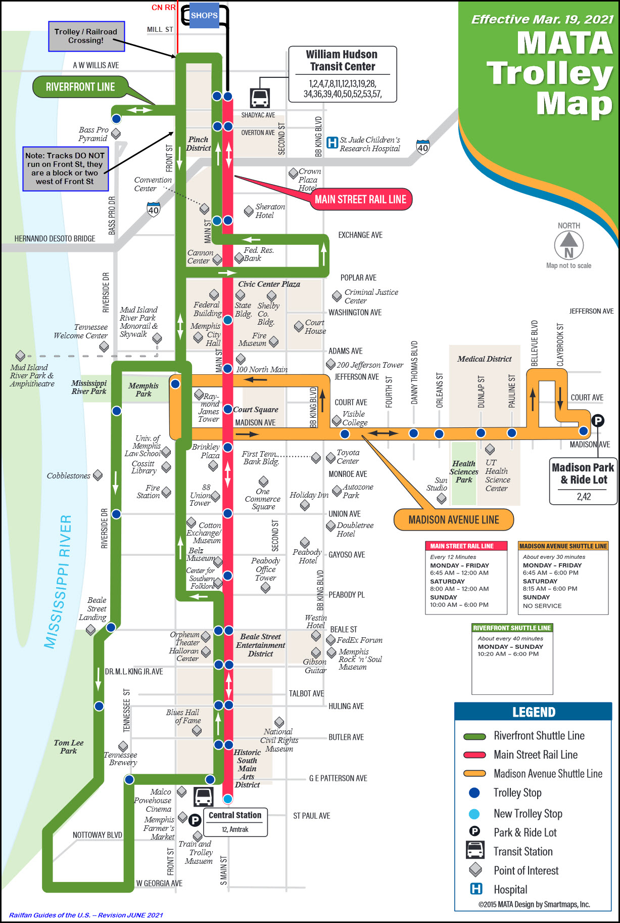
MATA Main Street Trolley
In General
Getting Here
Map
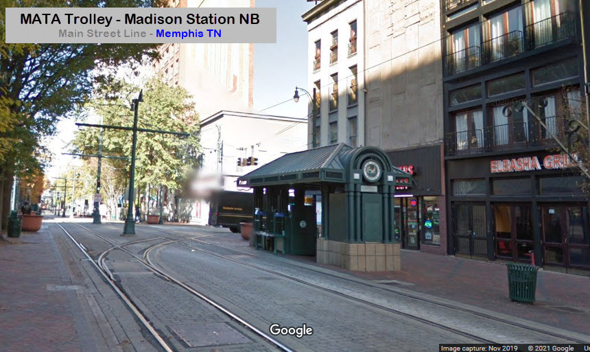
Station by Station - Main Street
Station by Station - Madison Ave
Sights
Pictures
Bridges
Signals
Fire & Police
Floobydust
RAILROAD SIGNALS HOME
Location / Name:
Memphis TN, Shelby County
What's Here:
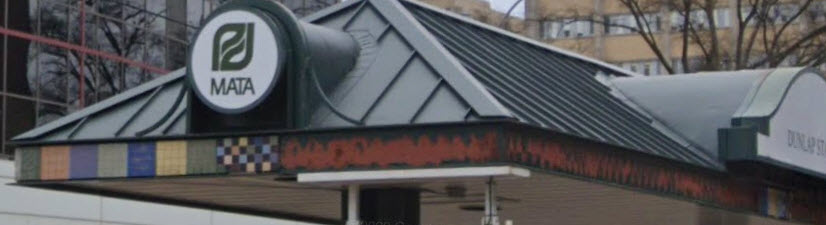
MATA Trolley System
Data:
GPS Coordinates: as needed
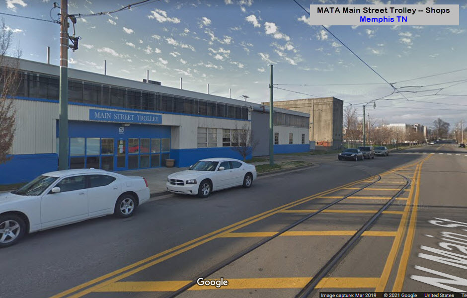
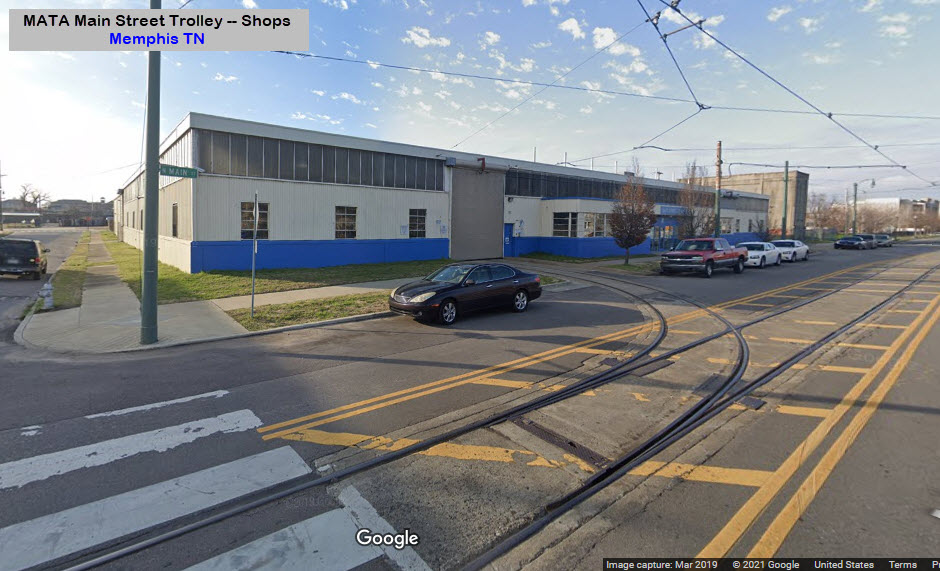
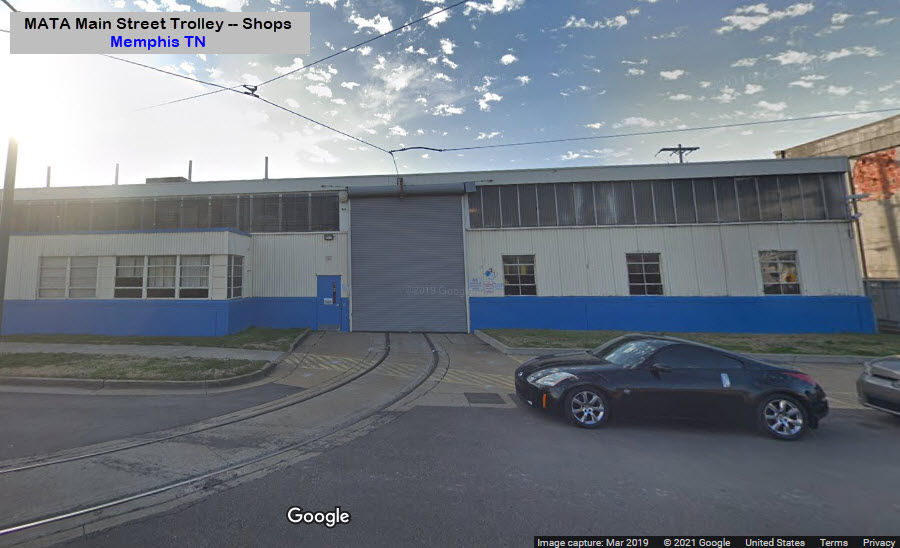
547 N Main St, Memphis, TN 38105
Phone A/C: 901
ZIP: 38105
Access by train/transit:
Amtrak at the Memphis Central Station
The Scoop:
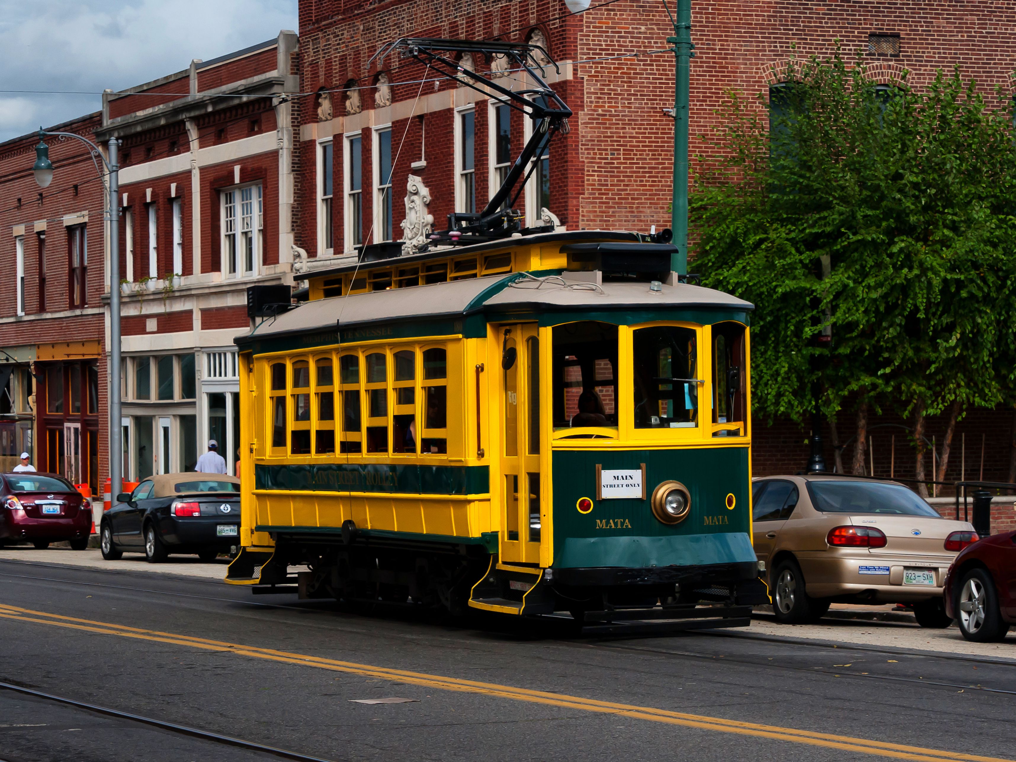
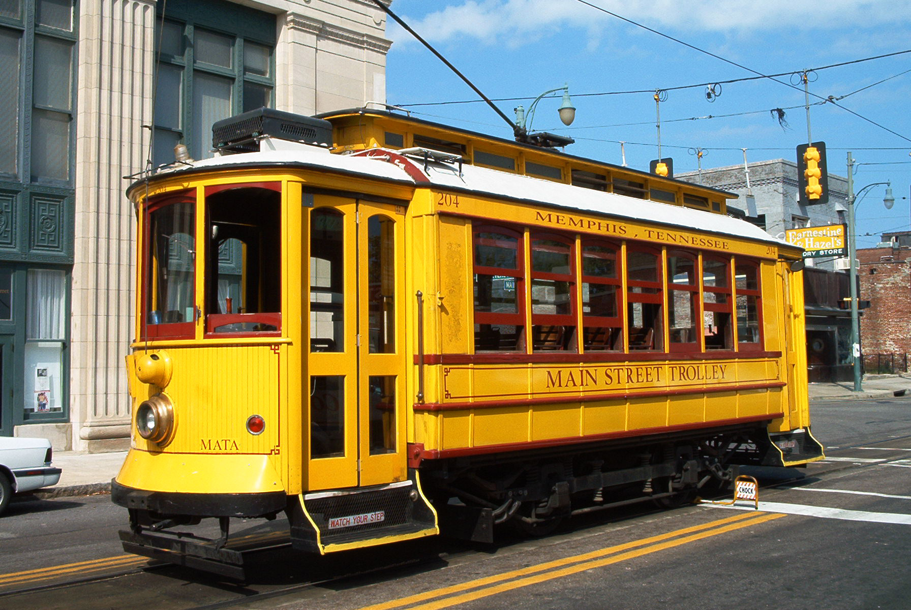
From Wikipedia: The MATA Main Street Trolley is a heritage streetcar transit system operating in Memphis TN (Tennessee). It began operations on April 29, 1993. The trolley system is operated by the Memphis Area Transit Authority (MATA). The trolleys used are almost all restored, vintage streetcars.
Since opening the system in 1993, it has been extended twice and now consists of three lines: 1) the Main Street Line, 2) the Riverfront Loop, and 3) the Madison Avenue Line. Altho Wikipedia says service on the last two lines is temporarily suspended, one of the Google Streetview pictures from 2018 below shows a streetcar heading east on Madison Avenue.
Service was suspended in June 2014, following fires on two cars. After nearly four years and repeated postponements, the reopening of the Main Street Line took place on April 30, 2018.
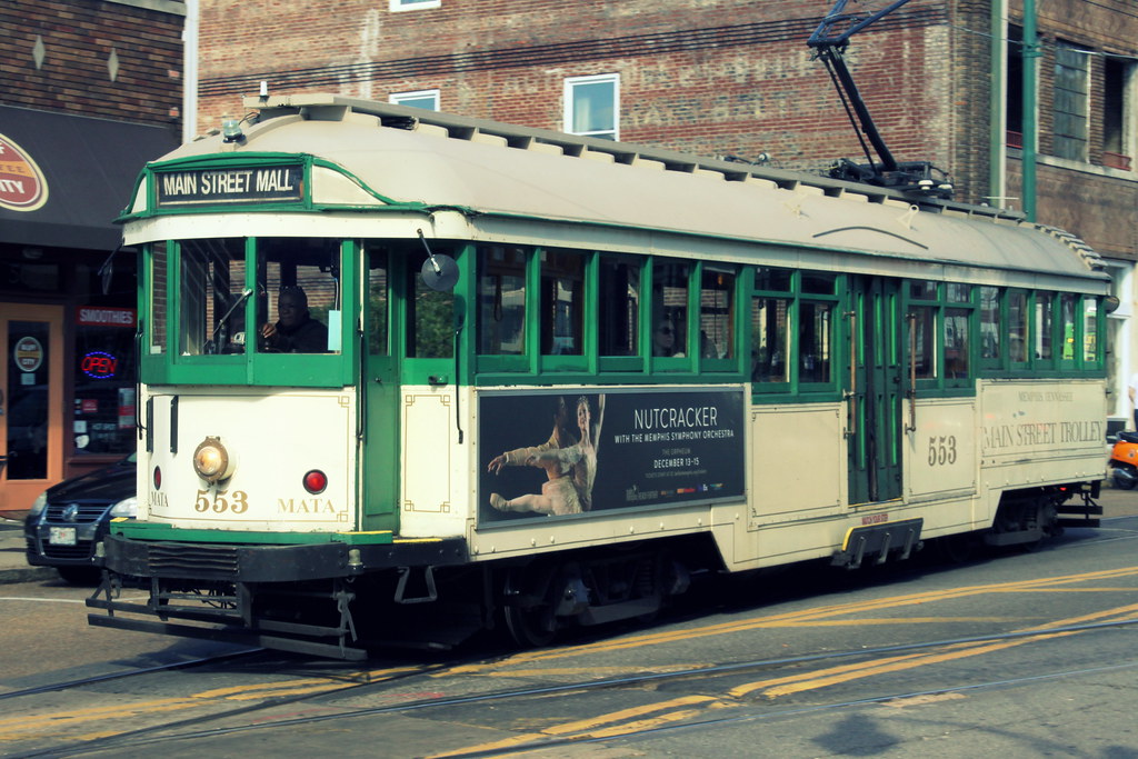
On car #553: On April 7, 2014 this trolley car caught fire at 7:45 AM. Nobody on board was injured after barely escaping before it burst into flames but damage to the trolley car resulted in a total loss. It was the second time this had happened to a MATA trolley in six months, so service continues to be suspended until they can ensure fires never happens again. This particular trolley was built in 1923 by Australia's Melbourne and Metropolitan Tramways Board. MATA bought the reconditioned car in 1997 for $387,500.
The last line of Memphis’ original streetcar network closed on June 15, 1947.
From Heritage Trolley dot org: As built, it stretches 2.5 miles along Main Street from the historic Pinch district on the north to Central Station and the Civil Rights Museum on the south. En route it passes the Pyramid Arena, the Convention Center/Civic Center/hotels complex, Beale Street, Elvis Presley Plaza, and the South Main Historic District About one third of the route shares the revamped mall with pedestrians. For the remainder the cars compete with other traffic, although at the south end there isn’t much competition as drivers seem to prefer other streets.
The terminal of the monorail to Mud Island is an easy two-block walk from a mall station. Mud Island is a major tourist attraction, including elaborate exhibits on the days of the riverboats, an outdoor scale model of the Mississippi River, and the World War II bomber Memphis Belle.
The area at the north end of the line contains the Convention Center, the Civic Center and hotels and is to all appearances busy and prosperous. The mall itself is a center for recreational activities. As one approaches the south end, it is apparent that there is still much work to be done if the area is to thrive.
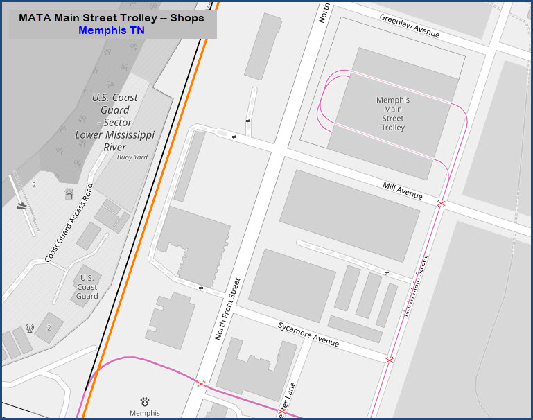
The entire line is double track except for a short extension beyond the northern terminal to the maintenance facility. All equipment is double-ended; there are no terminal loops. The maintenance facility does include a loop allowing the cars to be reversed.
The Madison Avenue Line:
The Madison Avenue Line is a line of the Memphis Area Transit Authority trolley system. The trolley line began operating in 2004, and cost $56 million to build. Currently, it operates 2.2 mi (3.5 km) of double track along Madison Avenue with six stops stretching into Midtown Memphis. The line was built to connect the Main Street system to the Medical District just east of Downtown Memphis.
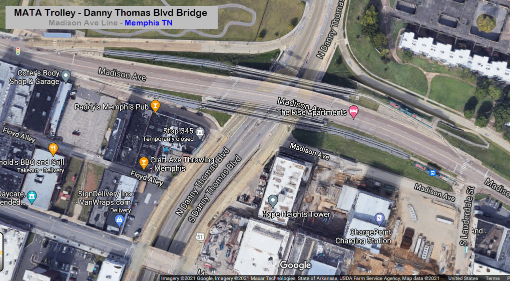
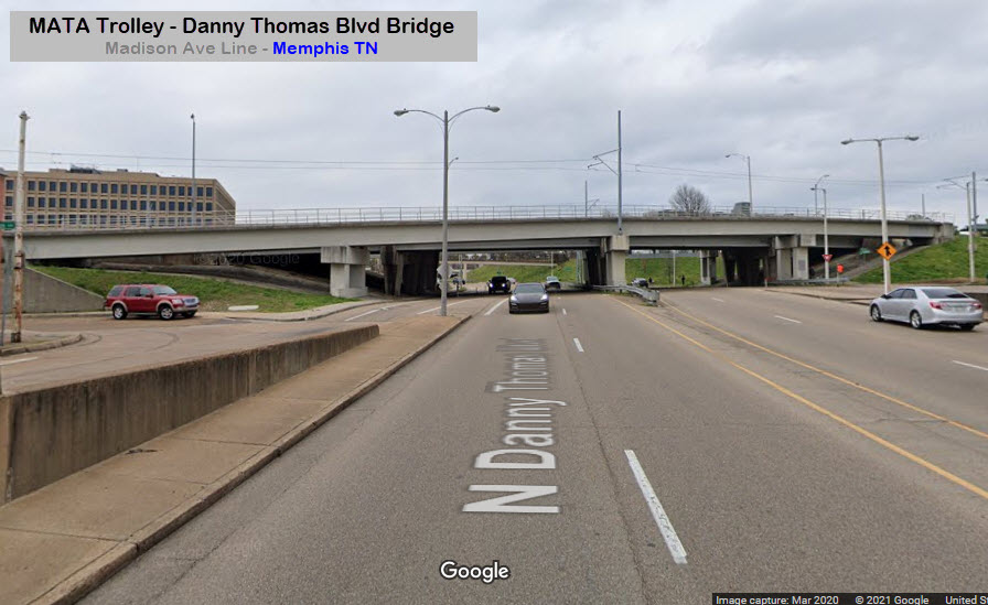
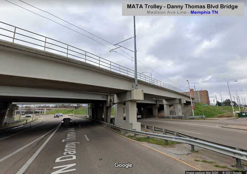
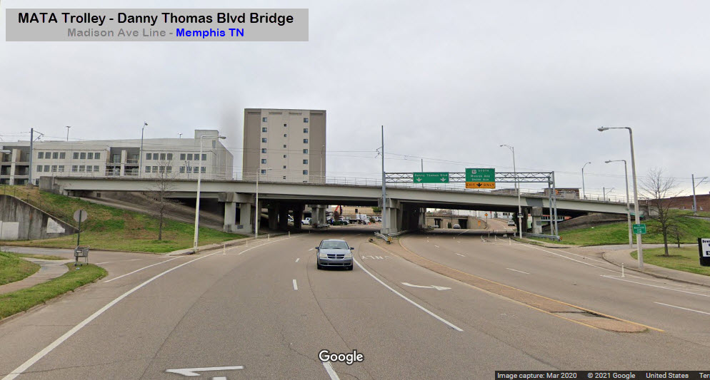
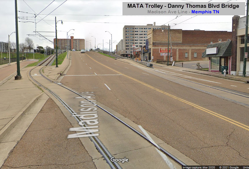
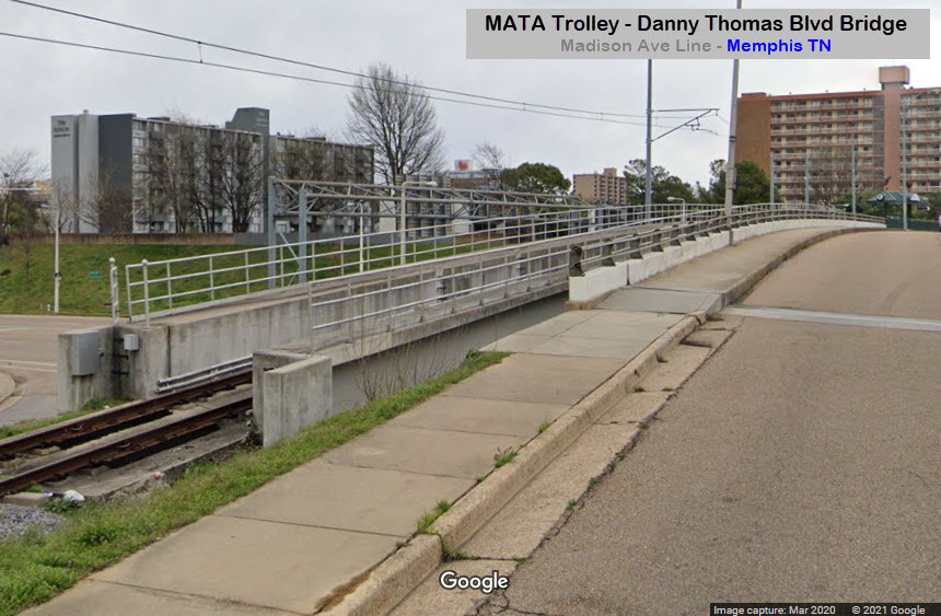
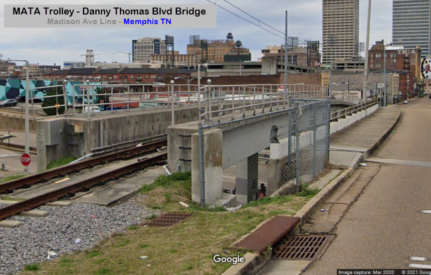
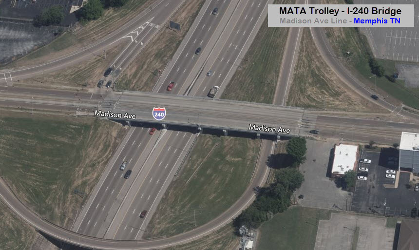
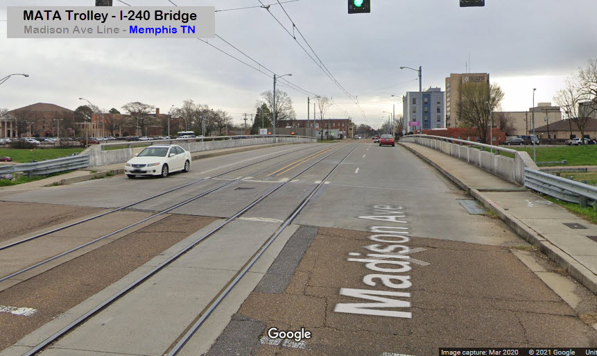
Madison Ave Line Route description: Beginning at the intersection of Main Street and Madison Avenue, the line heads east. After passing Autozone Park, the trolley crosses over Danny Thomas Boulevard on two rail-specific bridges on either side of the Madison Avenue bridge. The line continues through the Medical District passing through University of Tennessee Health Science Center campus before crossing over I-240 and heading into Midtown. The line terminates abruptly just after Cleveland Street in the Crosstown neighborhood.
Rolling Stock:
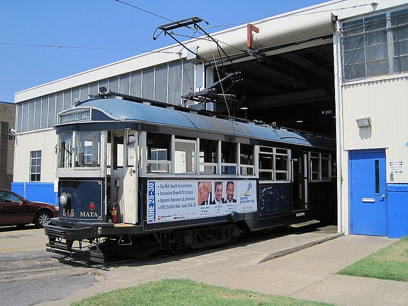
From Heritage Trolley dot org: Fourteen single-truck cars had been obtained from Porto, Portugal. With one exception, all were built at Porto between 1927 and 1940 using a Brill design of the early 1900s. The exception dates from 1907 and may be one of the original Brill cars ex-ported to Portugal. Six single-truck cars are now in service. Two double-truck cars were also obtained from Porto, but to date these and the rest of the single-truck cars remain in storage.
Those in service have been completely renovated, with extensive modifications to allow compliance with the Americans with Disabilities Act. They are mounted on what appear to be Brill 21-E trucks or Porto copies.
To accommodate wheelchair users, platform floors were raised and cuts made in frame cross members to allow a ramped aisle from the platform into the car. A steel plate installed beneath the raised platform floor is extended by hand to bridge the gap between the car and wayside lifts. Each car is in a different color scheme. Each carries a single trolley pole, making Memphis one of the few places in North America where operators must “walk the pole around” (Yakima and McKinney Avenue in Dallas are others) when changing ends.
As opening day approached, four of the planned six renovated cars were ready for service. Opening ceremonies were on April 29, 1993. During the first day of operation an astonishing 7000 riders crowded aboard the four cars—far more than expected. Ridership now averages about 2000 daily, although this varies widely depending on the number attending conventions, the weather, the season, and the day of the week.
Initially, there was political opposition to the use of double-truck cars as being too large. The obvious need for more capacity during periods of peak demand overcame this objection, and Melbourne W2-class car 353 was obtained from the Gomaco Trolley Company of Ida Grove IA. The Gomaco shop number, which it carries in Memphis, is 1978 - the car had previously been on loan to the Platte Valley Trolley at Denver.
It has proven satisfactory, although its single center door has meant that fare collection is essentially an honor system, supervised by the operator from his cab at the front With riders unfamiliar with the system, the operator asks that they deposit their fares in the farebox at the door. Riders seem conscientious in their compliance.
The W2 is a crowd-swallower, and a second one (former Melbourne 545) has since been purchased from Gomaco. A third already the property of MATA (Melbourne 417) is being refurbished in the Trolley’s maintenance shop. An additional car built new by Gomaco in 1993 and carrying builder’s number 1979 has also been purchased. It is a shortened version of a replica of a Bay State Street Railway closed, double-truck car built by Gomaco for the National Park Service at Lowell, Massachusetts. The single truck is from a W2, but with an extended wheelbase. The car will enter service following installation of air-operated doors. It and the W2 cars have been modified to meet ADA requirements.
Roster:
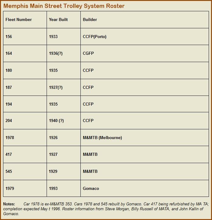
Here is where you will find the MATA Main Street Trolley:
Acknowledgements:
Alan Kirkpatrick
Brent Moore
Van Wilkens
Thomas R Machnitzki
Google Maps
Wikipedia
Wikipedia.DE
Websites and other additional information sources of interest for the area:
https://www.matatransit.com/
https://www.tripsavvy.com/mata-memphis-area-transit-authority-2322401
https://www.masstransitmag.com/rail/press-release/12410694/memphis-areas-transit-authority-mata-memphis-main-street-trolley-rail-line-back-in-service
https://www.flickr.com/photos/brent_nashville/17474891318
http://www.heritagetrolley.org/TNERJMemphGalv.htm
https://en.wikipedia.org/wiki/Memphis_Area_Transit_Authority
https://en.wikipedia.org/wiki/Madison_Avenue_Line_(MATA_Trolley)
https://en.wikipedia.org/wiki/MATA_Trolley
https://en.wikipedia.org/wiki/Memphis_Area_Transit_Authority
https://en.wikipedia.org/wiki/Template:MATA_Trolley_Main_Street_Line
https://de.zxc.wiki/wiki/MATA_Trolley
Coming in from the west on I-40: After crossing the Mississippi, take exit 1 and take the Front St exit to the left, when you get to Front St, take a left. Any street after Jackson (where there is a WB entrance ramp to I-40), you can take a right and go one block to main St, or, going up to Shadyac / North Pkwy, you can take a left and you will cross the tracks where the Riverfront Loop and CN run. Going another block and a half will take you to a grade crossing with the Riverfront Loop.
If you're coming in on I-40 WB, take exit 1A, this will let you off on N. 2nd St, which is one way SB. Take almost any street going to the right to get you to Main Street, which is a block away.
If you're coming up from the south via I-69, use exit 31 to get on WB I-40, and use the instructions above. For SB I-69, use exit 32 to get on WB I-40.
Maps
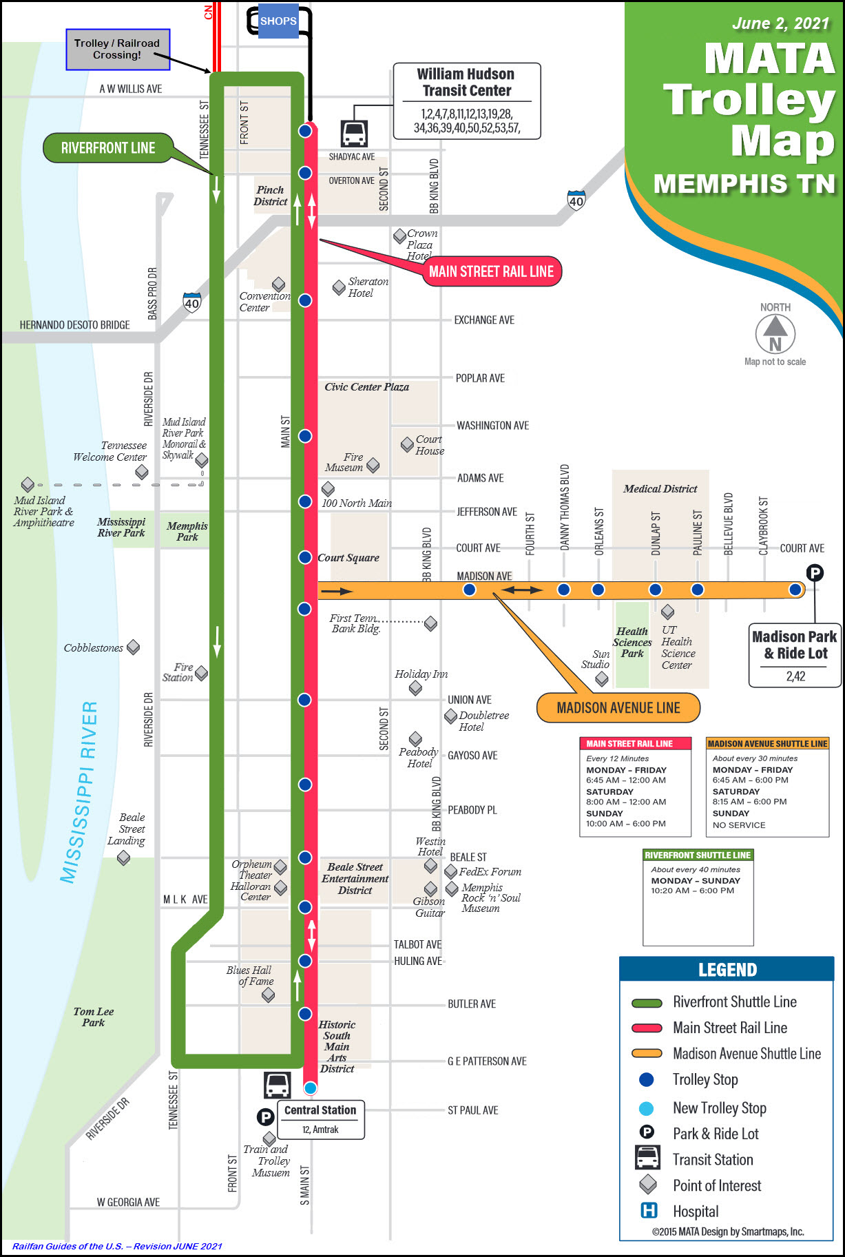
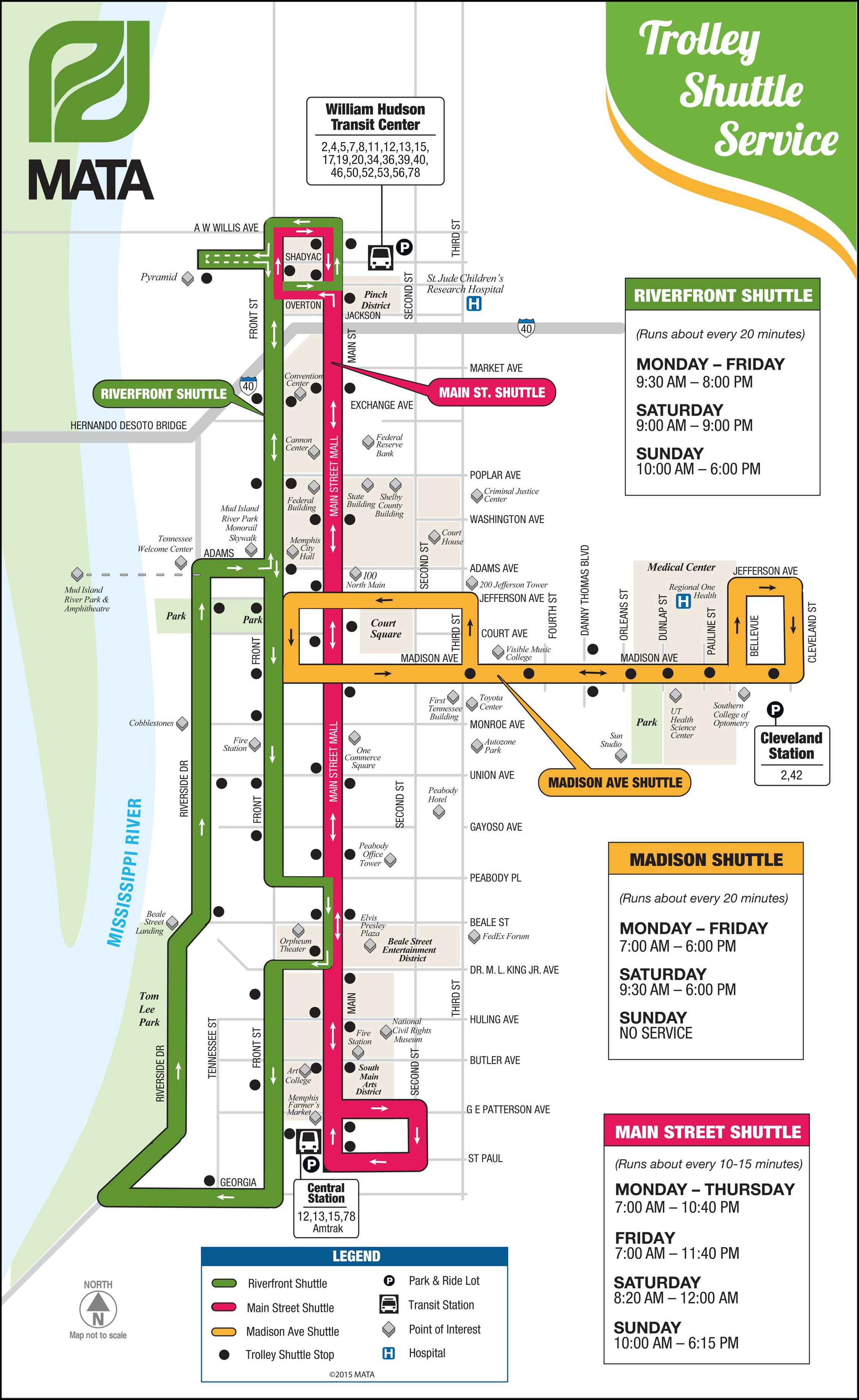
If you go to the MATA website, you will find the first map shown below.
I spent a lot of time looking at Google's Streetview to check their map out
vs what the street views show, and I am not finding any tracks on a large
portion of what they have depicted on their map. In addition, their
map shows the Riverfront Line going down Front Ave, and it does not, among
other "things" noticed. The second map is presented as a correction to
what I find on Google Streetview. All changes were made using Snag-it's
editor.
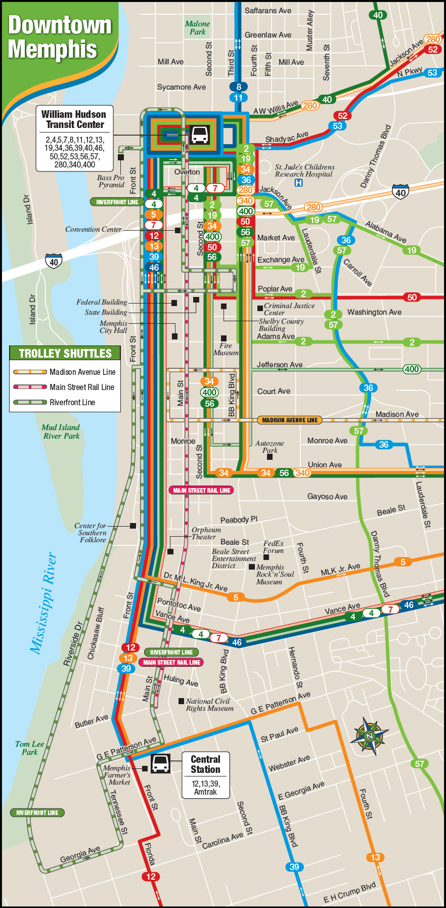
Of the two maps bottom maps, one appears to be an older version of the first map,
and the last one is a comprehensive map of the downtown area which includes bus service.
GPS Coordinates: 35.15959, -90.04722
547 N Main St, Memphis, TN 38105
901-577-2640
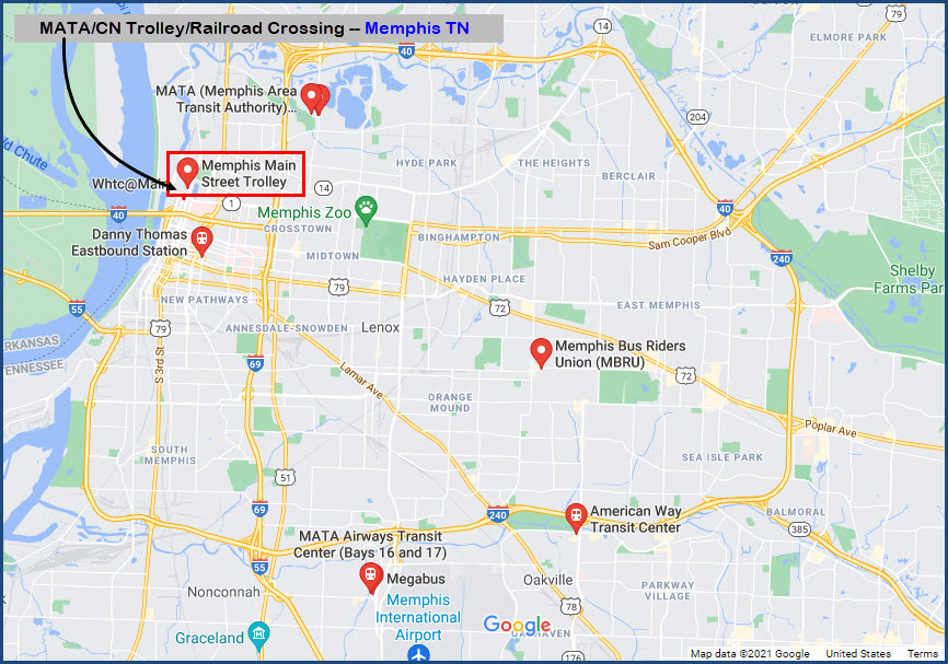
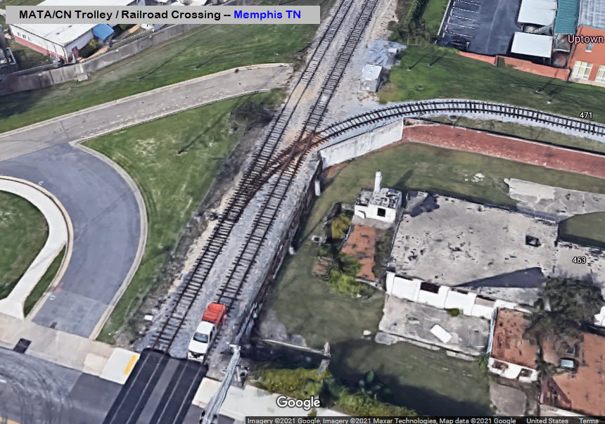
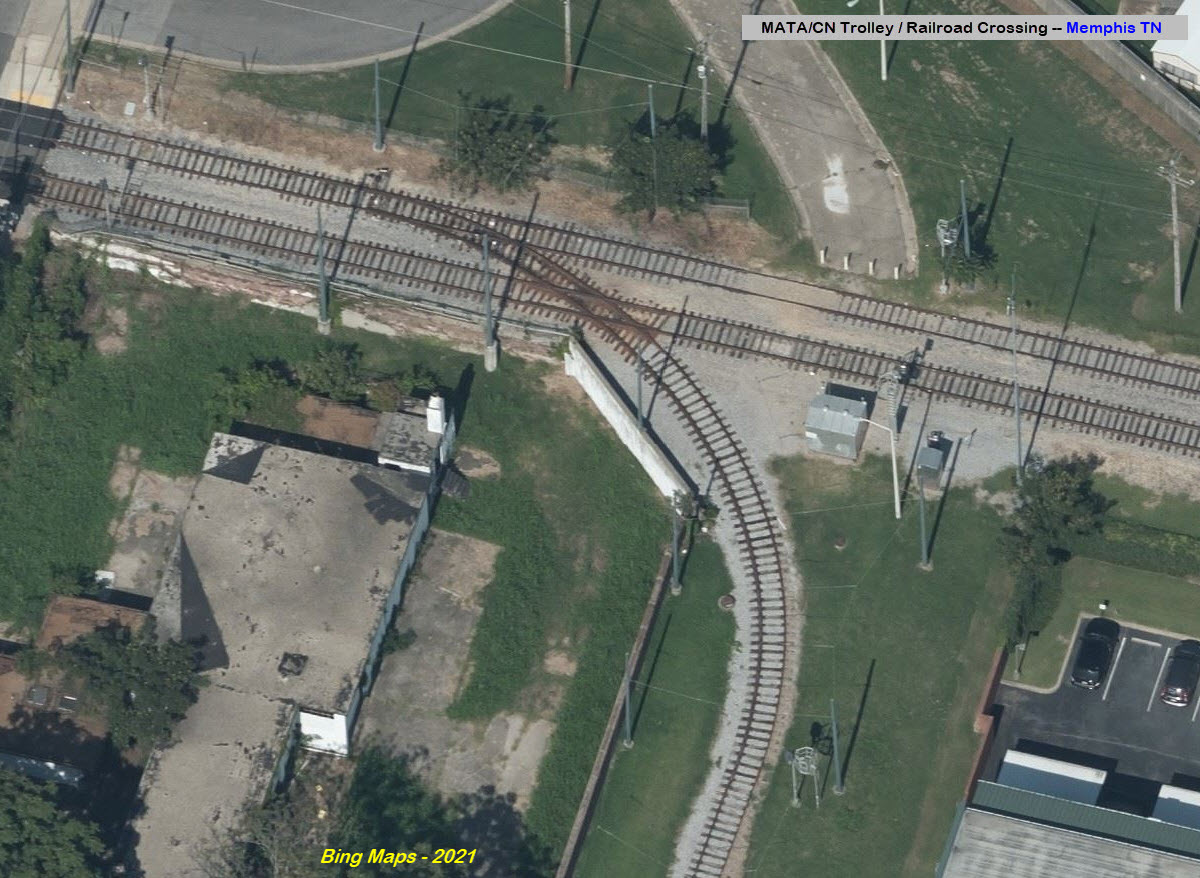
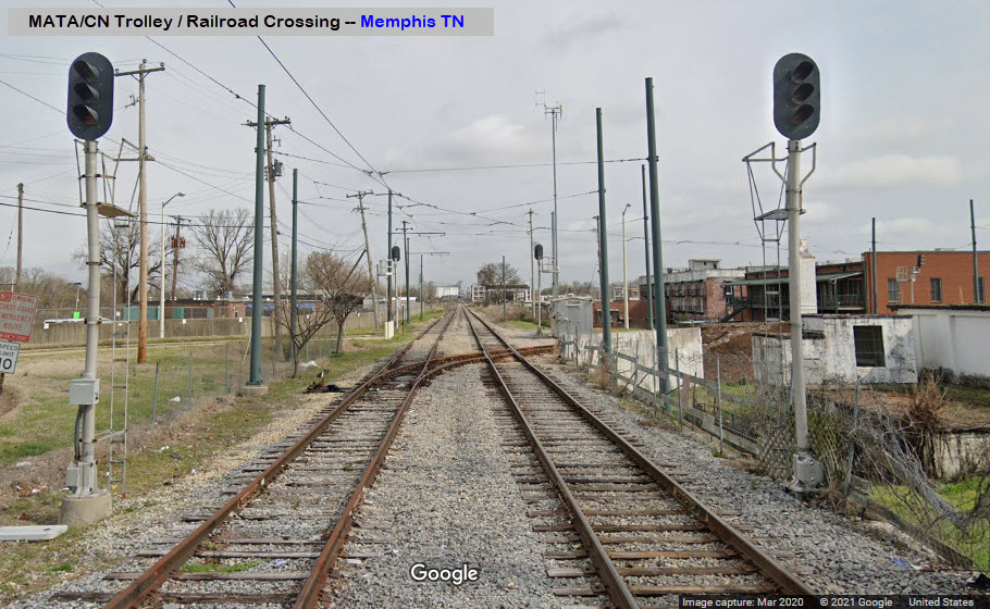
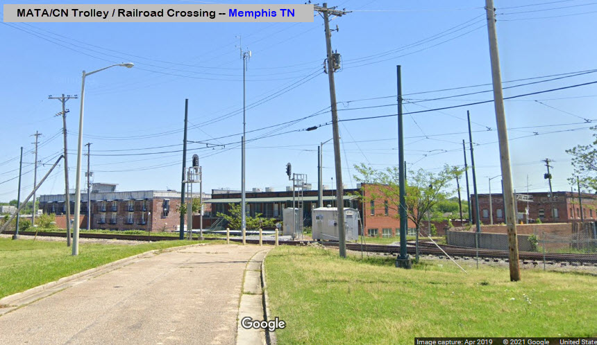
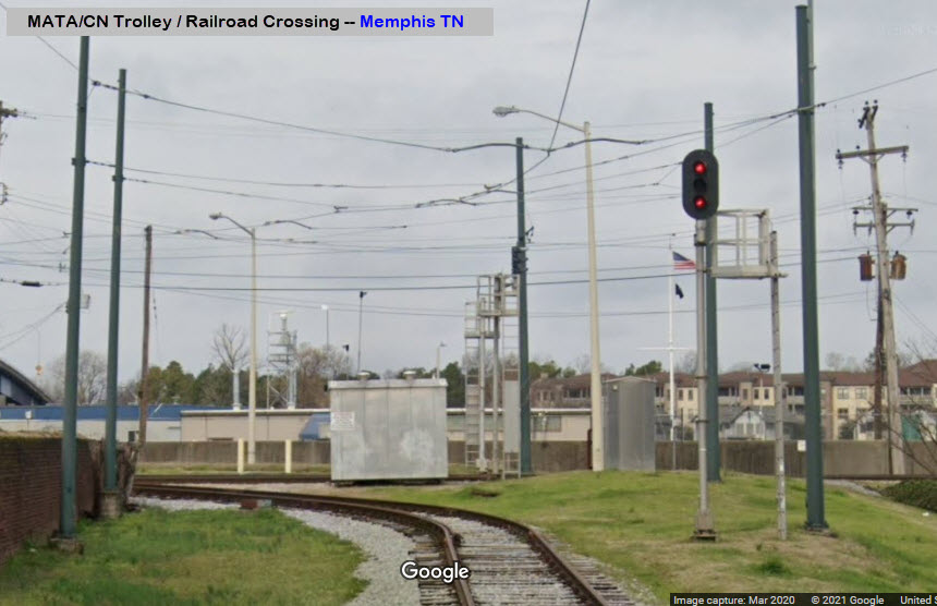
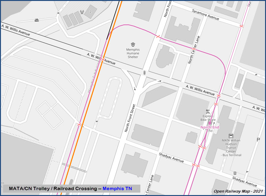
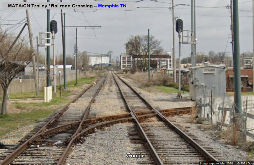
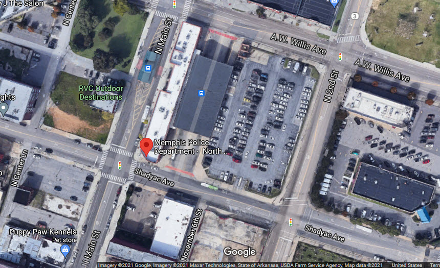
About a block south of the shops is the switch that comes off the Main Street line and heads over to the IC/CN right-of-way, where the Riverfront Line heeads south, after going across the CN tracks, in what is one of the very few trolley/railroad crossings in the United States.
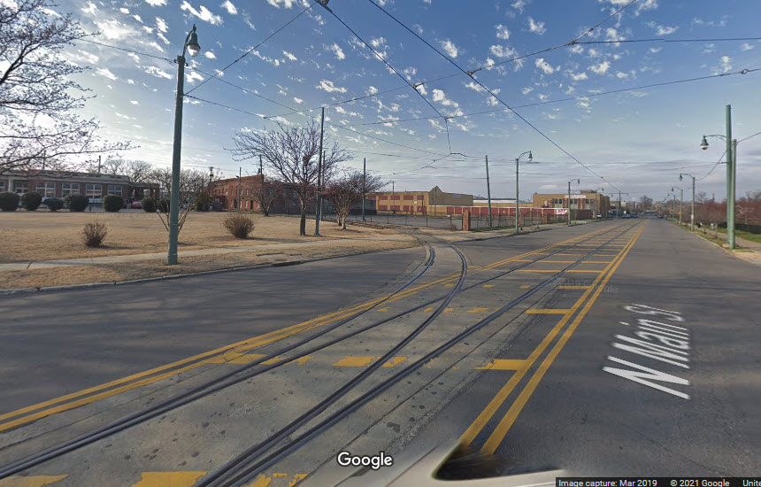
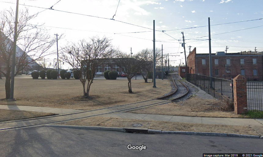
One of four that I know of in the United States.
I have all four of them on their own page here.
GPS Coordinates: 35.14521, -90.05279
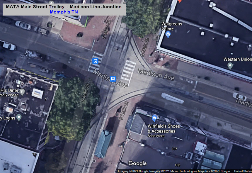
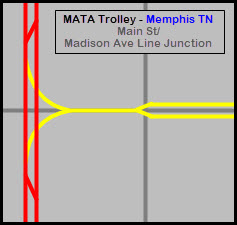
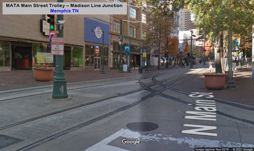
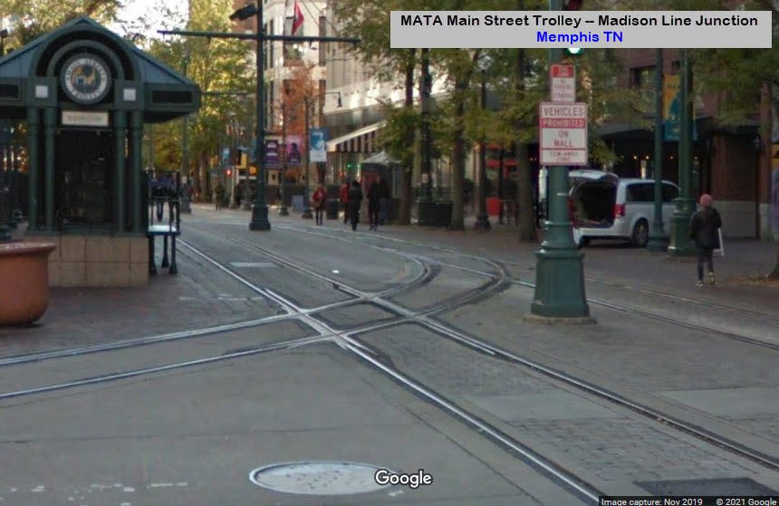
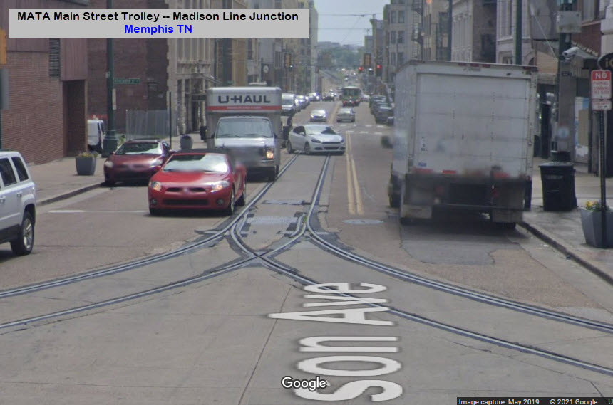
This is where the Madison Ave Line comes off the Main Street Line.
At first, it may seem "weird" to have done it this way, but it simplifies the track work, and allows trolleys to go from either Main St track, to/from either Madison Ave line track.
Station by Station
Main Street Line

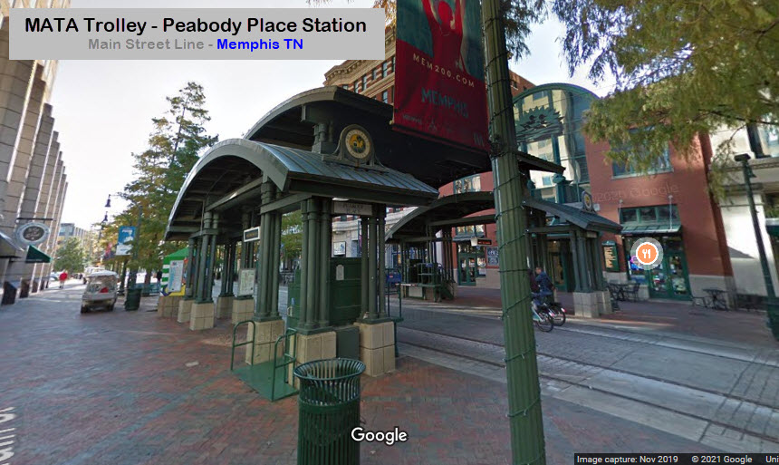
A number of the Main St stations have been integrated into the downtown
revival, such as Peabody Place and Civic Center Plaza.
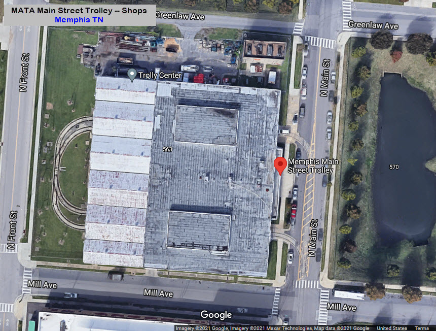
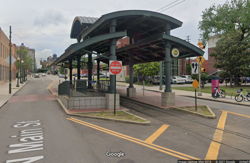
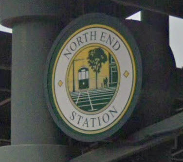
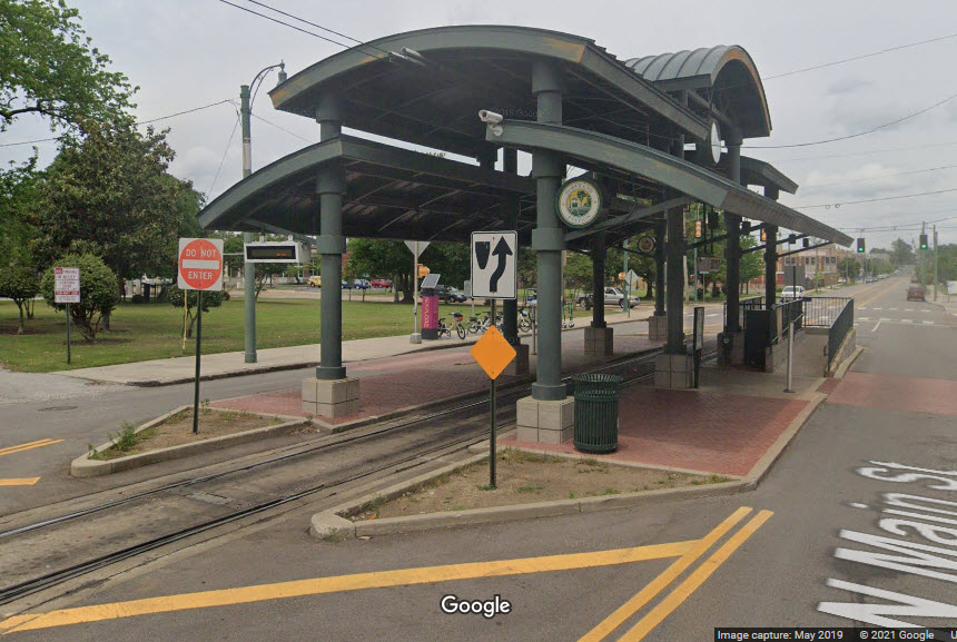
North End Station
This is the northern most station on the Main Street Line, and only has a single track running thru it - it goes into two tracks just on the south side of the station. North of this are the shops, and the lead that takes you over to the Riverfront Line.
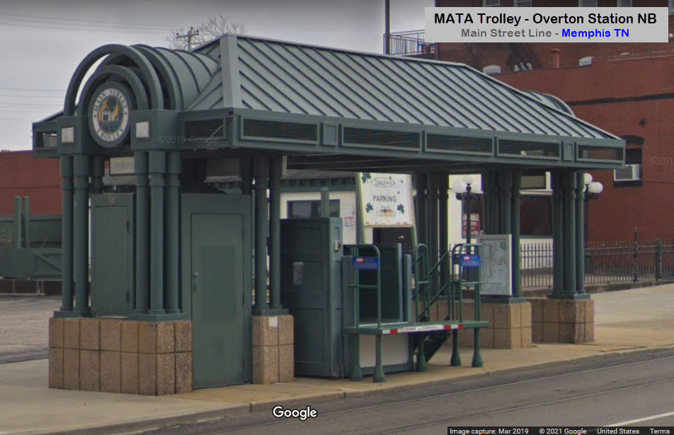
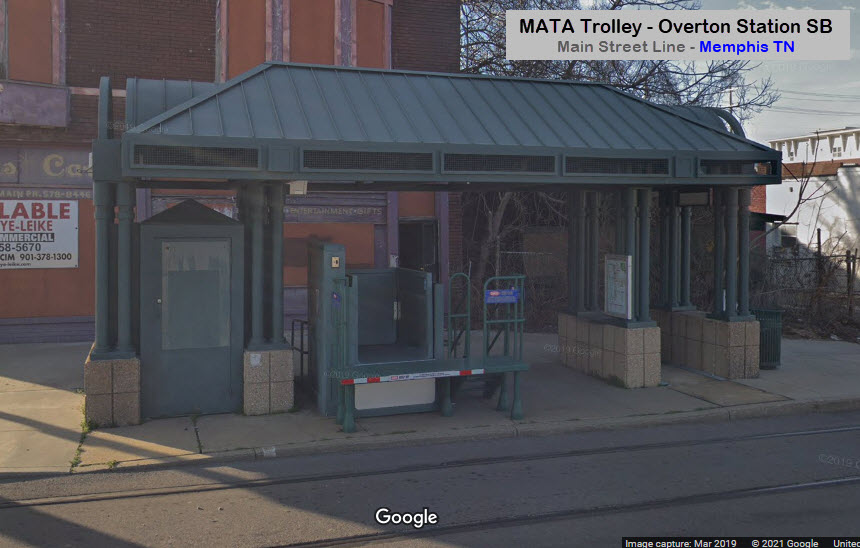
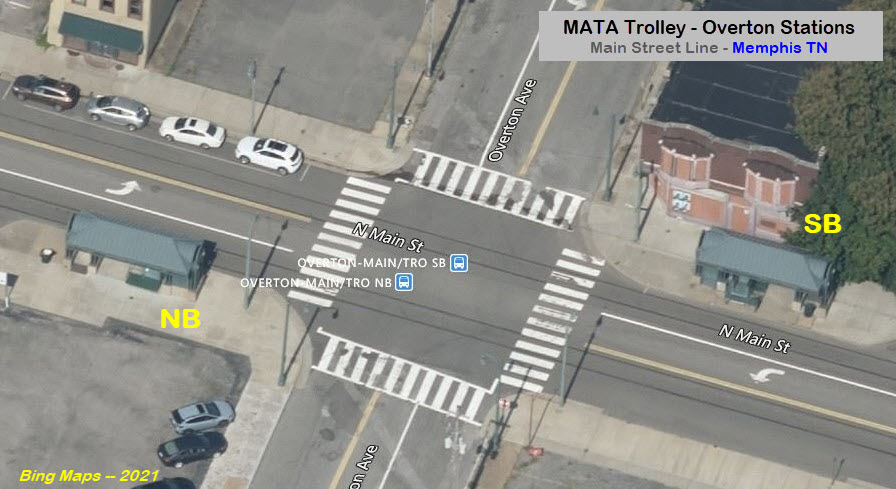
Overton Station
GPS Coordinates: 35.15515, -90.04884
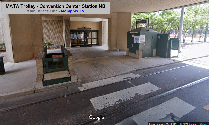
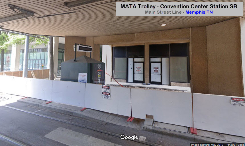
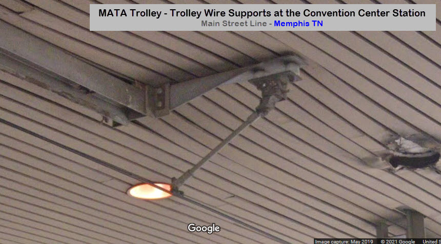
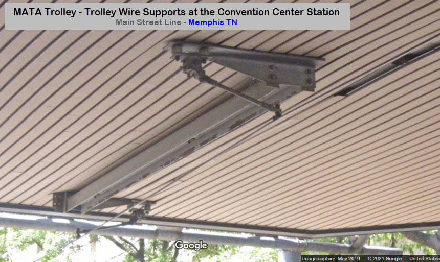
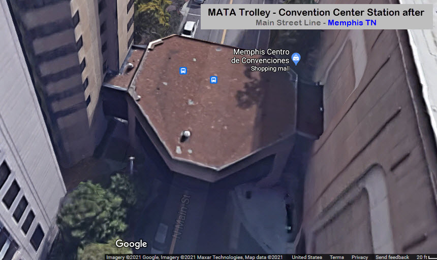
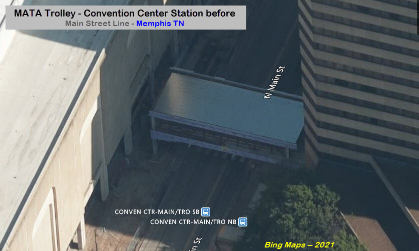
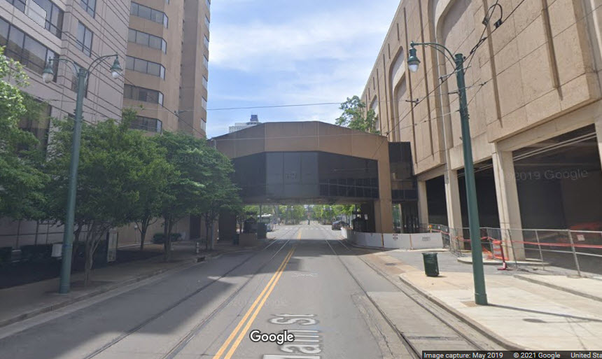
Convention Center Station
GPS Coordinates: 35.15184, -90.05017
Looks like they did a lot of work with the overpass. Bings birds eye view usually lags behind what Google has for the same area, so we were lucky to have a before picture of what it looked like before the modifications were done, yeah, I know, who cares? :-) :-) They also have some interesting trolley wire supports under the canopy!
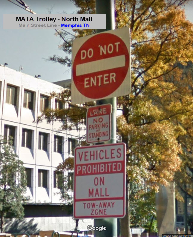
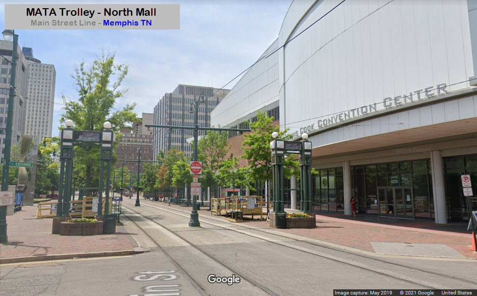
North Mall Entrance/Temp Convention Center Station
GPS Coordinates: 35.15116, -90.05045
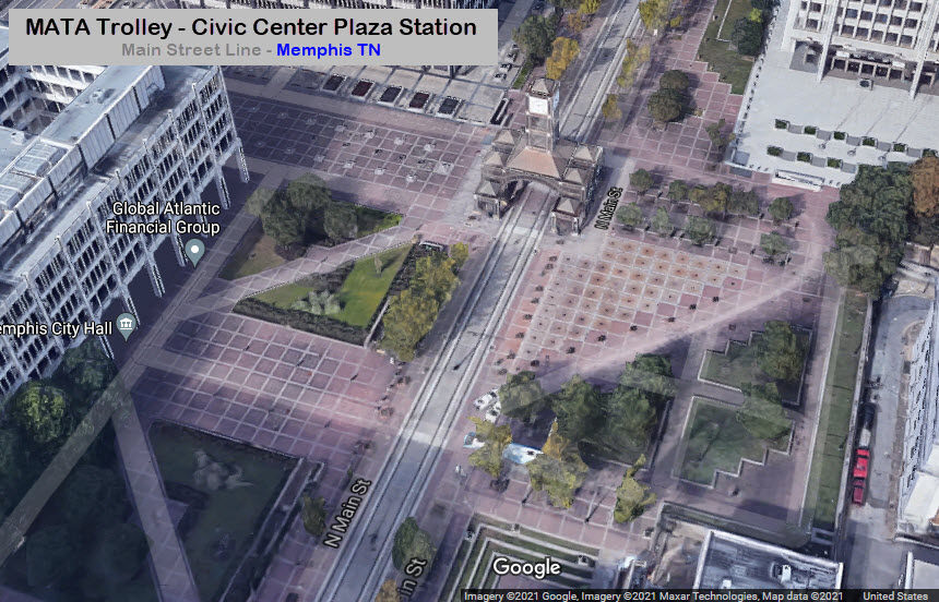
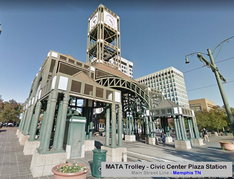
Civic Center Plaza Station
GPS Coordinates: 35.14922, -90.05123

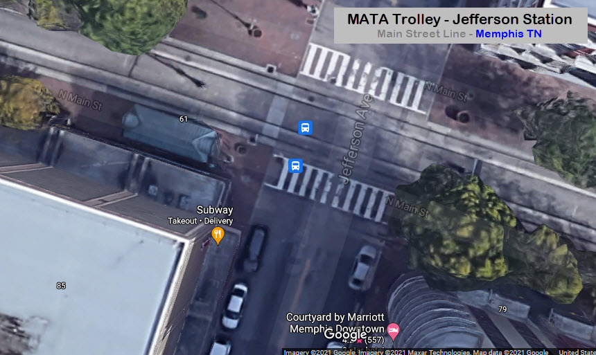
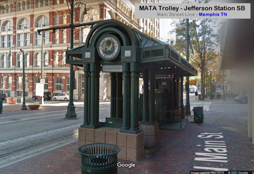
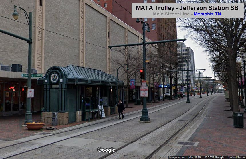
Jefferson Station
GPS Coordinates: 35.14736, -90.05203
Looks like Jefferson St only gets one station, on the SB side.
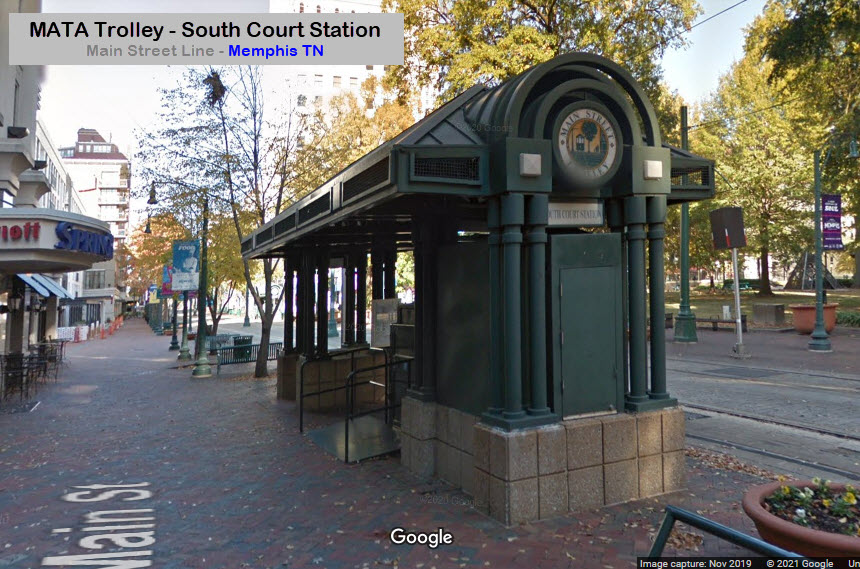
Court Station
GPS Coordinates: 35.14623, -90.05240

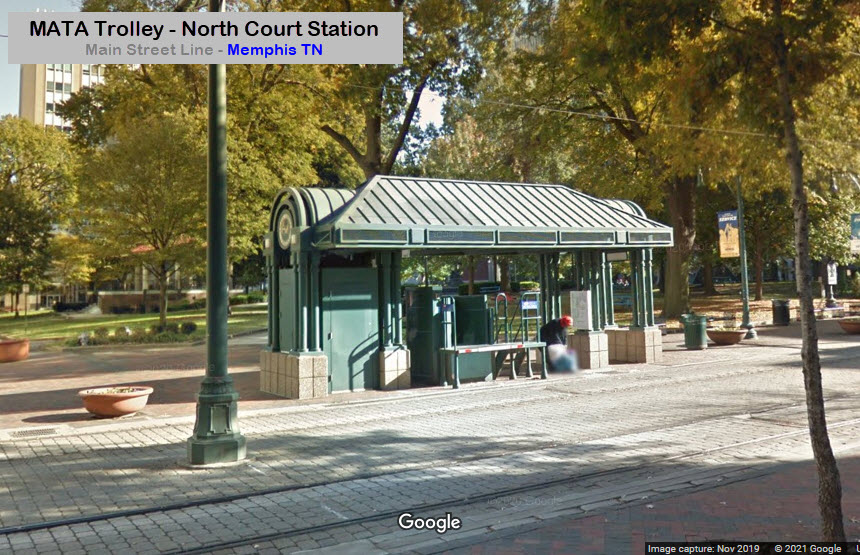
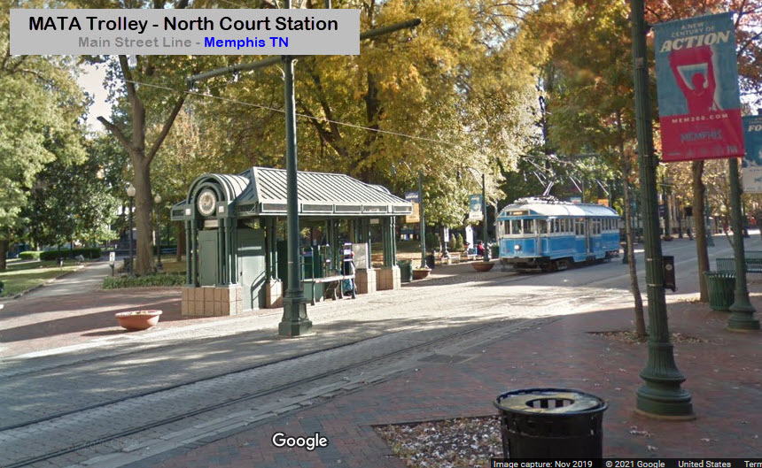
Madison Ave Line Junction
Madison Station
GPS Coordinates: 35.14499, -90.05284
The Madison Ave station has one shelter, on the NB side, just south of Madison Ave.
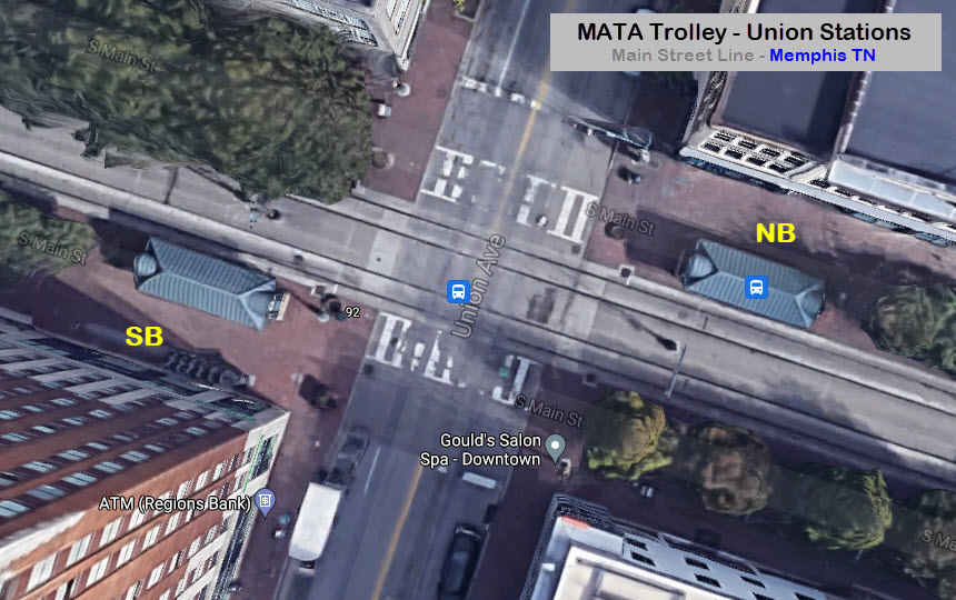
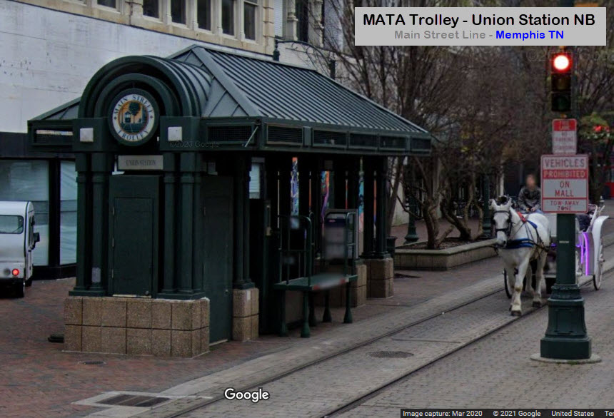
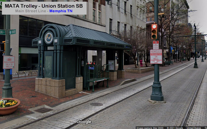
Union Station
GPS Coordinates: 35.14324, -90.05362
Union Station has two shelters, one on each side of Union Ave.
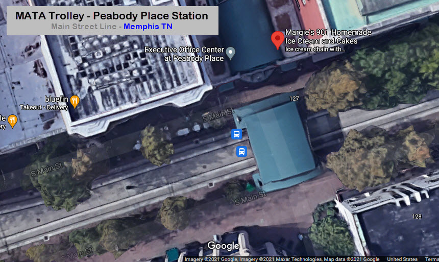
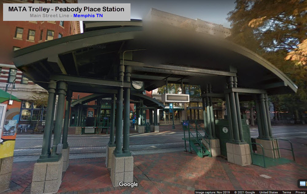
Peabody Place Station
GPS Coordinates: 35.14161, -90.05426
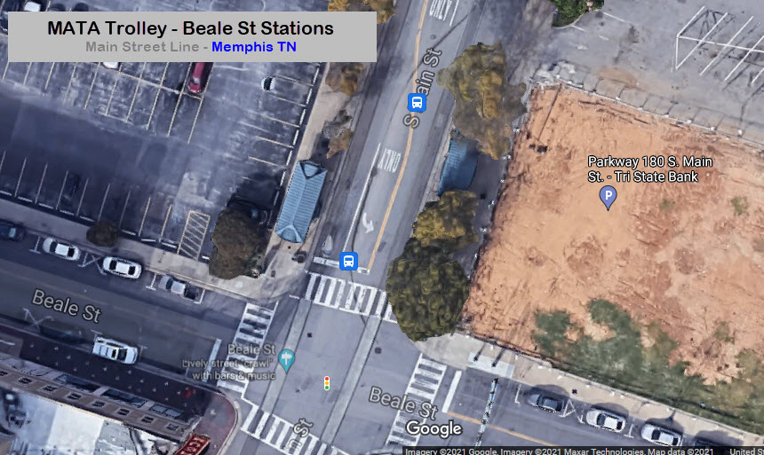
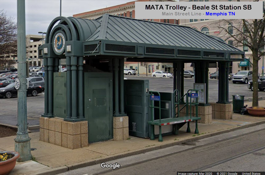
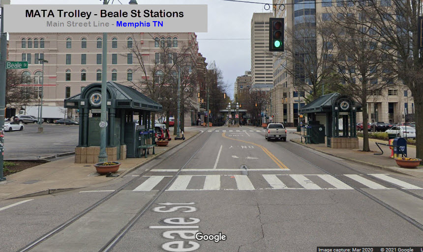
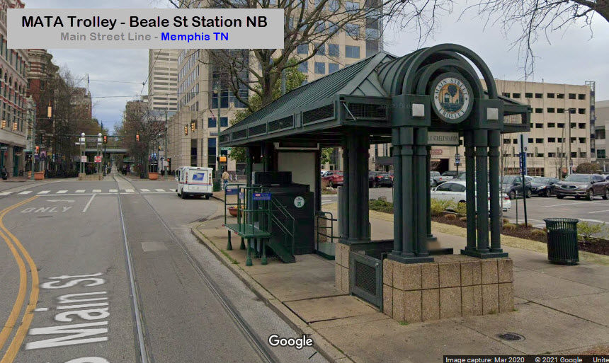
Beale Street Station
GPS Coordinates: 35.14052, -90.05469
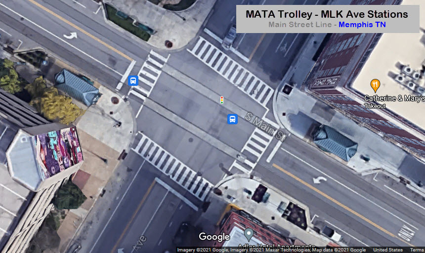
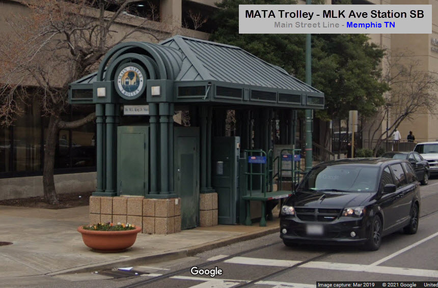
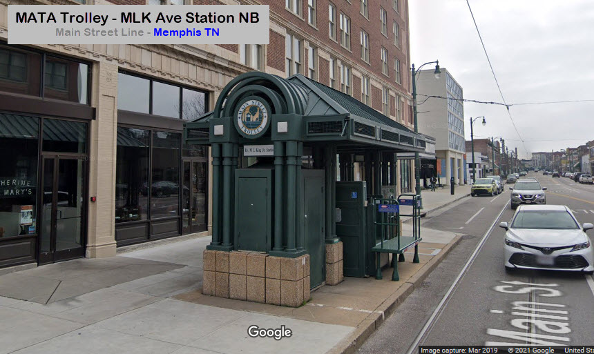
Dr. MLK Jr. Station
GPS Coordinates: 35.13893, -90.05578
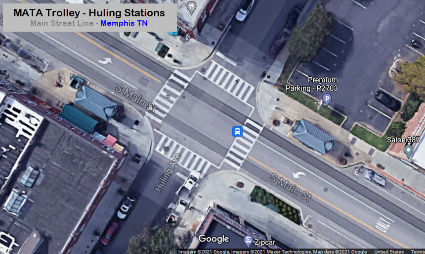
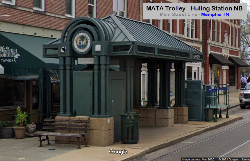
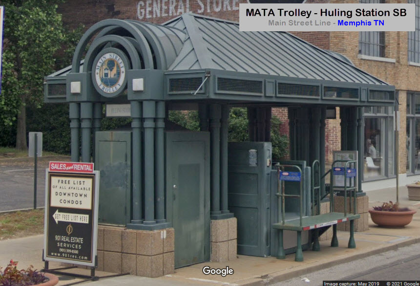
Huling Station
GPS Coordinates: 35.13549, -90.05825
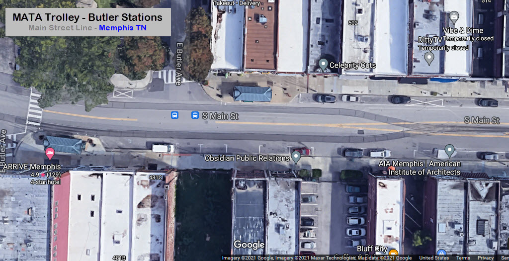
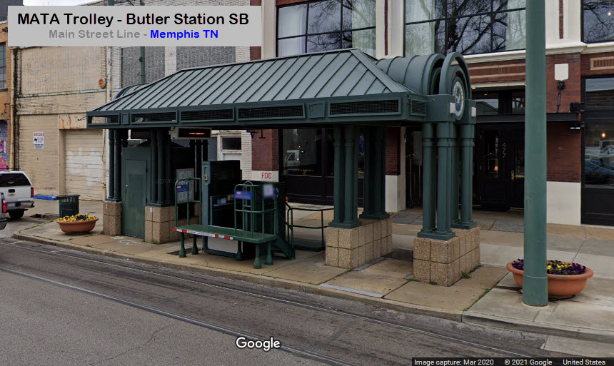
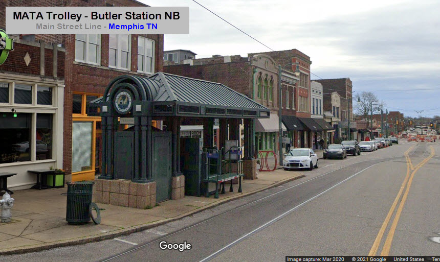
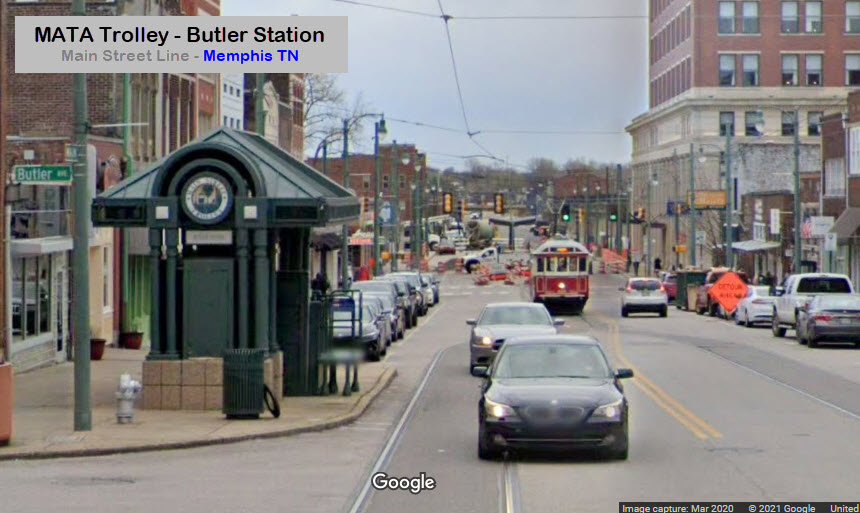
Butler Station
GPS Coordinates: 35.13434, -90.05901
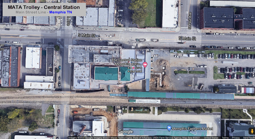
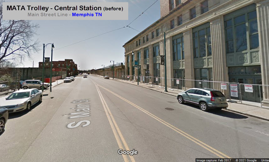
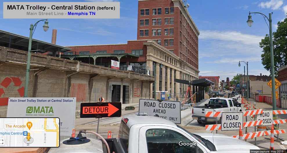
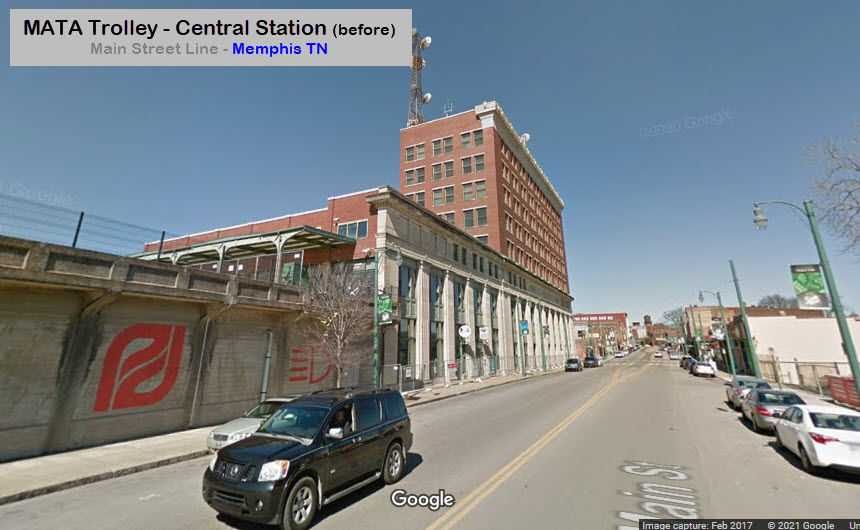
Central Station
GPS Coordinates: 35.13232, -90.05900
These Google streetview shots are from before the Central Station was started/completed.
Station by Station
Madison Ave Line
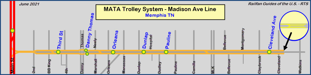
All of the Madison Ave stations are in the center except for Danny Thomas Blvd, where there is are separate
"off-street" EB and WB stations.
The line is all double tracked, except for the block before the Main St Line junction.
At the end of the line, there is a pocket track, used for reversing directions.
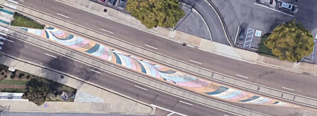
Each station has it's own and different art work.
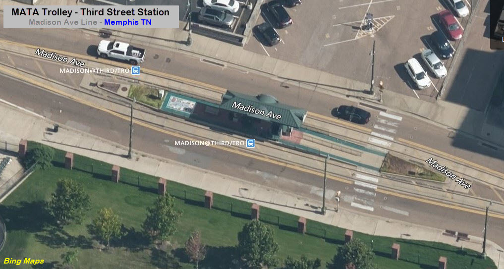
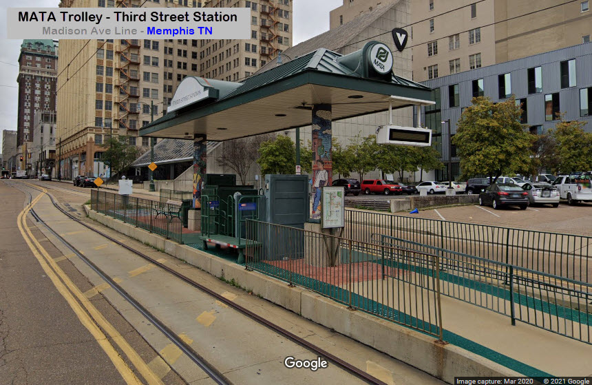
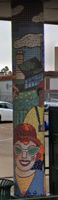
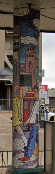
Third Street Station
GPS Coordinates: 35.14415, -90.04887
Interesting Art: Mosaics on roof support poles.
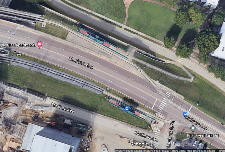
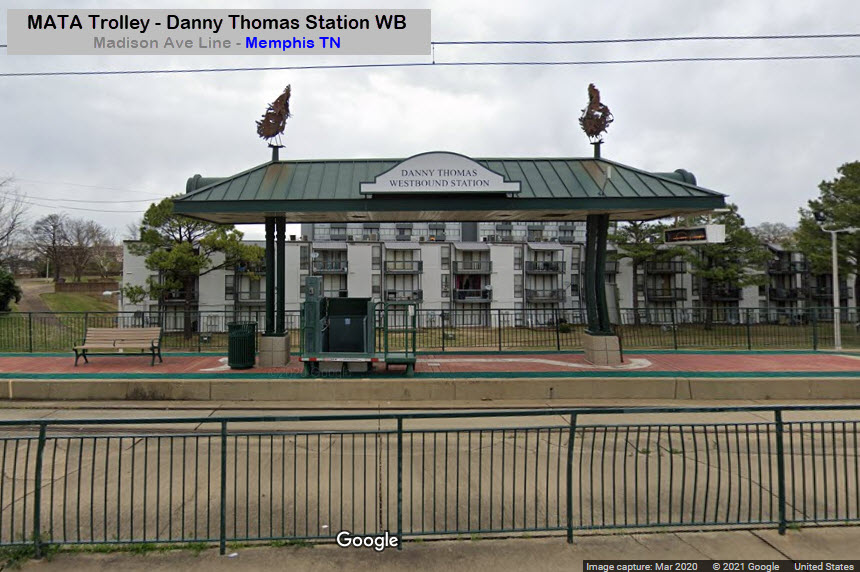
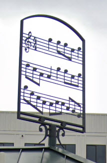
Danny Thomas Stations
GPS Coordinates WB: 35.14305, -90.04303
Interesting Art EB: "Music Sheets".
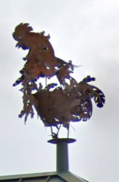
Interesting Art WB: "Chickens".
Because of how the Madison Ave Line was configured crossing Danny Thomas Blvd, there is a separate station for the westbound and eastbound "sides".
 WB
WB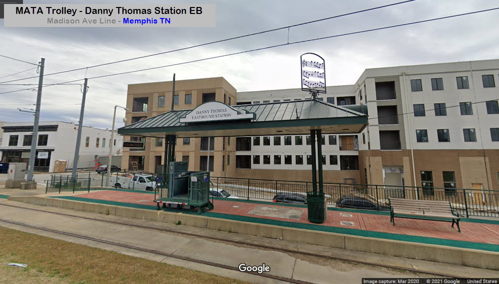
 EB
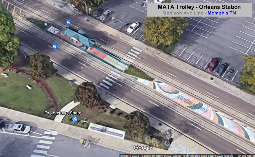
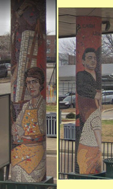
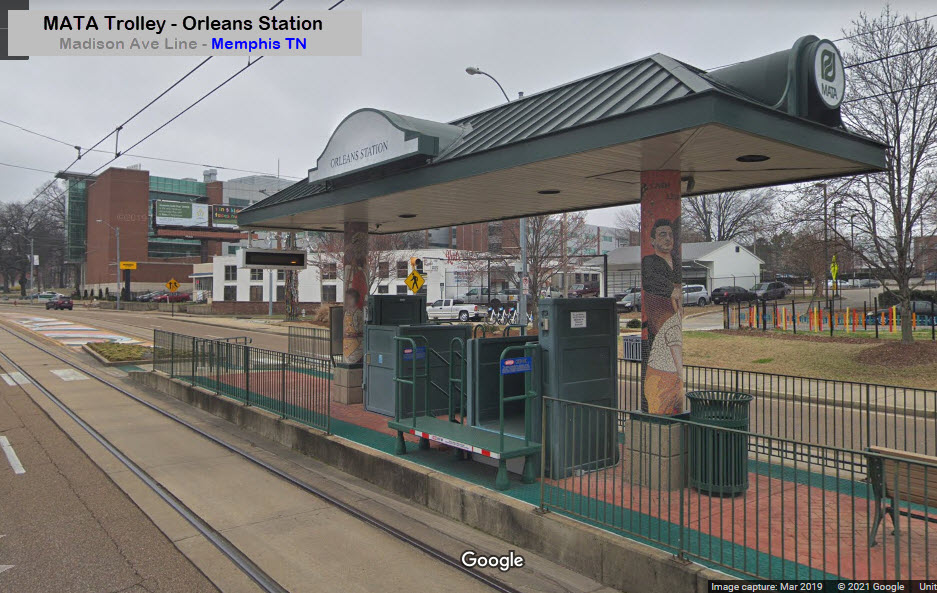
EBOrleans Station
GPS Coordinates: 35.14106, -90.03739
Interesting Art: Mosaics on roof support poles, extended decoratively painted median.
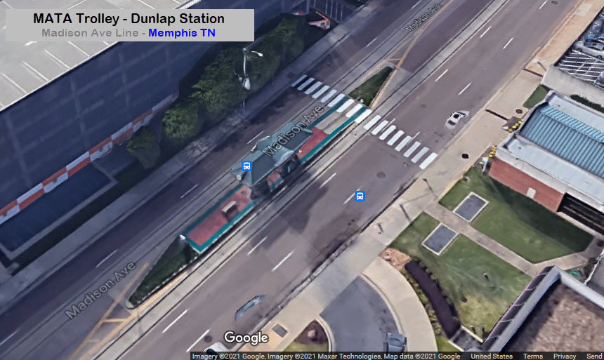
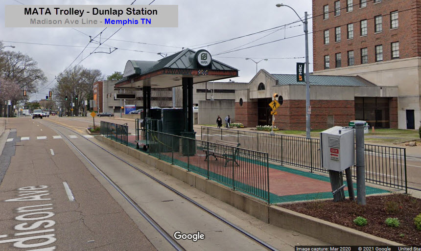
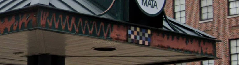
Dunlap Station
GPS Coordinates: 35.14047, -90.03239
Interesting Art: Mosaic Roof Trim (unfortunately, most of it has fallen off as of 2021) :-(
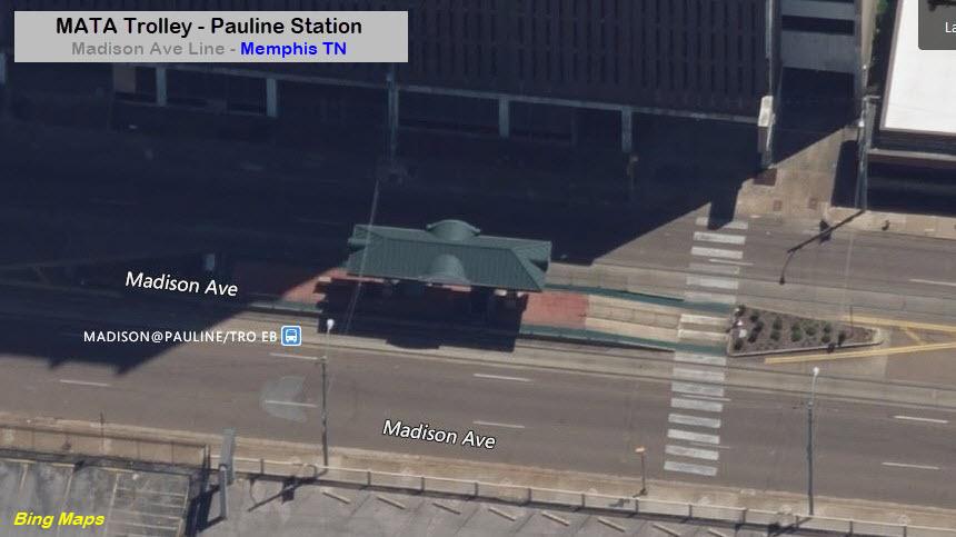
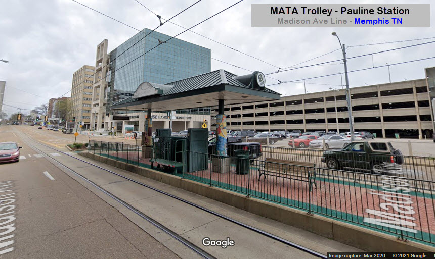
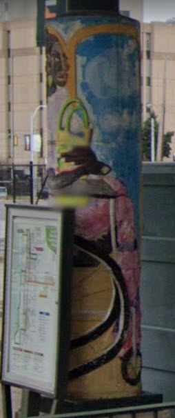
Pauline Station
GPS Coordinates: 35.14011, -90.02888
Interesting Art: Mosaics on roof support poles.
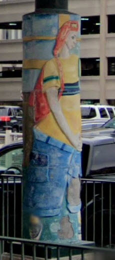
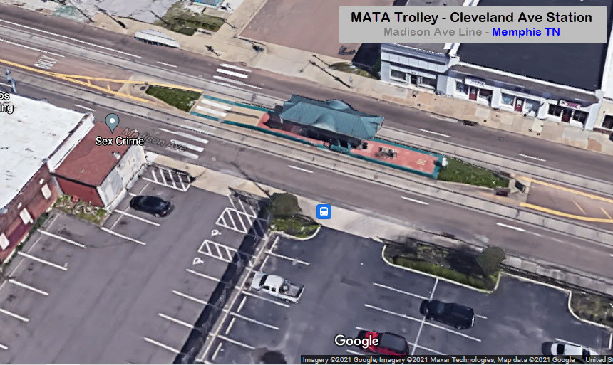
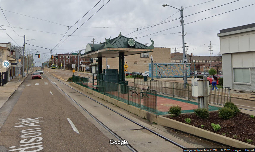
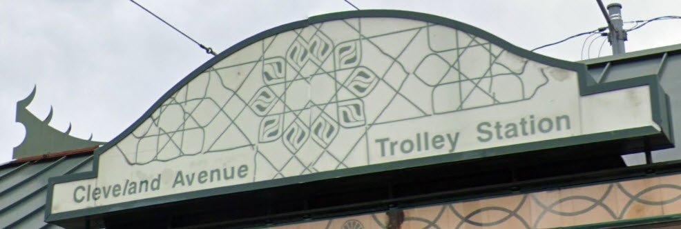
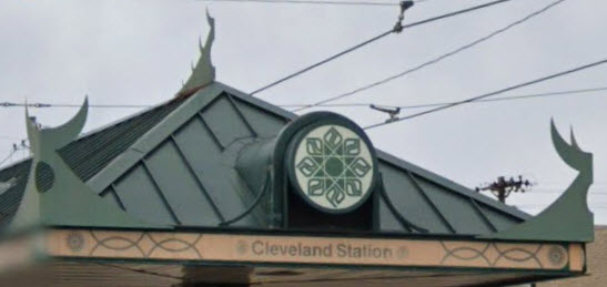
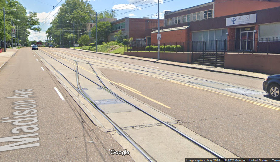
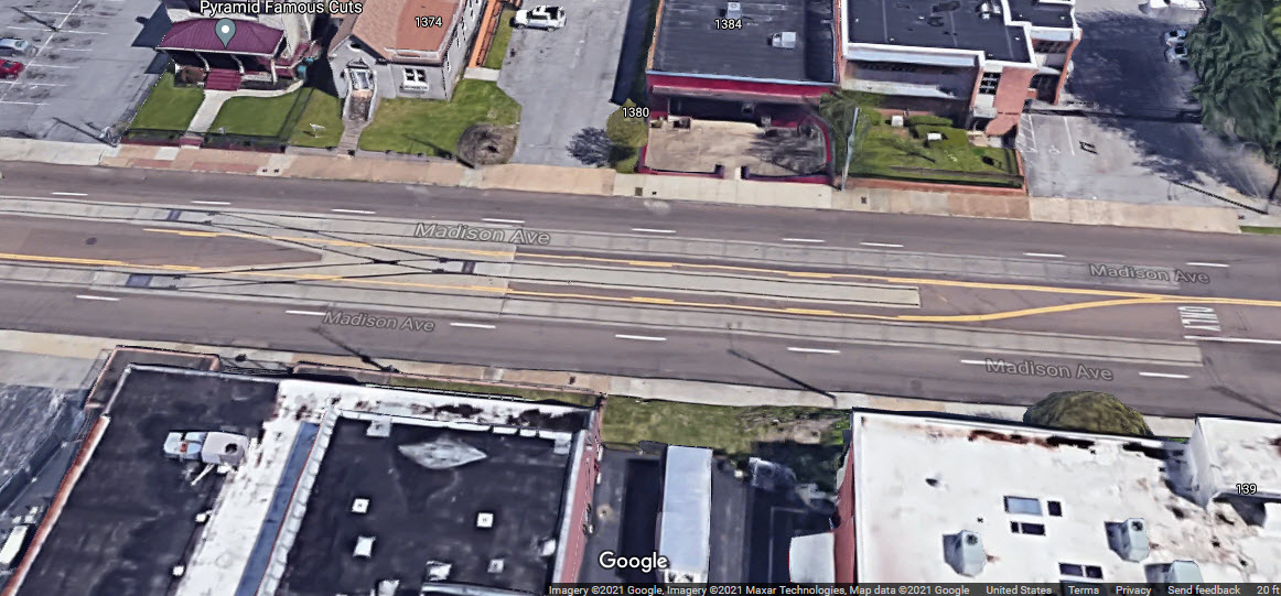
Cleveland Avenue Station
GPS Coordinates: 35.13903, -90.01750
Interesting Art: Enhanced signage, roof trim, decorative corner pieces.
Madison Ave End-of-Line
 2010, photo by Thomas R Machnitzki via wiki.de
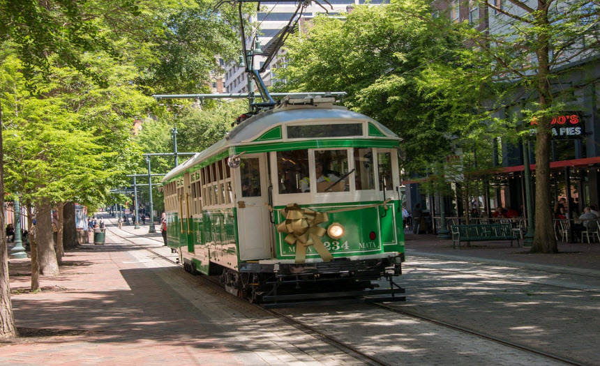 Alan Kirkpatrick
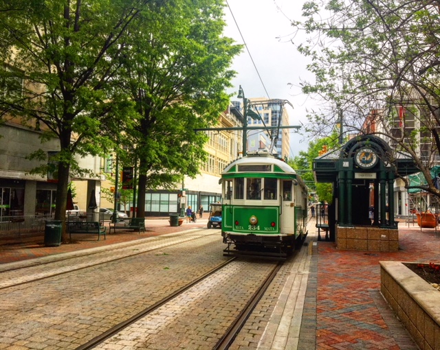
 Nov 2, 2013, photo by Brent Moore
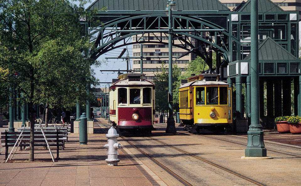 photo by Van Wilkens
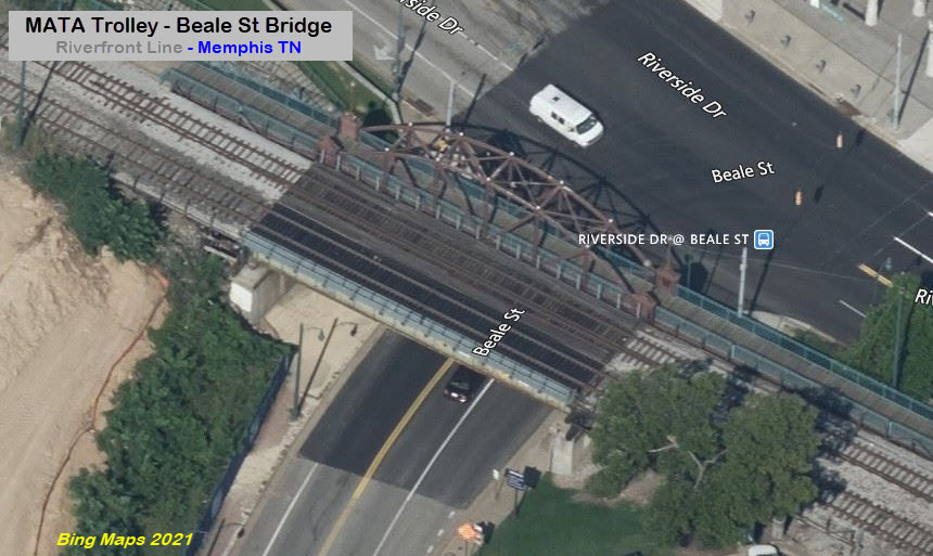
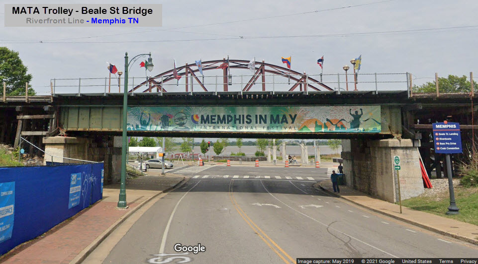
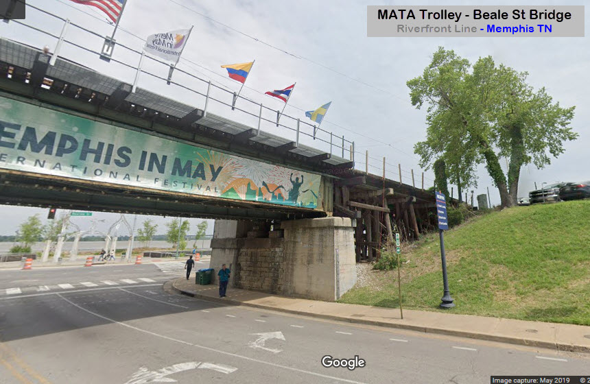
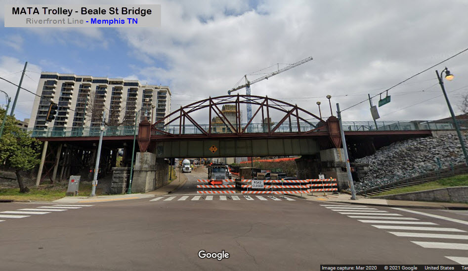
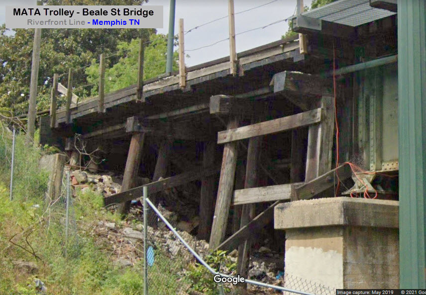
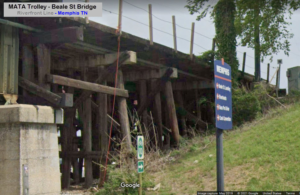
There are two tracks on this bridge, which is a girder bridge with a wooden trestle type approach on each side, originally constructed (probably) by the IC RR. From the Riverside Drive side, you cannot see the railroad bridge because the view is blocked by a new pedestrian overpass, but the walkway should be a good vantage point for pictures of the trolley (when running again) or CN trains. Convenient parking is provided in a lot off of Wagner Place off of Beale St.
It's only a guess, but I believe the main reason MATA built separate spans to cross the Danny Thomas Blvd is because of weight.
The only signals I have seen for the trolley system are at Pyramid Interlocking, where the streetcar tracks cross the IC freight line. I'm guessing for the majority of the system where the streetcars are traveling on public streets, that the trolleys follow the regular traffic lights.
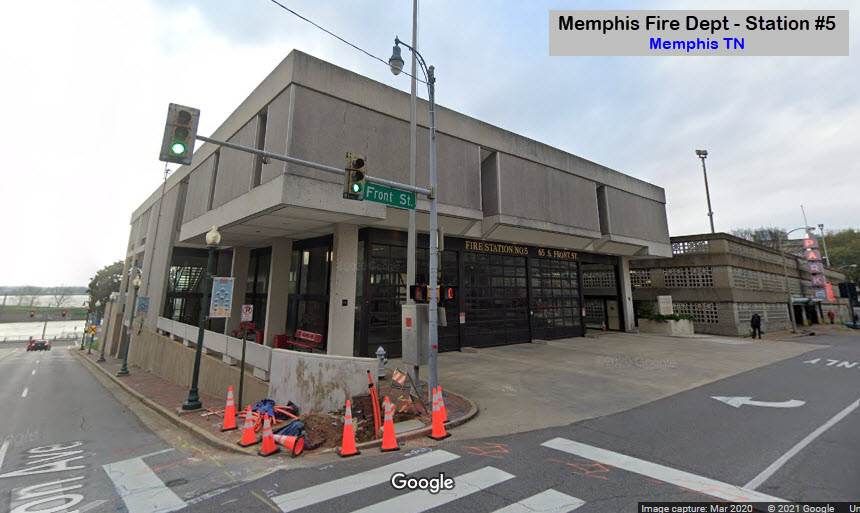
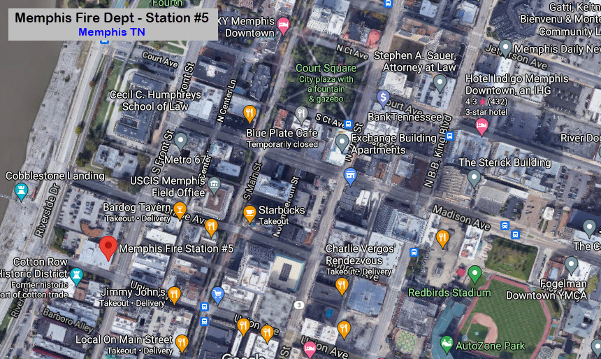
GPS Coordinates: 35.15659, -90.04802
65 S Front St, Memphis TN 38103
901-636-1400
GPS Coordinates: 35.15659, -90.04802
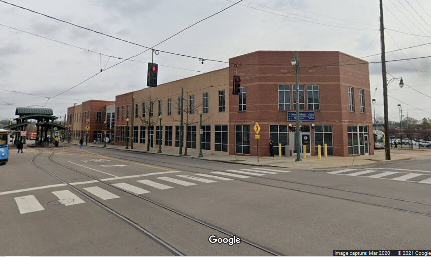
444 N Main St, Memphis TN 38105
901-636-4099
Located adjacent to the North Main trolley station.
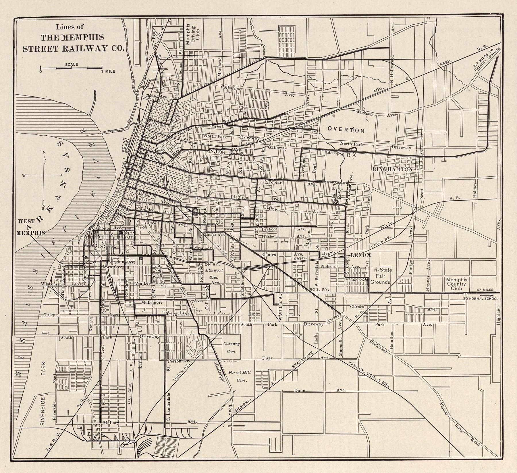
Memphis Street Railway Map
I always love the "old" maps, because they always contained way more information than the maps today, one exception I've seen is a map of Baltimore that the MTA put out of it's lines in the 1995 timeframe, which showed EVERYTHING!!!
The map below also shows the lines of the Illinois Central RR, the Louisville & Nashville RR, the Nashville, Chattanooga & St Louis RR, the Memphis & State Line RR, the Kansas City, Memphis & Birmingham RR, the Union RR, and the Yazoo & Mississippi Valley RR.
https://en.wikipedia.org/wiki/Yazoo_and_Mississippi_Valley_Railroad
https://en.wikipedia.org/wiki/Nashville,_Chattanooga_and_St._Louis_Railway
https://en.wikipedia.org/wiki/Kansas_City,_Memphis_and_Birmingham_Railroad
the Pyramid
GPS Coordinates: 35.15600, -90.05192
https://stores.basspro.com/us/tn/memphis/1-bass-pro-dr.html
https://www.businessinsider.com/memphis-bass-pro-shops-pyramid-one-of-worlds-largest-2017-11#some-memphis-residents-began-calling-it-the-tomb-of-doom-thanks-to-its-financial-struggles-and-a-rumor-that-a-crystal-skull-had-been-stored-in-the-apex-according-to-myth-the-skull-had-been-disturbed-unleashing-years-of-bad-luck-7
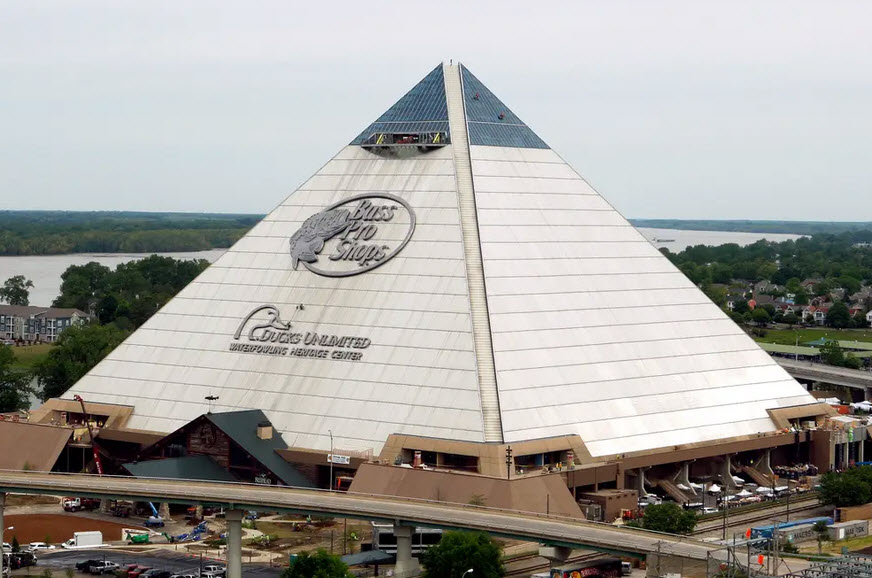
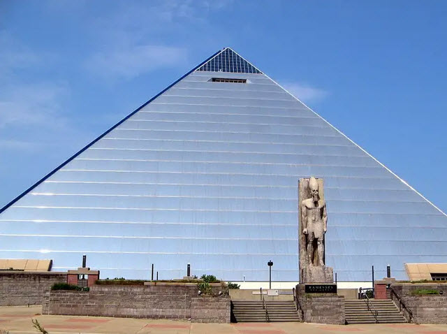

One of the largest pyramids in the world is a Bass Pro Shops mega store in Memphis TN. The pyramid also hosts a hotel, indoor swamp, and bowling alley. However, for roughly a decade, the pyramid was empty -- and some believed it was cursed due to a crystal skull installed by the owner of the Rainforest Café.
The pyramid has long captured the human imagination, with people traveling far and wide to view the architectural wonders that spring up from the sands of Egypt. But to see one of the biggest pyramids on the planet, Americans don't need to leave the country — they can just travel to Tennessee and visit a Bass Pro Shops. In 2015, Memphis' 321-foot-tall "Great American Pyramid" reopened as a Bass Pro Shop mega store after being abandoned for roughly a decade. The 32-floor pyramid contains a hotel, an indoor swamp, and a bowling alley. The road to opening a Bass Pro Shop in an enormous pyramid has been a rocky one. Here's the story behind how a hunting and fishing gear store opened up shop in one of the largest pyramids in the world.
Memphis, Tennessee has a sound historical reason to want to build a pyramid. The city was named after Memphis, a city in Egypt, when it was founded in 1819. Memphis' "Great American Pyramid" opened its doors in 1991, after two years and $68 million spent constructing the building.
At 321 feet, the building is a bit smaller than the Great Pyramid of Giza, which was originally 481 feet tall. It's still pretty massive, typically ranking in the top 10 tallest pyramids in the world (exact ranking varies based on how pyramids' sizes are measured).
Originally, the Memphis pyramid was used as an event space and sports arena, serving as the home court for the University of Memphis men's basketball team and the Memphis Grizzlies. However, when the new FedExForum opened nearby, the basketball teams switched home courts, and the Great American Pyramid went dark. Memphis struggled to find a company that was willing or able to find a use for the enormous pyramid, reportedly reaching out to everyone from Six Flags to Disney.
The Hard Rock Café founder who reportedly placed the skull at the top of the pyramid told The New York Times that the dark rumors were "utter nonsense." However, he did say he had placed "several other crystal and mystic objects" in the pyramid, as "part of the glamour and mystery and mysticism of Egypt." Then, a potential savior appeared: Bass Pro Shop. After years of rumors and delays, Bass Pro Shops opened its mega store in the pyramid in 2015.
In addition to a shop selling fishing and hunting wares, the pyramid now has a man-made swamp, a 13-lane, ocean-themed bowling alley, and an aquarium. Visitors can stay overnight at the Big Cypress Lodge, a 103-room hotel that the company describes as the "first hotel inside any Bass Pro Shops." The pyramid also has an observation deck. If you pay $10, you can head to the 28th floor and look out over Memphis. Many who drive by the pyramid and see the Bass Pro Shops logo embossed upon it may be baffled. However, it seems to be working out well for Bass Pro Shops -- the company reported $46.7 million in sales in the second year of business in the pyramid.


3 pix above: AP Photo/Karen Pulfer Focht
Disclaimers:
I love trains, and I love signals. I am not an expert. My webpages reflect what I find on the topic of the page. This is something I have fun with while trying to help others.
Please Note: Since the main focus of my two websites is railroad signals, the railfan guides are oriented towards the signal fan being able to locate them. For those of you into the modeling aspect of our hobby, my indexa page has a list of almost everything railroad oriented I can think of to provide you with at least a few pictures to help you detail your pike.
If this is a railfan page, every effort has been made to make sure that the information contained on this map and in this railfan guide is correct. Once in a while, an error may creep in :-)
My philosophy: Pictures and maps are worth a thousand words, especially for railfanning. Text descriptions only get you so far, especially if you get lost or disoriented. Take along good maps.... a GPS is OK to get somewhere, but maps are still better if you get lost! I belong to AAA, which allows you to get local maps for free when you visit the local branches. ADC puts out a nice series of county maps for the Washington DC area, but their state maps do not have the railroads on them. If you can find em, I like the National Geographic map book of the U.S..... good, clear, and concise graphics, and they do a really good job of showing you where tourist type attractions are, although they too lack the railroads. Other notes about specific areas will show up on that page if known.
Aerial shots were taken from either Google or Bing Maps as noted. Screen captures are made with Snagit, a Techsmith product... a great tool if you have never used it!
By the way, floobydust is a term I picked up 30-40 years ago from a National Semiconductor data book, and means miscellaneous and/or other stuff.
Pictures and additional information is always needed if anyone feels inclined to take 'em, send 'em, and share 'em, or if you have something to add or correct.... credit is always given! Please be NICE!!! Contact info is here
Beware: If used as a source, ANYTHING from Wikipedia must be treated as being possibly inaccurate, wrong, or not true.
RAILFAN GUIDES HOME
RAILROAD SIGNALS HOME
NEW JUN03/2021, JUN04/2021
Last Modified 11-Jun-2021