
In General
Getting Here
Map
Sights
Bridges
Pictures
Signals
Floobydust
USGS Maps
RAILROAD SIGNALS HOME
Location / Name:
Johnson City TN, Washington County (6)
What's Here:
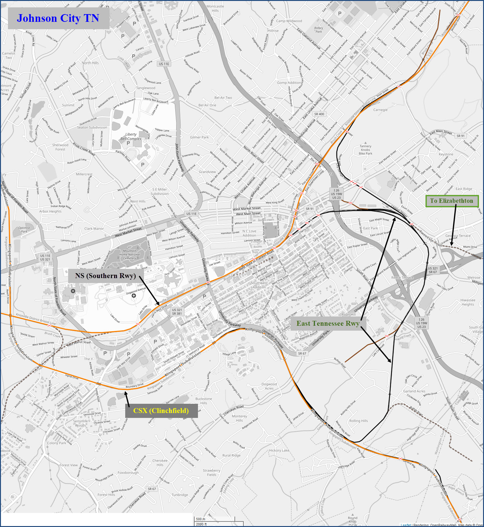
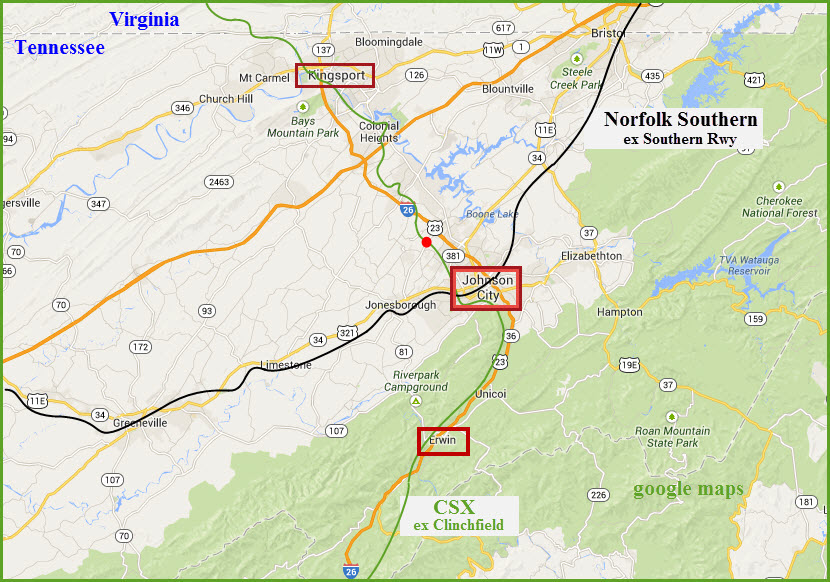
Norfolk Southern (former Southern Rwy)
CSX (former Clinchfield RR)
East Tennessee RR
High Bridge north of town
Data:
GPS Coordinates: as needed
Phone A/C: 423
ZIP: 37601
Access by train/transit:
None
The Scoop:
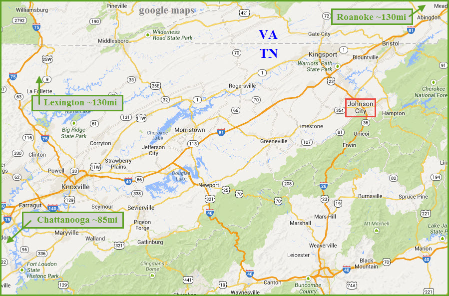
Johnson City is about 14 miles south of the east-west running Interstate 81. I-81 brings you in from Knoxville TN to the west, or Bristol VA/TN and Roanoke VA to the east. It's about 20 miles or so north of Erwin TN. One of the biggest things in town is ETSU, the East Tennessee State University.
Back in the 80's before the last of the big mergers took place, the Southern Rwy, the Clinchfield, and the East Tennessee RR serviced town. Today, NS And CSX are the main players, although since the decline of coal's popularity over the past years, traffic is almost non-existent on CSX.
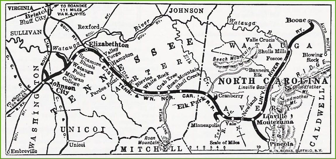
The Clinchfield came thru more or less north and south, like 12 and 6 on the clock. The track runs from Dante VA to Spartanburg SC.
The Southern came thru on its way from Bristol VA/TN to Knoxville, right into the eastern end of the Knoxville Yard. It runs thru town at about the 2 o'clock to 8 o'clock points on the clock as seen above in the map. According to Wikipedia: The Southern Railway used to serve Johnson City with several trains: the Birmingham Special (ended 1970), the Pelican (ended 1970) and the Tennessean (ended 1968).
By the time I arrived in Johnson City in 1980, the East Tennessee was running between Johnson City and Elizabethton. Over in Elizabethton, one of the more active facilities was a plant that used a boilerless steam engine to shuttle cars around - most interesting. The green and gold paint scheme is not, as most might assume, based on Southern Railway's old scheme. The predecessor East Tennessee & Western North Carolina narrow gauge "Tweetsie" adorned its Baldwin Ten-Wheelers in a similar green and gold livery in the '30s. Also, the original ET is now gone, but the current operation handles the remains of local switching in Johnson City. Not that many years ago, Southern, Clinchfield, and the ET&WNC itself served many rail-served industries and customers here with locally based crews. Now, only the ET handles what's left on both NS and CSX (under contracts). (from Ron Flanary)
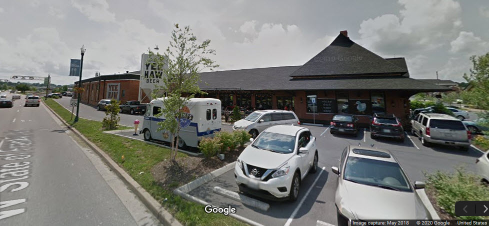
The former Clinchfield/CC&O depot was recently bought and now houses the BURG'r & BARREL restaurant - it looks great in the pictures and should be a nice place to have lunch if you're coming thru for railfanning since it's in the middle of everything.
One of the largest water heater manufacturers in the U.S. is located in Johnson City, the American Water Heaters Co. Back in the 80's they were called something else, but I can't remember.
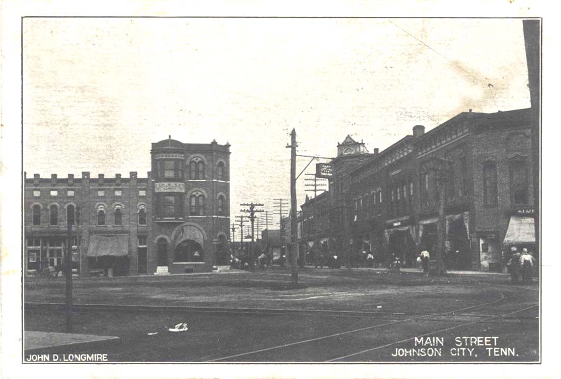
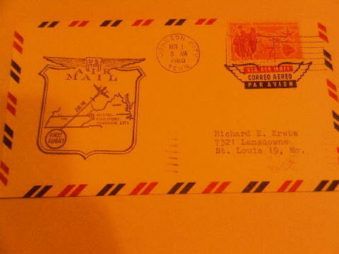
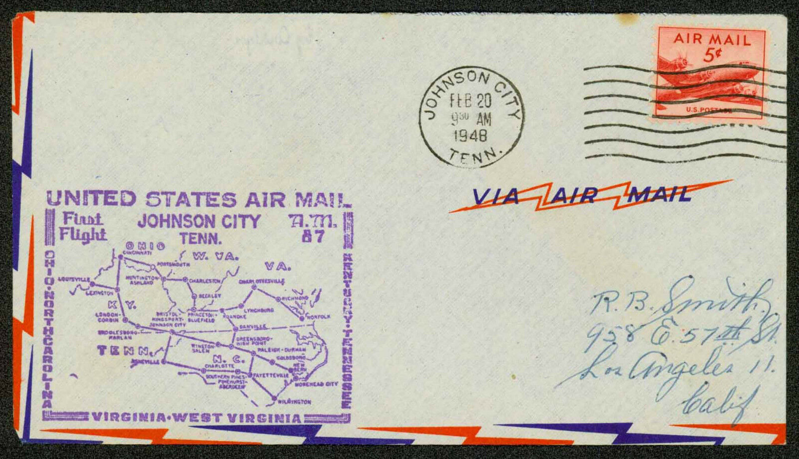
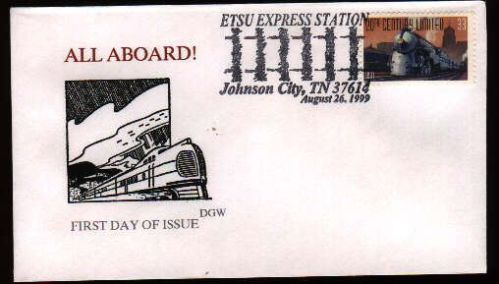
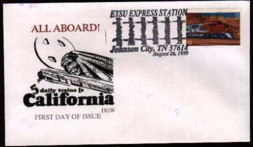
Postcards came from: http://www.johnsonsdepot.com/postcards1.htm
Acknowledgements:
Amy L./PHC
Ron Flanary
Elaine Goller
Pete Greischar
James Edgar
Kyle Korienek
Steve Patterson
Bob Braidsher
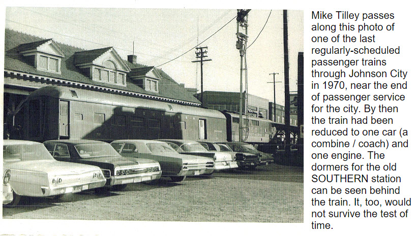
Mike Tilley
Sandhi Kozsuch
Denver Todd
Google Maps
Websites and other additional information sources of interest for the area:
https://charleston-cincinnati-chicago-clinchfield-railroad.com/
https://charleston-cincinnati-chicago-clinchfield-railroad.com/homepage/east-tennessee/johnson-city-2/
http://www.stateoffranklin.net/johnsons/southern/index_so.htm
https://www.johnsoncitypress.com/local/2013/03/18/rebirth-of-a-depot-johnson-city-s-historic-train-station-being-converted-into-restaurant
https://en.wikipedia.org/wiki/East_Tennessee_Railway
http://www.wataugavalleynrhs.org/newsletters/201507WhistleStop.pdf
https://en.wikipedia.org/wiki/Johnson_City,_Tennessee
Getting to Johnson City is pretty easy and straightforward.
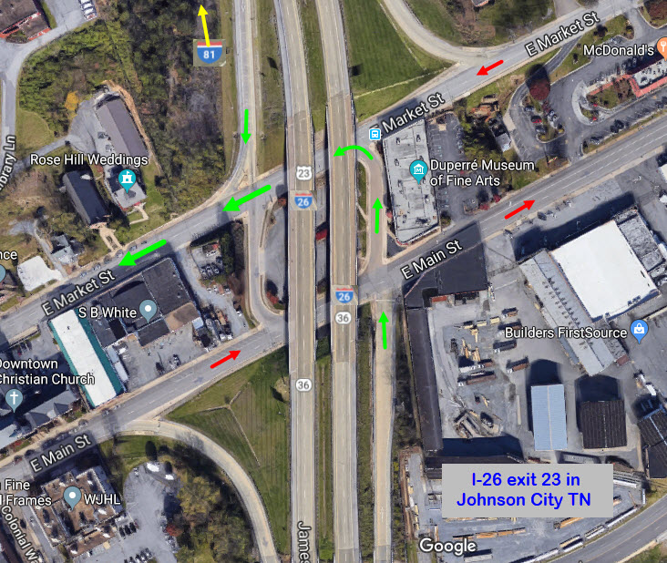
If you're coming from the west or northeast of Johnson City, the easiest way is to come in via interstate 81 (and I-40 further west from where I-81 begins). I-81/I-40 brings you in from the Tennessee towns plus Alabama. I-81 to the NE brings you down from VA, MD, PA, NY, and other "remote" locations such as OH and New England. You want exit 57 going south, which puts you on I-26, one of the "newer" interstates, being US 23 prior to that, altho it still carries the US 23 route.
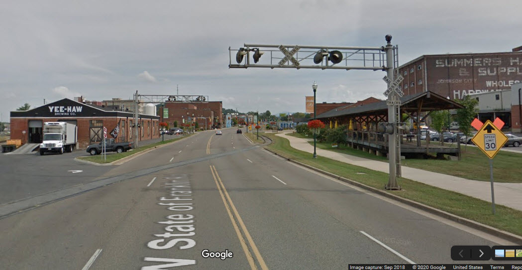
To hit the downtown area where most of the stuff is located, jump off at exit 23. This will put you on Market St, which you can then take west to buffalo St, where you want to take a left. Going a couple of blocks on Buffalo St will take you right to the Clinchfield depot when you come to State of Franklin Rd (it will be off to your right).
From the south, ie: Asheville NC, use I-26. This also connects with I-40, which splits off from I-81 about 30 miles east of Knoxville. On the way "up" to Johnson City, you will also pass thru Erwin. Coming up from the south like this, you can also use exit 23, but at the end of the exit ramp, you will want to cross Main St and go one block to get on to Market St heading west, as both Main and Market are one-way streets.
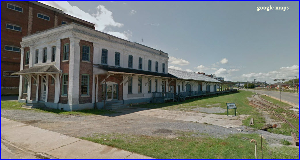
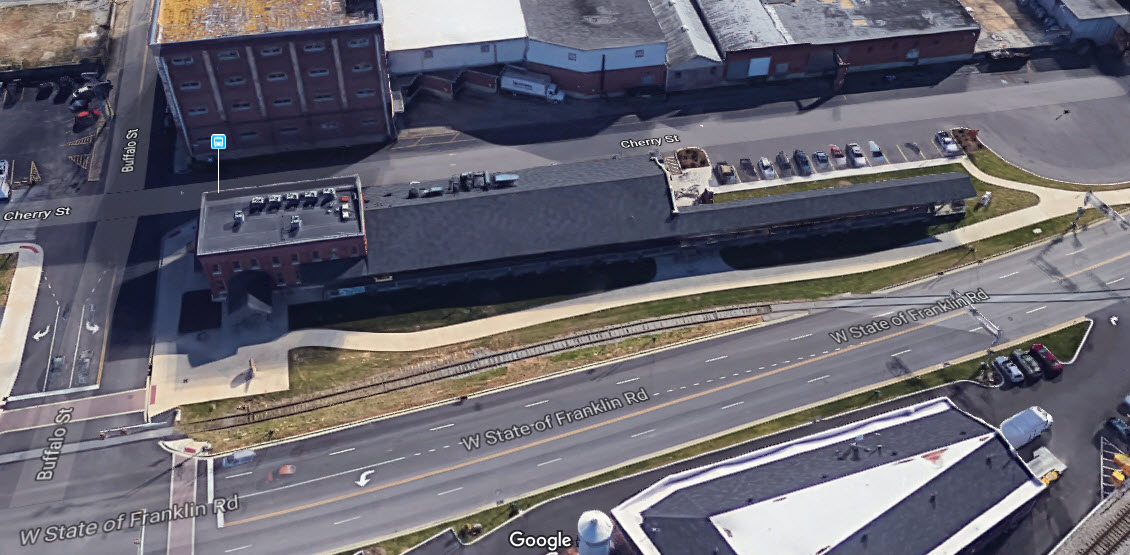
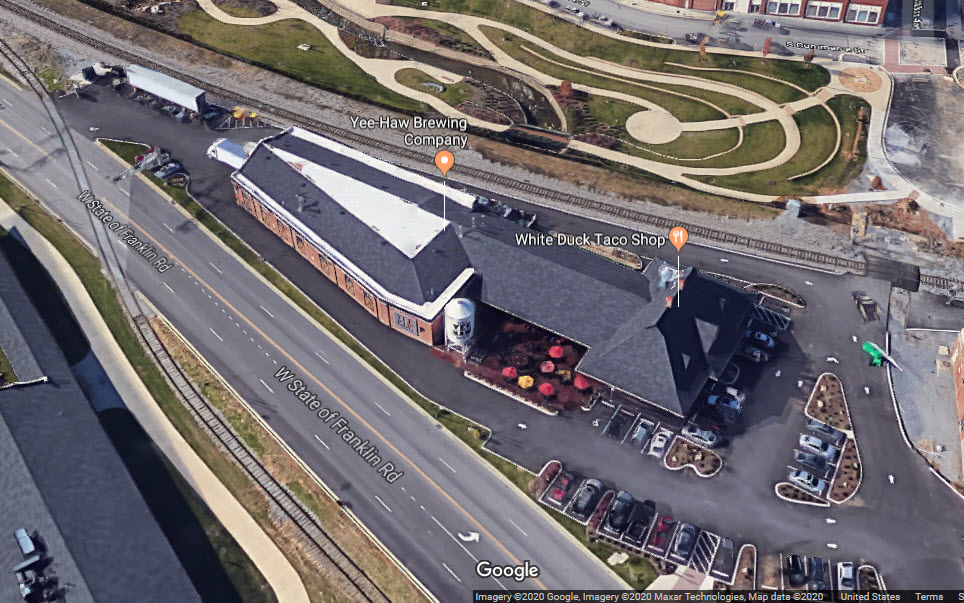
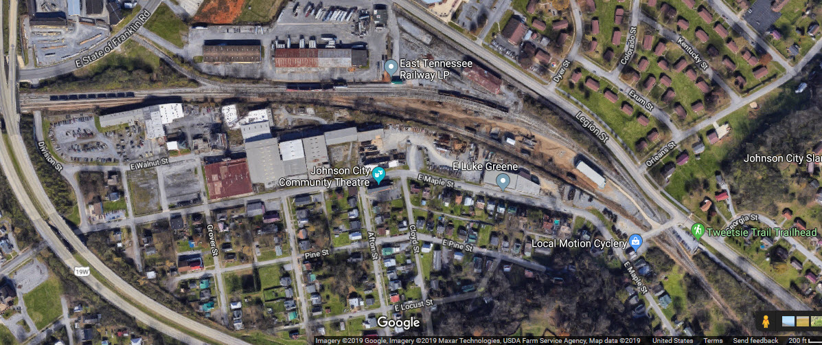
Johnson City had at one time three railroad depots, two of which have survived to today. In the aerial view below we can see where they were in relation to each other.
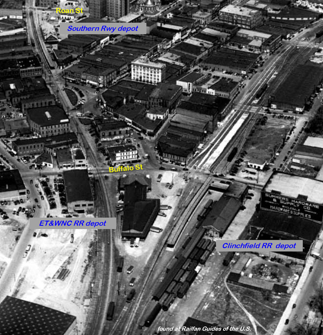
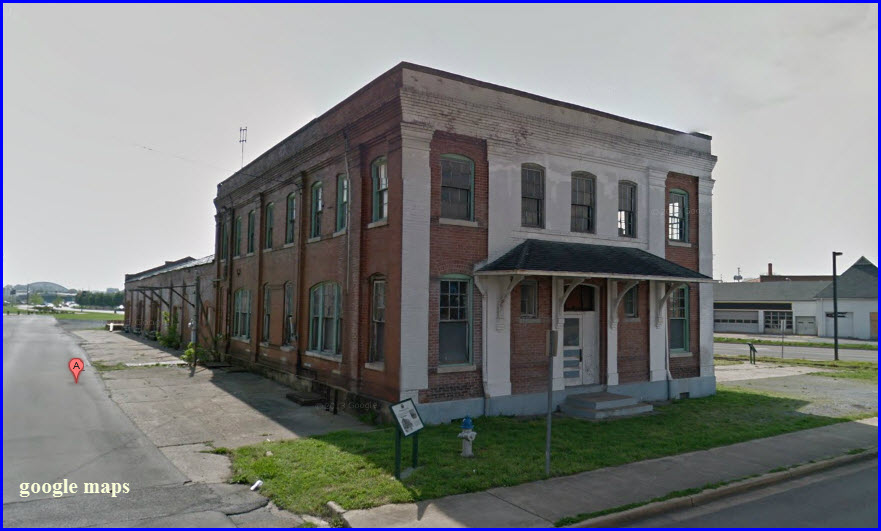
GPS Coordinates: 36.314382, -82.35285
Corner of Buffalo St and West State of Franklin Rd
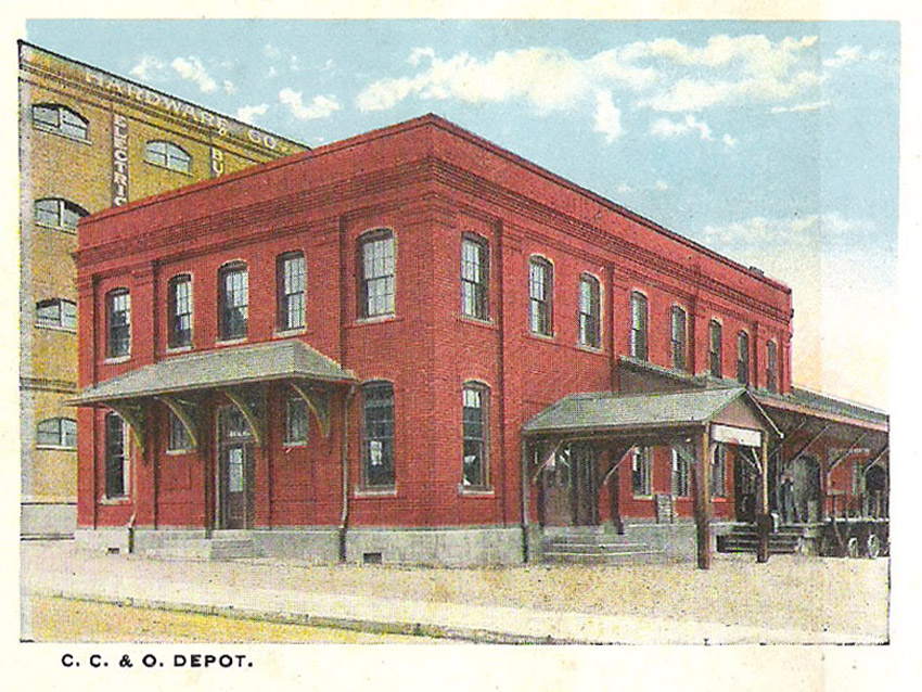
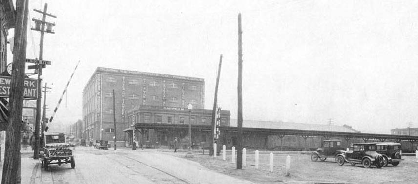
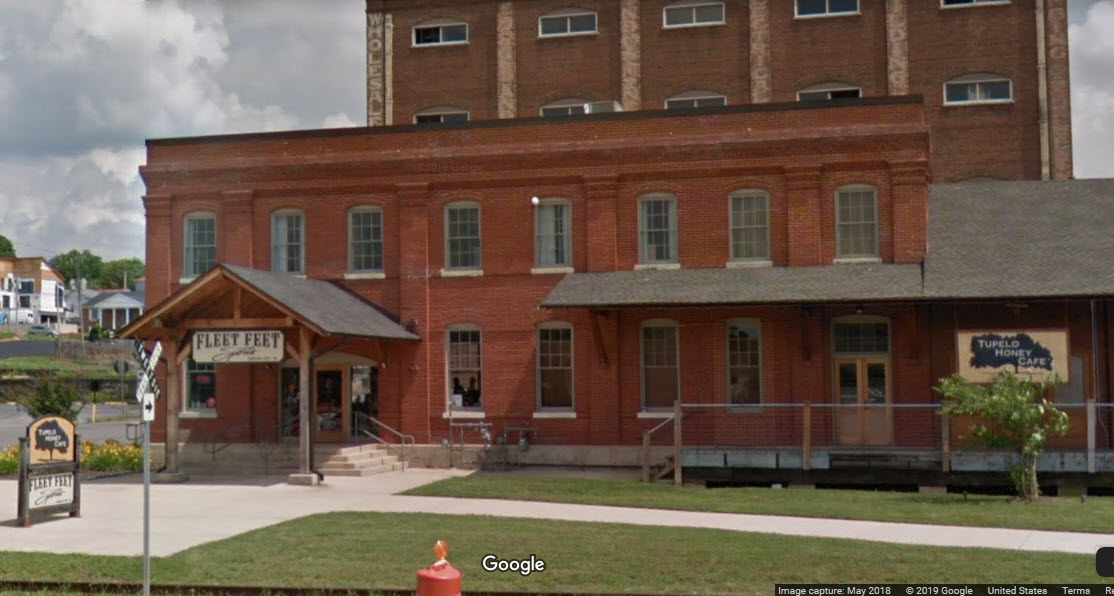
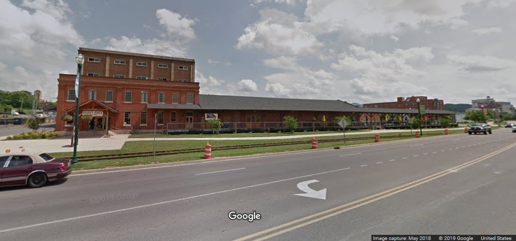
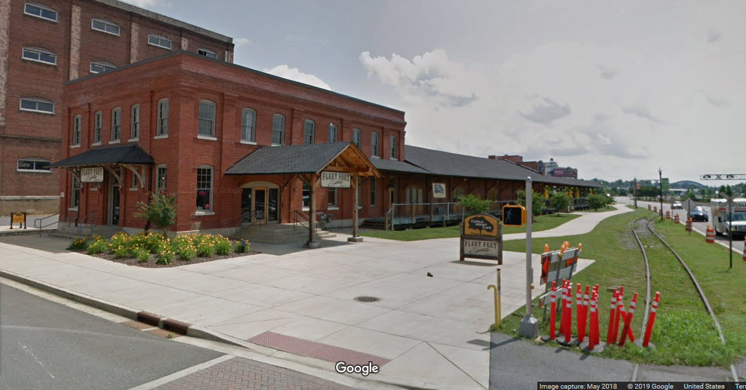
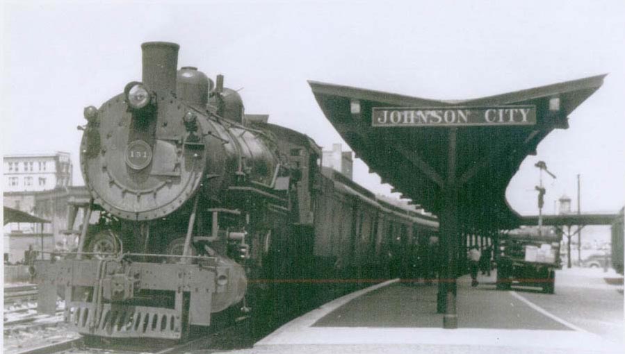
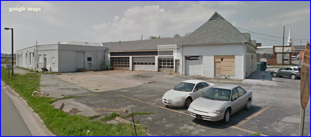
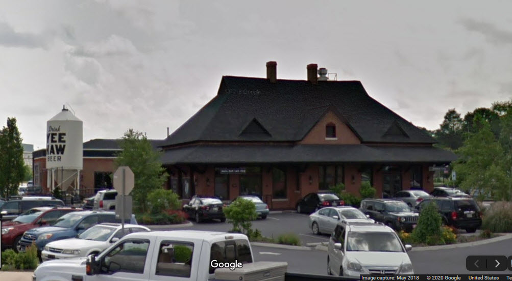
The depot was built in 1909 by the CC&O RR.
The historic Clinchfield Depot in Johnson City was saved from the wrecking ball in 2003 by Dorian Jones.
In 2008, the building was added to the National Register of Historic Places.
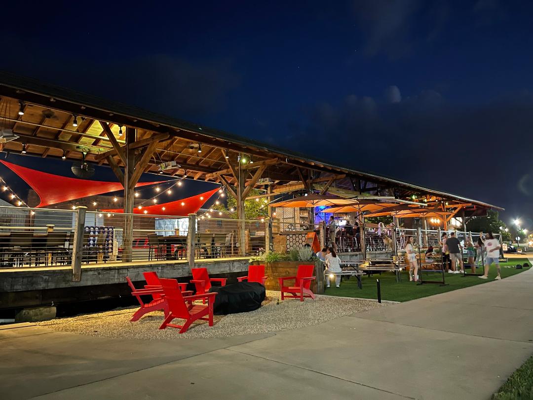
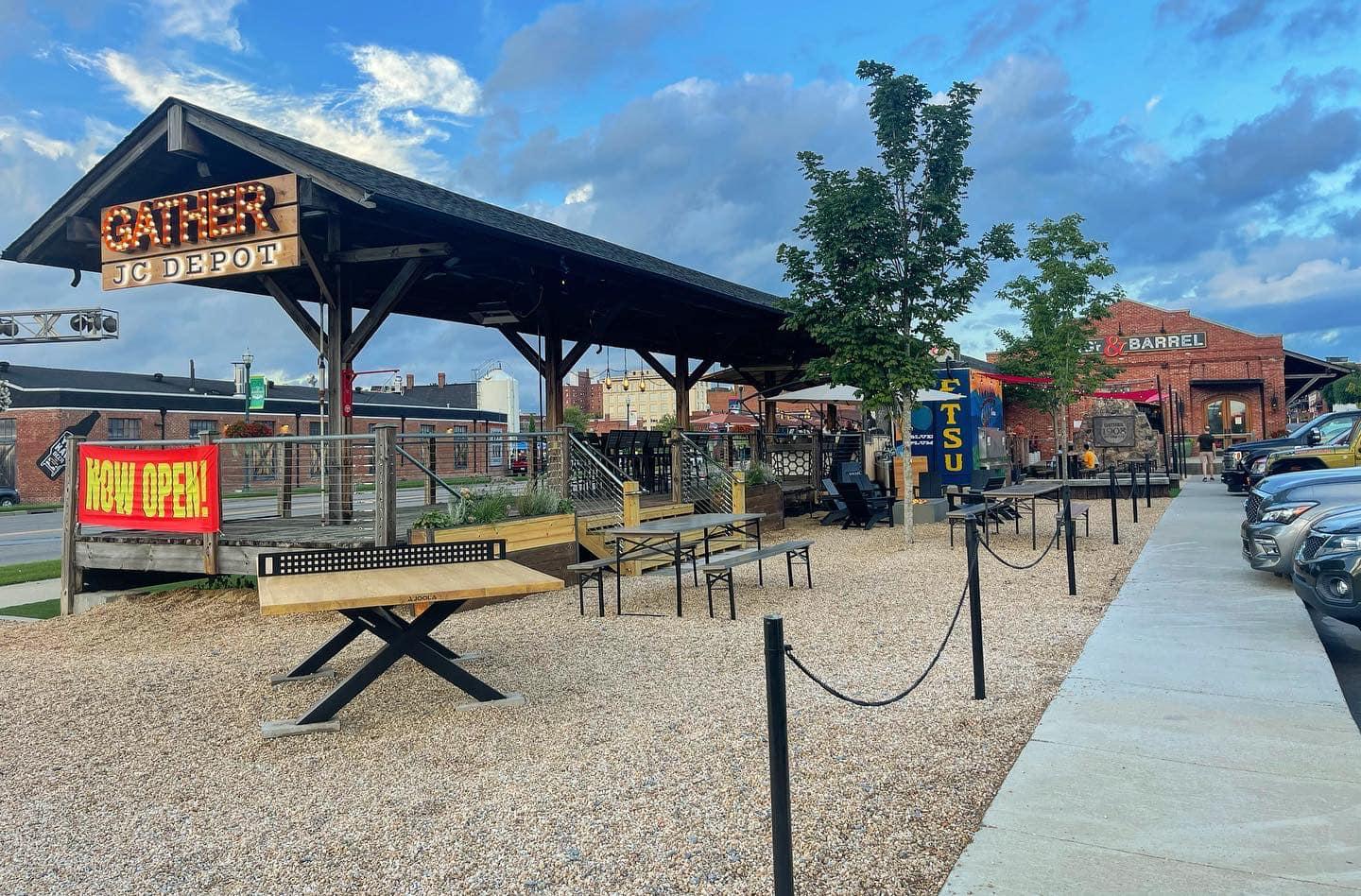
It housed the Tupelo Honey Cafe, however, as of December 2019, the Johnson City location has closed.
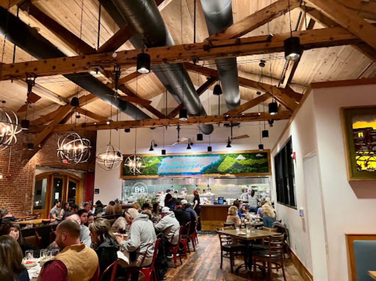
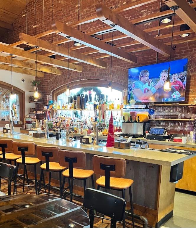
As of May 2022, the building was bought by PHC, Peerless Hospitality Concepts, and they have renovated the restaurant and reopened it as BURG'r AND BARREL.
A few pictures are below provided by PHC, Google Streetview has not been thru sine 2021....
Judging from the condition of the track at the Buffalo St crossing, I would infer that the ETRY doesn't use this NS interchange track.
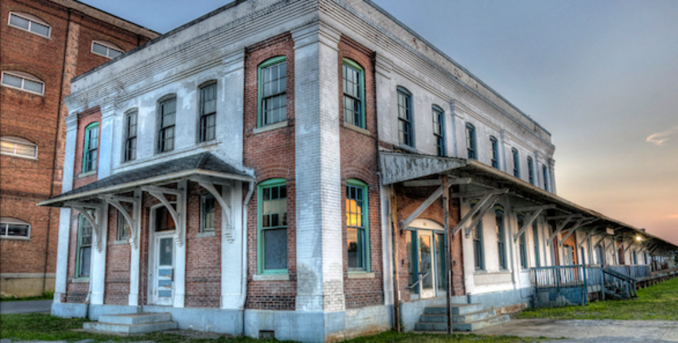
Info and Pictures of the BURG'r & BARREL:
https://www.burgrbarrel-jc.com/
https://www.facebook.com/burgrbarrel.jc/
330 Cherry St, Johnson City TN
423-297-9021
GPS Coordinates: 36.314604, -82.353533
Aerial pictures of the ET&WNC can be found at: http://urbaneagle.com/etwnc-aerialpics/
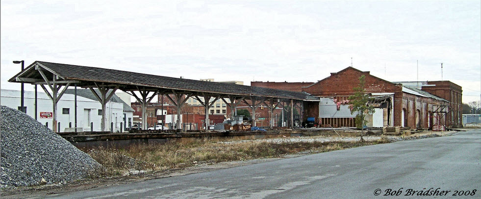
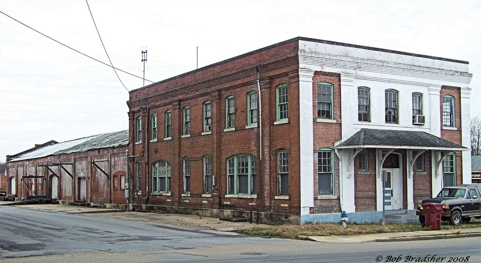
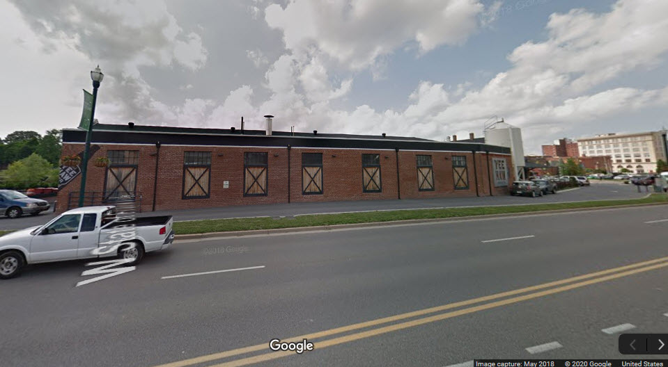
This depot is across the street from the Clinchfield depot, at the corner of Buffalo St and State of Franklin Rd.
You can see substantial redevelopment has taken place since I took the first Streetview shots about 6 years ago.
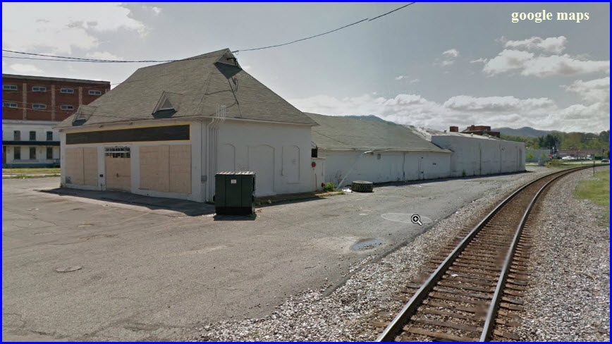
The rear end of both depots can be seen in this view....
GPS Coordinates: 36.315110, -82.336657 (parking lot for the Tweetsie Trail)
https://www.gwrr.com/railroads/north_america/east_tennessee_railway#m_tab-one-panel
https://hawkinsrails.net/shortlines/etry/etry.htm
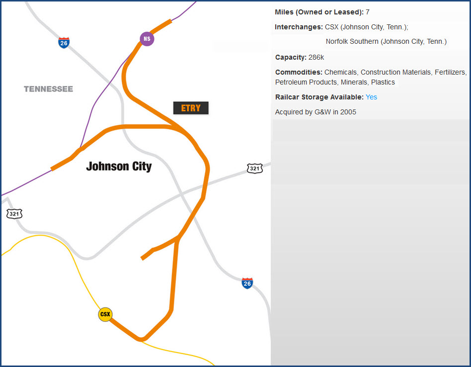
From Wikipedia: The East Tennessee Railway (reporting mark ETRY) is a short line railroad connecting CSX Transportation and the Norfolk Southern Railway in Johnson City TN. Since 2005, the railroad has been owned by the Genesee and Wyoming, an international operator of short line railroads, as part of its Rail Link group. The railroad uses a single diesel locomotive, SW1200 #214, to serve a small number of industries and a transloading facility, as well as to provide interchange services between NS and CSX.
The current standard gauge railroad is a remnant of a larger, narrow gauge railroad, the East Tennessee and Western North Carolina Railroad, chartered in 1866 to haul iron ore from Cranberry NC to Johnson City TN across the Appalachian Mountains. Through an acquisition and track extensions, the railroad grew to serve Boone NC and Saginaw NC. ET&WNC used dual gauge tracks between Johnson City and Elizabethton; eventually the railroad ceased all narrow gauge operations and only operated standard gauge service on this one section. Later, with a change in ownership, the line was reorganized as the East Tennessee Railway.
In 2003, the last train left Elizabethton TN. In 2009 the line was formally abandoned and railbanked. The rails and ties were removed in 2012 to make way for a rail-trail. The East Tennessee Railway still services customers around the yard in Johnson City and still makes deliveries to the CSXT and NS. ETRY started out with a two-man crew for many years, and have just now upped to a three-man crew. They work Monday through Friday.
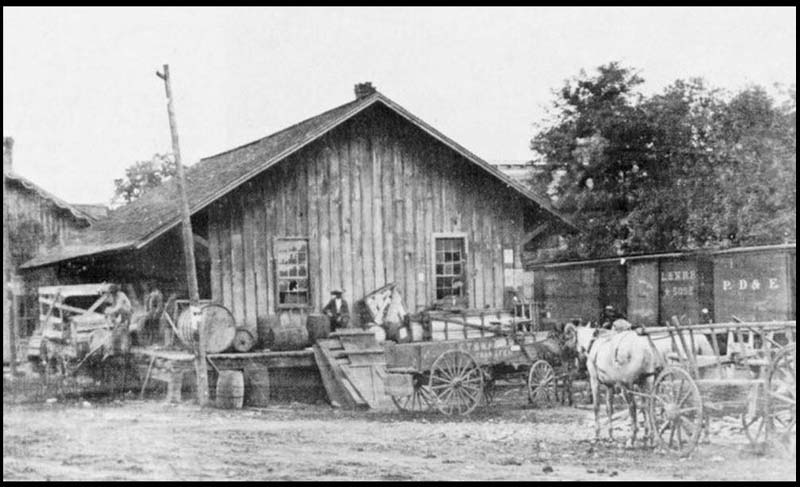
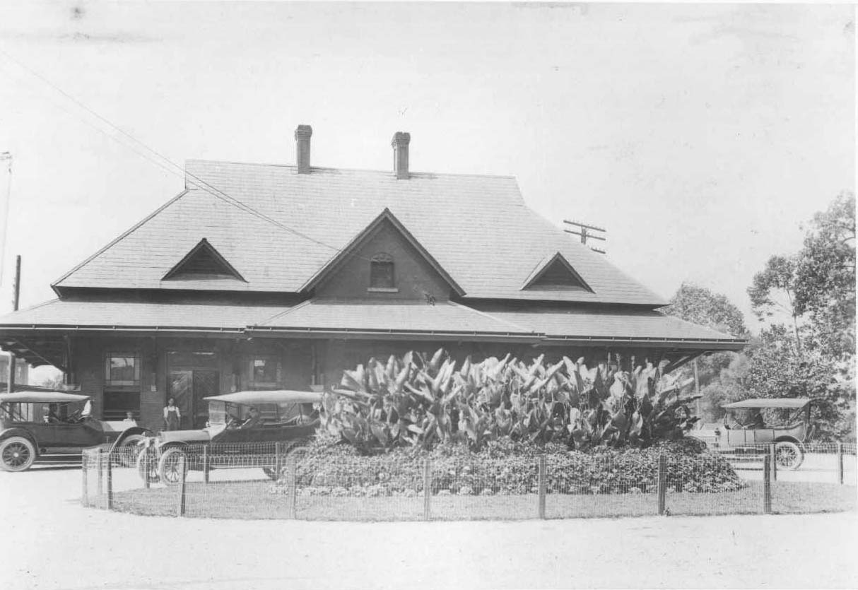 ET&WNC depot, unknown location, ~1930
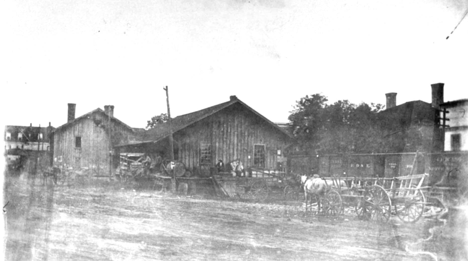
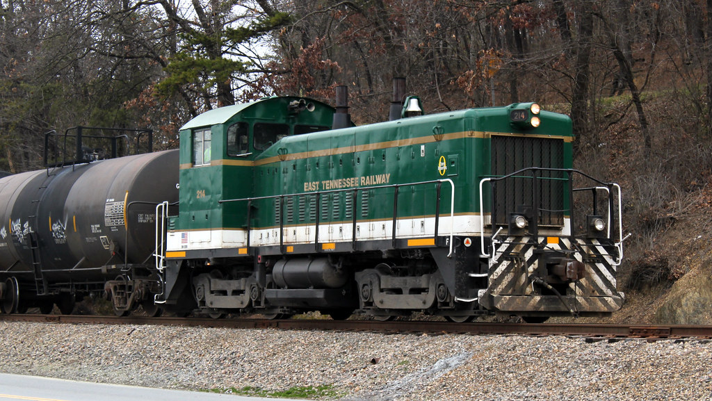 2011, photo by Matt
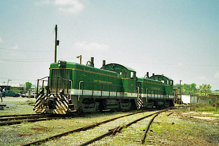
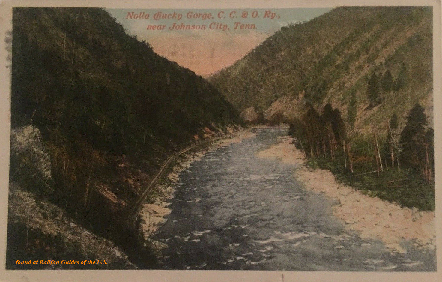
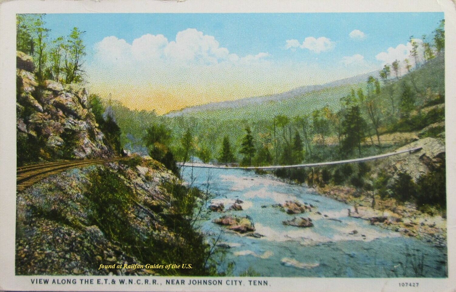
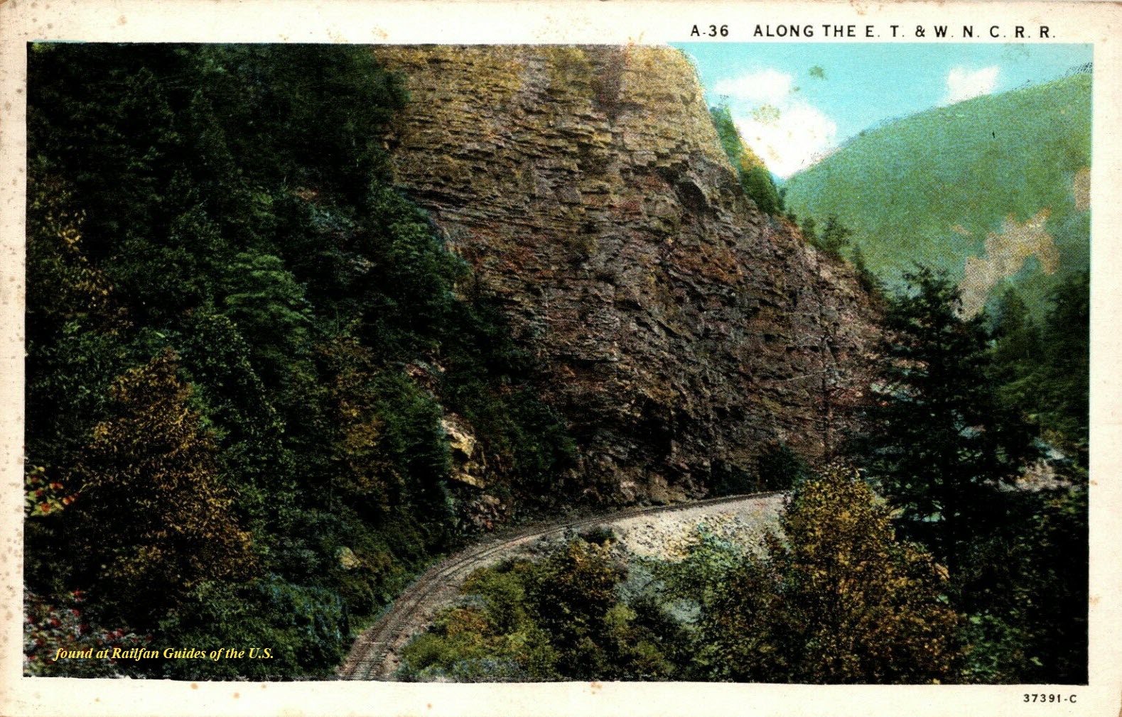
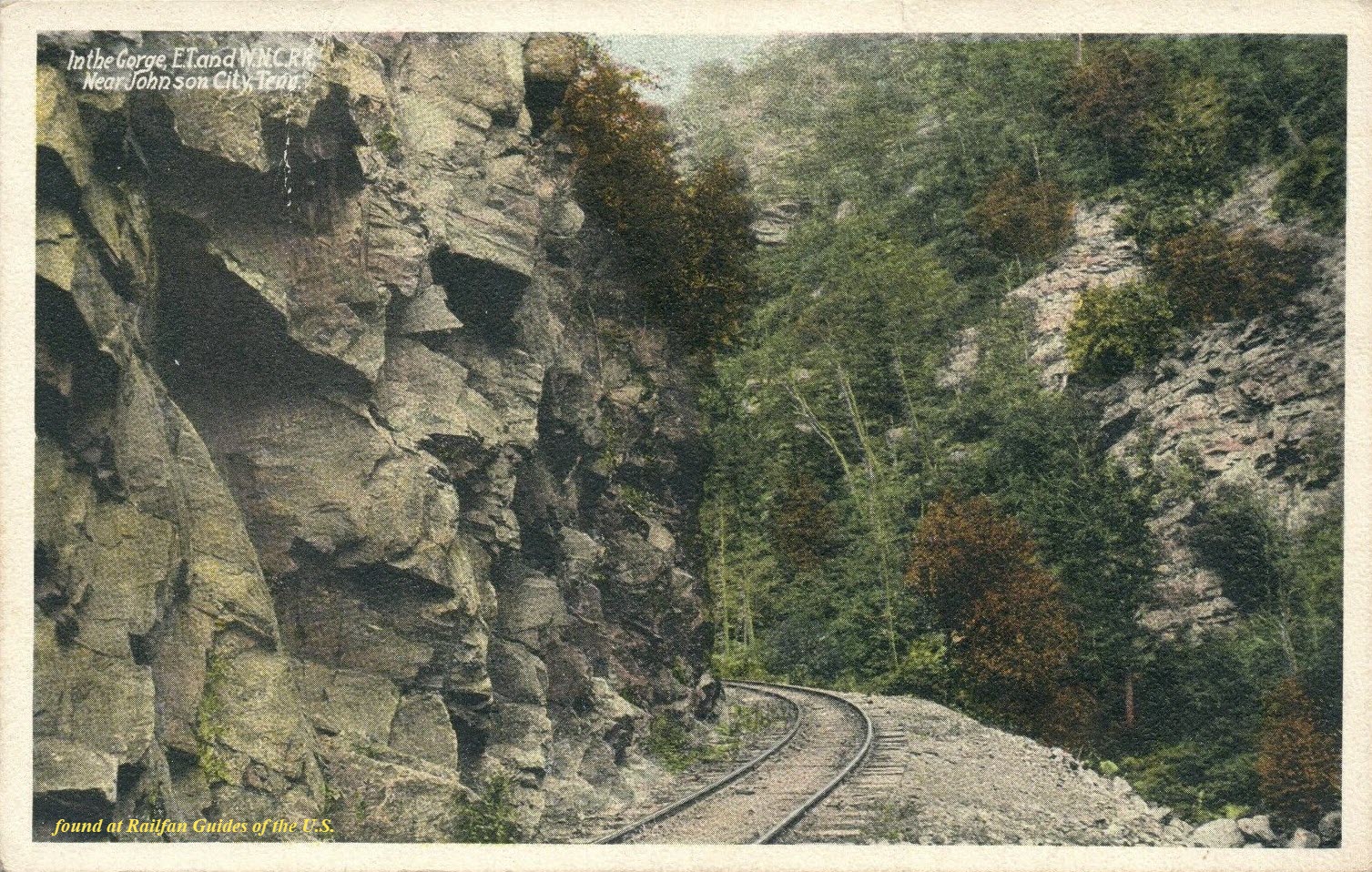
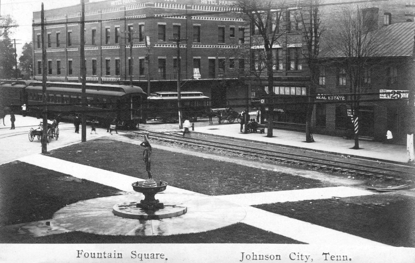
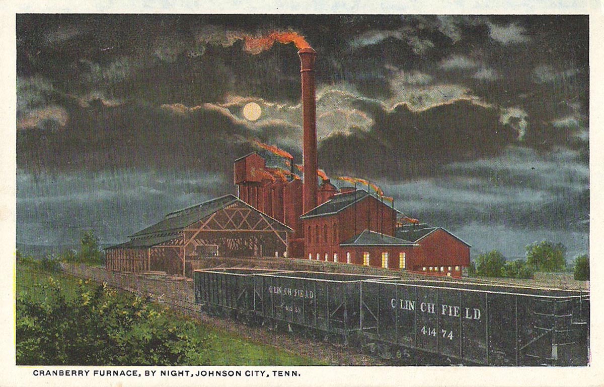
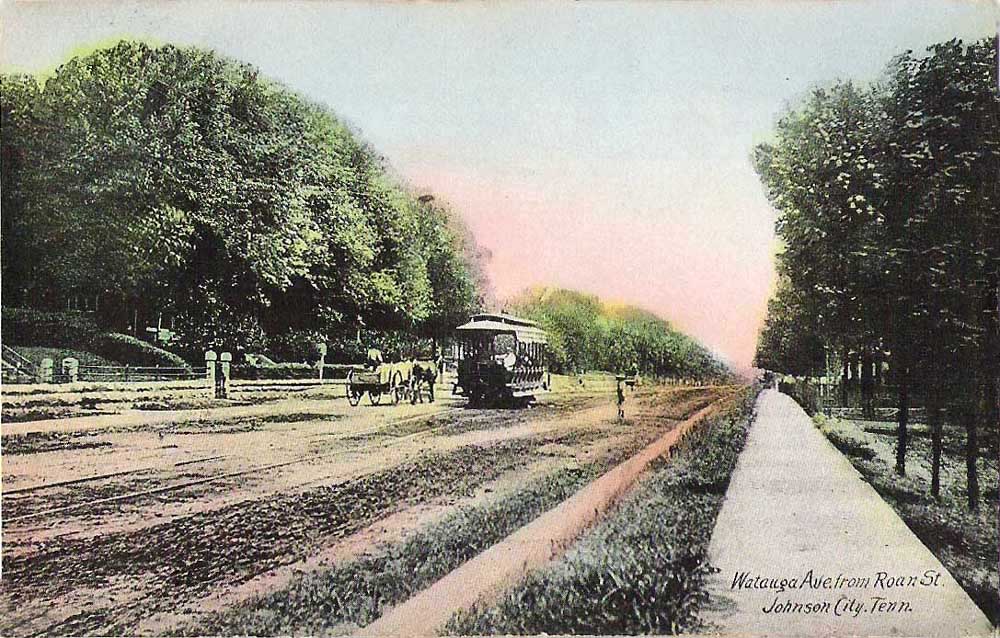
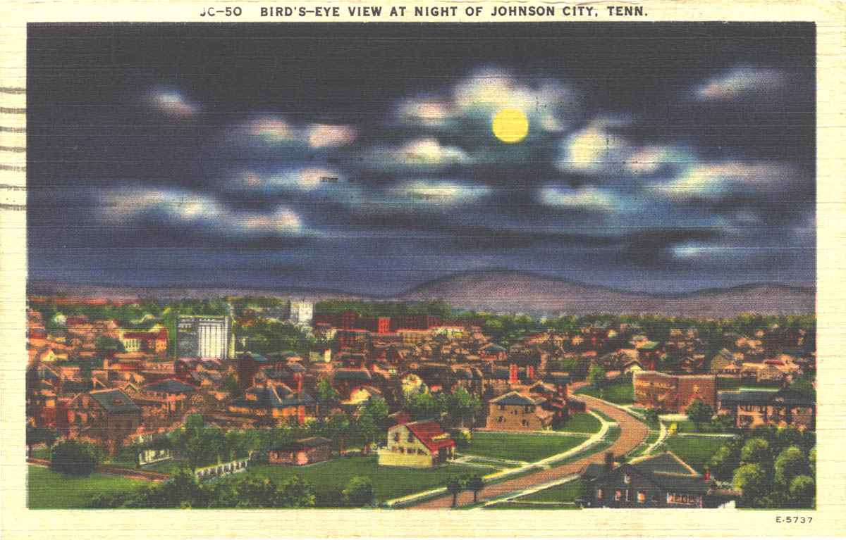
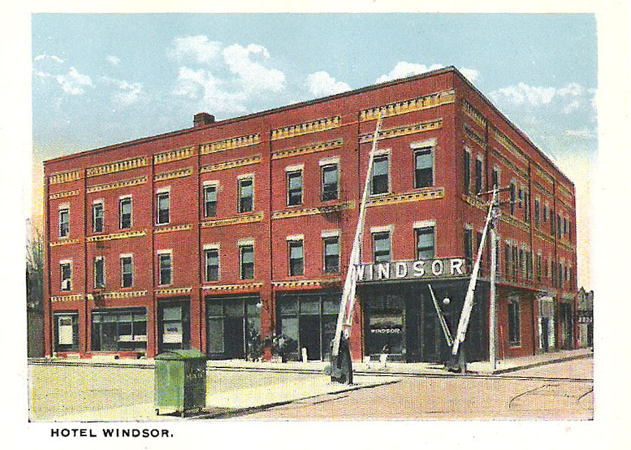
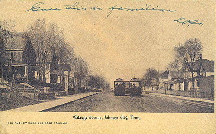
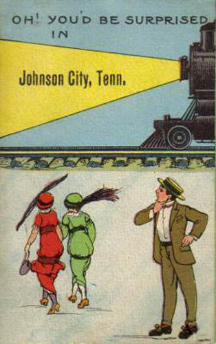
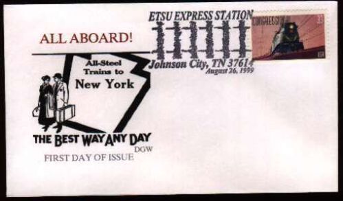
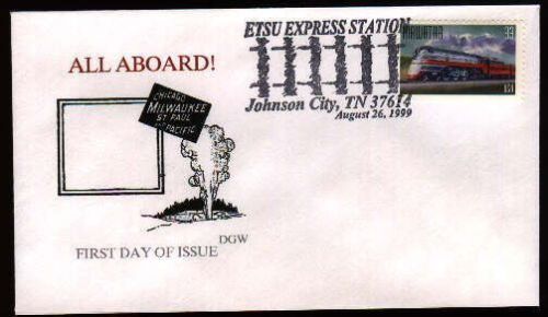
I usually stick postcards in the Floobydust section, but since these are East Tennessee related, I present them here:
GPS Coordinates: 36.317737, -82.352572
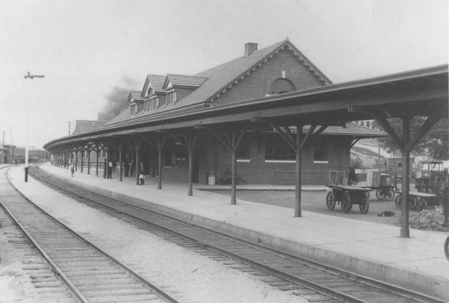
Don't have any information on the Southern depot, so I don't know when it was built, and don't know when it was torn down....
I used the aerial photo above to approximate its location, it would be in the middle of Buffalo St if still around :-)

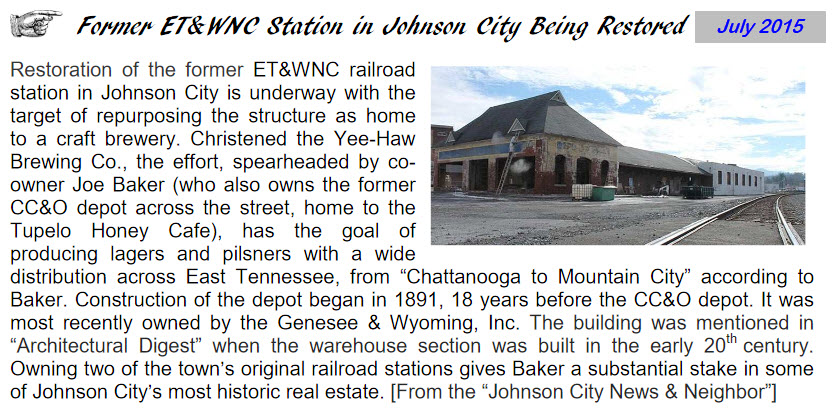
The picture below comes from the Watauga Valley Chapter NRHS newsletter from July 2015. Can't tell you much about it other than what the caption states.
Interesting semaphore pole and mounting, wish we had close-ups! :-)
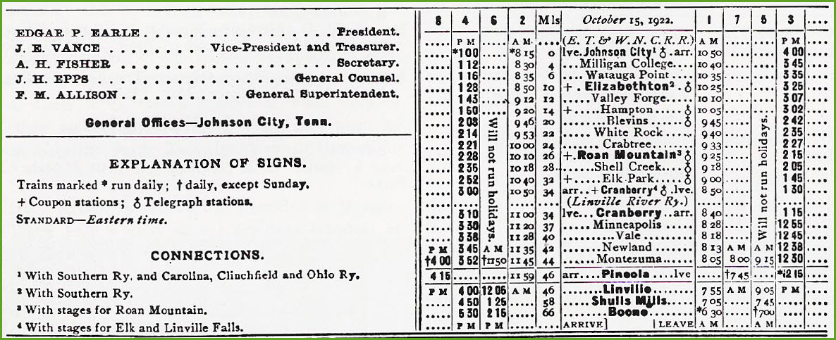
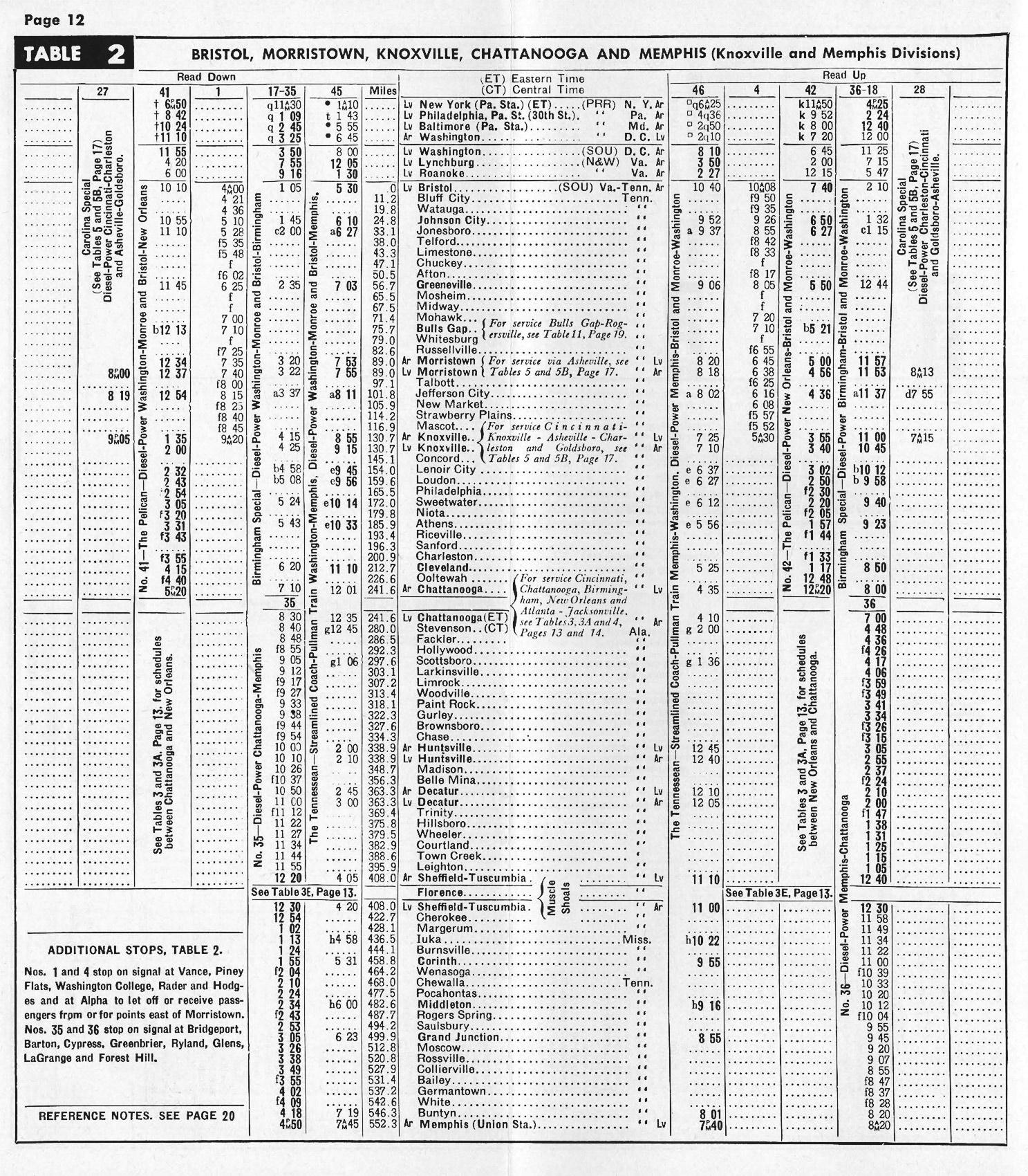
An undated timetable for trains passing through Johnson City on the Southern:
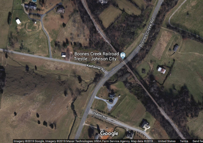
On the Clinchfield, we have the following bridges, overpasses, and underpasses from north to south, starting with Boones Creek Rd:
Boones Creek Road
Knob Creek Road
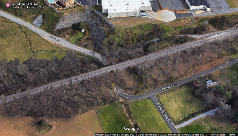
Fairridge Road
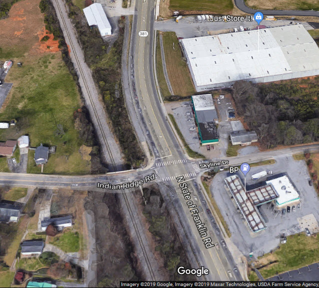
Indian Ridge Road
Market Street
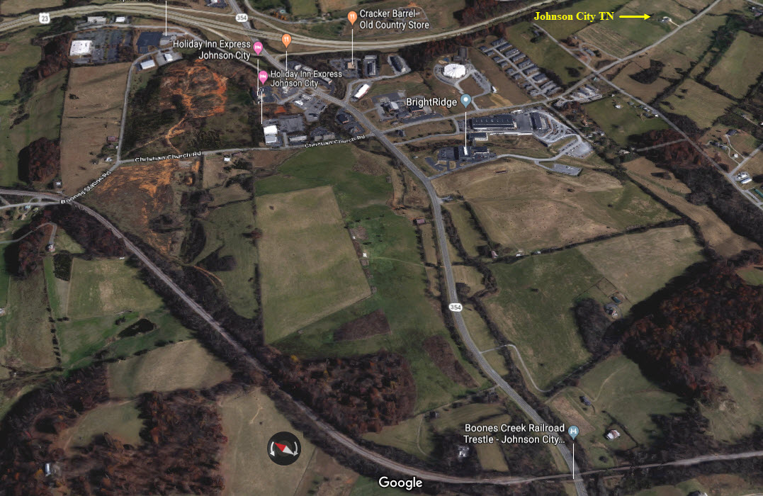
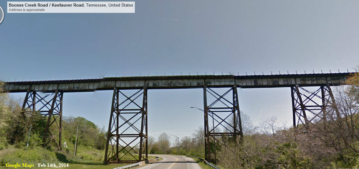
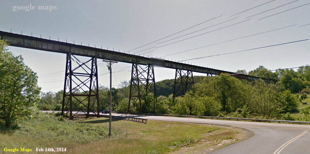
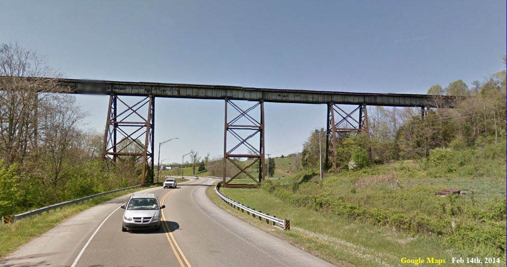
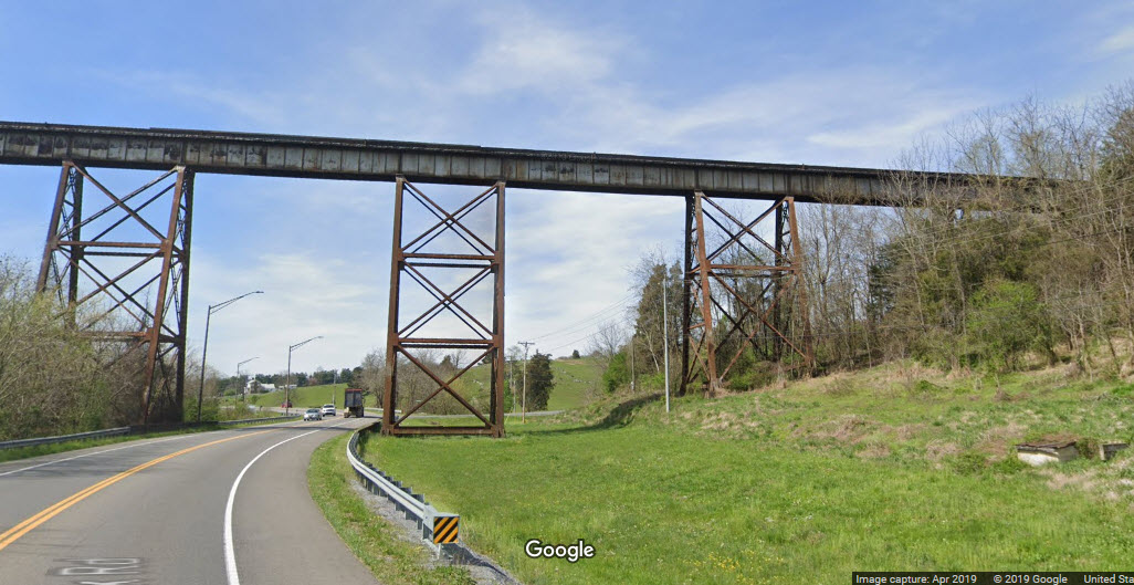
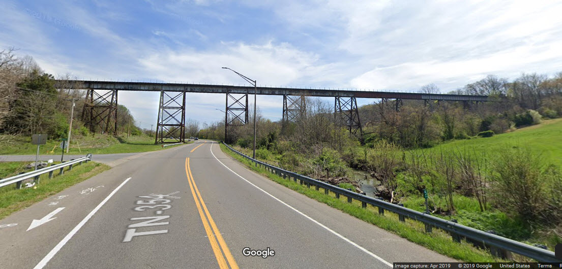
GPS Coordinates: 36.364144, -82.437201
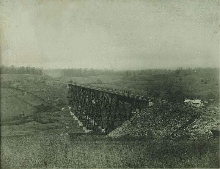
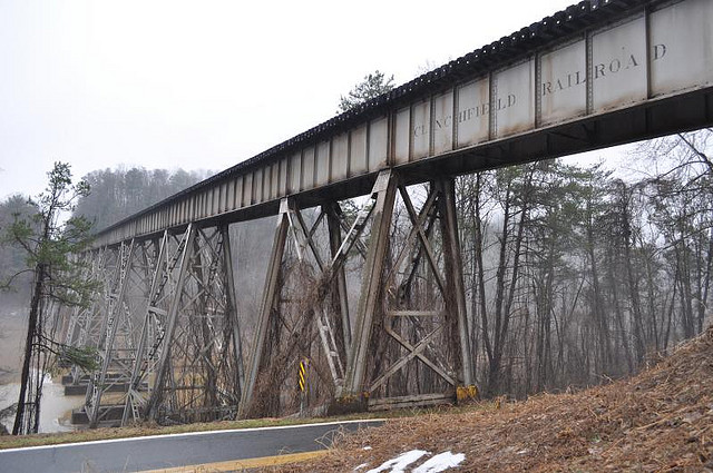
On the north side of Johnson City is a really beautiful steel trestle going over Boones Creek Rd. It used to be called the Knob Creek Rail Bridge.
Access for pictures is messy, I notice in the 5 years between pictures on Google Maps, that it looks like one fence, which was covered by vines, is gone. The vintage photo came from johnsonsdepot.com, which is no longer around. Would love to see a picture of a train crossing the trestle when there was nothing in the way.

GPS Coordinates: 36.340004, -82.416850
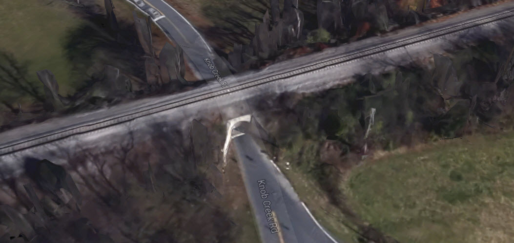
GPS Coordinates: 36.334240, -82.409135
This is more like a short, very short tunnel than an overpass.....
GPS Coordinates: 36.334240, -82.409135
Here, the railroad goes under Indian Ridge Road, providing the railfan with an opportunity for some nice shots from either direction.
Sight lines good in both direction, but less trees in the way for better sun in the afternoon to the north.
GPS Coordinates: 36.310242, -82.393032
Another overpass to shoot down from. Sight line OK, but trees on both sides interfere with good sun.
GPS Coordinates: 36.310242, -82.393032
Here the Clinchfield goes over the NS (Southern Rwy) and McKinley Road.
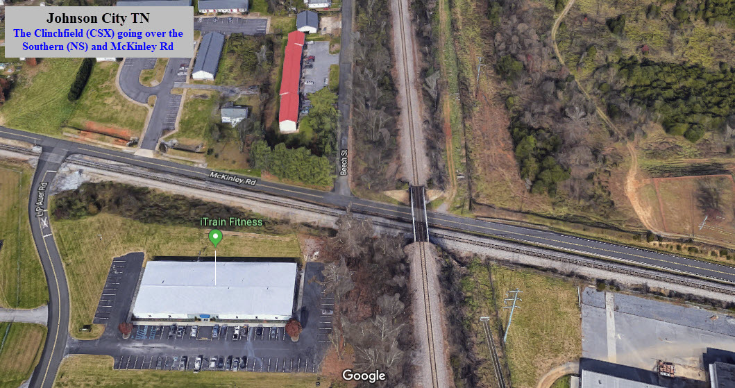
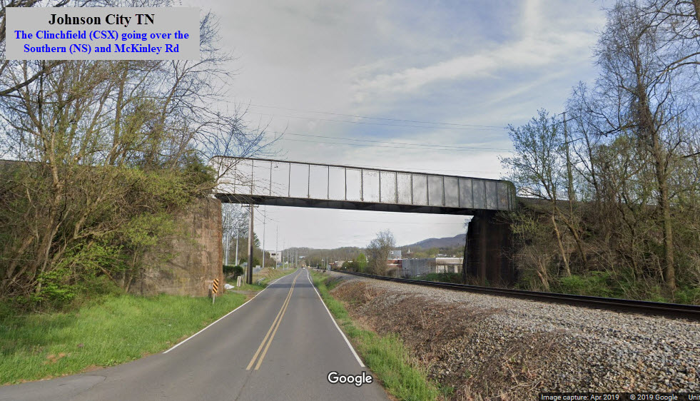
GPS Coordinates: 36.326464, -82.345520
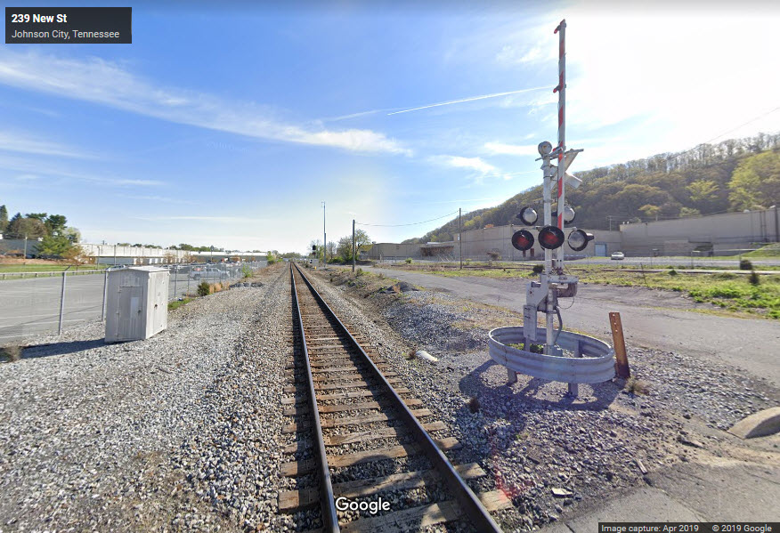
The Google Streetview shots are from New St, near the entrance to American Water Heater.
On the other side of the interchange is the NS Johnson City yard.
CSX freight at Knob Creek and Redstone Roads, Johnson City, Oct 2005. Photo by Pete Greischar.
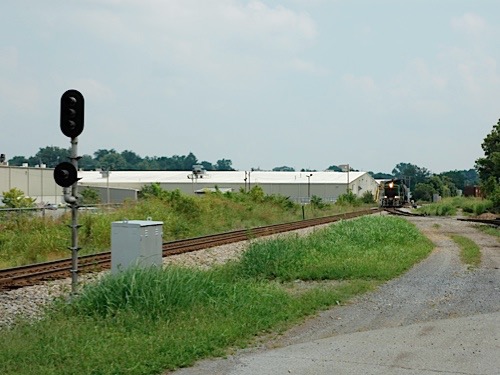
East Tennessee #214 at City Garage Rd, by Johnson City, Oct 2005. Photo by Pete Greischar.
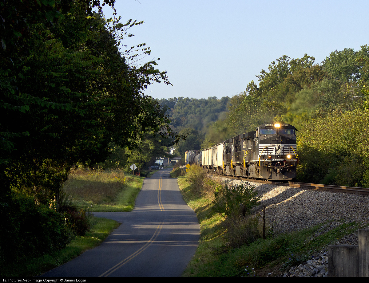
NS freight on the west side of Johnson City at Woodlyn and Weaver Hill Rds, Oct 2013, photo by James Edgar.
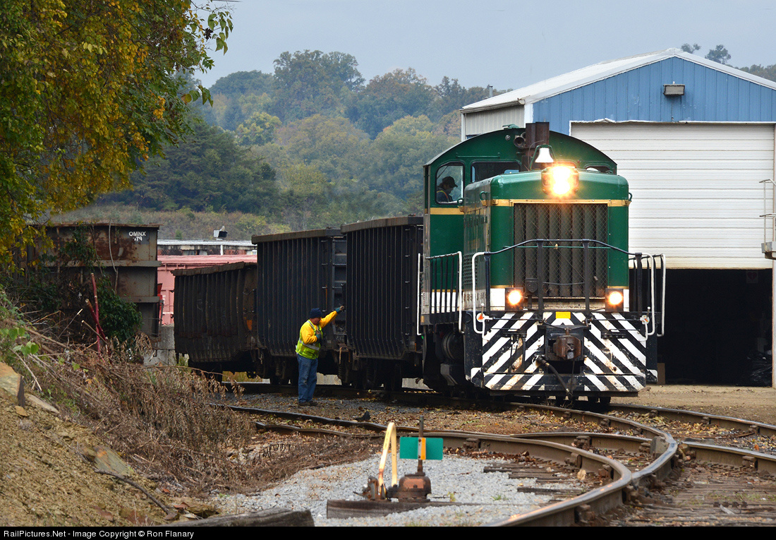
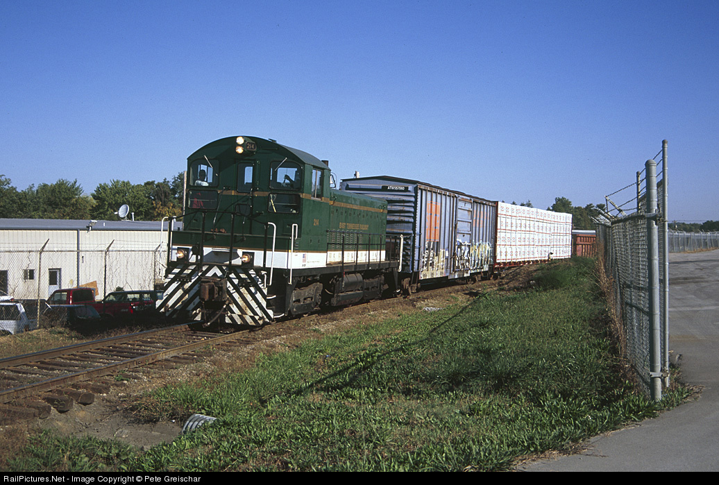
East Tennessee #214, Oct 2013, photo by Ron Flanary. The train is standing on what was the Clinchfield Railroad main line through Johnson City before October 1970, when the "High Line" a couple of miles to the west was opened for traffic.
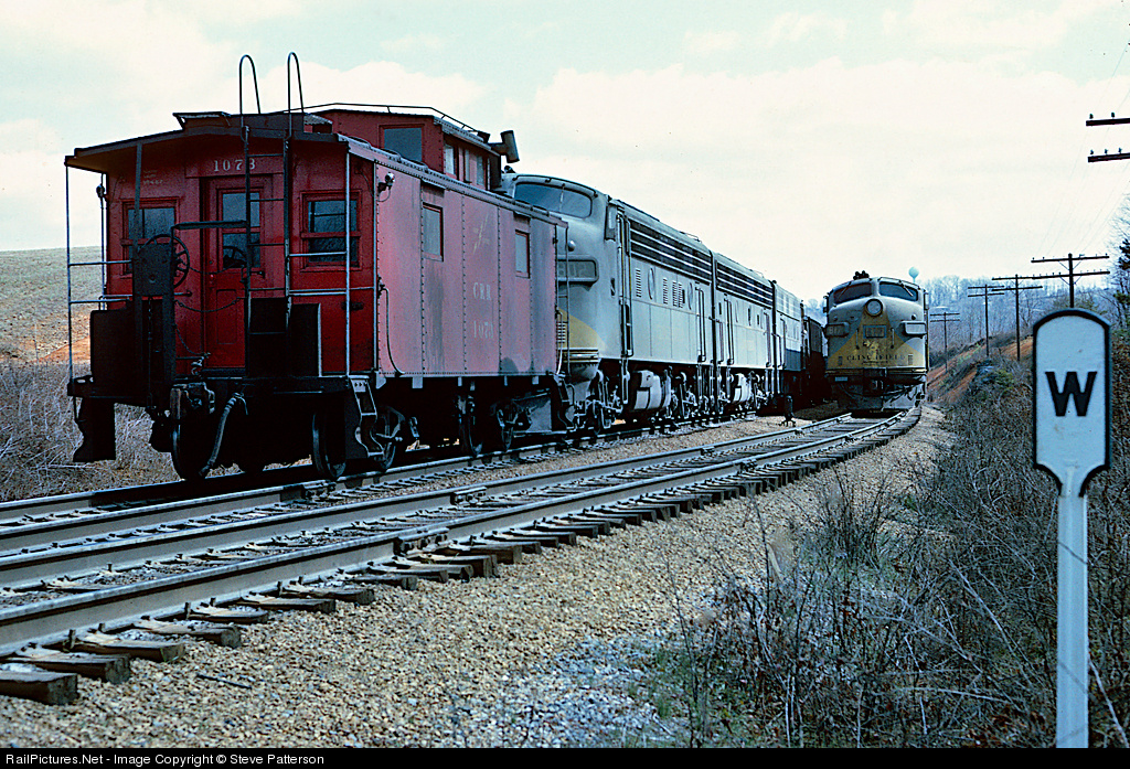
With three F unit pushers on its rear, southbound coal Train 26 is clearing the north siding switch at Barrett Yard or Johnson City, Tenn. to allow Extra 817 North to proceed. Photo by Steve Patterson, March 1965.
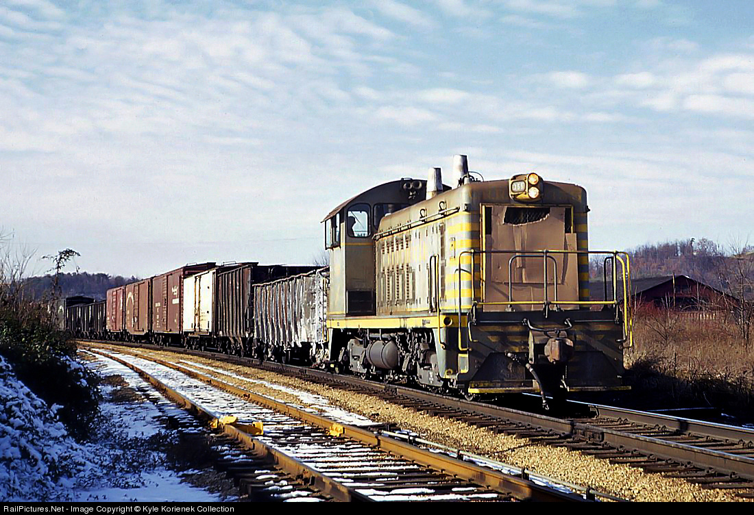
A somewhat rare sight, a Clinchfield SW7 355 enters Johnson City, TN on an Erwin bound local. After construction of the high line in the mid seventies, the Clinchfield no longer had to run through Johnson City with manifest trains, which shortened the journey from end to end and sped up traffic. Photo in the collection of Kyle Korienek. June 1971.
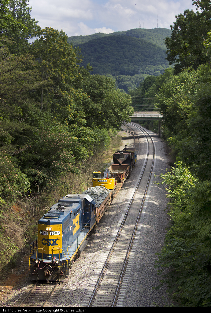
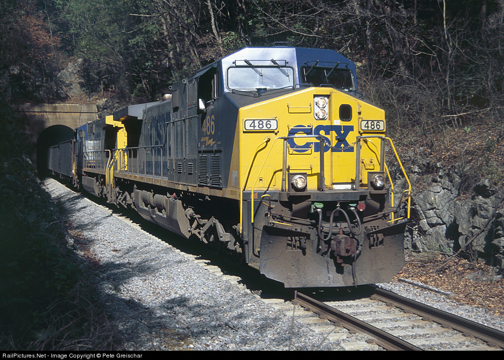
A former Seaboard Coast Line GP38-2 is in charge of a work train at Johnson City. Using a bay window caboose as a shoving platform, the train is backing toward the small yard on the south side of town, used for interchange with the East Tennessee Railway. The former Clinchfield portion of CSX is in the midst of a maintenance jamboree, which should be wrapping up soon. Meanwhile, aside from various work equipment, this is the only movement I've seen since the first of the month. Jul 2013, photo by James Edgar.
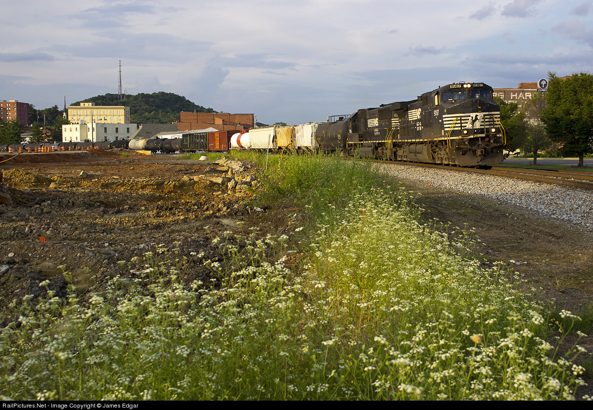
After a brief meet with the Greeneville local at Piney Flats, a westbound Norfolk Southern manifest rolls through downtown Johnson City on a warm summer evening. At left is the site of a former tire warehouse, currently being developed into a new city park as part of an effort to eliminate flooding problems that have plagued downtown businesses for years. Jul 2013, photo by James Edgar.
Clinchfield RR Lake James Bridge - Marion NC
Famous People from Johnson City
I know of two famous people lived here at one time, Hulk Hogan is one of them, he supposedly lived down the street from my Westinghouse buddy Dennis according to him, but I cannot confirm this. The Wikipedia page has around 40 or so people that you may know.
The other person that came thru Johnson City is Timothy Busfield, known for being in Thirty Something and Field of Dreams. He attended ETSU, and the only reason I know this is because a girl I dated, Elaine, went to school with him.
https://www.imdb.com/name/nm0124079/?ref_=tt_cl_t1

Postcards
License Plate Trivia
If you notice, at the top of the page where I have --Johnson City TN, Washington County (6)--, that is for those of you that may remember the "old" days when Tennessee used numbers on their license plates to denote the county. The "6" in the plate denoted Washington County. Erwin (to the south) is in Unicoi county, and the plates started with a 59. Folks in Johnson City used to kid around saying you never want to get behind a 59 plate (they always drove slow). I have to say tho, that even when I was driving here in the 80's, people were always nice and courteous, and, if you were in a line of cars going down, say, highway 23, and the car in the front was making a turn, everyone in that line of cars would turn their signals on too, to let the people behind them know someone was turning - only place in the U.S. I ever saw that done. Thanks to Elaine Goller for letting me have her old Johnson City license plates.
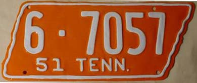 A Washington County plate from 1951
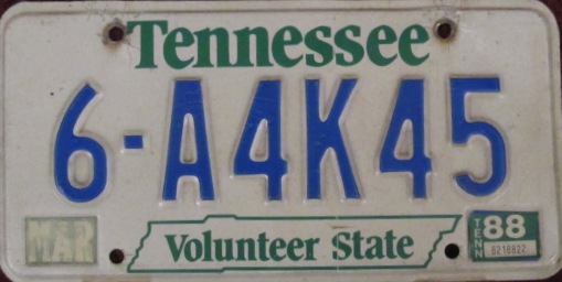 The Tennessee plates looked like this when I was coming here in the early 80's
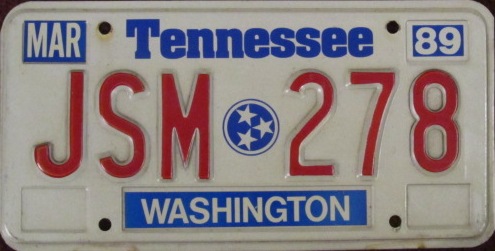 The next step in TN license plate evolution
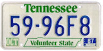 A plate from Unicoi County
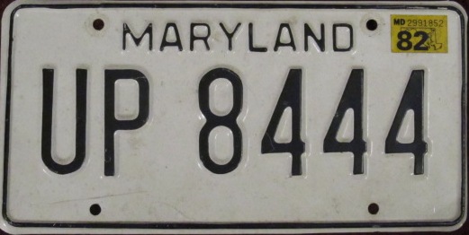
One day, back in 1982, or something like that, when I had the license plate UP 8444 on my car, I stopped off at the Clinchfield office in Johnson City to get the scoop on operations. While in there, I noticed they had a Union Pacific calendar on the wall, and it just so happened, that that month the featured picture was of, you guessed it, 8444. I made mention of that, and told the guy to look at my car and the license plate, and he was amazed to say the least. This was before vanity plates were in vogue in Tennessee, and he asked how I was able to do that!
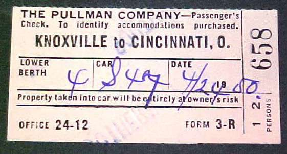
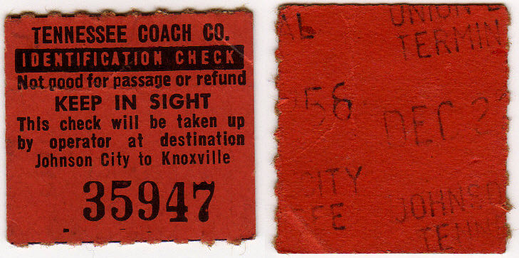
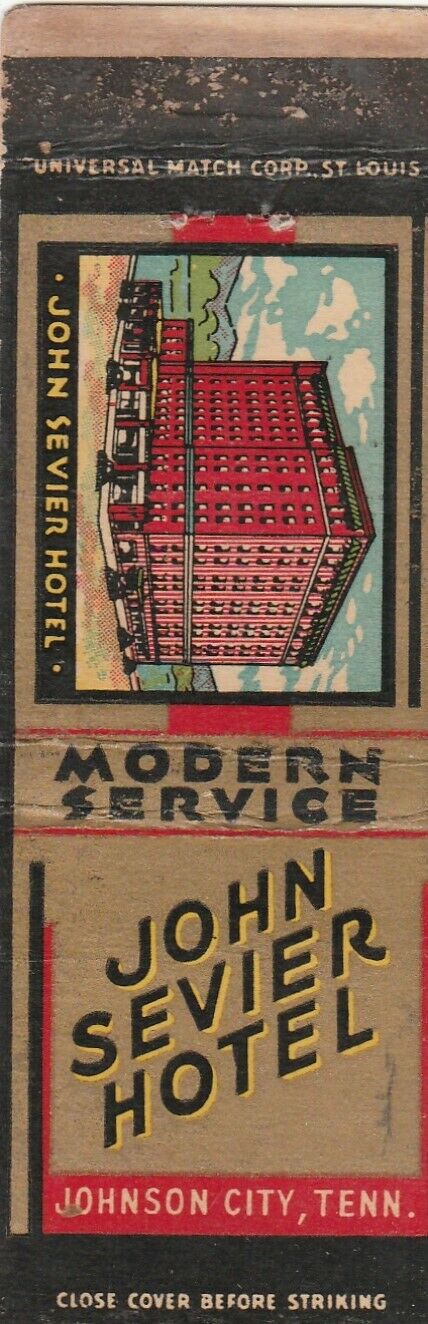
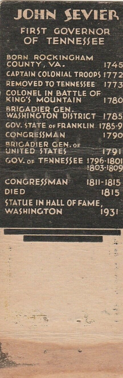
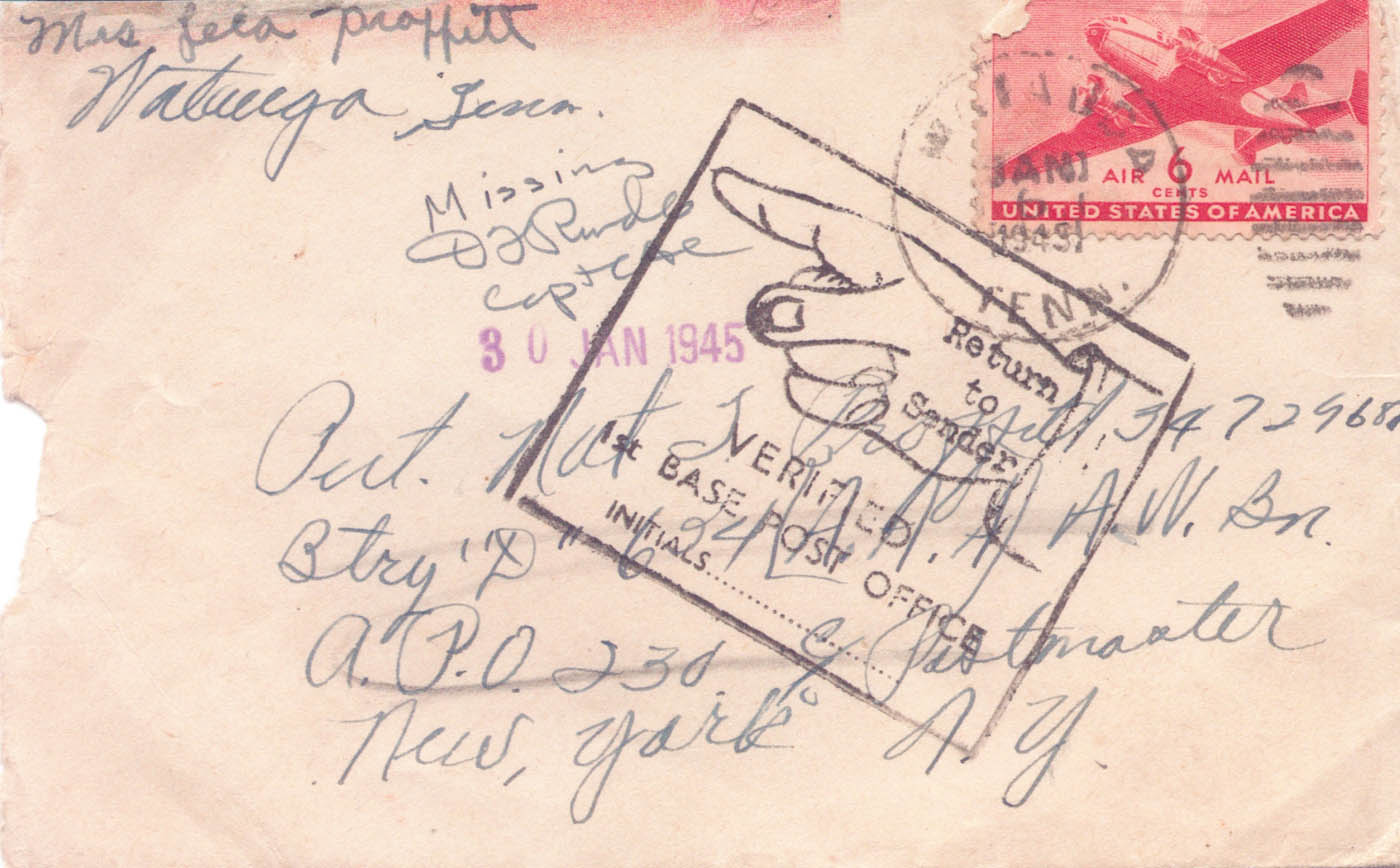
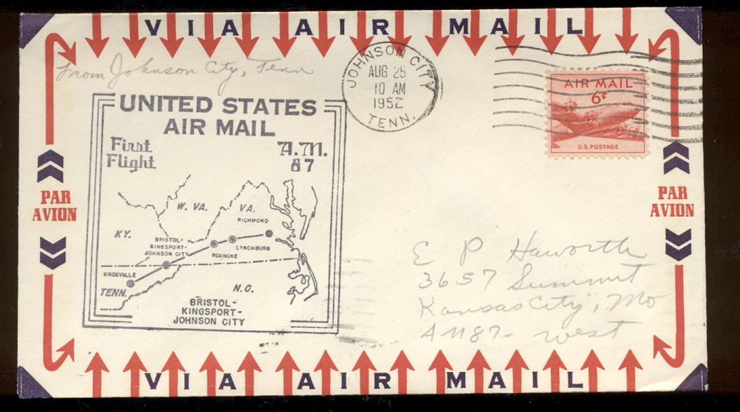
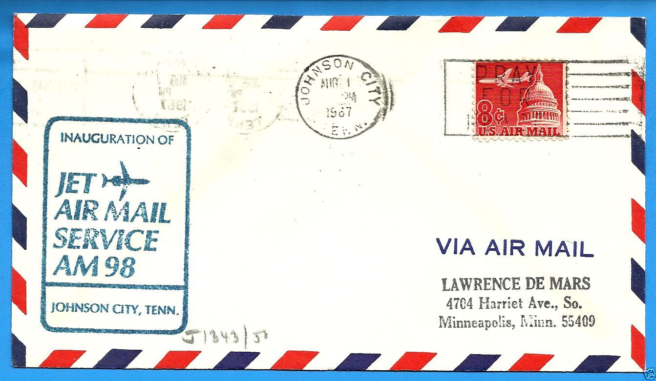
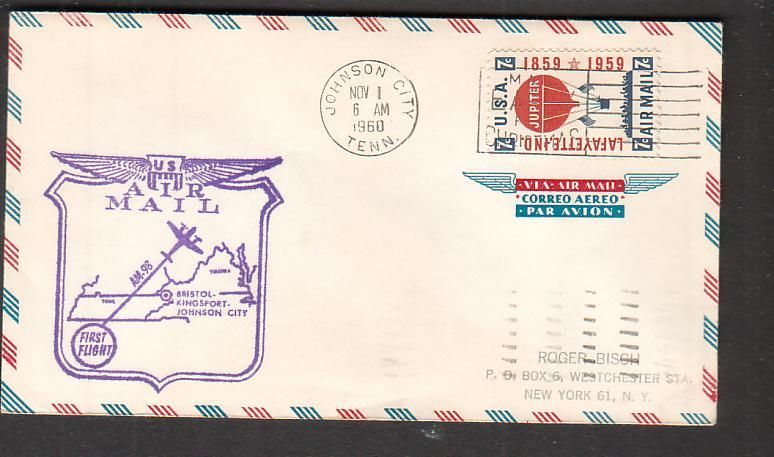
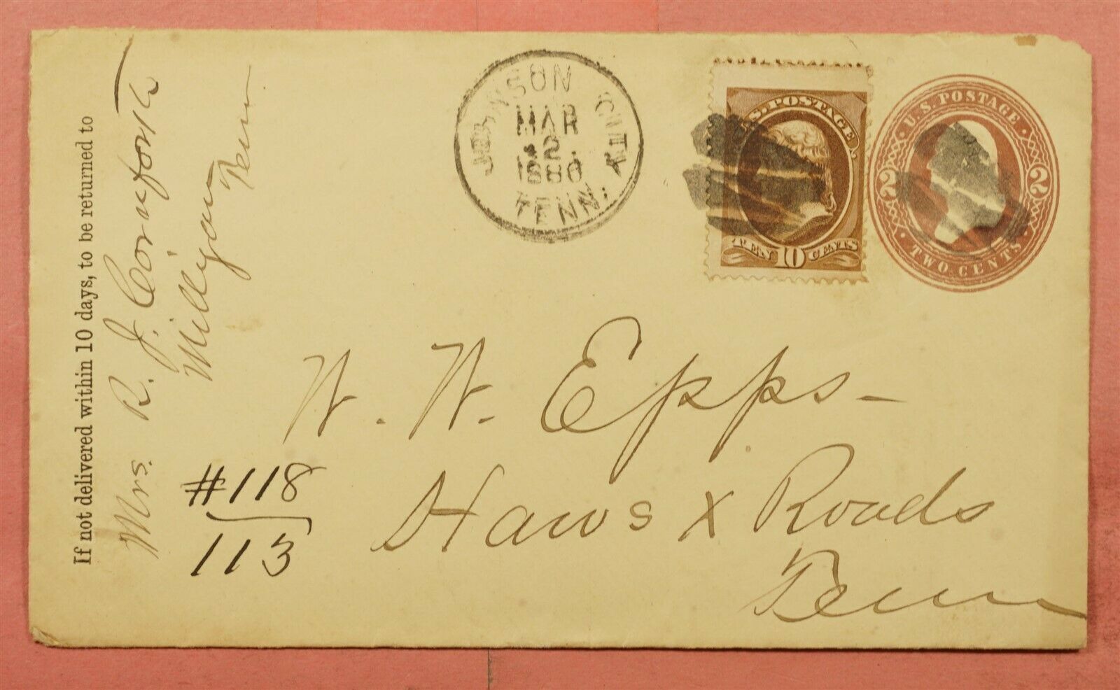
Tickets, Matchbook Covers, Letters, Etc....
From a variety of sources including EBay.
And some letters with a connection to Johnson City.....

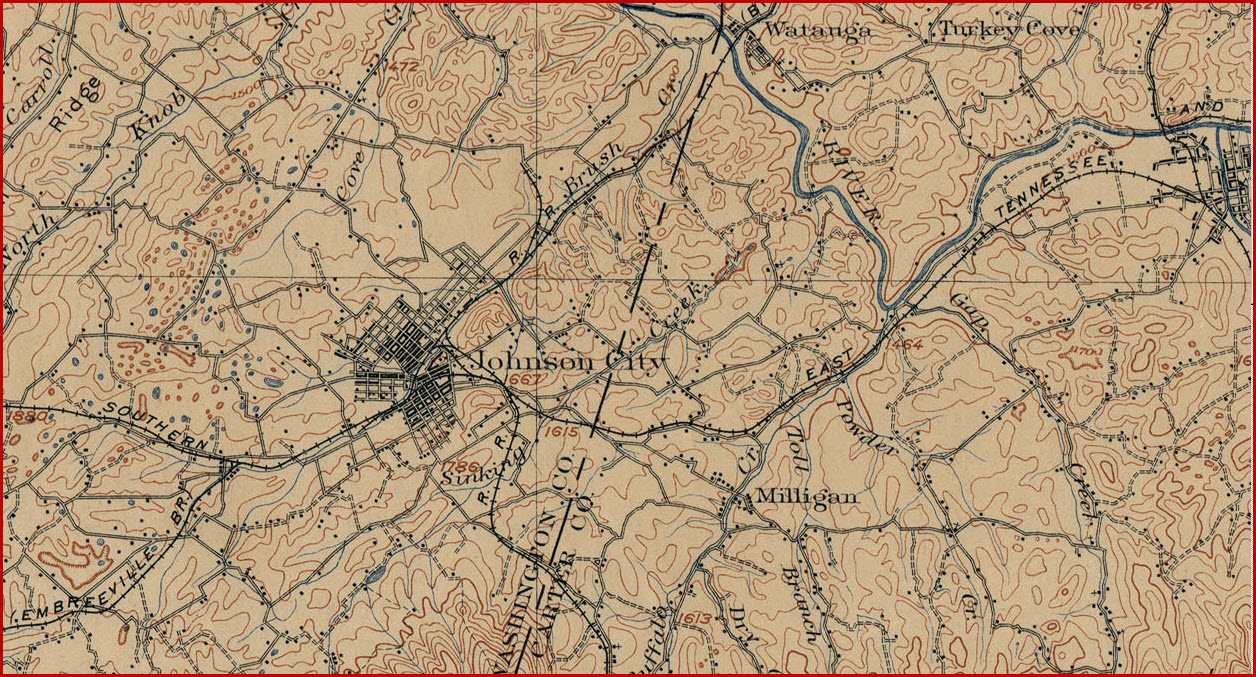
These maps are from 1902, and come from: http://www.lib.utexas.edu/maps/topo/topo_us.html
Disclaimers:
I love trains, and I love signals. I am not an expert. My webpages reflect what I find on the topic of the page. This is something I have fun with while trying to help others.
Please Note: Since the main focus of my two websites is railroad signals, the railfan guides are oriented towards the signal fan being able to locate them. For those of you into the modeling aspect of our hobby, my indexa page has a list of almost everything railroad oriented I can think of to provide you with at least a few pictures to help you detail your pike.
If this is a railfan page, every effort has been made to make sure that the information contained on this map and in this railfan guide is correct. Once in a while, an error may creep in :-)
My philosophy: Pictures and maps are worth a thousand words, especially for railfanning. Text descriptions only get you so far, especially if you get lost or disoriented. Take along good maps.... a GPS is OK to get somewhere, but maps are still better if you get lost! I belong to AAA, which allows you to get local maps for free when you visit the local branches. ADC puts out a nice series of county maps for the Washington DC area, but their state maps do not have the railroads on them. If you can find em, I like the National Geographic map book of the U.S..... good, clear, and concise graphics, and they do a really good job of showing you where tourist type attractions are, although they too lack the railroads. Other notes about specific areas will show up on that page if known.
Aerial shots were taken from either Google or Bing Maps as noted. Screen captures are made with Snagit, a Techsmith product... a great tool if you have never used it!
By the way, floobydust is a term I picked up 30-40 years ago from a National Semiconductor data book, and means miscellaneous and/or other stuff.
Pictures and additional information is always needed if anyone feels inclined to take 'em, send 'em, and share 'em, or if you have something to add or correct.... credit is always given! Please be NICE!!! Contact info is here
Beware: If used as a source, ANYTHING from Wikipedia must be treated as being possibly being inaccurate, wrong, or not true.
RAILFAN GUIDES HOME
RAILROAD SIGNALS HOME
NEW FEB14/2014, RENEW MAR23/2016, JAN09/2020, JAN02/2023, JUL27/2023
Last Modified 27-Jul-2023