
In General
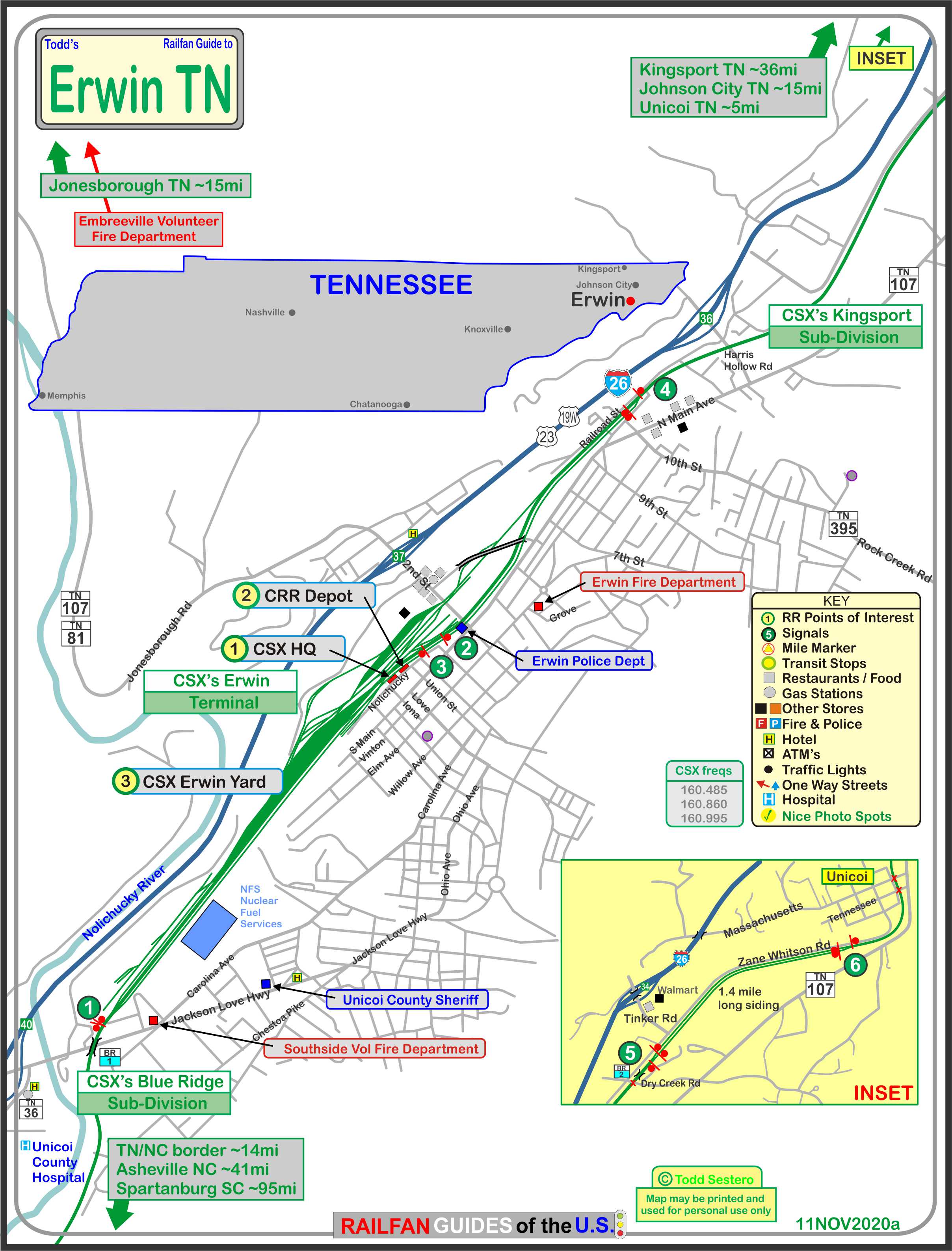
Getting Here
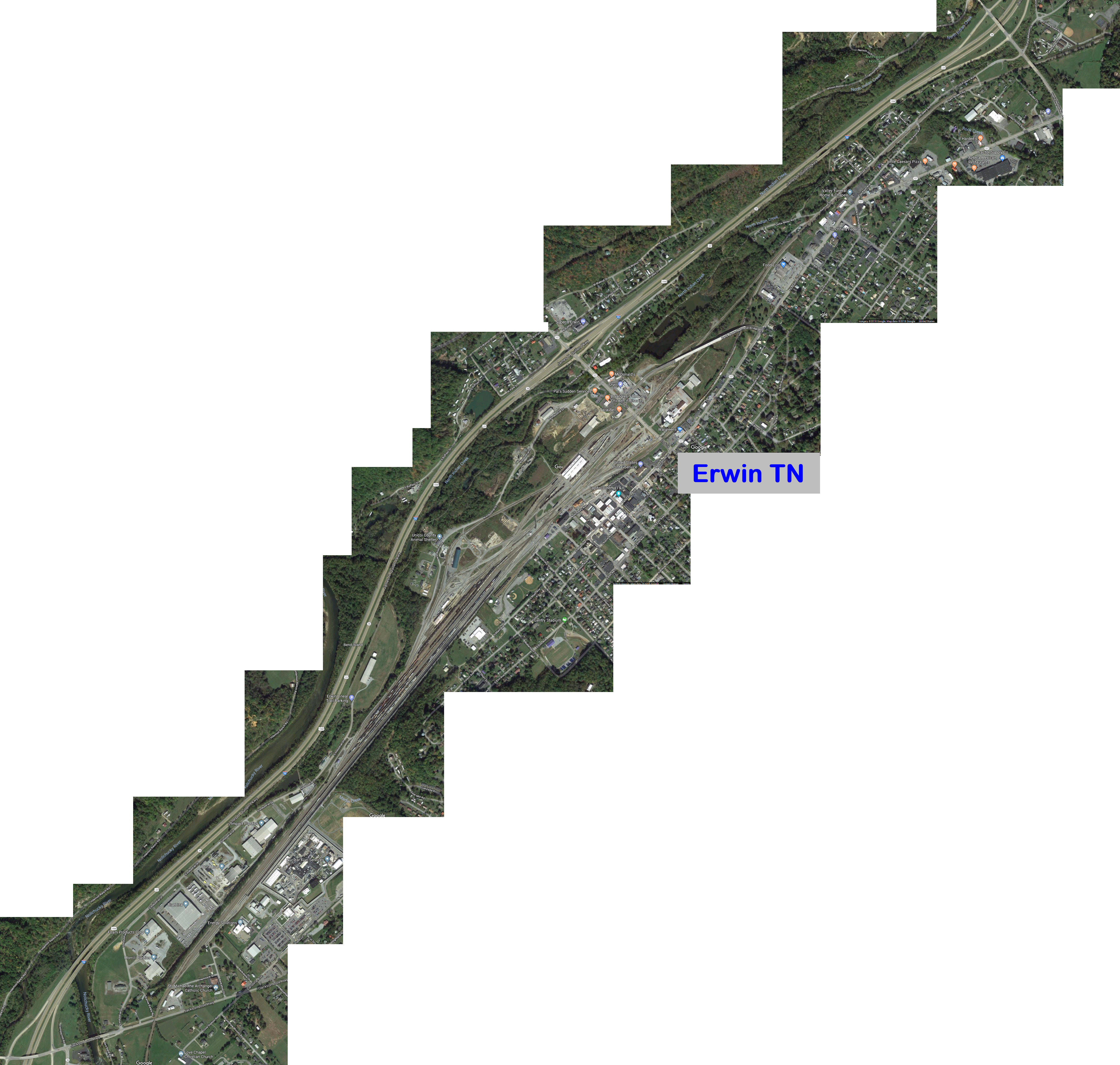
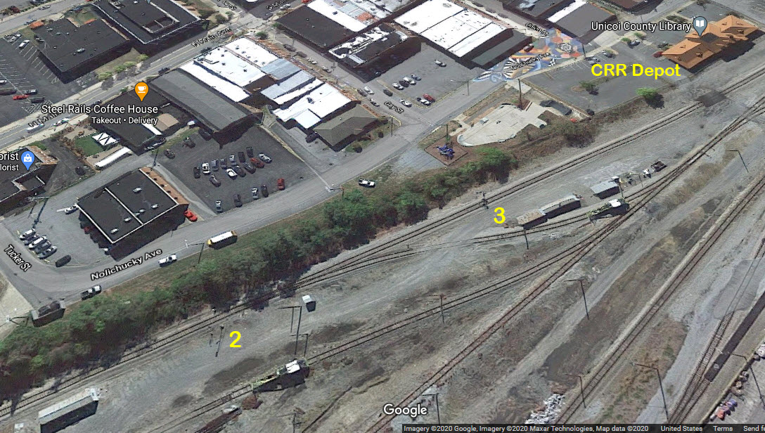
Map
Sights
Bridges
Signals
Fire & Police
Clinchfield History
Floobydust
USGS Maps
RAILROAD SIGNALS HOME
Location / Name:
Erwin TN, Unicoi County (59)
What's Here:
CSX Yard
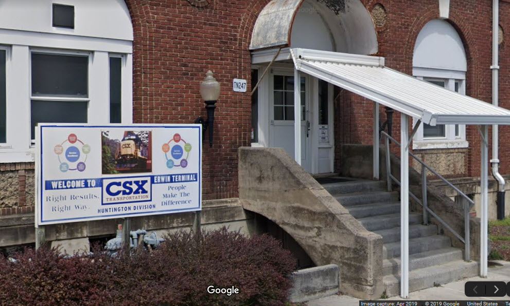
Former Clinchfield RR Headquarters
Sub-Division change point
Nuclear Fuels
Supposedly, the highest water falls east of the Mississippi is just south of Erwin
Data:
GPS Coordinates: as needed
Phone A/C: 423
ZIP: 37650
Scanner Freqs:
CSX: 160.230
Access by train/transit:
None
The Scoop:
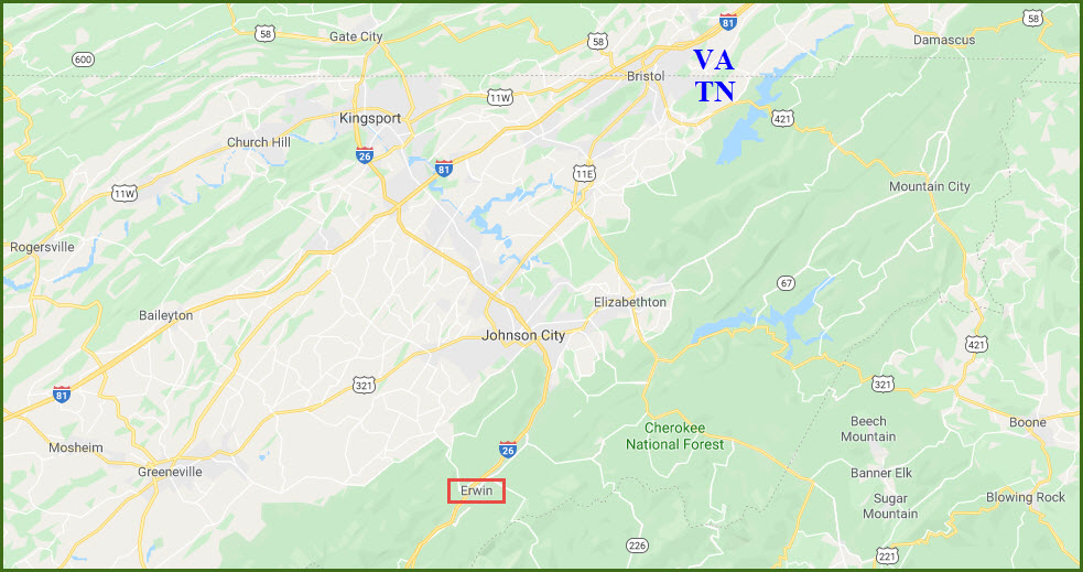
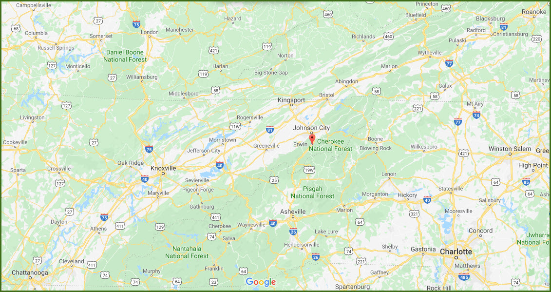
Erwin is a town of about 5,000 people, and is tucked away in the eastern part of Tennessee, south of Johnson City off Interstate 81. This area, although at first look in today's railroad picture, may not seem to have much to offer, but it is rich in history and gorgeous photo ops.
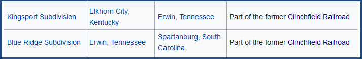
The Clinchfield was a coal hauling railroad, and Erwin used to be the headquarters of the CRR, prior to being absorbed by the Family Lines System in 1983. The 312 mile Clinchfield mainline is now part of the Huntington Division (formerly the Florence Division) of the CSX. From Erwin south to Spartanburg SC, it is the Blue Ridge Sub-Division, and northward it is the Kingsport Sub-Division to Elkhorn City KY. Erwin itself is the Erwin Terminal.
PS - the (Wikipedia) chart is wrong about the division name, so I can't be sure the sub-divisions are correct either.....
Today, with coal traffic way down, if not almost gone, there isn't a whole lot happening in Erwin.
Erwin is in the approximate middle of the railroad, and it's flatness made it a natural spot for putting a yard in.
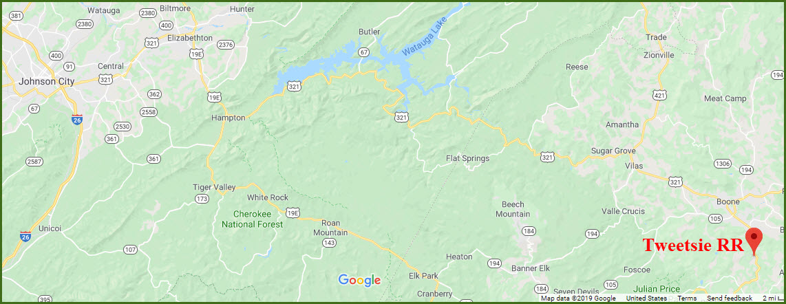
A "few" miles away (42 air miles, a lot more by road :-) to the east in North Carolina, is the Tweetsie RR. It opened in 1957, and was built on an extension of the original ET&WNC (the East Tennessee & West North Carolina RR) narrow gauge track in Blowing Rock NC. It has the only surviving narrow gauge steam locomotive from that railroad.
Railfanning Info:
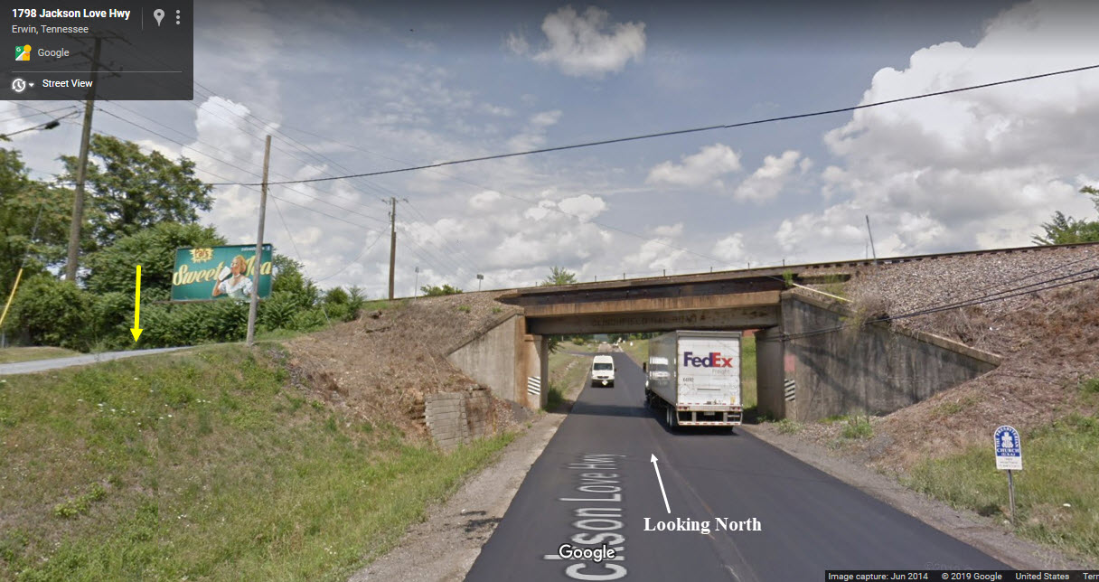
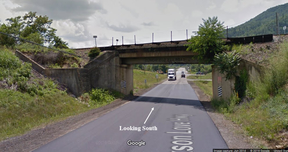
Exit 40 on the south end of Erwin puts you about 1900 feet from the CSX R-O-W. The Jackson Love Highway goes under the tracks with steep embankments and no convenient parking.
Exit 37 in puts you the middle of town on 2nd St and crosses the main line at the north end of the yard. Erwin put in a bypass over the tracks just in case a freight is coming thru, and is at the Shell gas station and 2nd St.
Exit 36, which puts you on Harris Hollow Rd and goes over the tracks in about 760 feet. It might be a good place for pictures if the sheriff doesn't chase you off the overpass, like NS did to me once in Knoxville, cause apparently there is a law that says you can't park on or close to an overpass (same thing happened to me in Bellevue OH too, BTW).
You will find most of the really photogenic photo ops outside of Erwin. There is no-way (without trespassing) to get pictures in the yard, as there are no public roads or access roads around it. There is one grade crossing at the north entrance to the yard, well, actually two, these are on 2nd St.
The old Clinchfield travels through some of the prettiest country when travelling south out of Erwin. Although good shots are difficult to obtain because most of the R-O-W is not close to the roads, the rewards for a little bit of hiking can be great! If you plan to chase the line south, check it out on Google or Bing maps first so you get an idea what to expect.
In Erwin, you don't have much that follows the tracks:
Sam Rogers Rd which follows it for about 5 blocks - north side Bailey Lane - south side
Grade crossings in Erwin are at (north to south):
GPS Coordinates: 36.168082,-82.388020 - Brown Rd
GPS Coordinates: 36.164358,-82.392204 - Fishery Park Rd (dunno what this one is like cause its at the very end of the road)
GPS Coordinates: 36.163059,-82.396077 - Harris Hollow Rd
You will find most of the really photogenic photo ops outside of Erwin. There is no-way (without trespassing) to get pictures in the yard, as there are no public roads or access roads around it. There is one grade crossing at the north entrance to the yard, well, actually two, these are on 2nd St.
The old Clinchfield travels through some of the prettiest country when travelling south out of Erwin. Although good shots are difficult to obtain because most of the R-O-W is not close to the roads, the rewards for a little bit of hiking can be great! If you plan to chase the line south, check it out on Google or Bing Maps first so you get an idea what to expect.
In Erwin, you don't have much that follows the tracks:
- Sam Rogers Rd which follows it for about 5 blocks - north side
- Bailey Lane - south side
Grade crossings in Erwin are at (north to south):
GPS Coordinates: 36.168082,-82.388020 - Brown Rd
GPS Coordinates: 36.164358,-82.392204 - Fishery Park Rd (dunno what this one is like cause its at the very end of the road)
GPS Coordinates: 36.163059,-82.396077 - Harris Hollow Rd (OVERPASS)(interchange 36 with I-26)
GPS Coordinates: 36.162353,-82.398593 - Sam Rogers Rd
GPS Coordinates: 36.160694,-82.401715 - Jackson Ave (Railroad St begins to follow tracks here - north end of double track too)
GPS Coordinates: 36.148908,-82.415823 - 2nd St (may be the best spot in town since its at the north end of the yard)
GPS Coordinates: 36.124205,-82.440156 - Jackson Love Hwy/Asheville Hwy (UNDERPASS)
GPS Coordinates: 36.114373,-82.441825 - Adkins Lane (Bailey Lane starts following tracks here)
GPS Coordinates: 36.107257,-82.444587 - Chestoa Pike
GPS Coordinates: 36.103287,-82.446288 - The Appalachian Trail!
GPS Coordinates: 36.099455,-82.443354 - Jones Branch Rd (UNDERPASS)
From this point, it crosses the Nolichucky River and becomes way difficult to follow along the river
"Up" in Unicoi, several roads follow the R-O-W:
Gouge Rd for a short spell
McCoury Lane (I think) for a short bit,
Grant St on the other side of the tracks from McCoury and Zane Whitson Rd (follows it quite a ways - almost into Erwin, on the west and north side of the tracks)
Grade crossings in Unicoi are at (north to south):
GPS Coordinates: 36.242006,-82.331951 - Garland Rd
GPS Coordinates: 36.226585,-82.339418 - Hensley Lane
GPS Coordinates: 36.217947,-82.343366 - Laughren Rd
GPS Coordinates: 36.210052,-82.347550 - Howard Gouge Rd
GPS Coordinates: 36.205395,-82.349267 - 173 (which is an interchange 32 with I-26)
GPS Coordinates: 36.201326,-82.350748 - McCurry Rd
GPS Coordinates: 36.196928,-82.351091 - Massachusetts Ave
GPS Coordinates: 36.195975,-82.350554 - Tennessee St
GPS Coordinates: 36.180857,-82.376883 - Dry Creek Rd (were about halfway between Erwin and Unicoi)
Other stuff:
In the day, the Clinchfield used to be the largest employer in Unicoi County.
The second largest employer in Unicoi County is Nuclear Fuels, which makes nuclear fuel rods for the Navy. Nuclear Fuels is the reason I made it down to Erwin, in the 1980 to 1984 timeframe, usually about three times a year.
Acknowledgements:
Ron Flanery
TC Caughman
Steve Patterson
Kyle Korienek
Dan Dover
Arnie Burchardt
Sandhi Kozsuch
Denver Todd
Google Maps
Bing Maps (of days yore)
Websites and other additional information sources of interest for the area:
https://charleston-cincinnati-chicago-clinchfield-railroad.com/
https://en.wikipedia.org/wiki/Clinchfield_Railroad
https://en.wikipedia.org/wiki/List_of_CSX_Transportation_lines
https://en.wikipedia.org/wiki/Interstate_26
https://en.wikipedia.org/wiki/Tweetsie_Railroad
Erwin is about 14 miles south of Johnson City TN using I-26, which in turn, is 15 miles south of I-81.
There are three exits for Erwin: exit 36 on the northside for Harris Hollow Rd, exit 37 dumps you off onto 2nd St, which puts you in the middle of town, and also crosses the R-O-W at the north end of the yard, and exit 40 puts you onto the Jackson Love Highway.
I-81 brings you in from the north, way north, like Harrisburg PA (~460mi), Scranton PA (564mi), Binghamton NY (~615mi), Winchester VA (~349mi), Staunton VA (~261mi), Roanoke VA (~190mi), and Bristol VA/TN (~47mi).
Coming in from the other direction on I-81, is Knoxville TN (~118mi), Chattanooga TN (~222mi), and even further away, is Nashville TN (~286mi). East of Knoxville, at Dandridge (I-40 exit 421), I-40 heads east, and I-81 takes over for the trek continuing NE towards Bristol and Roanoke VA. From Chattanooga to Knoxville, you travel on I-75 till it hits I-40 about 20 miles west of Knoxville. Be careful on this stretch of highway, because one of the worst fog areas in the country lies here around exit 36.
Getting to the Tweetsie RR from Erwin and Johnson City is easy - just take US 321 east out of JC, thru Elizabethton TN and Boone NC, and it is about halfway between Boone and Blowing Rock, right on 321.
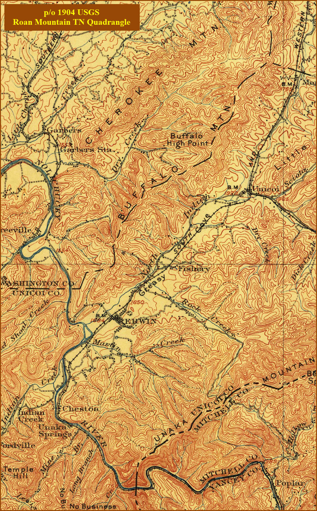
Map
The above map in PDF format is here
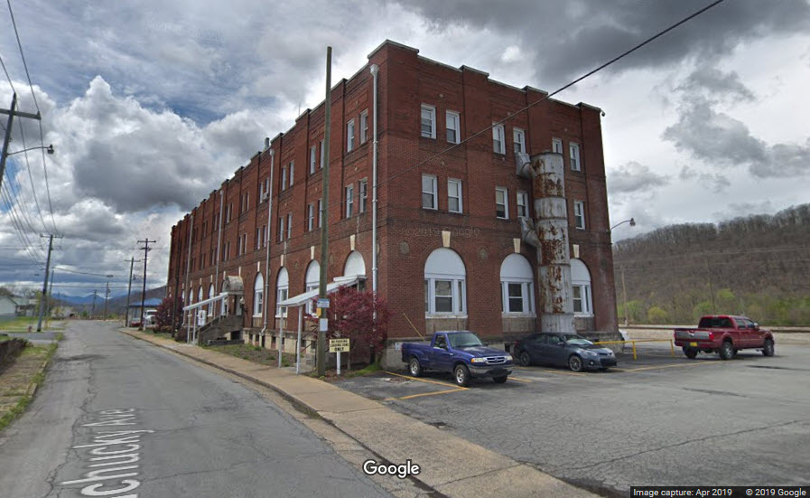
GPS Coordinates: 36.144683, -82.419475
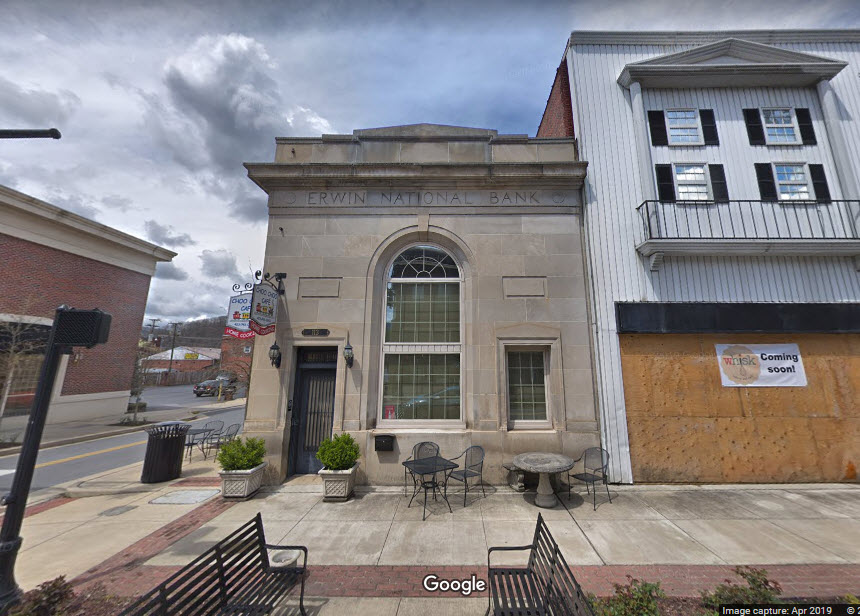
229 Nolichucky Ave, Erwin, TN 37650
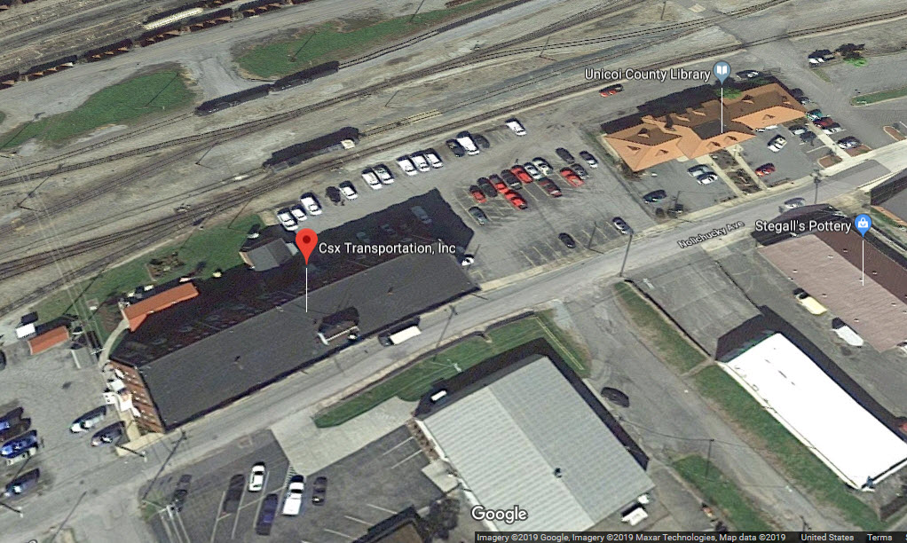
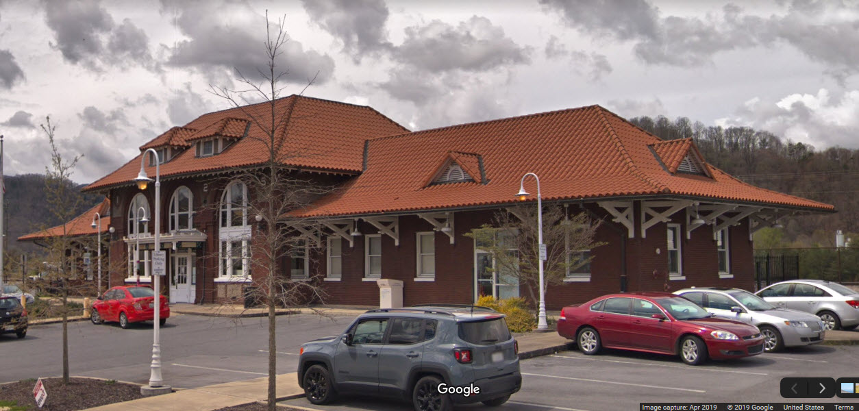
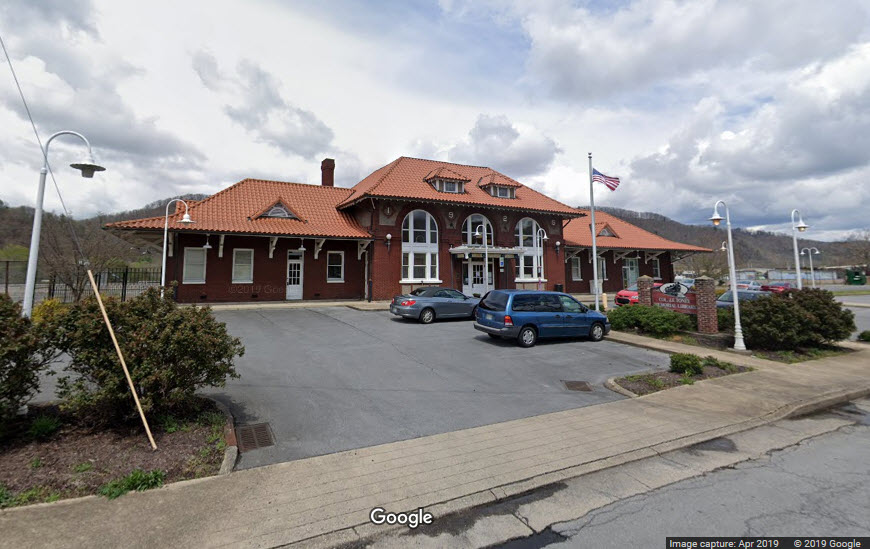
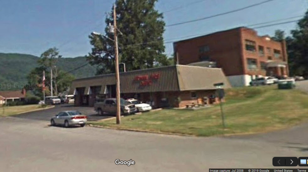
GPS Coordinates: 36.145308, -82.418717
201 Nolichucky Ave, Erwin, TN 37650
It is now the Erwin Library.
The yard stretches about half the length of Erwin, from around it's midpoint south. It has 22 tracks at its widest point, and stretches for about 1.6 miles, however, the bottom/southern end (3700 feet) is only seven (7) tracks wide.
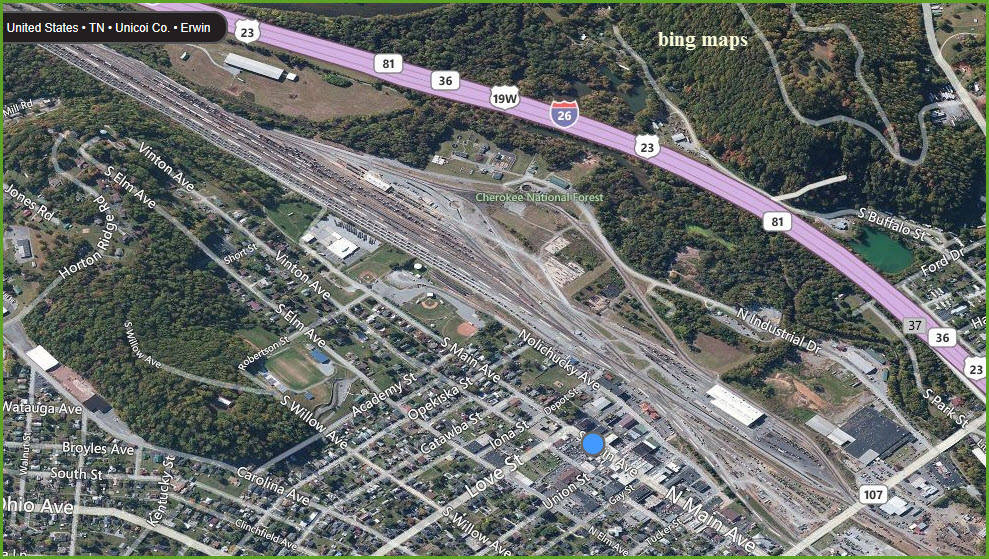
The following picture is a huge JPEG, and needs to be downloaded and expanded to see the detail. It is from BING MAPS when they were an excellent resource, unlike now.
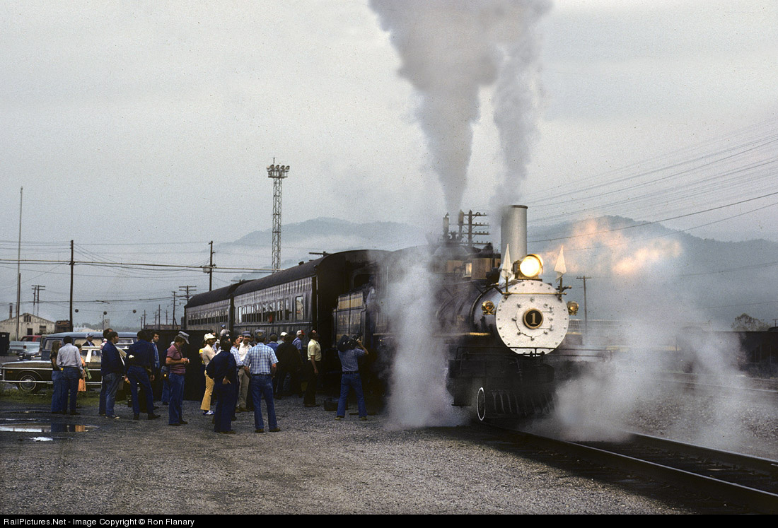
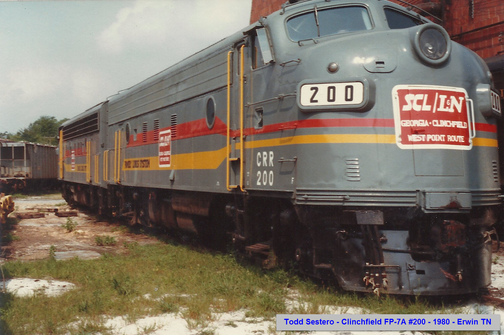
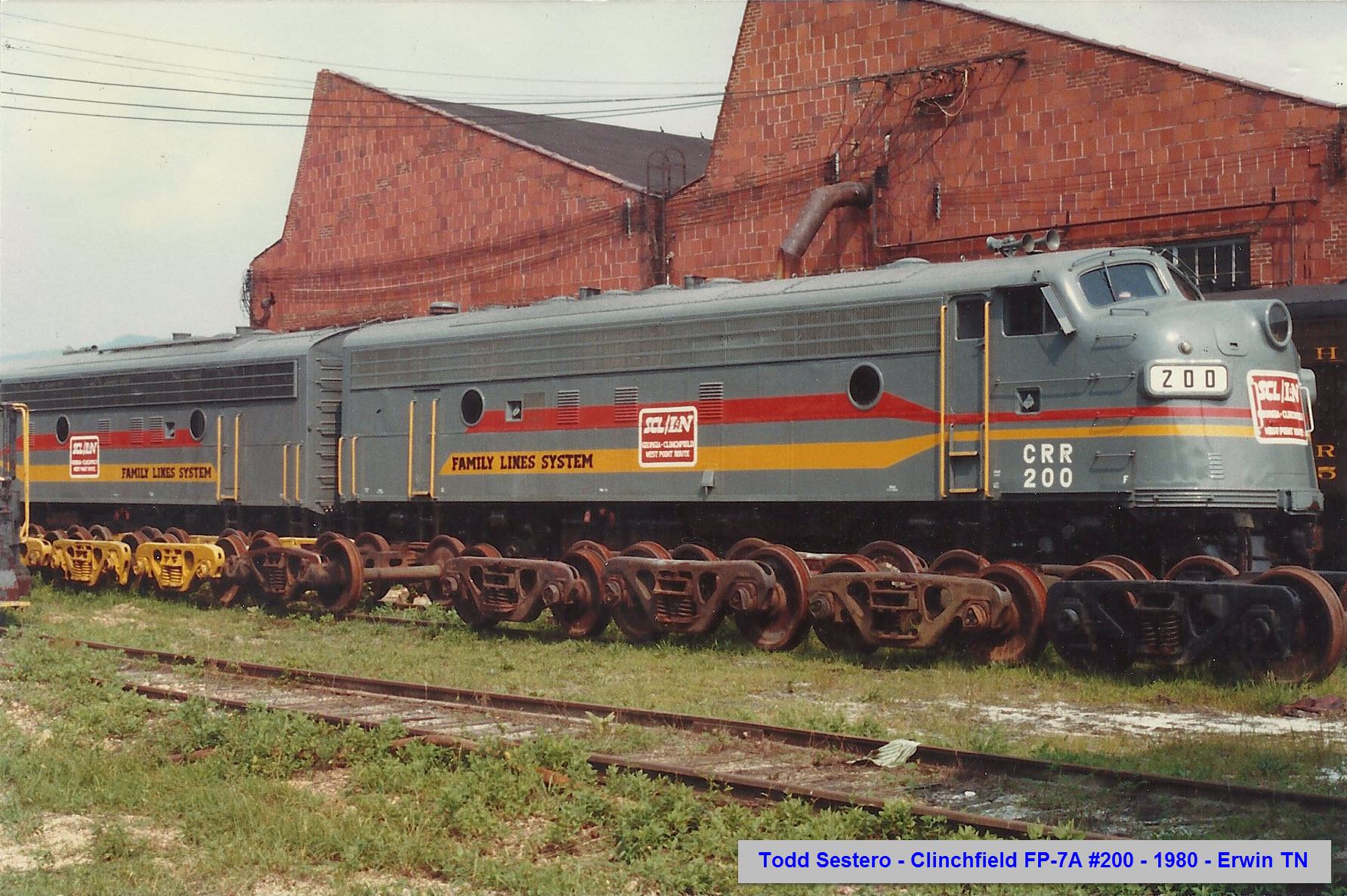
Clinchfield #1
Clinchfield #1 used to be Erwin's pride and joy until CSX yanked it out and gave it to the B&O Museum in Baltimore. When I was down at Nuclear Fuels in the 80-84 time period, they sure were pissed about it since I was from Baltimore and that's where CSX took it to (being a yank from NYC didn't help either! :-). I hope they have gotten over it by now :-)
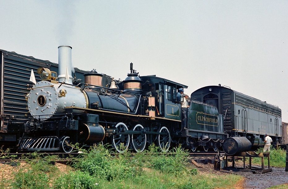
Jun 1978. Clinchfield Ten-Wheeler No. 1 is enveloped in a cloud of its own making. This is early on a June morning at Erwin, and the "One Spot" is ready to load passengers for an all-day round trip to St. Paul. This charter for the East Tennessee Chapter of the NRHS will be steam-only. The two loaded heavyweight coaches are all the diminutive steamer can handle on the grade up to Unicoi. Already anticipating a heavy work out, fireman George Hatcher has the engine's safety valve lifting. His brother, Ed, will do the running. The duo gained some degree of fame during the heyday of the Clinchfield's steam excursion program.
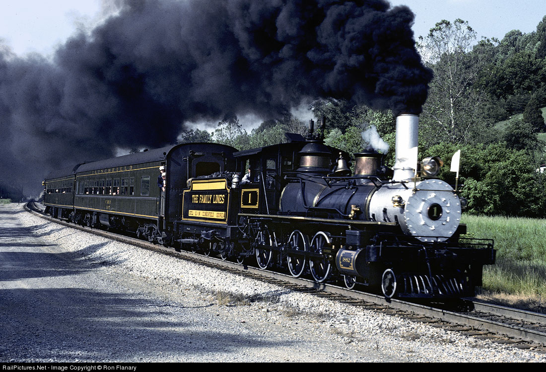
Jun 1978. Fireman George Hatcher is throwing the bituminous into the firebox of Clinchfield's "One Spot" on the last downgrade into Erwin. From here on in, however, it's all downhill. This was an all-day steam-only R/T to St. Paul, VA, sponsored by the ET Chapter, NRHS.
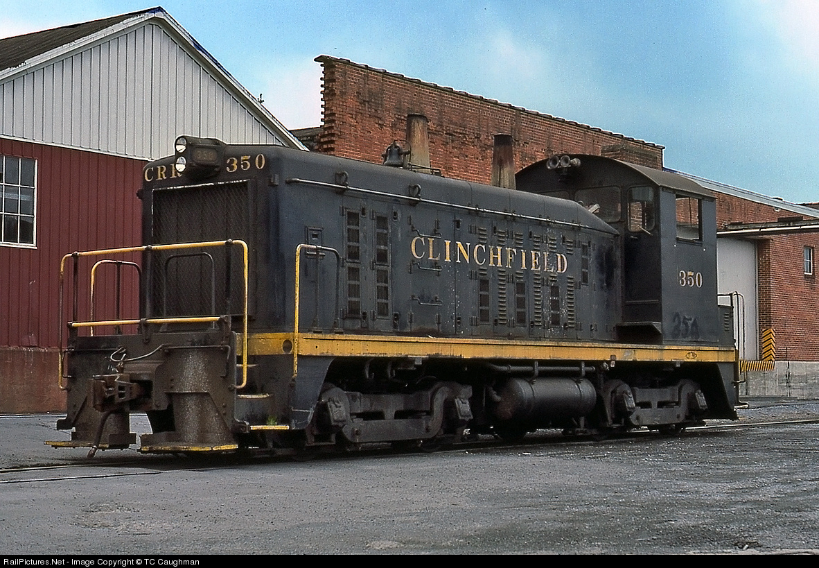
Clinchfield Stuff
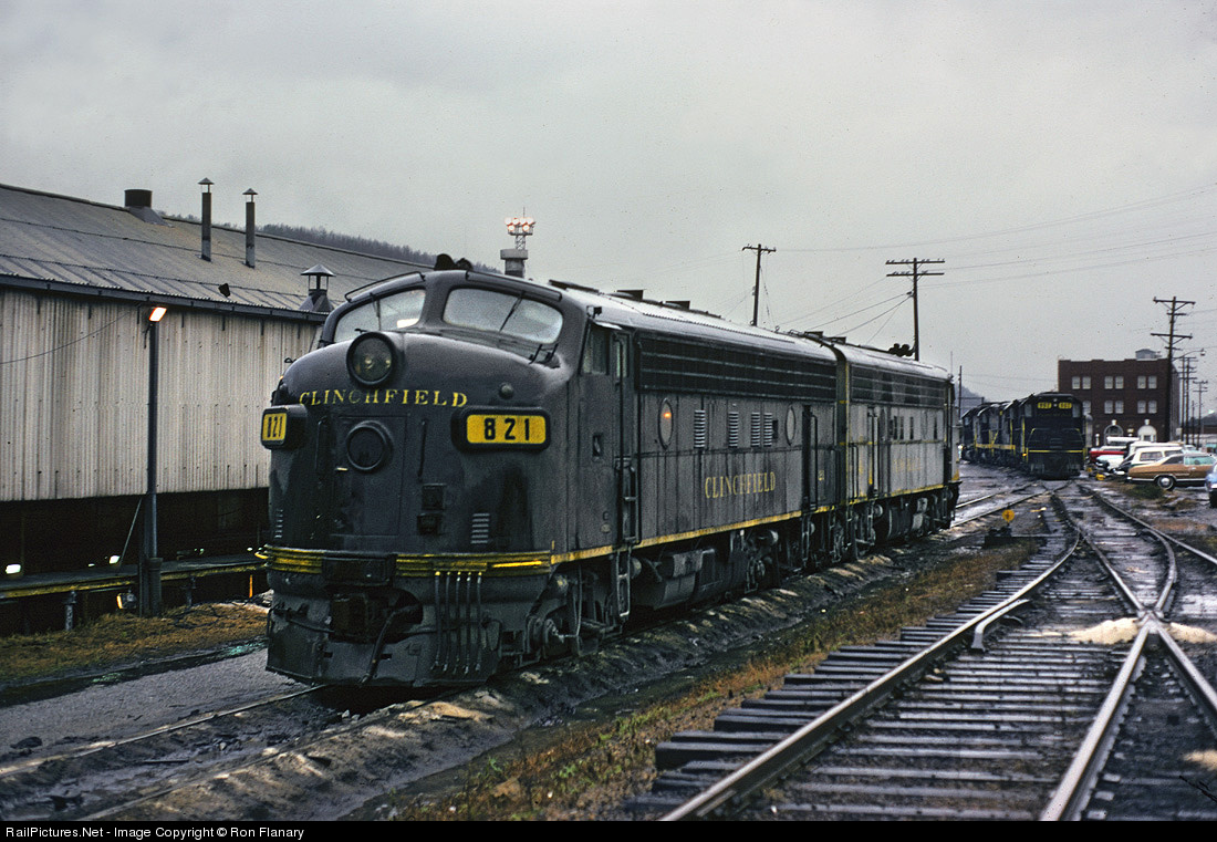
Jan 1975. Clinchfield F7A 821 had a truly interesting history. It was built in 1949 for the Nashville, Chattanooga & St. Louis Railroad as its 814. The NC&StL used its F-units for both freight and passenger service, so the 814 regularly led top-flight passenger trains like the Dixie Flagler, New Dixieland and Georgian in its career. When the road was merged into the L&N in 1957, the unit was renumbered to 1814. It was sent to ACL's Waycross Shop in 1965 where it was rebuilt, and renumbered to Clinchfield 821. In late 1977, it was painted light blue and lettered for Clinchfield Coal Company (no corporate relation) for radio-controlled loading of coal hoppers near Nora, VA. Several years ago it was rescued and sent to TVRM in Chattanooga, where it presumably still rests---un-restored.
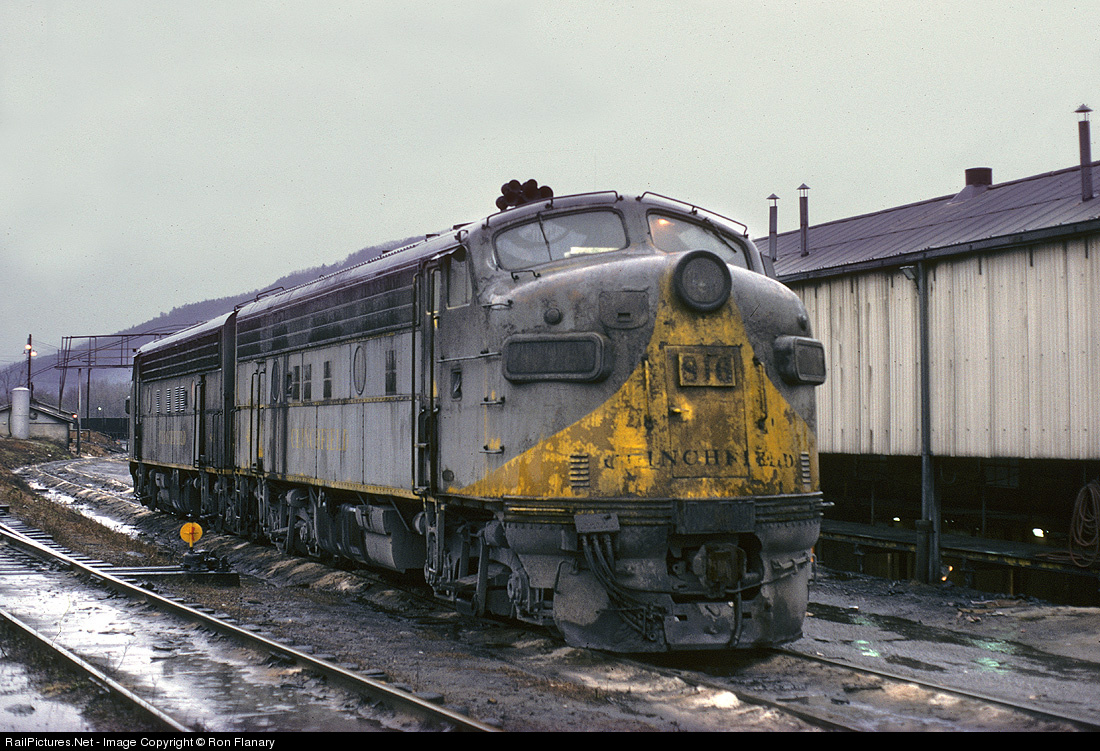
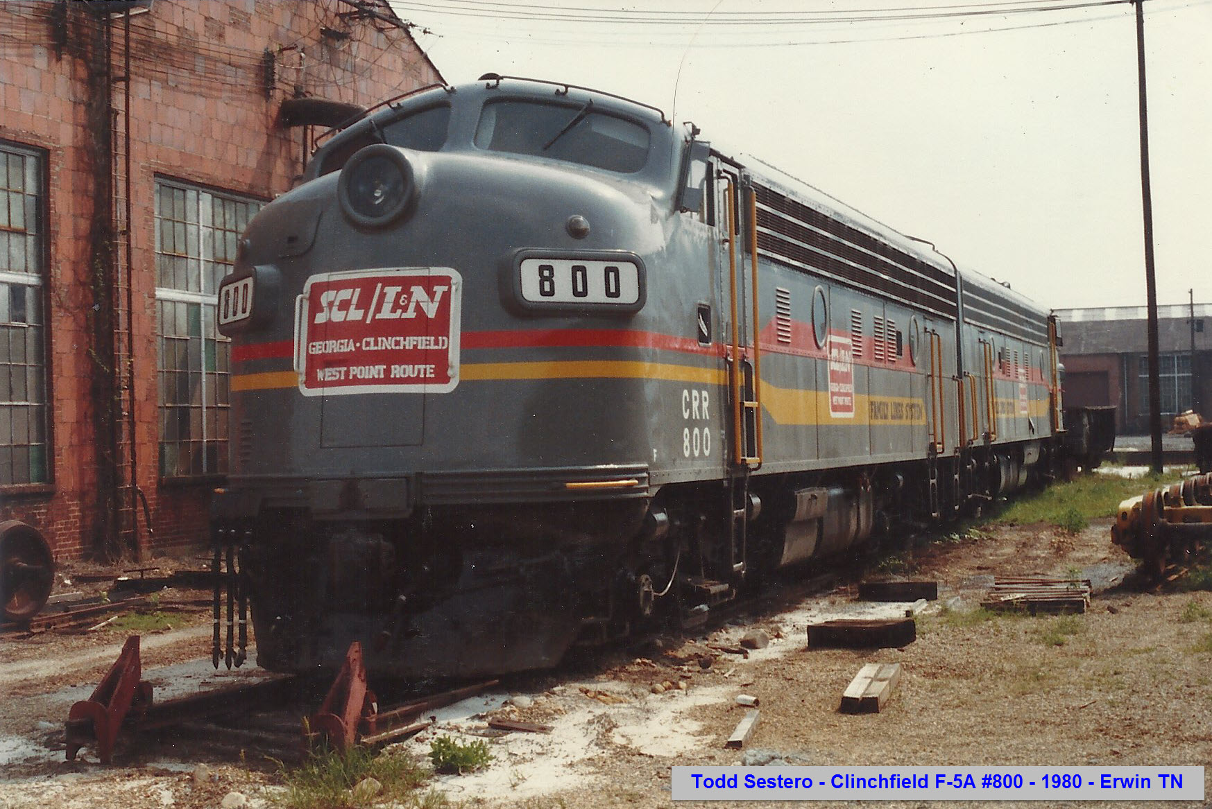
Jan 1975. On a particularly grubby and rainy January day in 1975, two well-traveled Clinchfield F-units are lined up for service on the east side of the old diesel shop at Erwin. The 816 was one of just a handful of units still wearing gray and yellow, but she has obviously been through the grinder of dragging tonnage through the Appalachian mountains. She has less than three years left, and will go to EMD on trade for an Seaboard Coast Line MP15.
Aug 1976. At the shops in Erwin. Photo by TC Caughman.
May 1975. Headed into the terminal in Erwin.
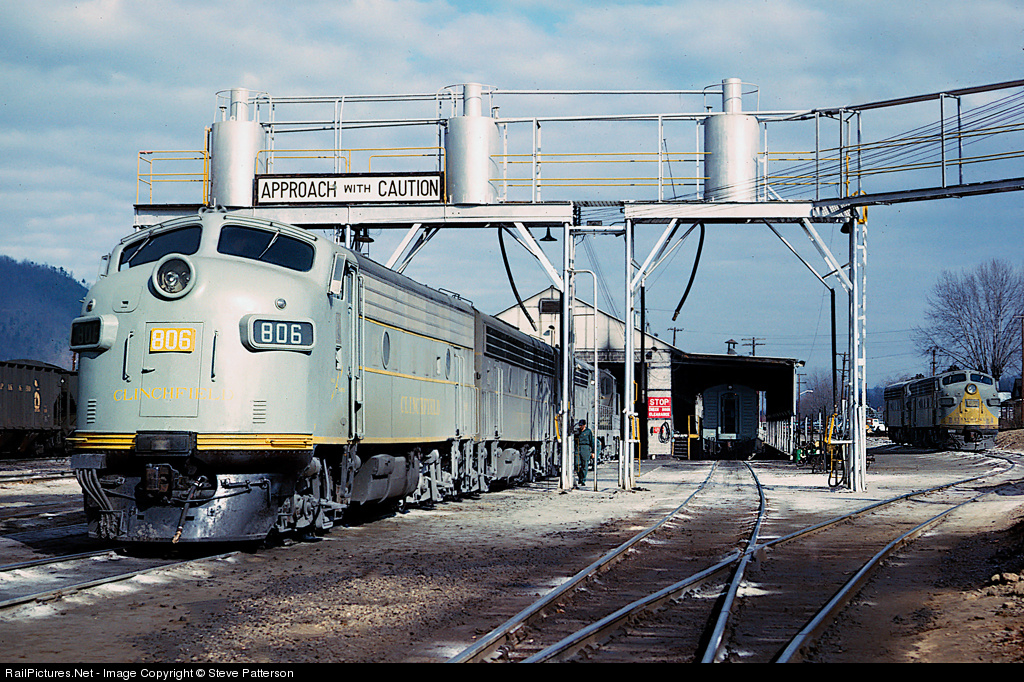
CRR 806 F unit has emerged from the paint shop without its yellow breast, and is being refueled at Erwin, Tenn. before taking a coal train south on Jan. 8, 1965. Photo by Steve Patterson.
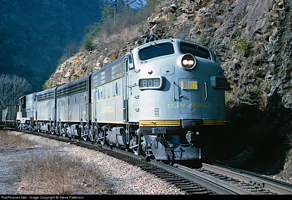
Clinchfield 806 and its EMD mates left Erwin less than 6 miles behind with coal Train 22 to get a run for the Blue Ridge. The train is about the cross Tennessee's Nolichucky River behind the camera at Unaka Springs and begin its 47-mile climb in earnest on Jan. 8, 1965. Photo by Steve Patterson.
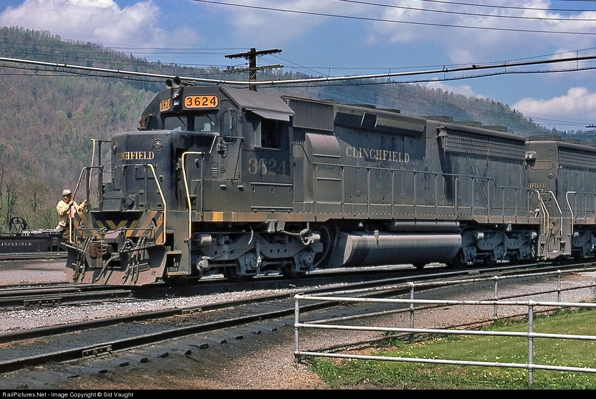
A trio of mixed Clinchfield power moves through a switch in the yard in Erwin, TN. This was a typical style lashup for the Clinchfield during this time, as management and yardmasters took the idea of "horsepower is horsepower", and as a result, whatever was available, was used. Photo in the collection of Kyle Korienek. Jun 1972.
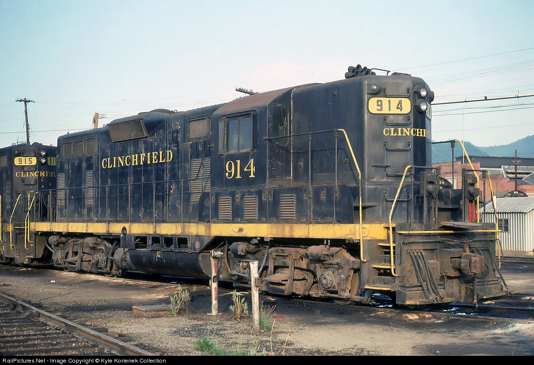
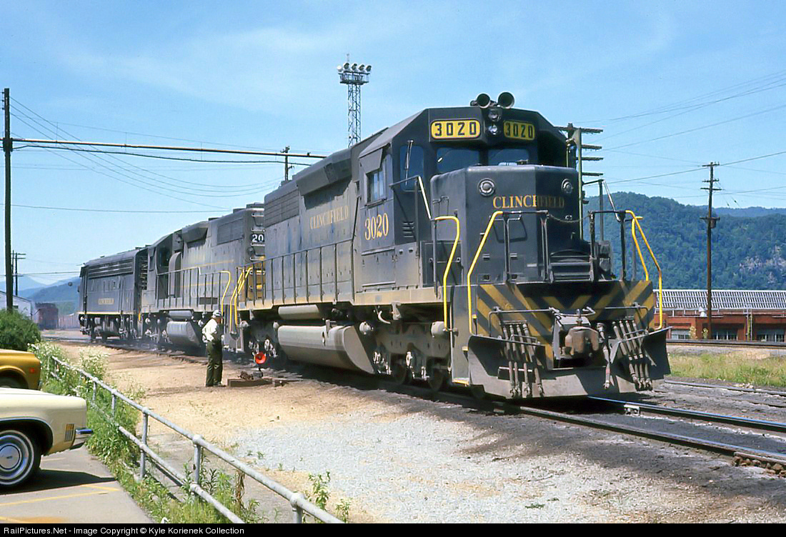
When the Clinchfield took delivery of their new GP7's in December 1950, it did not take management and crews to realize that they should have purchased the units with dynamic brakes. With the next round they purchased in 1952, they were equipped with dynamic brakes, but still did not meet the expectations that management desired for them. Despite this, the first generation geeps lasted well into the 70's, and several of them underwent rebuild programs in Paducah, KY on ICG and Tampa, FL in the Uceta shops on SCL. Here, 914, a second round purchase of GP7's sits in Erwin, TN. and has been painted in black and yellow, and 2 years from the time of the photo, the unit would be sent to Tampa and was rebuilt into a GP16. Photo in the collection of Kyle Korienek, photo by Arnie Burchardt. Aug 1978.
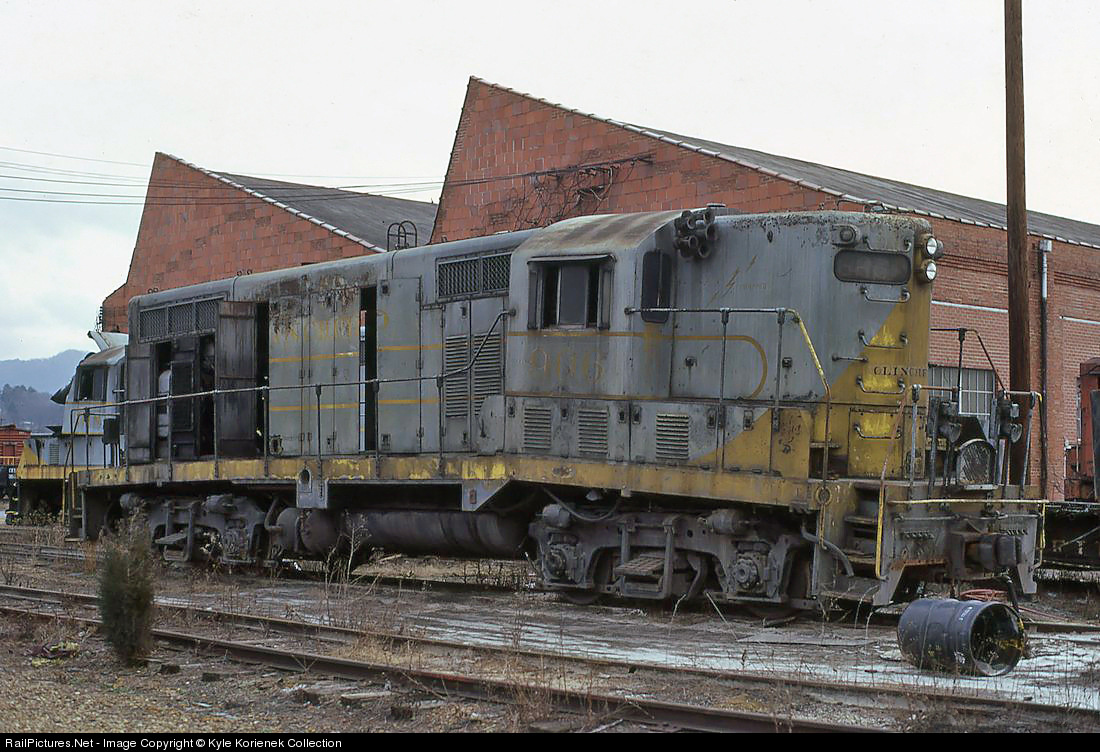
On July 3rd, 1972, Clinchfield RR. GP7 906 was involved in a crash in the yard in Elkhorn City, KY. When a cut of hoppers got loose in the yard and crashed into the locomotive servicing area on the north end. 906 received a very badly bent frame, as evident from the severe crown it is showing. The unit was eventually scrapped in 1973, and the carbody was sold to the Illinois Central Gulf, likely to be used at their Paducah facilities, which were well known for their rebuilding skills. Photo in the collection of Kyle Korienek, photo by Dan Dover.
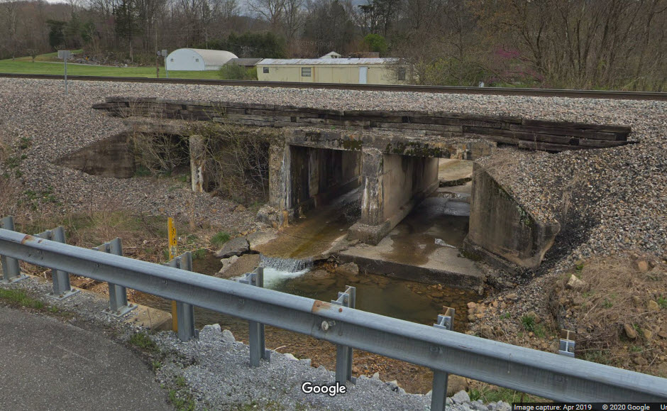
One would think, that for such a mountainous region, there would be a lot more bridges than there are in the Erwin area, but there isn't.
GPS Coordinates: 36.124206, -82.440168
The south side of the overpass is easiest to access, from the service road, where you can pull off onto the shoulder.
GPS Coordinates: 36.181216, -82.376487
South of Unicoi.
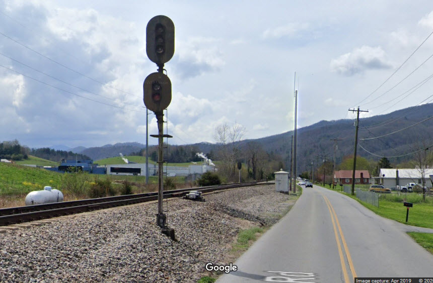
I could use additional pictures, especially the signals in Erwin, thanks.
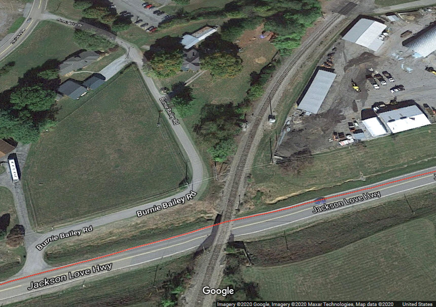
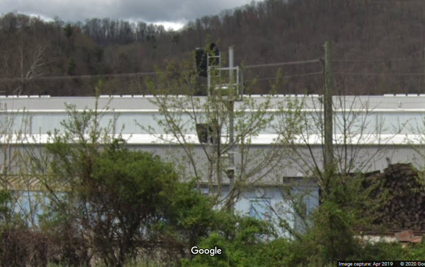
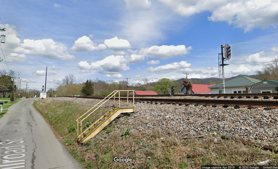
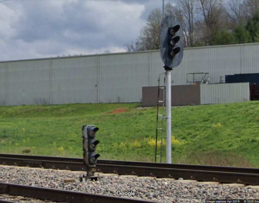
These are in south Erwin, off Jackson Love Blvd where the railroad goes over the road. This screen grab is from a 2008 Streetview, so the resolution is not all that good.
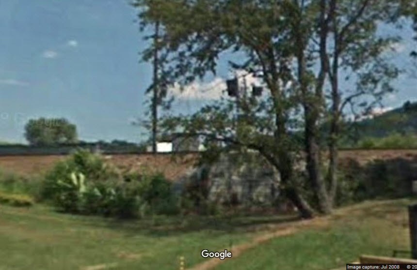
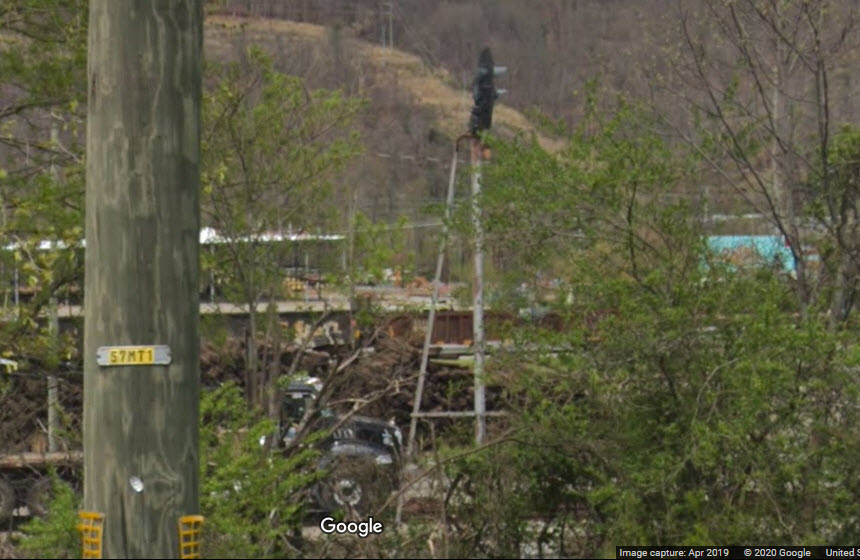
Located behind the playground next to the former CRR Depot. Need better pictures if anyone is in the area.
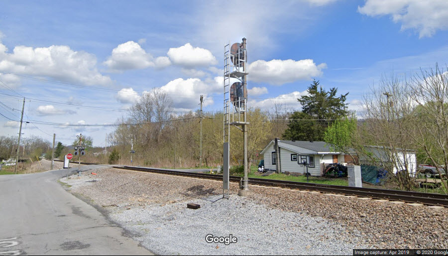
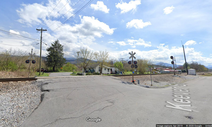
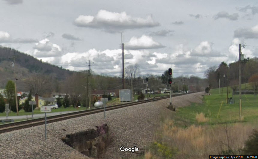
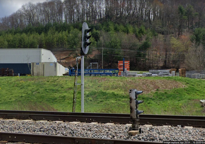
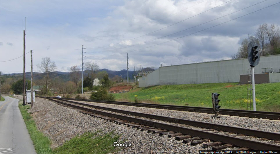
The SB single track line coming from Johnson City goes to two tracks. We still have the old Clinchfield signals here, with a dwarf for the NB secondary track. The grade crossing does not have any crossing gates, just lights. The track runs between Railroad St and Jackson Ave.
GPS Coordinates: 36.181780, -82.375897
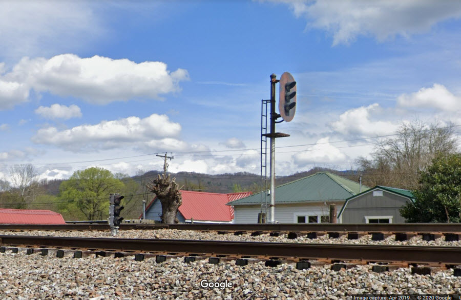
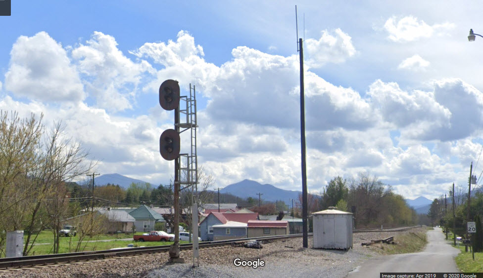
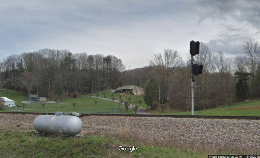
This is the south end (near Tinker Road) of a 1.4 mile long siding that begins in Unicoi. We still have the old Clinchfield signals here, with a dwarf for the siding and a doll post for the main track. The track runs along Zane Whitson Dr, and is VERY convenient because of exit 34 off the interstate.
GPS Coordinates: 36.191559, -82.355301
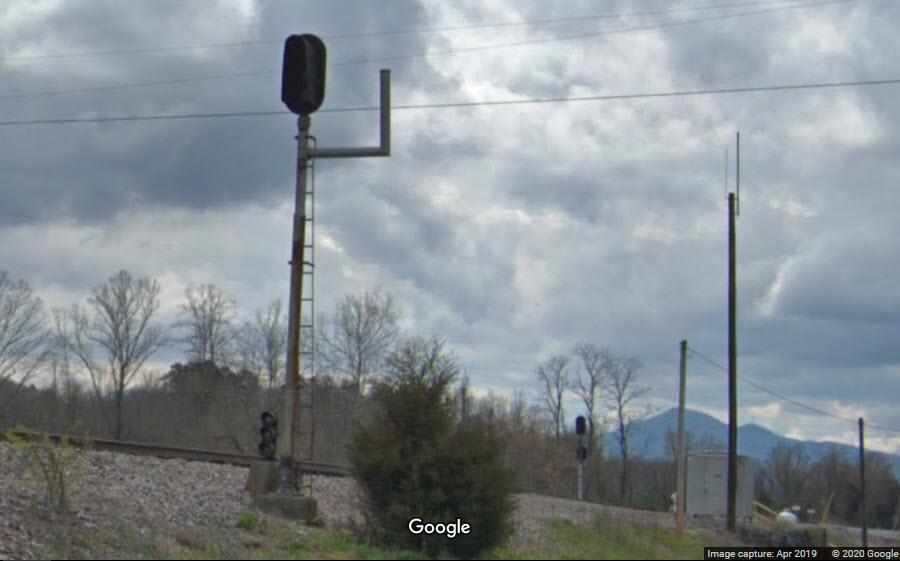
This is the north end of the 1.4 mile long siding, we're in "south" Unicoi.
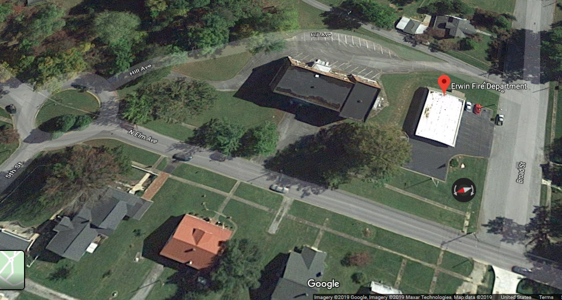
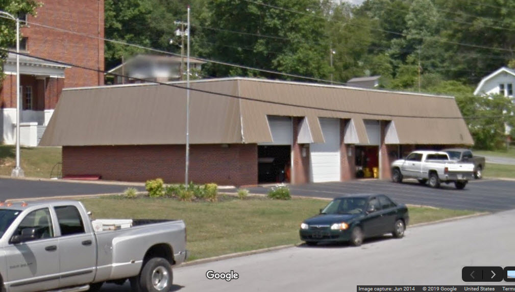
Here are the three fire stations in and around Erwin:
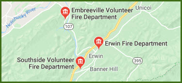
Erwin Fire Department
GPS Coordinates: 36.148554, -82.409324
305 Broad St, Erwin, TN 37650
423-743-3131
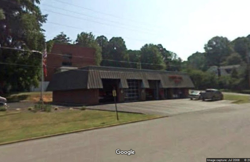
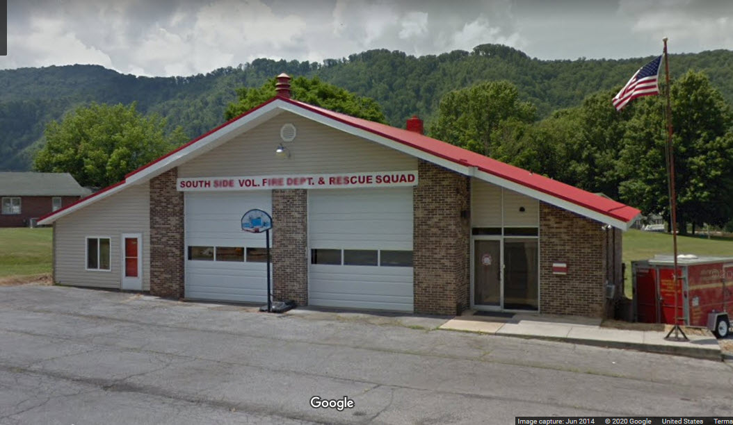
Southside Volunteer Fire Department
GPS Coordinates: 36.125686, -82.435726
1295 Carolina Ave, Erwin, TN 37650
423-743-5994
Erwin Police Department
GPS Coordinates: 36.147299, -82.414732
211 N Main Ave, Erwin, TN 37650
423-743-1870
TN Highway Patrol
111 Church Ave, Erwin, TN 37650
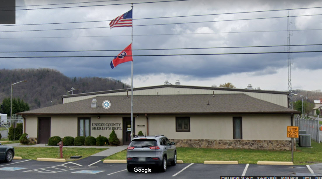
Unicoi County Sheriff
GPS Coordinates: 36.127738, -82.428055
1570 Jackson Love Hwy, Erwin, TN 37650
423-743-1850
From Johnsons Depot dot com.....
South Carolina Senator John C. Calhoun championed a railway from Charleston SC to Cincinnati OH during the 1830s to connect South Carolina with key markets in other states via inland river routes and emerging railroad systems. This vision was not fulfilled until 1909 when George L. Carter completed the Carolina, Clinchfield, and Ohio Railway, a 242-mile railroad straight across the Blue Ridge Mountain range from Dante VA to Spartanburg SC. Six years later in 1915, the final 35 miles were completed northward to Elkhorn KY. The name "Clinchfield" is derived from the coal region of Virginia as the railroad carried the products of the Clinchfield Coal Corporation from the coal fields and mining camps of that region to distant markets in need of coal for fuel.
And what a railroad it was. The Clinchfield line was designed and built by Chief Engineer Martin J. Caples to construction standards unheard of for its time. This railroad almost a century after its completion, remains a marvel of construction and civil engineering as it forms the backbone of the CSX railroad system today.
More Details from them:
The Carolina, Clinchfield and Ohio Railway was envisioned in the early nineteenth century as a transportation and commercial route from the Ohio Valley to Charleston, South Carolina, but the Appalachian mountain barrier made its completion a formidable task. Civil War General John Wilder organized interested capitalists and formed the Charleston, Cincinnati, and Chicago Railroad Company on September 30, 1886 (referred to as the Three "Cs"). It was incorporated by the state of Tennessee March 29, 1887. After completing track from Marion to Kingville, North Carolina and from Johnson City to Chestoa, Tennessee, the company suspended operations in the early 1890s. General Wilder and his business partners lost personal fortunes and Johnson City's first economic boom was over. It was uncertain if anyone would or could attempt to fulfill John Wilder's dream of the great Appalachian Mountain railway.
In July 1902 George L. Carter and associates purchased the Ohio River and Charleston Railway Company (the remnants of the failed Three Cs line) reorganizing it as the South and Western Railroad. This sparked an intense rivalry with the Southern Railroad, which made every effort to stop Carter's venture, and even announced and initiated plans to build a competing railway extension along the same route as the South and Western. Under Carter's direction, the railroad extended rapidly northward toward the coalfields and southward toward the Blue Ridge Mountains. Carter secured financing from Thomas Fortune Ryan of New York and what was at the time billed as "The Costliest Railroad in America" was in full motion. By 1908, when the company became the Carolina, Clinchfield and Ohio Railway (CC&O), the rail line stretched from Dante, Virginia to Spartanburg, South Carolina. General offices of the Clinchfield were in Johnson City where George L. Carter resided from 1906 through 1916.
Massive celebrations were held in 1909 in both Johnson City and Spartanburg commemorating the completion of the CC&O Railway. In Johnson City one of the most elaborate gatherings in the City's history took place on April 15 at the Hotel Carnegie with the Presidents of Johnson City's three railroads attending. Congressman Walter P. Brownlow was Master of Ceremonies and speeches, toasts, a banquet meal, and fine cigars were smoked long into the night. Johnson City's most prominent business leaders attended as well as one special guest: General John T. Wilder, the man who started the great railroad and failed to complete it, was honored and made a speech. In Spartanburg thousands of people attended the events held on October 29 and over 1,500 persons attended a barbecue celebrating the first train to arrive on the CC&O Railway.
George L. Carter and his scenic Clinchfield Railroad shaped Johnson City's destiny more than could have been envisioned in 1909. The Clinchfield gave Johnson City access to its second trunk line (in addition to the Southern) with the ET&WNC being the connector line serving both larger railways. The relationship of the three railway lines and the strategic location for regional commerce in the vicinity of Henry Johnson's Depot resulted in another decade of growth. As was true with most of the legendary railroad builders, George L. Carter was developing towns and cities along his rail line including the new "model industrial town" of Kingsport. In Johnson City East Tennessee State University, the Tree Streets neighborhood, the Model Mill (General Mills) the Ashe Street Post Office were all part of George L. Carter's handiwork and byproducts of the Clinchfield Railroad.
From Wikipedia:
The Clinchfield Railroad (reporting mark CRR) was an operating and holding company for the Carolina, Clinchfield, and Ohio Railway (reporting mark CCO). The line ran from the coalfields of Virginia and Elkhorn City KY, to the textile mills of South Carolina. The 35-mile segment from Dante VA, to Elkhorn City, opening up the coal lands north of Sandy Ridge Mountains and forming a connection with the Chesapeake and Ohio Railway at Elkhorn City, was completed in 1915.
The Clinchfield was the last Class I railroad built in the U.S. east of the Rocky Mountains. The 266-mile railroad provided access to numerous scenic wonders of the Appalachian region and is probably best known for the state-of-the-art railroad engineering techniques applied in its construction, as exemplified by the Clinchfield Loops climbing the Blue Ridge Mountains north of Marion NC.
The Clinchfield Railroad began operating the line December 1, 1924, and for many years it was leased jointly by the Atlantic Coast Line Railroad and Louisville and Nashville Railroad. When the L&N merged with the ACL's successor, the Seaboard Coast Line Railroad, effective January 1, 1983, forming the Seaboard System Railroad, the separate operating company was unnecessary and was merged into the Seaboard. The line is now owned and operated by CSX Transportation as their Blue Ridge Subdivision (Spartanburg to Erwin) and Kingsport Subdivision (Erwin to Elkhorn City).
At the end of 1925 the railroad operated 309 miles of road and 467 miles of track..... mileages in 1970 were 312 and 501.
More Details from the pedia..... In 1886 ex-Union Gen. John T. Wilder received a charter for the Charleston, Cincinnati, and Chicago Railroad, commonly referred to as the "Triple C" Railroad. This was the beginning of the modern Clinchfield. The promoters proposed a 625-mile line from Ironton OH to Charleston SC, with an extension down the Ohio River to Cincinnati. It would serve the rich agricultural lands of the Piedmont, the summer resorts of the North Carolina mountains, the rich timber and mineral deposits and coal fields of Virginia and Kentucky, with terminals on both the Ohio River and the Atlantic seacoast. The estimated cost was $21 million. Johnson City TN was established as the headquarters for the Triple C Railroad and that city became a railway boom town.
Built north
and south from Johnson City, tracks reached Erwin TN in 1890.
Grading was 90% complete from Johnson City to Dante VA in 1893
when the Triple C had financial problems and failed in the
national depression of that year. In July 1893, the assets
of the Triple C Railroad were sold at a foreclosure for
$550,000. The new owners renamed it the "Ohio
River and Charleston Railroad." The construction
continued halfheartedly and in 1897 owners began to sell off the
railroad in segments.
At the time an enterprising entrepreneur,
George Lafayette Carter, was involved in developing the coal
lands of southwestern Virginia and needed a railroad to
transport his coal to a seaport. In 1902, he purchased the Ohio
River and Charleston Railroad, renamed it the
Clinchfield Railroad, and
organized a gigantic construction program. Between 1905
and 1909 the road was completed from Dante VA to Spartanburg SC.
Carter got financing to build to high standards and Clinchfield
has not had to reduce grades, lighten curves, and enlarge
tunnels to handle larger equipment as other railroads have had
to do. (The main line retains many 14° curves, though.)
Carter established the Clinchfield's headquarters in Johnson
City TN, but later moved it to Erwin TN, when he could not get
land for the shops and classification yards. Erwin
remained Clinchfield's headquarters thereafter.
A station was built in 1910 near Little
Switzerland, North Carolina, for visitors to the resort.
The resort built Etchoe Pass Road, a 4-mile long toll road,
connecting to it. The tolls were lifted and the road is
now North Carolina Highway 226A. The toll booths are still
visible. The station's original name was Mount Mitchell
Station but it was subsequently changed to Little Switzerland.
The Clinchfield lost its identity in the mid-1970s when it came under
the Family Lines System banner,
a marketing name for Seaboard Coast Line, L&N, and several smaller
railroads. The Clinchfield is remembered for is its famous "Santa
Claus Special" that debuted in 1943 and ran the length of the
Clinchfield's main line between Elkhorn City and Spartanburg handing
out gifts to kids along the route. Today, it is operated by CSX
Transportation with the Kingsport Area Chamber of Commerce and
is now known as the "Santa Train".
On my very first trip to Erwin, back in 1980, I did the usual thing of
checking where things were, and back then, especially in Erwin, things were
VERY laid back, so I took the time to drive thru the yard. Lo and
behold, I came across some F-units sitting way back in along one of the shop
buildings. In later years, CSX made these into the head end power for
their business train. More info on the business train is below:
https://www.railfanguides.us/fl/jacksonville/JAXbusinesstrain/index.htm
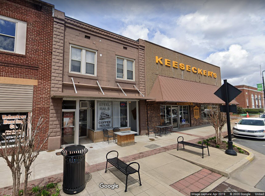
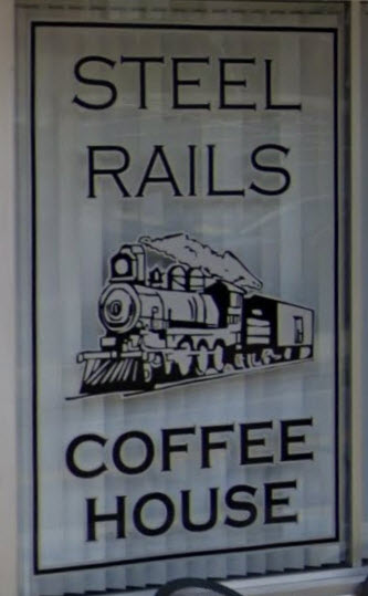
Place to Check Out: Steel Rails Coffee House
GPS Coordinates: 36.145746, -82.416286
113 N Main Ave, Erwin, TN 37650
423-388-1558
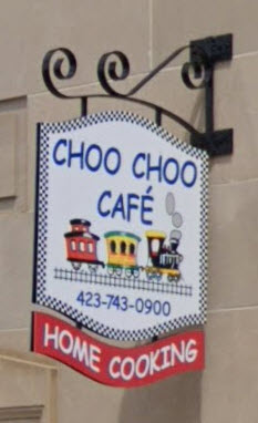
Place to Check Out: Choo Choo Cafe
GPS Coordinates: 36.144849, -82.417252
113 S Main Ave, Erwin, TN 37650
423-743-0900
License Plate Trivia:
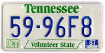
For those of you that may remember the "old" days when Tennessee used
numbers on their license plates to denote the county, Erwin is in Unicoi
county, and the plates started with a 59. Folks in Johnson City used to kid
around saying you never want to get behind a 59 plate (they always drove slow).
I have to say tho, that even when I was driving
here in the 80's, people were always nice and courteous, and, if you were in
a line of cars going down, say, highway 23, and the car in the front was
making a turn, everyone in that line of cars would turn their signals on
too, to let the people behind them know someone was turning - only place in
the U.S. I ever saw that done.
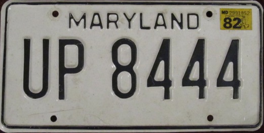
During one of my trips to Johnson City, I stopped by the local Southern RR office for a visit
to see what I could find out about movements in the area. The guys in
there had a Union Pacific calendar hanging in there, and that month, of all
things to be pictured, was UP steamer #8444. This was pretty
coincidental, as the license plate on my car also said "UP 8444". I
showed the picture to the agent on duty, and then pointed to my car, and he
got excited and said "how did you do that!?" I told him that for 80
bucks, Maryland will let you get whatever you want on your license plate.
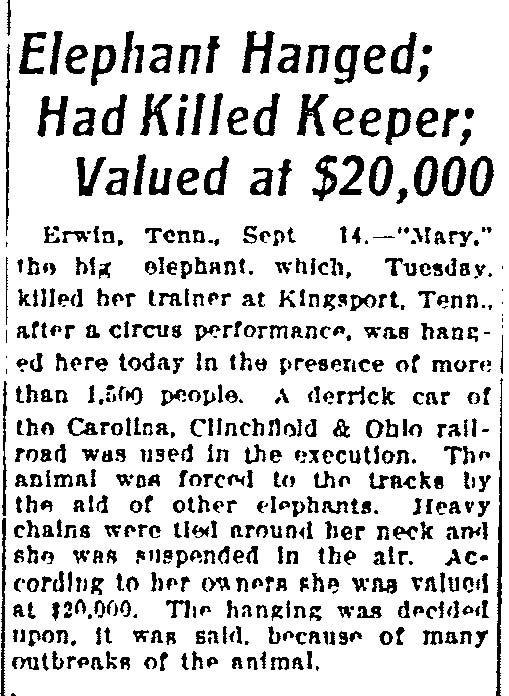
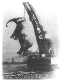
the Elephant Hanging
September 14th, 1916: One of the weirder
historical facts about Erwin is fairly unknown (and one they would rather
forget in Erwin), and most people, when you
tell them the story, look at you in disbelief. The circus had come to
Kingsport TN (about 30 miles north), and during one of the shows, an elephant went berserk and got
away from its handler, and killed him. They had a trial, and convicted
the elephant to death. The only problem was, they didn't have anything
strong enough to hang the elephant with (I guess hanging was the way they
"did it" back then. So, they took the elephant to Erwin and used a
crane of the Clinchfield to hang the elephant. Remember, at the time,
the Clinchfield did not go to Kingsport.
Lot's more on the story here.
Other Random Non-Sensical Stuff :-):
I was also lucky to be in town when the Southern ran a 4501 excursion that
came through Johnson City and Jonesborough - I caught it in JC one day, and
Jonesborough the next. Always nice when you can mix business with pleasure!
Another thing I was very lucky to have caught, was a fireless steam engine
in Elizabethton. It was a simple little 0-4-0 steamer that used the
steam from the plant to shuttle cars around. A very unique engine to
see in the 80's, fer sure. I wonder where that little engine is today?
From Wikipedia: The town of Erwin received its name by a mail mishap.
On December 5, 1879, the name of the town was Ervin, in honor of D.J.N. Ervin,
who had donated 15 acres of land for the county seat. A typo made by post
office officials caused the name to be recorded as Erwin. The mistake
was never corrected. (In an unrelated event, my mother wanted me to be
a Todd Robert, and in the same manner, the clerk at the county office put it
down as Robert Todd, but my mother registered me for just about everything
as Todd Robert - if you don't think that screwed everything up!!! (school,
SSI, etc))
I used to come here several times a year to fill in for a local field
engineer that maintained the security system at Nuclear Fuels. At the
time I worked for Westinghouse. One time I was down here, and I was up
in Johnson City on a date, and I looked up at the clouds and said, "this is
going to be a bad one!" Well, about 30 minutes later, I got beeped,
went down, and spent the next 30 hours there straight fixing most of what a
severe lightning strike did to the equipment, phew. One another
occasion, the union decided to go on strike, and we had to get bussed in
from a grocery store downtown. The union had bought a house directly
across the street from the plant, and when the strike was going on, they put
up a plywood fence so management couldn't see into the building. The
fellow I used to fill in for, Dennis, lived a block away from where Hulk Hogan lived
at the time in Johnson City - never did catch a glimpse of him tho! :-(
I know, this is stupid
to put on this page, but, the smartest
guy I knew with a Rubik's cube worked in
the control room of NFS. You could do anything you wanted to that
cube, and he would have it solved in about 5 or 6 seconds! Never seen
nuttin like it before or since.
Disclaimers:
I love trains, and I love signals. I am not an expert. My webpages reflect what I find on the topic of the page. This is something I have fun with while
trying to help others.
Please Note: Since the main focus of my two websites is railroad signals, the railfan guides are oriented towards the signal fan being able to locate them.
For those of you into the modeling aspect of our hobby, my
indexa page has a list of almost everything railroad oriented
I can think of to provide you with at least a few pictures to help you detail your pike.
If this is a railfan page, every effort has been made to make sure that the information contained on this map and in this railfan guide is correct. Once in a while,
an error may creep in :-)
My philosophy: Pictures and maps are worth a thousand words, especially for railfanning. Text descriptions only get you so far, especially if you get lost or
disoriented. Take along good maps.... a GPS is OK to get somewhere, but maps are still better if you get lost! I belong to AAA, which allows you to get
local maps for free when you visit the local branches. ADC puts out a nice series of county maps for the Washington DC area, but their state maps do not have the
railroads on them. If you can find em, I like the National Geographic map book of the U.S..... good, clear, and concise graphics, and they do a really good job
of showing you where tourist type attractions are, although they too lack the railroads. Other notes about specific areas will show up on that page if known.
Aerial shots were taken from either Google or Bing Maps as noted. Screen captures are made
with Snagit, a Techsmith product... a great tool if you have never used it!
By the way, floobydust is a term I picked up 30-40 years ago from a National Semiconductor data book, and means miscellaneous
and/or other stuff.
Pictures and additional information is always needed if anyone feels inclined to take 'em, send 'em, and share 'em, or if you have something to add or correct.... credit
is always given! Please be NICE!!! Contact info is here
Beware: If used as a source, ANYTHING from Wikipedia must be treated as being possibly being inaccurate, wrong, or not true.
RAILFAN GUIDES HOME
RAILROAD SIGNALS HOME
NEW DEC21/2019, NOV18/2020, JAN02/2023
Last Modified 02-Jan-2023