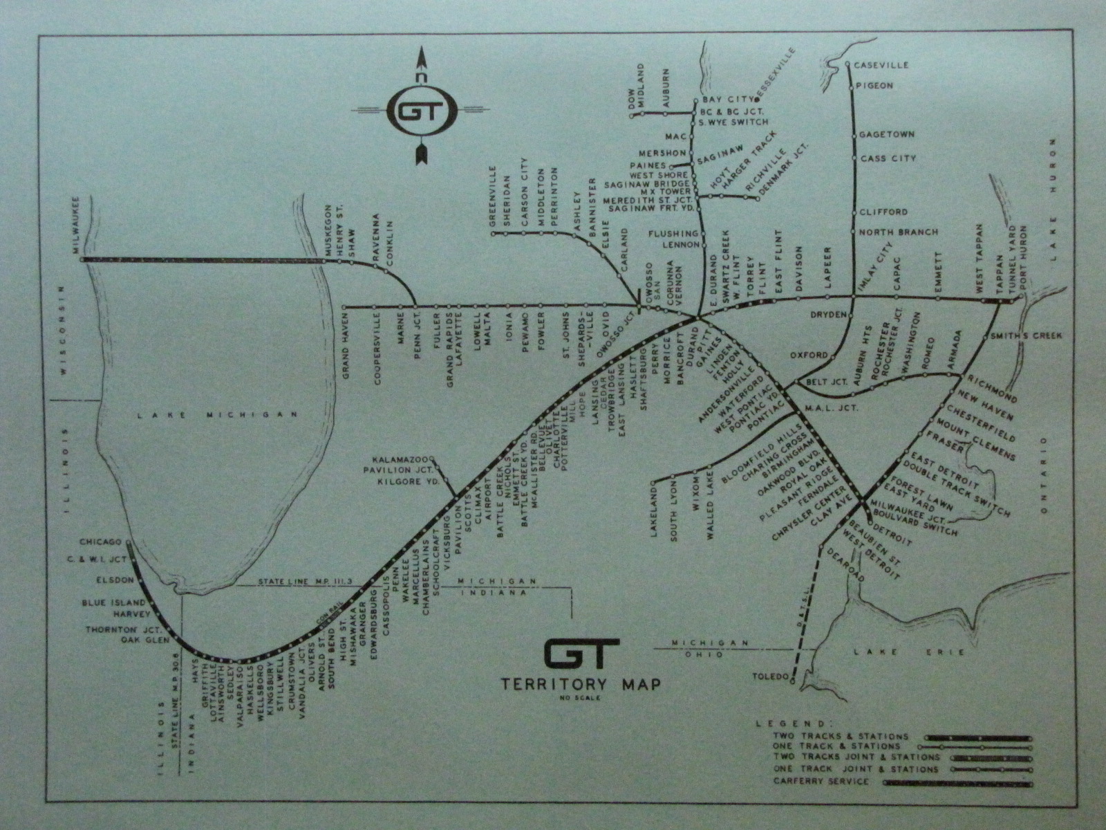
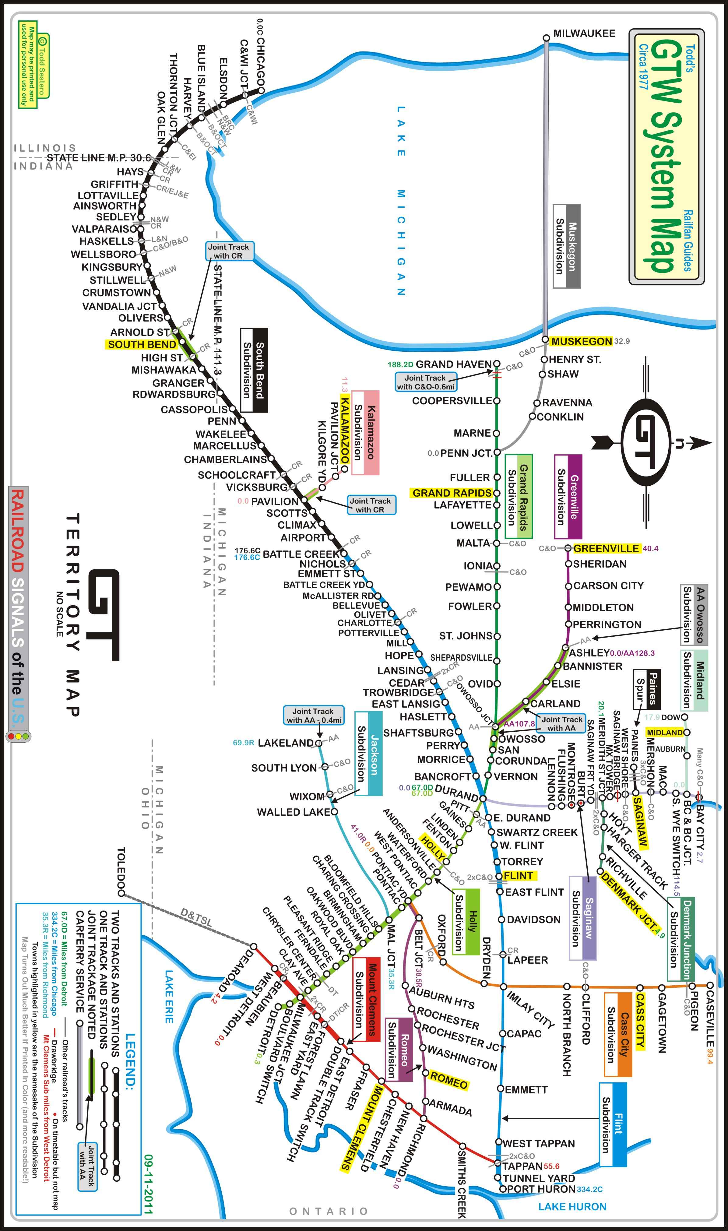
In a departure from my usual railfan guide maps, I've done my first system map of the Grand Trunk. Not exactly sure why, but a fellow sent me a box full of railroad
stuff, and in it was this 1977 Employee's Operating Timetable. For some reason, it impressed me! It is timetable #25, dated April 24th, 1977.
On the rear was a system map of their whole system, not just of one or a couple of sub-divisions.
Inside was all sorts of good information, untypical for a rulebook.
The following map is a combination of the system map on the rear cover, and the information inside, such as sub-division names, railroads crossing the Grand Trunk, and
drawbridges where mentioned in the rulebook.
I tried to keep to the original as much as possible, the large exception being the shore line, just way too much trouble to put all those tiny little wavy lines on the
map :-) I did however add the subdivision names, and colorized the map to highlight the subdivisions.
A few notes about the mileages, which were taken from the timetables...
● Two of the subdivisions are measured from Detroit, and two from Chicago.
● All of the other subdivisions are measured from a junction with another subdivision and noted by matching colored mile marker notes, for instance:
For the Muskegon subdivision, the mileage starts at Penn Junction, and next to Penn Junction, you will see a small 0.0 in a color that matches the subdivision
color, this is the starting point for the subdivisions mile markers (Milwaukee, however, does not have a m/m associated with it).
● The Mt Clemons subdivision, running N-S thru Detroit, is measured from West Detroit.
● The Flint subdivision is a "continuation" of the South Bend sub (mile wise), and mileage is continuous from Chicago.
● The Grand Rapids sub is a "continuation" of the Holly subdivision (mile wise), and mileage is measured from Detroit on both.
● Two stations on the Saginaw sub do not appear on the map, but are on the timetable: Montrose and Burt.
● Bay City, according to the notes, had many crossings with the C&O.
● No explanation on the Saginaw timetable why Bay City is m/m 2.7, when S Wye Switch is 114.5miles.
● Only the track between Saginaw and Paines is not part of a subdivision, and is referenced to as a SPUR on the Saginaw timetable.
● Yellow highlighted town names are the namesake of the subdivision, only one that doesn't have one is the Jackson sub.
Please note that the map was done on LEGAL size paper, in case you're going to print it out. Also, the map will turn out much better and easier to read if
printed in color.