
Abilene
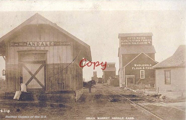
Andale
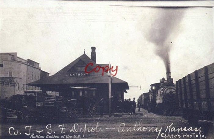
Anthony
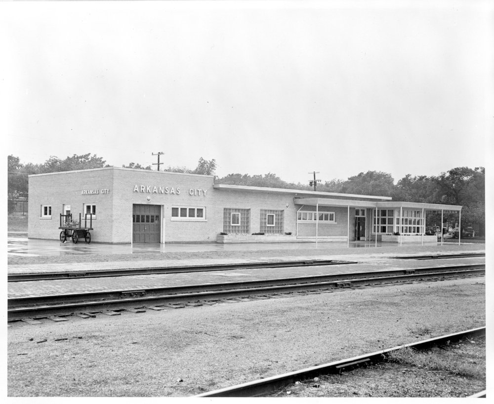
Arkansas City
Atchison
Bennington
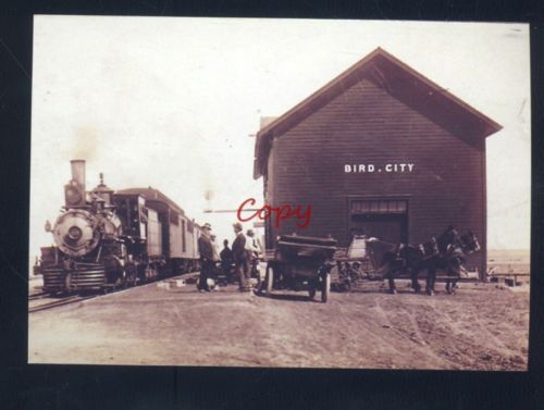
Bird City
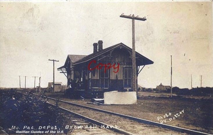
Brownell
Burdick
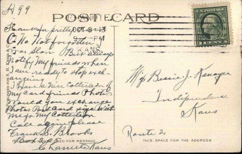
Chanute
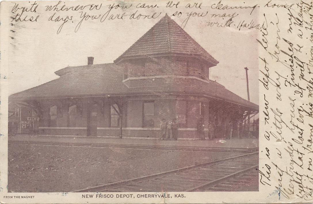
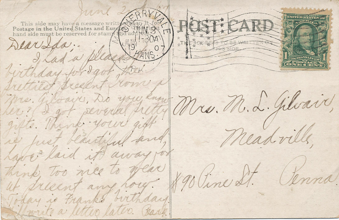
Cherryvale
Cimarron
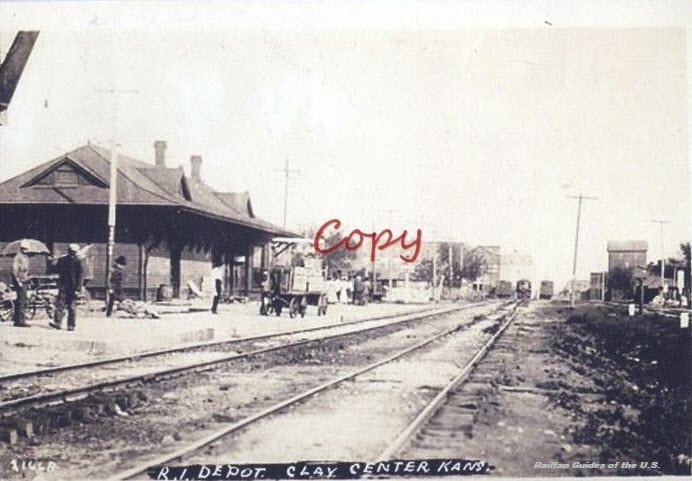
Clay Center
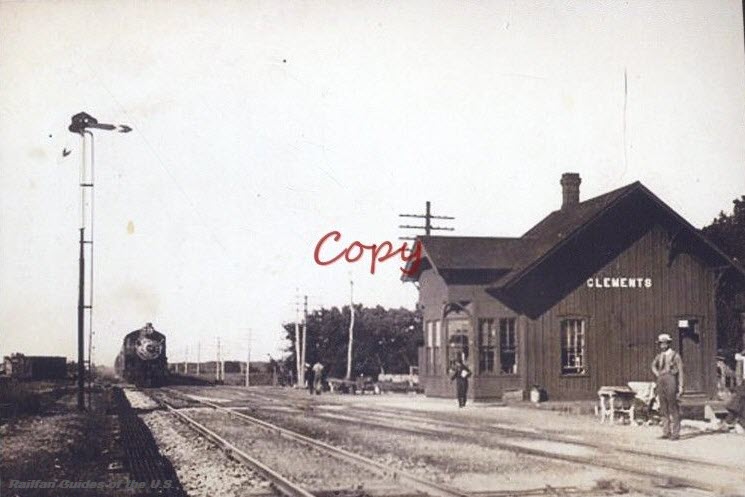
Clements
Coats
Coffeyville
Coldwater
Concordia
Cunningham
DeSoto
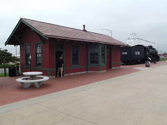
Dodge City
Dresden
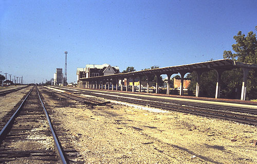
Ellis
Emporia
Eureka
Fort Scott
Freedonia
Ft Leavenworth
Ft Riley
Garden City
Geuda Springs
Great Bend
Hammond
Harper
Hays
Hepler
Hiawatha
Horton
Hutchinson
Independence
Iola
Iuka
Junction City
Kansas City - Union Station
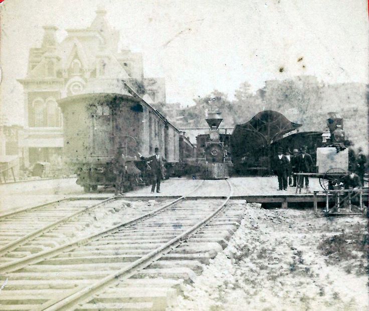
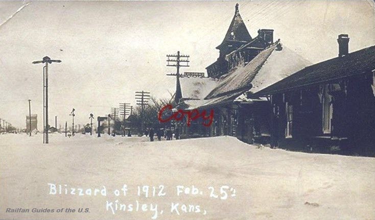
Kinsley
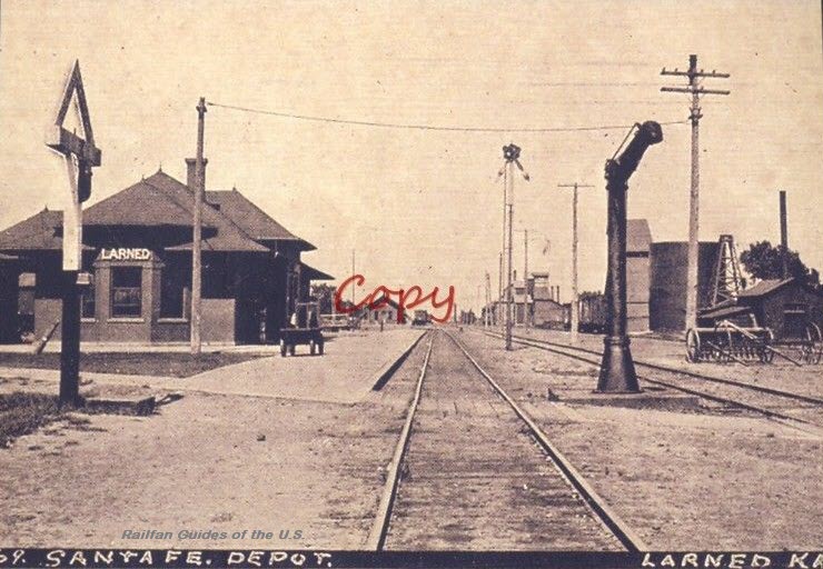
Larned
Lawrence
Lebo
Liberal
Lincoln Center
Longford
Manhattan
Marion
Mulvane
Newton
Niles
Oak Hill
Oatville
Osborn
Ottawa
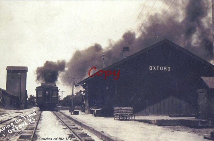
Oxford
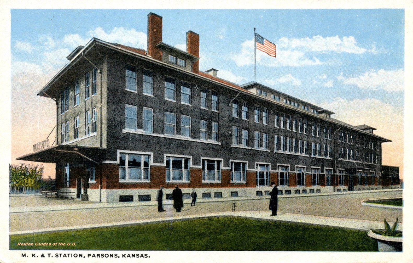
Parsons
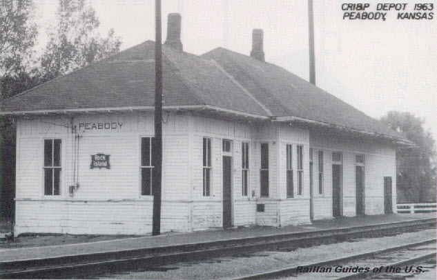
Peabody
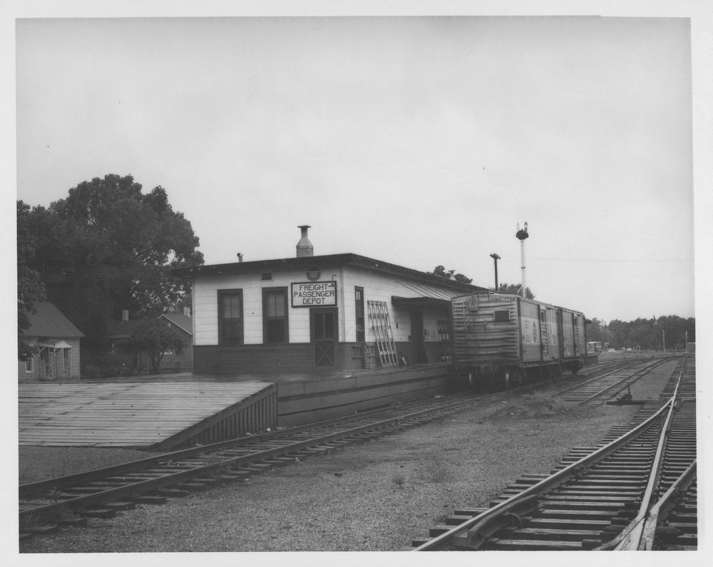
Pittsburg
Pratt
Reece
Richland
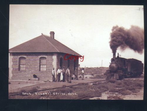
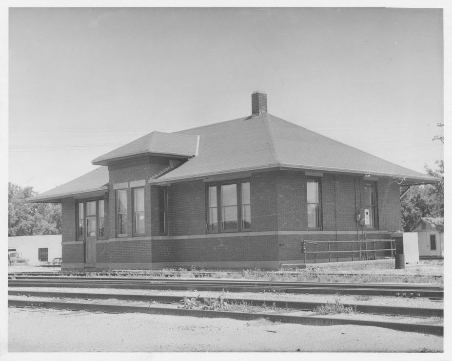
Russell Spring
Salina
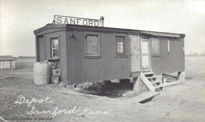
Sanford
Sharon Springs
St John
Sterling
Strong City
Topeka
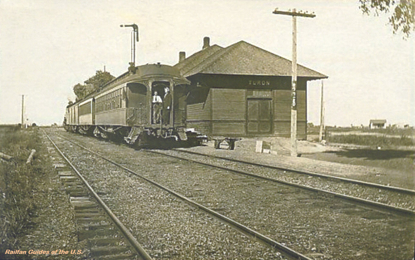
Turon
Valley Falls
Volland
Wamego
Wellington
Wichita
Wilmot
Wright
Yates Center
Zeandale
RAILROAD SIGNALS HOME
There are precious few good references for many of the railroad stations and depots that used to exist.
One of the better resources I have come across to this end is the plethora of old post cards still around depicting many of these structures, some better than others.
Most of the postcards were found on EBay unless noted, other pictures, mostly the more recent ones, come from Google and/or Bing images - credit given if the source is known. Compliments to (to name a few) skurfanpostcards, trentonstampandcoinco, and baysideantiques_02 for the many, many railroad depot pictures they all offer, without whom you wouldn't have as many pictures here to enjoy.... all of the pictures from these folks are for sale. Seller with the red word COPY on them is "skurfanpostcards".
Dates are in the picture name, x means the date is approximate. If they were available, and interesting, I included the back side of the postcards. 1901a and 1910b would be the same card, both sides.
If the picture was really, really bad, some of them have been cleaned up and/or repaired when I had the energy.
If you have the time, other good sources for pictures are: Shorpy, Google, and Bing images, and the Library of Congress (you have to be very patient to find things here :-)
Since many of these stations are no longer around (railfans seem to prefer the term "extant", I'm not one of them! :-), this page is mostly for historical reference.
This page is mostly for historical reference, as MANY of these stations are not around anymore!
What's the difference between a station and a depot? Most people will say "nuttin", it's a matter of preference, although many will use depot for older buildings.
If you have a picture you would like to contribute, please see the bottom of the page for how to find me, credit is always given to contributing photographers.
Abilene
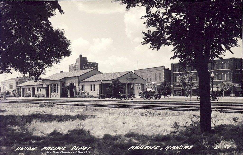 eBay seller: collectors_shelf
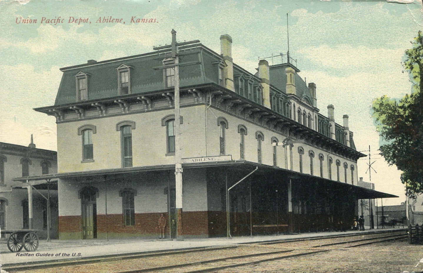 eBay seller: postcardduster
 from a slide sold by EBay seller twojoestreecare2013
 from a slide sold by EBay seller twojoestreecare2013
Andale
Anthony
Arkansas City
A depot built by the Atchison, Topeka & Santa Fe Railway. The depot was dedicated on April 27, 1951.
Pictures from: http://www.kshs.org/km/items/view/313486
Atchison
Picture from George's website at: http://www.georgelightfoot-art.com/art-images.html
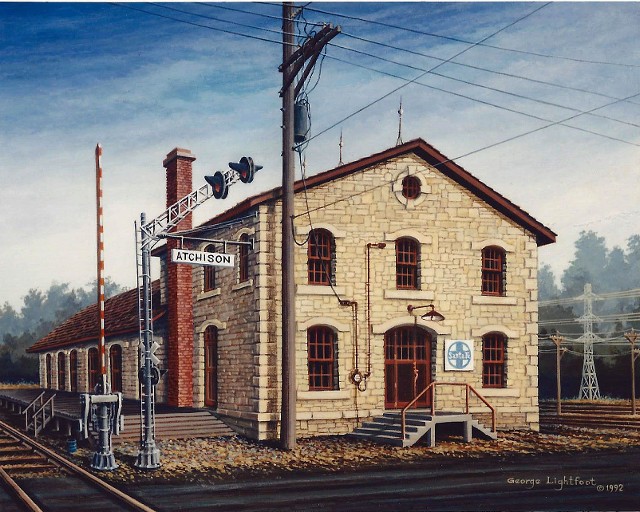 Painting by George Lightfoot, prints are available
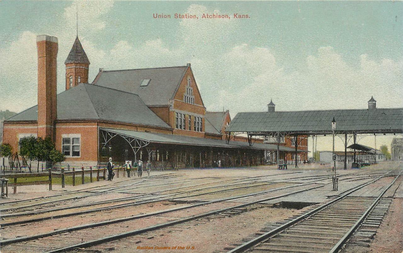 eBay seller: outwester
Bennington
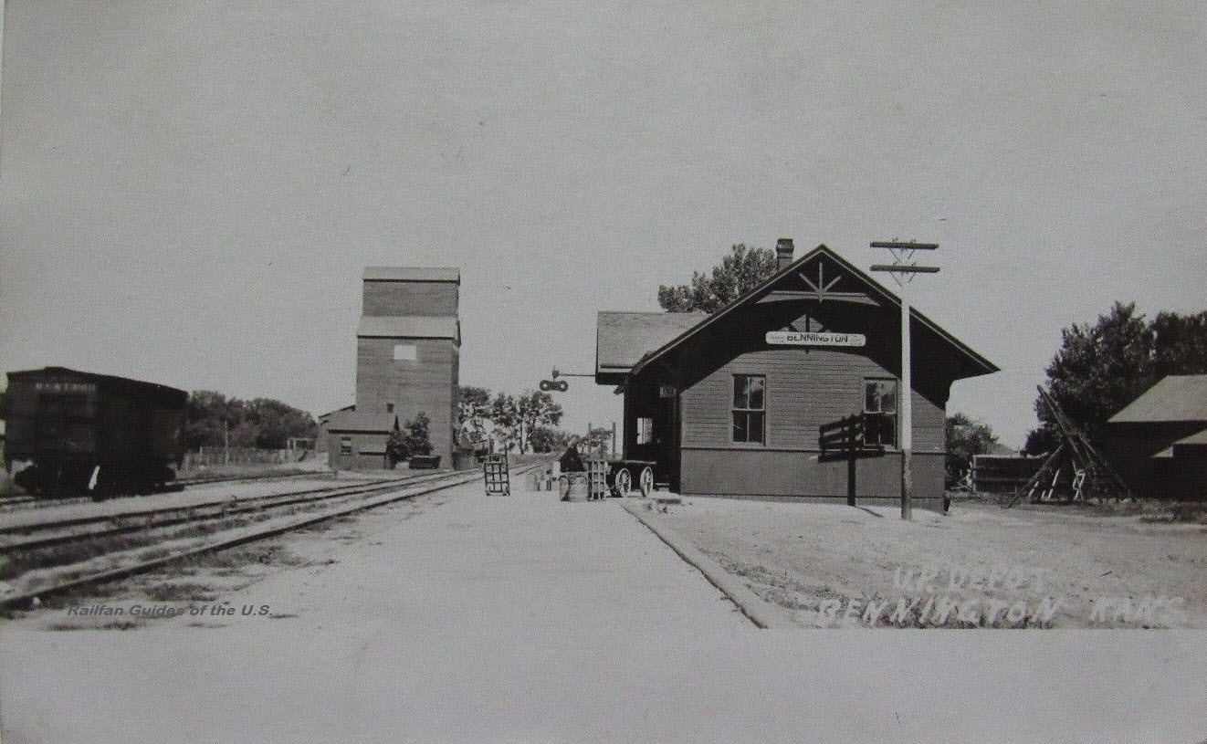 eBay seller: noelle3
Bird City
Brownell
Burdick
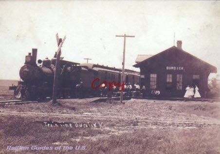 eBay seller: skurfanpostcards
Chanute
 eBay seller: trentonstampandcoinco
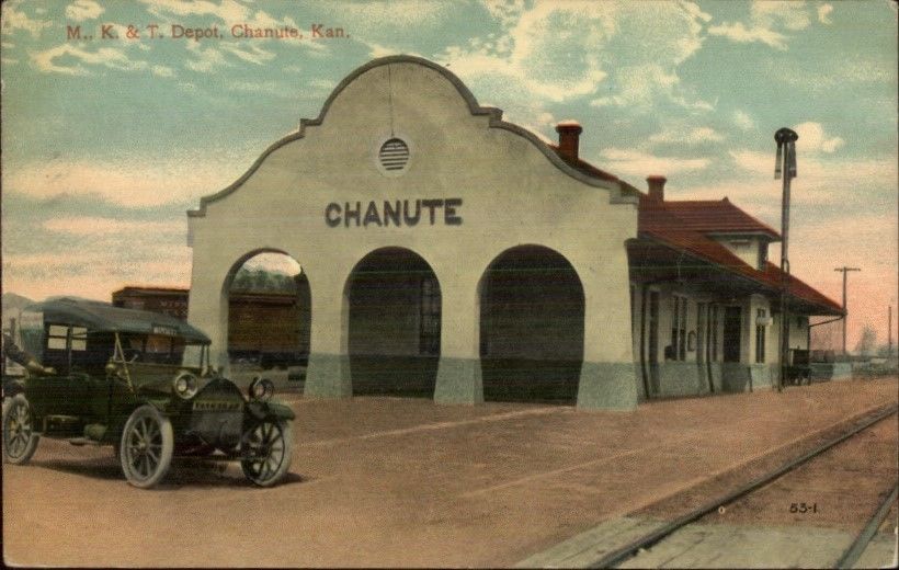
 eBay seller: mikeingreensboro
Cherryvale
 eBay seller: wscoop
Cimarron
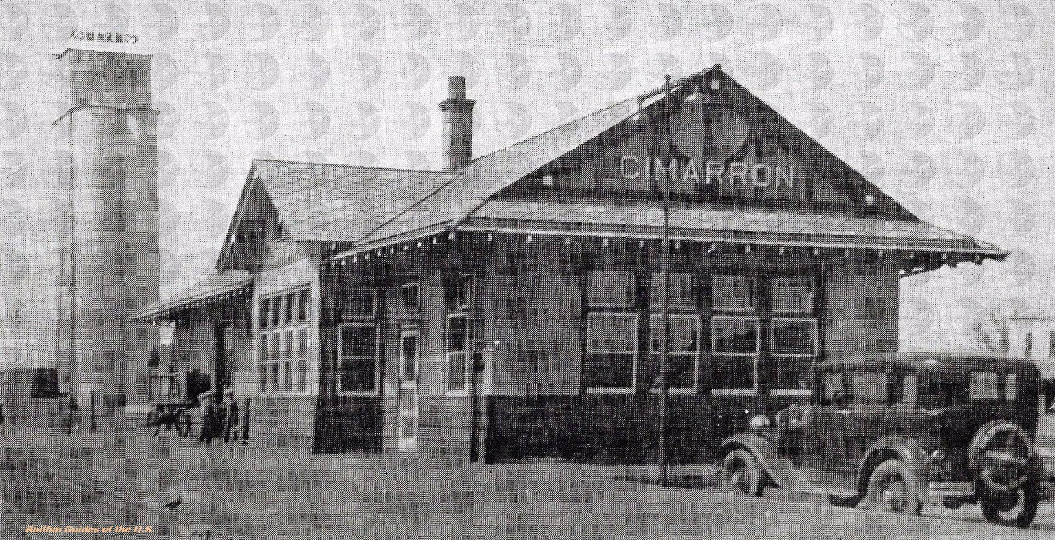 eBay seller: graffiti_moon59
Clay Center
Clements
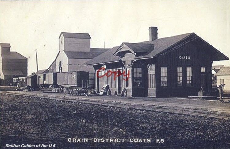
Coats
Coffeyville
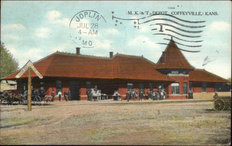
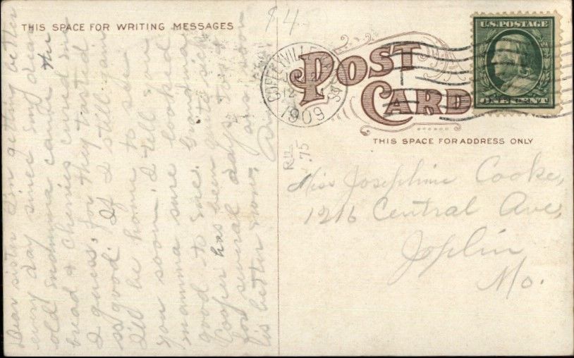 eBay seller: mikeingreensboro
Coldwater
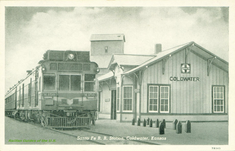 eBay seller: ourpastpostcards
Concordia
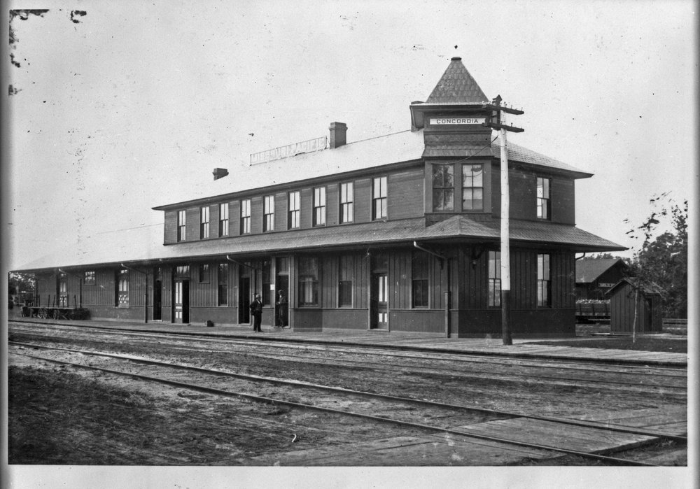
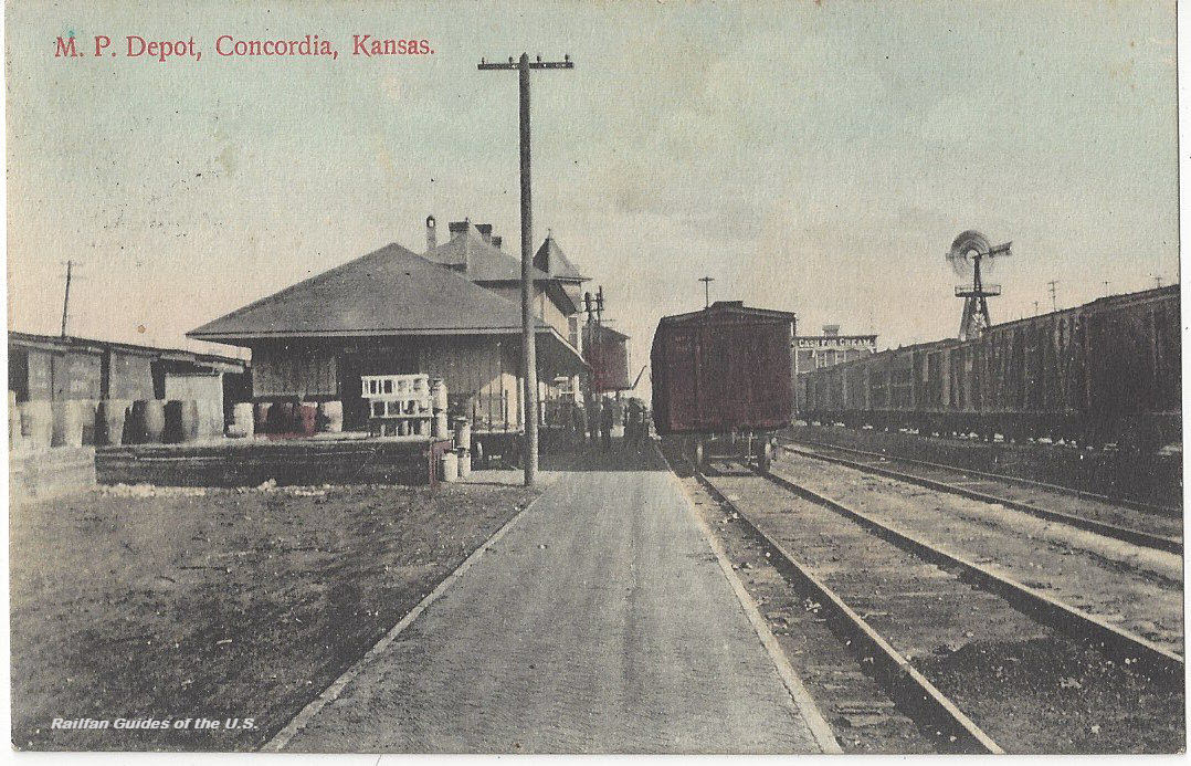
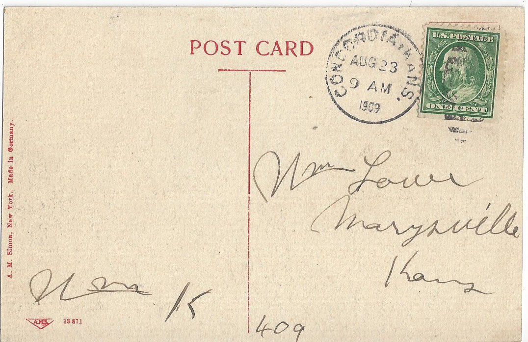 eBay seller: papercellar
Cunningham
Picture found here: https://joyride.guru/roadtrips/kansastrain/
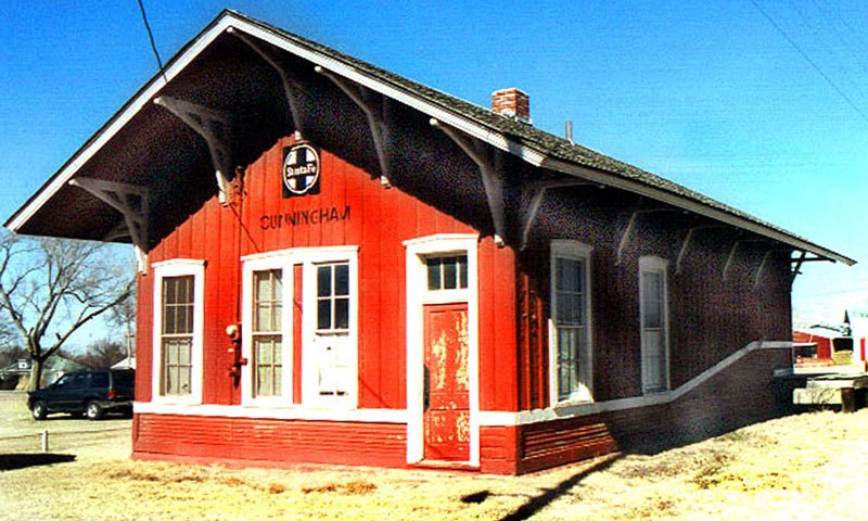 2002
2002DeSoto
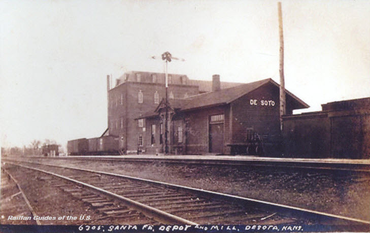 eBay seller: skurfanpostcards
Dodge City
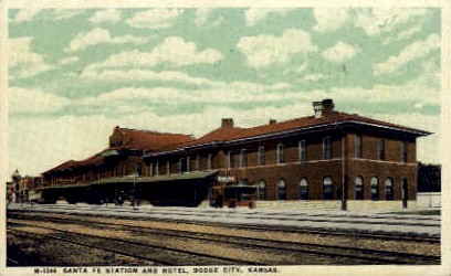
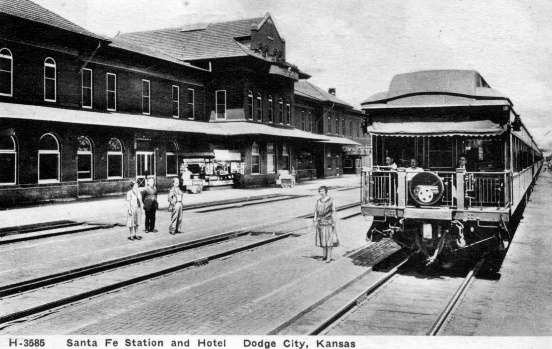 1929
1929Found here: http://streamlinermemories.info/?p=3937
Dresden
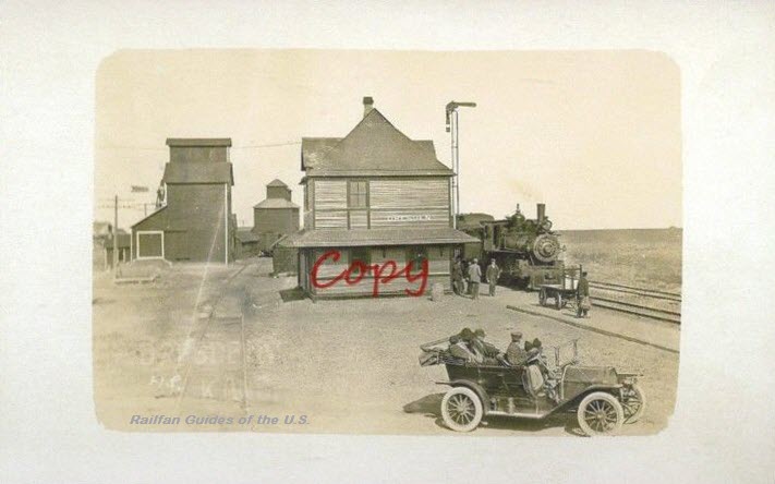
Ellis
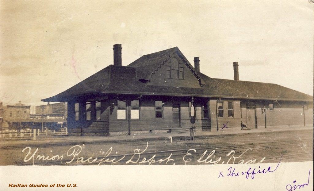 eBay seller: collectors_shelf
Emporia
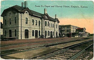
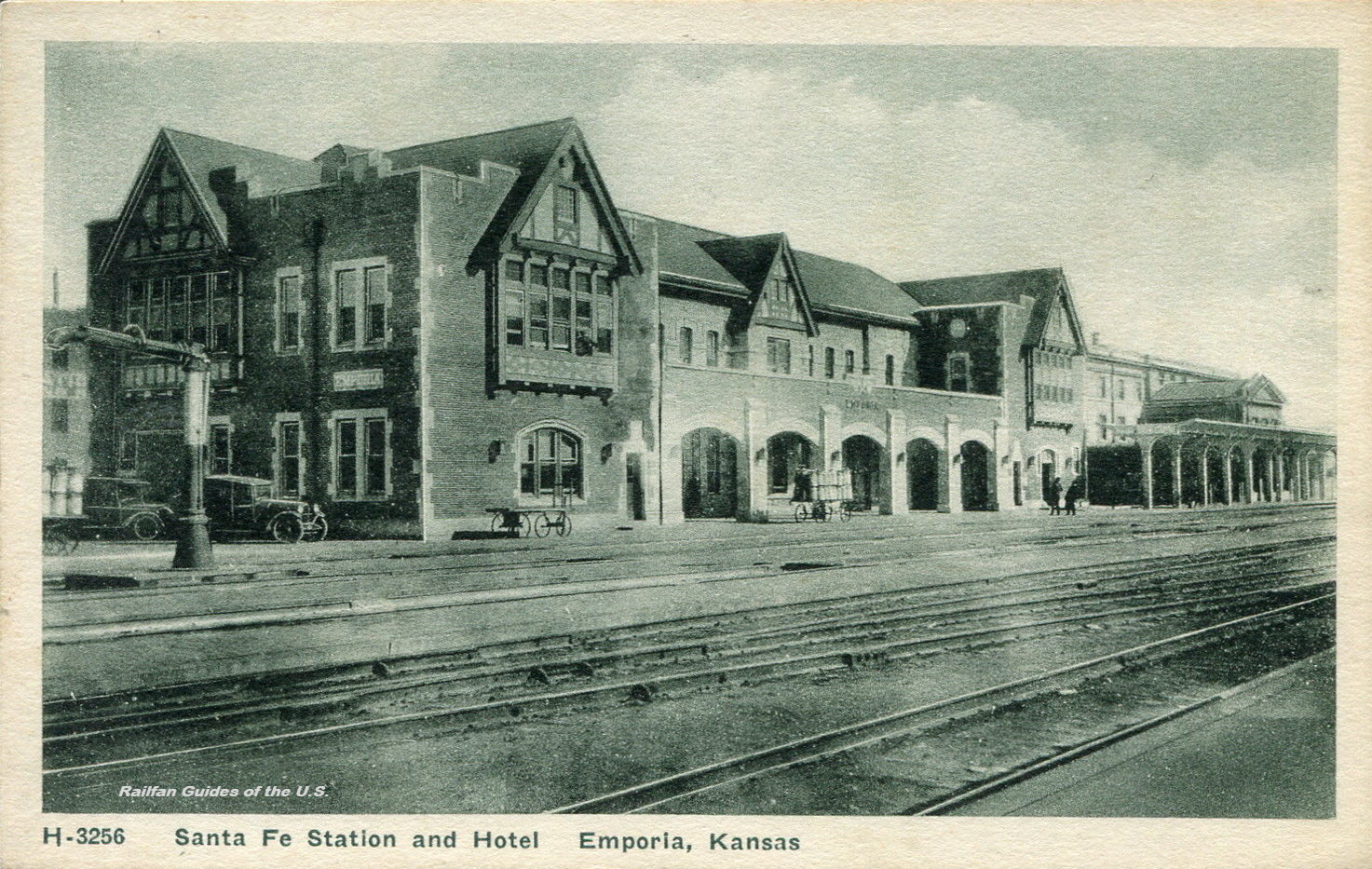 eBay seller: postcardduster
Eureka
This is a former Missouri Pacific RR depot. This combination depot, built in 1911, featured a passenger waiting room, a central office and a freight-baggage room. The depot was razed in March of 1984.
Picture from: http://www.kshs.org/km/items/view/97448
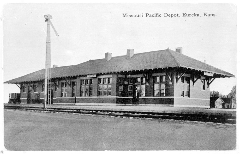 ~1915
~1915Fort Scott
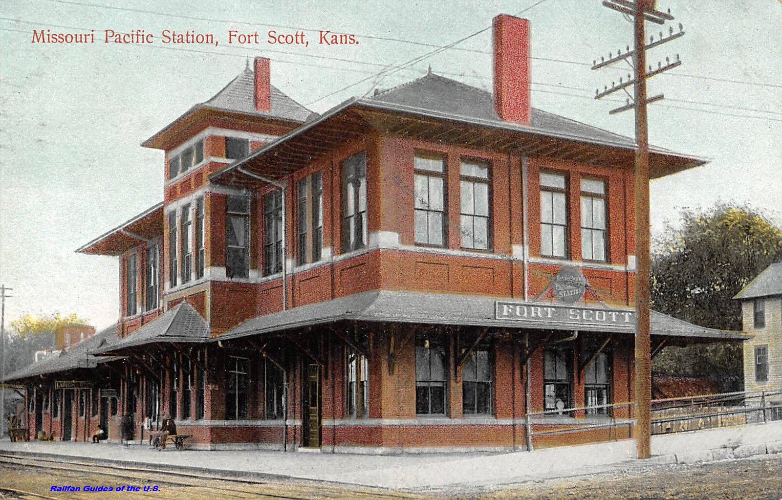 eBay seller: lacumo
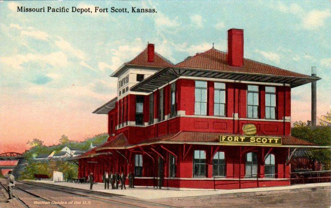 eBay seller: outweststv
Ft Leavenworth
Former Missouri Pacific RR depot. It was located on the Omaha Division, Atchison Subdivision at mile post 312.3.
Pix from http://www.kshs.org/km/items/view/215462
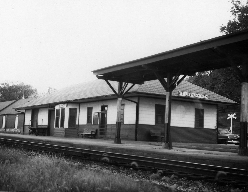 1960, picture courtesy H Killam
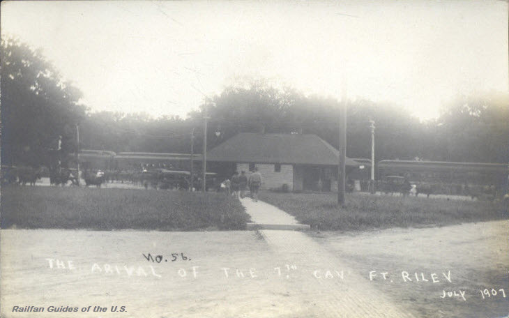
Ft Riley
Garden City
GPS Coordinates: 37.964206, -100.873340
Station code: GCS
Originally built by the ATSF in 1907, and was rebuilt by Amtrak in 2002.
More info at: https://en.wikipedia.org/wiki/Garden_City_station_(Kansas)
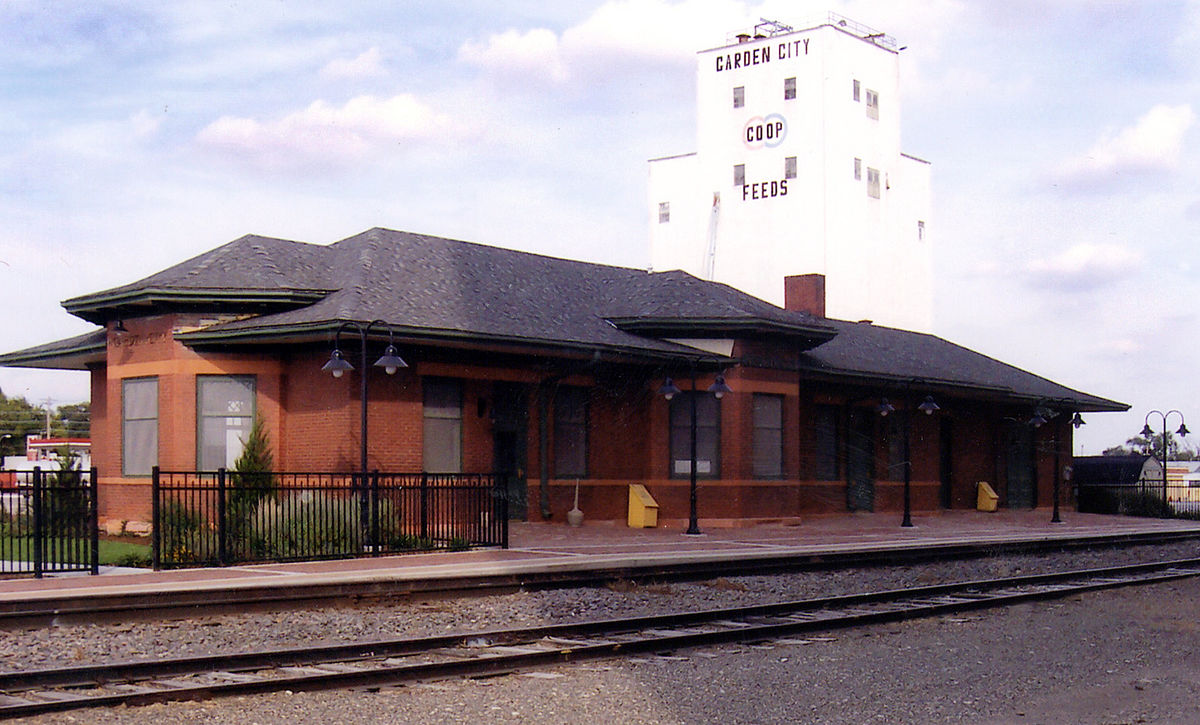 photo: Marion Doss
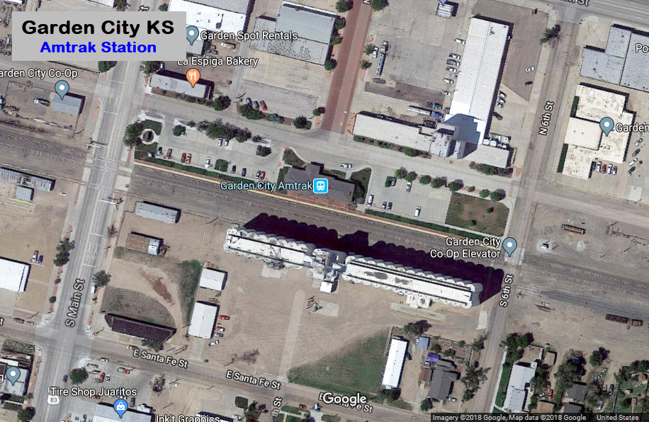
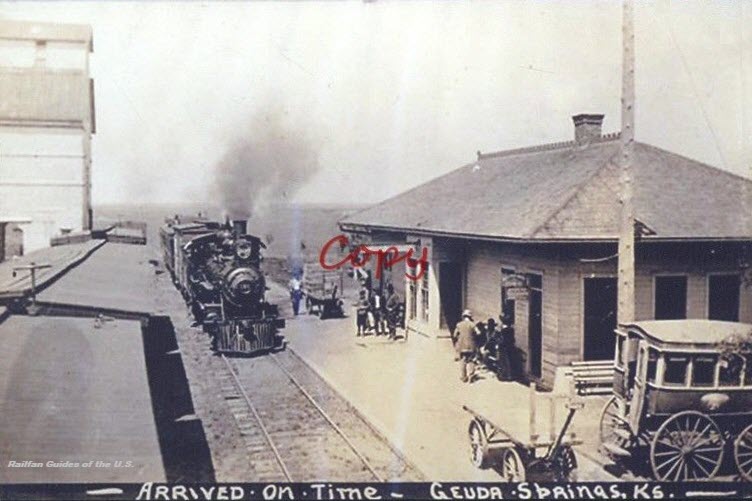
Geuda Springs
Great Bend
GPS Coordinates: 38.356587, -98.763636
Photo from: https://commons.wikimedia.org/wiki/File:Great_Bend_Train_Station_Grain_Elevator.jpg
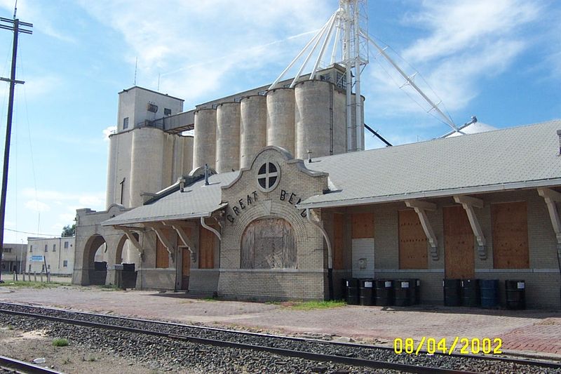 photo: Roger Pommerenke/wikipedia
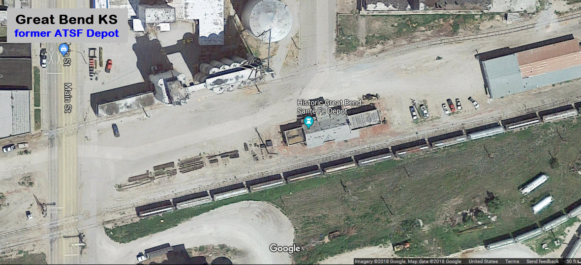
Hammond
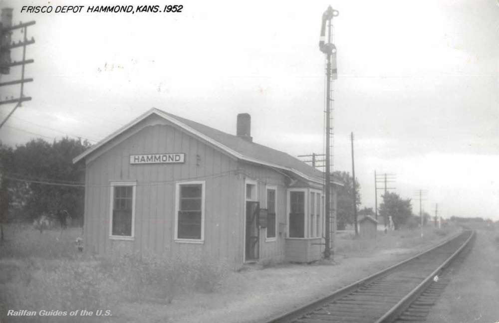 eBay seller: baysideantiques_02
Harper
Jack took two weeks back in 2002 to travel around Kansas and document old railroad depots, plenty more on his page.
Photo from: https://joyride.guru/roadtrips/kansastrain/
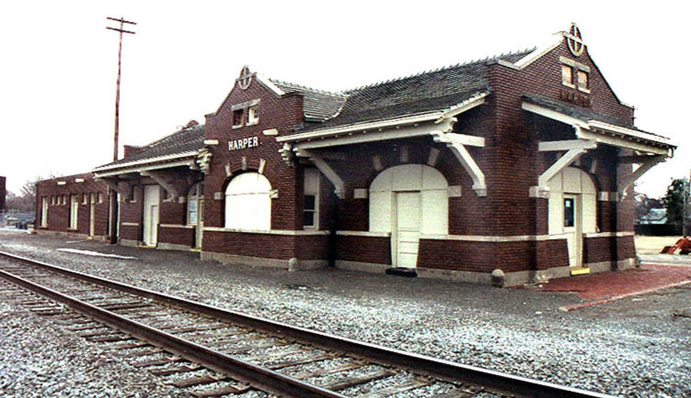 2002, photo by Jack Brandais
Hays
 eBay seller: skurfanpostcards
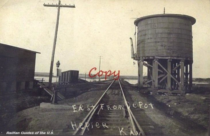
Hepler
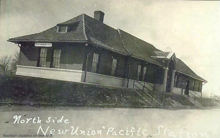
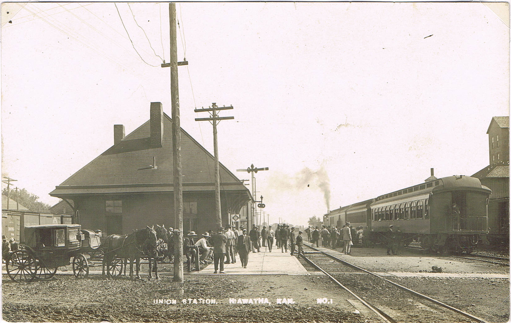
Hiawatha
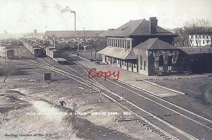
Horton
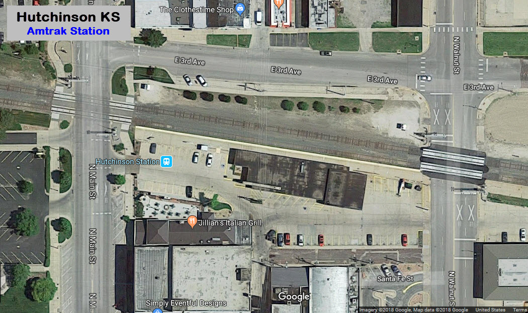
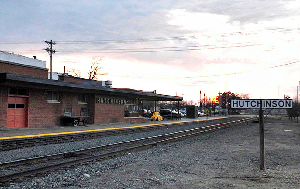
Hutchinson
GPS Coordinates: 38.055665, -97.930934
Picture from: https://winnieviews.blogspot.com/2015/06/off-beaten-path-in-kansas.html
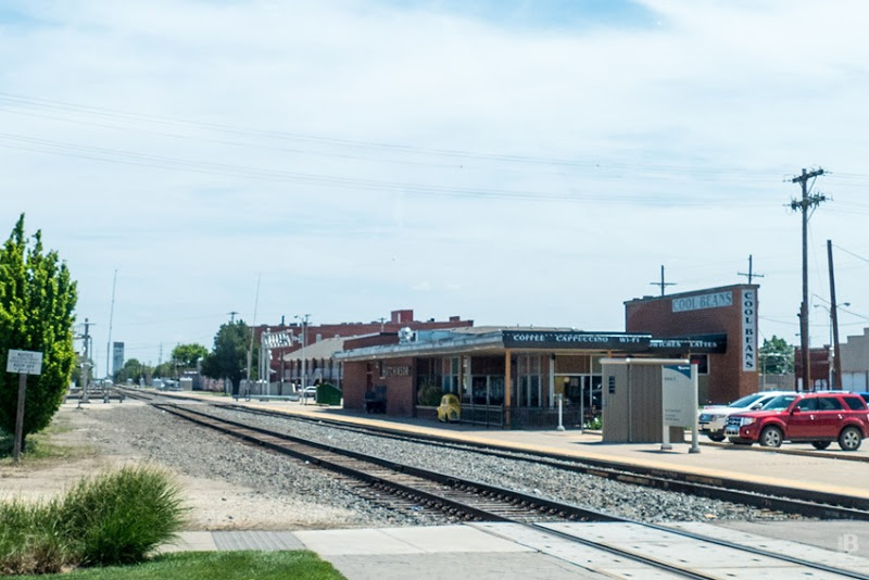 photo: Winnie Views
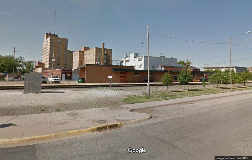
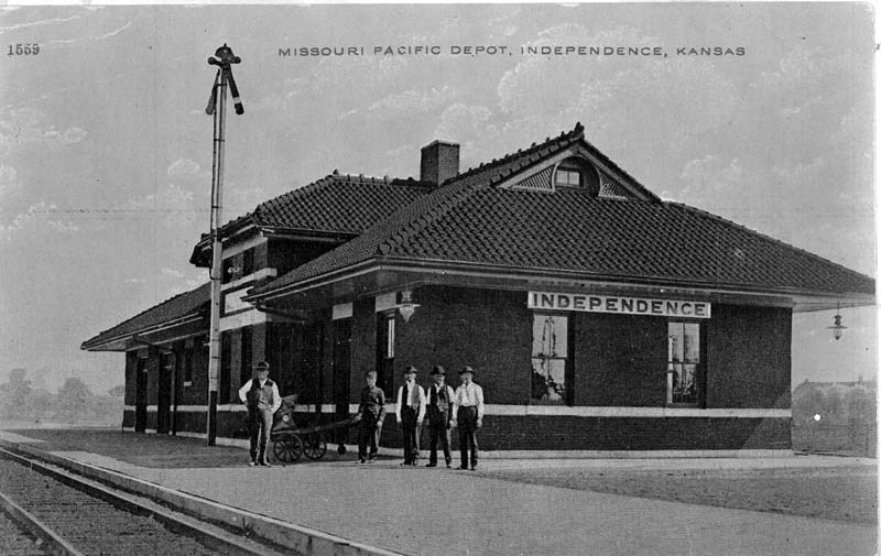
Indepedence
A former Missouri Pacific Railroad depot.
Picture from: http://www.kshs.org/km/items/view/613
Iola
A former Atchison, Topeka & Santa Fe Rwy depot built in 1891. The red-brick structure was located on the Eastern Lines, Eastern Division, Third District along mile post 109.7. The depot was razed in the 1980s.
Picture from: http://www.kshs.org/km/items/view/96976
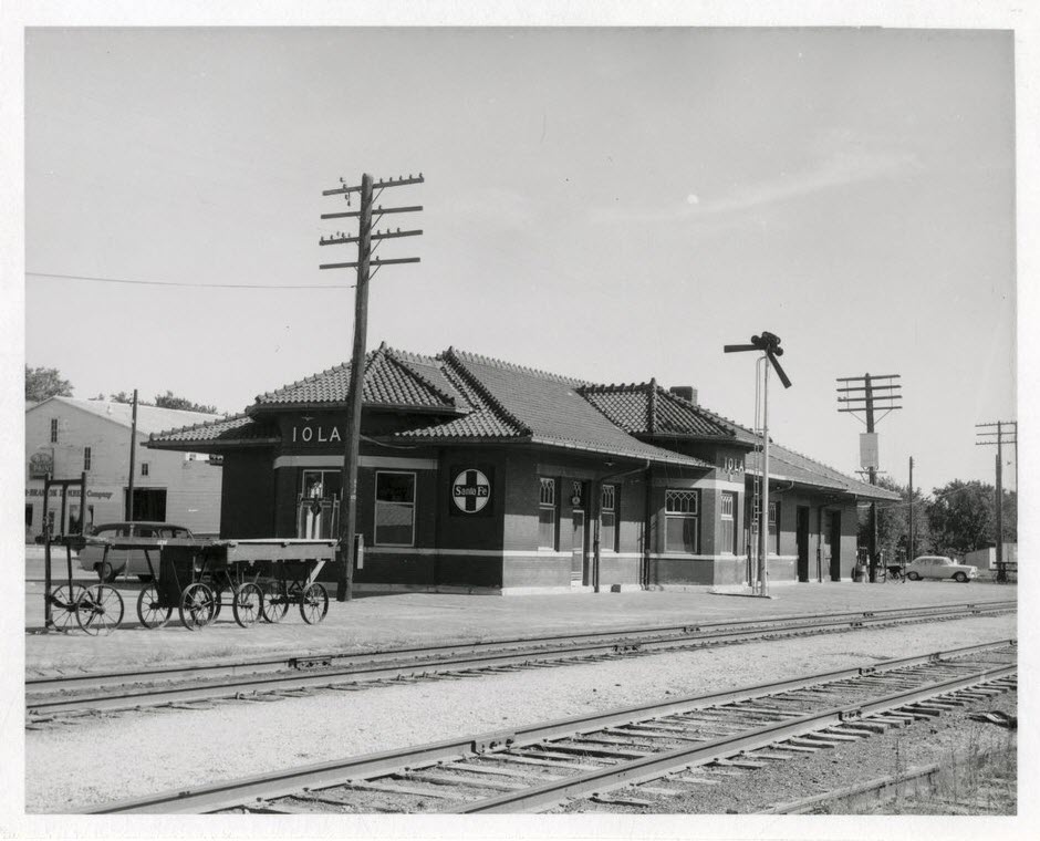 1956, picture courtesy H Killam
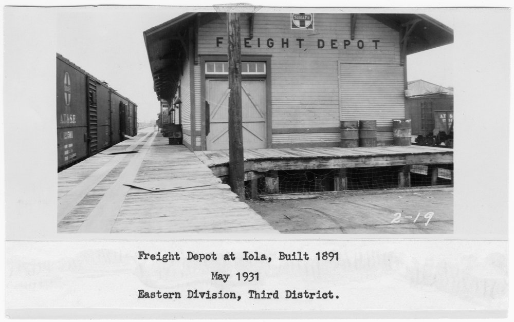 1931
1931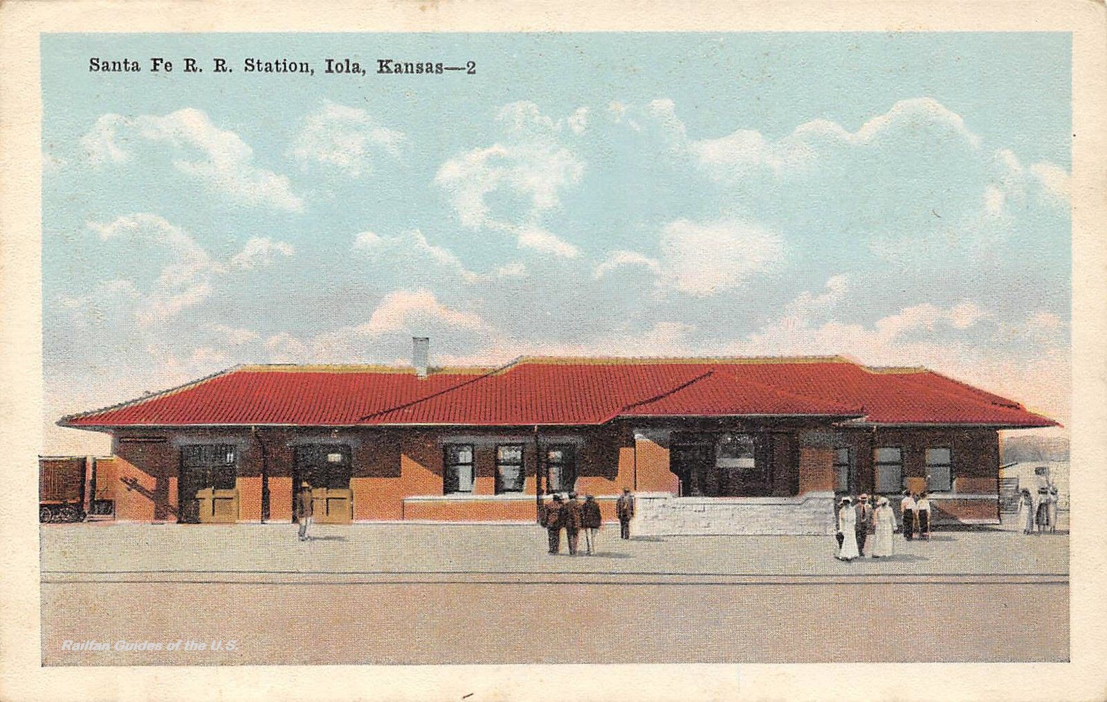 eBay seller: lacumo
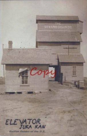
Iuka
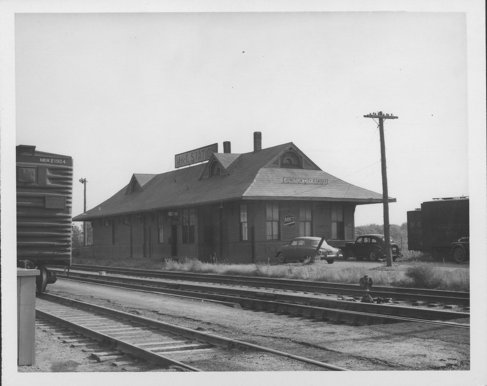
Junction City
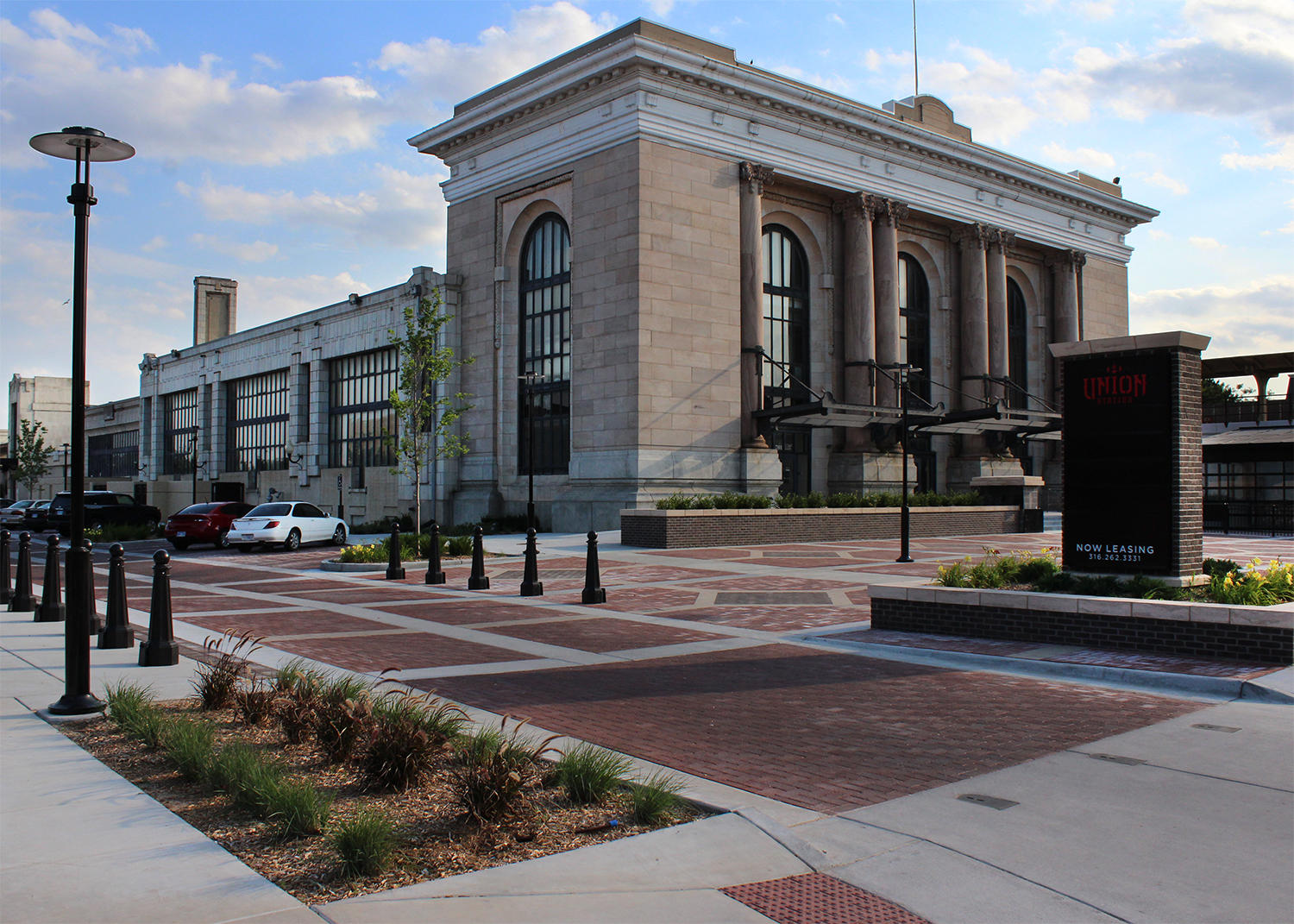
Kansas City MO - Union Station
We all know that this magnificent station is in Kansas City Missouri, and not Kansas, right? But we included it here because it says Kansas City :-)
Besides, it only misses Kansas by 1.18 miles.....
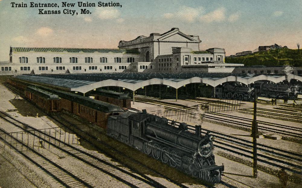
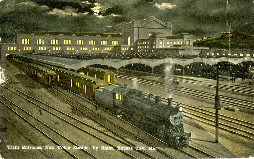
Early photoshopping! :-)
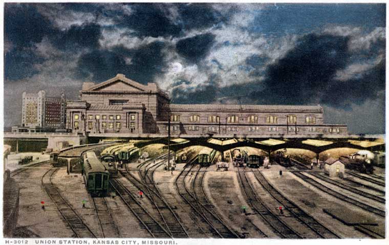
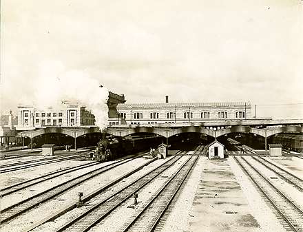
Above picture from a great trip report here: http://trainweb.org/amtrakpix/travelogues/101112A/101812D.html
 1883
1883Kinsley
Larned
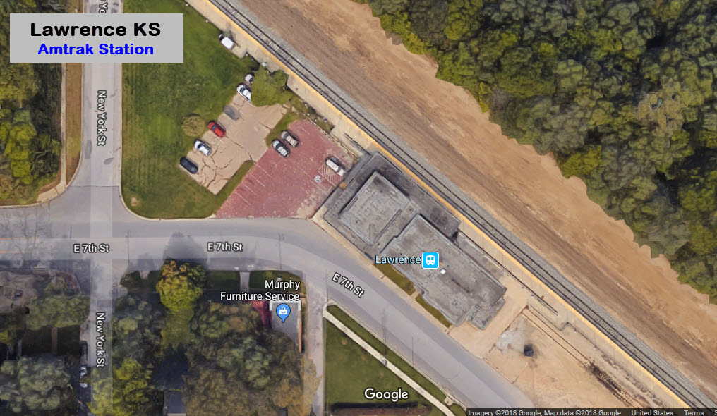
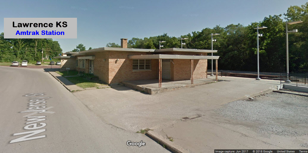
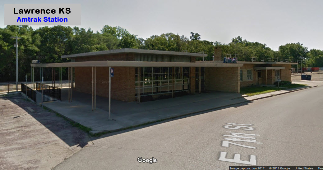
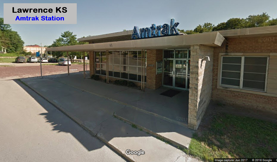
Lawrence - Amtrak Station
GPS Coordinates: 38.971241, -95.230363
413 E 7th St, Lawrence, KS 66044
Station code: LRC
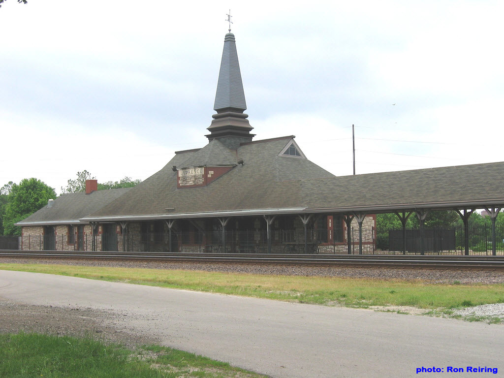
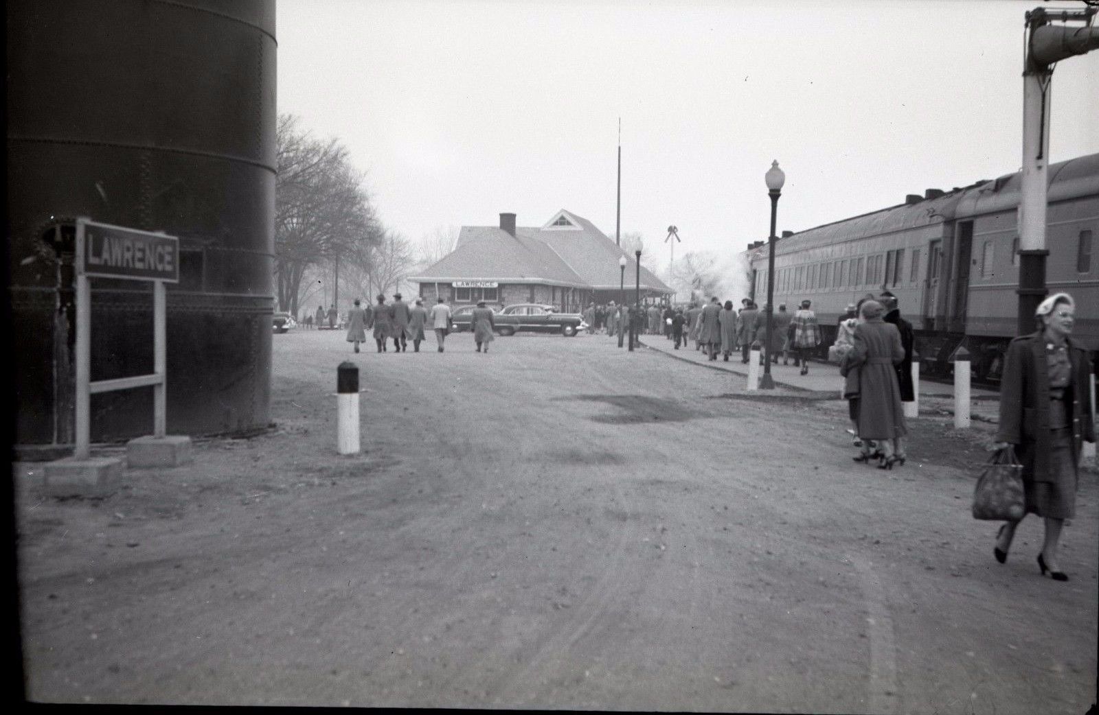
Lawrence - Union Pacific Depot
GPS Coordinates: 38.978670, -95.234504
402 N 2nd St, Lawrence, KS 66044
www.lawrenceks.org
Phone: (785) 856-3040
Built in 1889 by the UP, it now serves as the Lawrence Visitors Center.
 eBay seller: sprtstat99
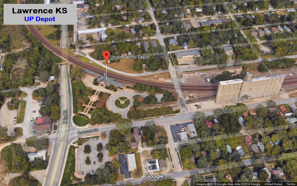
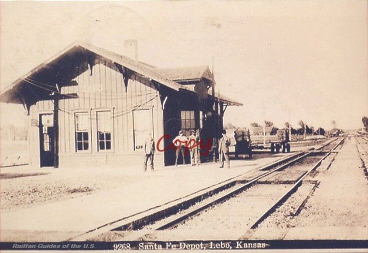
Lebo
Liberal
Picture from George's website at: http://www.georgelightfoot-art.com/art-images.html
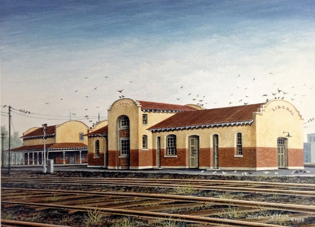 Painting by George Lightfoot, prints are available
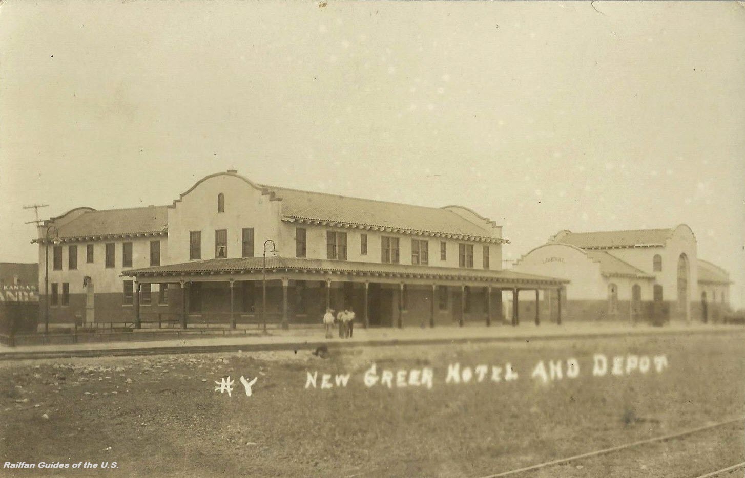 eBay seller: chippewacity
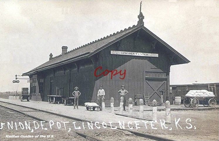
Lincoln Center
Longford
A former Atchison, Topeka & Santa Fe Railway Company depot, built in 1887.
Pix from here: http://www.kshs.org/km/items/view/313248
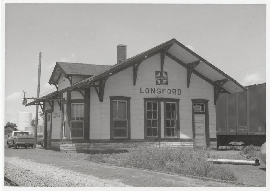 1970
1970Manhattan
Former Chicago, Rock Island & Pacific Railroad depot. It was on the Western Division, Subdivision 37 (Clay Center line), at mile post 143.2.
From: http://www.kshs.org/km/items/view/215523
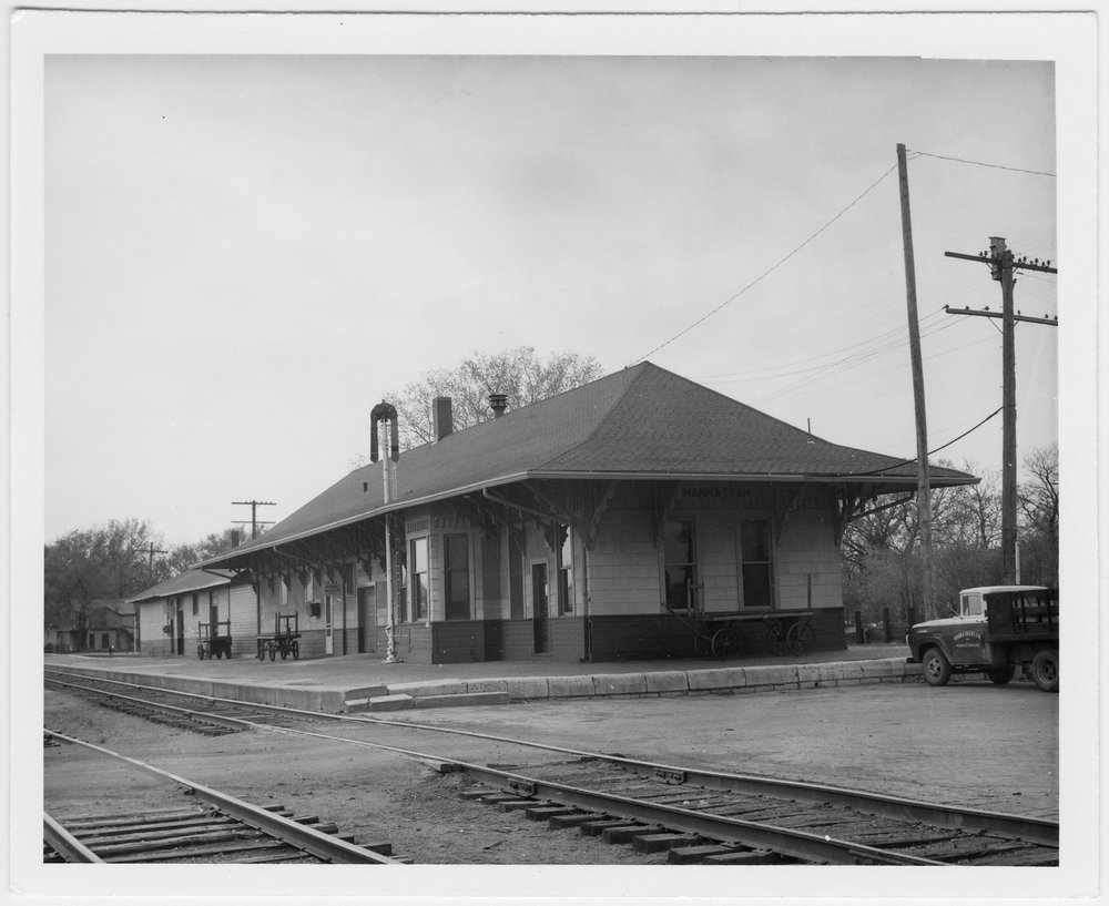 1958, picture courtesy H Killam
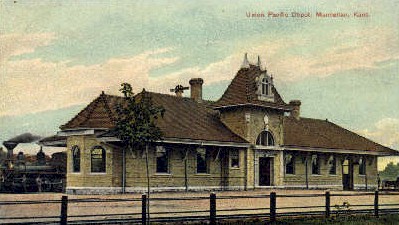
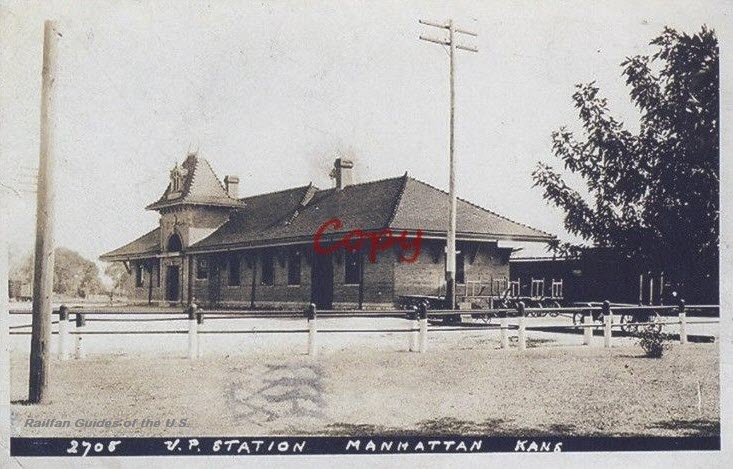 eBay seller: skurfanpostcards
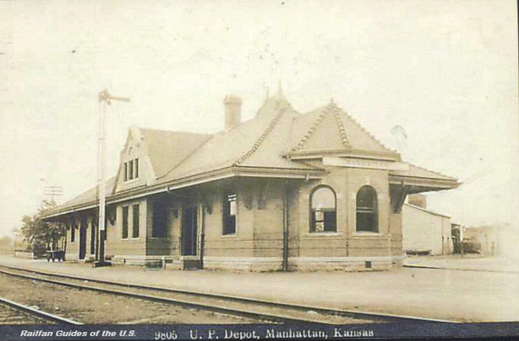 eBay seller: skurfanpostcards
Marion
A former Chicago, Rock Island & Pacific RR depot.
Picture found here: http://www.kshs.org/km/items/view/312468
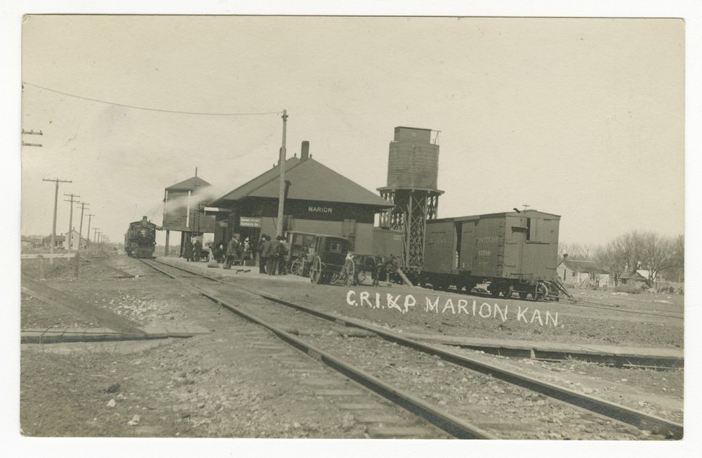 1909
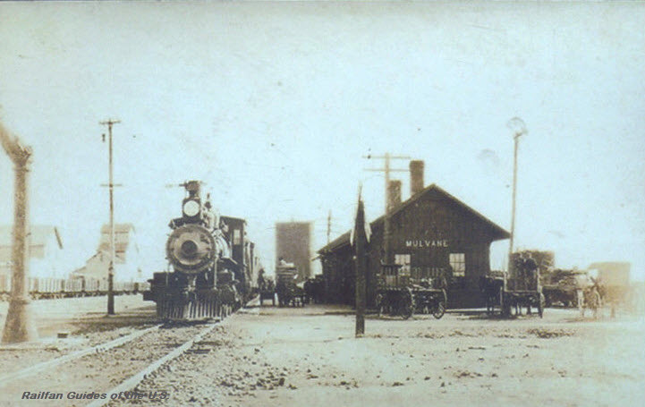
1909Mulvane
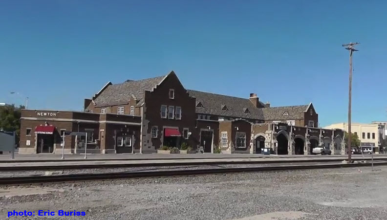
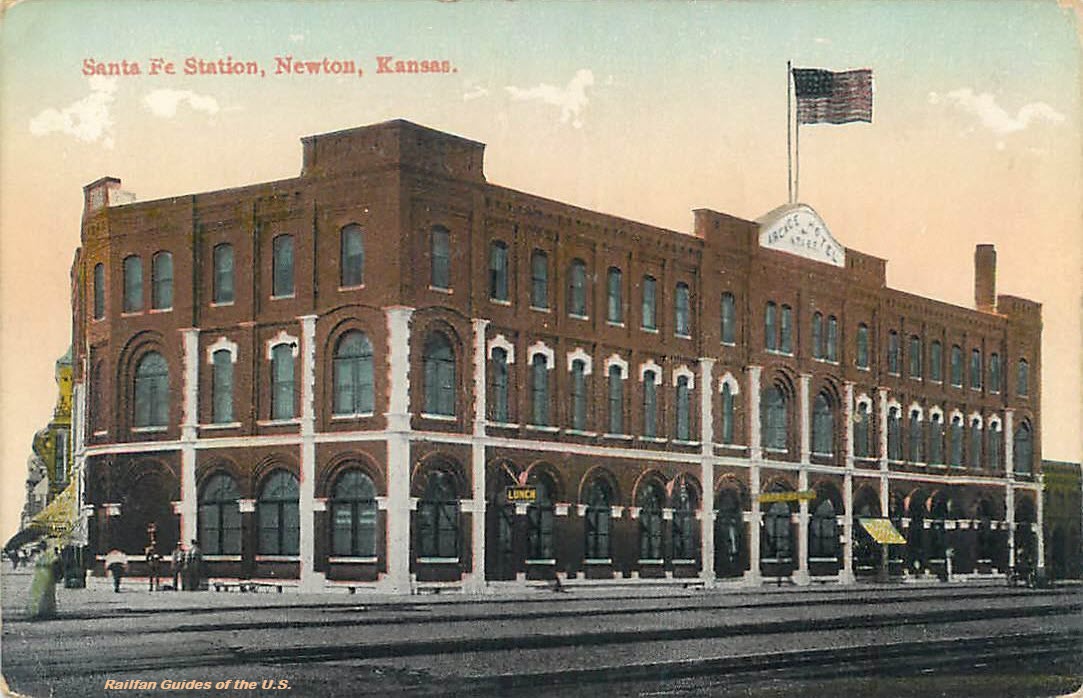
Newton
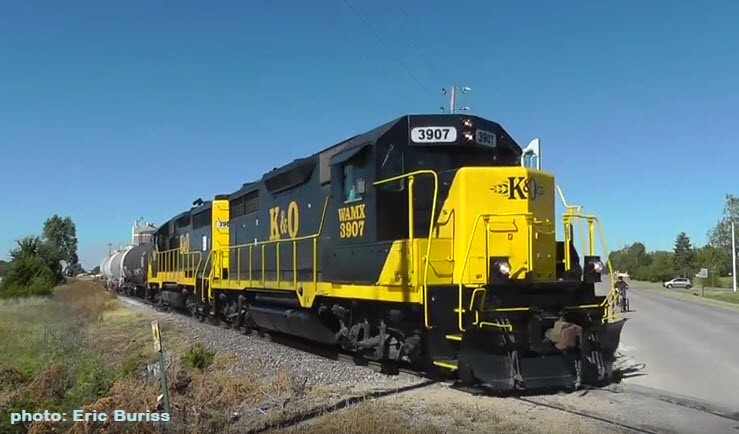
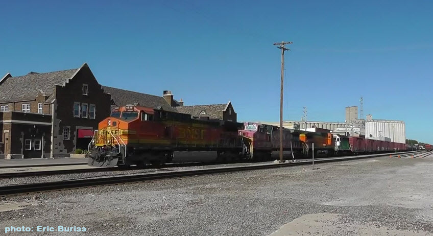
 eBay seller: outweststv
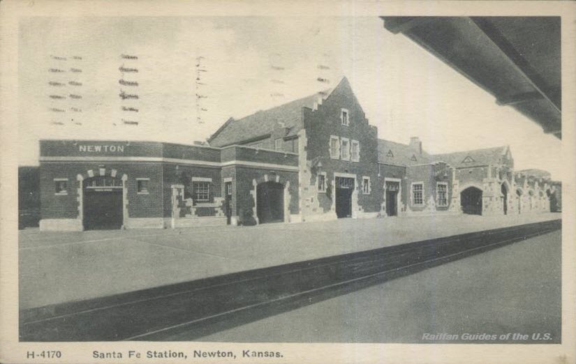 eBay seller: treasuresetcatzoom
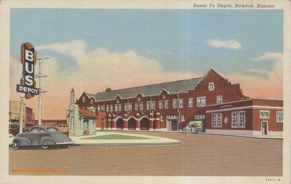 eBay seller: treasuresetcatzoom
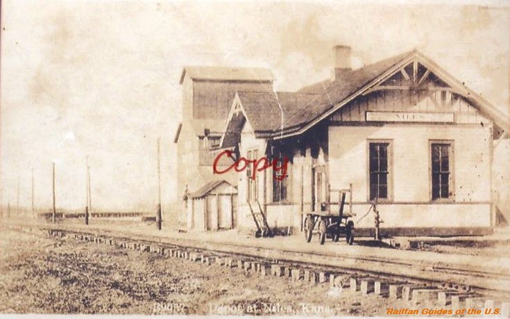
Niles
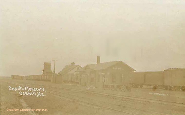
Oak Hill
 eBay seller: vintagepapermemories
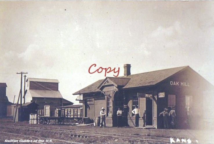
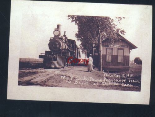
Oatville
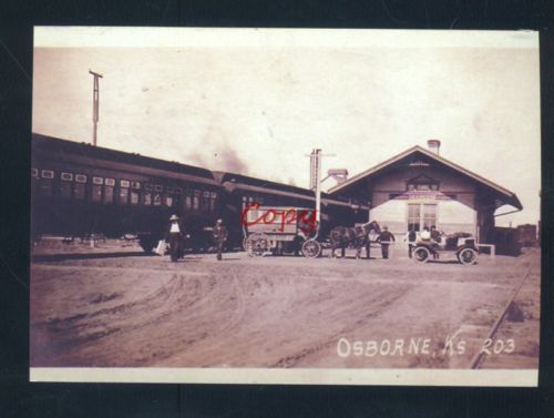
Osborn
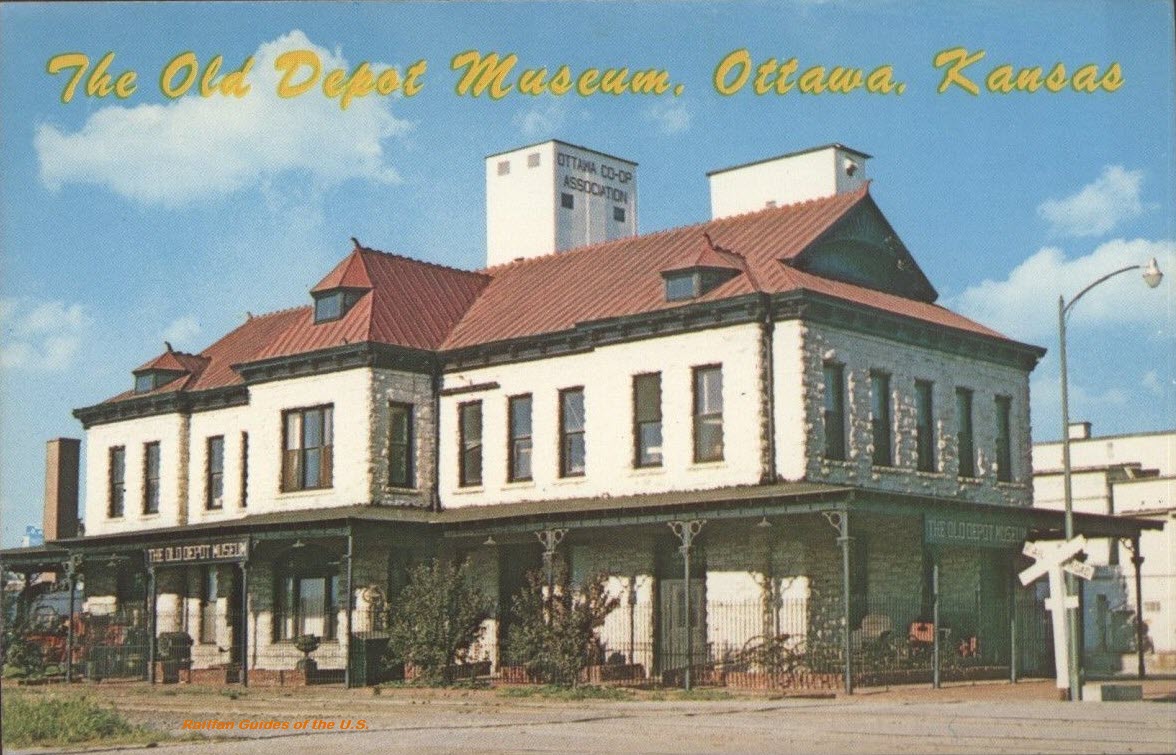
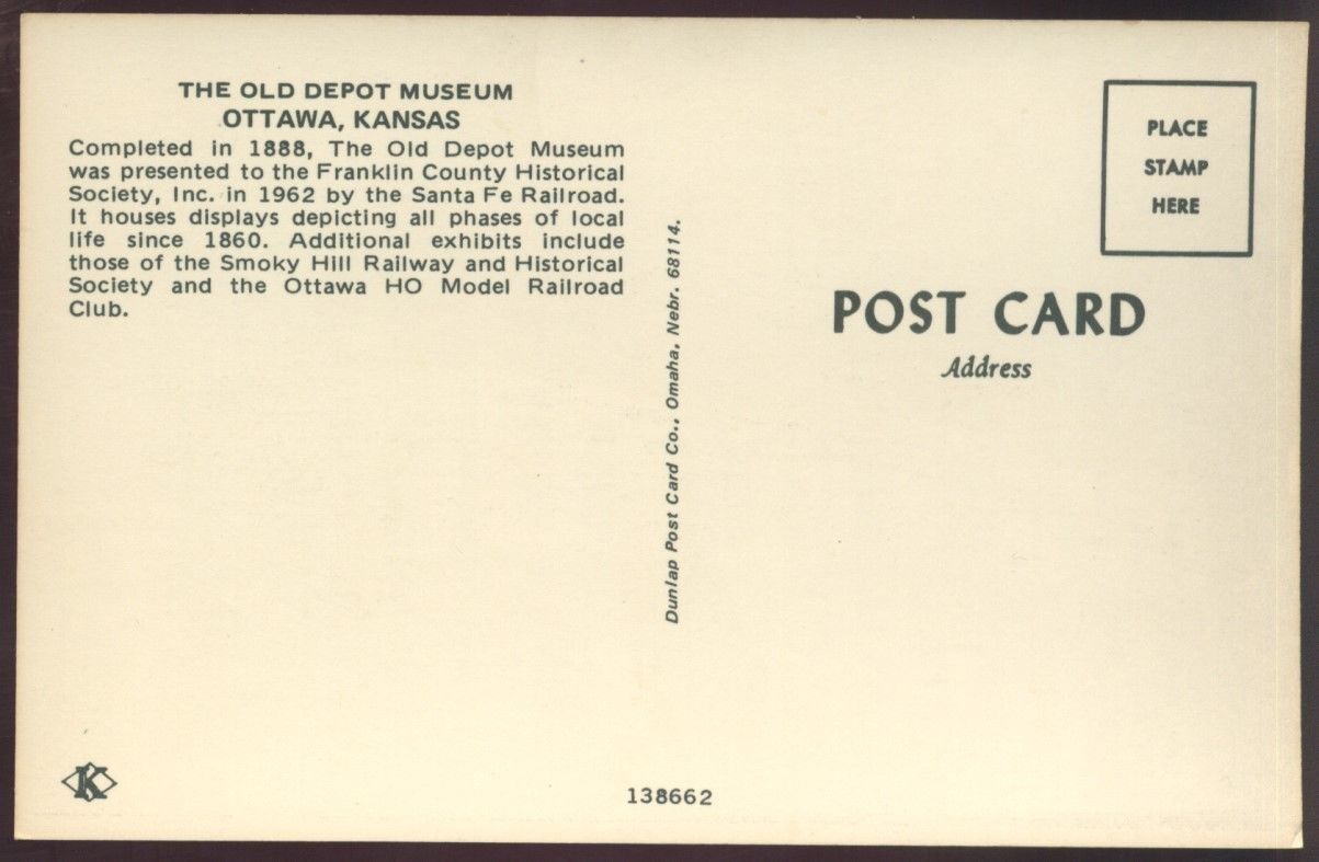
Ottawa
 eBay seller: ourpastpostcards
Oxford
Parsons
 eBay seller: paperbunni
Peabody
Pittsburg
Former Missouri Pacific RR depot. The depot was located on the Eastern Division, Pittsburg Subdivision, at mile post 358.14.
From: http://www.kshs.org/km/items/view/215396
 1958, photo courtesy H Killam
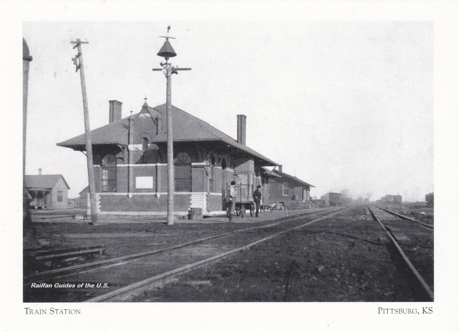 eBay seller: tejas-postcards-sportscards
Pratt
Picture from: https://joyride.guru/roadtrips/kansastrain/
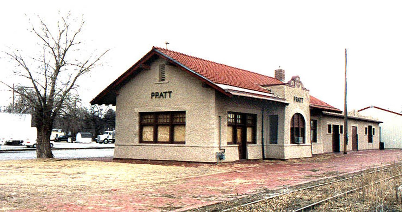 2002
2002Reece
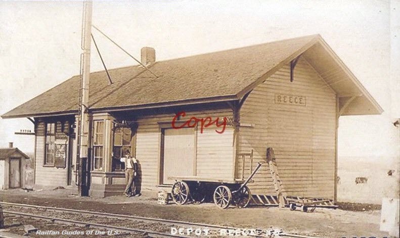
Richland
A former Missouri Pacific Railroad depot. The town was razed in the late 60's/early 70's as part of a flood control project, because the town was located along the banks of the Wakarusa River.
Picture from: http://www.kshs.org/km/items/view/216263
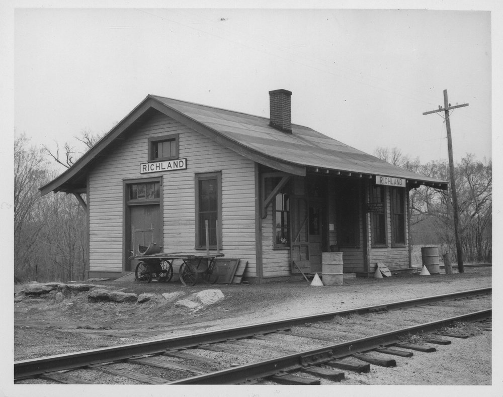 ~1955
~1955Russell Spring
Salina
A former Atchison, Topeka & Santa Fe Railway Company depot. The depot was built by the Salina Northern RR in 1914. In 1924, ownership was transferred to the Salina and Santa Fe Railway. Finally in 1942, it became part of the ATSF.
Pic came from: http://www.kshs.org/km/items/view/215584
 1957, photo courtesy H Killam
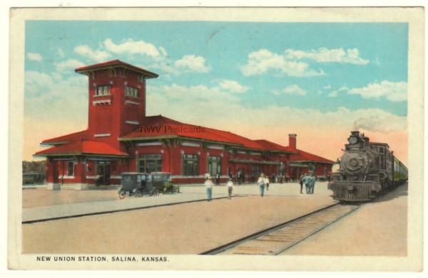
Sanford
 eBay seller: skurfanpostcards
Sharon Springs

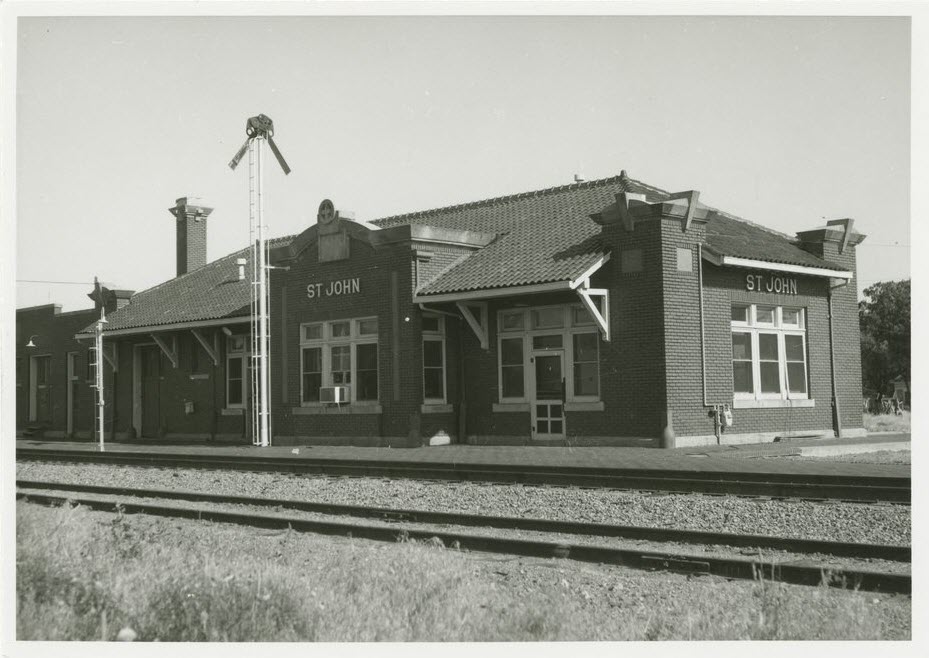
St John
A former Atchison, Topeka & Santa Fe depot, built in 1913.
Picture from: http://www.kshs.org/km/items/view/312808
Sterling
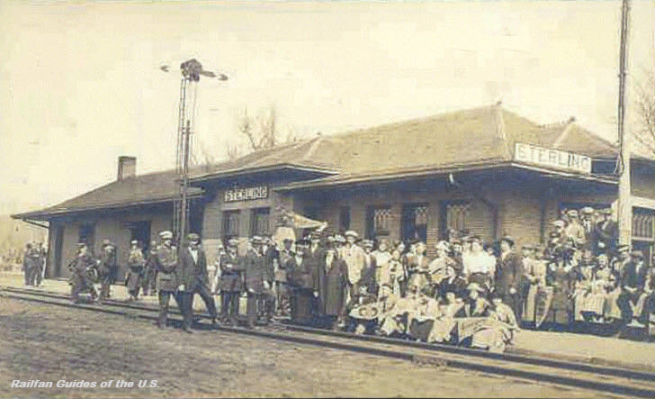 eBay seller: skurfanpostcards
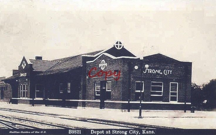
Strong City
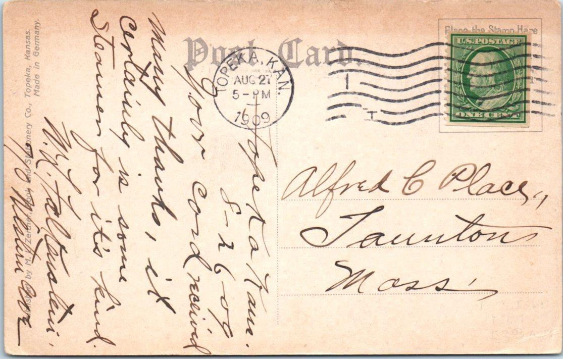
Topeka
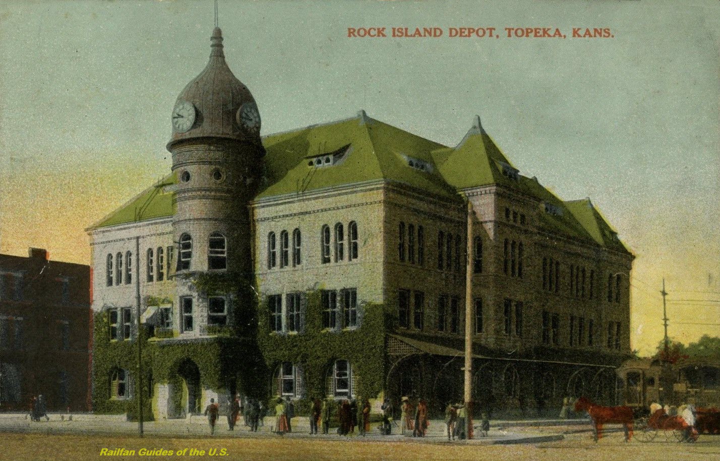
 eBay seller: trentonstampandcoinco
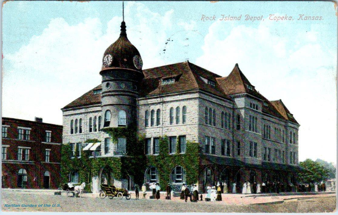
 eBay seller: outweststv
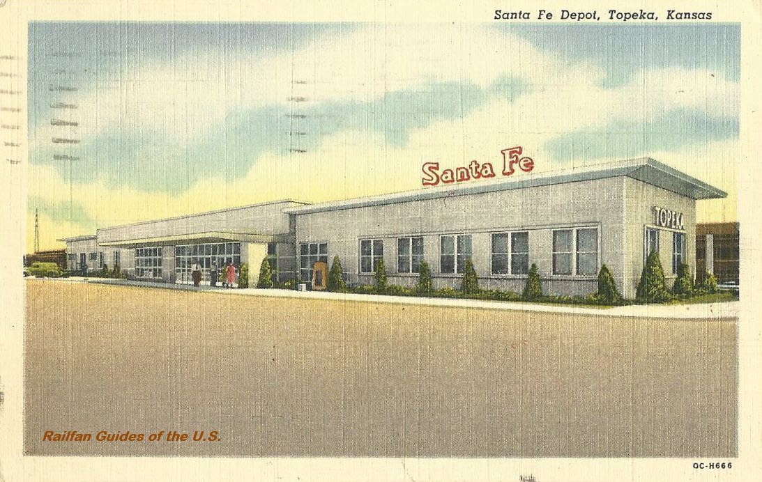 eBay seller: thepostcardhouse
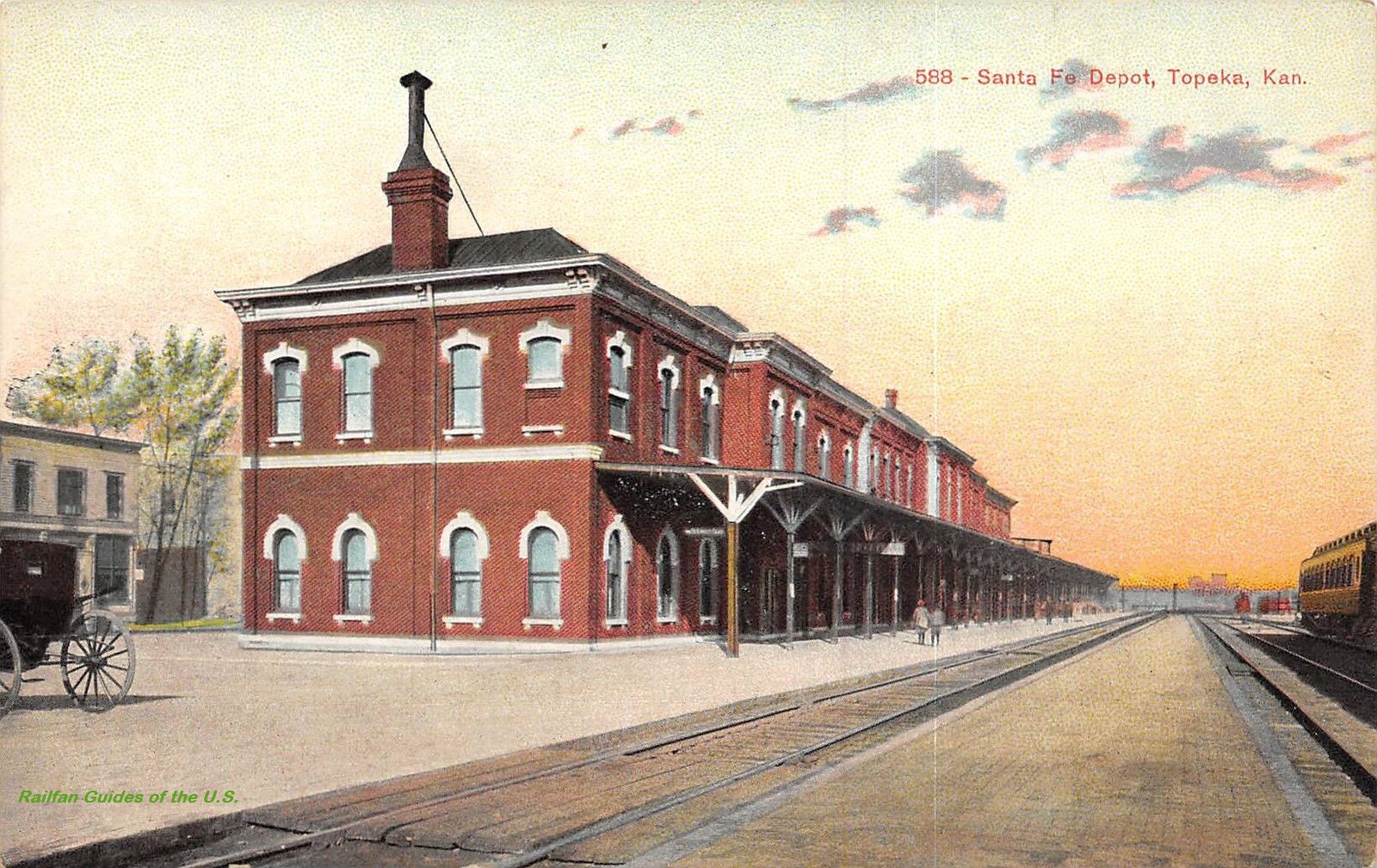 eBay seller: lacumo
 eBay seller: frutigen1
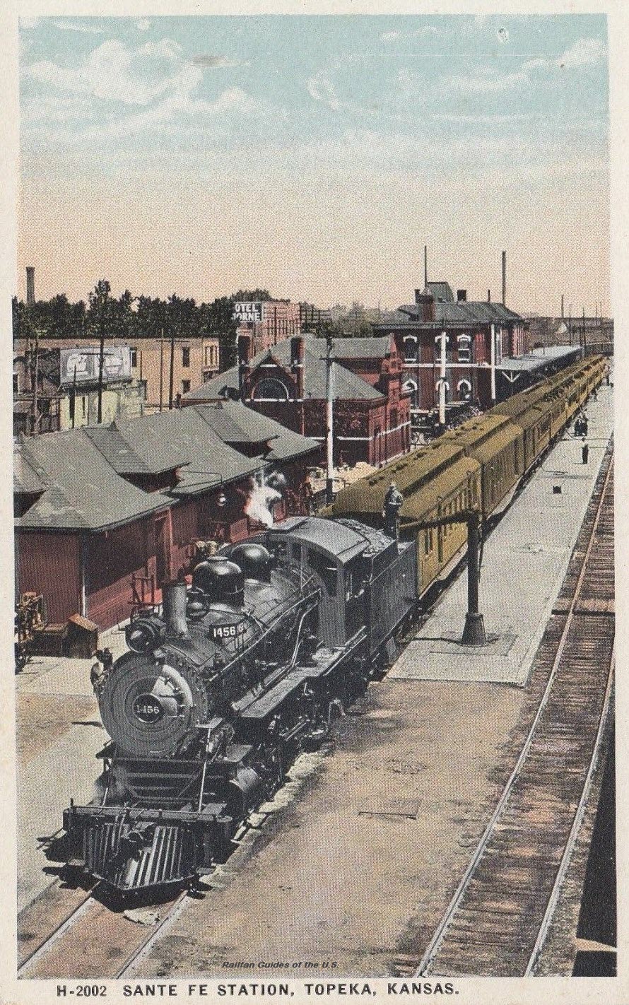 eBay seller: bdavidk27
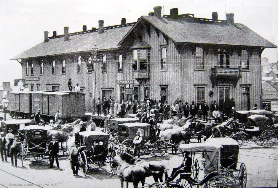 eBay seller: frutigen1
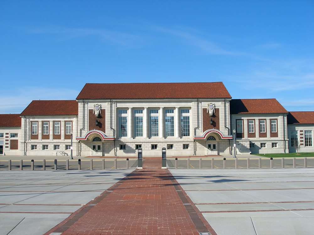 Carol/Cottonwood Whispers
Turon
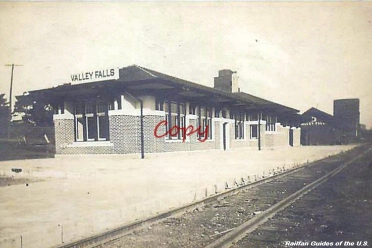
Valley Falls
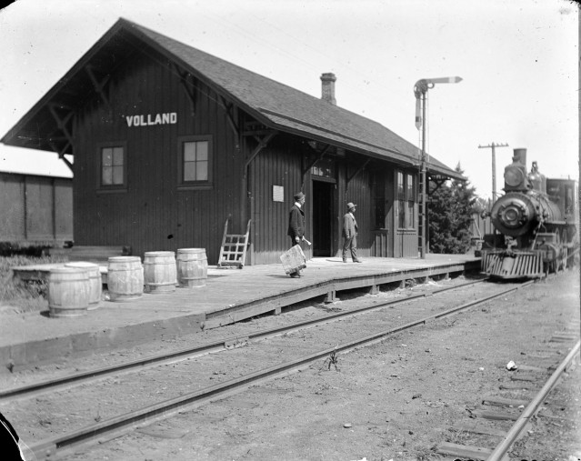
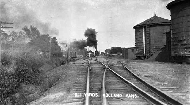
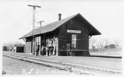
Volland
First two pictures from: https://wabaunseecomuseum.org/2016/11/20/rock-island-railway-at-volland-kansas/
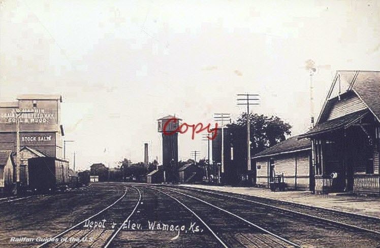
Wamego
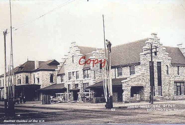
Wellington

Wichita
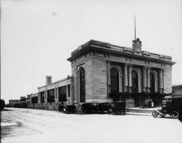
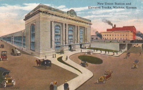
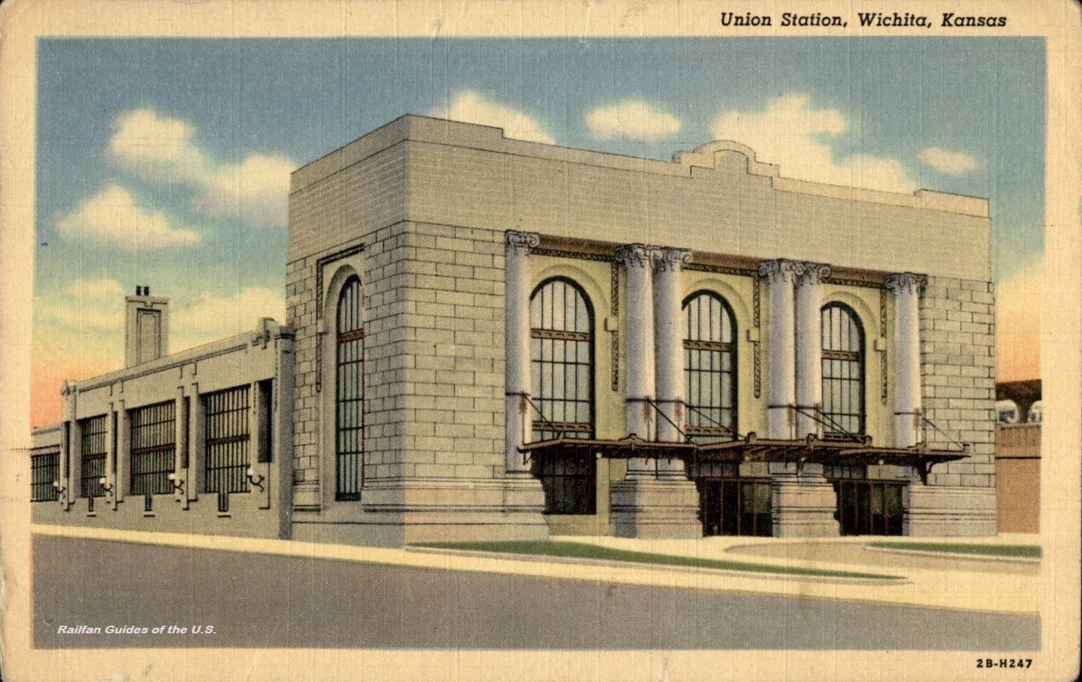 eBay Seller: susie201
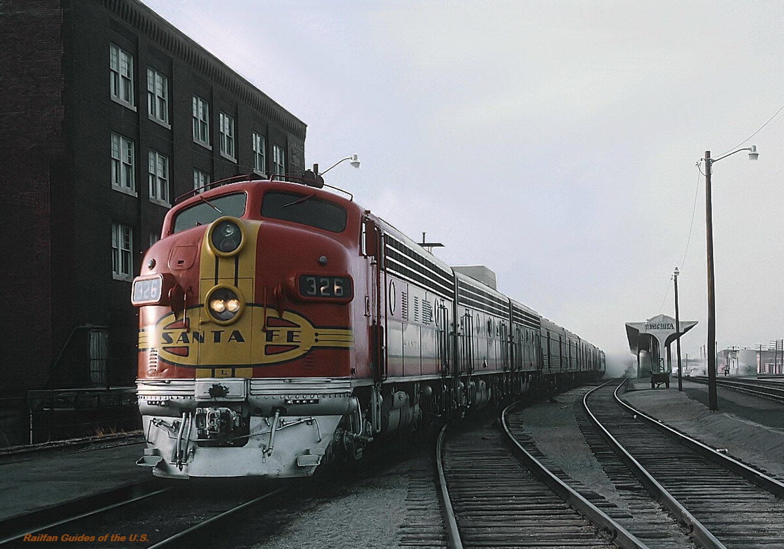 from a frig magnet, eBay Seller: tinkysmamamary
Wichita - Frisco Depot
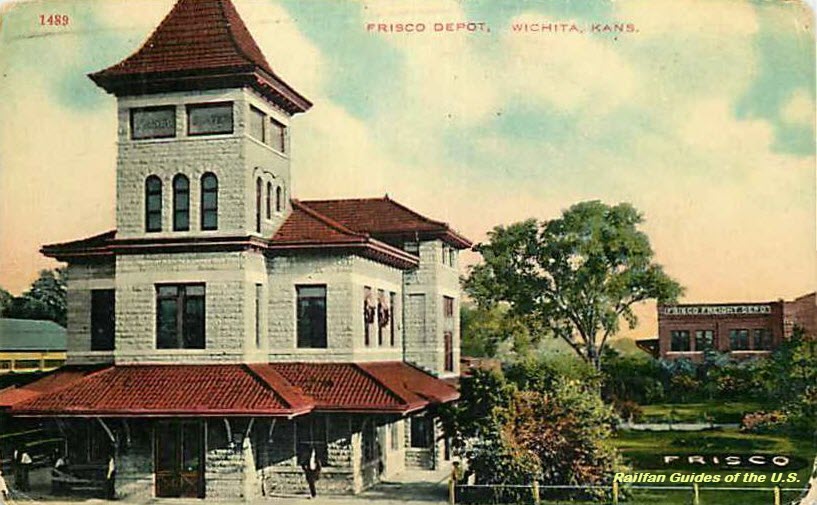 eBay Seller: woody64
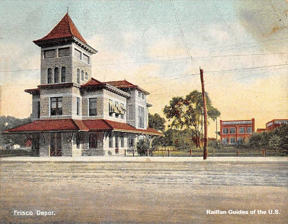 eBay seller: lacumo
Wichita - Missouri Pacific Depot
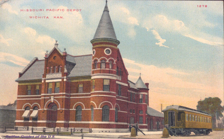 eBay seller: skurfanpostcards
Wichita - Rock Island Depot
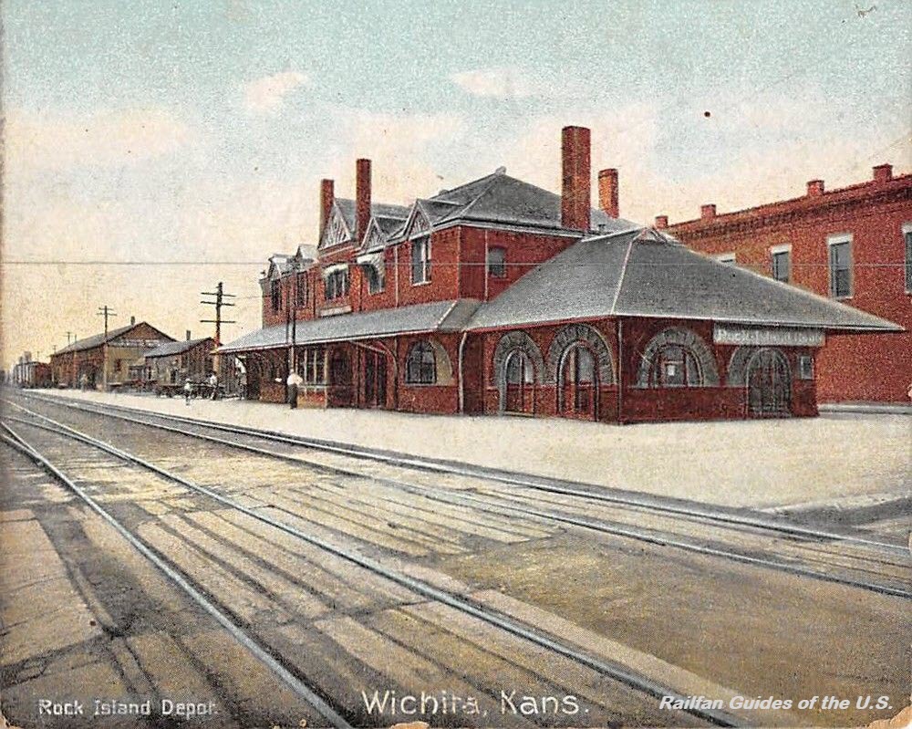 eBay seller: lacumo
Wilmot
Picture from: http://www.eccchistory.org/wilmot.htm
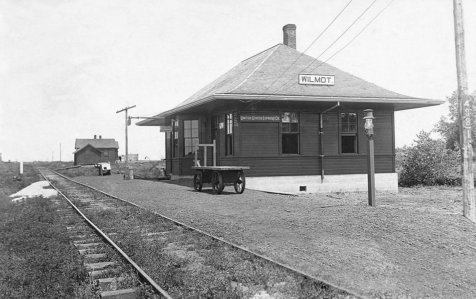

Mrs. T. R. (Maggie) Eastman, Switchboard operator at Telephone Exchange in Wilmot
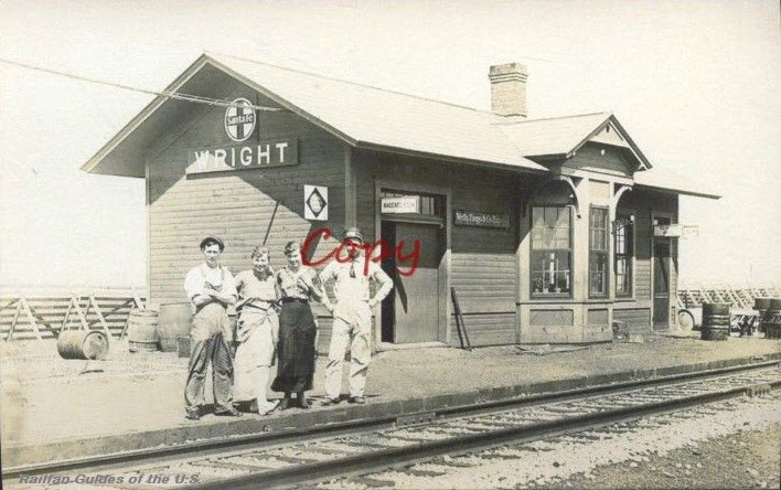
Wright
Yates Center
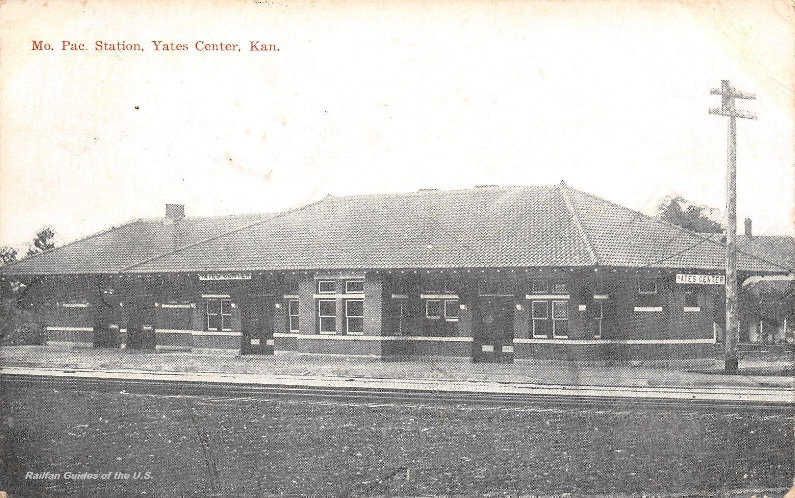
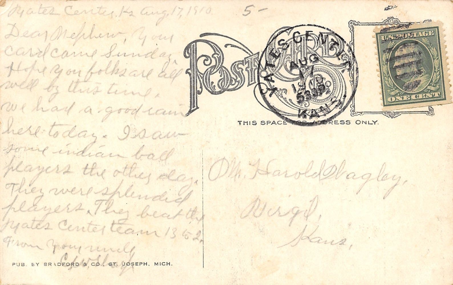 eBay seller: refried.jeans
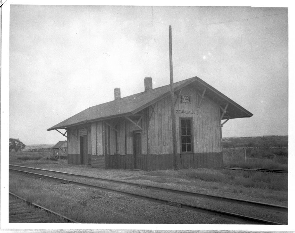
Zeandale
Former Chicago, Rock Island & Pacific RR depot, eight miles east of Manhattan KS.
From: http://www.kshs.org/km/items/view/211181
Disclaimers:
I love trains, and I love signals. I am not an expert. My webpages reflect what I find on the topic of the page. This is something I have fun with while trying to help others.
Please Note: Since the main focus of my two websites is railroad signals, the railfan guides are oriented towards the signal fan being able to locate them. For those of you into the modeling aspect of our hobby, my indexa page has a list of almost everything railroad oriented I can think of to provide you with at least a few pictures to help you detail your pike.
If this is a railfan page, every effort has been made to make sure that the information contained on this map and in this railfan guide is correct. Once in a while, an error may creep in :-)
My philosophy: Pictures and maps are worth a thousand words, especially for railfanning. Text descriptions only get you so far, especially if you get lost or disoriented. Take along good maps.... a GPS is OK to get somewhere, but maps are still better if you get lost! I belong to AAA, which allows you to get local maps for free when you visit the local branches. ADC puts out a nice series of county maps for the Washington DC area, but their state maps do not have the railroads on them. If you can find em, I like the National Geographic map book of the U.S..... good, clear, and concise graphics, and they do a really good job of showing you where tourist type attractions are, although they too lack the railroads. Other notes about specific areas will show up on that page if known.
Aerial shots were taken from either Google or Bing Maps as noted. Screen captures are made with Snagit, a Techsmith product... a great tool if you have never used it!
By the way, floobydust is a term I picked up 30-40 years ago from a National Semiconductor data book, and means miscellaneous and/or other stuff.
Pictures and additional information is always needed if anyone feels inclined to take 'em, send 'em, and share 'em, or if you have something to add or correct.... credit is always given! Please be NICE!!! Contact info is here
Beware: If used as a source, ANYTHING from Wikipedia must be treated as being possibly being inaccurate, wrong, or not true.
RAILFAN GUIDES HOME
RAILROAD SIGNALS HOME
NEW 12/16/2017, JAN21/2018, NOV24/2021
Last Modified 24-Nov-2021