One of the better resources I have come across to this end is the plethora of
old post cards still around depicting many of these structures, some better than others.
Most of the postcards were found on EBay unless noted, other pictures, mostly
the more recent ones, come from Google and/or Bing images - credit given if the
source is known. Compliments to (to name a few) skurfanpostcards,
trentonstampandcoinco, and baysideantiques_02 for the many, many railroad depot
pictures they all offer, without whom you wouldn't have as many pictures here to
enjoy.... all of the pictures from these folks are for sale. Seller with the
red word COPY on them is "skurfanpostcards".
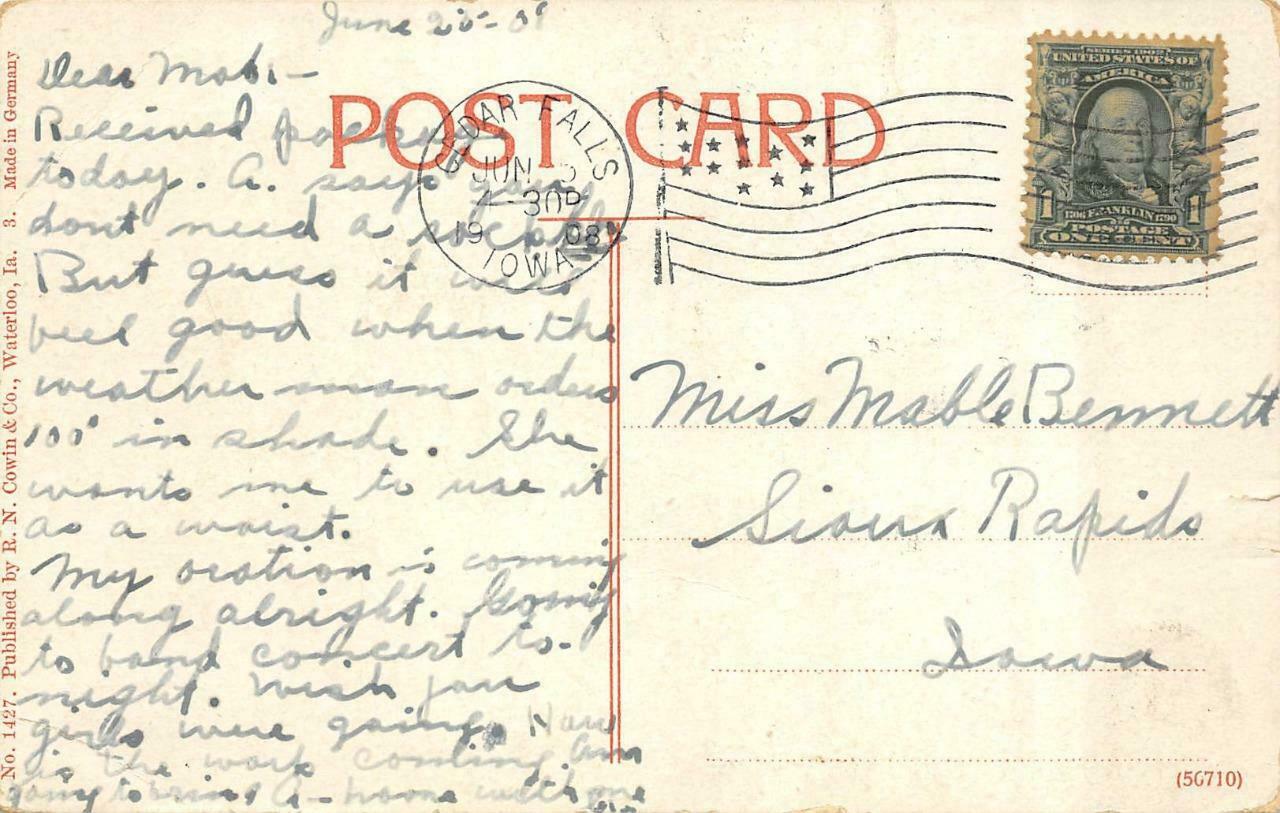
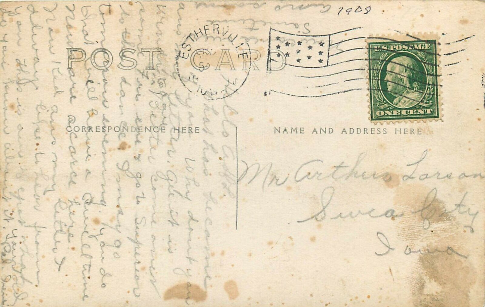
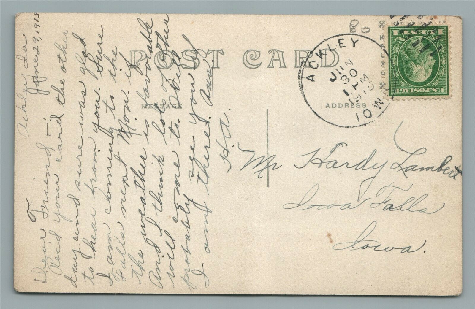
Dates are in the picture name, x means the date is approximate. If they were
available, and interesting, I included the back side of the postcards. 1901a
and 1910b would be the same card, both sides.
If the picture was really, really bad, some of them have been cleaned up and/or
repaired when I had the energy.
If you have the time, other good sources for pictures are:
Shorpy, Google,
and Bing images, and the Library
of Congress (you have to be very patient to find things here :-)
Since many of these stations are no longer around, this page is mostly for historical reference.
What's the difference between a station and a depot? Most people will say
"nuttin", it's a matter of preference, although many will use depot for older
buildings.
If you have a picture you would like to contribute, please see the bottom of the
page for how to find me, credit is always given to contributing photographers.
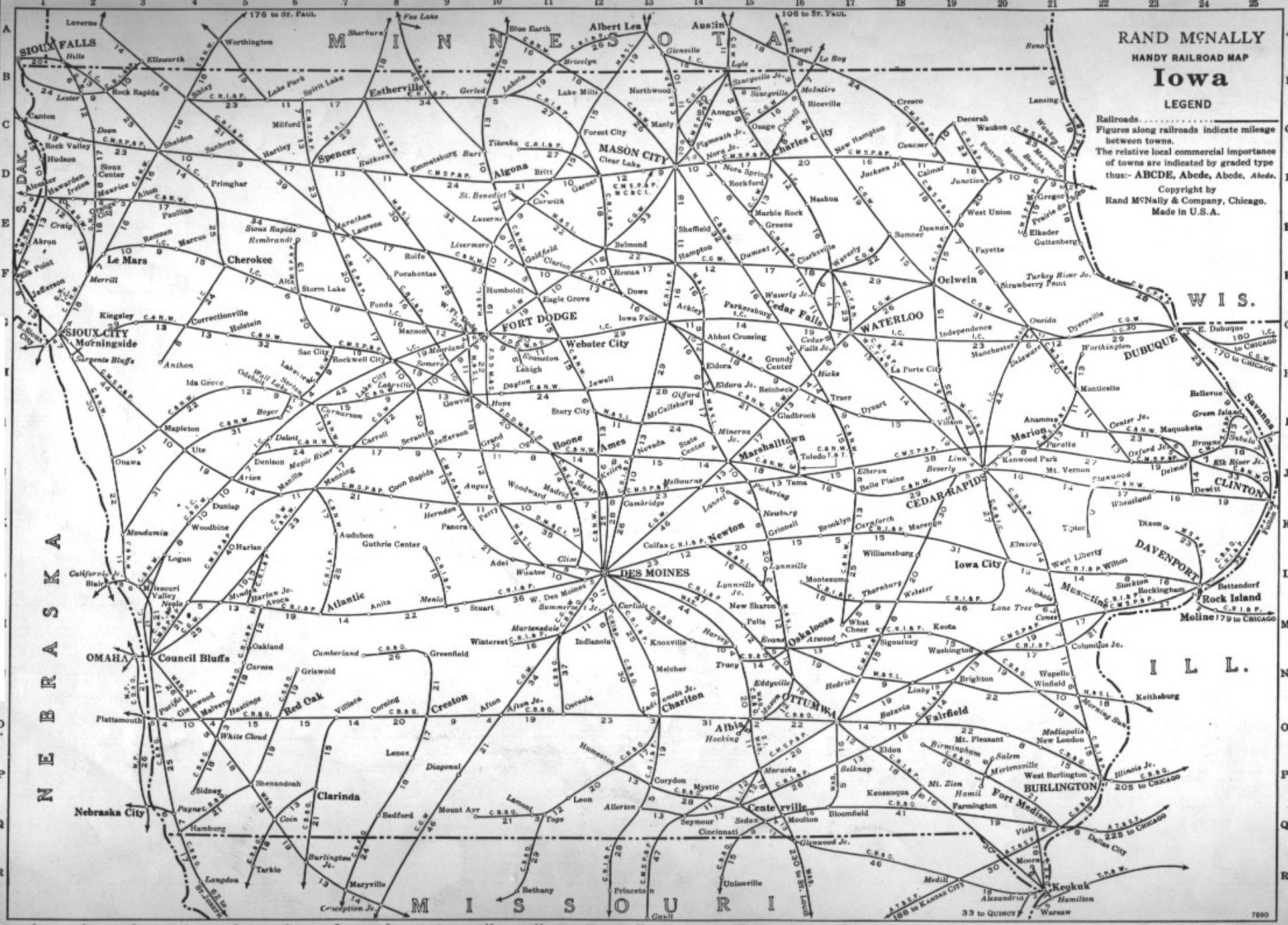
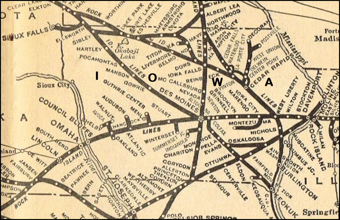
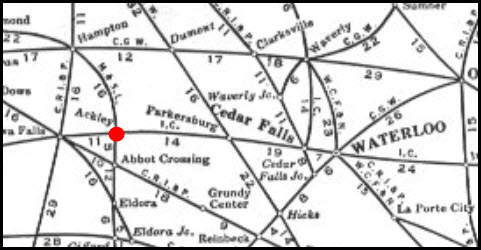
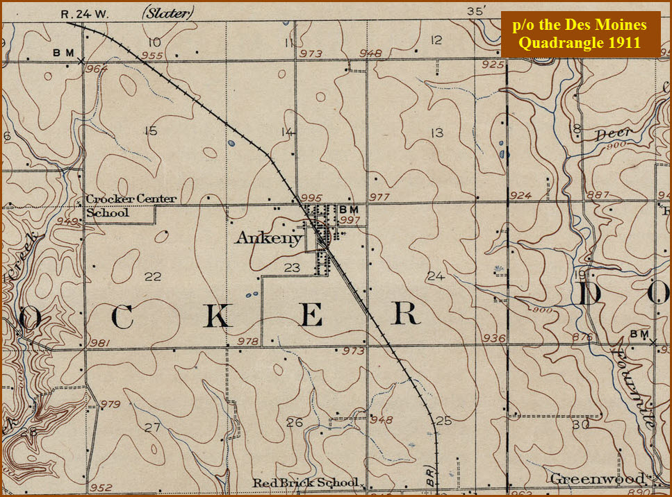
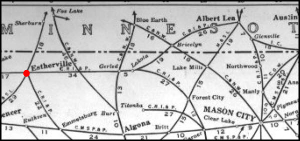
Here are a couple of Iowa railroad maps to illustrate where many of these stations were.
Most of the trackage in Iowa belonged to the Rock Island, the SOO, the CB&Q, the CNW, and
the Illinois Central (at least in the mid 1940's).
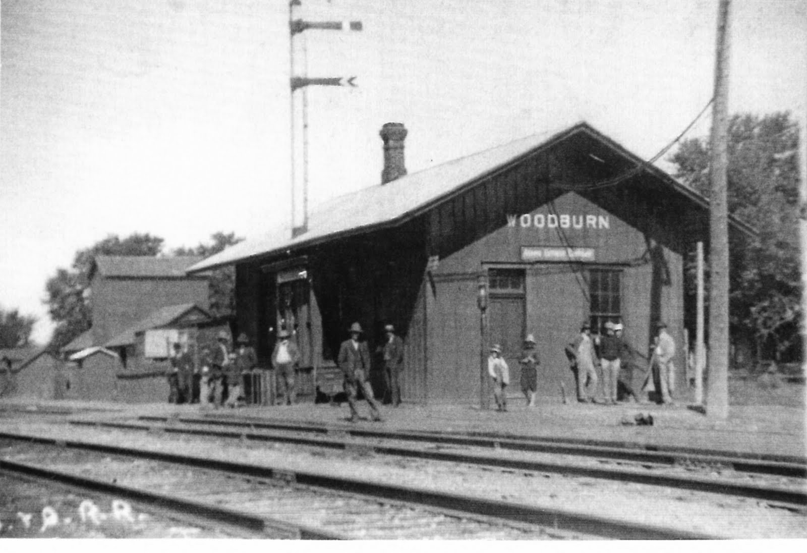
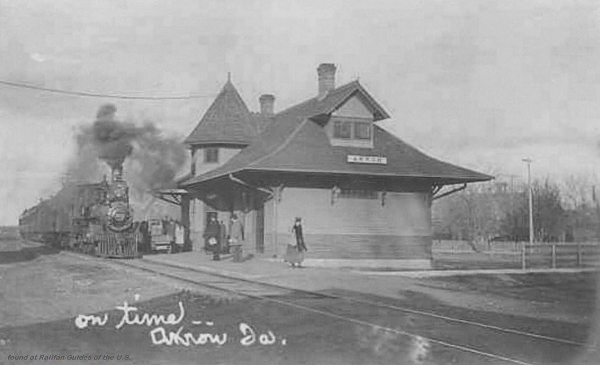
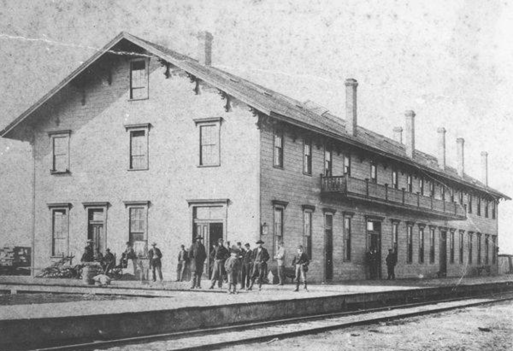
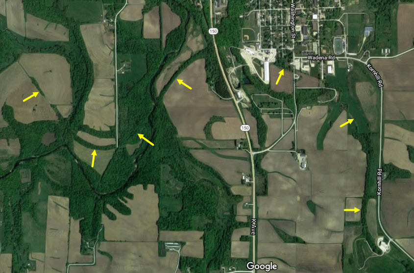
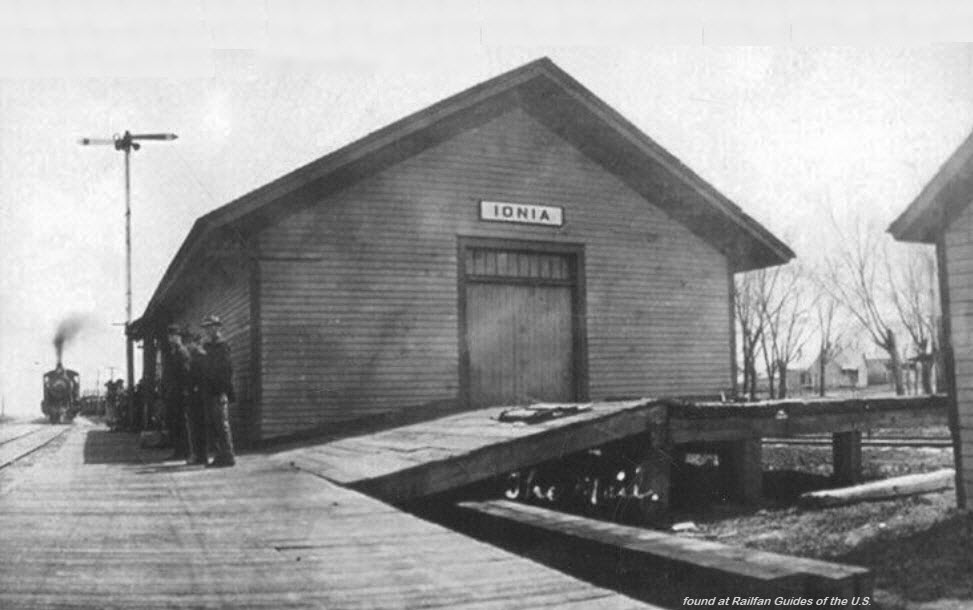
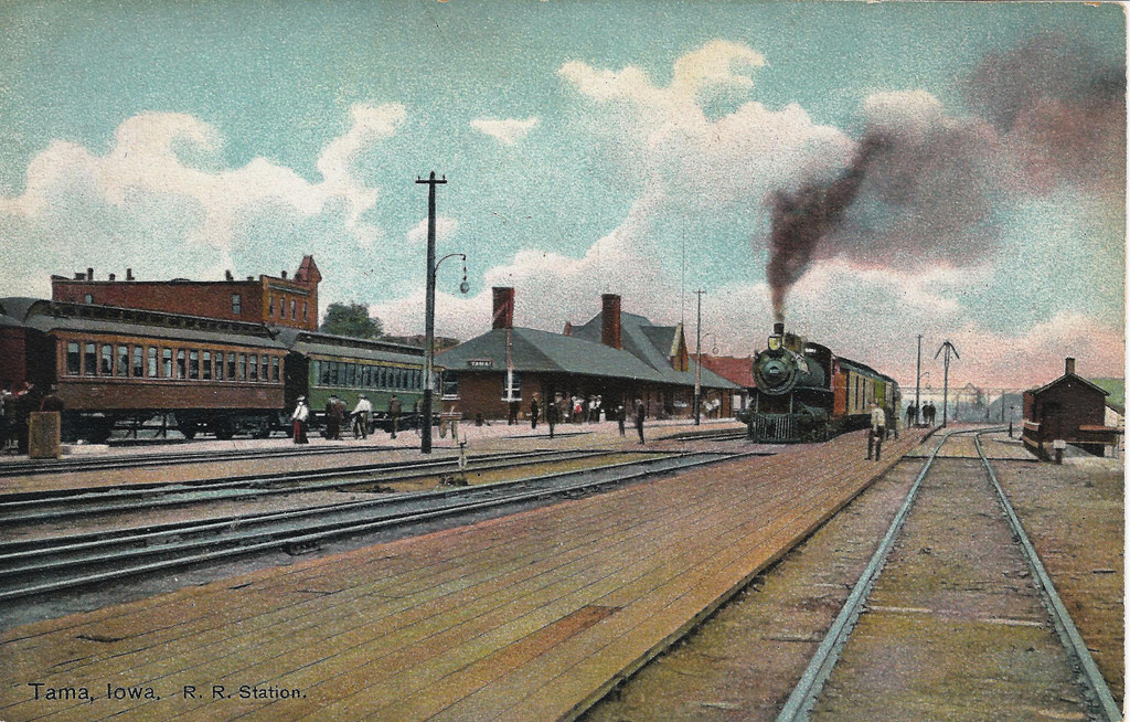
Akron
About 25 miles north of Sioux City on the west side of the state.
There is still a depot in town, but don't think it is the same one pictured here.
42.555145, -93.052340
Ebay seller skurfanpostcards
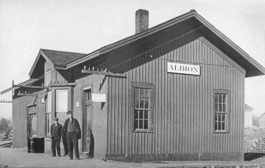
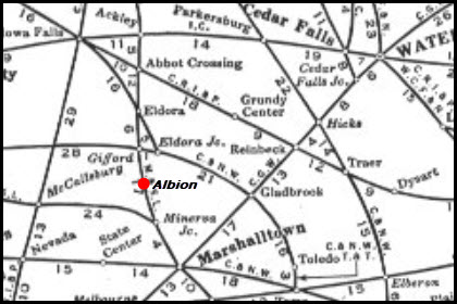
Albion
Albion is 6.75 miles north west of Marshalltown.
Ebay seller skurfanpostcards
Albion does not show up on the 1948 map.
Alton
Alton is about 40 miles north east of Sioux City.
Two CNW lines crossed here, one east-west, one north-south.
The north-south line still runs thru town, with a small yard.
Ebay seller skurfanpostcards
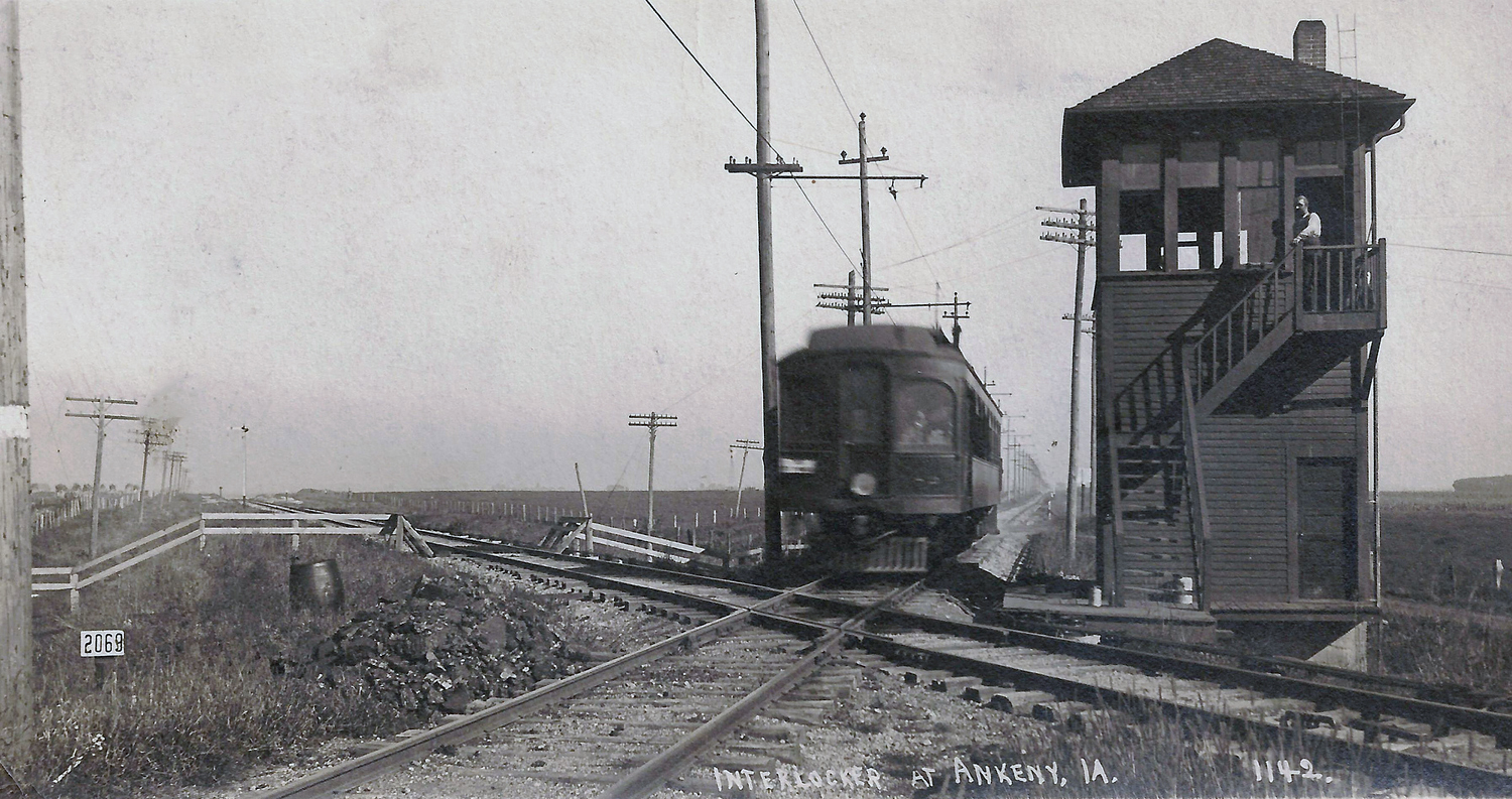
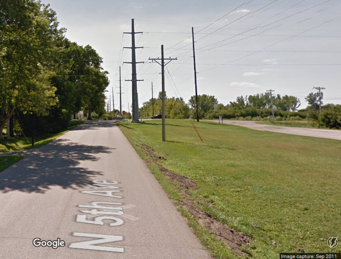
Ankeny The only thing left in Ankeny now is a hikey-bikey trail on the NW side of town.
Ankeny is a northern suburb (kinda) of Des Moines.
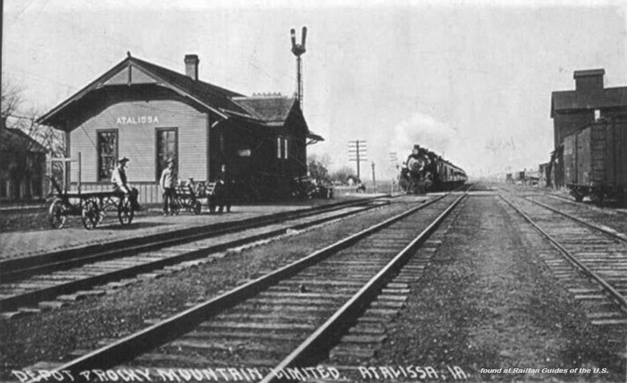
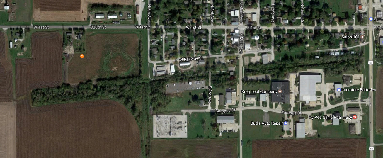
Atalissa
Atalissa is 20 miles south east (about 4 o'clock) from Iowa City.
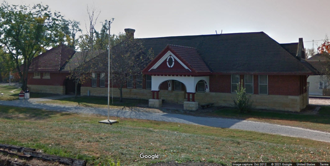
Bloomfield
Bloomfield is 86 miles due south east of Des Moines.
Ebay seller skurfanpostcards
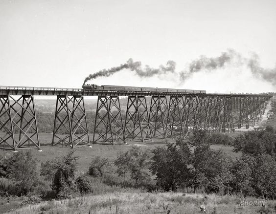
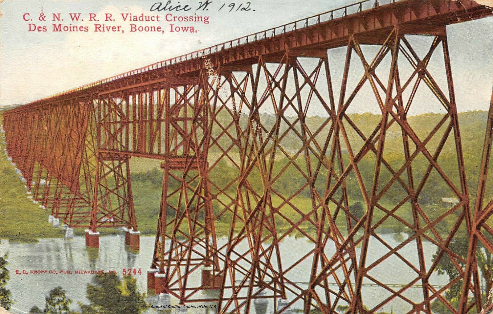
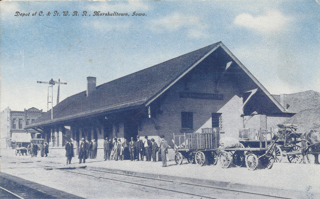
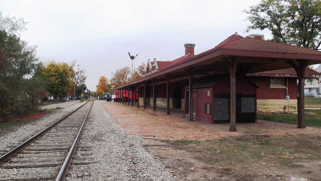
Boone
Boone is about 35 miles northwest of Des Moines and 13 miles west of Ames. It
was on a CNW mainline (now UP), and also had the CMStP&P and FDDM&S coming into town.
West of town is the Boone & Scenic Valley Railroad.
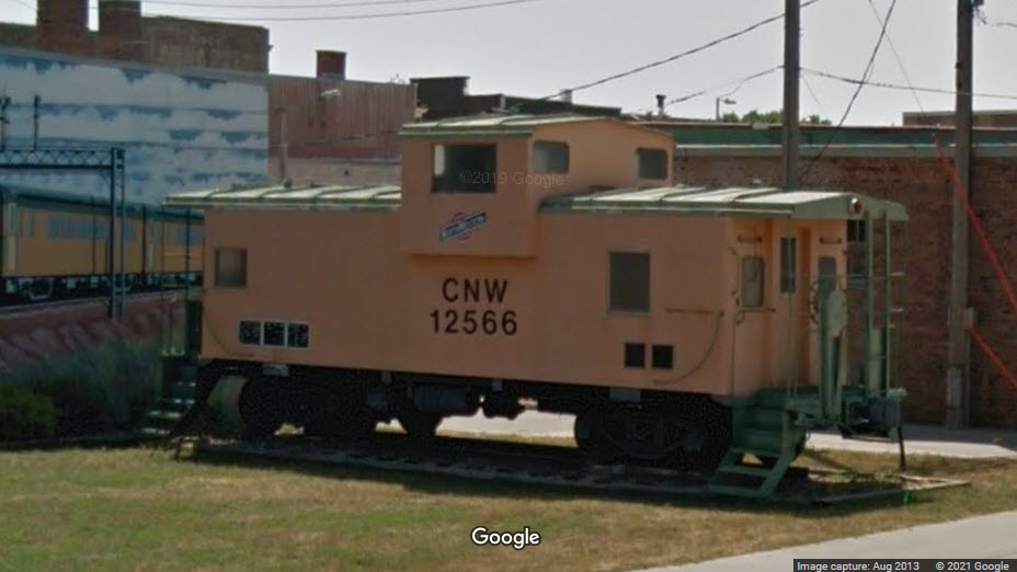
A block away from the depot is a railroad themed park with a CNW caboose.
It looks like we have two bridges worthy of pictures in the Boone area.....
This bridge spans the Bass Point Creek, and is NW of Logansport IA
Formerly a bridge on the Fort Dodge, Des Moines & Southern Rwy, it is now part of the Boone & Scenic Valley RR
For more info on this bridge: https://bridgehunter.com/ia/boone/boone-valley-high/
2010, photo by Jerry Huddleston
Ebay seller paper-traders3
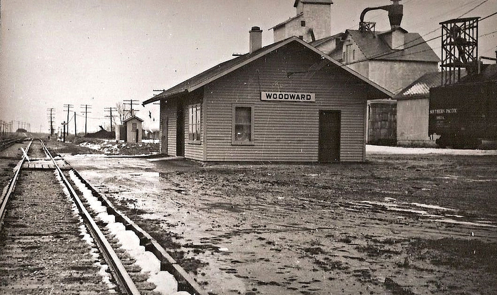
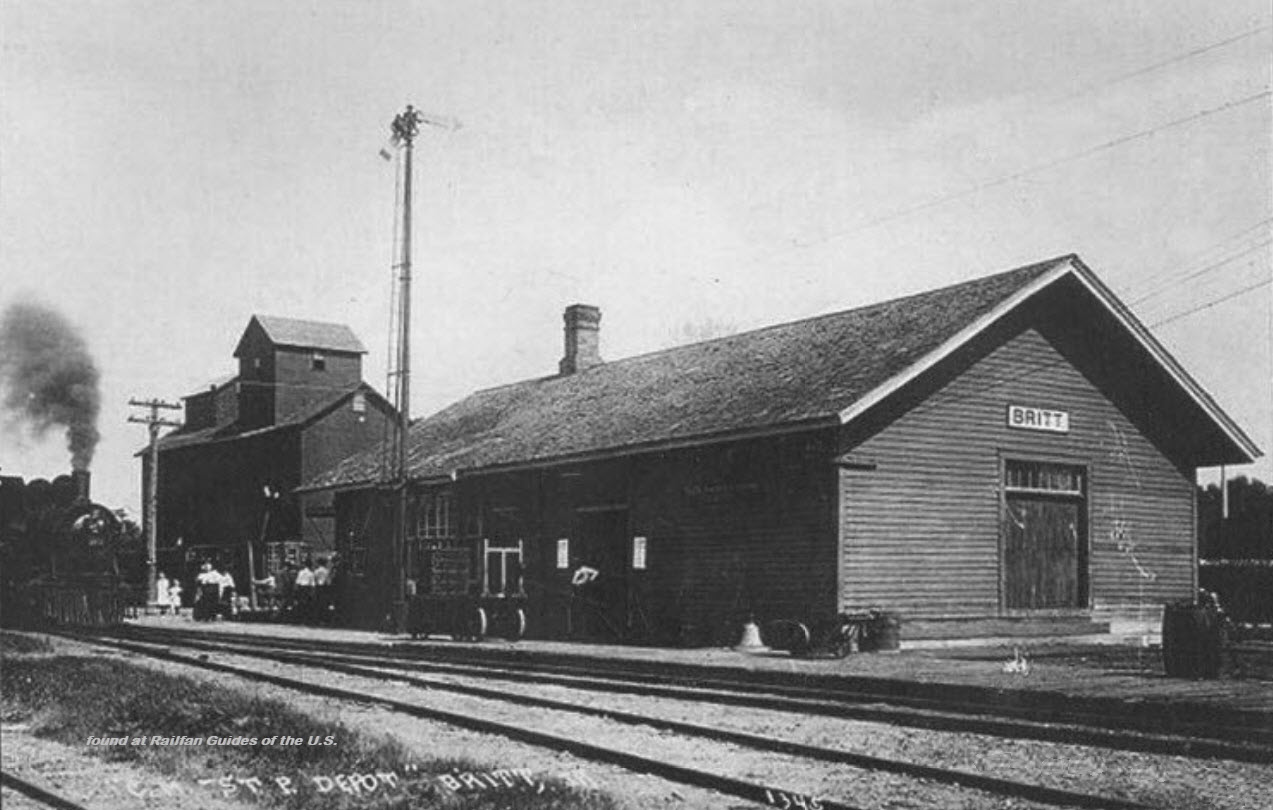
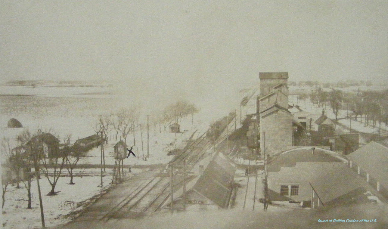
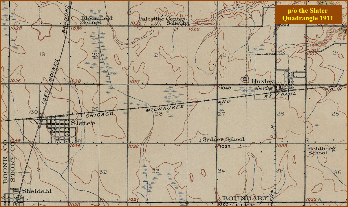
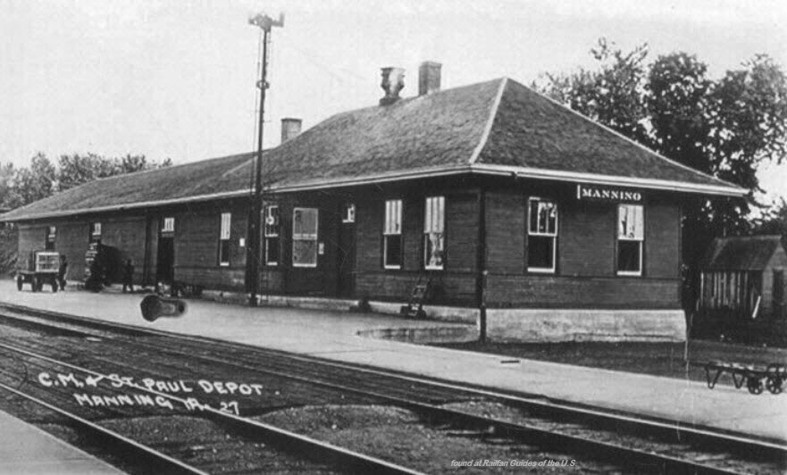
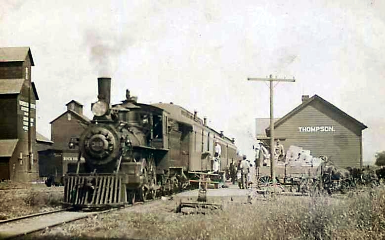
Britt
Britt is ~105 miles north of Des Moines and 30 miles west of Mason City -
about 23 miles west of I-35 exit 194, which is also an exit for Mason City.
There was a diamond here between the CMStP&P (the Milwaukee Road) and the M&SL.
The Fort Dodge, Des Moines & Southern Rwy and Chicago, Milwaukee & St Paul RR used to have tracks passing through town.
From the air, you can still see where "a" diamond and interchange used to be, altho it is not the one shown on the USGS
Map...... To the east of town, part of the R-O-W is used for the Heart
of Iowa Nature Tail. When I came thru in 1998/1999 to visit a customer, there was nothing around to see except for trees.
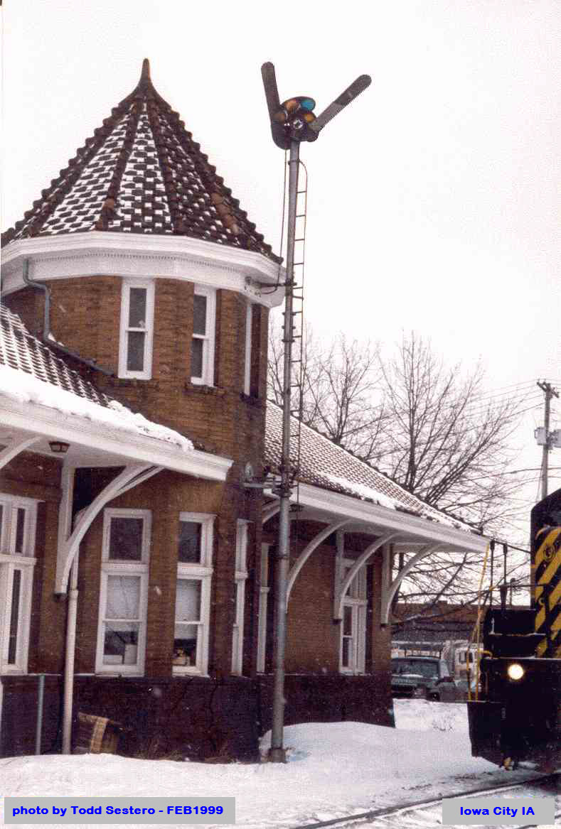
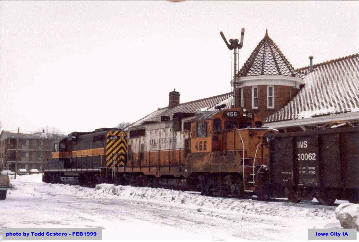
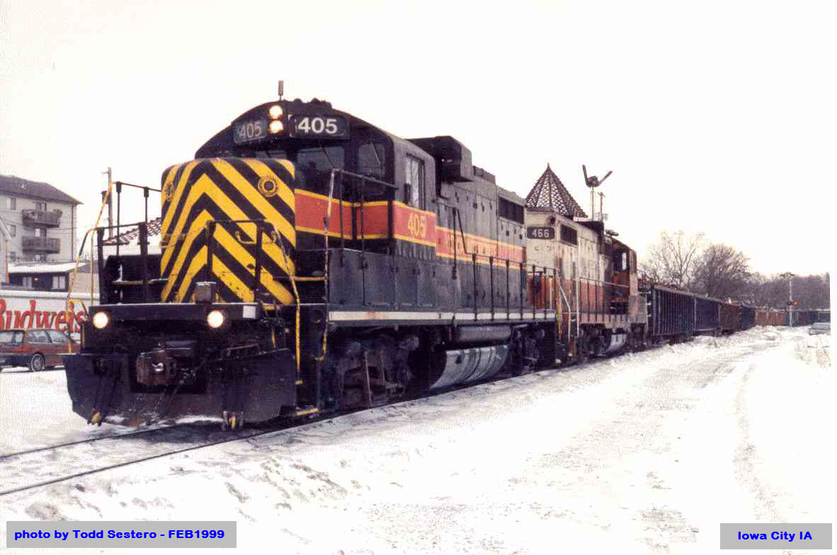
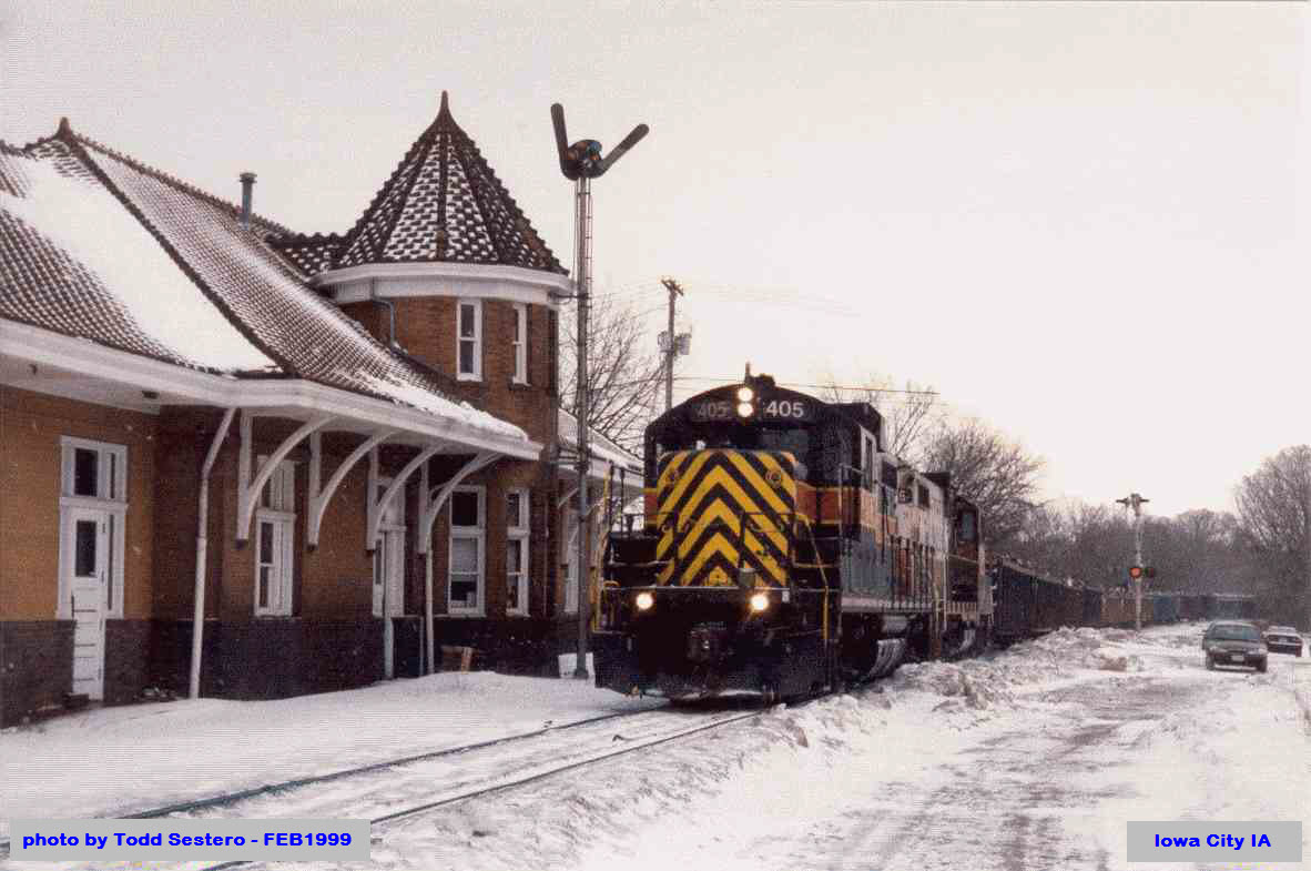
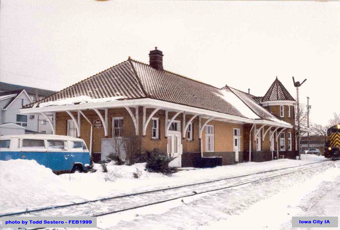
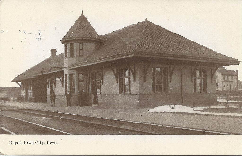
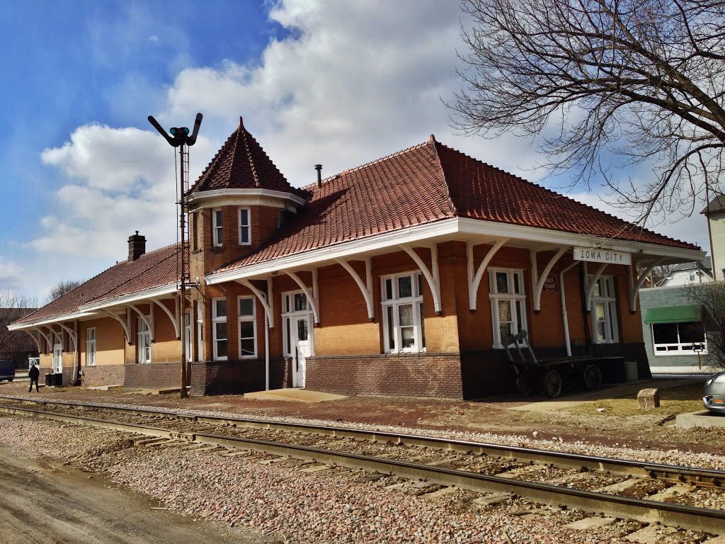
These pictures from 1999 are from a business trip I took to Iowa City to work at the radio "place"
formerly known as Collins Radio, now Rockwell-Collins. The office I visited
was next door to the former headquarters of the trucking company we see all over the place, Heartland
Express, altho they relocated to North Liberty IA. The street name they were on?: Heartland
Drive! This reminds me that I should do a guide for Iowa City..... :-)
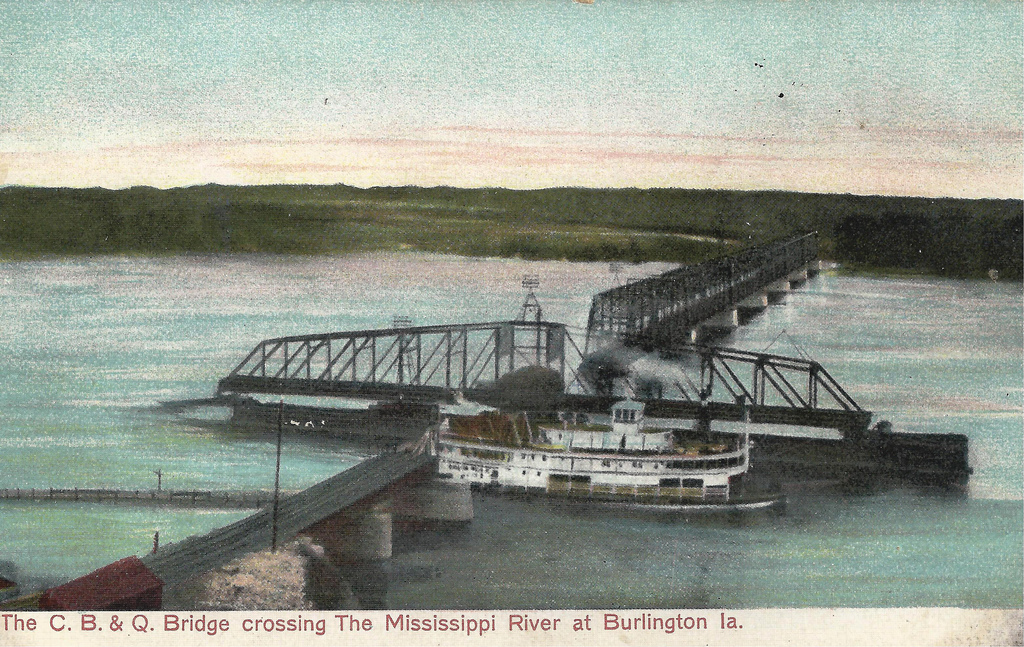
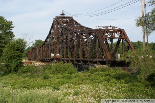
The Iowa Central reached this area in 1886, building a bridge across the Mississippi River
at Keithsburg the same year. The Iowa Central became part of the Minneapolis &
St. Louis Railway in 1902, who used this line to access Peoria. M&StL became part
of the Chicago & Northwestern Railway in 1960. C&NW used this bridge until
1971, when they sold the tracks to the Great River Railroad from
Winfield to Keithsburg, who couldn't turn a profit on this line. The line sat unused
until the late 1970s when the tracks were finally removed. Today, the Mississippi
River Bridge is abandoned missing a span (it collapsed in a fire in 1981) and the rest
of the line is gone other than some bridges.
This bridge is the main bridge over the Mississippi River. It contained a deck girder,
9 Pratt Through Trusses with riveted connections and A-Frame portals, a 234' Lift Span and a
single truss. The bridge was built in 1909 on concrete substructures to replace an 1886
Whipple Through Truss. The stone piers for that bridge are right beside this bridge. On
June 30th 1981, the bridge's lift span shack was set ablaze by teens with fireworks. This set
the bridge on fire, collapsing the lift span. It was nearly 2 weeks until the Army Corp
of Engineers blew up the lift span and one other truss. Today, this leaves a huge gap in the
bridge. There were plans to reuse the bridge as a coal dock, and recently, word has come
about of a possible rebuilding of this bridge.
Railroad transportation came to Iowa in the late 1840s. Iowa had approximately 655 miles of
track in operation by 1860 and 2,683 miles by 1870. This mileage grew to almost 9,200 at
the turn of the century (1900) and peaked between 1911 and 1917 with more than 10,500 roadway
miles of track.
Although there were several very small railroads operating in and around Iowa’ river towns,
the first railroad to cross the Mississippi River was the Mississippi and Missouri Railroad
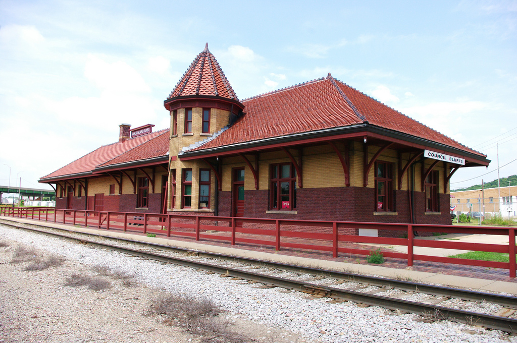
in 1856. This railroad later became known as the Chicago, Rock Island and Pacific Railroad.
The Rock Island filed for bankruptcy in 1975 and ordered to liquidate by the bankruptcy court
in June 1980. Much of the former Rock Island system in Iowa was acquired by the former Chicago
and North Western Railway Co. The former Rock Island main line across Iowa from Chicago to
Davenport to Council Bluffs and Omaha is now operated by the Iowa Interstate Railroad.
In 1867 the Chicago, Iowa and Nebraska Railroad, which later became the Chicago and North
Western Railway Co. was the first railroad to build tracks across Iowa. The Chicago and
North Western Railway Co. merged with the Union Pacific Railroad Co. in April 1995.
The Chicago, Burlington and Quincy Railroad Co. (now known as the BNSF Railway Co.) and
the Illinois Central Railroad Co., which later became the Illinois Central Gulf Railroad
Co. both completed their rail lines across Iowa in 1878. (In December 1985 the Illinois
Central Gulf Railroad sold all of its Iowa trackage to the Chicago, Central and Pacific
Railroad Co. and in January 1996 got back all that trackage by acquiring the Chicago,
Central and Pacific Railroad Co..) (Illinois Central Gulf Railroad Co.changed its name
back to Illinois Central Railroad Co. in 1988).
In 1874, the Milwaukee and Mississippi Railroad Co. became the Chicago, Milwaukee, St.
Paul and Pacific Railroad Co. and, also in 1878, became the fifth railroad to complete
its tracks across Iowa. The Milwaukee filed bankruptcy late in 1976 and was split into
two parts: the “operating core” and the “non-operating core”. Early in 1986 the Milwaukee
“operating core” was acquired and merged into the SOO Line Railroad Co., a subsidiary of
the CP Rail system formerly known as the Canadian Pacific Co.. The “non-operating core”
was liquidated.
Iowa’s rail system has experienced extensive change and restructuring since 1975 as a
result of railroad bankruptcies and rail line abandonments. As of Dec. 31, 2001, Iowa
has permanently lost approximately 6,595 miles of track since the peak years of 1911
to 1917. Of these about 3,800 miles were lost after 1974. The bankruptcies of the
Chicago, Rock Island and Pacific Railroad and the Chicago, Milwaukee, St. Paul and
Pacific Railroad in the mid-1970s caused the state to lose a significant amount of
trackage and service. Today, Iowa has only 3,905 miles of roadway track in operation.
In 2012, Iowa is served by five Class I railroads: the BNSF Railway Co., CN, Canadian
Pacific Railway, the Norfolk & Southern Railway, and the Union Pacific Railroad; one
Class II railroad, the Iowa Interstate Railroad; and 11 Class III railroads: the Appanoose
County Community Railroad, the Boone & Scenic Valley Railroad, the Burlington Junction
Railway, the CBEC Railway, the Cedar Rapids and Iowa City Railway,the D & I Railroad,
the D & W Railroad, the Iowa Northern Railroad, the Iowa Traction Railroad, the Iowa
River Railroad, and the Keokuk Junction Railway.
These railroads serve five principal gateways or interchange points in the Midwest:
Chicago, Minneapolis-St. Paul, Omaha, Kansas City,and St. Louis.
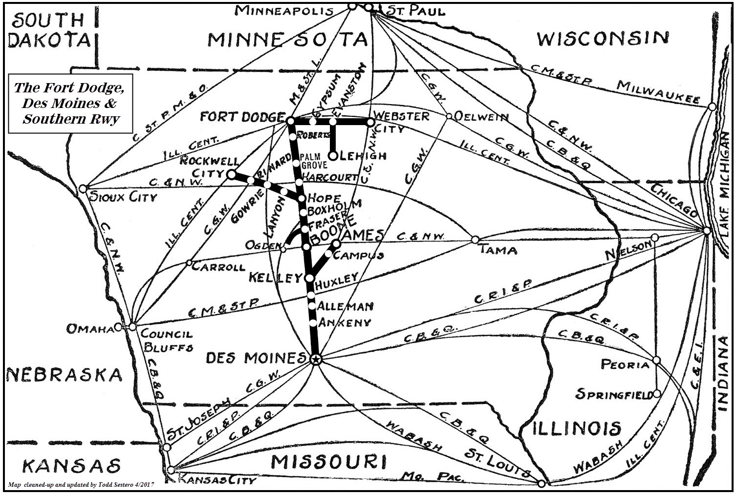
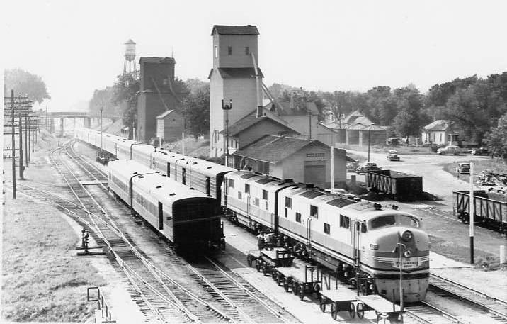
History of the Fort Dodge, Des Moines & Southern Railway
The Fort Dodge, Des Moines & Southern Railway (reporting marks FDDM) was officially incorporated during the first decade of the 20th century to serve the state capitol of
Iowa with points north as an interurban road. However, the history of its line dates as far back as the 1880s, as a standard rail line moving coal from mines in the northern regions of the state. In
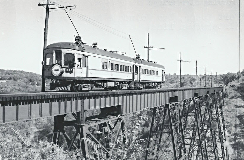
many ways the FDDM&S (or sometimes referred to as the FtDDM&S or just as its slogan, "The Fort Dodge Line") never acted like a true interurban although it was
once electrically operated and used trolley/interurban equipment. Freight was just as important as passengers and this concept allowed the company to thrive for many years, well after the interurban industry
collapsed after the 1920s despite its very high operating ratio. Eventually, the road dieselized and was acquired by the Chicago & North Western in the late 1960s
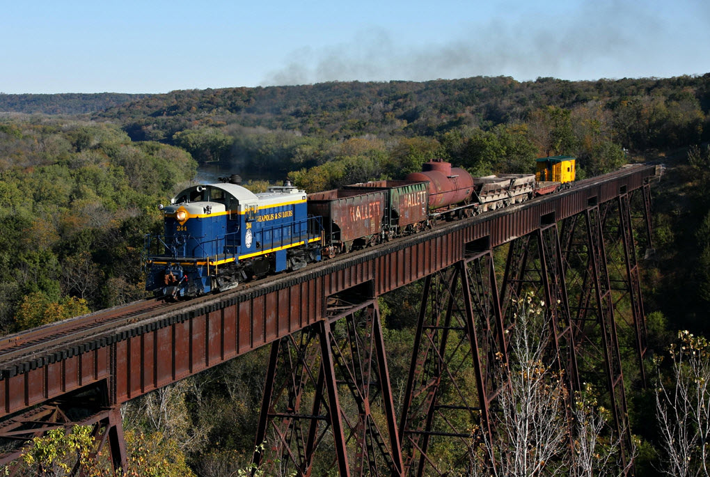
which promptly abandoned it less than 20 years later. Today, part of the route is operated by the Boone & Scenic Valley Railroad.
The earliest beginnings of the Fort Dodge, Des Moines and Southern Railway started with the Crooked Creek Railroad, a three-foot narrow-gauge line chartered in 1875. The
CCR would complete an eight-mile route from Judd, near Fort Dodge and a connection with the Illinois Central, to Lehigh and a cluster of coal mines. Ten years after it began the CCR upgraded its route to
standard-gauge and shortly thereafter in 1892 it purchased the Webster City & Southwestern Railroad. The WC&S was another coal hauler, connecting to the CCR and
running 14 miles east to Webster City. These two railroads essentially made up the northern lines of what would later become the FDDM&S. To the south, in 1893, another predecessor was
chartered, the Boone Valley Coal & Railway Company.
This system, also a coal hauler, built a small line serving mines near Fraser (northwest of Boone) to nearby Fraser Junction and a connection with the much larger Minneapolis & St.
Louis Railway. In 1899, the owners of the BVC&R chartered the Marshalltown & Dakota Railway as an additional coal route with high aspirations of
pushing this system from Newton (east of Des Moines) to Sibley, Iowa in the state's northwest corner. Along the way the line would pass through towns such as Fraser, Story City, Gowerie, and Rockwell
City. In 1901 it was renamed as the Boone, Rockwell City & Northwestern Railway, and again in 1902 as the Newton &
Northwestern. By 1905 the line was opened from Newton to Rockwell City and also had a branch to Colfax. While over 100 miles in length it never made it any further towards Sibley.
New owners acquired the N&NW in 1905 and again renamed the property, this time as the Fort Dodge, Des Moines and Southern Railroad.
While the FDDM&S continued to concentrate on coal it also began to focus on the movement of gypsum near Fort Dodge and general industry located around Des Moines. Additionally, its owners began
looking at electrifying part of the railroad as an interurban. It remained focused, however, on freight and in 1906 purchased the Ames & College Street Railway to
serve that town. After completing an extension from Hope to Fort Dodge, and establishing an interchange with the Des Moines & Central Iowa it now had a through
route between both of the state's major cities (easily Iowa's largest interurban). Service along the entire route opened on November 4, 1907. Soon after, its owners realized that the the N&NW's
route from Newton to Rockwell City offered a non-sustainable freight potential and decided to electrifying only part of the route between Hope and Midvale on a 1,200-volt, DC system.
In 1911 the Midvale to Newton section of the N&NW was abandoned and much of the entire FDDM&S route was electrified to some extent. Small editions continued to be added, including a branch from
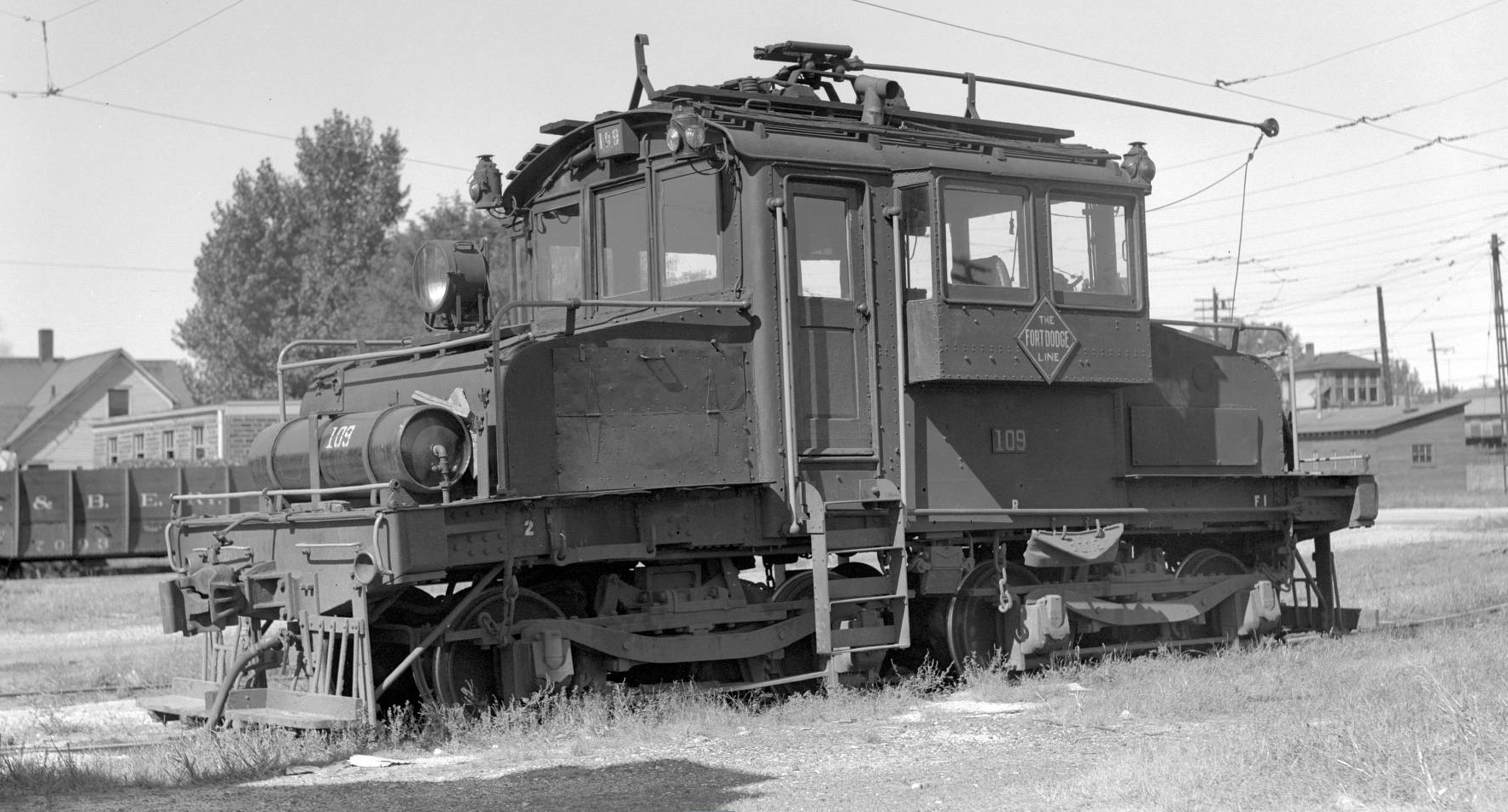
Kelley to Ames (which finally directly connected its Ames & College Street subsidiary) and the purchase of the aforementioned Crooked Creek Railroad in 1916. This route was also energized. For
freight service the railroad utilized second-hand General Electric-built freight motors (it acquired more beginning in 1942 from the Oregon Electric) and used Niles Car & Manufacturing Company interurban
cars for passenger operations. Part of the reason for the road's success was not only due to its freight traffic but also had numerous interchange partners (sometimes in more than one location) with
Class I lines including the Milwaukee Road, Illinois Central, Chicago & North Western, Burlington, and Rock Island.
The Great Depression hit the line hard and it fell into receivership in 1930, emerging in 1942 as the Fort Dodge, Des Moines and Southern Railway. Beginning in 1954 the FDDM&S began dieselizing
its motive power roster while at the same time ended virtually all of its remaining passenger services (branch line services began to be discontinued as early as 1926). Its diesels consisted almost
entirely of General Electric products, 44-tonners and 70-tonners along with a Plymouth 65-ton switcher. In 1955 the railroad was purchased by the Salzburg family, which owned a number of shortlines
including the Louisiana & North West and Wellsville, Addison & Galeton.
By the 1960s the railroad had cut back to its main line between Des Moines and Fort Dodge with the eastern extension to Webster City. It also was still operating a remaining section of the
N&NW between Hope and Gowrie. In 1968 the C&NW acquired the FDDM&S from Salzburg and, unfortunately, was not kind to the road. It immediately began cutting back services and by 1983
was looking to abandon the entire Fort Dodge-Des Moines route. Part of the system, a 12-mile section between Wolf and Boone was spared, and is now operated as the tourist line
Boone & Scenic Valley Railroad.
Disclaimers:
I love trains, and I love signals. I am not an expert. My webpages reflect what I find on the topic of the page. This is something I have fun with while
trying to help others.
Please Note: Since the main focus of my two websites is railroad signals, the railfan guides are oriented towards the signal fan being able to locate them.
For those of you into the modeling aspect of our hobby, my
indexa page has a list of almost everything railroad oriented
I can think of to provide you with at least a few pictures to help you detail your pike.
If this is a railfan page, every effort has been made to make sure that the information contained on this map and in this railfan guide is correct. Once in a while,
an error may creep in :-)
My philosophy: Pictures and maps are worth a thousand words, especially for railfanning. Text descriptions only get you so far, especially if you get lost or
disoriented. Take along good maps.... a GPS is OK to get somewhere, but maps are still better if you get lost! I belong to AAA, which allows you to get
local maps for free when you visit the local branches. ADC puts out a nice series of county maps for the Washington DC area, but their state maps do not have the
railroads on them. If you can find em, I like the National Geographic map book of the U.S..... good, clear, and concise graphics, and they do a really good job
of showing you where tourist type attractions are, although they too lack the railroads. Other notes about specific areas will show up on that page if known.
Aerial shots were taken from either Google or Bing Maps as noted.
Screen captures are made with Snagit,
a Techsmith product... a great tool if you have never used it!
By the way, floobydust is a term I picked
up 30-40 years ago from a National Semiconductor data book, and means
miscellaneous and/or other stuff.
Pictures and additional information is always needed if anyone feels inclined to take 'em, send 'em, and share 'em, or if you have something to add or correct.... credit
is always given! Please be NICE!!! Contact info is here
Beware: If used as a source, ANYTHING from Wikipedia must be treated as being possibly inaccurate, wrong, or not true.

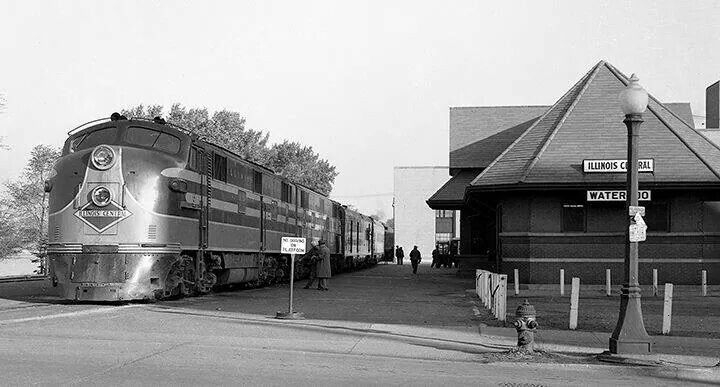
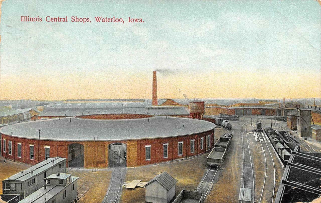
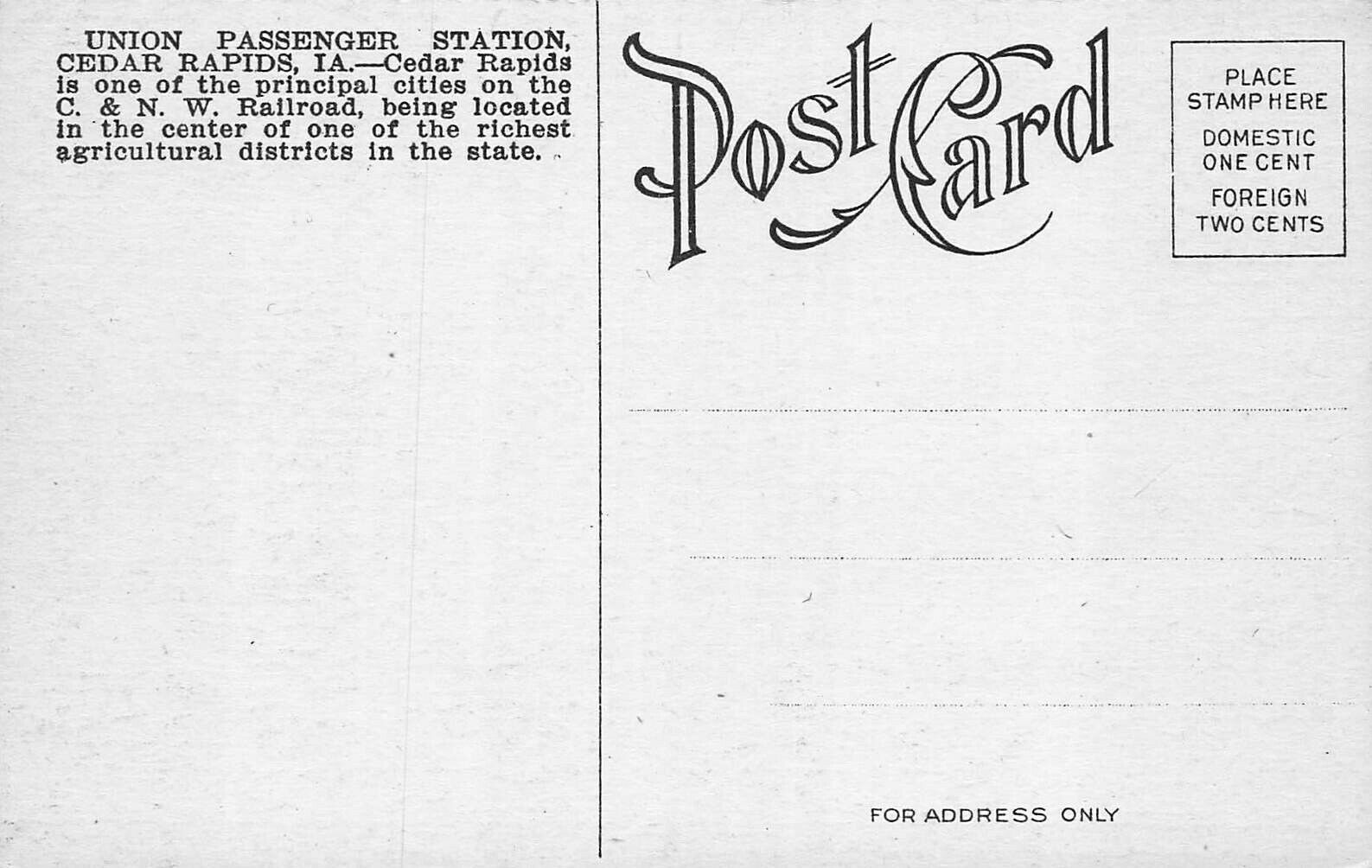
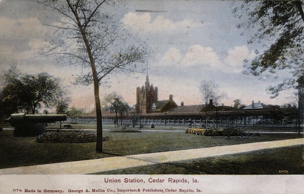
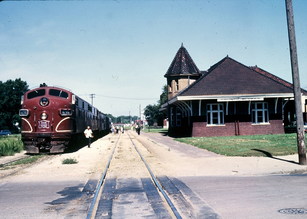
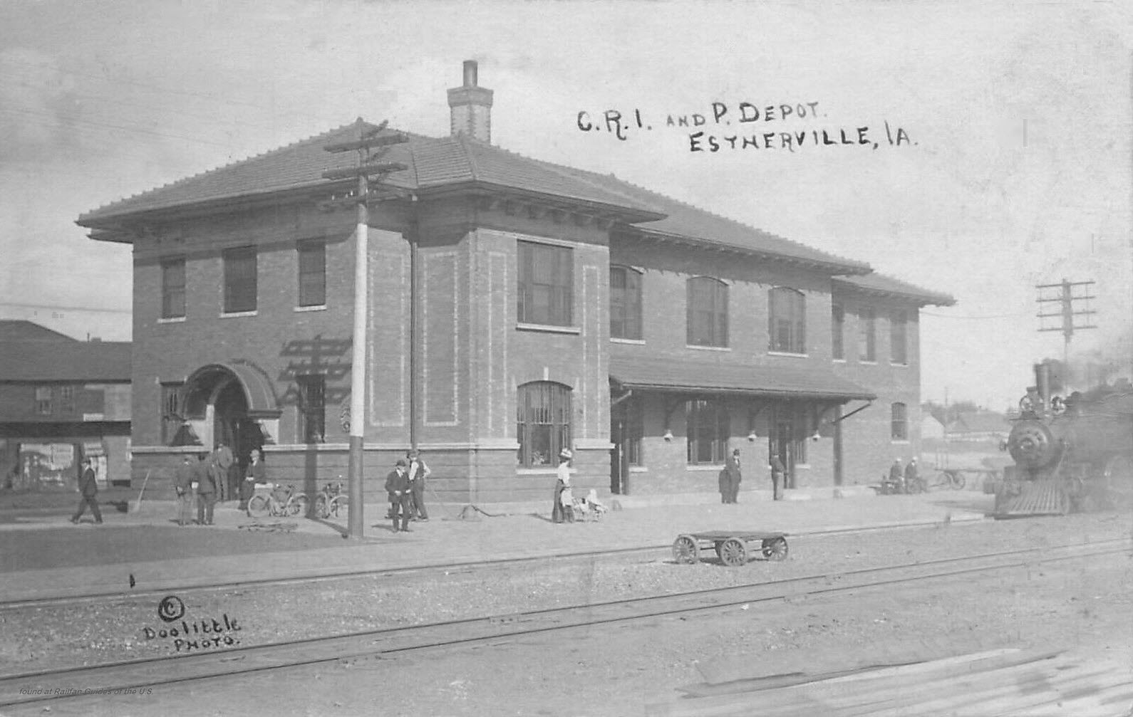
 Ebay seller skurfanpostcards
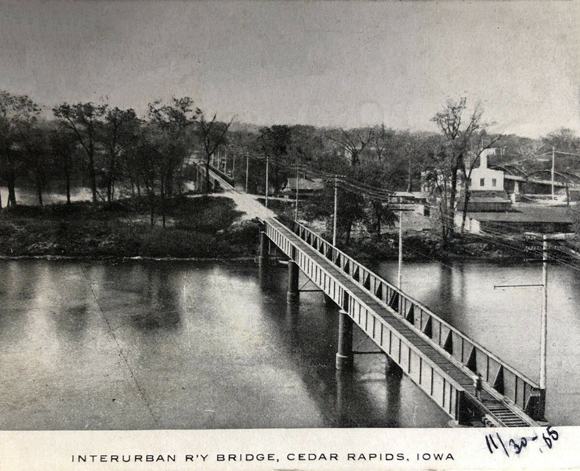
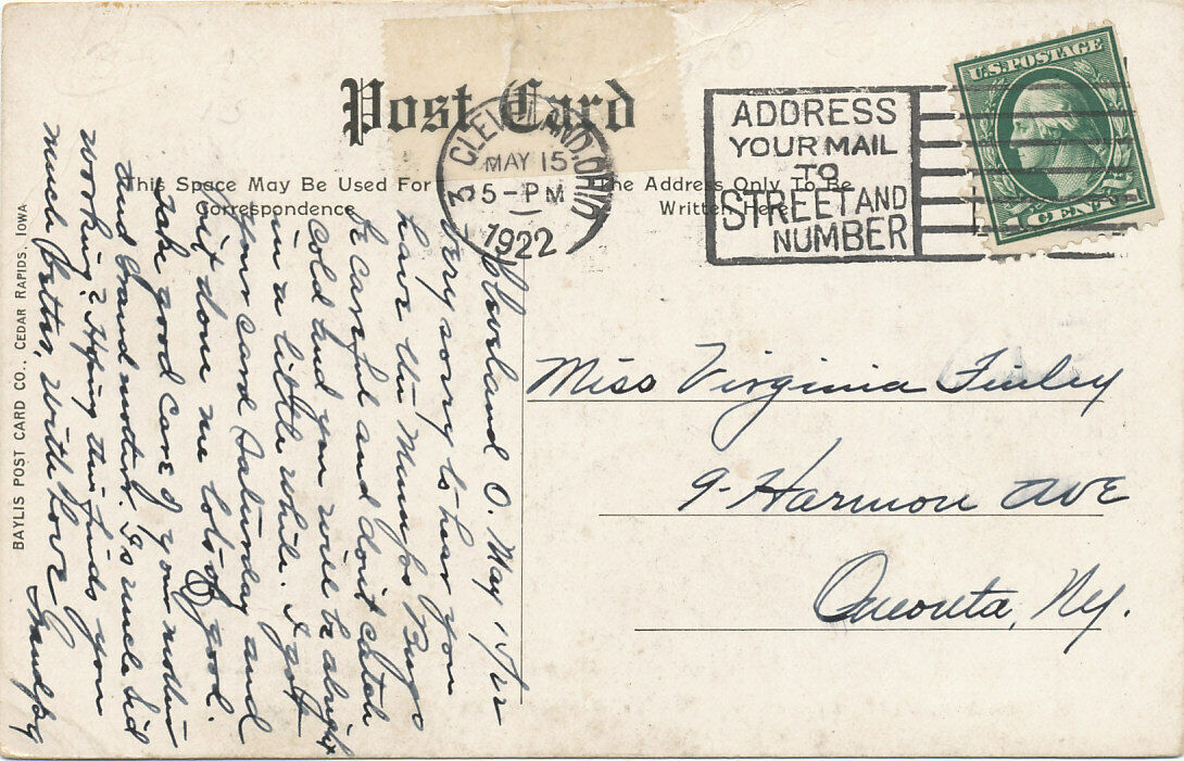
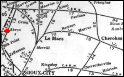
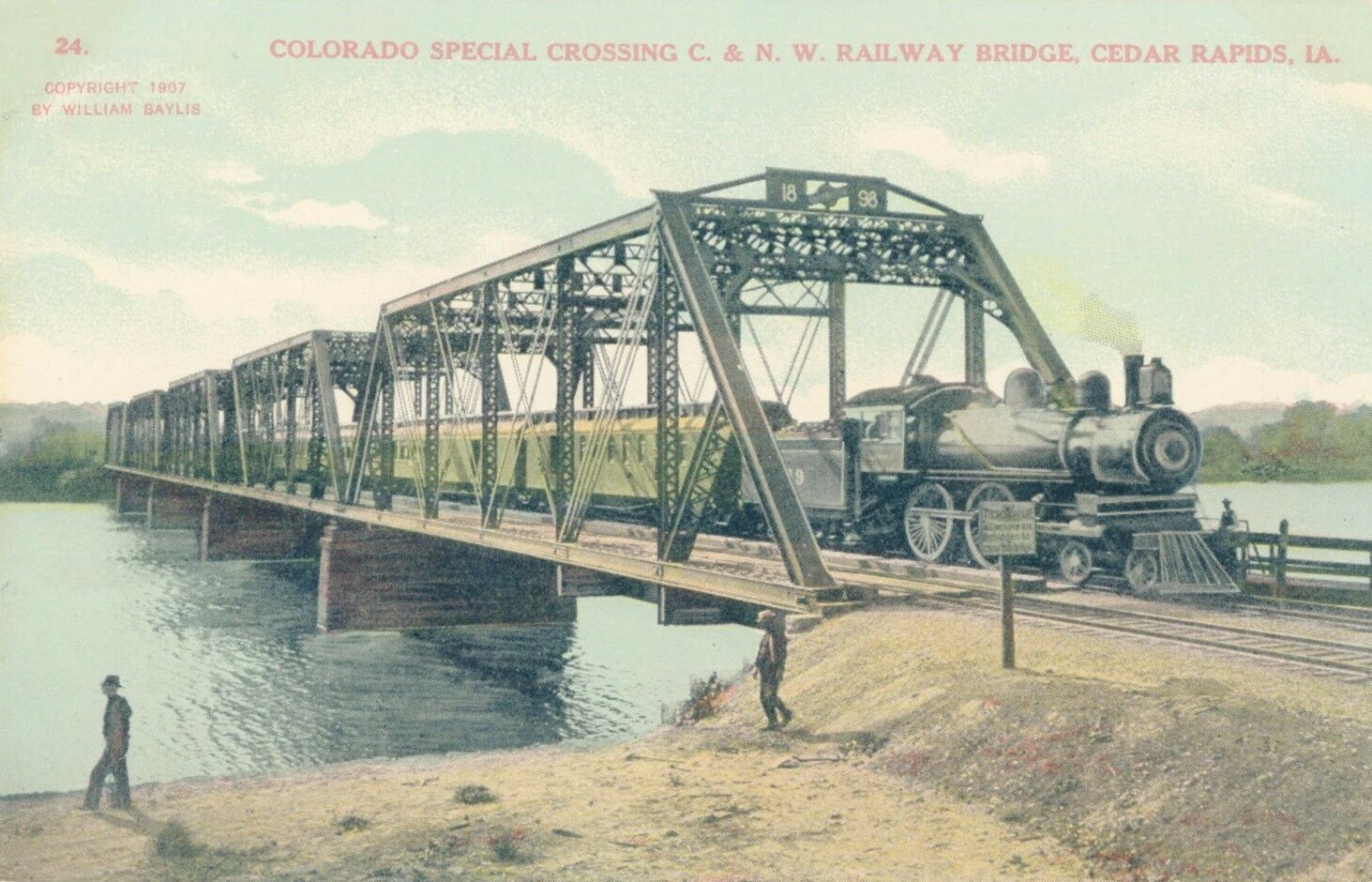
 Ebay seller skurfanpostcards
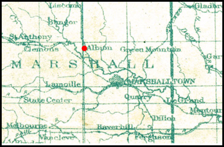
 Albion does not show up on the 1948 map.
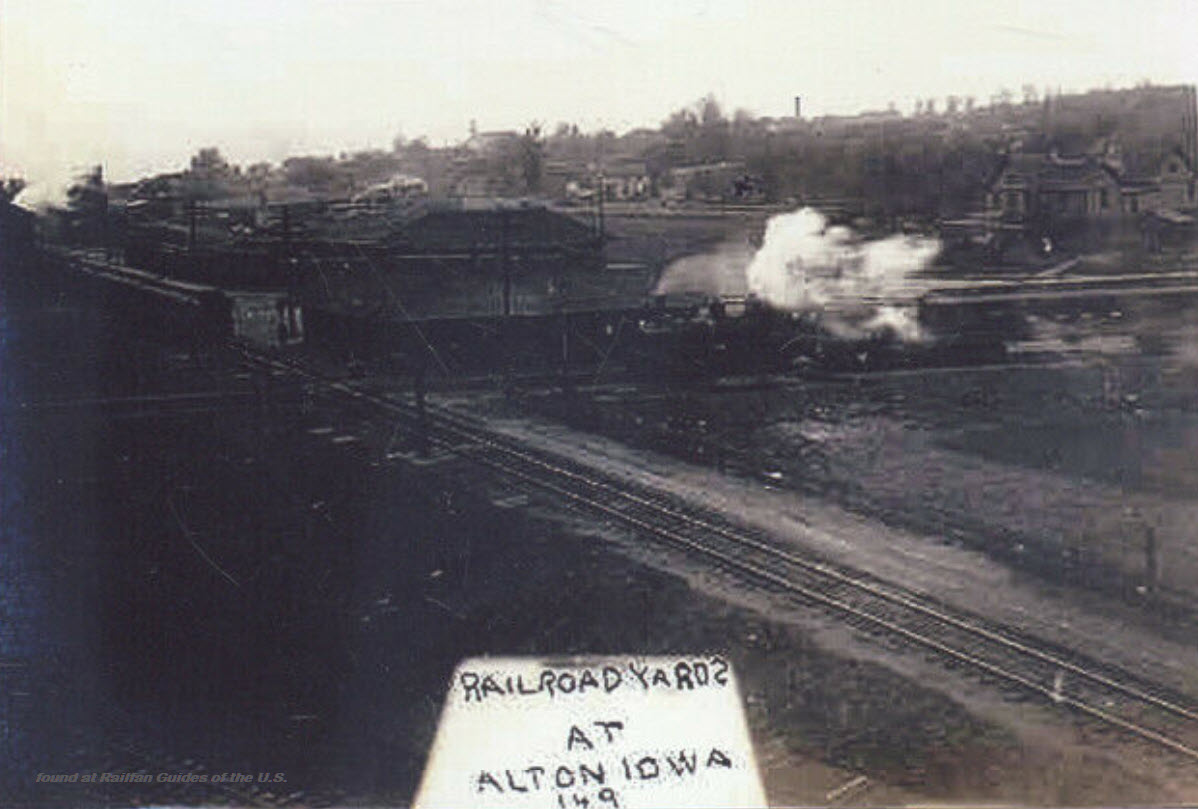 Ebay seller skurfanpostcards
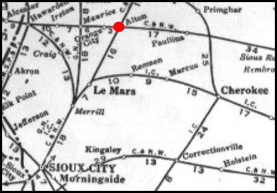
 Ebay seller skurfanpostcards
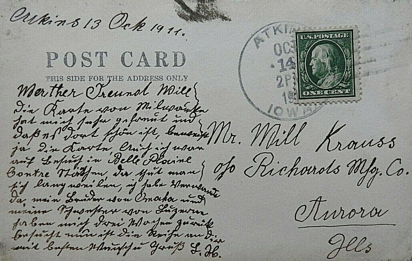
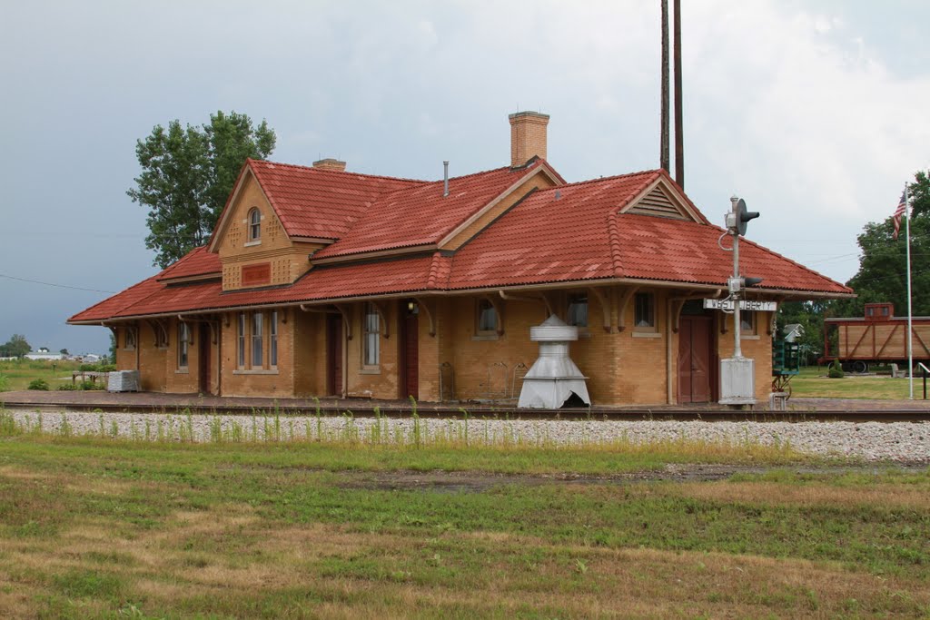
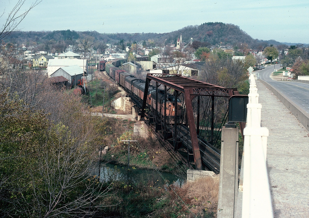 photo by photolibrarian
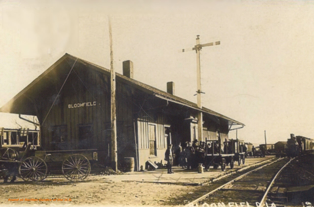 Ebay seller skurfanpostcards
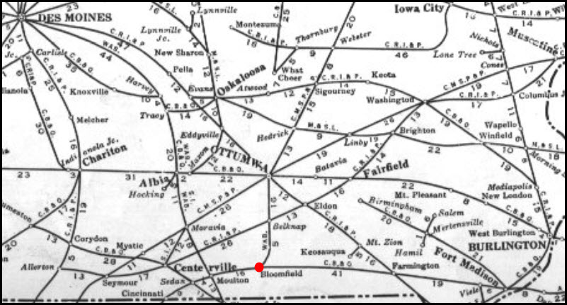
 2010, photo by Jerry Huddleston
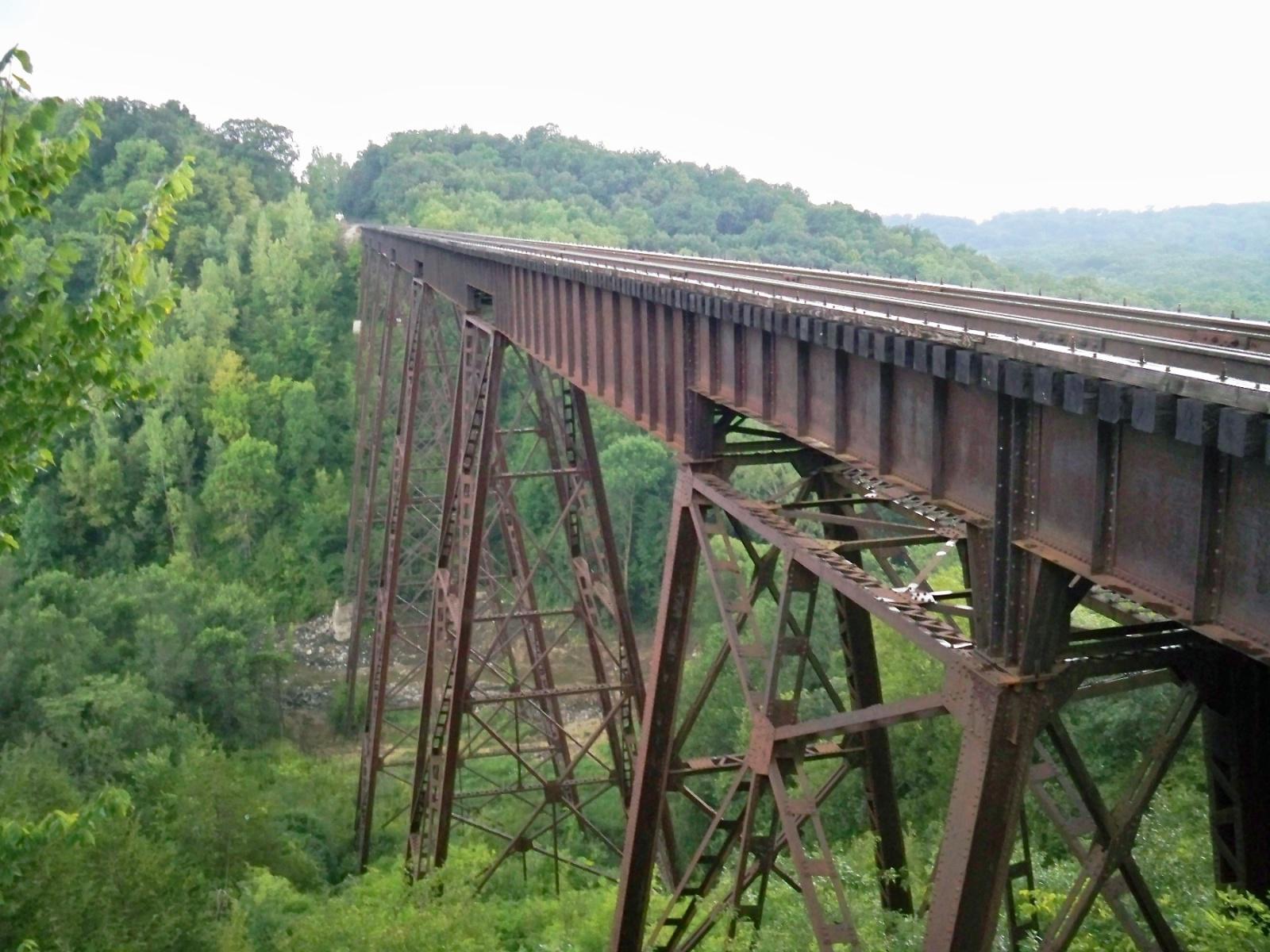
 Ebay seller skurfanpostcards
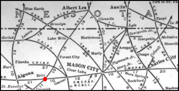
 Ebay seller skurfanpostcards
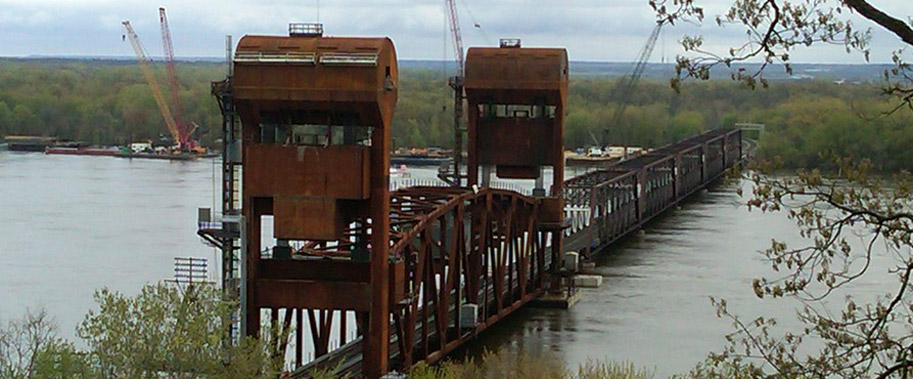
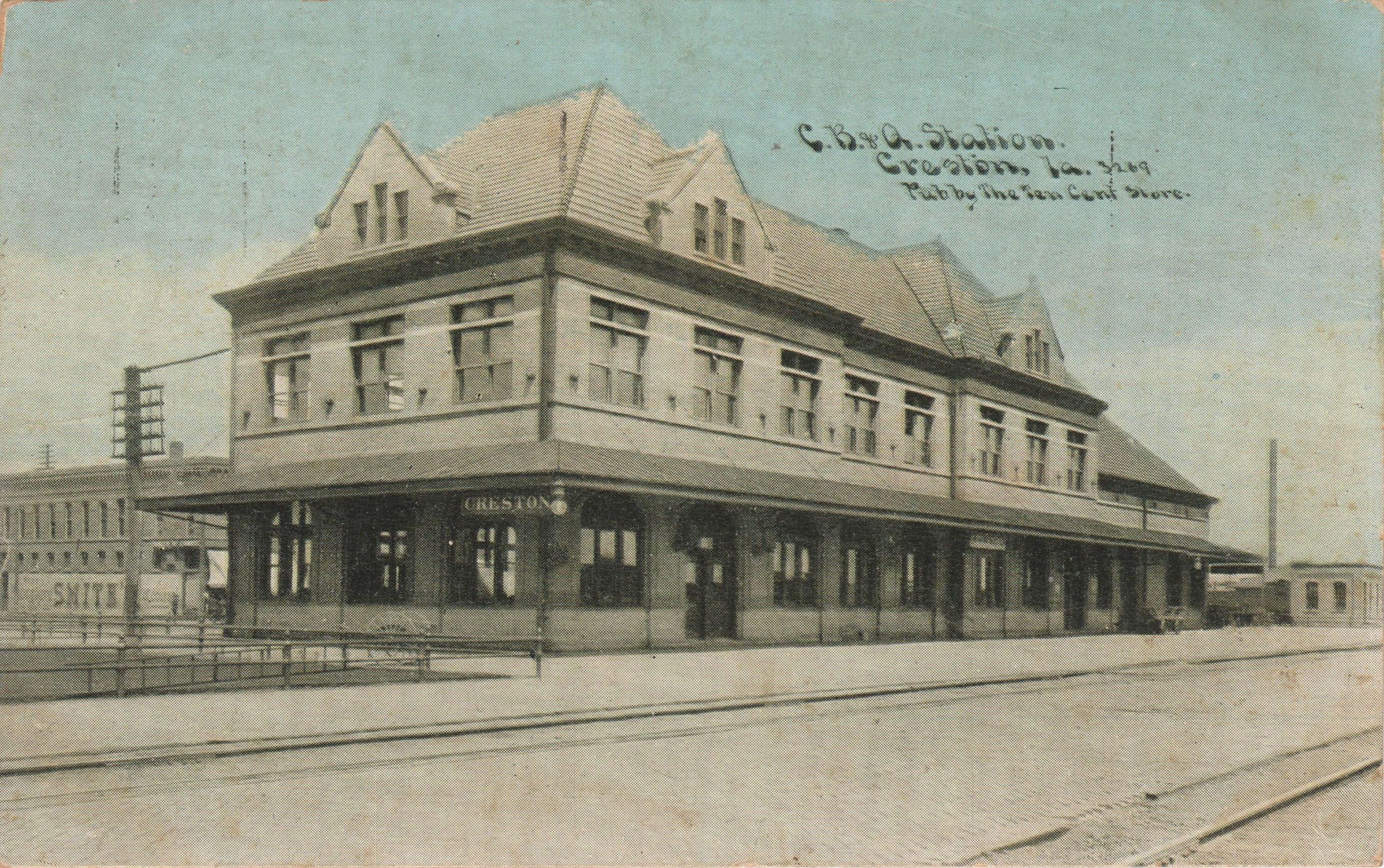
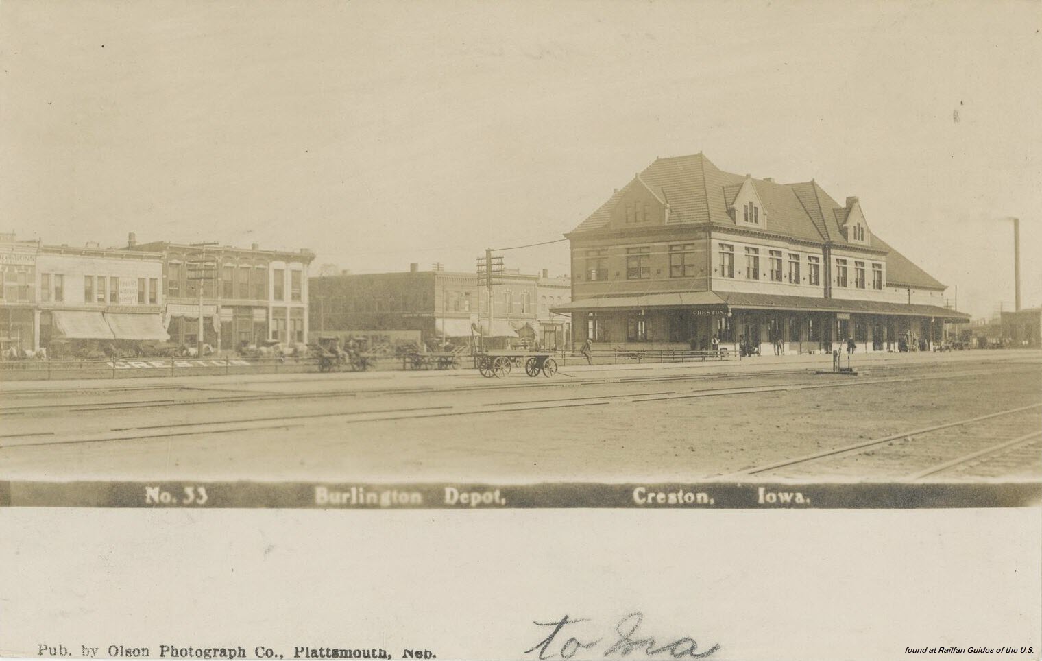
 1898, from Wikipedia, Charles B Armstrong
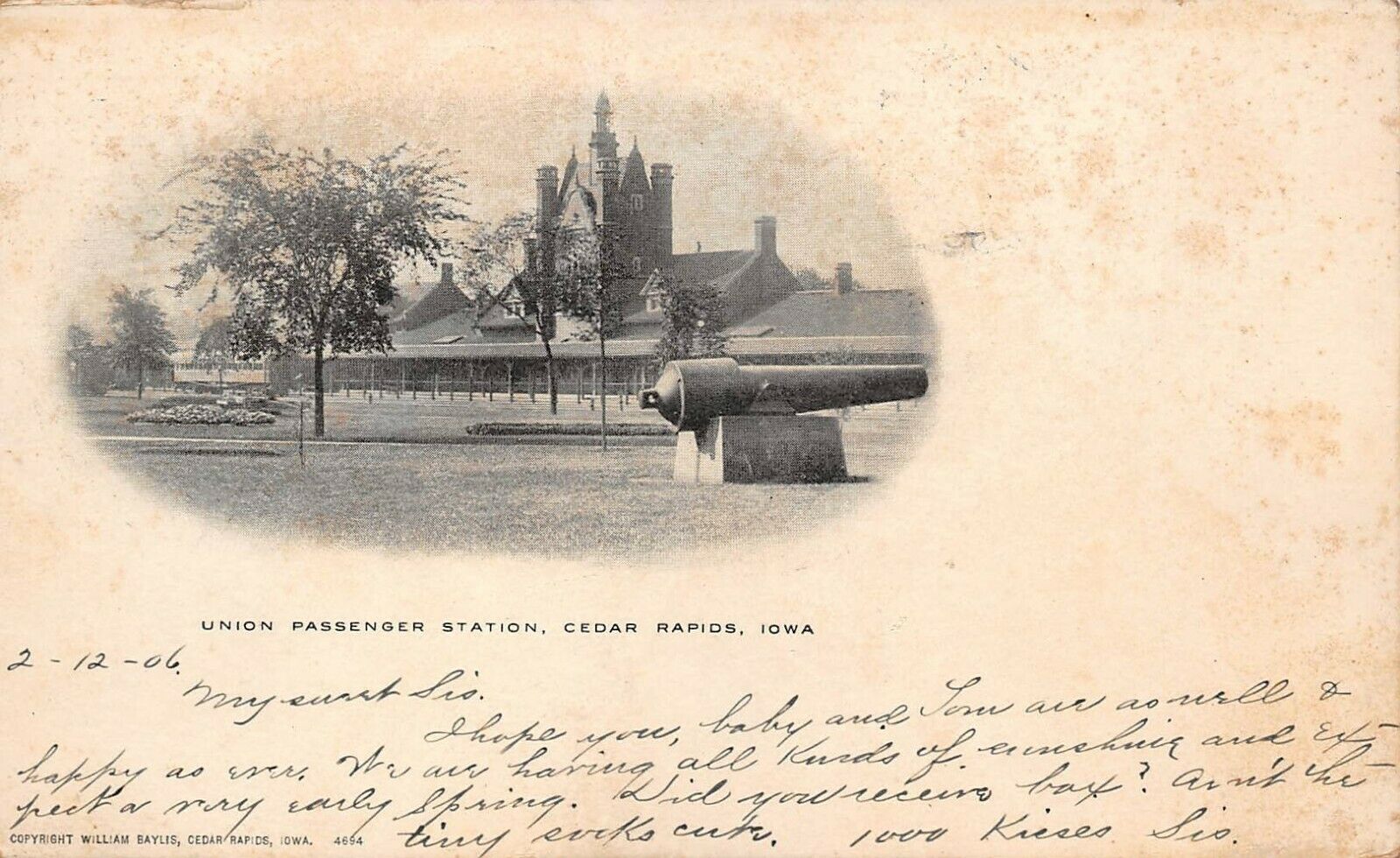 Ebay seller for_petes_sake17
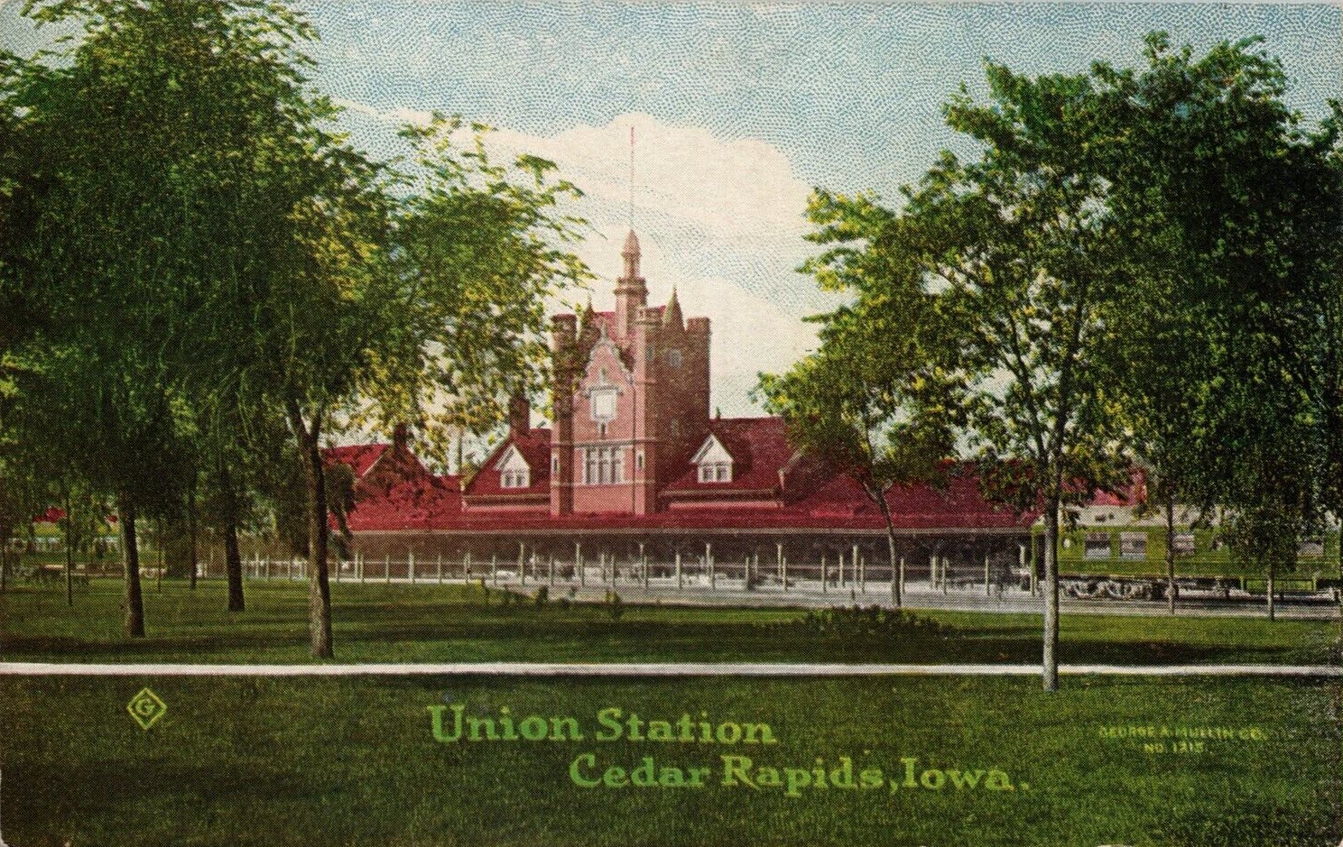 Ebay seller spinach-eater
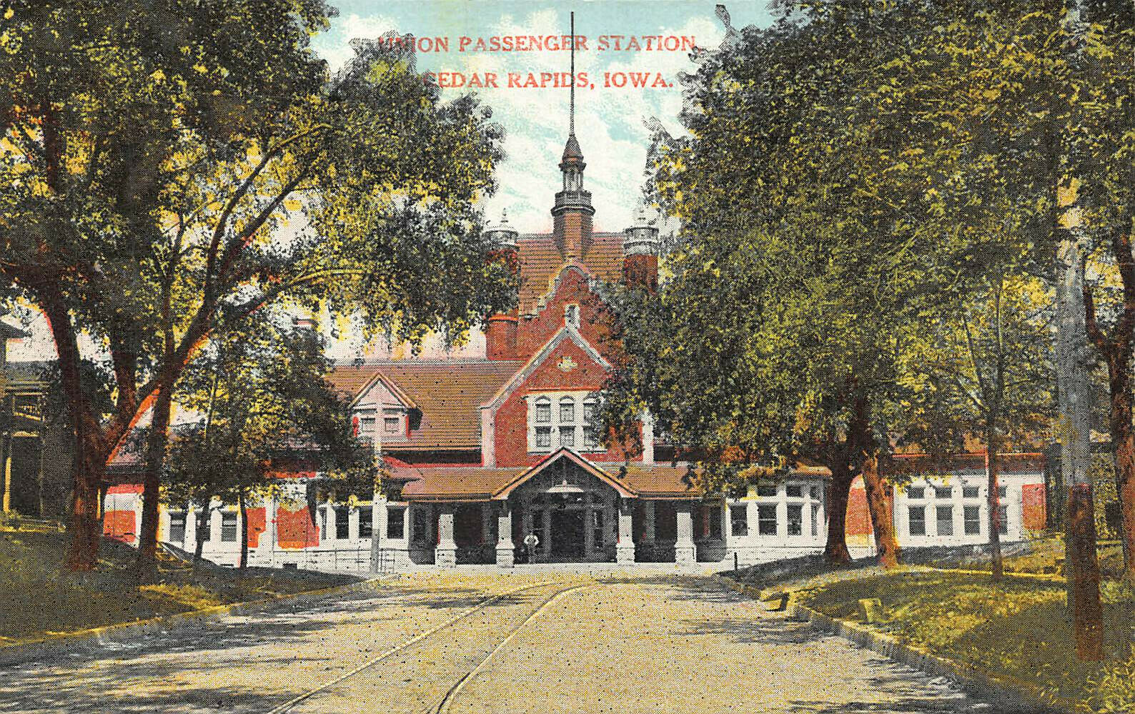
 Ebay seller pstcardman2014
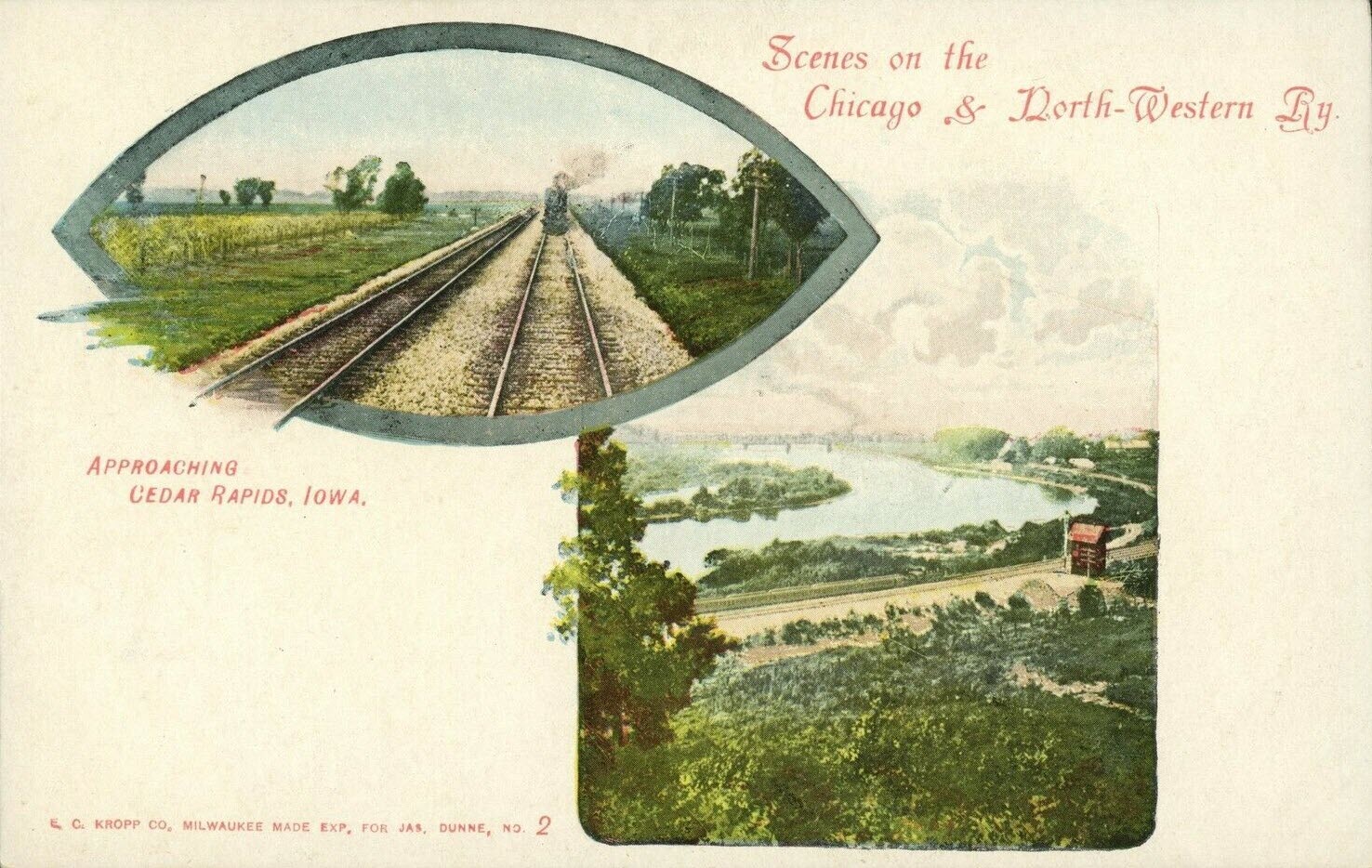 Ebay seller disney-luver
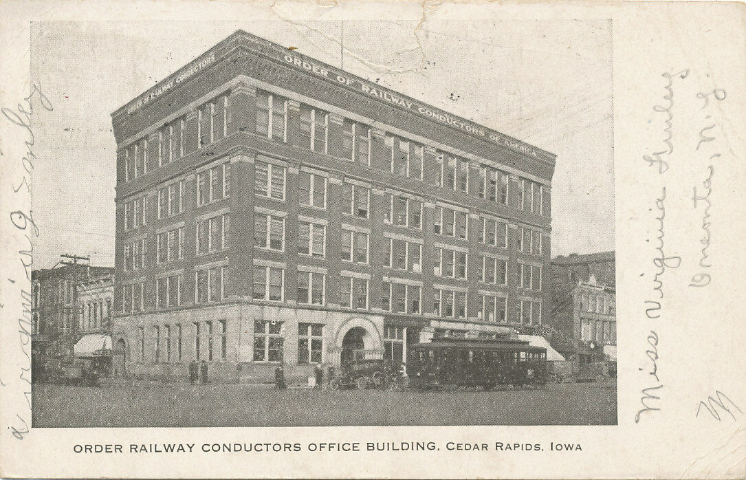
 Ebay seller motka1
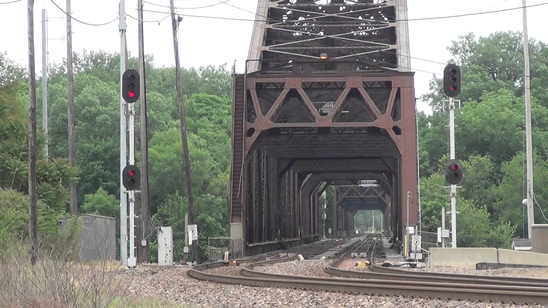
 Ebay seller njrtsr
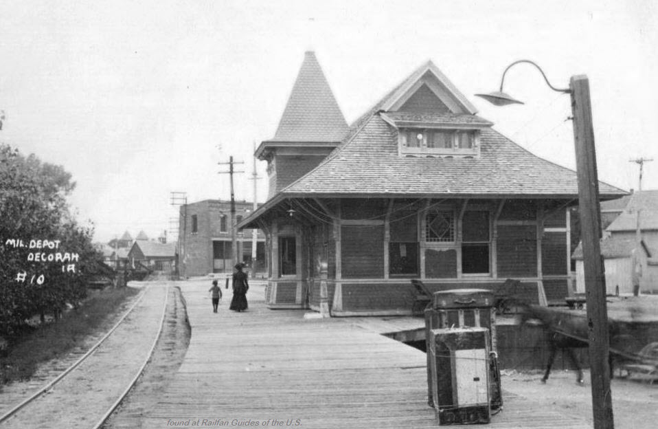
 https://www.johnweeks.com/river_mississippi/pagesA/umissAR03.html
 Ebay seller skurfanpostcards
 Ebay seller skurfanpostcards
 Ebay seller skurfanpostcards
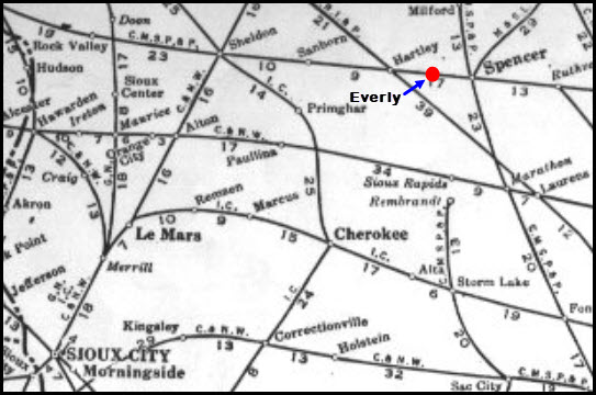
 Ebay seller skurfanpostcards
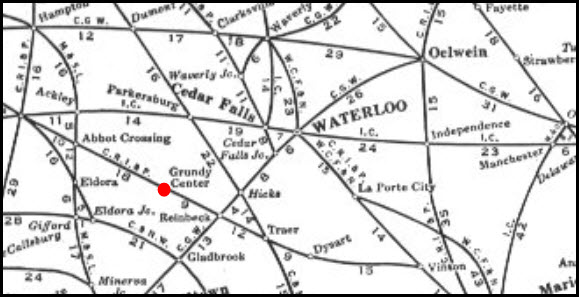
 Ebay seller skurfanpostcards
 Ebay seller skurfanpostcards
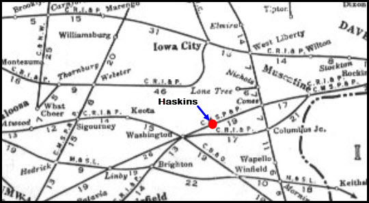
 Ebay seller skurfanpostcards
 Ebay seller skurfanpostcards
 Ebay seller skurfanpostcards
 Ebay seller skurfanpostcards
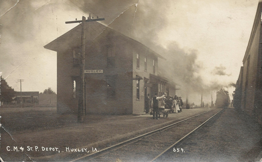
 Ebay seller skurfanpostcards
 Ebay seller skurfanpostcards
 Ebay seller skurfanpostcards
 Ebay seller skurfanpostcards
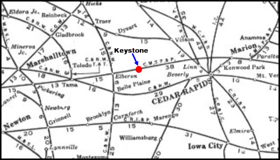
 Ebay seller skurfanpostcards
 Ebay seller skurfanpostcards
 Ebay seller skurfanpostcards
 Ebay seller skurfanpostcards
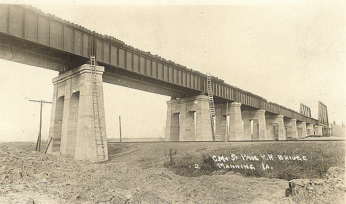
 Ebay seller skurfanpostcards
 Ebay seller skurfanpostcards
 photo from the IADOT
 Ebay seller thejumpingfrog
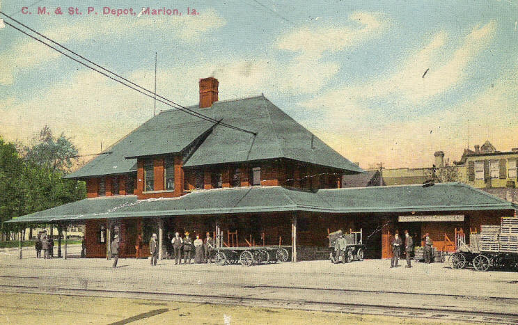
 Ebay seller skurfanpostcards
 Ebay seller skurfanpostcards
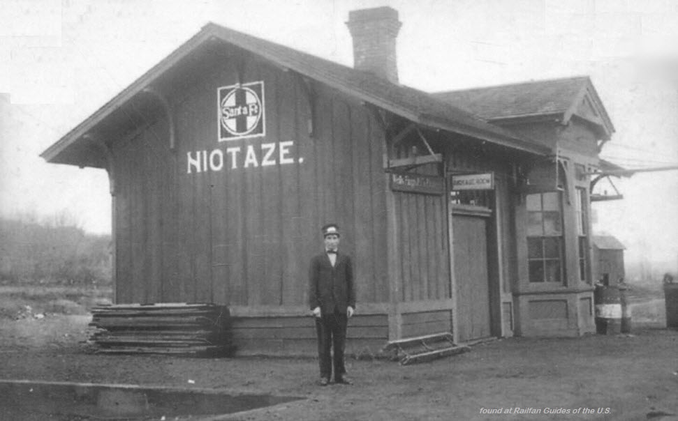 Ebay seller skurfanpostcards
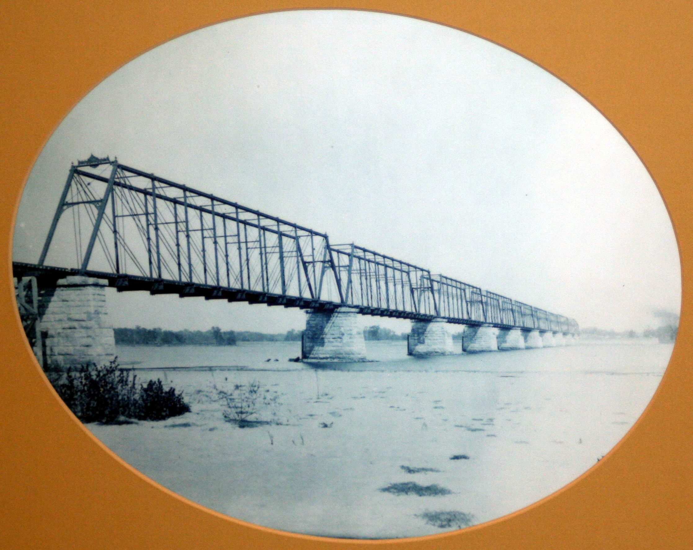
 Ebay seller mondopix
 Ebay seller skurfanpostcards
 Ebay seller skurfanpostcards
 Ebay seller skurfanpostcards
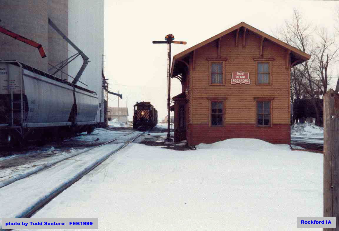
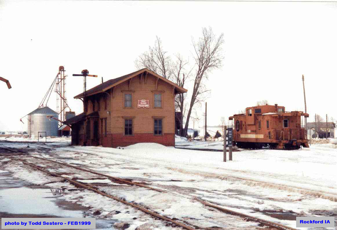
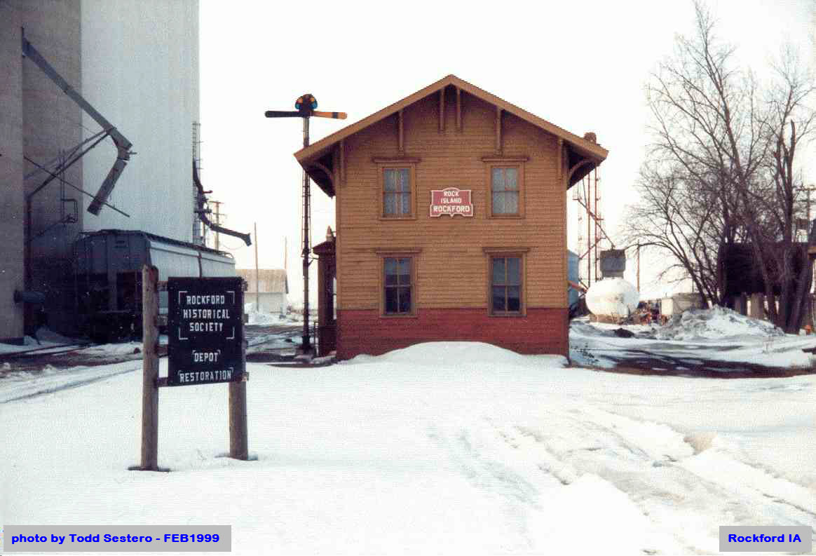
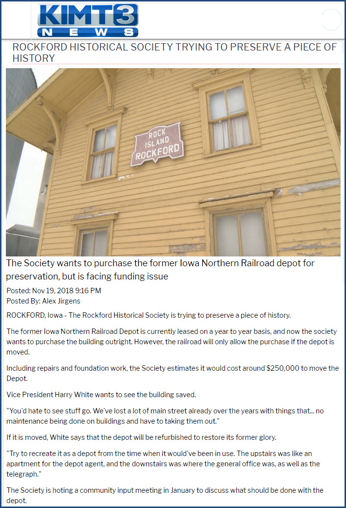
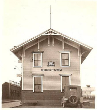 From the Rockford Historical Society FB page
 Ebay seller skurfanpostcards
 Ebay seller skurfanpostcards
 Ebay seller skurfanpostcards
 Ebay seller newbie56
 Ebay seller skurfanpostcards