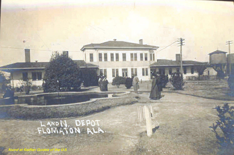
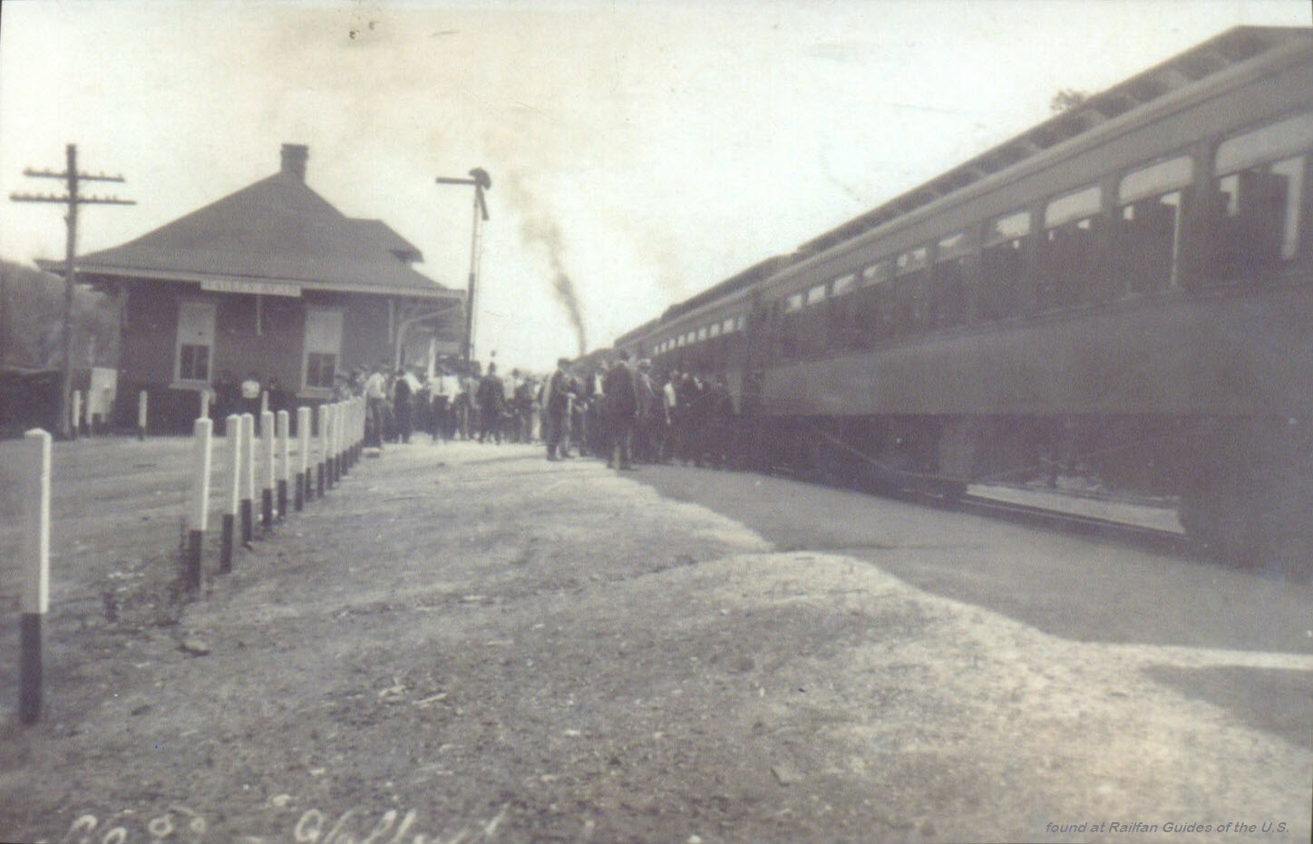
One of the better resources I have come across to this end is the plethora of
old post cards still around depicting many of these structures, some better than
others.
Most of the postcards were found on EBay unless noted, other pictures, mostly
the more recent ones, come from Google and/or Bing images - credit given if the
source is known.
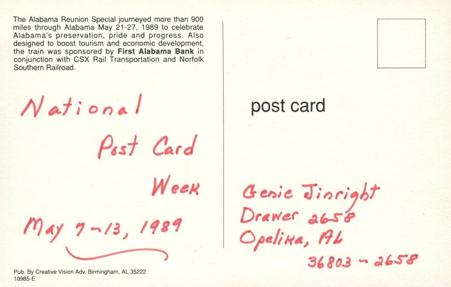
Dates are in the picture name, x means the date is approximate. If they were
available, and interesting, I included the back side of the postcards. 1910a
and 1910b would be the same card, both sides.
If the picture was really, really bad, some of them have been cleaned up and/or
repaired when I had the energy.
If you have the time, other good sources for pictures are:
Shorpy, Google,
and Bing images, and the Library
of Congress (you have to be very patient to find things here :-)
Since many of these stations are no longer around (railfans seem to prefer the
term "extant", I'm not one of them! :-), this page is mostly for historical
reference.
This page is mostly for historical reference, as MANY of these stations are not
around anymore!
What's the difference between a station and a depot? Most people will say
"nuttin", it's a matter of preference, although many will use depot for older
buildings.
If you have a picture you would like to contribute, please see the bottom of the
page for how to find me, credit is always given to contributing photographers.
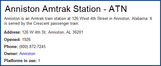
Amtrak in Alabama
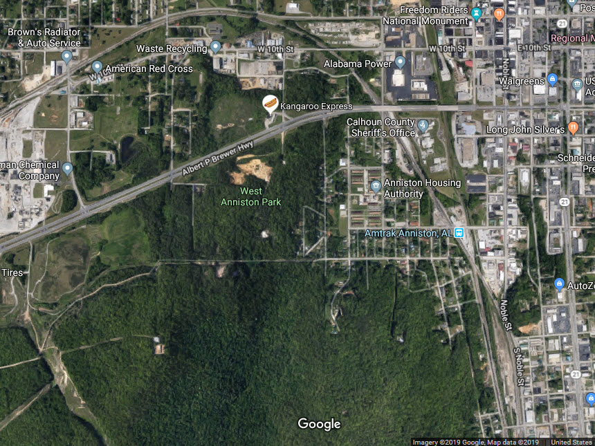
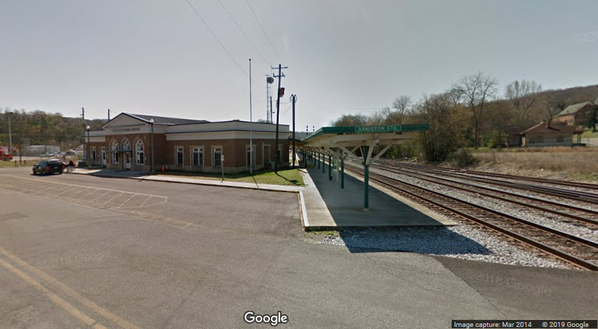
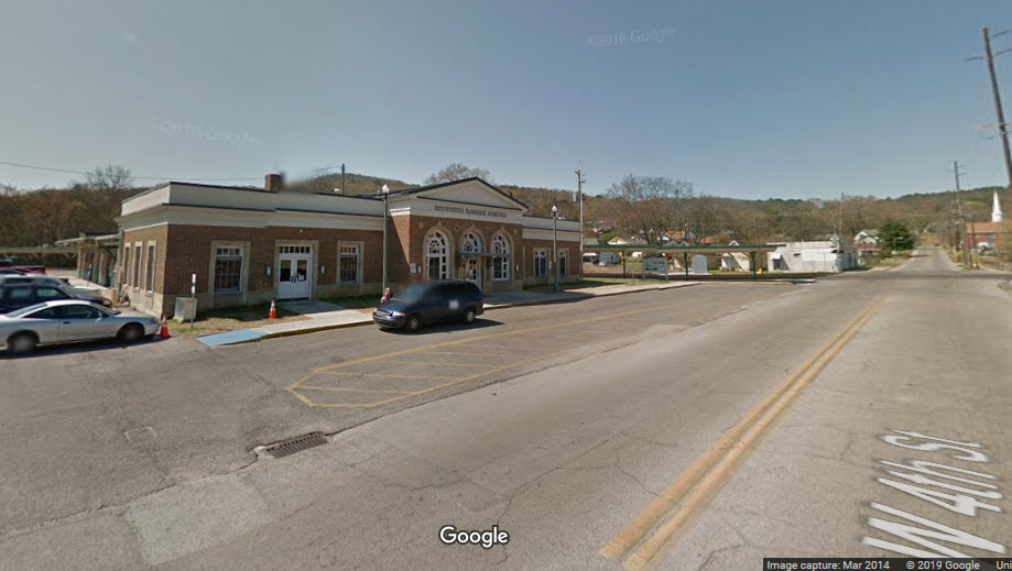
There are three train stations in Alabama: Anniston, Birmingham, and Tuscaloosa.
They are all the CRESCENT route, which was running on the Southern Railway
prior to Amtrak's start in 1971. I was lucky enough to have the
opportunity to ride the pre-Amtrak Crescent on something like January 4th, 1971
on my way home from L.A. to Baltimore. It was a trip I will never forget,
I just wish I had the wherewithall to be able to take more pictures.
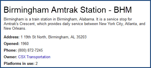
From Wikipedia: The Birmingham Intermodal Facility, which opened in 2017, combines several
modes of ground transportation in one central location: the MAX bus central station, Greyhound
bus service, Megabus service, Amtrak passenger rail and the city's Zyp bike program. The $32
million facility also includes a Birmingham Police substation, a food service area, a retail
space and the Birmingham-Jefferson County Transit Authority's corporate offices.
It is a service stop for Amtrak's Crescent, which provides daily service between New York
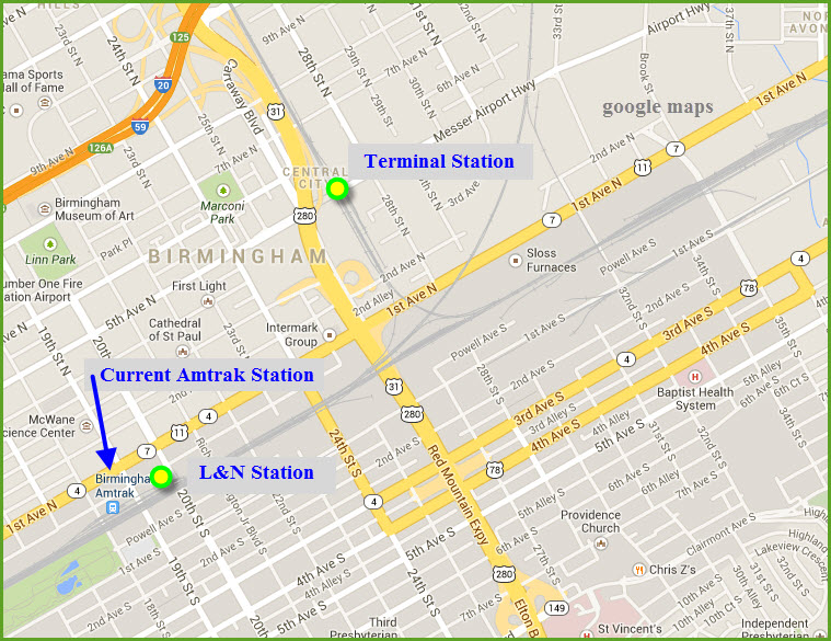
City, Atlanta, and New Orleans. The current station is located on the site of another
station originally built by the Louisville and Nashville Railroad in 1960, although
Amtrak did not use the building itself, which was torn down in part of this
millennium/century.
photo by Max Wolf via Wikipedia
before the new station was built
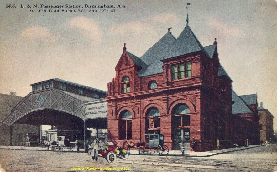
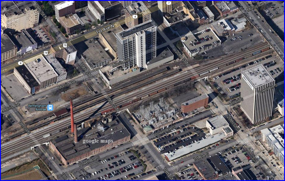
Birmingham -- Ex L&N Depot
Was at Morris Avenue and 18th/19th Street, where the current Amtrak station is now.
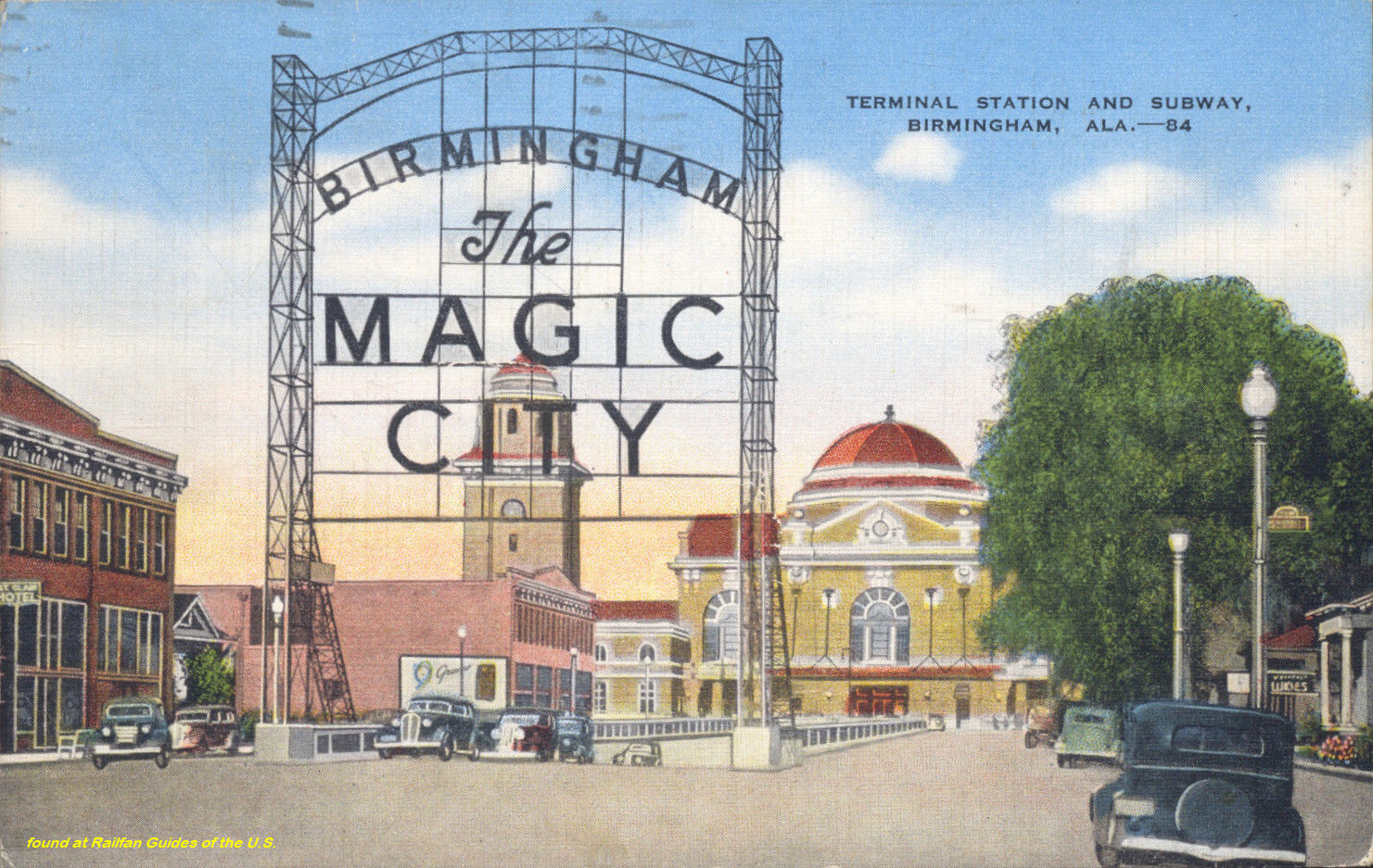
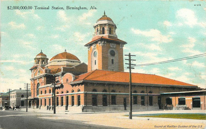
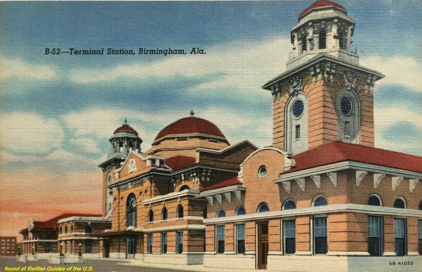
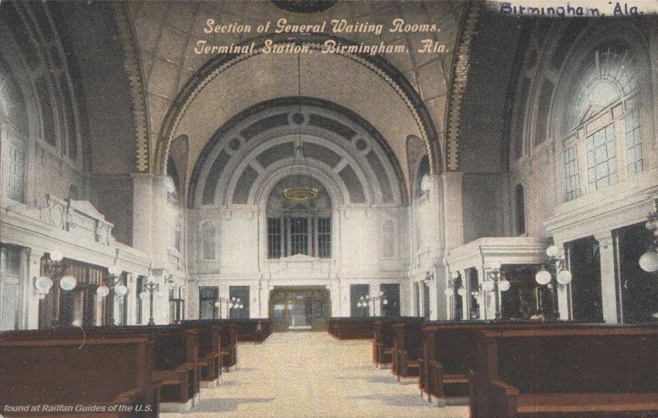
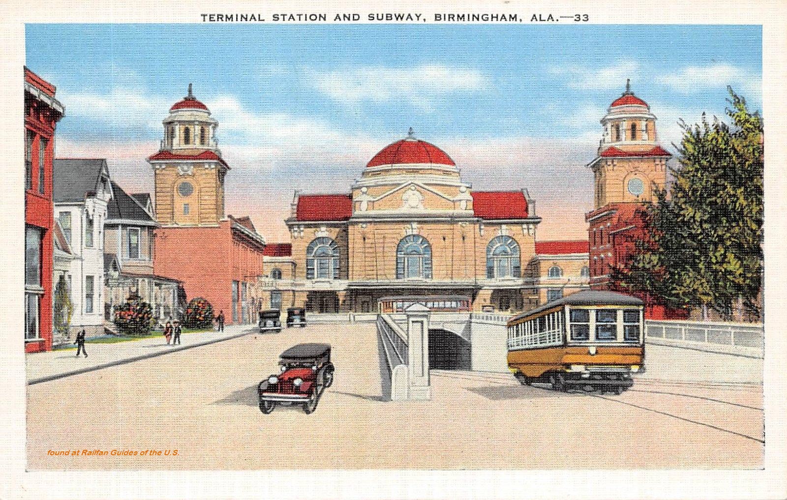
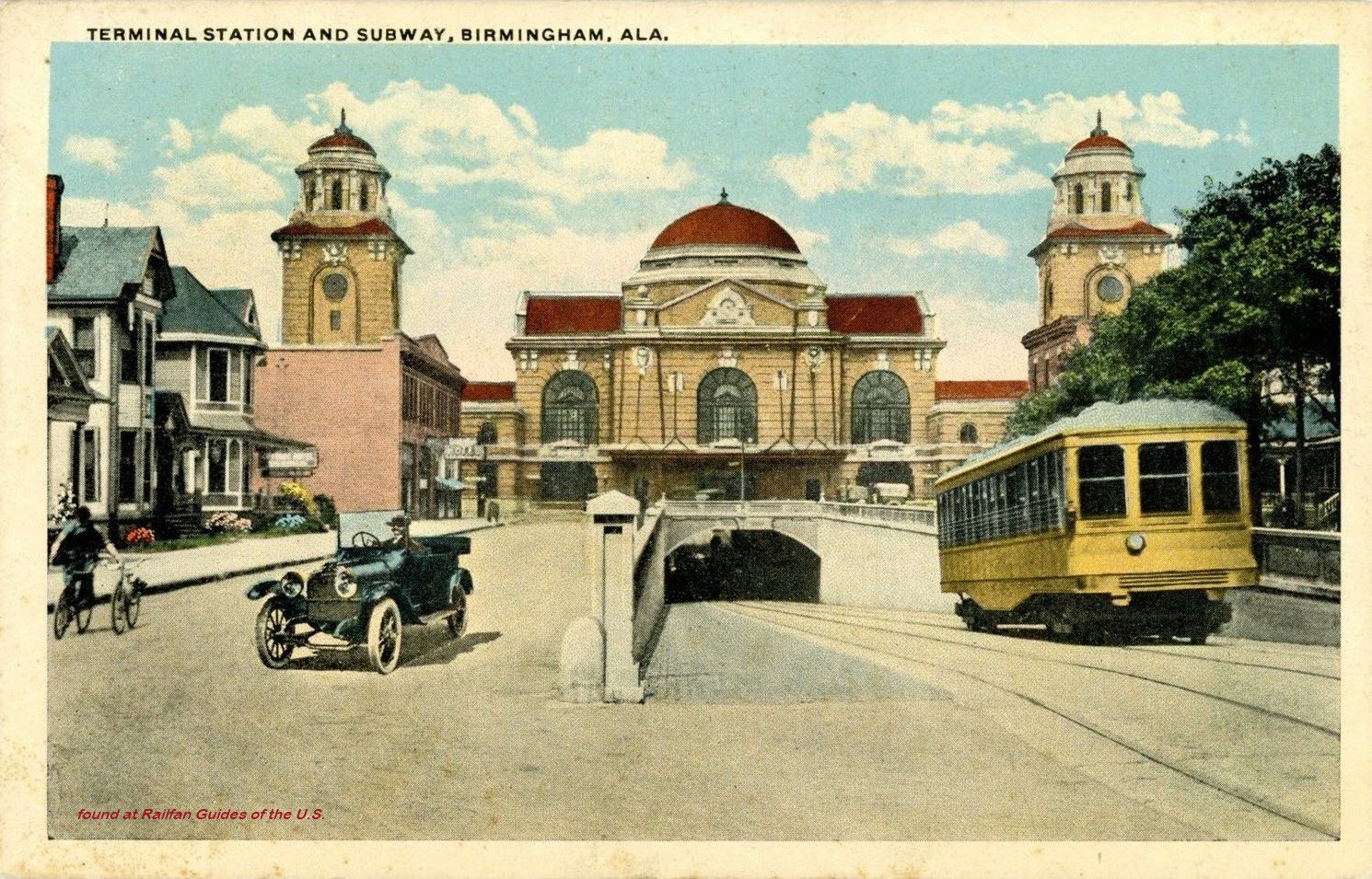
Birmingham -- Terminal Station
Ebay seller: ats4824
Ebay seller: bonnpon
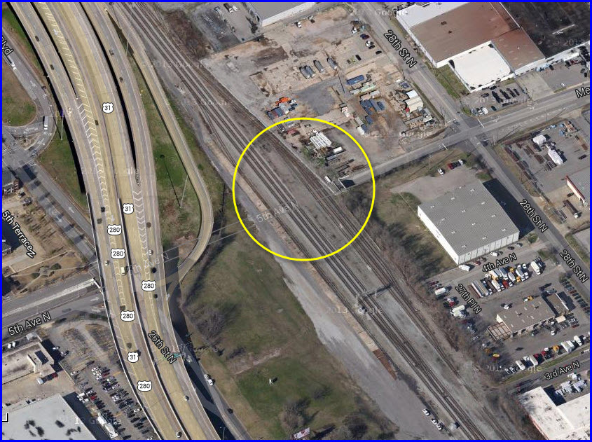
Where it used to be.
The following comes from Wikipedia:
Birmingham Terminal Station, completed in 1909, was the principal railway station for Birmingham, Alabama (USA) until the 1950s. It was demolished in 1969 and its loss
still serves as a rallying image for local preservationists.
Six of the seven railroads serving Birmingham joined to create the "Birmingham Terminal Company" in the early 20th century. They funded a new $2 million terminal
station covering two blocks of the city at the eastern end of 5th Avenue North downtown. The station largely took over the function of the Louisville and Nashville Railroad
station at Morris Avenue and 20th Street.
The architect for the hulking Byzantine-inspired Beaux-Arts station was P. Thornton Marye of Washington, D.C. The exotic design stirred controversy at first.
The exterior of the building was primarily dressed in light-brown brick. Two 130-foot (39.6 m) towers topped the north and south wings. The central waiting room covered
7,600 square feet (706 M²) and was covered by a central dome 64 feet (19.5 m) in diameter covered in intricate tilework and featuring a skylight of ornamental glass. The
bottom 16 feet (4.9 m) of the walls in the main waiting room were finished in gray Tennessee marble.
Connecting to the main waiting room were the ticket office, a separate ladies' waiting room, a smoking room, a barber shop, a news stand, a refreshment stand, and telephone
and telegraph booths. Along the north and south concourses were the kitchen, lunch and dining rooms, another smoking room, restrooms, and the "colored" waiting
room, a requirement of Birmingham's strict racial segregation. The north wing housed two express freight companies while the south was used for baggage and mail transfer.
Outside of the station were ten tracks. A series of overlapping "umbrella" sheds covered the platforms and tracks. These sheds provided protection from the rain
while still letting in sunlight and fresh air. During the Depression, the station fell into disrepair, but resurged in the late 1930s through World War II. In 1943 the
station underwent a $500,000 renovation which included sandblasting, new paint, and new interior fixtures. During this period of rebirth, rail traffic peaked
at 54 trains per day.
As automobile ownership increased and air travel gained popularity, rail travel suffered. By 1960 only 26 trains per day went through Terminal Station. At the beginning
of 1969 it was down to seven trains. During the 1960s the station served as the site of numerous small episodes of the Civil Rights Movement. Local Civil Rights
leaders like Fred Shuttlesworth challenged the racially-segregated accommodations of the station and crowds of belligerent whites gathered, sometimes leading to violence.
Permission to proceed with demolition was granted on June 30, 1969 by the Alabama Public Service Commission. They set aside the arguments of a handful of preservationists
in attendance saying that they could only consider "the necessity and convenience of the traveling public." In its run-down state, the Terminal Station was
judged to no longer meet those needs. Within a few months, the building was demolished and the site cleared.
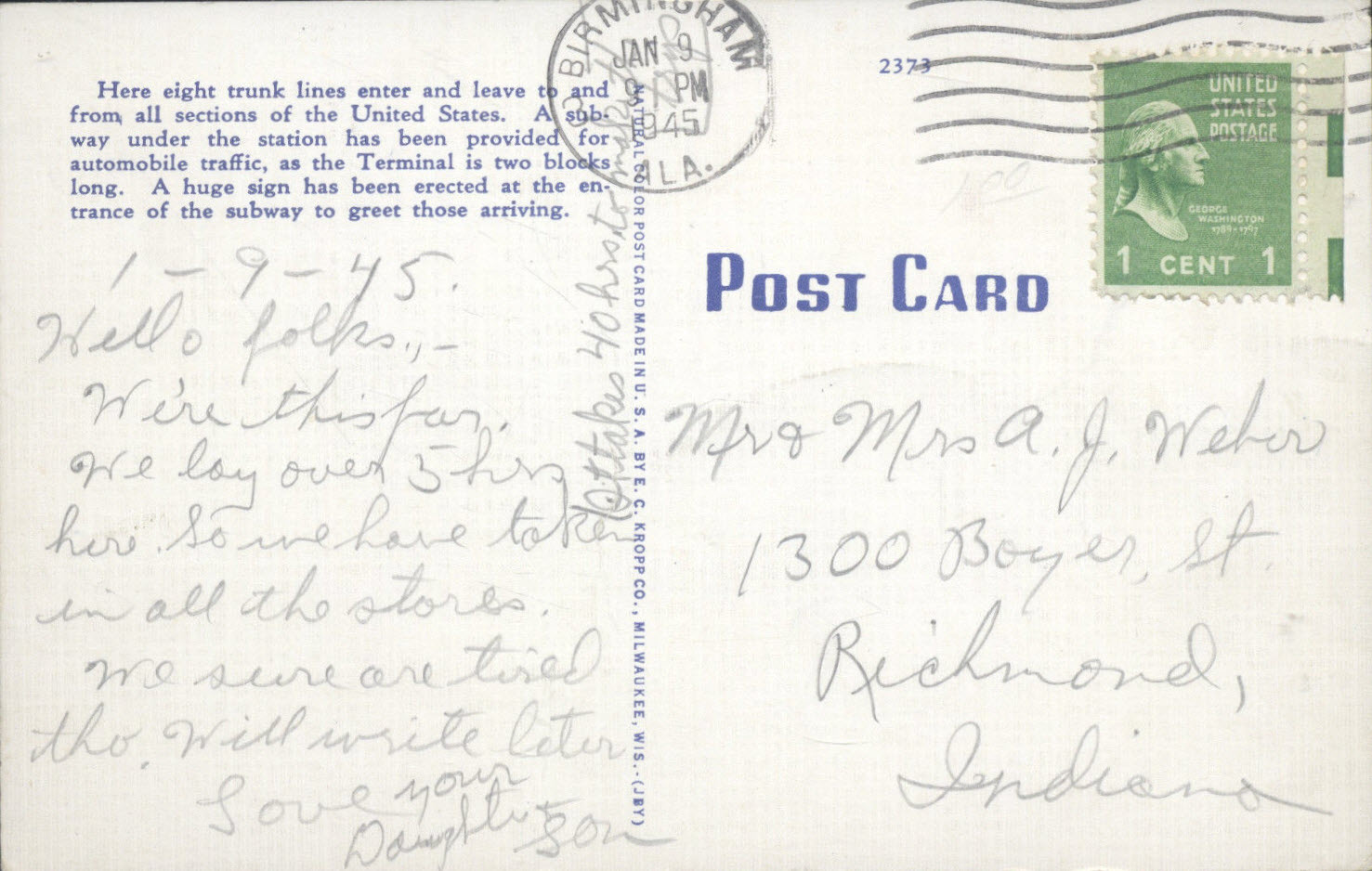
An underpass, locally called a "subway" tunneled below the center of the building, allowing streetcars to bypass the terminal and rail traffic. In 1926 a
large electric sign reading "Welcome to Birmingham, the Magic City", was erected outside the station at the west end of the underpass. The sign functioned
as a gateway for visitors who arrived primarily by rail and 5th Avenue became a "hotel row", lined with restaurants and entertainments. The only remnant
of the demolished building to survive after 1969 was the tunnel, now commonly known as the 5th Avenue North Tunnel that now carries that road under the highway
and railroad tracks.
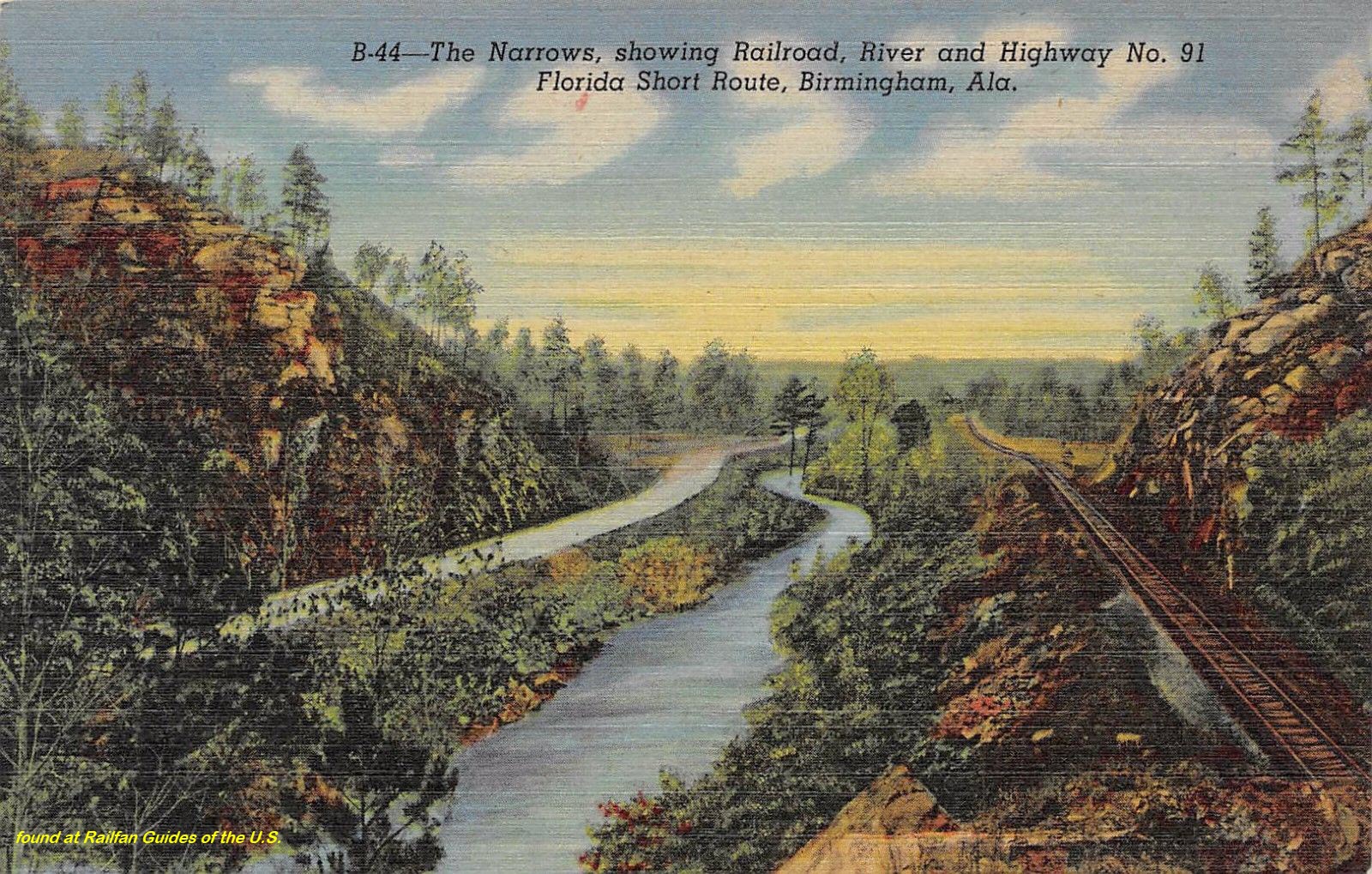
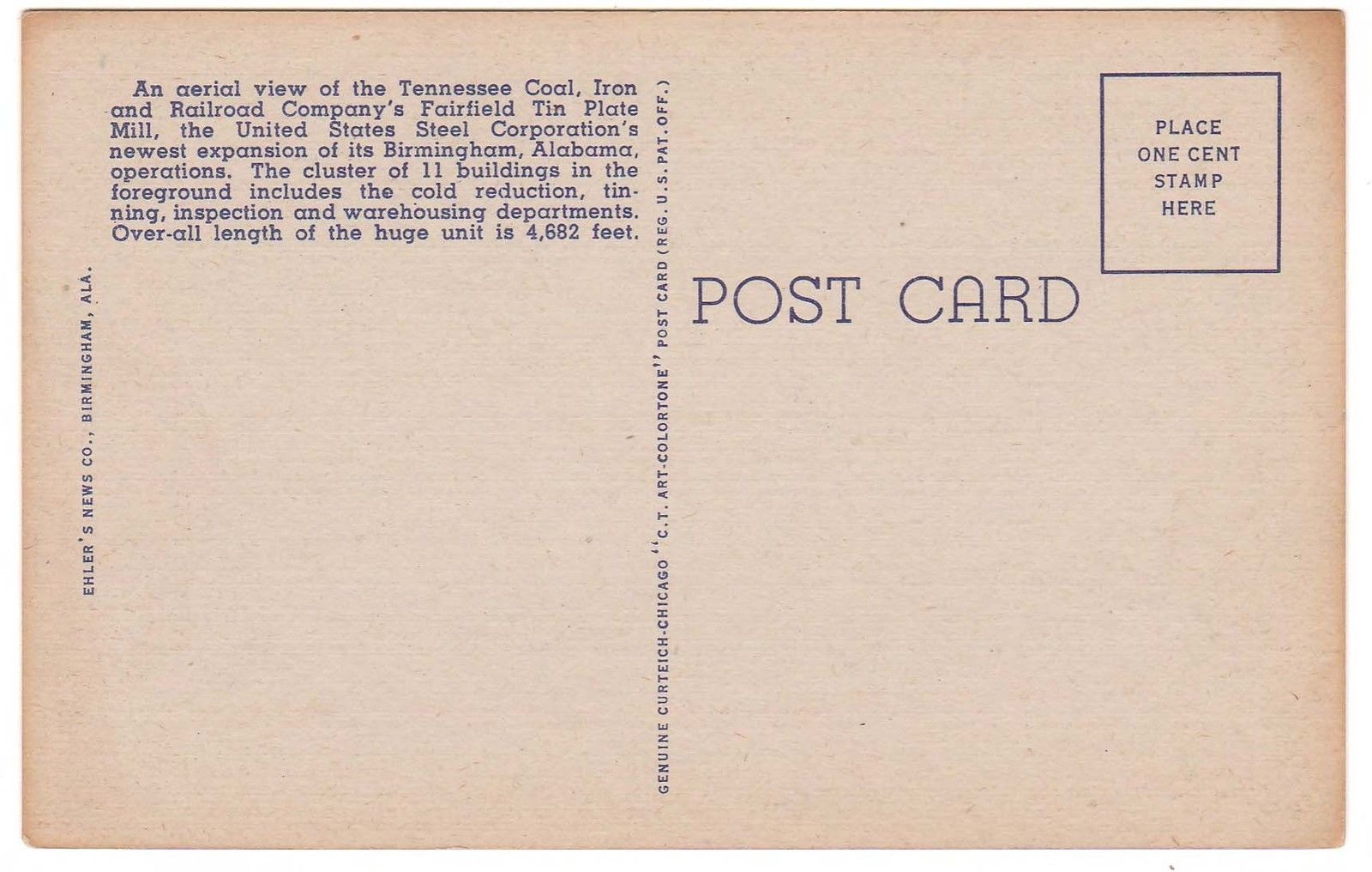
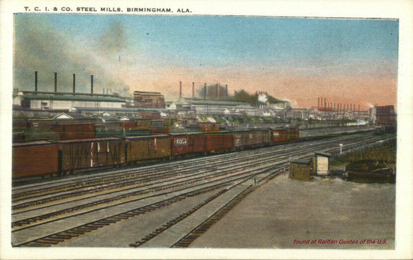
Birmingham City Scenes
Ebay seller: pstcardman2014
Ebay seller: pstcardman2014
Below: Not quite the same view as the above postcard depicts, but very similar on Third Avenue....
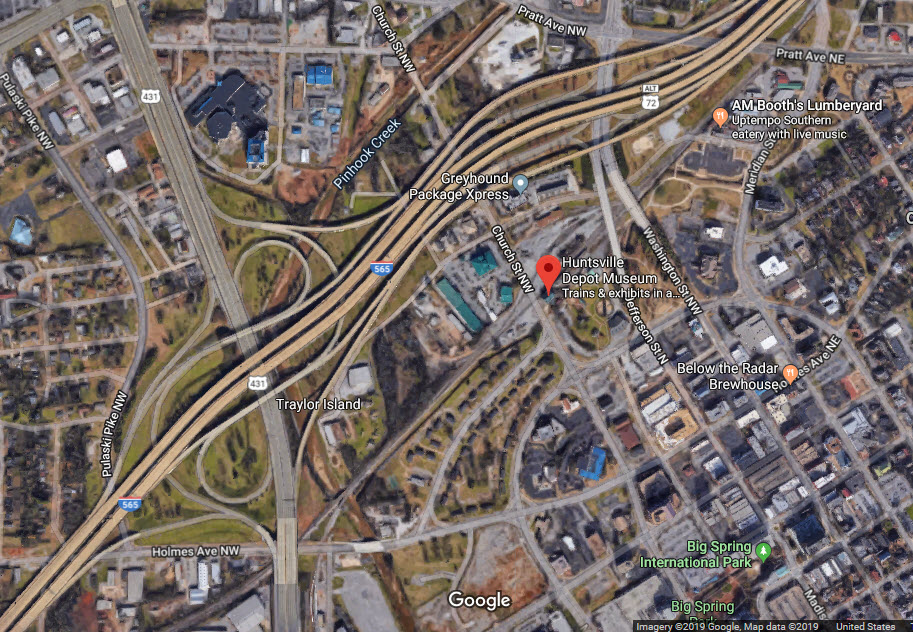
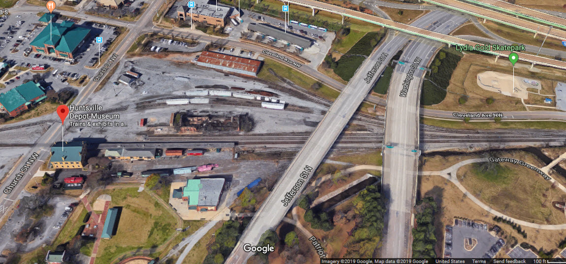
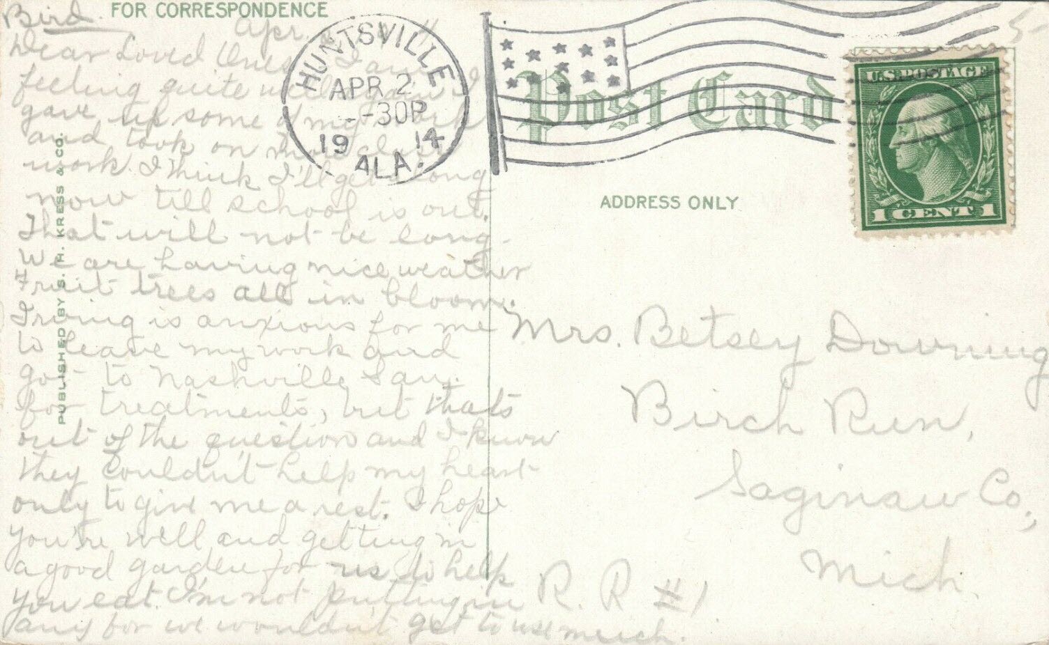
From Wikipedia: The Huntsville Depot located on the Norfolk Southern Railway line in
downtown Huntsville is the oldest surviving railroad depot in Alabama
and one of the oldest in the United States. Completed in 1860, the
depot served as eastern division headquarters for the Memphis and
Charleston Railroad.
Huntsville was occupied by Union forces in 1862 during the Civil War
as a strategic point on the railroad and the depot was used as a prison
for Confederate soldiers. Graffiti left by the soldiers can still be
seen on the walls. The Huntsville Depot saw its last regularly
scheduled passenger train, Southern Railway's The Tennessean,
on March 30, 1968. Today the Depot serves as a museum, part of
the Early Works Museum.
From the Encyclopedia Alabama page: On May 21, 1851, the
Memphis & Charleston Railroad Company began on a railroad to run
through Huntsville on its route from Memphis to Chattanooga. The
General Garth train made its first run through Huntsville on
October 13, 1855, coming from Decatur, Morgan County, 20 miles
away. Huntsville became the railroad company's Eastern Division
headquarters and by the late 1860s, the headquarters included the
depot, a freight station, a 13-bay roundhouse with turntable, an
engine house, a car shop, and a machine shop. On the first floor
of the depot were the ticket office, engineer's and conductor's
rooms, waiting and rest (then called "retiring") rooms, and a
baggage room. The second floor housed the offices of the superintendent,
the secretary, railroad treasurer, and other railroad officers, and
the third floor served as the railroad employees' bunk room.
On April 11, 1862, Union troops marched into Huntsville and
captured the depot, severing a vital Confederate rail link. For
ten days, 159 Confederate soldiers were held prisoner on the
third floor of the depot building before being transferred to
a prisoner of war camp in Ohio. Following the Civil War, the
U.S. government returned the line, in almost total ruin, to
the Memphis & Charleston Railroad Company, which subsequently
went bankrupt. The line was purchased by the Southern Railway
System in 1898. The depot was renovated in 1912 and remained
a passenger station until 1968.
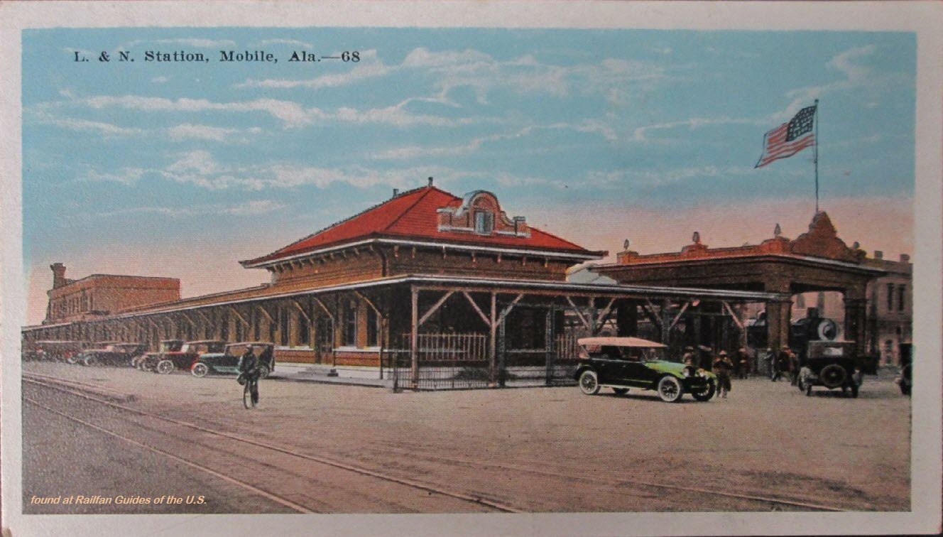
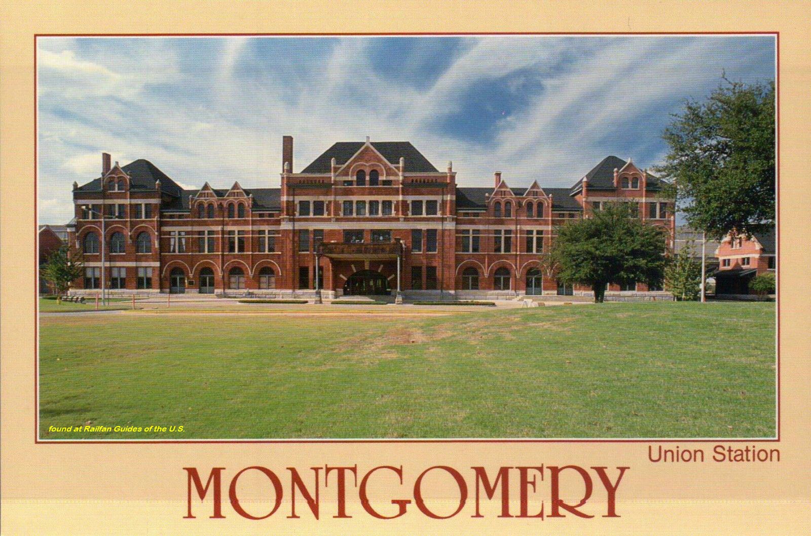
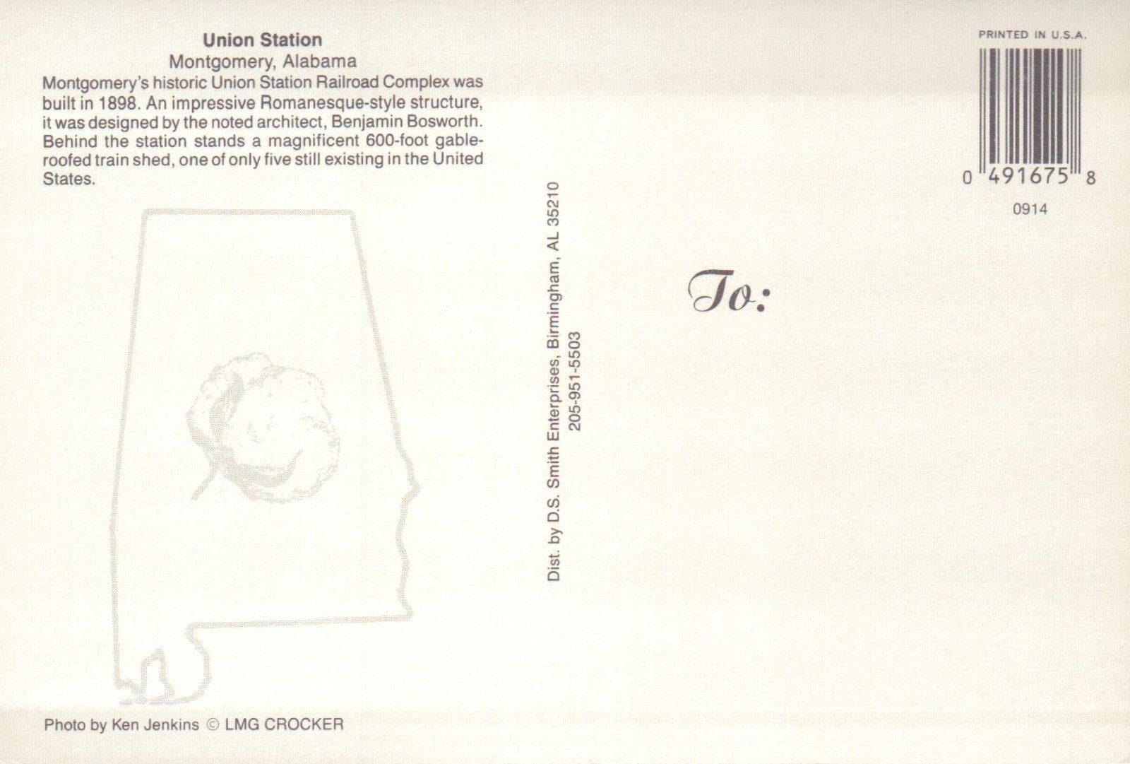
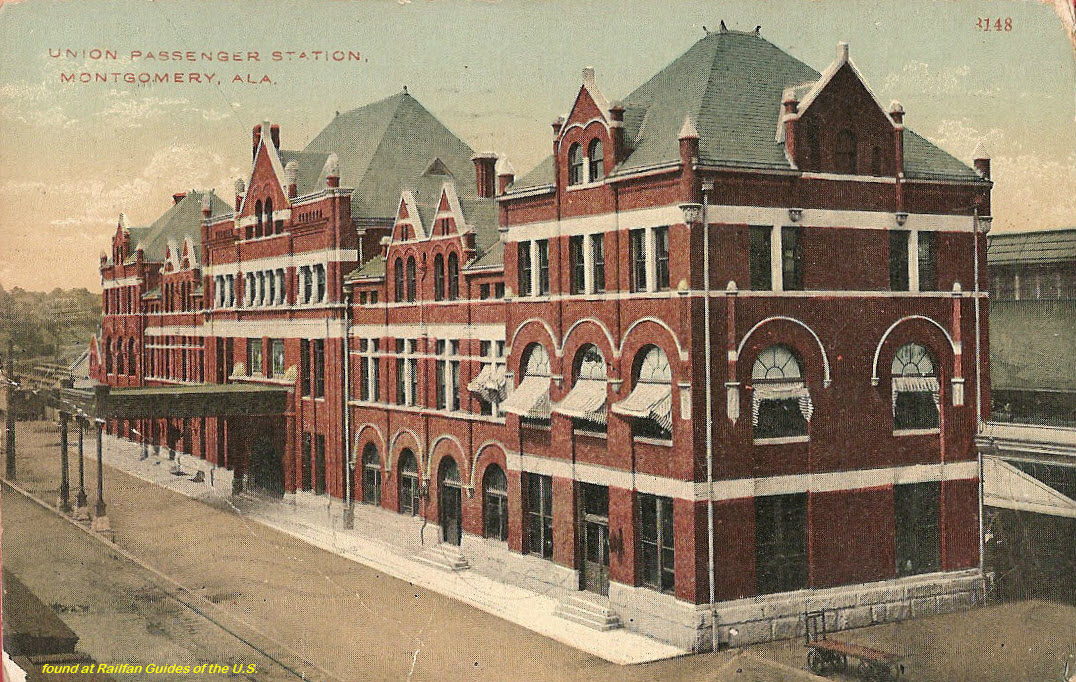
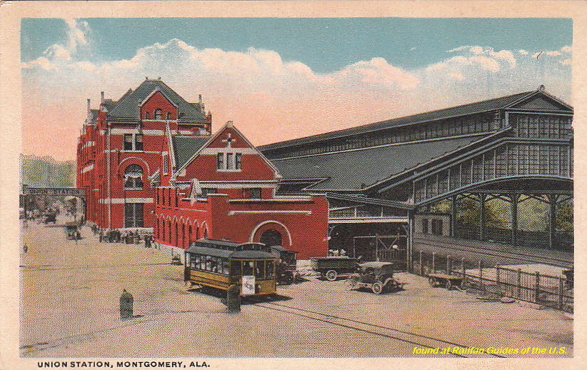
Union Station, also known as Montgomery Union Station or Montgomery Union Station and Trainshed, in Montgomery, AL was built by the Louisville
and Nashville Railroad and opened in 1898. Erected of brick and limestone on a high bluff along the Alabama River, the station also served passenger
trains of Atlantic Coast Line,Western Railway of Alabama, Seaboard Air
Line, Central of Georgia, and Gulf, Mobile and Ohio Railroad. The
station had six tracks under a 600 foot shed, with a coach yard on the south end of the station as well as a Railway Express Agency facility. The station's
design segregated passengers by race and incorporated Romanesque Revival elements.
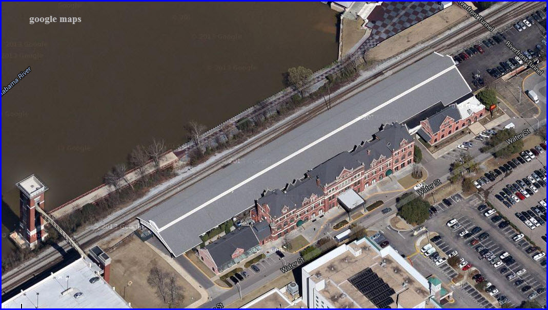
The number of passenger trains using Union Station declined during the 1950s and 1960s. When Amtrak came into existence in 1971, it continued passenger service
through Montgomery with a single train (the South Wind, later renamed the Floridian), operating between Chicago and Miami. However, this train was
terminated in 1979 and Union Station was closed.
After a period of disuse, Union Station was renovated for commercial tenants. The train shed still stands, although tracks under it have been replaced by asphalt parking.
It was declared a National Historic Landmark in 1976.
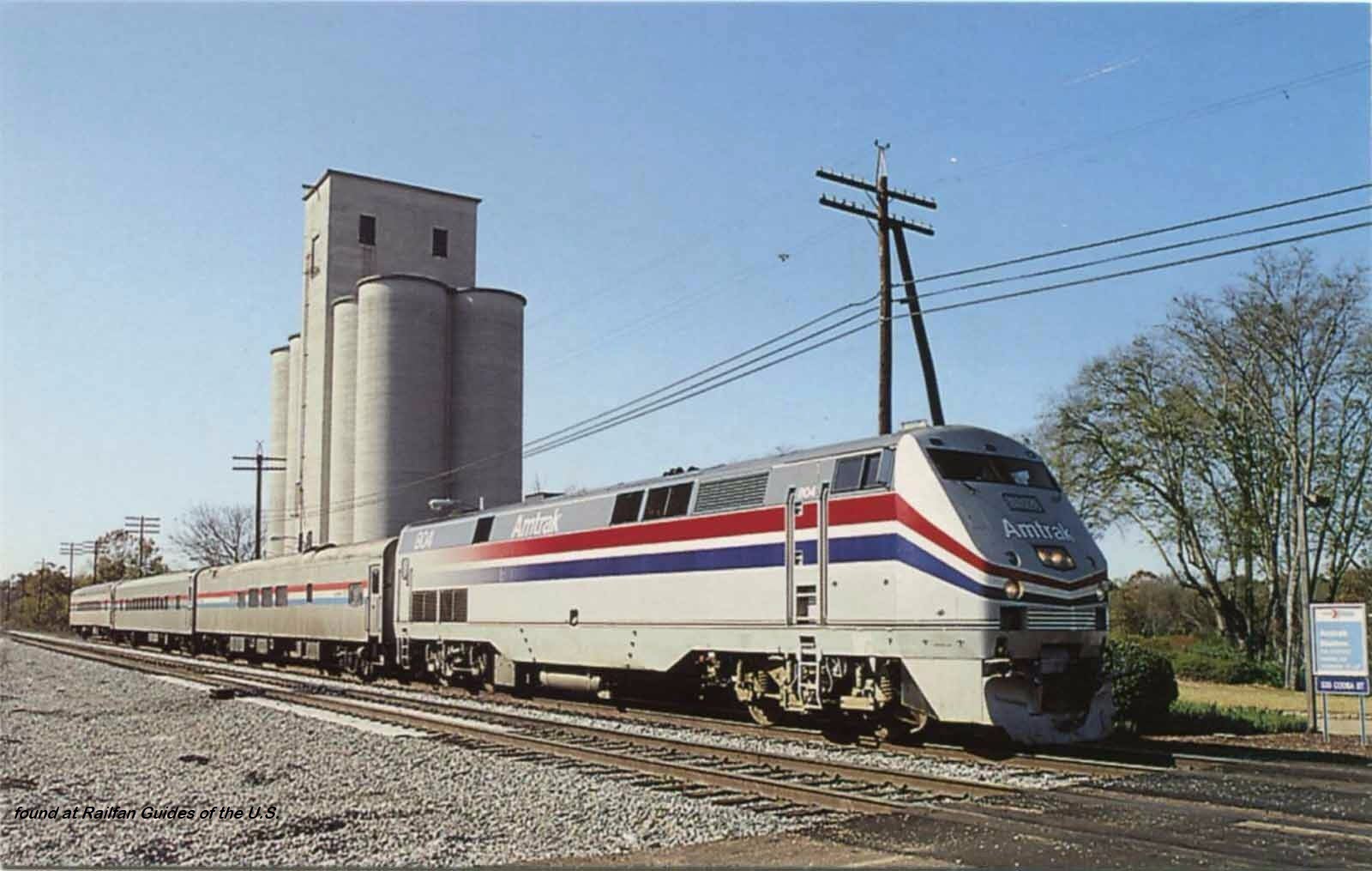
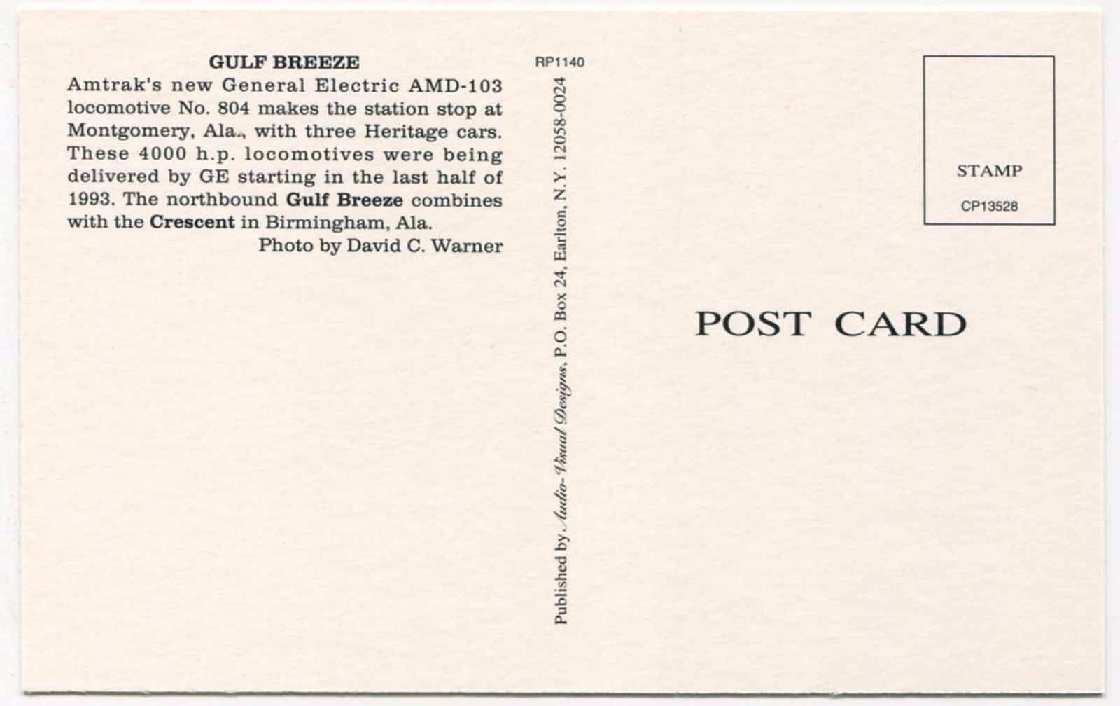
Amtrak returned to Montgomery in 1989 with an extension of the Crescent called the Gulf Breeze from Birmingham to Mobile; but Union Station was not used. Instead,
Amtrak contracted with a travel agent who occupied a former grain silo near Union Station. This Amtrak service was terminated in 1995, and Montgomery
has had no passenger rail service since. Among other tenants, Union Station currently hosts the Montgomery Area Visitor Center.
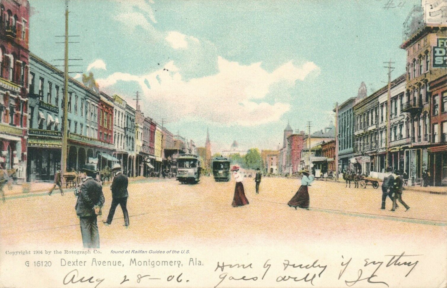
Montgomery City Scenes
Ebay seller: pstcardman2014
Notice below, that they photoshoped the trolley wire out of the scene.
Now, it's probably a 6-lane road with a hamburger joint every 1000 feet on each side :-)
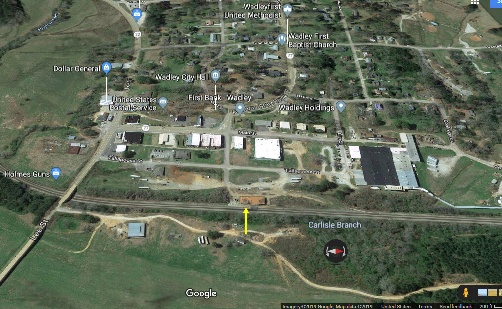
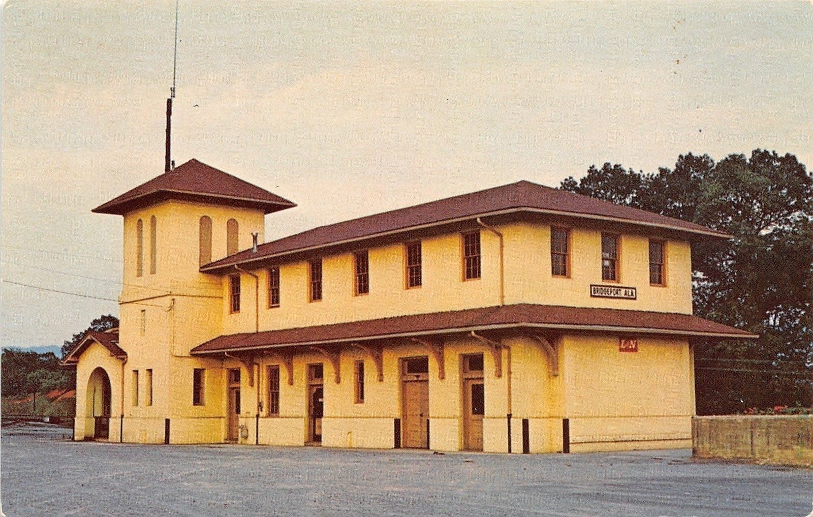
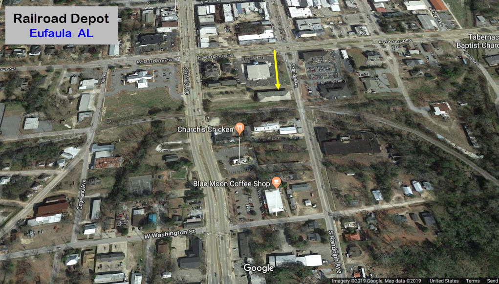
GPS Coordinates: 34.867539, -85.839999
Back in the 1984-1990 timeframe, when I worked in Huntsville AL and commuted home, I can't tell you how many times I passed by here on 72! :-)
The Stevenson RR Museum is also located here. https://railfanguides.us/al/stevenson/index.htm
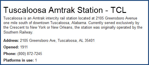
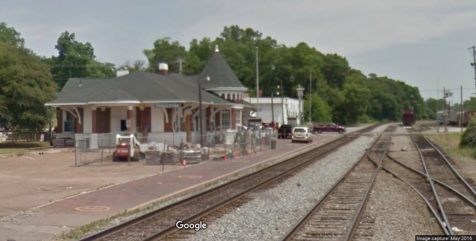
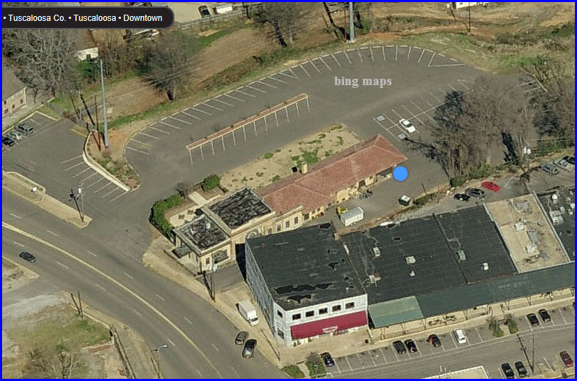
Located south of downtown, the Tuscaloosa depot sports a romantic castle-like bay with deep corbelling and a conical roof topped by a finial. The one story
brick Tuscaloosa station, located about a mile south of downtown, was built in 1911 for the Southern Railway as a replacement for
a depot erected in 1873. In addition to an Amtrak waiting room, the station has office space occupied by Norfolk Southern Railway.
In May 2012, the Ceres Garden Club completed a cosmetic improvement project at the station in conjunction with the city’s Greensboro Avenue Beautification
project. The garden club planting new shrubs and flowers, removed debris, painted the station and erected a flag pole. Amtrak installed new exterior
benches and rebranded the signage on the depot.
Tuscaloosa, also the seat of Tuscaloosa County, sits on the Black Warrior River. The city was named after the Chocktaw chieftain, Tuscaloosa, which means
“black warrior”. The river shoals in this area of western Alabama were the southern-most reliable ford on the river, and thus the natural
convergence of many trails from early times.
After the War of 1812, settlements began to emerge near the Creek village at the river’s fall line. In 1817, Alabama became a territory and on December
13, 1819, the territorial legislature incorporated the town of Tuscaloosa, one day before Alabama was admitted to the union as a state. From 1826 to 1846,
Tuscaloosa served as Alabama’s capital. The University of Alabama was established there in 1831, as well as the Bryce State Hospital in 1850.
During the American Civil War, a brigade of Union troops raiding the city burned the university campus, along with the damaging much of the rest of the city.
Due to the abundance of oaks and hardwoods in the area, Tuscaloosa gained the nickname “Druid City” during the war.
A system of locks built on the Black Warrior River in the 1890s opened up an inexpensive means of transport to the Gulf seaport at Mobile, stimulating the mining
and metallurgical industries in the region. Together with the University of Alabama and expanding high-quality mental health facilities in the city,
Tuscaloosa saw prosperity through much of the next century. Manufacturing plants for firms such as Michelin, JVC, and Mercedes contributed to its economic
advancement, though Tuscaloosa remains largely a college town.
Amtrak provides ticketing and baggage services at this station, which is served by the daily Crescent.
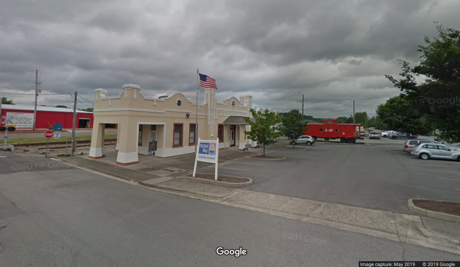
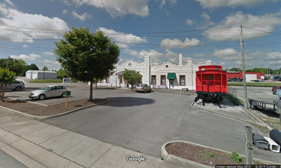
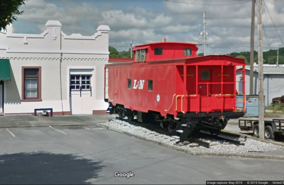
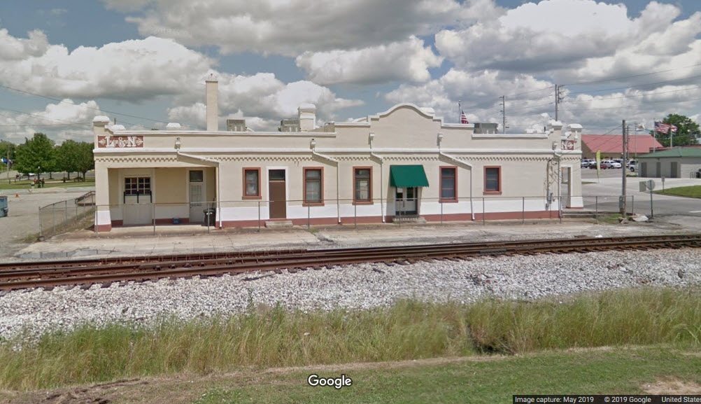
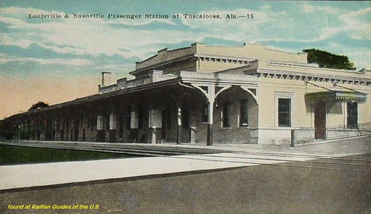
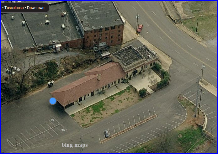
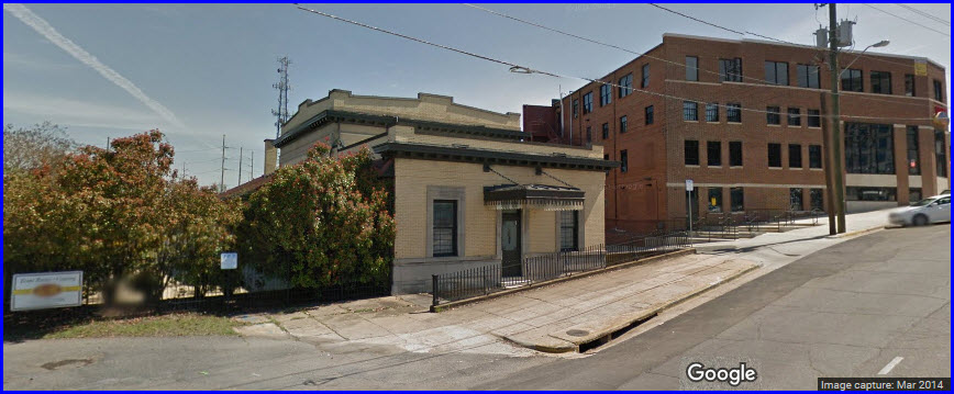
The L&N Station was the original Louisville & Nashville Train Station for Tuscaloosa, Alabama. Built in 1912, it became fully operational in 1913.
Many of the fixtures including the vintage tile floor and the marble walls are original. The large gasolier in The Main Room is also original and is one of very
few still in exisistence and in use. It has been wired for electricity but looks exactly as it did when it was powered by gas. It is one of the many
beautiful details that make this venue a perfect choice for your special event.
Historic Old Train Station remodeled available for special events. Full catering services available. Flexible set-up for up to 300. Banquets, receptions and reunions. Located
downtown at 301 Greensboro Avenue. can hold up to 300.
I love trains, and I love signals. I am not an expert. My webpages reflect what I find on the topic of the page. This is something I have fun with while
trying to help others.
Please Note: Since the main focus of my two websites is railroad signals, the railfan guides are oriented towards the signal fan being able to locate them.
For those of you into the modeling aspect of our hobby, my indexa page has a list of almost everything railroad oriented
I can think of to provide you with at least a few pictures to help you detail your pike.
If this is a railfan page, every effort has been made to make sure that the information contained on this map and in this railfan guide is correct. Once in a while,
an error may creep in :-)
My philosophy: Pictures and maps are worth a thousand words, especially for railfanning. Text descriptions only get you so far, especially if you get lost or
disoriented. Take along good maps.... a GPS is OK to get somewhere, but maps are still better if you get lost! I belong to AAA, which allows you to get
local maps for free when you visit the local branches. ADC puts out a nice series of county maps for the Washington DC area, but their state maps do not have the
railroads on them. If you can find em, I like the National Geographic map book of the U.S..... good, clear, and concise graphics, and they do a really good job
of showing you where tourist type attractions are, although they too lack the railroads. Other notes about specific areas will show up on that page if known.
Aerial shots were taken from either Google or Bing Maps as noted.
Screen captures are made with Snagit,
a Techsmith product... a great tool if you have never used it!
By the way, floobydust is a term I picked
up 30-40 years ago from a National Semiconductor data book, and means
miscellaneous and/or other stuff.
Pictures and additional information is always needed if anyone feels inclined to take 'em, send 'em, and share 'em, or if you have something to add or correct.... credit
is always given! Please be NICE!!! Contact info is here
Beware: If used as a source, ANYTHING from Wikipedia must be treated as being possibly being inaccurate, wrong, or not true.
 Geek Alabama
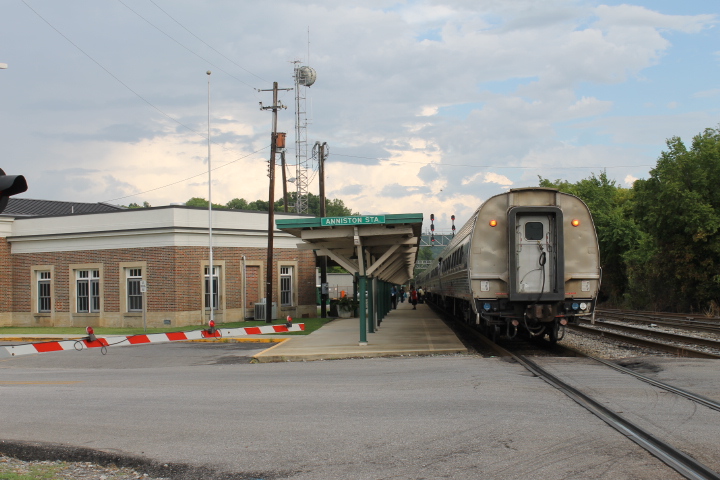 Geek Alabama
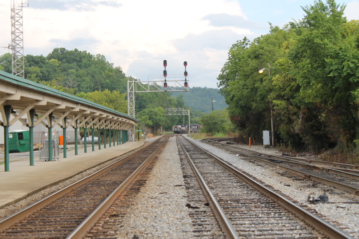 Geek Alabama
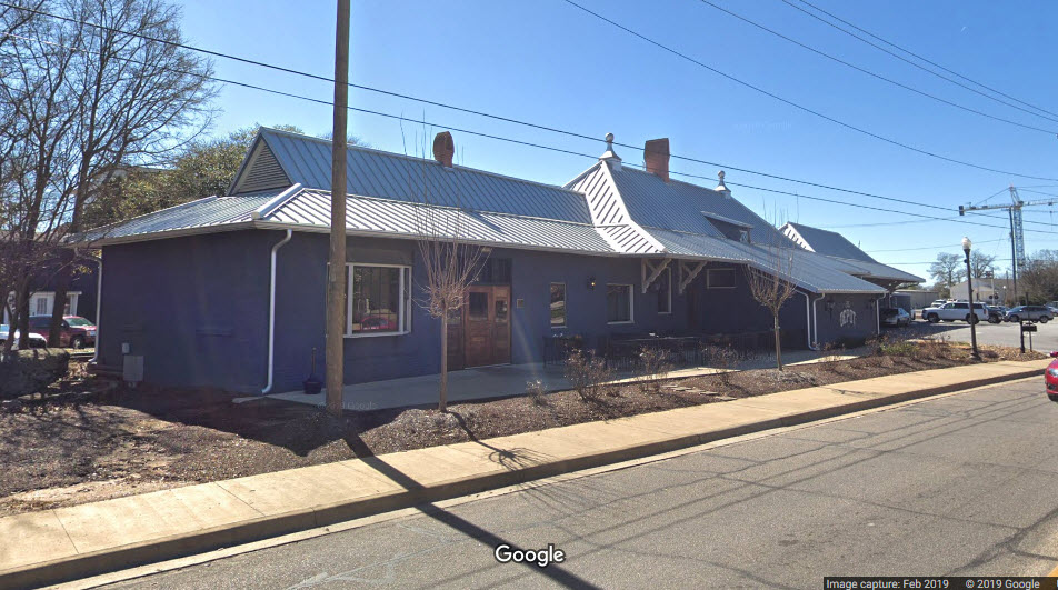
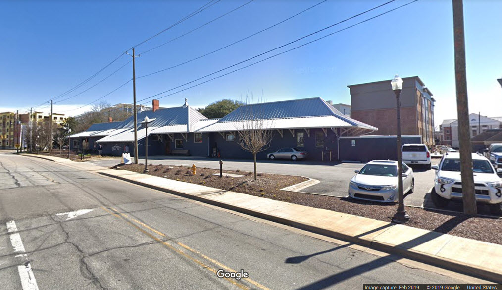
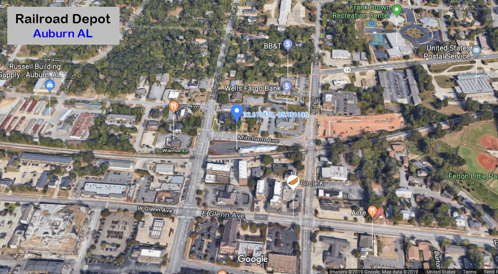
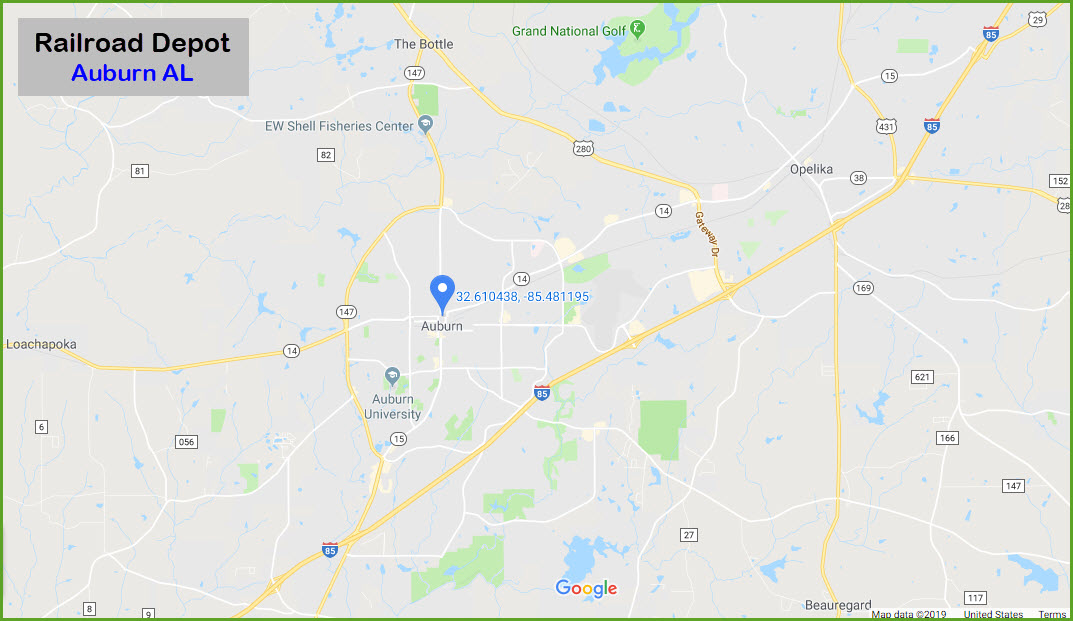
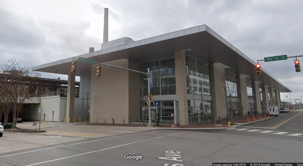
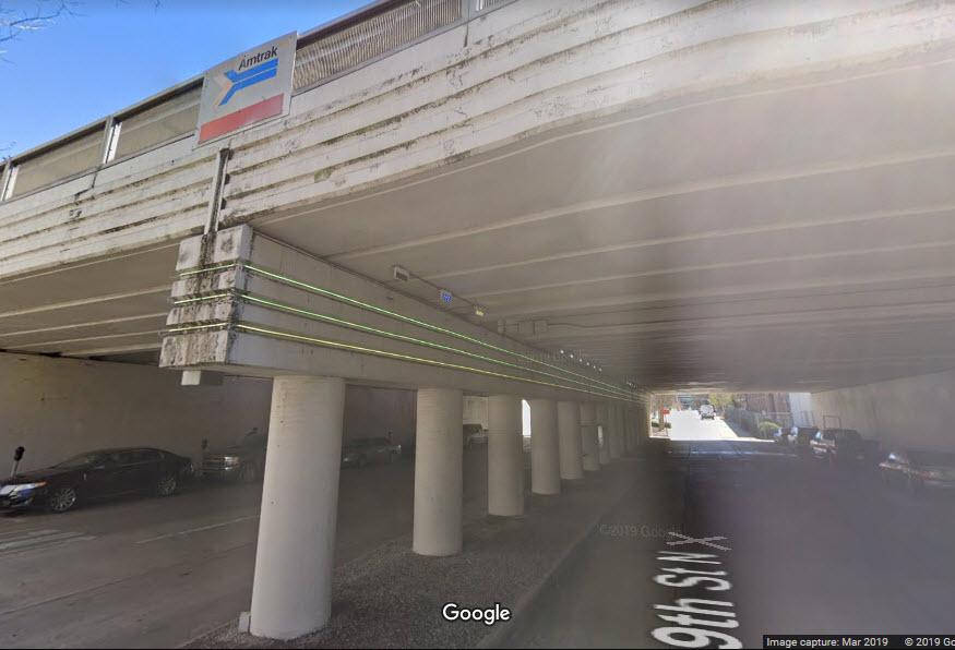
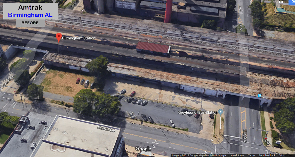
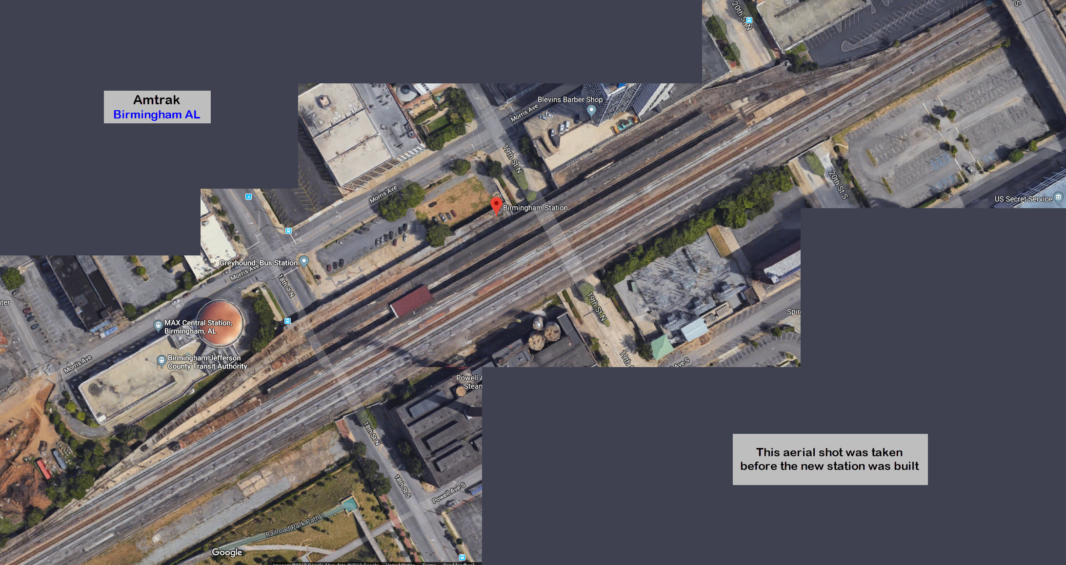
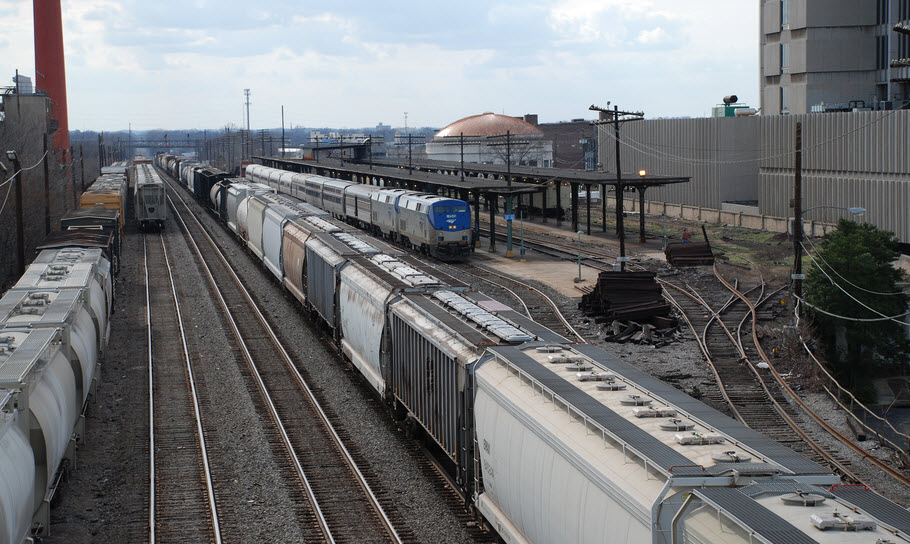 photo by Max Wolf via Wikipedia
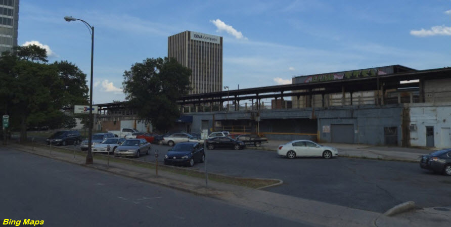 before the new station was built
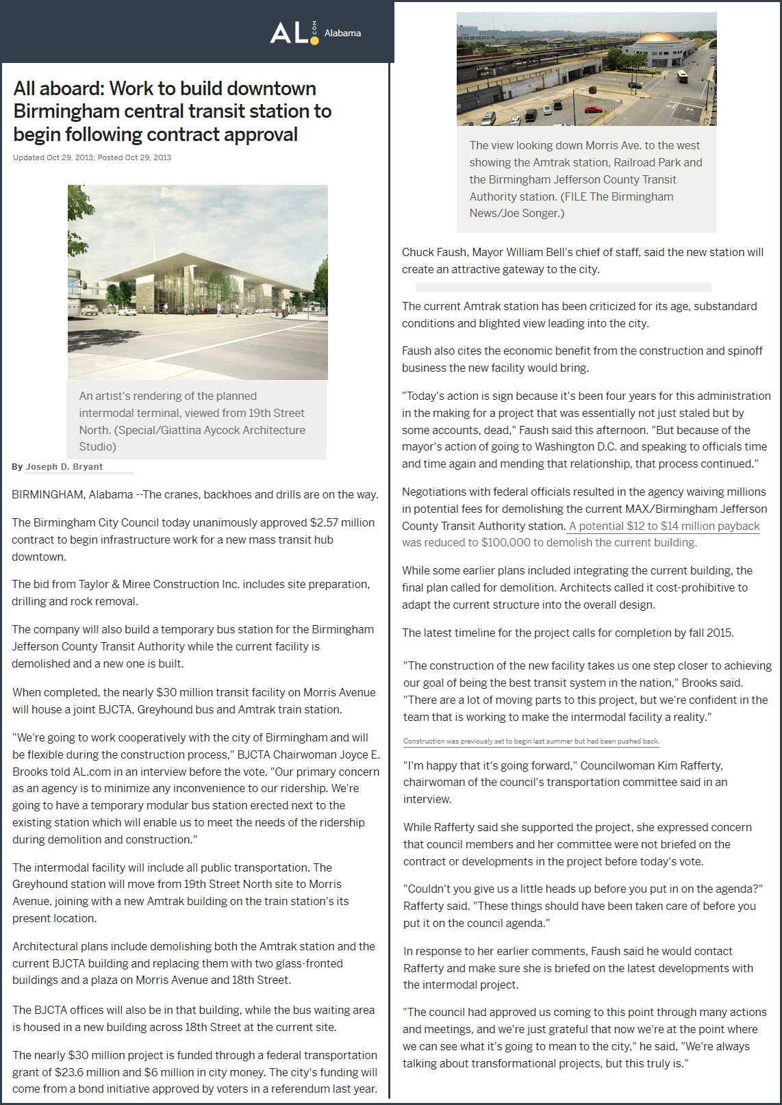
 Ebay seller: ats4824
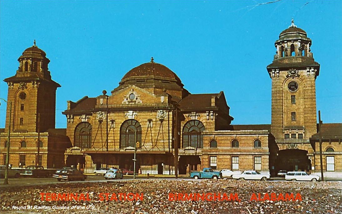 Ebay seller: bonnpon
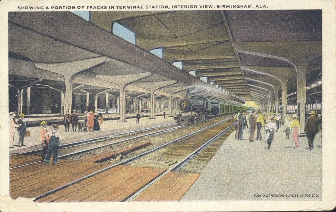
 Where it used to be.
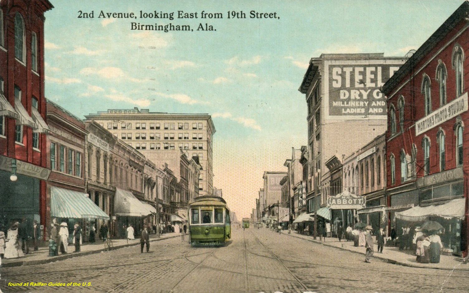
 Ebay seller: pstcardman2014
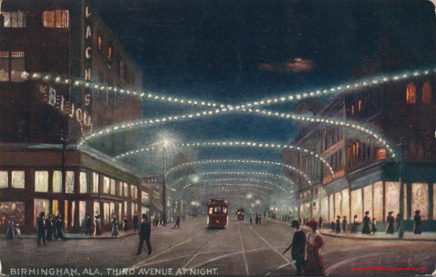
 Ebay seller: pstcardman2014
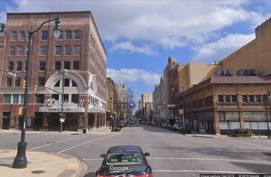
 Ebay seller: stampyboy
 Ebay seller: mikeingreensboro
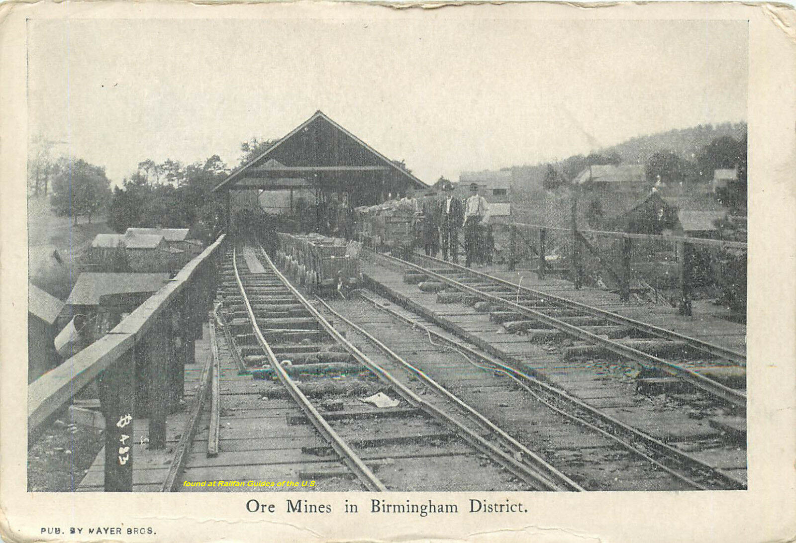 Ebay seller: delifrank
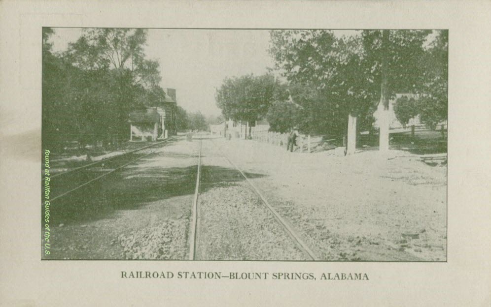
 Ebay seller: skurfanpostcards
 Ebay seller: baysideantiques
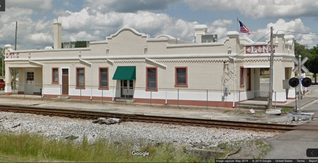
 Thanks Denver
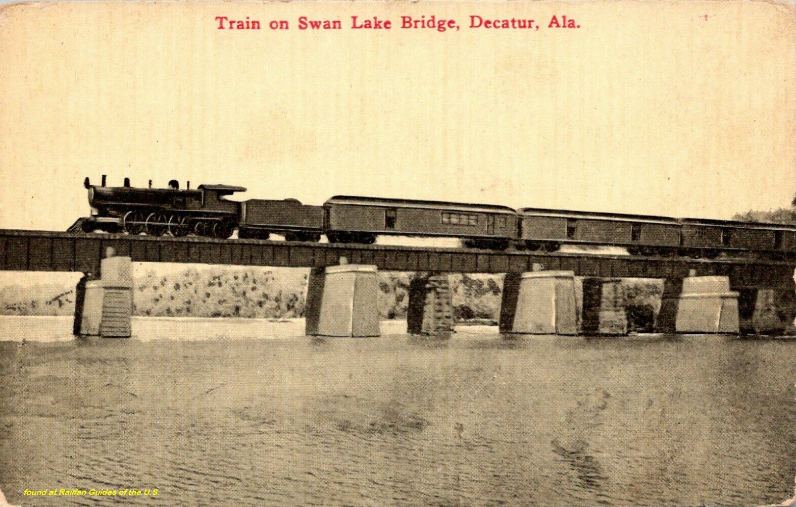 Ebay seller: smokecreekbooks
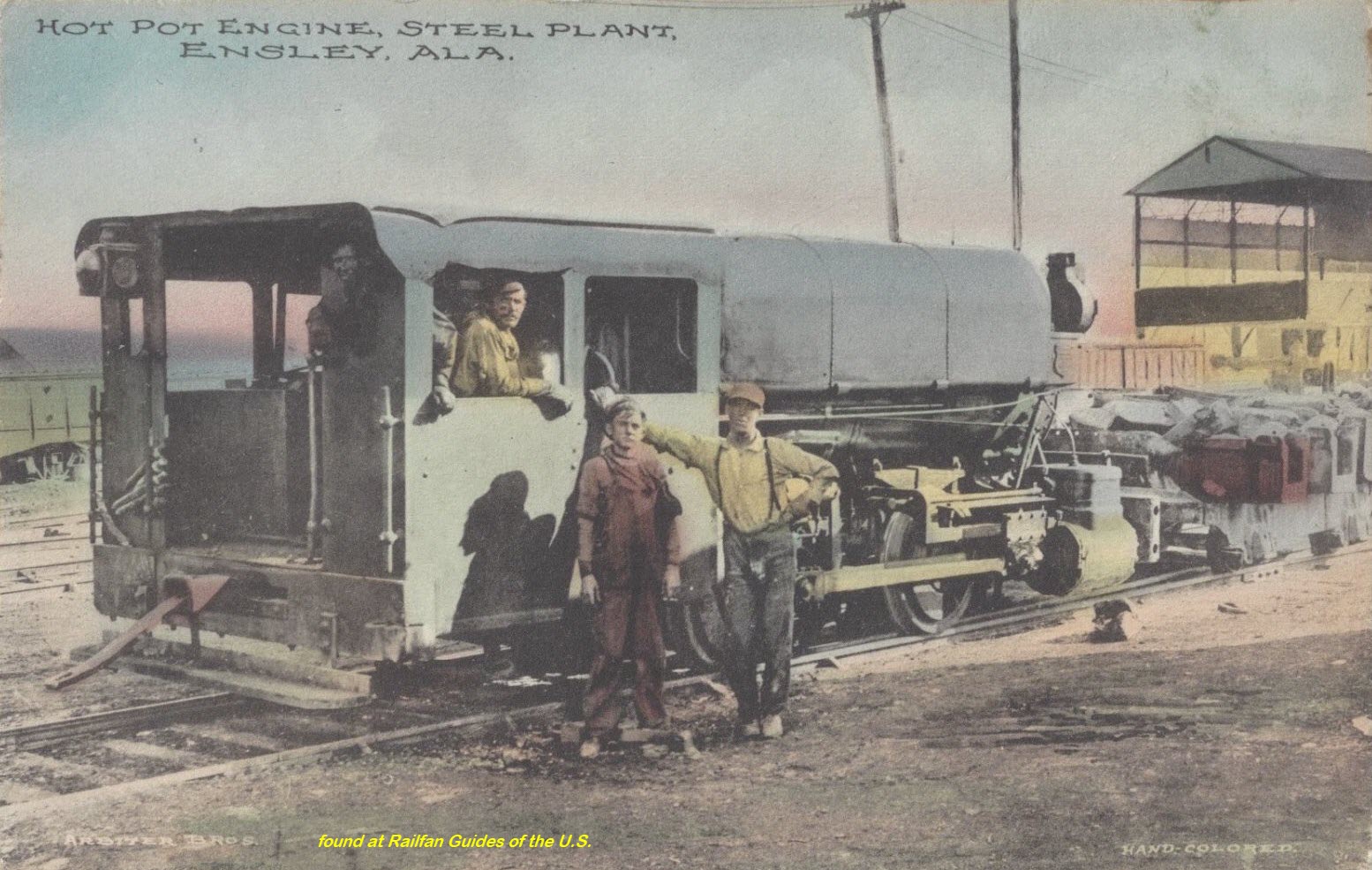
 Thanks Denver
 Ebay seller: skurfanpostcards
 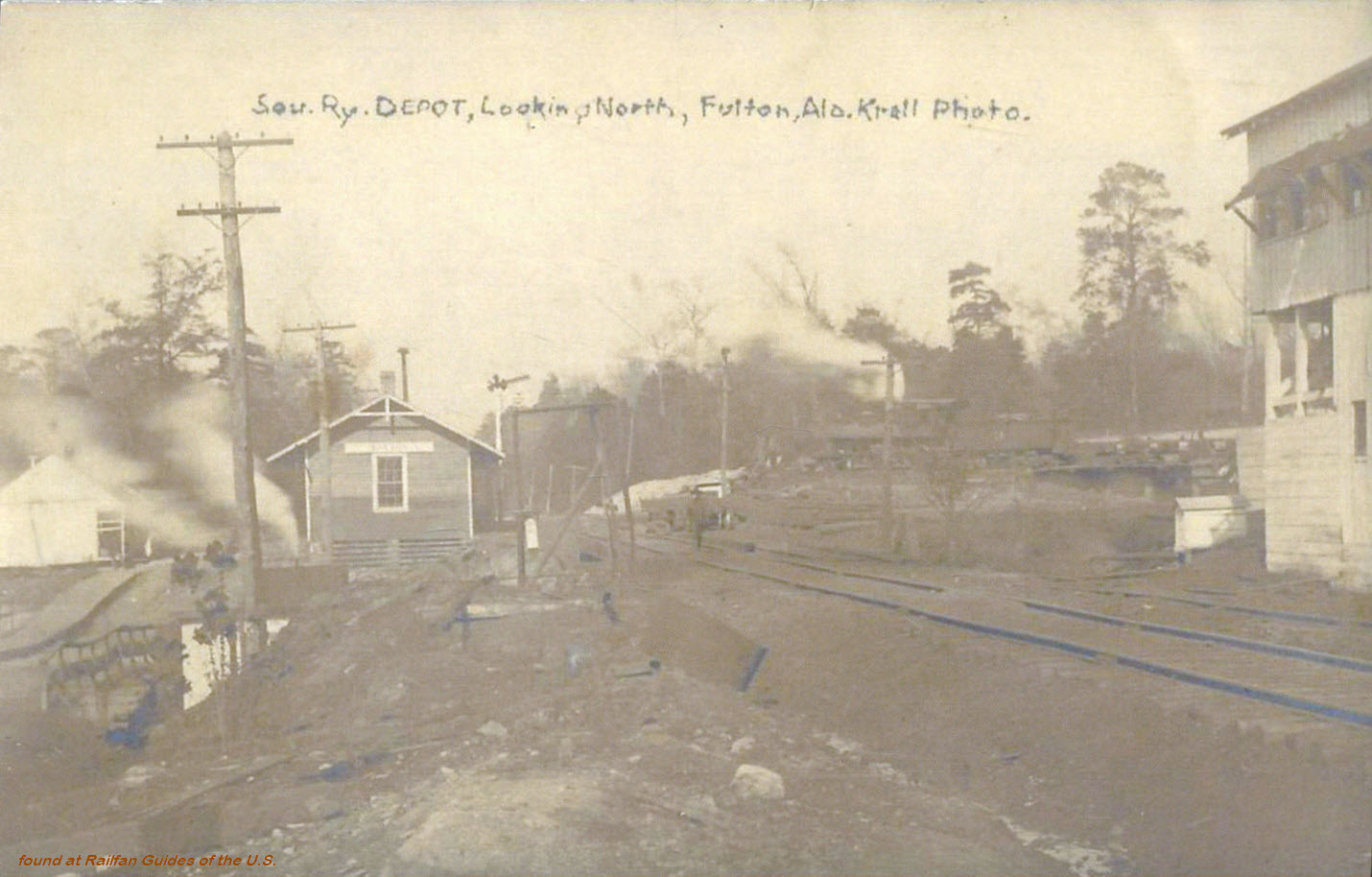 Ebay seller: skurfanpostcards
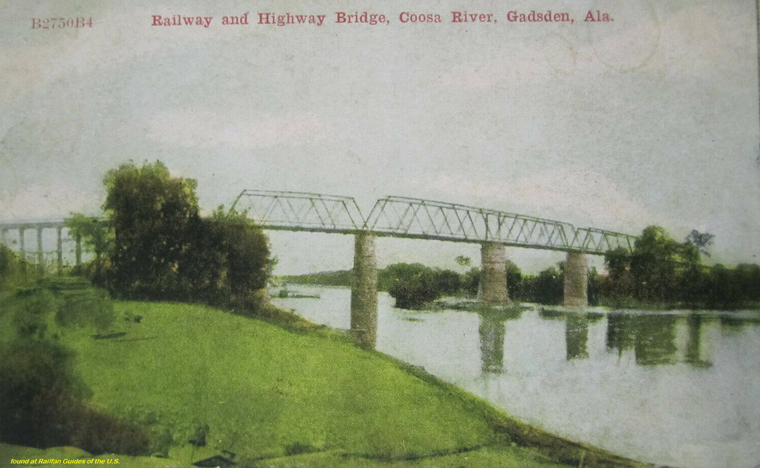 Ebay seller: i_love_mandi
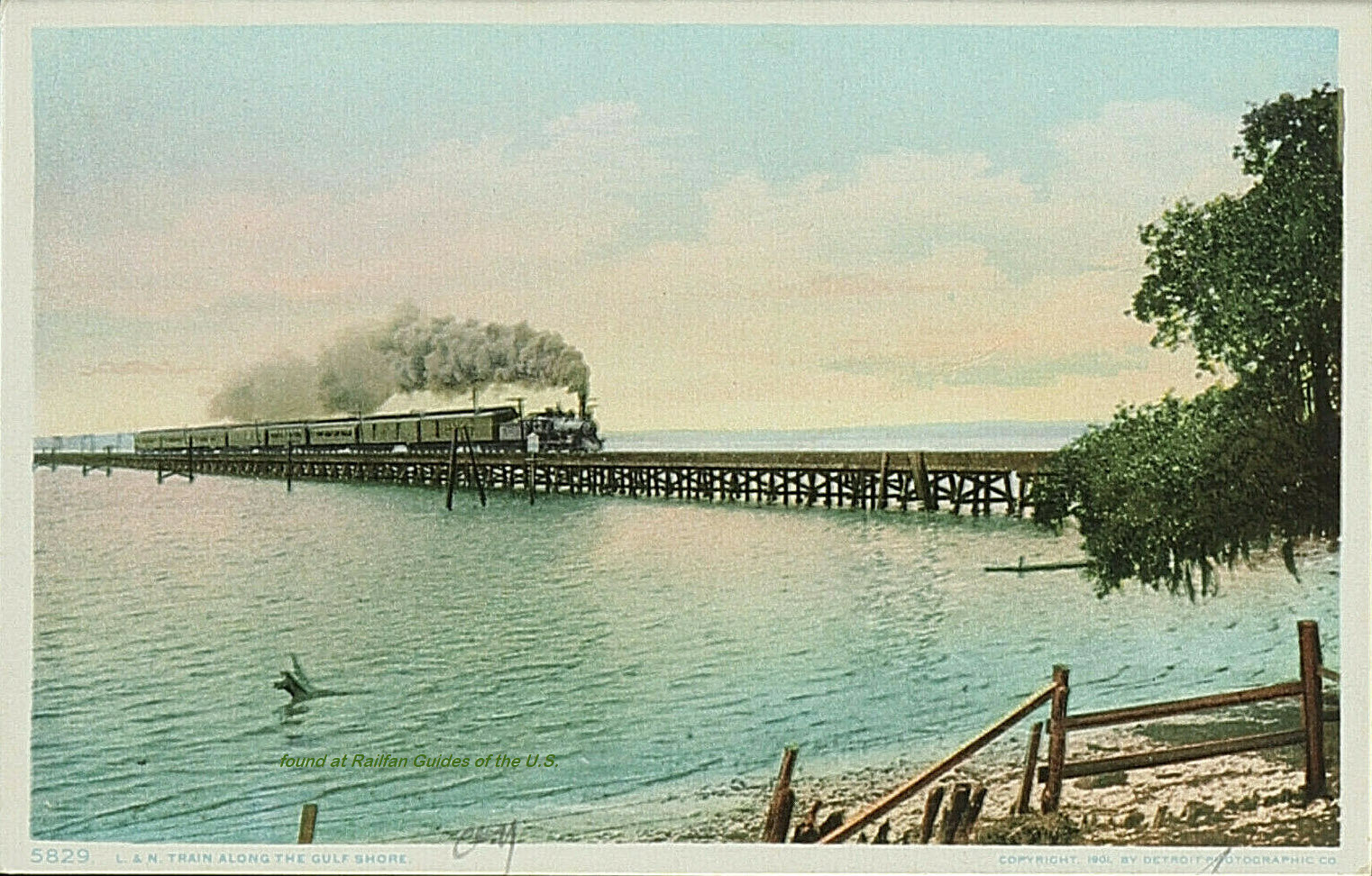 Ebay seller: santiagofrancisco2014
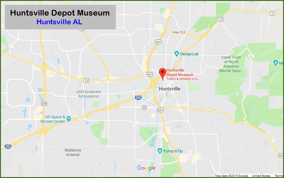

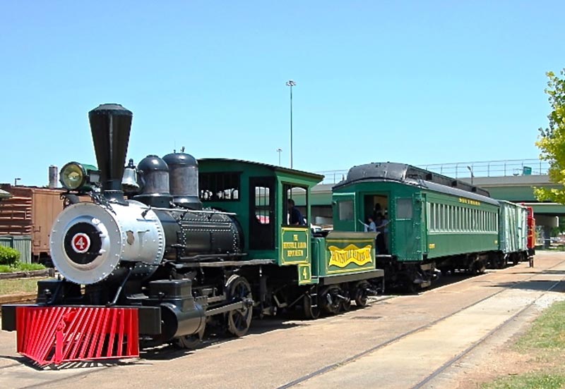 Photo by Mike Manosky Real Estate
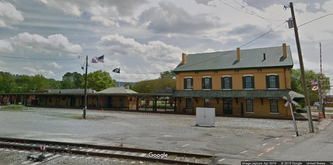
 Ebay seller: pstcardman2014
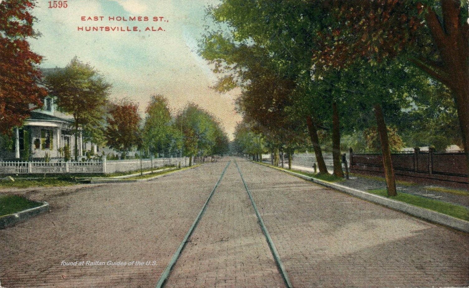
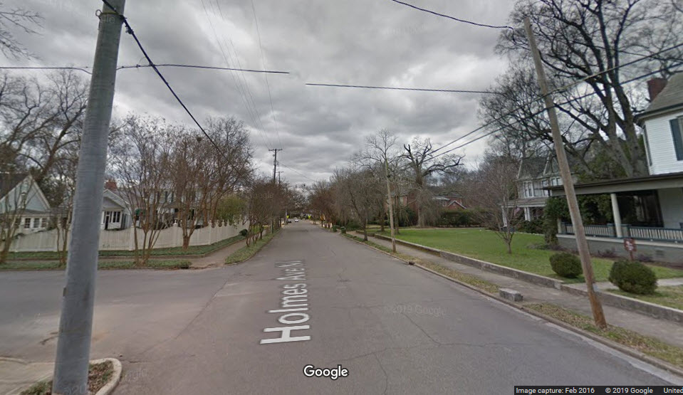 Current view of east Holmes Ave....
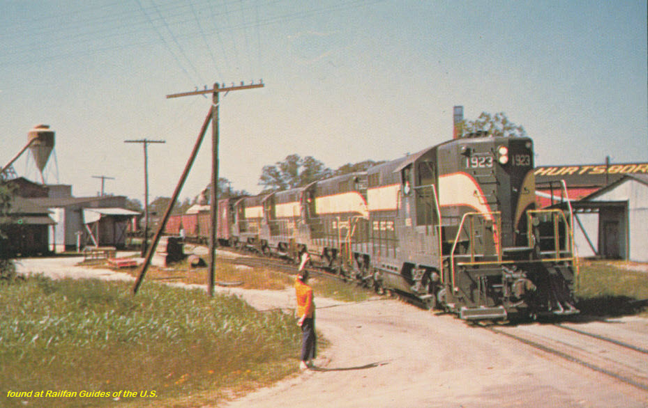
 Ebay seller: pstcardman2014
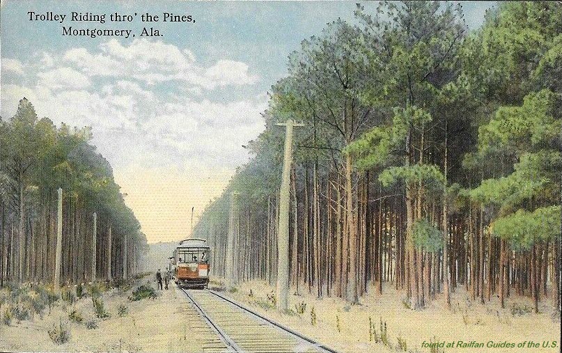 Ebay seller: refried.jeans
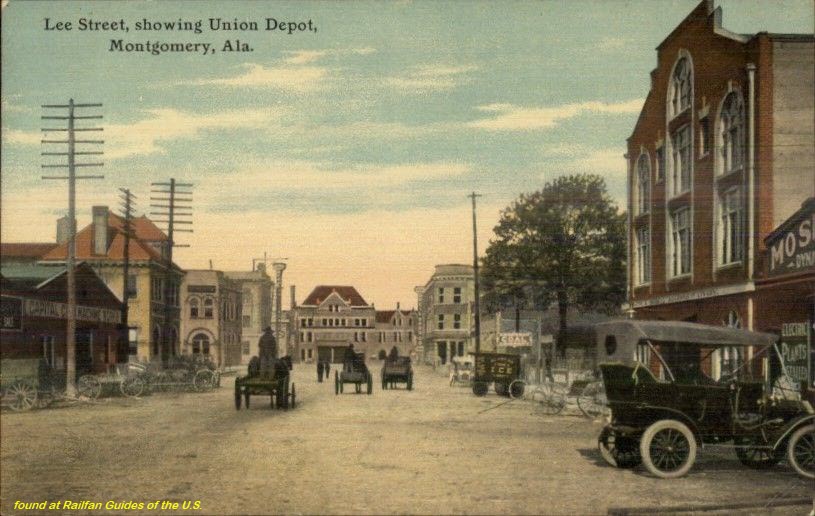 Ebay seller: mikeingreensboro
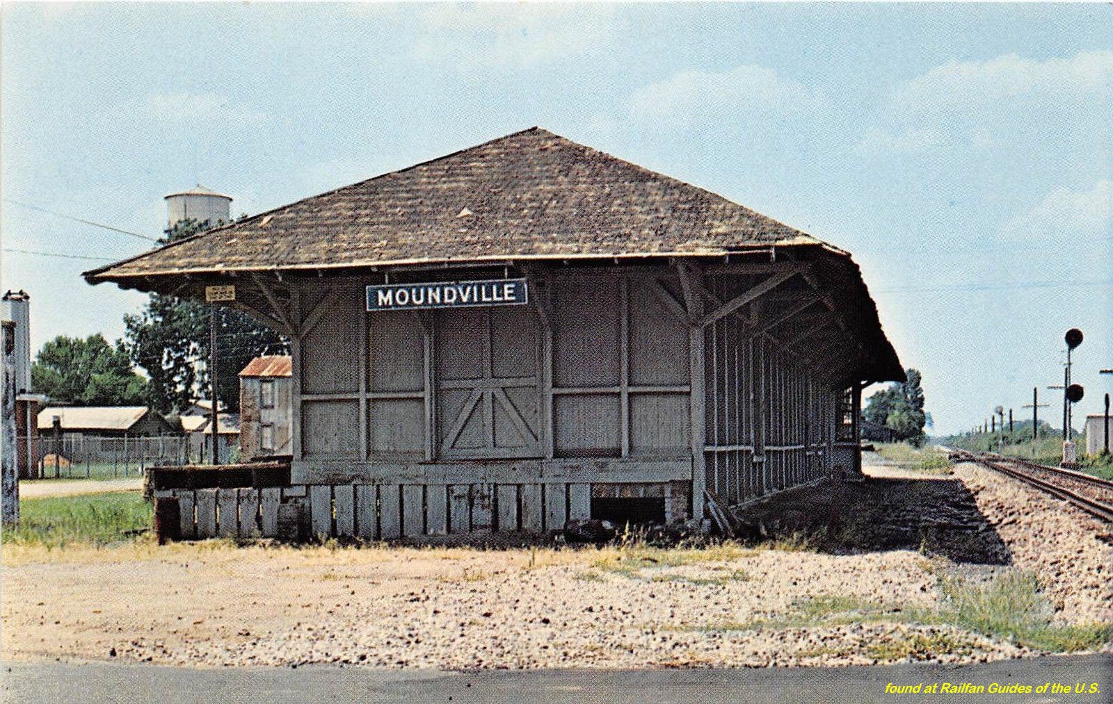
 Ebay seller: mikeingreensboro
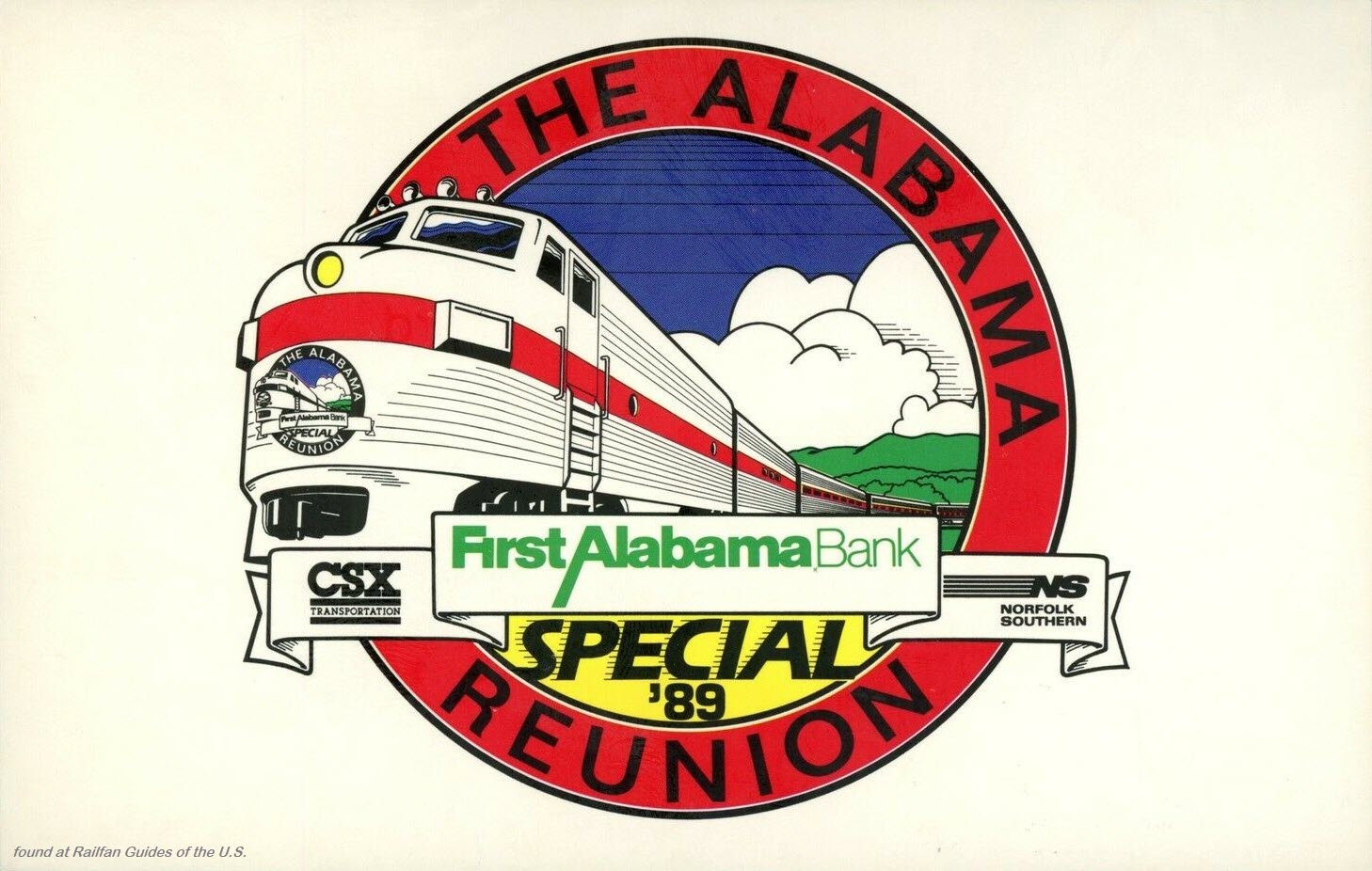
 Ebay seller: trentonstampandcoinco
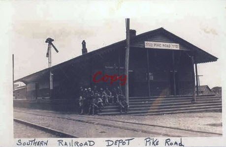
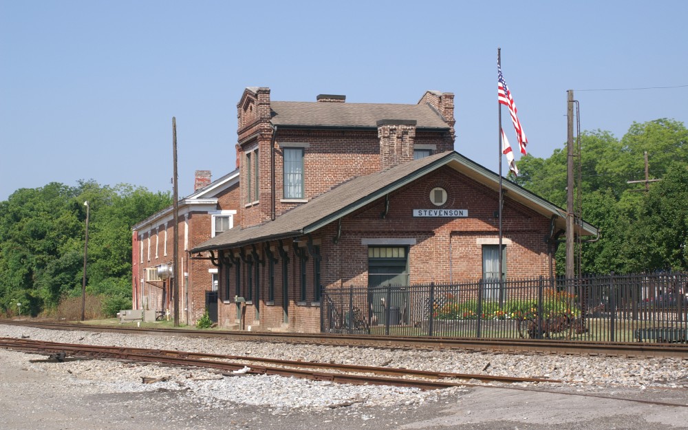 photo by Ron Kohlin
 Thanks to Denver Todd
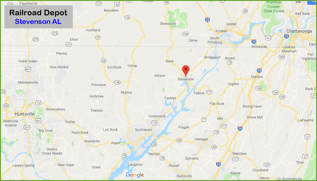
 Ebay seller: fxk19
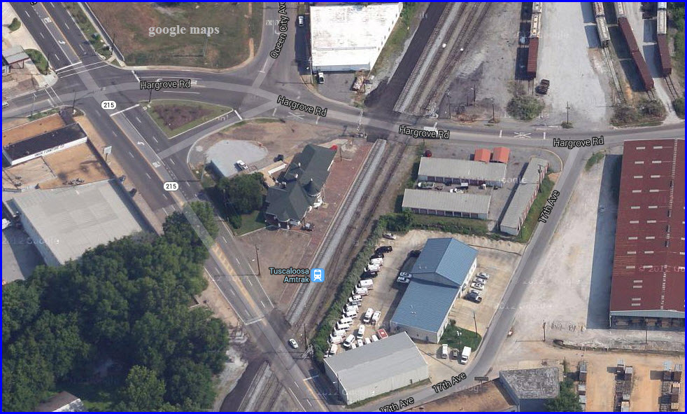
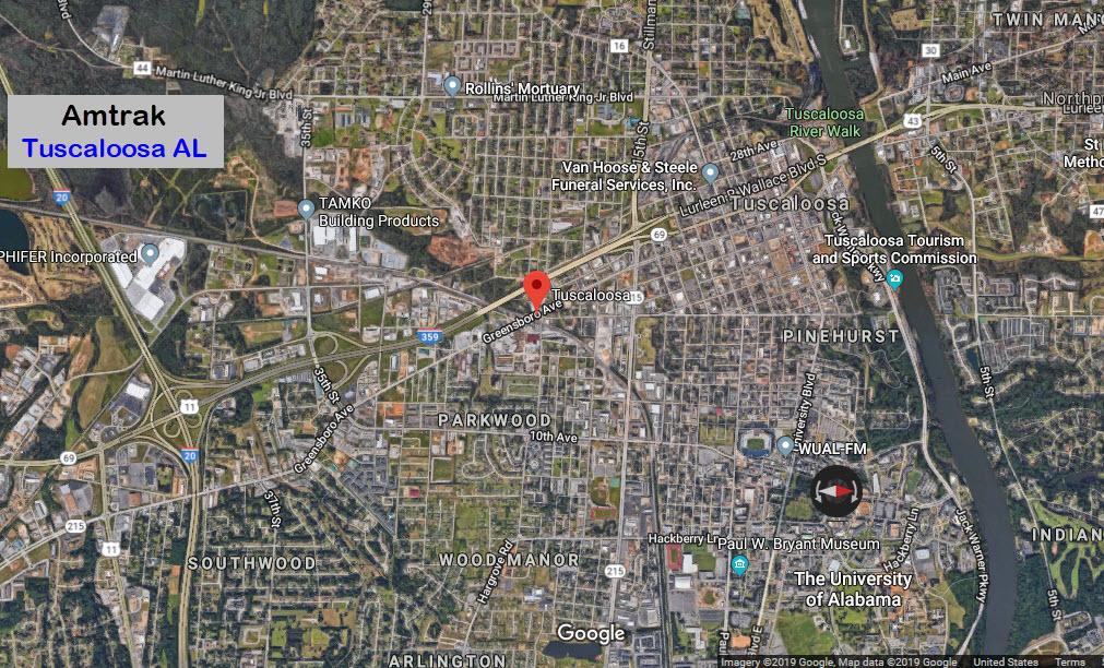
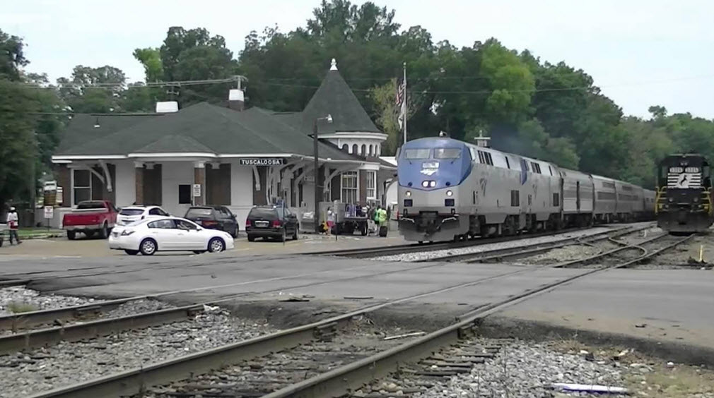
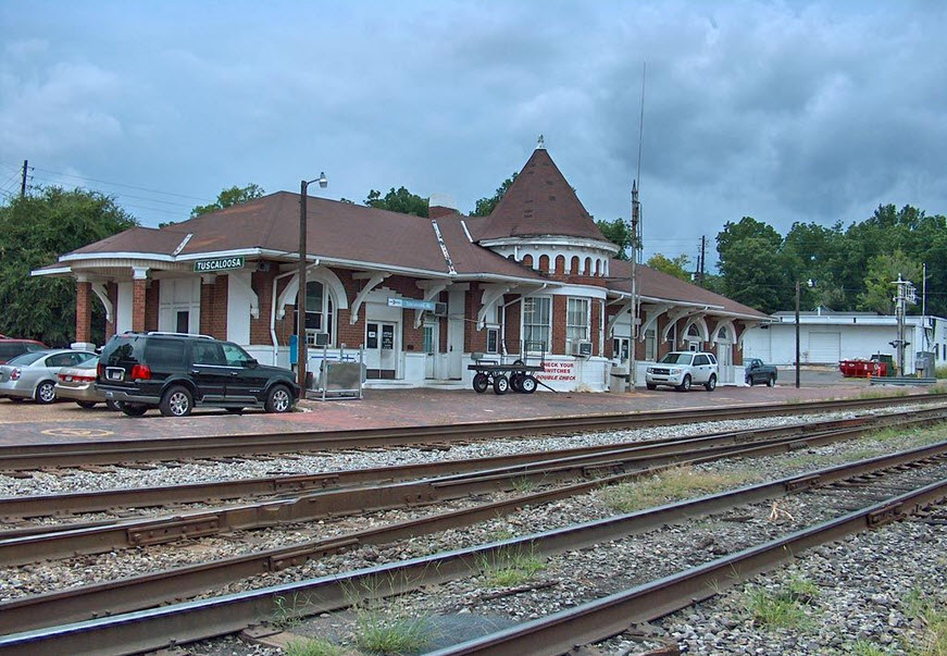 photo by John Helms
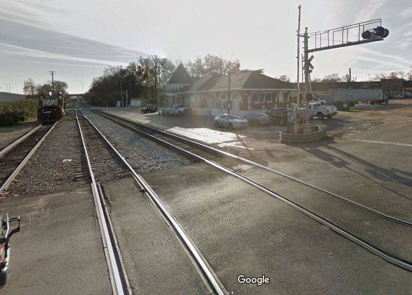
 Thanks to Denver Todd