
In General
Getting Here
Map
Sights
Floobydust
USGS Maps
RAILFAN GUIDES HOME
RAILROAD SIGNALS HOME
York from where I live is a short hop of about 40 miles. Being so close, you would have thought I would have been there all the time back in the early 70's.... not so... shame on me! Back then, the Ma and PA still went down to Red Lion, and the Northern Central (Pennsy) still ran thru freights and passenger trains from Baltimore to Harrisburg - signaled every two miles with PL's.
The Northern Central was the first railroad to reach York in 1837-38. After that, came the Western Maryland, the York, Hanover and Gettysburg Rwy, and a couple of other smaller ones.
Every year in January, York used to host the Cabin Fever Expo at the York Fairgrounds. The expo covers modelers and manufacturers of just about anything that has to do with building models of any size. At the expo, you will find trains, trucks, tractors, tools and more.... Cars and cranes are but a few. You will find steam powered, air powered, electric powered, and gas powered models. You'll find large models and small models, and some you almost need a magnifying lens to see! On Fridays, they have a regular auction, and on Saturday they have a silent auction. You'll never know what you will find there. "Live Steam Magazine" covers the expo every now and then. The event has been moved to the fairgrounds just south of Lebanon PA at the Lebanon Valley Expo Center & Fairgrounds Center.
So what's left today for the railfan?
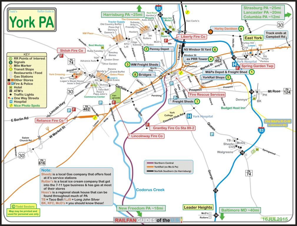
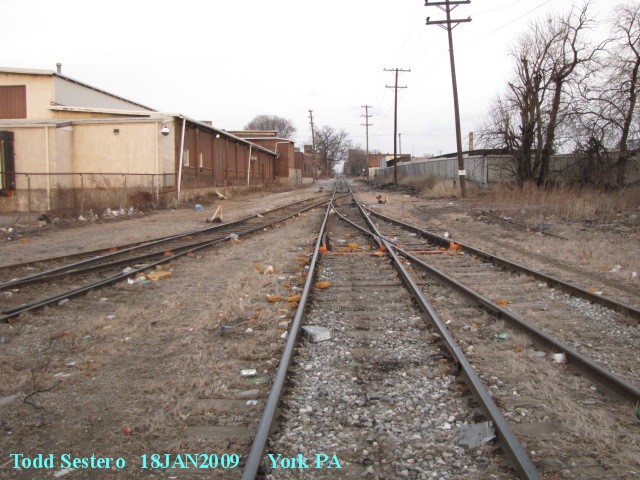
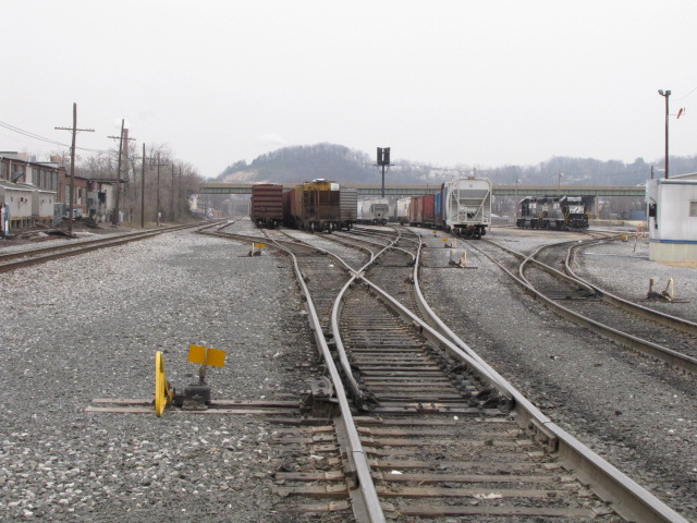
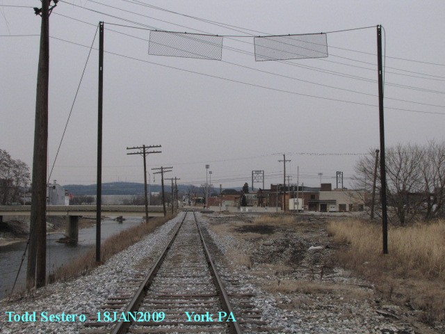
The ex Pennsy York Yard, ex PC, ex Conrail Windsor Street Yard now belongs to Norfolk Southern. It is a small yard on the north side of town where there are usually a couple of engines working the yard, or resting on the weekends.
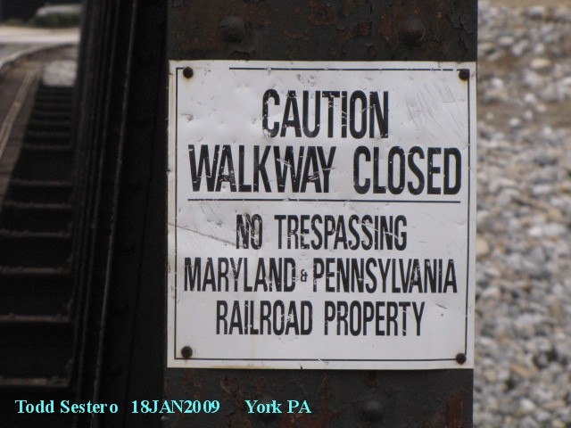
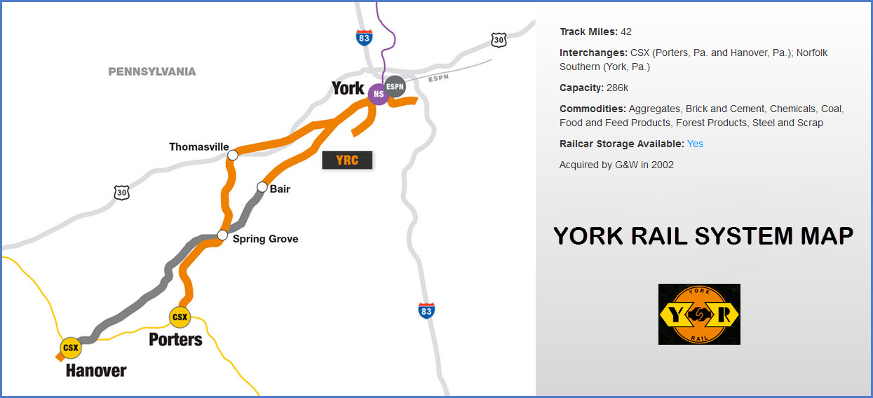
What's left of the MA and Pa, renamed YorkRail (in an effort to keep the railfans from coming around), is just east of the downtown area a couple of blocks off Market St. Yorkrail interchanges with the Norfolk Southern on the north side of town at the Windsor Street Yard, and interchanges with the CSX in Hanover and Porters Sideling PA. The railroad has about 40 miles of track.
As seen below, there are a couple of depots, Pennsy's old YORK tower, and numerous freight sheds still standing. It looks like the WM freight shed is used as an apartment building.
South of York is Howard Tunnel, and while the Liberty Limited dinner train was still running, it (supposedly) made this tunnel the oldest tunnel still in operation in the U.S., having opened in 1838.
The last thing I am aware of that ran down to New Freedom on the "Northern Central" was a couple of engines used to haul equipment out after the the NC Rwy Dinner Train had it's stuff auctioned off in 2002 (if I recollect correctly).
Starting in 2013, a new venture opened down in New Freedom. It is a replica train of the 1865 Lincoln train engine with matching coaches. My page for the train is here. Their website is here. They have dome a great job, and if you are in York, you should try to get down here on the weekends (and weekdays during the summer).
As for the Stewartstown RR, it hasn't run anything for years, and it's been even longer since a load of lumber's been delivered into Stewartstown.
About signals - as far as I am aware, there are no signals left in the York area. After hurricane Agnes came through in September 1972, the NC tracks were severely damaged, so much so, that they were never rebuilt "south of the border" (the MD/PA line). After the hurricane, came local service only to Cockeysville (on the MD portion), and after being rebuilt by York County, service from York to New Freedom. Being non-mainline tracks, the signals were no longer needed, and fell into a state of disrepair and were eventually removed, although much of the MD section signals were not removed until the Light Rail was built in 1990. I have a couple of schematics and a relay laying around from around where I live in Ruxton/Riderwood - the relay was given to me when I worked for the Light Rail system back in 1995-98 cause the MOW foreman knew I was a railnut :-), sure wish I knew them when the line was being rebuilt so I could have gotten one of the PL signals.
Some of the above information came from the various York info sites I happened across as mentioned below.
Additional information may be found
at these pages, some haven't been updated for a while (dates in parenthesis):
The Ma and Pa homepage:
http://www.maparailroadhist.org/index.htm
A page by Greg Halpin (2002):
http://www.railroadsofyork.com/
A page by Dave Cathell (2003):
http://davecathell.tripod.com/yr.html
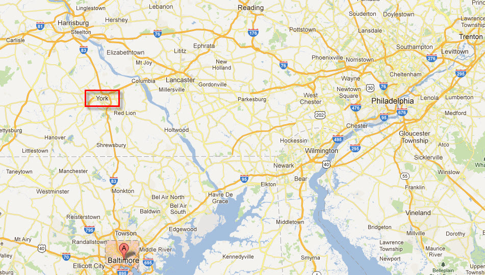
York is pretty easy to get to, being off the north-south interstate I-83. I-83 goes between Harrisburg and Baltimore, with York kinda in the middle.
In Harrisburg, I-83 connects with I-81 (and the PA Turnpike), which heads north to Scranton, Binghamton NY and on into Syracuse.
The PA Turnpike is the main east-west corridor of Pennsylvania stretching from Philadelphia to Pittsburgh and the Ohio border, bringing you in from MI, IL, IN, and Chicago.
About 20 miles east of Harrisburg, I-81 connects with I-78 which heads over to Allentown and the New York area.
I-81 heading south from Harrisburg hits I-70 in Maryland, connecting you with the west, such as Cumberland, and heading to the PA Turnpike, I-76, at Breezewood (one of those good ole tourist traps :-).... It then heads into West Virginia, if for only a few miles, and then 300+ miles of Virginia, the biggest town along the route of which is Roanoke.
Going east and west through York is US30. To the west is Gettysburg, and much further you hit US522 which would take you to the East Broad Top. To the east is Columbia, Lancaster and Strasburg.
The above map is available
here as a PDF
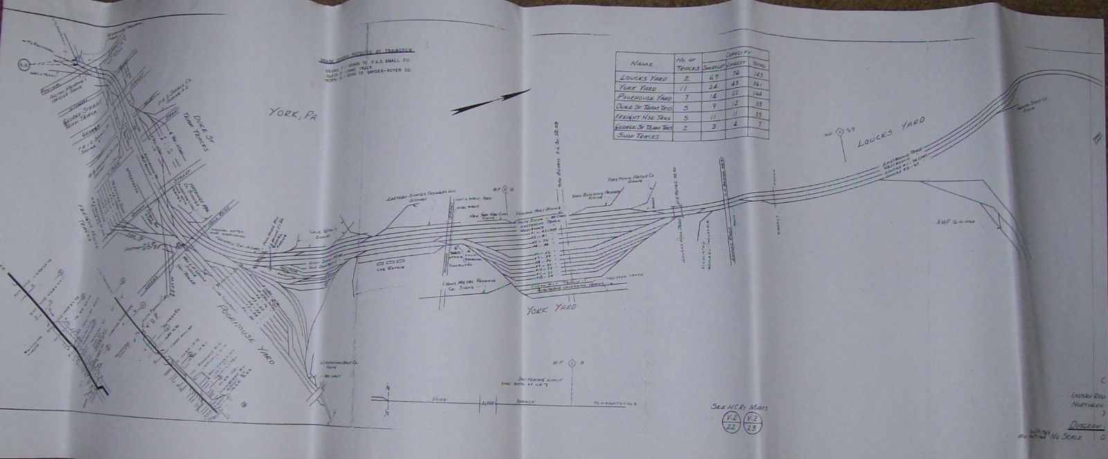
A map of the PRR yards from about 1950 or so, came from an EBay listing - for 20
bucks, the map can be yours :-)
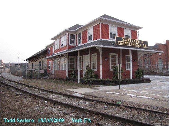
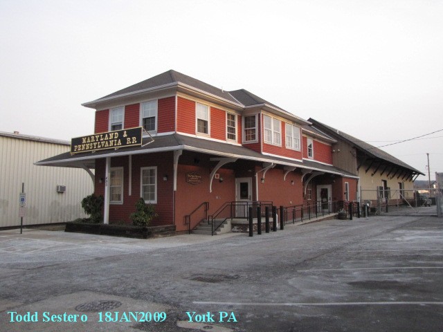
![]() The old Ma and Pa
Depot
The old Ma and Pa
Depot
It is on East Market St.
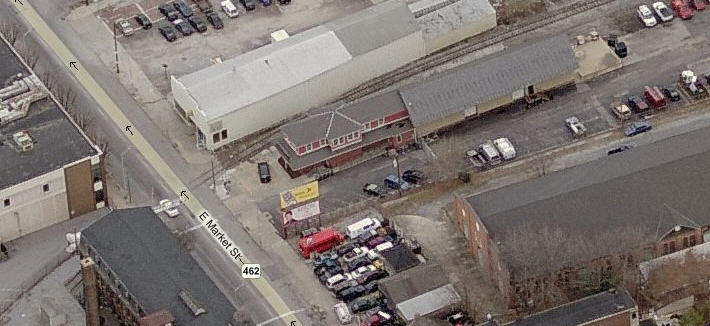
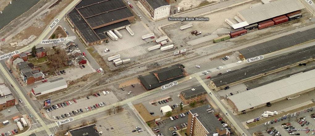
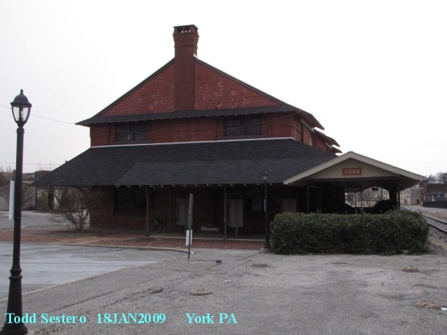
![]() The ex-Pennsy Depot
The ex-Pennsy Depot
The remaining freight sheds are to the right. The area across the tracks from the depot has now been turned into a stadium, and the area where the homes are in the picture, is now part of the stadiums park.


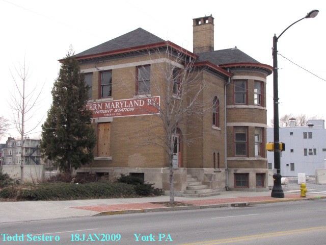
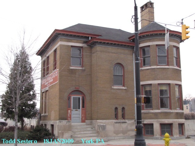
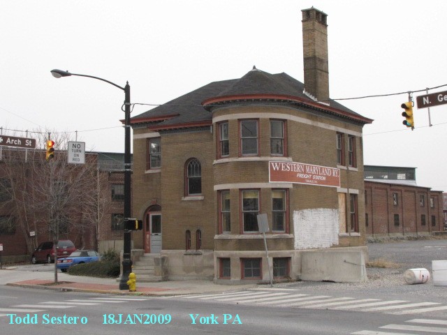
![]() The ex-Western Maryland Freight Building
and Shed
The ex-Western Maryland Freight Building
and Shed
The shed part is now gone.
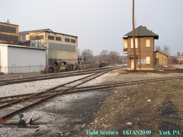
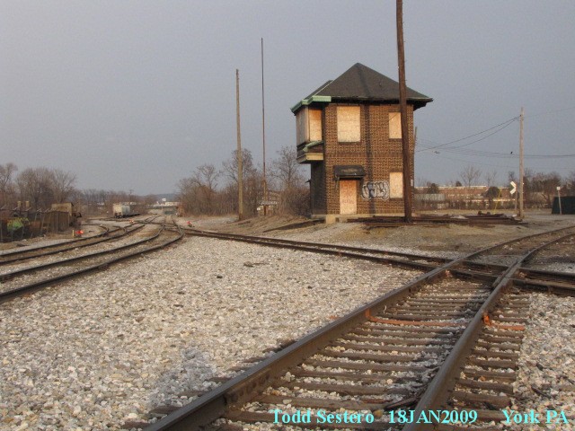
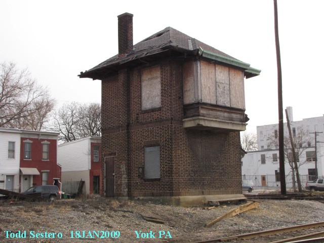
![]() Pennsy's YORK tower
Pennsy's YORK tower
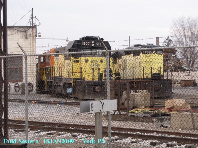
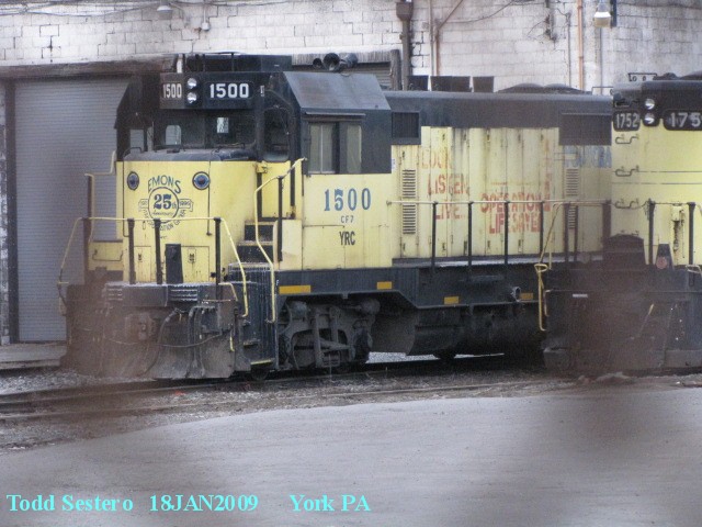
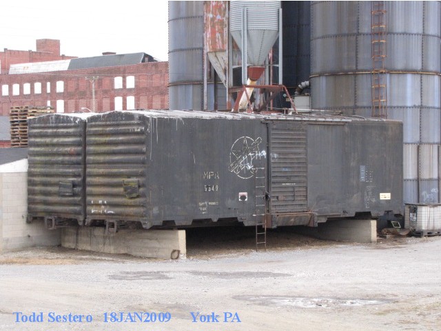
![]() The York Rail shops
The York Rail shops
As can be seen, they fence off everything "good" overnight and over the weekends.

![]() Norfolk Southern's Windsor St
Yard
Norfolk Southern's Windsor St
Yard
There's not usually anyone around on Sunday's to chase you off, but then, there's usually not anything running, either.
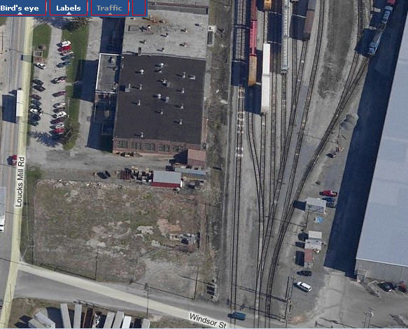


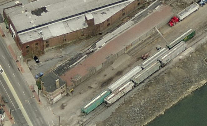
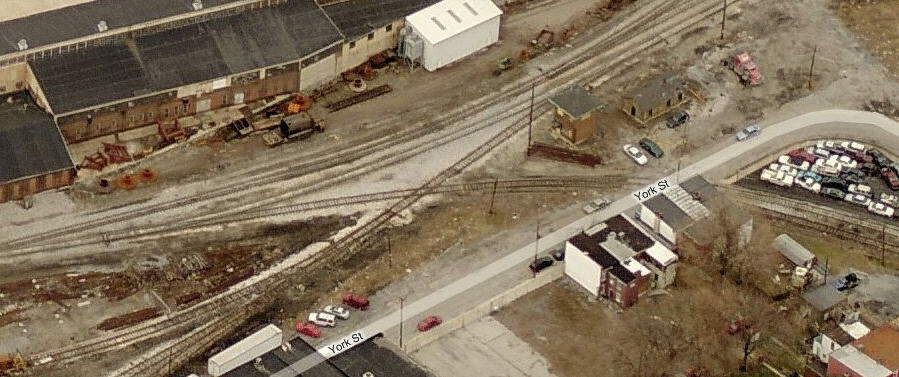
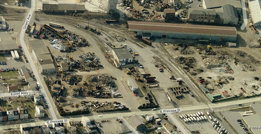
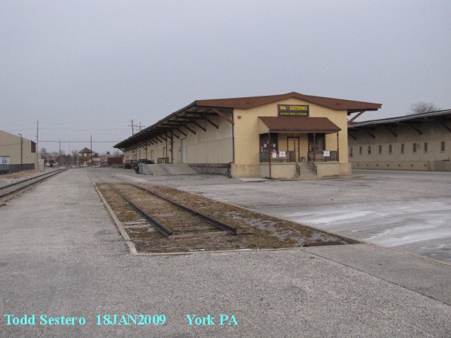
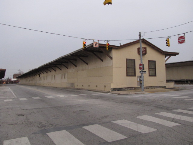
![]() Some of the Remaining Freight
Sheds
Some of the Remaining Freight
Sheds
The aerial shot for the Pennsy depot shows where they are.


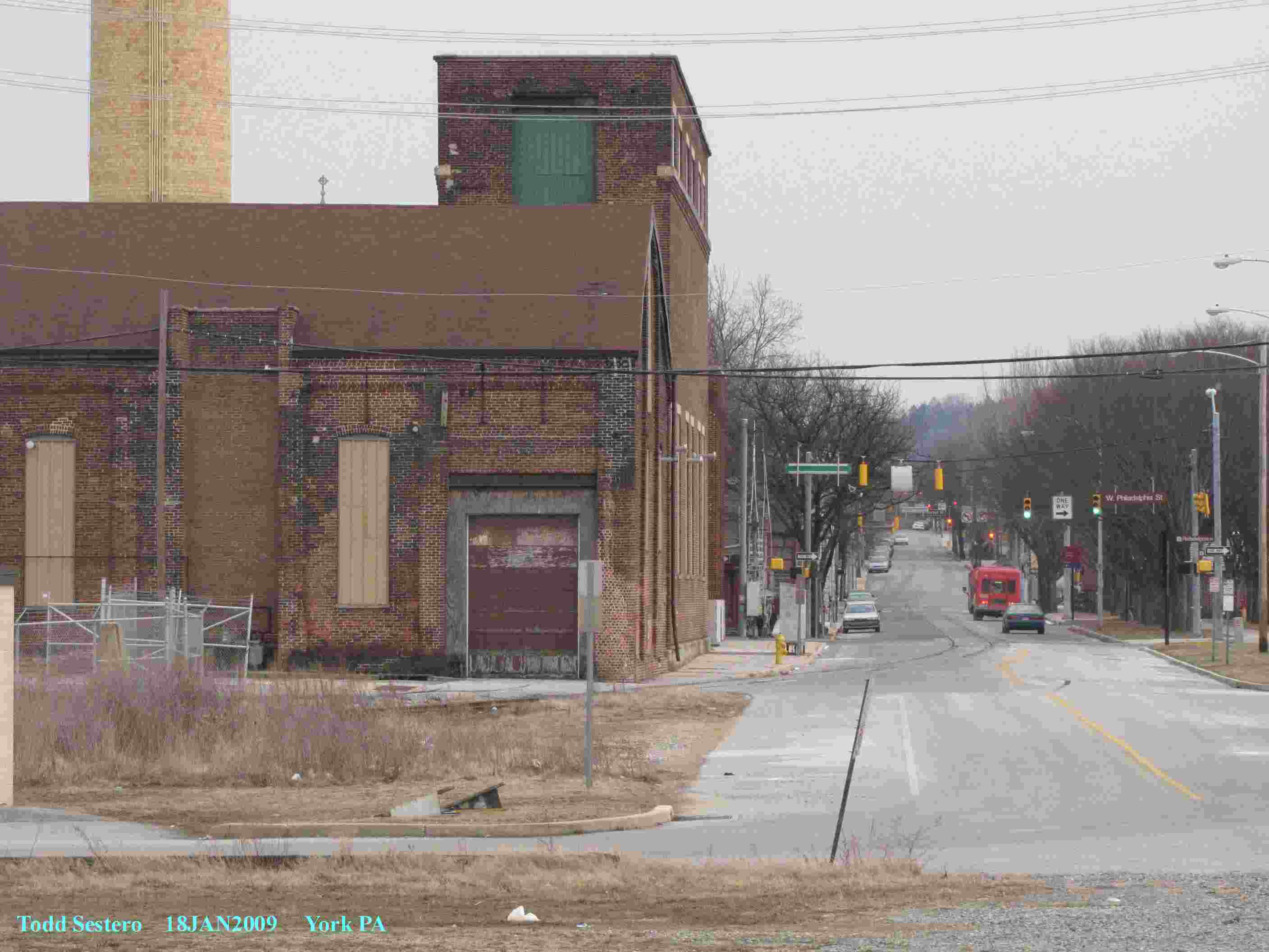
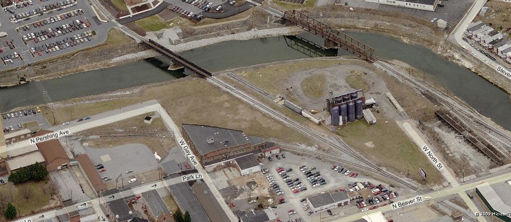
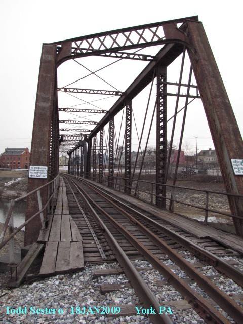
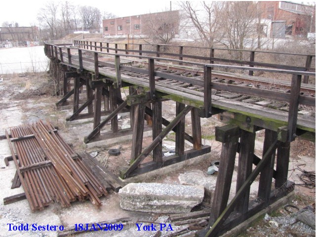
![]() Bridges
Bridges
The two bridges in town are seen in this picture.... both still in use. The old main line to Baltimore curves off to the left, skimming by the odd shaped building with the curved side. I'm sure there used to be signals all through here, but little evidence (very little) of them remains today. The coal trestle on the right side of the picture was recently removed.


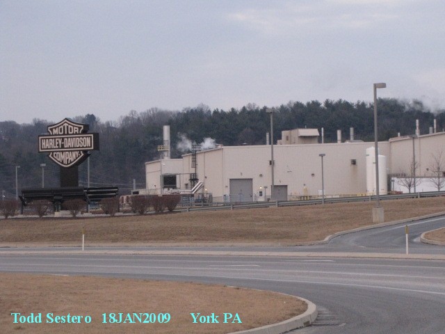
![]() The Harley Factory
The Harley Factory
It is on US 30, just east of I83. It
was built in 1973, sits on 230 acres, and is a 1.5 million square foot facility.
You can tour the plant and get a walk thru the actual factory floor, which
starts in the Vaughn L. Beals tour facility. They assemble touring and
Softail models here.
For more info, visit:
http://www.harley-davidson.com/wcm/Content/Pages/Factory_Tours/york.jsp?locale=en_US
 Between the tower and the NS yard, stands
this isolated coal trestle.
Between the tower and the NS yard, stands
this isolated coal trestle.
 Picture by Jersey Mike
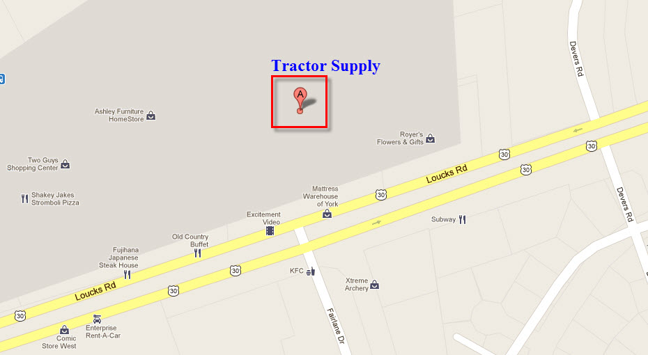
Tractor Supply
Tractor Supply is located on US 30, west of I-83.
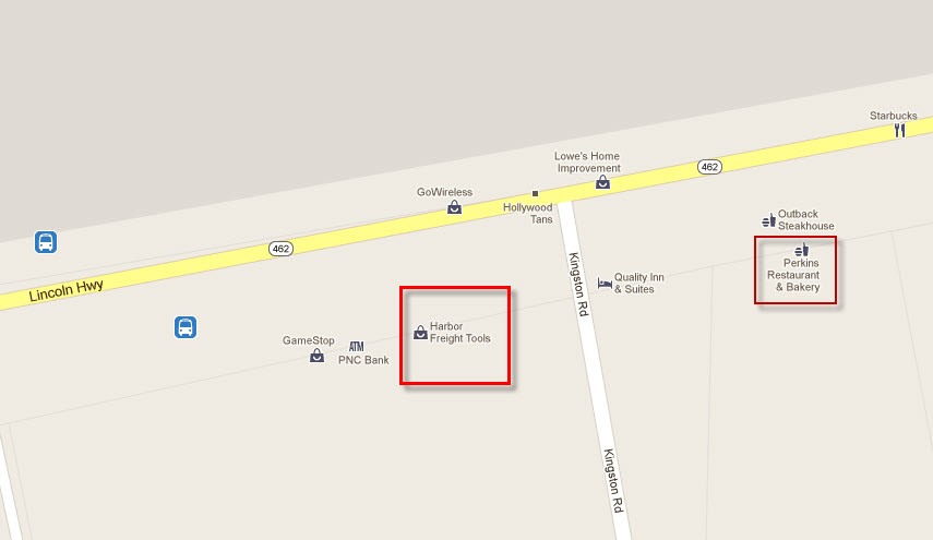
Harbor Freight
Harbor Freight is on Market Street east of I-83, exit 19. While you're there, why not stop in at Perkins for some grub.... like Appleby's, but they have much better deserts!
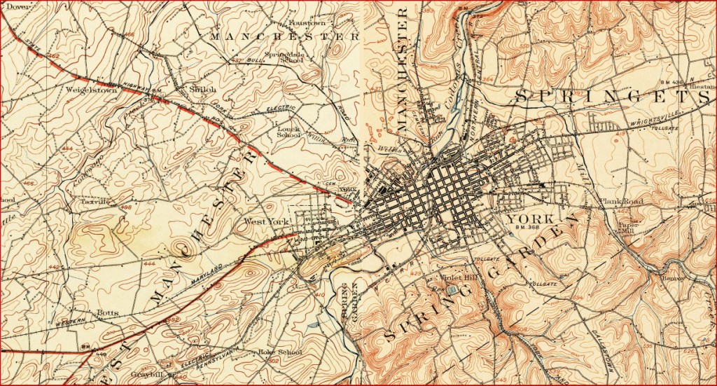
Courtesy of the University of Texas Library, click here for their index page.
This is a composite of the 1908 York quadrangle and the 1920 Hanover quadrangle.
Disclaimers:
I love trains, and I love signals. I am not an expert. I do these pages because I love spending my time doing them - although I do a reasonable amount of research to make sure the information presented is accurate! :-) :-)
Please Note: Since the main focus of my two websites is railroad signals, the railfan guides are oriented towards the signal fan being able to locate them. For those of you into the modeling aspect of our hobby, my indexa page has a list of almost everything railroad oriented I can think of to provide you with at least a few pictures to help you detail your pike.
If this is a railfan page, every effort has been made to make sure that the information contained on this map and in this railfan guide is correct. Once in a while, an error may creep in, oooooooops, oh well! :-)
My philosophy: Pictures and maps are worth a
thousand words, especially for railfanning. Text descriptions only
get you so far, especially if you get lost or disoriented. Take
along good maps.... a GPS is OK to get somewhere, but maps are still
better if you get lost! I belong to AAA, which allows you to get
local maps for free when you visit the local branches. ADC puts
out a nice series of county maps for the Washington DC area, but their
state maps do not have the railroads on them. If you can find em,
I like the National Geographic map book of the U.S..... good, clear, and
concise graphics, and they do a really good job of showing you where
tourist type attractions are, although they too lack the railroads.
Other notes about specific areas will show up on that page if known.
BTW, floobydust is
a term I picked up 30-40 years ago from a National Semiconductor data
book, and means miscellaneous and/or other stuff.
Pictures and additional information is always needed if anyone feels
inclined to take 'em, send 'em, and share 'em, or if you have
something to add or correct.... credit is always given! BE NICE!!! Contact info
is here
Beware: If used as a source, ANYTHING from Wikipedia must be treated as being possibly being inaccurate, wrong, or not true.
RAILFAN GUIDES HOME
RAILROAD SIGNALS HOME
NEW 2/8/2009
Last Modified 13-Feb-2017