What's Here:
PAT Light Rail System
Data:
GPS Coordinates: as needed
Phone A/C: 412
ZIP: 15219 (downtown)
Access by train/transit:
Amtrak at the Pittsburgh Union Station is a 2,300 foot walk from the
Steel Plaza station
Busses as noted on my map.
The Scoop:
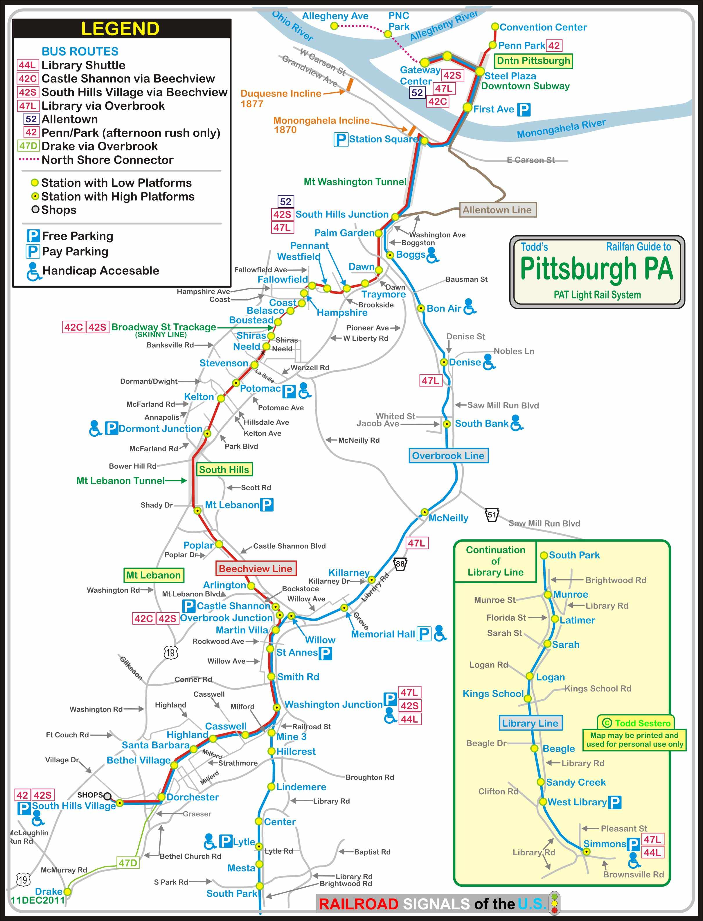
The Pittsburgh Light Rail (commonly known as The T) is a
25-mile (40.2 km) long system. The majority of service in the downtown
area is in a subway. On the south side of the Monongahela the system
mostly on private right-of-way. The notable exceptions are street running
on the Red line on Broadway, between the Fallowfield and Neeld stations, and on
the Allentown line, which is almost all street running going over the hill.
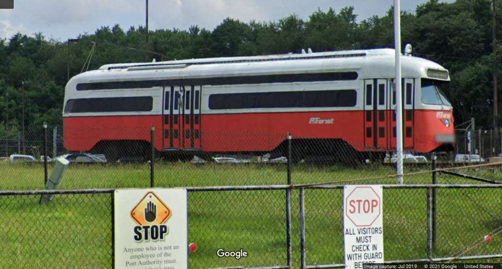
The Pittsburgh system was one of the last places one could
go to photograph PCC cars. In the latter part of 1980, the T started
updating the system, and the first modern light rail cars began operation from
South Hills Village to Castle Shannon on April 15, 1984. The downtown
subway was added to the system on July 3, 1985. The last leg of the modern
suburban "Beechview" line completed the modern system on May 22, 1987.
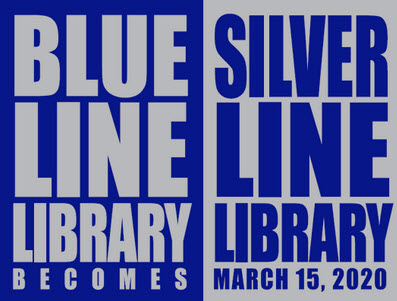
On Sunday, March 12th, 2020, PAT officially changed the name of the Blue Line
Library to the Silver Line Library.
When they first put the new system in, Pittsburgh took a
lot of heat over the design of their catenary poles, built to survive a 100MPH
wind, but I don't think they will ever have to worry about them not withstanding
the trials of time. At least they put them in the middle of the tracks,
which makes for better pictures than systems like Baltimore where they are on
the "outside", making decent pictures impossible - NOT TO MENTION
how much cheaper it is to put one in every 200 feet instead of two! :-).
PAT discontinued two 47 line streetcar lines in 1999....
Drake and Shannon, and with it, came the end of PCC service in Pittsburgh.
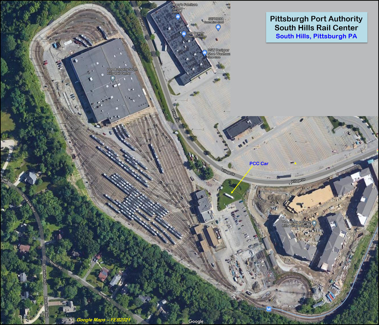
The system has one shop and yard, the South Hills
Rail Center, located at the end of the line behind the South Hills Village Mall.
This facility has been around since the streetcar days.
I don't usually say "refer to your GPS", but since the system covers such a
large area, that's what I'm going to suggest.
However, if you are coming from the east via the Pennsy Turnpike, get off at
exit 57, and head west on I-376/US22/US30, Parkway West, it will take you
right into downtown. The trip is about 15 miles.
If you're coming in from Ohio via the Turnpike, get off at exit 28 and head
south I-79 7 miles to the junction with I-279 (Parkway North), and take it into the city,
another 12 1/2 miles. Just before you cross the Allegheny River, it
will change into I-579, and gets you very close to the Amtrak station.
If you're coming in from th west via I-70 (like Wheeling WV), take 70 until
you hit I-79 in Washington, and head north. Travel about 20 miles to
I-376/US22/US30, exit 59, and take it east to downtown, another 6.2 miles.
From the Altoona area, the best way is US 22, it's a ride of a little over
90 miles.
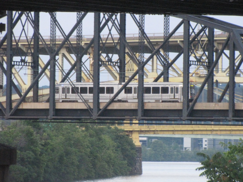
An LRV crossing the Panhandle Bridge over the Monongahela - it's headed into downtown. JUL2009
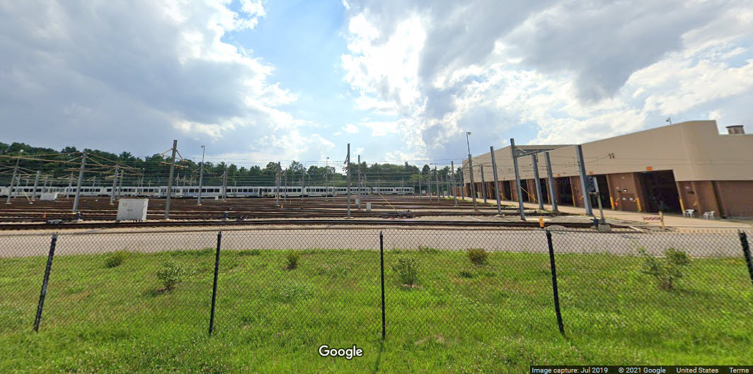
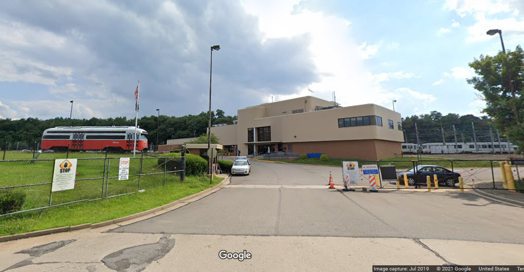
The South Hills Maintenance Facility
The three following pictures were taken from Village Drive.
Disclaimers:
I love trains, and I love signals. I am not an expert. My webpages reflect what I find on the topic of the page. This is something I have fun with while
trying to help others.
Please Note: Since the main focus of my two websites is railroad signals, the railfan guides are oriented towards the signal fan being able to locate them.
For those of you into the modeling aspect of our hobby, my
indexa page has a list of almost everything railroad oriented
I can think of to provide you with at least a few pictures to help you detail your pike.
If this is a railfan page, every effort has been made to make sure that the information contained on this map and in this railfan guide is correct. Once in a while,
an error may creep in :-)
My philosophy: Pictures and maps are worth a thousand words, especially for railfanning. Text descriptions only get you so far, especially if you get lost or
disoriented. Take along good maps.... a GPS is OK to get somewhere, but maps are still better if you get lost! I belong to AAA, which allows you to get
local maps for free when you visit the local branches. ADC puts out a nice series of county maps for the Washington DC area, but their state maps do not have the
railroads on them. If you can find em, I like the National Geographic map book of the U.S..... good, clear, and concise graphics, and they do a really good job
of showing you where tourist type attractions are, although they too lack the railroads. Other notes about specific areas will show up on that page if known.
Aerial shots were taken from either Google or Bing Maps as noted. Screen captures are made
with Snagit, a Techsmith product... a great tool if you have never used it!
By the way, floobydust is a term I picked up 30-40 years ago from a National Semiconductor data book, and means miscellaneous
and/or other stuff.
Pictures and additional information is always needed if anyone feels inclined to take 'em, send 'em, and share 'em, or if you have something to add or correct.... credit
is always given! Please be NICE!!! Contact info is here
Beware: If used as a source, ANYTHING from Wikipedia must be treated as being possibly inaccurate, wrong, or not true.