
In General
Getting Here
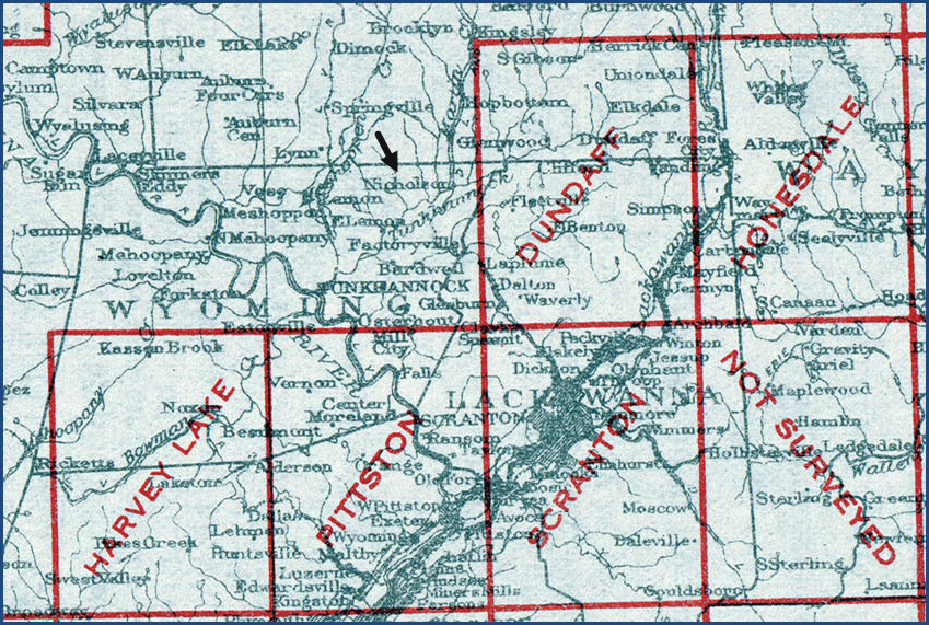
Map
Sights
Pictures
Signals
Fire & Police
Floobydust
USGS Maps
RAILROAD SIGNALS HOME
Location / Name:
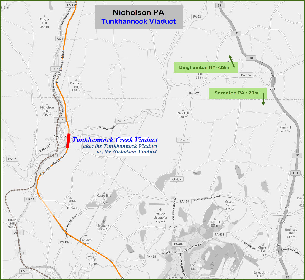
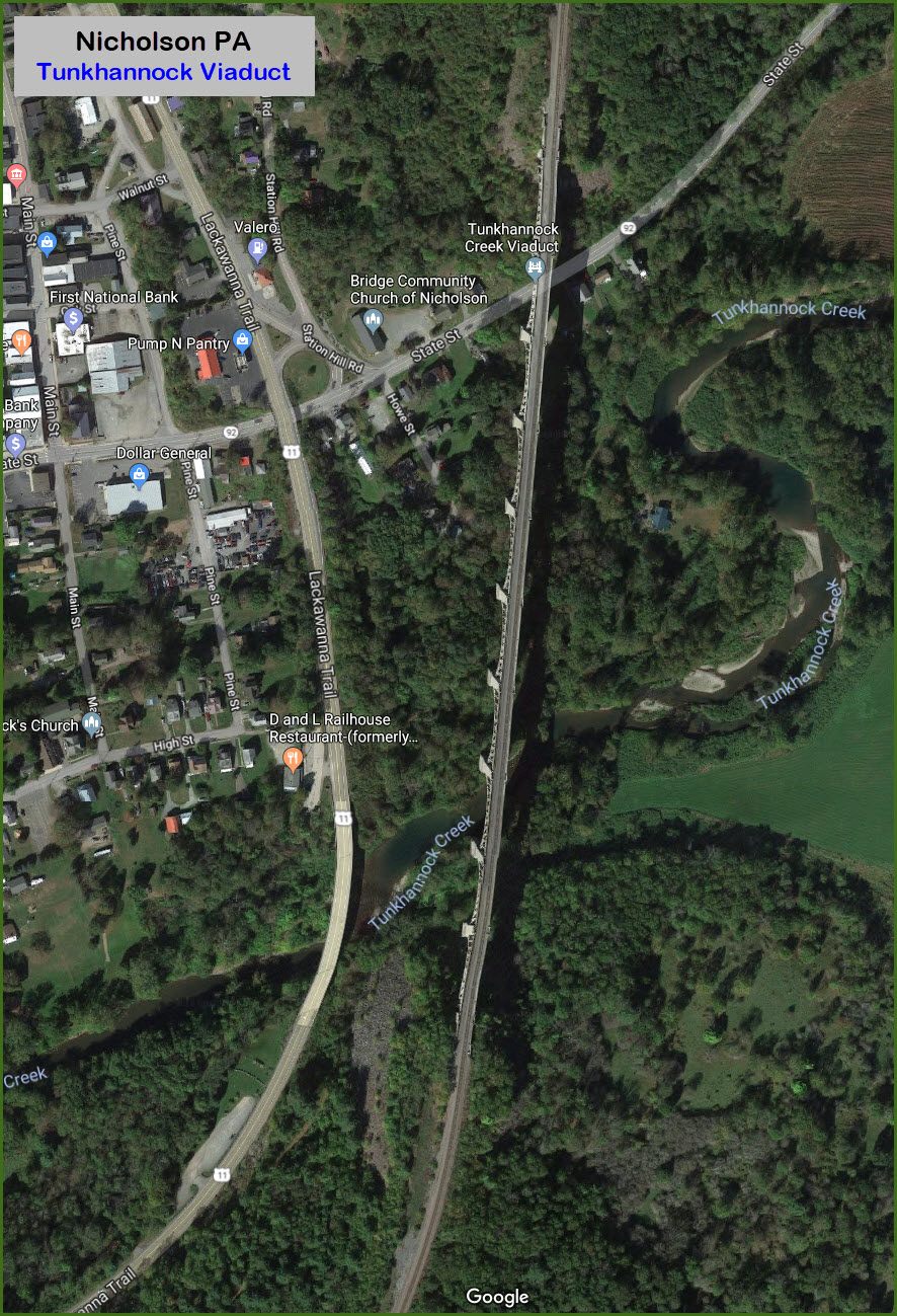
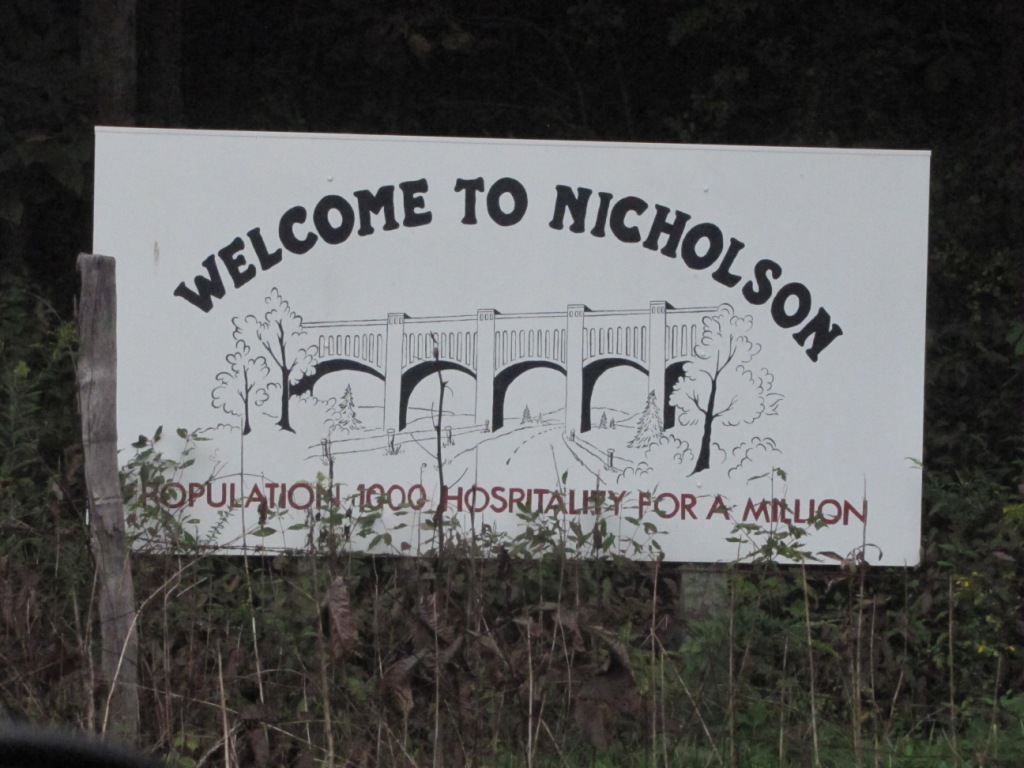
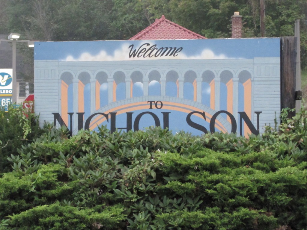
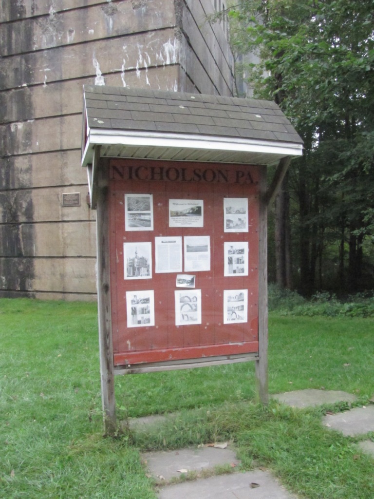
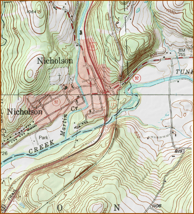
Nicholson PA, Wyoming County
What's Here:
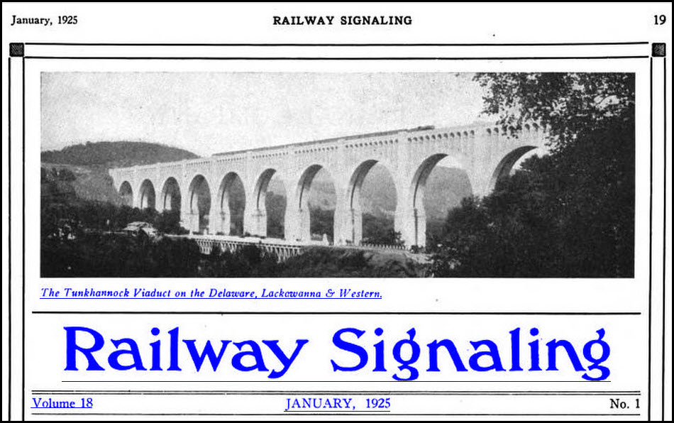
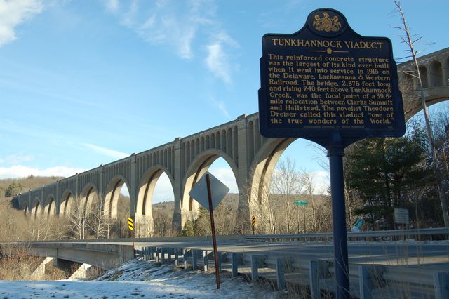
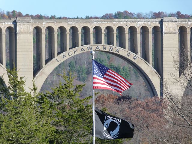
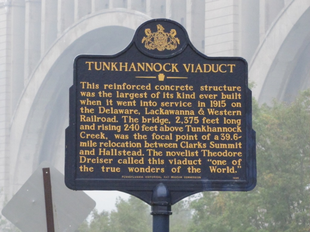
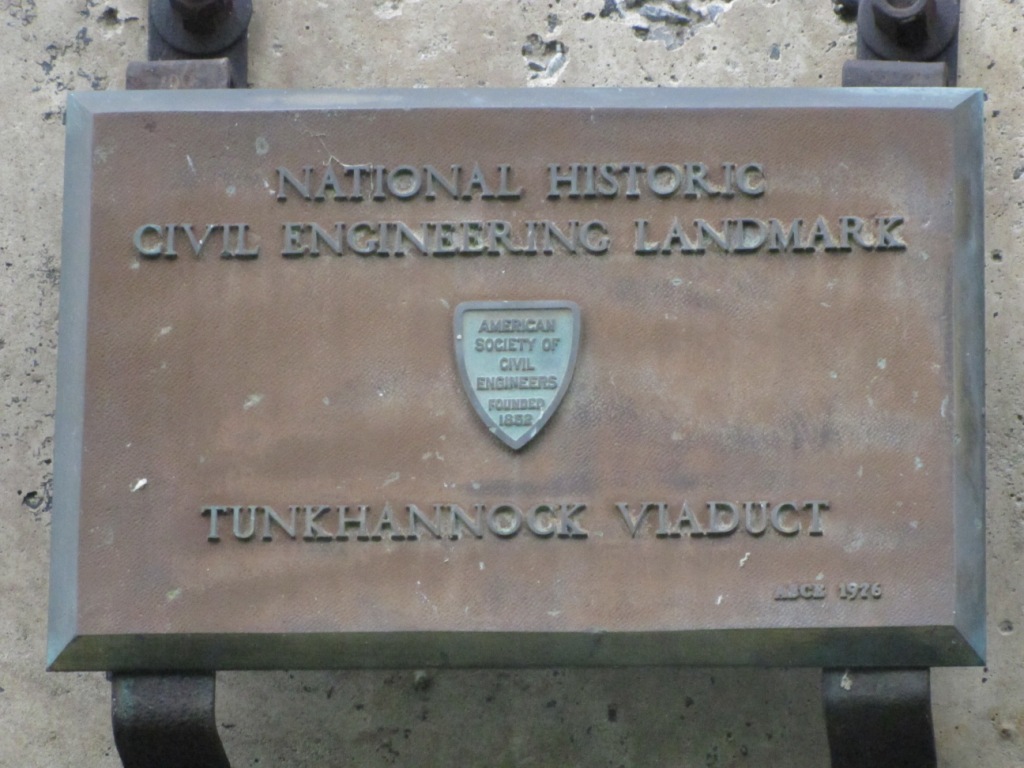
Tunkhannock Viaduct, AKA: Nicholson Viaduct
Data:
GPS Coordinates: 41.622846, -75.776666
Phone A/C: 570
ZIP: 18446
Access by train/transit:
None
The Scoop:
One of the coolest bridges around, bar none. If you are anywhere near, YOU HAVE TO STOP BY, even if you get into an argument with your wife or girlfriend over it! :-)
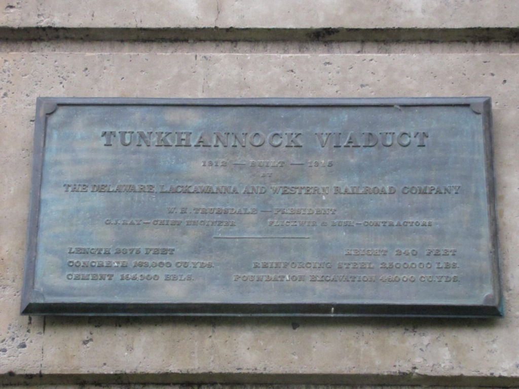
The Nicholson Bridge was built by the Delaware, Lackawanna & Western Railroad (DL&W) in 1912 and was dedicated and ready to go on November 6, 1915.
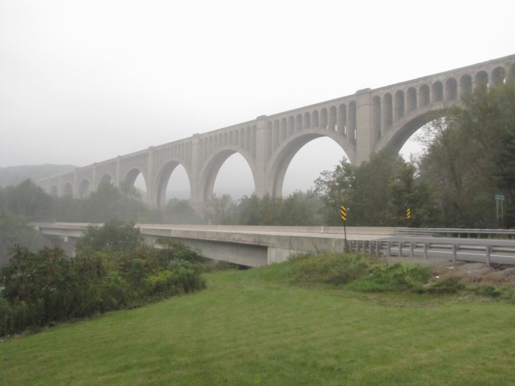
The bridge is 2,375 feet long and 34 feet wide. It is 240 feet above stream level and 300 feet above bedrock. There are twelve arches with ten being 180 feet across and two being 100 foot arches.
The Tunkhannock Creek Viaduct is also known as the Nicholson Bridge, or sometimes as the Tunkhannock Viaduct.
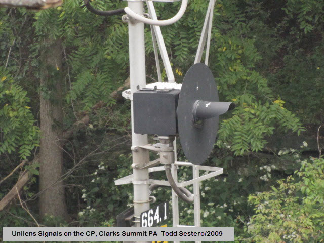
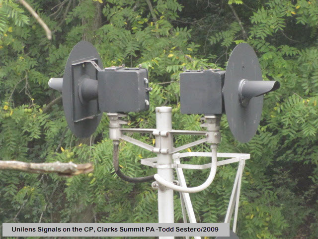
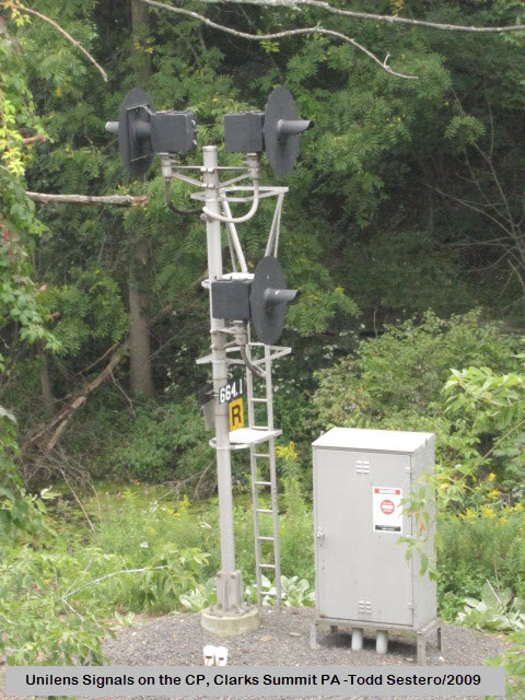
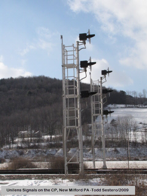
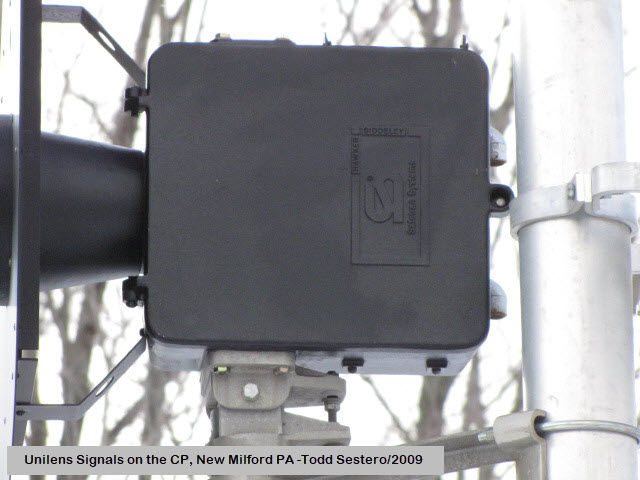
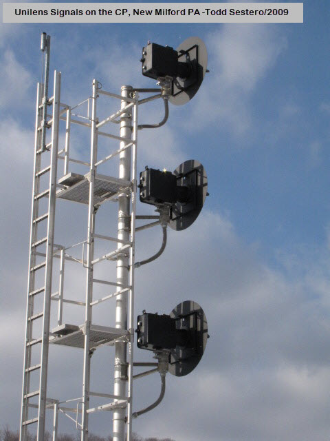
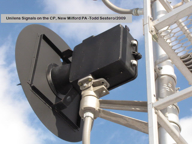
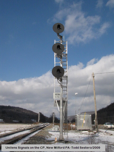
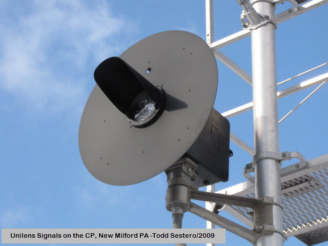
Since being built, the ownership has passed thru the DL&W, the Erie-Lackawanna in 1960, Conrail, the Delaware & Hudson, Guilford Transportation, the New York Susquehanna & Western, and finally the Canadian Pacific, with NS having trackage rights. Not sure with all of the changes in ownership if the line is still the Sunbury Line or not. The Sunbury line goes from Binghamton NY down to Sunbury PA, where it would meet up the old PRR Buffalo Line, and head into Harrisburg PA. The line between Binghamton and Scranton is one of the few U.S. lines signaled with Safetran Unilens signals.
Acknowledgements:
Denver Todd
Wikipedia
Open Railway Maps
Websites and other additional information sources of interest for the area:
https://railfanguides.us/pa/scranton/map4/index.htm Chase map & guide for Scranton to Nicholson
https://en.wikipedia.org/wiki/Tunkhannock_Viaduct
http://historicbridges.org/bridges/browser/?bridgebrowser=pennsylvania/tunkhannock/
http://www.nicholsonheritage.org/tunkhannock-creek-viaduct/
If you are coming from either Scranton PA or Binghamton NY, the easiest thing to do is to take I-81, and get off at exit 206.
From there, go west on PA 374 7.5 mi into Nicholson.
When you get to Nicholson US 11, take a left to the parking lot for the viaduct.
Or, if you want the more scenic route, you can take US 11 from either Scranton to Binghamton to the viaduct.
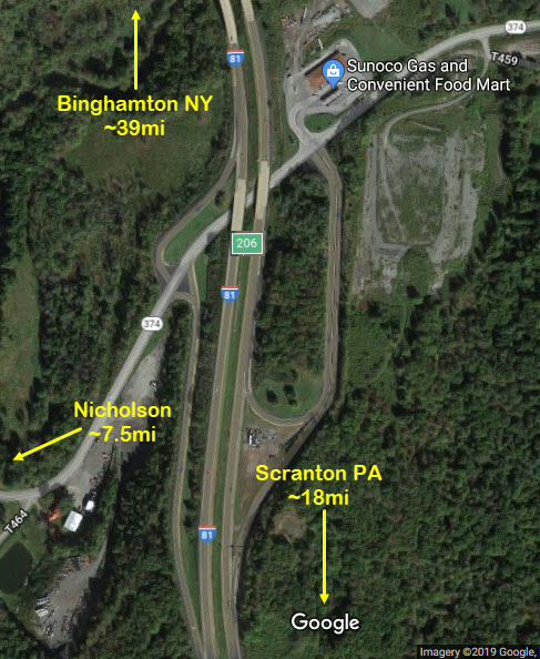
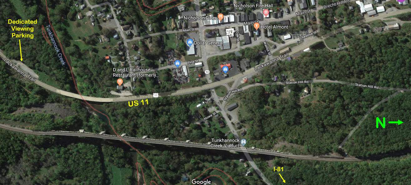
GPS Coordinates: 41.620649, -75.779042 (at the parking lot)
From the Nicholson Heritage Association: The Nicholson Bridge is 2,375 feet long and 34 feet wide. It is 240 feet above stream level and 300 feet above bedrock. There are twelve arches with ten being 180 feet across and two being 100 foot arches, one at each end of the bridge that are totally buried in the land fill.
The Tunkhannock Creek Viaduct, also known as the Nicholson Bridge or sometimes as the Tunkhannock Viaduct, was built by the Delaware, Lackawanna & Western Railroad (DL&W) in 1912 and was completed, dedicated and ready for use on November 6, 1915.
The Tunkhannock Creek Viaduct received its proper name from the Tunkhannock Creek that it traverses. However, it is also known as the Nicholson Bridge because of the small Pennsylvania borough where it is located.
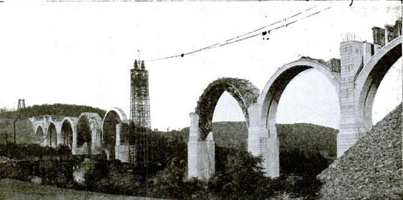
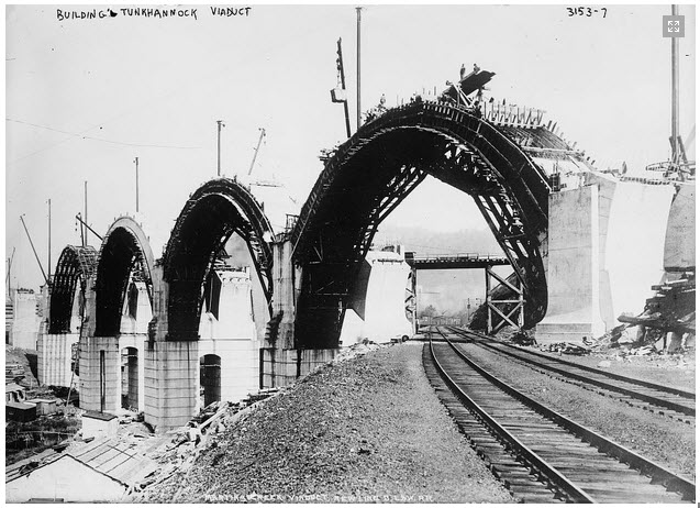
This engineering marvel was designed by Abraham Burton Cohen with George J. Ray as the chief engineer of the project. Concrete was first poured in January 1913 with the entire project using 185,000 barrels, or 1,093 carloads, of cement producing 167,000 cubic yards of concrete. In addition, about 1,140 tons of steel were used to reinforce the concrete. Moreover, the bridge was built to endure 6,000 pounds per square foot, considering that some engines at that time would weigh 233 tons. At that time, the bridge itself cost about $1.4 million to build.
Five hundred men of which only half or less were skilled laborers worked 24 hours a day with very little equipment. All they had were steam shovels, dynamite for excavation and a cement mixer that was built on-site. At piers 5 and 6, the workers encountered quicksand making it necessary to use pneumatic chambers and many extra hours of manpower.
From Wikipedia: Construction on the bridge began in May 1912 by excavating all 11 bridge piers to bedrock, which was up to 138 feet (42 m) below ground. In total, excavation for the viaduct removed 13,318,000 cubic yards) of material, more than half of that rock. Almost half of the bulk of the bridge is underground. At mid-construction, 80,000 cubic yards (61,000 m3) of concrete had gone into its substructures, and it was estimated that construction would require 169,000 cubic yards (129,000 m3) of concrete and 1,140 short tons (1,030 t; 1,020 long tons) of steel. The steel estimate proved accurate; the bridge ultimately used a bit less concrete than expected: 167,000 cubic yards (128,000 m3), making the total weight approximately 670,000,000 pounds (300,000,000 kg). The bridge was dedicated on November 6, 1915, along with the opening of the Nicholson Cutoff. Construction photos along with a short history of the bridge were published by the Nicholson Area Library in a brochure in 1976. It was listed on the National Register of Historic Places on April 11, 1977. Since 1990, the local community has celebrated the building of the bridge on the second Sunday of September with "Nicholson Bridge Day", a street fair, parade, and other activities. The 100th-anniversary celebration was held in September 2015.
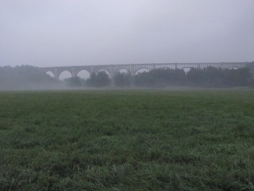 One hazy morning....
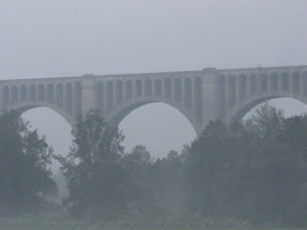
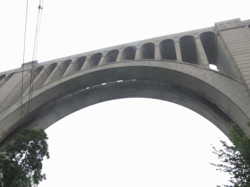
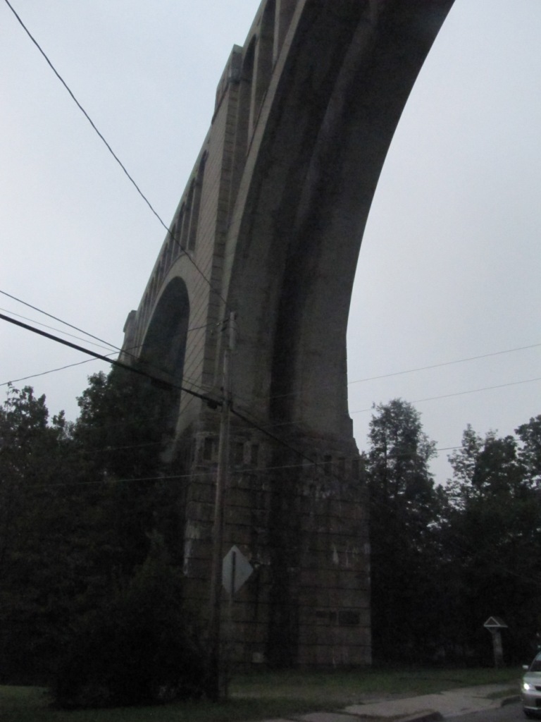
 Looking down the middle of the arches
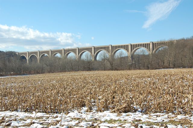
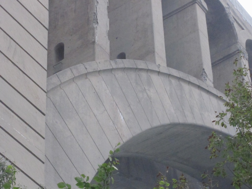
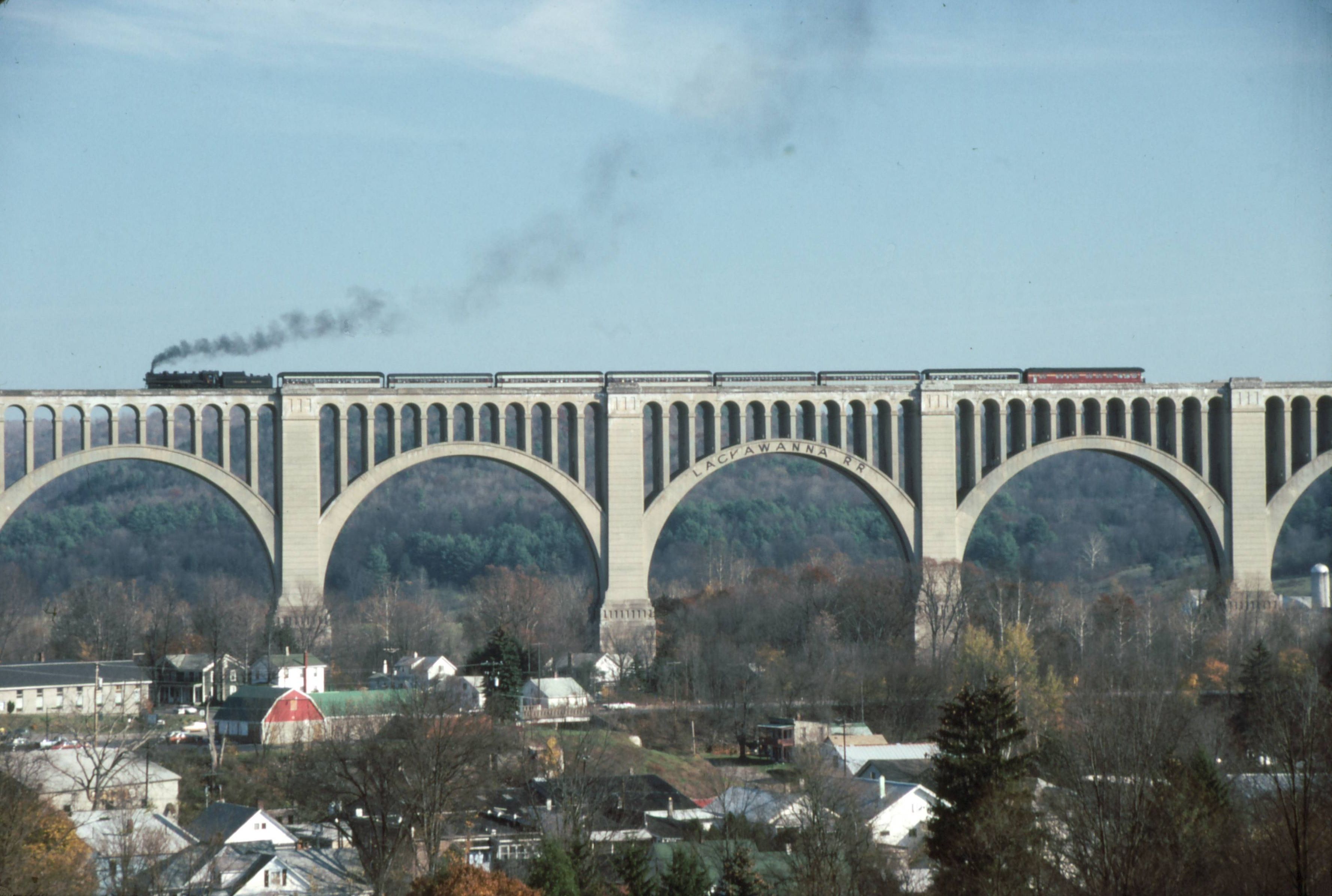 photo: WallyFromColumbia, from Wikipedia
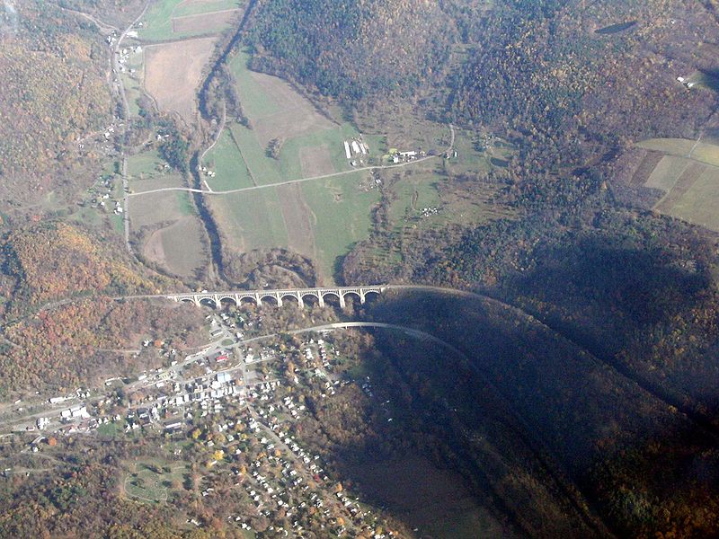
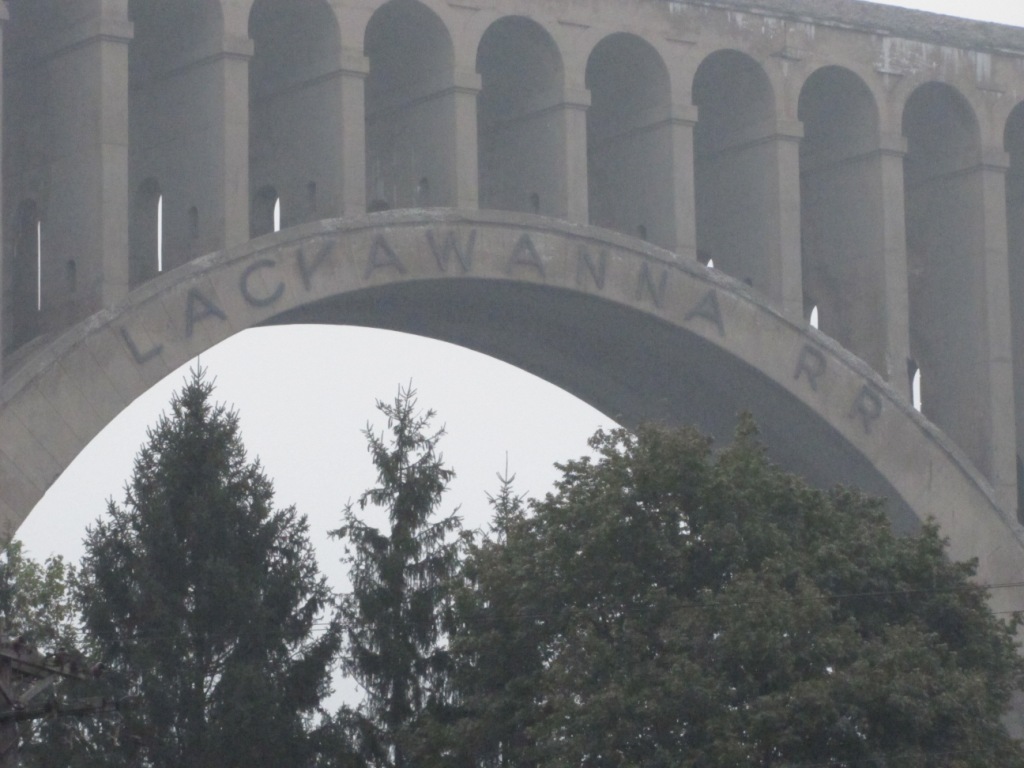
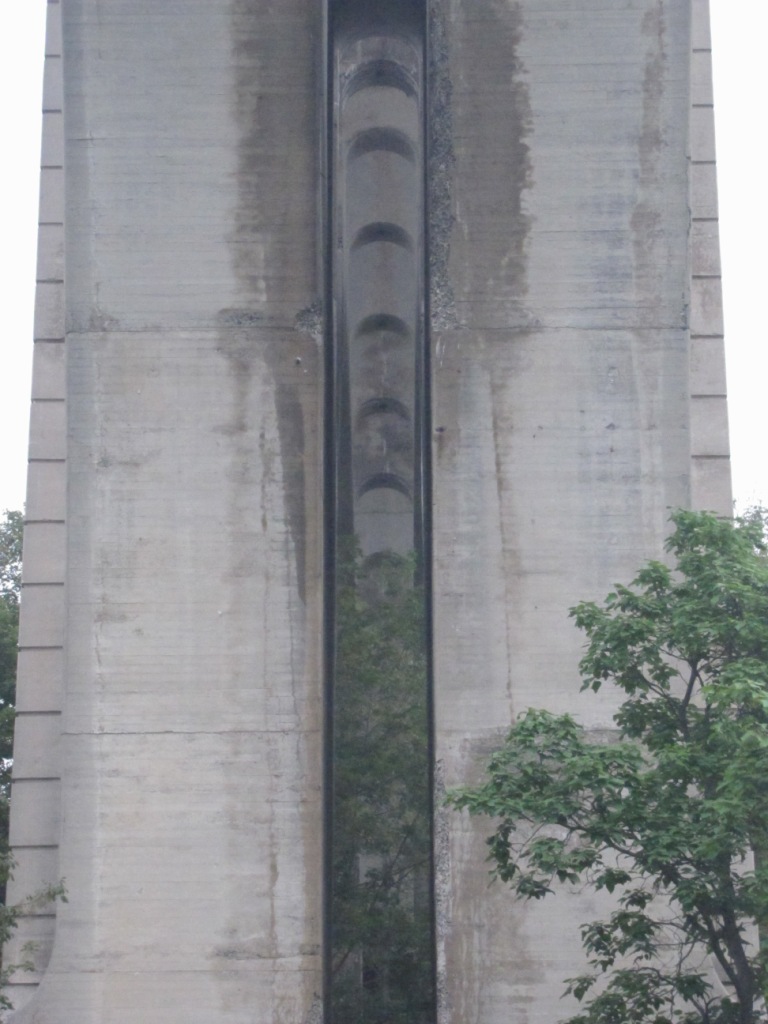
 from HistoricBridges.org
None in the immediate area, but here's what is close..... All signals on this CP Rail line are Safetran Unilens type signals.
Clarks Summit PA
New Milford PA
Courtesy of the University of Texas Library, click here for their index page.
They don't have this quadrangle in their collection, it doesn't even show up on the 1926 PA locator map that the University of Texas has on file.....
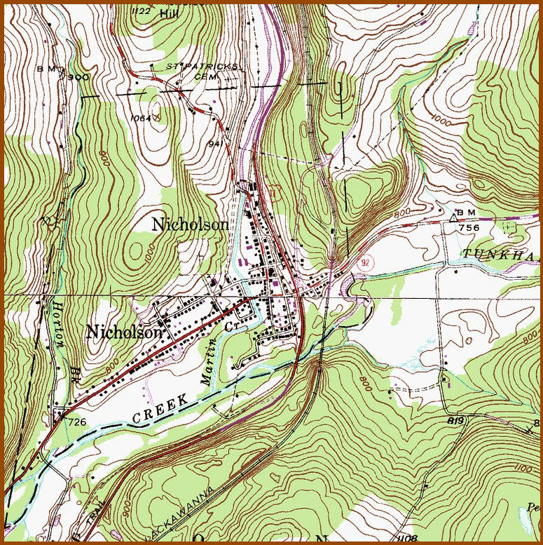
Came from Topoquest, but no date is given, p/o Hop Bottom quadrangle, probably a later and revised version of the one below.
This one came from Topozone, also no date on the map.....
Disclaimers:
New format 10/26/23: Please check out my disclaimer page for my standard dribble and contact info here
RAILFAN GUIDES HOME
RAILROAD SIGNALS HOME
NEW 07/01/2017, MAR08/2018, JAN27/2019, JUN03/2023, APR26/2024
Last Modified 26-Apr-2024