RAILFAN GUIDES of the U.S.
Todd's
Railfan Guide to
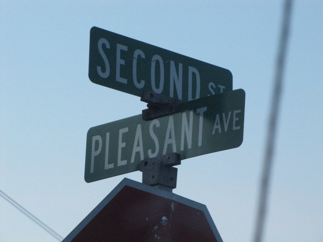
NEW FREEDOM - PA
In General
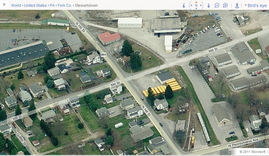
Getting Here
Map
Sights
Railroad
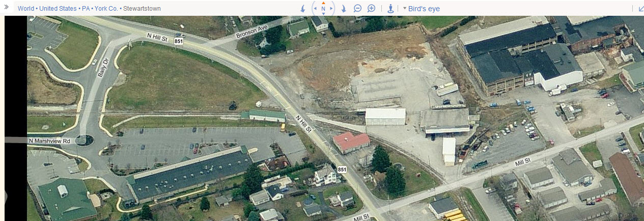
Stewartstown
Fire & Police
Floobydust
USGS Maps
RAILFAN GUIDES HOME
RAILROAD SIGNALS HOME
New Freedom used to be a hub of
activity 40 years ago or so. Today, the Penn
Central (Northern Central/Pennsy) freights are gone, the Stewartstown is closed for
business, and the Northern Central dinner train has long gone.
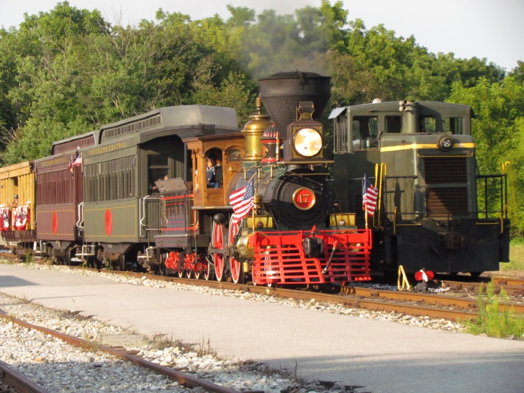
BUT, starting in 2013, the Northern Central is back into operation, this time
with a new steam engine, made to be a copy of the engine that pulled the Lincoln
funeral train through here back in 1865. The picture at the top of the
page is the train returning from a trip to Hanover Junction, and is running by
the old Stewartstown center-cab engine. The Northern Central has its
own page
here.
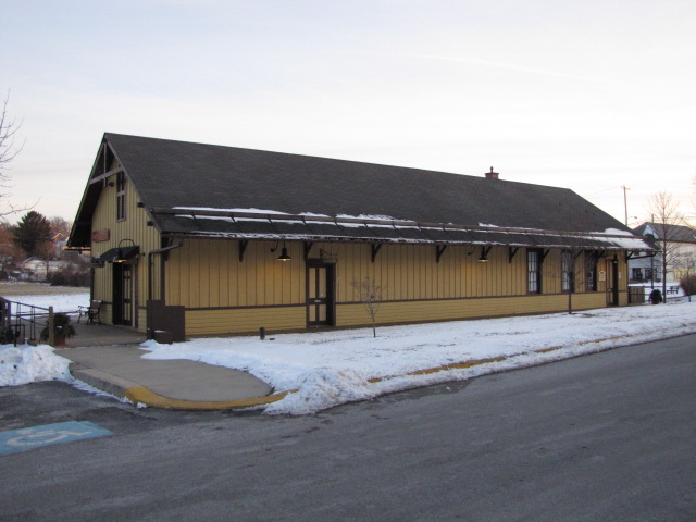
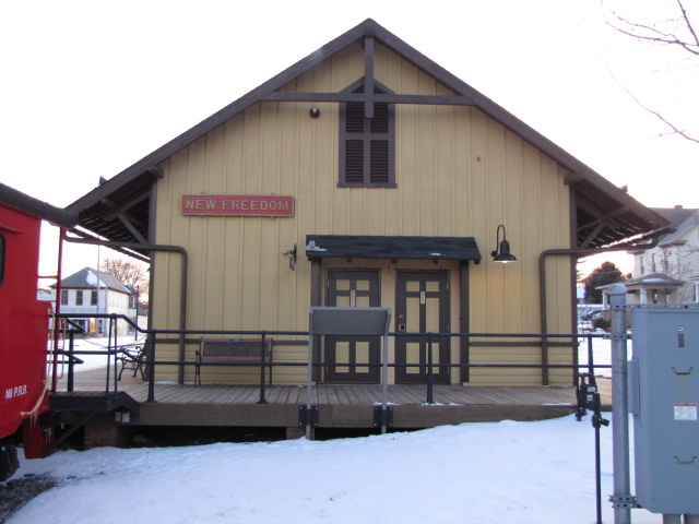
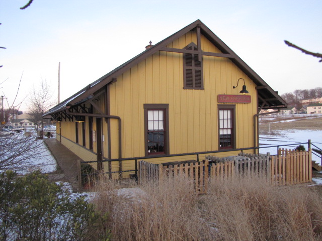
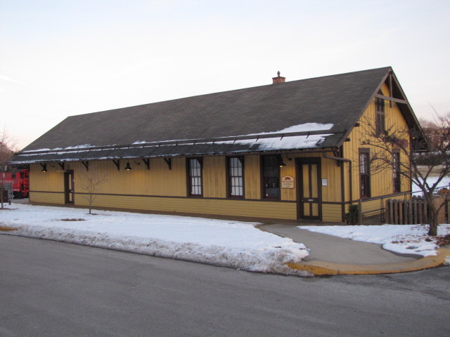
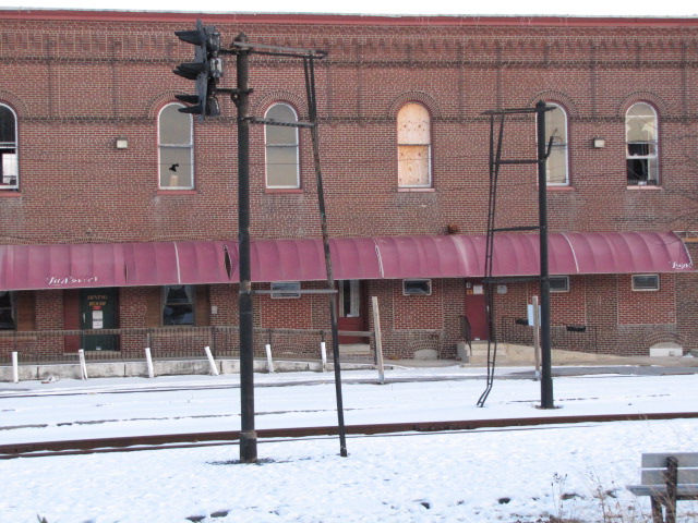
Aside from that, the biggest draw to New Freedom is the depot, one of five Northern Central stations still left on the line (the others are in Baltimore, Riderwood, Lutherville, and Monkton).
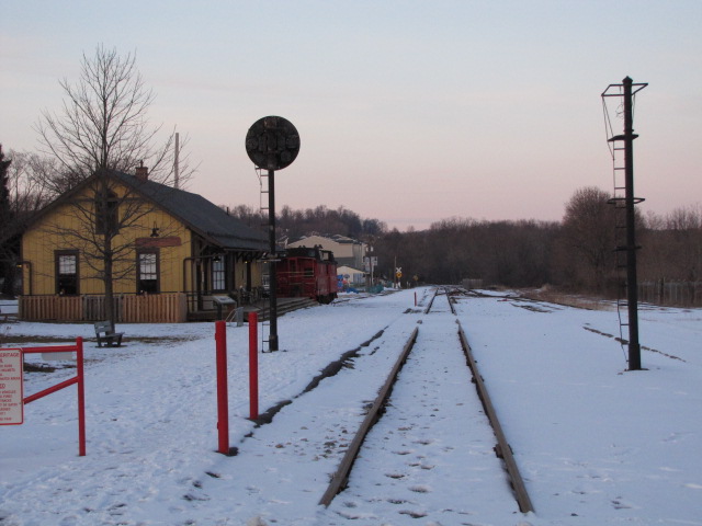
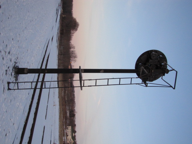
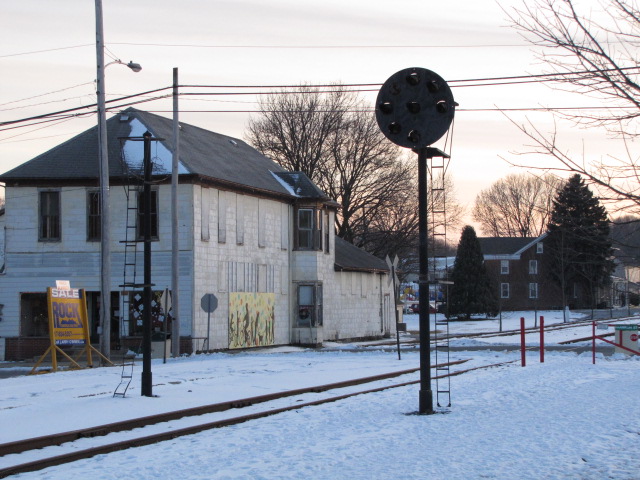
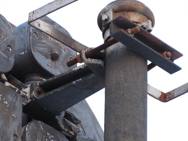
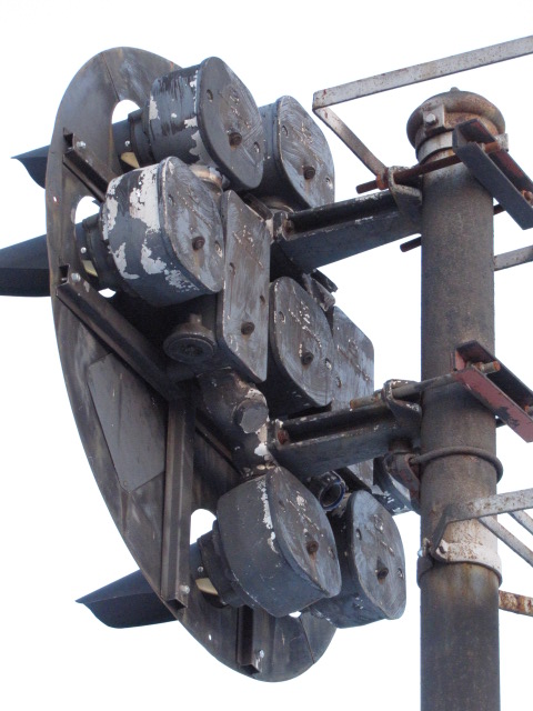
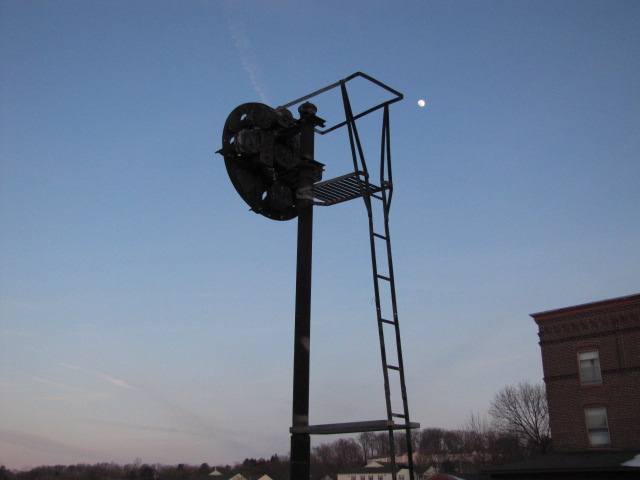
A lone Pennsy PL signal is still on display for SB trains just south of the depot, although it is not an original PL-5 style, it is a newer replacement by Safetran. There is also the mast for the NB signal still standing.
I thought the last train activity to be seen in New Freedom was after the auctioning of the Northern Central Rwy Dinner train in (I believe) September of 2002, but in looking at the Bing aerial shots, you can see there is only one caboose in the picture. Figuring the shots can be as old as two, three, even four years old, is seems the second caboose got delivered more recently than 2002.
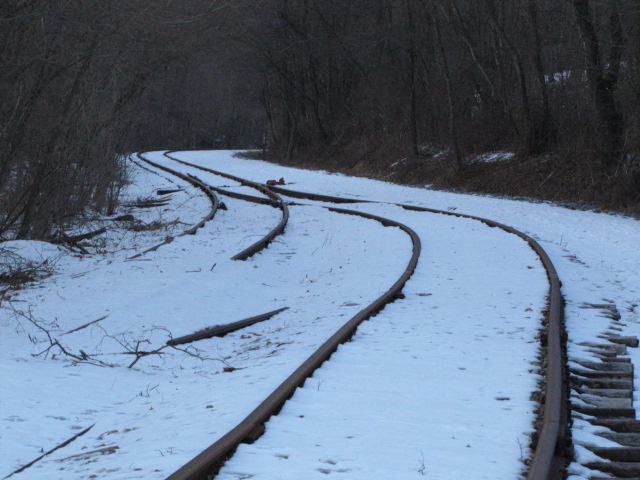
The tracks between York and New Freedom are still in place, and they share the R-O-W with a hikey-bikey trail. The tracks from New Freedom to Hanover Junction have been upgraded for the steam engine.
South of New Freedom the tracks are gone, due to hurricane Agnes which ripped through these parts in September 1972. It wasn't the wind that did the Penn Central (Northern Central) in, because by the time Agnes got to MD and PA, it was just a really heavy rain storm which brought down bridges, embankments, and track. The Penn Central was not in financial condition to rebuild the line, and the trains were rerouted to Perryville MD and up the Port Road along the Susquehanna River to Harrisburg..
Pictures and aerial shots of Railroad and Stewartstown are at the bottom of the page.
The easiest way to take exit 4 from I-83, the Harrisburg Expressway, whether you are coming down from the north (York and Harrisburg), or from the south (Baltimore).
From 83, you can get into New Freedom via several different routes, none of which are particularly quicker than the other. Pick one and come back a different way to enjoy the countryside!
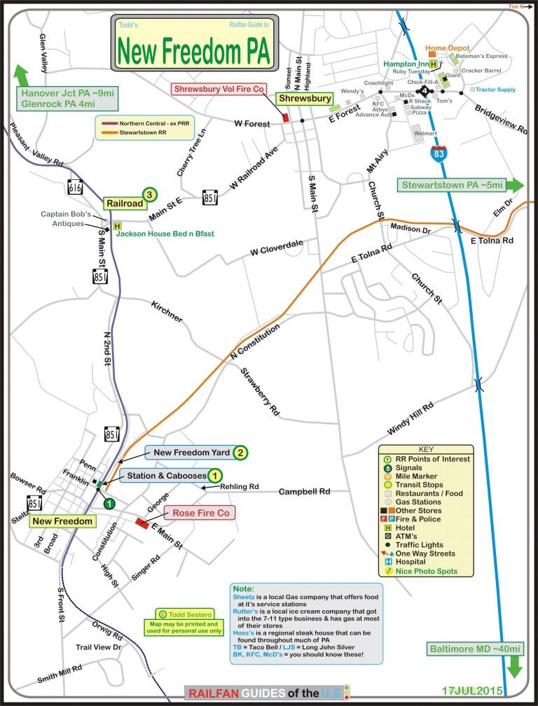
click
here
for the above map in PDF form
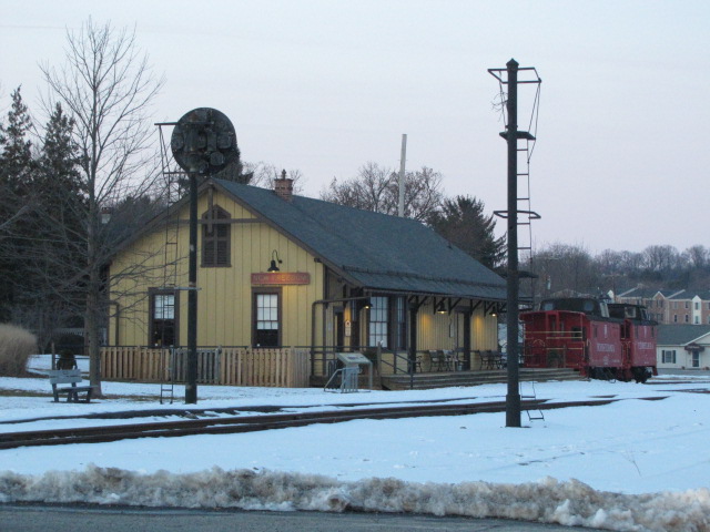
1 The Station and Cabooses
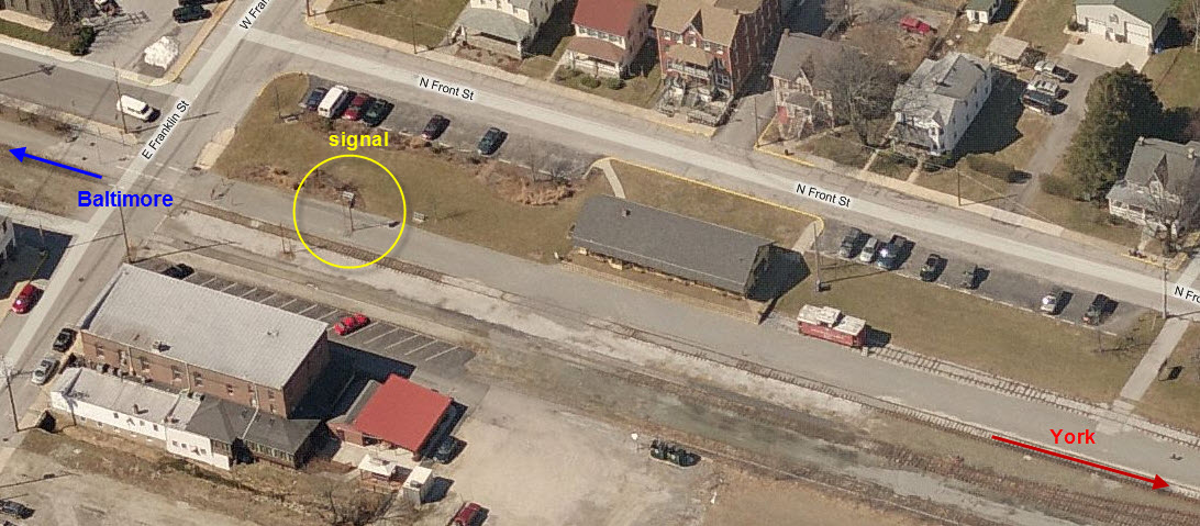
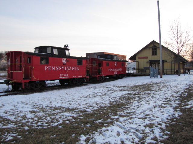

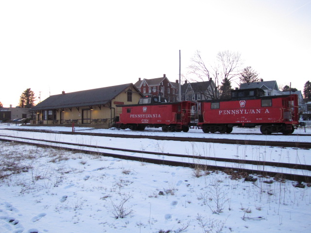

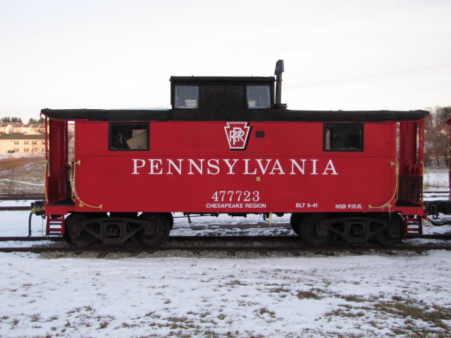 The two PRR cabooses, #477723 and #477834, both N5B's.
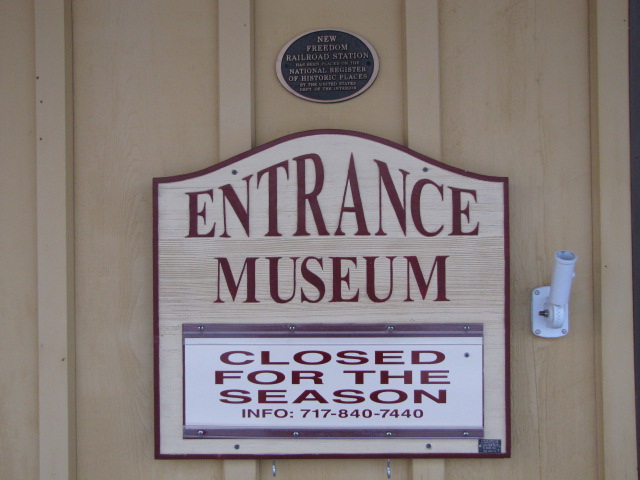
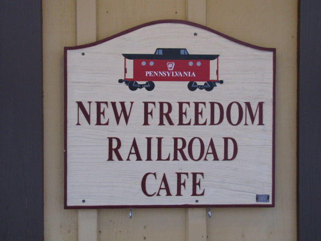
 Some of the signs that adorn the depot, during warmer months,
the cafe is open.
Some of the signs that adorn the depot, during warmer months,
the cafe is open.
 The Northern Central Rwy caboose, from 2001, sold in the
auction in 2002.
The Northern Central Rwy caboose, from 2001, sold in the
auction in 2002.
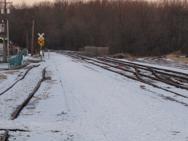
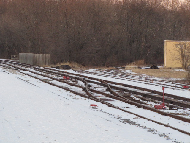
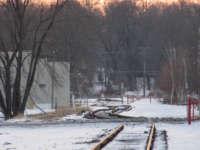
2 The Yard
The Stewartstown Railroad has not run for at least 10 years that I know of, maybe longer, although the R-O-W is still in place. As the track approached the New Freedom yard, it split into two, and these can be seen in these yard pictures - the two tracks "on the bottom" are the Stewartstown's, and the two "on the top" are the Pennsy's.
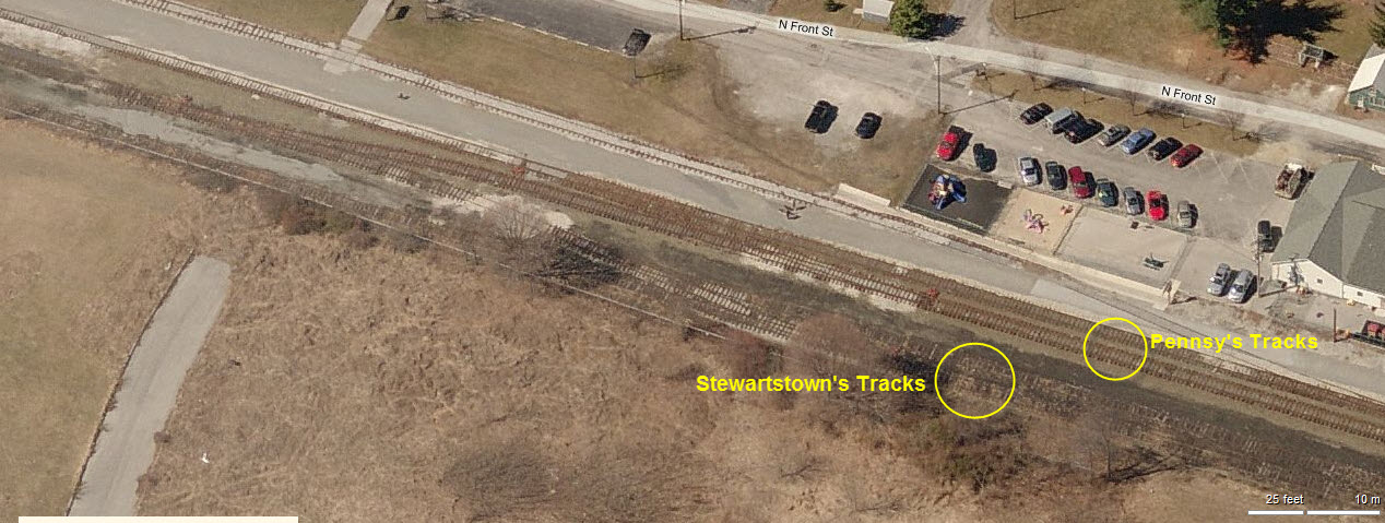

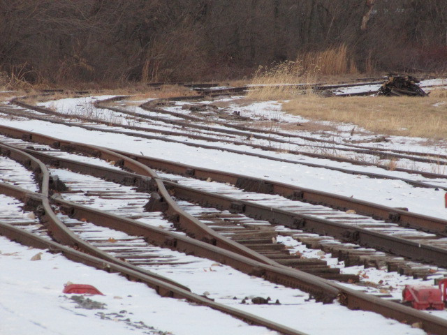 The tracks to Stewartstown can be seen heading off to
the right.
The tracks to Stewartstown can be seen heading off to
the right.
 Looking north towards York.
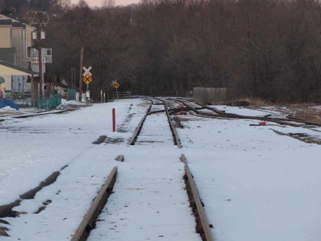
 Looking south towards Baltimore.
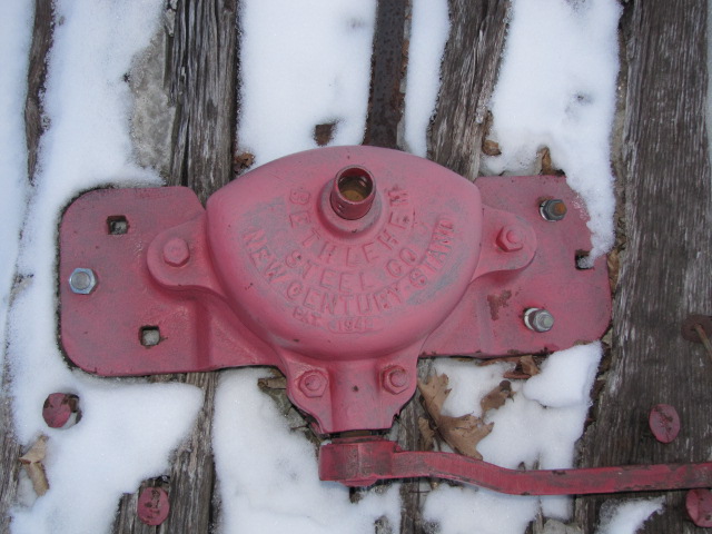
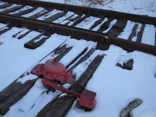
 A manual throw on the interchange tracks to Stewartstown.
3 Railroad
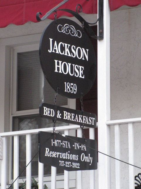
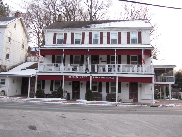
 The Jackson House Bed and Breakfast, wish those trains
were still rambling by! :-)
The Jackson House Bed and Breakfast, wish those trains
were still rambling by! :-)
 Interesting wall, don't know if it has railroad origins or
not.
Interesting wall, don't know if it has railroad origins or
not.
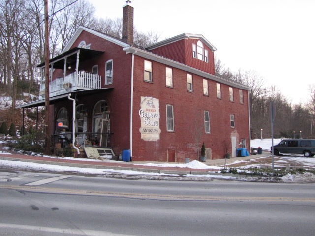 The General Store antique
store.
The General Store antique
store.
1 ex PRR PL Signal


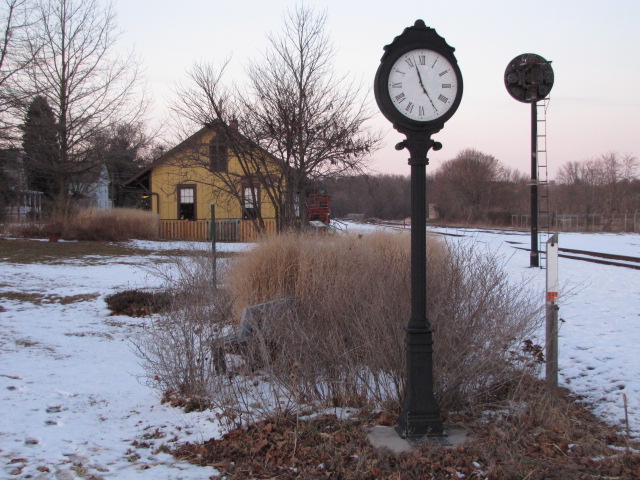
Stewartstown
Stewartstown is about 8 miles to the east of New Freedom, and the
Stewartstown RR used to service the route. Many years ago, the railroad
ceased operations, one of the reasons was a lean against the property of around
$200K. I have heard that the lean has been paid off, and the railroad may
once again run (once the R-O-W has been upgraded). The sdcreen captures
below are from Bing Maps, many years ago.

 The
Stewartstown Ra
The
Stewartstown Ra
Shrewsbury
 The Shrewsbury Volunteer Fire Company.

 Adjacent to the depot is a small park along the trail, a place to rest your
weary bones.
Adjacent to the depot is a small park along the trail, a place to rest your
weary bones.
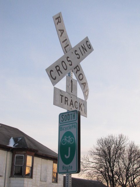 Crossing sign on Franklin Street.
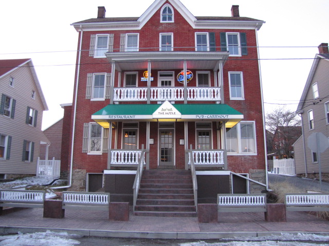
 Across from the depot is the Hodle,
a restaurant/bar.
Across from the depot is the Hodle,
a restaurant/bar.

 On the north side of New Freedom is this typical PRR culvert, and the line going
into single track.
On the north side of New Freedom is this typical PRR culvert, and the line going
into single track.
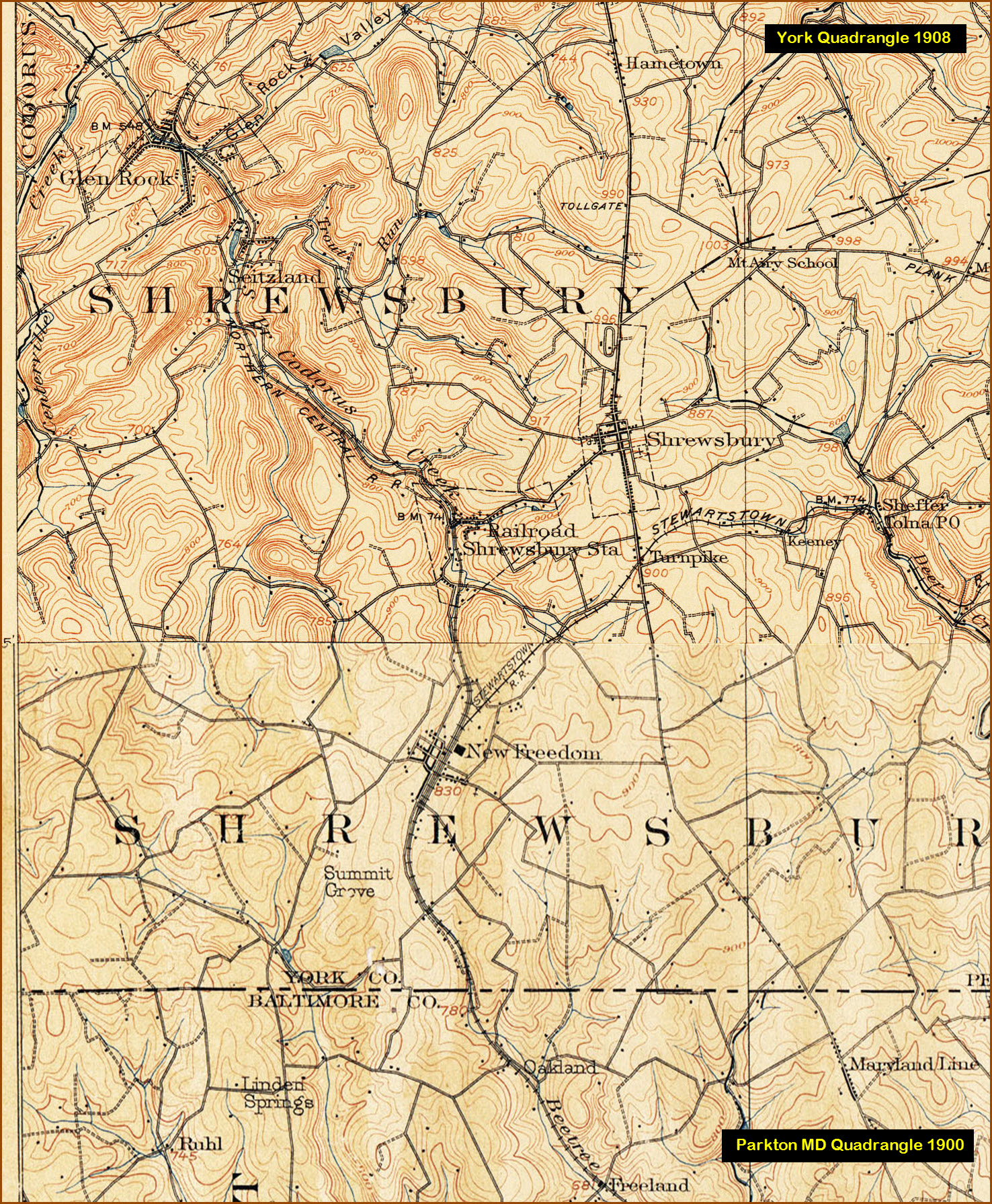
Courtesy of the University of Texas Library, click here for their index page. This map is a combination of the Parkton MD quadrangle from 1900 and the York MD quadrangle from 1908.
Disclaimers:
I love trains, and I love signals. I am not an expert. My webpages reflect what I find on the topic of the page. This is something I have fun with while trying to help others. My webpages are an attempt at putting everything I can find of the subject in one convenient place. There are plenty of other good websites to help me in this effort, and they are listed in the links section on my indexa page, or as needed on individual pages. Please do not write to me about something that may be incorrect, and then hound the heck out of me if I do not respond to you in the manner you would like. I operate on the "Golden Rule Principle", and if you are not familiar with it, please acquaint yourself with how to treat people by reading Mathew 7:12 (among others, the principle exists in almost every religion). If you contact me (like some do, hi Paul) and try to make it a "non-fun" thing and start with the name calling, your name will go into my spambox list! :-)
Please Note: Since the main focus of my two websites is railroad signals, the railfan guides are oriented towards the signal fan being able to locate them. For those of you into the modeling aspect of our hobby, my indexa page has a list of almost everything railroad oriented I can think of to provide you with at least a few pictures to help you detail your pike.
If this is a railfan page, every effort has been made to make sure that the information contained on this map and in this railfan guide is correct. Once in a while, an error may creep in, especially if restaurants or gas stations open, close, or change names. Most of my maps are a result of personal observation after visiting these locations. I have always felt that a picture is worth a thousand words", and I feel annotated maps such as the ones I work up do the same justice for the railfan over a simple text description of the area. Since the main focus of my website is railroad signals, the railfan guides are oriented towards the signal fan being able to locate them. Since most of us railheads don't have just trains as a hobby, I have also tried to point out where other interesting sites of the area are.... things like fire stations, neat bridges, or other significant historical or geographical feature. While some may feel they shouldn't be included, these other things tend to make MY trips a lot more interesting.... stuff like where the C&O Canal has a bridge going over a river (the Monocacy Aqueduct) between Point of Rocks and Gaithersburg MD, it's way cool to realize this bridge to support a water "road" over a river was built in the 1830's!!!
My philosophy: Pictures and maps are worth a
thousand words, especially for railfanning. Text descriptions only
get you so far, especially if you get lost or disoriented. Take
along good maps.... a GPS is OK to get somewhere, but maps are still
better if you get lost! I belong to AAA, which allows you to get
local maps for free when you visit the local branches. ADC puts
out a nice series of county maps for the Washington DC area, but their
state maps do not have the railroads on them. If you can find em,
I like the National Geographic map book of the U.S..... good, clear, and
concise graphics, and they do a really good job of showing you where
tourist type attractions are, although they too lack the railroads.
Other notes about specific areas will show up on that page if known.
By the way, floobydust is
a term I picked up 30-40 years ago from a National Semiconductor data
book, and means miscellaneous and/or other stuff.
Pictures and additional information is always needed if anyone feels
inclined to take 'em, send 'em, and share 'em, or if you have
something to add or correct.... credit is always given! BE NICE!!! Contact info
is here
Beware: If used as a source, ANYTHING from Wikipedia must be treated as being possibly being inaccurate, wrong, or not true.
RAILFAN GUIDES HOME
RAILROAD SIGNALS HOME
NEW 1-19-2011
Last
Modified 17-Jul-2015