
In General
Getting Here
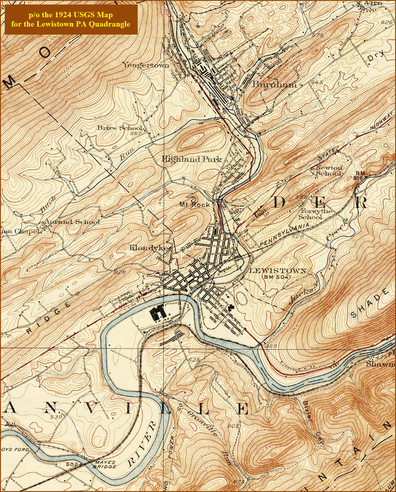
Map
Sights
Pictures
Bridges
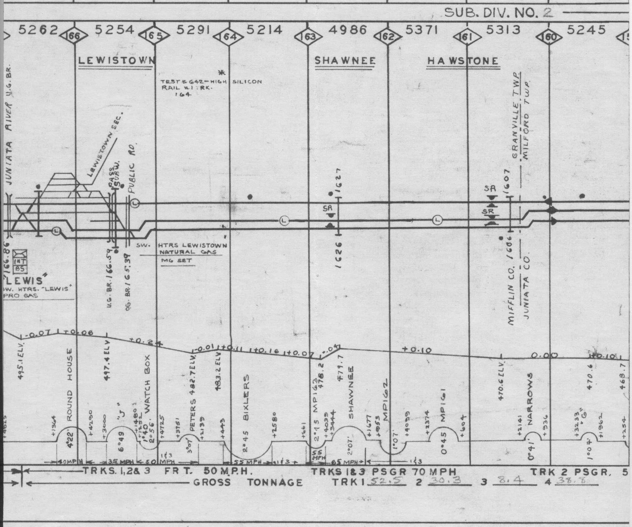
Signals
Fire & Police
Floobydust
USGS Maps
RAILROAD SIGNALS HOME
Location / Name:
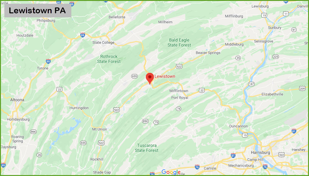
Lewistown PA, Mifflin County
What's Here:
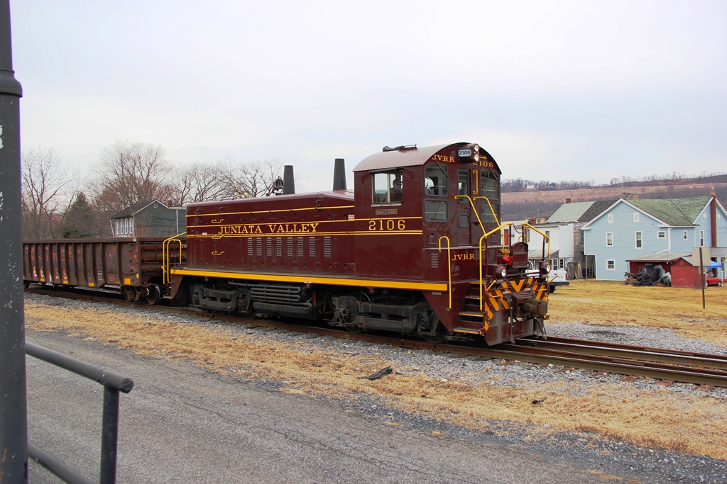
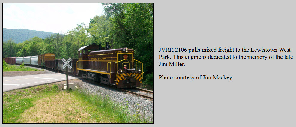
Juniata Valley Railroad
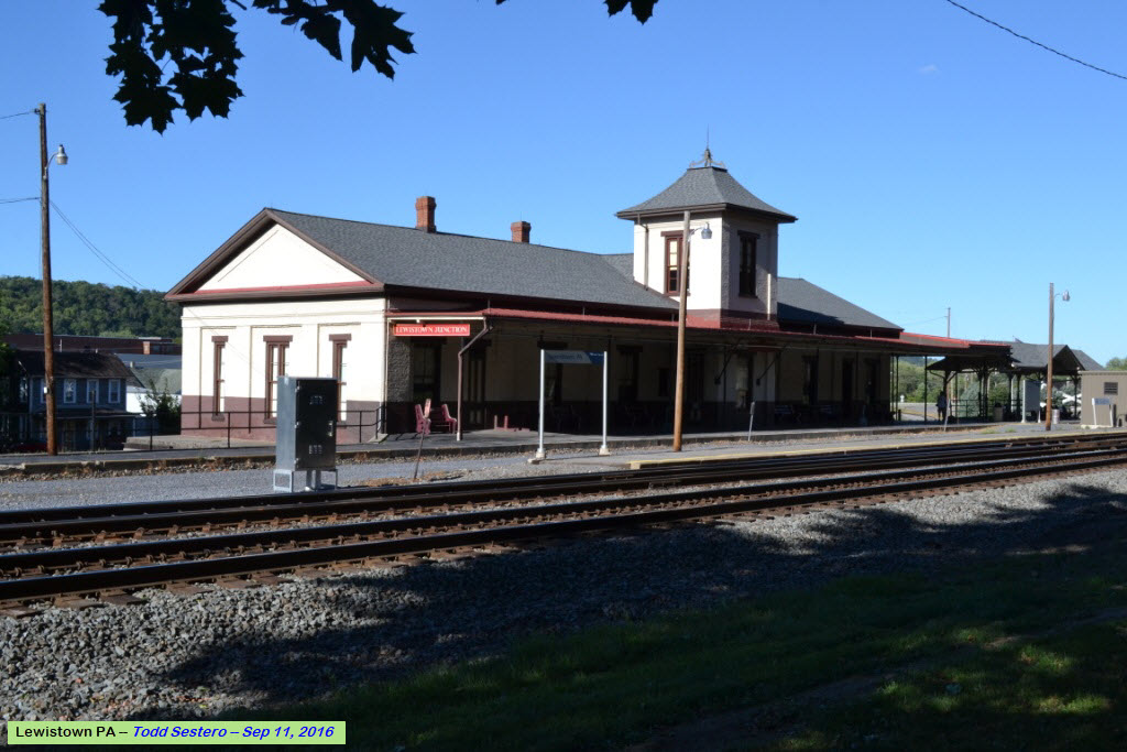
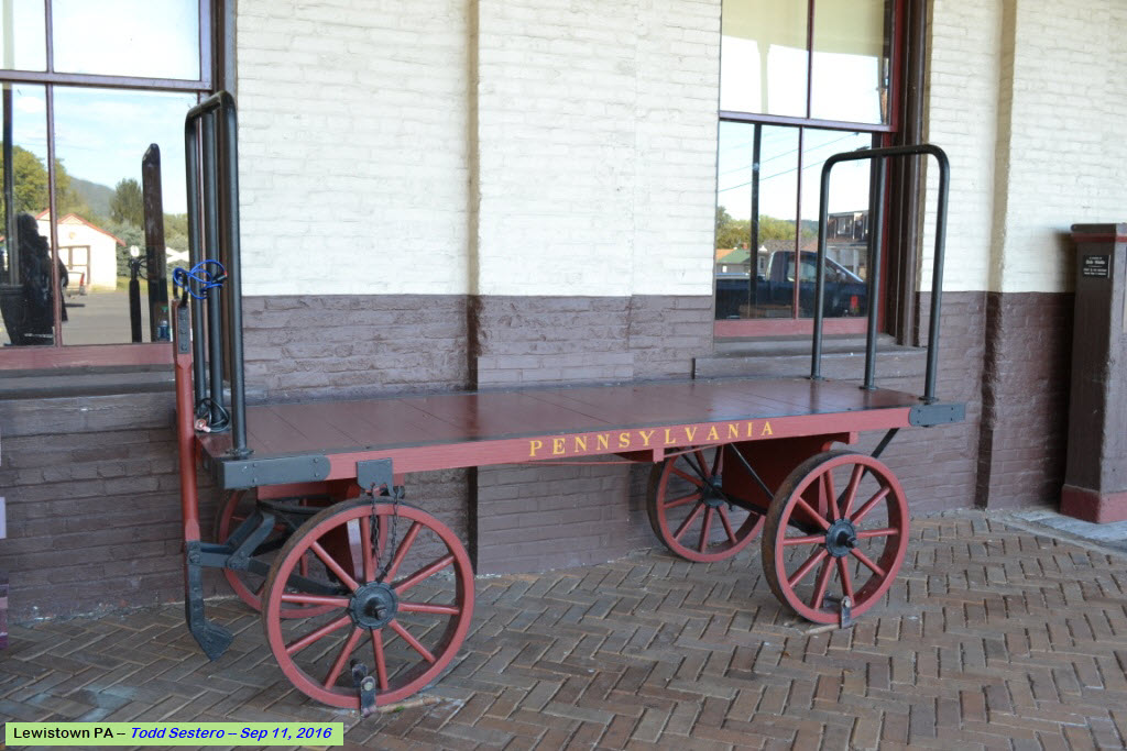
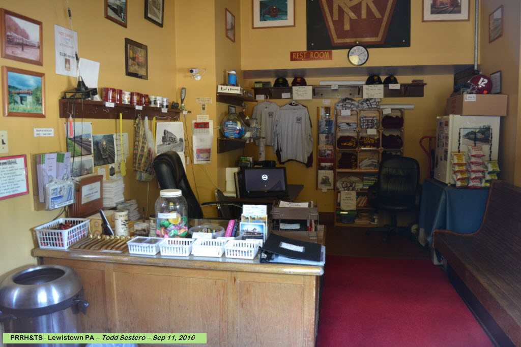
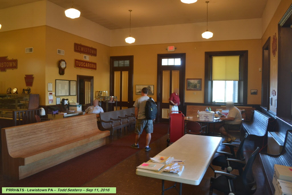
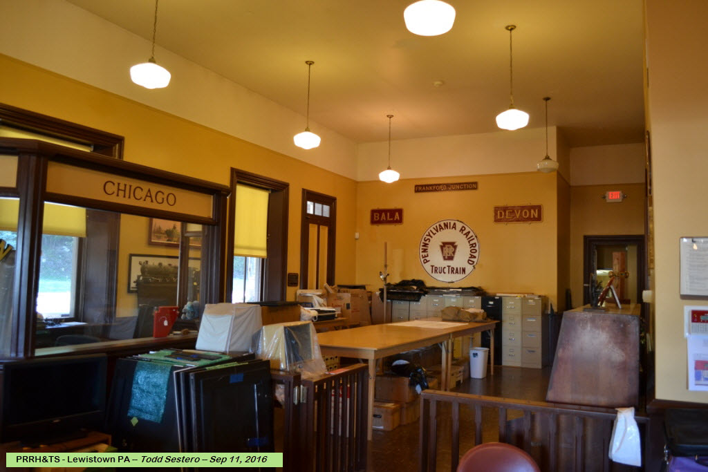
former PRR Depot - HQ for the PRRH&TS (PRR Historical & Technical Society)
Data:
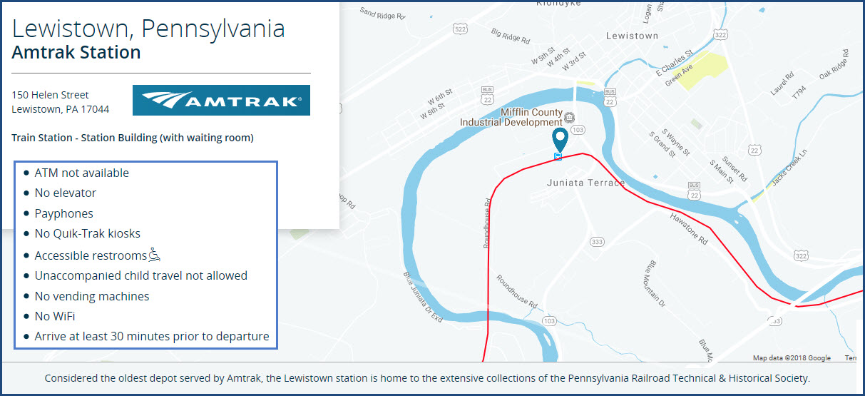
GPS Coordinates: 40.28258, -86.51806 (at the depot)
ZIP: 17044
Phone A/C: 717
Access by train/transit:
Amtrak Trains #
Scanner Freqs:
160.800, 161.070
The Scoop:
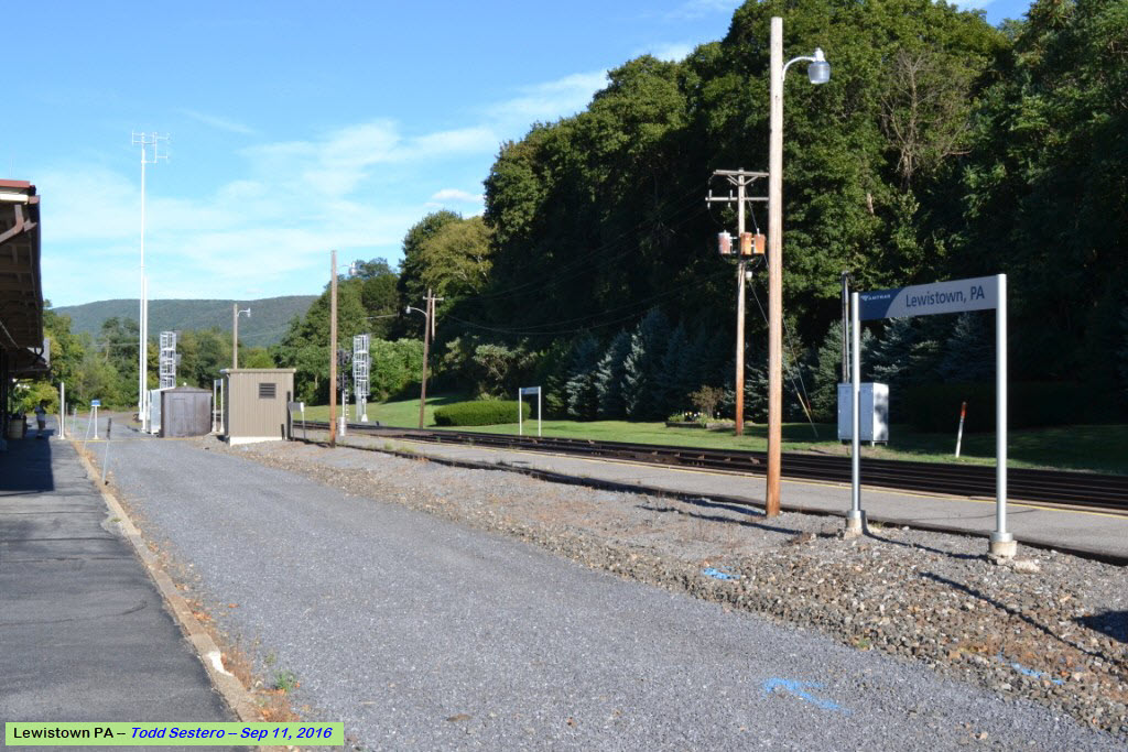
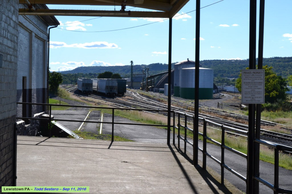
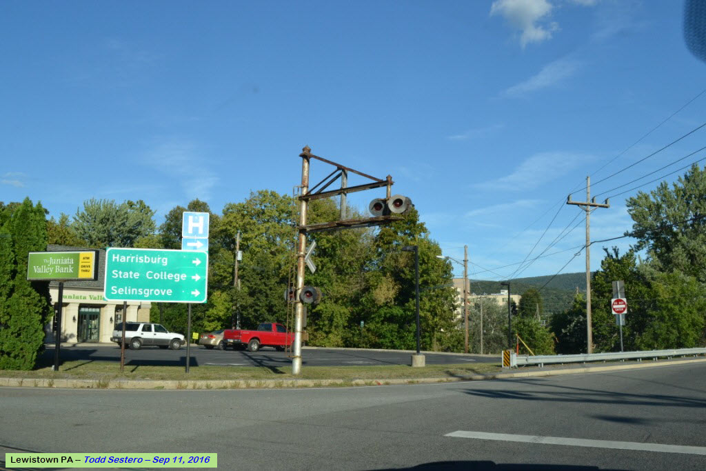
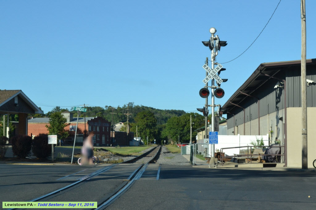
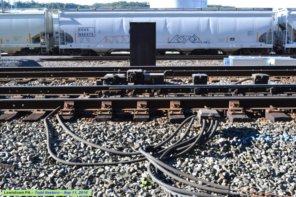
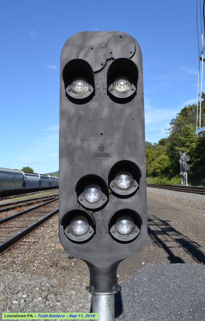
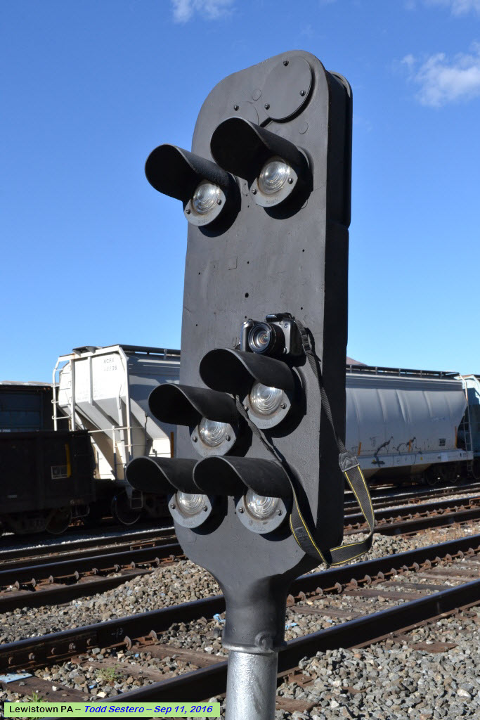
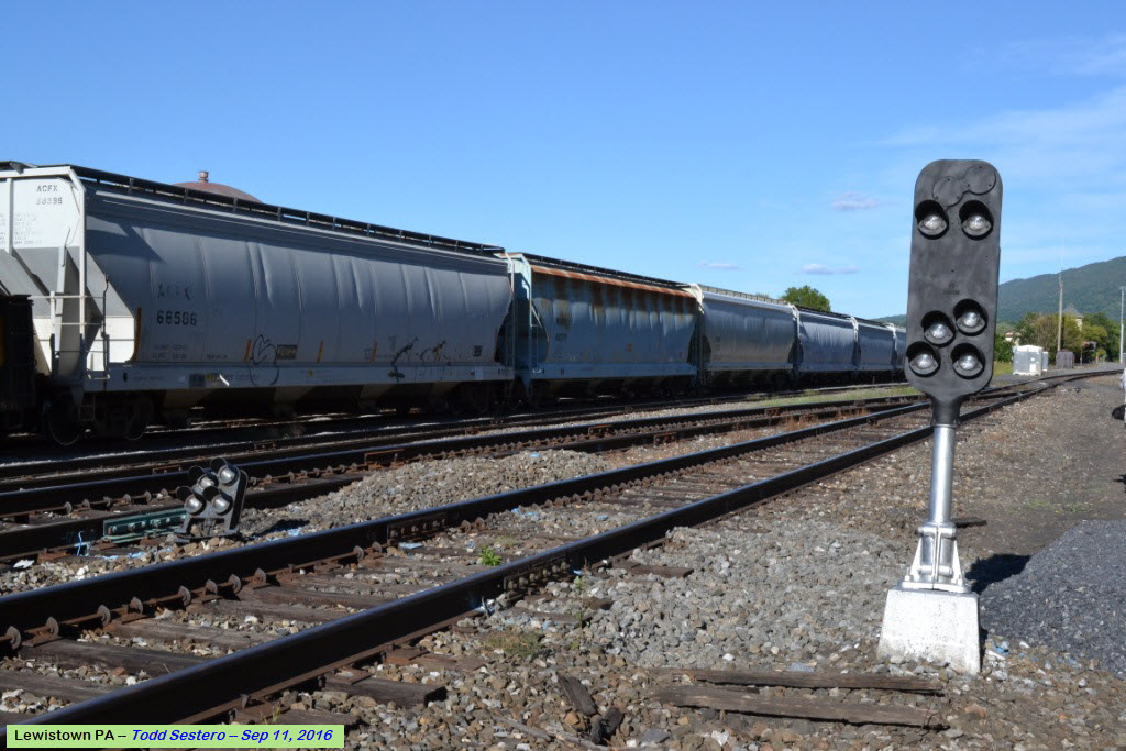
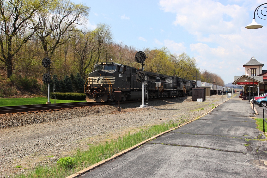
OK, for you signal fans out there - as of summer 2016, NS is in the process of replacing the Pennsy PL (position light) signals. This also includes the Pedestal signal on the west side of the station. For now, it looks like the PL-5 dwarf is safe.... maybe.
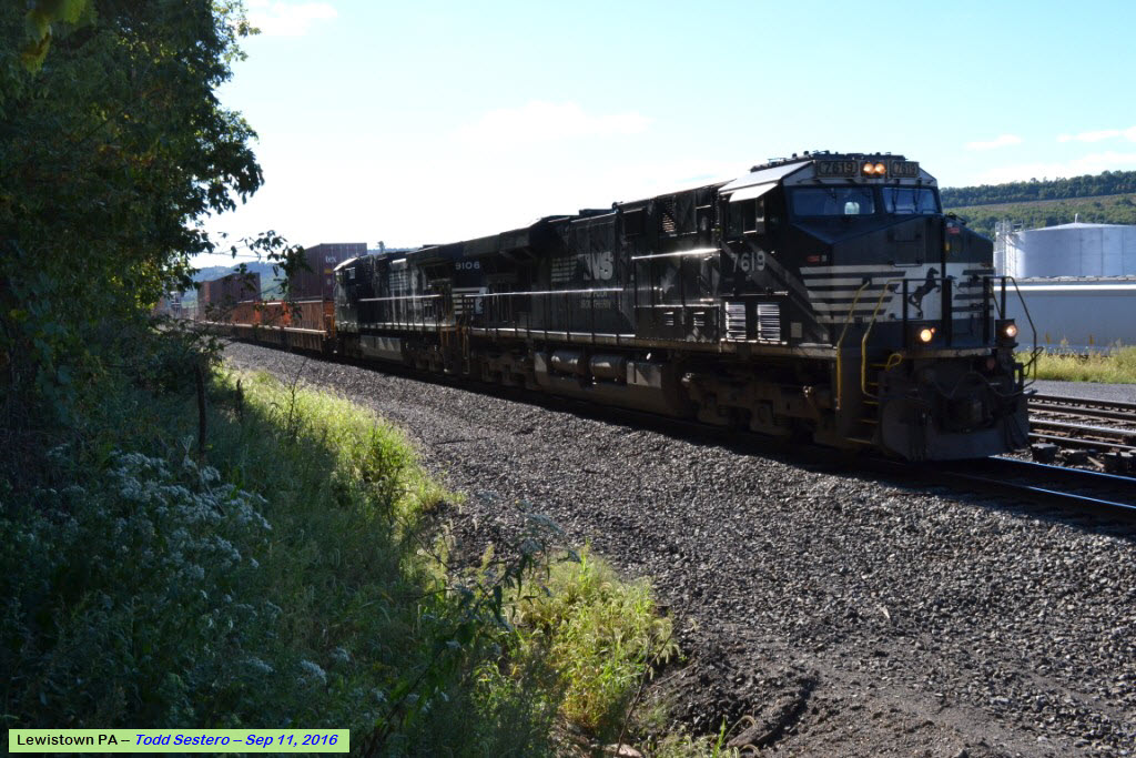
There are 50 to 60 trains a day coming thru Lewistown.
There is no food sales or vending machines at the station, but Sheetz is nearby in town, as well as other places.
Acknowledgements:
Denver Todd
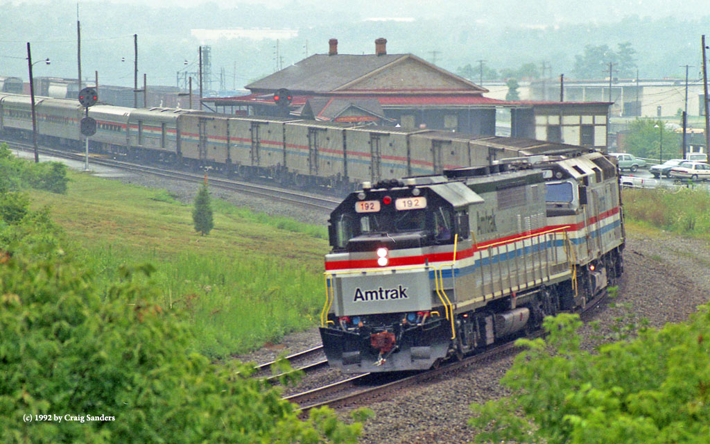
Craig Sanders
Jerry W. Jordak
Amtrak
Websites and other additional information sources of interest for the area:
https://www.nshr.com/jvrr
https://www.greatamericanstations.com/stations/lewistown-pa-lew/
https://en.wikipedia.org/wiki/Lewistown_station
https://www.nightwatchparanormal.com/lewistown-train-station.html
http://railfanlocations.weebly.com/lewistown-pa.html
https://en.wikipedia.org/wiki/Pittsburgh_Line
https://elevation.maplogs.com/poi/mifflin_county_industrial_development_pa_50_lewistown_pa_usa.208424.html
Lewistown is not off of an interstate, but US22/US322 is just as good! If you are coming from Harrisburg PA, it is about an hours drive from I-81/I-83 (I-83 ends at I-81, BTW)
Lewistown is at the junction of US522 and US22/US322, making it even easier to get to.

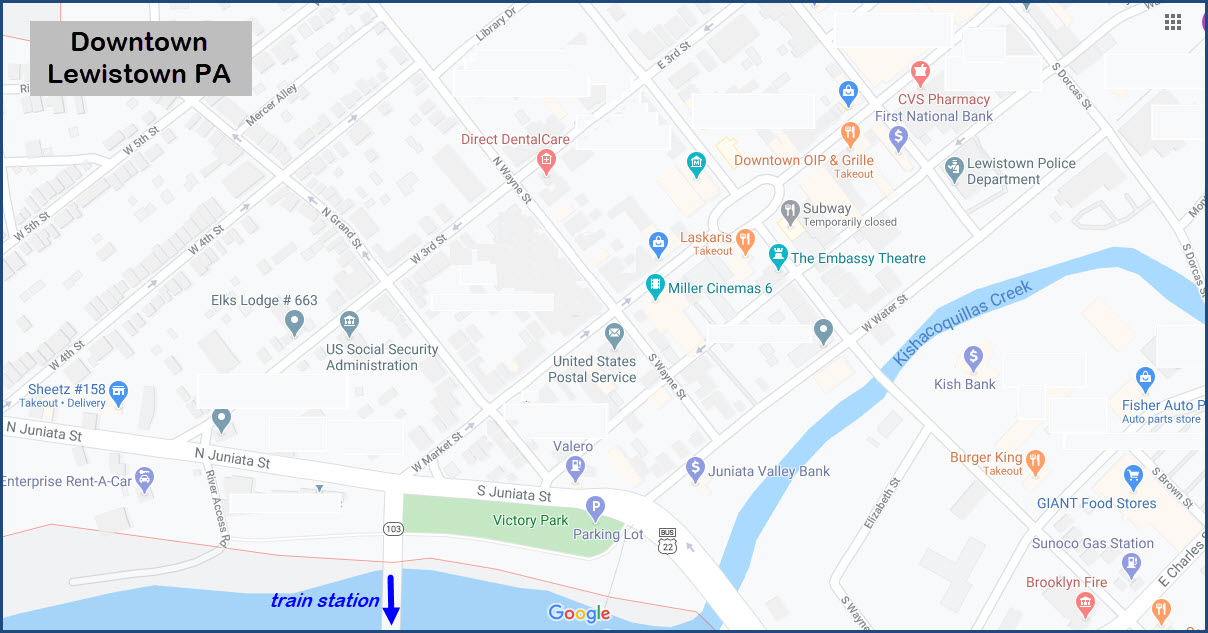
GPS Coordinates: 40.588217, -77.580289
Amtrak Code: LEW
http://www.greatamericanstations.com/stations/lewistown-pa-lew/
https://en.wikipedia.org/wiki/Lewistown_station
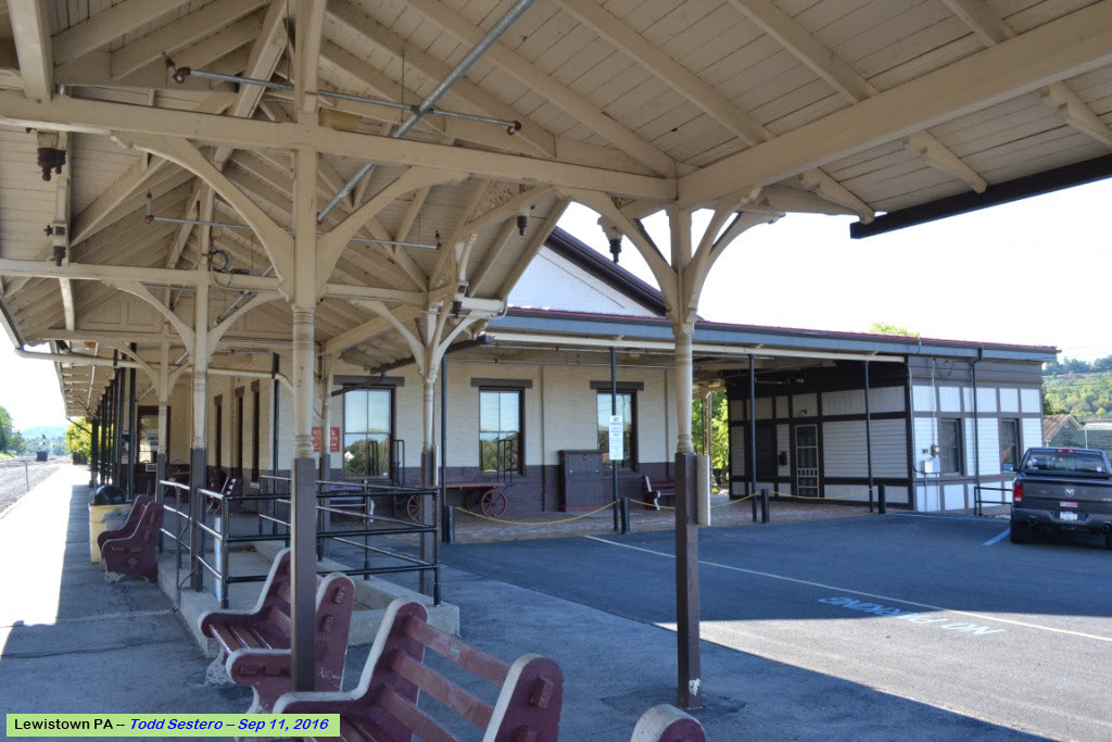
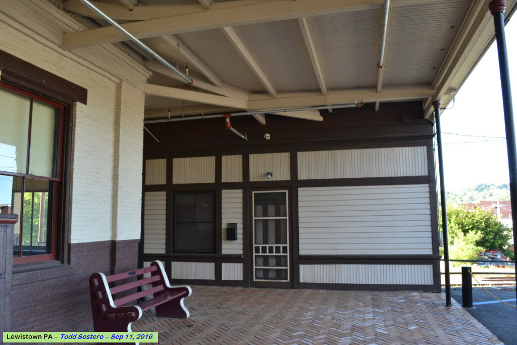
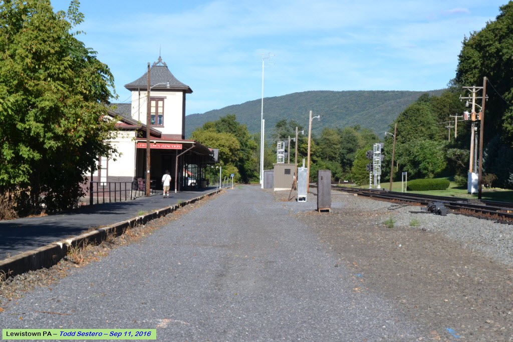
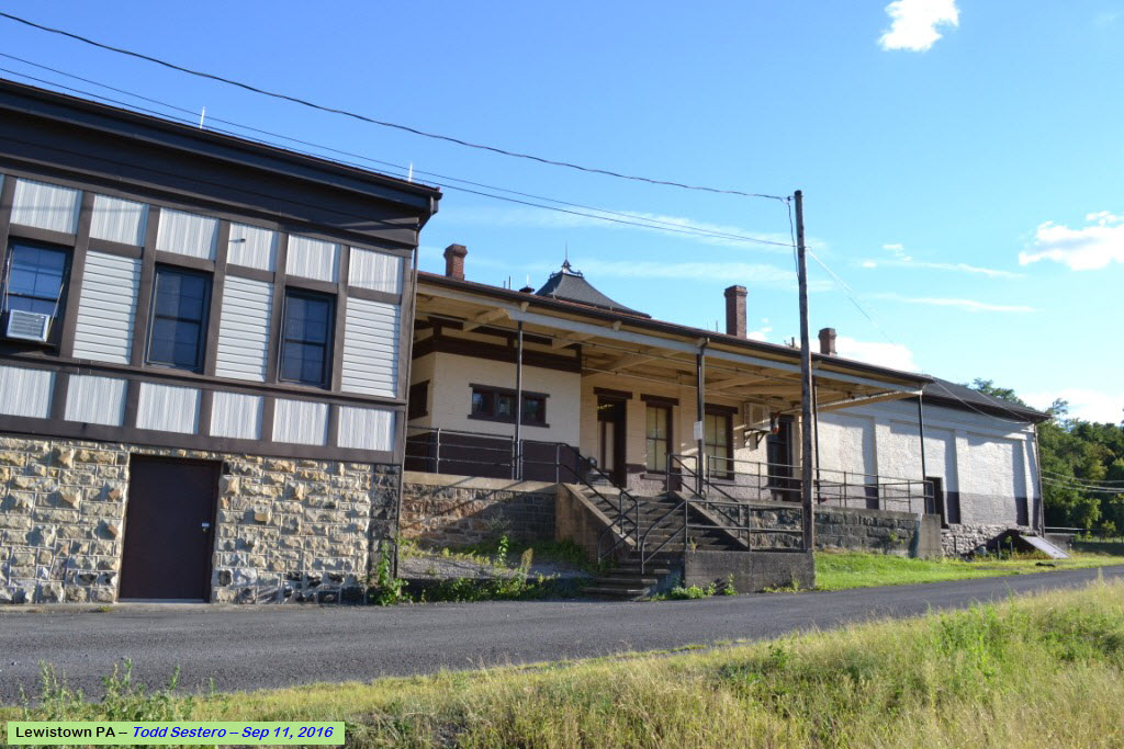
From the Great American Stations page: The Lewistown station sits on the right bank of the Juniata River across from downtown, but the two areas are connected by Veterans’ Memorial Bridge. The Lewistown station holds a special distinction as the oldest surviving structure known to have been built by the Pennsylvania Railroad (PRR). Serving freight shippers or passengers since it opened in 1849, the building is also thought to be the oldest station in continuous use in the United States.
Although the PRR was later known as one of the world’s largest and most powerful corporations, it had humble beginnings in the mountains of central Pennsylvania. The first stretch of track ran between Harrisburg and Lewistown, which served as the western terminus for a few short months. Originally constructed as a freight handling warehouse, the Lewistown station was converted to passenger use in 1868; it replaced an informal waiting area located in a hotel across the street. Rectangular in plan, the brick depot sports a simple gabled roof and a two tone paint scheme of white walls above a brown base.
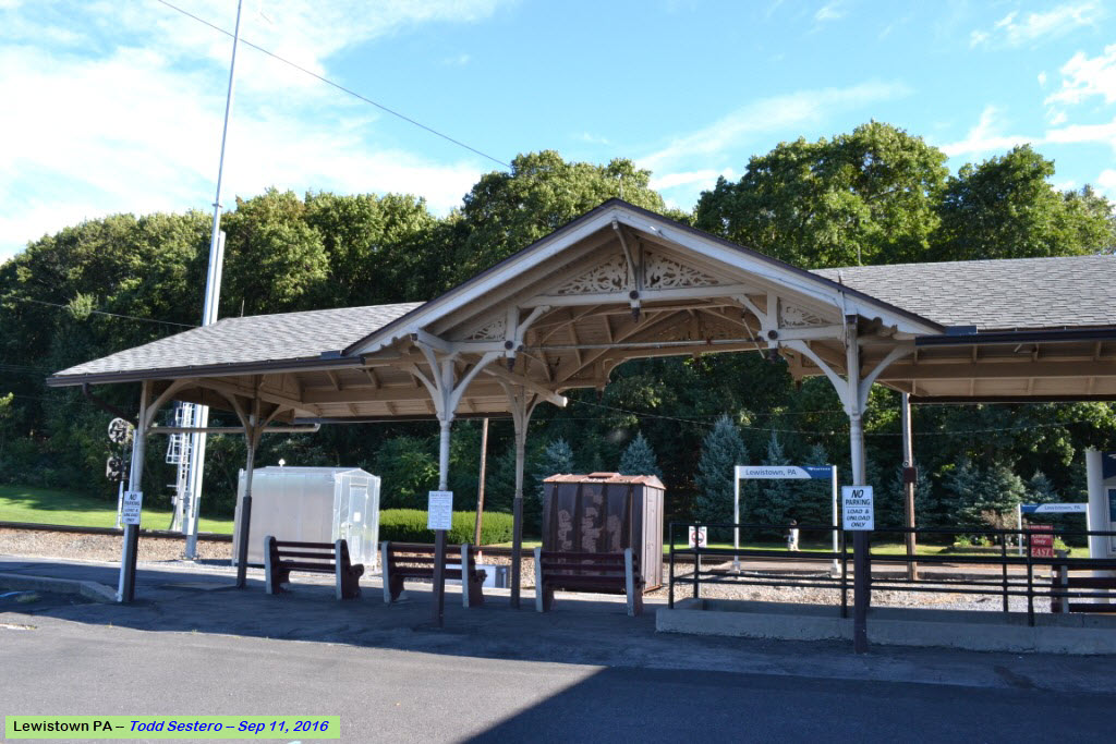
The end gables feature three tall windows framed by stylized pilasters that lightly reference the Greek Revival architectural aesthetic that was popular at the time. A two storey tower located at the center of the trackside façade projects onto the platform area and acts as a visual exclamation point. It too displays stylized pilasters at its corners and is capped by a shallow hipped roof crowned with a finial made up of curlicues. A tower would have been an unusual feature on a utilitarian freight house and was probably added to the building when the section of the railroad running through Lewistown gained a manual block signal system in the mid-1870s.
 Looking towards town
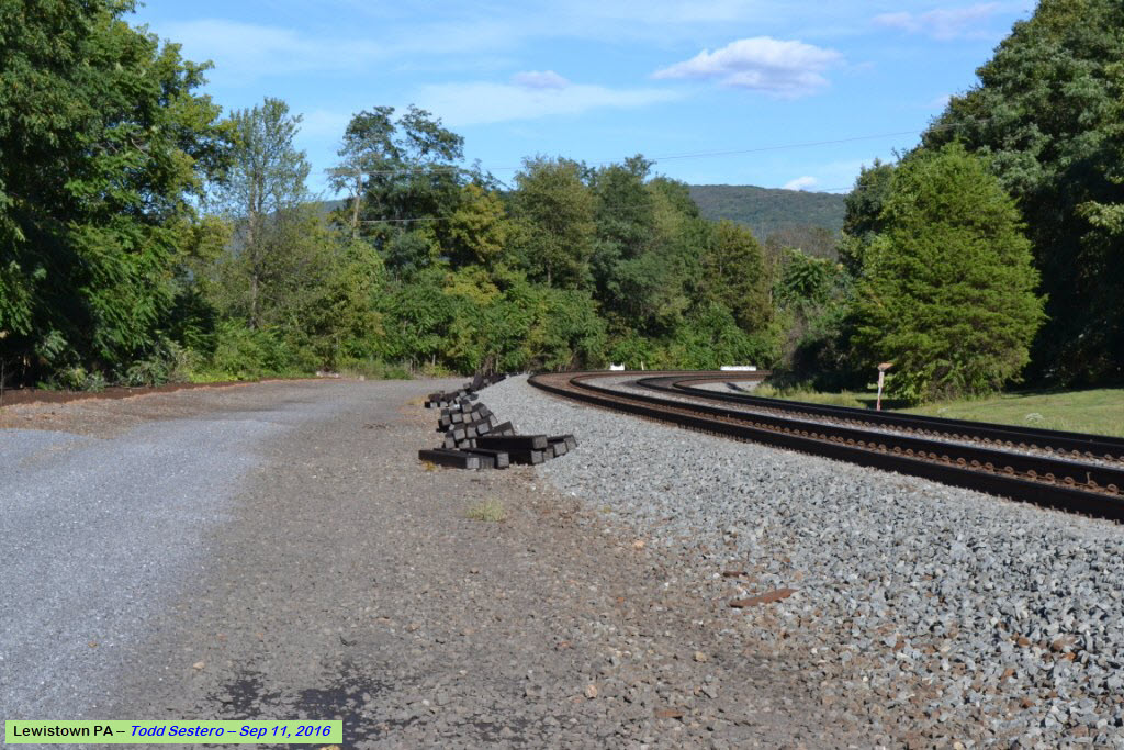 Looking east
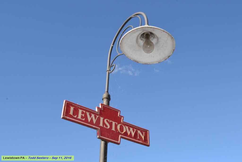

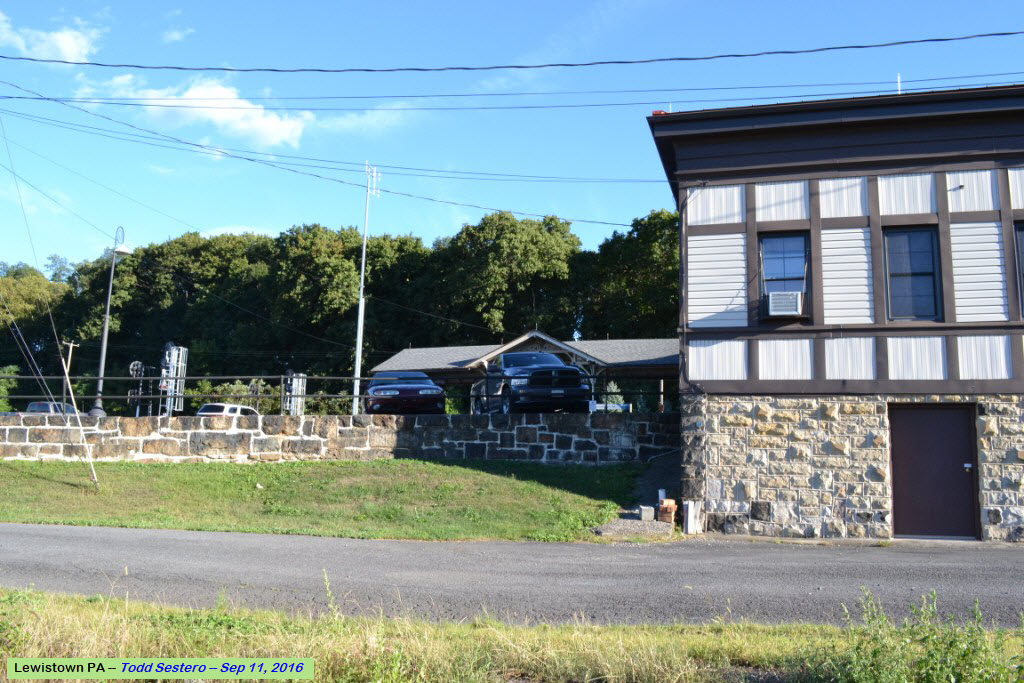
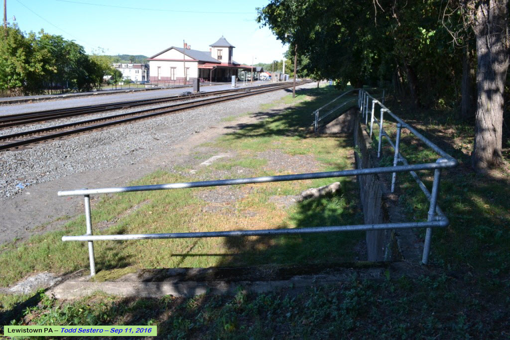
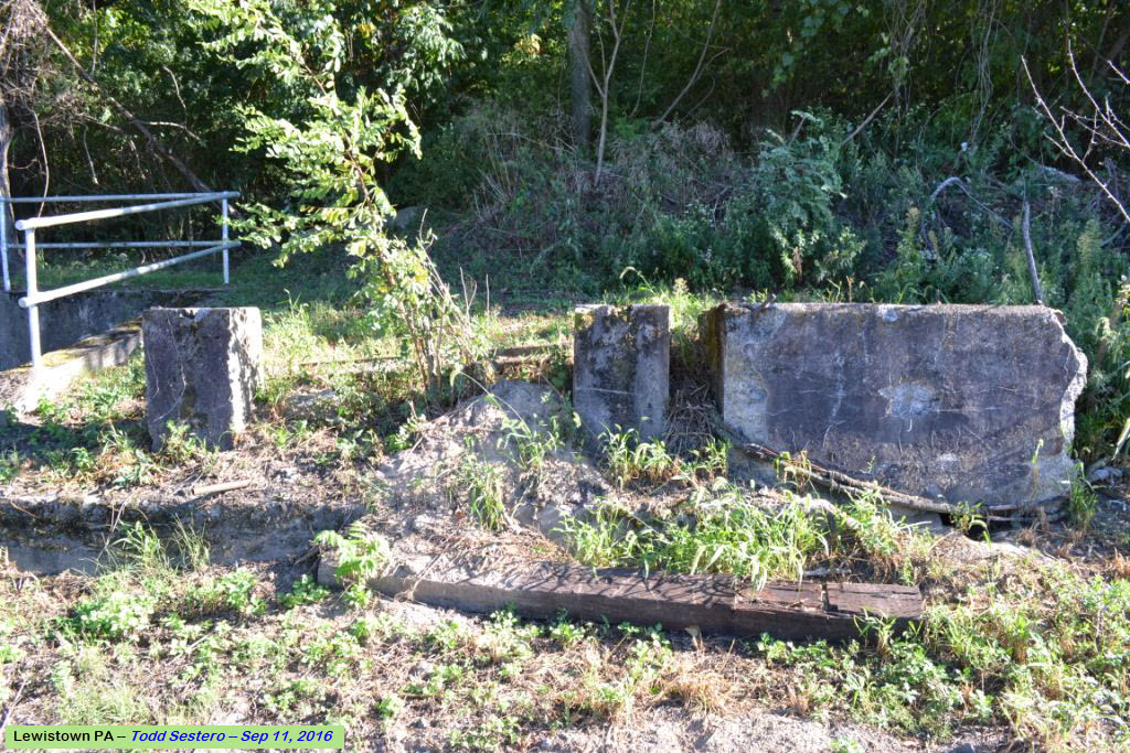
Where the tower used to stand... You can still find some of the wire in the ground.
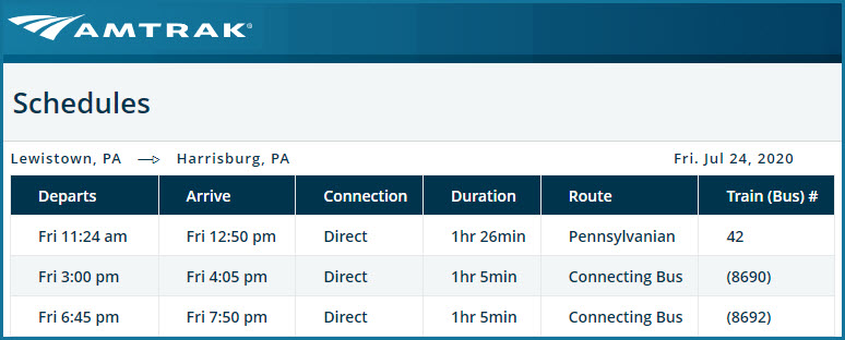
This illustrates why Amtrak is not always the best choice or the most expedient for getting somewhere........
GPS Coordinates: 40.586516, -77.587144
565 Roundhouse Road, Lewistown PA 17044
717-242-5934
Homepage: https://www.nshr.com/jvrr
The North Shore corporate offices are located in Northumberland PA. There are connections to NS in Lewistown and Northumberland, as well as an indirect connection to the Canadian Pacific. The North Shore Railroad System in the U.S. includes the following short lines:

See the floobydust section for more info on the North Shore Railroad System.
 from the Weebly website
On the track behind the station....
At the corner of West water St and US 22 Business, just after the line cross the Juniata River
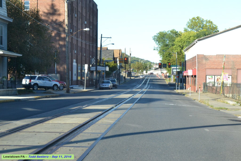
A little bit of street running down West Water Street...
The end of street running at Dorcas St
http://www.prrths.com/
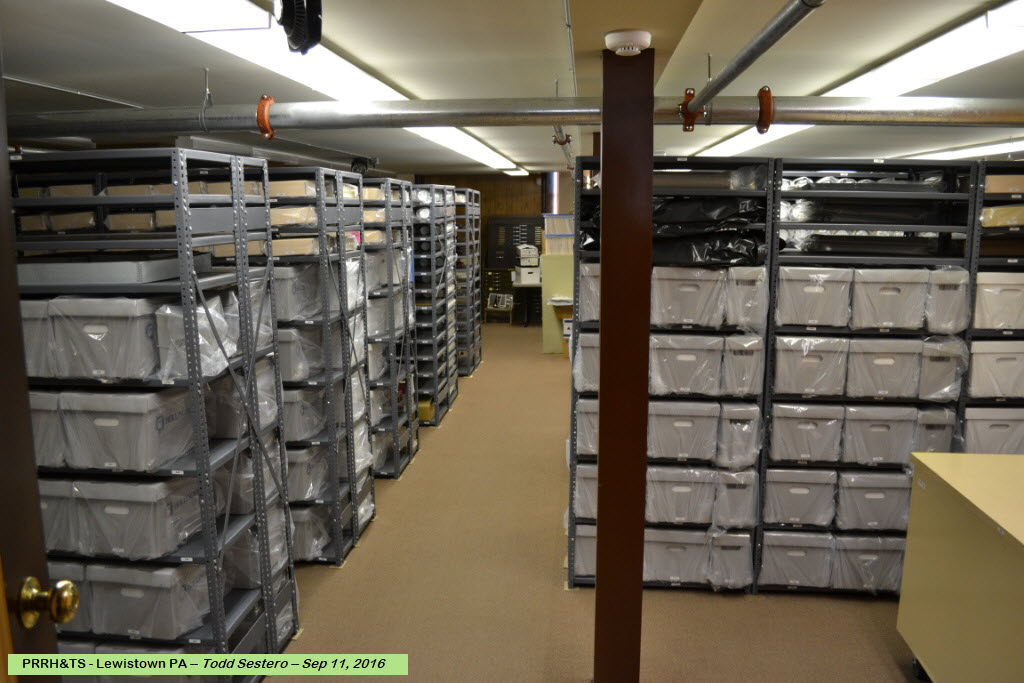
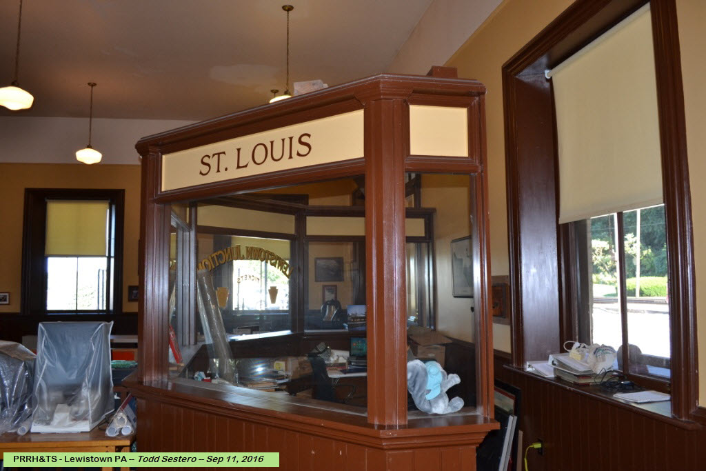
The PRRH&TS is the sole tenant of the Lewistown Station. They archive anything related to the Pennsylvania Railroad. If you happen to be here when there is someone around, you should stop in and say hi, they are a friendly bunch!!!
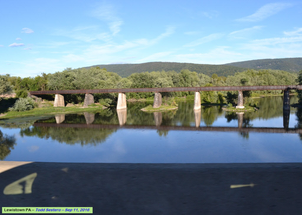
https://bridgehunter.com/pa/mifflin/bh49760/
This bridge carries the interchange track to the Juanita Valley RR, and crosses the Juanita River parallel to Belle Ave/103 between the station and downtown.
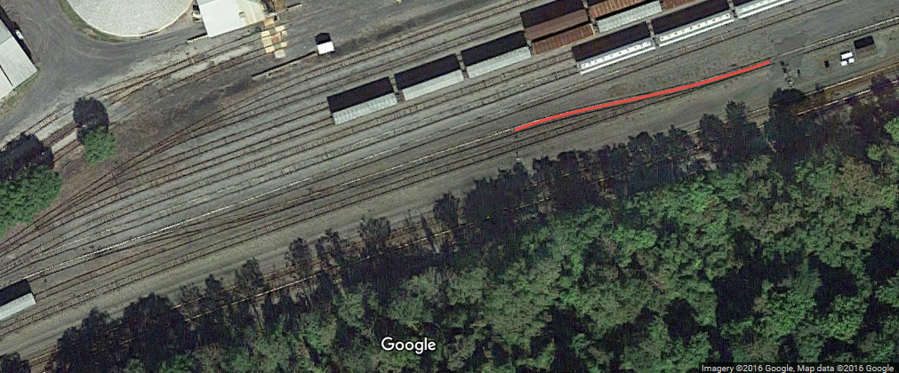
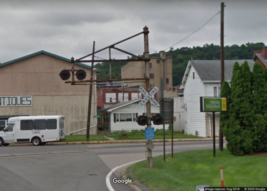
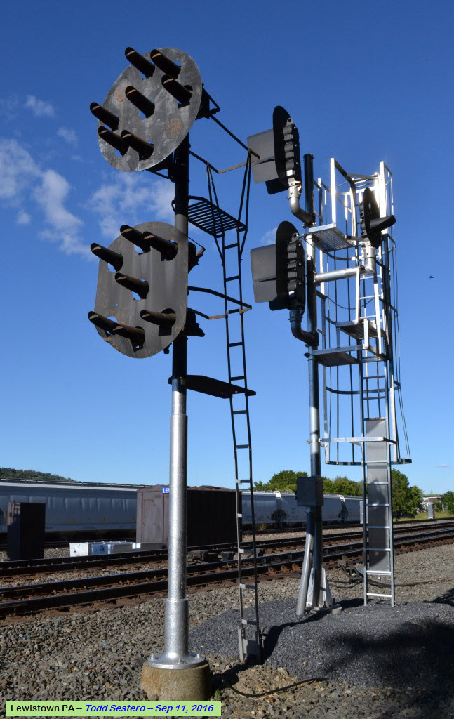
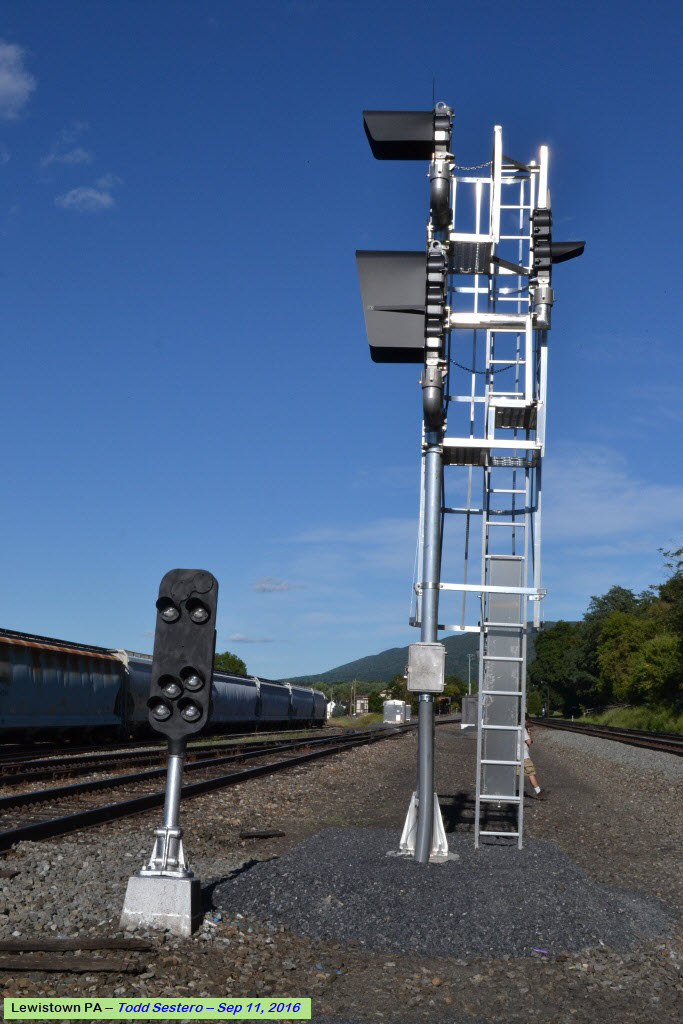
Signals here, and on this whole former Pennsy mainline between Harrisburg and Pittsburgh, used to be ALL PL signals, Position Light signals. Norfolk Southern has been slowly replacing them with standard colorlight signals for the past ten years or so. Lewistown changed over in the 2016/2017 timeframe, as can be seen in the accompanying pictures, taken in September of 2016.
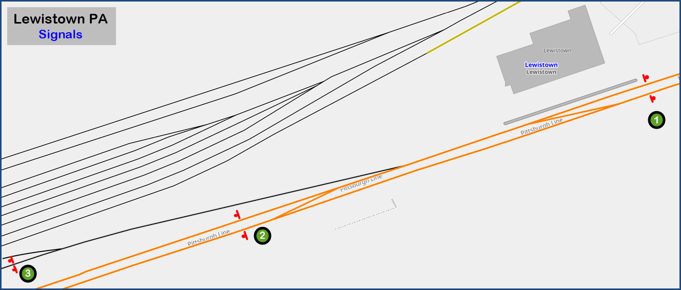
From PL's to Colorlights......
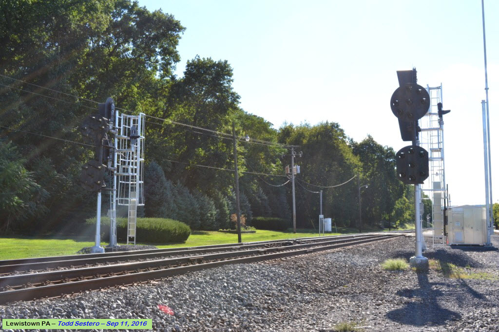
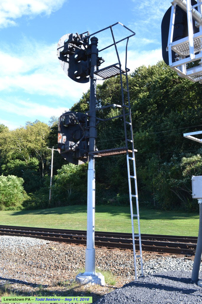

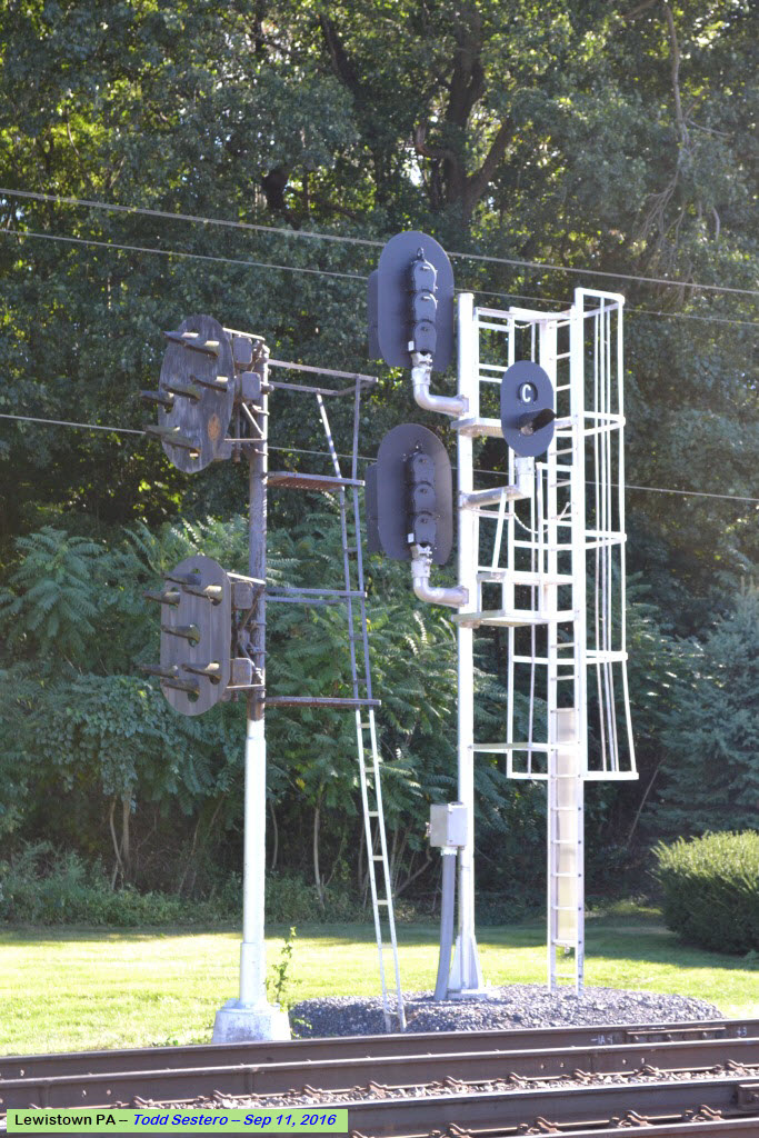

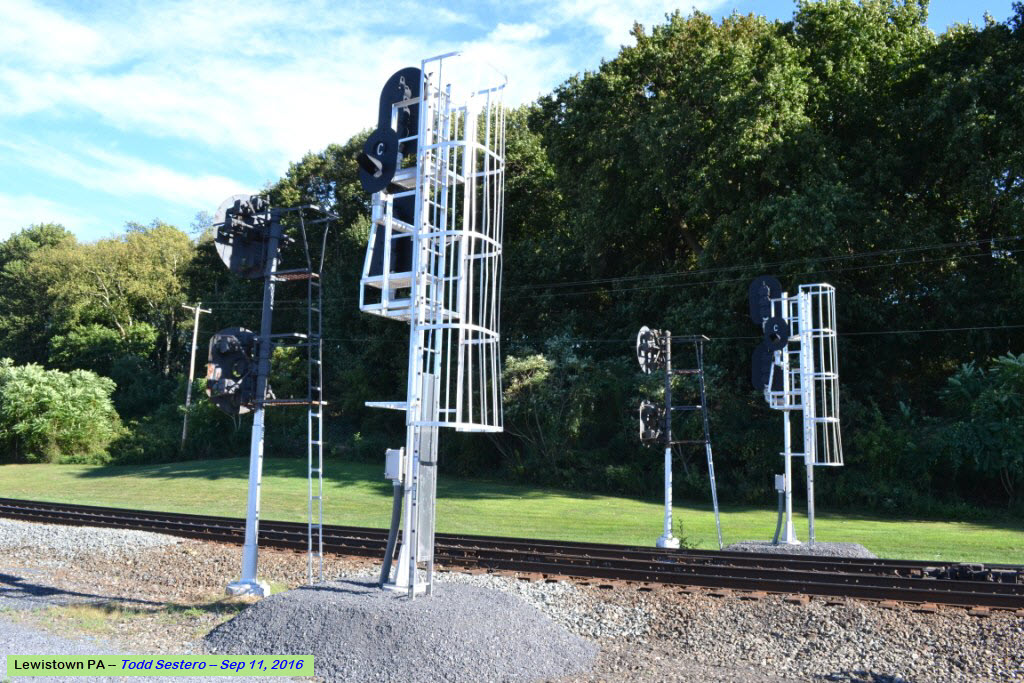
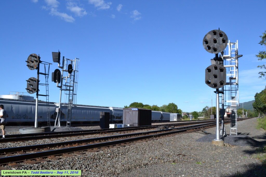
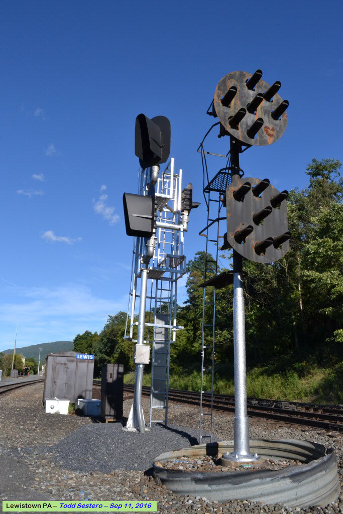
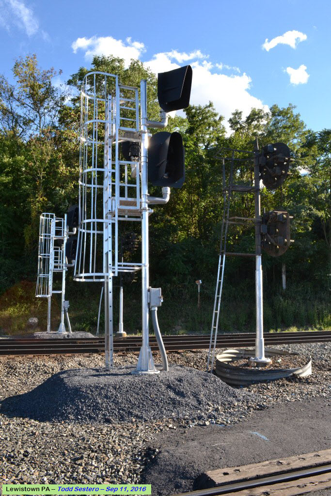
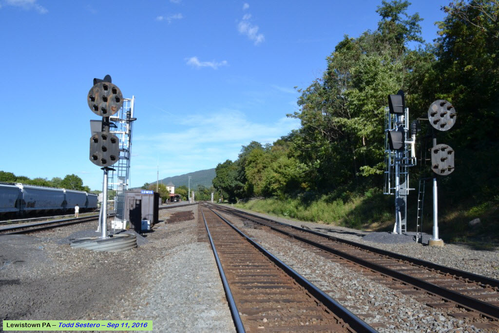
Looks like they are replacing the pedestal signal with a regular high signal. Not sure why a regular colorlight dwarf would not have worked here, since it is a yard lead track, thereby being a slow speed signal to begin with... These signals control movements from the yard tracks onto the mainline.
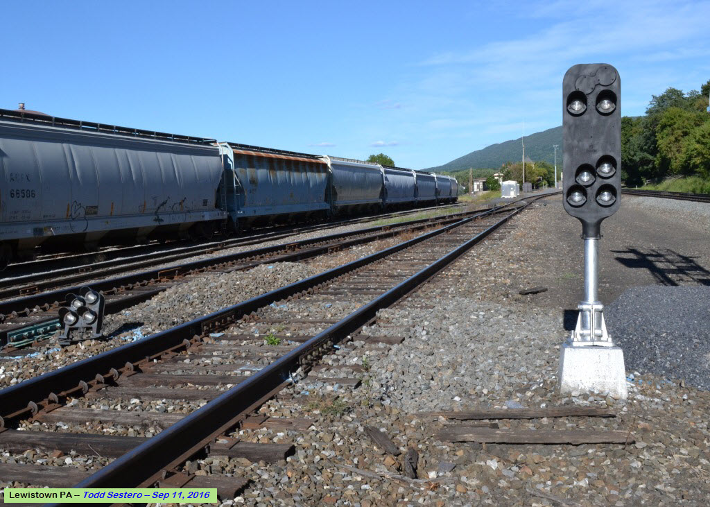
This is the only train that came by while we were here, it was a Sunday...
 from the Weebly website
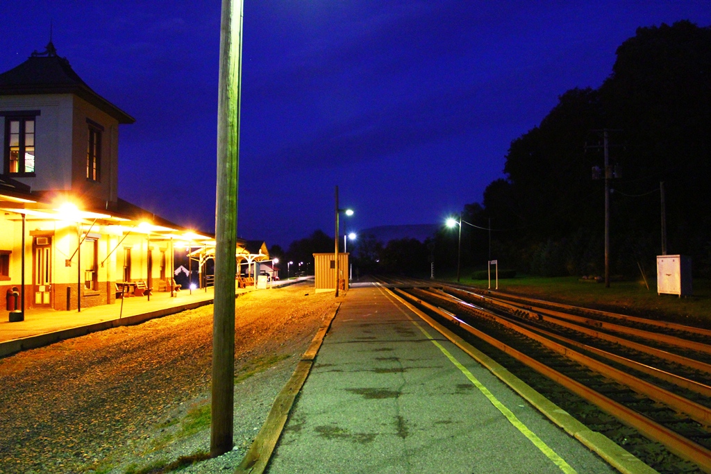 from the Weebly website
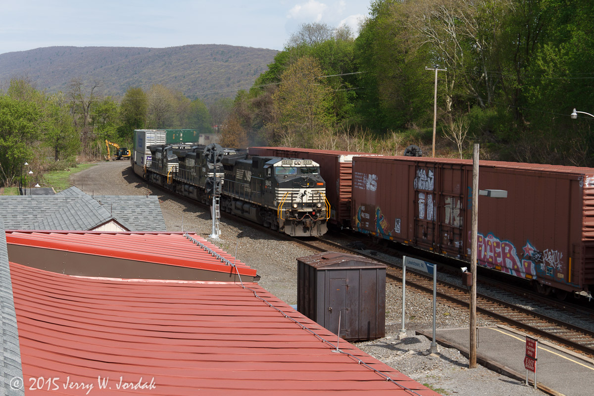
On The Way Home

The North Shore Railroad System Railroads
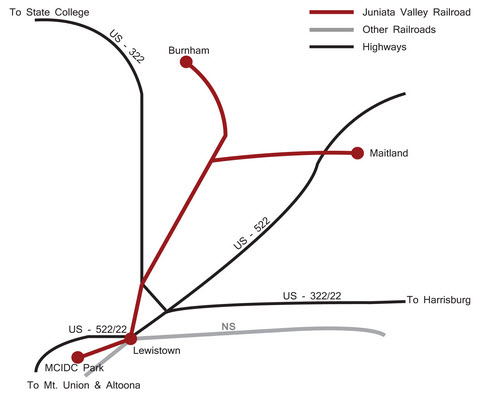
In General (all of these descriptions are from Wikipedia): The Juniata Valley RR (reporting mark JVRR) is part of the North Shore RR System, and operates 11 miles of track in Mifflin County PA.
The communities served include Lewistown (and the MCIDC industrial park), the unincorporated village of Maitland in Derry Township, and Burnham. All the track meets at Lewistown, with lines to the industrial park to the southwest, Maitland to the northeast (roughly parallel to U.S. Route 522), and Burnham to the northwest (roughly parallel to U.S. Route 322).
The system connects to and has trackage rights via the Norfolk Southern Railway in Lewistown.
History: The line operated by the Juniata Valley Railroad was a Penn Central Railroad line that was taken over by Conrail. SEDA-COG JRA (Susquehanna Economic Development Association - Council of Governments Joint Rail Authority) was formed in July, 1983 to continue to provide rail service to communities whose rail lines Conrail had decided to abandon. In 1996 the JRA took over the line when Conrail abandoned it, and the Juniata Valley Railroad was born as its fourth railroad.
The Lycoming Valley Railroad (reporting mark LVRR) is a short line that operates 38 miles (61 km) of track in Lycoming and Clinton counties in Pennsylvania in the United States. It is part of the North Shore Railroad System.
The line runs generally west between Muncy (in Lycoming County) and Avis (in Clinton County). Other communities served include Montoursville, Williamsport (and its western neighborhood of Newberry), the unincorporated village of Linden (in Woodward Township) and Jersey Shore (all in Lycoming County). 37 miles (60 km) of track are in Lycoming County and 1-mile (1.6 km) is in Clinton County.
The rail line runs north and then west along the left bank of the West Branch Susquehanna River, roughly following the routes of Interstate 180 and U.S. Route 220.
The corporate offices are located in Northumberland, Pennsylvania. There are connections to the Norfolk Southern Railway line at Muncy and Linden (as well as an indirect connection to Canadian Pacific Railway service).
The Lycoming County Visitors Bureau offers occasional train excursions, departing from Williamsport and going to either Jersey Shore or Muncy and returning. In the fall these are billed as " Fall Foliage Excursions" and in December there are Polar Express rides with Santa Claus.
The system has trackage rights via the Norfolk Southern line. These allow the Lycoming Valley Railroad to connect to the west with the Nittany and Bald Eagle Railroad (at Lock Haven) and, to the south, with the Union County Industrial Railroad (at Milton), the North Shore Railroad (at Northumberland), and Shamokin Valley Railroad (at Sunbury).
The line operated by the Lycoming Valley Railroad (Initials are LVRR) was formerly part of the Reading Company and New York Central Railroad, and was absorbed into Conrail. SEDA-COG JRA was formed in July 1983 to continue to provide rail service to communities whose rail lines Conrail had decided to abandon. In 1996 the JRA took over the line when Conrail abandoned it, and the Lycoming Valley Railroad was born as its fifth railroad.
Vast stands of timber and nearby coal deposits brought three early railroads to the Williamsport area. In December 1854, the Sunbury & Erie RR, a PRR predecessor, built northward through Williamport. The Catawissa, Williamsport & Erie RR, a Reading predecessor, ran its trains to Williamsport over Sunbury & Erie from 1854 until its own line was constructed 1871. The New York Central presence in the Valley dates from 1883, when its Pine Creek RR opened between Wellsboro and Newberry, to haul coal. All these routes were merged into Conrail in 1976.
Purchased by the SEDA-CoG Joint Rail Authority, they have been operated by the Lycoming Valley Railroad Company since August 15, 1996.
On September 8, 2011 the railroad bridge over Loyalsock Creek was heavily damaged by flooding. Heavy rain from the remnants of Tropical Storm Lee raised the creek "higher than anything we've seen in recorded history", according to a Lycoming County official. The damage to the bridge is likely severe enough that the bridge will not be usable. The Loyalsock Creek bridge is in the process of being rebuilt.
The Nittany and Bald Eagle Railroad (reporting mark NBER) is a short line railroad that operates 70 miles (110 km) of track in Blair, Centre, and Clinton counties in Pennsylvania in the United States.
The line runs generally northeast between Tyrone (in Blair County) and Lock Haven (in Clinton County). Other communities served include Port Matilda, Milesburg (both in Centre County), and Mill Hall (in Clinton County). There is a spur at Milesburg that runs southeast to Bellefonte, then splits, with a track going northeast to Pleasant Gap and another going southwest to Lemont and State College (all in Centre County). There are 5 miles (8.0 km) of track in Blair County, 60 miles (97 km) in Centre County, and 5 miles (8.0 km) in Clinton County.
The rail line follows Bald Eagle Creek northeast in Centre and Clinton counties, and runs roughly parallel to U.S. Route 220 between Tyrone and Milesburg, and parallel to Pennsylvania Route 150 between Milesburg and Lock Haven. The spur to Bellefonte follows Pennsylvania Route 144 and the line from Lemont to Pleasant Gap follows Pennsylvania Route 26.
There are connections to the Norfolk Southern Railway at both Tyrone and Lock Haven as well as an indirect connection to Canadian Pacific Railway.
The system has trackage rights via the Norfolk Southern line. These allow the Nittany and Bald Eagle Railroad to connect via Lock Haven to the east and south with the Lycoming Valley Railroad at Muncy and the village of Linden in Woodward Township, Lycoming County, the Union County Industrial Railroad at Milton, the North Shore Railroad at Northumberland, and the Shamokin Valley Railroad at Sunbury.
History: The line operated by the Nittany and Bald Eagle Railroad was formerly the Bald Eagle Valley Branch of the Pennsylvania Railroad Tyrone Division, later part of the Penn Central, and then Conrail. SEDA-COG JRA (Susquehanna Economic Development Association - Council of Governments Joint Rail Authority) was formed in July, 1983 to continue to provide rail service to communities whose rail lines Conrail had decided to abandon. In 1984 the JRA took over the line when Conrail abandoned it, and the Nittany and Bald Eagle Railroad was born (along with the North Shore Railroad). In 1989, more track was purchased, extending the Nittany and Bald Eagle line to Lock Haven. The name of the railroad comes from Mount Nittany in Centre County and Bald Eagle Creek.
The Bellefonte Historical Railroad (BHRR): The Bellefonte Historical Railroad is a tourist/excursion railroad that also uses the line operated by the Nittany and Bald Eagle Railroad. Because Norfolk Southern also uses the line increasingly for coal and other traffic, the Bellefonte Historical Railroad "is thought to be the only volunteer operation in the country that runs in conjunction with a Class I railroad". Unfortunately this also hampers their ability to operate on the main line at times, as Class I traffic has the right of way.
The Bellefonte Historical Railroad is non-operational at this time but hosts special excursion runs. Their website is http://www.bellefontetrain.org
The North Shore Railroad (reporting mark NSHR) is a short line railroad that operates 44 miles (71 km) of track in Northumberland, Montour, Columbia, and Luzerne counties in Pennsylvania in the United States. The line runs generally northeast between Northumberland (in Northumberland County) and the unincorporated village of Beach Haven in Salem Township (in Luzerne County).
Other communities served include Danville (in Montour County), Bloomsburg, and Berwick (both in Columbia County).
The rail line runs generally northeast along the north shore of the North Branch of the Susquehanna River, roughly following U.S. Route 11. There are 10 miles (16 km) of SEDA-COG Joint Rail Authority track in Northumberland County, 12 miles (19 km) in Montour County, and 15 in Columbia County. Beach Haven is just east of Berwick and the Columbia County - Luzerne County line.
The corporate offices are located in Northumberland, where there is a connection to the Norfolk Southern Railway line.
The system has trackage rights via the Norfolk Southern line. These allow the North Shore Railroad to connect to the south with the Shamokin Valley Railroad (at Sunbury), and to the north and west with the Union County Industrial Railroad (at Milton), the Lycoming Valley Railroad (at Muncy and at Linden) and the Nittany and Bald Eagle Railroad (at Lock Haven).
History: The North Shore Railroad's line first was built in 1852 as part of the Lackawanna and Bloomsburg Railroad. This was in turn acquired by the Delaware, Lackawanna and Western Railroad in 1873. The DL&W merged with the Erie Railroad in 1960, forming the Erie Lackawanna Railroad, and was absorbed into Conrail in 1976.
SEDA-COG JRA was formed in July, 1983 to continue to provide rail service to communities whose rail lines Conrail had decided to abandon. In 1984 the JRA took over the line along the north shore of the Susquehanna River from Northumberland to Beach Haven and renamed it the "North Shore Railroad".
The Shamokin Valley Railroad (reporting mark SVRR) is a short line railroad that operates 27 miles of track in southern Northumberland County, Pennsylvania in the United States. It is part of the North Shore Railroad System.
Communities served include the villages of Paxinos (in Shamokin Township) and Weigh Scales (in Ralpho Township), and the city of Shamokin. The rail line runs east from Sunbury, then turns south through Paxinos and Weigh Scales to Shamokin, where it turns east again, always along or near Shamokin Creek and roughly following the route of Pennsylvania Route 61. It interchanges with the Reading Blue Mountain and Northern Railroad in Locust Summit.
The corporate offices are located in Northumberland, Pennsylvania. There is a connection to the Norfolk Southern Railway at Sunbury.
The system has trackage rights via the Norfolk Southern line. These allow the Shamokin Valley Railroad to connect to the north and west with the North Shore Railroad (at Northumberland), the Union County Industrial Railroad (at Milton), the Lycoming Valley Railroad at Muncy and the village of Linden (in Woodward Township, Lycoming County, and to the Nittany and Bald Eagle Railroad at Lock Haven.
History: The line operated by the Shamokin Valley Railroad was formerly part of Conrail. SEDA-COG JRA (Susquehanna Economic Development Association - Council of Governments Joint Rail Authority) was formed in July, 1983 to continue to provide rail service to communities whose rail lines Conrail had decided to abandon. In 1989 the JRA took over the line when Conrail abandoned it, and the Shamokin Valley Railroad was born as its third railroad.
The Union County Industrial Railroad (reporting mark UCIR) is a short line railroad that operates on approximately 12 miles (20 km) of track in Union County in the U.S. State of Pennsylvania. It is part of the North Shore Railroad System.
The line is along the right bank of the West Branch Susquehanna River, roughly following U.S. Route 15 between the unincorporated village of Winfield in southern Union County and the village of New Columbia (in White Deer Township) in northern Union County. Other communities served by the UCIR include Lewisburg, the village of West Milton (in Kelly Township), and Milton (east across the West Branch Susquehanna River in Northumberland County).
Although the UCIR has no employees and owns none of the track on which it operates, its corporate offices are located in Northumberland PA. There is a connection to the Norfolk Southern Railway line at Milton.
Robey Railroads, a private company, operates the Union County Industrial Railroad. The Union County Industrial Railroad has no employees, instead they are provided by the North Shore Railroad. This led the Railroad Retirement Board to find that "the Union County Industrial Railroad is not an employer subject to the Railroad Retirement and Railroad Unemployment Insurance Acts."
The North Shore Railroad System has trackage rights via the Norfolk Southern line. These allow the Union County Industrial Railroad to connect to the north and west with the Lycoming Valley Railroad (at Muncy and Linden), the Nittany and Bald Eagle Railroad (at Lock Haven) and, to the south, with the North Shore Railroad (at Northumberland) and the Shamokin Valley Railroad (at Sunbury).
Union County rail lines: There are basically two rail lines in Union County (although they have five different owners as of 2006):
1) the former "Reading Williamsport Line" from Winfield to Allenwood (north-south along the river);
2) the former "Reading Catawissa Branch" from West Milton east to Milton (east-west crossing the river);
All of the lines in Union County passed into the possession of Conrail, and were eventually abandoned or sold by it or its successors. Although the UCIR has a contract to operate on these lines between Winfield and Allenwood, and West Milton and Milton, as of 2008, the line from New Columbia north to Allenwood is out of service on account of bad track.
The UCIR formerly operated the West Shore Railroad (reporting mark WTSE) from Lewisburg to Mifflinburg, but service ended in 1997 and the 11.8 miles (19.0 km) line was sold to become a rail trail in 2008.
As of 2006, ownership of the lines in Union County is as follows - The north-south former "Reading Williamsport Line" along the river is divided into four sections with three owners:
1) The "Lewisburg and Buffalo Creek Railroad" (LBCX) owns the track from Winfield north to West Milton. It is a non-operating railroad, although a tourist service operated on this track until the mid-1990s. As of 2006, this track is used by the UCIR for freight services.
2) The "West Shore Railroad Corporation" (WSRC) owns the track from Milton, through West Milton north to New Columbia, terminating just north of Interstate 80. This track is also used by the UCIR.
3) The "White Deer and Reading Railroad" (WDRR, owned by SEDA-COG JRA) owns the track from just north of Interstate 80 north to the village of White Deer (across the river fromWatsontown). The local NRHS chapter also runs short excursions over this track.
4) The "Union County Industrial Development Corporation" owns the out-of-service track north of Allenwood, (and perhaps further north to the county line).
Courtesy of the University of Texas Library, click here for their index page.
Disclaimers:
I love trains, and I love signals. I am not an expert. My webpages reflect what I find on the topic of the page. This is something I have fun with while
trying to help others.
Please Note: Since the main focus of my two websites is railroad signals, the railfan guides are oriented towards the signal fan being able to locate them.
For those of you into the modeling aspect of our hobby, my indexa page has a list of almost everything railroad oriented
I can think of to provide you with at least a few pictures to help you detail your pike.
If this is a railfan page, every effort has been made to make sure that the information contained on this map and in this railfan guide is correct. Once in a while,
an error may creep in :-)
My philosophy: Pictures and maps are worth a thousand words, especially for railfanning. Text descriptions only get you so far, especially if you get lost or
disoriented. Take along good maps.... a GPS is OK to get somewhere, but maps are still better if you get lost! I belong to AAA, which allows you to get
local maps for free when you visit the local branches. ADC puts out a nice series of county maps for the Washington DC area, but their state maps do not have the
railroads on them. If you can find em, I like the National Geographic map book of the U.S..... good, clear, and concise graphics, and they do a really good job
of showing you where tourist type attractions are, although they too lack the railroads. Other notes about specific areas will show up on that page if known.
Aerial shots were taken from either Google or Bing Maps as noted. Screen captures are made
with Snagit, a Techsmith product... a great tool if you have never used it!
By the way, floobydust is a term I picked up 30-40 years ago from a National Semiconductor data book, and means miscellaneous
and/or other stuff.
Pictures and additional information is always needed if anyone feels inclined to take 'em, send 'em, and share 'em, or if you have something to add or correct.... credit
is always given! Please be NICE!!! Contact info is here
Beware: If used as a source, ANYTHING from Wikipedia must be treated as being possibly being inaccurate, wrong, or not true.
RAILFAN GUIDES HOME
RAILROAD SIGNALS HOME
2016_0911n2
NEW
SEP13/2016, SEP14/2016, AUG12/2018, JUL18/2020
Last Modified
21-Jul-2020