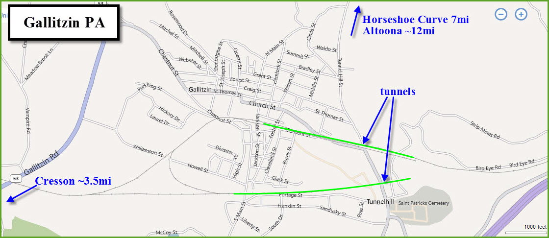
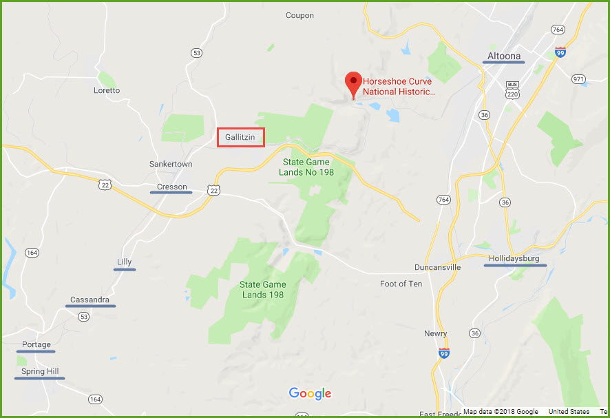
Along with the Horseshoe Curve and Altoona, Gallitzin and Cresson make this part of the country one of the biggest and best railfan spots in the U.S. to visit.
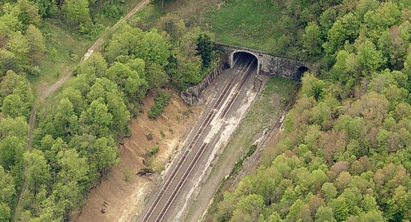
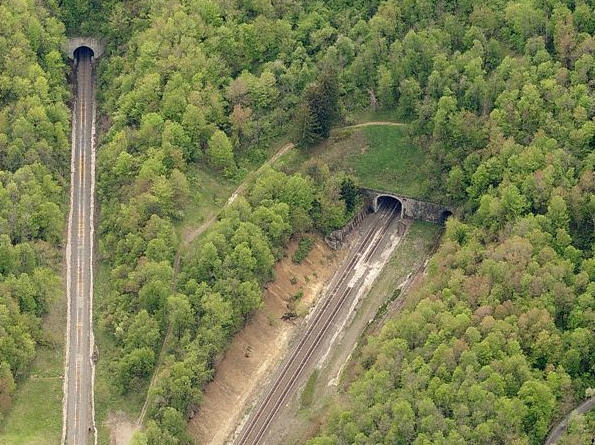
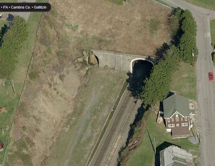
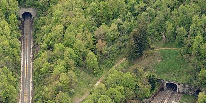
Gallitzin is home to the top end of three famous tunnels: the Gallitzin, the Allegheny, and
the New Portage.
The Allegheny and New Portage tunnels were completed in 1854, and the Gallitzin tunnel in 1904.
The Allegheny tunnel was expanded to two tracks in 1995, and at that time, the Gallitzin tunnel was taken out of service.
The New Portage tunnel is primarily for EB traffic, and the Allegheny tunnel, WB.
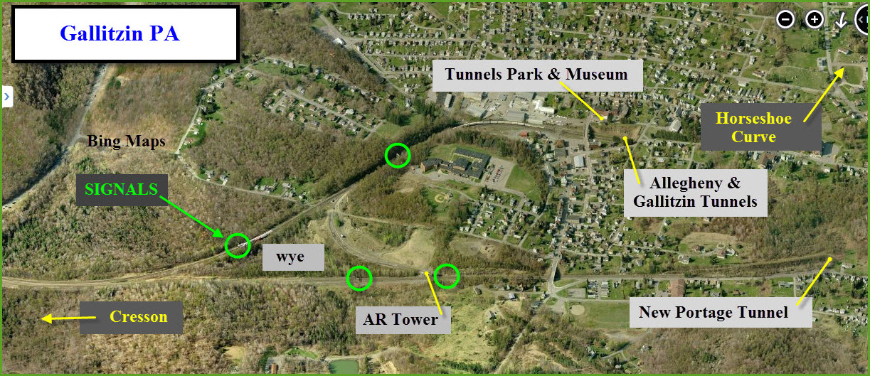
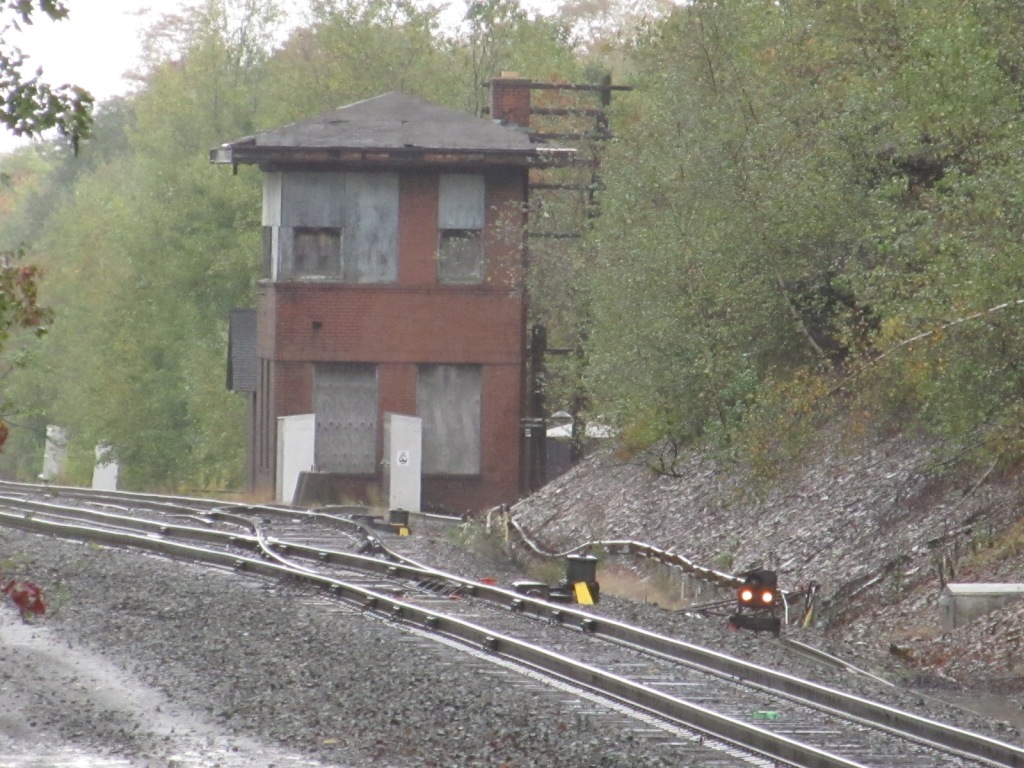
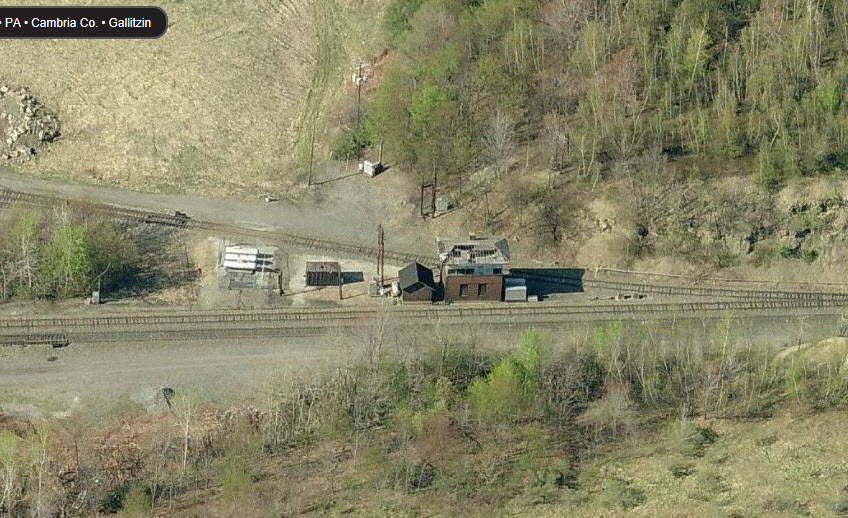
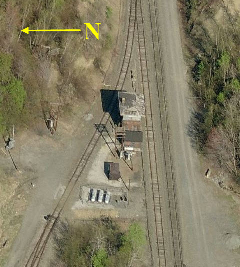
"On the other side of town" is the former Pennsy AR tower, and a wye for turning power (and sometimes trains) around.
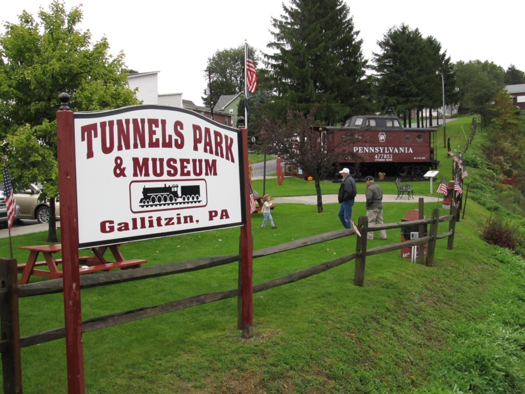
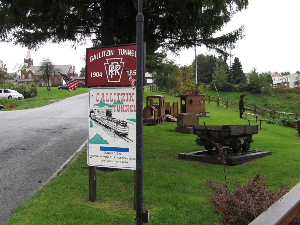
At the tunnels, there is a gift shop/museum and a park with a caboose in it, and he always seems to have a few unusual things for sale!
Acknowledgements:
Denver Todd
Websites and other additional information sources of interest for the area:
More info can be found at: http://www.gallitzin.info/
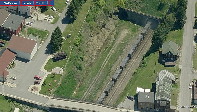
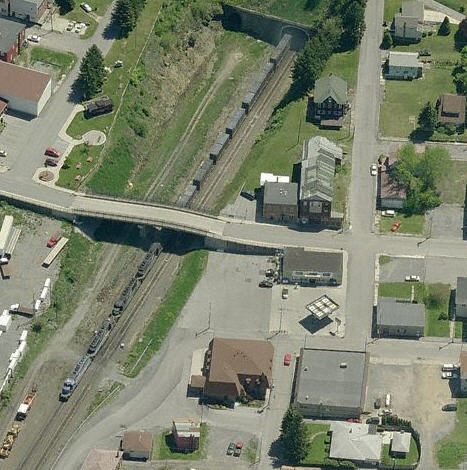
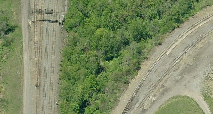
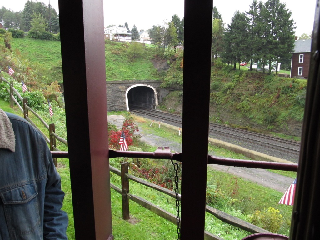
In the above set of photos, taken from the "bottom" of the tunnels, the New Portage Tunnel is on the left in
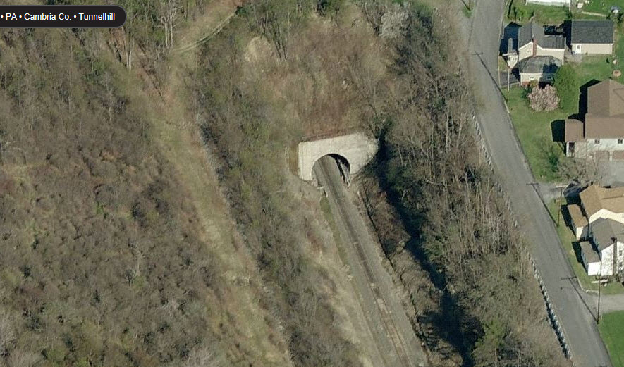
the left photo. The approach to the two tunnels is in the middle. Below is the where the access road to the lower tunnel portals comes off the
main road in Tunnel Hill.
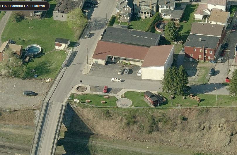
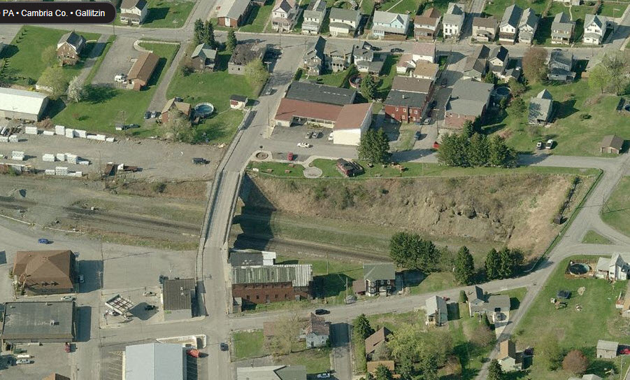
AR Tower
A more recent aerial shot from Bing Maps shows the roof is in a bad state of repair.... Also looks like they removed the signal
to the right of the tower when compared to the photo below. Aerial shots from Bing Maps around 2012 or thereabouts.
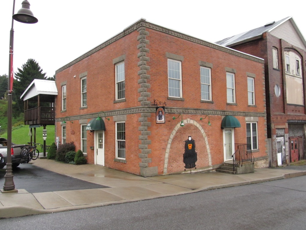
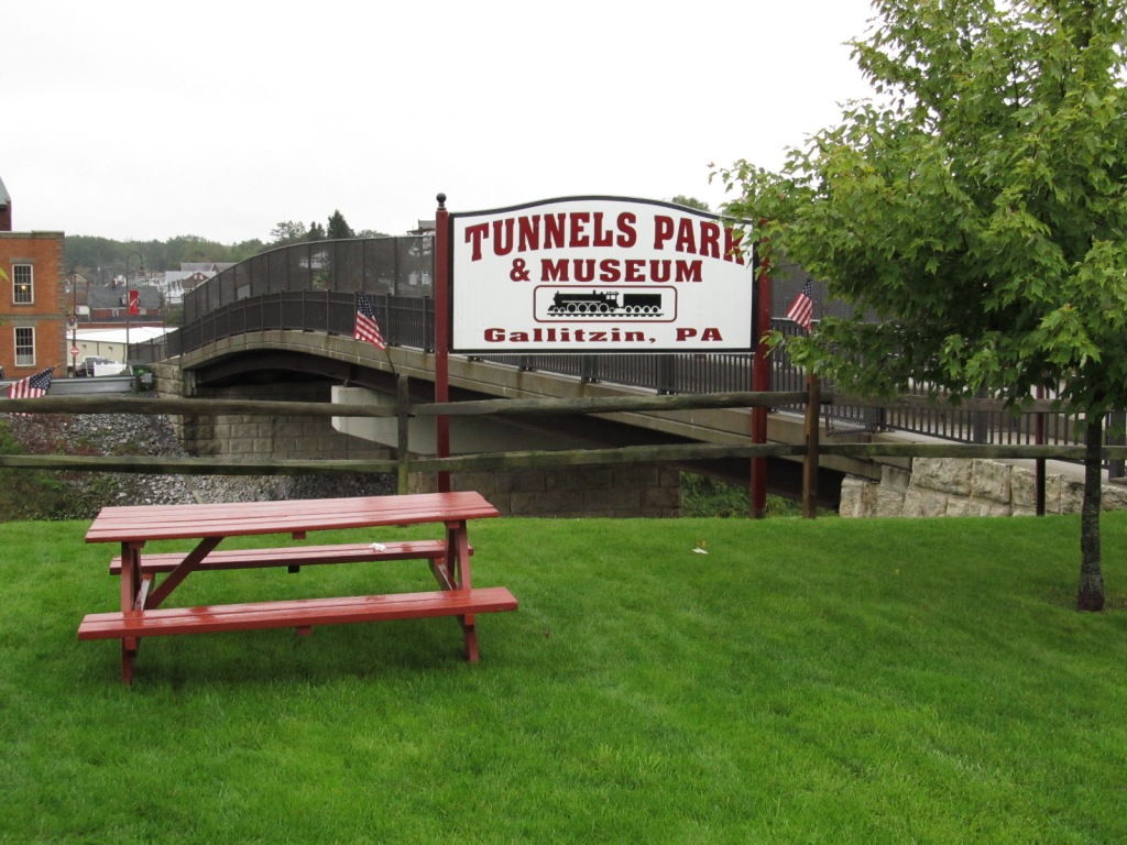
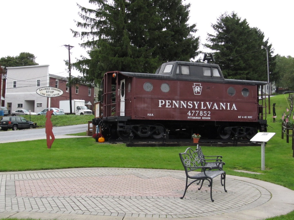
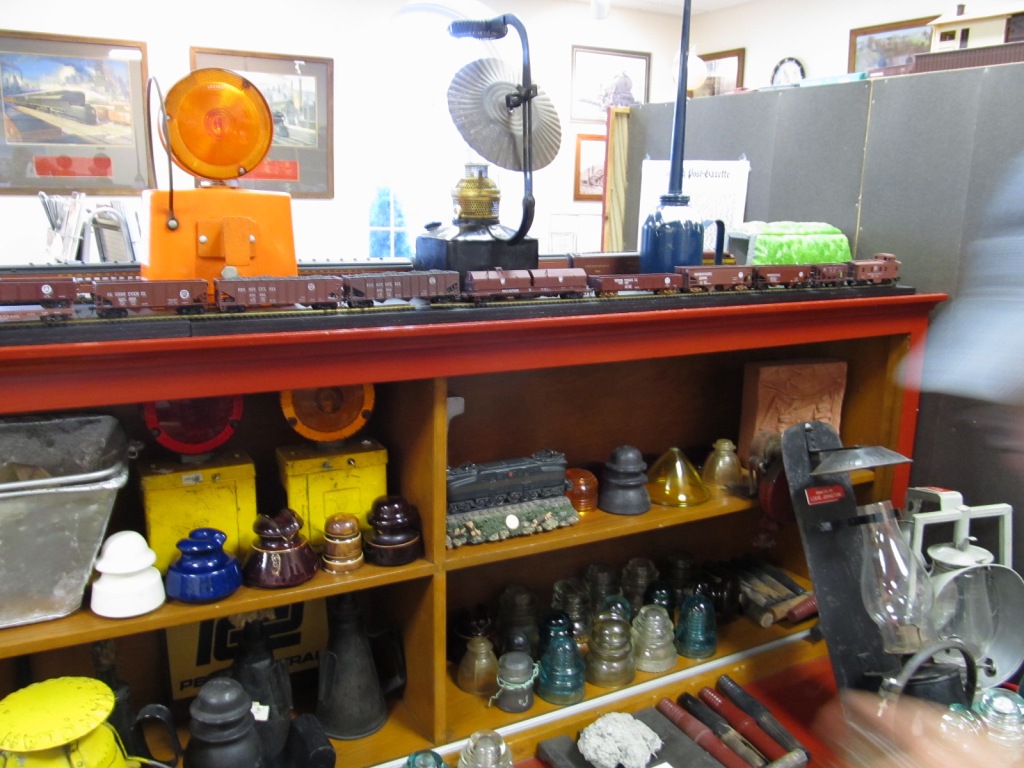
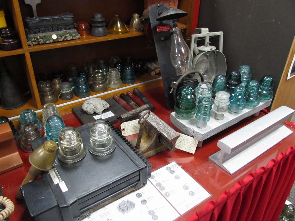
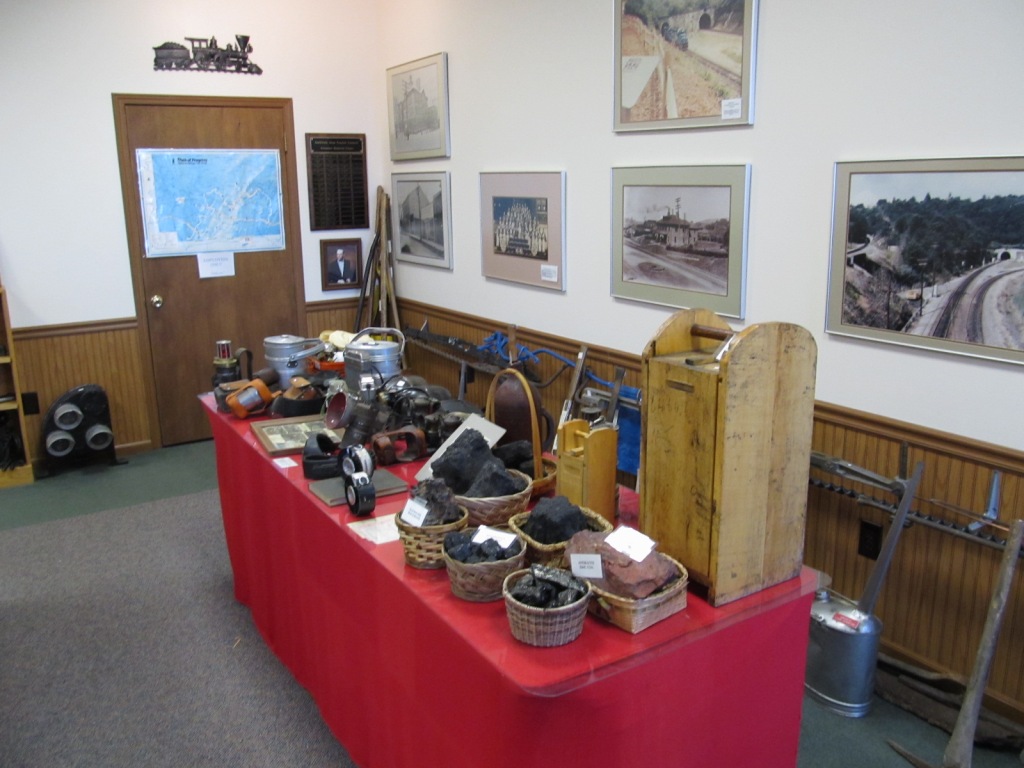
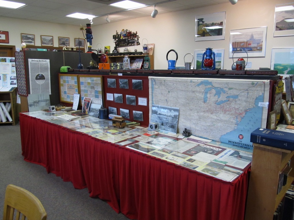
Gallitzin Tunnels Park & Museum
the Park
In the Museum
At the caboose
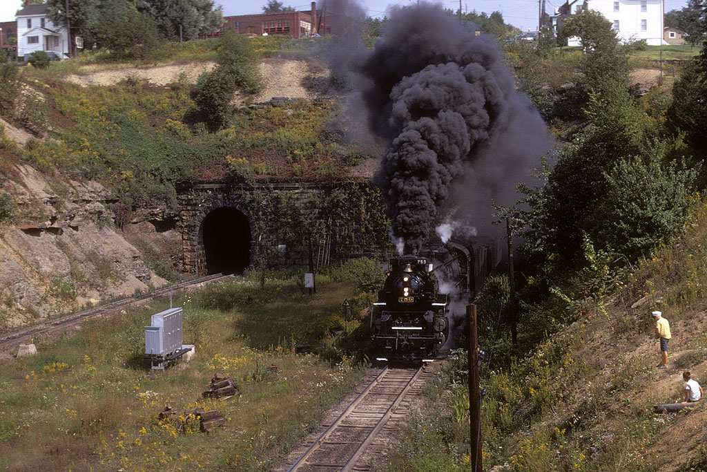
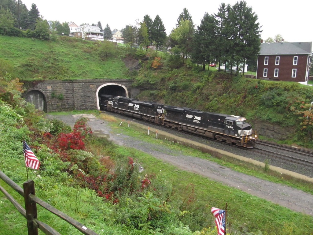
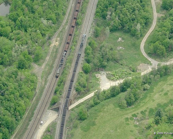
A picture of the freight coming out of the tunnels is at the top of the page
the Tunnel Inn - Bed & Breakfast
Back in the late 60's and into the 70's, NKP 759 ran excursions all over the place in Pennsylvania and Maryland. Harrisburg, Port Covington (Baltimore), and
Cumberland MD were all favorite starting places for the steam excursions. Here we see 759 emerging from the Allegheny Tunnel. The first time I caught
it was west of Meyersdale PA in May of 1969 coming back from Promontory UT - it was painted in AAR blue and yellow for the 100th anniversary of the completion of
the trans-continental railroad.
Disclaimers:
I love trains, and I love signals. I am not an expert. My webpages reflect what I find on the topic of the page. This is something I have fun with while
trying to help others.
Please Note: Since the main focus of my two websites is railroad signals, the railfan guides are oriented towards the signal fan being able to locate them.
For those of you into the modeling aspect of our hobby, my indexa page has a list of almost everything railroad oriented
I can think of to provide you with at least a few pictures to help you detail your pike.
If this is a railfan page, every effort has been made to make sure that the information contained on this map and in this railfan guide is correct. Once in a while,
an error may creep in :-)
My philosophy: Pictures and maps are worth a thousand words, especially for railfanning. Text descriptions only get you so far, especially if you get lost or
disoriented. Take along good maps.... a GPS is OK to get somewhere, but maps are still better if you get lost! I belong to AAA, which allows you to get
local maps for free when you visit the local branches. ADC puts out a nice series of county maps for the Washington DC area, but their state maps do not have the
railroads on them. If you can find em, I like the National Geographic map book of the U.S..... good, clear, and concise graphics, and they do a really good job
of showing you where tourist type attractions are, although they too lack the railroads. Other notes about specific areas will show up on that page if known.
Aerial shots were taken from either Google Maps or www.bing.com/maps as noted. Screen captures are made
with Snagit, a Techsmith product... a great tool if you have never used it!
By the way, floobydust is a term I picked up 30-40 years ago from a National Semiconductor data book, and means miscellaneous
and/or other stuff.
Pictures and additional information is always needed if anyone feels inclined to take 'em, send 'em, and share 'em, or if you have something to add or correct.... credit
is always given! Please be NICE!!! Contact info is here
Beware: If used as a source, ANYTHING from Wikipedia must be treated as being possibly being inaccurate, wrong, or not true.


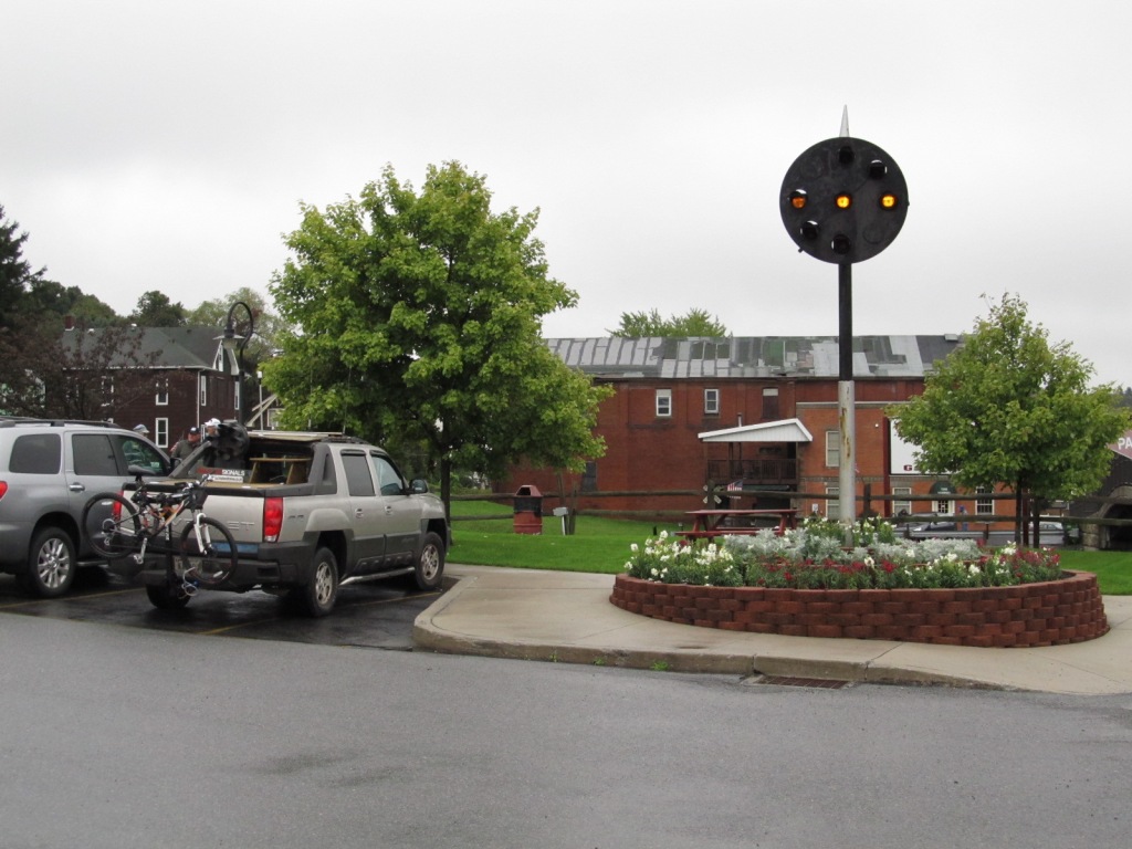
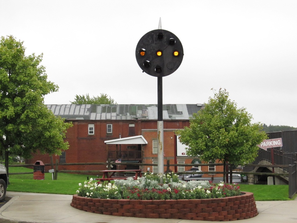
 the Park
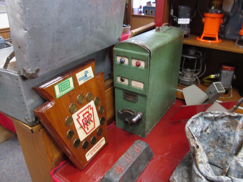
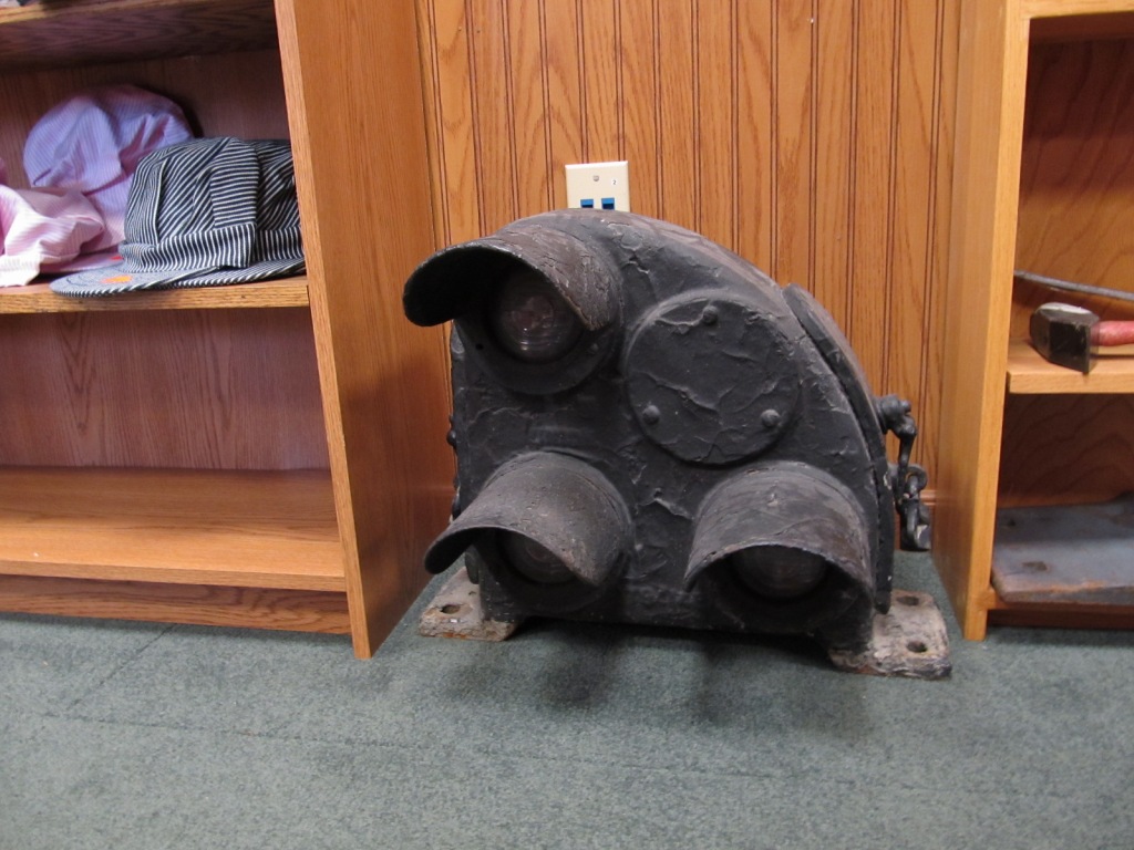
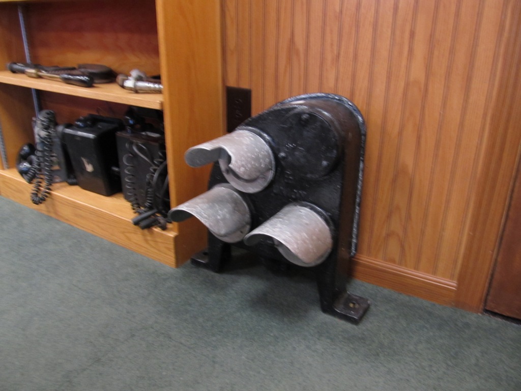
 In the Museum
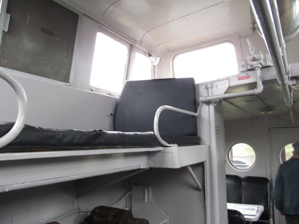
 At the caboose
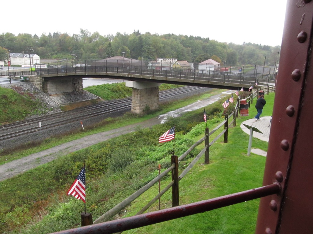
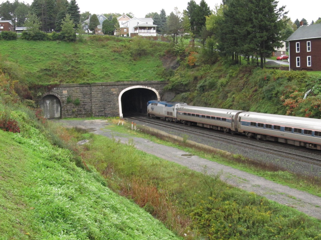
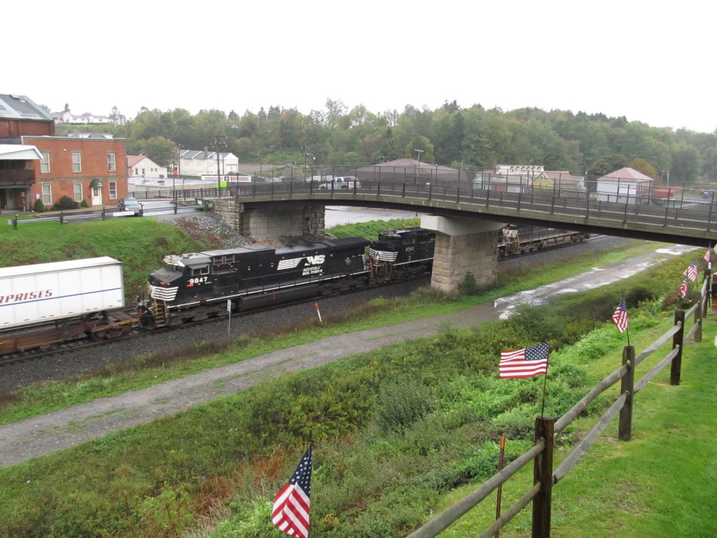 A picture of the freight coming out of the tunnels is at the top of the page