Data:
GPS Coordinates: as needed
Phone A/C: 503
ZIP: n/a
Access by train/transit:
MAX Light Rail
Amtrak (in downtown Portland)
Portland Streetcar
The Scoop:
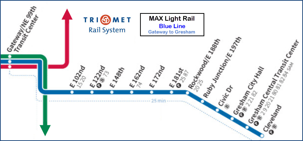
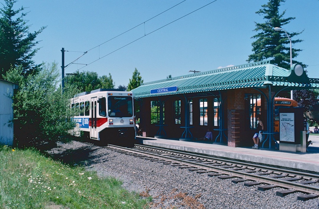
This is the original line of Portland's light rail system, opening in 1998.
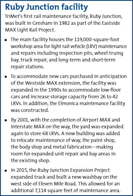
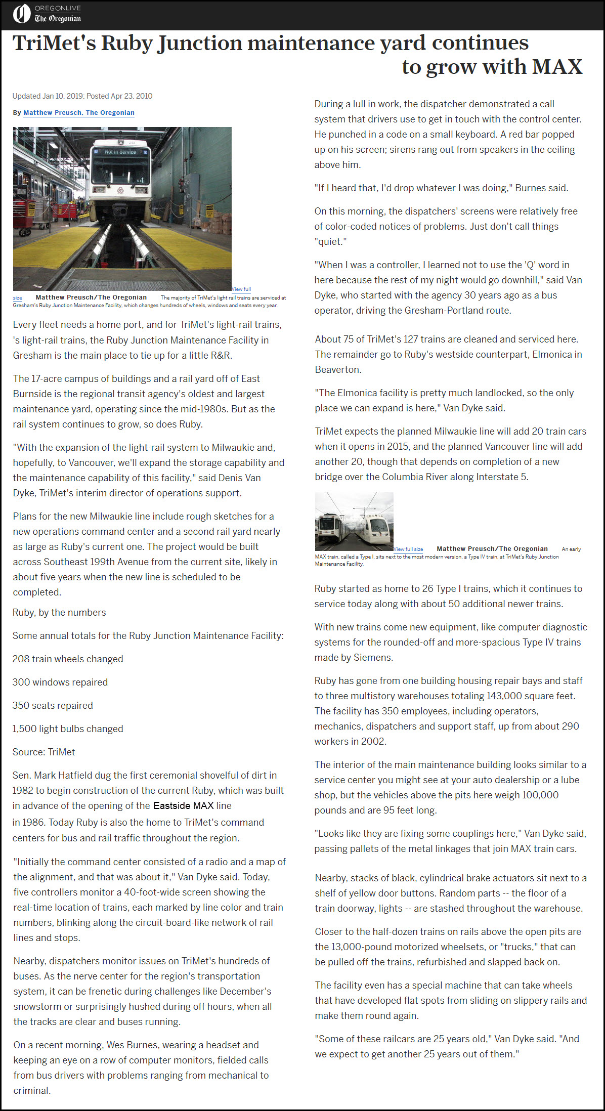
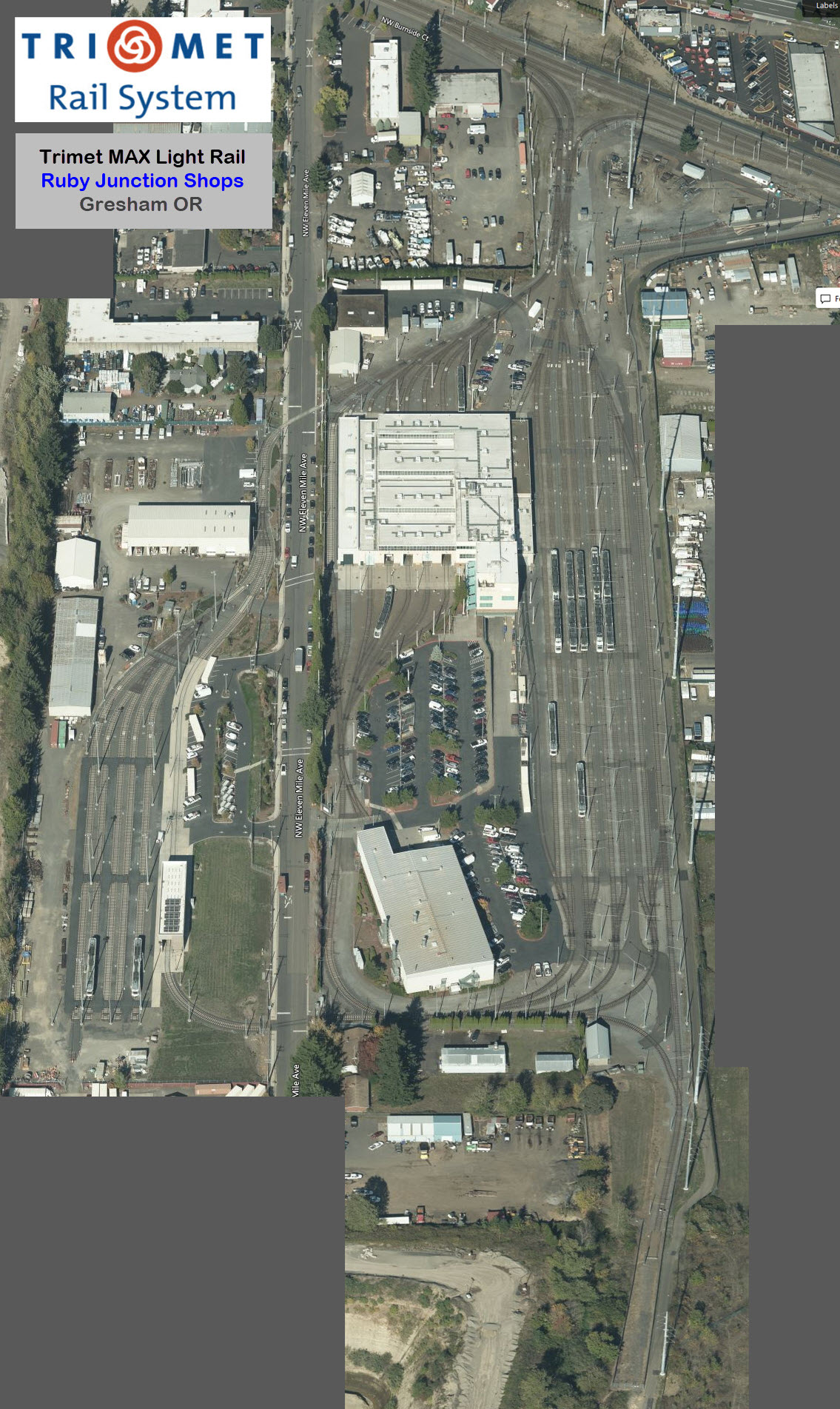
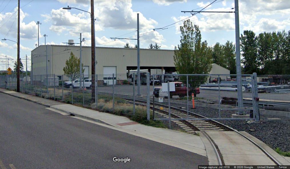
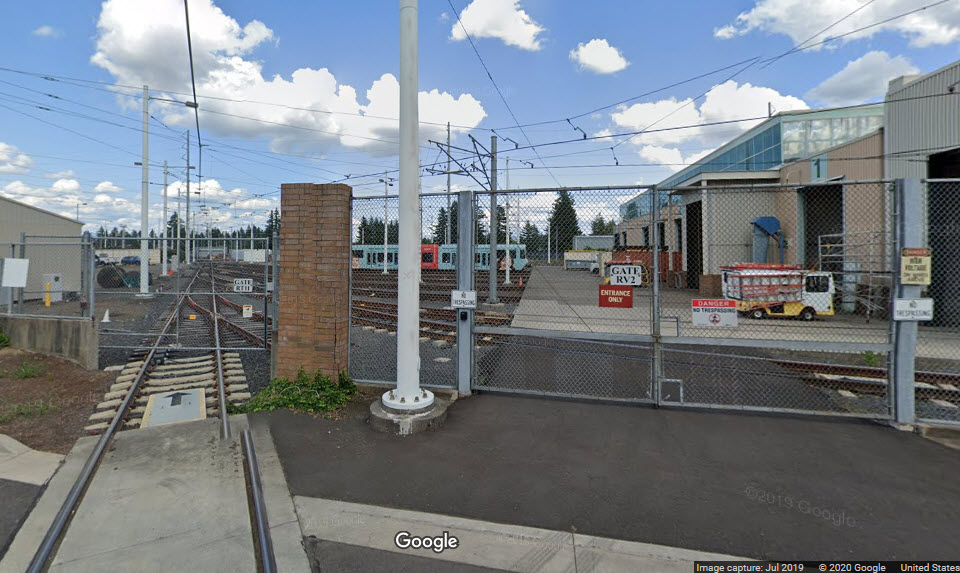
One of the system's two shops/maintenance facilities is located towards the end
of the line in Gresham, the Ruby Junction Shops - it serves all of the lines.
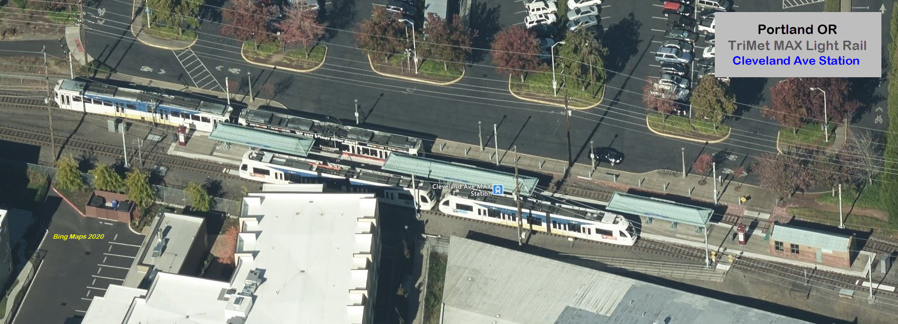
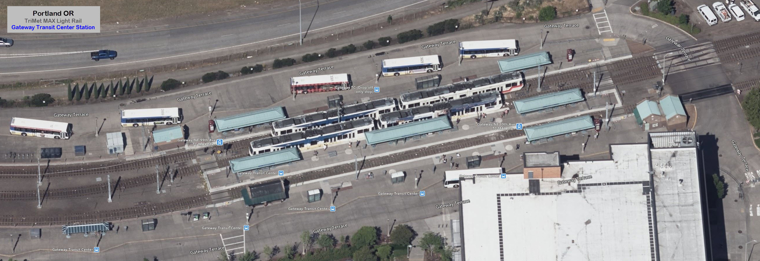
We will start at the Gateway station, working our way east to the end of the
line in Cleveland.
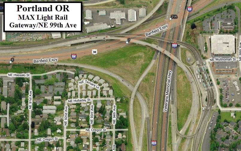
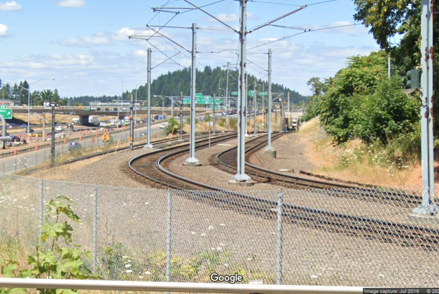
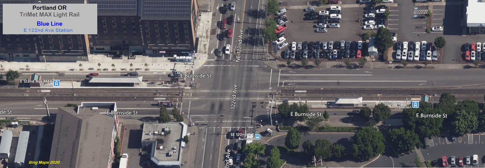
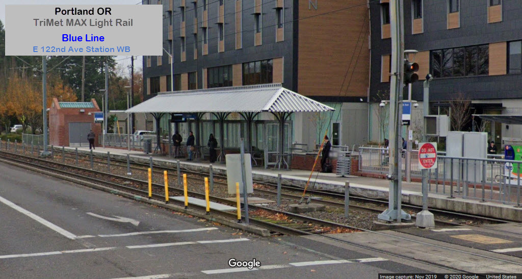
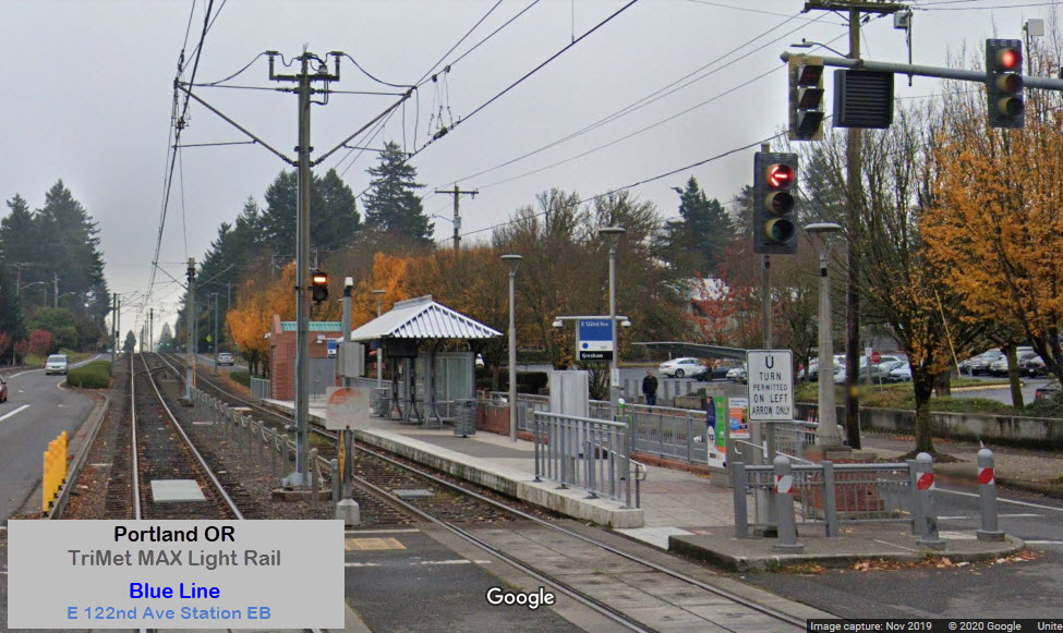
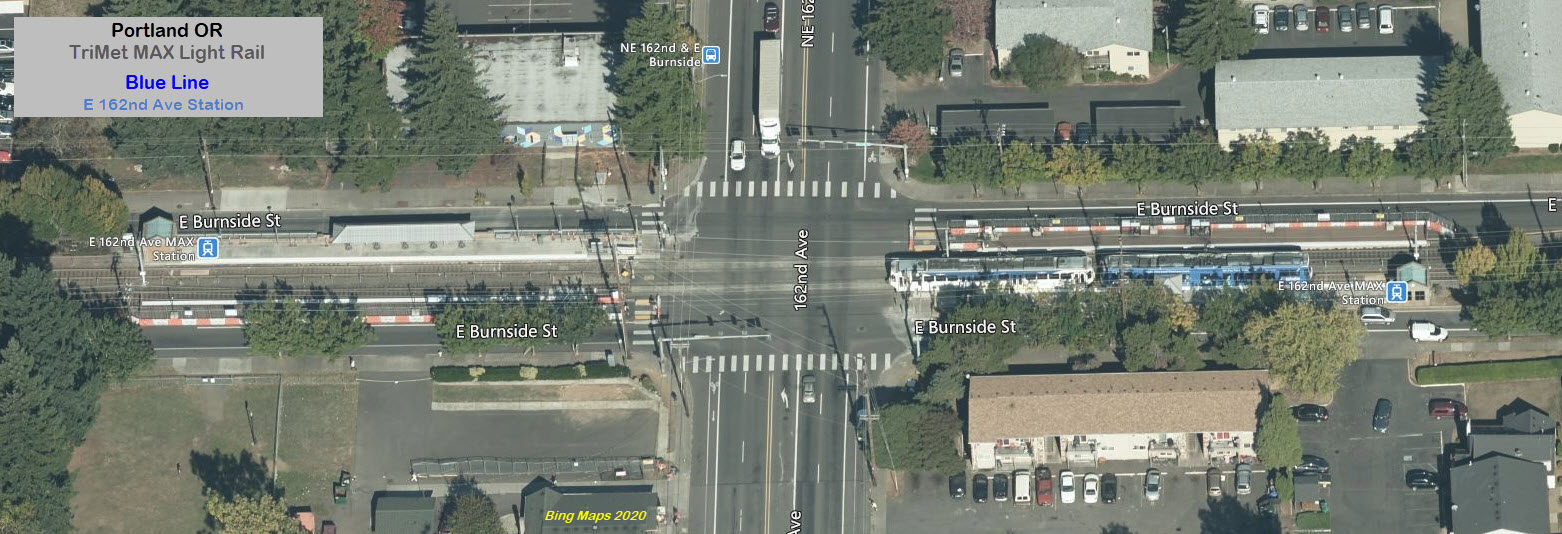
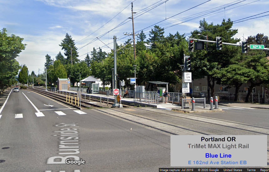
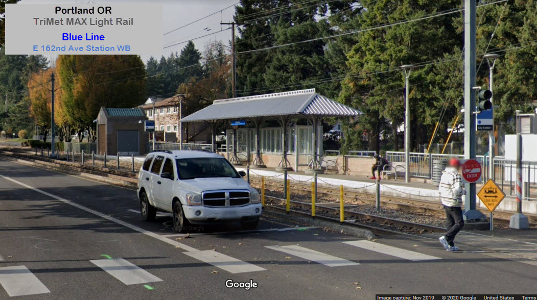
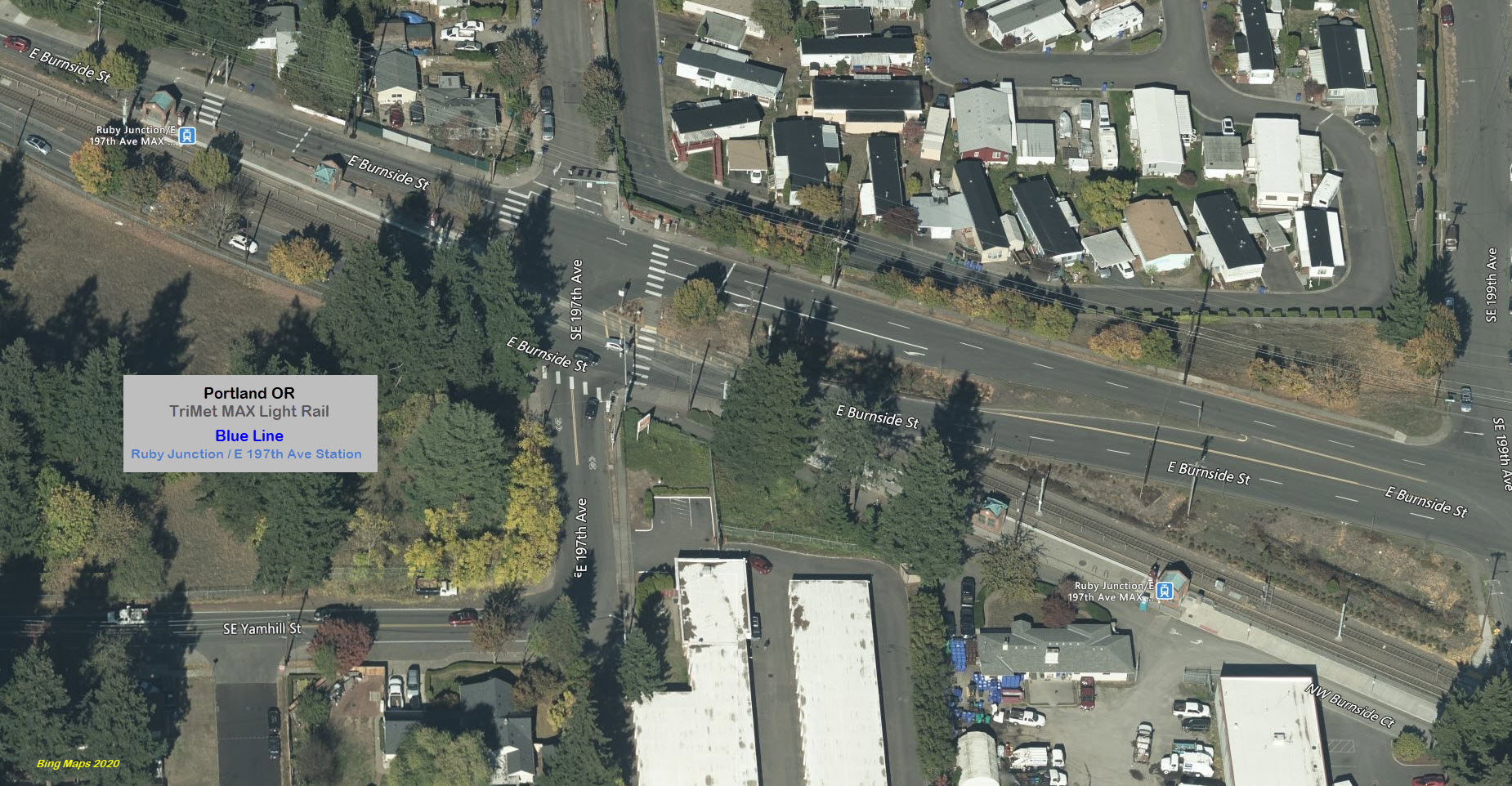
The tracks come out of the Gateway station on the east side of the 205, and then
make a turn onto East Burnside Street, and heads east towards Gresham.
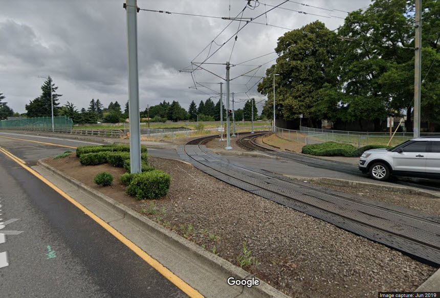
This happens at NE 97th Avenue. At Glisan, the next major east-west street
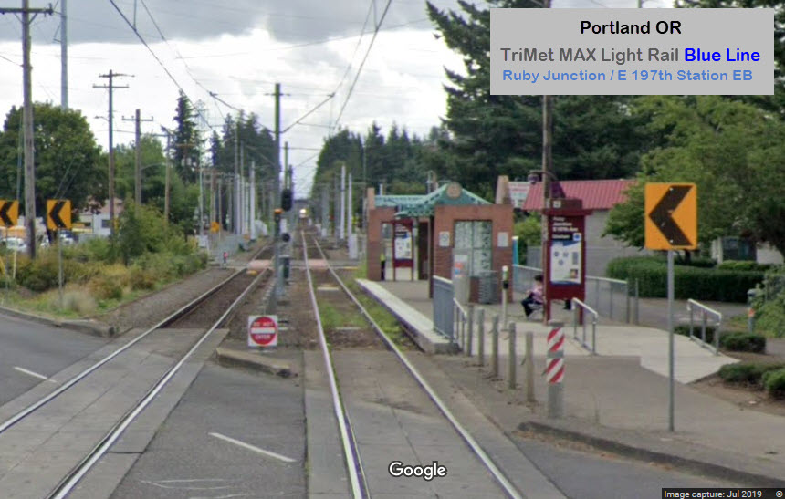
north of Burnside, the tracks go under the road. "Street running" ends at
the Ruby Junction station, in between the two platforms. It is a run of
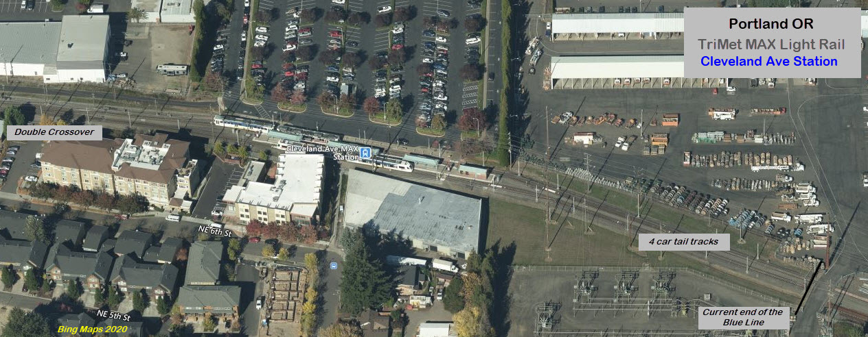
about 5.14 miles. From there to the end of the line, the light rail runs
on private R-O-W. The picture below shows how you can still see, from the
air, where the railroad tracks used to run.
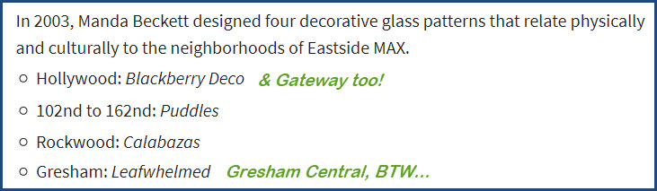
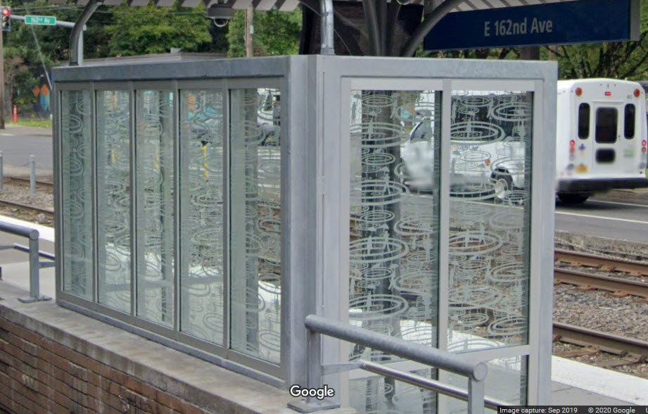
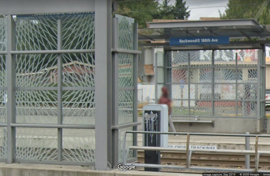
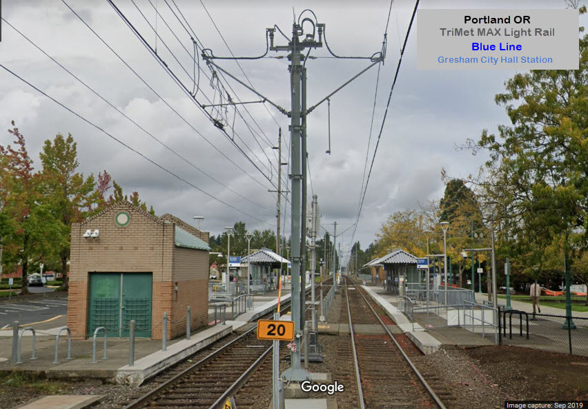
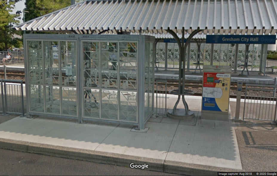
Starting in 2003, TriMet established an "art" program. There are two major
works, at the Rockwood/188th and Civic Drive stations. Many of the other
stations have shelter windscreens with designs by Manda Beckett. Be
forewarned that the "blue line east public art" page below is full of
inaccuracy's and poor grammar - way worse than mine! :-).
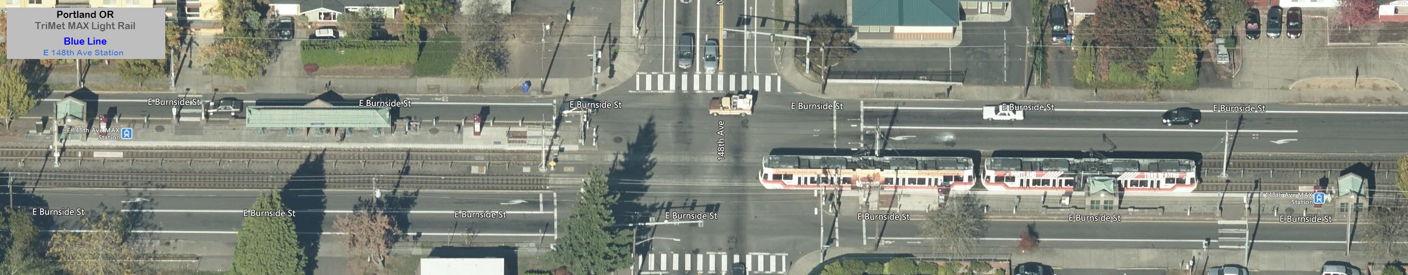
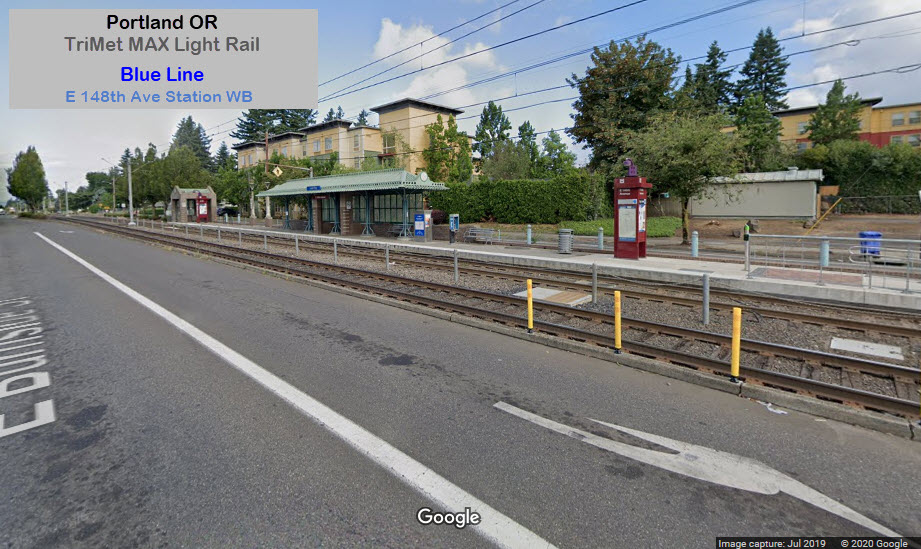
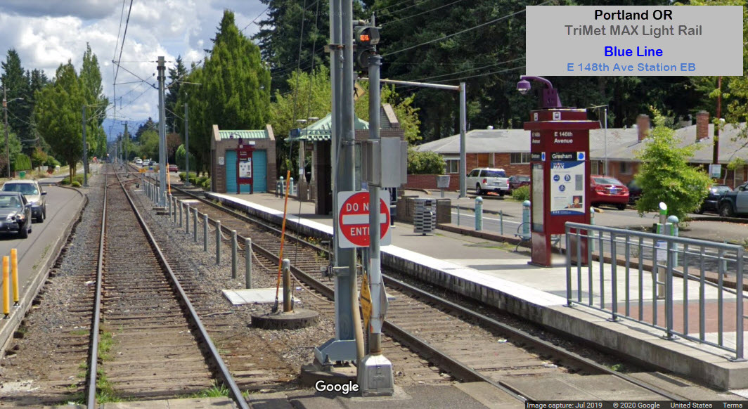
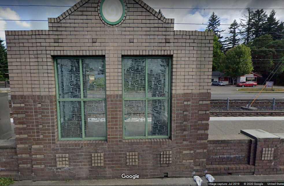
The "puddles" shelter windscreen artwork at 148th Ave - they did a really
nice job with the design of the shelter itself, which probably few appreciate:
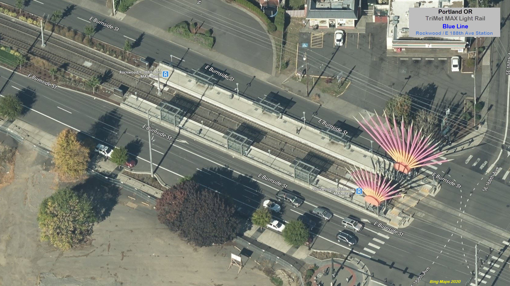
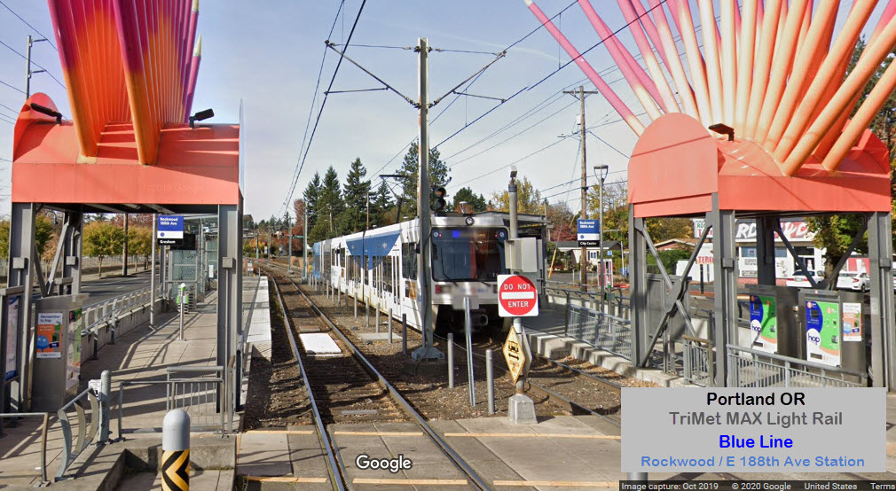
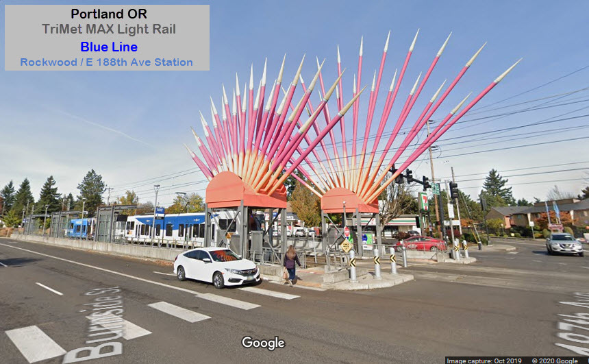
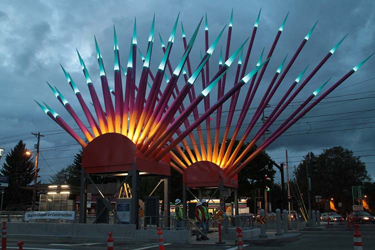
The Rockwood station has one of the more colorful and cool looking pieces of art seen anywhere
at a light rail station. Artist Dan Corson designed Rockwood Sunrise in 2011, to be a
vibrant gateway for the multi-cultural Rockwood neighborhood. Tall,
brightly painted steel rays constitute a highly visible landmark for the station and a
beacon of civic pride for the community. Imagery was inspired by the Ferris wheel --
once an annual feature in Rockwood, the bold colors of the Hispanic culture, and the
universal symbolism of the sunrise. Translucent tips of the rays illuminate as the
trains arrive and depart the station. The sunrise image also appears in the shelter
glass pattern designed by Corso (this is wrong in Trimet's PDF brochure,
because on the second page of the brochure, it tells you that the shelter glass
was designed by Manda Beckett, another error besides using improper grammar).
A little more than a car length away from the station is a colorful park.
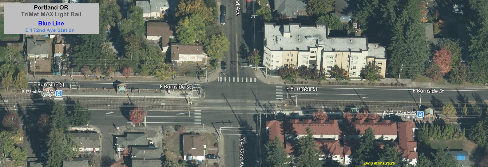
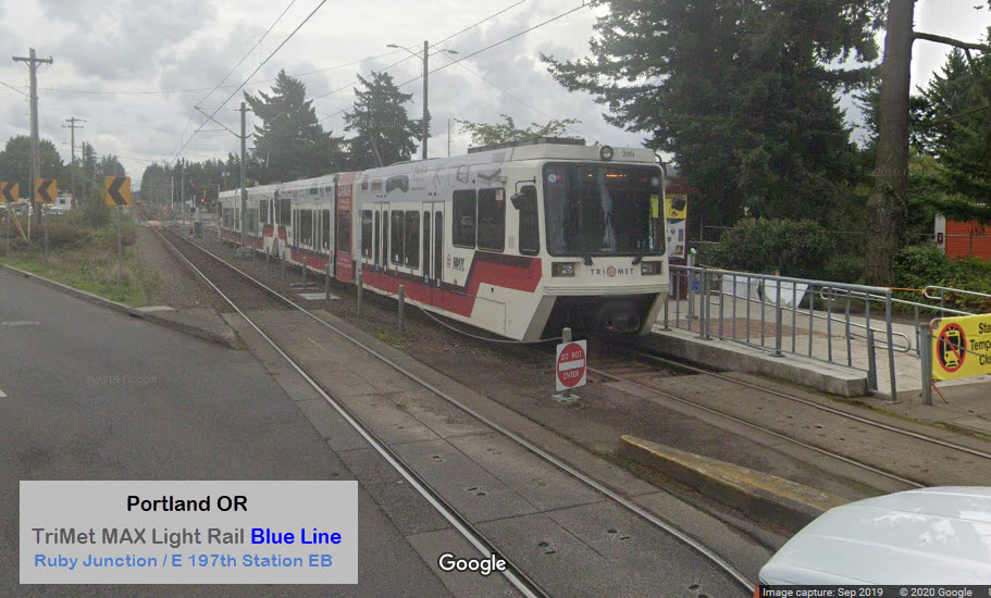
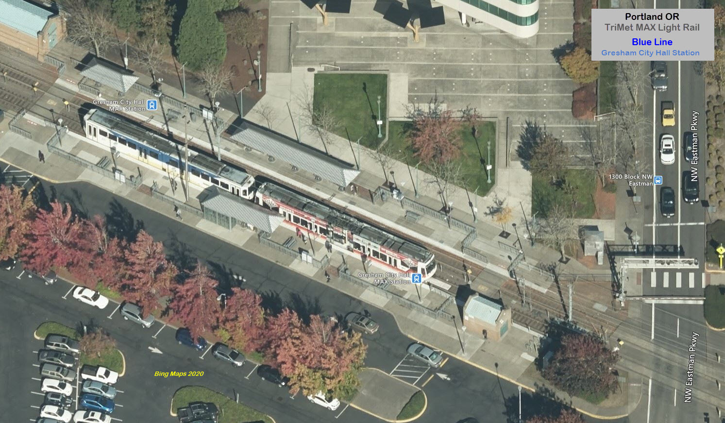
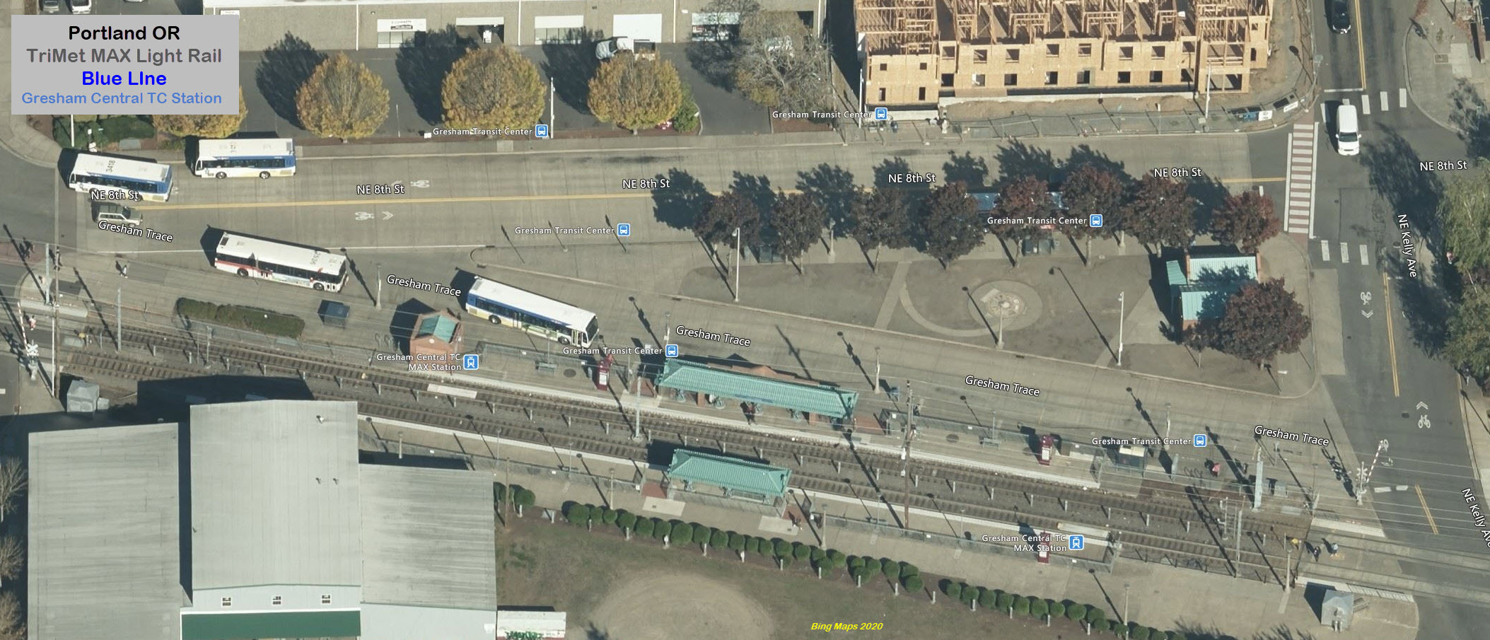
From Wikipedia: The Ruby Junction station serves the Ruby Junction Maintenance and Operations Facility -- often
the point where MAX operators switch shifts or trains returning to the yards terminate,
according to their rollsigns. Construction of this facility, which was the first
construction on TriMet's MAX system, began in March 1982, and the facility opened in
mid 1983. It has been expanded several times since then.
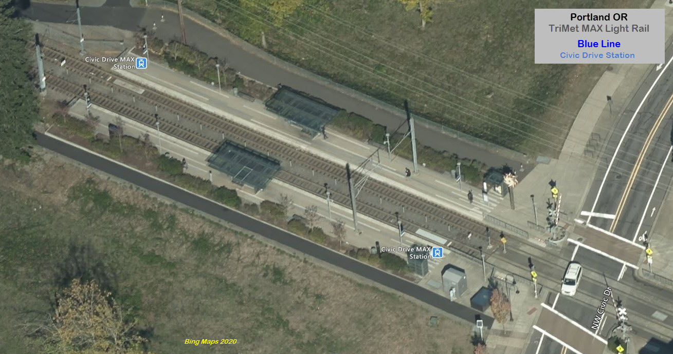
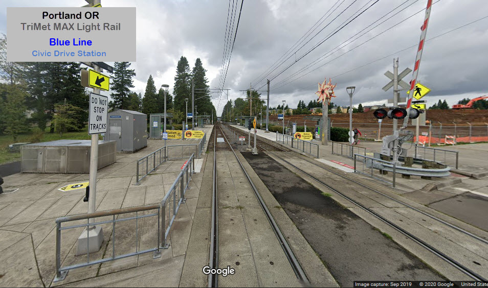
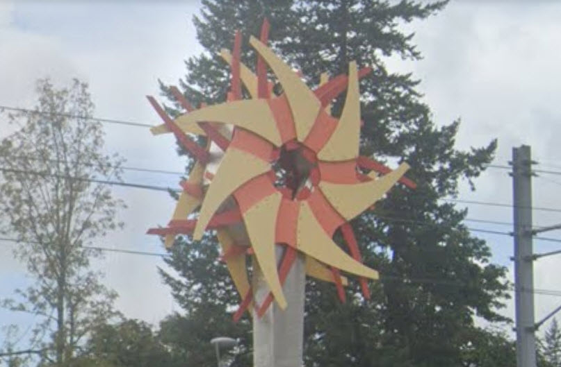
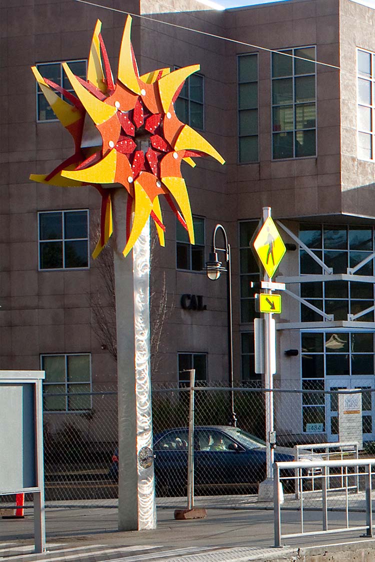
The Civic Drive station is one of two that has a noticeable artwork for riders
to enjoy. In 2010, Pete Beeman designed the Civic Drive Iris, a
colorful, kinetic sculpture that functions as a landmark for the station. The
tall, brightly colored sculpture evokes a blossoming flower or radiating sun. A
hand crank invites pedestrians to interact with the sculpture. Turning a crank
causes the sculpture top to illuminate and simultaneously expand and contract
like an iris valve.
I love trains, and I love signals. I am not an expert. My webpages reflect what I find on the topic of the page. This is something I have fun with while
trying to help others.
Please Note: Since the main focus of my two websites is railroad signals, the railfan guides are oriented towards the signal fan being able to locate them.
For those of you into the modeling aspect of our hobby, my
indexa page has a list of almost everything railroad oriented
I can think of to provide you with at least a few pictures to help you detail your pike.
If this is a railfan page, every effort has been made to make sure that the information contained on this map and in this railfan guide is correct. Once in a while,
an error may creep in :-)
My philosophy: Pictures and maps are worth a thousand words, especially for railfanning. Text descriptions only get you so far, especially if you get lost or
disoriented. Take along good maps.... a GPS is OK to get somewhere, but maps are still better if you get lost! I belong to AAA, which allows you to get
local maps for free when you visit the local branches. ADC puts out a nice series of county maps for the Washington DC area, but their state maps do not have the
railroads on them. If you can find em, I like the National Geographic map book of the U.S..... good, clear, and concise graphics, and they do a really good job
of showing you where tourist type attractions are, although they too lack the railroads. Other notes about specific areas will show up on that page if known.
Aerial shots were taken from either Google or Bing Maps as noted. Screen captures are made
with Snagit, a Techsmith product... a great tool if you have never used it!
By the way, floobydust is a term I picked up 30-40 years ago from a National Semiconductor data book, and means miscellaneous
and/or other stuff.
Pictures and additional information is always needed if anyone feels inclined to take 'em, send 'em, and share 'em, or if you have something to add or correct.... credit
is always given! Please be NICE!!! Contact info is here
Beware: If used as a source, ANYTHING from Wikipedia must be treated as being possibly inaccurate, wrong, or not true.
 Steve Morgan photo, 2011
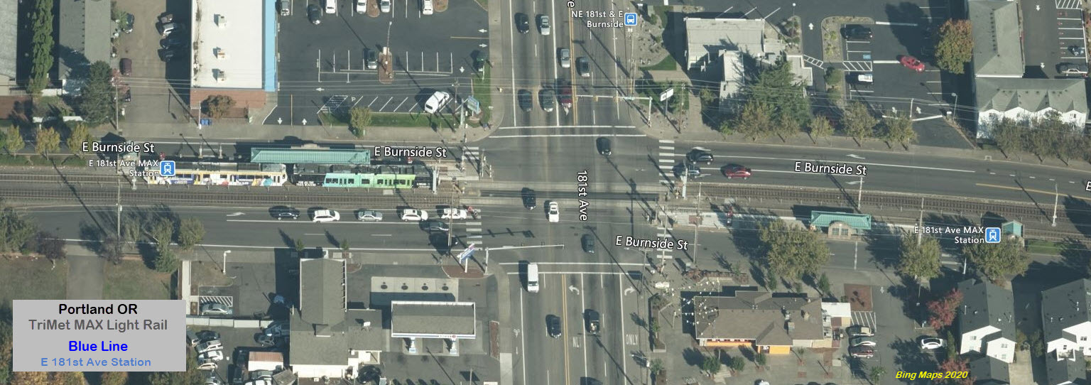

 the shelter glass
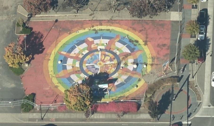

 Steve Morgan