GPS Coordinates: 45.530592, -122.563583
https://en.wikipedia.org/wiki/Gateway/Northeast_99th_Avenue_Transit_Center
You WILL get bored reading about this station, it appears on 4 or 5 pages :-).
Gateway station marks another division point in the system. The Blue and Green
lines continue south from here, but the Red line loops around, deals with a
pretty good grade to loop back under itself and then head north along I-205 on
it's way to the Portland Airport.
photo by Pi.1415926535, 2018, via Wikipedia
This is the Red Line loop coming south out of the Gateway station and then crossing the NB 205
exit ramps, so the line can head north to the airport. The LRV off to
the right is a Blue or Green Line train.
Into the Middle
About 4,000 feet north of Gateway, or 1.08 miles by way of the track, the
Red Line goes under the northbound side I-205 to run up the middle of the interstate.
The line is in the middle of I-205 for about a 1.89 mile run (by using Google
Maps to measure).
Parkrose / Sumner TC Station
GPS Coordinates: 45.559056, -122.565586
https://en.wikipedia.org/wiki/Parkrose/Sumner_Transit_Center
There is a Quailty Inn, Econolodge, and Rodeway Inn adjacent to the station, as
well as a number of places to eat. You're about 2-1/2 air miles from the
airport, and 3-1/2 by road.
Cascades Station
GPS Coordinates: 45.572237, -122.558014
https://en.wikipedia.org/wiki/Cascades_station
You have a Hyatt and another hotel close to this station, and at least 5
restaurants including Chipotle and Famous Dave's.
photo by M.O. Stevens via Wikipedia, 2011
Mt Hood Station
GPS Coordinates: 45.577121, -122.567171
https://en.wikipedia.org/wiki/Mount_Hood_Avenue_station
The station is actually about 40 miles from Mt Hood! A Residence Inn,
Target, the FBI, and an Embassy Suites is near this station.
I love trains, and I love signals. I am not an expert. My webpages reflect what I find on the topic of the page. This is something I have fun with while
trying to help others.
Please Note: Since the main focus of my two websites is railroad signals, the railfan guides are oriented towards the signal fan being able to locate them.
For those of you into the modeling aspect of our hobby, my
indexa page has a list of almost everything railroad oriented
I can think of to provide you with at least a few pictures to help you detail your pike.
If this is a railfan page, every effort has been made to make sure that the information contained on this map and in this railfan guide is correct. Once in a while,
an error may creep in :-)
My philosophy: Pictures and maps are worth a thousand words, especially for railfanning. Text descriptions only get you so far, especially if you get lost or
disoriented. Take along good maps.... a GPS is OK to get somewhere, but maps are still better if you get lost! I belong to AAA, which allows you to get
local maps for free when you visit the local branches. ADC puts out a nice series of county maps for the Washington DC area, but their state maps do not have the
railroads on them. If you can find em, I like the National Geographic map book of the U.S..... good, clear, and concise graphics, and they do a really good job
of showing you where tourist type attractions are, although they too lack the railroads. Other notes about specific areas will show up on that page if known.
Aerial shots were taken from either Google or Bing Maps as noted. Screen captures are made
with Snagit, a Techsmith product... a great tool if you have never used it!
By the way, floobydust is a term I picked up 30-40 years ago from a National Semiconductor data book, and means miscellaneous
and/or other stuff.
Pictures and additional information is always needed if anyone feels inclined to take 'em, send 'em, and share 'em, or if you have something to add or correct.... credit
is always given! Please be NICE!!! Contact info is here
Beware: If used as a source, ANYTHING from Wikipedia must be treated as being possibly inaccurate, wrong, or not true.
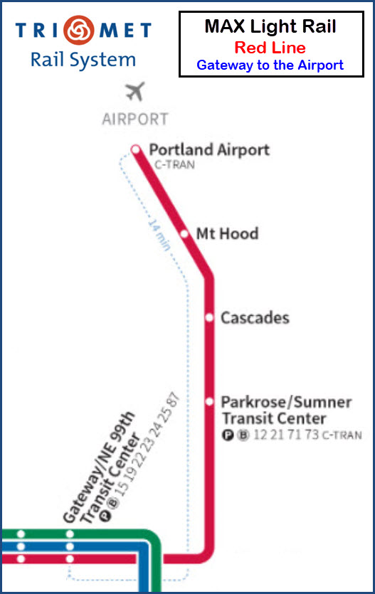
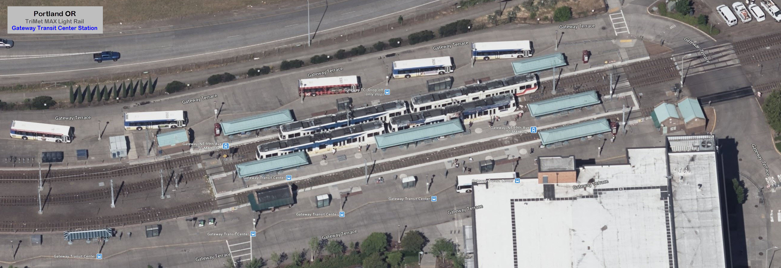
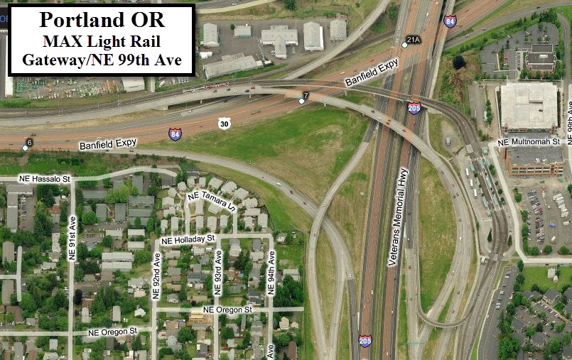
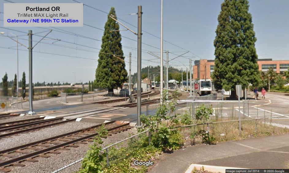
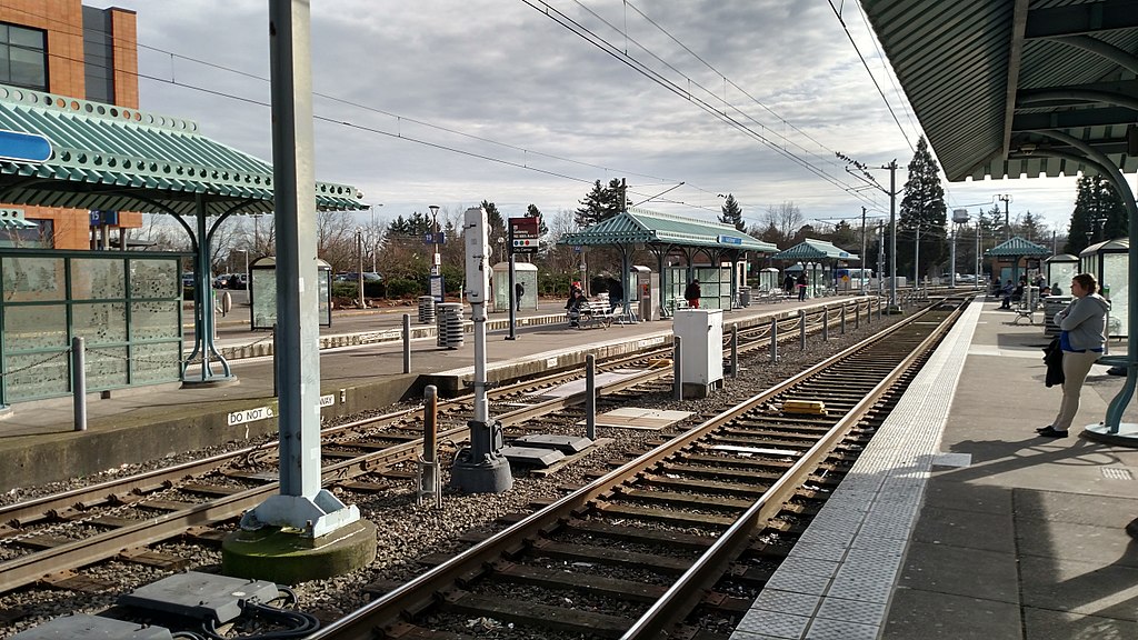 photo by Pi.1415926535, 2018, via Wikipedia
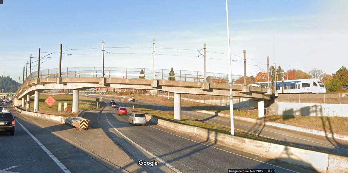
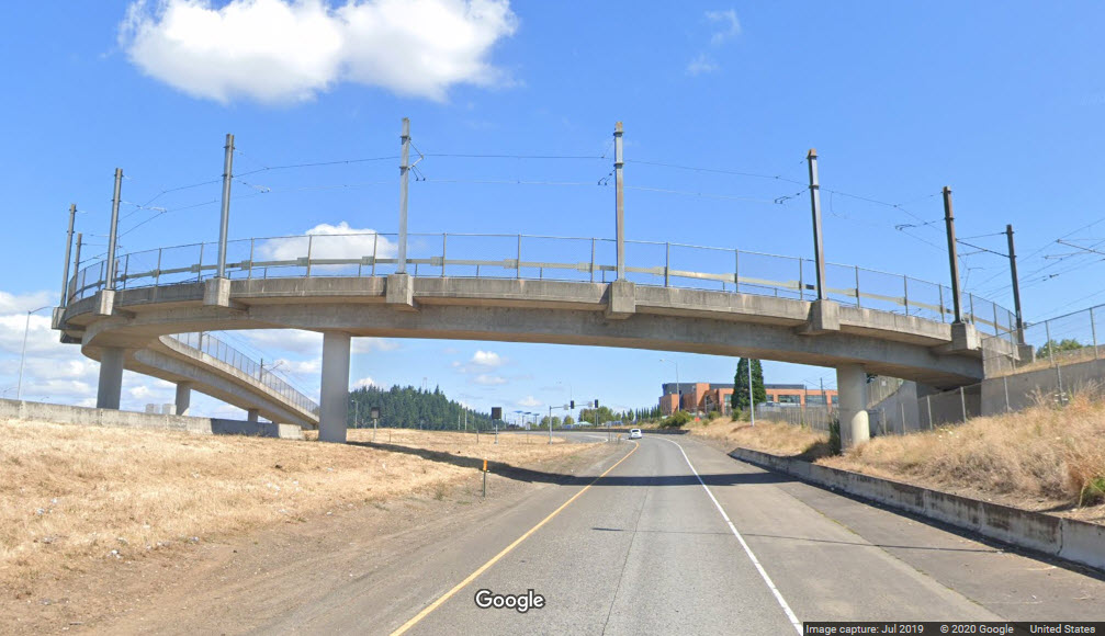
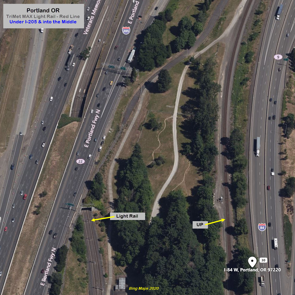
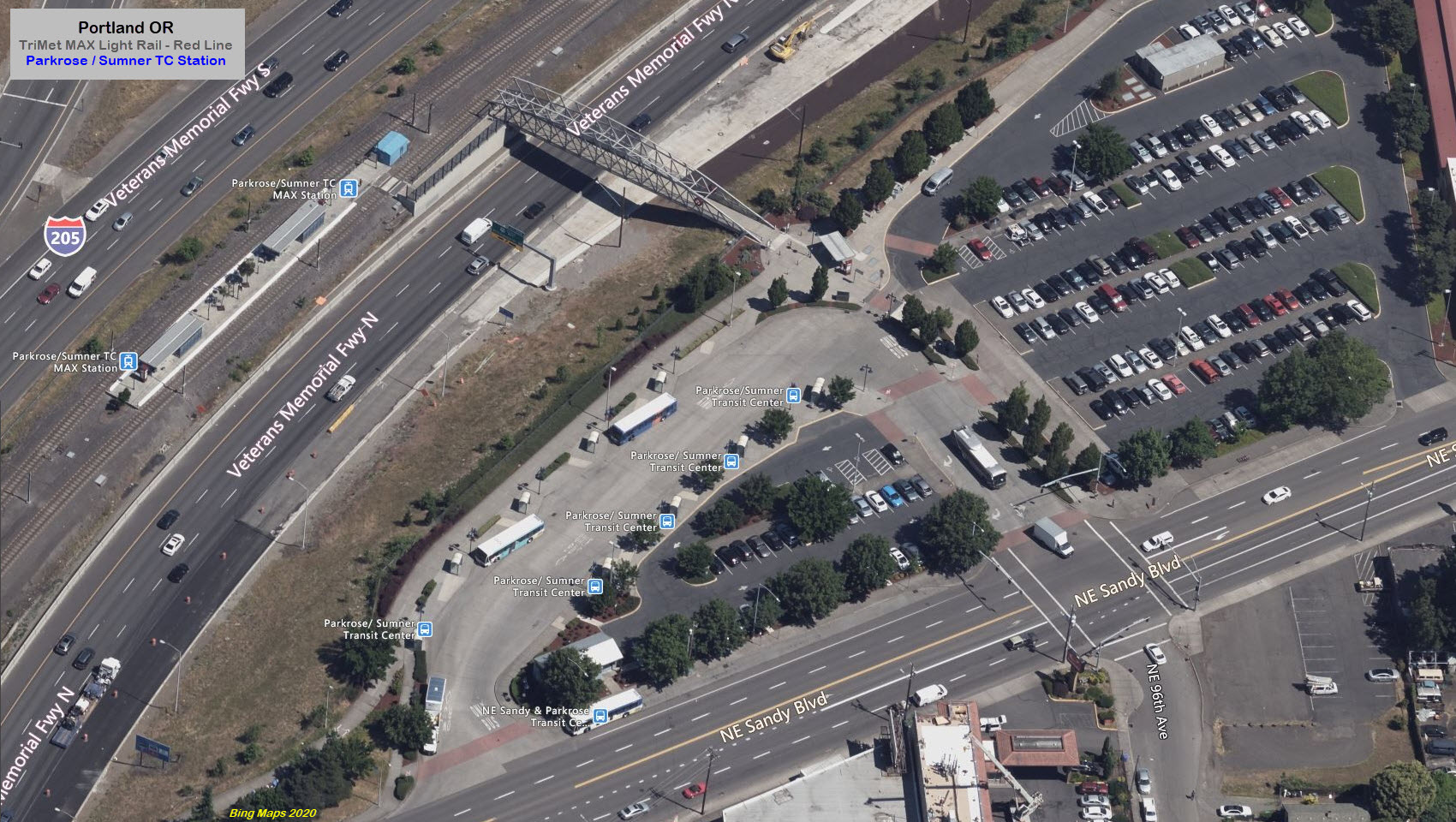
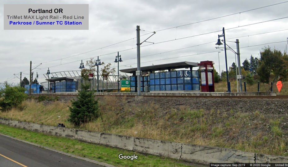
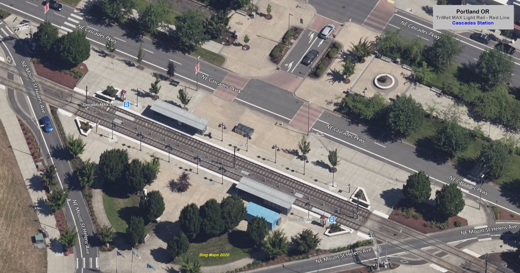
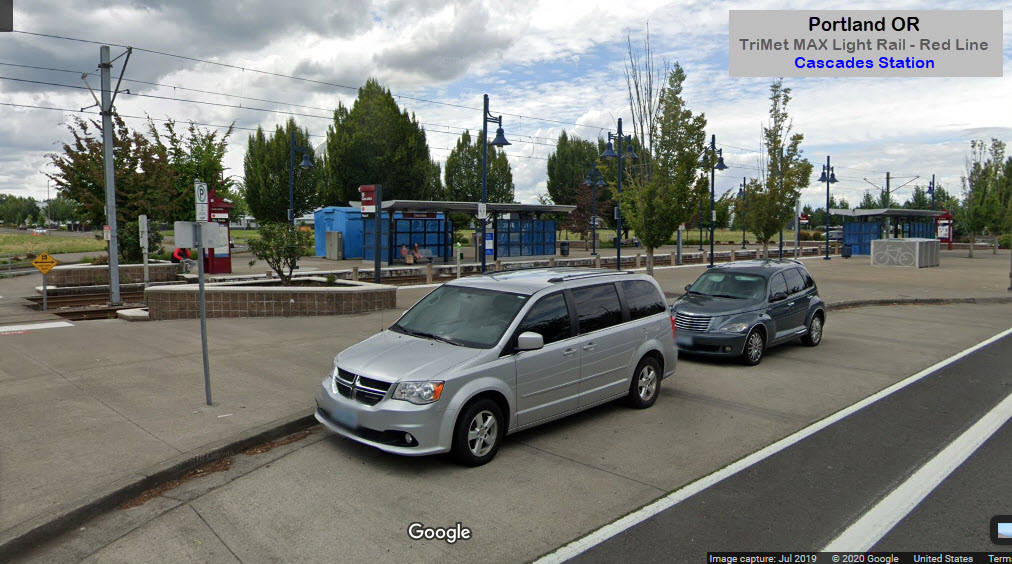
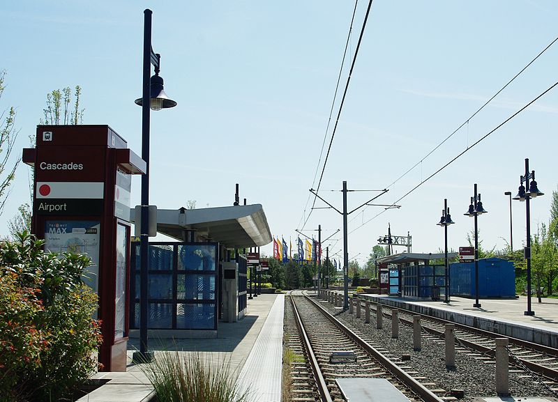 photo by M.O. Stevens via Wikipedia, 2011
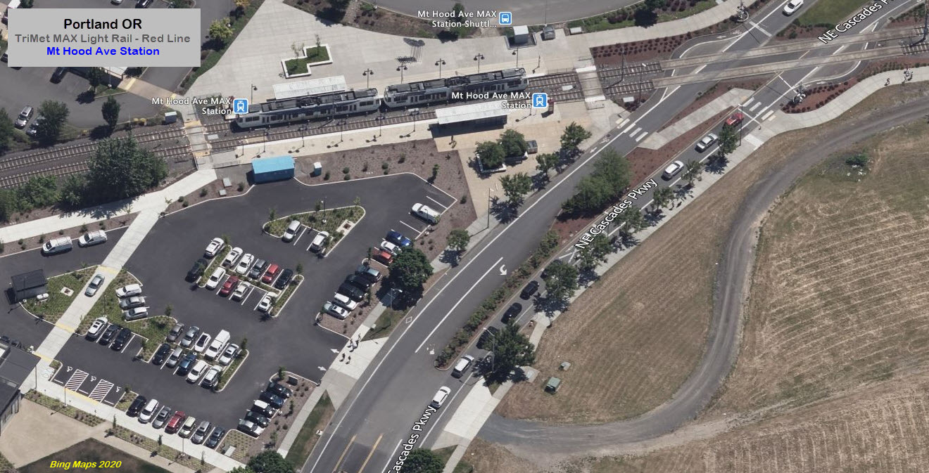
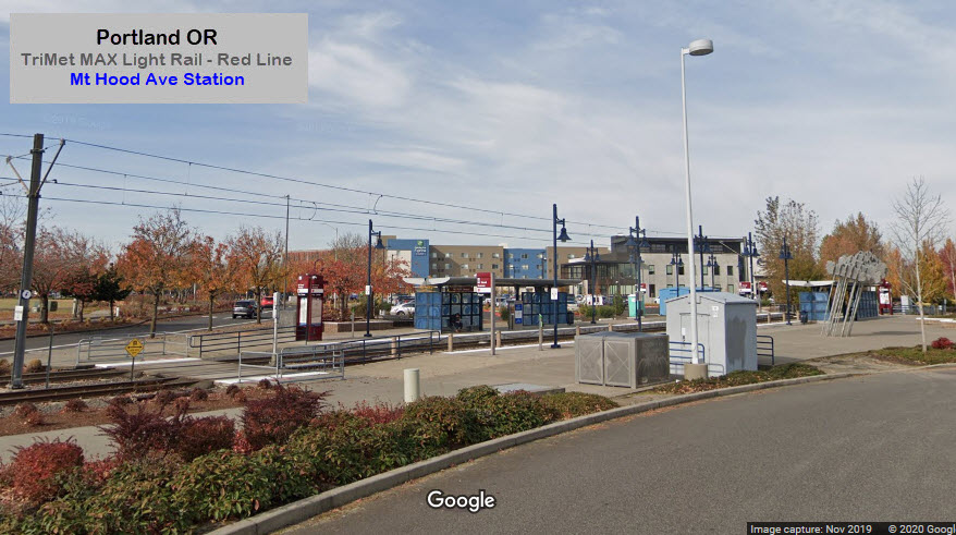
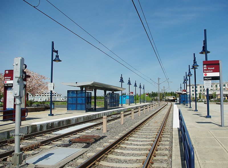 photo by M.O. Stevens via Wikipedia, 2011
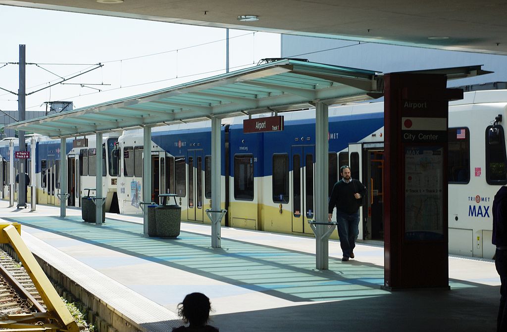 photo by M.O. Stevens via Wikipedia, 2011
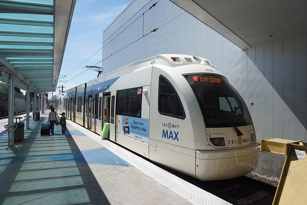 photo by Michael Barera