
![]()
In General
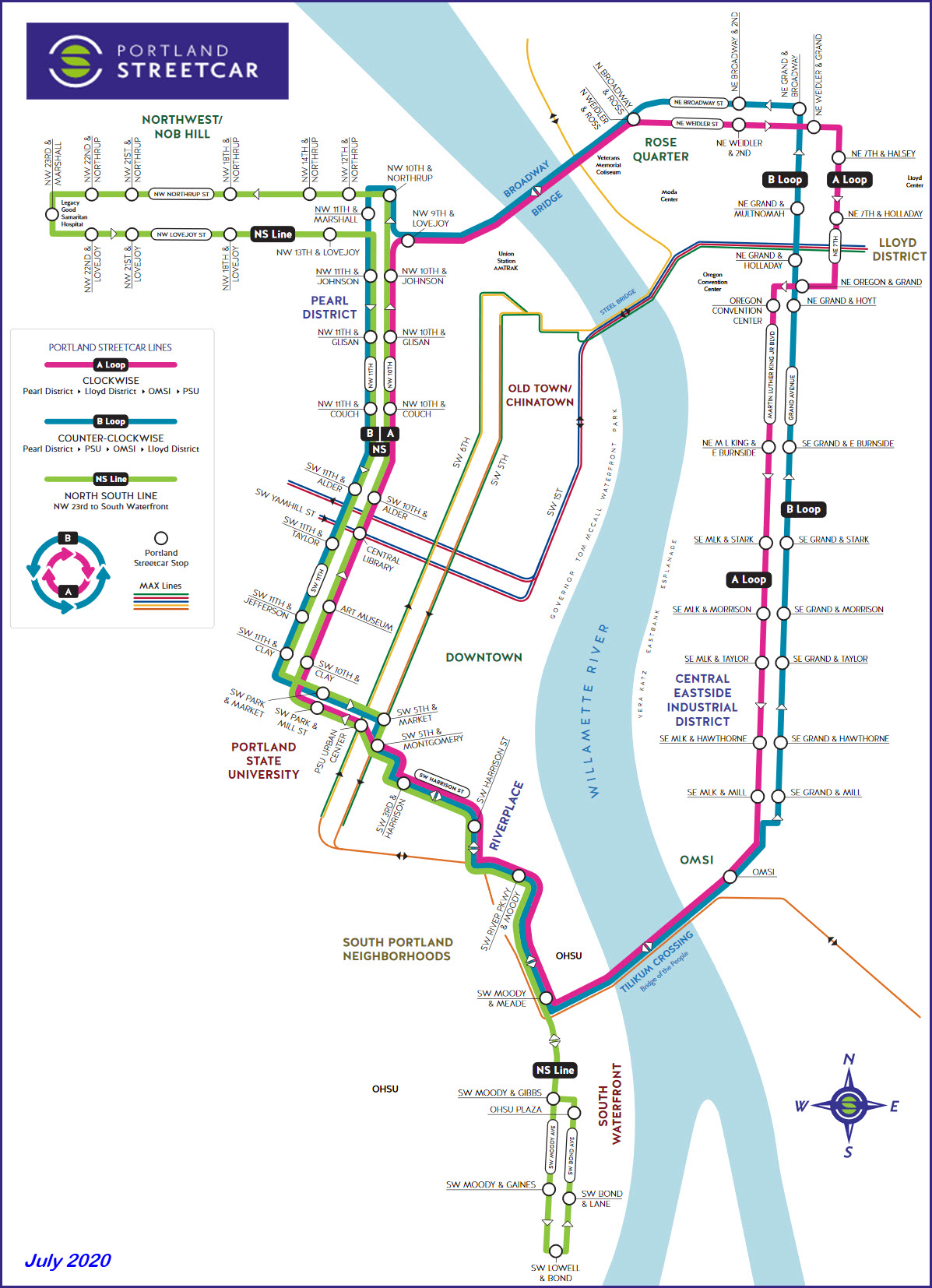
Map
Pictures
Shops
Signals
Floobydust
RAILROAD SIGNALS HOME
Location / Name:
Portland OR, Multnomah County
What's Here:
Portland Streetcar among others
Data:
GPS Coordinates: as needed
Phone A/C: 503
ZIP: 97201 (dntn)
Access by train/transit:
Amtrak at Union Station
TriMet Light Rail
Portland Streetcar downtown
The Scoop:
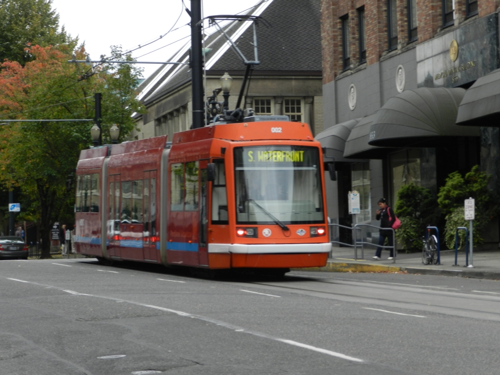
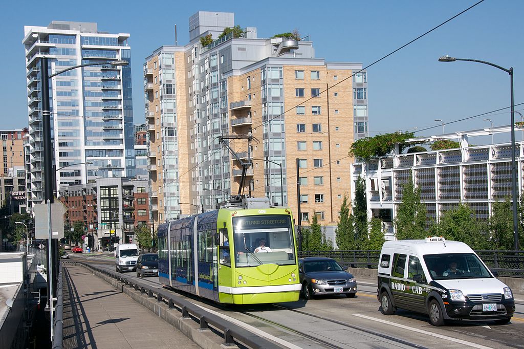
The Portland Streetcar began operation on July 20th, 2001. I was lucky to have been able to go to Portland for work soon after they started running. It's a great operation and should be the blueprint for any city that is contemplating a rail transit system! Portland's streetcar system was the first NEW streetcar system in the U.S.A. since WWII to use modern vehicles. As of 2020, they have 17 cars, with three on order.
Although the operation is separate from Tri-Met's MAX Light Rail system, it uses MAX operators and maintenance people in their shops.
As of mid-2015, the two-line streetcar system measures 7.2 miles (11.6 km), measured in one direction only – not round-trip lengths – and counting only once the section served by both routes. The end-to-end length of the original route, now designated the "NS Line", is 3.9 miles (6.3 km) since 2007, and the 2012-opened "CL Line" added 3.3 miles (5.3 km). The total one-way length of the CL Line is 4.4 miles (7.1 km), for it shares 1.1 miles (1.8 km) of route along 10th and 11th Avenues in downtown with the NS Line.
Connections to the MAX Light Rail system: The two systems are connected at two places. The first is a single curve of track at 10th and Morrison connecting to the westbound Red and Blue Line track. An additional set of connections exists at both ends of the Tilikum Crossing, as Central Loop streetcars share tracks with the MAX Orange Line to cross the bridge.
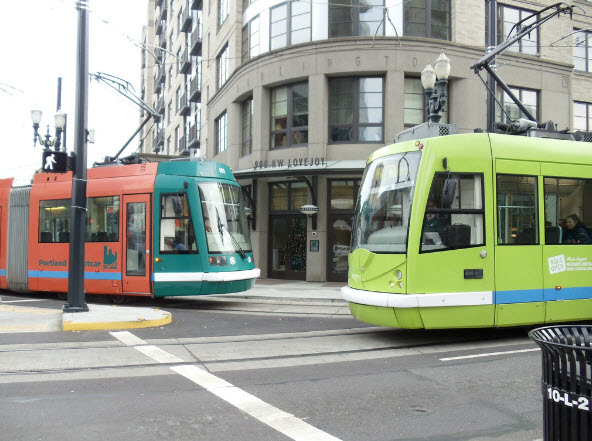
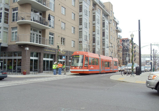
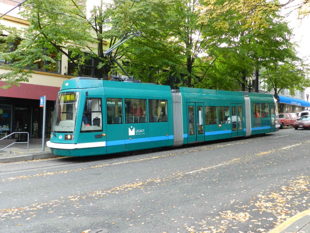
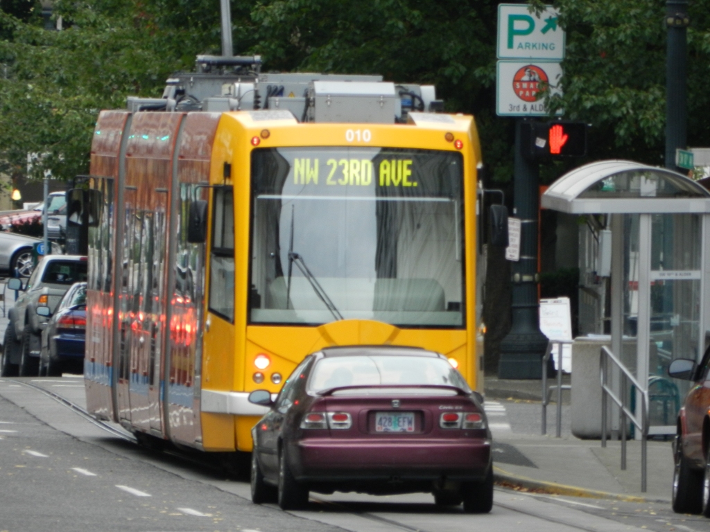
One of the most noticeable aspects of the system are their colorful streetcars. For picture taking, they can't be beat.
Acknowledgements:
Rick Holm
Sam Beebe
Denver Todd
Google Maps
Wikipedia
Bing Maps
Websites and other additional information sources of interest for the area:
http://www.portlandstreetcar.org/.
http://en.wikipedia.org/wiki/Portland_Streetcar
From the Portland Streetcar website

From Wikipedia
One of the newer models streetcar, assembled in the U.S.A. It's built by United Streetcar, under license from Skoda, and based on their 10T model.
They entered service in September 2012.
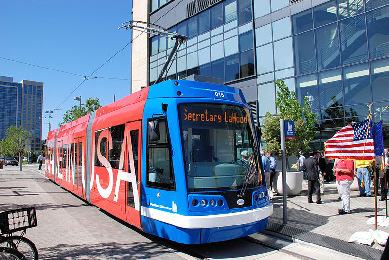 photo by Steve Morgan
A vintage streetcar ran on the Portland Streetcar tracks until 2005 :-(
It is one of two that are a replica of a 1904 Brill streetcar, built in 1991 by Gomaco.
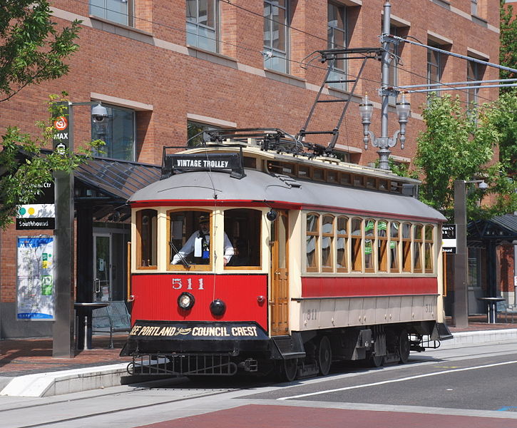 photo by Steve Morgan
Three pictures courtesy Rick Holm. NEW AUG30/2013, SEP02/2013, JUL28/2020
Google Streetview and Bing Maps Birds-Eye View Aerial Shots
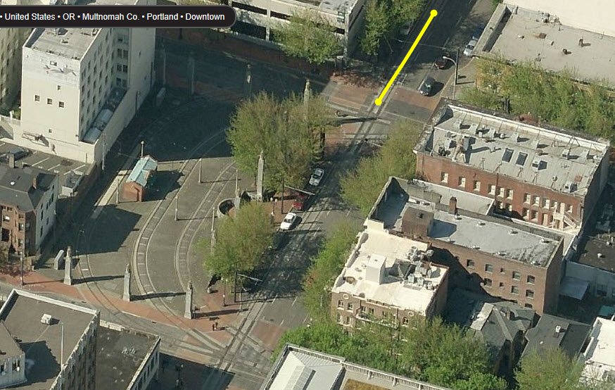
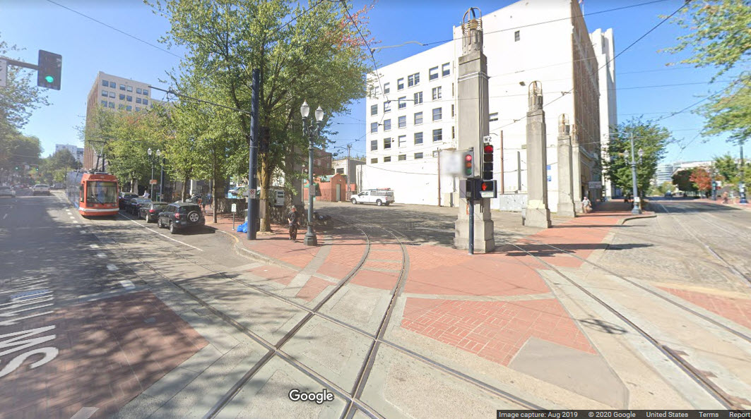
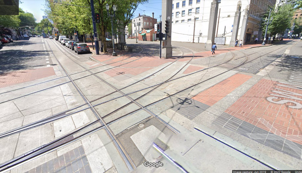
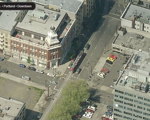
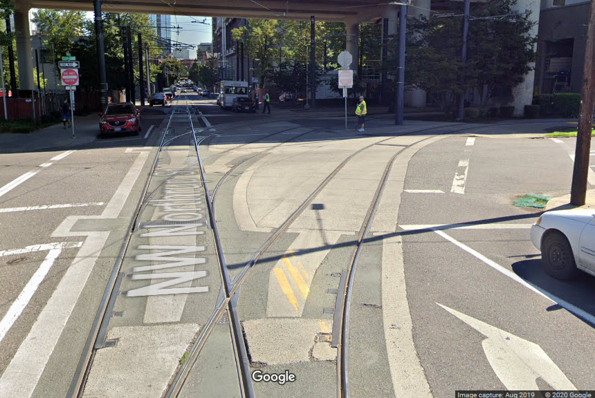
Trackwork Plus! As the Portland Streetcar makes it way south thru downtown Portland
on SW 11th Ave, it crosses the Max Light Rail Line at SW Morrison St and SW Yamhill St.
Before the MAX headed west thru the tunnel to Hillsboro, the three loops are where the line ended.
The middle loop/streetcar crossover has some especially tricky trackwork due
to the turnout for the loop track!
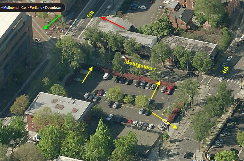
One of the few places the Portland Streetcar runs on what we can consider
"Private Right-of-Way", it's on the south side of downtown at
Montgomery Rd and 4th Ave.
The yellow arrows point to single track mainline that is used by both outbound and inbound trains.
The green arrow points to private ROW for outbound cars, coming over from Mill St.
The Red arrow is pointing to the inbound track running NB in 5th St.
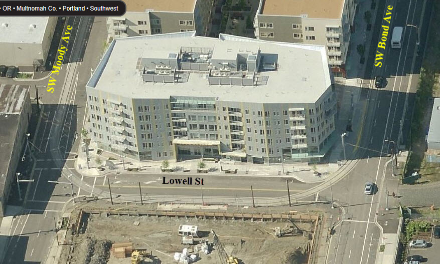
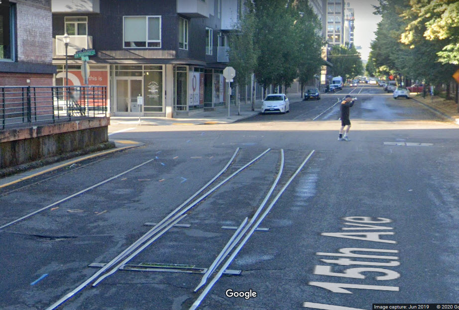
Below: This used to be the south end of the streetcar route in southwest Portland.
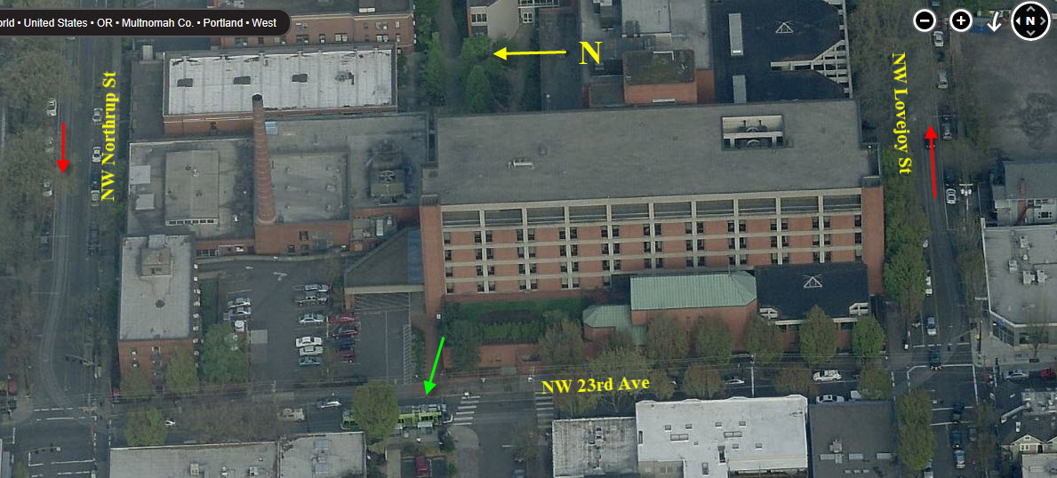
Below: This was the north end of the streetcars route in northwest Portland.
The green arrow is pointing to a streetcar on the turnaround.
The red arrows are the direction of travel.
Portland Streetcar "Central Loop" first run. Car 009 climbing the Lovejoy Street ramp to the Broadway Bridge.
 Sep 2012, photo by Sam Beebe
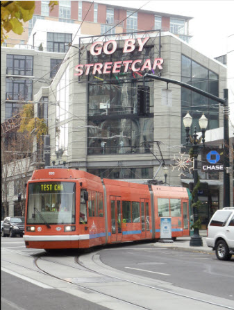
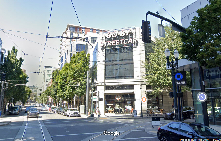
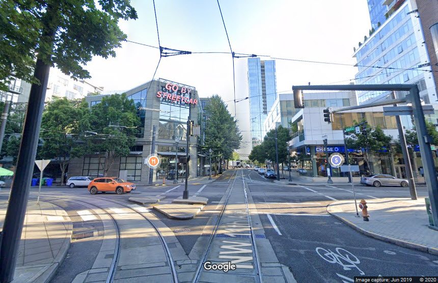
The "Go By Streetcar" sign at Lovejoy and NW 11th Ave...
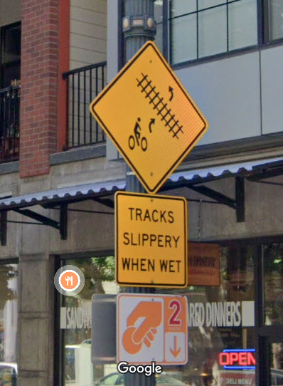
Various streetcar related signs...
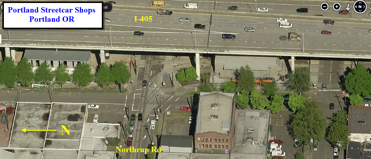
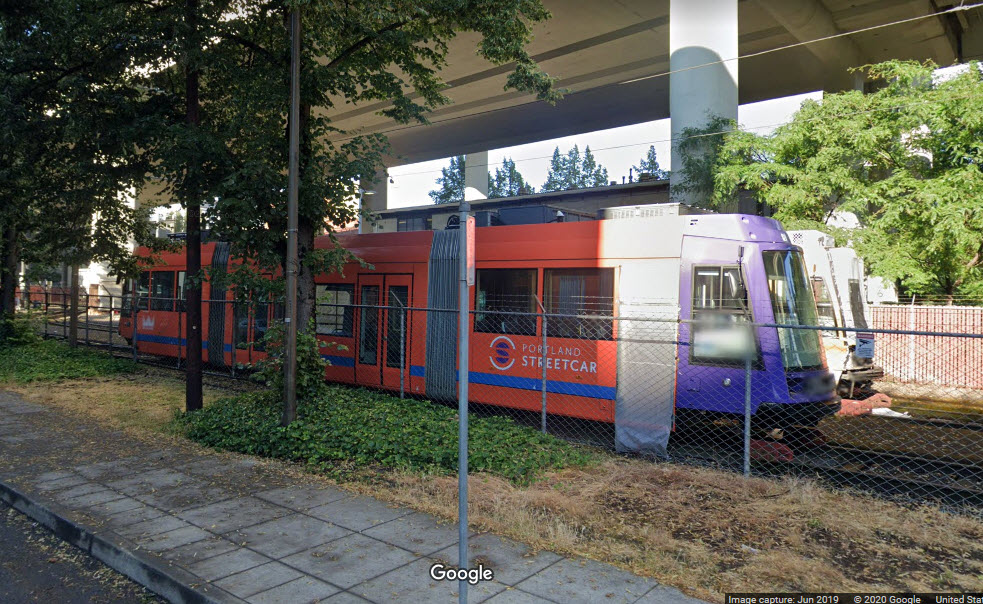
The Maintenance Yard: Streetcars are stored at the rail yard near
the Portland Streetcar, Inc. headquarters (1516 NW Northrup Street). Storage
tracks and facilities occupy three city blocks underneath an elevated section
of Interstate 405, between NW Overton and NW Lovejoy streets (north-to-south)
and NW 16th and NW 15th streets (west-to-east).
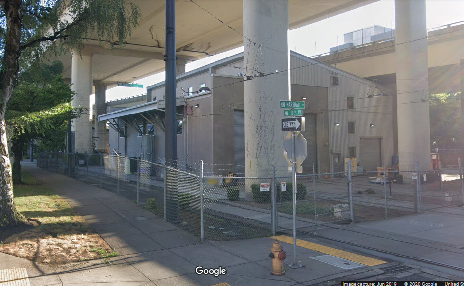
 Opposite the shop building
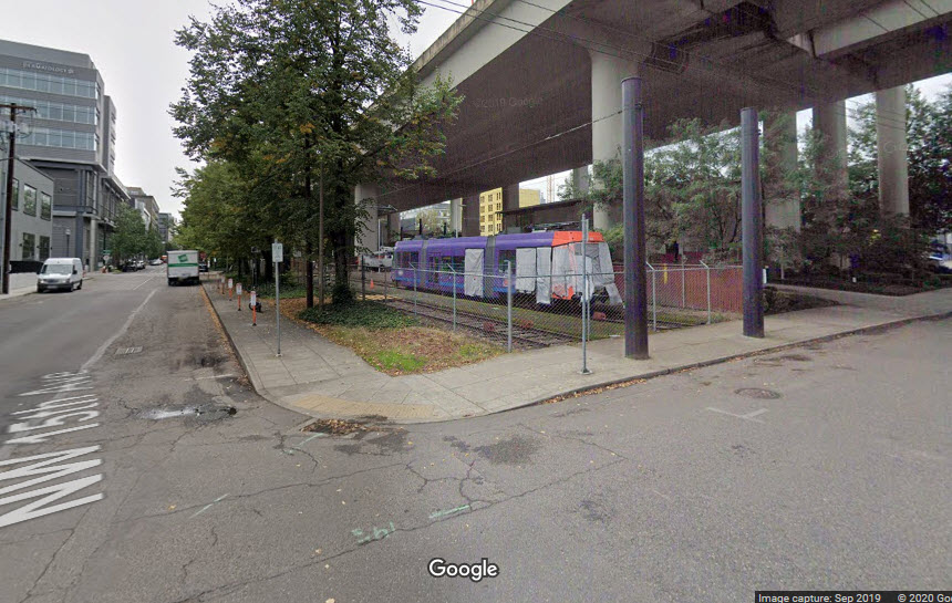
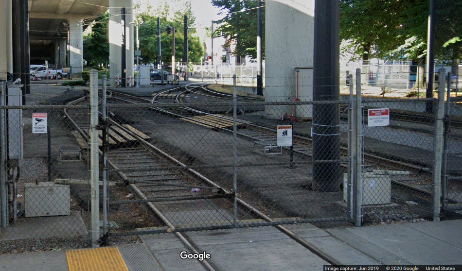
 Three tracks into the shop
 Abandoned tracks next to shops
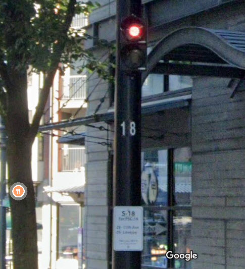
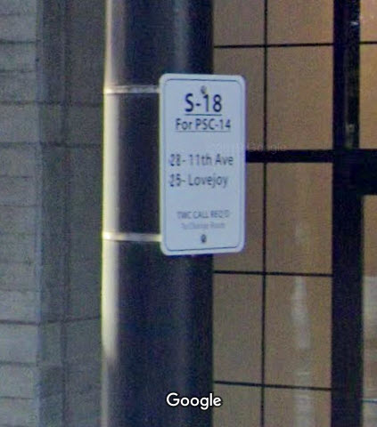
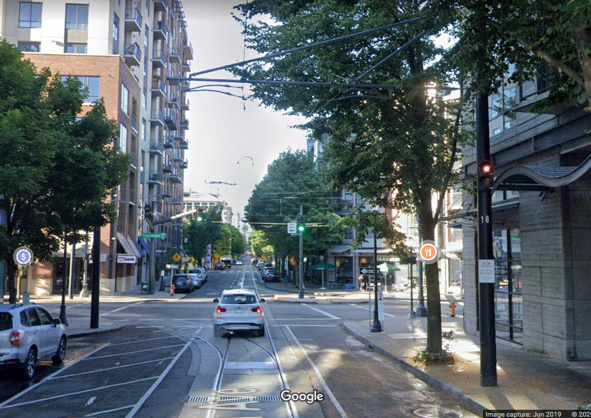
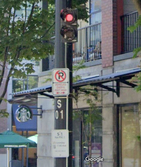
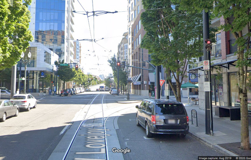
I haven't come across many signals on the Portland Streetcar lines.
The pictures below are at the junction at Lovejoy and NW 11th Ave, where the
"Go By Streetcar" sign is.
The first set is the S18 signal for 11th Ave to Lovejoy (or straight), not
sure if these are go/no-go signals, or route indicators:
The second set is the S01 signal for Lovejoy to 11th Ave (or straight):
Disclaimers:
I love trains, and I love signals. I am not an expert. My webpages reflect what I find on the topic of the page. This is something I have fun with while
trying to help others.
Please Note: Since the main focus of my two websites is railroad signals, the railfan guides are oriented towards the signal fan being able to locate them.
For those of you into the modeling aspect of our hobby, my
indexa page has a list of almost everything railroad oriented
I can think of to provide you with at least a few pictures to help you detail your pike.
If this is a railfan page, every effort has been made to make sure that the information contained on this map and in this railfan guide is correct. Once in a while,
an error may creep in :-)
My philosophy: Pictures and maps are worth a thousand words, especially for railfanning. Text descriptions only get you so far, especially if you get lost or
disoriented. Take along good maps.... a GPS is OK to get somewhere, but maps are still better if you get lost! I belong to AAA, which allows you to get
local maps for free when you visit the local branches. ADC puts out a nice series of county maps for the Washington DC area, but their state maps do not have the
railroads on them. If you can find em, I like the National Geographic map book of the U.S..... good, clear, and concise graphics, and they do a really good job
of showing you where tourist type attractions are, although they too lack the railroads. Other notes about specific areas will show up on that page if known.
Aerial shots were taken from either Google or Bing Maps as noted. Screen captures are made
with Snagit, a Techsmith product... a great tool if you have never used it!
By the way, floobydust is a term I picked up 30-40 years ago from a National Semiconductor data book, and means miscellaneous
and/or other stuff.
Pictures and additional information is always needed if anyone feels inclined to take 'em, send 'em, and share 'em, or if you have something to add or correct.... credit
is always given! Please be NICE!!! Contact info is here
Beware: If used as a source, ANYTHING from Wikipedia must be treated as being possibly being inaccurate, wrong, or not true.
RAILFAN GUIDES HOME
RAILROAD SIGNALS HOME
Last Modified
29-Jul-2020