Data:
GPS Coordinates: as needed
Phone A/C: 503
ZIP: n/a
Access by train/transit:
Amtrak (in downtown Portland)
Portland Streetcar (in downtown Portland)
MAX Red and Blue Lines (at Gateway and downtown Portland)
The Scoop:
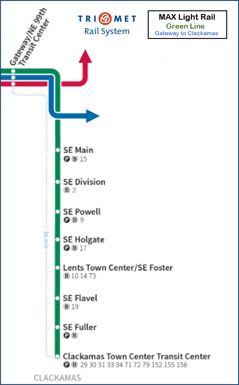
The four MAX lines all cross the Willamette River on the Steel bridge, with
the Yellow Line splitting off just after it hits solid ground. The other
three lines, Red, Blue, and Green, then head east after going thru the Rose
Quarter station. They run together for about 5 miles, paralleling I-84 for
the most part until they reach the Gateway Station. Beyond Gateway, the
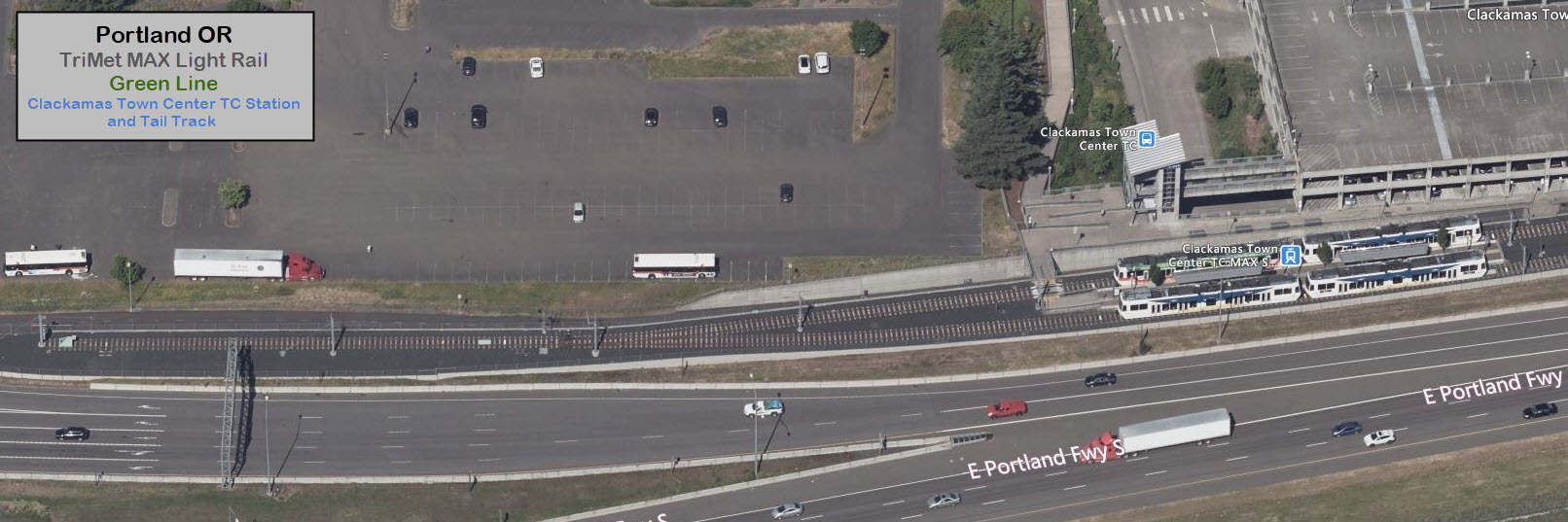
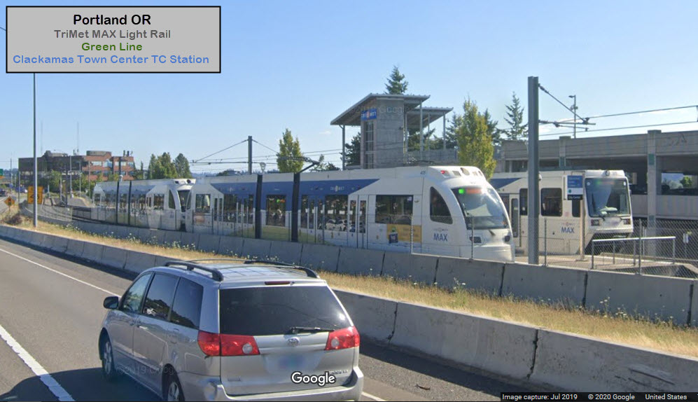
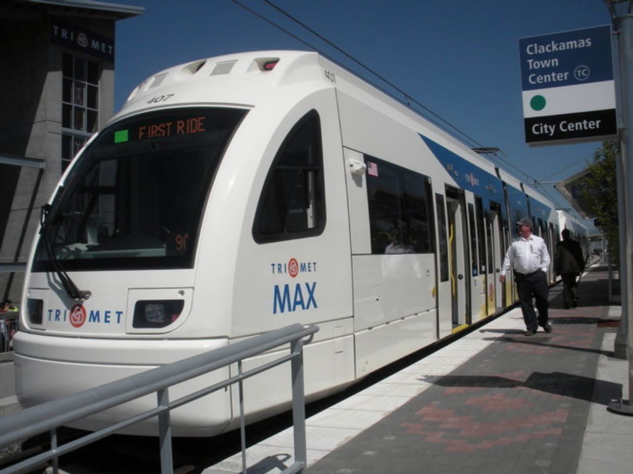
three lines go their separate way, with the Green Line heading south to
Clackamas, paralleling I-205.
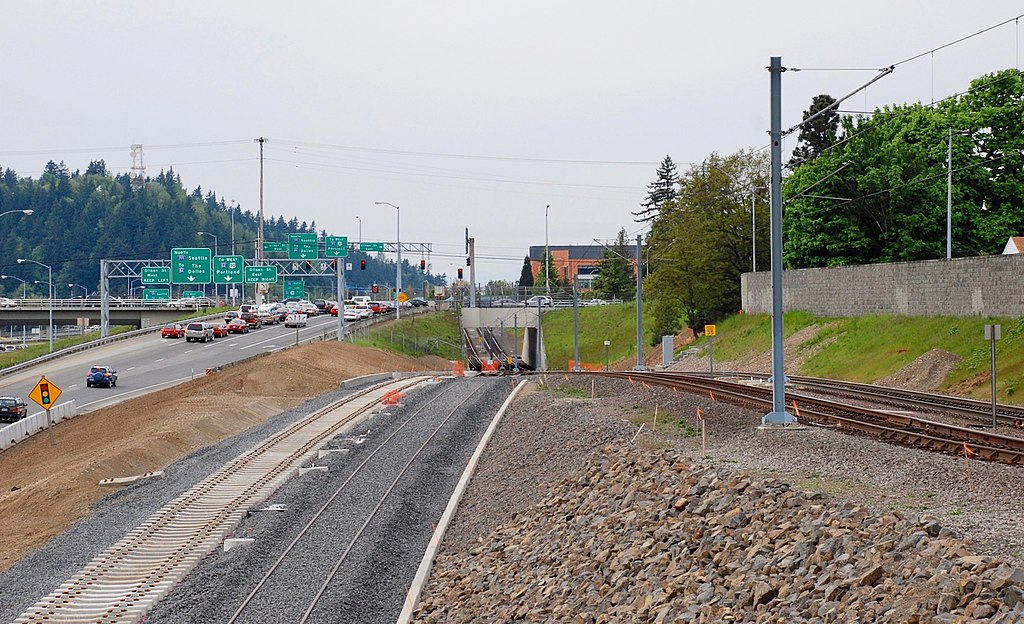
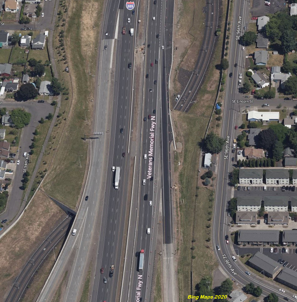
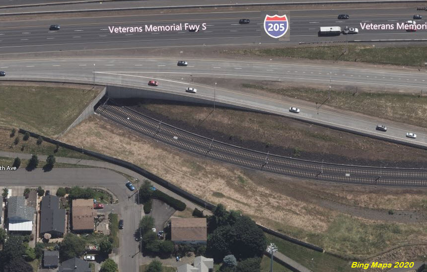
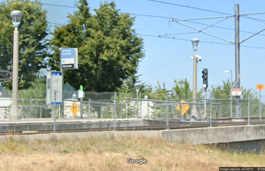
This line has several interesting features. One is the "tunnel" under the
205 in order to be on the west side of the freeway. Down around the Lents/Flavel
area, the tracks pass over three bridge spans, all of which are between those
two stations!
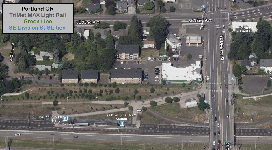
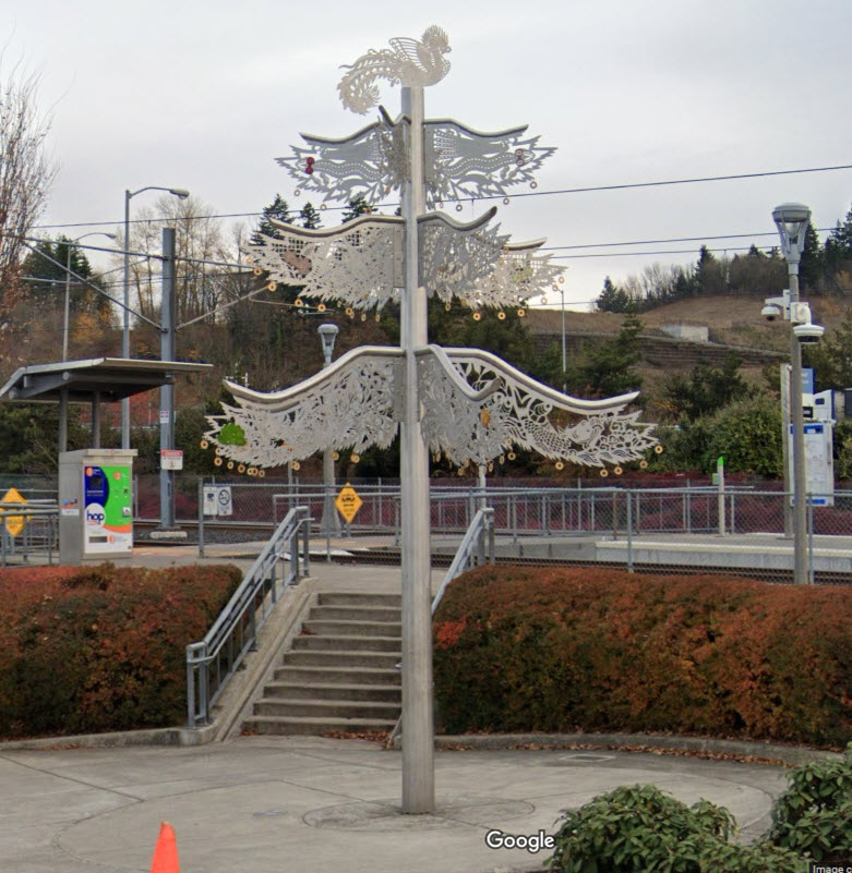
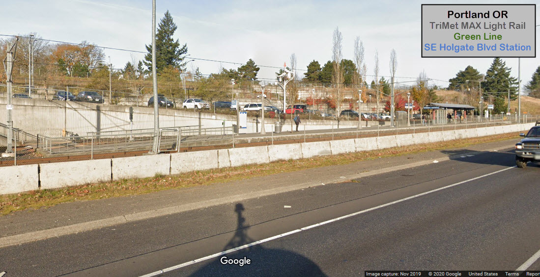
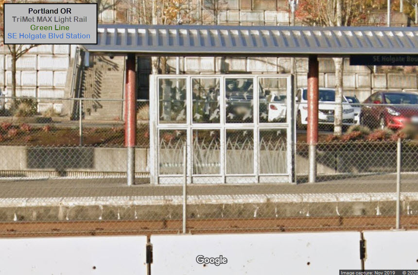
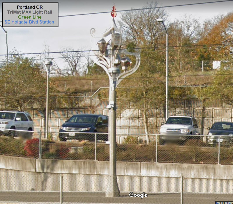
Where they are noticeable (and I can get screen captures of them from Google
Maps), I have included the artwork TriMet has placed at the various stations,
including the Windscreens.
A bike trail parallels the line for a good portion of it.
Acknowledgements:
Steve Morgan
Toyota97
The Oregonian
Denver Todd
Interstate 205 provides easy access to most of the Green Line.....
Exit 17 drops you off onto SE Foster Rd, which is close to the Lents Town Center station.
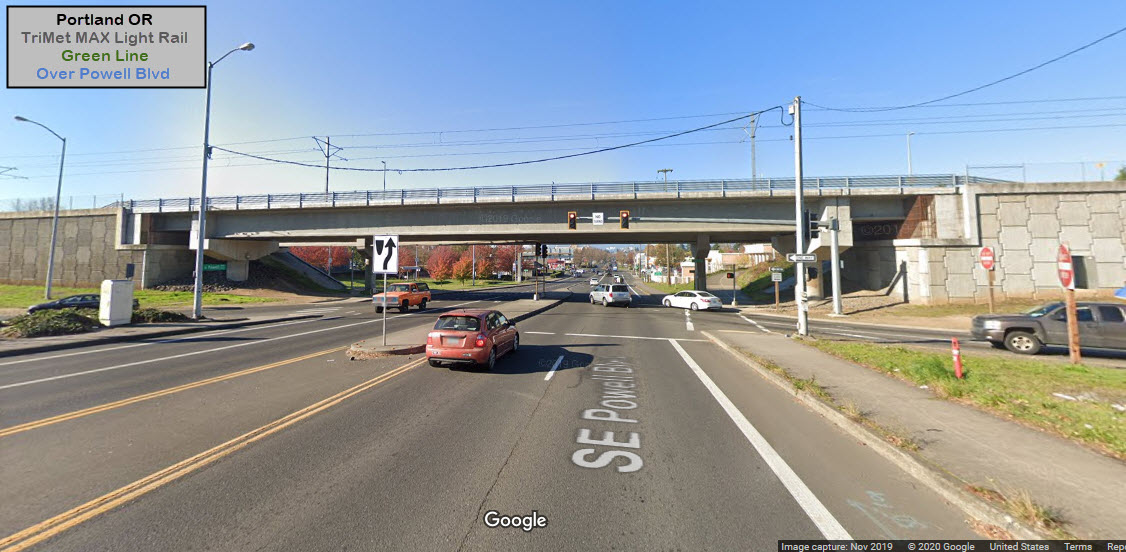
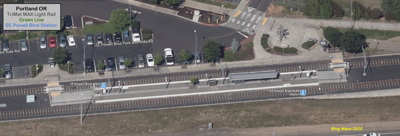
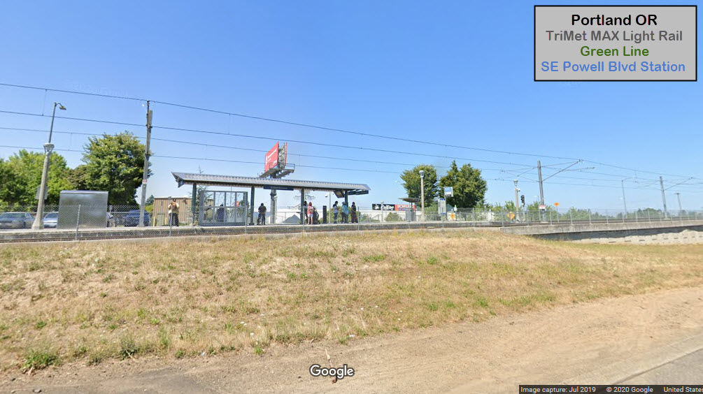
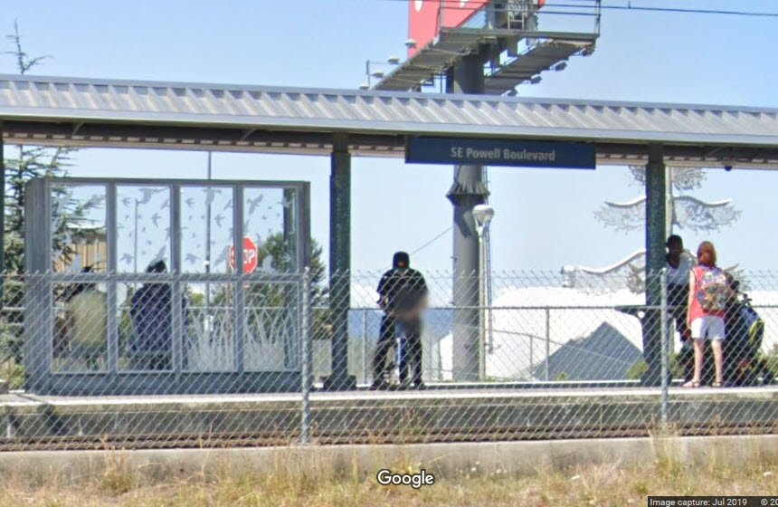
Exit 19 will get you off at SE Powell Blvd, for the station of the same name.
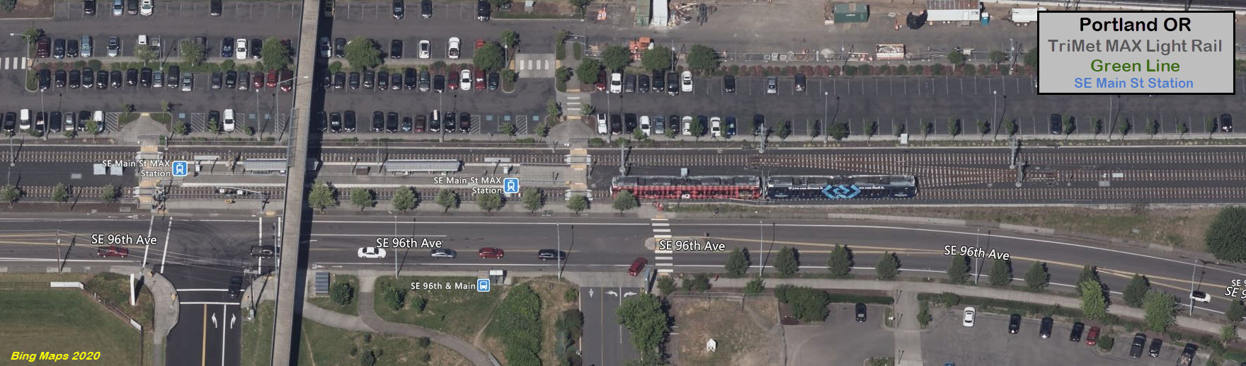
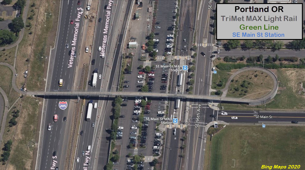
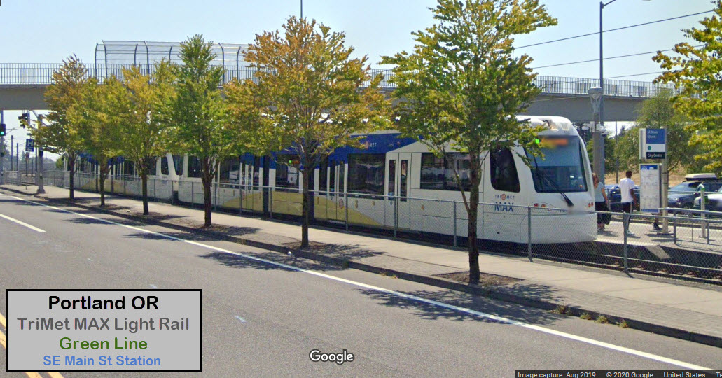
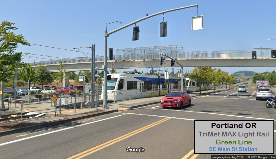
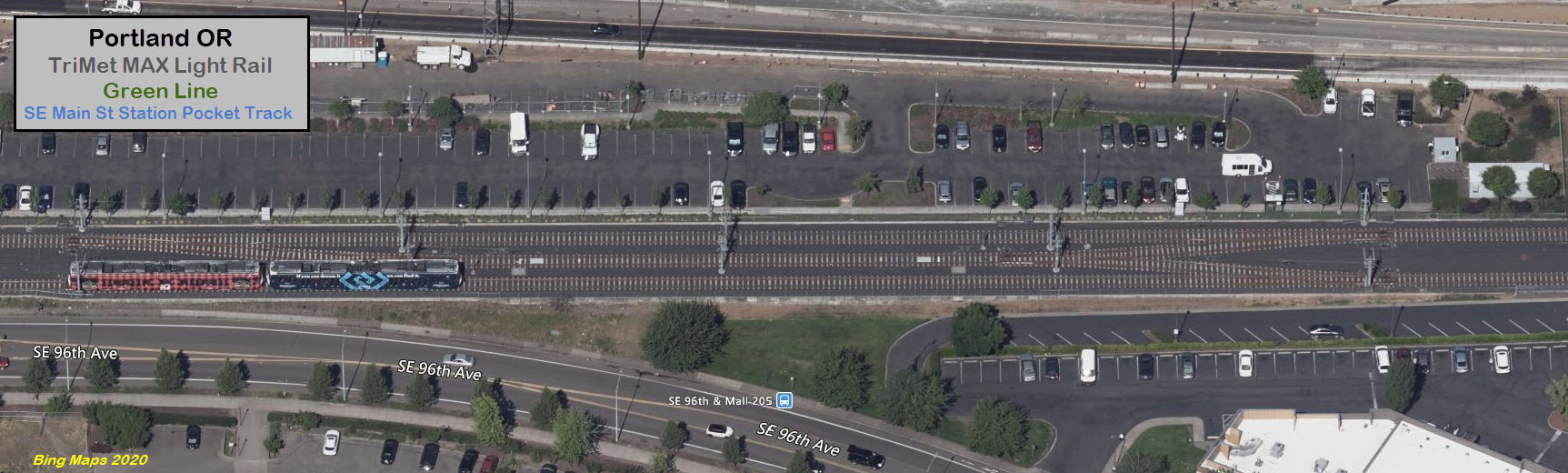
Take exit 20 for Washington Blvd and Starke St (go south on SE 96th Ave from
Washington to get to the Main St station).
NE Glisan St is at exit 21A, then north on NE 99th Ave to NE Pacific St to get
to Gateway.
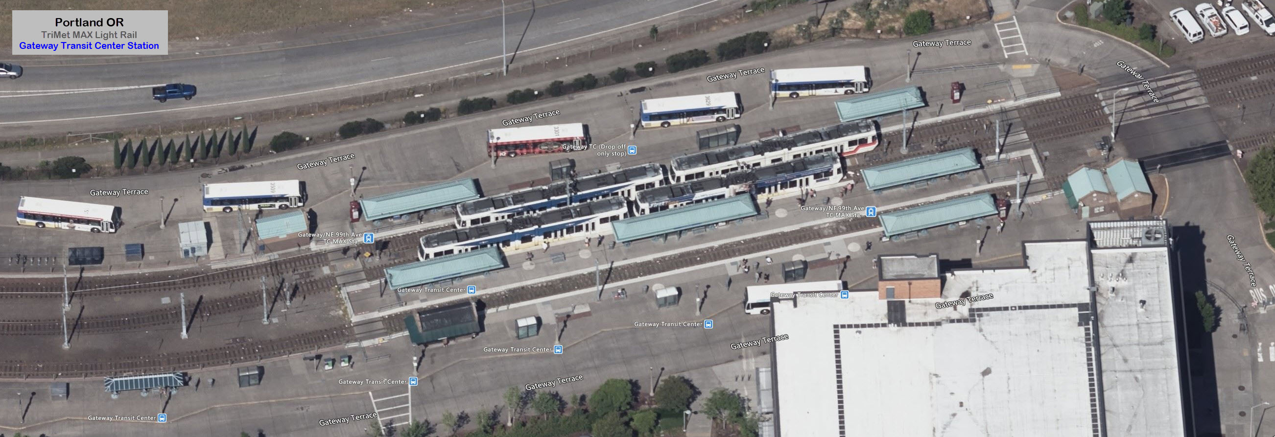
You WILL get bored reading about this station, it appears on 4 or 5 pages :-).
Gateway station marks another division point in the system. The Blue and Green
lines continue south from here, but the Red line loops around, deals with a
pretty good grade to loop back under itself and then head north along I-205 on
it's way to the Portland Airport.
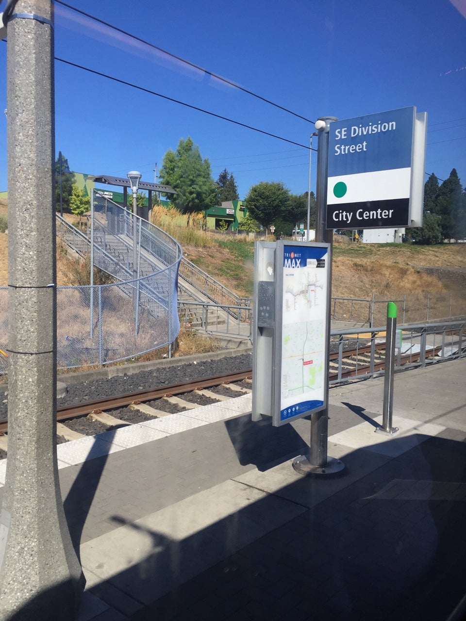
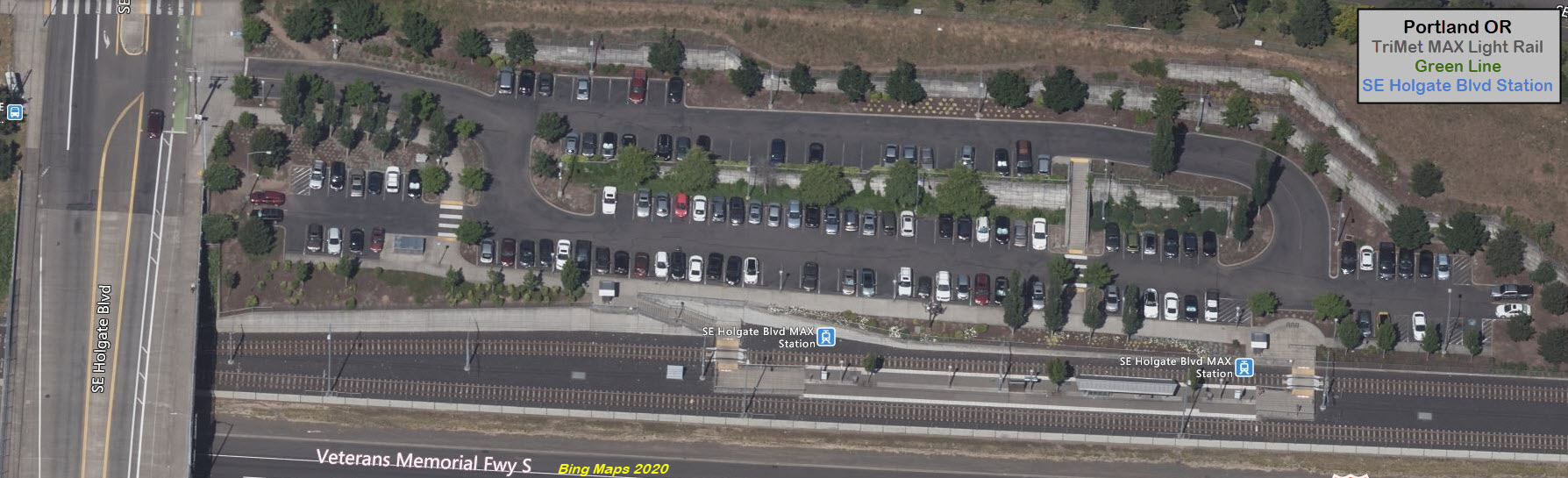
The R-O-W leaves Gateway on the east side of Interstate 205, then, between SE Market
Street to the north, and SE Division Street to the south, is crosses under the 205.
GPS Coordinates: 45.480387, -122.566822
https://en.wikipedia.org/wiki/Lents_Town_Center/Southeast_Foster_Road_station
South of here, the R-O-W crosses over three "things" in a nice change from just
cruising along: A single span over two roads, a former railroad R-O-W, and a
small creek before going into the Flavel station. NOTE: Wikipedia was
wrong, there is NO third track at this station! (till I corrected the entry)
I love trains, and I love signals. I am not an expert. My webpages reflect what I find on the topic of the page. This is something I have fun with while
trying to help others.
Please Note: Since the main focus of my two websites is railroad signals, the railfan guides are oriented towards the signal fan being able to locate them.
For those of you into the modeling aspect of our hobby, my
indexa page has a list of almost everything railroad oriented
I can think of to provide you with at least a few pictures to help you detail your pike.
If this is a railfan page, every effort has been made to make sure that the information contained on this map and in this railfan guide is correct. Once in a while,
an error may creep in :-)
My philosophy: Pictures and maps are worth a thousand words, especially for railfanning. Text descriptions only get you so far, especially if you get lost or
disoriented. Take along good maps.... a GPS is OK to get somewhere, but maps are still better if you get lost! I belong to AAA, which allows you to get
local maps for free when you visit the local branches. ADC puts out a nice series of county maps for the Washington DC area, but their state maps do not have the
railroads on them. If you can find em, I like the National Geographic map book of the U.S..... good, clear, and concise graphics, and they do a really good job
of showing you where tourist type attractions are, although they too lack the railroads. Other notes about specific areas will show up on that page if known.
Aerial shots were taken from either Google or Bing Maps as noted. Screen captures are made
with Snagit, a Techsmith product... a great tool if you have never used it!
By the way, floobydust is a term I picked up 30-40 years ago from a National Semiconductor data book, and means miscellaneous
and/or other stuff.
Pictures and additional information is always needed if anyone feels inclined to take 'em, send 'em, and share 'em, or if you have something to add or correct.... credit
is always given! Please be NICE!!! Contact info is here
Beware: If used as a source, ANYTHING from Wikipedia must be treated as being possibly inaccurate, wrong, or not true.
 Steve Morgan, 2008
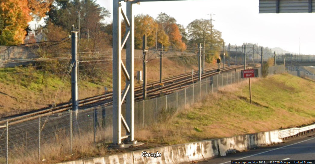
 south portal
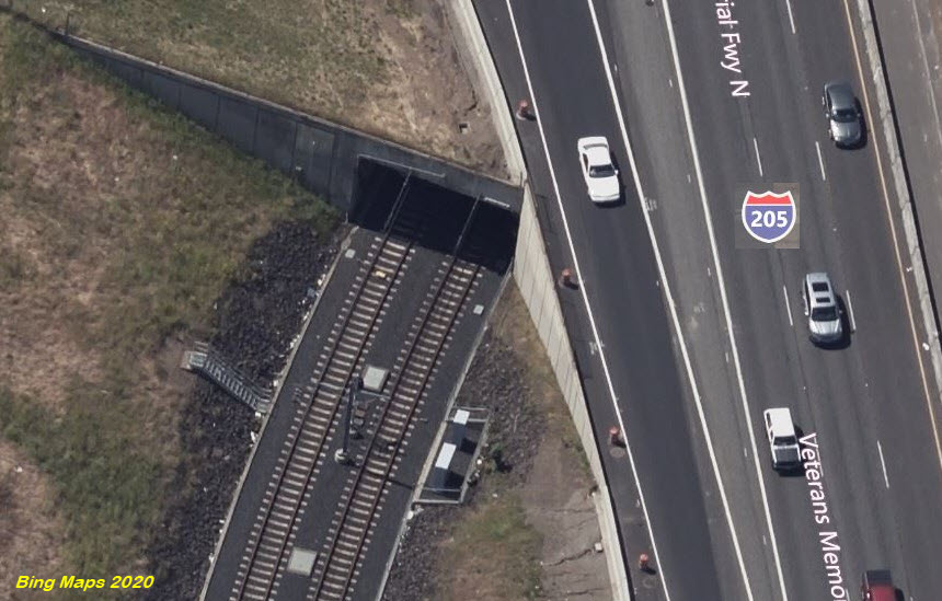 north portal
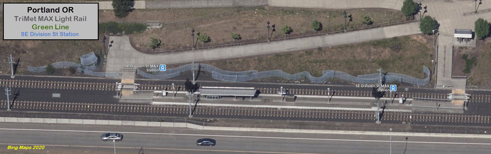
 Steve Morgan photo
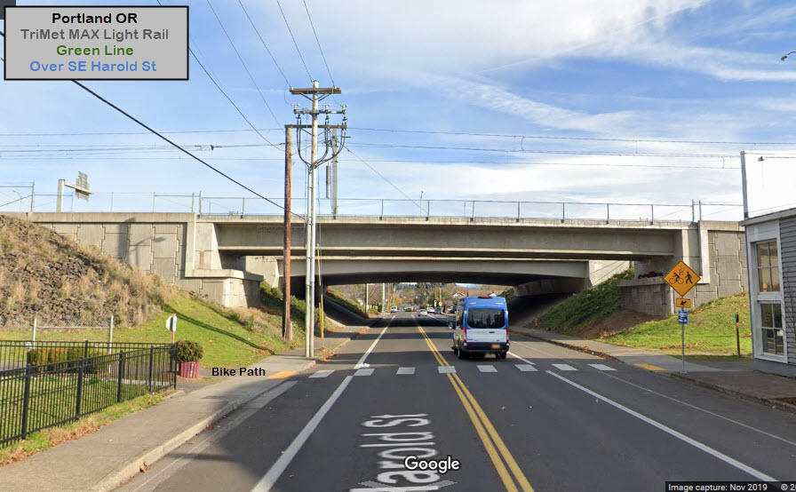
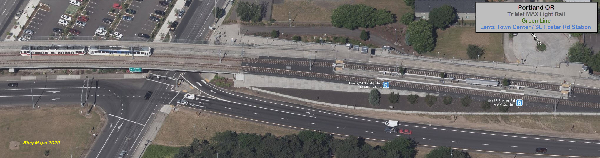
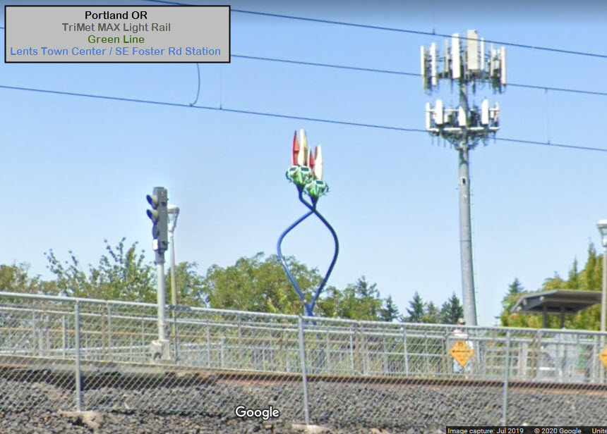
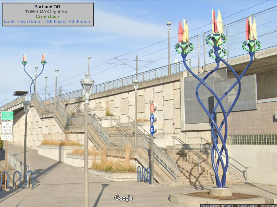
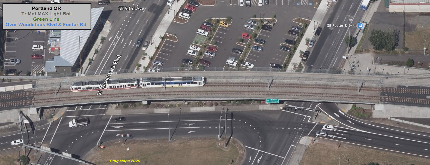
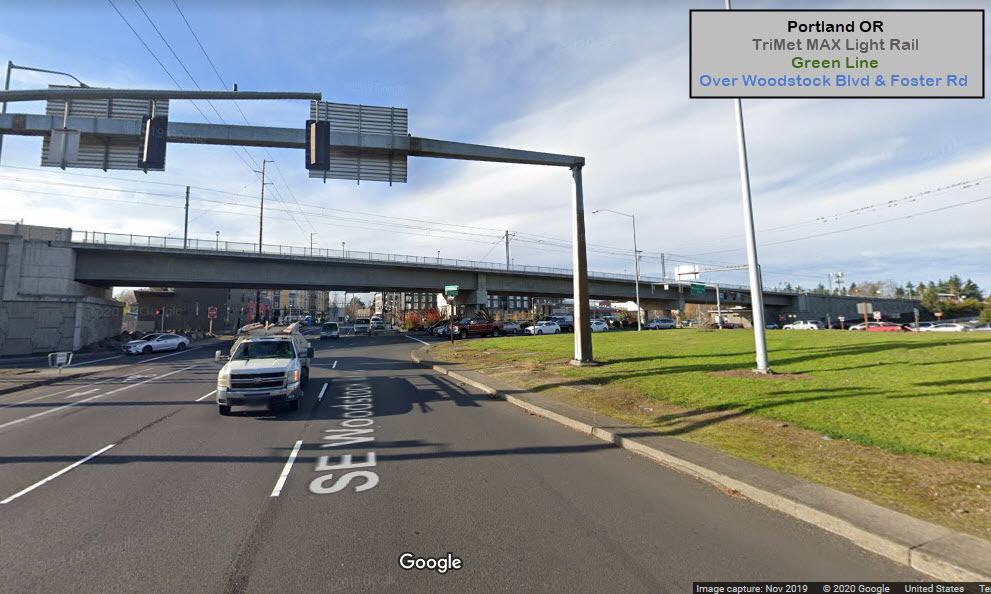
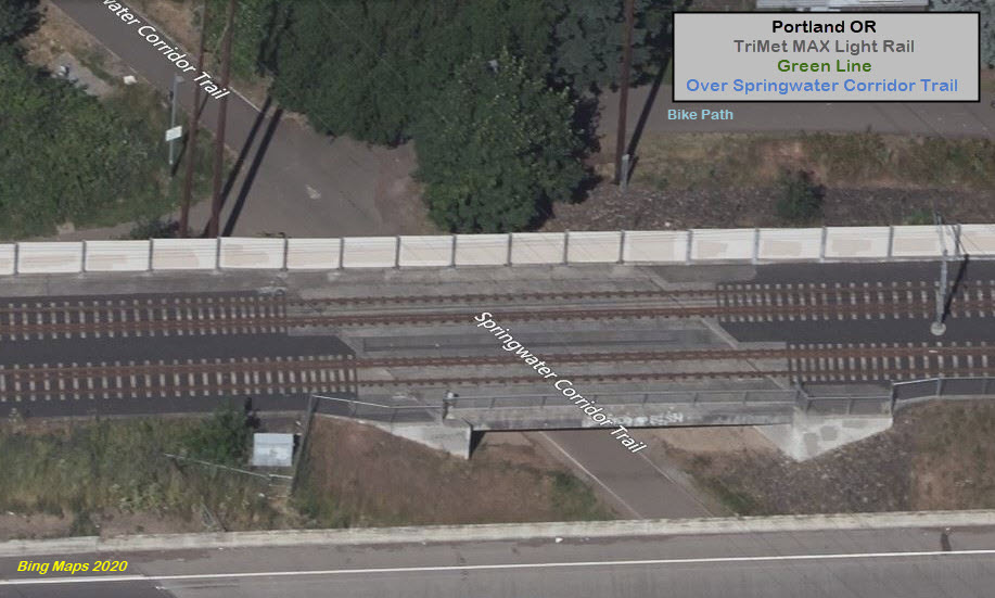
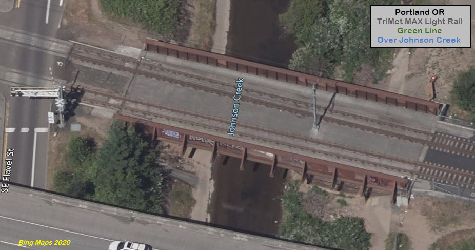
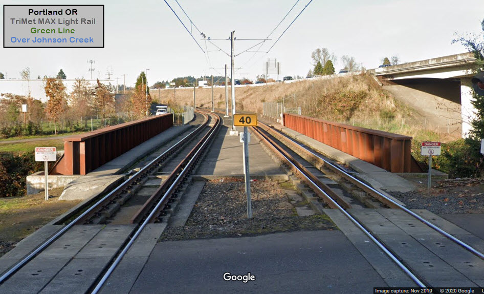
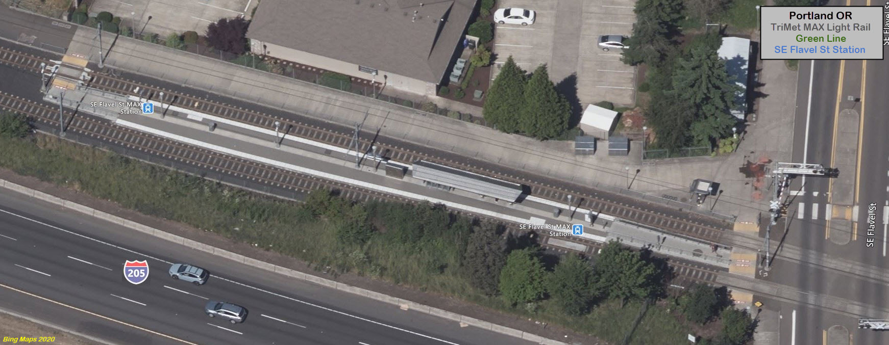
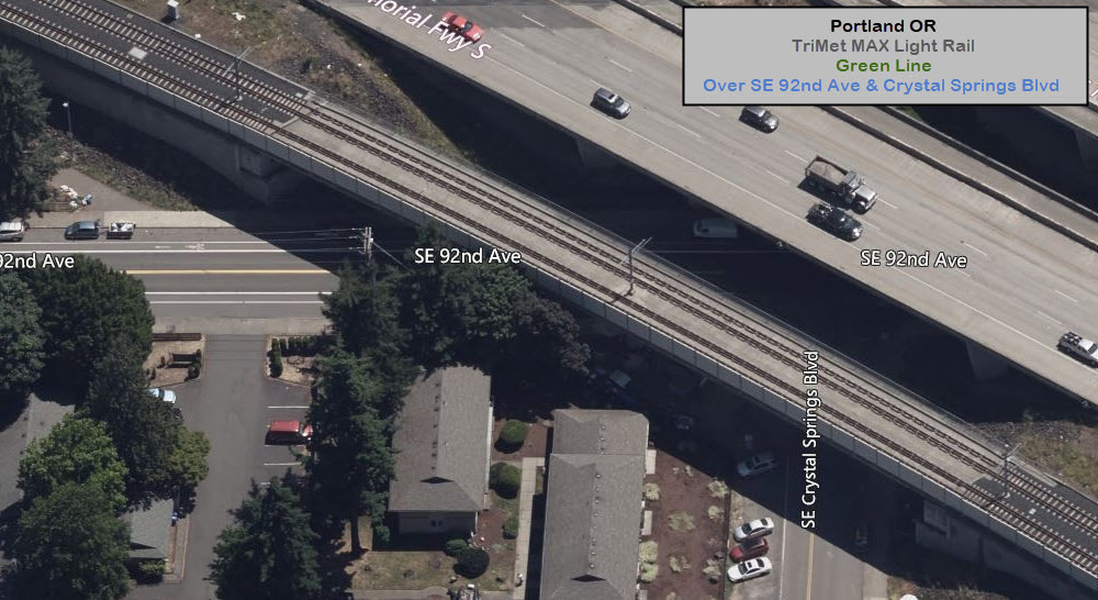
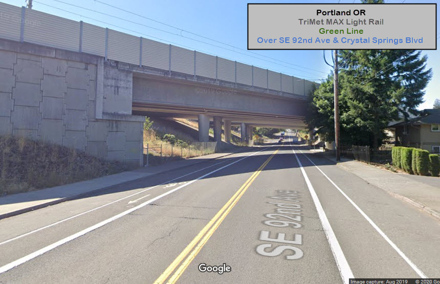

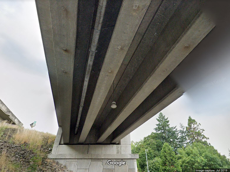
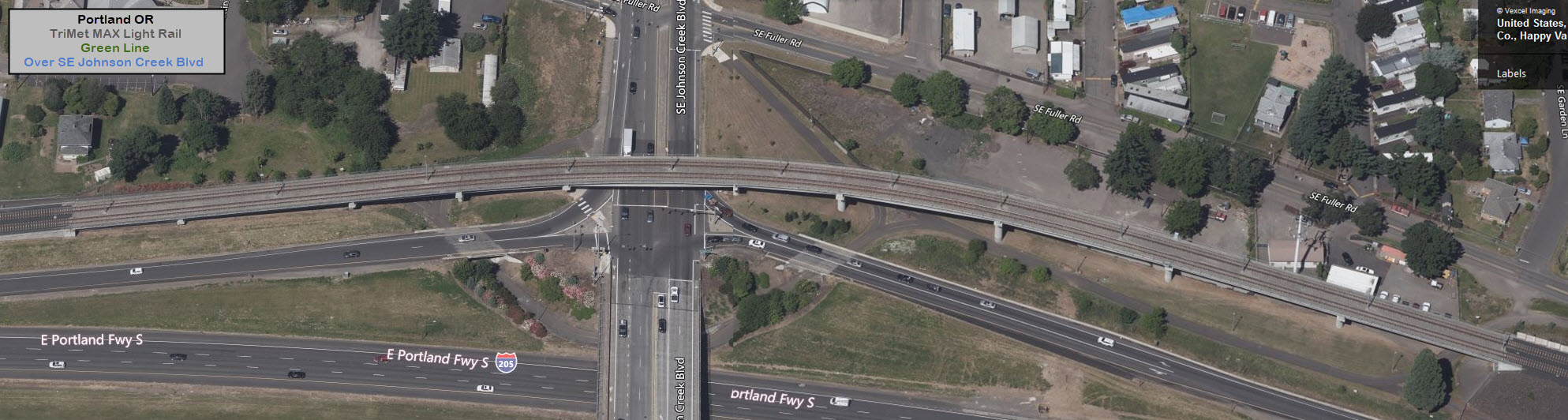
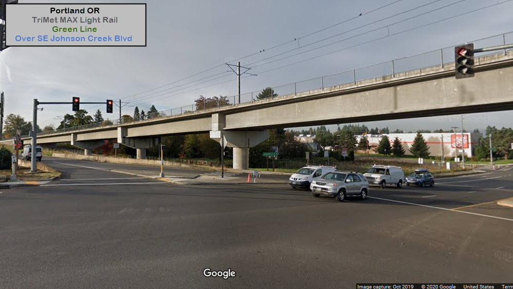
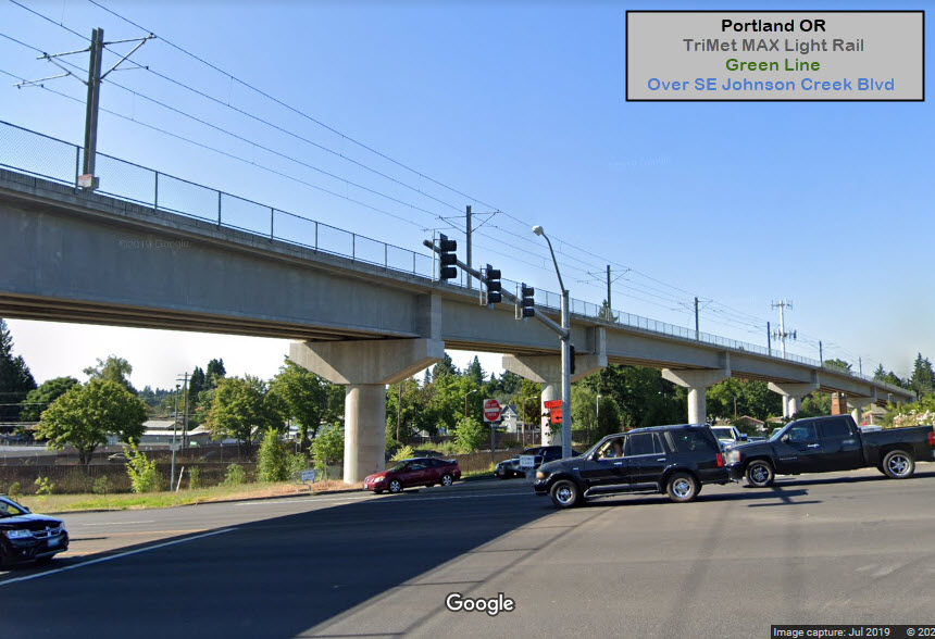
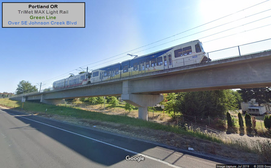
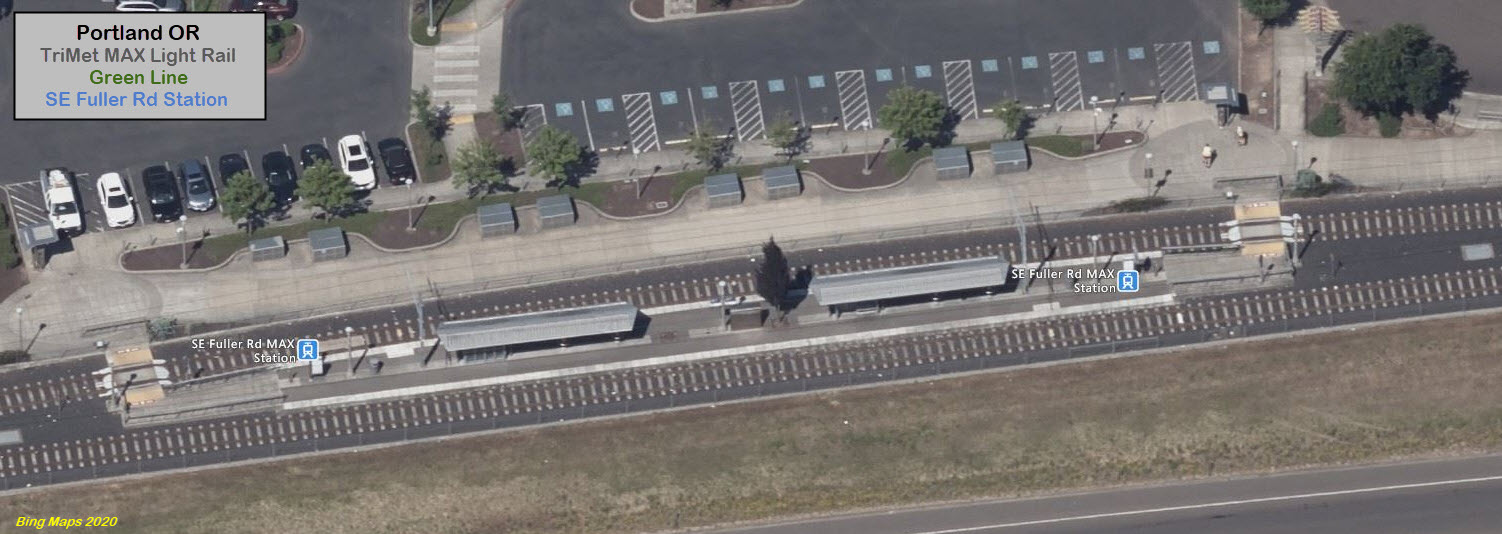
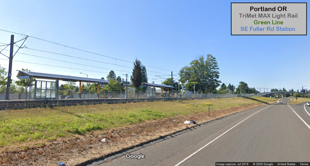
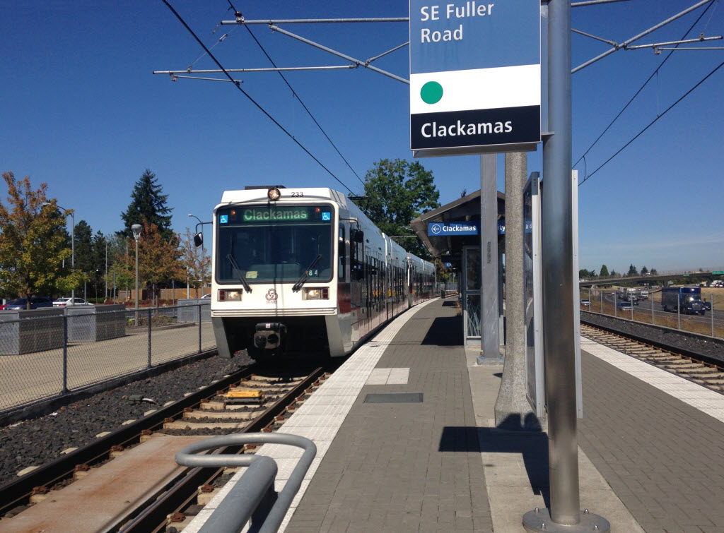 photo Toyota97, 2015
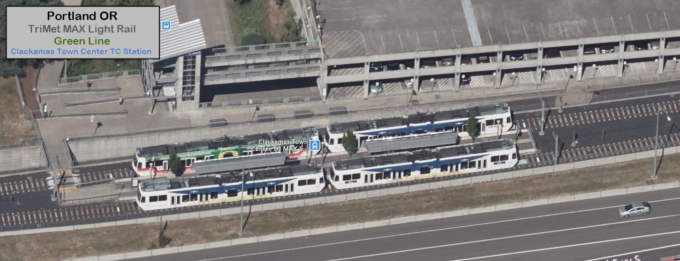
 The Oregonian