
In General
Getting Here
Map
Sights
Pictures
Bridges
Signals
Floobydust
RAILFAN GUIDES HOME
RAILROAD SIGNALS HOME
Location / Name:
Waynoka OK, Woods County
What's Here:
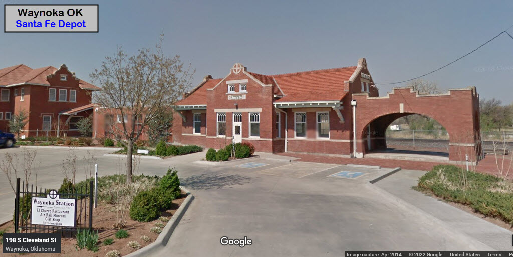
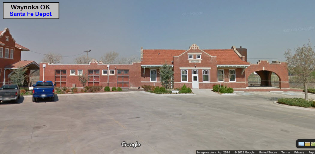
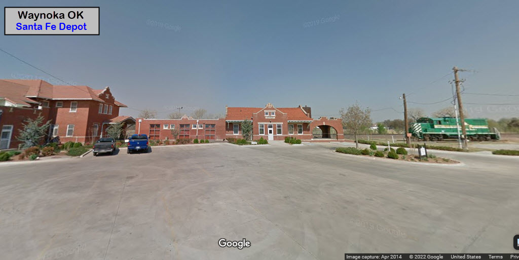
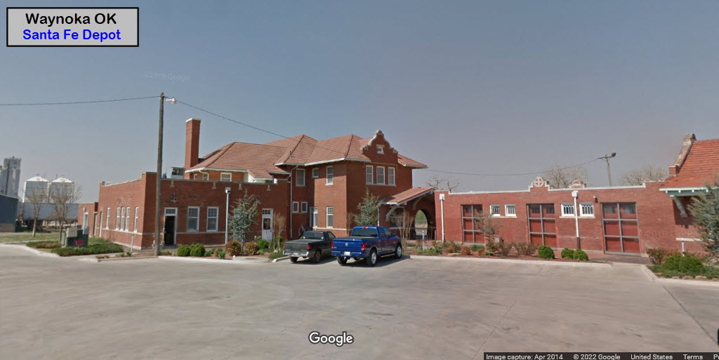
Former Santa Fe Depot
BNSF mainline action
Data:
GPS Coordinates: as needed
Phone A/C: 580
ZIP: 73860
2010 Population: ~925
Access by train/transit:
None
The Scoop:
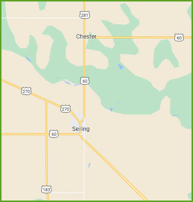
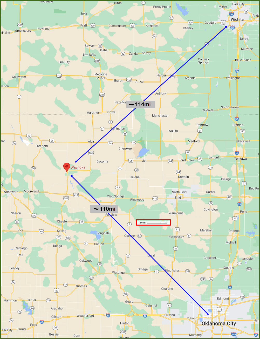
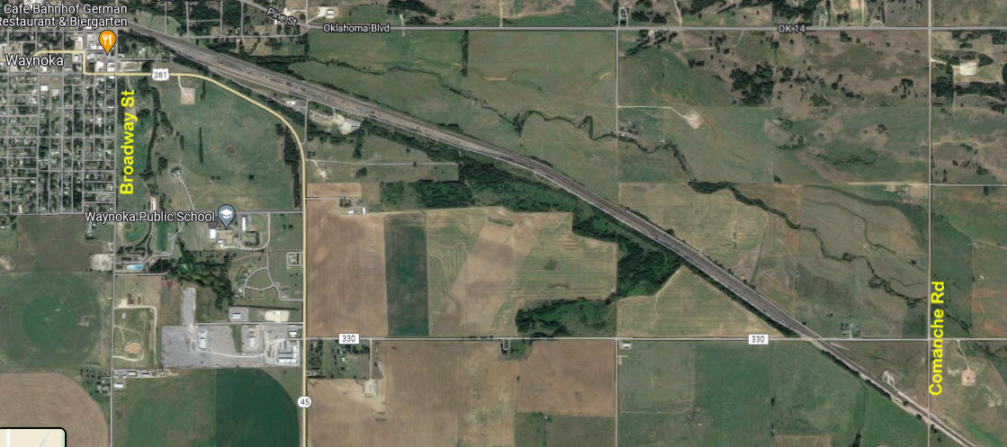
Waynoka is located on U.S. Highway 281 and State Highway 14, seventy miles west of Enid. Moreland is the next town west (~24mi), and Alva is about 21 miles to the east.
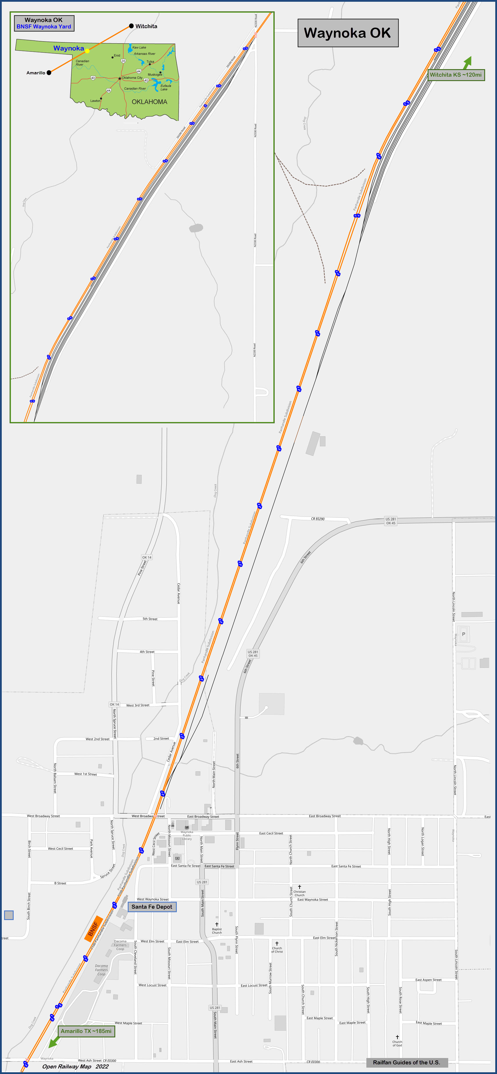
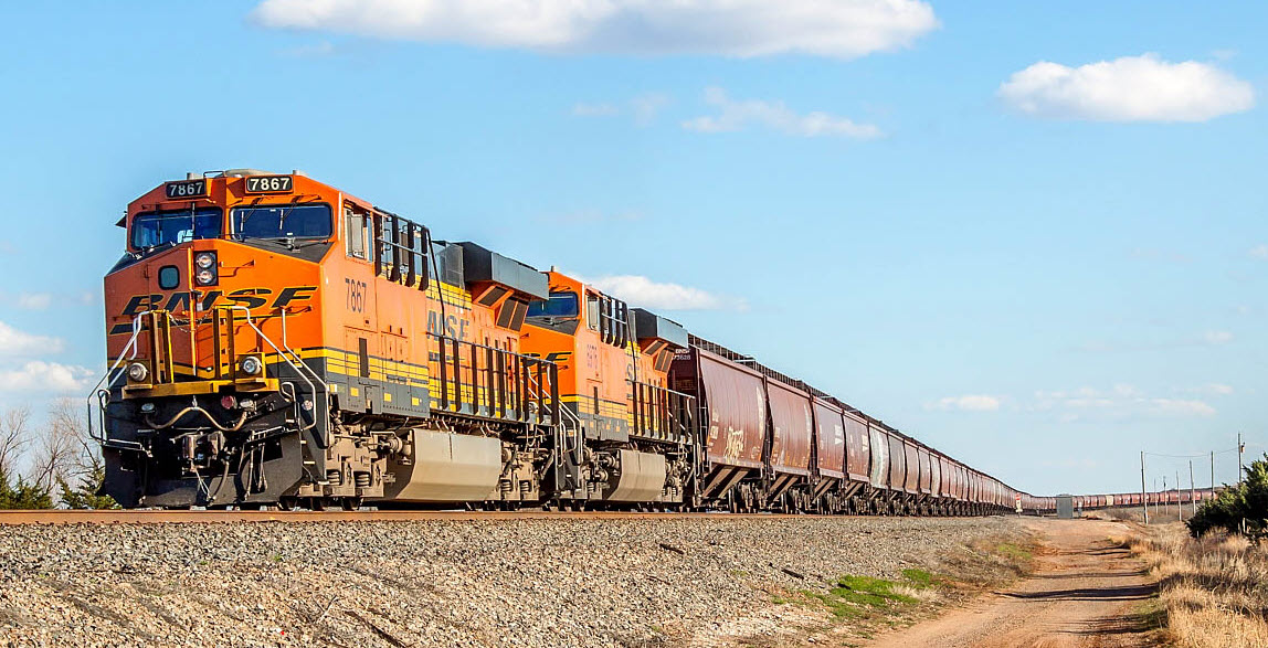
It is on BNSF's Panhandle Sub-Division, and sees anywhere from 70 to 100 trains a day! As can be seen from the few pictures I picked, the desert landscape is beautiful!
Over in Woodward, about 30 miles west, you have the Northwestern Oklahoma RR, at 1720 Lincoln Ave, Woodward OK 73801
Acknowledgements:
Denver Todd
Judy Maxwell
Open Railway Map
Wikipedia
Google Maps!
Maplogs . com
Websites and other additional information sources of interest for the area:
https://en.wikipedia.org/wiki/Waynoka_Santa_Fe_Depot_and_Harvey_House
https://www.waymarking.com/waymarks/wm9DMD_Santa_Fe_Depot_Waynoka_OK
https://www.pinterest.com/pin/236931630366208428/
https://sunrise.maplogs.com/waynoka_ok_usa.194535.html
https://www.trainorders.com/discussion/read.php?1,5306138
Unfortunately, Waynoka is out in the middle of "nowhere" (no disrespect for those of you who live out in "nowhere"). But because of this, it will take some doing if you are coming from elsewhere, say, Wichita or Oklahoma City.
I-35 is the closest N/S interstate to the east, runs from up the Twin-cities area of Minnesota down to Dallas and San Antonio. I would take exit 194 and head west on US-412. Travel about 90 miles to US-281, and take a right, this will put you in Waynoka in another ~12 miles.
The closest E/W interstate is I-40, about 80 miles south via US-281, US-60, and US-183 (it changes numbers around Chester and Seiling OK).
If you're coming in from the lands NW of Waynoka, please take the advice of your GPS unit or smart phone.
GPS Coordinates: 36.58353, -98.88319
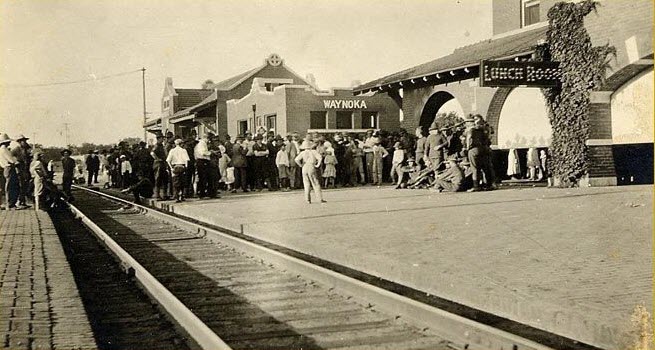
From Wikipedia: The Waynoka Santa Fe Depot and Harvey House in Waynoka OK are substantial brick buildings from 1910 built for the Atchison, Topeka and Santa Fe Railway ("Santa Fe"). The Harvey House operated from 1910 to 1937, and was renovated to serve as a dormitory and reading room for train crewmen. The Depot was a stop for the San Francisco Chief. It was listed on the National Register of Historic Places listings in Woods County, Oklahoma in 1974. The depot building is 84 by 22 feet (25.6 m × 6.7 m) in plan. The Harvey House building is H-shaped in plan. end Wiki
From Waymarking: The Santa Fe Depot and adjacent Harvey House, located at 202 Cleveland Street, at the west end of Waynoka Street are restored and owned by the Waynoka Historical Society. Paint was removed to restore the brick depot to its original condition. The buildings were built in 1910 and were actively operated on this rail line which is one of America's busiest lines. Even today, 50-100 trains pass this way daily. This line was the main line for travelers from Chicago to Los Angeles and for a two year period from 1929-1931 was part of the Transcontinental Air Transport (predecessor of TWA) Air-Rail system which offered cross-country travel by rail and air in 48 hours.
In the adjacent Harvey House restaurant building, a Mexican restaurant operates, and on the second floor, the Air-Rail Museum and Waynoka History Museum offer a peek into the rich history of Waynoka. Both buildings were placed on the National Register of Historic Places in 1974.
Fred Harvey service lasted at Waynoka until 1937. The railroad continued to use the Harvey House as a crew "reading room" into the 1990's. At some point the depot and Harvey House were given an ill-conceived coat of cream-colored paint over the bricks with red trim on the woodwork, as shown in the top photo. The depot was retired in 1986 and converted into a museum. end Waymarking
GPS Coordinates: 36.58380, -98.88297
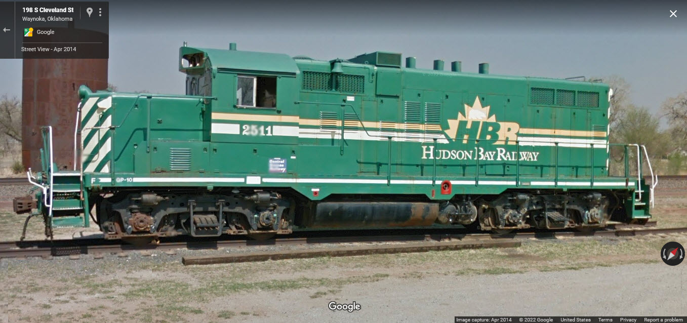
It sits next to the depot. A long way from home.... they should paint it in Santa Fe colors :-)
Has seven (7) tracks in it, on the east side of the mainline. The north end of the yard starts just below Comanche Rd, and runs about 1.6 miles in length until it turns into a (basically) long single track lead that comes back to the mainline at Broadway St, at Chester Ave. Access to the middle of the yard is from Roundhouse Rs and 281. I don't know how friendly or unfriendly folks are there.
 found on Pintrest, uploaded by Judy Maxwell
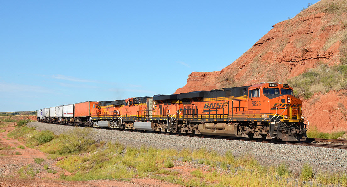
From the Maplogs website, plenty more pictures there.... but no photo credits are given :-(
 Maplogs
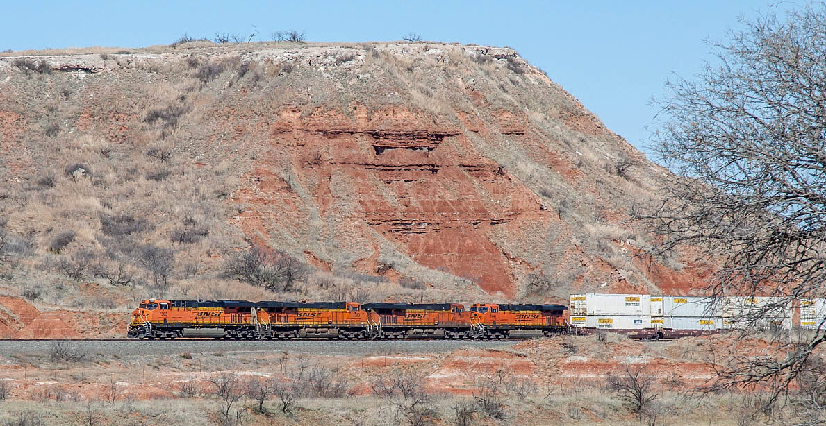 Maplogs
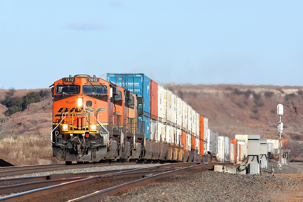 Maplogs
GPS Coordinates: 36.58762, -98.88149
Viewed from Chester St, at the "bottom" of the yard.
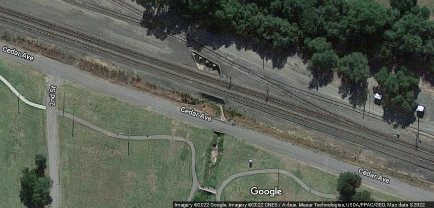
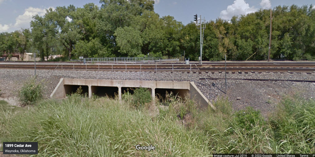
GPS Coordinates: 36.56839, -98.90073
A little over a mile south of the Ash St grade crossing. No easy access without a whole lotta walking. Dunno why bridges droop like this on their aerial views.....
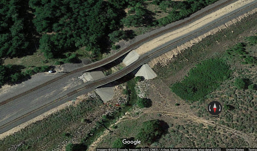
GPS Coordinates: 36.56839, -98.90073
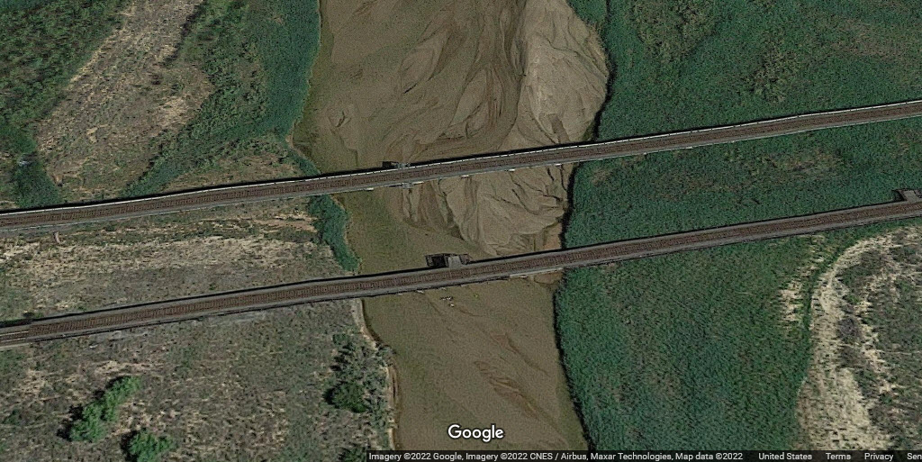
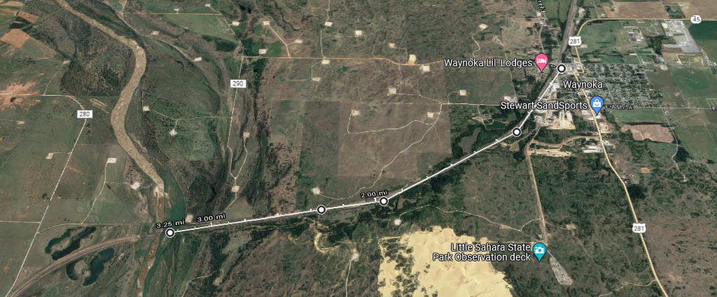
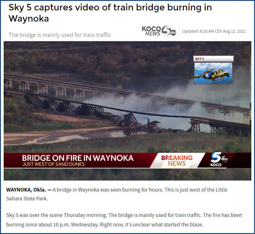
About 3 miles south of town. No easy access without a whole lotta walking. Had a fire on the #2 side in mid 2021.
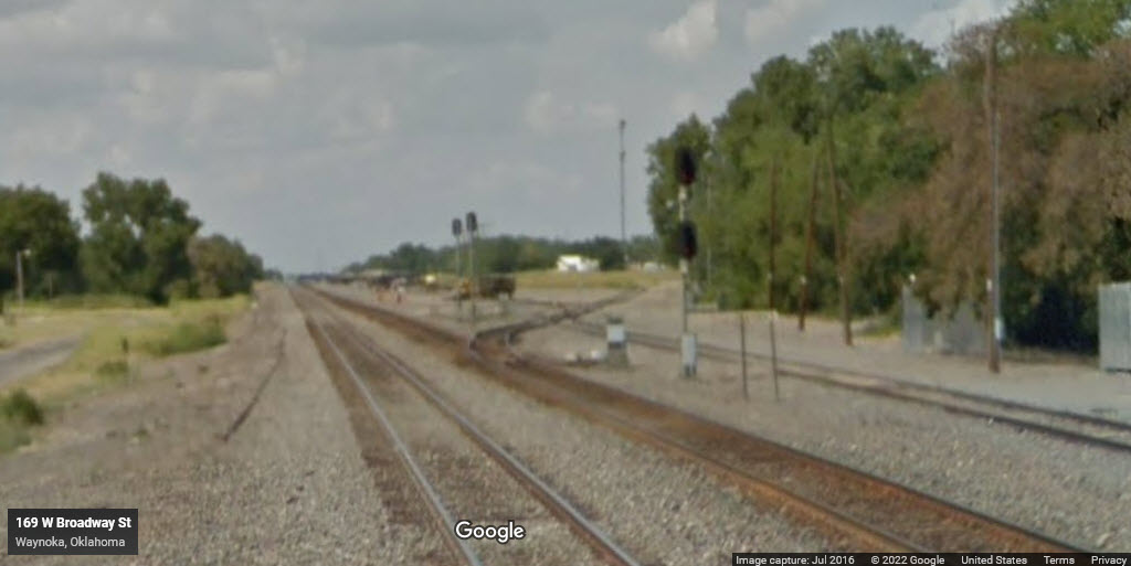
GPS Coordinates: 36.58664, -98.88179
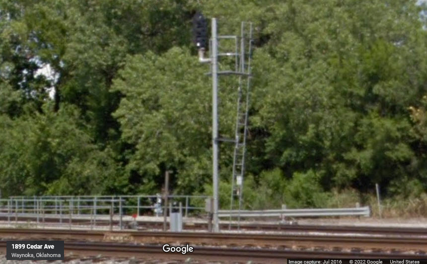
Controls EB traffic and entrance into the small siding here.
GPS Coordinates: 36.58734, -98.88150
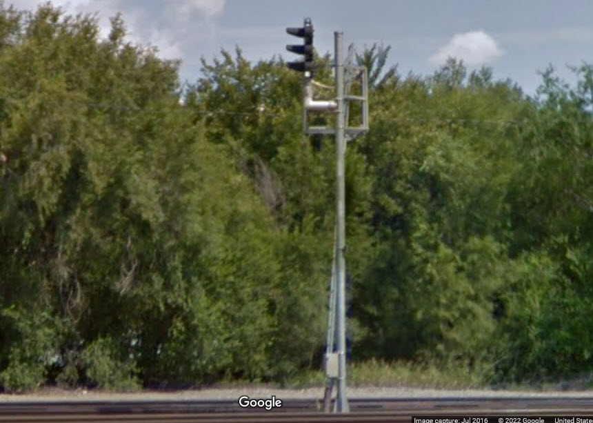
The left signal is the signal for WB traffic on main 2, which services this siding, the signal on the right is for siding traffic coming out onto the main.
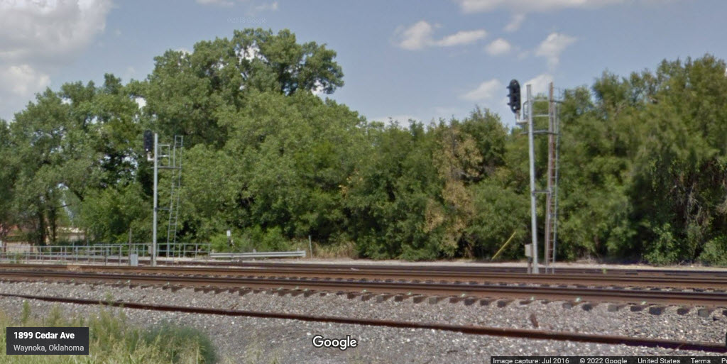
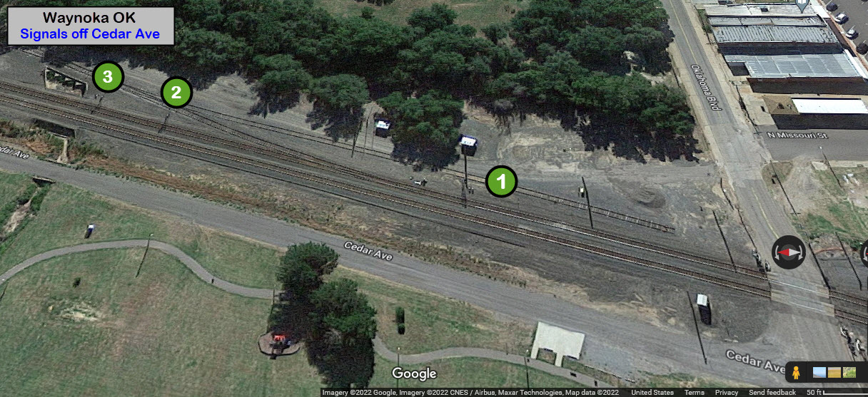
GPS Coordinates: 36.58752, -98.88142
Nothing for now....
Disclaimers:
I love trains, and I love signals. I am not an expert. My webpages reflect what I find on the topic of the page. This is something I have fun with while trying to help others.
Please Note: Since the main focus of my two websites is railroad signals, the railfan guides are oriented towards the signal fan being able to locate them. For those of you into the modeling aspect of our hobby, my indexa page has a list of almost everything railroad oriented I can think of to provide you with at least a few pictures to help you detail your pike.
If this is a railfan page, every effort has been made to make sure that the information contained on this map and in this railfan guide is correct. Once in a while, an error may creep in :-)
My philosophy: Pictures and maps are worth a thousand words, especially for railfanning. Text descriptions only get you so far, especially if you get lost or disoriented. Take along good maps.... a GPS is OK to get somewhere, but maps are still better if you get lost! I belong to AAA, which allows you to get local maps for free when you visit the local branches. ADC puts out a nice series of county maps for the Washington DC area, but their state maps do not have the railroads on them. If you can find em, I like the National Geographic map book of the U.S..... good, clear, and concise graphics, and they do a really good job of showing you where tourist type attractions are, although they too lack the railroads. Other notes about specific areas will show up on that page if known.
Aerial shots were taken from either Google or Bing Maps as noted. Screen captures are made with Snagit, a Techsmith product... a great tool if you have never used it!
By the way, floobydust is a term I picked up 30-40 years ago from a National Semiconductor data book, and means miscellaneous and/or other stuff.
Pictures and additional information is always needed if anyone feels inclined to take 'em, send 'em, and share 'em, or if you have something to add or correct.... credit is always given! Please be NICE!!! Contact info is here
Beware: If used as a source, ANYTHING from Wikipedia must be treated as being possibly inaccurate, wrong, or not true.
RAILFAN GUIDES HOME
RAILROAD SIGNALS HOME
NEW 07/18/2022, JUL19/2022
Last Modified 19-Jul-2022