

In General
Getting Here
Map
Sights
Pictures
Bridges
Signals
Fire & Police
Floobydust
USGS Maps
RAILROAD SIGNALS HOME
Location / Name:
Vinita OK, Craig County (county seat)
What's Here:
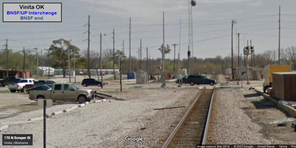
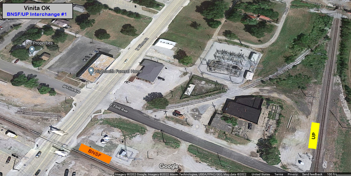
UP / BNSF Diamond
Data:
GPS Coordinates: as needed
Phone A/C: 918
ZIP: 74301
Population: ~5,700 (2010)
Access by train/transit:
None
The Scoop:
Vinita is a small waypoint along I-44, but if you're passing by here, you might as well stop by and see if you can catch anything. Because the UP and BNSF cross each other here, you kinda double your chances of catching something here.
The north-south running UP line is a former MKT track (Missouri-Kansas-Texas), and the east-west running BNSF track used to be a former Frisco/SLSF line.
From the Vinita City website: Since its founding in 1871, Vinita has been a crossroads of freight and travel across America. Established in Indian Territory, Vinita was located at the crossing of the Atlantic and Pacific (now Burlington Northern Santa Fe) Railroad and the Missouri, Kansas, Texas (now Union Pacific) Railway. (end)
There is a BNSF MOW yard adjacent to the North Miller Street grade crossing.
Looks like there are six hotels in town. A Walmart is across from the exit/entrance to the thruway. Most of the restaurants I see are on US-60 between the thruway and Wilson St, and then a few on South Wilson St.
Acknowledgements:
Denver Todd
Diesel Dan
CaptainKirk
Mark Davidson
Terry Cantrell
J. Parker Lamb/Center for Railroad Photography and Art
Open Railway Map
Google Maps
Websites and other additional information sources of interest for the area:
https://www.roadsideamerica.com/story/11683
https://www.legendsofamerica.com/vinita-mcdonalds/
https://ogrforum.ogaugerr.com/topic/train-orders
https://www.youtube.com/watch?v=7Olsu6aHGSg Video of UP 4014 in Vinita
https://frisco.org/mainline/tag/467/
https://www.cityofvinita.com/explore/pages/railroad
https://www.cityofvinita.com/about-vinita/pages/history-vinita
https://railphoto-art.org/collections/lamb/group-five/#!jig[1]/FL/29830525212
Exit 289 off of I-44 (the Will Rodgers Turnpike - a toll road). At the end of the exit ramp, take US-60/OK-66 WEST, to Vinita. Go about 4/5 of a mile, and take a right onto North 1st Street. This will take you to one side of the diamond on the BNSF. If you go one block further, crossing the UP, and then taking a right onto North Wilson Street, it will take you to the other side of the diamond on the BNSF.
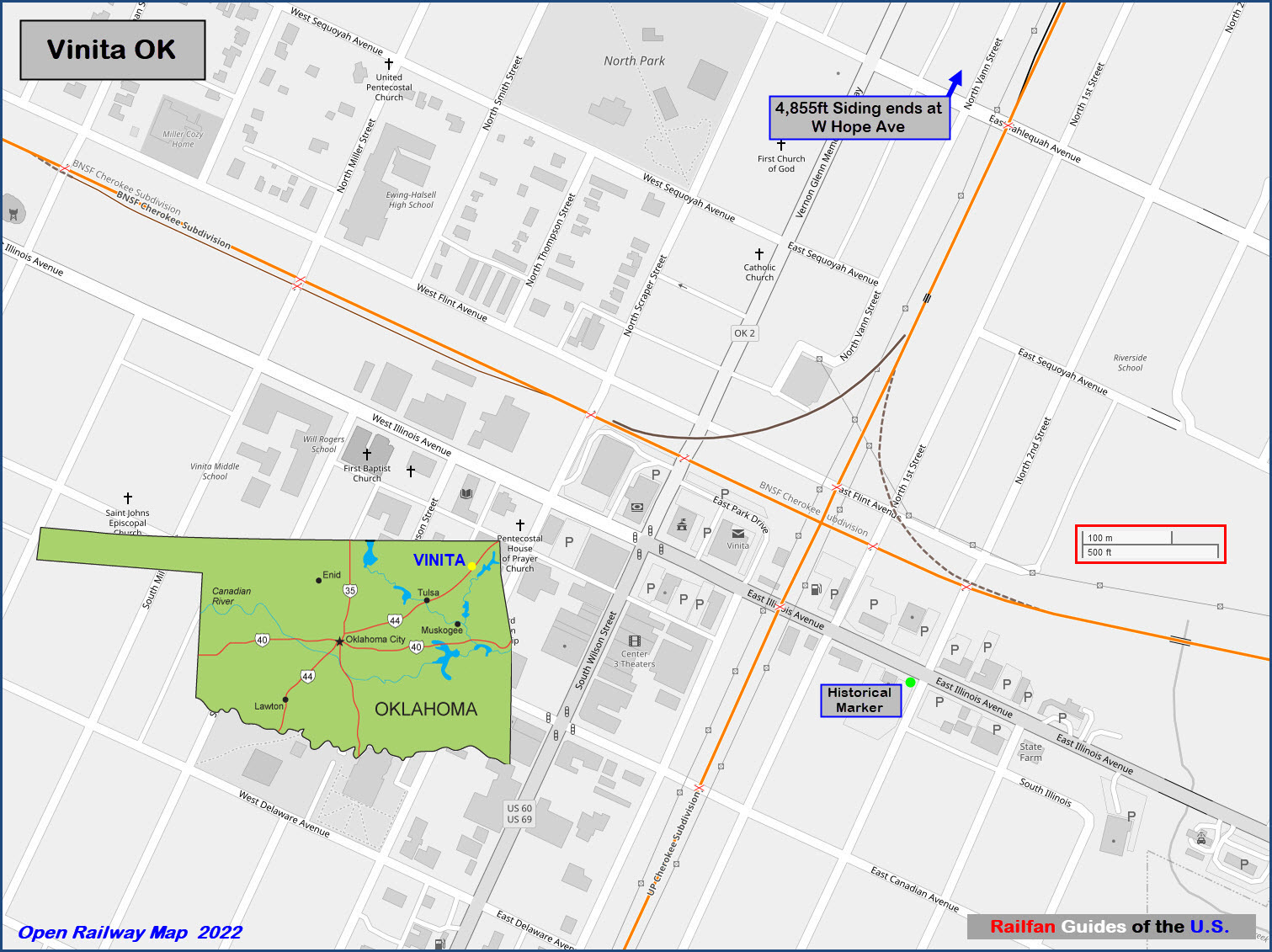
GPS Coordinates: 36.63900, -95.15223
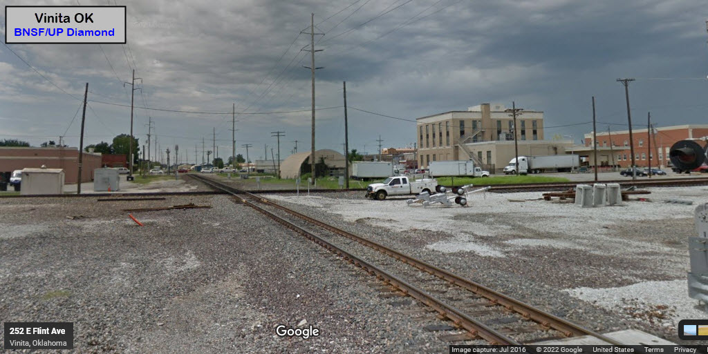
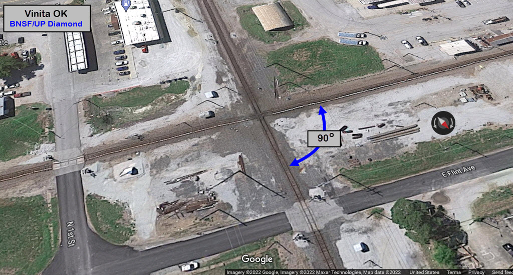
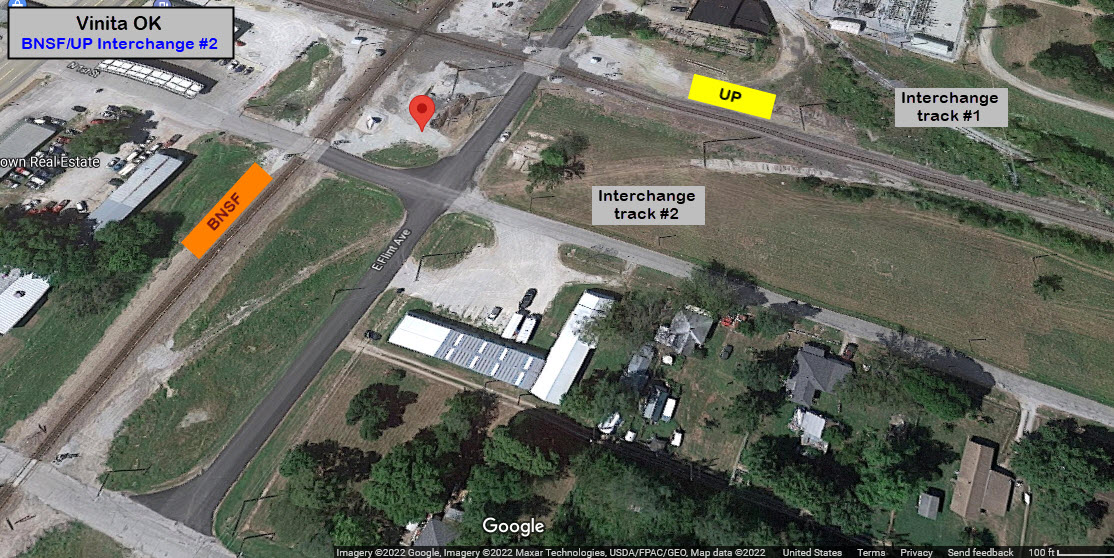
There used to be two interchange tracks, then there was one, and now it appears that we are down to none. Both the Wilson St and Flint Ave grade crossing have been paved over.
Have no clue when it was removed, but it's been a while....
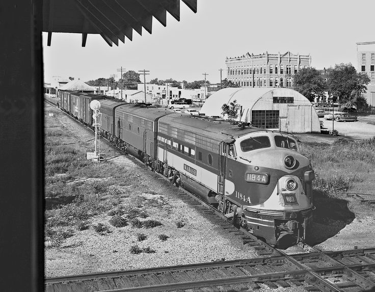
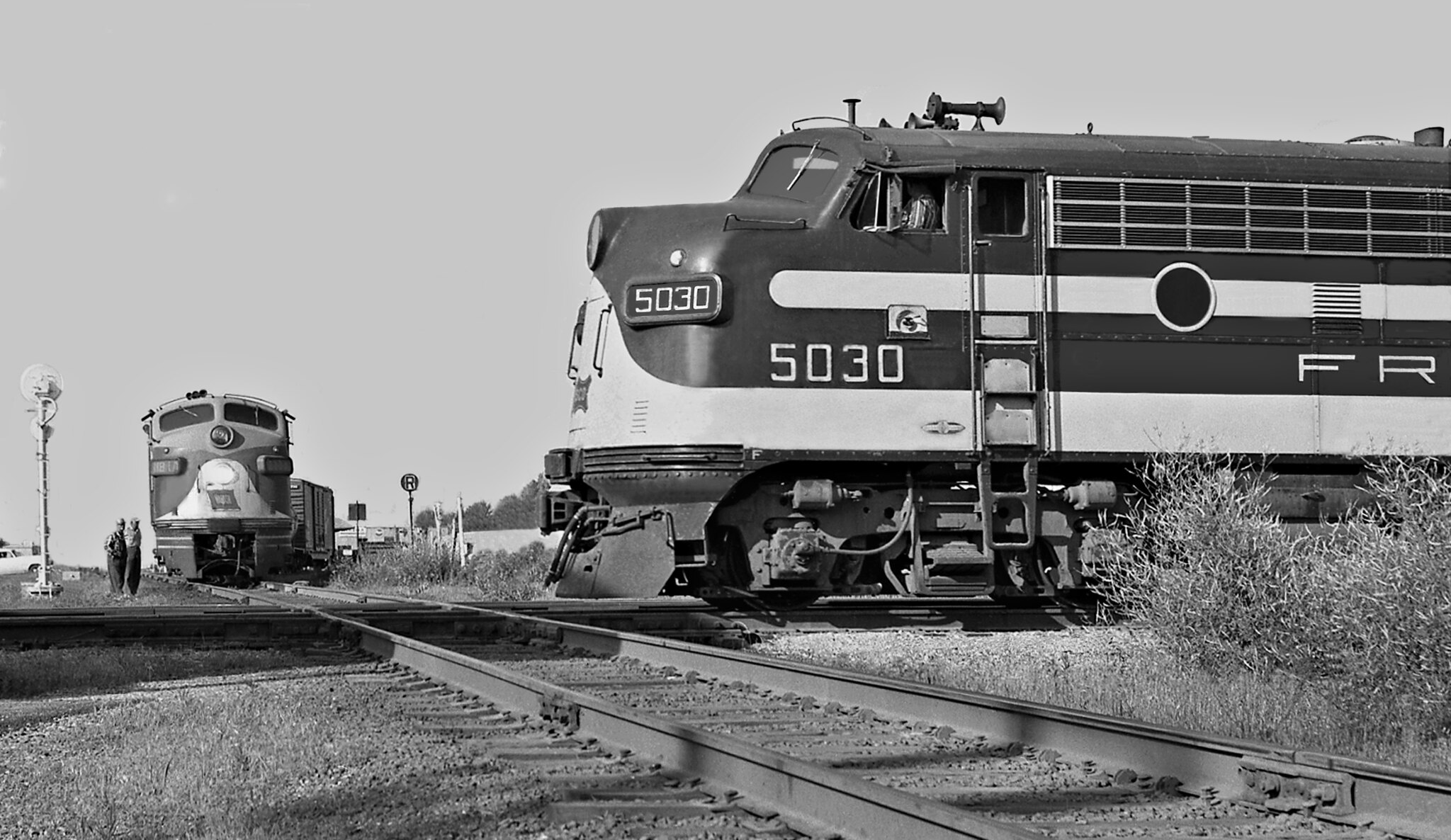 J. Parker Lamb/1959
A Tulsa bound Frisco freight crosses the diamond in 1959. Center for Railroad Photography and Art.
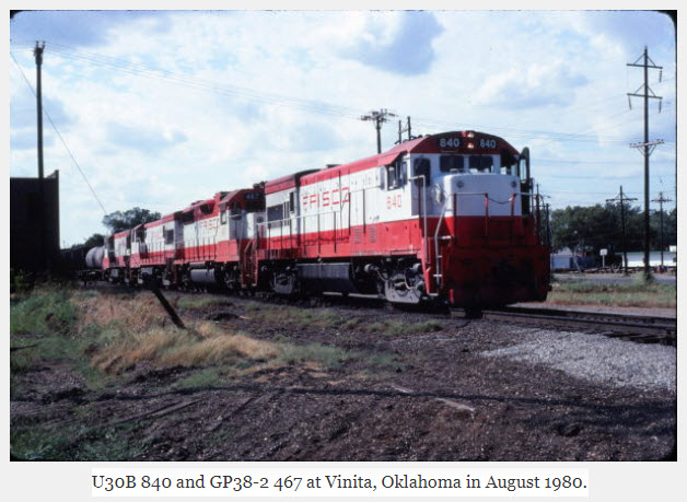 Mark Davidson, via Frisco Archives
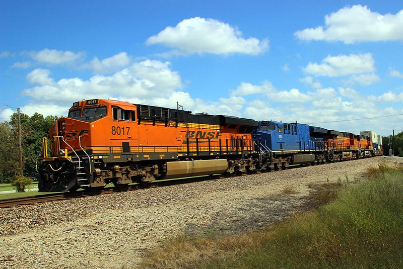 Terry Cantrell, 2015
The two following pictures came off an "O Gauge Forum" about train orders....
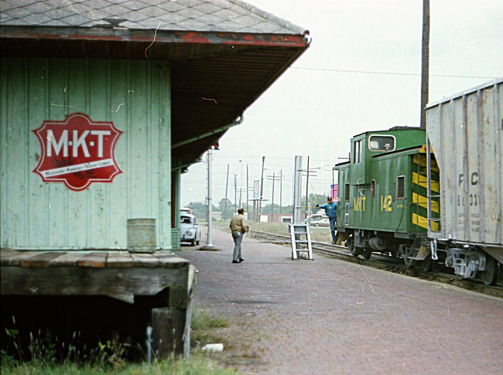 Diesel Dan, 1977
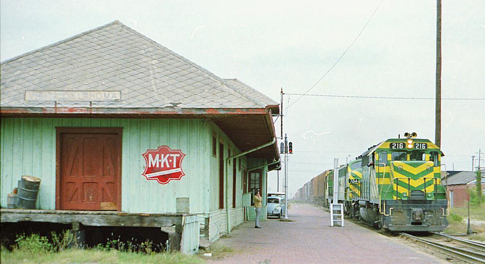 Diesel Dan, 1977
From the Youtube video, the train stopped short of the diamond:
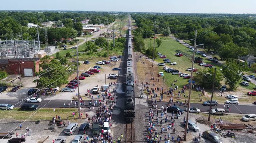 CaptainKirk, 2021
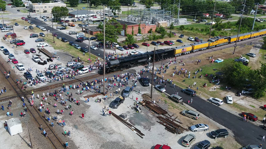 CaptainKirk, 2021
GPS Coordinates: 36.63779, -95.14764
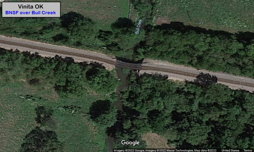
Not much around to "go over", this seems to be "it", about 1400ft east of the diamond.
GPS Coordinates: 36.63883, -95.15182
Easy to get to off of North 1st St.
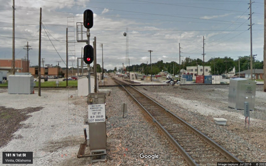
GPS Coordinates: 36.63919, -95.15262
Easy access from North Wilson St.
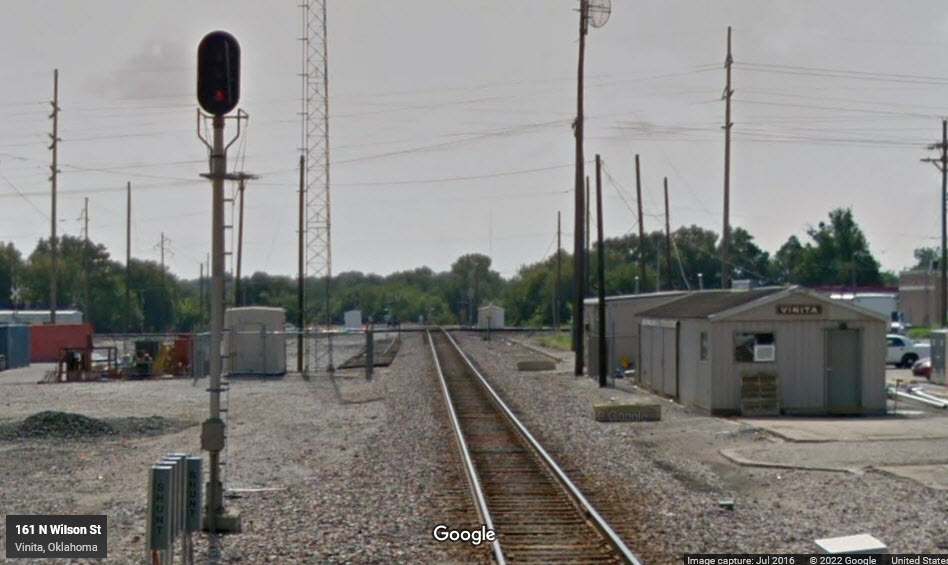
GPS Coordinates: 36.63860, -95.15240
Easy access from US-60.
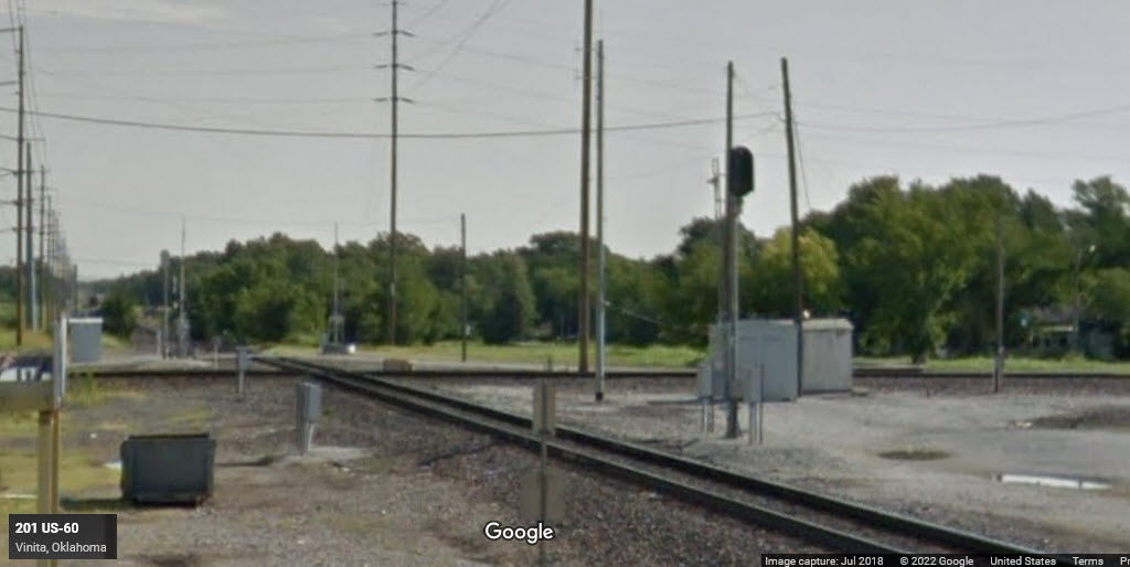
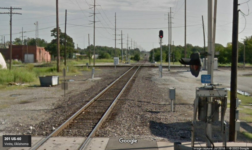
GPS Coordinates: 36.63958, -95.15199
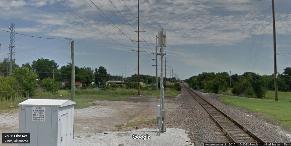
Easy access from East Flint Ave.
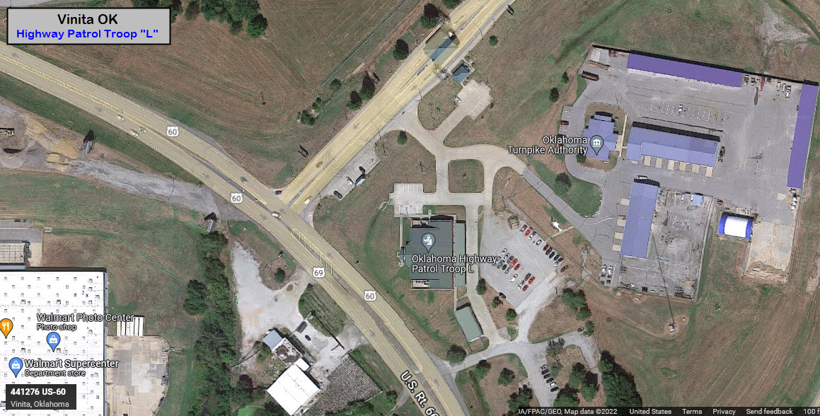
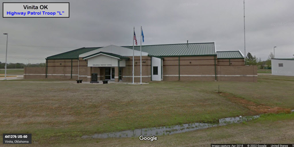
![]() Oklahoma Highway Patrol Troop "L"
Oklahoma Highway Patrol Troop "L"
441276 US-60, Vinita OK 74301
918-256-3388
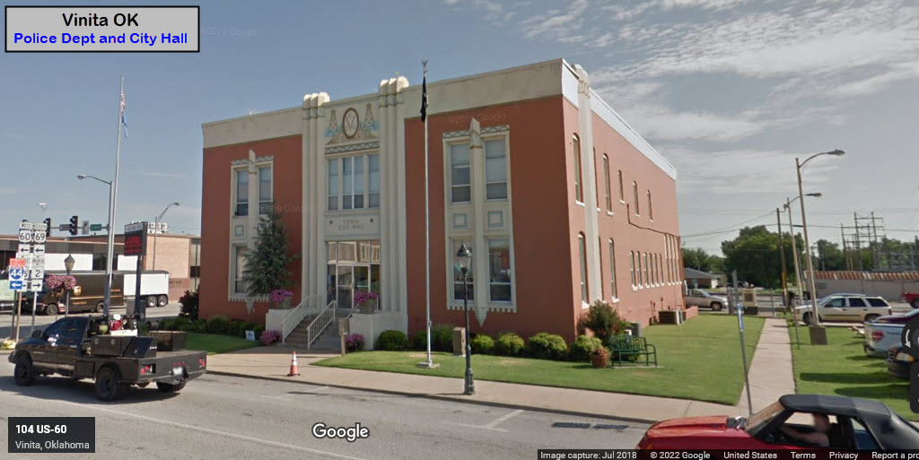
![]() Vinita Police Department
Vinita Police Department
104 E Illinois Ave, Vinita OK
918-256-6414
https://www.facebook.com/vinitapolicedept
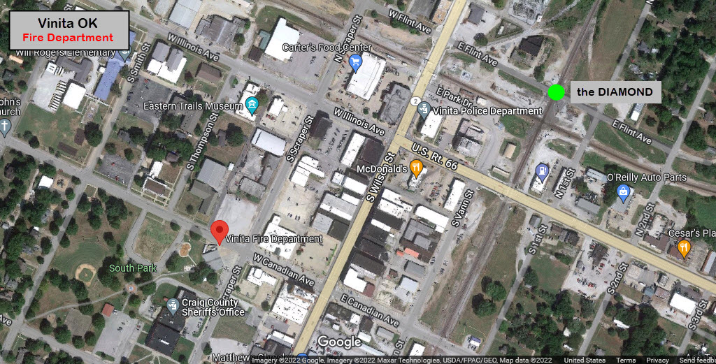
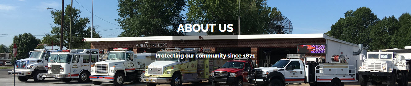
![]() Vinita Fire Department
Vinita Fire Department
202 W Canadian Ave, Vinita OK 74301
918-256-2674

The Vinita Fire Department has been serving Vinita and the surrounding areas since 1871. Serving the City of Vinita and surrounding parts of Craig County, the Vinita Fire Department runs approximately 400 runs each and every year. Our team of career and volunteer firefighters enjoy working for the citizens of this great city.
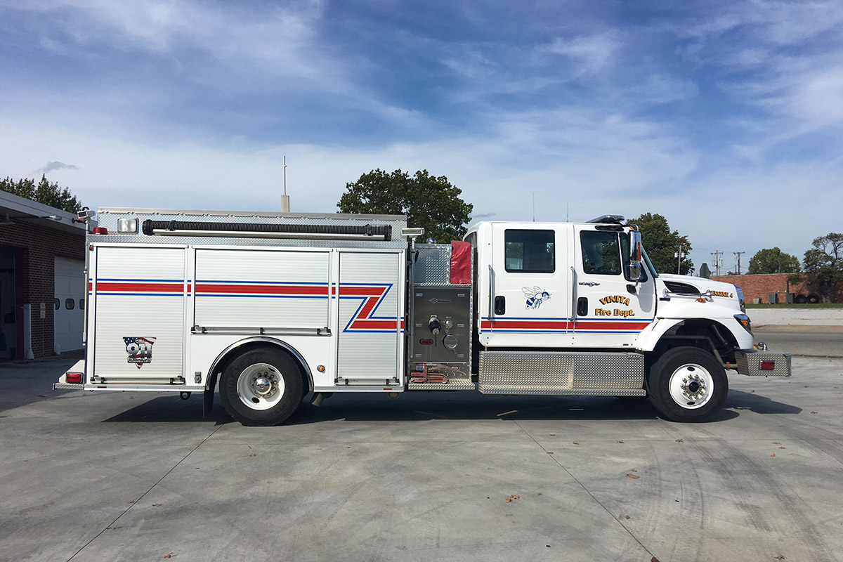
Engine 4 is a 2012 Spartan Legend Pumper built by Spartan Motors. It is our “first-out” truck for most calls we receive. This pumper carries 1,000 gallons of water and is capable of pumping 1,500 gallons per minute. It also contains a set of our vehicle extrication tools, commonly knows as “Jaws of Life.”
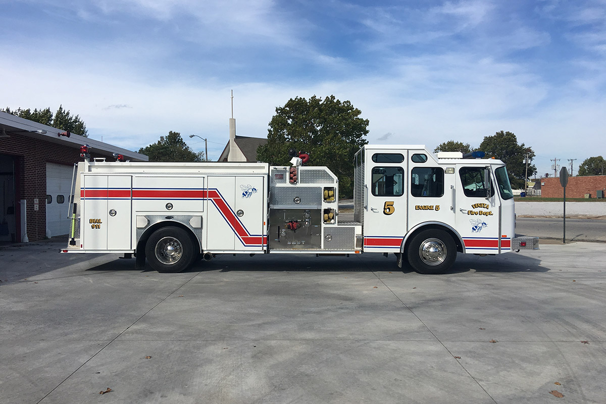
Engine 5 is a 1997 E-ONE Cyclone fire truck. It carries 1,000 gallons of water and has the capability of pumping 1,500 gallons per minute. Engine 5’s use is dedicated exclusively to the City of Vinita and does not leave the city limits.
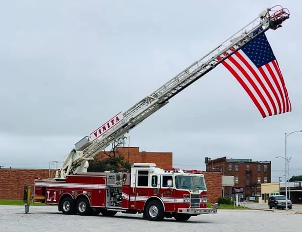
Ladder 1 is a Pierce Quint with a 50ft aerial ladder.
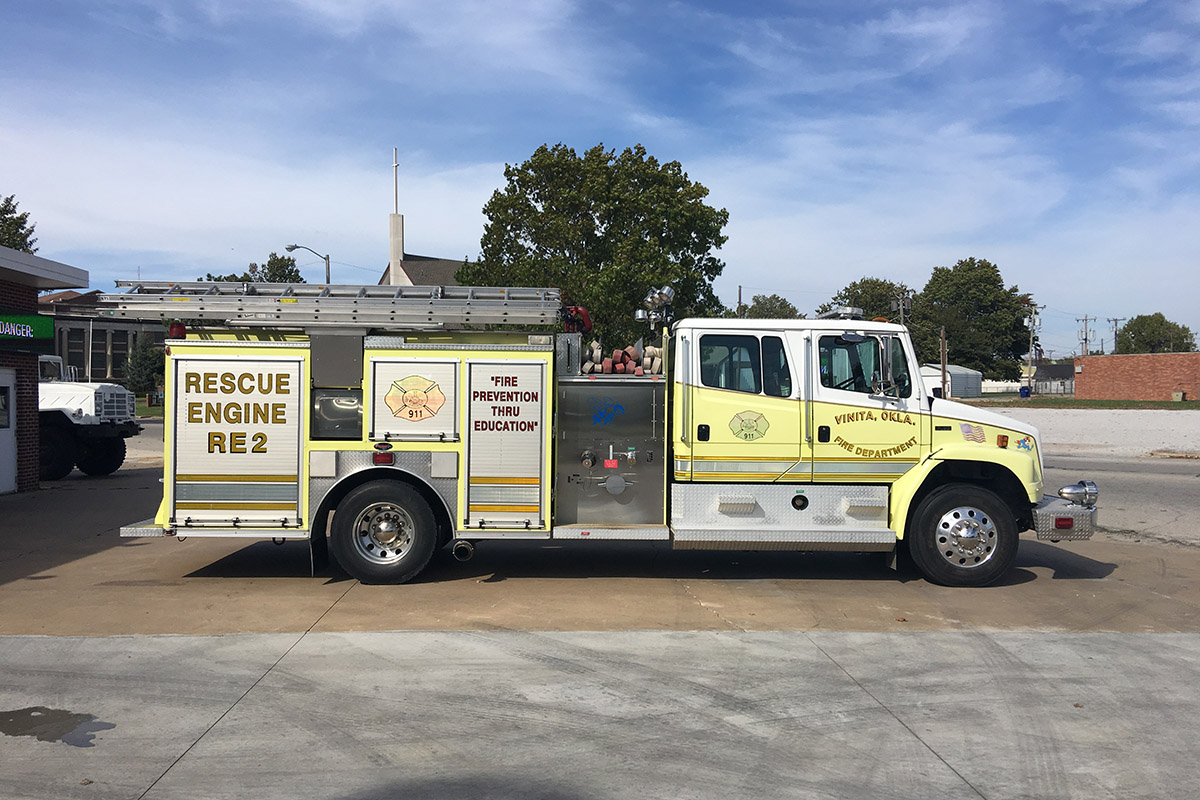
Rescue 2 is a 1997 Freightliner FL80 manufactured by Precision Fire Apparatus, Inc. It carries 500 gallons of water and has the capability of pumping 1,500 gallons per minute. It is used for motor vehicle accidents and as a backup pumper for structure fires. It contains VFD’s second set of extrication tools.
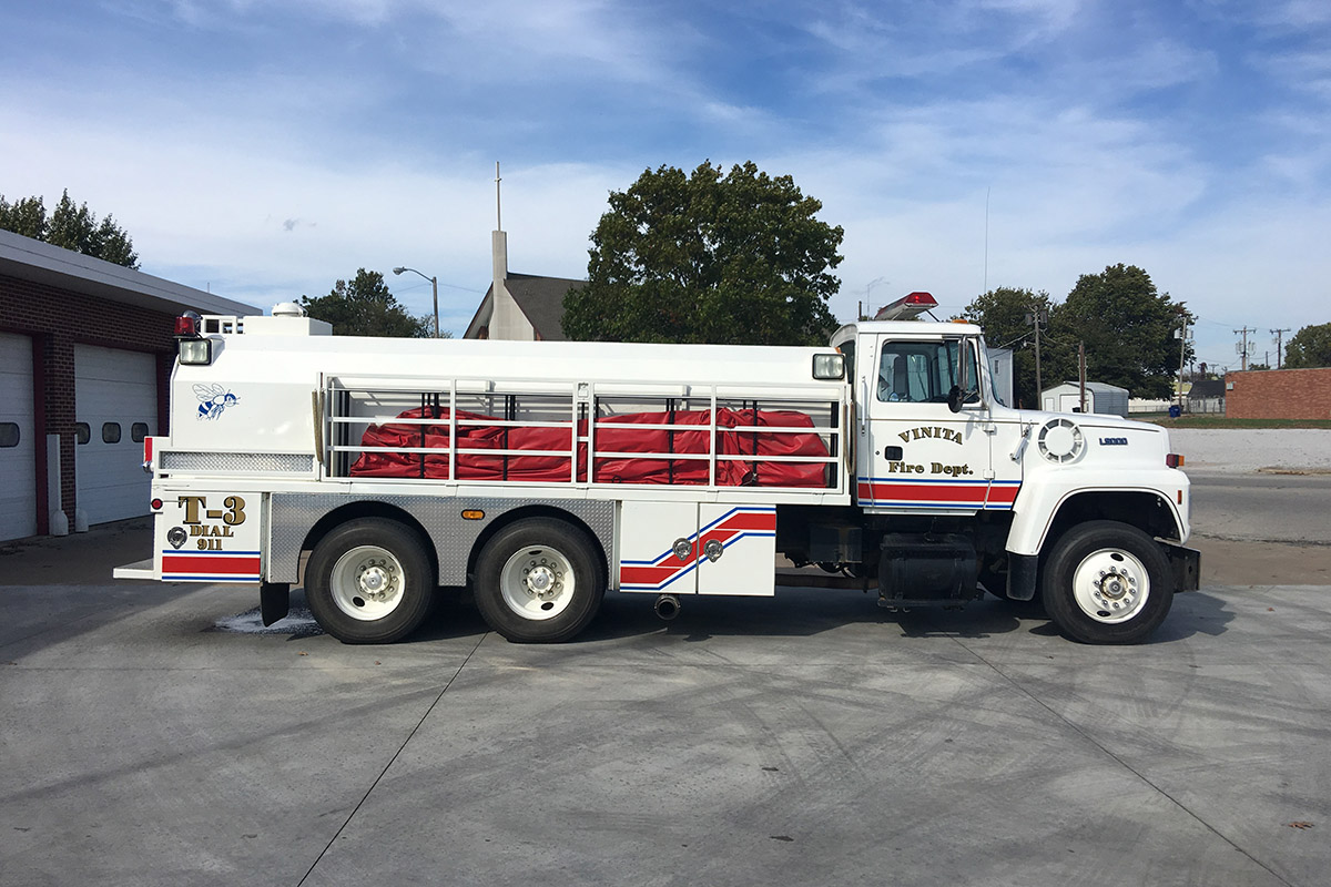
Tanker 3 is a 1993 Ford L9000 built by Deep South Trucks. It carries 3,000 gallons of water and is used to support our fleet when fighting wildland fires and structure fires alike.
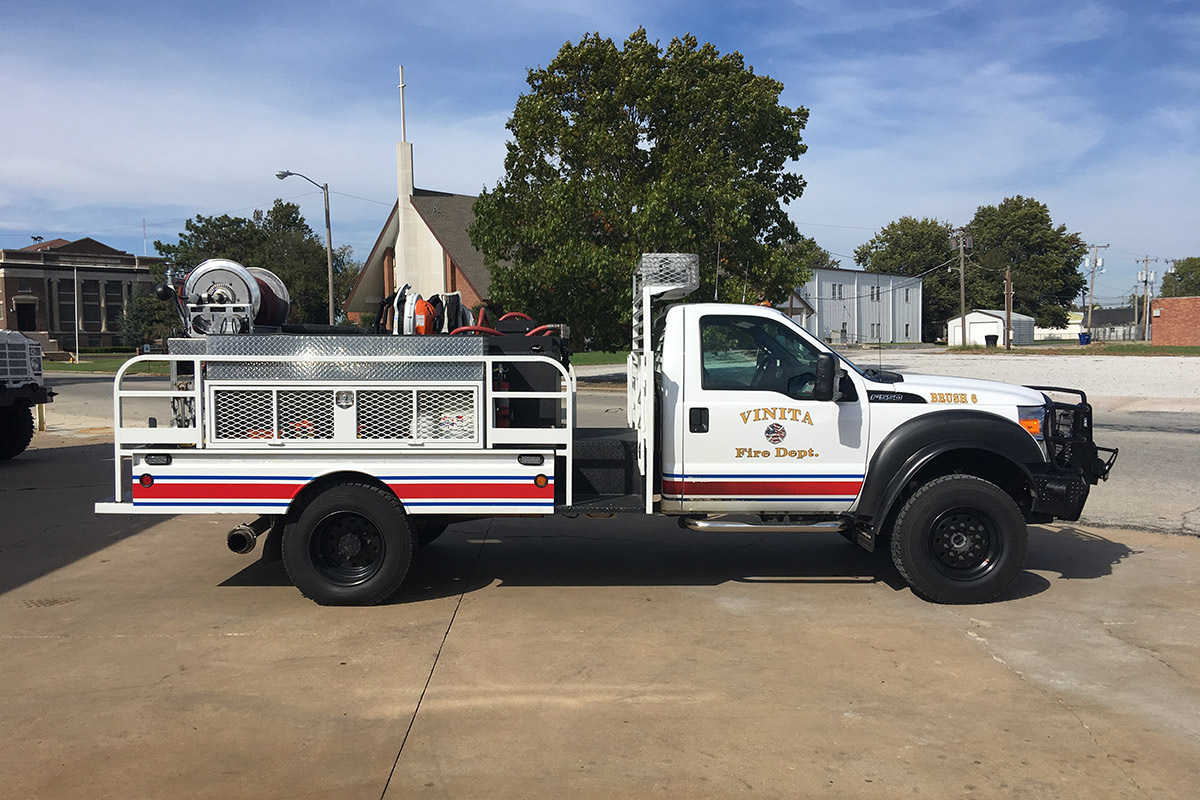
Brush 6 is a 2012 Ford F550 built by AMI fire. As its name implies it is used to fight wildland fires.
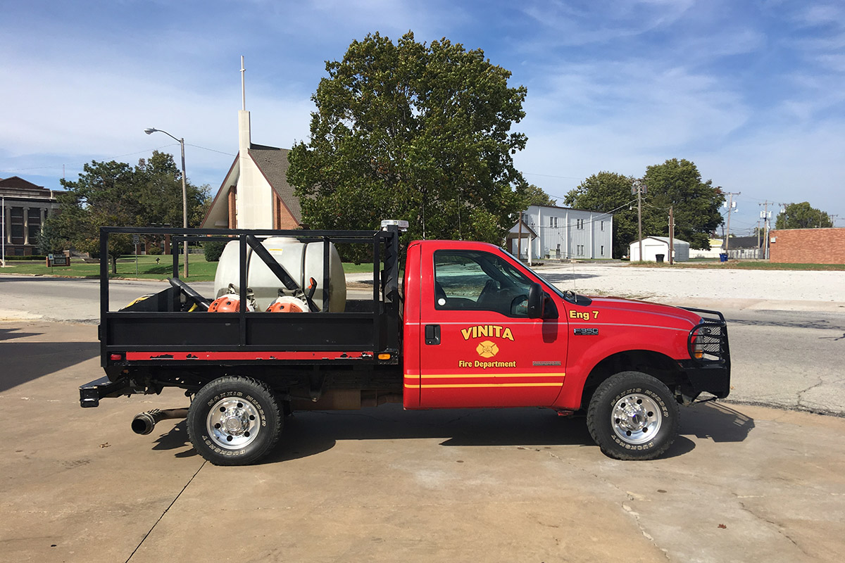
Brush 7 is a 2004 Ford F350. As its name implies it is used to fight wildland fires.
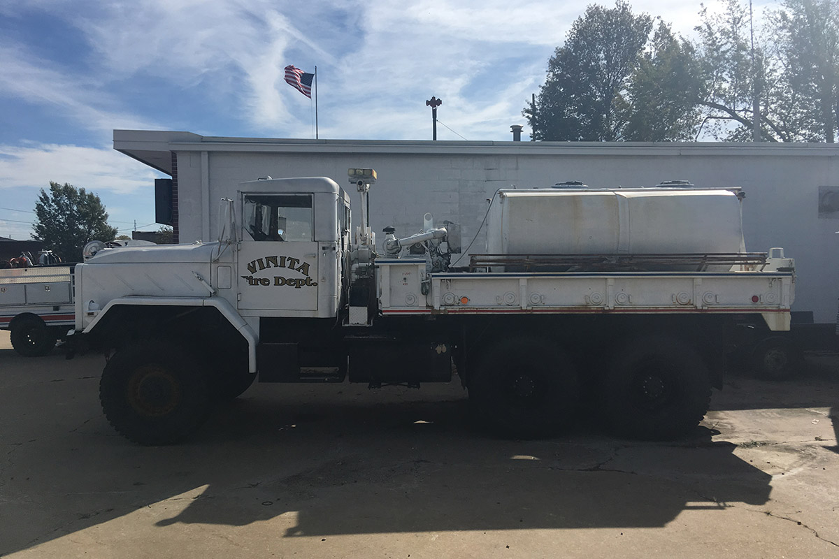
Brush 8 is 1984 AM General retired from the U.S Military. It is a beast of a truck that is used to fight wildland fires and also rescue people trapped by flood waters.
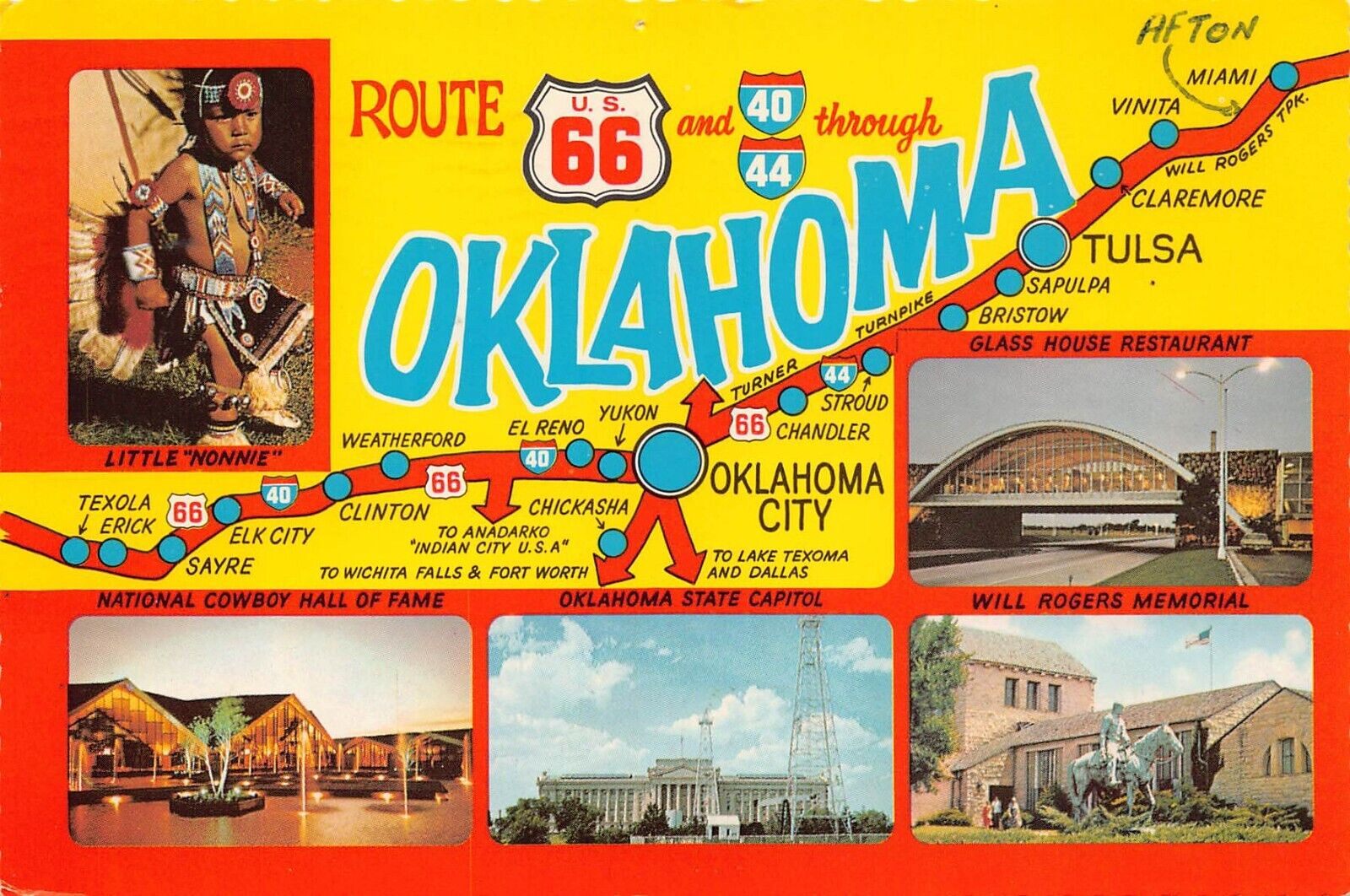
Vinita is on part of the iconic Route 66 highway
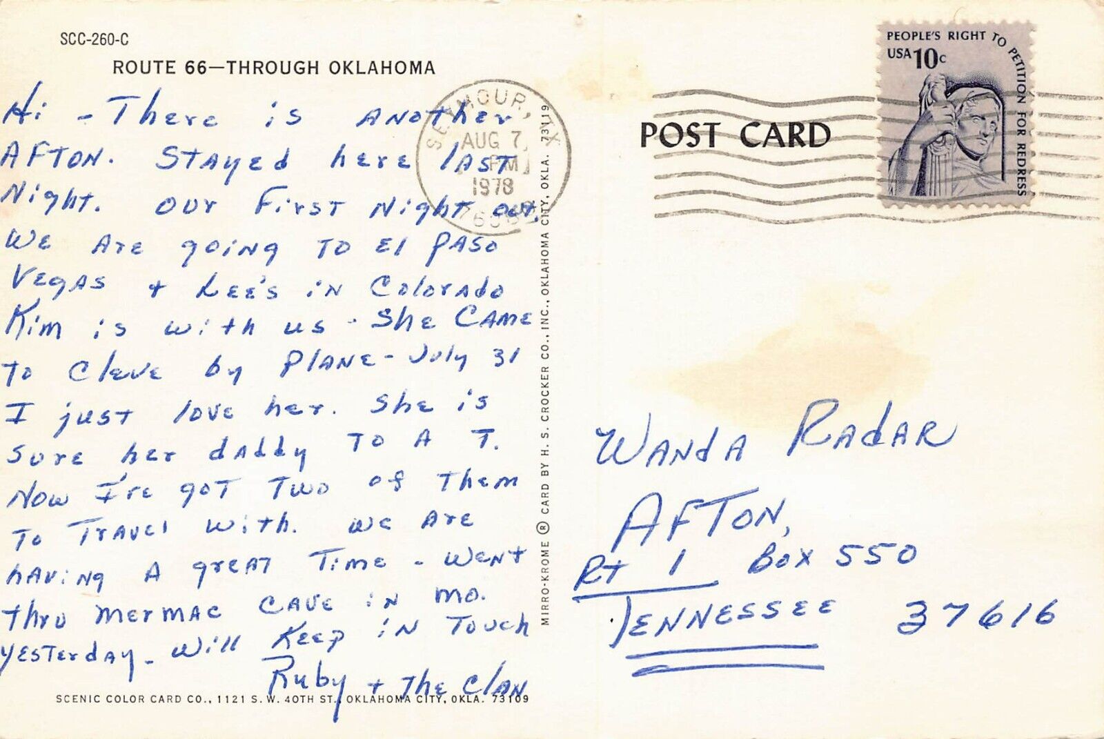
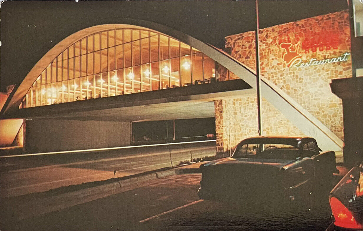
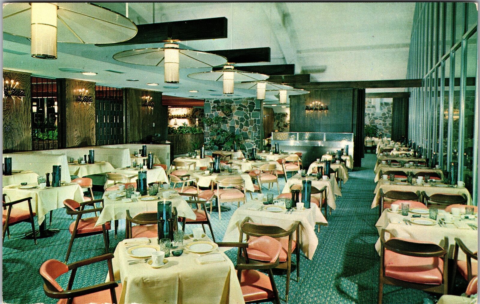
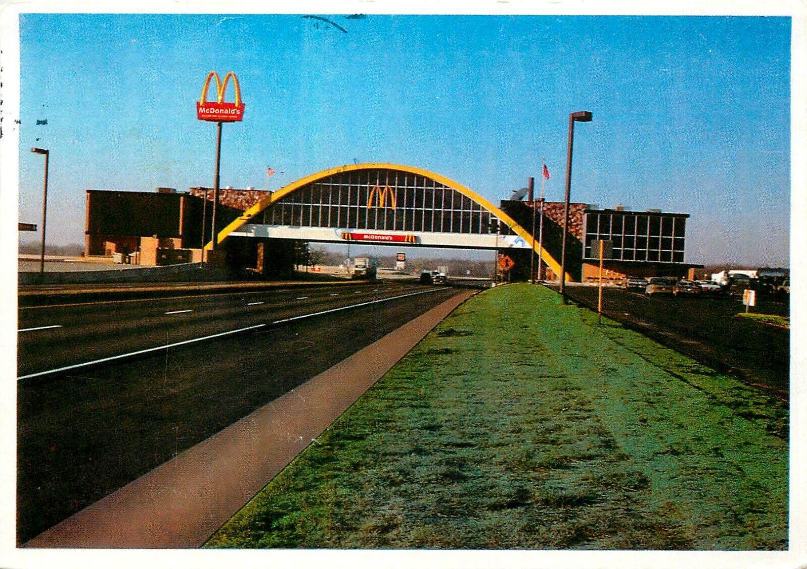
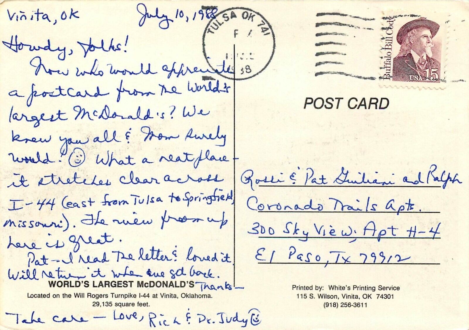
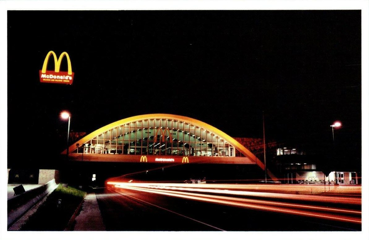
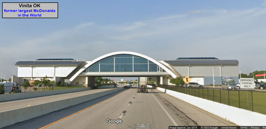
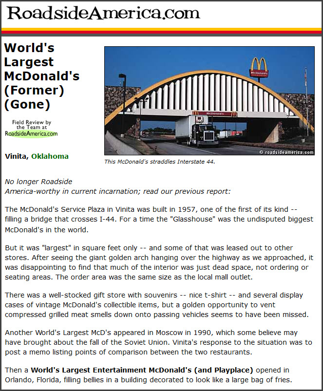
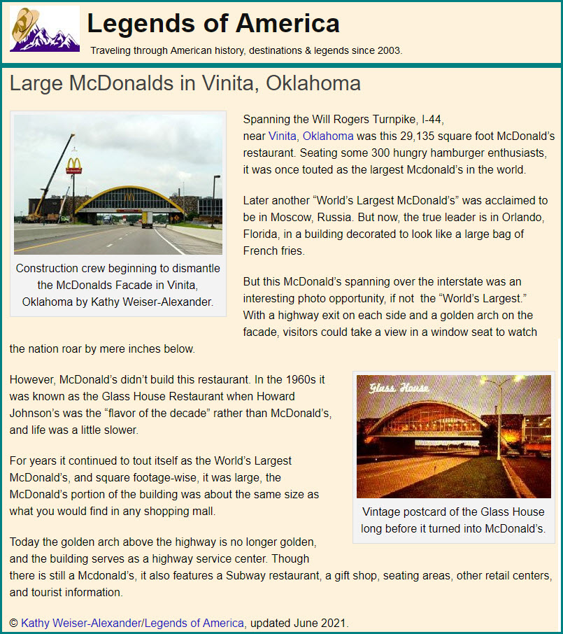
Before the rest stop restaurant became a McDonald's, it was the Glass House Restaurant Broiler Room.
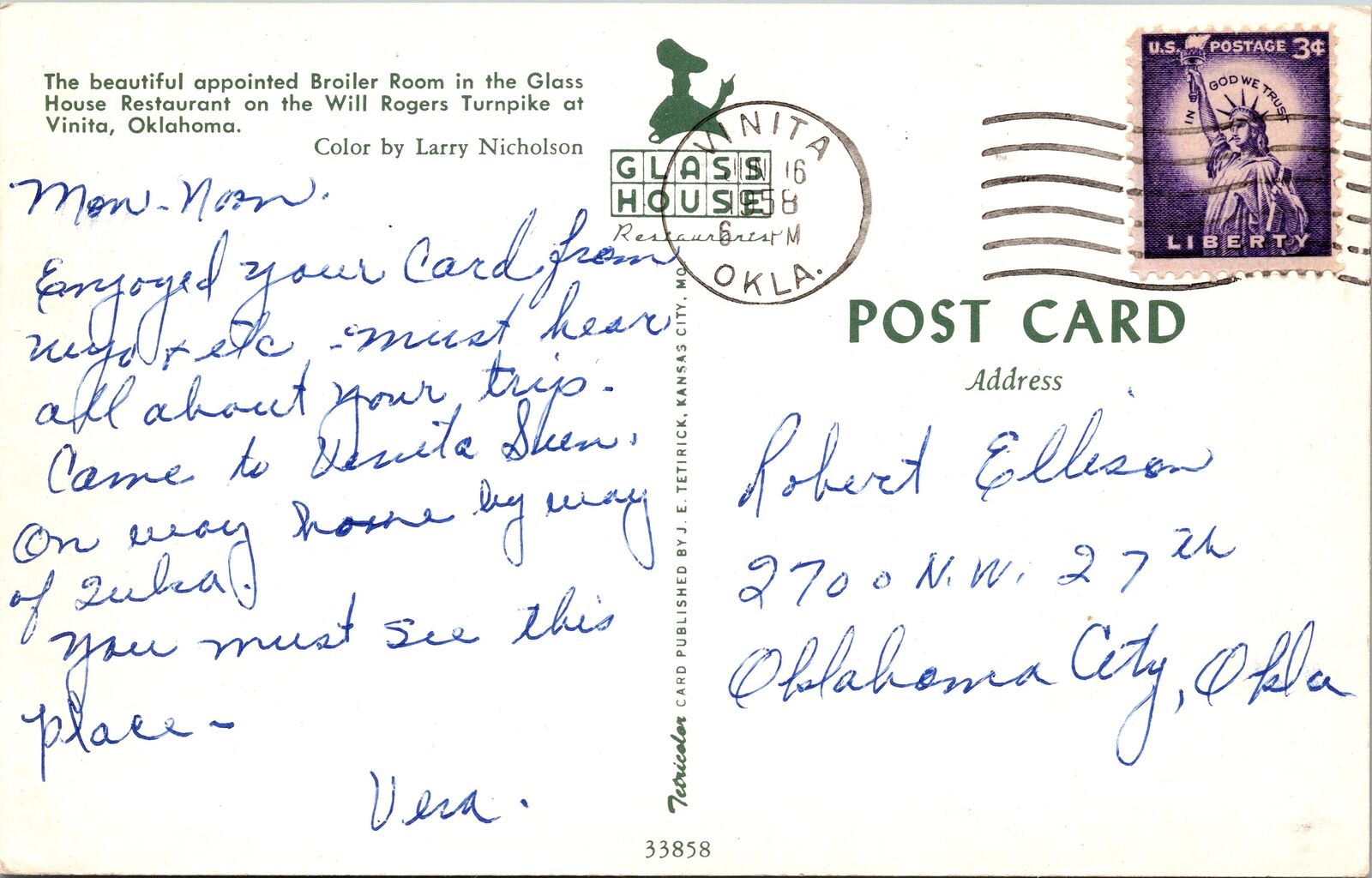
Former World's Largest McDonalds
The building is still there, but I'm not sure if there is a McDonalds inside it or not, or if it has been relocated to a building elsewhere at the rest stop.
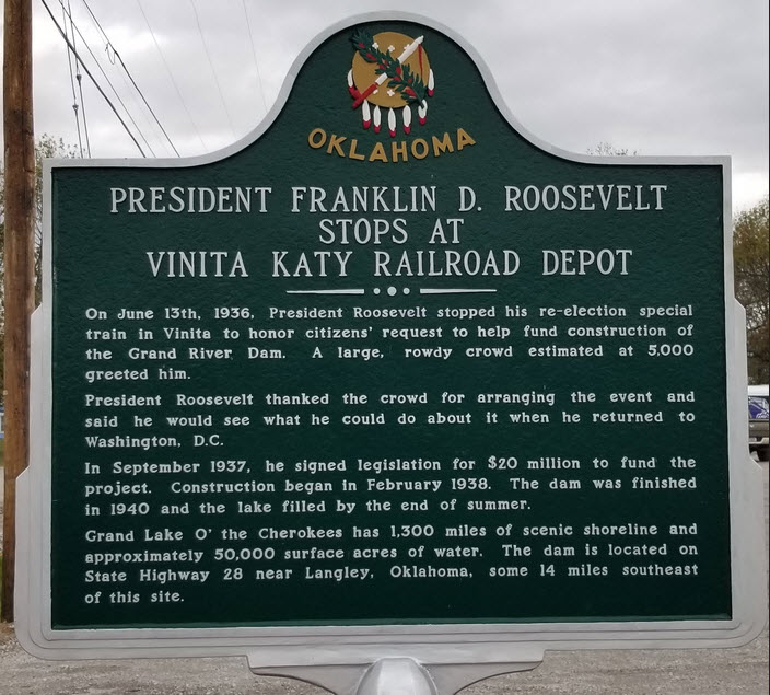
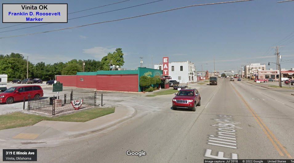
Franklin D. Roosevelt Historical Marker
GPS Coordinates: 36.63736, -95.15105
At the intersection of East Illinois Ave (US-60) and South 2nd St, on the right when traveling east on East Illinois Ave.
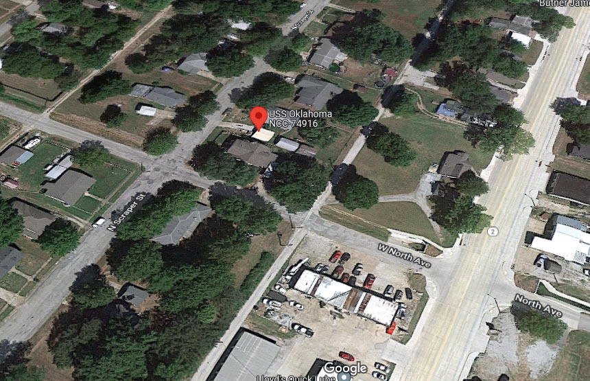
Unknown Landmark????
GPS Coordinates: 36.64685, -95.15101
506 N Scraper St, Pensacola OK 74301
Dunno what the deal is with this, and Google even has a 360 view from this spot.... anyone want to investigate?
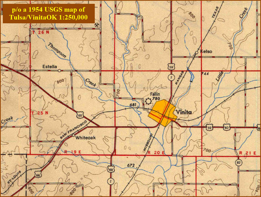
Courtesy of the USGS, click here for their index page.
Even with the USGS, there are not a whole lot of maps they did for much of "the west", so there are no 1:24,000 maps for Vinita available before the 2000's.
Disclaimers:
I love trains, and I love signals. I am not an expert. My webpages reflect what I find on the topic of the page. This is something I have fun with while trying to help others.
Please Note: Since the main focus of my two websites is railroad signals, the railfan guides are oriented towards the signal fan being able to locate them. For those of you into the modeling aspect of our hobby, my indexa page has a list of almost everything railroad oriented I can think of to provide you with at least a few pictures to help you detail your pike.
If this is a railfan page, every effort has been made to make sure that the information contained on this map and in this railfan guide is correct. Once in a while, an error may creep in :-)
My philosophy: Pictures and maps are worth a thousand words, especially for railfanning. Text descriptions only get you so far, especially if you get lost or disoriented. Take along good maps.... a GPS is OK to get somewhere, but maps are still better if you get lost! I belong to AAA, which allows you to get local maps for free when you visit the local branches. ADC puts out a nice series of county maps for the Washington DC area, but their state maps do not have the railroads on them. If you can find em, I like the National Geographic map book of the U.S..... good, clear, and concise graphics, and they do a really good job of showing you where tourist type attractions are, although they too lack the railroads. Other notes about specific areas will show up on that page if known.
Aerial shots were taken from either Google or Bing Maps as noted. Screen captures are made with Snagit, a Techsmith product... a great tool if you have never used it!
By the way, floobydust is a term I picked up 30-40 years ago from a National Semiconductor data book, and means miscellaneous and/or other stuff.
Pictures and additional information is always needed if anyone feels inclined to take 'em, send 'em, and share 'em, or if you have something to add or correct.... credit is always given! Please be NICE!!! Contact info is here
Beware: If used as a source, ANYTHING from Wikipedia must be treated as being possibly inaccurate, wrong, or not true.
RAILFAN GUIDES HOME
RAILROAD SIGNALS HOME
NEW 07/15/2022, JUL16/2022
Last Modified 16-Jul-2022